
“When you hear the Cornish folk mentioning the names of their villages, hills, and other landmarks, you will notice something un-English about them. In the accent and cadence of some of the placenames there is an echo of the goblin world. Is there not, in such names as Ogbeare, Killeganogue and Poulza, an oddity – a twist that is just on the edge of the bizarre.”
(Hopkins T. ‘Our Beautiful Homeland: Cornwall’ date unknown)
It is true that the first thing a visitor to Cornwall will notice is the placenames, they are very ‘un-English’ in particular the further west you go. My interest in them began many years ago as a student writing a masters dissertation on the landscape continuity on the north coast of West Penwith.
The study of placenames can be highly complex, after all names do change for whatever reasons and in the case of Cornwall the names are often in Cornish which as a language has also undergone many changes. The Cornish language is related to both the Welsh and Breton languages, all of which are regarded as being descended from the language spoken by the ‘Celts’. The relationship with these Brittonic languages is often used as evidence for the age of a particular placename, albeit in a general sense.
“The name of a village or farm or field may describe the locality as it was when the name was given, or refer to a natural or man-made feature nearby, or include the name of a pioneer farmer or priest (the latter often termed a ‘saint’). Names can seldom be translated with the certainty aimed a in normal translation between languages; generally they can only be interpreted, with a greater or less degree of probability, as unconscious and unintended messages from the past which are seldom free from ambiguity or obscurity. The prime rule in placename interpretation is to attempt none until all available forms of the name have been considered, and then to place greater reliance on earlier rather than later forms.” (Pool P. A. S. 1990 ‘The Fieldnames of West Penwith).
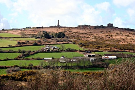
The distribution of Cornish placenames is not uniform across the county, those places nearest the Tamar River – the natural boundary between Cornwall and Devon – have a greater tendency to be more English than those in the far west. In my dissertation I surveyed an area of the north coast of west Penwith (within the parishes of Morvah and Zennor) and of the forty placenames to be found on the Tithe map of 1841 only one had an English name – the hamlet of Wicca.
Below are a handful of the most common prefixes used in Cornish placenames and their meaning (from Weatherhill C. 1998 ‘Cornish Placenames and Language’)
Bos – as in Boscastle, Boscawen or Bosavern. Also found as Bot-, Bo-, Boj-, Bus-, and Bod-. Meaning dwelling or home it seems to be a very early form whose usage dwindles by 1500. It is often followed by a persons name such as Bodilly on the Lizard which can be translated as ‘the dwelling of Deli’.
Car-/Gear-/Caer-/Cr- as in Caervallack, Carwythenack or Carvossa. Meaning an enclosed settlement and occasionally a ‘fort’. Often found associated with late prehistoric farmsteads within round enclosures as well as Iron Age hillforts. Carvedras near Truro can be translated as ‘Modret’s fort’.
Carn – as is in Carn Brea, Carn Meal or Carn Clew. One of the most common still in use today and is used in reference to prominent rock formations, on hilltops it can translated to ‘tor’ whilst at other locations it might mean ‘crag’ or ‘rockpile’. Occasionally it may even refer to a Bronze Age Barrow.
Chy-/Che-/Ch-/Ty- as in Chun, Chyanvounder or Chynoweth. Meaning either ‘cottage’ or ‘house’. Thus Chyandour can be translated as ‘house by the water/stream’. This prefix replaces the earlier ‘Bos’.
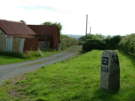
Hen – as in Hendra or Henscath. Meaning old as in former, ancient. Hendra can in its simple form mean ‘old farm’ but is better interpreted as ‘farm which still stands on its original site.
Lan – as in Lamorran or Lanzeague. Meaning ‘church enclosure’ it became redundant by 1500, historians usually take the presence of this prefix as an indicator for an early church site often surrounded by an enclosure which in some cases is a reused prehistoric site.
Tre-/Trev-/Tr- as in Tregenna or Tregeseal to name but two – this is by far and away the most common of all prefixes. Meaning “farming settlement’ and later used to denote a larger settlement such as village. They are often followed by a persons name such as Tregiffian or ‘Gifyan’s farm’ and in other cases it might be followed by a descriptive word such as Trencrom or ‘the farm on the curve’.
Venton-/Fenton- as in Venton Vedna or Ventonraze. Meaning ‘a well’ in the sense of a natural spring, an artificially dug well is ‘Peeth’. Often the prefix is followed by a name of a saint such as Venton Uny or ‘the well of St Euny’ others might be followed by a distinguishing feature such as Ventonwyn or ‘the white well’.
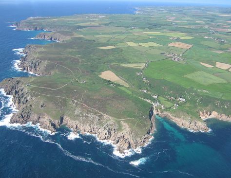
Of course understanding the meaning behind the names is not the only source of information. Looking at the distribution of certain placenames within a given area may hint at the evolution of the human landscape. In some areas it is possible to see the stratigraphy of the landscape. An essential part of such a study involves the use of maps.
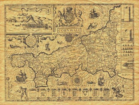
No study of the landscape can be conducted without a good range of maps. Early Ordnance Survey maps and Tithe maps are crucial in understanding any landscape before modern incursions such as motorways, housing subdivisions, caravan parks and business parks, make an appearance. Even in the case of West Penwith the choice of the 1841 Tithe Map during my dissertation was to ensure that any more recent names attached to barn conversions and holiday lets did not lead to false results. Maps can also show features which may no longer be obvious on the ground such as hedges which may have later been removed and mining remains among others.
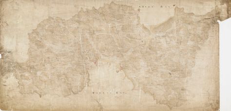
Of course very early maps can be quite frustrating as often the information included is not clear and/or very selective according to who made the map and why. Just because a settlement does not appear on one map does not mean it did not exist at the time of surveying. For example, the Domesday Book records only a handful of settlements in the whole of West Penwith. It seems highly unlikely that the region was all but empty, but given this was an economic text and not a history one it is not too surprising either. To this extent gaining insight from a wide range of maps is often the best course of action.
Another source of information which can often be overlooked in the study of past landscapes are fieldnames. Although they are less well documented and it is not until the Tithe Apportionment of 1841 that fieldnames are properly recorded, albeit by this stage most are in English. It is also important to note that by their very nature fieldnames are transient, their names can change as their usage does. However there is on occasion names which stick and just occasionally these names can hint at a previously unknown archaeological site or field usage. For example Park an Vellan could suggest the presence of a mill (vellan being a form of melyn or mill) and Park Menheere suggests the presence of standing stone.
In the case of later English fieldnames some may well have been directly translated from the Cornish and are thus older than expected. So Spring Field may have originally been Park an Venton or Barrow Field was Gweal Creeg.
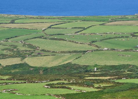
The study of placenames, maps and fieldnames is one of the least intrusive forms of research a person can do and yet can yield a myriad of information that in some cases was not known. When combined with other sources such as documents and aerial photography it becomes a powerful part of archaeological research providing fresh insight into our ancient landscapes.
Once you have got your eye in so to speak, it will be forever impossible to go for a simple walk in the landscape. I am doomed to be wandering the landscape always looking for patterns, asking what does that name mean and is it in it’s original form.
Sources:
Gelling M. (2000) Place-Names in the Landscape Phoenix Press
Hopkins R. T. (?) Our Beautiful Homeland: Cornwall Blackie and Son Ltd
Pool P. A. S (1990) The Fieldnames of West Penwith Published by the Author
Weatherhill C. (1998) Cornish Place Names and Language Sigma Leisure


One thought on “Clues in the Landscape – Placenames, Maps and Fields.”