Tag Archives: Medieval

Saveock – An Archaeological Mystery…

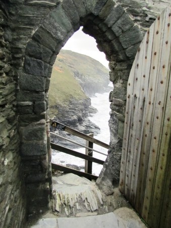
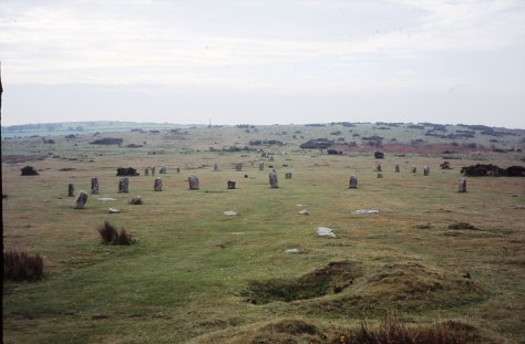
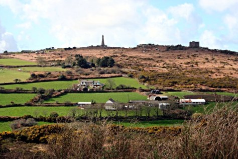
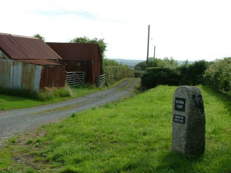
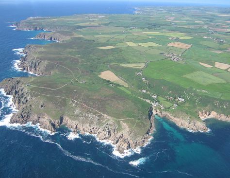
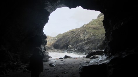
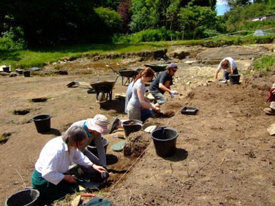
Going to Saveock is a bit like travelling back in time, seeing a peep of a thatched roundhouse roof only adds to the impression that you are somewhere else. Originally you would have had to wait on the other side of the train tracks, call the main station to see if any trains were coming and if they gave the all clear, open both sides of the gate then speed across – they had been known on the rare occasion to get it wrong. Today though there is a much safer way of getting into Saveock, a suitably narrow hedge lined drive leads down to the small holding and even though it is only a fifteen minute drive from Cornwall’s main city of Truro, it feels remote and tranquil – timeless.

So,where is Saveock?  Well, it is a small holding situated in a tranquil river valley near Truro in Cornwall.  On arrival at Saveock you are met with the ever smiling Jacqui Wood who is not only a well known and respected experimental archaeologist (did I mention the roundhouse?) and author of several books including Cliff Dreamer: The Goddess Returns, a new fictional story set in the turbulent times of our very distant ancestors. She also runs the Saveock Water Archaeology Centre where students of archaeology (age and experience no barrier) are instructed in the art of excavation, here they find their minds being opened to the endless possibilities that the study of the past can present to those willing to listen.

I met Jacqui some fifteen years ago when during a chance conversation she told me about some curious stake holes, a green clay floor and associated flint tools which she happened upon whilst digging a flue to conduct an experiment in tin extraction. At the time I was teaching A level Archaeology and we thought it would be a good chance for the students to learn some excavation techniques in the field, after all in archaeology practical experience is far more useful way to learn. It was the beginning of many seasons of excavation, intriguing finds, the remodelling of cow shed to comfy quarters for the diggers and much more. My eldest spent the first few months of his life sleeping safely at the edge of a trench.


taking-another-slice-of-tre
Volunteers and students at the trench face.

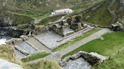
The site at Saveock covers a wide range of time as you would expect of a small river valley in the heart of Cornwall with fertile soils, natural springs and near a well known source of tin and possibly gold. The earliest phase belongs to the Mesolithic, the evidence for which comes firmly from those aforementioned stake holes, green clay floor and the associated flints.

 
“In the Mesolithic the main site trench was over a south facing peat bank on the bend of a river that was between two shallow lakes. This entire site has been purposely covered with various different coloured clays in an attempt to make the river bank a suitable place for dwellings. In the area A/2 the first phase of the site, is what we believe to be a Mesolithic dwelling platform covered with dense green clay surrounded by stony yellow clay in which the stakes to support the dwelling were driven.” (Jacqui Wood).
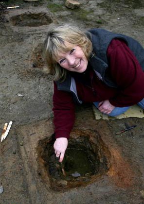
The second phase was and still is a bit confusing but it does seem entirely possible that it belongs in the Neolithic. When excavating it had been our intention to extend the trench to get a better picture of the Mesolithic features, so imagine our surprise when we came across a stone lined and capped drain covered in thick green clay that lead in one direction towards the river and in the other to another feature, rectangular in shape and lined with white quartz stones and spring fed. Several seasons later in 2005 Jacqui and her team uncovered another similar feature adjacent to the first original ‘pool’.
Dating the pool feature was problematic as it seemed to have been used over a long period of time.

B2-insidedrydrain
Inside the stone capped drain looking roughly north.

The only other similar feature we have found was the platform around the Neolithic monument of Maeshowe in Orkney. This platform was made up of thick clay and when a trench was put through it a stone lined and capped drain was discovered which was almost identical to the one at Saveock. The presence of the quartz stone too would suggest a very early date, the use of quartz in Neolithic and Bronze Age ritual sites is well attested to. The pool itself became known as the ‘moon pool’ as the white quartz glows in the bright moonlight.
As for its function, well ritual seems a good an answer as any other but only because there appears to be no other alternative and believe me we considered a wide range of alternatives. Jacqui herself was always of the opinion that the word ‘ritual’ was used far too loosely in archaeological circles to explain seemingly unexplainable objects or sites. Later post excavation work on the mud we scooped up from the bottom of the pool (it couldn’t be excavated in the traditional manner as it kept filling with water) revealed some small finds which told a story of long usage and deposition.  These included human hair, fingernails, Medieval straight pins, 128 small pieces of textile, parts of shoes, heather branches and perhaps most interesting was the broken half of iron pot or cauldron.


Many of these finds seemed to date to the last phase of usage at a time just before the pool was filled in and covered, a deliberate act to erase a pagan site. The lack of any finds earlier than the late Medieval may suggest that intervals the pool was clean out – thousands of years of deposition, not to mention silt, would have filled the pool considerably if it was not cleaned out regularly. Interestingly, in the layer just above the infill layer a broken glass bottle and a few sherds of pottery dated the closure of the pool to around the time of the English Civil War. Cornwall was at the time and even today a place where the rituals of time past were an important part of local society often overlooked by the Church. Cromwell’s puritan army would not have been so kind to Royalist (and pagan) Cornwall.

Perhaps one of the most intriguing episodes in the sites history comes from once more as a result of an extension of the trench with the Mesolithic features this time along the edge towards the marsh by the river. Whilst following the expected green clay floor and associated stake holes we encountered shallow pits with unusual contents cut into the clay floor. Because this area is essentially a waterlogged part of the site organic remains survived particularly well.


Area-L-2
The clay floor with pits.

“When we excavated the first one we were surprised to find white feathers in it and thought it might have been perhaps a bird plucking pit, which was a common farming practice at the turn of the century. This turned out not to be the case when we found that the feathers were not plucked, but had been laid skin side out with white feathers inside. We took samples of the feathers to the bird expert at the local zoo and found them to be swan feathers.” (Jacqui Wood).

 
In addition a small amount of tiny stones were found surrounded by some sort of organic matter. Initially the assumption was that this was the crop of the swan but the stones were too pristine and it was concluded that the stones had been wrapped in leaves and deposited on purpose alongside claws from a range of other birds. The stones themselves were of an interest as they appeared to be brought to the site as they contained tiny nodules of beach flint an unusual feature given how far inland Saveock is. A suggestion from a local had us mounting an expedition to Swan Pool, some fifteen miles away on the coast and sure enough the stones at Swan Pool were identical to our small sample. Radiocarbon dates from the swan skin dated the pit to the 1640s, once again it seems dangerous ritual activities are occurring at a time when to be called a witch would mean certain death.


3)-egg-pit-9
A pit being excavated.


A further eight pits were excavated that season, only two of them were intact the other six had had their contents removed in antiquity leaving just a few feathers and stones to show what their previous fill was. Excavation of this area was tough going, a thick layer of reeds impeded the work and as time went on more pits would be found, all with their contents removed that was until 2005 (two years after the first pit had been discovered).
Three pits were found in a row, two rectangular and one round in the middle. Of the three it was decided to excavate the middle round one, here the dig crew found the pit to be lined once again with swan feathers but also on either side the bodies of two magpies. In the midst of this were the remains of over fifty-five eggs and although the shells had rotted away the membranes were remaining. The eggs themselves appear to have come from a variety of birds, some even had full formed chicks ready to hatch inside them still.

2)-chicks-in-eggs-from-pit
The egg membranes with chicks…

Further pits revealed the remains of a cat and dog skull.  Perhaps the most astounding part of this whole story is the radiocarbon dates for the cat pit which was dated to around the mid 18th century and the dog pit which had a date of circa 1950s.

But as archaeologists we need to ask why? What was the purpose of the pits? There is the suggestion that these are the result of witchcraft based rituals and conversations with many experts in the field of witchcraft have yielded very little to enlighten us. If these pits are connected in some way to witchcraft or even pagan rituals of a different kind it is not one commonly known. This is not too surprising given that so much knowledge about traditions and rituals has faded away. Jacqui though has her own theory as to who and why;
“My own theory (and it is only a theory) is that maybe if you got married and did not get pregnant in the first year, you might make an offering to St. Bride of a feather pit. If you finally got pregnant you had to go back to the pit and take out the contents and burn them and set the spirit of the swan free. If you never got pregnant then the pit remained untouched.”

Saint Bride or Brigit has many similarities to the Celtic deity of Brigid. The first of February is St Brigids feast day but also Imbolc where the goddess Brigid is remembered as one who brings the spring. Both are associated with healing, poetry and other domestic tasks. There is also a connection with the sacred wells. Today well dressing is done in the name of the Saint. Wells have long been a place of veneration, our modern wishing wells merely a continuation of a ritual act of deposition that begun in the Bronze Age if not earlier. The connection with the goddess and the saint at Saveock is slight but as we all know it is a place to start.

On a personal note I should like to mention that when the quartz lined pool was excavated it was myself and a friend who did the digging (we were the only ones willing to get so mucky). We spent the good part of a week in the mud and spring water. In late November of that same year I discovered I was pregnant with my eldest (who incidentally was born at midsummer) and a few days later my friend who had been digging too told me she too was pregnant – our children were born just a week apart.
More recent excavations have been looking in a completely different area of the farm and this time they have uncovered a hearth edged with smoky quartz crystals. Dating was provided by the large quantities of Bronze Age pottery found in association with the hearth. Work at Saveock is never dull but it is ongoing, so if you fancy have a holiday with a difference then check out the link below.


Jacqui Wood 1
Jacqui excavating one of the pits.


For more information on the Saveock Water Archaeology Centre please go to the website www.archaeologyonline.org
Jacqui Wood’s book Cliff Dreamers is available to buy on Amazon along with her book on food through the ages Tasting the Past. Jacqui also has numerous articles published many of which can be found at www.academia.edu

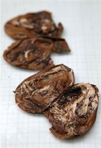
Please Note – all photos except the featured image at the top of the article were provided by Jacqui Wood and the copyright belongs to her.  The featured image at the top of the article is my own.

This article originally appeared in the Celtic Guide magazine December 2016.

Caerphilly Castle

So, I was in the mood for castle…

But before we get to pictures, a bit of background…

Built in 1268 by Gilbert de Clare (also known as “Red Gilbert” due to his hair colour) as part of his conquest Glamorgan and the continuing subjugation of the Welsh by the Normans.  It is constructed on a natural gravel bank in the middle of a river basin and consists of two large artificial lakes within thirty acres making it the second largest castle in Britain.

The water defences of the castle were most likely inspired by a similar design at Kenilworth which de Clare would have witnessed in action during the seige of Kenilworth in 1266.  The vast lakes prevents the castle walls from being undermined – a popular siege tactic at the time.   Caerphilly was also the first concentric castle to be built in Britian and its walls were built using Pennant Stone.

A Brief Timeline

1268 – Construction begins with the daming and digging of the lakes, temporary wooden palisades and buildings.

1270 – Rising tensions with Welsh resulted in the castle being attacked by Llywelyn ap Gruffudd and supporters – the wooden structures were burnt to the ground.

1271 – In an effort to quell the tensions between the Welsh and the Normans the castle is taken over by royal officials who promise to negotiate and arbitrate a solution to the ongoing problems.

1272 – de Clare’s men seize back the castle and work recommences, the castle is completed later that year.

1294 – Once again the castle is attacked but this time by Madog ap Llywelyn.

1316 – And again the castle is attacked, during the Llywelyn Bren uprising.

1326-27 – And again during the overthrow of Edward III…

From the fifteenth century the castle begin to decline…

1776 – Caerphilly is acquired by the Marquesses of Bute but it is not until the third and fourth Marquesses that extensive restoration work begun.

1950 – The castle and grounds were given to the state.

Today – The site is managed by CADW – the Welsh heritage organisation.

IMG_7437
The massive gatehouse entrance  – the large tower in the rear of the picture was designed to be defensible postion even if the entire castle was breached.  A working portcullis and murder holes are visible today.
IMG_7441
One of the massive fireplaces in the gate tower.
IMG_7440
Looking out onto the inner courtyard.
IMG_7443
Looking down onto the tower gatehouse and outer gatehouse towards town.  Originally there would have been a drawbridge across the moat.

This slideshow requires JavaScript.


IMG_7447
The archers corridor – made of timber with apertures for the archers to aim through and roofed this would have hung of the exterior walls of the castle and provided greater protection to the archers.
IMG_7439
The leaning tower – natural subsidence or as a result of Oliver Cromwell decreeing that the castle be ‘slighted’ during the Civil War?

This slideshow requires JavaScript.


IMG_7452IMG_7435


Caerphilly Castle was a defensive stronghold – the lack of windows and decoration combined with forbidding walls was testimony to this fact – it was a castle which meant business.


More Information can be found at the following links:

Caerphilly Castle

CADW


Archaeology in Cornwall – My Top Ten Sites.

If archaeology is your thing (and it’s certainly mine) then Cornwall is a great county to visit with a mulititude of sites to visit, especially if you want to get away from the crowds and sitting on the beach has lost its appeal.  From the outset I should point out the following are my favourite sites/landscapes to visit (it was quite difficult to keep it to just ten and yes they are mostly prehistoric sites), others may have different views – the list is purely my own opinion.  Feel free to comment on your favourites.

1. Chun Castle and Quoit

Okay so I have cheated a bit – here we have two very different sites but their proximity to each other I think allows for a bit of cheating…

Firstly, Chun Quoit – quoits are neolithic monuments found throughout Cornwall (there are about a dozen known sites) consisting of upright granite slabs topped by a large capstone.  They can also be called portal dolmens, chamber tombs or cromlechs.  Some are in a better state of repair than others and Chun Quoit is perhaps one of the few which has been interferred with the least.  Chun Quoit consists of four large uprights supporting a capstone which is estimated to weigh over 8 tonnes.  It is also possible to see the remains of a circular stone cairn and associated kerbstones (the stone rubble at ground level) which would have originally surrounded the Quoit but not covering it leaving a the facade and the capstone visible.

chunquoitborlase2

Two hundred metres to the east of the quoit are the impressive remains of Chun Castle.  Unlike many other Iron Age hillforts which utilise an earthen ditch and bank system Chun Castle is entirely stone built.  It consists of two large concentric stone walls and is 85 metres in diameter.  There is some evidence that the hillfort was built over an earlier enclosure represented by a shallow ditch and low bank on the southwest side.  Inside the hillfort there is a stone lined well and escavations during the late 1920s found evidence for a later post Roman occupation of the hill fort.  Iron Age occupation consisted of at least a dozen round houses which based on the pottery found date the site to the 3rd and 2nd centuries BC.  Sitting high on the ridgeway known as the Tinners Way the site would have been visible from many miles around, from here it is possible to make out several other hillforts in the distance such as Caer Bran.  Below the hillfort about 500metres to the north east is the site of Bosullow Trehyllys – a courtyard house settlement of the late Iron Age (see the earlier post on  Chysauster and Carn Euny), it is unexcavated but appears to consist of at least three detached courtyard houses and a number of round houses.

2. Chysauster

I wanted to include a courtyard house settlement in the list and it was a choice between Carn Euny and Chysauster. In the end Chysauster won mainly because it is easier to get to but also because the visitor can get a good idea of size of this unique house type. However, I would recommend a visit to Carn Euny too – the fogou makes it well worth while.  I have discussed both sites already in a previous post – Chysauster and Carn Euny – A Unique Settlement Type – so won’t say much more than that.

3. Treryn Dinas

Treryn Dinas falls into the category of Iron Age cliff castle or promontory fort – one of many coastal headlands with Iron Age defences in the form of earthen or stone ramparts and external ditches usually across the neck of the headland.  The term ‘cliff castle’ does not denote a particular function, some were large enough to have settlements within their walls, such as The Rumps and Trevelgue Head, others were much smaller and perhaps served as trading posts or lookouts.  Treryn Dinas, however, appears to more than that – the visitor only need to look at the position and surroundings of this site to realise it is special.

Overlooking the beach at Porthcurno, the ramparts enclose a large rocky headland which contains the Logan Rock – a substantial boulder perched on the outcrop which in times past would rock in the wind and was only dislodged in 1824 by cocky young lieutenant and the crew of the HMS Nimble.  The local people were rightfully upset at this and the lieutenant was charged to replace the rock at his own expense and with the help of the admiralty it was eventually returned to its original position, although it is said to no longer rock as easily as it had done once before.

According to folklore the earliest inhabitants of the headland were the giants who protected the neighbouring communities in return for cattle and other necessaries.  Giants are a common feature in Cornish folkore and seem to be particularly associated with large outcrops of granite which feature in the landscape.  From an archaeological point of view Treryn Dinas has four lines of defence with the last crossing the low neck of the headland.  It consists of a deep ditch and a stone faced wall behind which are the foundations of two buildings either side of the presumed entrance.  The general view is that this site is one of spiritual significance which may date many centuries earlier than the Iron Age.  Finds of Bronze Age pottery have been found wedged in the crevices  of the outcrop, the Logan Rock itself may have been seen as supernatural and there is the problem of that fourth line of defence.  You will note in the photograph below that this line of defence is not particulary defensible as it easily looked down from the landward side, in addition the amount of useful land on the headland is extremely limited and the only thing the fourth rampart is ‘protecting’ are the rocks themselves.


4. Boscawen-Un

In the parish of St Buryan is the stone circle of Boscawen-Un, dating to the early Bronze Age and consisting of nineteen stones there are several interesting features of the site.  The most obvious is the stone which is slightly south of center, it leans sharply towards the north east and at its base there are two very faint relief carvings of axe heads.  A past student once suggested to me that the stone itself looked like a large stone axehead which had been struck into the ground.  Minor excavations have further revealed that its leaning position was intentional and not the result of subsidence.  The second interesting feature of this stone circle is the large block of quartz to the south west which is part of the circle.  Our understanding of the role of quartz within prehistoric rituals is poorly understood but there is an increasing amount of evidence which points to its importance.

Boscawen-Un is one of several archaeological sites which feature in my novels – The Adventures of Sarah Tremayne.

boscawen-un-copy


5. A Fogou

Okay, so now I really am cheating but the fact is any visit to Cornwall should definitly include a fogou and I couldn’t decide which I preferred – Carn Euny or Halligye are the easiest to get to and Halligye the largest (it can be found on the Trelowarren Estate, near Helston) however, Carn Euny does have a courtyard settlement, the nearby hillfort of Caer Bran and the fogou itself has a beehive shaped internal chamber.  So you can see my dilemma…I have already written about fogous in an earlier blog so shall not rehash what we know and don’t know about these enigmatic structures.

img_7204
The entrance to the fogou at Chysauster.

6. Carn Brea

Situated between Redruth and Camborne is long hill easily visible from the A30, it is a hill with a long history beginning as far back as the Neolithic.  Today two features stand out the most, firstly the the tall monument on the central summit erected in 1836 in the memory of Francis Bassett of Tehidy and the second is the small medieval castle perched on an outcrop.  The latter was most likely a hunting lodge belonging to the Bassetts, an ancient local family and was first recorded in the fifteenth century.  The land surrounding the hill was prime tin mining country and the flanks of the hill are covered in shafts and pits.

Heading further back in time the astute visitor might notice the remains of eleven Iron Age roundhouses on the saddle between the east and central summits, these are part of a much larger settlement on the hilltop, set within a substantial hillfort of forty-six acres.  The defences are made up of two ramparts enclosing the hill.  However, the occupation of Carn Brea began much earlier in the Neolithic.  Surounding the eastern and central summits are another two smaller enclosures, of these the eastern summit has been partially excavated.  The date range showed that the ramparts had been built somewhere between 4000 and 3500BC, making it the oldest known fortified settlement in Britain.  There were traces of wooden buildings and Neolithic pottery, in addition a large number of flint arrowheads (700+) were uncovered along with evidence for the destruction of the site suggesting the site had been under attack (Cornish Archaeology, 1981, 20).


7.  Trevelgue Head

So many visitors to Cornwall will invariably end up in Newquay without realising the long and fascinating history of this seaside town.  Just north of St Columb Porth on the road to Watergate Bay is the impressive cliff castle of Trevegue Head.  It is the most heavily defended of all the cliff castles with seven lines of defence.  The first ditch and bank is not so obvious as the next six with largest bank being roughly four metres high.  Erosion over the centuries has seen much of the land disappear and it is suggested this included the original entrance.  Excavation in th 1930s demonstrated that Trevelgue was continously occupied from the  thrid century BC until the fifth/sixth century AD.  At least fourteen roundhouses were identified (it is still possible to see the house platforms with a keen eye).  Given its position in the landscape, the sheer scale of the defences, some of the artefacts found (bronze horse harness and Roman coins) in addition to the significant amount of evidence for both bronze and iron smelting, it is fair to say Trevelgue Head was most likely a high status site, the home ground of someone of great import.

The importance of this headland and other similar to it along the coast is further attested to by the presence of the two bowl barrows dating to the Bronze Age – these were opened in late 1800s but nothing is known of their contents.  Further along the coast is Trevelgue Downs where a further two barrows can be seen.  In the eastern barrow a crouched adult skeleton was found within a stone cist with a stone battlexe close to hand.  From personal experience I have walked this cliff castle many times and it was not uncommon to espy tiny Mesolithic flints protruding from the exposed edges of the paths.  Further testament to the sites long history.


8.  Tintagel

It had to be on the list – perhaps one of the most controversial of all sites in Cornwall from local resistance to English Heritage’s plans for the site to the myriad of myths and legends associated with Tintagel – no where captures the imagination more.  Like several other sites on this list I have already waxed lyrical about Tintagel so will not bore the reader with much of the same (but do follow the link if you want to seperate fact from fiction).

img_7296

9.  Castle an Dinas

An impressive example of an Iron Age hill fort found in mid Cornwall near St Columb Major.  Measuring 260m across it would have been a formidable place in its heyday, the substantial ramparts are visible for many kilometres even today.  There is some faint evidence for a much earlier enclosure on this hilltop possibly dating from the Neolithic or Bronze Age and the presence of two Bronze Age barrows within the hillfort is further testament to the importance of this place throughout prehistory.  In the early 1960s a relatively small excavation was undertaken with the idea of prove the tradition of such places being re-used during the post-Roman phase and although they failed to do this a fine cobbled road was found.

earthworks_at_the_iron_age_fort_castle_an_dinas_-_geograph-org-uk_-_329999_cropped
The earthworks of Castle an Dinas – note the commanding view from the hillfort.  Photo by Mike Hanncock (geograph.co.uk)

10. Bodmin Moor

Yes I know this really is cheating…but no list of sites to visit is complete with at least one from Bodmin Moor.  However the problem is I could not choose just one, there are so many wonderful sites to visit on the moor.  Like its much larger cousin in the next county over, Dartmoor, Bodmin Moor has a wide variety of archaeological sites to visit beginning way back into the Mesolithic (flint scatters possible representing seasonal camps as found on Butterstor)  and the Neolithic such as Stowes Pound and Rough Tor which are thought to be tor enclosures similar to Carn Brea and Trencrom further to the west, but it is the Bronze Age which dominates the archaeological record.

There are stone circles, stone rows, menhirs, barrows (earthen mounds), cairns (stone mounds) and of the latter there is in excess of 300 known.  The most well known barrow is the Rillaton barrow which is the largest on the moor and where an individual was buried with a bronze dagger, an urn and a beaten gold cup.

“…the distribution of the monuments throughout the whole of the upland suggests that its use had intensified enormously. Virtually every block of land (as defined for example by prominent hills and divided by rivers and streams) is marked by a group of cairns, as if all available land was claimed and accounted for.  The analysis of fossil pollens fromthe ancient land surfaces sealed beneath the excavated cairns shows that by this date the upland was predominantly open grassland, with woodland confined to the steep valley sides.” (Herring P & Rose P Bodmin Moors Archaeological Heritage pp17-18)

There are sixteen known stone circles of which the best known is the Hurlers.  All the circles seem to have been placed carefully within the landscape – nearly all are within sight of tor which is always to the north of the circle, with Roughtor being the most dominant (nine of the sixteen circles).  The stone rows, menhirs and embanked avenues are not as numerous but still make up an important part of the ritual landscape.

A feature of the later Bronze Age landscape of the moor is represented by the vast numbers of settlements represented by field walls and the stone foundations of round houses.  There are approximately 1500 prehistoric round houses representing around 200 settlements and although only three have been excavated they are assumed to be all by analogy with Dartmoor to belong in the second millenium BC.  Often found associated with these settements are field systems of varying shape and size best seen from the air and on large scale maps.

Ar around 1000BC a deteriorating climate and soils resulted in most settlements being abandoned and the use of the moor being less intensive.  The hillfort sites of Bury Castle, Cardinham and Berry Castle are the only easily identifiable settlements of the Iron Age, although it is assumed that the moor continued to be used for the seasonal grazing of livestock, much as parts of it are today.

img_0006
Stowes Pound – the tumbled wall of stones in the foreground represents the early and possibly Neolithic enclosure wall.
img_0007
Two upright menhirs frame the view to Stowes Pound and the Cheesewring.
img_0008
Looking south at the Hurlers.

Further Reading

Rowe T M (2005) Cornwall in Prehistory Tempus/History Press

Weatherhill C (2009) Cornovia Ancient Sites of Cornwall and Scilly Halsgrove

Johnson N & Rose P (2003) Cornwall’s Archaeological Heritage Twelveheads Press

Herring P & Rose P (2001) Bodmin Moor’s Archaeological Heritage Cornwall County Council

The Frescoes of Breage

Breage is a small village some five kilometers from Helston in the west of Cornwall and on the face of it there is not much for the visitor to see.  Most will whizz past, intent on exploring other places.  But if you have the time do stop and pay a visit to the church, trust me, it is well worth it.

img_7394

First A Little Bit of History

The earliest history of the area relates to the settlements upon Tregonning Hill overlooking Breage and neighbouring Germoe.  Here you will find Castle Pencaire an oval Iron Age hillfort.   On the northern slopes are two well preserved ’rounds’ or enclosed settlements (also Iron Age in date).  When the light is right it is also possible to see the remains of a field system and possible trackway associated with these sites.

The Roman Milestone.

In the church itself is a Roman ‘milestone’.  These stones (of which there are several in Cornwall) were mark stones set beside an actual road and inscribed to the Emperor.  This particular example is inscribed in Latin to “the Emperor Caesar our Lord Marcus Cassianius Latinius Postumus, pious, fortunate, august”.  It dates from AD 258 – 268.

The Domesday Book mentions lists this part of Cornwall as being held by the King under the name of the Manor of Binnerton.  It had eight hides of land with enough for sixty ploughs, there were thirty two villagers, twenty five smallholders with fifteen ploughs between them.  There was also two acres of meadow, two square leagues of pasture and half a square league of woodland.  Not forgetting the forty five mares, sixty sheep, thirteen cattle and five pigs.  At this point the church is not mentioned, although it seems likely that there was one, albeit an unprofitable one and therefore of no interest to the Norman assessors.

The earliest evidence for a church at this site is the red sandstone cross head.  Interesting in itself, for the red sandstone is not a material to be found in the local area and the style of cross is regarded to be of  Hiberno-Saxon in origin.  This early church may well have been made of timber and quite small, thus leaving no trace.  Later, the Normans built a larger and most likely more substantial church.  However, yet again very little remains of this church, just a portion of the Norman font was found outside the north door and is now incorporated into the present font.

The early cross.
The early cross.

Documents do state however, in the 12th century the Earl of Gloucester gives the church to the Abbey of Tewkesbury but after eighty six years the Earl of Cornwall takes it back and gives it to the abbey of Hailes.  There is an unsubstantiated note to the early church being dedicated in the year AD1130 to St Breaca.

The church you see today is 15th century in date  and is of a standard design for the period.  Originally it seems the church once had stained glass windows but during the Reformation Edward VI Commissioners appear to have ordered the destruction of these due to them depicting the saints and other emblems of idolatry.  Fragments of stained glass have been found around the churchyard.

Once inside the church your eyes are immediately drawn to the frescoes.   These are a series of five wall paintings, four of which are saints – Ambrose, Christopher, Corentine and Hilary. The church boasts one of the most remarkable wall paintings belonging to a style which has been labelled “Christ as Piers Plowman”. It depicts a crowned near naked and wounded figure of Christ surrounded by the tools of husbandry, fishing, cloth and metal-working trades. In the many wounds is, perhaps, a message about man’s sins and the continuing Passion of Christ.  

These too appear to have suffered during the Reformation, even so they are still impressive.  It is often easy to forget how important art and pictures would have been in the past, for a society where the majority of people could not read.  Visual depictions of their stories either Biblical or otherwise would have been important.  

img_7383 img_7384 img_7386


Apart from the painted figures there are also a variety of other decorations such as the borders around the windows.   Perhaps one of the most surprising revelations which I took away from our visit was how colourful churches would have been in the past.

img_7391 img_7390 img_7389 img_7387

St Breaca

The church is dedicated to St Breaca (hence the name Breage).  As with so many of these early saints it is difficult to distinguish fact from fiction.  The following is the traditional view and not necessarily what actually happened.

Breaca was said to be an Irish missionary who travelled with vast hoard of other Irish missionaries landing at the mouth of the Hayle River at around AD500.  Their drive to convert the Cornish was firmly rejected and many skirmishes ensued.  Castle Pencaire (mentioned above) has in the past been referred to as ‘Loban Rath’, the place were the missionaries fled to under threat from King Teudar.

St Breaca was one such missionary who took up residence on Tregonning Hill.  Tradition has it she built a small church near Chynoweth and Tolmena on the south eastern slopes of the hill.  No evidence for this remains.  Eventually, once hostilities had calmed Breaca is said to have moved to the current place we now call Breage, establishing her church there on the hill.

Breage has had several names in the past – in Cornish it is either Eglosbrek, Eglos Pembroc or Eglospennbro.  Eglos means church, the ‘brek’ or ‘broc’ are derivitives of Breaca and ‘pem’ or ‘penn’ refers to a hill.  Other more recent names have been St Breock-in-Kirrier (Kirrier or Kerrier being the old hundred) and St Briack.

Like so many churches in Cornwall, the tower is easily visible for many miles around and even out to sea.  Making it an important landmark for travellers.

The following is a link to an old book titled ‘Story of an Ancient Parish – Breage with Germo’.  Written in 1913 by H R Coulthard, it is in many ways a product of its time however, it still makes for an interesting read and is free to download. 

img_7392

Clues in the Landscape – Placenames, Maps and Fields.

“When you hear the Cornish folk mentioning the names of their villages, hills, and other landmarks, you will notice something un-English about them.  In the accent and cadence of some of the placenames there is an echo of the goblin world.  Is there not, in such names as Ogbeare, Killeganogue and Poulza, an oddity – a twist that is just on the edge of the bizarre.”

(Hopkins T. ‘Our Beautiful Homeland: Cornwall’ date unknown)

It is true that the first thing a visitor to Cornwall will notice is the placenames, they are very ‘un-English’ in particular the further west you go.  My interest in them began many years ago as a student writing a masters dissertation on the landscape continuity on the north coast of West Penwith.

The study of placenames can be highly complex, after all names do change for whatever reasons and in the case of Cornwall the names are often in Cornish which as a language has also undergone many changes.  The Cornish language is related to both the Welsh and Breton languages, all of which are regarded as being descended from the language spoken by the ‘Celts’.  The relationship with these Brittonic languages is often used as evidence for the age of a particular placename, albeit in a general sense.

“The name of a village or farm or field may describe the locality as it was when the name was given, or refer to a natural or man-made feature nearby, or include the name of a pioneer farmer or priest (the latter often termed a ‘saint’).  Names can seldom be translated with the certainty aimed a in normal translation between languages; generally they can only be interpreted, with a greater or less degree of probability, as unconscious and unintended messages from the past which are seldom free from ambiguity or obscurity.  The prime rule in placename interpretation is to attempt none until all available forms of the name have been considered, and then to place greater reliance on earlier rather than later forms.” (Pool P. A. S. 1990 ‘The Fieldnames of West Penwith).

The distribution of Cornish placenames is not uniform across the county, those places nearest the Tamar River – the natural boundary between  Cornwall and Devon – have a greater tendency to be more English than those in the far west.  In my dissertation I surveyed an area of the north coast of west Penwith (within the parishes of Morvah and Zennor) and of the forty placenames to be found on the Tithe map of 1841 only one had an English name – the hamlet of Wicca.

Below are a handful of the most common prefixes used in Cornish placenames and their meaning (from Weatherhill C. 1998 ‘Cornish Placenames and Language’)

Bos – as in Boscastle, Boscawen or Bosavern.  Also found as Bot-, Bo-, Boj-, Bus-, and Bod-.  Meaning dwelling or home it seems to be a very early form whose usage dwindles by 1500.  It is often followed by a persons name such as Bodilly on the Lizard which can be translated as ‘the dwelling of Deli’.

Car-/Gear-/Caer-/Cr- as in Caervallack, Carwythenack or Carvossa.  Meaning an enclosed settlement and occasionally a ‘fort’.  Often found associated with late prehistoric farmsteads within round enclosures as well as Iron Age hillforts.  Carvedras near Truro can be translated as ‘Modret’s fort’.

Carn – as is in Carn Brea, Carn Meal or Carn Clew.  One of the most common still in use today and is used in reference to prominent rock formations, on hilltops it can translated to ‘tor’ whilst at other locations it might mean ‘crag’ or ‘rockpile’.  Occasionally it may even refer to a Bronze Age Barrow.


carn_brea_hill_from_the_east_-_geograph-org-uk_-_353749
Carn Brea – the rocky tor visible on the hill top. (geograph.co.uk – 1185968)


Chy-/Che-/Ch-/Ty- as in Chun, Chyanvounder or Chynoweth.  Meaning either ‘cottage’ or ‘house’.   Thus Chyandour can be translated as ‘house by the water/stream’.  This prefix replaces the earlier ‘Bos’.

Hen – as in Hendra or Henscath. Meaning old as in former, ancient.  Hendra can in its simple form mean ‘old farm’ but is better interpreted as ‘farm which still stands on its original site.


hendra_farm_-_geograph-org-uk_-_210812
Entrance to Hendra Farm (geograph.co.uk – 210812)


Lan – as in Lamorran or Lanzeague.  Meaning ‘church enclosure’ it became redundant by 1500, historians usually take the presence of this prefix as an indicator for an early church site often surrounded by an enclosure which in some cases is a reused prehistoric site.

Tre-/Trev-/Tr- as in Tregenna or Tregeseal to name but two – this is by far and away the most common of all prefixes.  Meaning “farming settlement’ and later used to denote a larger settlement such as village.  They are often followed by a persons name such as Tregiffian or ‘Gifyan’s farm’ and in other cases it might be followed by a descriptive word such as Trencrom or ‘the farm on the curve’.

Venton-/Fenton- as in Venton Vedna or Ventonraze.  Meaning ‘a well’ in the sense of a natural spring, an artificially dug well is ‘Peeth’.  Often the prefix is followed by a name of a saint such as Venton Uny or ‘the well of St Euny’ others might be followed by a distinguishing feature such as Ventonwyn or ‘the white well’.

Of course understanding the meaning behind the names is not the only source of information.  Looking at the distribution of certain placenames within a given area may hint at the evolution of the human landscape.  In some areas it is possible to see the stratigraphy of the landscape.  An essential part of such a study involves the use of maps.


john_speed_-_map_of_cornwall_-_1614_-_001
John Speed’s Map of Cornwall 1614


No study of the landscape can be conducted without a good range of maps.  Early Ordnance Survey maps and Tithe maps are crucial in understanding any landscape before modern incursions such as motorways, housing subdivisions, caravan parks and business parks, make an appearance.  Even in the case of West Penwith the choice of the 1841 Tithe Map during my dissertation was to ensure that any more recent names attached to barn conversions and holiday lets did not lead to false results.  Maps can also show features which may no longer be obvious on the ground such as hedges which may have later been removed and mining remains among others.


1280px-ordnance_survey_drawings_-_lands_end_osd_1
An early drawing for large scale OS map of Lands End.  Two points of interest are – the tin and copper mines are indicated by a dotted lines, also the circular marking on the left indicate the area around Sancreed and the hillfort of Caer Bran.  It was not until 1816 that the recording of archaeologica sites on OS maps became obligatory.


Of course very early maps can be quite frustrating as often the information included is not clear and/or very selective according to who made the map and why.   Just because a settlement does not appear on one map does not mean it did not exist at the time of surveying.  For example, the Domesday Book records only a handful of settlements in the whole of West Penwith.  It seems highly unlikely that the region was all but empty, but given this was an economic text and not a history one it is not too surprising either.  To this extent gaining insight from a wide range of maps is often the best course of action.

Another source of information which can often be overlooked in the study of past landscapes are fieldnames.  Although they are less well documented and it is not until the Tithe Apportionment of 1841 that fieldnames are properly recorded,  albeit by this stage most are in English. It is also important to note that by their very nature fieldnames are transient, their names can change as their usage does.  However there is on occasion names which stick and just occasionally these names can hint at a previously unknown archaeological site or field usage.  For example Park an Vellan could suggest the presence of a mill (vellan being a form of melyn or mill) and Park Menheere suggests the presence of standing stone.

In the case of later English fieldnames some may well have been directly translated from the Cornish and are thus older than expected.  So Spring Field may have originally been Park an Venton or Barrow Field was Gweal Creeg.


800px-fields_near_zennor
A view of fields near the hamlet of Zennor demonstrating the higgly-piggly nature of the fields systems.  (geograph.co.uk – 633)


The study of placenames, maps and fieldnames is one of the least intrusive forms of research a person can do and yet can yield a myriad of information that in some cases was not known.  When combined with other sources such as documents and aerial photography it becomes a powerful part of archaeological research providing fresh insight into our ancient landscapes.


775px-west-penwith-coast-2-edited
An aerial photo giving a birds eye view over a portion of the West Penwith coastline (copyright Tom Corser 2009)


Once you have got your eye in so to speak, it will be forever impossible to go for a simple walk in the landscape.  I am doomed to be wandering the landscape always looking for patterns, asking what does that name mean and is it in it’s original form.

Sources:

Gelling M. (2000) Place-Names in the Landscape Phoenix Press

Hopkins R. T. (?) Our Beautiful Homeland: Cornwall Blackie and Son Ltd

Pool P. A. S (1990) The Fieldnames of West Penwith Published by the Author

Weatherhill C. (1998) Cornish Place Names and Language Sigma Leisure


Tintagel: Facts vs Fiction

On a cold and damp day in January the family and I decided to visit the famous site of Tintagel Castle in North Cornwall.

img_7263
Walking down the valley towards Tintagel Haven the castle’s outer ward can be seen in the distance.

For hundreds of years the site of Tintagel Castle has fascinated visitors and locals alike. Even without knowing any of its past the place oozes with untold stories and imaginations can run riot (which they have).
The Fiction

800px-boys_king_arthur_-_n-_c-_wyeth_-_title_page
The title page from N C Wyeth’s ‘The Boys King Arthur’.

Ask almost anyone about Tintagel Castle and immediately King Arthur and Merlin will come to the fore. It was Geoffrey of Monmouth who wrote the History of the Kings of Britain sometime between the 1135 and 1138 who associated Tintagel with King Arthur as the place where Arthur’s father Uther Pendragon seduced/tricked Igerna into bedding him (Merlin and magic appear to be involved…) and so Tintagel became known as the place where King Arthur was conceived. It should be noted that at no time did Geoffrey of Monmouth ever suggest that Tintagel was Arthur’s home or that the castle belonged to him. The only connection was and is the story of his conception.
“The History nowhere claims that Arthur was born at Tintagel, or that he ever visited the place later in life, or that in any sense the stronghold became his property when he was King…On so slight a foundation, almost every subsequent writer was able to expand the conception of Arthur at Tintagel to his birth there and, by implication, ownership and even residency.” (Thomas C. 1993)
Whilst it is understandable, after all this part of Cornwall with its dramatic coastline rather lends itself to stories of magic, romance, skulduggery and drama. It seems a shame that the Arthur connections – real or imaginary – detract from the true story of the headland and its castle.
The Facts
The remains the visitor sees today can be divided roughly into two phases of occupation, post-Roman (5th- 7th centures AD) and after 1100AD.
The occupation of the headland in the post-Roman era was originally believed to have represented the remains of early Celtic monastery. This theory has now been rejected and instead it is believed that the site is that of a “…high status secular settlement probably used by the Kings of Dumnonia between the Roman withdrawal in 410AD until the end of the seventh century AD, and it has now been identified as the Durocornouis (fortress of the Cornish)…” (Weatherhill C. 2009).

img_7285
Site A – the larger walls at the rear are the remains of the chapel whilst the low dry stone walls in the foreground are post Roman/early Medieval in date.

The buildings which are associated with this phase can be found clustered around the later medieval chapel, below on the cliff edge (just above the iron gate) and further along the headland. Many of the buildings were revealed after a scrub fire on the headland. Excavations have produced vast quantities of Mediterranean pottery such as amphorae dating to the fifth and sixth centuries. The amount of imported pottery exceeds the amounts found on all other known post-Roman sites in Britain.
An often overlooked feature of the headland is the indentation known as Arthur’s footprint. It is an eroded hollow in the rock on the highest point of the headland and shaped roughly like a footprint. Its association with Arthur is irrelevant as it is more likely an indication of ceremonies enacted here during the post-Roman period if not earlier.
In parts of Ireland and Scotland there are places which also have footprint type impression in rock and are associated with inauguration ceremonies of important people well into medieval times. Symbolically, placing a foot in a specific place is representative of a persons right to rule over the surrounding territory. Is it not possible that this example here at Tintagel was something similar and equally ancient.
“It can be wondered. therefore, if the occasions when the Dumnonian ruler and his court – or any other major chieftain in the post-roman south-west – came to Tintagel included public recognition of a king as replacing his dead predecessor, and whether this rock-marking figured in ceremonies.” (Thomas C 1993).
Perhaps the importance of Tintagel during this period cannot be over emphasised enough. In 2016 three weeks of excavations were carried out by the Cornwall Archaeological Unit as part of a long term research project undertaken by English Heritage. During this time the team dug opened trenches in two different parts of the island opening a small but fascinating window into Tintgels past. Over 200 sherds of imported Mediterranean pottery were found alongside some fragments of high quality glass vessels. All pointing to Tintagel being a place of great importance – unfortunately the dubious connection with King Arthur reared its head in the newspapers with headlines such as ‘Kings Arthurs Palace Found’ for which there is no evidence at all…For more well informed facts regarding last summers excavation follow this link to the EH blog – English Heritage Blog – Tintagel Castle Dig.

tintagel-early-medieval-settlement-768x696
Reconstruction drawing of TIntagel in the post-Roman period – drawings based on the 1930s excavations – Picture from the English Heritage Blog site (see link above).
img_7295
Site B – the low walls in the foreground are post Roman whilst the inner and outer ward seen in the background are 12th century.

The second phase of settlement belongs in the twelfth century and is the result of building works done under the auspices of Richard the Earl of Cornwall. Richard was made Earl of Cornwall in 1227 and in 1233 bought Bossiney and Tintagel from Gervase de Hornicote although it does seem that building works had already begun by this time.
Much of the impressive remains the visitor sees today are the ruins of Richards castle. The inner ward is on the island and the outer ward is on the mainland side. Originally there appears to have been a bridge between the two as by this time the land bridge had all but eroded away.

img_7282
The remains of the Great Hall of the inner ward.
img_7279
A reconstruction drawing of the 12th century Great Hall taken from an information board.

One question does need to be asked at this point – why did the Earl of Cornwall build a substantial castle here in Tintagel? It is far from the centers of Cornish commerce and it is no where near the main routes into and out of Cornwall. It defends nothing but open water. In short it has no military value or function and is that not what castles are for? So then, why Tintagel?
Richard was the second son of King John and by all accounts was an ambitious and educated man who had decided to make a statement. He would have read Geoffry of Monmouth’s History and would have been told about Tintagel being the ancient seat of the rulers of Dumnonia. His decision to build a flashy castle here was his way of saying to the Cornish people and others – “Here I am, your Earl – from this ancient seat of power I will rule”.


Final Facts
· The headland has two freshwater wells.
· The Chapel is dedicated to St Juliot and is 12th century in date but seems to have earlier origins (see photo below).
· The tunnel is an enigma, dug into the stone bedrock of the island with small iron tools, it is most likely medieval in date and it has been suggested it was a cool store for foodstuffs such as meat (see photos below).
· Merlin’s Cave is a great place to explore at low tide but is unlikely to have anything to do with the Merlin of Arthurian myth.
· The beach below the headland is known as the Haven.
In the end, it is fair to say the story of Tintagel Castle is not complete. I, as much as the next person have a great affection of the Arthurian stories and if such stories provide impetus for the average person to visit Tintagel then all the better. But personally the facts are the clincher – it is they which make the better story.
Sources
Thomas C. 1993 Tintagel – Arthur and Archaeology English Heritage/Batsford.
Weatherhill C. 2009 Cornovia Ancient sites of Cornwall and Scilly 4000BC – 1000AD. Halsgrove.

img_7275
From inside Merlins Cave looking out at the Haven –
img_7287
The feature known as the tunnel.
img_7288
Inside the tunnel – note the work marks on the wall indicating metal tools were used to dig the tunnel out of the rock.
img_7286
The remains of the 12th century chapel dedicated to St Juliot.
img_7284
Sheep have been reintroduced to the island in an effort to keep the vegetation under control.
img_7296
The Post Medieval doorway framing the view of Glebe Point.


Share this: