Category Archives: Sites From Other Places

Mudlarking on the Thames – A Couple of Hours of Joy!

As an Amazon Associate, I earn from qualifying purchases and as such some of the links in this blog are affiliate links. This means if you clink on the link and purchase, I get a small commission, at no extra cost to you. The items I have linked are always ones that I myself have enjoyed/read – all opinions remain my own.

July 2022, it’s hot, humid and even though only 10am the sweat is beginning to accumulate between my shoulder blades and in other unmentionable places. Not for the first time I am surprised at how hot it is in the city. Crossing the road in search of shade, I find myself greeted by the vista of St Pauls Cathedral, but this is not my destination, turning left I head for the Thames and the Millenium Bridge. Today, or at least for a couple of hours, I am joining a group of like-minded people to…mudlark.

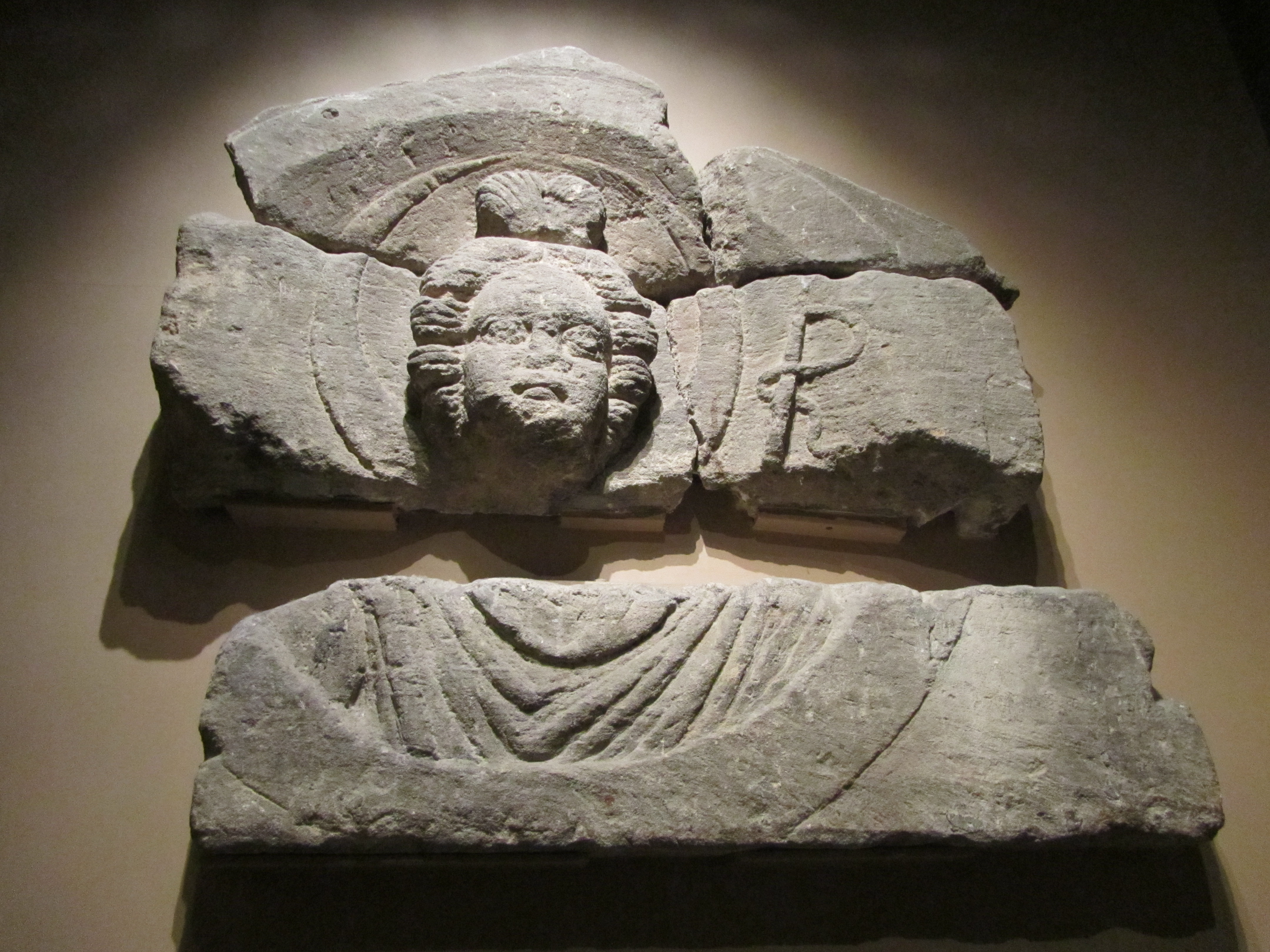
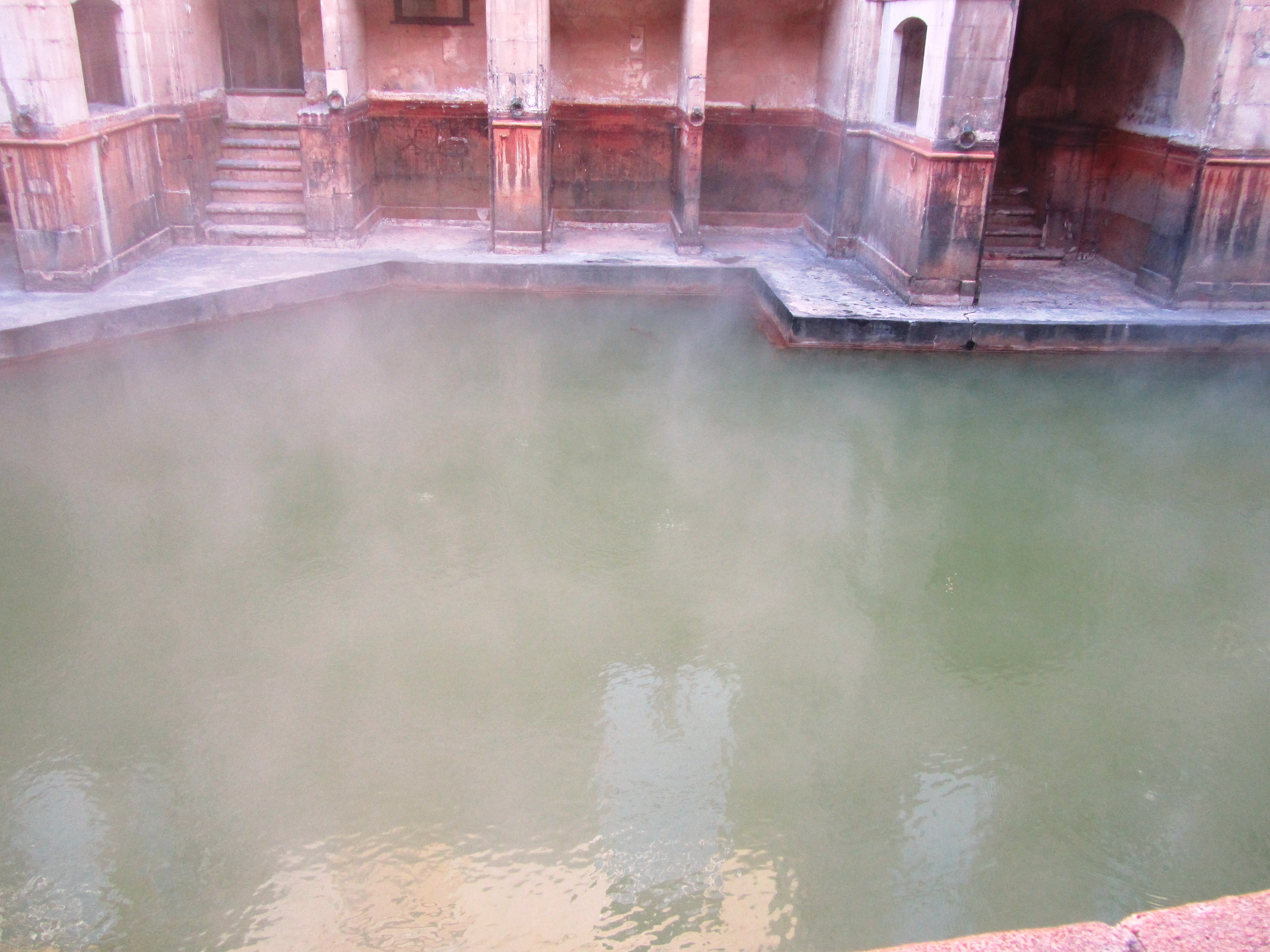
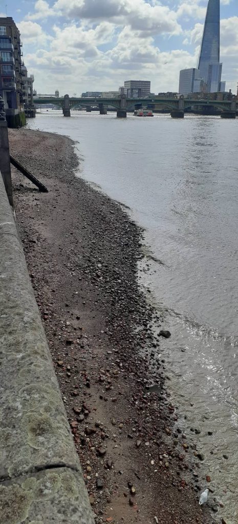
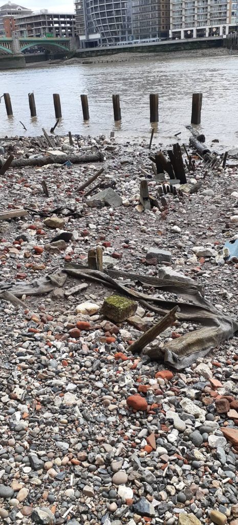
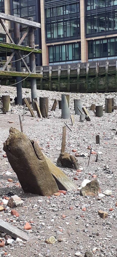
I am early, really early, but it gives me time to watch – the river and the people – from a shady spot, which, thankfully, is tickled by an occasional breeze. Observing the tide as it slowly retreats, numerous wooden structures begin to appear, the remains of old jetties and the like can be seen jutting out of the mud. The Thames has been the lifeblood of London for more than two thousand years and although officially it was the Romans who first established a settlement here there were other inhabitants of the area throughout prehistory.

The tide begins to fall…
The excitement builds as more of the foreshore is revealed…
Finally…I am on the foreshore…where do I look first? (note the ubiquitous clay pipe stem).

All of those people, have over thousands of years left traces of their lives on the foreshore of the Thames.

In the past mudlarks were group of souls who spent endless hours sorting and collecting useful debris from the mud to sell – it was an occupation for only the most desperate.

The searched for pieces of coal they could wash and sell on the streets; rags, bones, glass and copper nails they could take to various merchants to recycle…sometimes the children would turn cartwheels in the mud for the amusement of onlookers, who would toss in a penny for them to find. It was a pathetic existence and just a step away from the workhouse.” (L Maiklem ‘A Field Guide to Larking’ 2021).

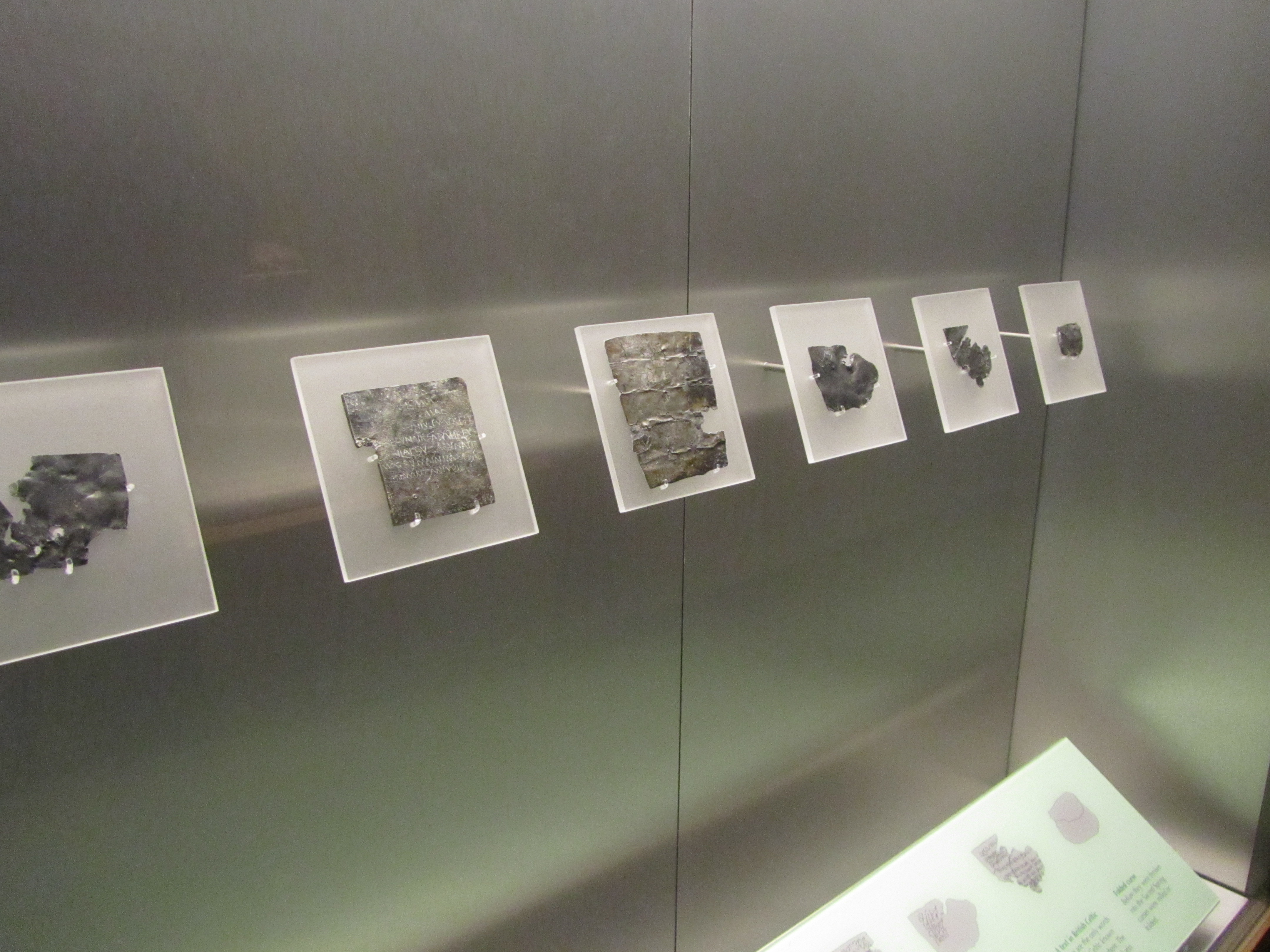
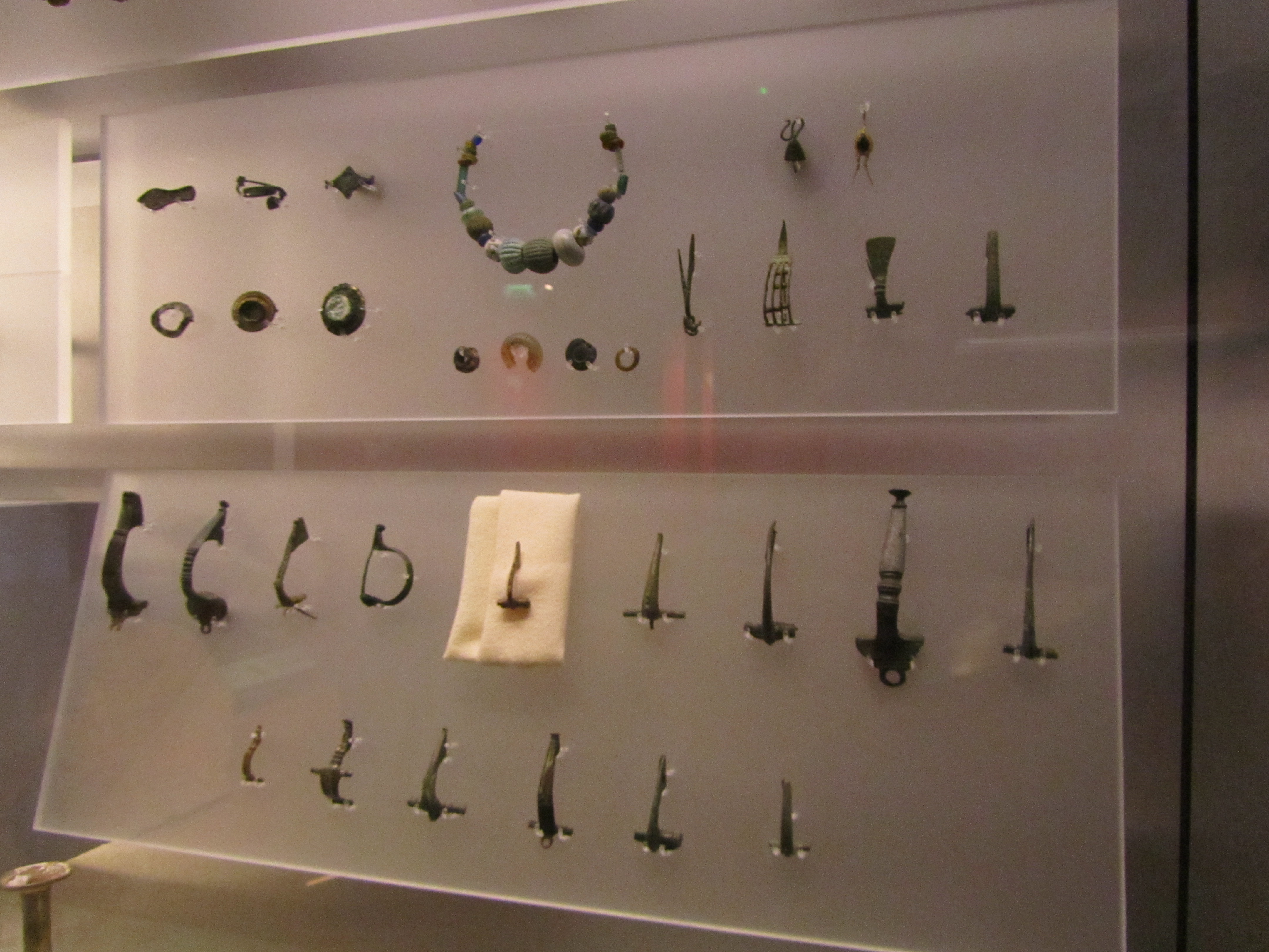
Nowadays, mudlarks have a much-improved reputation – the twenty first century mudlarks of the Thames foreshore scour the mud and debris for stories of the past. Bits of broken pottery, clay pipes pieces, coins, buckles, pins, tiles, bones and much more all tell the story of London’s history. Not the story of kings and queens but one of ordinary people whose voices are often lost to us but who can speak to us down through time via the bits and bobs they lost and discarded along the river.

As some may already realise, larking is one of my favourite activities – in NZ it is dressed up as beach combing and often consists of finding odds and ends of glass bottles and 19th/20th century ceramics if I’m lucky. So when the opportunity arises for me to become a mudlark for a few hours…well…what can I say…(actually I yelled, ‘here take my money!’)

At this point it is important to note that not just anyone can mudlark on the Thames foreshore and there are a number of rules and regulations to follow. Everyone who is involved in the searching and removal of objects from the foreshore has to hold a permit to do so. There are also exceptions as to where you can and cannot search, for example, the foreshore in front of Westminster is completely out of bounds (for obvious reasons). There are places where only certain permit holders can go and there are rules surrounding the digging/scraping of the foreshore. For more information on the rules and regulations look here.

For the casual visitor to London there are two ways to get involved mudlarking – get a day permit from the Ports of London Authority or join a mudlarking tour. The Thames Explorer Trust do daily tours and give you plenty of time on the foreshore to fossick. Needless to say, my foray into mudlarking was with the Thames Explorer Trust, as I found it to be the cheapest and easiest way to get involved.

Our guide (standing in the hat) giving us a whistle-stop tour of London’s history through its artefacts.

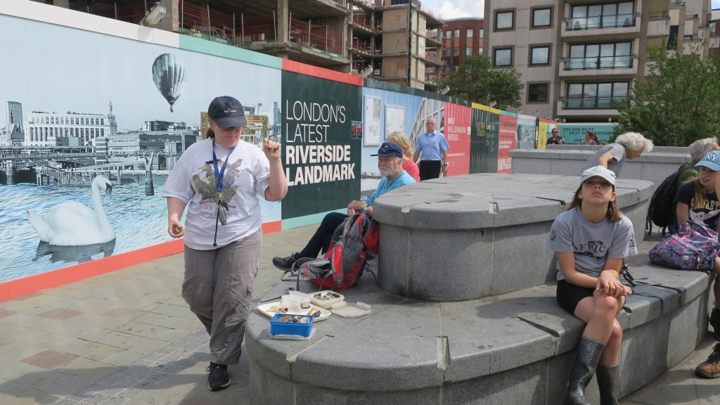
Our guide for the morning was both knowledgeable and enthusiastic (and a fellow NZer!) She began the tour with a whirlwind introduction to the history of London and the types of artefacts we might find on the foreshore. Eventually, we were ushered to the steps that led down to the riverside. A few final words of warning from our guide (watch out for the wash of passing boats, no digging or scraping and don’t go past that point over there…) and we were left to our own devices.

The area where we were not allowed to venture – the round posts in the center of the photo are actually surrounding the remains of the Anglo Saxon wharf at Queenhithe. Only certain people are allowed to search in this area.

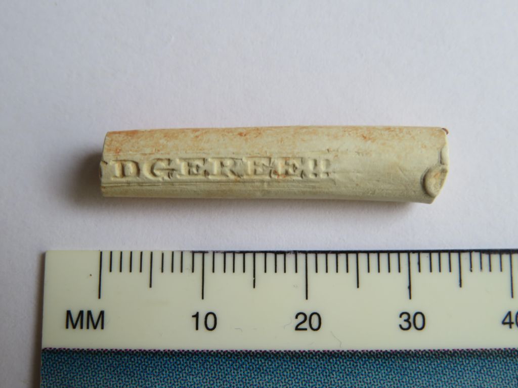
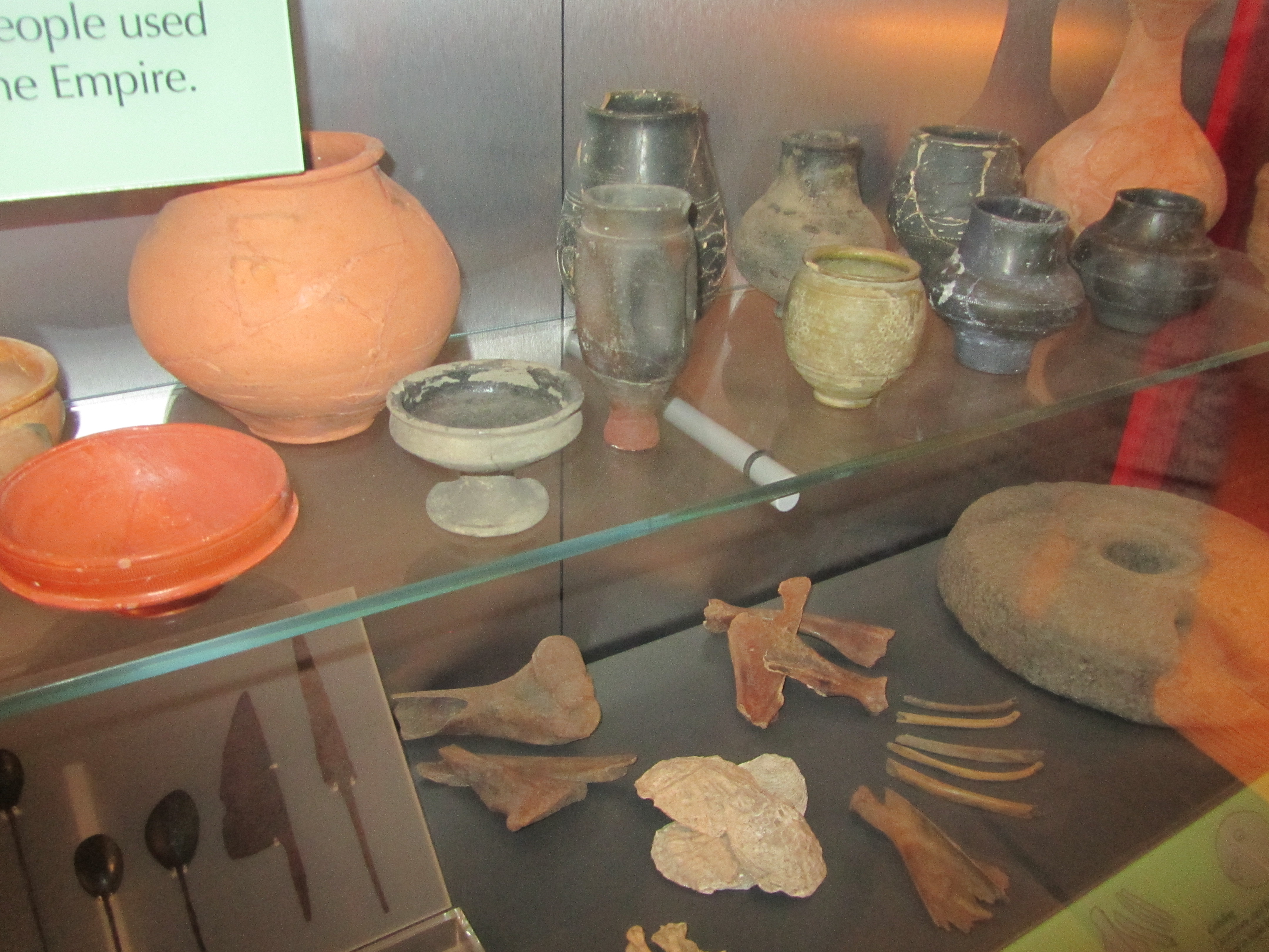
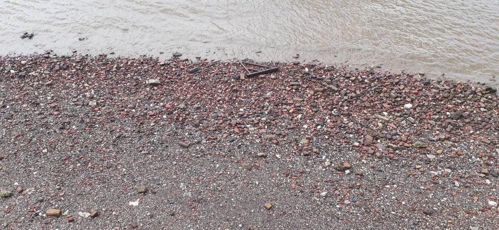
Bent over, eyes on the ground, the rest of the world receded to a low hum in the background as bit-by-bit London’s past revealed itself. The broken stems of clay pipes were by far the most numerous artefacts, along with red bricks and roof tiles, pottery fragments began to leap out. At first the ubiquitous willow pattern and plain white sherds but then as I looked harder, the green glaze of medieval pottery could be seen. Animal bones were plentiful, some the remains of someone’s fried chicken dinner, whilst others spoke of the butcher and the resources needed to feed the people of London. Oyster shells told a tale of cheap and easy eats (in the past oysters were not a delicacy but a cheap foodstuff for poor people).

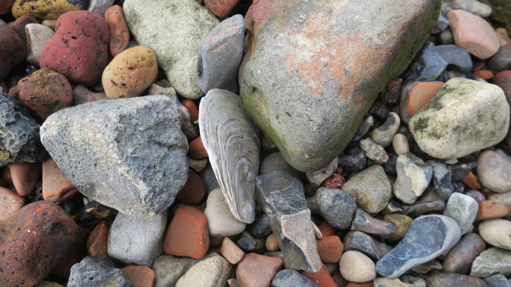
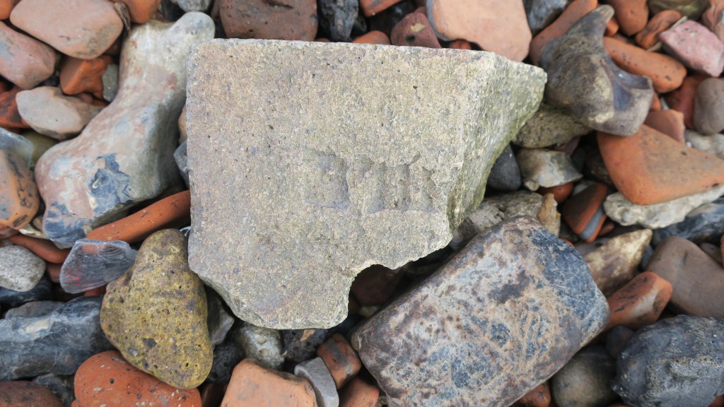
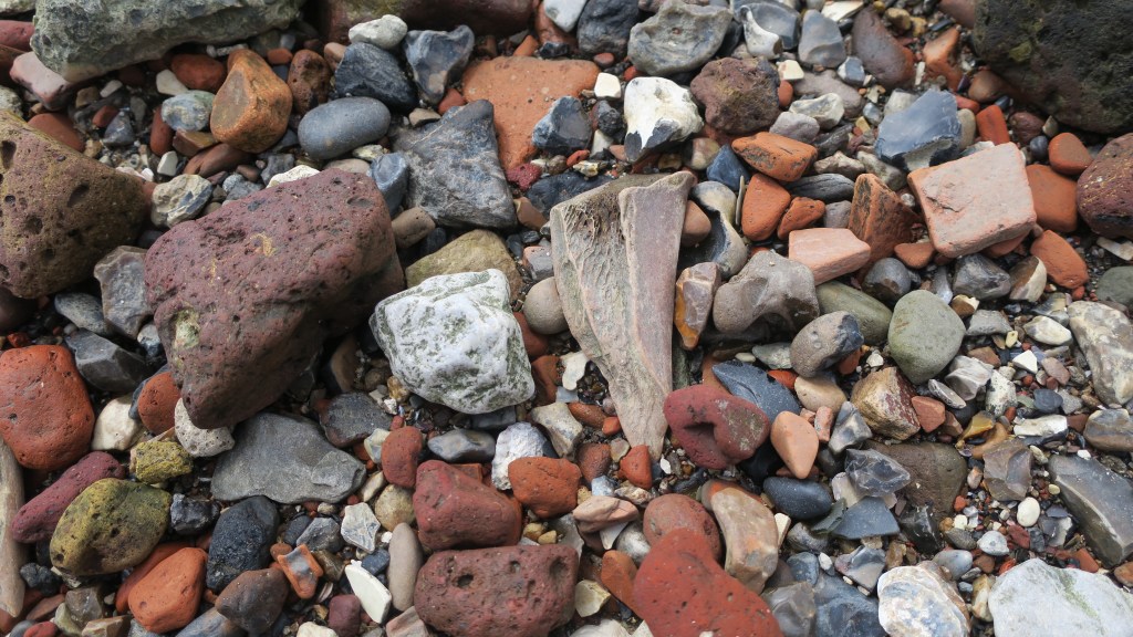
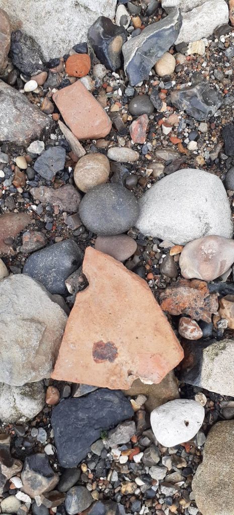
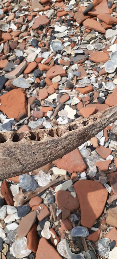
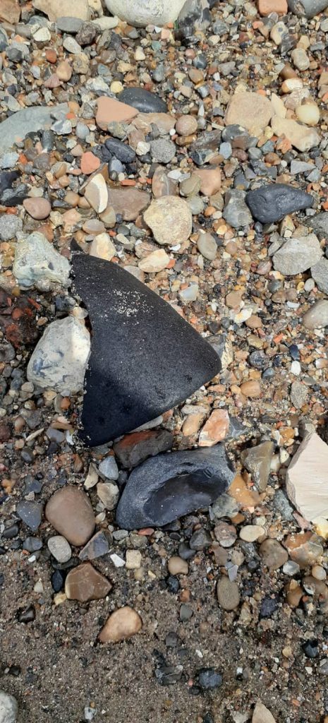
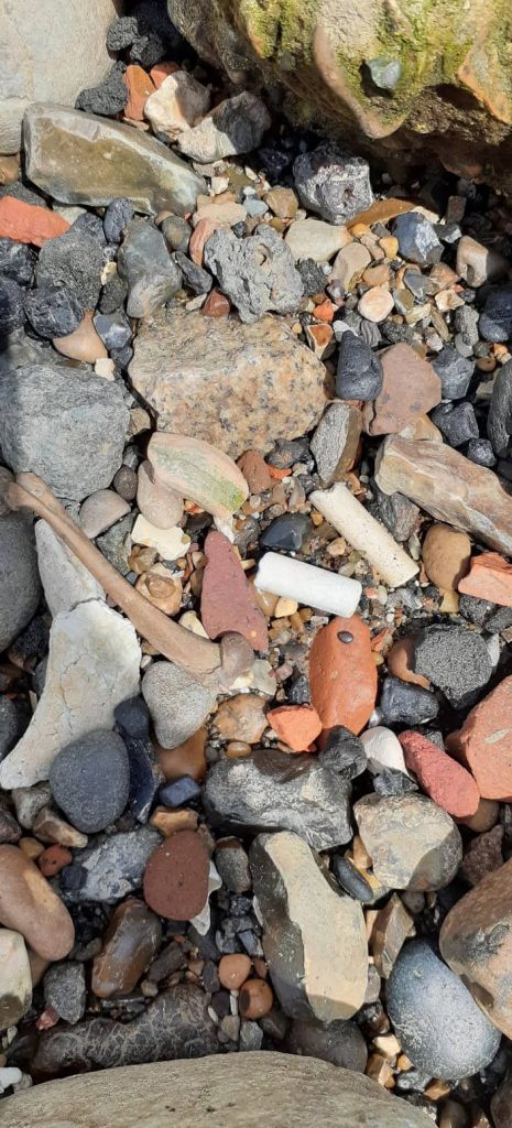
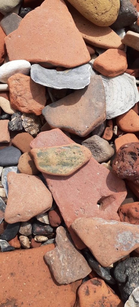
The above photos show just some of the things I spotted – in truth I kept forgetting to take photos, I was so engrossed. The first photo is of a roof tile, the nail holes can be seen on either side (I would like to think this was Roman but I cannot say for sure), second photo is the jaw bone of a pig and represents just some of the vast amount of bones found on the foreshore. The third photo is the sole of a leather shoe, age is undetermined but most likely Victorian – the Thames mud is of type which preserves organic remains very well. The fourth picture shows first a chicken leg bone, clay pipe stems and a small sherd of green glazed medieval pottery. The final photo is a close up of the medieval pottery sherd, note the quantity of terracotta brick and tile.

It was, simply, two hours of joy that flew by in seconds.

Please note, as a participant of the tour artefacts could not be removed from the foreshore; if you have one day permit you can remove artefacts but if you are travelling overseas, it is important to know that it is illegal to remove any artefacts over 300 years old from the UK. I would also like to stress that there are many laws around the removal of artefacts from any archaeological site (The Thames can be considered an archaeological site in its entirety) and it is up to the individual to know and understand these laws.

The following books are a good source of information regarding mudlarking on the Thames.

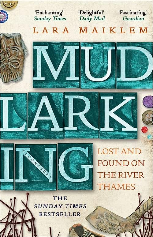
L. Maiklem (2019) ‘Mudlarking. Lost and Found on the River Thames’

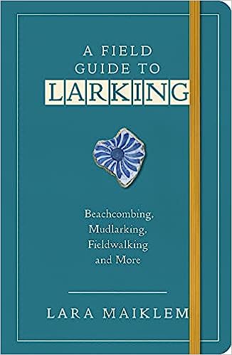
L. Maiklem (2021) ‘A Field Guide to Larking – Beachcombing, Mudlarking, Fieldwalking and More.’

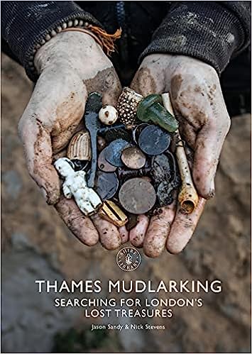
J. Sandy & N. Stevens (2021) ‘Thames Mudlarking. Searching for London’s Lost Treasures.’

Squatters Budgeree !! – A small find with a big story…

Recently I was contacted by a reader of this blog who showed me a small but intriguing artefact he had found on the beach at Fitzpatrick’s Bay (Waitemata Harbour, Auckland, New Zealand). The photo was of a single piece of clay pipe stem, not all that unusual in itself. Clay pipes are one of the most common finds on any settler/colonial sites. However it was the legend stamped onto the opposing sides of the stem that caught my attention – ‘SQUATTERS BUDGEREE!!’ – yes there are two exclamation marks at the end of the legend.

Such an unusual name must have a good story…

A quick online search located an article published in the Australian Historical Archaeology journal which was able to provide the background to the name (see below for the reference to the article and link) and some eloquent discussion on the symbolism associated with this particular pipe.

This particular type of clay tobacco pipe was manufactured between 1840 and 1865 for the Australian market and was one of the ‘first commercial products specifically branded to appeal to the Australian colonial market’. It should be noted that these were most likely manufactured in the UK and not actually in Australia. Although Gojak and Courtney (2018) suggest that the mold was created by someone with local knowledge. When first manufactured the pipe itself spoke volumes about the political and social situation in Australia at the time.

Australia in the late 1830s and 1840s was undergoing a period of pastoral expansion which resulted in the dispossession and often violence towards indigenous people. Events came to a head with the Myall Creek massacre in 1838, here around thirty Indigenous people were murdered. This went against the then colonial government who tried to reign in the pastoralists and protect the Indigenous people. The government hunted down a number of those who were responsible for the massacre, seven of which were executed.

The symbolism therefore advocated for the pastoral interests at a time when there was a significant divide in colonial society…the symbolism of the pipe matched what many people already believed, that Aboriginal society was widely thought to be doomed…reflecting the belief in the inevitability of the strong and advanced overcoming the weak and primitive.

Gojak, D., & Courtney, K. (2018). Squatters Budgeree: a distinctive clay tobacco pipe produced for the Australian colonial market. Australasian Historical Archaeology, 36, 5–15

The bowl was decorated with coarse depictions of Indigenous people drinking alcohol on the side with word ‘budgeree!!’ And a pastoralist with animals under a cabbage tree on the side with the word ‘squatter’. The symbolism of the two opposing scenes clearly spoke to many in colonial Australia of the differences between the Aboriginal world of chaos and savagery and the world of the pastoralist – serene, productive, sobriety and quiet reflection. Even the exclamation marks at the end of the legend serve to emphasise the indignation of the pastoralists who felt they were being unfairly treated by the government in favour of the Indigenous people.

Unfortunately, all that was found at Fitzpatricks was a short fragment of stem but the words stamped on the stem are also a political statement. Both words originate in New South Wales – ‘squatter’ refers to the pastoralists who grazed their herds on land without government sanction, whilst ‘budgeree’ is a form of pidgin local dialect and comes from the Dharug language from Sydney. It means ‘something that is good’ or ‘someone who is doing well’. Thus the words can be read that the ‘pastoralists are doing really well’.

From this point on colonial society became split into two camps, those who supported the pastoralists and those who did not. Using the ‘Squatters Budgeree’ pipe became a political act – a way of displaying support for the pastoralists. Not dissimilar to our modern inclination of showing support for various causes on a t-shirt.

Photo by D J Payne and used with permission.

So, what is an Australian tobacco pipe doing in New Zealand? Other Squatter Budgeree pipes have occasionally turned up during excavations in New Zealand, such as, at Paremata on the Porirua Harbour and the Victoria Hotel site in Auckland. In the case of Paremata, a military site, it could be that it arrived as a personal item with troops from Australia at the time of the New Zealand wars. Whilst the excavation of the Victoria Hotel yielded a large number of clay pipes, amongst which was a variety of Australian themed types, including the Squatters Budgeree. At the time almost all of New Zealand’s imports came through Australia and it is most likely that these pipes were part of a general lot. It is equally possible that such pipes were sold in New Zealand from a job lot, so to speak, when the Squatter pipes went out of fashion after 1860.

In regard to our small but perfect specimen, the jury is out but given the bay’s proximity to the new settlement of Auckland, the connection to the harbour and of course our understanding of the early settlement of Fitzpatricks Bay – the reader can make their own judgements…

Reference – ‘Squatters Budgeree: a distinctive clay tobacco pipe produced for the Australian colonial market.’ By Denis Gojak and Kris Courtney. Australian Historical Archaeology Vol 36 2018 pp5-15.

https://www.jstor.org/stable/26775685

Written with special thanks to D J Payne who brought the pipe stem to my attention and provided the photos for this blog post. Please do not use the photos without permission.

The Ghosts of the Ancestors

Its that time of year in the Northern Hemisphere that some folks thoughts turn towards all things supernatural. Halloween or Samhain, to give it its traditional name, is said to be a time when the veil between the world of the ancestors and our world is at its thinnest. The celebration of this festival varies from person to person depending on age, background and of course where you live. Some choose to trick or treat, some go on a ghost hunt, whilst others use this time to remember and celebrate their ancestors.

The history of the festival of Samhain is comprehensively covered in main different parts of the internet and it is not my intention to rehash the topic here. Instead want to consider the idea of hauntings and deep past, after all the roots of Samhain can be found within the distant past with the ancestors.

Hauntings and ghosts in the UK are most commonly associated with castles, old country houses, old pubs and the like – the age and history of these places are enough to provide copious amounts of storytelling fodder. But what about the truly ancient places in the landscape? Surely based on age alone they too should have their fair share of tales…

Stonehenge

Stonehenge is probably one of the most famous ancient sites in the UK (for more information feel free to check one of my earlier articles here). However, it does come with some of its own spooky stories…

In 1971, when it was far easier to get up close and personal with the stones, a group of hippies decided to camp out in the center of the circle. All was going well until at sometime around 2am a violent and sudden thunderstorm struck the Salisbury Plains. At the same time a farmer was checking on his stock and a policeman was in the area. Both spoke of a bright blue light illuminating the stones and of hearing screams from the campers. When they rushed to the campsite all they found were the ashes of the fire and smoldering tent pegs – the hippies had vanished.

Stonehenge sits within a much wider ‘ritual’ landscape, surrounded by numerous Bronze Age burial mounds known as barrows. One such group of barrows sits on a ridge known as Kings Barrow Ridge and it was in the woods nearby that a man in the 1950s had a strange encounter. It was late at night and the man in question was on his way home when he became disorientated. Climbing one of the barrows to get a better idea of where he was, he saw some lights in the distance and assumed them to be a farmhouse. Climbing down the barrow he became alarmed when he realised that the lights were moving towards him and they were not electric lights but flaming torches. Assuming they were a group of modern druids enacting some pagan ritual and not wanting to disturb them he hid and waited for them to pass.

Once they had passed he quietly followed them hoping they would be heading back to the main road from whence he would be able to get himself home. After awhile the silent procession reached the edge of the wood and the man recognising where he was, slipped away not wanting to disturb them. Unfortunately, he made that small mistake of looking back, he watched in horror as one by one the torches flickered out and the robed figures disappeared into thin air.

Other interesting phenomena associated with Kings Barrow Ridge are the strange blue flashes of light that are occasionally seen arcing across the barrows and the simultaneous loss of electrical current.

Avebury

Another well know stone circle is that of Avebury, not far from Stonehenge (please check out my earlier article for more information about Avebury here). Perhaps one of the salient points to remember about Avebury is that a number of the stones have been removed, broken up and used as building material whilst others have simply been pulled over and buried where they lay as a result of anti-pagan fervor during the medieval period. It is said that the buildings which were built using the old standing stones are subject to a poltergeist type manifestation known as ‘The Haunt’. Then there are a number of stories which include moving lights, phantom singing and spectral figures around and within the stones themselves.

Inner circle with ditch and bank visible – photo my own

One such figure may even be the ghost of the man who died some time in the 1320s. When Alexander Keiller decided to re-erect some of the stones in the circle. Under one such stone the skeleton remains of man were found, the coins and tools on him dated his death to the 1320s, his trade as a barber-surgeon (this stone is now known as the Barber stone). It seems he was helping to dig the burial pit for the stone when it fell and crushed him. His compatriots deciding it was not worth the effort to dig him out for a proper burial and perhaps superstition got the better of them.

A similar story is told about the Caratus Stone (possibly a fifth century AD memorial stone) in Somerset. Here the tale tells of a foolish carter who tried to uproot the stone to get at the treasure which supposedly lay beneath it. Unfortunately for him, the stone (or should that be the ancestors) had different ideas, it fell on him crushing him to death. His apparition is said to frequent the area on foggy nights.

Another story regarding Avebury tells of a young woman called Edith Olivier who during World War One decided to drive to Avebury for the first time. She wrote of the looming avenue of megaliths that lined her route from the west and how once in the village she noticed a crowd of villagers attending a fair. It was not until sometime later she discovered that not only had the avenue she had seen disappeared by 1800 but that there had been no fair in the village since 1850.

Barrows and the Fae

There are many tales of the fairy folk and in different parts of the UK they often have local names, such as in Cornwall where you get piskies who have acquired the status of ‘supernatural vermin’. Also in Cornwall there is a variation of the piskie called a spriggan (a more malevolent type of fae) and it is these which are said to guard the treasures hiding in the barrows. Such traditions of fairy folk protecting the barrows of the ancestors are widespread and perhaps hark back to a distant religion.

A barrow covered in bluebells and not looking at all menacing…photo by Sharon Loxton on http://www.geograph.co.uk

On Wick Moor in Somerset there is a barrow surrounded by barbed wire and set within the middle of the Hinkley Nuclear Power Station. Known as Pixie’s Mound, the story goes a man found a small broken toy spade. He mended it and left it by the barrow. When he next passed that way he found the spade gone and a plate of cakes in its place, these he ate and forevermore enjoyed good fortune. During the power stations construction the builders were warned that if they built over the barrow nothing would work. Advice which they took seriously.

Wick Moor with Hinkley Power Station in the background – photo by A and J Quantock (www.geograph.co.uk)

Throughout the UK there are many landscapes and places associated with the fairy folk. Often it is the vast lonely moorlands which seem to have more than their fair share of tales told of unwary travellers being befuddled and lead astray by the fae. In the far west of Cornwall there is a lonely stretch of moorland between Woon Gumpus and Carn Kenidjack, here not only does the Devil ride the fairy path on a black horse but dancing lights are often seen while the granite tor wails in the wind. Fairy paths are the dead straight paths which lead between fairy forts and barrows; it is on these you are most likely to encounter the fae.

Carn Kenidjack (also known as the hooting carn) with Tregeseal stone circle in the foreground – photo By Jowaninpensans – Own work, CC BY-SA 4.0, https://commons.wikimedia.org

Apparitions

Bona fide prehistoric ghosts are a rare phenomena but one of the best substantiated ghosts in the Dorset area and most probably the oldest is that of Bronze Age ghost seen on Bottlebrush Down. Here a respected archaeologist R C Clay witnessed (in 1924) whilst driving home one evening from an excavation the apparition of man on horseback galloping beside his vehicle. He wore a long dark cloak and rode bareback, brandishing a weapon angrily. Approaching a barrow Mr Clay was astonished to see the horse and rider suddenly vanish into the burial mound. He is only one of many who have seen this particular spectre.

Other ghostly figures at archaeological sites include a horse and chariot at Ruborough Camp in Somerset which is said to be guarding treasure buried there. Near Thetford in Norfolk on the banks of the river Thet there is a barrow known as Thet Hill. It is regarded as being very haunted, here a red-haired chieftan has been seen. In Wroxham (Norfolk) you may come across the apparition of a Roman soldier who will order you away, it seems he is clearing a passage for a ghostly procession of prancing horse, chariots, gladiators, lions, centurions and their prisoners who make their way from Brancaster to the arena which once stood there.

The River Thet in Norfolk – photo By Bob Jones, CC BY-SA 2.0, https://commons.wikimedia.org

In the Welsh county of Glamorgan is one of the UK’s oldest archaeological sites. On the coast are the Paviland Caves where a burial of Paleolithic hunter was found and excavated at the end of the 19th century. Labelled the ‘Red Lady of Paviland’ stories abounded about it being a woman imprisoned there during a storm whilst hunting for treasure amongst other things and of course she was said to haunt the cave. However, this is definitely one of those cases where the human imagination was allowed a little too much free reign. The Red Lady was later proven to be a man and considerably older then first imagined.

Worth a mention though and not far from the above site is Rhossli, behind the village is a moorland area which the locals admit to feelings of being watched and menace. Here it is said the air seems full of evil foreboding…

Over the years I have visited many prehistoric sites and have heard the stories of many others. There are often those who speak of feelings of foreboding, of not being welcome. At West Kennet long barrow several people have said they have felt unwelcome. But it would seem that this depends on the person and the when of the visit. I know from my own experience that walking into a stone circle invites contemplation and even unruly children become quiet and reflective without being told. Perhaps this too is a type of haunting when only the energy remains.

Landscapes imbued with meaning, with the rituals of the past; vast stretches of empty wild rugged land; brooding moorland; mysterious stones; cursed burial mounds; noises in the mist; shadows at the corner of your eye…Samhain…a time when the veil is thin…a time to honour the ancestors…

My Son – Temples in the Jungle

During a recent holiday in Vietnam I visited the temple precinct of My Son, the principal religious center of the Champa. The following are a few photos (read many) of this day trip with a bit of background for good measure.

Who were the Champa?

Essentially the Champa were a collection of independent polities who ruled central and southern Vietnam from around the second century AD. The independent states became united in the fourth century under the rule of King Bhadravarman of Indrapura during the 4th century. Between the 7th and 10th centuries the Cham controlled the trade in spices and silk out of the South China Sea. Hoi An was the main port of the principality of Indrapura and whilst the capital of the Champa was in the area of the modern village of Dong Duang – both are situated near to My Son.

Map of Vietnam – Hoi An and Da Nang are roughly central on the coast.

From around the fourth century the Cham adopted Hinduism as their principle religion although many were eventually converted to Islam from the 10th century onwards. Today whilst the majority are Muslim there are still some that retain the Hindu faith and traditions.

The name Champa comes from the Sanskrit word ‘campaka’ which refers to species of flowering tree similar to a magnolia.

By 1832 the northern Vietnamese Emperor Minh Mang had annexed and absorbed the Cham polities

My Son

My Son is situated in a valley near the village of Duy Phu approximately 69km from DaNang and was the site of religious ceremonies for the HIndu Cham rulers between the 4th and 14th centuries. It also served as a royal burial place. There are in excess of seventy temples in addition to many stele containing important inscriptions in both Sanskrit and Cham.

An aerial view of the now jungle covered valley, the bare patches are some of the temples accessible to the visitor.

The Hinduism of the Champa was Shaiva with elements of local religious cults such as that of the earth goddess Lady Po Nagar. A number of the features at My Son are the linga – a black stone pillar representing Shiva and the yoni representing the mother.

Unfortunately the valley was carpet bombed by the Americans during the Vietnam war and many of the temples were severely damaged and in some cases totally destroyed. In recent years efforts have been made to rebuild the temples (the work is ongoing).

The hollows are indeed bomb craters – this part of the site has been left untouched – as awful as the bombing of such an important site is, the act is part of the history of My Son and as such needs to be remembered and preserved if we are to learn anything from it.

All but one of the temples are constructed from red brick (the only stone built temple is in the area known as B1). The decorative carvings which adorn the temple exteriors were cut directly into the bricks themselves. Although there has been some discussion about the type of mortar used in construction of the temples, it is now generally accepted that the mortar consisted of a sticky clay solution similar to the brick clay.

There are four types of buildings –

  1. Kalan – the brick sanctuary used to house the diety.
  2. Mandapa – the entry hallway associated with a sanctuary.
  3. Kasagrha – ‘fire-house’ usually with a saddle shaped roof and used to house valuables or to cook for the diety.
  4. Gopura – the gate tower leading into a walled temple complex.

In addition to the many sculptures and statues there are numerous stele (32 known in total) dating between the 5th and 12th century. The stelae can refer to a foundation of a temple, altar or pedestal. As historical documents they are very useful as they list names of kings, cities and occasionally describe important historical events such as the wars between Champa and Cambodia in the 12th century. The statues and carvings are usually representations of Shiva, also there are guardian statues found outside the temples.


The monuments of the My Son sanctuary are the most important constructions of the My Son civilization. The tower temples have a variety of architectural designs symbolizing the greatness and purity of Mount Meru, the mythical sacred mountain home of Hindu gods at the center of the universe, now symbolically reproduced on Earth in the mountainous homeland of the Cham people. They are constructed in fired brick with stone pillars and decorated with sandstone bas-reliefs depicting scenes from Hindu mythology. Their technological sophistication is evidence of Cham engineering skills while the elaborate iconography and symbolism of the tower-temples give insight into the content and evolution of Cham religious and political thought.  

From the UNESCO world heritage centre website
https://whc.unesco.org/en/list/949

Myths and Colonisation of the Pacific.

This article was originally written several years ago for the ‘Mythology Magazine’ which is now defunct. My intention when writing this was to look at some of the myths and legends associated with the colonisation of the Pacific so please do bear in mind this is not an academic treatise on this subject (that is a far too large a subject for a simple blog…).

The islands of the Pacific Ocean were one of the last places in the world to be colonised by people.  The how, when and why has occupied archaeologists, anthropologists, linguists and historian for decades.  For the European scientist these questions need to be answered with solid evidence backing them.  For the indigenous populations tradition told them all they needed to know, the myths and legends providing all that was needed by the way of explanation. 

Map of Oceania

New Zealand, Hawaii and Easter Island were the last landmasses to be colonised in the Pacific.  These first peoples were at the end of a long line of ancestors whose collective knowledge fuelled their ability and desire to travel across vast tracts of ocean.  The Pacific region is made up of three distinct areas – Melanesia, Micronesia and Polynesia.  The first area to have been settled by people was Melanesia; it consists of Vanuatu, Papua New Guinea, Fiji, the Solomon Islands, the Bismarck Archipelago and New Caledonia.  Dates for the first colonisation range between some 50-30,000 years ago their ancestors originating from South East Asia.  Micronesia is situated north of the Melanesian group and is made up of groups of islands including Kiribati, Nauru, Marshall Islands (to name a few) and the US territories of Guam, Northern Mariana Island and Wake Island.  Evidence for the settlement of this region is difficult to pin down; the earliest archaeological evidence comes from the island of Saipan and is dated to around 3500 years ago.  The third group of islands is Polynesia which covers a wide part of the Pacific.  Generally speaking New Zealand, Hawaii and Easter Island form the corners of a triangle within which all other islands sit and are referred to as Polynesia.

The ancestors of the Polynesians migrated from South East Asia a little later than the settlers of Micronesia, passing through some parts of Micronesia and Melanesia, but rarely settling for long.  Fiji is an interesting case, as in many ways it straddles the line between Melanesia and Polynesia.  When the ancestors of the Polynesians arrived in Fiji there was already a decent sized population and had been for millennia.  Yet today the visitor to Fiji will see a multitude of faces, some are distinctly Melanesian looking (mainly in the eastern islands) and others look more Polynesian.  Fiji in many ways was a jumping off point for the exploration further west, the next islands to be settled were Samoa and Tonga, both of which are not a great distance from Fiji.  These early explorers are known as Lapita people based on a distinctive type of pottery found on the archaeological sites.

The distinctive pottery of the Lapita Culture – this is a plaster reproduction photo courtesy of the Metropolitan Museum of Art.

“All island groups in island Melanesia and West Polynesia that lie in a south-east direction have Lapita settlements.  None of these settlements have been found on other islands.” (G. Irwin. Pacific Migrations – ancient voyaging in Near Oceania. Te Ara: The Encylcopedia of New Zealand.) 

These people were exploring the region from as early as 3500 years ago (evidence found at the Bismarcks) and by 3000 years ago were already as far as Samoa and Tonga.  The archaeology tells us these were small groups who travelled fast and light, they established only a few permanent villages on each major island group and then they moved on.  At this time the distinctive Polynesian culture began to emerge in the west and by 2000 years ago people had begun to move into the eastern part of the region.  By 700AD the majority of Polynesia had been settled with the last migrations being to New Zealand, Hawaii, Easter Island and South America (the only evidence for South America is the presence of the ‘kumara’ or sweet potato, radiocarbon dates from kumara found in the Cook Islands indicate that Polynesians had reached South America and returned by 1000AD at the latest).

Kumara (or sweet potato) a staple food source.

All well and good you might say, but what has this to do with the mythology of the region?  To study the past of this region it is important to not only use all those scientific tools we have at our disposal but also use the traditional knowledge, stories and myths to provide a greater depth of understanding.  In Polynesia there are many stories which have a commonality suggesting a shared ancestry.

In much of eastern Polynesia Hawaiki (the Maori name) does not refer to the islands we know as Hawaii but to a mythical land where the ancestors journeyed from – an ancient homeland.  In New Zealand nearly all the Maori have traditions of such a voyage, in the Marquesas it called Havai’i, in the Tuamotus it is Havaiki and in the Cook Islands the ancient homeland is referred to as Avaiki.  Not only is Hawaiki the ancient homeland but it is also a place where a persons spirit would go after death.  The main island of the Hawaii group is so named because it is the site of two volcanoes which were regarded as a place of great supernatural importance and the home of the gods.  Similarly the island of Ra’iatea in the Society Islands was previously known as Havai’i and it too has a volcano on it (albeit a extinct one) believed to be the entrance to the underworld and the home of the gods.

In Maori myth Hawaiki is in the east – the direction of the rising sun and the stars which bring the changing seasons.  Thus it is not surprising that Hawaiki was associated with life, fertility and success.  It is said that the first human life was created from the soil of Hawaiki by Tane (or sometimes Tiki).  It is the place of highly valued resources such as the kumara which is said to grow wild there – this is interesting in itself because if you travel directly eastwards from New Zealand you will (eventually) land in South America, the homeland of the sweet potato.

“When the ancestors arrived in their waka, they brought with them many treasured plants and birds, also important atua and ritual objects such as mauri.  In one way and another, Hawaiki was the ultimate source of the mana of all these.  The crops flourished, the gods exerted their powers, the mauri ensured continuing fertility of the resources they protected, because of their origin in Hawaiki.” (M.Orbell 1995 Maori Myth and Legend)

The veneration of the east – many rituals are conducted facing east – is unusual for Polynesia and has led some to make the dubious suggestion that New Zealand was settled by people from South America.  More recent studies have demonstrated that the first voyagers would have taken a south-west trajectory from either the Cook Islands or the Society Islands in order to land on the east coast of New Zealand.  Over time it would seem this navigational knowledge was amalgamated with the traditions of an ancient homeland.

In other parts of eastern Polynesia Hawaiki is in the west or sometimes even in the sky and in western Polynesia it is called by another name – Pulotu, a word that can be linguistically traced into Micronesia.  It is interesting to note that the largest island that forms part of Samoa (western Polynesia) is called Savai’i and is a land associated in tradition with many supernatural goings on.  Hawaiki was not only the land where the ancestors came from but also a place of spirits, a place where the myths came into being.

As time went on many of these stories would become absorb into local tradition with familiar places becoming the setting to the story.  Thus the story of Maui who fished up the islands can be found everywhere in Polynesia.  In New Zealand it is said that the North Island was a giant stingray fished up out of the sea by Maui using his magic hook (the hills and valleys of the land are a result of his brothers greed when they hacked at the fish). On the tiny atolls of Manikihi and Rakahanga it is believed that these islands are all that remains of a single land which broke apart when Maui leapt from it into the heavens.  In Hawaii tradition tells of the islands being a shoal of fish and how Maui enlists the help of Hina-the-bailer to bring the shoal together with his magic hook to form one mass.  Maui hauled on the line, instructing his brothers to row without looking back, which of course they did, this resulted in the line breaking and the islands become separated for all time.   In the Tuamotaus Maui and his brothers are once more fishing far from land, once more he has a magic hook and once more he pulls up an island but because his brothers did not listen to Maui the giant fish/island broke apart and became the land the Tuamotua people refer to as Havaiki, where Maui and his family reside.

Fish hooks represented more than just a means of procuring fish, they also had a symbolic meaning and it is possible that some of the larger more ornate types were representative of the ancestral stories.

Maui is one of the most well known of Polynesian deities, found in the stories throughout the region he is often known as a trickster, part god and part human.  He was of a time when the world was still new and there much to do to make it bearable for people.  Maui is said to be responsible for raising the skies, snaring the sun, fishing up lands, stealing fire, controlling the winds and arranging the stars.  On the island of Yap in Micronesia a demi-god figure called Mathikethik went fishing with his two elder brothers, he also had a magic hook and on his first cast brought up all sorts of crops, in particular taro, an island staple.  On his second cast he brought up the island of Fais.  The similarities here with Polynesian Maui are obvious and once again we can get a tantalising glimpse of past movements of people.

Other characters common to the stories of the Polynesia from Samoa in the west to Hawaii in the east include Hina, said to be both the first woman and a goddess who is the guardian of the land of the dead; Tinirau whose pet whale was murdered by Kae; Tawhaki who visited the sky and Rata whose canoe was built by the little people of the forest and was a great voyager and Whakatau the great warrior. 

“…on every island the poets, priests and narrators drew from the same deep well of mythological past which the Polynesians themselves call the The Night of Tradition.  For when their ancestors moved out from the Polynesian nucleus they carried with them the the knowledge of the same great mythological events, the names of their gods and of their many demi-gods and heroes.  As time passed the Polynesian imagination elaborated and adapted old themes to suit fresh settings, and new characters and events were absorbed into the mythological system.” (R. Poignant 1985 Oceanic and Australasian Mythology).

Of course none of this addresses the question of why.  Why did the first people leave their homelands and explore into the vast ocean, particularly to places like New Zealand, South America, Easter Island and Hawaii?  What motivated them?  The myths do in some way suggest possible reasons, these are stories people would have heard over and over again as they grew into adulthood.  Stories of great adventurers, of those who dared to do the impossible and it does seem that much of the early migration was a result of simple human curiosity.  Prestige and mana could be gained by person willing to find new lands.  In the places they originally came from there was no food shortage and in some instances even once they had discovered a new island, they would move on leaving but only a small population behind.  In the traditions there are also stories told of people being banished and having to find new places to live, in addition there are stories of battles lost and people fleeing retribution.  These too could well be another window into the motivation behind Oceanic migration. 

Ocean going craft as suggested in “The History of Mankind” (1896)

On their own the mythologies of the Pacific cannot provide us with more than a unique insight into the mindset of the peoples considered to be some of the greatest explorers of the past but when combined with genetics, linguistics and archaeology it gives us the ability to answer those questions of how, when and why.

Sources

Irwin G (2012) ‘Pacific Migrations – Ancient Voyaging in Near Oceania’ Te Ara: The Enclyclopedia of New Zealand.

Ratzel F & Butler A J (1869) History of Mankind

Poignant R (1985) Oceanic and Australasian Mythology

Orbell M (1996) Maori Myth and Legend

The First Archaeologists

People have always been interested in the past, as far back as Nabonidus who ruled Babylon from 555 – 539BC who had a keen interest in antiquities to such an extent he even excavated down into a temple to recover the foundation stone which had been laid some 2200 years prior.  Nabonidus also had a museum of sorts where he stored his collection.  During the Renaissance those with the wealth to travel and collect began to keep cabinets of curios.  In these you would find ancient artefacts displayed alongside minerals and natural history pieces. 

“…the Renaissance attitude to the examination of the past…involved travel, the study of buildings and the collection of works of art and manuscripts.” (K. Greene 1983).

Initially it was classical antiquity which grabbed the attention of the well-to-do but after awhile eyes began to turn towards relics of their own past. The great stone monuments of North-western Europe became the immediate focus, places such as Carnac in Brittany and Stonehenge in Britain.  Some of these gentlemen scholars would make systematic and accurate surveys of the monuments, which are still useful today, even if there were the less scrupulous who dressed up treasure hunting as scholarly research.  These antiquarians were in essence the first archaeologists and their contributions can still be useful today.

In Britain several antiquarians stood out between the 16th and 18th centuries.  John Leland (1503-1552) held the post of Keeper of the Kings Library and such travelled extensively throughout Britain.  Even though his main interest was in genealogy and historical documents he also recorded non-literary evidence as part of his wider researches, one of the first to do so. 

William Camden (1551-1623) learnt not only Latin but also Welsh and Anglo-Saxon in order to study place-names.  At the age of 35 he published ‘Britannia’ a general guide to the antiquities of Britain.  His descriptions of the ancient monuments are very detailed and he was one of the first to make a note of cropmarks and their possible links to sites no longer visible – an important part of aerial photography today.  Camden was also interested in other forms of material culture such as pottery as a source of information on the past, a concept regarded eccentric at the time.

William Camden (portrait by Marcus Gheeraerts the Younger)

In the mid 17th century John Aubrey was one of the earliest writers to assign a pre-Roman date to sites such as Stonehenge, Avebury and Silbury Hill.  His belief that such places were built and used by the Celts and Druids was so revolutionary there are still some who won’t let it go.  Following in Aubrey’s footsteps was William Stukeley (1687-1765) who although trained as a physician spent a great deal of time conducting extensive fieldwork in Wessex during the 1720s.  His highly accurate and detailed surveys of Avebury, Stonehenge and Silbury Hill are still used today.  Stukeley’s recording of the avenue of stones (now destroyed) leading from Stonehenge to the Avon aided present day archaeologists in their search for them.  However, in 1729 he was ordained and then attempted to use his fieldwork to establish a theological connection between the Druids and Christianity.

William Stukeley’s drawing of the Kennet Avenue – sensible and accurate fieldwork…
And then there is the more fantastical of Stukeley’s drawings – his interpretation of the Avebury landscape and it’s Druidical temple…

“Just as Dr Stukeley may be said to be the patron saint of fieldwork in archaeology, so can the Rev. William be held to be the evil genius who presides over all crack-brained amateurs whose excess of enthusiasm is only balanced by their ignorance of method.” (K. Greene 1983)

At the same time, across Britain, lesser well known antiquarians were busy studying and recording their own local areas.  In the county of Cornwall this was no different.  The earliest known antiquarian was Richard Carew (1555-1620) of East Antony, he was a member of the “The Elizabethan Society of Antiquaries” and in 1602 published his county history, “Survey of Cornwall”.  Perhaps the most well known and often cited antiquarian was William Borlase (1695-1772) who like so many began collecting natural rocks and fossils found in the local copper works in Ludgvan where he was the local pastor.  In 1750 he was admitted as a Fellow of the Royal Society and by 1754 he had published “Antiquities of Cornwall” which he then followed with “Observations on the Ancient and Present State of the Islands of Scilly and their importance to the Trade of Great Britain” in 1756. 

Zennor Quoit as drawn by William Borlase (1769)
Zennor Quoit as seen today (photo from wikicommons – geography.co.uk – 902) This highlights why early antiquarian researchers should be dismissed immediately as having nothing to contribute to our understanding of the past.

Borlase’s great great grandson – William Copeland Borlase (1848-1899) – continued with the tradition of antiquarianism conducting some of the first excavations in Cornwall at Carn Euny in 1863.  Copeland Borlase published many articles and books on the antiquities of Cornwall, including a two volume book titled “Ancient Cornwall” in 1871 and a year later “Naenia Cornubiae: a decscriptive essay, illustrative of the sepulchres and funereal customs of the early inhabitants of the county of Cornwall”.  There were also a lecture on the tin trade and a monography on the Saints of Cornwall, not to mention a piece on the dolmens of Ireland and one on the mythologies of the Japanese.

William Copeland Borlase (1848-1899)

William Copeland Borlase also spent a great deal of time getting his hands dirty excavating large numbers of barrows in Cornwall.  He has been criticised for poor archaeological practice in only writing up a small percentage of those he excavated.  Nothing makes an archaeologist bury their face in their hands then the lack of a written record for an excavation.  Copeland Borlase often employed the services of John Thomas Blight (1835-1911) as an archaeological illustrator, although Blight was a well known antiquarian in his own right.  He published two books regarding the crosses and antiquities of Cornwall, one for the west and the other for the east of the county. 

Blight’s drawings of Carwynnen Quoit were recently rediscovered by the lead archaeologist, Jacky Nowakowski, during her researches prior to the excavation and restoration of the quoit.  In particular, the pencil drawing which had actual measurements was very useful in the interpretation of a stone pavement discovered during the excavation when combined with modern techniques.  The archaeologists were able to get a better understanding of the positioning of the quoit within the Neolithic landscape.

Throughout the country there have been numerous societies which promoted the work of antiquarians beginning with the prestigious Royal Society.  Even Cornwall had its own Royal Institute of Cornwall which is still operating today and currently manages the Royal Cornwall Museum as well as the Courtney Library which holds all manner of documents dating back into the 1700s.  These early scholarly societies however, did not focus on one aspect of research, natural history, geology, botany and other gentlemanly pursuits were all encouraged.  This attitude of open discourse across a variety of disciplines is one of the hallmarks of good archaeological research today. 

Archaeology is defined as the “study of the past through the systematic recovery and analysis of material culture” (The Penguin Archaeology Guide).  It is the recovery, description and analyse of material culture with the purpose of understanding the behaviour of past societies.  Material culture is defined as anything which has been altered or used by humans – it can be as small as shark tooth with a hole drilled into it for a pendant or as large as a European cathedral.  To study archaeology in general is to be a ‘jack of all trades and master of none’ – as a subject it borrows from history, anthropology, geology, chemistry, physics, biology, environmental sciences, ethnography to name but a few.  Archaeologists have never been afraid of pilfering theories, methodologies and techniques from other disciplines.

The value of the early antiquarians does not necessarily lie in the outdated interpretations but in the production of often accurate and highly descriptive illustrations, field surveys and texts that are the basis of many manuscripts.  Some of these ancient sites are now lost and/or destroyed, and the antiquarian illustrations are all we have as a record.  Fieldwork will always be a fundamental part of archaeological work and the antiquarians of the past where the very first fieldworkers and the societies they belonged to provided the basis for the discipline of archaeology.

Green K. (1985) Archaeology – an Introduction. Routledge.

http://www.giantsquoit.org   A website detailing the excavations and restoration of Carwynnen Quoit.

The Terracotta Warriors – An Exhibition of Immortality.

The Terracotta Warriors are famed throughout the world and have been on my bucket list for quite some time. So imagine my excitement when I heard that a handful were to visit New Zealand.  The following is just a few photos of the exhibition on at Te Papa, Wellington until April

But first some background

Like many of the great archeoloagical discoveries the terracotta army and the mausoleum of the first emperor Qin was really quite accidental. It was in the spring of 1974 that the local villagers decided to sink a new well a good couple of kilometres from the already well known mausoleum of Emperor Qin. After digging down for about five metres through numerous archaeological layers they eventually began to bring up bronze objects and parts of the warriors themselves.

The importance of the villagers finds was eventually realised and it was this discovery which was to form a catalyst for further extensive research and excavation in the area. The First Emperor’s Mausoleum refers to the complex of funerary remains which pertain to the burial of the First Emperor, it is a massive area with a vast complex of structures.

“…the most important remains of the tomb complex include the cemetary’s architectural structures, tomb tunnels, tomb burial chambers, the gate watchtowers, walls, roads and coffins, as well as accompanying tombs, pits and mausoleum villages. The mausoleum is also the product of supreme engineering and architectural efforts, including the construction of massive dykes and channels to prevent flooding, underground sluice walls, drainage channels, man-made lakes and ponds and so on. There are also a large number of facilities that are protective of, and associated with, these mausoleum structures, such as the remains of factories and workplaces, kilns and the tombs of those working on the mausoleum. There would o be fording places, wharfs and the like.” (Terracotta Warriors: Guardians of Immortality – edited by Rebecca Rice)

With that one paragraph we realise that there is so much more to a site, a place than just the sensational. A fact which is important to remember when dealing with any archaeological site…

Whilst the terracotta warriors are the main attraction for this travelling exhibition there are also a wide range of artefacts on display from many burial sites and dated over a wide period of time. Please excuse the poor quality of some of the photos, flash photography was not allowed, (all photos are my own).

Just a few of the bronze items found in the burials of the Qin and Han Dynasty.  These are three legged cauldrons – the one the front is Han Dynasty (206BCE-220CE), the one at the rear belongs to the Warring States (before the Qin) 475-221CE.
Pottery will always have a part to play in deciphering the past – these examples belong to the Han Dynasty. The tubular one in the middle was for storing grain and the other two are simply described as pottery bowls.
These delightful pottery fish are from the Qin Dynasty (221-206BCE) and are believed to be childrens toys, they were thought to originally contain a small stone causing them to rattle.
Not the best photograph…but this jade and agate pendant is from the Western Zhou Dynasty (1046-771BCE).  “The sound of tinkling that accompanied the wearing of such pendants both regulated the wearers pace and kept evil thoughts at bay”.
These seemingly plain and uninteresting discs of jade actually have a far greater meaning than their appearance might suggest. 
The ancient Chinese fashioned jade in the circular shape they imagined Heaven to be. Jade discs like these were used to worship Heaven, and were placed on the bodies of the dead to ensure immortality”. 
Here we have examples of belt buckles. The object to the front is gold inlaid with agate, 
hematitie, turquoise and shell – it is dated to the Western Han dynasty (206BCE – 9CE).  It is made from a single sheet of gold and hammered into design that includes animals both real
and mythical. The belt buckle to the rear is made from bronze and is dated to the Han dynasty.
Again excuse the photo quality – described as ‘sword blade with inlaid openwork hilt’, it is a very mundane description for what is 
an impressive artefact.  The blue decoration are inlaid turquoise. The sword is dated to the Spring and Autumn
period (771-475BCE).
The display of bronze arrowheads reminds us that whilst many of the atefacts speak of great artisanal skill 
and a culture rich in meaning it was also one where martial rule was equally important.  These arrows are dated to the Qin dynasty (221-206BCE) and were for use with the crossbow and instrumental weapon in the defeat of the nomadic tribes.  
“Over 40,000 arrowheads have been excavated from the Terracotta Army Pit 1. Each archer would have carried sets of 70, 100 or 114 arrows in hemp quivers on their back”.
Decoration was everywhere in ancient China – the above is one of many roof tile-ends, I particularly liked the deer motif. These objects protected the rooflines and eaves of a building. The deer symbolises longevity. It is dated to the Warring States period (475-221BCE).
This is a much larger roof tile end and was excavated from the site of the Qin Yellow Mountain Palace. It is thought that the abstract pattern represents two dragons in mirror image. It is a pattern/imagery associated the most with the First Emperor.

As soon as the First Emperor became King of Qin excavations and building started at Mt Li (the location of the tomb), while after he won the empire more than 700,000 consripts from all parts of the country worked there…they dug through three subterrnean streams and poured molten copper nd bronze to make the outer coffin, and the tomb was file with models of palaces, pavilions and offices as well as fine vessels, precious tones and rarities. Artisans were ordered to fix up crossbows so that any theif breaking in would be shot. All the country’s rivers, the Yellow River and the yangtze were reproduced in quicksilver and by some mechanical means made to flow into a miniature ocean. The heavenly constellations were shown above and the regions of the Earth below. The candles were made of whale oil to ensure their burning forever.


(Sima Qian – Records of the Grand Historian)

At this stage in time the First Emperor’s actual tomb has yet to be excavate but the high levels of mercury recorded might suggest that the above quote was not an exageration…Sima did not mention the terracotta army in his description of the Emperor’s burial. The army occupies four large pits and it is estimated there are 8000 soldiers with only 3000 excavated. On average each soldier stands 180cm tall and weigh around 100-300 kilograms. There are foot soldiers, archers, armoured officers, wooden carriages and horses. All face east and it has been suggested that they are there to protect the Emperor in the spirit world from those he killed during his conquest of China…

Armoured military officer
Armoured General
The kneeling archer
The chariot horses – the hole visible on the side show where a wooden chariot would have been attached.


A modern replica in bronze of a chariot – the detail even down to the all the individual reins and straps was fascinating to see.

After the Qin Dynasty the Han Dynasty rose to prominence and whilst their style of rule was quite different from the the First Emperor they did continue with the tradition of large scale mausoleums. The following photos are from the tomb of Emperor Jing of Han (157-141BCE); a Han general’s tomb at Yangjiawan (also of the Western Han – 206BCE-9C).

These small figures are the Han version of the First Emperor’s army – orignally they would have had wooden movable arms and have been clothed. There purpose was also to protect the Emperor Jing in the afterlife.
One of pair on isplay these two lion like mythological creatures date to the Eastern Han dynasty (25-220CE). It is thought the may have been placed in front of a nobles tomb.

The above are the remains of a tomb gate from the Eastern Han dynasty. These were regarded as doorways between Heaven and Earth, the iconography suggests a celestial journey needed to reach Heaven after death. The battle scenes on the horizontal lintel hint at possible challenges on that journey.

Some Photos from Roman Baths in Bath (and why it inspired me to write “A Roman Moon”)

Holidaying in the UK in winter can be rather satisfying.  Mainly because you don’t have to contend with the vast crowds which are usual in the warmer months at popular spots.  One such place was the Roman bath complex in Bath, here we were able to meander around the buildings and displays without being jostled by eager tourists trying to capture the perfect selfie.  This physical space allowed the imagination a chance to wander the halls of time.  A multitude of questions and possible scenarios playing out in my minds eye and so ‘A Roman Moon’ was born.


IMG_7459
The imposing stucture of Bath Abbey looms over the now open Great Bath – originally the Great Bath would have been roofed, most likely with an arched roof.


IMG_7458
Looking down on the Great Bath.

Bath complexes in the Roman period were not simply places to wash and clean the body but also places to meet, socialise, to be seen and make those all important contacts.  At the Roman town of Aquae Sulis (Bath) the baths rose to prominence from the late first century AD as a result of the natural hot springs which were a feature of the landscape and worshipped for many generations prior to the arrival of the Romans.

As with so many aspects of the Iron Age/Celtic landscape of the time, the natural springs here had its own diety who was recorded by the Romans with the name of Sulis.  The Romans were very good at adopting and blending local cultures with their own as part of their overall colonisation package. For the Romans the local goddess Sulis had much in common with one of their own – Minerva.  Thus the hot springs became dedicated to the amalgamated goddess of Sulis Minerva.

IMG_7477
The very roman looking head of a statue believed to be Sulis Minerva herself – most likely stood within the sacred space of the actual temple.

The success of Aquae Sulis (even the towns name pays homage to the goddess – ‘the waters of Sulis’) is down to it also being a place of pilgrimage.  People from all around would come to the town to make offerings or petitions to the goddess.  One such method to ensure the goddess knew what was required was to write a message on a sheet of lead.  For this purpose a trained scribe would be employed.  Once  the wording was just so the lead sheet was folded or rolled and then thrown into the sacred spring – a number of these have been recovered from the spring, mostly they were curses for relatively small wrong doings.

IMG_7474
A few examples of the inscribed lead sheets.

As well as the lead sheets, other gifts were found during excavations.  Thousands of coins (and even today people throw coins into the spring), jewellery, pewter dishes and cups usually inscribed with a dedication to Sulis Minerva.  The cups may have been used to drink the waters (as we continue to do so today) or as libation vessels.  The belief in the healing powers of the spring waters was an important part of the towns fame.

IMG_7469
Some of the jewellery finds from the spring.  It is interesting to note the continuity of ritual in this act of depositing important items into a watery context.  For more on this read here.

IMG_7468
And a few of the more everyday items found during excavations – people lived and worked here too.

Besides Sulis Minerva there were within the temple complex depictions of other deities.

IMG_7471
A relief carving of the goddess Luna – the disc of the moon can be seen behind her head and she holds a whip for driving her chariot across the sky.  This carving would have decorated one of the buildings in the temple precinct. 

IMG_7463
This massive pediment would have originally adorned the entrance to the temple of Sulis Minerva.  Although interpreted as a gorgon others have suggested it may in fact be Oceanus or even the sun god Sol (or Bel, ‘the shining one’ if you are looking for Celtic diety which is also the nickname of our heroines bodyguard and friend…). 

IMG_7472
This unassuming relief carving is believed to depict the triple goddess, a distinctly Celtic personification.  As to who and what this may be is a complicated discussion but foremost is the ability of the goddess to have many faces – to be one and the same.  Often the triple goddess in modern pagan/wiccan practice refers to the maiden, the mother and the crone however there is no way of telling if this was the case in the past.   An interesting take on this can be read here.

The rituals in Roman religion took place mostly outdoors, the temples buildings were often small affairs where only the priests or priestesses would be allowed to enter.  Public ceremonies would have been conducted outside in the surrounding precinct.  Within the precinct there would have been altars dedicated to the diety set up by individuals in anticpation of a divine favour or to give thanks, these would have been decorated in offerings of all kinds or with bowls of incense.

“The temple, in its original late first century form, was a purely classical building set on a high podium reached by a steep flight of steps.  Its porch was dominated by four massive Corinthian columns supporting an ornate pediment.  Behind lay a simple room, the cella, where only priests could enter to tend the flames kept burning around the life-sized cult statue of Sulis Minerva” (from ‘The Essential Roman Baths” – a guidebook).

The above is a selection of the numerous altar stones and memorials found in the Roman layers during excavations.


The complex at Aquae Sulis was quite extensive – with facilities for men and women to bath seperately which was rare and spoke volumes about the wealth of the town.  At the heart of the complex is the Great Bath, a rectangular swimming bath surrounded by a walkway with alcoves for people to sit and relax in.  The bath itself was and still is lined with 45 sheets of Mendip lead.


IMG_7460
A model of the bath and temple complex in its heyday. 


IMG_7479
The Great Bath – looking across to one of the alcoves.


IMG_7484
The East Bath – a rectangular tepid bath – the doors would have led to heated rooms known as tepidariums. 


IMG_7486
The remains of the extensive hypercaust system – ensuring visitors were kept warm and comfortable at all times.


IMG_7466
One of many mosaics which would have adorned the floors of the rooms within the complex.


IMG_7478
The arched overflow was part of the Roman engineering which kept the water flowing through the complex and still does today.


IMG_7485
The dark interior of the circular bath, here bathers would complete their visit to the steam rooms with a cold plunge to rinse off – note the coins littering the bottom of the pool. 

The complex at Aquae Sulis was quite extensive – with facilities for men and women to bath seperately which was rare and spoke volumes about the wealth of the town.  At the heart of the complex is the Great Bath, a rectangular swimming bath surrounded by a walkway with alcoves for people to sit and relax in.  The bath itself was and still is lined with 45 sheets of Mendip lead.


IMG_7460
A model of the bath and temple complex in its heyday. 


IMG_7479
The Great Bath – looking across to one of the alcoves.


IMG_7484
The East Bath – a rectangular tepid bath – the doors would have led to heated rooms known as tepidariums. 


IMG_7486
The remains of the extensive hypercaust system – ensuring visitors were kept warm and comfortable at all times.


IMG_7466
One of many mosaics which would have adorned the floors of the rooms within the complex.


IMG_7478
The arched overflow was part of the Roman engineering which kept the water flowing through the complex and still does today.

IMG_7461


The above shows a reconstruction picture of how the town may have looked at its height based upon what has been discovered through various archaeological excavations.  In “A Roman Moon” astute readers will note that I did away with the amphitheatre, replacing it with a Forum.  Why? Well, to begin with the evidence for an amphitheatre is at this stage is quite thin on the ground and I am sure that a town of such importance would have had a Forum.  In addition, you can also put it down to the authors whim, a bit of ‘literary licence’.

The river running beside the town is the Avon, known then as Afon which is Welsh for river (amusingly making the name of the River Avon, the River River)…

I hope you can see why the ancient town of Aquae Sulis inspired me to write ‘A Roman Moon’ – from the presence of Luna, the triple goddess and the sacred spring all play a part in Sarah’s story.


RM cover 1 (2)


The Roman Baths Official Website

Wikipedia – Roman Bath


Caerphilly Castle

So, I was in the mood for castle…

But before we get to pictures, a bit of background…

Built in 1268 by Gilbert de Clare (also known as “Red Gilbert” due to his hair colour) as part of his conquest Glamorgan and the continuing subjugation of the Welsh by the Normans.  It is constructed on a natural gravel bank in the middle of a river basin and consists of two large artificial lakes within thirty acres making it the second largest castle in Britain.

The water defences of the castle were most likely inspired by a similar design at Kenilworth which de Clare would have witnessed in action during the seige of Kenilworth in 1266.  The vast lakes prevents the castle walls from being undermined – a popular siege tactic at the time.   Caerphilly was also the first concentric castle to be built in Britian and its walls were built using Pennant Stone.

A Brief Timeline

1268 – Construction begins with the daming and digging of the lakes, temporary wooden palisades and buildings.

1270 – Rising tensions with Welsh resulted in the castle being attacked by Llywelyn ap Gruffudd and supporters – the wooden structures were burnt to the ground.

1271 – In an effort to quell the tensions between the Welsh and the Normans the castle is taken over by royal officials who promise to negotiate and arbitrate a solution to the ongoing problems.

1272 – de Clare’s men seize back the castle and work recommences, the castle is completed later that year.

1294 – Once again the castle is attacked but this time by Madog ap Llywelyn.

1316 – And again the castle is attacked, during the Llywelyn Bren uprising.

1326-27 – And again during the overthrow of Edward III…

From the fifteenth century the castle begin to decline…

1776 – Caerphilly is acquired by the Marquesses of Bute but it is not until the third and fourth Marquesses that extensive restoration work begun.

1950 – The castle and grounds were given to the state.

Today – The site is managed by CADW – the Welsh heritage organisation.

IMG_7437
The massive gatehouse entrance  – the large tower in the rear of the picture was designed to be defensible postion even if the entire castle was breached.  A working portcullis and murder holes are visible today.

IMG_7441
One of the massive fireplaces in the gate tower.

IMG_7440
Looking out onto the inner courtyard.

IMG_7443
Looking down onto the tower gatehouse and outer gatehouse towards town.  Originally there would have been a drawbridge across the moat.

This slideshow requires JavaScript.


IMG_7447
The archers corridor – made of timber with apertures for the archers to aim through and roofed this would have hung of the exterior walls of the castle and provided greater protection to the archers.

IMG_7439
The leaning tower – natural subsidence or as a result of Oliver Cromwell decreeing that the castle be ‘slighted’ during the Civil War?

This slideshow requires JavaScript.


IMG_7452IMG_7435


Caerphilly Castle was a defensive stronghold – the lack of windows and decoration combined with forbidding walls was testimony to this fact – it was a castle which meant business.


More Information can be found at the following links:

Caerphilly Castle

CADW