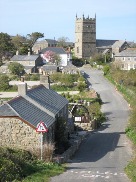
It has been almost a year since our last journey to Cornwall and so it seems appropriate to tell you all a bit about that time.
Normally any trip to Cornwall is one of expectation, hope and joy but on this occasion, it was a time of sadness. On the day we arrived in Penzance, my mother-in-law passed away. We were half an hour away from seeing her when we got the call…
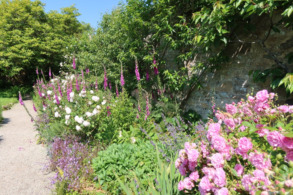
It was not an easy time but we did find moments to distract us, Cornwall, after all is a beautiful county filled with fascinating places. There were beach walks, pasty’s, drives down winding lanes, pub lunches, moors and visits to ancient places. Below is just a few of the places we visited in our down time between packing up a life well lived and saying goodbye. We knew it would be a long time before we came back and so we made the most of the time we had.
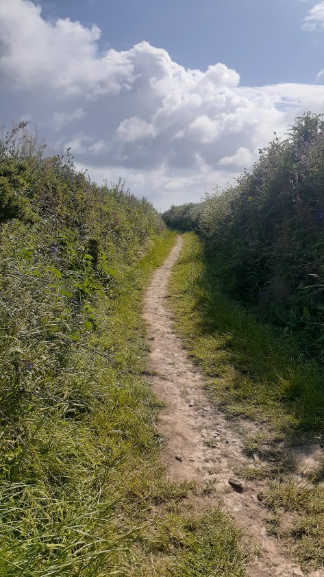
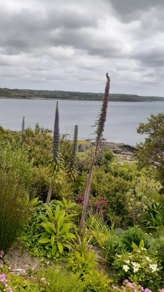
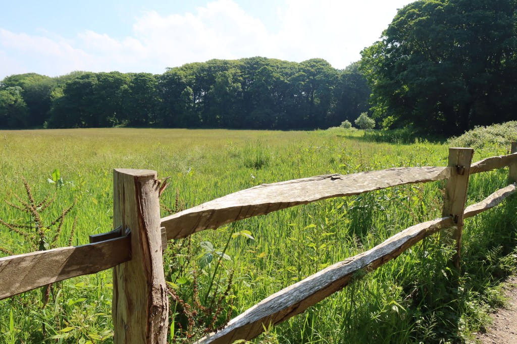
Getting fresh air and exercise became a part of our daily routine, early mornings sorting the house, followed by appointments with solicitors or funeral directors and then a good walk in ‘the nature’ to soothe the emotions. Cornwall is not short of a good walk. Below are a few photos from these walks.
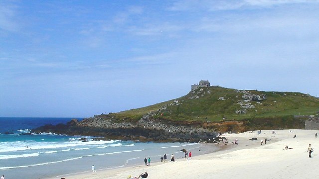
Godrevy Beach, St Ives in the far distance.
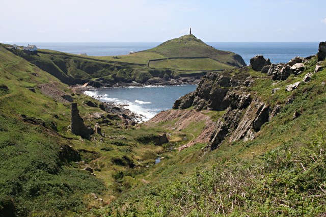
Cape Cornwall.
On the cliffs overlooking Hell’s Mouth.
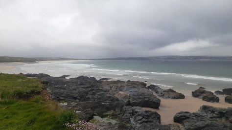
Gunwalloe Beach
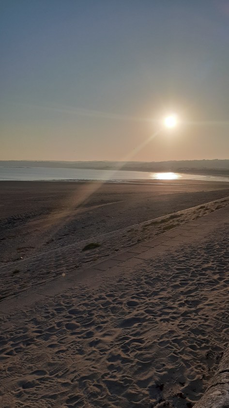
Marazion Beach, looking towards Penzance.
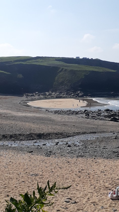
On the way to Nanjizel
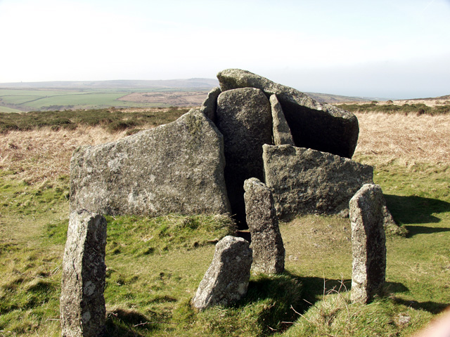
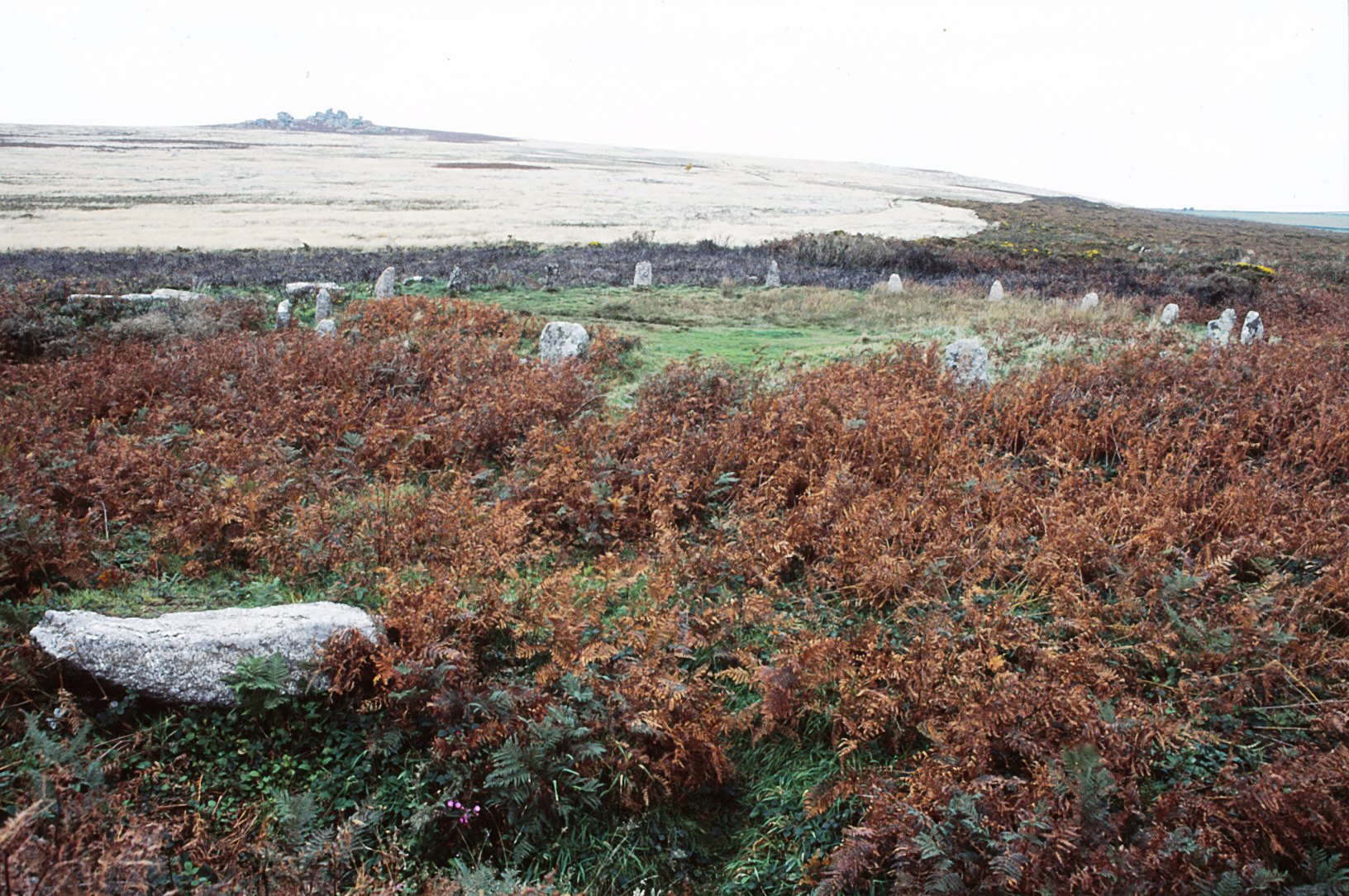
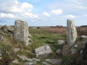
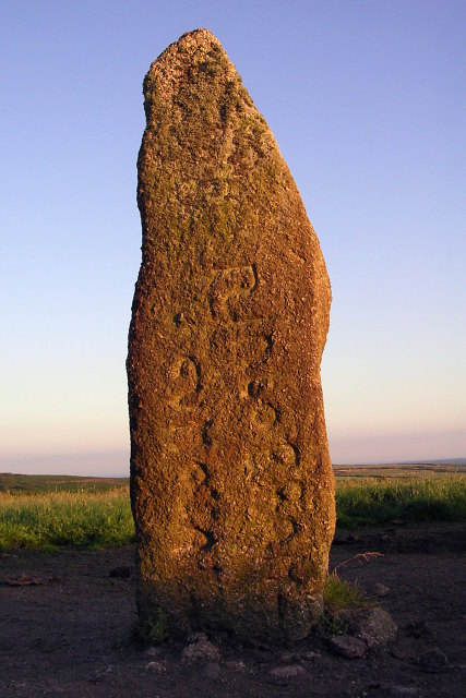
Men an Tol
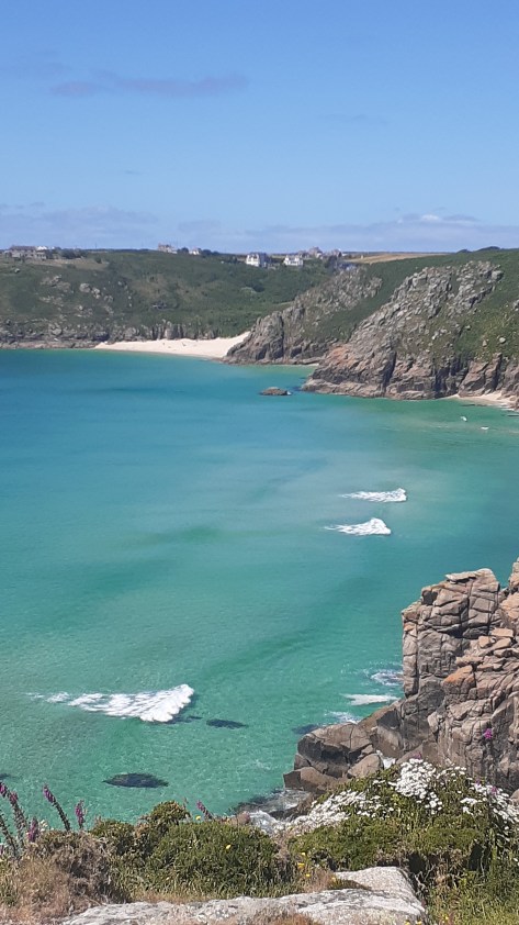
On the cliff at Treryn Dinas, Porthcurno Beach in the distance.
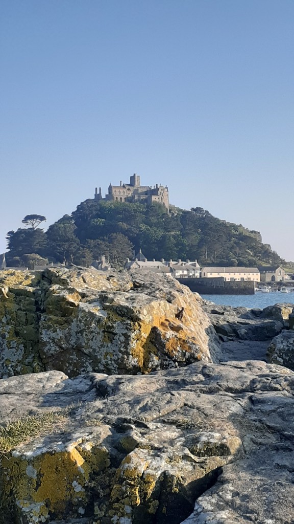
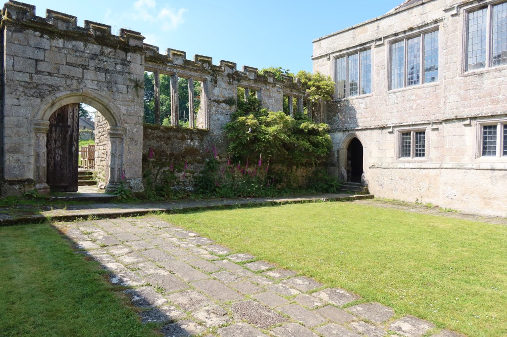
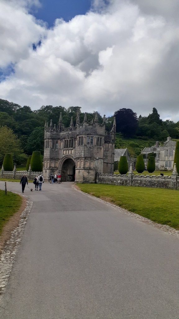
There were some days when we had more time on our hands and on these days we ventured a little further afield. As members of Heritage New Zealand we are allowed to visit both National Trust and English Heritage sites free of charge – Lanhydrock, Godolphin House, Restormel Castle. Tintagel and the gardens at St Michael’s Mount were all on the list.
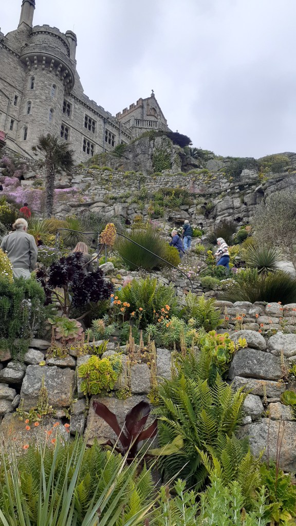
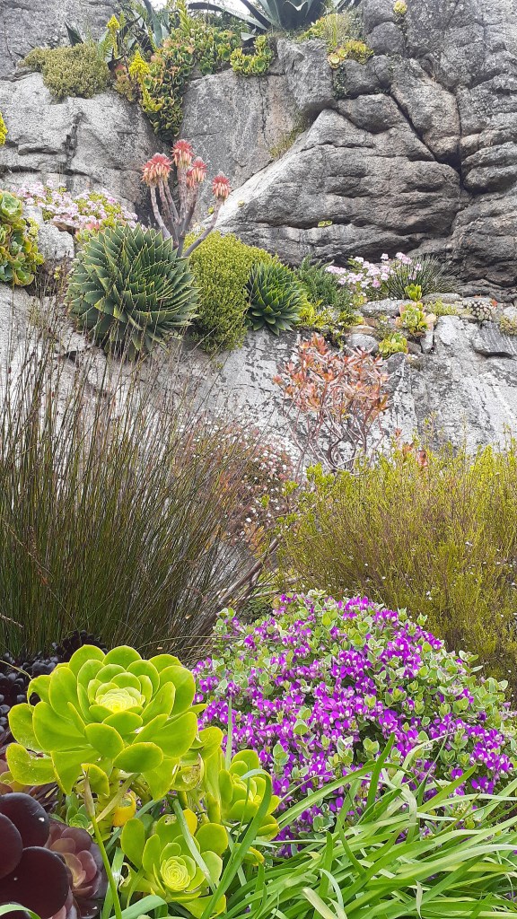
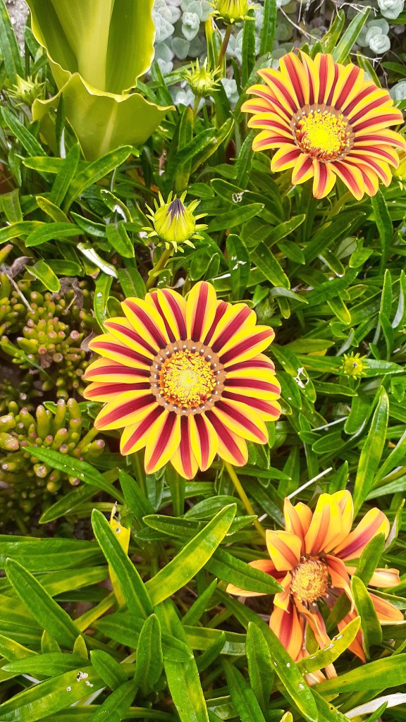
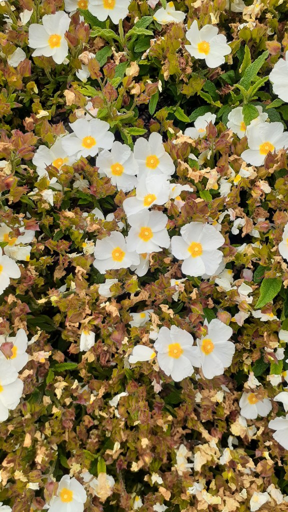
The Gardens at St Michael’s Mount
Why just the gardens? We had visited the house on several other occasions and given the time of year and how busy it was we thought a good nosey around the gardens – which are not always open – would be nice on a sunny day.
The gardens are situated on the lower terraces of the mount facing towards the Lizard Peninsula. They were first designed in 1878 for Sir John St Aubyn (later the first Lord St Levan). This part of the island has a microclimate and is able to grow a number of plants you would not expect.
The following are just a few photos of the gardens.
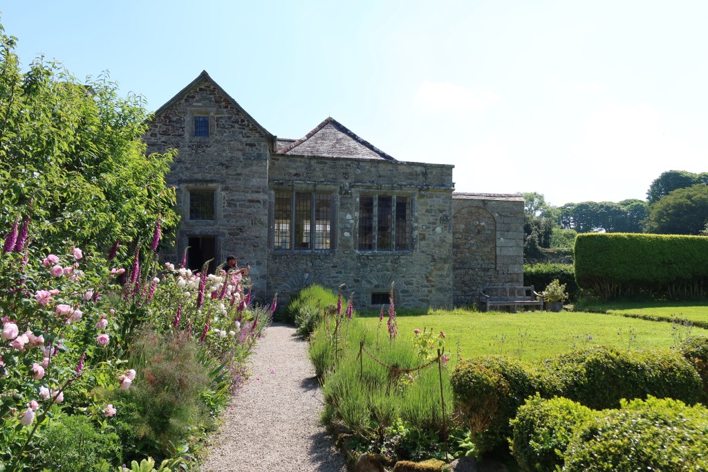
Godolphin House
One of my favourite houses to visit in this part of Cornwall is Godolphin House. Only open to the public a few times a year (the house is let out as a holiday let), although the gardens and estate are regularly open to enjoy for walks and cups of tea in the little cafe. The story of Godolphin House is one ‘enormous mineral wealth, heavy industry, agriculture, high political office, war, decline, ruin and eventual rescue – a living timeline through Cornwall’s history’.
As the above quote would imply Godolphin House has a long and winding story to tell and is perhaps one for an article of its own. For now enjoy the following photos and if you do ever get a chance to visit the house, do so.
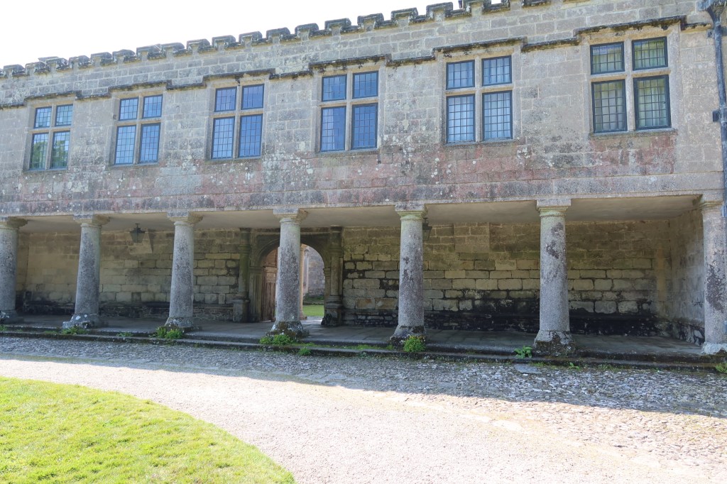
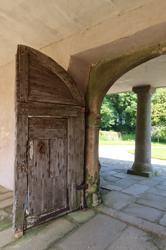
Lanhydrock
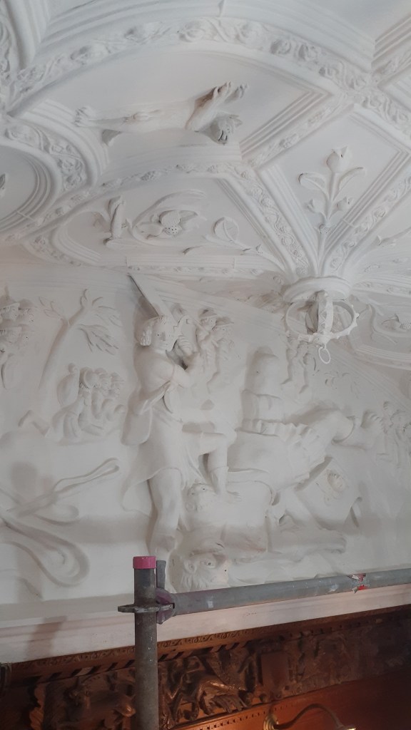
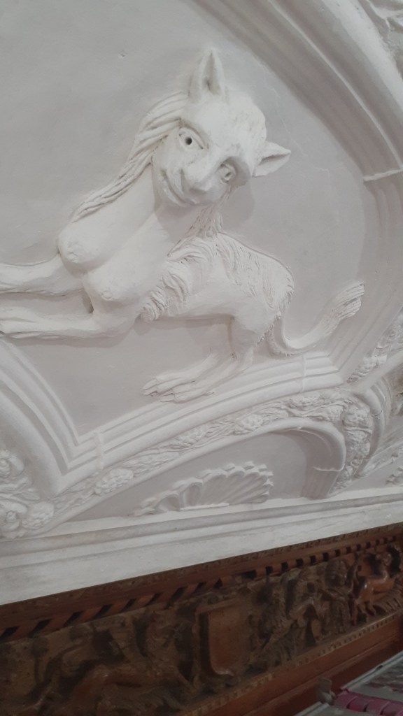
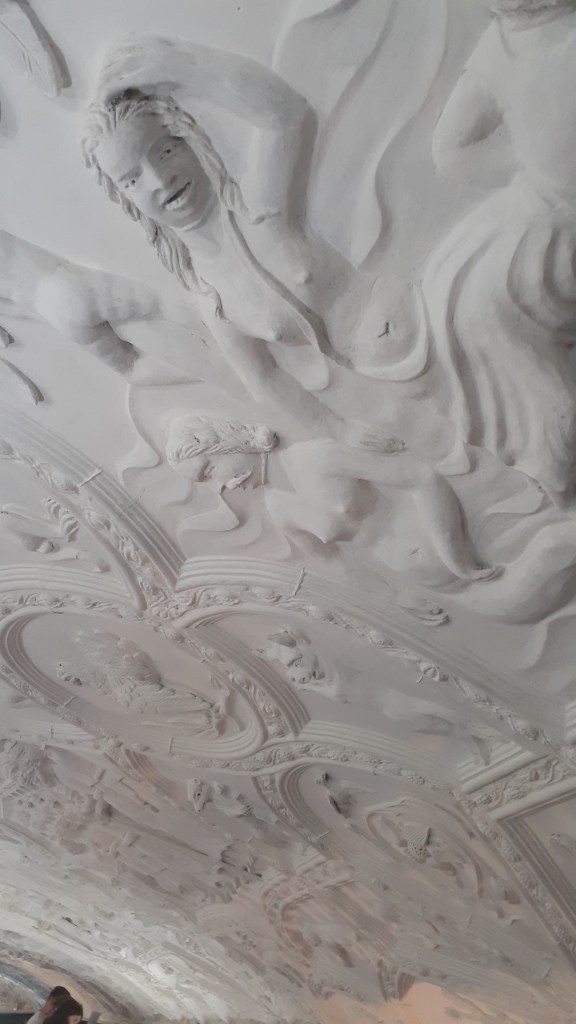
This particular National Trust House and Estate was much further afield. At the time of our visit the house and its contents were undergoing restoration work. Interestingly rather then block off sections and prevent people from viewing the work, the visitor was granted an opportunity to see what happens when a house of this size needs some love and attention. Our visit coincided with the restoration work on the ceiling of the hall and visitors were able to go onto the scaffolding and get a close look at a space that normally only the eagle eyed could view.
Below are a couple of photos of the ceiling.
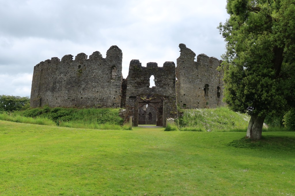
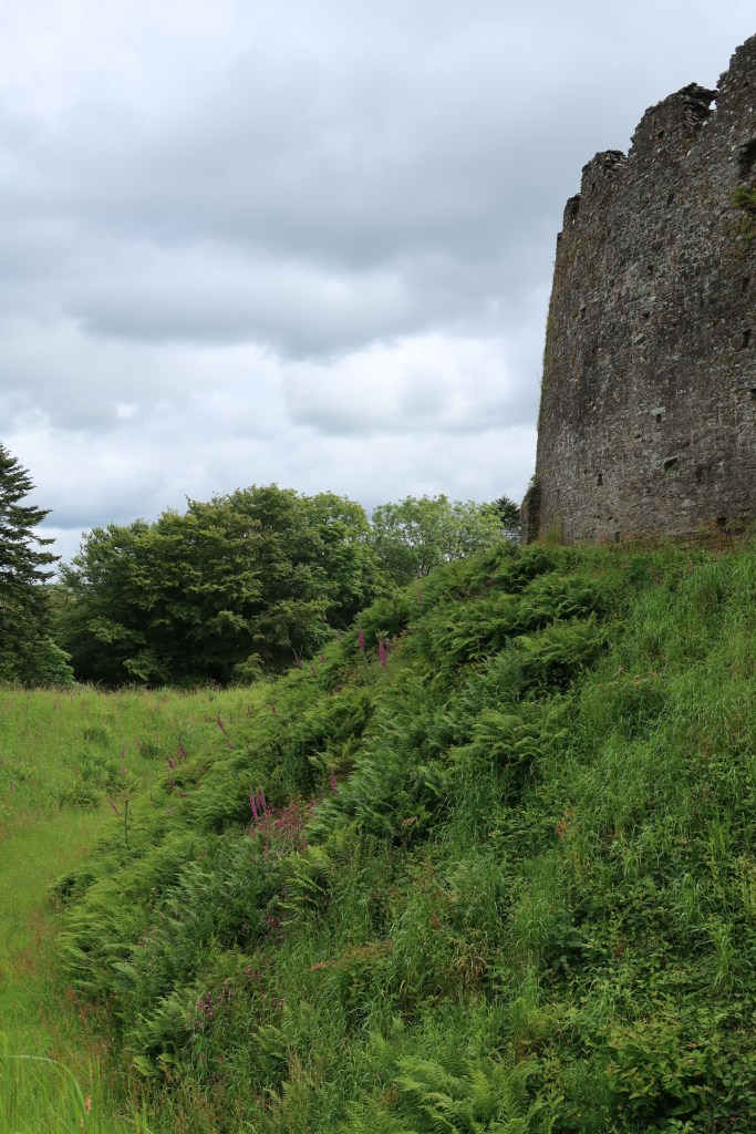
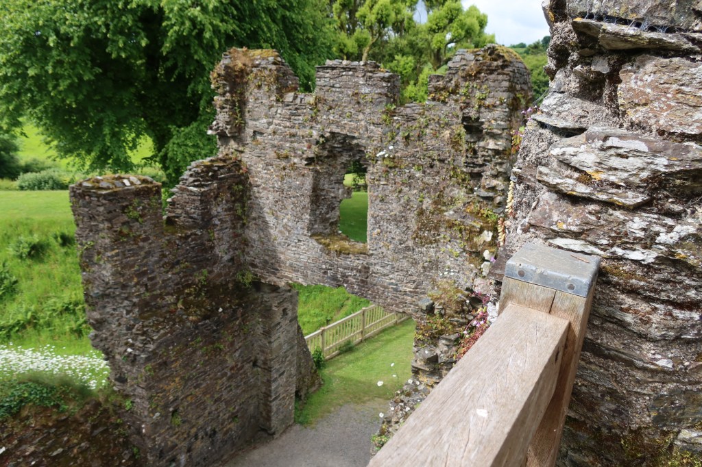
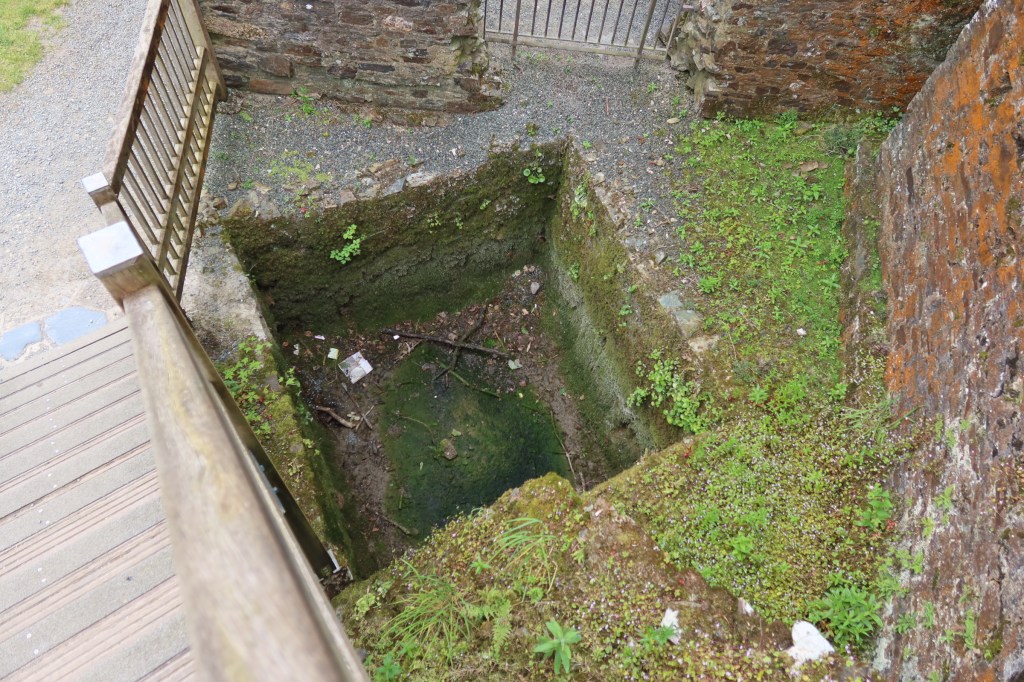
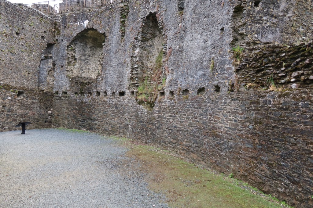
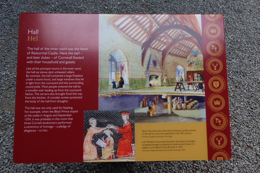
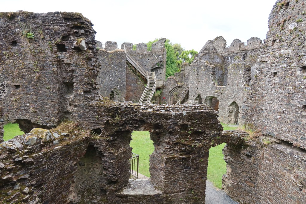
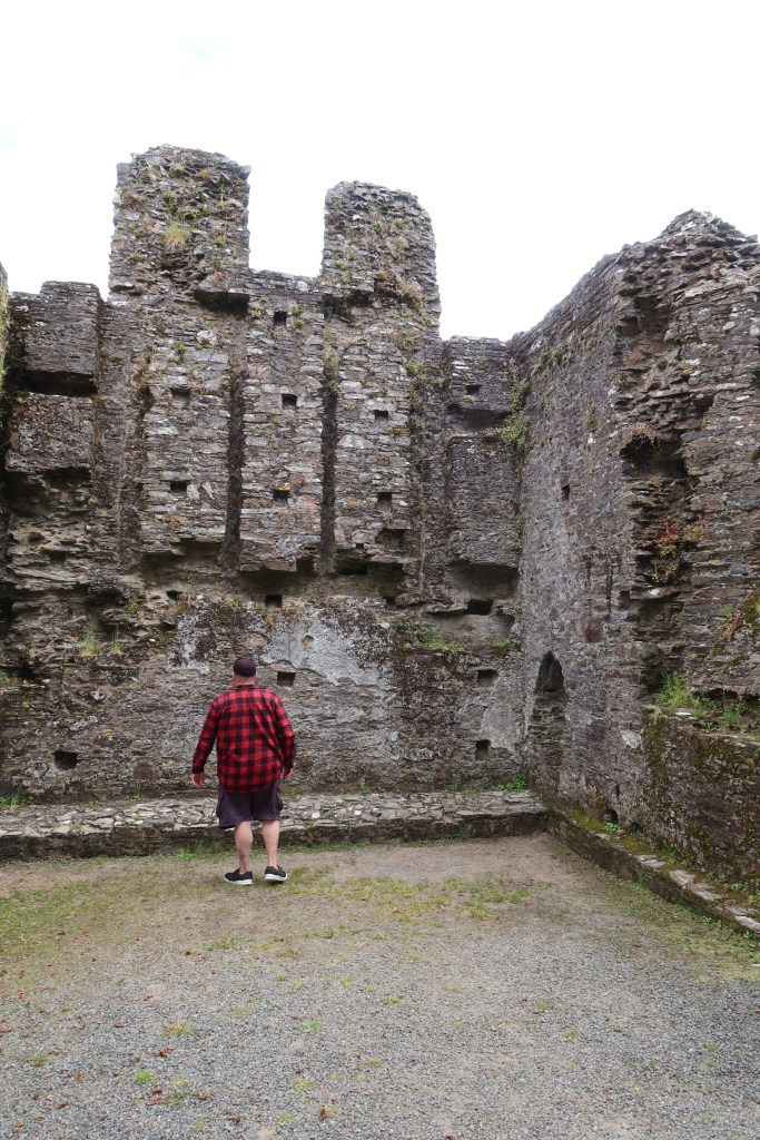
Restormal Castle
Our visit to Restormal Castle occurred as we were leaving the county, having done all we could. The castle providing a welcome pit stop and distraction.
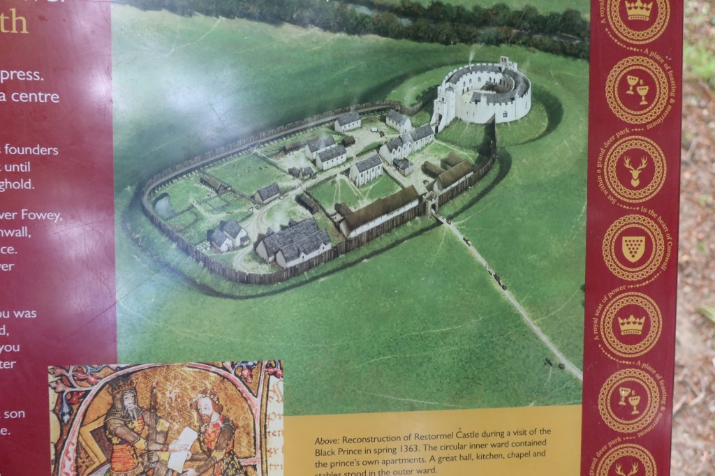
The early history of the site is not well understood, there is some evidence for a mid 12th century date but it the history from the 13th century onwards which is better understood. From the mid 12th the land on which the castle stands belonged to the Cardinham’s – a powerful landowning family from central Cornwall. In 1268 Cardinhams’ heiress, Isolda de Tracy, granted to Richard Earl of Cornwall and King of the Romans, the town of Lostwithiel – a fishery on the river Fowey – and the castle of Restormel, complementing his castles at Launceston and Tintagel. In 1270 he acquired a fourth castle at Trematon.
Earl Richard died in 1272, only four years after acquiring Restormel, so it seems more probable that it was his son Edmund who built the present castle. Edmund’s work at Trematon Castle is documented and provides a parallel. However, by the 1330s (and after the castle had changed hands a few times) documents refer to the castle being in need of repair. 1337 saw the son of Edward III being made Duke of Cornwall (also Edward – the Black Prince), along with a significant endowment of land and properties – including Restormal Castle.
This was a high point in the history of the castle, with many repairs and improvements being made to it and the surrounding park land. Apparently more time and money was spent on the boundary to the park land than on any other feature, an indication of its importance as a hunting park.
The history of the castle and its surrounding is one of neglect, repair and neglect once again. More can be found on its history here.
These are just a tiny fraction of the many places a person can visit in Cornwall, so I hope you have enjoyed this short meander through the county.
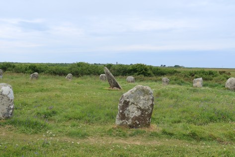
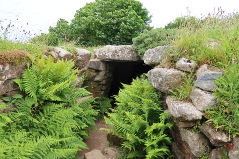
Boscawen Un stone circle
The fogou at Carn Euny
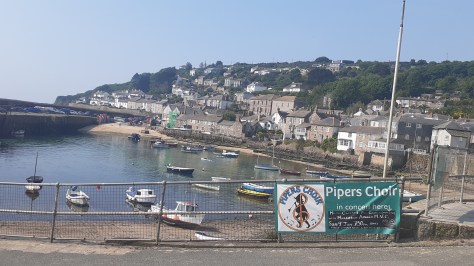
The village of Mousehole
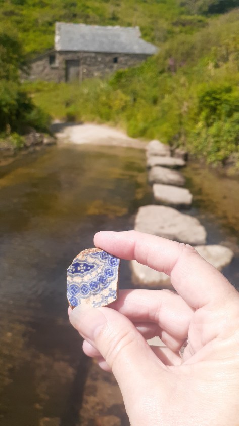
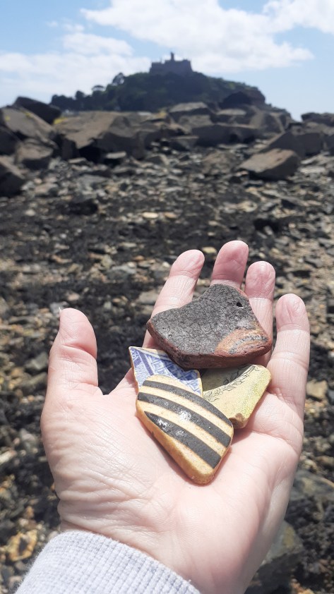
Finding pottery at Penberth cove
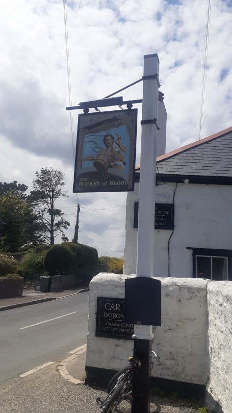
The Bucket of Blood
Finding pottery near St Michael’s Mount
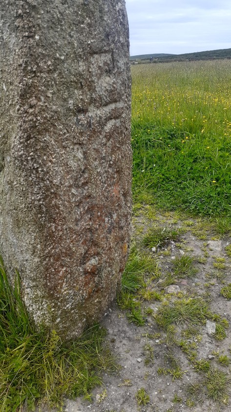
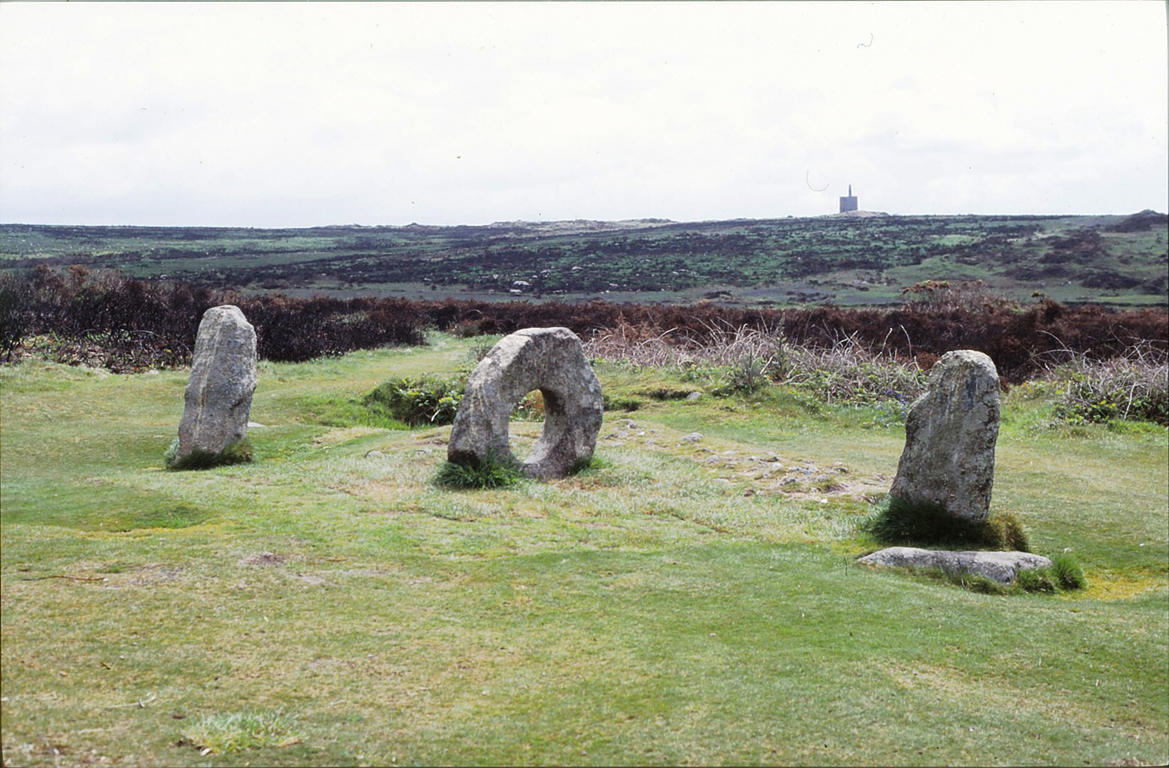
Men Scryfa – an inscribed stone near Men an Tol
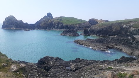
Kynance Cove
Looking towards Mounts Bay
In memory of Christine Rowe and Alan Dalton – gone too soonbut never forgotten.
A recent discovery (and purchase) of three booklets in a local charity shop is my inspiration for this post. Folklore, legends, customs and superstitions have always interested me and if it they have anything to do with my favourite place in the UK – Cornwall – all the better. Reading through them I became aware that perhaps on an unconscious level such stories may have influenced parts of ‘The Adventures of Sarah Tremayne’. In particular, the character of Nan who is a practitioner of the craft in her own very personal way; the West Penwith landscape and places such as Zennor and the great granite tors.
What follows is a brief look at some of these stories, but first an introduction to the person who recorded them over a hundred years ago.
In 1865 Robert Hunt wrote ‘Popular Romances of the West of England’ as a result of a period of convalescence where for ten months he wandered around Cornwall and up to the borders of Dartmoor listening to ordinary people and recording their stories. In his own words, “drinking deeply from the stream of legendary lore which at that time flowing as from a well of living water”. He recorded many interesting and quirky tales, some about giants, some about the fairy folk, some about the enigmatic megaliths and some about witches and magic.
As mentioned above, witchcraft and magic are very much part of my writing, thus for the purpose of this article lets look at some of these tales of witches in Cornwall…
Zennor Charmers
One of the first stories to grab my attention was the tale of the Zennor charmers – afterall, Sarah’s Nan lives in Zennor as did her ancestors. According to Hunt it is said that the men and women of this parish had the ability to stop blood, however fast it flowed. But it seemed that the charms were closely guarded secret and not even amongst themselves would be shared. People travelled from miles to have themselves or their children charmed for things such as ringworm, pains in the limbs or teeth and ulcerations. Hunt recorded that a correspondent of his wrote of ‘…a lady charmer, on whom I called. I found her to be a really clever, sensible woman. She was reading a learned treatise on ancient history. She told me there were but three charmers left in the west, – one at New Mills, one in Morva and herself’.
Charms are a common form of magic found in the relatively recent past, most have a religious element invoking angels and the use of holy water – possibly as a means of not upsetting the religious sensibilities of the community who would suffer their presence provided they were not openly subversive. Others use more natural elements such as the ash tree, the moon and even fire (ie candles) – a reflection of older pre-christian beliefs but still acceptable providing no harm was done. Their use is mainly used as a curative for various ailments or to find love. There are those that could be used to harm others but these are rare and fraught with danger as often such things have been known to rebound on the user in unimaginable ways.
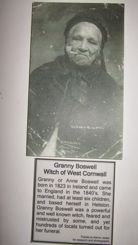
Granny Boswell – a well known Cornish wise woman. Photo my own from the Museum of Witchcraft at Boscastle (for more on the Museum follow the link – here)
Charmers (also sometimes called pellars) were the more acceptable face of magic – tolerated by the church and society in general – unlike the witch or sorcerer…
Here we find that the mysterious granite rocks play a part.
“Touch a Logan stone nine times at midnight, and any woman will become a witch. A more certain plan is said to be – to get on the Giant’s Rock at Zennor Churchtown nine times without shaking it. Seeing that this rock was at one time a very sensitive Logan stone, the task was somewhat difficult” (Cornish Legends p27)
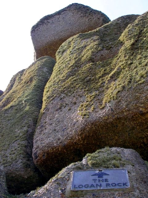
A Logan stone is simply put a large slab of granite which is perched so perfectly on top of another, with only a single point of contact, that it rocks when touched and does not fall. There are several examples of Logan stones in Cornwall, the most famous is found at Treryn Dinas, the headland beyond the village of Treen. This particular one features in our next tale of Cornish witches.
The Witches of the Logan Stone
In his descriptions Hunt speaks of the ‘wild reverence of this mass of rock’ by Druids and people of the past. But it is the peak of granite just south of the Logan Stone, known as Castle Peak that he tells has been the place of midnight rendezvous for witches. He refers to them as the witches of St Levan who would fly into Castle Peak on stems of ragwort, bringing with them the things necessary to make their charms potent and strong.
From this peak many a struggling ship has been watched by a malignant crone, while she has been brewing the tempest to destroy it; and many a rejoicing chorus has been echoed, in horror, by the cliffs around, when the the witches have been croaking their miserable delight over the perishing of crews, as they have watched man, woman and child drowning, whom they were presently to rob of the treasures they were bringing home from other lands.
Cornish Legends Robert Hunt 1865 p29
The latter paragraph seems to confuse the witches of St Levan gathering at a dangerous stretch of Cornish coast with a band of wreckers, the similarities are obvious. Perhaps the stories were spread by the those who would not wish for anyone to pay to close attention to a particular locale.
The Logan Rock near the village of Treen. (Photo by Jim Champion / This way to the Logan Rock…)
Pengersick
There are many tales told about Pengersick Castle near Praa Sands. It is particularly well known for its many ghostly stories, I myself have had several odd encounters in and around the castle which you can read about online at The Celtic Guide (Halloween edition 2014). Hunt however, wrote of the first Pengerswick and his desire to improve his familys status. It seems that an ‘elderly maiden’ connected with the very influential Godolphin family wished to marry the elder son, a match his father encouraged. Unfortunately, the son could not be swayed, even when love potions brewed by the Witch of Fraddam were used. Eventually she married the old Lord himself.
Now the witch had a niece call Bitha who had been called upon to aid the lady of Godolphin and her aunt with their spells on the son, however she fell in love with him too. When the lady of Godolphin became the Lady of Pengerswick she employed Bitha as her maid. Yet the lady was still infatuated with the son and soon this turned to hate and then jealousy when she saw him with Bitha. In her bitterness she attempted all manner of spells but Bitha’s skill learnt from her aunt kept him safe. Eventually, the young man left Pengersick only returning on the death of his father.
During his absence the mistress and the maid spent a great deal of time plotting and counter-plotting to secure the wealth of the old Lord. When the son returned from distant Eastern lands with a princess for a wife and learned in all the magic sciences, he found his stepmother locked away in the tower, her skin covered in scales like a serpent as a result of the poisons she had distilled so often for the father and the son. She eventually cast herself into the sea, ‘to the relief of all parties’. Bitha did not fare much better, her skin had become the colour of a toad due to all the poisonous fumes she had inhaled and from her dealings with the devil.
Rod Allday / Pengersick Castle
The Witch of Treva
Once upon a time, long ago, there lived at Treva, a hamlet in Zennor, a wonderful old lady deeply skilled in necromancy. Her charms, spells and dark incantations made her the terror of the neighbourhood. However, this old lady failed to impress her husband with any belief in her supernatural powers, nor did he fail to proclaim his unbelief aloud”.
Robert Hunt ‘Cornish Legends’ p42
All of that changed one evening when the husband returned to find no dinner on the table. His wife, the witch, was unrepentant merely stating ‘I couldn’t get meat out of the stone, could?’ The husband then resolved to use this as a way of proving once and for all his wife’s powers. He told her that if she could procure him some good cooked meat within the half hour he would believe all she said of her power and be submissive to her forever. Confident she couldn’t accomplish such a thing, St Ives, the nearest market town was some five miles away and she had only her feet for transport, he sat and watched as she put on her cloak and headed out the cottage door and down the hill. He also watched as she placed herself on the ground and disappeared, in her place was hare which ran off at full speed.
Naturally he was a little startled but sat down to wait, within the half hour in walked his wife with ‘good flesh and taties all ready for aiting’.
Trewa, The Home of Witches
Not to be confused by the previous Treva (both pronounced ‘truee’) this particular place is now known as Trewey Common. Situated high on the moor between Nancledra and Zennor, it is landscape dotted with the remains of the ever present mining industry sitting alongside great outcrops of granite, some used in the construction of ancient monuments. Hunt described the scenery as ‘of the wildest description’, he is not wrong – even the modern mind can run wild with imagination in the evening twilight or on a moody day when the sky is as grey as the granite.
Hunt tells us that regardless of what local historians may say local tradition says that on Mid-summer Eve all the witches in Penwith gather here, lighting fires on every cromlech (quoit or tomb) and in every rock basin ‘until the hills were alive with flame’. Their purpose was to renew their vows to the ‘evil ones from whom they derived their power’.
It seems there was also another much larger pile of granite known as the ‘Witches Rock’ which no longer exists, having been removed quite some time ago. It was the removal of the rock which caused the witches to depart.
“…the last real witch in Zennor having passed away, as I have been told, about thirty years since, and with her, some say, the fairies fled. I have, however, many reasons for believing that our little friends have still a few haunts in this locality.”
R Hunt 1865 ‘Cornish Folklore’
Hunt did go on to say that there was one reason why all should regret the removal of the Witches Rock, it seems that touching the rock nine times at midnight was insurance against bad luck…
Cornish Sorcerors
Sorcerers were the male equivalent of the witch, however with the addition that the powers were passed from father to son (more a reflection of the patriarchal nature of society at the time).
“There are many families – the descendants from the ancient Cornish people – who are even yet supposed to possess remarkable powers of one kind or another.”
Robert Hunt 1865 ‘Cornish Folklore’
Unfortunately, apart from mentioning the family of Pengersick (which had by this time died out) and alluding to their wicked deeds he does not go into any great length about any of the other ancient Cornish families. Perhaps wisely, for if these unmentioned families did have remarkable powers it would not pay to offend…
Final Words
It is perhaps not surprising that certain parts of the Cornish landscape is given to fantastical tales of giants, witches and the fairy folk. The many ancient monuments, the craggy granite outcrops and the vast expanses of moorland lend themselves to an active imagination. The stories also serve as a caution against unchristian behaviour. As in the case of the witch of Treva who it is said when she died a black cloud rested over her house when everywhere else it was clear and blue. When the time came to carry her coffin to the churchyard, several unusual events occurred such as the sudden appearance of a cat on her coffin. It was only with the parson repeating the Lords Prayer over and over were they able to get her to the churchyard without any further incidents until they paused at the church stile and a hare appeared which as soon as the parson began the prayer once more gave a ‘diabolical howl, changed into a black unshapen creature and disappeared’.
People
have always been interested in the past, as far back as Nabonidus who ruled
Babylon from 555 – 539BC who had a keen interest in antiquities to such an
extent he even excavated down into a temple to recover the foundation stone
which had been laid some 2200 years prior.
Nabonidus also had a museum of sorts where he stored his
collection. During the Renaissance those
with the wealth to travel and collect began to keep cabinets of curios. In these you would find ancient artefacts
displayed alongside minerals and natural history pieces.
“…the Renaissance attitude to the examination of the
past…involved travel, the study of buildings and the collection of works of
art and manuscripts.” (K. Greene
1983).
Initially
it was classical antiquity which grabbed the attention of the well-to-do but
after awhile eyes began to turn towards relics of their own past. The great
stone monuments of North-western Europe became the immediate focus, places such
as Carnac in Brittany and Stonehenge in Britain. Some of these gentlemen scholars would make
systematic and accurate surveys of the monuments, which are still useful today,
even if there were the less scrupulous who dressed up treasure hunting as
scholarly research. These antiquarians
were in essence the first archaeologists and their contributions can still be
useful today.
In
Britain several antiquarians stood out between the 16th and 18th
centuries. John Leland (1503-1552) held
the post of Keeper of the Kings Library and such travelled extensively
throughout Britain. Even though his main
interest was in genealogy and historical documents he also recorded
non-literary evidence as part of his wider researches, one of the first to do
so.
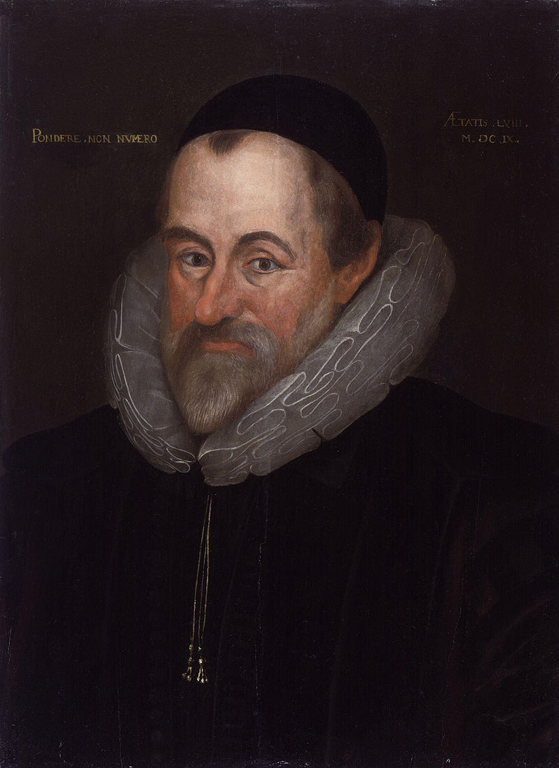
William
Camden (1551-1623) learnt not only Latin but also Welsh and Anglo-Saxon in
order to study place-names. At the age
of 35 he published ‘Britannia’ a
general guide to the antiquities of Britain.
His descriptions of the ancient monuments are very detailed and he was
one of the first to make a note of cropmarks and their possible links to sites
no longer visible – an important part of aerial photography today. Camden was also interested in other forms of
material culture such as pottery as a source of information on the past, a
concept regarded eccentric at the time.
William Camden (portrait by Marcus Gheeraerts the Younger)
In
the mid 17th century John Aubrey was one of the earliest writers to
assign a pre-Roman date to sites such as Stonehenge, Avebury and Silbury
Hill. His belief that such places were
built and used by the Celts and Druids was so revolutionary there are still
some who won’t let it go. Following in
Aubrey’s footsteps was William Stukeley (1687-1765) who although trained as a physician
spent a great deal of time conducting extensive fieldwork in Wessex during the
1720s. His highly accurate and detailed
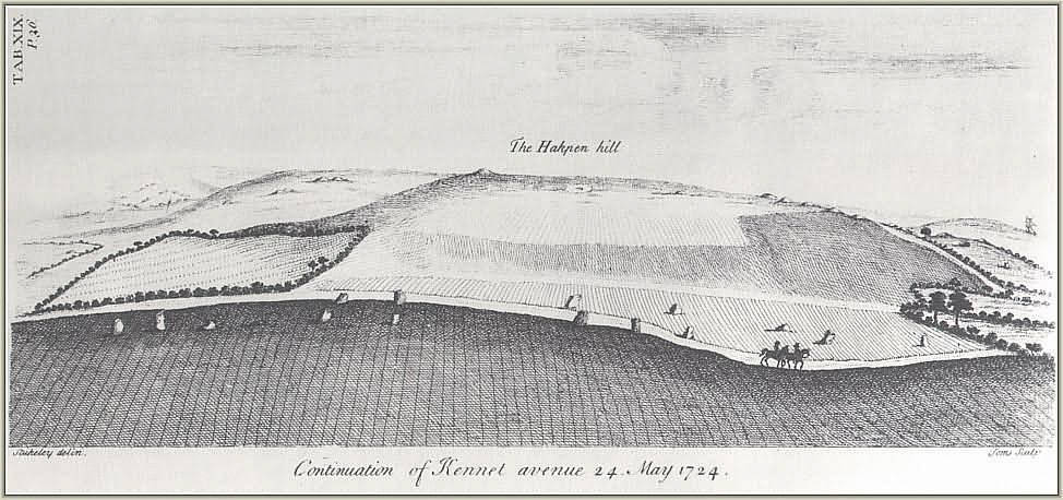
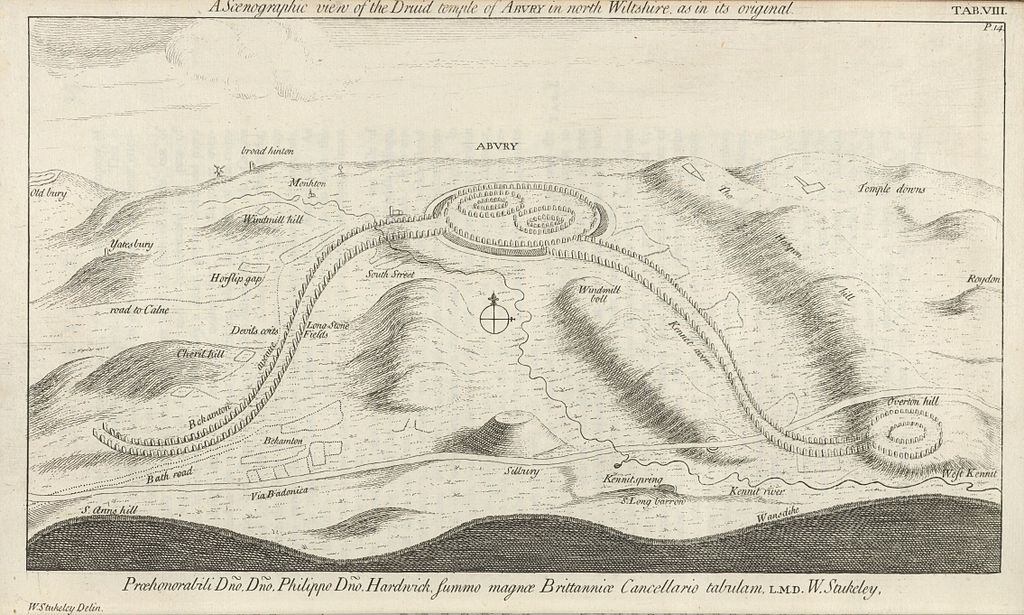
surveys of Avebury, Stonehenge and Silbury Hill are still used today. Stukeley’s recording of the avenue of stones
(now destroyed) leading from Stonehenge to the Avon aided present day
archaeologists in their search for them.
However, in 1729 he was ordained and then attempted to use his fieldwork
to establish a theological connection between the Druids and Christianity.
William Stukeley’s drawing of the Kennet Avenue – sensible and accurate fieldwork…And then there is the more fantastical of Stukeley’s drawings – his interpretation of the Avebury landscape and it’s Druidical temple…
“Just as Dr Stukeley may be said to be the patron
saint of fieldwork in archaeology, so can the Rev. William be held to be the
evil genius who presides over all crack-brained amateurs whose excess of
enthusiasm is only balanced by their ignorance of method.” (K. Greene 1983)
At
the same time, across Britain, lesser well known antiquarians were busy
studying and recording their own local areas.
In the county of Cornwall this was no different. The earliest known antiquarian was Richard
Carew (1555-1620) of East Antony, he was a member of the “The Elizabethan Society of Antiquaries” and in 1602 published his
county history, “Survey of Cornwall”. Perhaps the most well known and often cited
antiquarian was William Borlase (1695-1772) who like so many began collecting
natural rocks and fossils found in the local copper works in Ludgvan where he
was the local pastor. In 1750 he was
admitted as a Fellow of the Royal Society and by 1754 he had published “Antiquities of Cornwall” which he then
followed with “Observations on the
Ancient and Present State of the Islands of Scilly and their importance to the
Trade of Great Britain” in 1756.
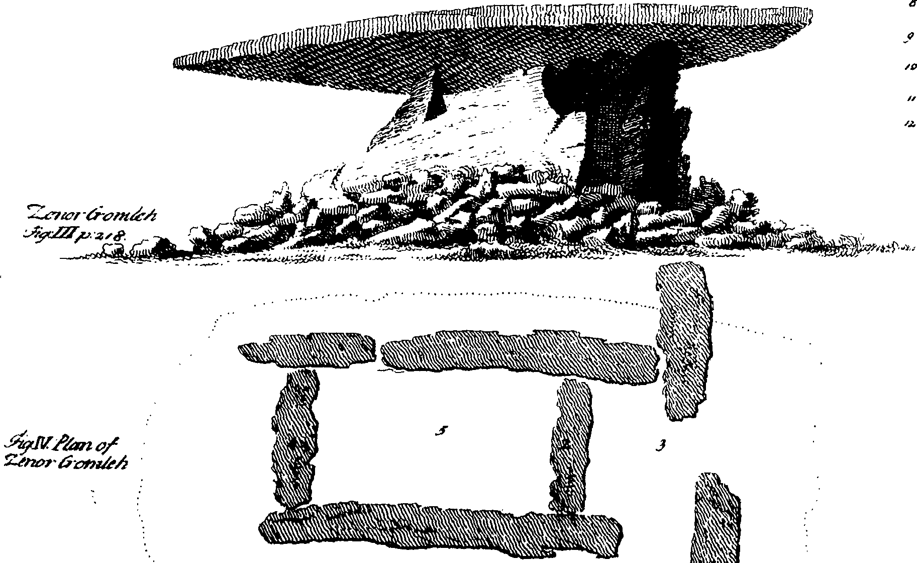
Zennor Quoit as drawn by William Borlase (1769)Zennor Quoit as seen today (photo from wikicommons – geography.co.uk – 902) This highlights why early antiquarian researchers should be dismissed immediately as having nothing to contribute to our understanding of the past.
Borlase’s
great great grandson – William Copeland Borlase (1848-1899) – continued with
the tradition of antiquarianism conducting some of the first excavations in
Cornwall at Carn Euny in 1863. Copeland
Borlase published many articles and books on the antiquities of Cornwall, including
a two volume book titled “Ancient
Cornwall” in 1871 and a year later “Naenia
Cornubiae: a decscriptive essay, illustrative of the sepulchres and funereal
customs of the early inhabitants of the county of Cornwall”. There were also a lecture on the tin trade
and a monography on the Saints of Cornwall, not to mention a piece on the
dolmens of Ireland and one on the mythologies of the Japanese.
William Copeland Borlase (1848-1899)
William
Copeland Borlase also spent a great deal of time getting his hands dirty
excavating large numbers of barrows in Cornwall. He has been criticised for poor
archaeological practice in only writing up a small percentage of those he
excavated. Nothing makes an
archaeologist bury their face in their hands then the lack of a written record
for an excavation. Copeland Borlase
often employed the services of John Thomas Blight (1835-1911) as an
archaeological illustrator, although Blight was a well known antiquarian in his
own right. He published two books
regarding the crosses and antiquities of Cornwall, one for the west and the
other for the east of the county.
Blight’s
drawings of Carwynnen Quoit were recently rediscovered by the lead
archaeologist, Jacky Nowakowski, during her researches prior to the excavation
and restoration of the quoit. In
particular, the pencil drawing which had actual measurements was very useful in
the interpretation of a stone pavement discovered during the excavation when
combined with modern techniques. The
archaeologists were able to get a better understanding of the positioning of
the quoit within the Neolithic landscape.
Throughout
the country there have been numerous societies which promoted the work of
antiquarians beginning with the prestigious Royal Society. Even Cornwall had its own Royal Institute of
Cornwall which is still operating today and currently manages the Royal
Cornwall Museum as well as the Courtney Library which holds all manner of
documents dating back into the 1700s.
These early scholarly societies however, did not focus on one aspect of
research, natural history, geology, botany and other gentlemanly pursuits were
all encouraged. This attitude of open
discourse across a variety of disciplines is one of the hallmarks of good
archaeological research today.
Archaeology is defined as the “study of the past through the systematic recovery and analysis of material culture” (The Penguin Archaeology Guide). It is the recovery, description and analyse of material culture with the purpose of understanding the behaviour of past societies. Material culture is defined as anything which has been altered or used by humans – it can be as small as shark tooth with a hole drilled into it for a pendant or as large as a European cathedral. To study archaeology in general is to be a ‘jack of all trades and master of none’ – as a subject it borrows from history, anthropology, geology, chemistry, physics, biology, environmental sciences, ethnography to name but a few. Archaeologists have never been afraid of pilfering theories, methodologies and techniques from other disciplines.
The
value of the early antiquarians does not necessarily lie in the outdated
interpretations but in the production of often accurate and highly descriptive
illustrations, field surveys and texts that are the basis of many
manuscripts. Some of these ancient sites
are now lost and/or destroyed, and the antiquarian illustrations are all we
have as a record. Fieldwork will always
be a fundamental part of archaeological work and the antiquarians of the past
where the very first fieldworkers and the societies they belonged to provided
the basis for the discipline of archaeology.
Green
K. (1985) Archaeology – an Introduction. Routledge.
Amidst the chaos of house building I have been researching early medieval Cornwall as the backdrop to the new Sarah Tremayne novel. One question which arose was – exactly how Christian were the locals? At what point did Christianity take a firm hold? And how were those who did not adhere to the new religion treated? As a result I have been investigating early medieval Christianity with a great deal of frustration…the following blog serves to highlight a few of the issues using one of the more obscure Saints as an example.
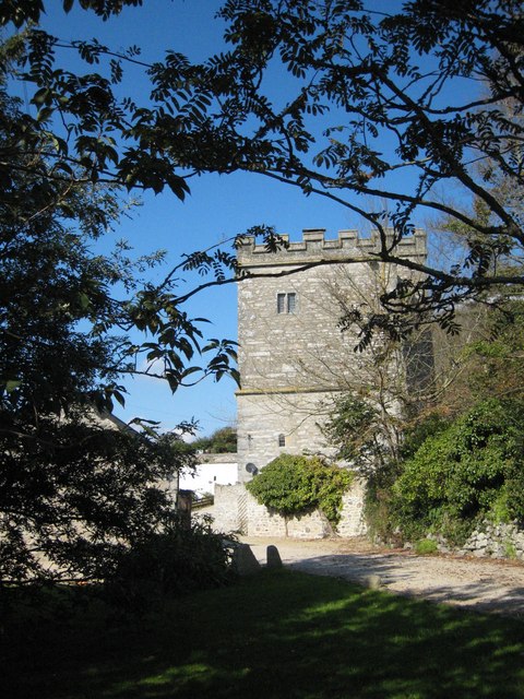
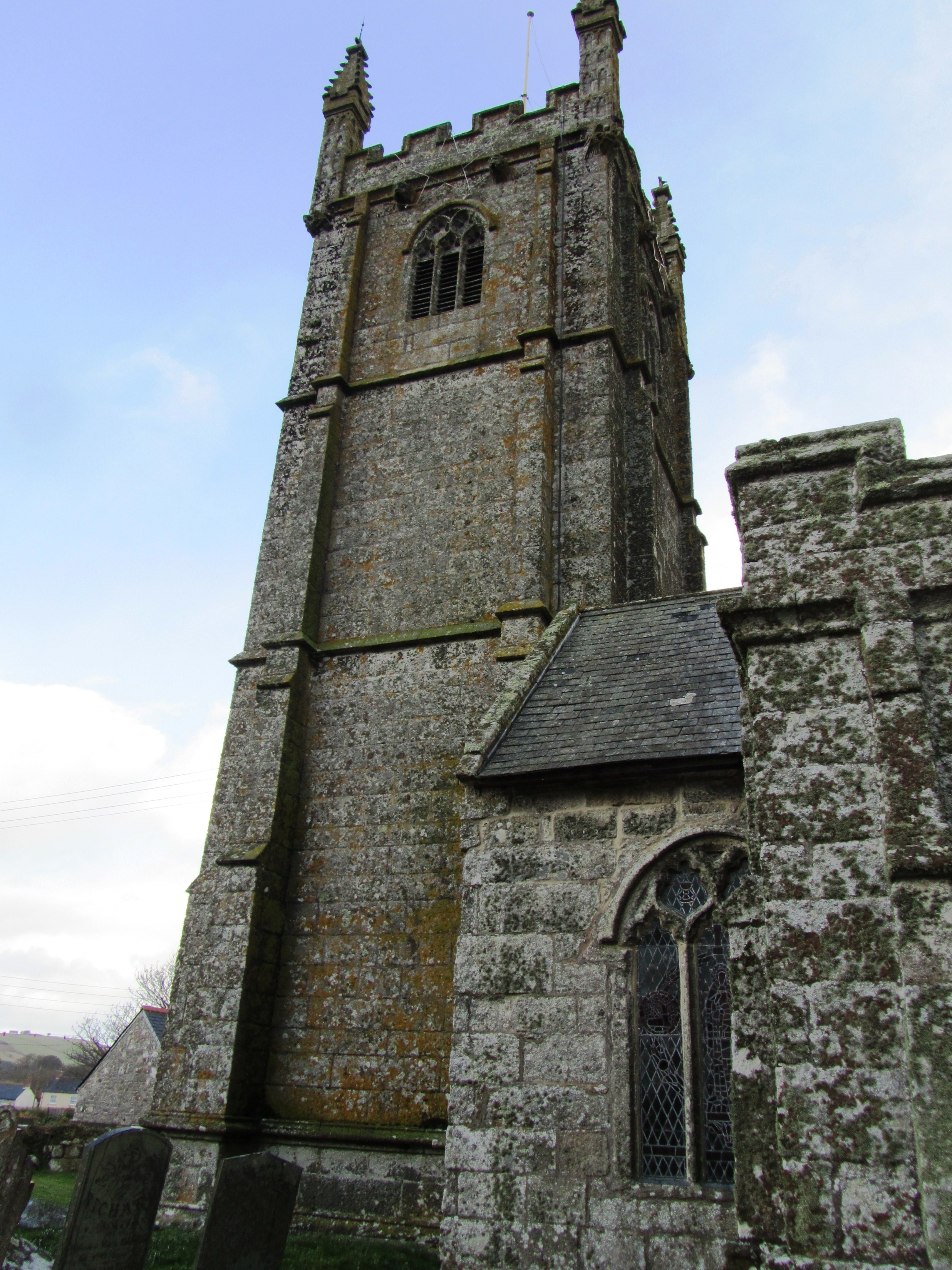
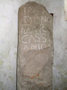
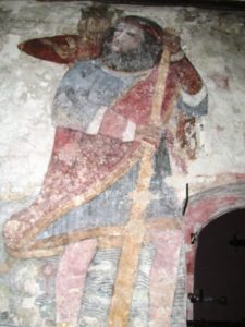
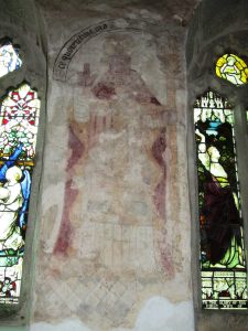
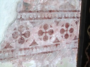
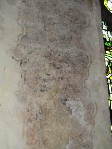
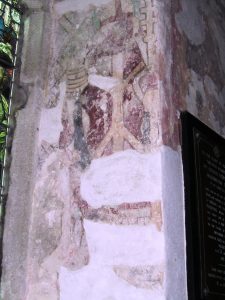
In the small parish of Germoe partway between the Penwith peninsula and the Lizard is the village of Breage. It is an easy village to miss, the main road skirts its edges and unless you have done your research any ordinary person might just drive on by. However, there are several good reasons to stop and visit. The church is the focal point of the village and it is here you will find a number of medieval scenes painted on the walls of the church, a Roman waymarker dedicated to the Emperor Marcus Cassianius Latinius Postumus dated to between 258-268AD. (see an earlier post ‘The Frescoes of Breage’)
The Church in Breage.
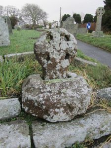
There are also several interesting stone crosses within the walls of the churchyard. The earliest is situated near to the front door and is likely to date between the late ninth and early tenth centuries. Carved from red sandstone it would have been highly decorated when first erected. Today only a little of this elaborate carving can be seen furthermore it is not in its original position, the cross was found buried in the churchyard and placed where it currently stands. The use of sandstone is very unusual, as the majority of Cornish crosses are carved from local granite. The cross has been described as a “four holed wheel cross with Hiberno-Saxon decoration” (N. Pevsner 1951 The Buildings of England: Cornwall).
The early sandstone cross.
The church yard is also of interest, it is easy to discern its round shape, a feature often regarded as an indication of antiquity. Early Celtic missions would construct an enclosure around their settlement and in Cornish the prefix “Lan” is often found in conjunction with such sites.
“Meaning church enclosure, it normally described an Early Christian foundation of the Celtic Church within a round or oval earthwork, usually a re-used prehistoric site. Parish churches still occupy many of these sites…” (C. Weatherhill 1998 Cornish Placenames and Language).
The church you see today was dedicated to St Breaca on the 26th December 1456 completely replacing the earlier Norman church. The earliest mention of Breage in documents is just prior to 1066 when the village was called “Eglosbrek” or “Eglospenbro” (the latter refers to the farm of Penbro) and was part of the large manor of Winnianton. By 1264 the church was being referred to St Breaca’s.
St Breaca is one of the many saints’ names which litter the Cornish landscape, however very little is known about her. A hagiography written in the late fourteenth century and which is now lost, recorded the lives of many Cornish saints. John Leland during his itinerary of 1540 did record parts of this lost hagiography as was pertinent to his travels.
According to Leland Breaca was born in the region of Lagonia and Ultonia in Ireland and she became a nun at the oratory founded by St Brigid of Kildare. At around the 460AD she travelled to Cornwall with seven other Irish saints – Germoe, Senanus (Sithney), Mavuanus (Mawgan), Elwen, Crowan, Helena and Tecia. They settled at Revyar on the River Hayle but some were killed by the tyrant king Tewdwr Mawr of Penwith. Breaca then travelled onwards visiting Castle Pencaire and establishing a church at Chynoweth. When she died the church was moved to its present location and many miracles occurred at her tomb.
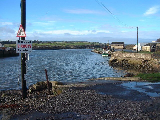
A view of the harbour at Hayle – one of only a few safe anchorages on the north coast of Cornwall. (from wikicommons -geograph.co.uk 179114)
On the face of it this is a good story but closer inspection reveals that a number of the story elements can be found elsewhere in other local saintly stories. Conflict with a local pagan tyrant, establishment of a hermitage in a remote part of the land, an Irish origin and connection with a more well known Saint. Simply read and compare the stories of St Ia or St Gwinear and you begin to get a feel for the standard hagiography, many of which were written some thousand years after the Saint concerned had lived and died. It is not surprising that the more obscure saints such at Breaca ended up with a mash up story for her life.
So is there any hope in finding out the real story behind St Breaca? Possibly. But first we need to look at the much wider picture.
Cornwall during the Roman period appears to be semi autonomous and although the Romans were in complete control of trade, life in Cornwall went on much as it had during the Iron Age. The impact of the Roman Legions leaving Britain in 410AD would have had a minimal effect on Cornwall even if the repercussions in other parts of the country were felt keenly for several decades. Political manoeuvring (and warfare) in the mid fifth century resulted in Cornwall becoming part of the kingdom of Dumnonia which spread from the far west of Cornwall up into south Somerset. Into this seemingly unsettled time the Irish missionaries appear.
There is some conflict on how many Irish came to Cornwall, some accounts say few as seven others seven hundred and seventy seven. In 1899 Sabine Baring-Gould wrote about the Cornish saints, he believe that it was a much greater number which arrived on the Cornish shores but with a less than peaceful mission. For Baring-Gould this was an invasion, hence the bloody reaction from Tewdwr in slaughtering, thus martyring, a number of the Irish (St Ia being the most well known). Interestingly St Germoe who was said to be one of St Breaca’s companions was according to legend a king in Ireland – a claim not yet substantiated.
The invasion theory may sound a little far-fetched but given that the Cornish as a rule over the centuries were more than amicable with all their neighbours along the Atlantic seaboard an outright slaughter of a peaceful mission of Christians seems also far-fetched. Tewdwr is often portrayed as a pagan tyrant and this comes to us from a time when our pagan past was seen as a dark time, he becomes the demon which our Christian saints have to triumph over. Afterall, who triumphed in the end? Who wrote the hagiographies?
It is believed that later Tudor era writers used Tewdwr (who was not a king, more a local chief/lord) to lampoon and criticise Henry VII in the wake of his crushing defeat of the Cornish Rebellion of 1497. If this is the case it is perhaps necessary to take much of what is said about the “tyrant” with a grain of salt.
Those who escaped the battle (irrespective of who started it) would have fled to remoter parts of Cornwall perhaps seeking protection from local and more sympathetic chiefs.
This may be where St Breaca’s story has a ring of truth about it. She is said to have visited Castle Pencaire before setting up home at Chynoweth on the lower slopes of Tregonning Hill. Castle Pencaire is situated on the summit of Tregonning Hill and was originally an Iron Age hillfort. Although there is no current evidence (much later mining works have almost completely destroyed the inside of the hillfort) for its reoccupation during St Breaca’s time it is strong possibility. Other Iron Age hillforts were temporarily reoccupied at this time, such as Chun Castle in West Penwith, and why would Breaca visit an ‘abandoned’ antiquity? If Breaca wished to establish a mission in the local area she would have realised the importance of asking permission from the local chieftain/lord, his goodwill would have been important to the success of her mission.
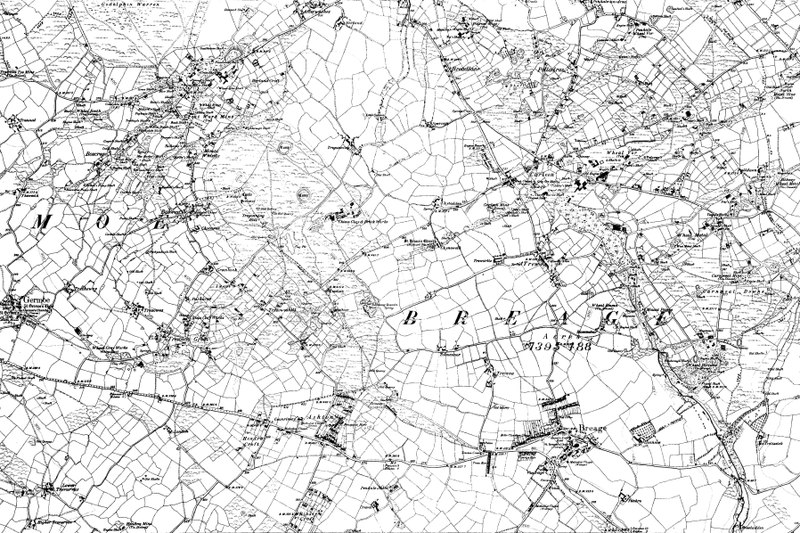
An ordnance survey map of the area around Breage (bottom right) from the late 1800s. Tregonning Hill (Castle Pencaire) is the area of open moorland above and to the left of Breage.
The question does remain when did she arrive and was she actually Irish? The date of her arrival will never be satisfactorily agreed upon, it will have to be enough to say she arrived sometime in the late fifth but not later than the early sixth centuries AD. Was she with that first flux of Irish? This we will never know, the later successes of Irish saints would suggest there were several voyages to the Cornish coast.
The presence of the early cross with its “Hiberno-Saxon” decoration might point towards a later commemoration of an Irish saint, the use of sandstone rather than granite could be explained by one of two ways. Either the stone was carved elsewhere and then brought to Breage or the stonemason was not from Cornwall and did not have the skills needed to carve in granite.
Breaca is occasionally mentioned in writings from other parts of the county. In 1478 William Worcester refers to her feast day as being May 1st even though in later times her feast day is celebrated on June 4th and is appears to be quite an important festival. An idiom recorded in the village of Germoe in the 18th century refers to their patron saint – Germoe – as a king but Breaca was a midwife. The 19th century residents of St Leven believed Breaca to be the sister to the villages’ patron saint – Selevan or Salaman.
In all likelihood we will never know the truth of St Breaca but it has been fun trying to find out…
Going to Saveock is a bit like travelling back in time, seeing a peep of a thatched roundhouse roof only adds to the impression that you are somewhere else. Originally you would have had to wait on the other side of the train tracks, call the main station to see if any trains were coming and if they gave the all clear, open both sides of the gate then speed across – they had been known on the rare occasion to get it wrong. Today though there is a much safer way of getting into Saveock, a suitably narrow hedge lined drive leads down to the small holding and even though it is only a fifteen minute drive from Cornwall’s main city of Truro, it feels remote and tranquil – timeless.
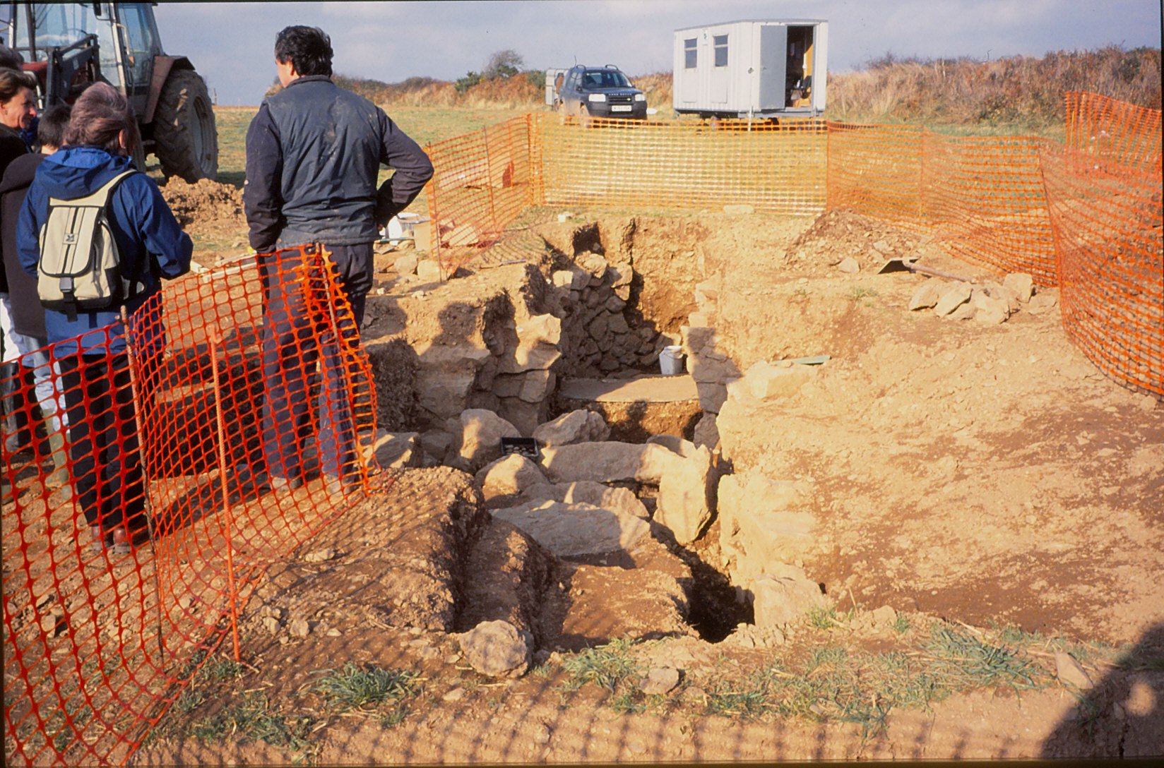
So,where is Saveock? Well, it is a small holding situated in a tranquil river valley near Truro in Cornwall. On arrival at Saveock you are met with the ever smiling Jacqui Wood who is not only a well known and respected experimental archaeologist (did I mention the roundhouse?) and author of several books including Cliff Dreamer: The Goddess Returns, a new fictional story set in the turbulent times of our very distant ancestors. She also runs the Saveock Water Archaeology Centre where students of archaeology (age and experience no barrier) are instructed in the art of excavation, here they find their minds being opened to the endless possibilities that the study of the past can present to those willing to listen.
A reconstruction drawing of how a courtyard house such as those found at Chysauster might have been roofed.
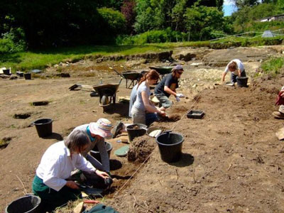
I met Jacqui some fifteen years ago when during a chance conversation she told me about some curious stake holes, a green clay floor and associated flint tools which she happened upon whilst digging a flue to conduct an experiment in tin extraction. At the time I was teaching A level Archaeology and we thought it would be a good chance for the students to learn some excavation techniques in the field, after all in archaeology practical experience is far more useful way to learn. It was the beginning of many seasons of excavation, intriguing finds, the remodelling of cow shed to comfy quarters for the diggers and much more. My eldest spent the first few months of his life sleeping safely at the edge of a trench.
Volunteers and students at the trench face.
The site at Saveock covers a wide range of time as you would expect of a small river valley in the heart of Cornwall with fertile soils, natural springs and near a well known source of tin and possibly gold. The earliest phase belongs to the Mesolithic, the evidence for which comes firmly from those aforementioned stake holes, green clay floor and the associated flints.
“In the Mesolithic the main site trench was over a south facing peat bank on the bend of a river that was between two shallow lakes. This entire site has been purposely covered with various different coloured clays in an attempt to make the river bank a suitable place for dwellings. In the area A/2 the first phase of the site, is what we believe to be a Mesolithic dwelling platform covered with dense green clay surrounded by stony yellow clay in which the stakes to support the dwelling were driven.” (Jacqui Wood).
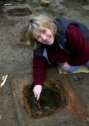
The second phase was and still is a bit confusing but it does seem entirely possible that it belongs in the Neolithic. When excavating it had been our intention to extend the trench to get a better picture of the Mesolithic features, so imagine our surprise when we came across a stone lined and capped drain covered in thick green clay that lead in one direction towards the river and in the other to another feature, rectangular in shape and lined with white quartz stones and spring fed. Several seasons later in 2005 Jacqui and her team uncovered another similar feature adjacent to the first original ‘pool’.
Dating the pool feature was problematic as it seemed to have been used over a long period of time.
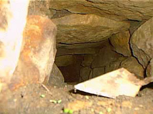
Inside the stone capped drain looking roughly north.
The only other similar feature we have found was the platform around the Neolithic monument of Maeshowe in Orkney. This platform was made up of thick clay and when a trench was put through it a stone lined and capped drain was discovered which was almost identical to the one at Saveock. The presence of the quartz stone too would suggest a very early date, the use of quartz in Neolithic and Bronze Age ritual sites is well attested to. The pool itself became known as the ‘moon pool’ as the white quartz glows in the bright moonlight.
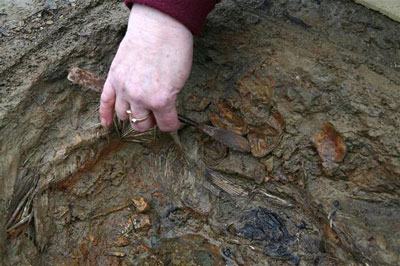
As for its function, well ritual seems a good an answer as any other but only because there appears to be no other alternative and believe me we considered a wide range of alternatives. Jacqui herself was always of the opinion that the word ‘ritual’ was used far too loosely in archaeological circles to explain seemingly unexplainable objects or sites. Later post excavation work on the mud we scooped up from the bottom of the pool (it couldn’t be excavated in the traditional manner as it kept filling with water) revealed some small finds which told a story of long usage and deposition. These included human hair, fingernails, Medieval straight pins, 128 small pieces of textile, parts of shoes, heather branches and perhaps most interesting was the broken half of iron pot or cauldron.
Many of these finds seemed to date to the last phase of usage at a time just before the pool was filled in and covered, a deliberate act to erase a pagan site. The lack of any finds earlier than the late Medieval may suggest that intervals the pool was clean out – thousands of years of deposition, not to mention silt, would have filled the pool considerably if it was not cleaned out regularly. Interestingly, in the layer just above the infill layer a broken glass bottle and a few sherds of pottery dated the closure of the pool to around the time of the English Civil War. Cornwall was at the time and even today a place where the rituals of time past were an important part of local society often overlooked by the Church. Cromwell’s puritan army would not have been so kind to Royalist (and pagan) Cornwall.
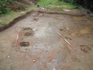
Perhaps one of the most intriguing episodes in the sites history comes from once more as a result of an extension of the trench with the Mesolithic features this time along the edge towards the marsh by the river. Whilst following the expected green clay floor and associated stake holes we encountered shallow pits with unusual contents cut into the clay floor. Because this area is essentially a waterlogged part of the site organic remains survived particularly well.
The clay floor with pits.
“When we excavated the first one we were surprised to find white feathers in it and thought it might have been perhaps a bird plucking pit, which was a common farming practice at the turn of the century. This turned out not to be the case when we found that the feathers were not plucked, but had been laid skin side out with white feathers inside. We took samples of the feathers to the bird expert at the local zoo and found them to be swan feathers.” (Jacqui Wood).
In addition a small amount of tiny stones were found surrounded by some sort of organic matter. Initially the assumption was that this was the crop of the swan but the stones were too pristine and it was concluded that the stones had been wrapped in leaves and deposited on purpose alongside claws from a range of other birds. The stones themselves were of an interest as they appeared to be brought to the site as they contained tiny nodules of beach flint an unusual feature given how far inland Saveock is. A suggestion from a local had us mounting an expedition to Swan Pool, some fifteen miles away on the coast and sure enough the stones at Swan Pool were identical to our small sample. Radiocarbon dates from the swan skin dated the pit to the 1640s, once again it seems dangerous ritual activities are occurring at a time when to be called a witch would mean certain death.
A pit being excavated.
A further eight pits were excavated that season, only two of them were intact the other six had had their contents removed in antiquity leaving just a few feathers and stones to show what their previous fill was. Excavation of this area was tough going, a thick layer of reeds impeded the work and as time went on more pits would be found, all with their contents removed that was until 2005 (two years after the first pit had been discovered).
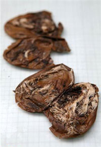
Three pits were found in a row, two rectangular and one round in the middle. Of the three it was decided to excavate the middle round one, here the dig crew found the pit to be lined once again with swan feathers but also on either side the bodies of two magpies. In the midst of this were the remains of over fifty-five eggs and although the shells had rotted away the membranes were remaining. The eggs themselves appear to have come from a variety of birds, some even had full formed chicks ready to hatch inside them still.
The egg membranes with chicks…
Further pits revealed the remains of a cat and dog skull. Perhaps the most astounding part of this whole story is the radiocarbon dates for the cat pit which was dated to around the mid 18th century and the dog pit which had a date of circa 1950s.
But as archaeologists we need to ask why? What was the purpose of the pits? There is the suggestion that these are the result of witchcraft based rituals and conversations with many experts in the field of witchcraft have yielded very little to enlighten us. If these pits are connected in some way to witchcraft or even pagan rituals of a different kind it is not one commonly known. This is not too surprising given that so much knowledge about traditions and rituals has faded away. Jacqui though has her own theory as to who and why; “My own theory (and it is only a theory) is that maybe if you got married and did not get pregnant in the first year, you might make an offering to St. Bride of a feather pit. If you finally got pregnant you had to go back to the pit and take out the contents and burn them and set the spirit of the swan free. If you never got pregnant then the pit remained untouched.”
Saint Bride or Brigit has many similarities to the Celtic deity of Brigid. The first of February is St Brigids feast day but also Imbolc where the goddess Brigid is remembered as one who brings the spring. Both are associated with healing, poetry and other domestic tasks. There is also a connection with the sacred wells. Today well dressing is done in the name of the Saint. Wells have long been a place of veneration, our modern wishing wells merely a continuation of a ritual act of deposition that begun in the Bronze Age if not earlier. The connection with the goddess and the saint at Saveock is slight but as we all know it is a place to start.
On a personal note I should like to mention that when the quartz lined pool was excavated it was myself and a friend who did the digging (we were the only ones willing to get so mucky). We spent the good part of a week in the mud and spring water. In late November of that same year I discovered I was pregnant with my eldest (who incidentally was born at midsummer) and a few days later my friend who had been digging too told me she too was pregnant – our children were born just a week apart.
More recent excavations have been looking in a completely different area of the farm and this time they have uncovered a hearth edged with smoky quartz crystals. Dating was provided by the large quantities of Bronze Age pottery found in association with the hearth. Work at Saveock is never dull but it is ongoing, so if you fancy have a holiday with a difference then check out the link below.
Jacqui excavating one of the pits.
For more information on the Saveock Water Archaeology Centre please go to the website www.archaeologyonline.org
Jacqui Wood’s book Cliff Dreamers is available to buy on Amazon along with her book on food through the ages Tasting the Past. Jacqui also has numerous articles published many of which can be found at www.academia.edu
Please Note – all photos except the featured image at the top of the article were provided by Jacqui Wood and the copyright belongs to her. The featured image at the top of the article is my own.
This article originally appeared in the Celtic Guide magazine December 2016.
If archaeology is your thing (and it’s certainly mine) then Cornwall is a great county to visit with a mulititude of sites to visit, especially if you want to get away from the crowds and sitting on the beach has lost its appeal. From the outset I should point out the following are my favourite sites/landscapes to visit (it was quite difficult to keep it to just ten and yes they are mostly prehistoric sites), others may have different views – the list is purely my own opinion. Feel free to comment on your favourites.
1. Chun Castle and Quoit
Okay so I have cheated a bit – here we have two very different sites but their proximity to each other I think allows for a bit of cheating…
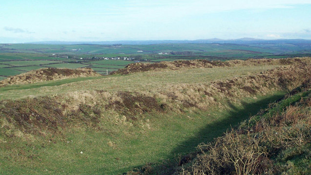
Firstly, Chun Quoit – quoits are neolithic monuments found throughout Cornwall (there are about a dozen known sites) consisting of upright granite slabs topped by a large capstone. They can also be called portal dolmens, chamber tombs or cromlechs. Some are in a better state of repair than others and Chun Quoit is perhaps one of the few which has been interferred with the least. Chun Quoit consists of four large uprights supporting a capstone which is estimated to weigh over 8 tonnes. It is also possible to see the remains of a circular stone cairn and associated kerbstones (the stone rubble at ground level) which would have originally surrounded the Quoit but not covering it leaving a the facade and the capstone visible.
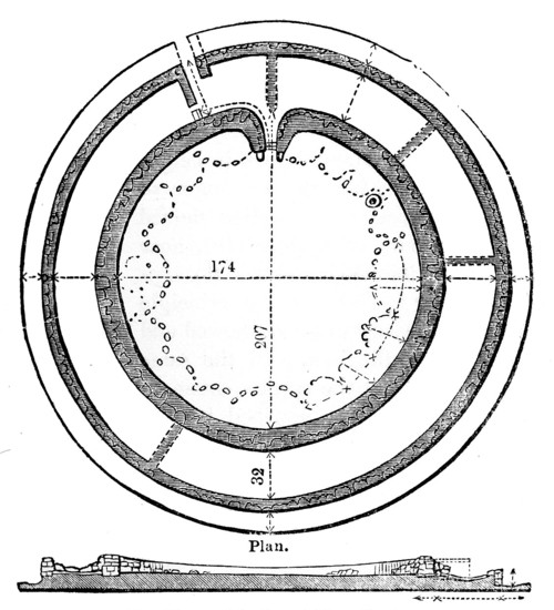
Two hundred metres to the east of the quoit are the impressive remains of Chun Castle. Unlike many other Iron Age hillforts which utilise an earthen ditch and bank system Chun Castle is entirely stone built. It consists of two large concentric stone walls and is 85 metres in diameter. There is some evidence that the hillfort was built over an earlier enclosure represented by a shallow ditch and low bank on the southwest side. Inside the hillfort there is a stone lined well and escavations during the late 1920s found evidence for a later post Roman occupation of the hill fort. Iron Age occupation consisted of at least a dozen round houses which based on the pottery found date the site to the 3rd and 2nd centuries BC. Sitting high on the ridgeway known as the Tinners Way the site would have been visible from many miles around, from here it is possible to make out several other hillforts in the distance such as Caer Bran. Below the hillfort about 500metres to the north east is the site of Bosullow Trehyllys – a courtyard house settlement of the late Iron Age (see the earlier post on Chysauster and Carn Euny), it is unexcavated but appears to consist of at least three detached courtyard houses and a number of round houses.
2. Chysauster
I wanted to include a courtyard house settlement in the list and it was a choice between Carn Euny and Chysauster. In the end Chysauster won mainly because it is easier to get to but also because the visitor can get a good idea of size of this unique house type. However, I would recommend a visit to Carn Euny too – the fogou makes it well worth while. I have discussed both sites already in a previous post – Chysauster and Carn Euny – A Unique Settlement Type – so won’t say much more than that.
3. Treryn Dinas
Treryn Dinas falls into the category of Iron Age cliff castle or promontory fort – one of many coastal headlands with Iron Age defences in the form of earthen or stone ramparts and external ditches usually across the neck of the headland. The term ‘cliff castle’ does not denote a particular function, some were large enough to have settlements within their walls, such as The Rumps and Trevelgue Head, others were much smaller and perhaps served as trading posts or lookouts. Treryn Dinas, however, appears to more than that – the visitor only need to look at the position and surroundings of this site to realise it is special.
Overlooking the beach at Porthcurno, the ramparts enclose a large rocky headland which contains the Logan Rock – a substantial boulder perched on the outcrop which in times past would rock in the wind and was only dislodged in 1824 by cocky young lieutenant and the crew of the HMS Nimble. The local people were rightfully upset at this and the lieutenant was charged to replace the rock at his own expense and with the help of the admiralty it was eventually returned to its original position, although it is said to no longer rock as easily as it had done once before.
According to folklore the earliest inhabitants of the headland were the giants who protected the neighbouring communities in return for cattle and other necessaries. Giants are a common feature in Cornish folkore and seem to be particularly associated with large outcrops of granite which feature in the landscape. From an archaeological point of view Treryn Dinas has four lines of defence with the last crossing the low neck of the headland. It consists of a deep ditch and a stone faced wall behind which are the foundations of two buildings either side of the presumed entrance. The general view is that this site is one of spiritual significance which may date many centuries earlier than the Iron Age. Finds of Bronze Age pottery have been found wedged in the crevices of the outcrop, the Logan Rock itself may have been seen as supernatural and there is the problem of that fourth line of defence. You will note in the photograph below that this line of defence is not particulary defensible as it easily looked down from the landward side, in addition the amount of useful land on the headland is extremely limited and the only thing the fourth rampart is ‘protecting’ are the rocks themselves.
Looking to the headland – below the rock outcrop is the remains of the internal wall protecting the headland.
The substansial outer bank on the landward side.
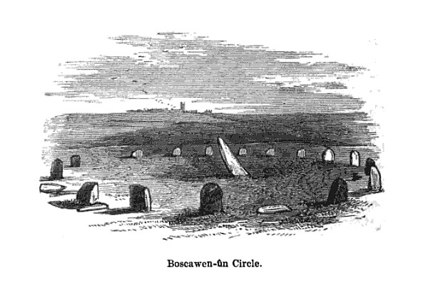
4. Boscawen-Un
In the parish of St Buryan is the stone circle of Boscawen-Un, dating to the early Bronze Age and consisting of nineteen stones there are several interesting features of the site. The most obvious is the stone which is slightly south of center, it leans sharply towards the north east and at its base there are two very faint relief carvings of axe heads. A past student once suggested to me that the stone itself looked like a large stone axehead which had been struck into the ground. Minor excavations have further revealed that its leaning position was intentional and not the result of subsidence. The second interesting feature of this stone circle is the large block of quartz to the south west which is part of the circle. Our understanding of the role of quartz within prehistoric rituals is poorly understood but there is an increasing amount of evidence which points to its importance.
Okay, so now I really am cheating but the fact is any visit to Cornwall should definitly include a fogou and I couldn’t decide which I preferred – Carn Euny or Halligye are the easiest to get to and Halligye the largest (it can be found on the Trelowarren Estate, near Helston) however, Carn Euny does have a courtyard settlement, the nearby hillfort of Caer Bran and the fogou itself has a beehive shaped internal chamber. So you can see my dilemma…I have already written about fogous in an earlier blog so shall not rehash what we know and don’t know about these enigmatic structures.
The entrance to the fogou at Chysauster.
6. Carn Brea
Situated between Redruth and Camborne is long hill easily visible from the A30, it is a hill with a long history beginning as far back as the Neolithic. Today two features stand out the most, firstly the the tall monument on the central summit erected in 1836 in the memory of Francis Bassett of Tehidy and the second is the small medieval castle perched on an outcrop. The latter was most likely a hunting lodge belonging to the Bassetts, an ancient local family and was first recorded in the fifteenth century. The land surrounding the hill was prime tin mining country and the flanks of the hill are covered in shafts and pits.
Heading further back in time the astute visitor might notice the remains of eleven Iron Age roundhouses on the saddle between the east and central summits, these are part of a much larger settlement on the hilltop, set within a substantial hillfort of forty-six acres. The defences are made up of two ramparts enclosing the hill. However, the occupation of Carn Brea began much earlier in the Neolithic. Surounding the eastern and central summits are another two smaller enclosures, of these the eastern summit has been partially excavated. The date range showed that the ramparts had been built somewhere between 4000 and 3500BC, making it the oldest known fortified settlement in Britain. There were traces of wooden buildings and Neolithic pottery, in addition a large number of flint arrowheads (700+) were uncovered along with evidence for the destruction of the site suggesting the site had been under attack (Cornish Archaeology, 1981, 20).
Looking east the 15th century castle can be seen in the distance. In the foreground the remains of one of the Iron Age roundhouses is visible as a semi circle of stones.
The path through the inner Neolithic enclosure wall.
Winter is the best time to visit – the outer ramparts are clearly visible.
7. Trevelgue Head
So many visitors to Cornwall will invariably end up in Newquay without realising the long and fascinating history of this seaside town. Just north of St Columb Porth on the road to Watergate Bay is the impressive cliff castle of Trevegue Head. It is the most heavily defended of all the cliff castles with seven lines of defence. The first ditch and bank is not so obvious as the next six with largest bank being roughly four metres high. Erosion over the centuries has seen much of the land disappear and it is suggested this included the original entrance. Excavation in th 1930s demonstrated that Trevelgue was continously occupied from the thrid century BC until the fifth/sixth century AD. At least fourteen roundhouses were identified (it is still possible to see the house platforms with a keen eye). Given its position in the landscape, the sheer scale of the defences, some of the artefacts found (bronze horse harness and Roman coins) in addition to the significant amount of evidence for both bronze and iron smelting, it is fair to say Trevelgue Head was most likely a high status site, the home ground of someone of great import.
The importance of this headland and other similar to it along the coast is further attested to by the presence of the two bowl barrows dating to the Bronze Age – these were opened in late 1800s but nothing is known of their contents. Further along the coast is Trevelgue Downs where a further two barrows can be seen. In the eastern barrow a crouched adult skeleton was found within a stone cist with a stone battlexe close to hand. From personal experience I have walked this cliff castle many times and it was not uncommon to espy tiny Mesolithic flints protruding from the exposed edges of the paths. Further testament to the sites long history.
Looking towards the end of the headland. On the right is the first of two Bronze Age barrows.
Eroded banks and ditches of Trevelgue Head.
8. Tintagel
It had to be on the list – perhaps one of the most controversial of all sites in Cornwall from local resistance to English Heritage’s plans for the site to the myriad of myths and legends associated with Tintagel – no where captures the imagination more. Like several other sites on this list I have already waxed lyrical about Tintagel so will not bore the reader with much of the same (but do follow the link if you want to seperate fact from fiction).
9. Castle an Dinas
An impressive example of an Iron Age hill fort found in mid Cornwall near St Columb Major. Measuring 260m across it would have been a formidable place in its heyday, the substantial ramparts are visible for many kilometres even today. There is some faint evidence for a much earlier enclosure on this hilltop possibly dating from the Neolithic or Bronze Age and the presence of two Bronze Age barrows within the hillfort is further testament to the importance of this place throughout prehistory. In the early 1960s a relatively small excavation was undertaken with the idea of prove the tradition of such places being re-used during the post-Roman phase and although they failed to do this a fine cobbled road was found.
The earthworks of Castle an Dinas – note the commanding view from the hillfort. Photo by Mike Hanncock (geograph.co.uk)
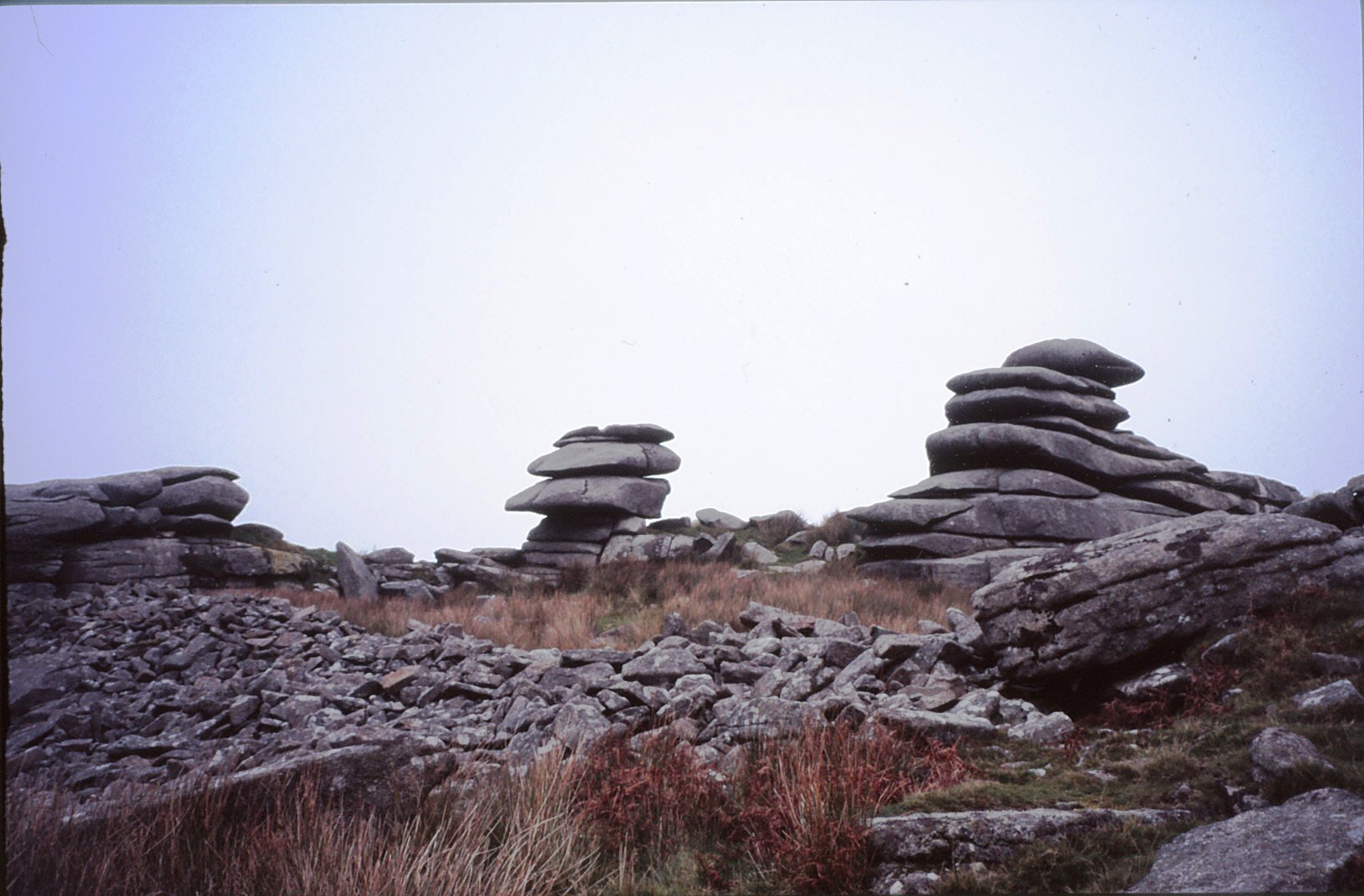
10. Bodmin Moor
Yes I know this really is cheating…but no list of sites to visit is complete with at least one from Bodmin Moor. However the problem is I could not choose just one, there are so many wonderful sites to visit on the moor. Like its much larger cousin in the next county over, Dartmoor, Bodmin Moor has a wide variety of archaeological sites to visit beginning way back into the Mesolithic (flint scatters possible representing seasonal camps as found on Butterstor) and the Neolithic such as Stowes Pound and Rough Tor which are thought to be tor enclosures similar to Carn Brea and Trencrom further to the west, but it is the Bronze Age which dominates the archaeological record.
There are stone circles, stone rows, menhirs, barrows (earthen mounds), cairns (stone mounds) and of the latter there is in excess of 300 known. The most well known barrow is the Rillaton barrow which is the largest on the moor and where an individual was buried with a bronze dagger, an urn and a beaten gold cup.
“…the distribution of the monuments throughout the whole of the upland suggests that its use had intensified enormously. Virtually every block of land (as defined for example by prominent hills and divided by rivers and streams) is marked by a group of cairns, as if all available land was claimed and accounted for. The analysis of fossil pollens fromthe ancient land surfaces sealed beneath the excavated cairns shows that by this date the upland was predominantly open grassland, with woodland confined to the steep valley sides.” (Herring P & Rose P Bodmin Moors Archaeological Heritage pp17-18)
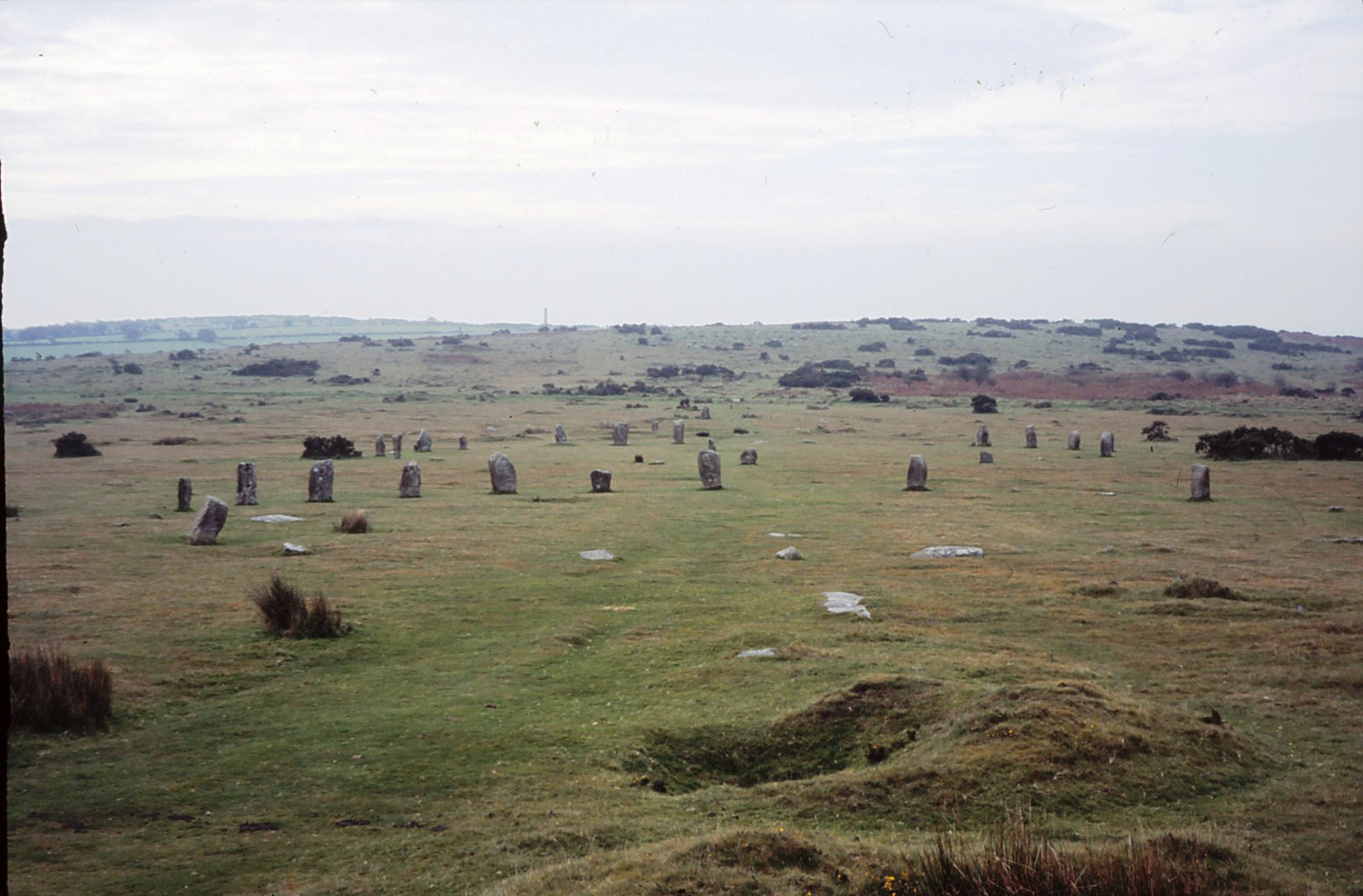
There are sixteen known stone circles of which the best known is the Hurlers. All the circles seem to have been placed carefully within the landscape – nearly all are within sight of tor which is always to the north of the circle, with Roughtor being the most dominant (nine of the sixteen circles). The stone rows, menhirs and embanked avenues are not as numerous but still make up an important part of the ritual landscape.
A feature of the later Bronze Age landscape of the moor is represented by the vast numbers of settlements represented by field walls and the stone foundations of round houses. There are approximately 1500 prehistoric round houses representing around 200 settlements and although only three have been excavated they are assumed to be all by analogy with Dartmoor to belong in the second millenium BC. Often found associated with these settements are field systems of varying shape and size best seen from the air and on large scale maps.
Ar around 1000BC a deteriorating climate and soils resulted in most settlements being abandoned and the use of the moor being less intensive. The hillfort sites of Bury Castle, Cardinham and Berry Castle are the only easily identifiable settlements of the Iron Age, although it is assumed that the moor continued to be used for the seasonal grazing of livestock, much as parts of it are today.
Stowes Pound – the tumbled wall of stones in the foreground represents the early and possibly Neolithic enclosure wall.
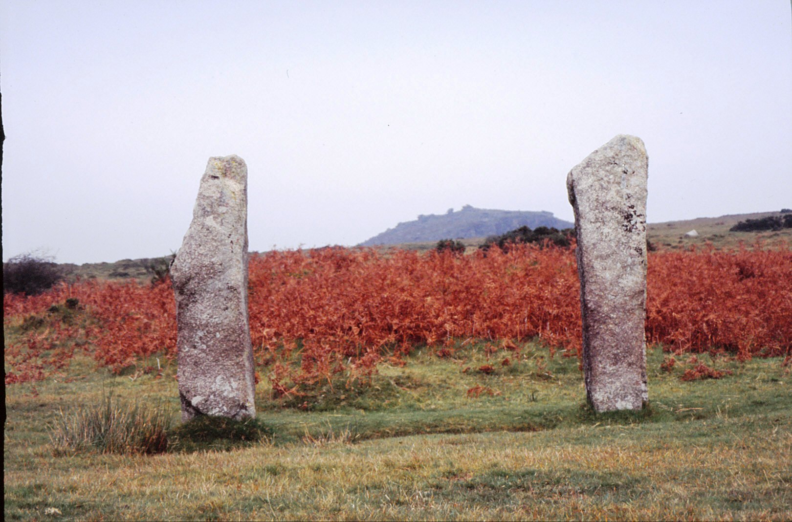
Two upright menhirs frame the view to Stowes Pound and the Cheesewring.
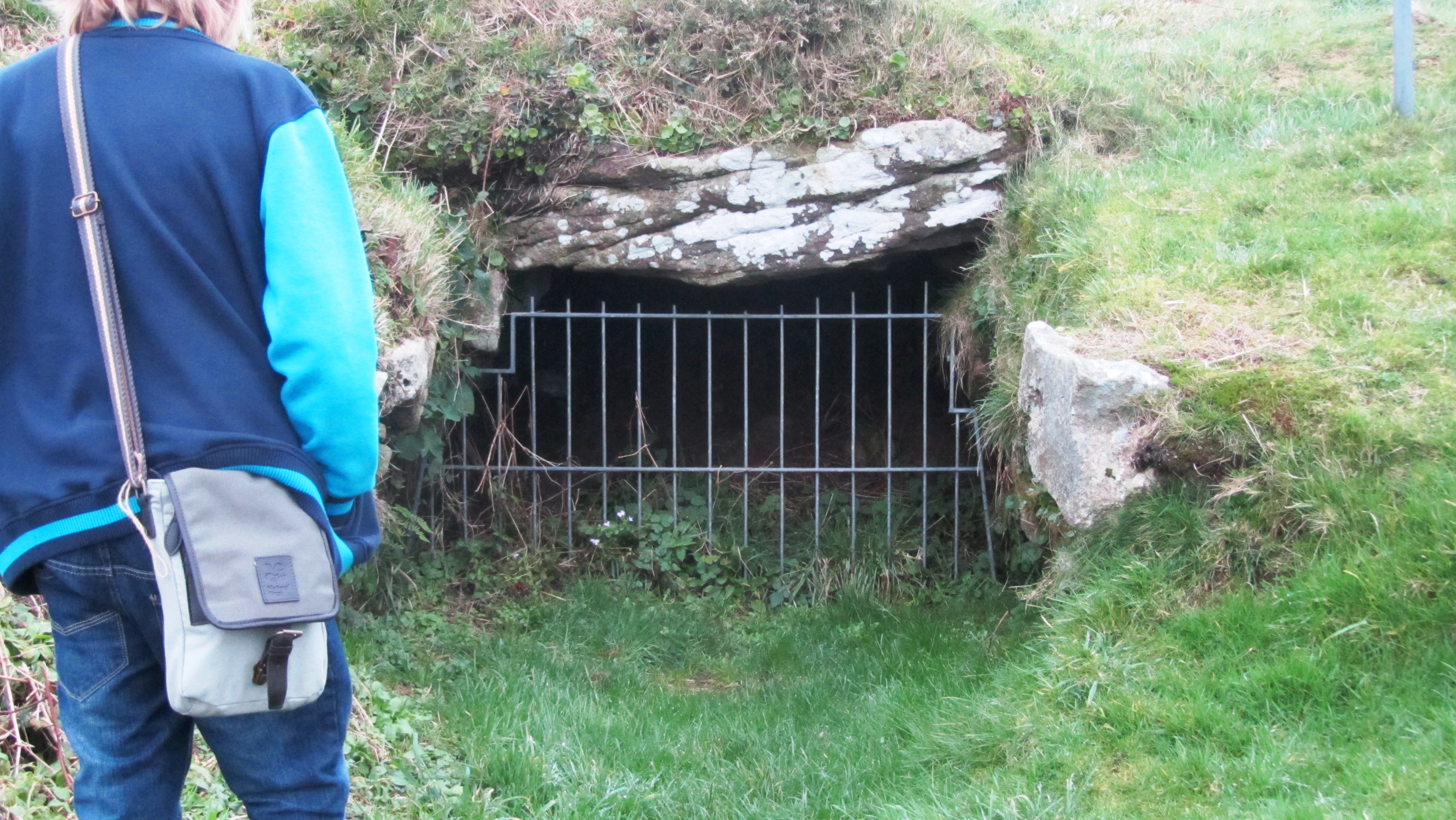
Before we delve too deeply into fogous and the mystery surrounding them it is probably a good idea to describe what a fogou is. The word ‘fogou’ is very simply Cornish for ‘cave’ and this gives us our first clue. It is, in essence a subterranean (or semi-subterranean) structure. Occasionally other writers will compare the Cornish fogou with the Scottish or Irish souterrain but beware of this pitfall; the Cornish will not thank you for it.
The structures in themselves are “…a low passage walled with dry masonry and roofed with large stone slabs, generally but not invariable underground and generally attached to an Iron Age settlement.” (Weatherhill, Pool and Thomas 1980 ‘The Principle Antiquities of the Land’s End District’).
The passagway at Halligye Fogou on the Trelowarren Estate – photo by Jim Champion (geograph.co.uk)
Typically, fogous vary between 12 to 15 metres in length and 1.5 to 1.8 metres in width. The passage walls have a degree of curvature with courses of corbelled masonry to reduce roof width and in most cases the passage itself curves or branches making it difficult to see the end as you enter. Most have a wide accessible entrance today, but it does seem that for many the original access point was a low restrictive doorway called a ‘creep’.
As mentioned before fogous are almost always associated with a settlement dating to the Iron Age and for many they would have been the only stone structure within that settlement. The distribution of these sites is restricted to areas west of the Fal Estuary with the majority being in West Penwith. There are at least twelve sites known for certain and at least another a dozen or so possible sites suggested from placenames, fieldnames and those described by past antiquarians. For example, the West Penwith Survey identified one such site at Lower Leah from a description left by J T Blight in 1850 of a subterranean chamber in which burial urns and fused tin were found.
No two fogous are exactly alike and to further emphasise this, the structures at Carn Euny and Bosporthennis each have what is known as a ‘beehive hut’. The name is something of misnomer as the structures were highly unlikely to have anything to do with bees or bee keeping. The name was given due to the shape of the chamber, which resembles a beehive.
Excavations at Carn Euny during the 1960s and 70s depict a settlement which was occupied for about seven hundred years from around 500BC. There were several phases, the earliest consisted of timber structures and the last was the construction of the stone courtyard houses which are visible today. The ‘beehive hut’ is associated with the earliest phase of settlement, a second phase of roundhouses are associated with the construction of the long passage and by the time the courtyard houses were constructed the passage was made to link into the courtyard house north of it.
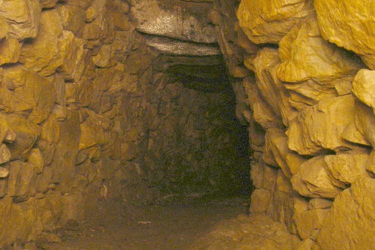
Inside the fogou
Inside the beehive
The entrance to the fogou at Carn Euny – not the original entrance.
The most recent fogou to be excavated is that of Boden Vean on the Lizard Pennisula. This particular site was first recorded in 1816 by the vicar of Manaccan and then was promptly lost. In 1991 the current landowner was having some pipe work done in a field when a cavity emerged and the fogou was rediscovered. Geophysical survey identified several anomalies, one of which turned out to be a Bronze Age roundhouse and subsequent excavations demonstrated that the fogou was part of an enclosed Iron Age settlement known as a ‘round’ (which can rather confusingly be anything but round…).
Bodean Fogou under excavation.
Fogous and their Function
What were fogous used for? This is the heart of the mystery. The lack of consensus, of agreement as to what the function of a fogou is defines Cornish archaeology and archaeologists. There are three possible explanations – a place of refuge, storage and ritual. Lets’ examine each of these in turn.
Refuge – this particular theory has generally fallen out of favour. The argument against this theory relates to the accessibility of the fogou. When most fogous were built the only access was through the creep and whilst it is an easy enough task to crawl through if you are young, fit and not claustrophobic, an elderly or infirm person would find it difficult. The second point against this theory is the lack of an exit strategy. It would be an easy enough task for any would be raiders to smoke out the people hiding in these passages, there are no air vents and no other way out. The third and final nail in the coffin relates to the overall position of these structures within the landscape, many are situated within easy distance of well defended site such at Carn Euny with the hillfort of Caer Bran only a short distance uphill.
The orignal entrance at Carn Euny known as the creep.
Storage – for many archaeologists this is the prevailing theory. Comparisons are often made to souterrains found in Brittany, Scotland and Ireland which did have a more utilitarian purpose and are often of very different dates. However, Ian Cooke suggests that the fogou is not an imported concept, they “…represent a continuation of long established local megalithic traditions.” (Antiquities of West Cornwall 3 Carn Euny Village and Fogou).
In Cornwall there is a tradition of building places of storage, these are called ‘crows’ or ‘hulls’. A crow is a small stone hovel used to store tools, fuel and in some cases livestock. They are often built into the side of a field hedge or bank and most are at best two centuries old. A hull is a chamber dug out of the ground and faced with stone; often there will be a lintelled doorway to prevent collapse. They are found close to settlements and were used to store perishable foods. These structures were common from around fourteenth or fifteenth century.
However, the argument against the use of fogous as a place of storage considers how damp and airless they are (a visit to any fogou requires a pair waterproof shoes at anytime of the year). Research has shown that the only foodstuffs suitable to storing in this environment are beer and dairy produce. There is also the accessibility issue, clambering down the creep with a barrel of beer is not the most efficient means of storing your excess foodstuffs. It is possible that the fogou did change in use over time, the later opening up of the fogou during its last phase at Carn Euny would have made it a better option for the storing of foodstuffs.
A secondary argument also looks at the effort required to build the fogou and as mentioned before, at the time of construction it would have been the only stone building in the settlement. Both suggest that the fogou was a socially important structure, which leads us the final possible explanation.
Ritual – some archaeologists tend to shy away from using ‘ritual’ to describe a sites function. This is a backlash from criticism in the 80s and 90s when archaeologists were accused of using ‘ritual’ as a definition when nothing else fitted. The term was certainly bandied about…even so, the idea of the fogou as a place of ritual does need to be examined because interpretations as places of storage or refuge are at this point unsatisfactory.
The entrance to the fogou at Chysauster.
Ian Cooke has spent a substantial amount of time recording and analysing fogous throughout Cornwall. For him and many others involved in earth mysteries fogous were definitely places of ritual. Cooke found that all but two were ‘symbolically’ aligned to the rising midsummer sun and the two that weren’t were aligned on the setting of the midsummer sun. He says symbolically as at the time no light would have entered the passages. The importance of midsummer needs no explanation here. Some archaeologists have questioned these alignments but have noted the monumental nature of the fogou, drawing analogies with a medieval church within a settlement of less substantial structures (P. Herring 1994 CA Journal 33).
Cooke also noted how “…the majority of fogous, where sufficient remains can be traced, have the northern end of their long curved passage aligned north-east to correspond with the prevailing direction taken by the subterranean mineral lodes…” Drawing a connection between the tin trade and the construction of the fogous, perhaps it is not unsurprising then when we here of small finds of fused tin found inside the passages and in the backfill of the creep such as at Carn Euny.
“…the rationale behind building fogous was the need to provide a place of contact between the plunderers of the earth and the dieites believed to control the fertility of the land and the mineral wealth beneath it, and that these places were used for the performance of rituals related to the pagan religion of Iron Age West Cornwall in which a Sun God and Earth Mother Goddess formed the central element.” (Ian Cooke The Mother and the Sun 1993).
It has also been suggested fogous may have been a place where important rituals took place which relate to transformation such as when a child becomes an adult or during death. The dark places of the world have always represented an otherworldliness to human beings, even to this day, caves are regarded as special places.
The more sceptical who argue against a ritual function point out, “by and large fogous lack obvious design features or contexts that make them stand out as undoubted ritual structures,” (P. Rose ‘Shadows in the Imagination: Encounters with caves in Cornwall CA Journal 2000/1). The argument follows that because we have been unable to identify any elements within Celtic belief that may be associated with the fogou then a ritual function is unlikely.
However lets briefly consider what we do know, it is fairly well understood that the people of the Celtic Iron Age attributed all aspects of the world around them with a spirit of some kind and that ‘no activity however trivial would have been entered into without some thought for the attitudes of those who inhabited the other world’ (B Cunliffe Facing the Ocean 1995). Surely this would have extended to the extraction of tin and other metals from the ground.
“As tin extraction is an activity that is unique to Cornwall, particularly west Cornwall, is it not possible that the fogou is a unique regional response to this,” (TM Rowe Cornwall in Prehistory 2005). The continuing fertility of the land and its mineral wealth would have been important concerns in this period.
All of the folk stories which surround fogous can be traced back to one of three themes.
It’s the location of hidden treasure.
They have impossibly long passages.
Associated with demons, witches, giants and other ‘dangerous’ creatures.
Thus, Piskey’s Hall was long thought to contain fairy treasure, at Boleigh there was a belief that the passage ran for many miles under the Penwith landscape and at Pendeen Vau there is a tale of a young woman dressed in white and carrying a red rose appearing at the mouth of the fogou on Christmas day. It is said if you see her you will die within the year.
There were giants at the fogous of Lower Boscaswell and Higher Bodinar and at Boleigh it is said that the Penwith witches were in the habit of meeting the Devil here.
It is not difficult to see how such stories might begin. Treasure seekers have for centuries dug holes in curious mounds in search of riches, the mound covering a fogou would have been no different. Should you ever visit a fogou without a torch (not recommended, by the way) the passage will seem to go on forever, it often feels as if time has stood still and the passage is never ending. As for demons, giants, witches and ladies in white foretelling your death, well, the ever active imagination of the human species may well be responsible.
Or, perhaps local folklore can give us hints about the fogou, as it is with a game of Chinese whispers, folk memory can distort ancient knowledge of a place as time goes by and other influences intervene. Stories of lost treasure might relate to knowledge of precious mineral lodes; the fear of the never ending passage may be just an extension of the fogou representing the underworld; the association of the devil and witches perhaps an attempt in early Christian fervour to discourage people away from ancient places of worship. For those who follow the path of the Goddess today, the role of the witch in the past is a manifestation of the Goddess, hence the persecution (put very simply).
Final thoughts
So are we any closer in solving this archaeological mystery? In short, no. Like so much when we are dealing with a time so very distant from our own it is difficult to make assumptions about sites such as fogous when the evidence is so sparse. It has been suggested in order to get a much clearer idea of the function a detailed excavation of a fogou undisturbed since time of abandonment would be ideal.
Even so, solving this mystery is left to the individual, only he or she can decide how these places were used and that is why fogous are special places – they are different things for different folks.
NB when visiting a fogou please take a torch and if you don’t like spiders, don’t look up…really, do not look up!
Links
Not a comprehensive list of links but a starting point for further investigation.
In the far west of Cornwall lies a trackway that has been trodden by many feet over many millennia. Once a central part of a wider network of tracks it is now only used by ramblers, dog walkers, horse riders and those interested in the sites along its way. What it was called in the past is unknown but today it has become known as the Tinners Way.
Paths and tracks traverse the landscape creating a maze of possible routes from A to B and are probably one of the least understood aspects of the past in Britain. The greatest issue is in the understanding of the chronology of this particular site type.
“Unmetalled roads and trackways are extremely difficult to date. They have no constructional material to aid interpretation and artefacts are rarely present. This difficulty is compounded by the fact that their form has remained unchanged from prehistoric to modern times and that many were in continuous use for centuries, even millennia” (Prehistoric Roads, Trackways and Canals – Historic England 2011)
Historic England/English Heritage have defined a trackway as a ‘linear route which has been marked on the ground surface over time by the passage of traffic. Trackways are usually relatively short routes for local use’. In west Cornwall the Tinners Way has been identified as one such trackway, one which in all likelihood has a lengthy history going back into prehistory. It follows the granite backbone of West Penwith passing by and sometimes through archaeological sites as well as the remains of later of tin mining.
So, from where does the Tinners Way begin and where does it end? Well the answer to that would very much depend on from what direction you are coming as it travels between Cape Cornwall and St Ives. For our purposes here we will begin at Cape Cornwall in the very far west, stopping at various points and ending up on the Island in St Ives.
Kenidjack Valley with Cape Cornwall in the background – photo by Tony Aitkin (geograph.co.uk)
It is probable that the Kenidjack Valley which runs alongside the Cape was the source of one of the earliest and most accessible deposits of alluvial tin ore. Tin was an important resource to the Cornish economy from the Bronze Age into the 19th century.
The bracken covered sides of Kenidjack Valley hide the remains of alluvial mining.
.
A view of one of the trio of stone circles known as the Tregeseal stone circles with Carn Kenidjack in the background.
From here the trackway heads inland and up onto the moors of Penwith past Carn Kenidjack and the Tregeseal Stone Circles not to mention the mysterious holed stones. Continuing on to the fascinating sites of Chun Quoit and Chun Castle.
Chun Quoit – drawing by William Copeland Borlase 1872
Back long before metals were exploited in Cornwall our Neolithic ancestors built great stone tombs, archaeologically these are known as quoits or chambered cairns. Although this is not the place to go into a lengthy discussion on the function of such sites it should be pointed out that many of these sites do seem to appear in significant places in the landscape and thus would seem to have a function beyond simple burial. Along the Tinners Way there are several quoits which serve to mark the way – Zennor Quoit, Mulfra Quoit, and of course Chun Quoit with the possibility of more having been ravaged by time.
Just past Chun Quoit are the remains of what was once a great stone walled hillfort – Chun Castle. The walls are still impressive even after the attempts at removal for use in other building projects (the pavement on Market Jew St in Penzance is made up of stone from the hillfort). Originally occupied in the Iron Age it straddles the trackway, interestingly it was later occupied in the 5th and 6th centuries – a time of unease – and the evidence does seem to suggest it was used as a stronghold for the storage of tin ore.
Plan drawing of Chun Castle by Charles Knight 1845.
The imposing gateway of Chun Castle – photo by Rod Allday (geograph.co.u
All along the Tinners Way there is evidence of tin mining (hence the name) – old mine shafts can be a hazard for those wandering off the beaten track (please remember to keep your dogs under control when walking along here). Much of the visible mining remains date from the 17th to the 19th centuries.
The pumping engine house over the Greenbarrow shaft of Wheal Malkin often referred to as Ding Dong Mine – photo by Rod Allday (geograph.co.uk)
On leaving Chun Castle you pass the overgrown Iron Age courtyard house settlement of Bosullow Trehyllys – see an earlier article on the more well known courtyard house settlements of Chysauster and Carn Euny. From here the trackway follows the well trod path past the Men-an-Tol and Men Scryfa.
Men-an-Tol – the moorland behind is covered in disused mining shafts. In the far distance is the abovementioned pumphouse of Ding Dong Mine.
The first was probably once a chambered tomb which has suffered at the hands of people over a very long time. The latter an inscribed stone dating to the 5th/6th century and is a memorial stone to “Rialobrani Cunovali Fili’ – roughly translated as ‘the royal raven son of the glorious prince’. It’s position along this important route undoubtedly deliberate.
The Men Scryfa Stone – photo by Jim Champion (geograph.co.uk)
Not far from Men Scryfa is the Four Parish Stone. This stone indicates the point in which the boundaries of the four ancient parishes of Zennor, Gulval, Madron and Morvah meet. This is not the modern civil parish boundaries but the much older church boundaries. A document from the 17th century mentions this place in the landscape, referring to it as ‘Meane Crouse’ or ‘stone cross’ suggesting the presence of a stone cross which marked this important crossroads. Any traveller to Cornwall will note how stone crosses covered in moss and worn by weather are often found at road junctions.
From here the landscape is dominated by the impressive tor known as Carn Galva and whilst not the highest point in West Penwith (Watch Croft the adjacent tor takes that accolade) it is the most atmospheric of tors with its giant granite boulders standing silent sentinel over the millennia. It is now generally believed that Carn Galva is one of the few Neolithic enclosures to be found in Cornwall – Carn Brea, Helman Tor and Trencrom are the more well known.
One of the many remains of roundhouses to be found at Bodrifty – behind can be seen the high ground leading to Zennor Hill and Carn Glava. Photo by Alan Simkins (geograph.co.uk)
Further on the walker can take a minor side trip to see the Nine Maidens stone circle and the remains of a roundhouse settlement probably dating to the late Bronze Age/early Iron Age (Bodrifty). Nearby the farmer at Bodrifty Farm has recreated a roundhouse and it is possible to visit but do ask first. After Bodrifty the trackway goes past Mulfra Quoit.
Mulfra Quoit – drawing by William Borlase 1769.
Alternatively and the most likely direction for the trackway to follow is across the moorland of Bosporthennis Common between the highpoint of The Beacon and Mulfra Hill to the parish boundary stone known as the Bishops Head and Foot.
“Used over generations, these trackways created permanent scars across hills and valleys, and formed a web of easily followed routes which were later utilised to mark the extent of private estates which had superseded previous communal use of tribal lands. When the system of parishes was established about the 12th century additional use was made of these muddy tracks to form their boundaries in conjunction with streams and prominent rocks” (Antiquities of West Cornwall – The Tinners Way. Ian Cooke 1991)
It is often speculated that the old parish boundaries are based on ancient trackways and at the Bishops Head and Foot there are important paths which traverse Penwith from Zennor to Castle-an- Dinas and Chysauster (both important Iron Age sites) and on to Mounts Bay. The Tinners Way as already demonstrated follows several sections of parish boundaries along the high ground. The trackway then continues through the parish of Towednack along the base of Rosewall Hill covered in old mining shafts and then onto the village of St Ives and The Island.
The view from the Lady Downs in Towednack looking east. In the distance it is possible to see Perran Sands and St Agnes Beacon. Photo by Sheila Russell (geograph.co.uk)
Although today there stands a small chapel to St Nicholas on the Island it is thought that originally the headland was a much older promontory fort. Its position which overlooks Porthmeor Beach and the wider expanse of St Ives bay including the entry to Hayle Harbour and with views all the way up the coast would suggest it was an important site.
The Island at St Ives – Porthmeor Beach is in the foreground. Photo by Chris Dixon (geograph.co.uk)
The Hayle Estuary was an important trading port on this coast until the Medieval period. Dredging in the now silted harbour has in the past brought up finds from all periods including the Roman period and earlier. Overlooking the harbour is the ancient enclosure of Trencrom Hill which as mentioned before can be dated to the Neolithic and later.
“It used to be thought that the earliest routes in Britain were prehistoric ‘ridgeways’, long distance trackways…This idea grew up in the early years of archaeological studies when the most obvious prehistoric monuments, such as Bronze Age burial mounds and Iron Age hillforts, were found concentrated in upland areas.” (Pre-industrial Roads, Trackways and Canals Historic England 2011).
Even though there is no concrete way of dating this particular route there are certainly a lot of indicators which point to it being an important part of the landscape in West Penwith with a long and fascinating history.
A useful wee book to read if you can get hold of one is “The Tinners Way”by Ian Cooke. It is in essence a guidebook for walkers wishing to do the the Tinners Way, detailing the route and the various features along the way.
Breage is a small village some five kilometers from Helston in the west of Cornwall and on the face of it there is not much for the visitor to see. Most will whizz past, intent on exploring other places. But if you have the time do stop and pay a visit to the church, trust me, it is well worth it.
First A Little Bit of History
The earliest history of the area relates to the settlements upon Tregonning Hill overlooking Breage and neighbouring Germoe. Here you will find Castle Pencaire an oval Iron Age hillfort. On the northern slopes are two well preserved ’rounds’ or enclosed settlements (also Iron Age in date). When the light is right it is also possible to see the remains of a field system and possible trackway associated with these sites.
The Roman Milestone.
In the church itself is a Roman ‘milestone’. These stones (of which there are several in Cornwall) were mark stones set beside an actual road and inscribed to the Emperor. This particular example is inscribed in Latin to “the Emperor Caesar our Lord Marcus Cassianius Latinius Postumus, pious, fortunate, august”. It dates from AD 258 – 268.
The Domesday Book mentions lists this part of Cornwall as being held by the King under the name of the Manor of Binnerton. It had eight hides of land with enough for sixty ploughs, there were thirty two villagers, twenty five smallholders with fifteen ploughs between them. There was also two acres of meadow, two square leagues of pasture and half a square league of woodland. Not forgetting the forty five mares, sixty sheep, thirteen cattle and five pigs. At this point the church is not mentioned, although it seems likely that there was one, albeit an unprofitable one and therefore of no interest to the Norman assessors.
The earliest evidence for a church at this site is the red sandstone cross head. Interesting in itself, for the red sandstone is not a material to be found in the local area and the style of cross is regarded to be of Hiberno-Saxon in origin. This early church may well have been made of timber and quite small, thus leaving no trace. Later, the Normans built a larger and most likely more substantial church. However, yet again very little remains of this church, just a portion of the Norman font was found outside the north door and is now incorporated into the present font.
The early cross.
Documents do state however, in the 12th century the Earl of Gloucester gives the church to the Abbey of Tewkesbury but after eighty six years the Earl of Cornwall takes it back and gives it to the abbey of Hailes. There is an unsubstantiated note to the early church being dedicated in the year AD1130 to St Breaca.
The church you see today is 15th century in date and is of a standard design for the period. Originally it seems the church once had stained glass windows but during the Reformation Edward VI Commissioners appear to have ordered the destruction of these due to them depicting the saints and other emblems of idolatry. Fragments of stained glass have been found around the churchyard.
Once inside the church your eyes are immediately drawn to the frescoes. These are a series of five wall paintings, four of which are saints – Ambrose, Christopher, Corentine and Hilary. The church boasts one of the most remarkable wall paintings belonging to a style which has been labelled “Christ as Piers Plowman”. It depicts a crowned near naked and wounded figure of Christ surrounded by the tools of husbandry, fishing, cloth and metal-working trades. In the many wounds is, perhaps, a message about man’s sins and the continuing Passion of Christ.
These too appear to have suffered during the Reformation, even so they are still impressive. It is often easy to forget how important art and pictures would have been in the past, for a society where the majority of people could not read. Visual depictions of their stories either Biblical or otherwise would have been important.
Apart from the painted figures there are also a variety of other decorations such as the borders around the windows. Perhaps one of the most surprising revelations which I took away from our visit was how colourful churches would have been in the past.
St Breaca
The church is dedicated to St Breaca (hence the name Breage). As with so many of these early saints it is difficult to distinguish fact from fiction. The following is the traditional view and not necessarily what actually happened.
Breaca was said to be an Irish missionary who travelled with vast hoard of other Irish missionaries landing at the mouth of the Hayle River at around AD500. Their drive to convert the Cornish was firmly rejected and many skirmishes ensued. Castle Pencaire (mentioned above) has in the past been referred to as ‘Loban Rath’, the place were the missionaries fled to under threat from King Teudar.
St Breaca was one such missionary who took up residence on Tregonning Hill. Tradition has it she built a small church near Chynoweth and Tolmena on the south eastern slopes of the hill. No evidence for this remains. Eventually, once hostilities had calmed Breaca is said to have moved to the current place we now call Breage, establishing her church there on the hill.
Breage has had several names in the past – in Cornish it is either Eglosbrek, Eglos Pembroc or Eglospennbro. Eglos means church, the ‘brek’ or ‘broc’ are derivitives of Breaca and ‘pem’ or ‘penn’ refers to a hill. Other more recent names have been St Breock-in-Kirrier (Kirrier or Kerrier being the old hundred) and St Briack.
Like so many churches in Cornwall, the tower is easily visible for many miles around and even out to sea. Making it an important landmark for travellers.
The following is a link to an old book titled ‘Story of an Ancient Parish – Breage with Germo’. Written in 1913 by H R Coulthard, it is in many ways a product of its time however, it still makes for an interesting read and is free to download.