It has been almost a year since our last journey to Cornwall and so it seems appropriate to tell you all a bit about that time.
Normally any trip to Cornwall is one of expectation, hope and joy but on this occasion, it was a time of sadness. On the day we arrived in Penzance, my mother-in-law passed away. We were half an hour away from seeing her when we got the call…
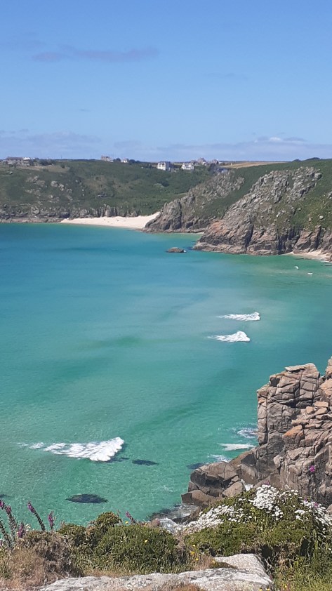
It was not an easy time but we did find moments to distract us, Cornwall, after all is a beautiful county filled with fascinating places. There were beach walks, pasty’s, drives down winding lanes, pub lunches, moors and visits to ancient places. Below is just a few of the places we visited in our down time between packing up a life well lived and saying goodbye. We knew it would be a long time before we came back and so we made the most of the time we had.
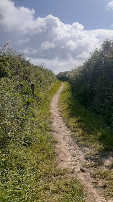
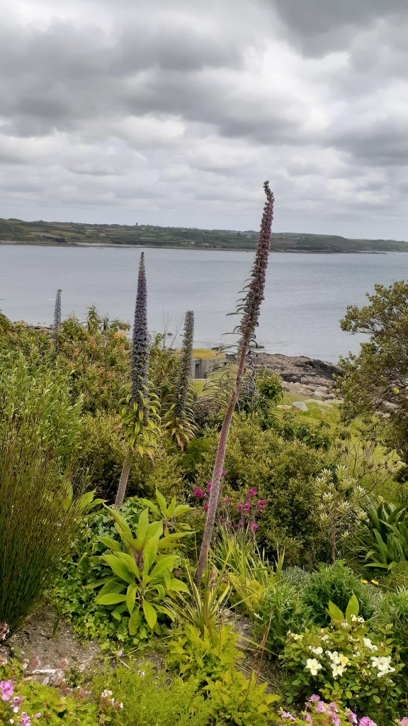
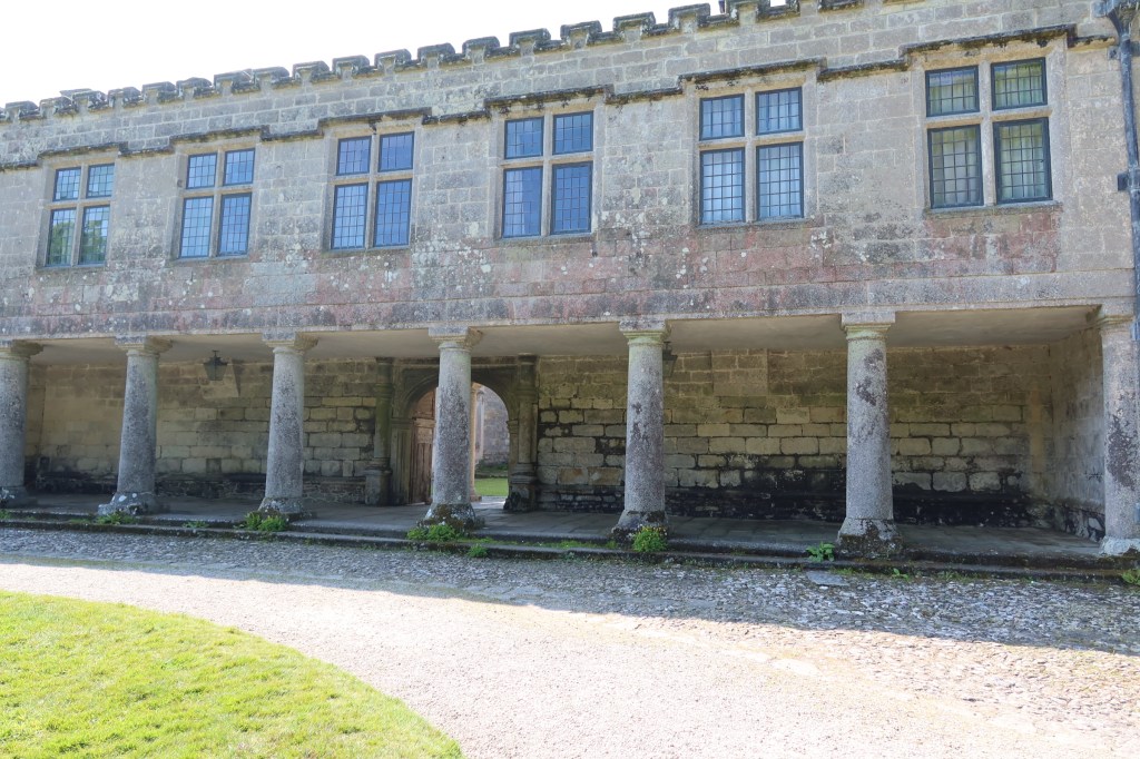
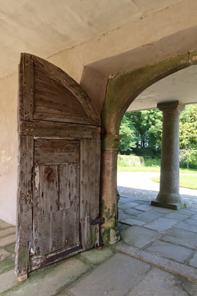
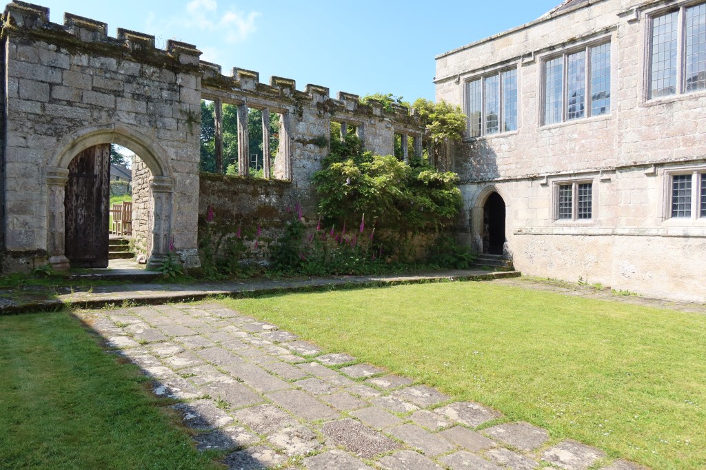
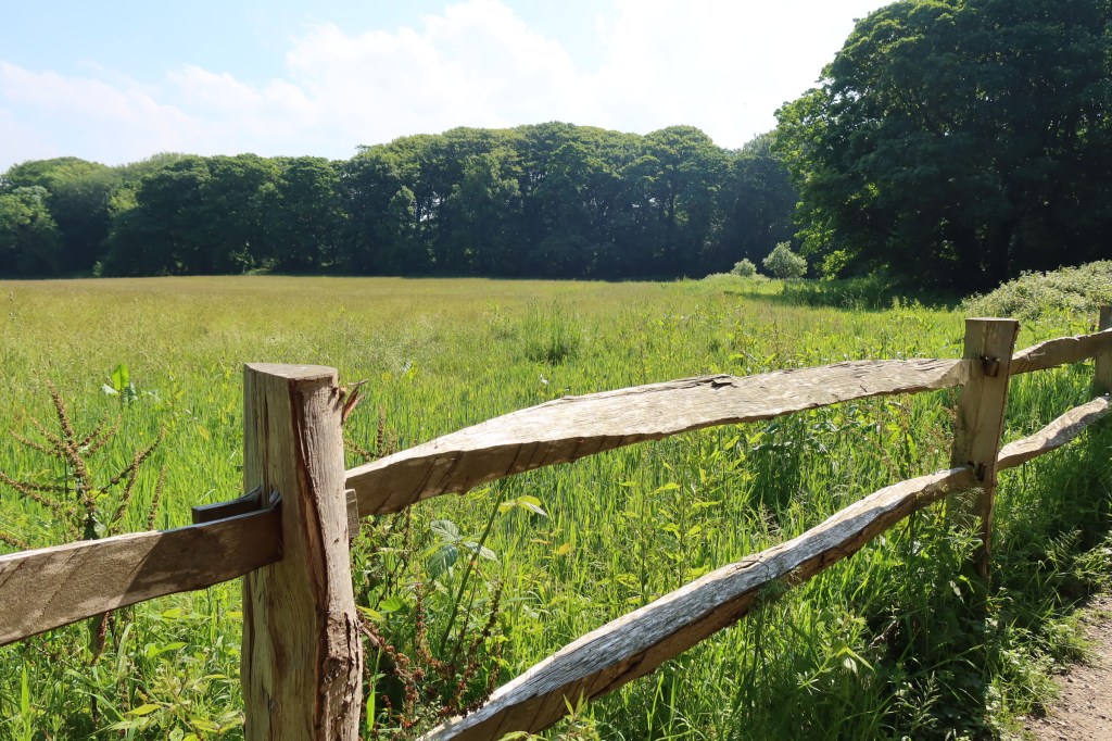
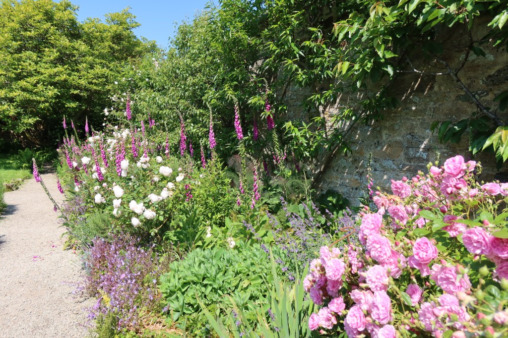
Getting fresh air and exercise became a part of our daily routine, early mornings sorting the house, followed by appointments with solicitors or funeral directors and then a good walk in ‘the nature’ to soothe the emotions. Cornwall is not short of a good walk. Below are a few photos from these walks.
Godrevy Beach, St Ives in the far distance.
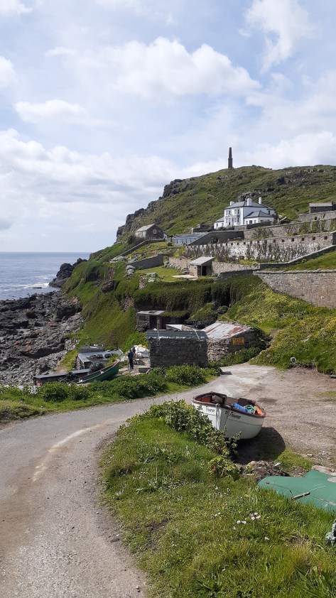
Cape Cornwall.
On the cliffs overlooking Hell’s Mouth.
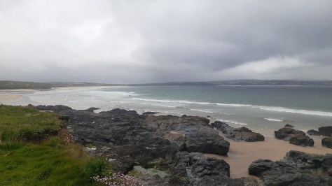
Gunwalloe Beach
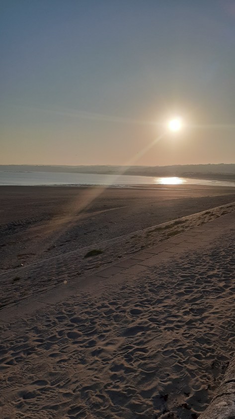
Marazion Beach, looking towards Penzance.
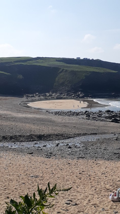
On the way to Nanjizel
Men an Tol
On the cliff at Treryn Dinas, Porthcurno Beach in the distance.
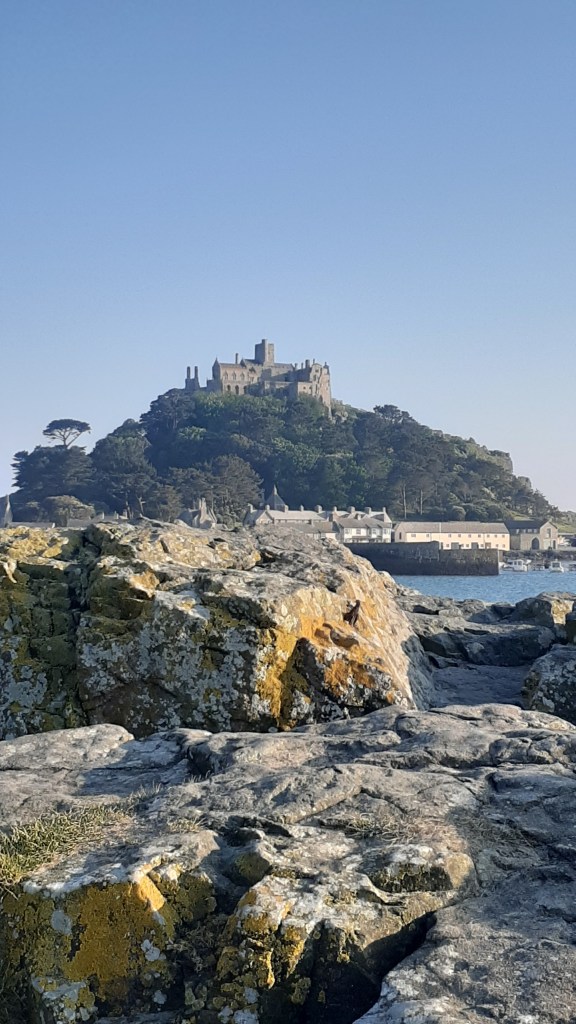
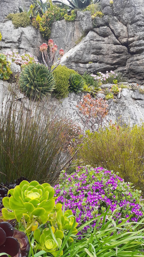
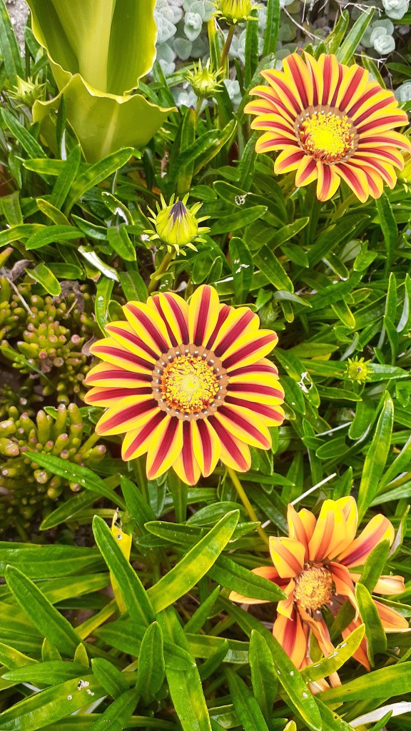
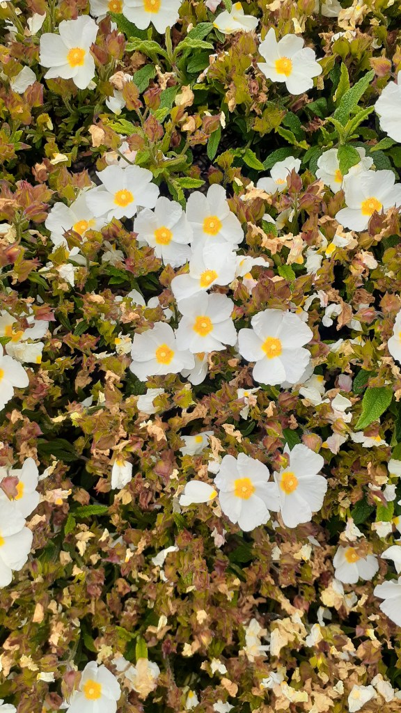
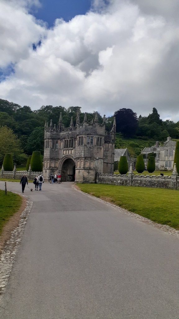
There were some days when we had more time on our hands and on these days we ventured a little further afield. As members of Heritage New Zealand we are allowed to visit both National Trust and English Heritage sites free of charge – Lanhydrock, Godolphin House, Restormel Castle. Tintagel and the gardens at St Michael’s Mount were all on the list.
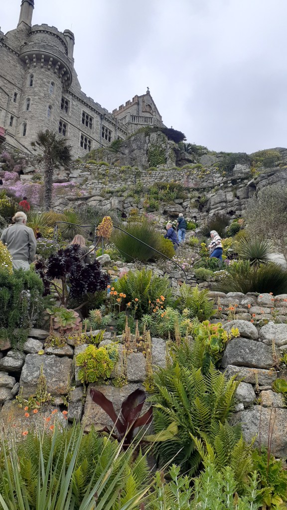
The Gardens at St Michael’s Mount
Why just the gardens? We had visited the house on several other occasions and given the time of year and how busy it was we thought a good nosey around the gardens – which are not always open – would be nice on a sunny day.
The gardens are situated on the lower terraces of the mount facing towards the Lizard Peninsula. They were first designed in 1878 for Sir John St Aubyn (later the first Lord St Levan). This part of the island has a microclimate and is able to grow a number of plants you would not expect.
The following are just a few photos of the gardens.
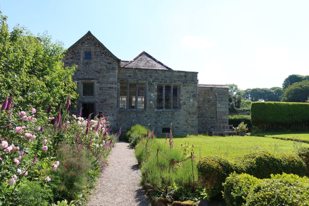
Godolphin House
One of my favourite houses to visit in this part of Cornwall is Godolphin House. Only open to the public a few times a year (the house is let out as a holiday let), although the gardens and estate are regularly open to enjoy for walks and cups of tea in the little cafe. The story of Godolphin House is one ‘enormous mineral wealth, heavy industry, agriculture, high political office, war, decline, ruin and eventual rescue – a living timeline through Cornwall’s history’.
As the above quote would imply Godolphin House has a long and winding story to tell and is perhaps one for an article of its own. For now enjoy the following photos and if you do ever get a chance to visit the house, do so.
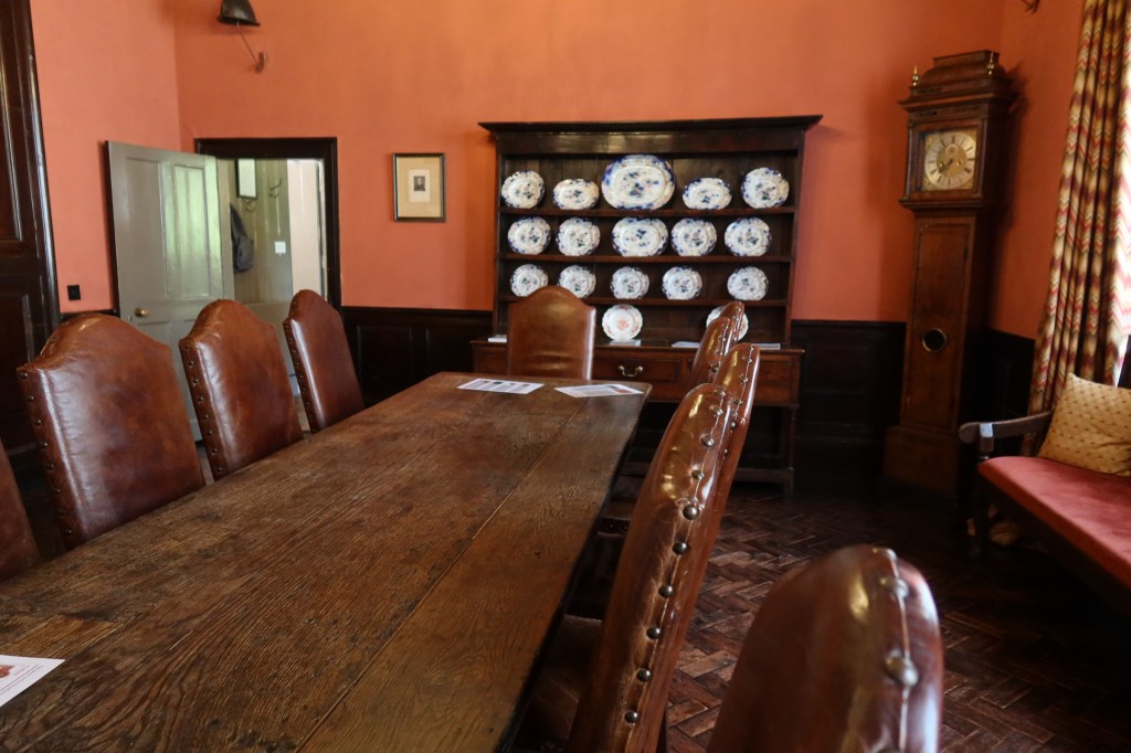
Lanhydrock
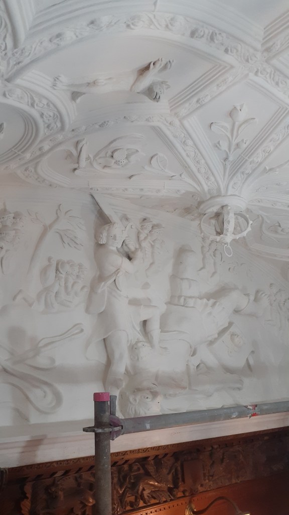
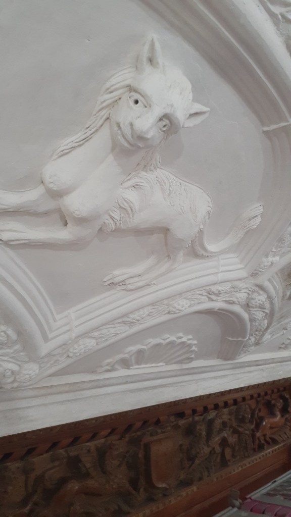
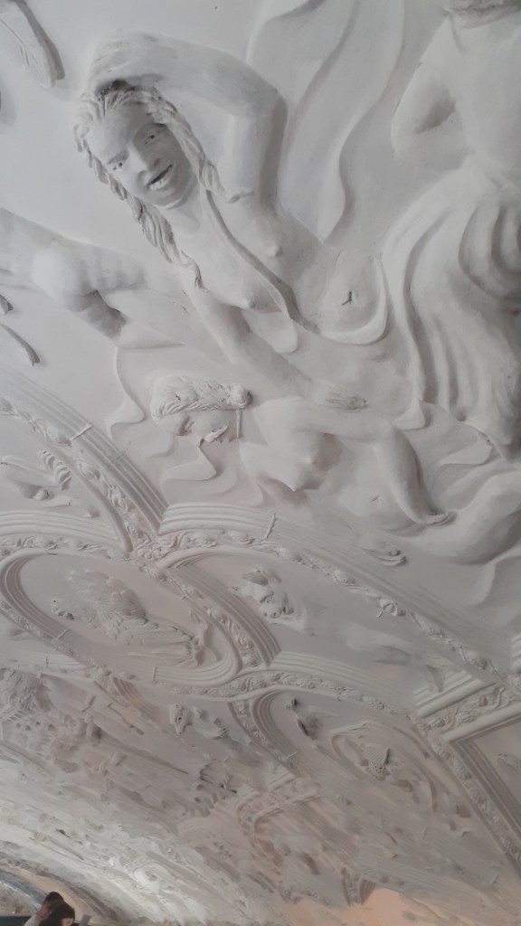
This particular National Trust House and Estate was much further afield. At the time of our visit the house and its contents were undergoing restoration work. Interestingly rather then block off sections and prevent people from viewing the work, the visitor was granted an opportunity to see what happens when a house of this size needs some love and attention. Our visit coincided with the restoration work on the ceiling of the hall and visitors were able to go onto the scaffolding and get a close look at a space that normally only the eagle eyed could view.
Below are a couple of photos of the ceiling.
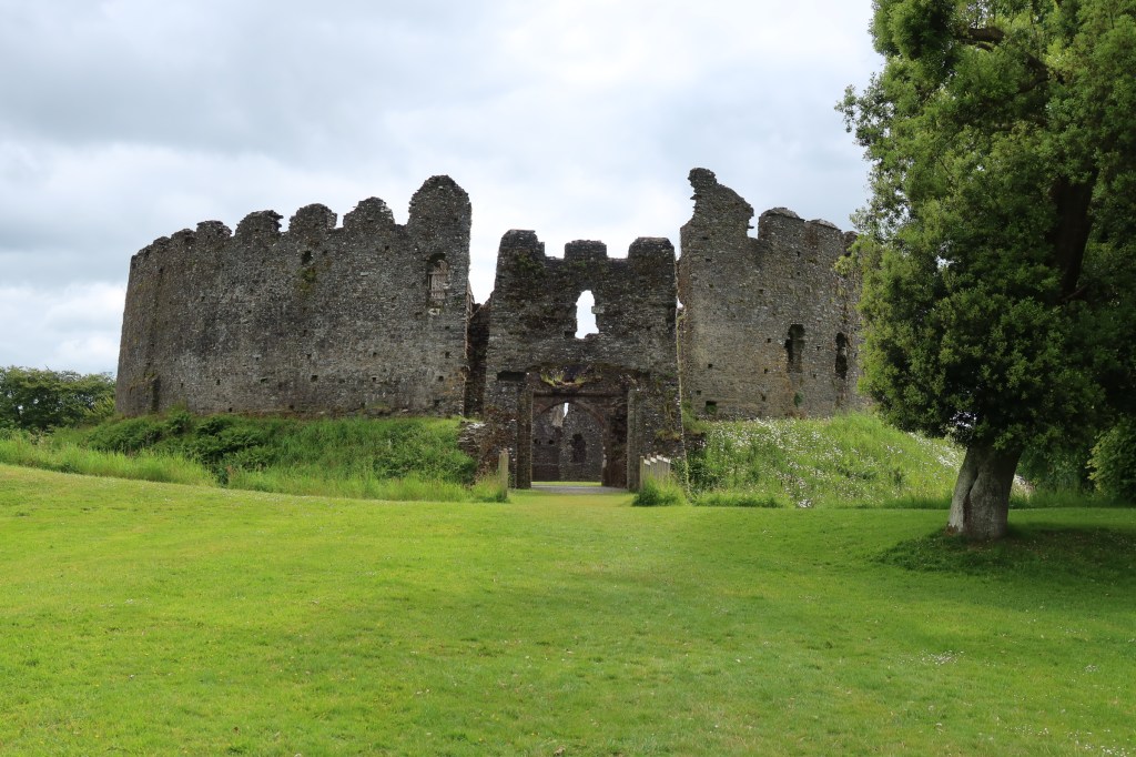
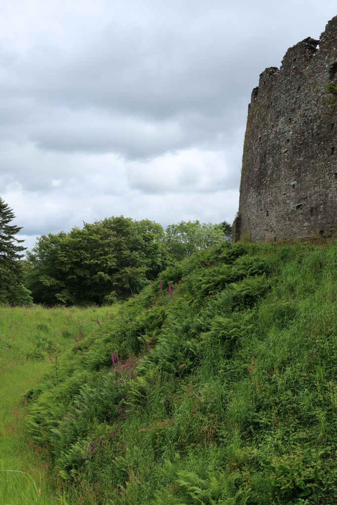
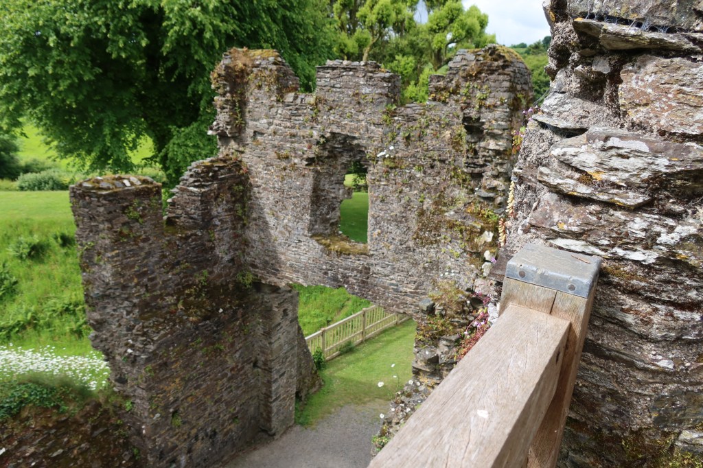
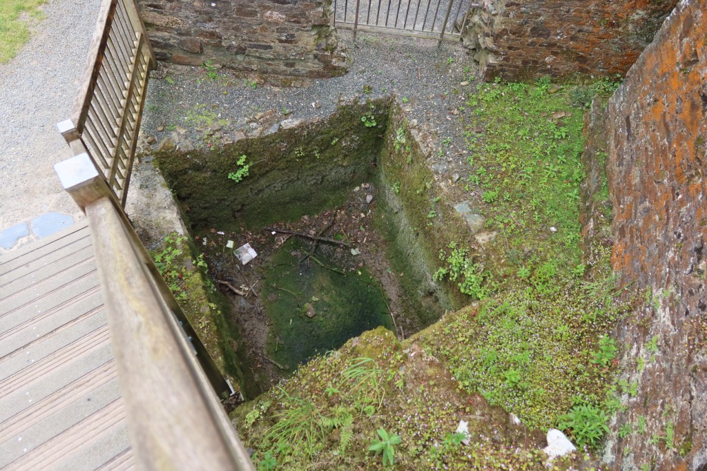
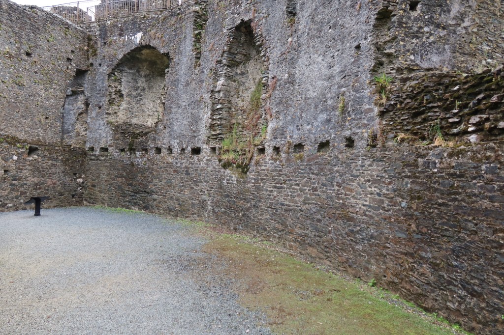
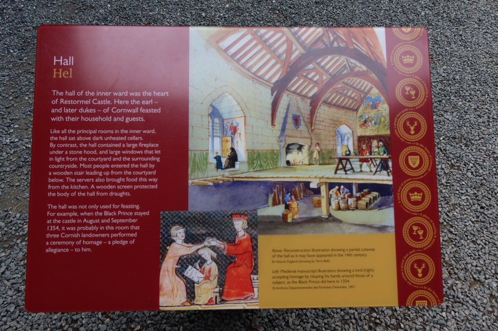
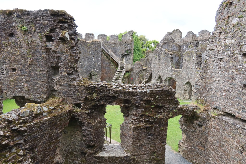
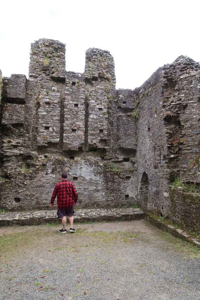
Restormal Castle
Our visit to Restormal Castle occurred as we were leaving the county, having done all we could. The castle providing a welcome pit stop and distraction.
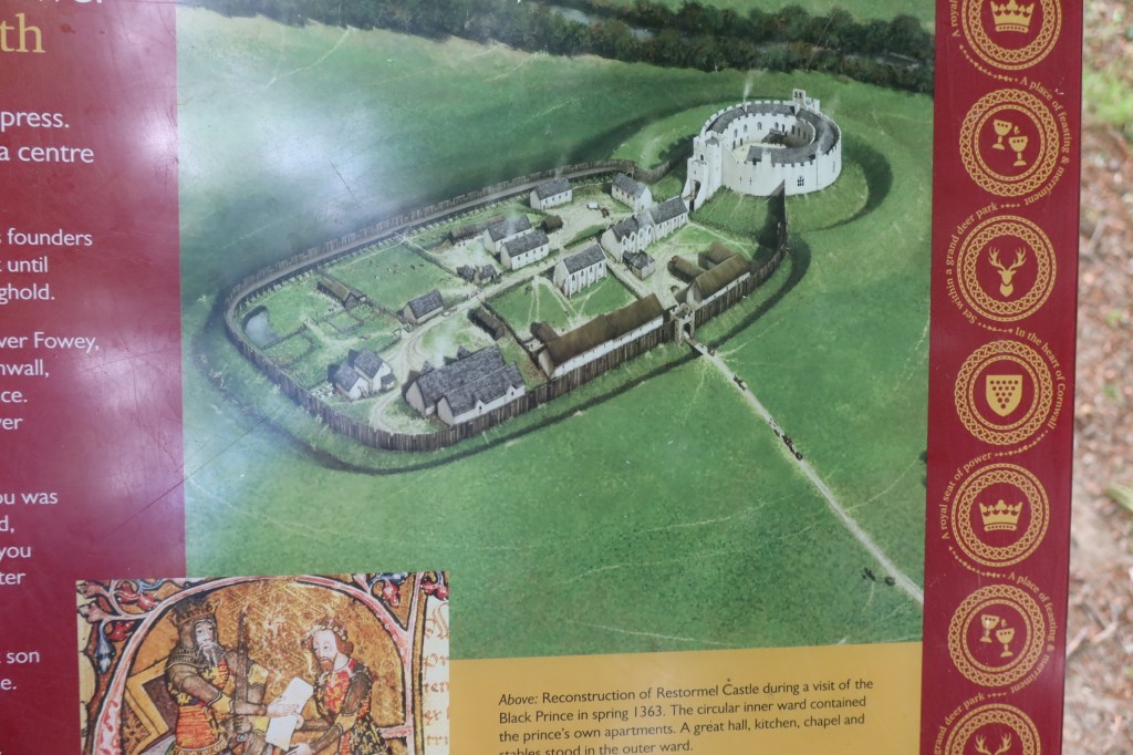
The early history of the site is not well understood, there is some evidence for a mid 12th century date but it the history from the 13th century onwards which is better understood. From the mid 12th the land on which the castle stands belonged to the Cardinham’s – a powerful landowning family from central Cornwall. In 1268 Cardinhams’ heiress, Isolda de Tracy, granted to Richard Earl of Cornwall and King of the Romans, the town of Lostwithiel – a fishery on the river Fowey – and the castle of Restormel, complementing his castles at Launceston and Tintagel. In 1270 he acquired a fourth castle at Trematon.
Earl Richard died in 1272, only four years after acquiring Restormel, so it seems more probable that it was his son Edmund who built the present castle. Edmund’s work at Trematon Castle is documented and provides a parallel. However, by the 1330s (and after the castle had changed hands a few times) documents refer to the castle being in need of repair. 1337 saw the son of Edward III being made Duke of Cornwall (also Edward – the Black Prince), along with a significant endowment of land and properties – including Restormal Castle.
This was a high point in the history of the castle, with many repairs and improvements being made to it and the surrounding park land. Apparently more time and money was spent on the boundary to the park land than on any other feature, an indication of its importance as a hunting park.
The history of the castle and its surrounding is one of neglect, repair and neglect once again. More can be found on its history here.
These are just a tiny fraction of the many places a person can visit in Cornwall, so I hope you have enjoyed this short meander through the county.
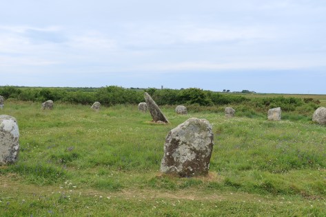
Boscawen Un stone circle
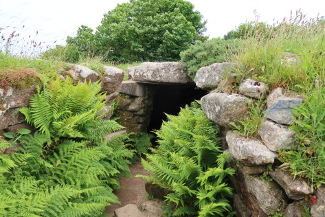
The fogou at Carn Euny
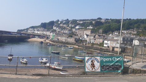
The village of Mousehole
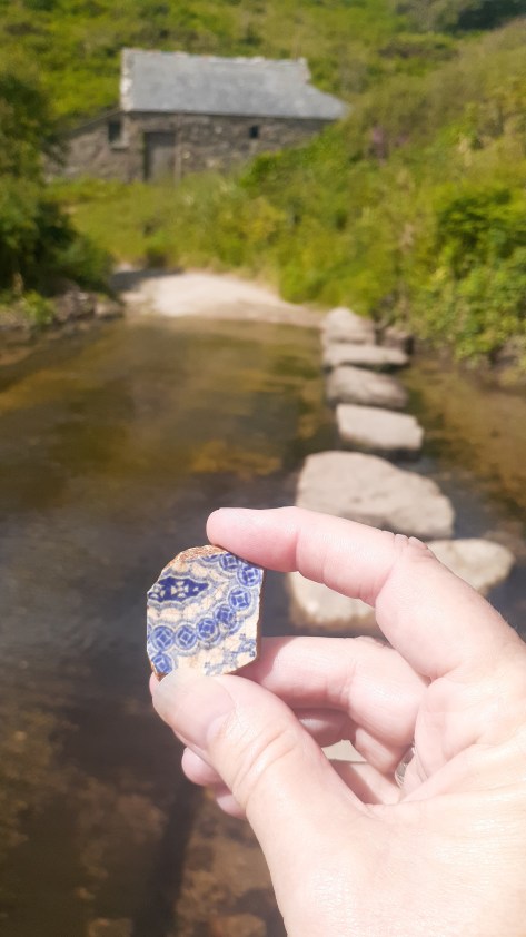
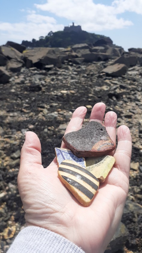
Finding pottery at Penberth cove
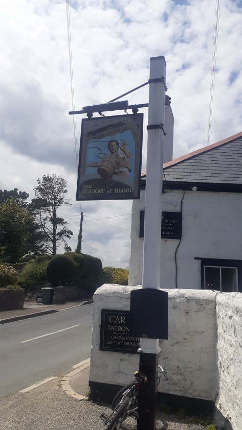
The Bucket of Blood
Finding pottery near St Michael’s Mount
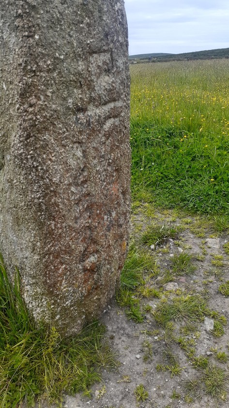
Men Scryfa – an inscribed stone near Men an Tol
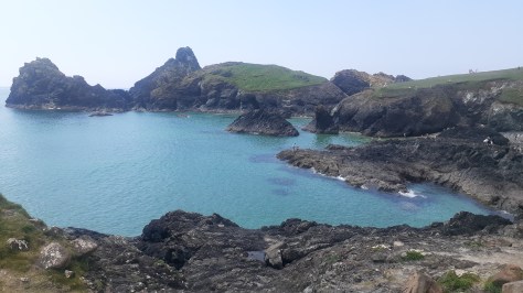
Kynance Cove
Looking towards Mounts Bay
In memory of Christine Rowe and Alan Dalton – gone too soonbut never forgotten.
I was recently browsing a second hand bookshop (not an uncommon thing in my world) when I spied a small but curious book. The title ‘The Curious Cures of Old England’ had me hooked and on further investigation it found its way into my possession. The following is but a few of these curious and bizarre cures used by people when times were desperate.
Aches, pains, blemishes, maladies, disease, wounds and breakages, all of these and more have plagued our world since the beginning of time. The ways in which people have dealt with such issues has varied in terms of methodology and levels of success.
One of the most common ailments to afflict humankind is the headache and if blood letting was not your cup of tea then you could try one of the following.
Place a cabbage leaf or large lettuce leaf in your hat to cool your head.
Gargle mustard.
Tie a piece of hangman’s rope around your head, the fresher the better (these can be bought from your local hangman).
If the above was not available try a snakeskin.
Rub your temples with half an onion.
A poultice of raw potato.
And when all else fails there is always opium (please note I am not suggesting that you do this only that was what done ‘way back when’).
Headaches can sometimes be a precursor to other ailments such as the common cold, nowadays we take some paracetamol, drink plenty of fluids and spend the day in bed. In the past there were more inventive methods to deal with coughs and colds…
Soak a thick piece of toast in vinegar and bind it your throat.
Go to bed at night with a dirty sock or stocking around your neck with the heel (very specifically) on your larynx.
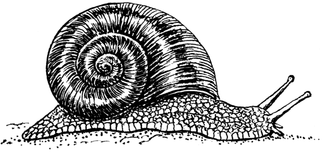
Extract the juice from a bucketful of snails by adding some brown sugar and hanging over a bowl in a meat cloth overnight – the resulting liquid was said to cure sore throats.
Stick orange peel up your nose.
A chesty cough can be healed with two drops of turpentine on a lump of sugar (please don’t try this at home).
Or strap rashers of bacon to the chest area (waste of good bacon…)
Or make a vest of brown paper and goose fat.
An earache can be helped by sticking a variety of things in your ear – snail juice, a cockroach dipped in oil or a garlic clove dipped in honey.
Serious bronchial problems can be solved by inhaling the breath of a cow.
A serious childhood complaint was that of whooping cough and our ancestors had some rather bizarre means of dealing with it.
Pass the child under the belly of a donkey (particularly popular in regions with a lot of donkeys).
Rub the feet with hogs lard and keep the child warm (the last is quite sensible).
Swallow four wood lice in a spoonful of jam or treacle.
‘A field mouse skinned and made into a pie, then eaten, the warm skin bound hair side to the throat and kept there nine days…’ (as from The Bedale Book of Witchcraft).
Or ‘catch a frog, open its mouth then cough into three times, then throw the frog over your left shoulder’ (also from the above book).
An Irish remedy from the 17th century says to put a live trout in the child’s mouth and then throw it back into the water – the trout will carry off the cough. But if you can’t manage a trout a frog is a good subsitute.
Pluck a hair from the child and feed it to the dog.
Tie a spider in a muslin bag and hang over the mantelpiece.
Make a broth from owls and feed to the child or try some fried mice or make cakes from barley and the child’s urine…
Sore eyes and cataracts had cures for which the wildlife of old England needed to be afraid of…
A 6th century cure tells the sufferer of cataracts to catch a fox and tear out its tongue, releasing it back into the wild. The tongue should be carried around wrapped in a red rag.
Or, bind the lungs of a hare over the eyes.
Or, lick the eyes of a frog (?!), chicken dung, a salve of a lizard, bats blood or blood taken from the tail of a black cat were all believed to be equally effective.
The Anglo Saxons used the lungs of a squirrel to bandage sore eyes.
If you didn’t fancy hurting an animal, the spittle of a starving peasant may well help…
The past was a dangerous place and physical injury/wounds were areal threat but don’t fret they had a cure for that too.
A mix of red wine and earthworms with the moss from a skull of a man recently dead applied to the wound was favored by some.
Skull moss could be replaced by blood or human fat however in these cases the ointment would be applied to the object which caused the wound as some form of sympathetic healing.
Some 16th century doctors (I use the word loosely) liked to use a salve made from cats boiled in oil…
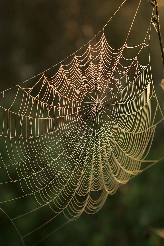
If that doesn’t appeal try covering the wounds in spiders webs.
Minor cuts could be treated with toasted cheese, mouldy bread or tobacco and calf dung mixed with crushed earthworms.
Broken bones could be healed by swallowing powdered dog skull (or the more traditional tea of comfrey).
Plagues and pestilence were an unknowable part of life in times gone by and indeed as recent events have demonstrated it remains the case. In 1348 the Black Death struck England, devastating the population. It made regular reappearances up until the 17th century by which stage many realised prevention was better than a cure. Some preventative measures included –
Prayer
Onions – the smell of which was believed to purify the air.
Beer – as sold by the Green Dragon Tavern in Cheapside.
Stay indoors with the windows closed.
Don’t eat fish, waterfowl, poultry or beef.
Don’t cook in rainwater or olive oil.
Avoid exercise, sleeping during the day and bathing.
And, weirdly, catch syphilis…
If you did catch the Plague then possible remedies included – pressing roasted onions stuffed with treacle and figs against the buboes or drying a toad over an open fire and pressing against the swollen glands as a way of drawing out the disease. Not to mention the plague pills and cordials which all guaranteed prevention and/or cure against the plague.
Beyond the extreme case of the Black Death, there was cholera, tuberculosis and a whole range of fevers/sweating sicknesses/agues to contend with. Once again, the cures sometimes can be worse than the cause.
A cure for cholera involved the drinking of rhubarb juice or rosehip syrup.
A recipe for a life saving stew against tuberculosis (consumption) begins tamely – pieces of chicken flattened with dates and herbs, add pearls and gold and cook in a pot, in another pot…oh and the chicken, which is actually a cockerel has to be torn to pieces while still alive…
Or you can eat slugs…
Or drink snail soup.
For an ague the right foot of a black dog hung over the right arm.
Or, boil the contents of a horses hoof in water – although it is not clear if it should be drunk or bathed in…
Fasting for seven days, eating only seven sage leaves or woodlice rolled into balls or eating a spider could effect a cure for fevers, chills and sweating.
A Tudor remedy for sweating sickness was to take half a nutshell of unicorn’s horn in three large spoonfuls of dragon water, but only if you were rich enough.
Or, you could use a combination of mercury (please don’t), marigold, endive and nightshade.
Perhaps one of the most common cure all that many would have heard of was the act of blood letting either by way of leeches, cupping or scarification (small cuts into the skin). This particular form of healing has a history going back into the distant past, Hippocrates who lived in the 4th and 5th centuries BC and who is considered the father of medicine highly recommended it.
The biggest issue (and there were several) was regarding how much to take, some believed that the job wasn’t properly done until the patient had lost all sensation and fainted – today we would say they had gone into ‘shock’ – and for many this would have been their undoing.
Leeches have an interesting history in this story, they could be applied all over for bleeding purposes. All manner of issues could be solved with a good dose of leechcraft – earache, tonsilitis, gout, headaches and mental illness to name a few. Their use fell out of fashion in the 19th century only to be revived in the mid 20th century as an aid in skin grafts etc, the anticoagulant in leech saliva encourages blood flow and has anesthetic and an antibiotic qualities.
An extension of bloodletting was the next step in any serious illness to purge a body by means of vomiting etc. Seen as a means of curing all manner of ailments from headaches, fever, bowel disorders to deafness and insanity. For a price a person could buy any number of powerful laxatives and purging pills as a cure all. Unicorn horn being the most expensive…
I hope you have enjoyed this short romp through the weird and downright bizarre world of medicinal history, if you want more (you know you do) then I recommend reading Nigel Cawthorne’s book, ‘The Curious Cures of Old England’.
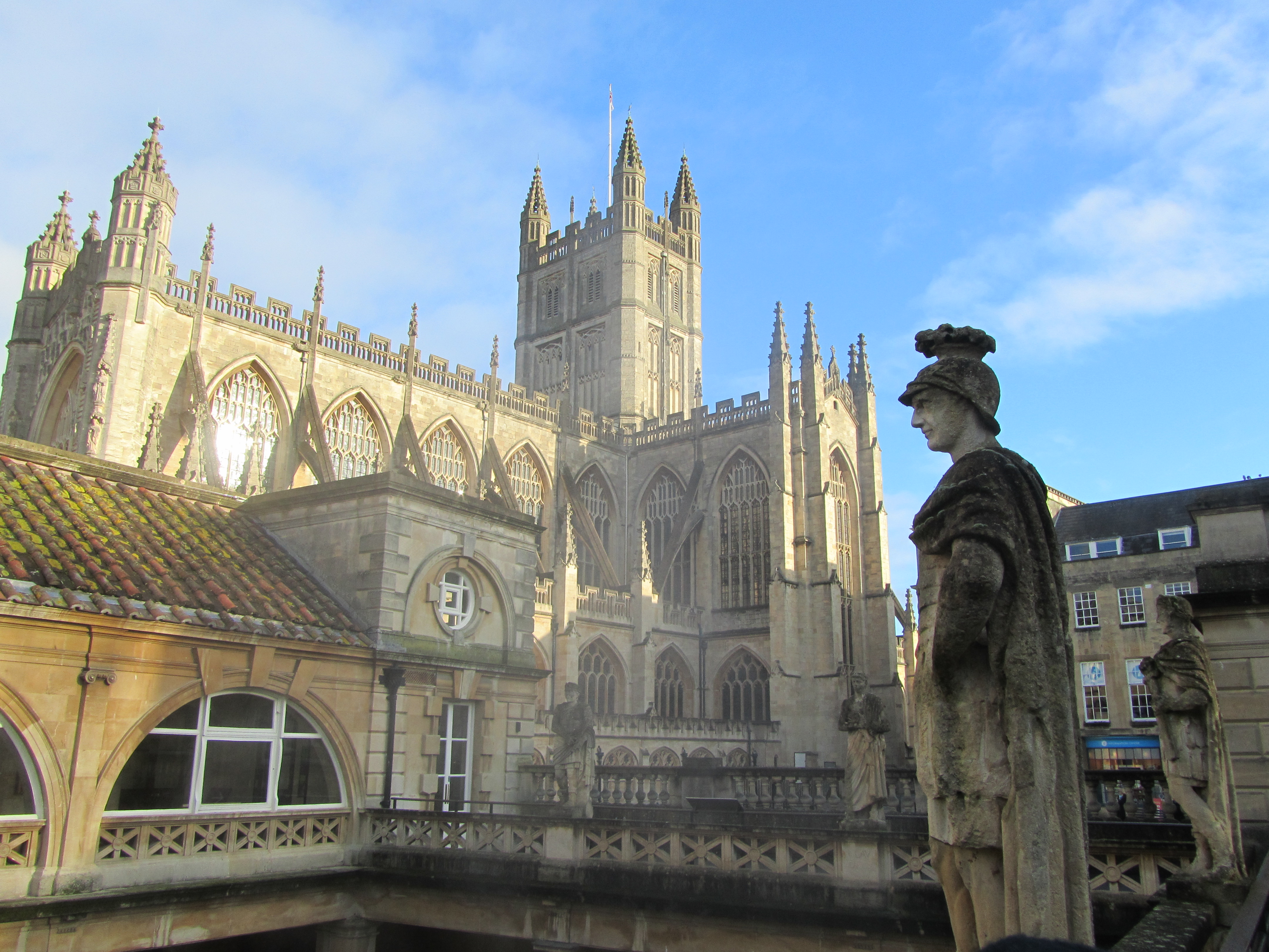
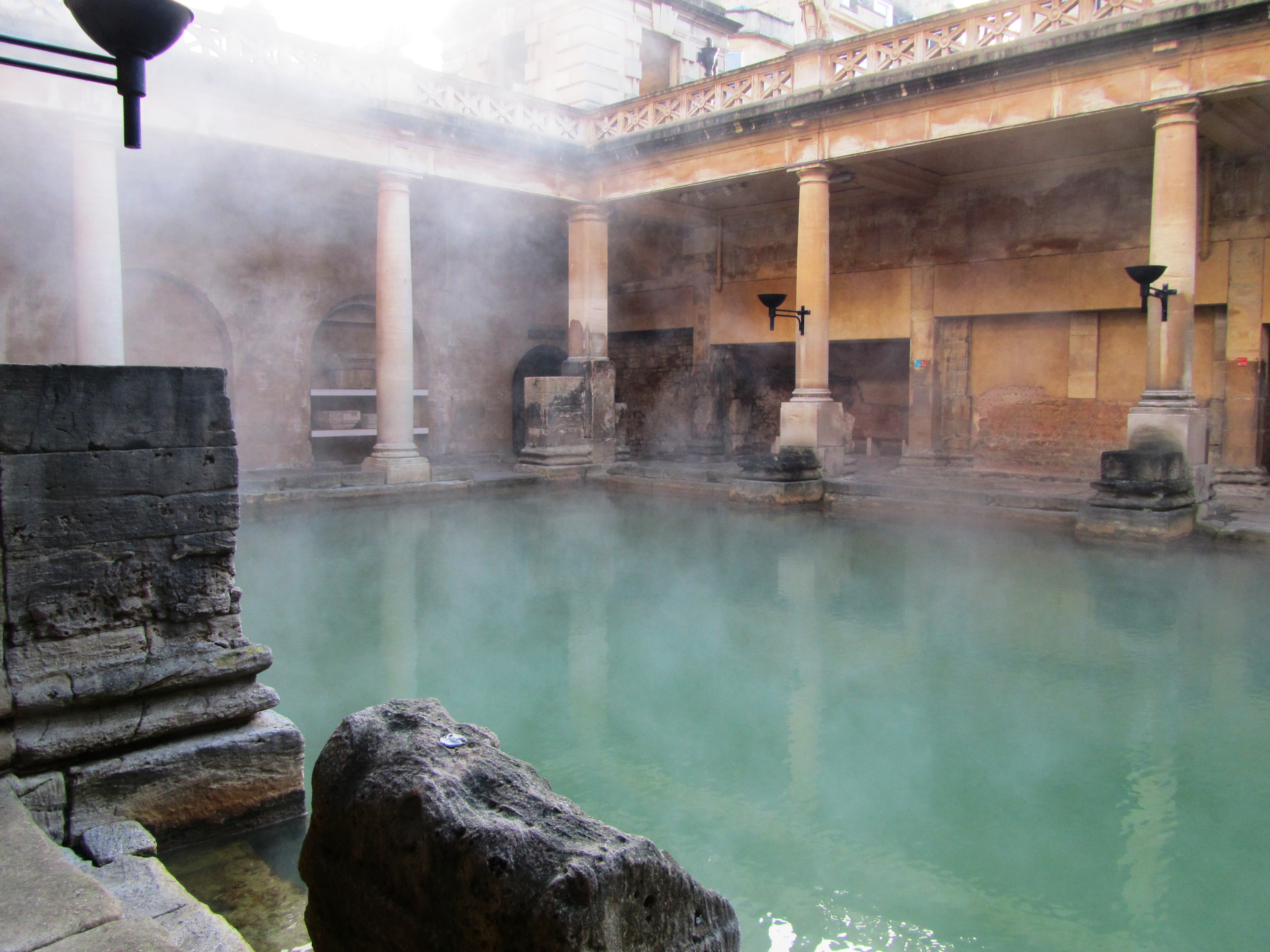
Holidaying in the UK in winter can be rather satisfying. Mainly because you don’t have to contend with the vast crowds which are usual in the warmer months at popular spots. One such place was the Roman bath complex in Bath, here we were able to meander around the buildings and displays without being jostled by eager tourists trying to capture the perfect selfie. This physical space allowed the imagination a chance to wander the halls of time. A multitude of questions and possible scenarios playing out in my minds eye and so ‘A Roman Moon’ was born.
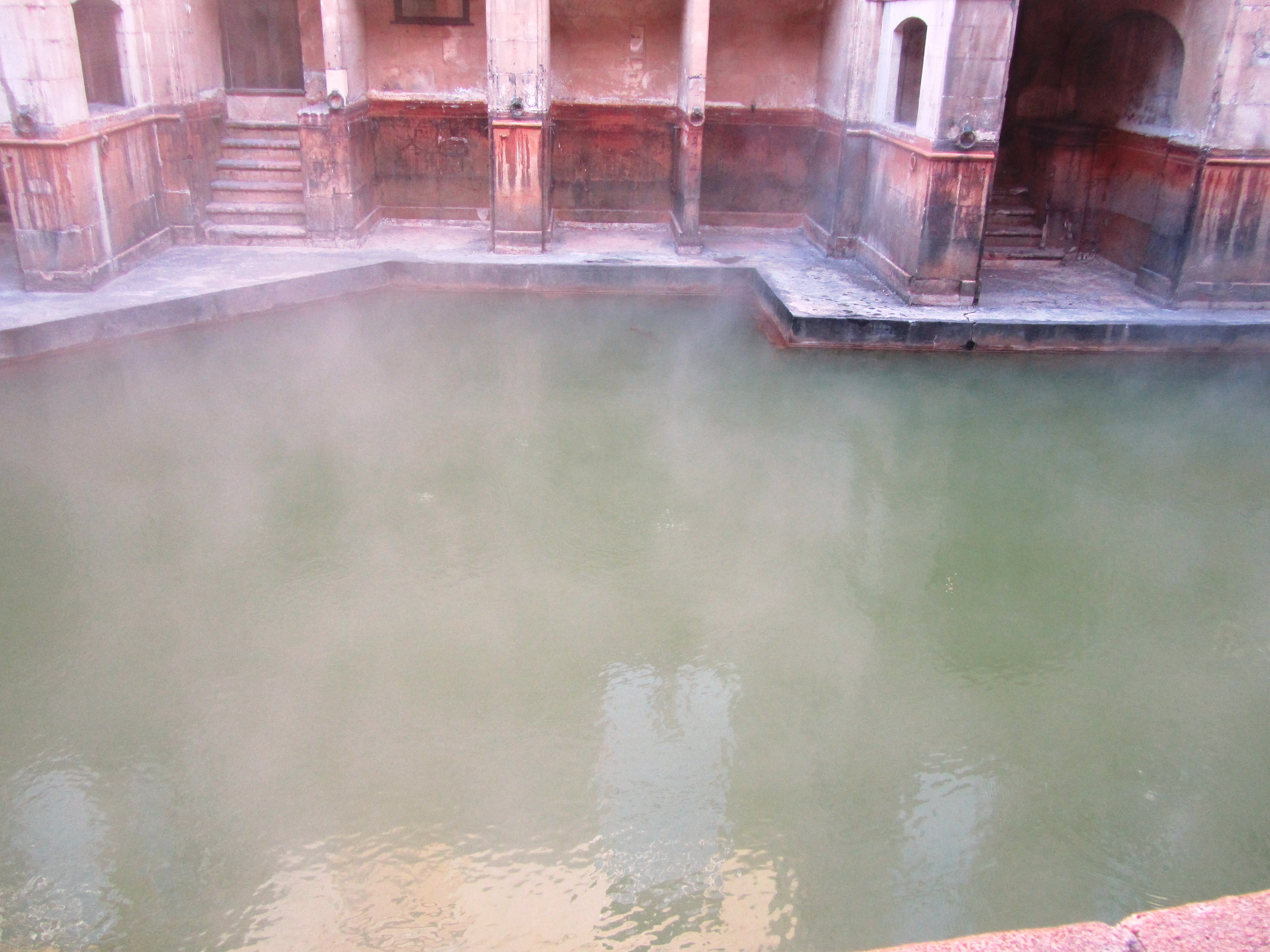
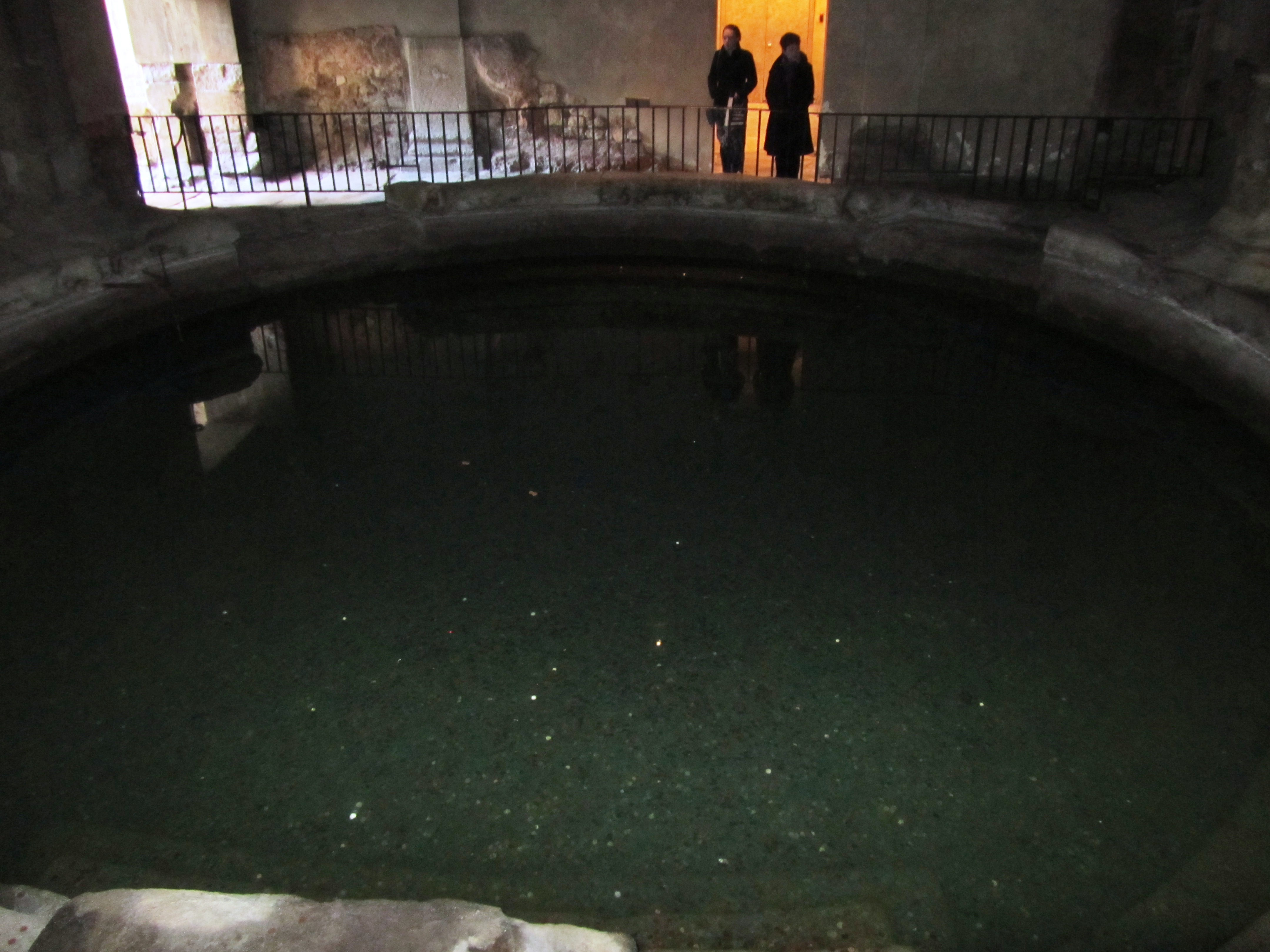
The imposing stucture of Bath Abbey looms over the now open Great Bath – originally the Great Bath would have been roofed, most likely with an arched roof.
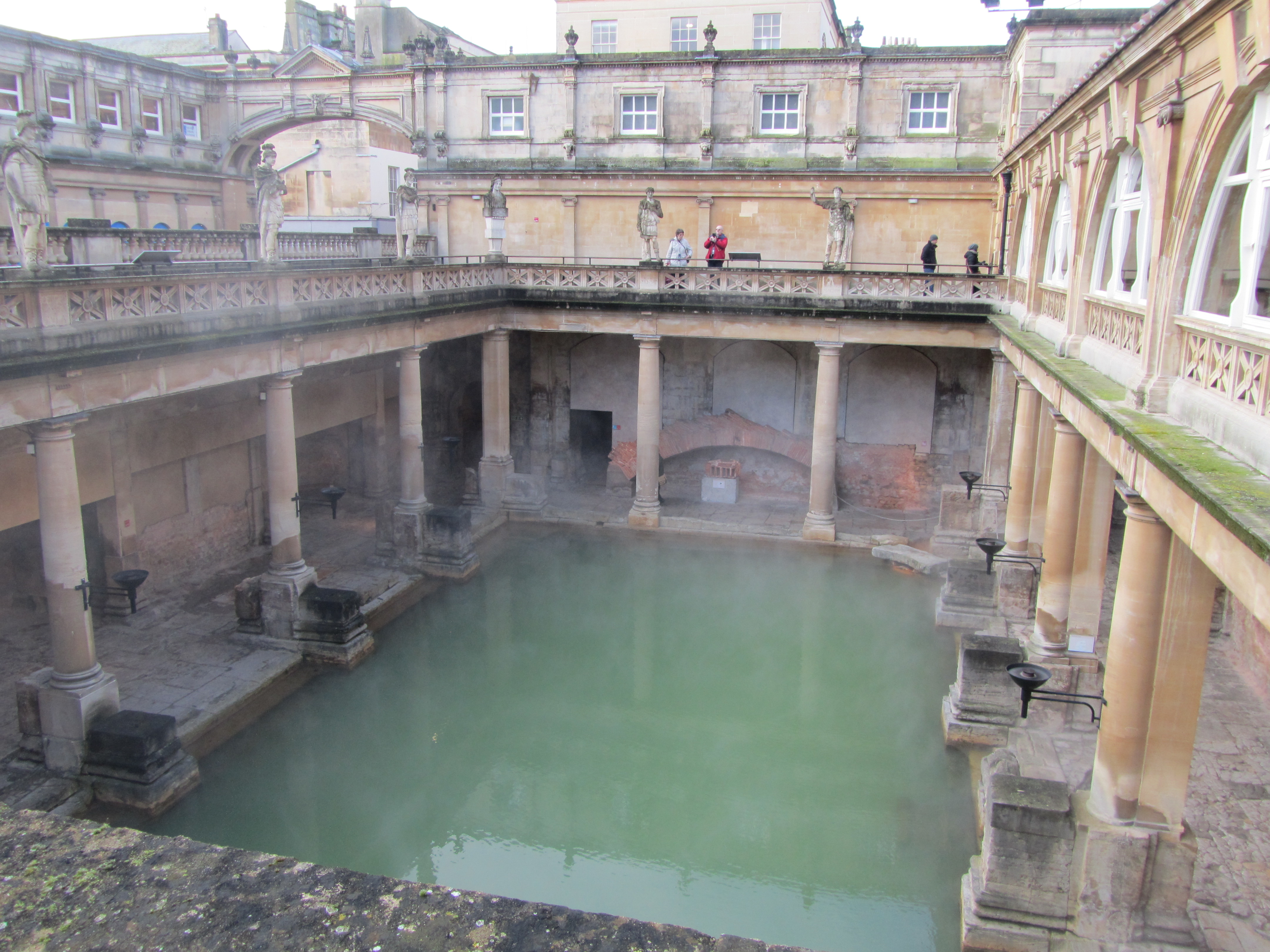
Looking down on the Great Bath.
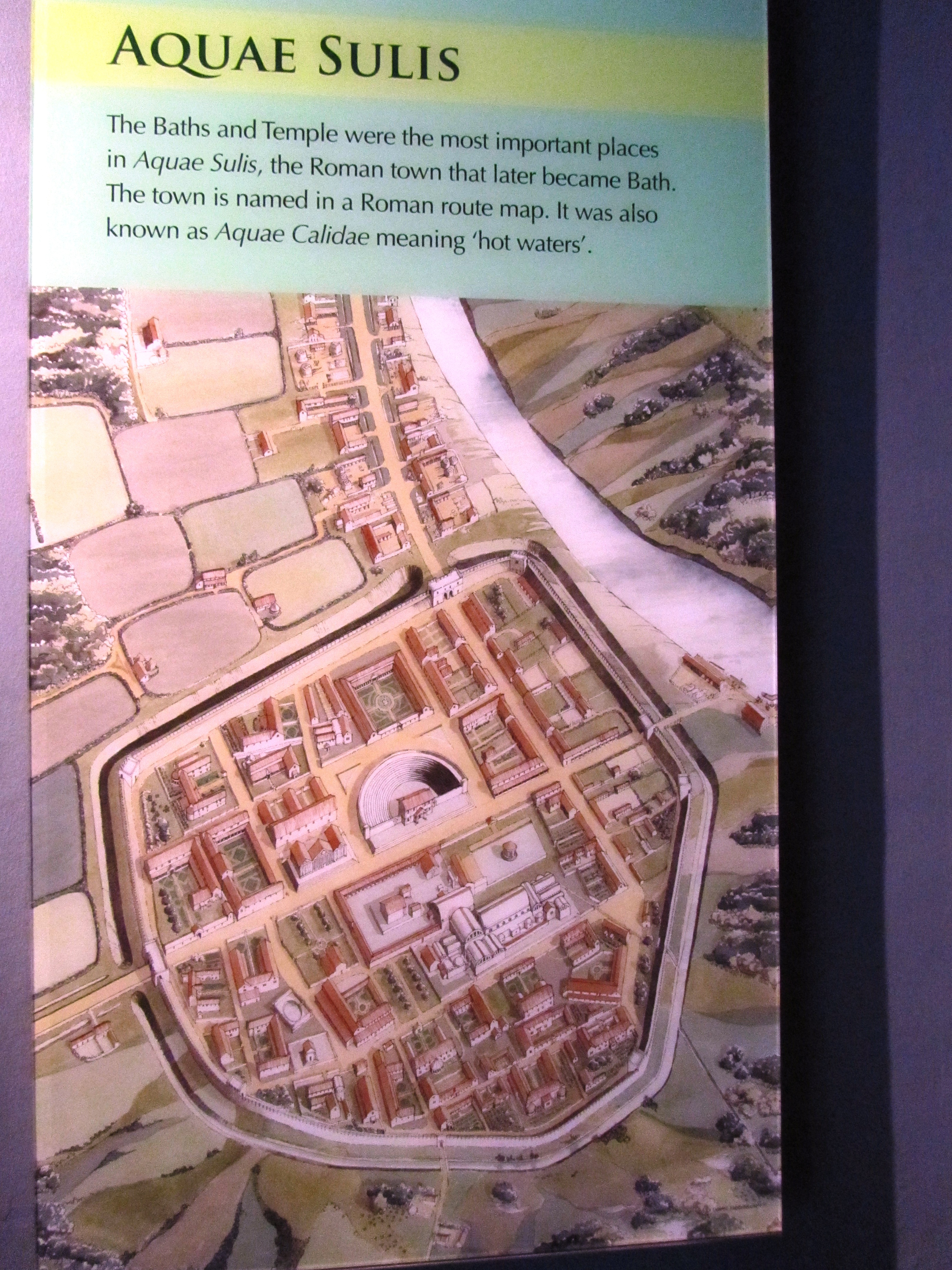
Bath complexes in the Roman period were not simply places to wash and clean the body but also places to meet, socialise, to be seen and make those all important contacts. At the Roman town of Aquae Sulis (Bath) the baths rose to prominence from the late first century AD as a result of the natural hot springs which were a feature of the landscape and worshipped for many generations prior to the arrival of the Romans.
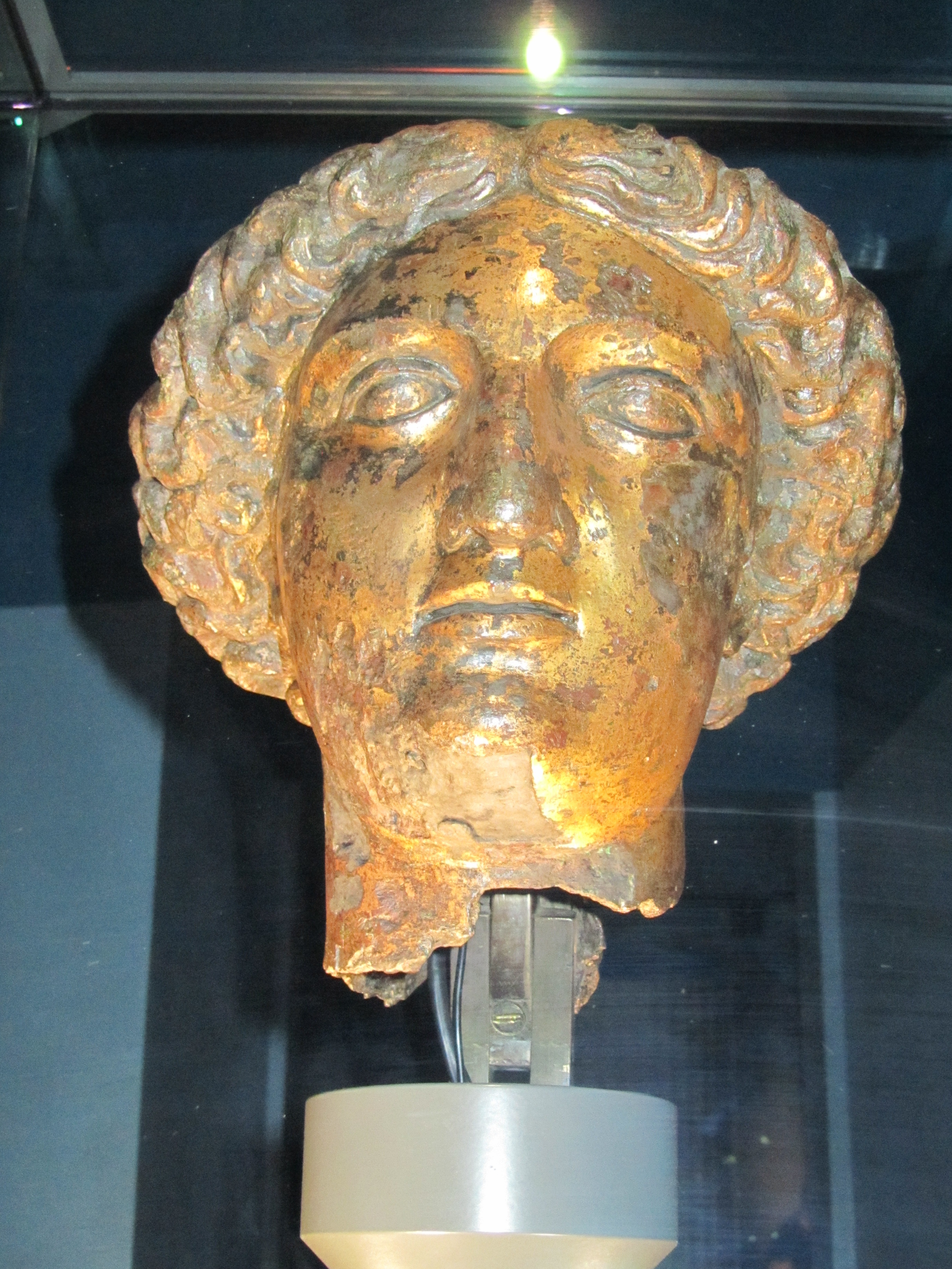
As with so many aspects of the Iron Age/Celtic landscape of the time, the natural springs here had its own diety who was recorded by the Romans with the name of Sulis. The Romans were very good at adopting and blending local cultures with their own as part of their overall colonisation package. For the Romans the local goddess Sulis had much in common with one of their own – Minerva. Thus the hot springs became dedicated to the amalgamated goddess of Sulis Minerva.
The very roman looking head of a statue believed to be Sulis Minerva herself – most likely stood within the sacred space of the actual temple.
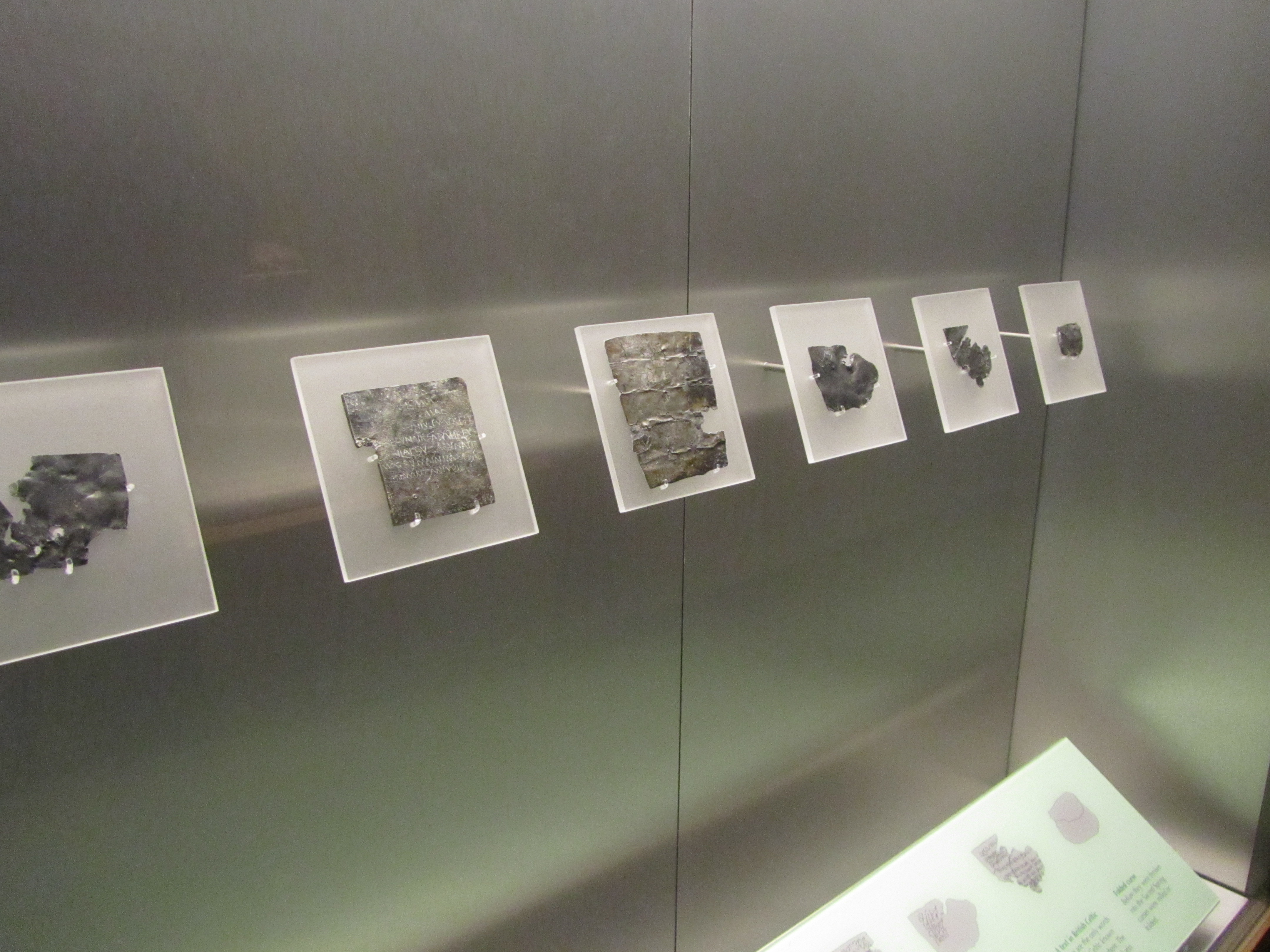
The success of Aquae Sulis (even the towns name pays homage to the goddess – ‘the waters of Sulis’) is down to it also being a place of pilgrimage. People from all around would come to the town to make offerings or petitions to the goddess. One such method to ensure the goddess knew what was required was to write a message on a sheet of lead. For this purpose a trained scribe would be employed. Once the wording was just so the lead sheet was folded or rolled and then thrown into the sacred spring – a number of these have been recovered from the spring, mostly they were curses for relatively small wrong doings.
A few examples of the inscribed lead sheets.
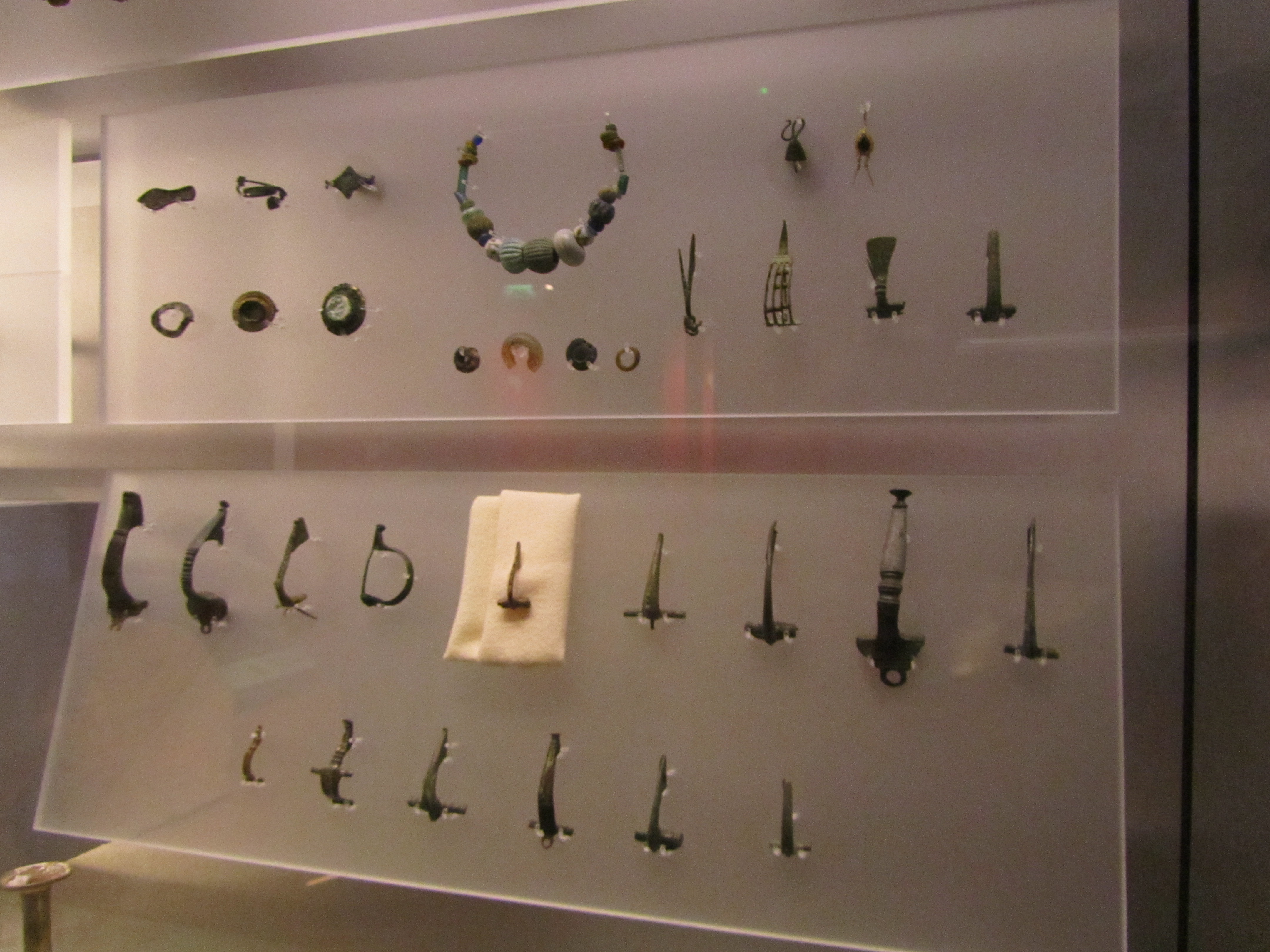
As well as the lead sheets, other gifts were found during excavations. Thousands of coins (and even today people throw coins into the spring), jewellery, pewter dishes and cups usually inscribed with a dedication to Sulis Minerva. The cups may have been used to drink the waters (as we continue to do so today) or as libation vessels. The belief in the healing powers of the spring waters was an important part of the towns fame.
Some of the jewellery finds from the spring. It is interesting to note the continuity of ritual in this act of depositing important items into a watery context. For more on this read here.
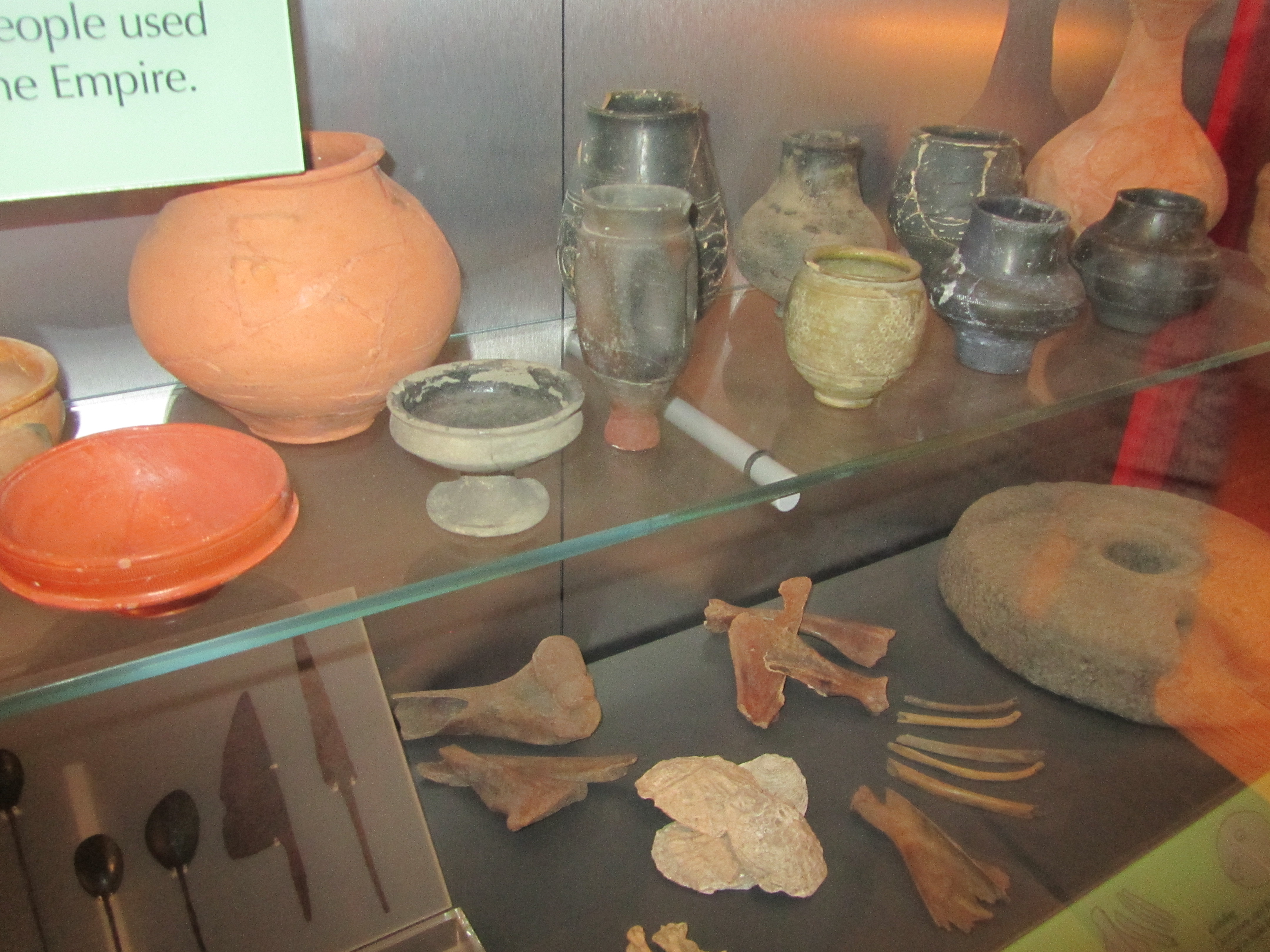
And a few of the more everyday items found during excavations – people lived and worked here too.
Besides Sulis Minerva there were within the temple complex depictions of other deities.
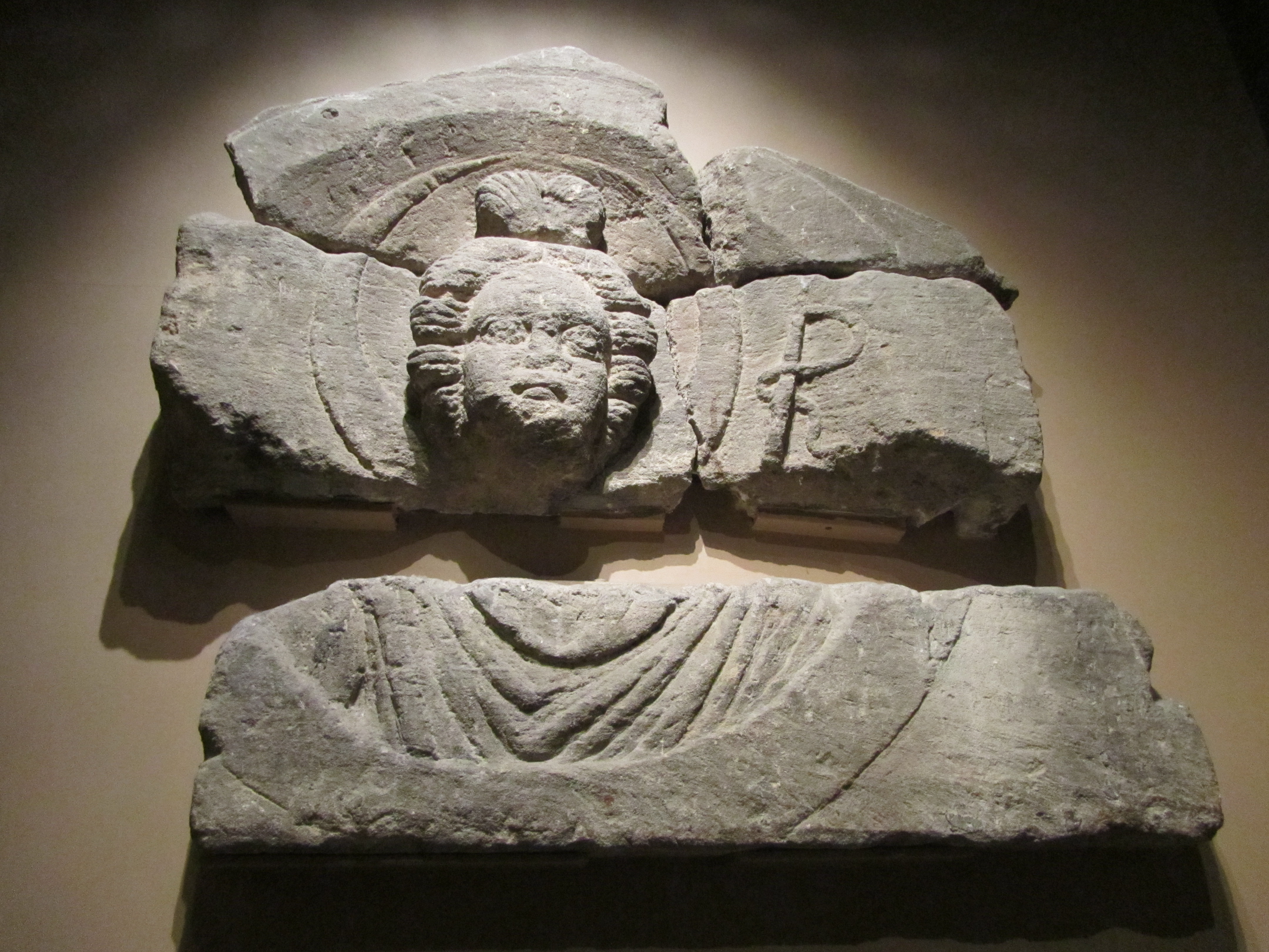
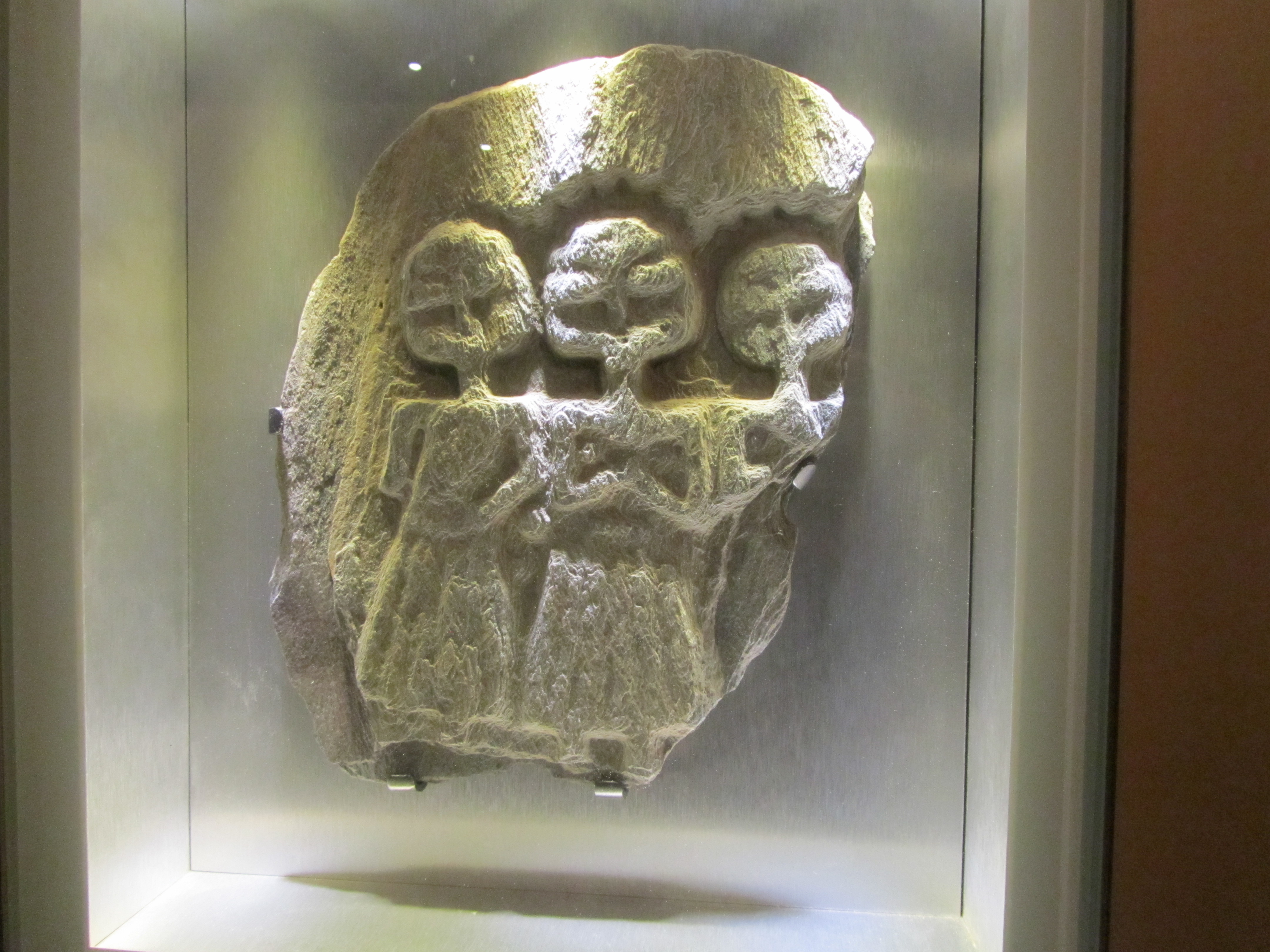
A relief carving of the goddess Luna – the disc of the moon can be seen behind her head and she holds a whip for driving her chariot across the sky. This carving would have decorated one of the buildings in the temple precinct.
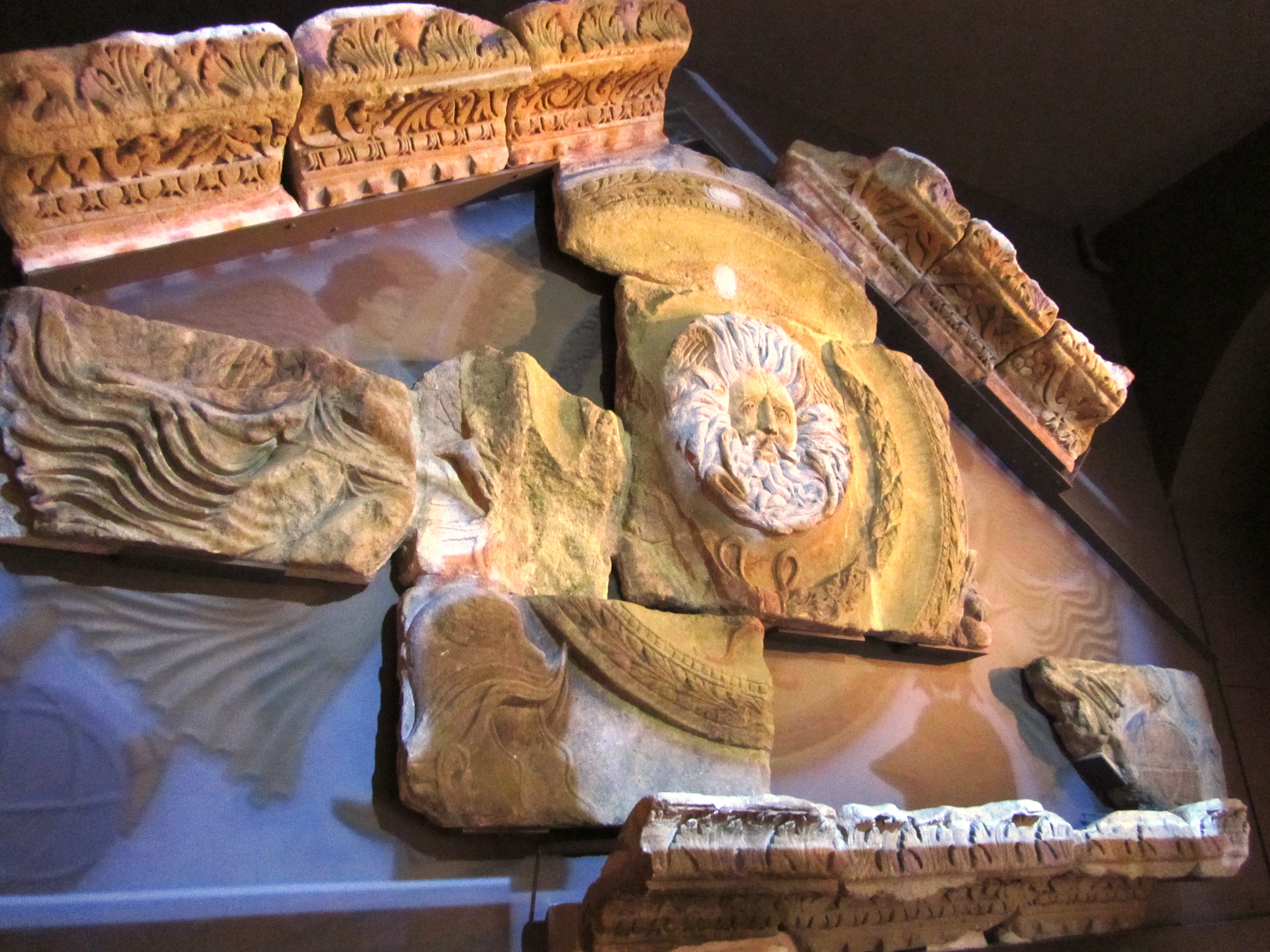
This massive pediment would have originally adorned the entrance to the temple of Sulis Minerva. Although interpreted as a gorgon others have suggested it may in fact be Oceanus or even the sun god Sol (or Bel, ‘the shining one’ if you are looking for Celtic diety which is also the nickname of our heroines bodyguard and friend…).
This unassuming relief carving is believed to depict the triple goddess, a distinctly Celtic personification. As to who and what this may be is a complicated discussion but foremost is the ability of the goddess to have many faces – to be one and the same. Often the triple goddess in modern pagan/wiccan practice refers to the maiden, the mother and the crone however there is no way of telling if this was the case in the past. An interesting take on this can be read here.
The rituals in Roman religion took place mostly outdoors, the temples buildings were often small affairs where only the priests or priestesses would be allowed to enter. Public ceremonies would have been conducted outside in the surrounding precinct. Within the precinct there would have been altars dedicated to the diety set up by individuals in anticpation of a divine favour or to give thanks, these would have been decorated in offerings of all kinds or with bowls of incense.
“The temple, in its original late first century form, was a purely classical building set on a high podium reached by a steep flight of steps. Its porch was dominated by four massive Corinthian columns supporting an ornate pediment. Behind lay a simple room, the cella, where only priests could enter to tend the flames kept burning around the life-sized cult statue of Sulis Minerva” (from ‘The Essential Roman Baths” – a guidebook).
The above is a selection of the numerous altar stones and memorials found in the Roman layers during excavations.
The complex at Aquae Sulis was quite extensive – with facilities for men and women to bath seperately which was rare and spoke volumes about the wealth of the town. At the heart of the complex is the Great Bath, a rectangular swimming bath surrounded by a walkway with alcoves for people to sit and relax in. The bath itself was and still is lined with 45 sheets of Mendip lead.
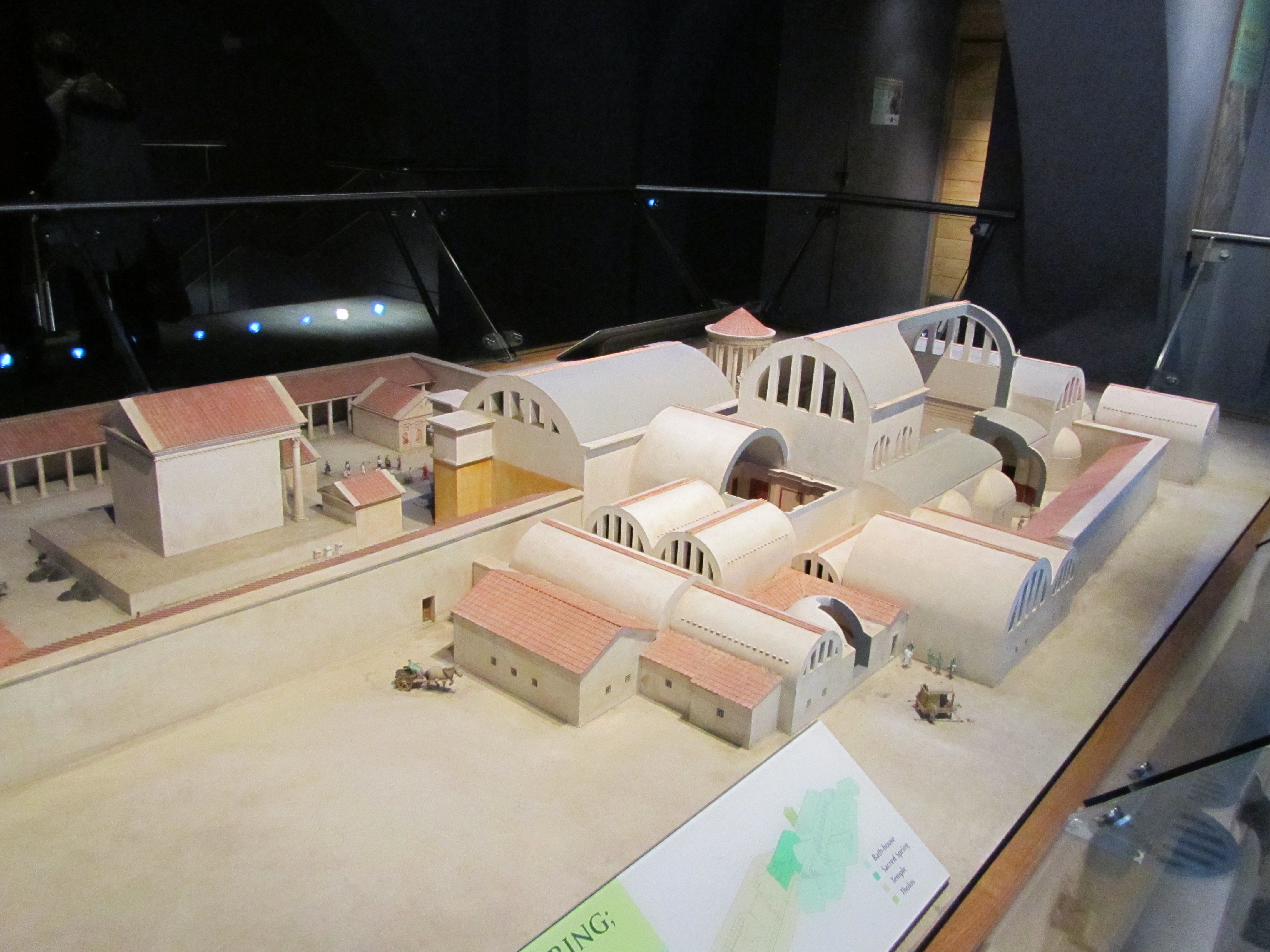
A model of the bath and temple complex in its heyday.
The Great Bath – looking across to one of the alcoves.
The East Bath – a rectangular tepid bath – the doors would have led to heated rooms known as tepidariums.
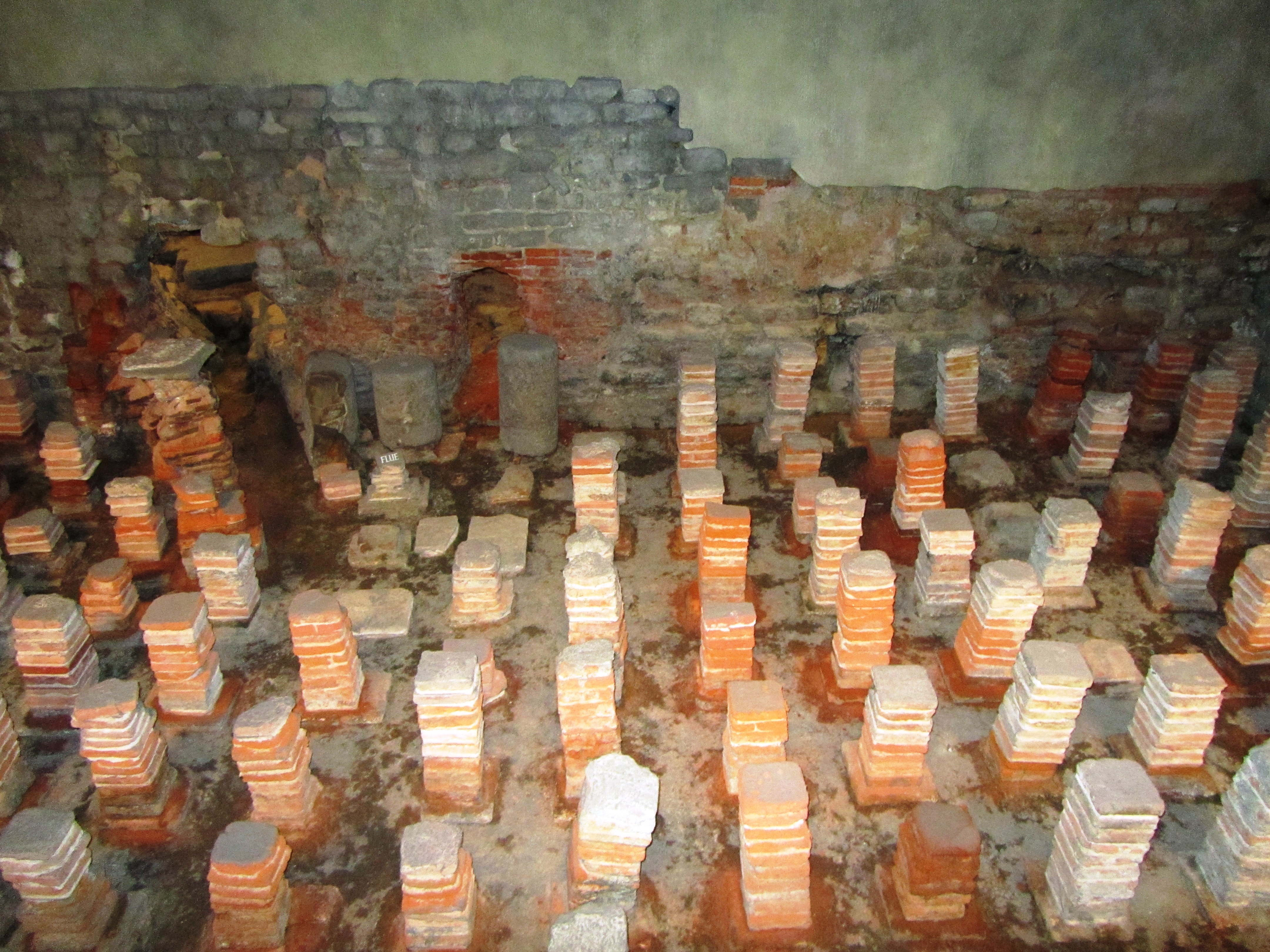
The remains of the extensive hypercaust system – ensuring visitors were kept warm and comfortable at all times.
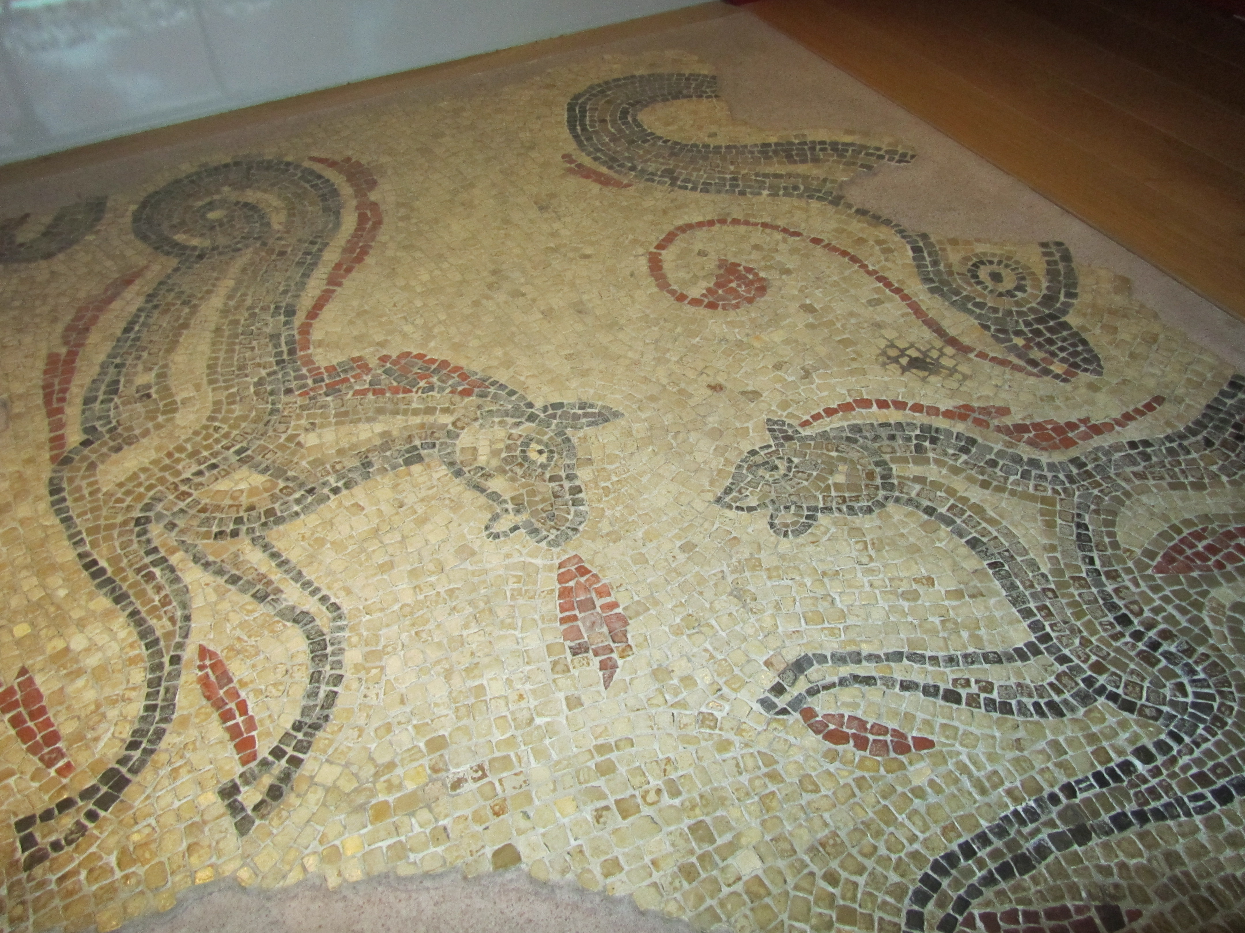
One of many mosaics which would have adorned the floors of the rooms within the complex.
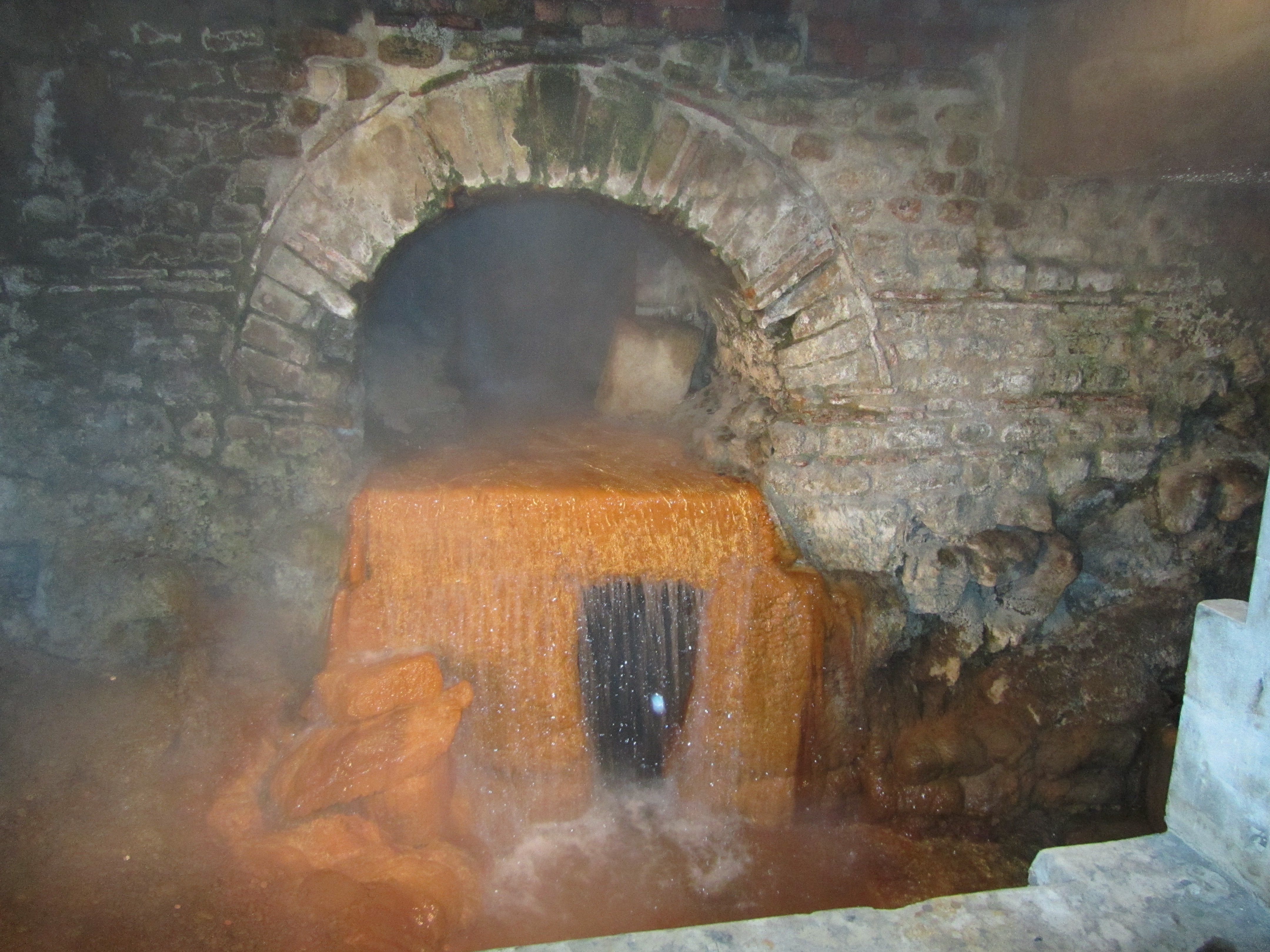
The arched overflow was part of the Roman engineering which kept the water flowing through the complex and still does today.
The dark interior of the circular bath, here bathers would complete their visit to the steam rooms with a cold plunge to rinse off – note the coins littering the bottom of the pool.
The complex at Aquae Sulis was quite extensive – with facilities for men and women to bath seperately which was rare and spoke volumes about the wealth of the town. At the heart of the complex is the Great Bath, a rectangular swimming bath surrounded by a walkway with alcoves for people to sit and relax in. The bath itself was and still is lined with 45 sheets of Mendip lead.
A model of the bath and temple complex in its heyday.
The Great Bath – looking across to one of the alcoves.
The East Bath – a rectangular tepid bath – the doors would have led to heated rooms known as tepidariums.
The remains of the extensive hypercaust system – ensuring visitors were kept warm and comfortable at all times.
One of many mosaics which would have adorned the floors of the rooms within the complex.
The arched overflow was part of the Roman engineering which kept the water flowing through the complex and still does today.
The above shows a reconstruction picture of how the town may have looked at its height based upon what has been discovered through various archaeological excavations. In “A Roman Moon” astute readers will note that I did away with the amphitheatre, replacing it with a Forum. Why? Well, to begin with the evidence for an amphitheatre is at this stage is quite thin on the ground and I am sure that a town of such importance would have had a Forum. In addition, you can also put it down to the authors whim, a bit of ‘literary licence’.
The river running beside the town is the Avon, known then as Afon which is Welsh for river (amusingly making the name of the River Avon, the River River)…
I hope you can see why the ancient town of Aquae Sulis inspired me to write ‘A Roman Moon’ – from the presence of Luna, the triple goddess and the sacred spring all play a part in Sarah’s story.
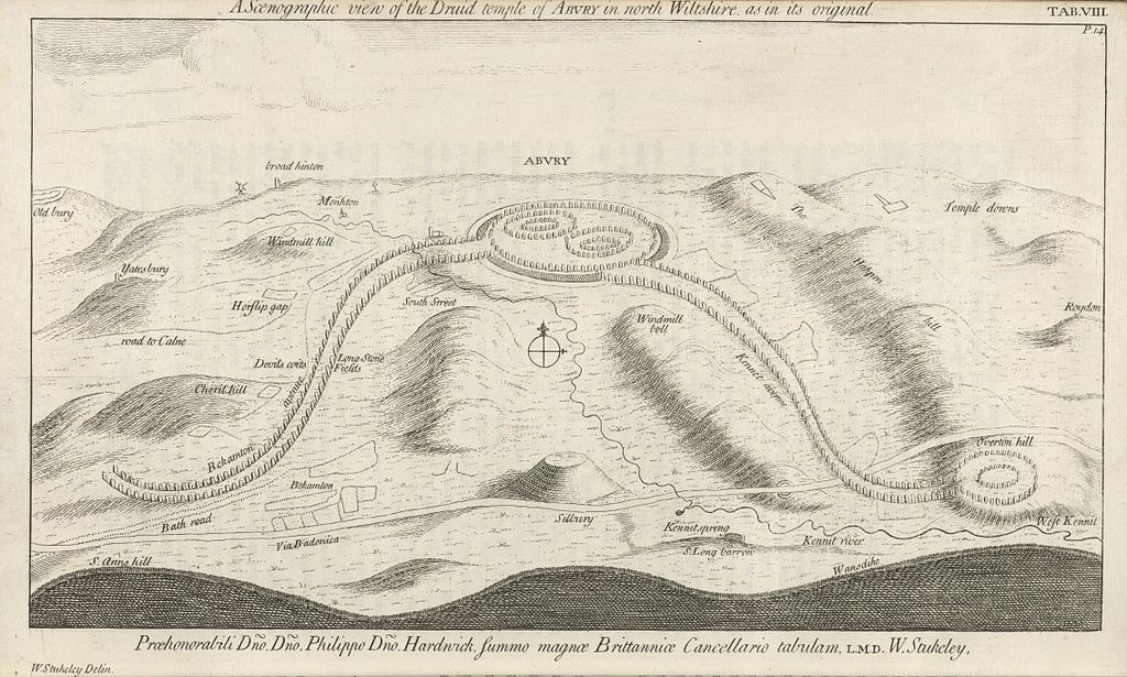
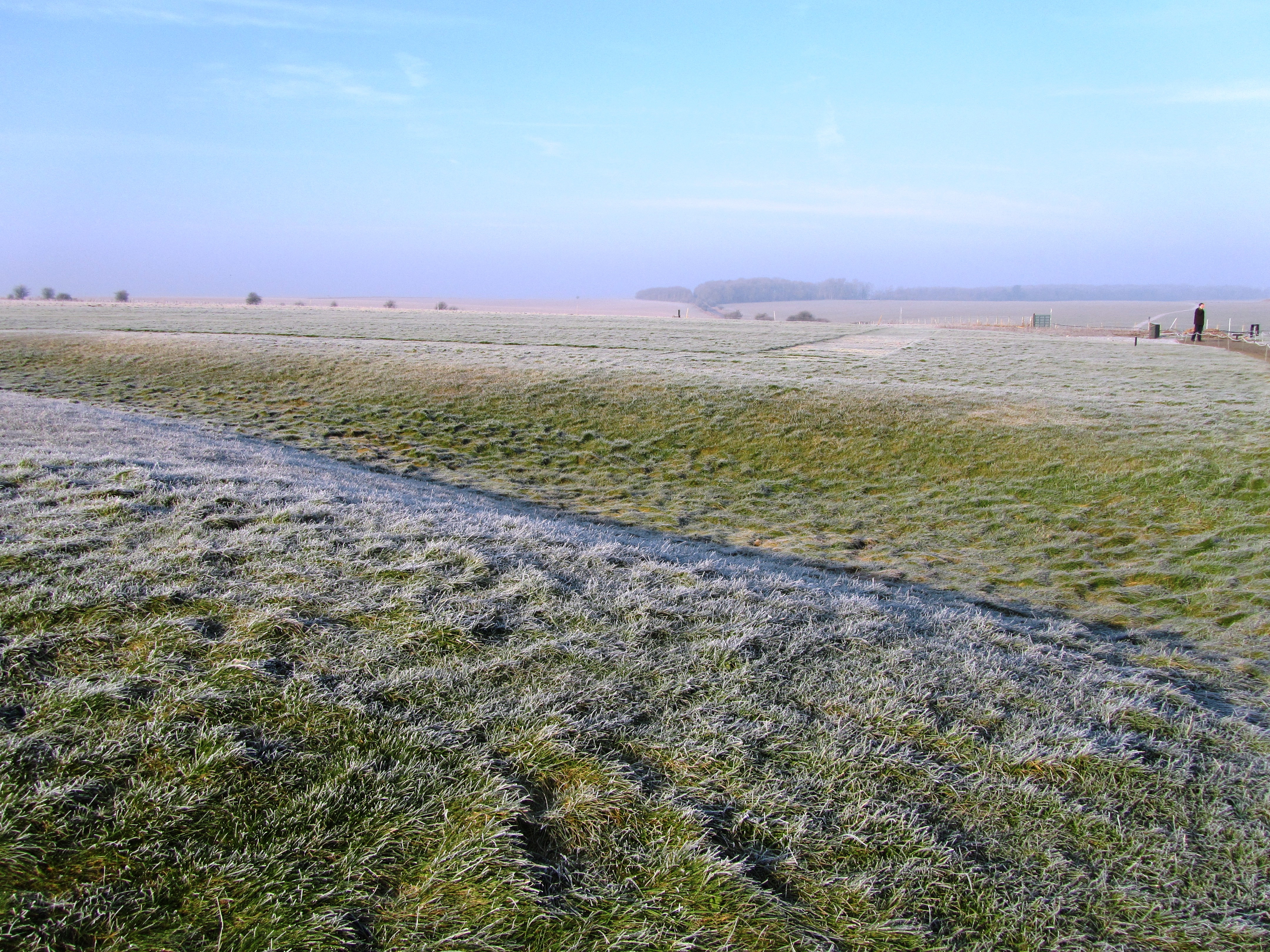
Avebury – the largest stone circle in Europe. It is an easy platitude and just as easily the visitor can wander around the giant stones, exclaiming, wondering why and who built the circle. Then with equal ease get back in their car/tour bus, tick it off the bucket list and move on. However, stop for a moment, look around, peruse the maps and the visitor will see Avebury sits within landscape full of engimatic archaeological sites – West Kennet long barrow and Avenue, Silbury Hill, Windmill Hill, the Sanctuary to name a few. Avebury, the largest stone circle in Europe is but a single element of a much wider sacred landscape.
In fact the Avebury landscape can lay claim to having the largest human constructed mound in Europe (Silbury Hill); the largest long barrow in Britian (West Kennet); one of the largest settlement sites of the earlier Neolithic in Britian (Windmill Hill) and the remains of the longest known avenue of standing stones in Britian (West Kennet Avenue). It would be easy to think that the people of Neolithic Avebury had something to prove but that would be putting modern thoughts of competition into a mindset many thousands of years old.
But lets not jump the gun, first consider what came before the Neolithic and then look at each of the sites individually.
Hunter gatherers in Avebury
To date no single site has been discovered which can be dated to the Mesolithic. In fact the hunter gatherer forebears of Avebury offer up very little in the way of evidence to say ‘we were here’. At the most, isolated findspots of flint tools are known and even these are sparse with just over thirty being recorded. However as many a archaeological lecturer will point out ‘absence of evidence does not equal evidence of absence’.
“As a landscape it is not necessarily empty of significance. There is plentiful ethnographic evidence to show how hunter-gatherer communities invest landscapes with symbolic, mythical and narrative meanings” (Pollard J & Reynolds A ‘Avebury. The Biography of a Landscape’ 2002).
Whilst it might not be obvious to modern eyes the positioning of sites in the earlier Neolithic may well be based on long term community memories, stories and myths which stretch back into the Mesolithic. The simple passing of time reinforcing the importance of place.
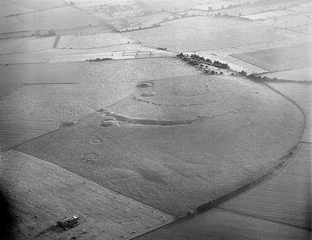
Windmill Hill
Windmill Hill was in use long before the Avebury of today was constructed and is one of a group of early Neolithic monuments known collectively as causewayed enclosures. Numerous examples are known across Britain and although they vary in size and geography there defining feature are the concentric rings of ditches with multiple ’causeways’.
An aerial photograph of Windmill Hill – photo from English Heritage, NMR.
“As the earliest recorded monuments designed to enclose open space, causewayed enclosures represent an unprecedented phenomenon in the archaeological record of the British Isles. The deliberate deposition of artefacts and other cultural material into features dug into the ground represents another important new departure. The creation of the monuments – especially the initial act of defining a place as seperate from the outside world – has therefor increasingly been stressed as a key aspect of their function.”
(Oswald A, Dyer C & Barber M ‘The Creation of Monuments: Neolithic Causewayed Enclosures in the British Isles’ 2001 English Heritage).
Windmill Hill consists of three concentric rings of ditches first dug between 3700-3500BC with a total area of around eight hectares. Within the Avebury area there are a further two similar but less well known enclosures dating to this early Neolithic phase – Knap Hill and Rybury. Windmill Hill has been excavated on several occasions beginning in the late 1920s by Alexander Keiller. Further excavations occured in 1957, 1958 and 1988.
The artefacts found during these excavations represent what can be seen as a microcosm of early Neolithic life. The large quantity of animal bones (mainly cattle) and over twenty thousand pottery sherds represent the importance of raising stock as well as food production and consumption, perhaps in the form of feasting. The one hundred thousand pieces of worked flint; worked sarsen stone; chalk artefacts; antler tools, human bone and axes made of non-local stone represent other aspects of exchange and manufacture; human interactions with the living and the dead.
Beyond the artefacts there is the enclosure itself – for the first time areas of the landscape are being seperated out from their surroundings. Whilst we cannot say for certain it is possible that Windmill Hill was already a place with special meaning and the bounding of the land gave the activities which occured here a greater significance. Evidence demonstrates that Windmill hill was not occupied all year round, most likely from spring to autumn.
“By providing a focus for people to come together on specific occasions, the creation and re-creation of the monuments may have helped to confirm links between groups and individuals, simultaneously establishing a place of lasting significance to all.” (ibid)
The importance of causewayed enclosures such as Windmill Hill should not be underestimated. Windmill Hill provides a point of origin for the development of the later ritual landscape all too evident in the Avebury area.
Long Barrows are another type of site which belong to the pre-Avebury stone circle phase and the early Neolithic. Consisting of trapezoidal or rectangular mounds of earth, turf and chalk. There are two types, megalithic or those with stone chambers and non-megalithic or earthen long barrows.
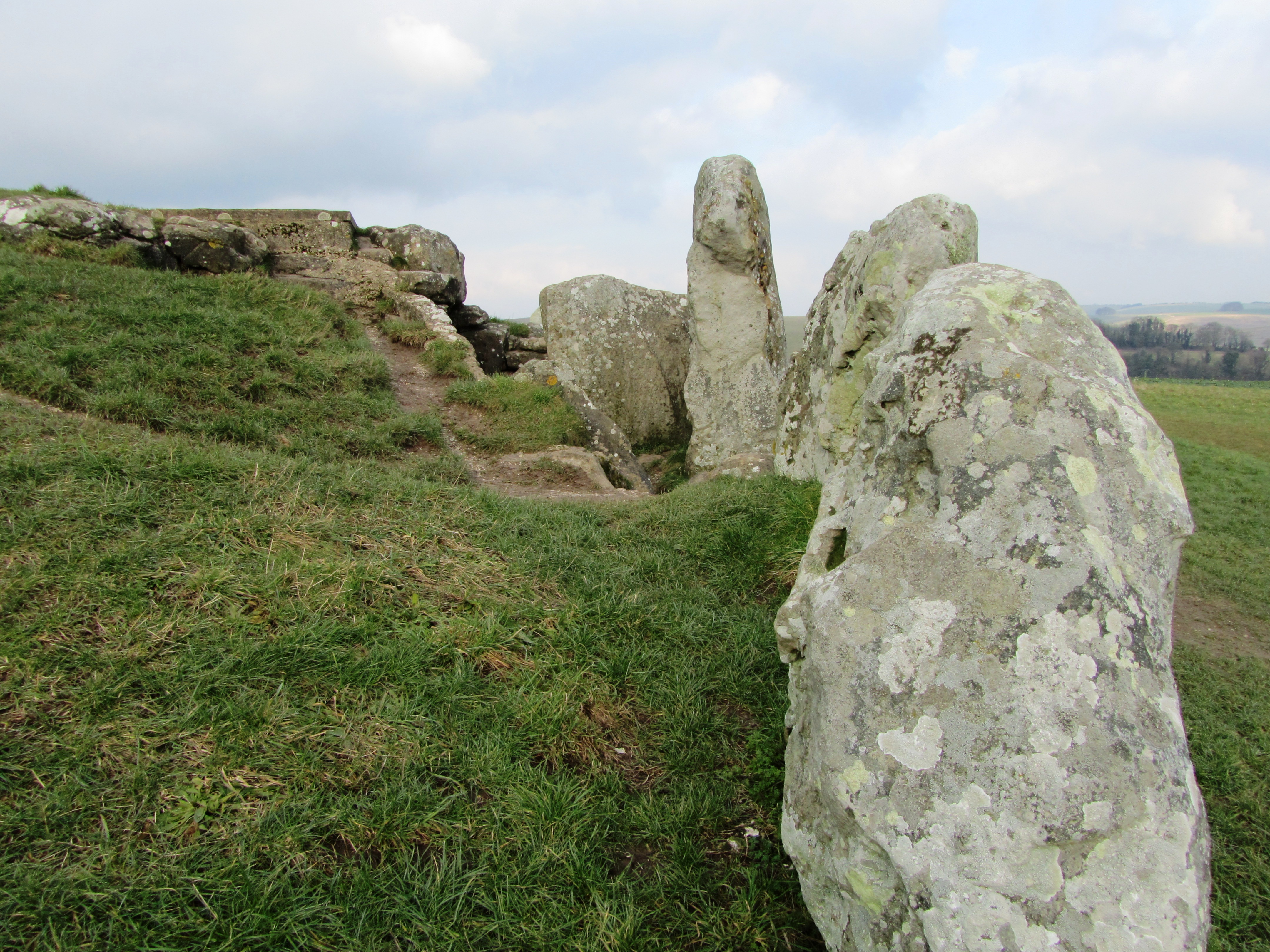
Looking down the megalithic passage.
One of the side chambers.
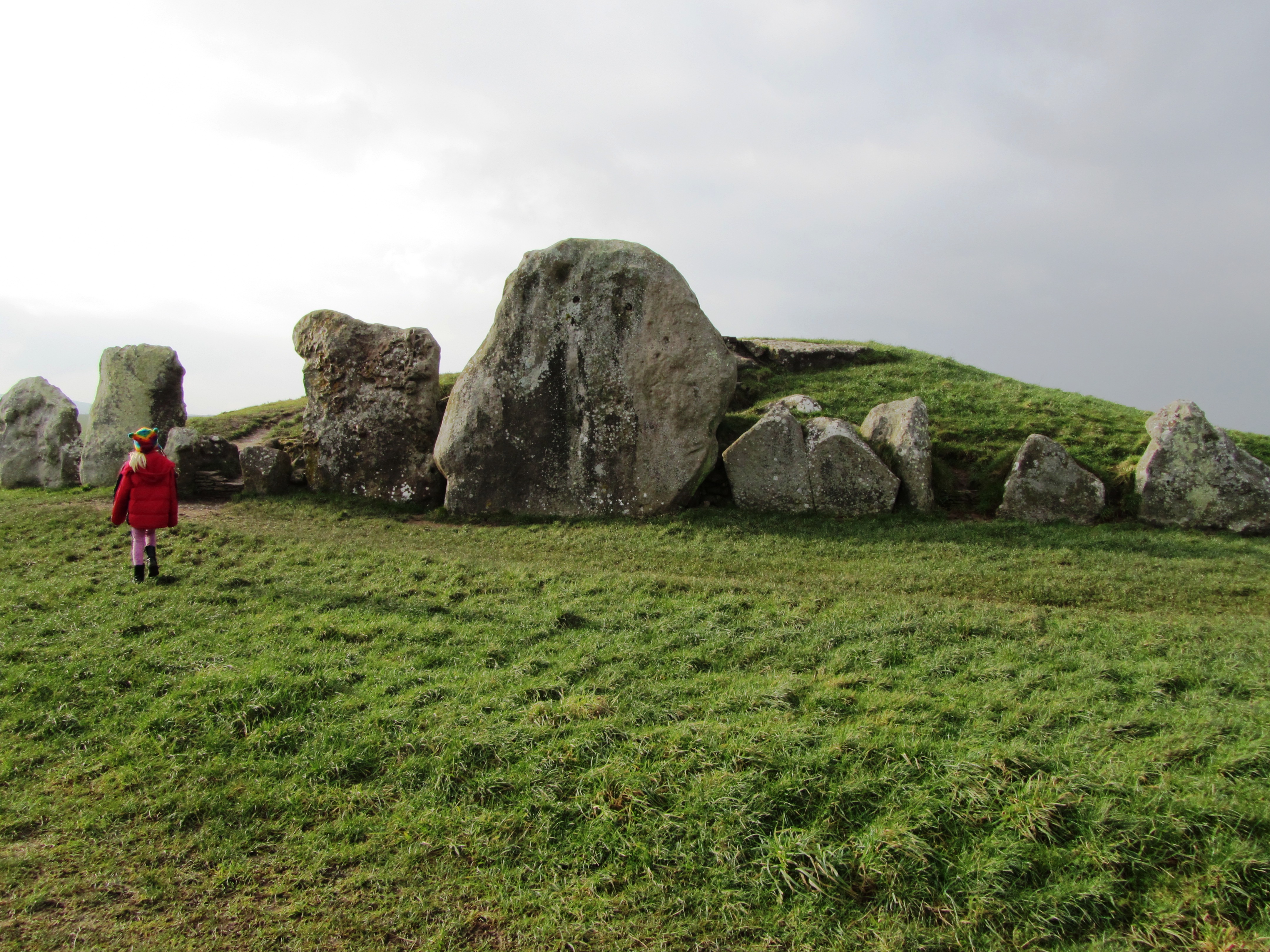
West Kennet is but one of fourteen long barrows known within a three mile radius of Avebury and is dated to around 3700BC – West Kennet however, is the longest (at 100m long) and the only one in the area which can be easily visited today. Belonging to a group known as the Cotswold-Severn type it was first excavated in 1859 and then in the late 1950s. It consists of five stone chambers connected by stone corridor at its eastern end. The chambers extend twelve metres into the mound and are fronted by an elaborate facade.
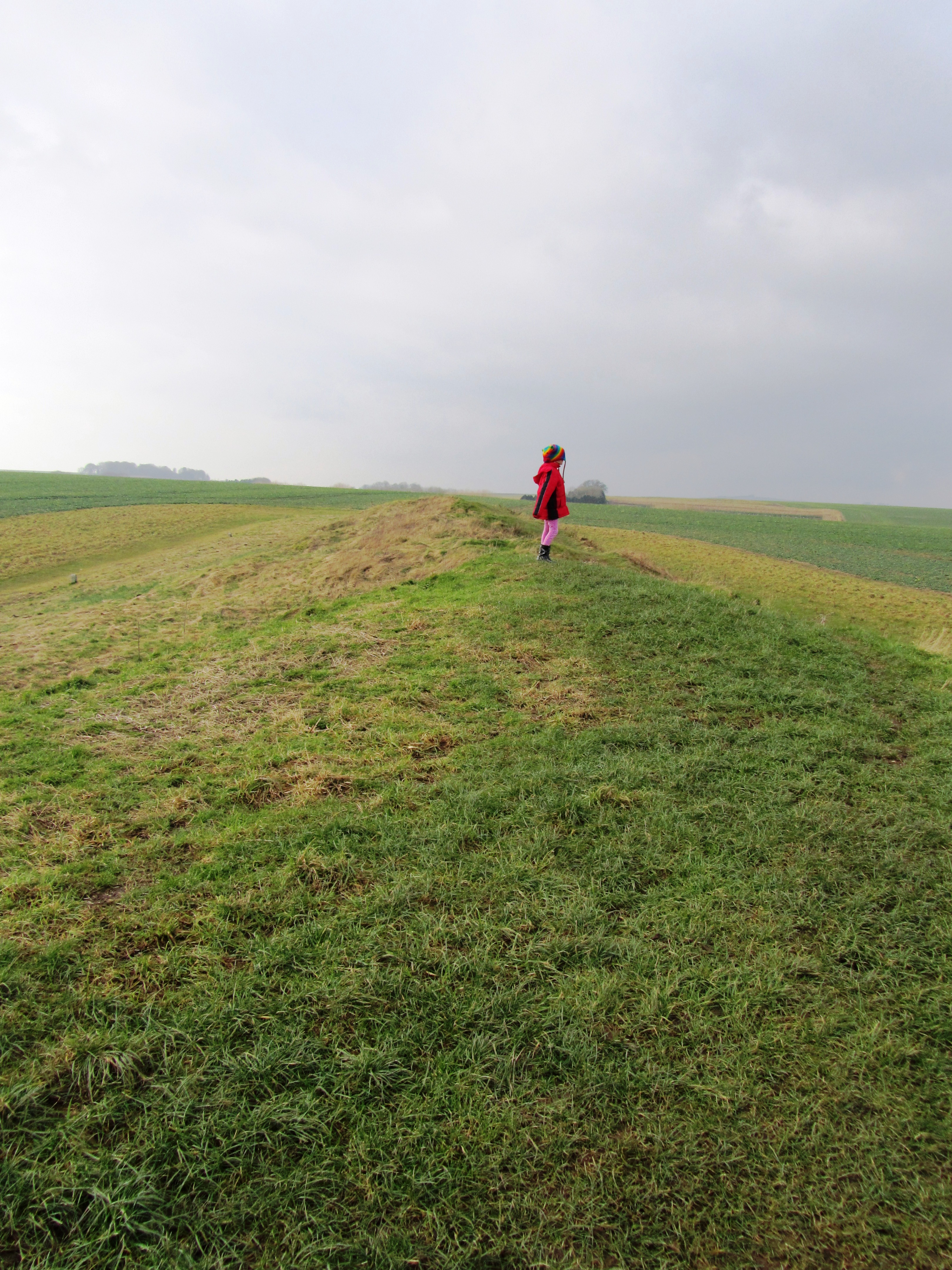
My daughter standing on top of the earthern mound of West Kennet.
Human remains were found in all five chambers, which would definitely suggest a funerary function for the site. Initially these were placed in the chambers as whole bodies but over time these were moved around, re-organised and in some cases completely removed (perhaps finding their way to the ditches of Windmill Hill and the like). After the final internments and over several hundred years the chambers were filled in with chalk rubble, pottery debris, animal bones, bone beads, stone, shell and worked flint. Within and on top of this fill other human bones were discovered, mainly of children and most dating to a later period of around 3300BC. There were ten seperate and distinct layers suggesting that this was a deliberate act and not random.
As a final act in the late third millenium BC a facade of three large sarsen stones was built across the forecourt effectively blocking access into the tomb – this act was contemporary with the main stone phase of Avebury; “…closing the monument and marking the end of ‘an older tradition focussed on ancestors and the past'” (Pollard J & Reynolds A ‘Avebury: The Biography of a Landscape” 2002).
The front facade of West Kennet long barrow – note the large blocking sarsens in the center.
A view of behind the facade.
Avebury
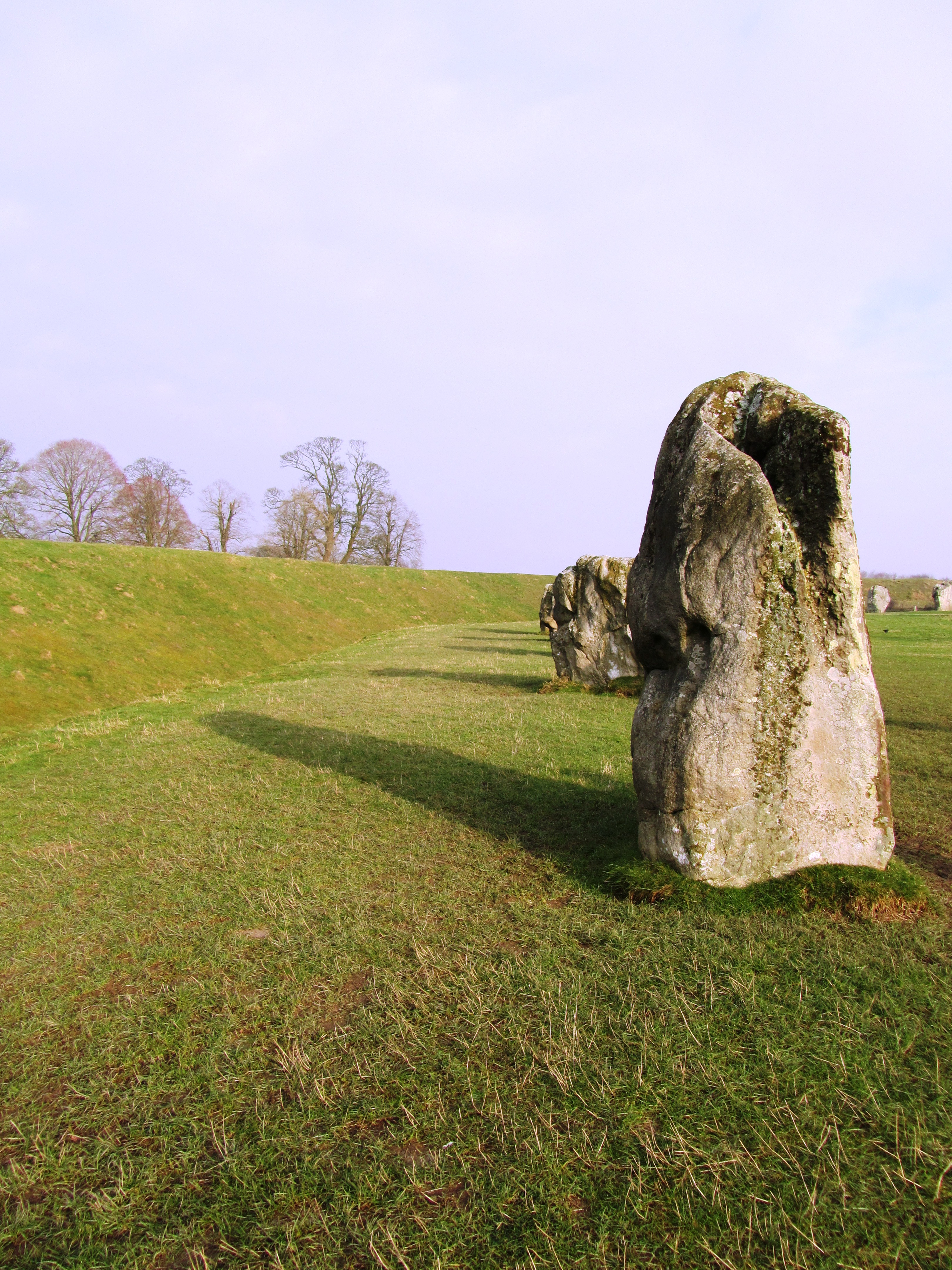
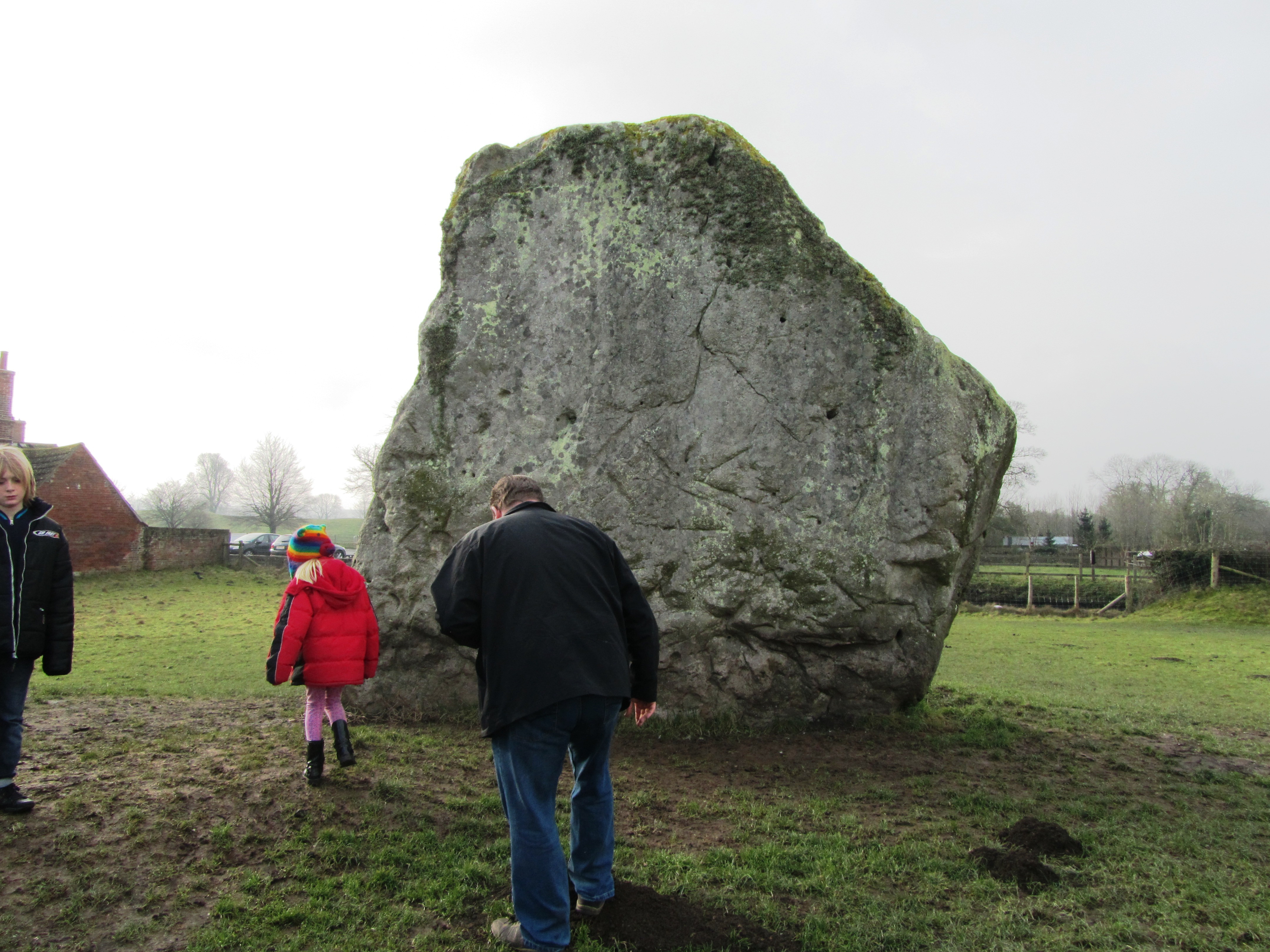
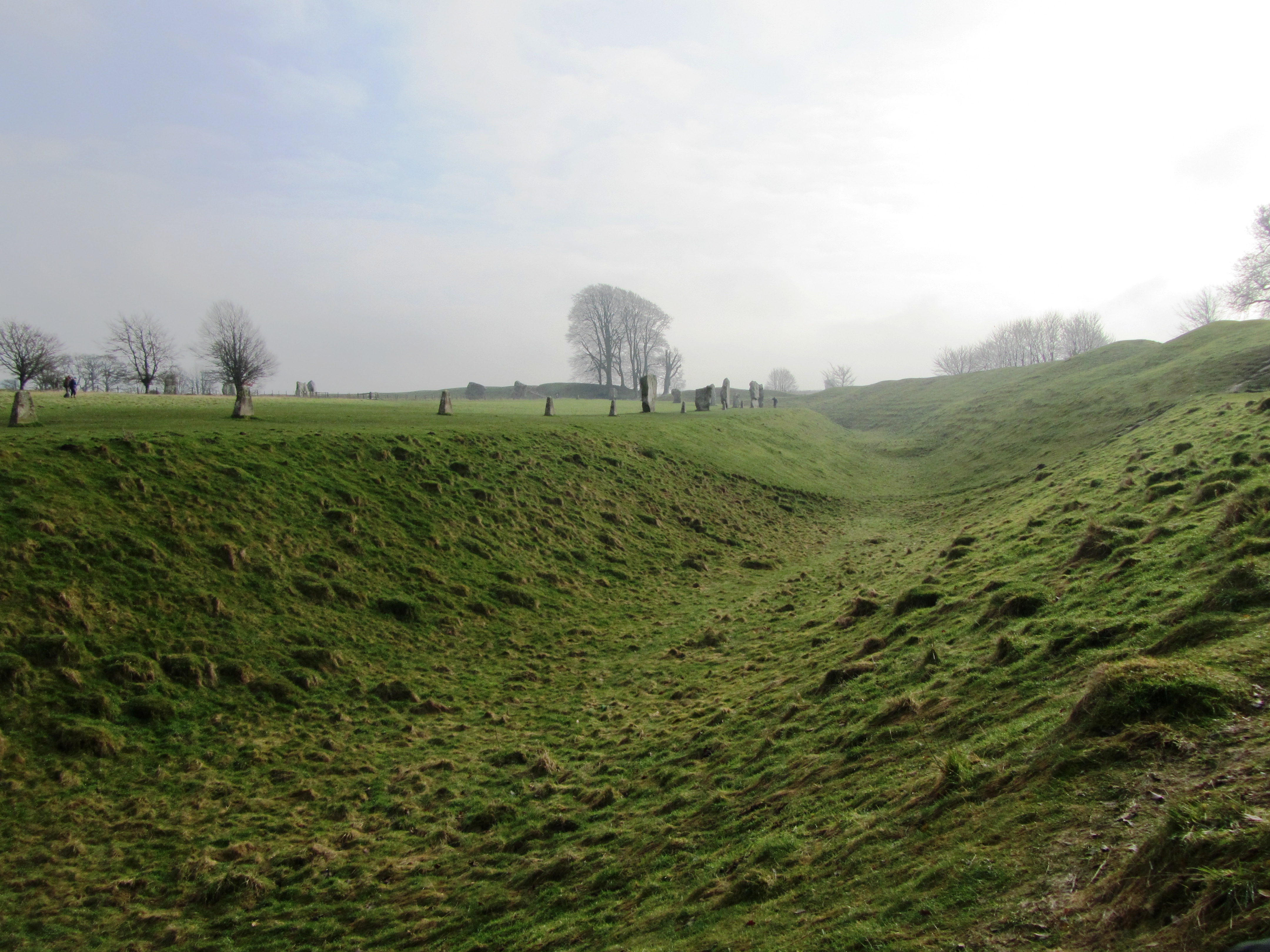
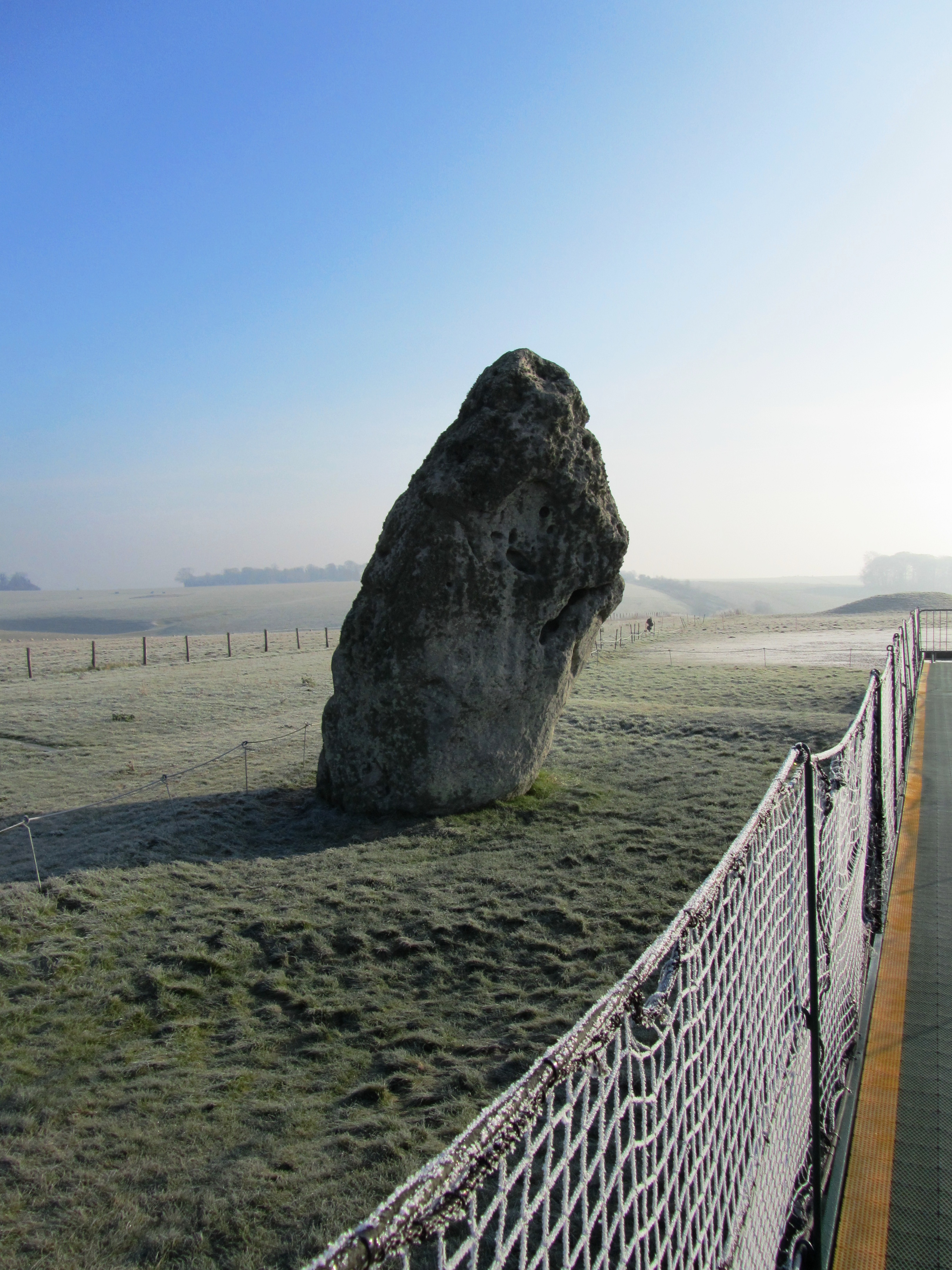
Avebury is approximately 420 metres in diameter and encloses around 11.5 hectares. The bank is on the outside of the ditch and there are four entrances (SSE, WSW, NNW and ENE). The ditch today is four to five metres deep but originally it would have been ten to fourteen metres deep and although grassed over today when first dug the walls of the ditch would have gleamed white, a very obvious feature within the landscape. Contained within the ditch and bank is the largest stone circle in Britain and although many are now missing, it has been estimated that originally there would have been between 95-100 stones around the circumference of the ditch. The largest blocks flank the southern and northern entrances making the route into the centre sinous and not straightforward. At the northern entrance stands a huge stone sometimes referred to as the Diamond Stone and it weighs in at around sixty tonne. Up until the eighteenth century a taller straighter partner stood on the opposite side. The stones are sarsen, a hard grey sandstone with quartz grains. When freshly cut the stones would of looked very different to what they do today.
The Diamond Stone – this has not been moved since it was first placed here in the late Neolithic.
This slideshow requires JavaScript.
One of the most influential people in the recent history of Avebury was Alexander Keiller who undertook many of the excavations in the area during the 1930s and resurrected thirty six of the current stones. When he first bought the land only fifteen of the stones remained upright.
Within the larger circle there are two further smaller circles situated on the saddle of a crest over which the entire monument is situated. In their original form each circle would have had around 25-30 stones and a diameter of approximately 100 metres. In the centre of this were two further monuments referred to as the Cove and the Obelisk. The latter no longer exists but we know of due to William Stukeley who describes it as a pillar 5.5-6 metres high. The Cove are a box like setting of three stones of which only two still remain. In addition, fifteen metres to the west is a thirty two metre long row of nine small reddish stones; roughly half way between the southern small circle and the outer circle is another standing stone referred to as the Ring stone as it is naturally perforated. An aerial survey in 1995 identified numerous parchmarks which may represent more stones.
The smaller northern stone circle
The stone row
Further aerial work, geophysical survey and excavation have identified other features not of stone but of timber and earth. Not much can be said of these features in terms of character and date but it is likely some may be contemporary with Neolithic Avebury. For example, excavations in 1939 at the southern entrance uncovered a substantial 1 metre deep posthole suggesting a pre stone phase of timber posts. In the 1980s geophysical survey suggested the existence of multiple timber circle in the north-east quadrant about forty metres in diameter.
One notable feature of Avebury is the relative lack of prehistoric artefacts. When they are found during excavation they appear to be related to the earliest phases of the monument or its construction. The latter are often referred to as depositional deposits such as the antler picks used to dig the ditch which when the ditch was finished were then deposited on the base, in the primary fill and in the bank.
“We should avoid thinking of the construction of a monument like Avebury as a pragmatic process, as though the sanctity of the site was something conferred upon it once building was complete (not that for much of its early life is ever was). The process of digging ditches, creating banks, dragging in and erecting stones, of ‘altering the earth’, was fundamentally significant in itself – a direct intervention into nature and the cosmos. Indeed, the act of building may have been of as much significance as any completed project.” (Pollard J & Reynolds A ‘Avebury The Biography of a Landscape’)
Another view of the ditch and bank.
Other deposits are found in stone holes or around stones, although only in some parts of the circle. For example, excavations of the southern Inner Circle found a concentration of worked flint particularly around the Obelisk. The south-west sector by comparison was almost clean of artefacts. In the north-west quadrant a variety of artefacts were recovered including sherds of Grooved Ware, human and animal bone, flint flakes, fragments of axes and sandstone implements. Much of this material appears to have been brought in from elsewhere and some are even older than the date deposition.
Of course, all of this is very interesting but what was it used for? Which is of course a million dollar question…interpretations vary and as more research is conducted and more information comes to light so the interpretations change or are tweaked.
The variety of theories include rituals to celebrate certain times of the year; death; transitional periods within life; making contact with the ancestors or the supernatural. Such activities may have been perceived to be dangerous times and hence the act of enclosing the site kept the people safe. Francis Pryor has suggested that the bank outside the ditch allowed people to witness the activities in the interior but at the same time excluded them by the presence of the ditch. The lack of artefacts inside the circle also suggests that this was not a space for just anybody to occupy.
“In one form or another Avebury succeeded the earlier enclosure to the north on Windmill Hill. Both were locations for the periodic gatherings of large numbers of people; these gatherings involved the deliberate burial of artefacts, animal and human remains (though on a much reduced scale at Avebury); at both sites people were involved in a dialogue with spiritual and supernatural agencies…Avebury is more formalised in terms of architecture, and more restricted in terms of how it could be entered and encountered than Windmill Hill – it is less inclusive. But, like Windmill Hill, Avebury also incorporated references to the wider Neolithic social world and surrounding landscape.” (Pollard J & Reynolds A – Avebury. The biography of a landscape.)
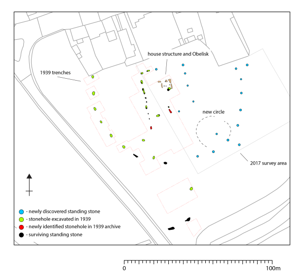
Most recently news has come to light of an unusual feature within the centre of the southern inner circle. A research team led by the University of Leicester and University of Southhampton found a series of stone holes which formed a square shaped monument around the now lost Obelisk. Although currently undated, it has been suggested that this may be the oldest part of the entire site and may even be a form of dedication to an even earlier house structure. Only excavation will answer these questions and once again our understanding of this site will need re-evaluating. The team also found evidence for short lines of stones which radiated out from the square to edge of the inner circle.
Squaring the Circle – a blog from FragmeNTS regarding the square monument at Avebury.
From the FragmeNTS blog
The Avenues
In the later part of the Neolithic another type of megalithic monument emerged in the landscape – the Avenues. Leading from the henge at Avebury were two double lines of megalithic stones, one heading from the southern entrance – the West Kennet Avenue; the second heading from the western entrance – the Beckhampton Avenue. Of the two only the West Kennet can be easily walked today.
Both avenues are similar in construction – each are around fifteen metres wide and consist of paired of sarsen blocks that have not been modified. The stones are set every 20 – 30 metres and are around 1.5 – 3 metres tall. The West Kennet leads to the site known as the Sanctuary on Overton Hill and is made up of around one hundred stones. It has been suggested that the avenues were not laid out in one go but were constructed in a series of stages. Dating of the avenues has been relatively problematic due the ‘clean’ nature of the sites, although the Beckhampton Avenue is regarded as being the later monument – but not by much. The current date range is between c.2600-2300BC.
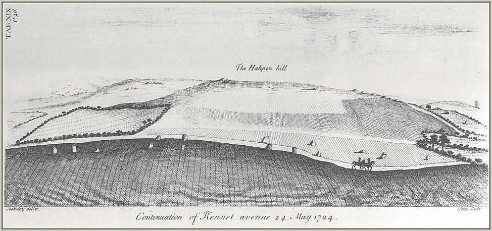
West Kennet Avenue by William Stukeley 1724
The full length of the Beckhampton Avenue is not yet known and was first recorded by William Stukeley in the 1720s and even then it was in a very sorry state. By the nineteenth century only two stones remained upright known as the Longstones (or Adam and Eve). For many years there was some doubt as to what Stukeley recorded but excavations in 1999 and 2000 proved the presence of the avenue and an associated Cove at the Longstones. This area of the Beckhampton avenue underwent a series of changes and readjustments overtime eventually ending with a box shaped setting of stones forming a terminal end to the Avenue.
In regards to purpose it is fair to say that the avenues represent a need to prescribe particular pathways of movement and approach to and from Avebury. It has also been suggested that the processional ways are all about social grading – someone is always in the lead whilst others must follow. In addition, the movement through the landscape also serves as a form of remembrance – linking significant places of cultural memory together.
“At another level, the avenues transformed a landscape of scattered monuments and significant places into a unified complex that was to be approached, read and understood in a very particular way.” (Pollard & Reynold ibid).
The Sanctuary
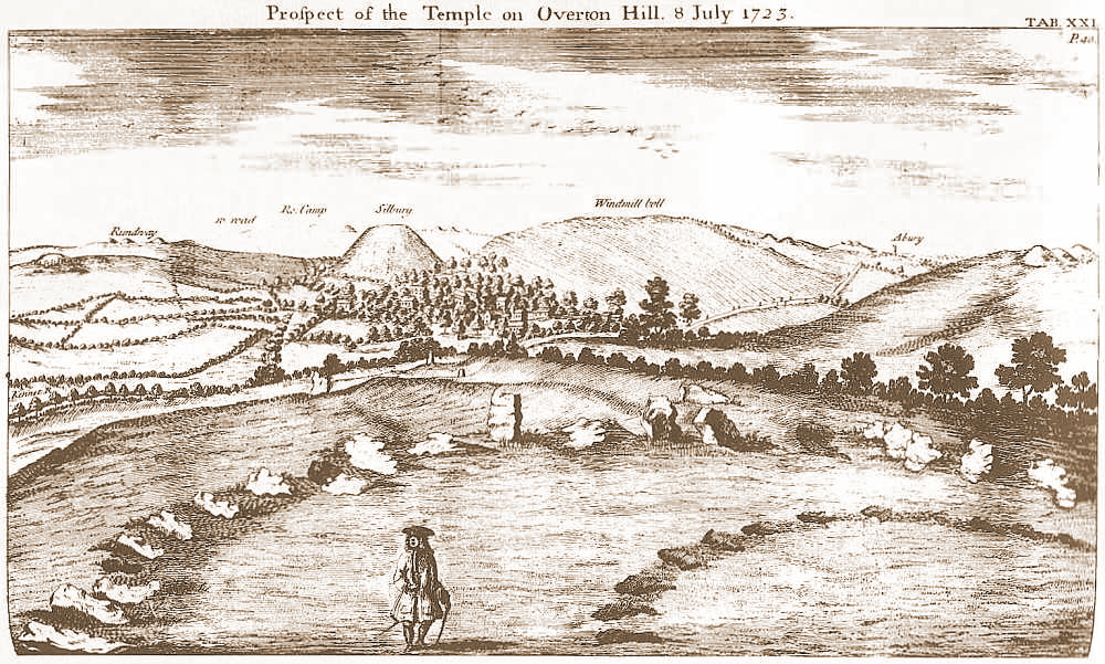
As mentioned above the Sanctuary is connected to Avebury via the West Kennet Avenue. Located on the southern spur of Overton Hill it is a complex monument which began life as a circle of timber posts roughly twenty metres in diameter, later becoming a larger double stone circle monument. Although our understanding of the constructional history is not complete it does seem as if many of the timber posts remained in situ during the construction of the stone circles and beyond. Giving an image of a ‘confusing mass of posts’ in both timber and stone. Today the site is marked by two rings of low concrete posts. In the 1720s the field was taken under the plough and the stone removed.
The Sanctuary by William Stukeley 1723 – even Stukeley noted the sites connection to other places of importance in the landscape.
However, it’s importance must not be underestimated. With commanding views along the Kennet valley, the long barrows at East and West Kennet are visible as is Windmill Hill. In addition, there is a long history of activity on the site stretching back into the fourth millenium BC. The most predominant artefact type found on site is flint knapping debris and animal bone, although finds of pottery and human bone were also found as formalised deposits.
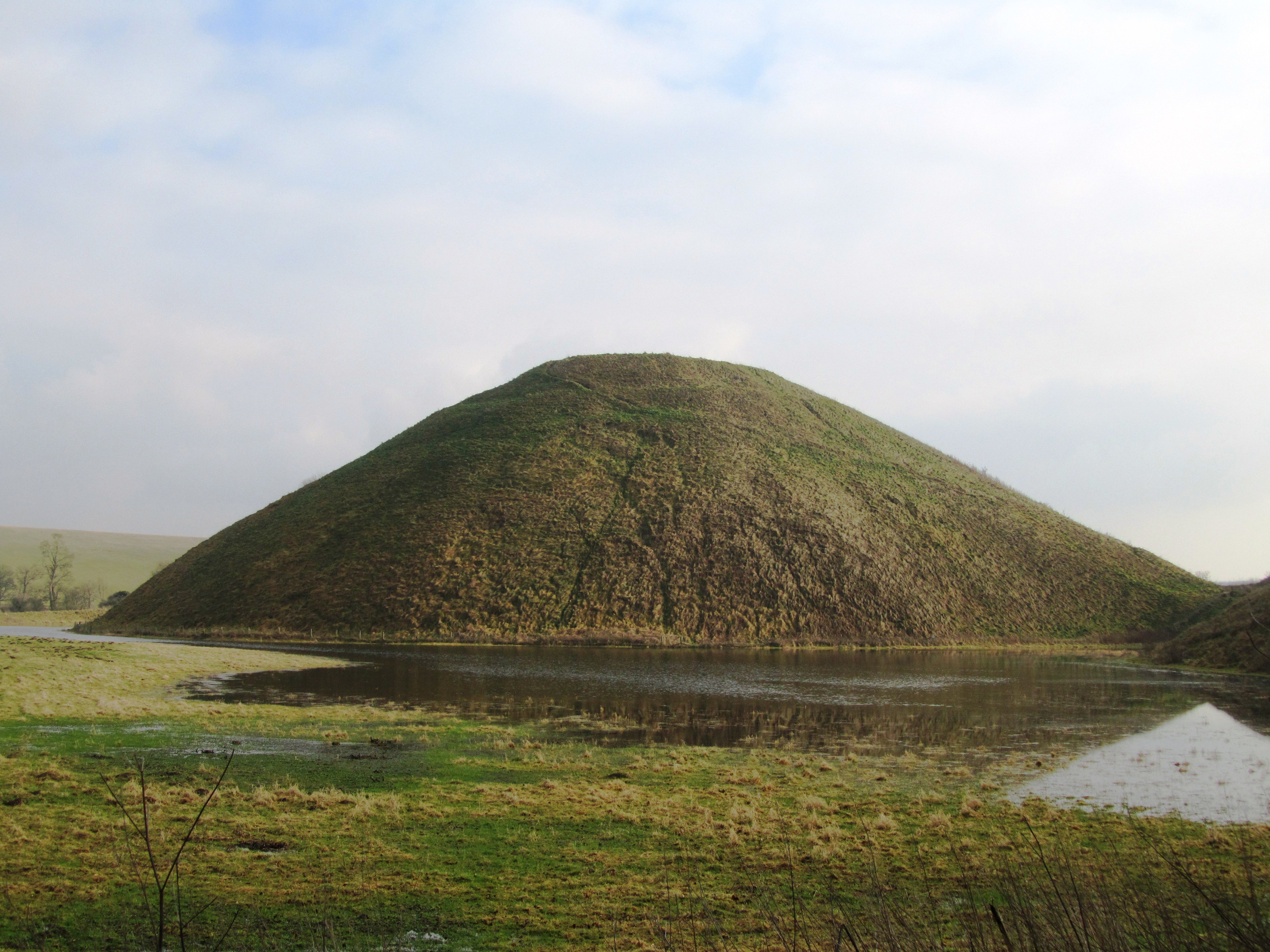
Silbury Hill
Thirty seven metres high, thirty metres across at the top and five hundred metres around the base – Silbury Hill is the largest prehistoric human made mound in Europe and probably the most enigmatic too. It sits on the valley floor close to where the River Kennet rises at the Swallowhead Springs. It seems the construction of the site began around 2400BC although an end date is even less certain. Many attempts have been made to tunnel in to see if anything lies inside and as of yet nothing has been found. Work in 2007 suggests that the mound grew as a result of many small events, giving an image of pilgrimage.
As to its purpose, well…
Final words
There are of course many more monuments within the Avebury landscape – the West Kennet Enclosures; Knap Hill; barrows and other stone circles at places like Winterbourne Bassett – but unfortunately this blog post is already long enough. If you are interested then I do recommend reading Avebury. The Biography of a Landscape by Joshua Pollard and Andrew Reynolds. But most of all I do encourage you to get out and see these places for yourself – it is through experiencing the places of our past do we begin to get a glimmer of understanding.
The following are some online sites that may be of interest:
Postscript – from the Telegraph today we learn that a ‘5000 year old house of the dead’ in the Vale of Pewsey (half way between Avebury and Stonehenge) is to be fully excavated.
Why fleeting you might ask? Well in a nutshell, the visit occured a couple of years ago during a whirlwind trip to London with the family and after a protracted visit to the Natural History Museum followed by getting distracted by a well known sci-fi shop I was left with a mere two and half hours to see the Museum…As some of you are well aware this is not nearly enough time and so it was, a fleeting visit. The following are a few of the photos I took along with brief explanations.
One of the first gallerys I made my way to was the early Medieval gallery – I had long wanted to see the artefacts from Mound 1 at Sutton Hoo, the famous Anglo-saxon ship burial. Sutton Hoo is located near Woodbridge in Suffolk and is the remains of a 6th and 7th century AD cemetary. Mound 1 was excavated in 1939 providing the world with a fascinating glimpse of the artistic ability of our Anglo-saxon forebears. The artefacts were richer and more intricate than any other found before.
The most famous face of Anglo-saxon England – the helmet was in in a bad way when excavated and the above shows only the few remaining pieces which could be salvaged.
An ornate purse lid – would have originally covered a leather pouch which hung at the waist.
These ornate shoulder clasps are one of kind in Europe and were originally used to hold together the two halves of a stiff leather cuirass so it can fit the torso snugly in the Roman style.
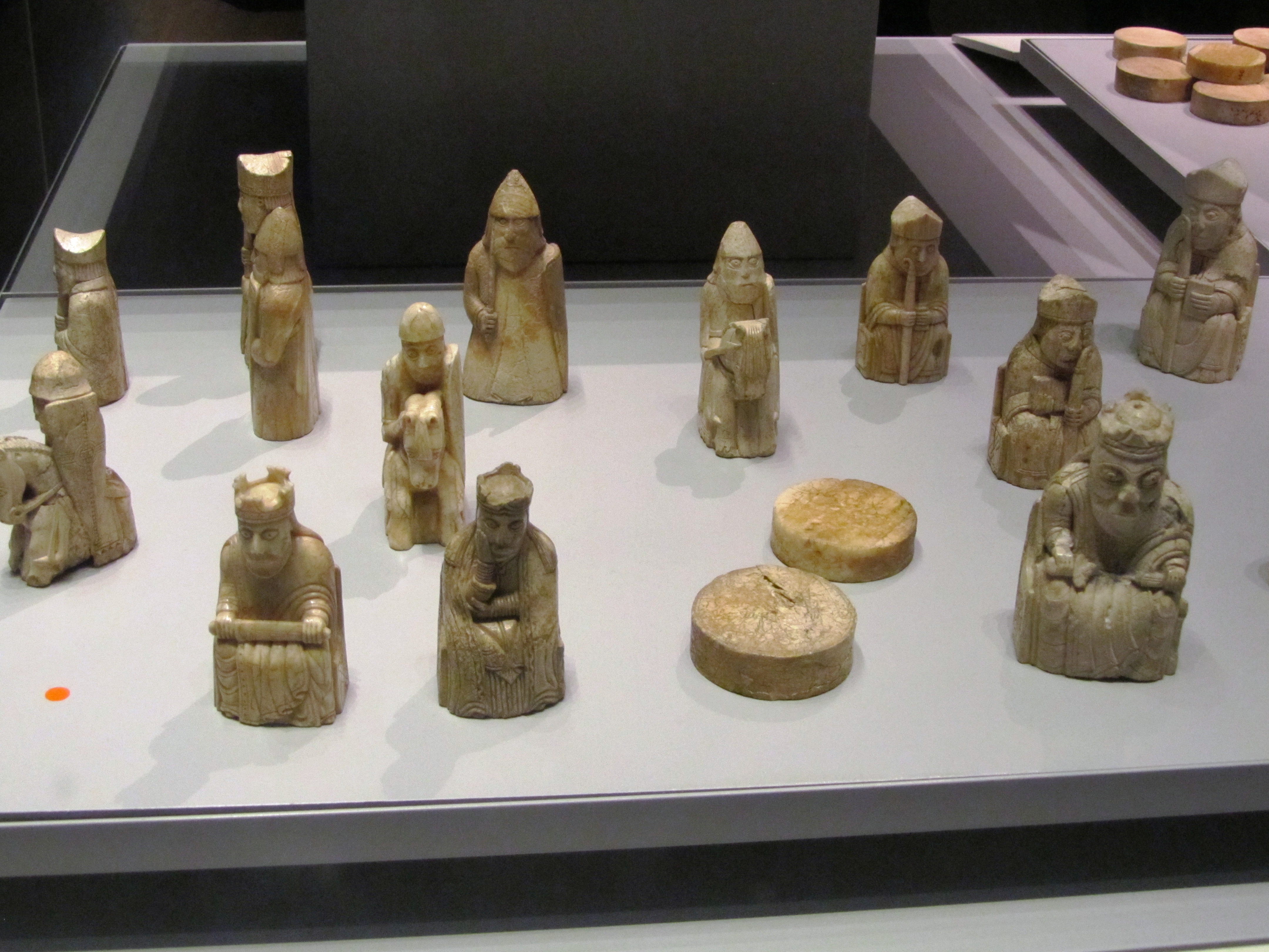
Not far from the Sutton Hoo treasure is the Lewis Chessmen. These fascinating wee carvings were discovered in 1831 in Uig on the Isle of Lewis (Outer Hebrides). They are 12th century in date and carved from walrus ivory; it is believed they were originally made in Trondheim in Norway – at the time the Outer Hebrides were ruled by Norway. A number of years ago, a travelling exhibition on the Vikings came to the Auckland Museum in New Zealand. Two of the Lewis Chessmen accompanied the exhibition and it was this that inspired me to write “A Viking Moon”.
The Lewis Chessmen
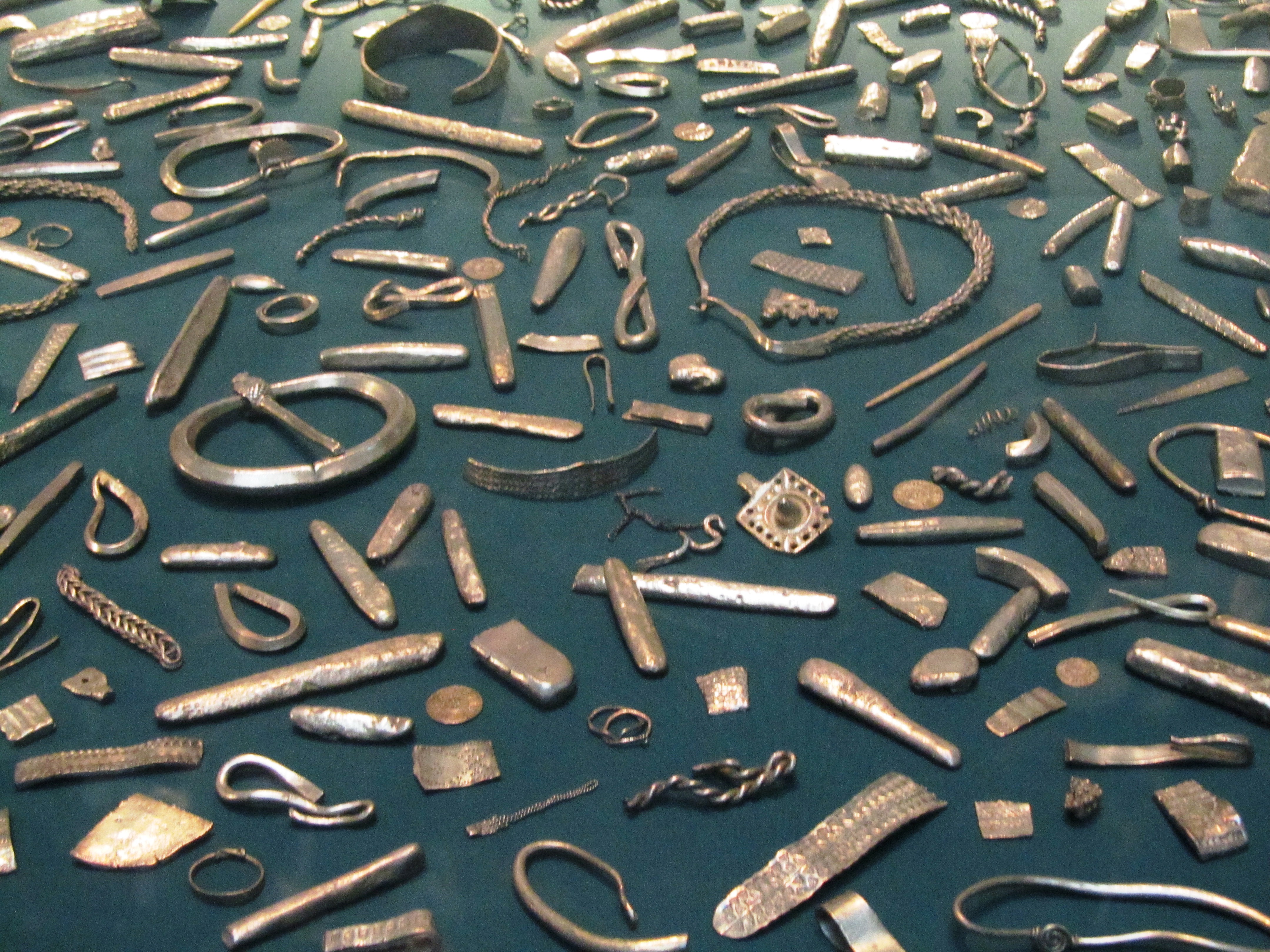
Staying with the Vikings we have the Cuerdale Hoard from Lancashire. The display at the museum is only part an enormous hoard of silver found in a lead chest beside the River Ribble. The hoard itself consisted of 7500 coins and 1200 pieces of silver bullion, weighing in at forty kilograms. The coins come from a variety of sources – mainly the eastern Viking kingdoms of England but also from King Alfred’s Wessex, Byzantium, Scandinavia, Islamic and Carolingian sources. The Ribble Valley was an important Viking route between the Irish Sea and York and this may have some bearing on why the hoard was found here.
Part of the Cuerdale Hoard
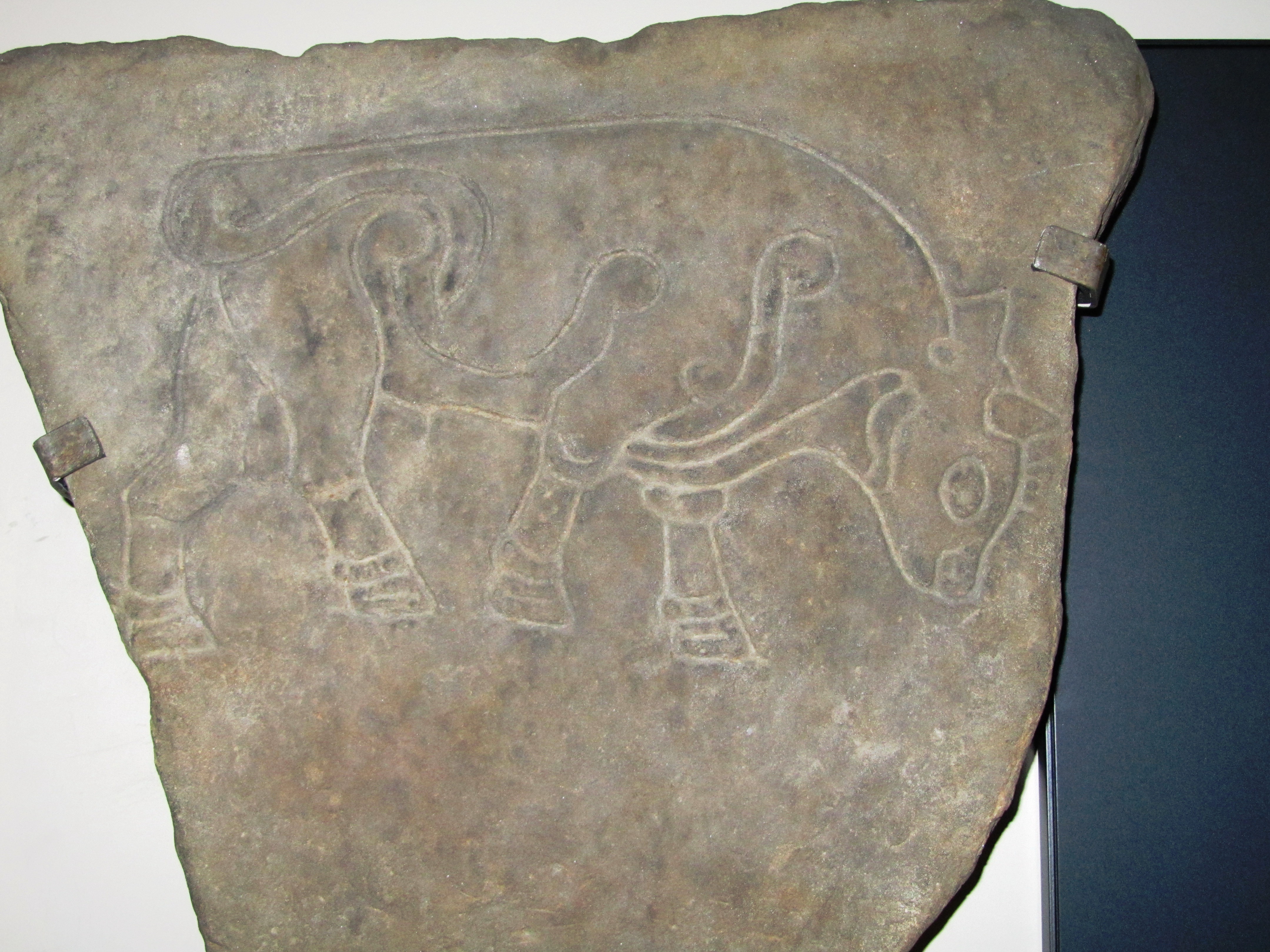
Staying in the early Medieval my next photo is of the Burghead Bull. The town of Burghead in Moray, Scotland occupies part of what was once a Pictish promontory fort of great importance. The Burghead Bulls were discovered in the late nineteenth century when much of the fort was destroyed to make way for more houses. Originally there were thirty panels carrying carved images of bulls, now however, only six remain – one of which is held at the British Museum. They are dated to 5th century AD and it has been suggested they formed a frieze set into the ramparts of the fort and possibly represent a warrior cult which celebrated strength and aggression. Regardless of what the bull represents it is a fabulous piece of Pictish art.
Burghead Bull
Travelling back in time I moved onto the Roman and Iron Age galleries (this was a flying visit, I had just recieved a text from an impatient husband…)
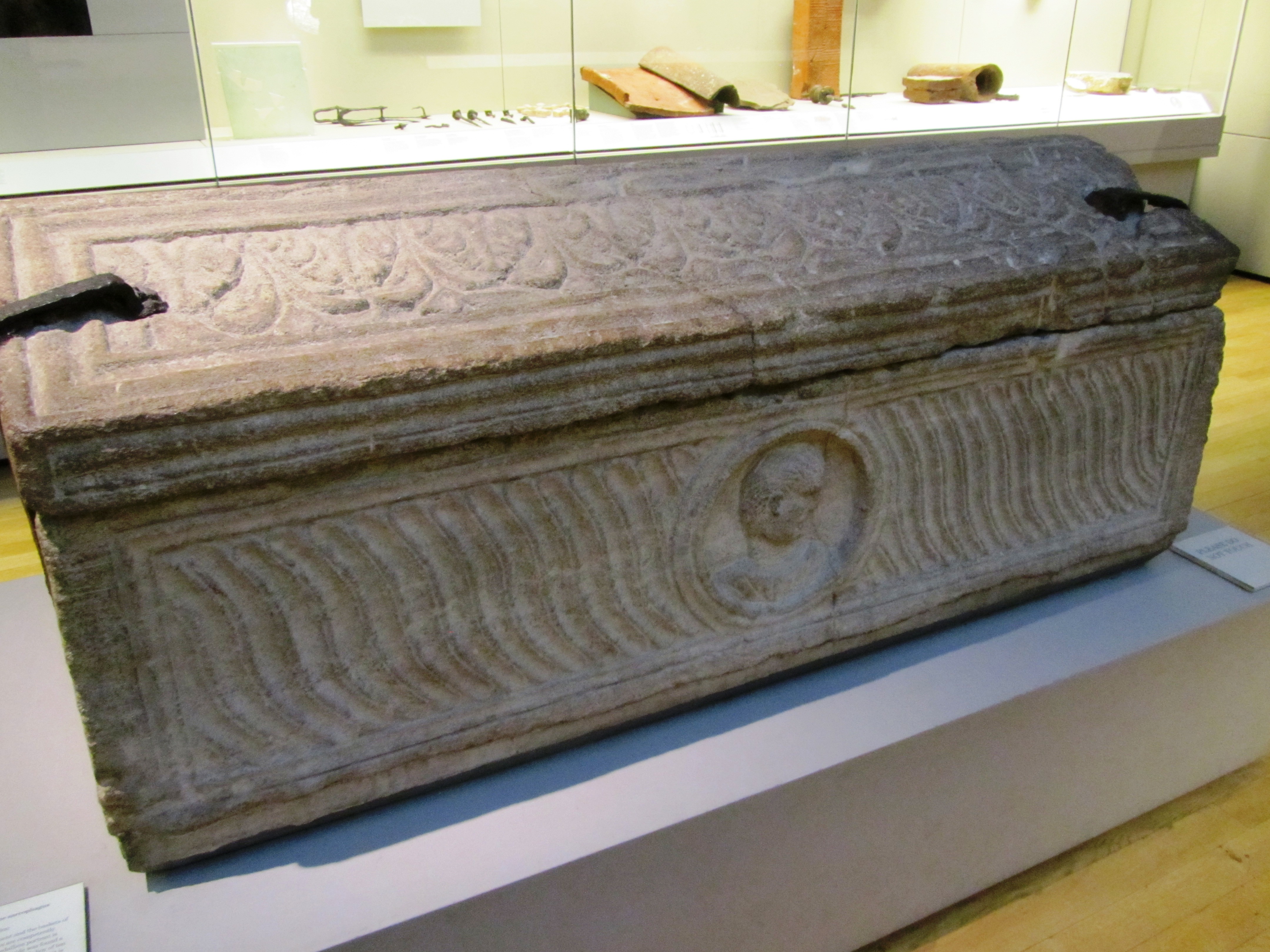
In the Roman gallery I took a moment to admire a stone sarcophagus found in London in 1853 within what was described as an extensive Roman cemetary outside the city wall to the east. It is dated to the early 4th century AD.
An early 4th century AD Roman stone sarcophagus.
Moving along swiftly I found myself in the British Iron Age and here I had to stop and admire the mirrors. Of all the artefacts from this period these are my favorite (and no its not because I have vain streak…). I have long held the belief that mirrors were more than a toilette item for these were never true mirrors that the modern person might be familiar with. Their surfaces were often burnished bronze and would at best reflect a fuzzy image. Instead I would suggest that the surface of a mirror acted in a similar way to the reflective surface of lake, pond or well providing access to the otherworld – a liminal space/place. Such places are well documented as being special, the vast numbersof artefacts found deposited into watery places at this time speaks for itself. Furthermore, it is surely no coincidence that later myths and stories use a mirror as a storytelling device (think Snow White).
The St Keverne Mirror (Cornwall) 120BC-80BC
The Desborough Mirror (50BC-50AD)
The Wetwang Mirror (Yorkshire) 210BC-160BC
Then of course something shiny caught my eye, first the Snettisham Torc and then the twisted gold torcs from the Ipswich Hoard. The Snettisham Torc was discovered in 1950 near the village of Snettisham in Norfolk. It is made up of a kilo of gold mixed with silver, there are 64 threads and each thread is 1.9mm wide, eight threads were pulled together and twisted then all were twisted again to make the torc. The terminal ends are hollow and were cast from a mould. The torc is dated to between 150BC and 50BC. The Ipswich Hoard was the second hoard to be found in the area, the first being Anglo-saxon in date. This particular hoard was discovered during the construction of a housing estate in 1968 by a digger driver and consisted of six twisted gold torcs. These torcs had less silver in them which has led the musuem to date their manufacture to around 75BC.
The Snettisham Torc
The Ipswich Hoard
Finally I wound my way through the Egyptian gallery and down the stairs to meet up with the family who were marvelling at the large statues from the ancient world. The following is a selection of the photos from this part of the museum.
This slideshow requires JavaScript.
There was so much else to see but I simply ran out of time and as we were flying out the next day any other sight seeing would have to wait until another visit – although I have heard recently that there are plans afoot for a downloadable VR experience for those who can’t visit in person.
Below are a few links which relate to the above photos.
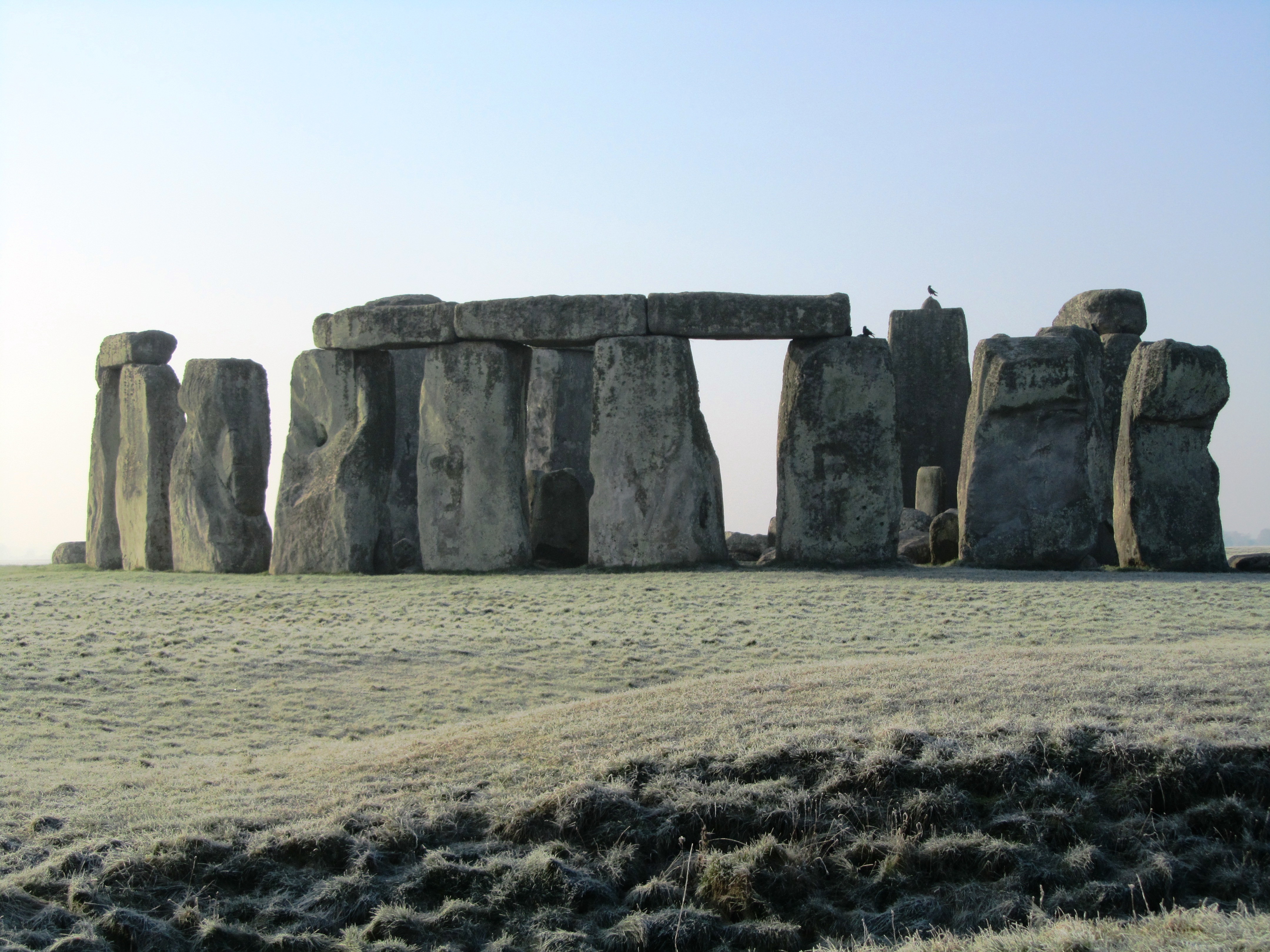
Stonehenge – a name that evokes a great many emotions in a great many people. For some it is a place of pilgrimage, a place to connect with the ancestors and for others it is seen as a tourist trap or something to tick off the bucket list. For centuries it has captured our imagination; never has a heritage site been so controversial – something which continues to this day. In this post it is not my intention to give a full on thesis about Stonehenge, there are plenty of books/websites who do this already. Instead it is simply an overview of what is currently understood about the site, its surrounding landscape and my own personal thoughts.
Stonehenge is situated on the Salisbury Plains, to the south is the busy A303, a main road between the south-west and London, and for many years the equally busy A344 ran alongside the site. This latter road was removed sometime ago to improve the visitors experience. Today there are ongoing discussions regarding the upgrading of the A303 and a proposed tunnel. It is a highly emotive subject, on one hand I understand the need to improve the road situation (ask anyone who is stuck in a traffic jam on the A303) but as an archaeologist I am also aware of the sensitive nature of the surrounding heritage landscape (and yes I am on the fence). Mike Pitts in his recent post discusses the pros and cons for those of you who are interested.
For the visitor today the focus is on the large stone circle with its trilithons, they marvel at how it could have been built by ‘primitive man’ often leading to suggestions of alien intervention and lost technologies. But such thoughts only serve to belittle our ancestors and our past. Others may ask why did our ancestors build Stonehenge? Often the answers are unimaginative and simple – sun-worship; display of power; ancient computer; druid temple – once more when we look only for one answer to a what is obviously a complicated site of great longevity we belittle their achievements. Instead if Stonehenge was understood in terms of the wider landscape and as a site whose history spanned several millenia we might come to some small understanding of how and why.
In today’s world of instant gratification where everything has a beginning and an end, it is hard to imagine beginning a project knowing you might not see it finished but this was a reality for the builders of Stonehenge. It has lead some to suggest that it was not the end product which was important but the doing, the act of building which was in fact the purpose. Suggesting a cyclical thought pattern which can be seen in other aspects of prehistoric life – round houses, stone circles, round barrows. in addition, time itself was most likely viewed in cycles, the phases of the moon and the movement of the seasons are all cyclical events which would have been of great importance to prehistoric people trying to make sense of their world.
“So was Stonehenge ever ‘finished’? The answer to that has to be no, because completion was never the intention of the people who created it.” (Pryor F. 2016 ‘Stonehenge: The Story of a Sacred Landscape).
It is well known that Stonehenge itself had many incarnations, perhaps meaning new and different things with each alteration or rebuild. To understand Stonehenge it is important to consider it in the wider context of the surrounding landscape (there are literally hundreds of prehistoric monuments around it) in all the different phases.
The Mesolithic Story
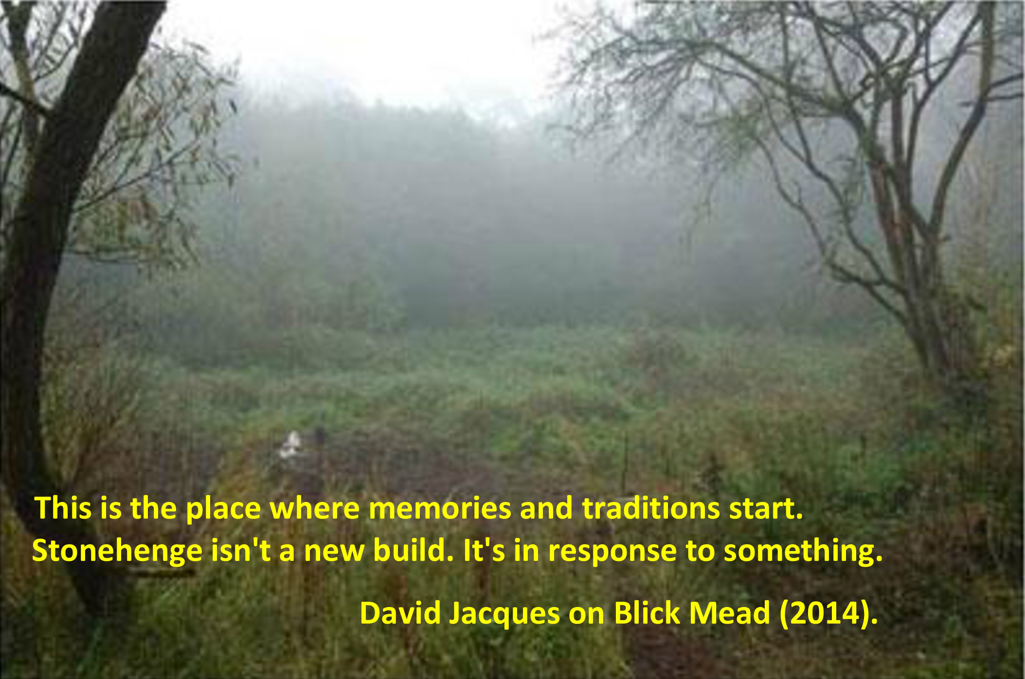
The story of the Stonehenge landscape begins back in the Mesolithic, ongoing recent excavations at Blickmead are providing archaeologists with tantalising clues as to why this area was important to our ancestors. The site is situated near a spring by the River Avon, excavations began in 2005 and almost immediately were fruitful. Basically, the deposits consisted of an array of Mesolithic settlement debris, mostly flint fragments (tens of thousands) but also a great number of animal bones. Interestingly, the site also yielded the largest collection of auroch bones ever found on a Mesolithic site in Britain so far. Other animals which were hunted and consumed included red deer, wild boar and salmon – this has led archaeologists to suggest that feasting was a common occurence around the spring. The spring itself is quite unusual as it has the tendency to stain flints and other materials a bright magenta pink – the importance of springs in later prehistory is well attested to.
In 1966 row of four large pit like features were found during upgrades to the old carpark close by Stonehenge. When excavated one was found to be a the root-hole of a tree and the other three were holes dugs to hold large poles. Examination of the material from these features gave a date range from between 8500 and 7000BC. The posts would have been approximately 75cm in diameter and were from pine trees. Later in 1988 another post-hole was discovered south and east of the original pits but it was contemporary.
So here we have a landscape already well populated by hunter-gatherer communities who revered certain natural features long before Stonehenge makes an appearance. A landscape which had meaning to the people who inhabit it; who had traditions and memories of place.
At around 3500BC (Neolithic) with the arrival of farming these communities and their traditions had evolved and more permenant features began to make an appearance on the landscape. Long barrows such as those at East and West Kennet or Winterbourne Stoke were the first to appear and by 3400BC the Stonehenge Cursus and Lesser Cursus was under construction.
3000BC – The first official phase of construction
In many parts of Britian at this time a new type of monument was being constructed, these were earthwork enclosures which are referred to as henges. They consist of irregular cut ditches encircling a defined area with corresponding banks. Stonehenge’s earliest phase was one such earthwork. Here there were two entrances one faced north-east and the other faced south. The north-easterly entrance remained in use for much of the sites lifetime and appears to be important to its function. The entrance is aligned along a line of natural gullies which face towards the midsummer sunrise in one direction and the midwinter sunset in the other.
The bank and ditch of the first phase of construction – often overlooked by the visitor as they focus on the stones.
These natural gullies would have been visible to the people of the Mesolithic and may have been why the large pine posts were erected where they were – the midsummer and midwinter solstices were just as important then as they were to the later prehistoric communities.
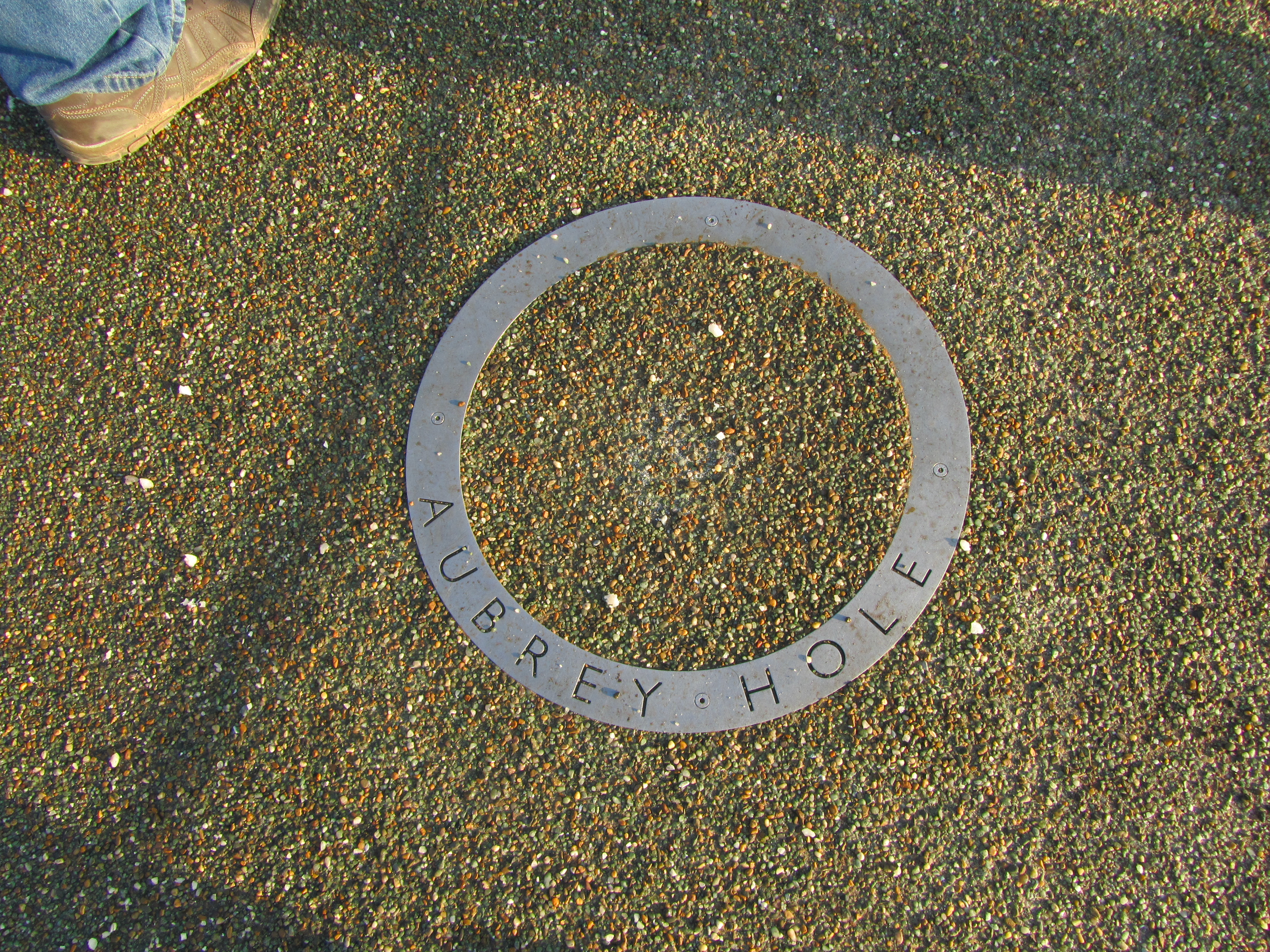
Inside the earthwork enclosure around the inner edge of the bank were fifty-six regularly spaced pits – these are now known as the Aubrey Holes. There is some discussion as to what they were or what they contained – small stone uprights or wooden posts? However, what is known is that eventually they did contain cremated human remains. Similar deposits have been found in the partly filled ditch and cut into the bank suggesting that at this stage in its history Stonehenge was used as a cemetary, among other things.
These circular markers define the spot where an Abrey Hole can be found.
The Building of the Stone Monument
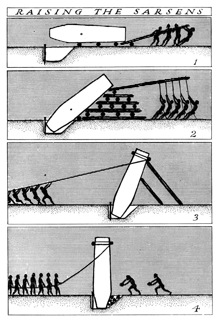
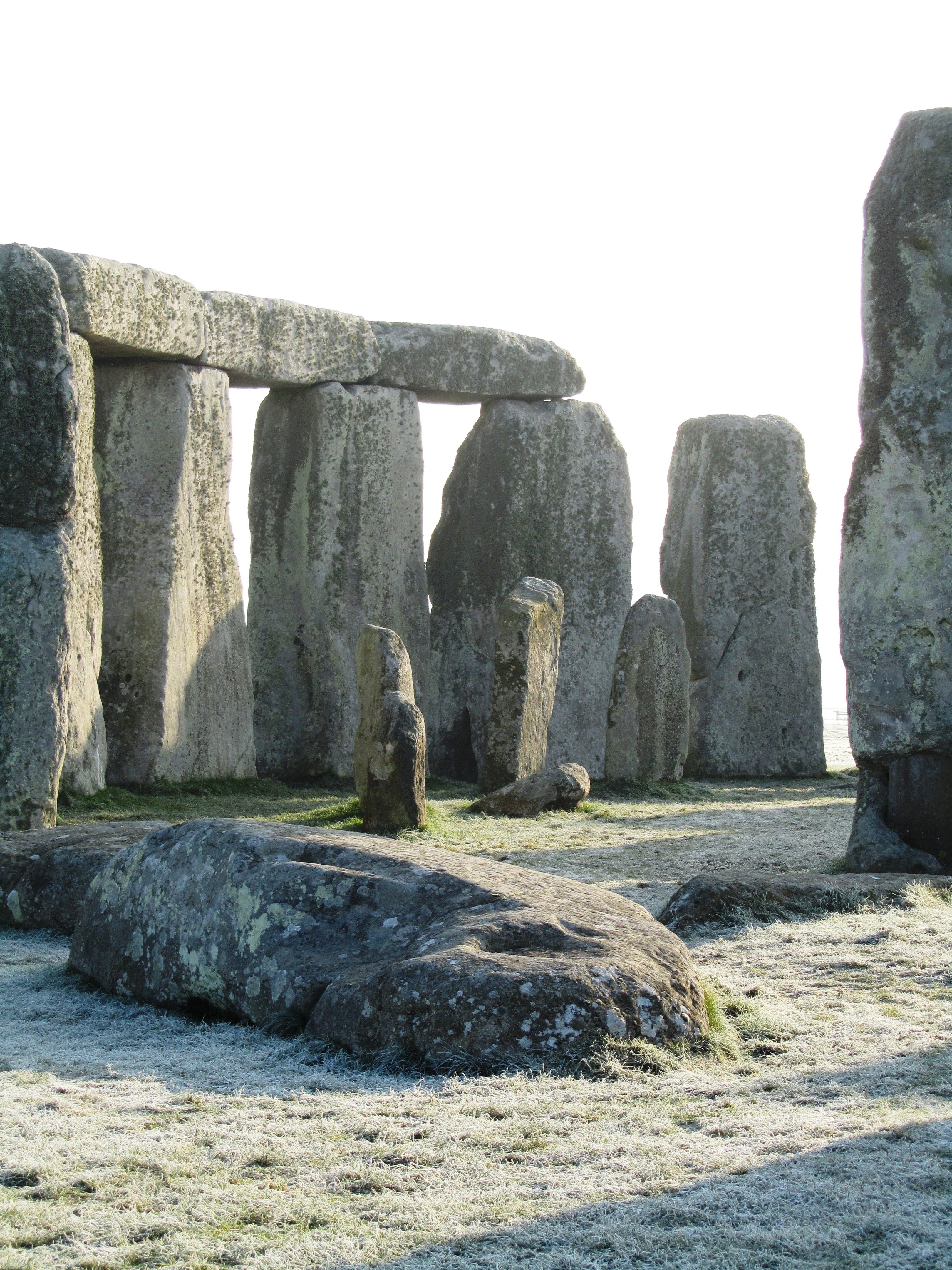
At around 2500BC Stonehenge began to resemble a site we are much more familiar with. It is at this time that the massive sarsen stones from the Marlborough Downs were moved to the site and erected. If that was not all at the same time the smaller but no less cumbersome, blue stones from the Preseli Mountains in Wales were transported and erected at Stonehenge. The Heel stone was moved to its current position and four smaller sarsen stones (the station stones) were erected inside the enclosure just inside the bank.
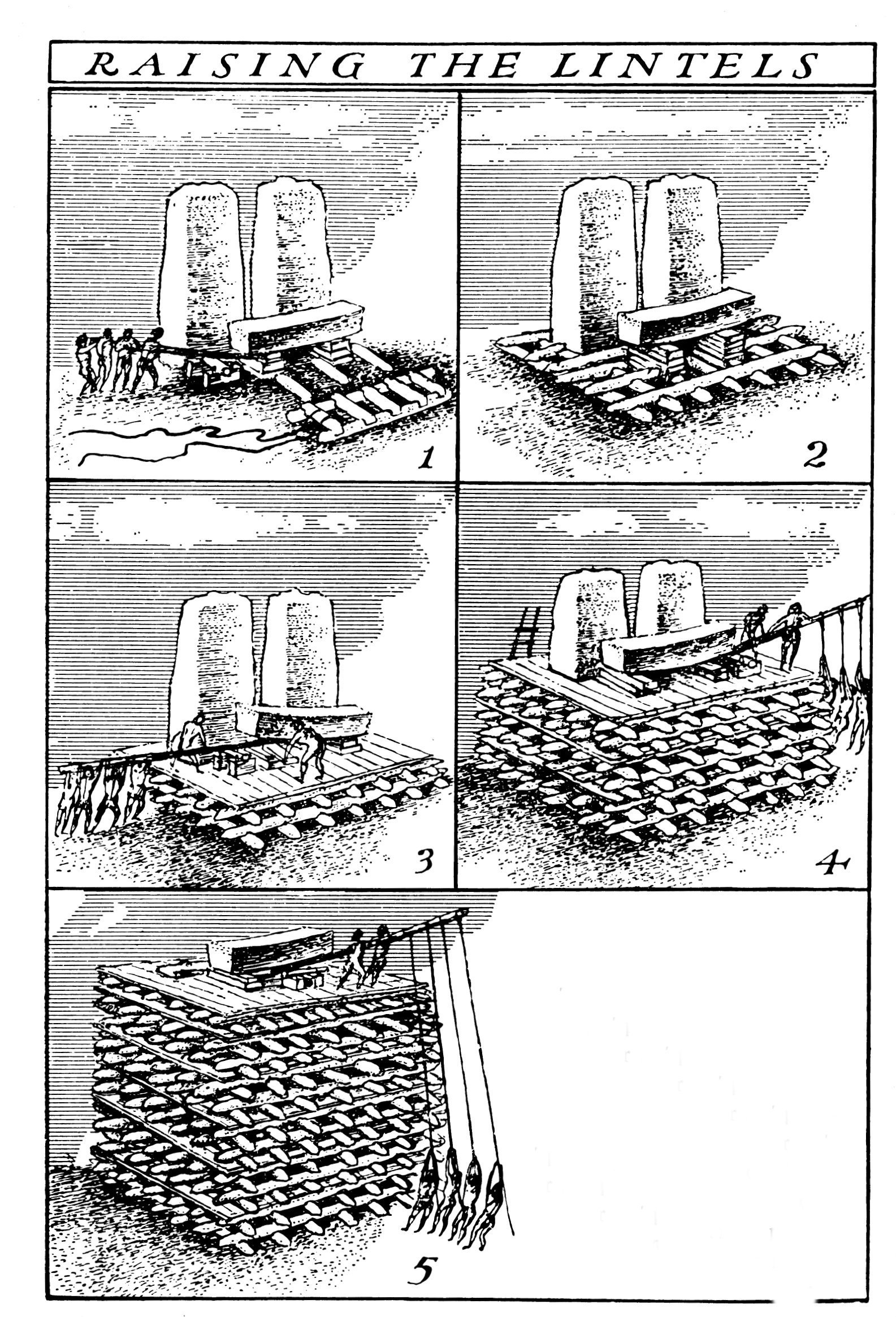
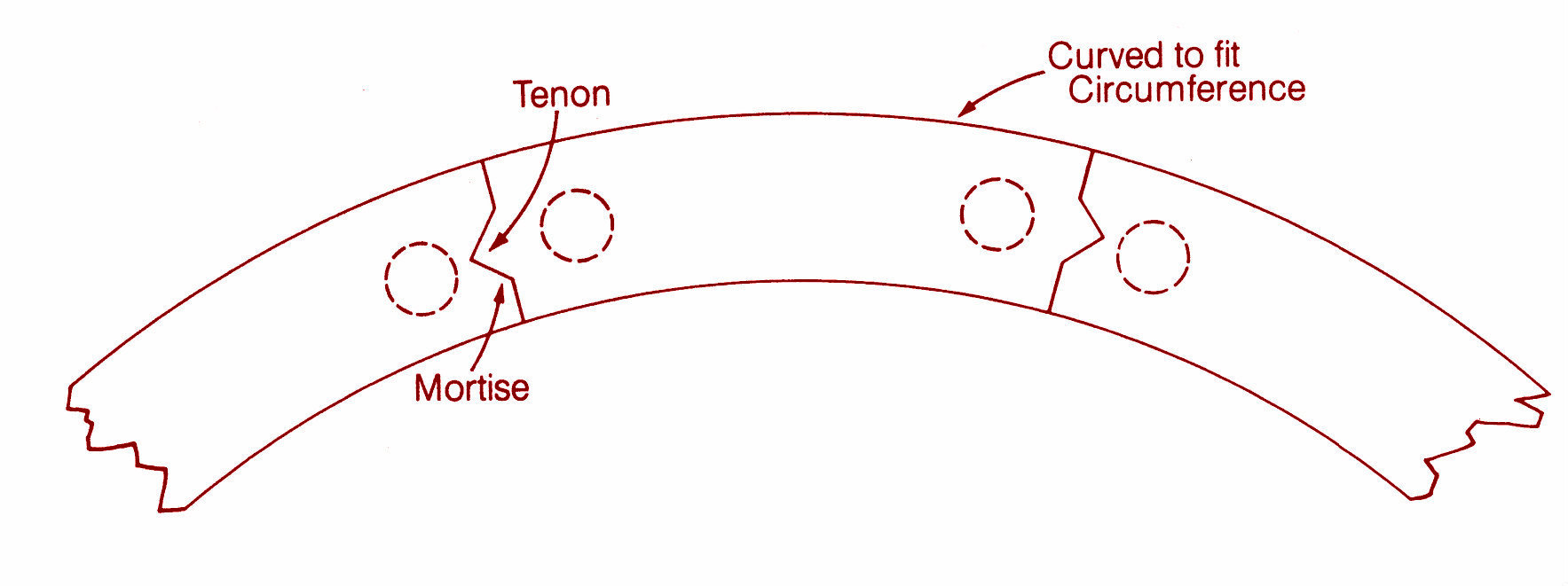
The first two diagrams above demonstrate one theory of how the trilithon stones were erected. The third diagram shows the sophistication of the construction, with each lintel fitting neatly into each other – borrowed from the Univeristy of Buckingham’s MOOC “Stonehenge”.
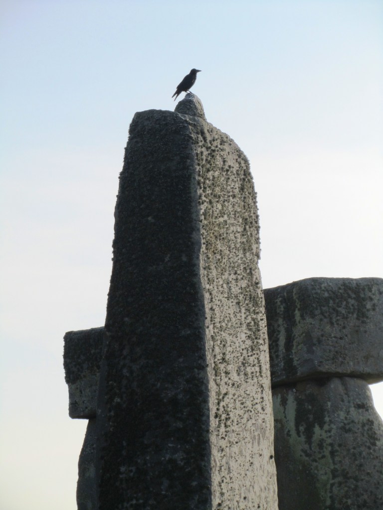
The friendly raven accentuating the knob which would have ensured a lintel that did not move.
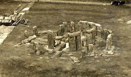
Stonehenge in 1917 – taken from a hot air balloon.
In a mere one hundred years it seems the two main structures of the trilithon horseshoe and the circle was completed. Interestingly it seems that greater care was taken in the shaping and construction of the stones visible from the north-east side and the main entrance. The bluestones were also erected at this time but not in the form we see today at Stonehenge. Excavation has shown us that there were two concentric arcs of stone holes, known as the Q and R holes were found on the north and east sides of the central area. It has been suggested that these were not representative of a complete circle as there is little to no evidence on the southern or western sides of corresponding holes.
The Heel stone – it is thought that unlike the other sarsen stones which come from the Marlborough Downs, the Heel stone was always here and simply raised upright.
2200BC – Consolidation and Alterations
From this time on Stonehenge underwent a series of minor alterations although the large sarsen stones remained in their positions although much later in the Bronze Age shallow carvings of axeheads and the occasional dagger were added. There are some 115 carvings and these have been dated stylistically to between 1750 and 1500BC.
The smaller bluestones however were rearranged and by 2200BC the incomplete circles were dismantled and repositioned to form a circle concentric to and just inside the circle of larger sarsen circle whilst a second oval of bluestones (spotted dolerite) was also formed within the trilithon setting. Later a number of stones were removed from the oval to form the horseshoe setting which is seen today.
The smaller stones are the remnants of the bluestone circle.
At around the same time the ditch was recut and a small bank was constructed and the Avenue was constructed. This later feature follows the solstice alignment with ditches and banks for part of the way and then veers off to the east ending in a valley of the River Avon. Recent excavations at the place where the Avenue meets the River Avon have uncovered evidence for a previously unknown henge monument made up of bluestones. These were likely to have been removed to supplement the bluestones already at Stonehenge.
Surrounding the monument are significant numbers of round barrows dating from the Bronze Age, some of which contained rich burials with artefacts made of bronze, gold, jet and amber. Suggesting a society rather different from the one which was able to come together communally to construct Stonehenge and yet the place, the landscape and the site still had a powerful pull to these people – it is no different today…
Above are two of the many round barrows littering the landscape around Stonehenge.
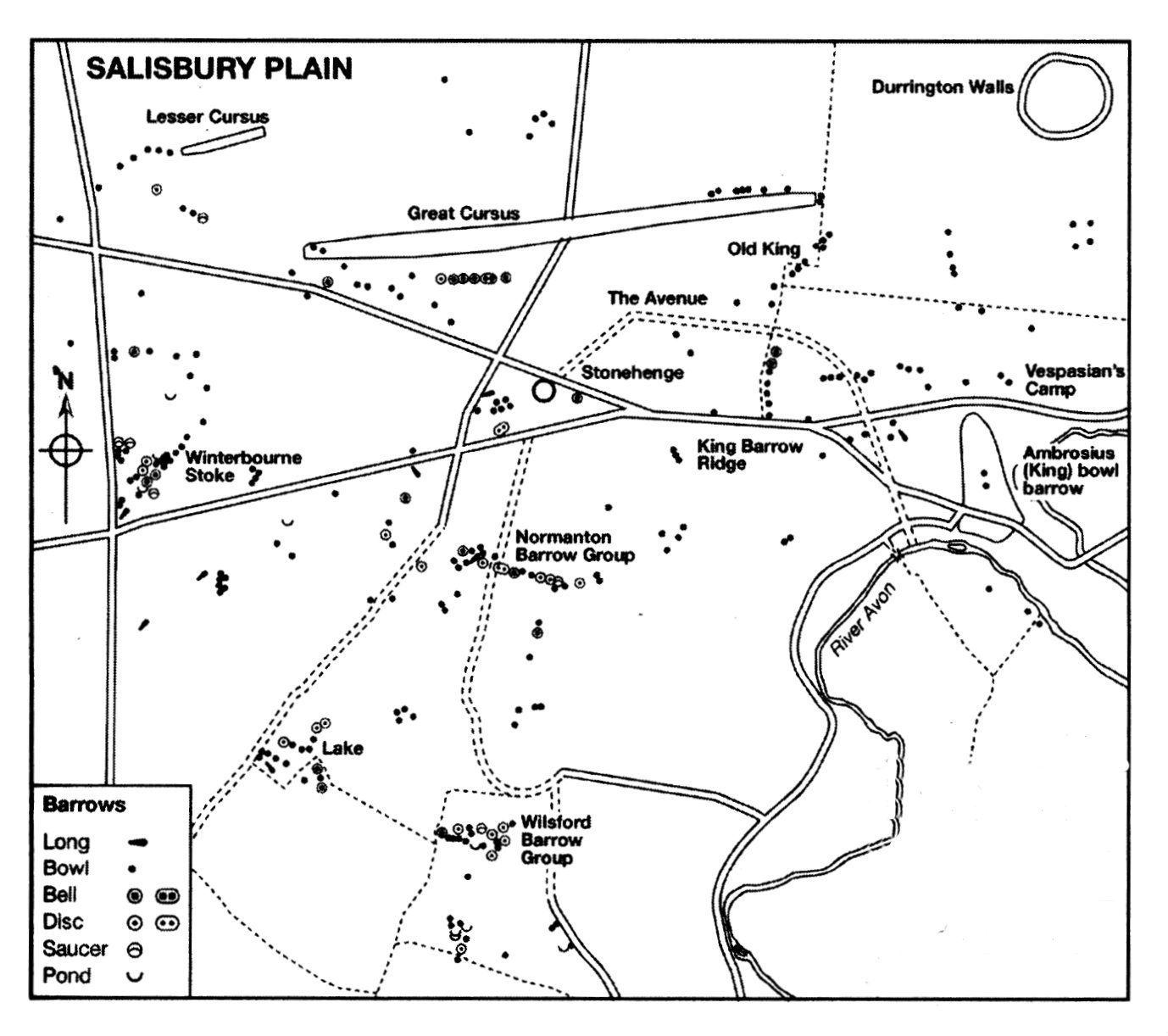
A map showing the distribuiton of barrows in the Stonehenge landscape.
The pictures above show a reconstruction of houses found during excavations at Durrington Walls which date to approximately the same time as when the main phase of construction at Stonehenge was underway. It is interesting to note the layout of the houses with the ‘dresser’ opposite the door and the beds to the right as you enter. This layout is reminiscent of house layouts at Skara Brae and later similar layouts are seen in Bronze Age roundhouses.
This slideshow requires JavaScript.
Stonehenge is a UNESCO World Heritage Site, it is one of the most popular tourist attractions in Britain; it evokes a variety of emotions; it is a British icon and yet so many people still only today see the stones. Yes they are impressive but there is so much more to their story than what you see. To really understand Stonehenge the curious need to look at the wider landscape and then look further again. Afterall, not too far away is the equally astounding landscape surrounding Avebury. What was the relationship between these two sacred landscapes? What can they tell us about the people who lived at the time? These landscapes were created by a people who viewed the world very differently to ourselves and carry a language, a dialogue that would have been obvious to those who lived in the Neolithic and even the Bronze Age. In our modern world where landscapes are viewed as places to use – either to make money or in terms of leisure pursuits – it is often hard for us to step back in time to view the landscape as living breathing entity without which we could not survive.
Stonehenge and its surrounding landscape undoubtedly meant many things to the people who occupied it (and probably those further afield too), the stones themselves were taken from the land and perhaps used to create a space where the natural world could be contained; where a semblance of control was maintained; where perhaps a balance was found between the natural world and the constructed world.
There are a great deal of books and websites which delve into the Stonehenge enigma in far greater detail. I have listed some of those below (browse Amazon for comprehensive lists). In particular I would like to recommend the free online course run by Buckingham University via Iversity (click here for more details).
Further Reading
Pryor F (2016) Stonehenge: The Story of a Sacred Landscape
Parker-Pearson M et al (2015) Stonehenge: Making Sense of Prehistoric Mystery
Parker Pearson M (2013) Stonehenge: Exploring the Greatest Stone Age Mystery
Bowden M et al (2015) The Stonehenge Landscape: Analysing the Stonehenge World Heritage Site.
If archaeology is your thing (and it’s certainly mine) then Cornwall is a great county to visit with a mulititude of sites to visit, especially if you want to get away from the crowds and sitting on the beach has lost its appeal. From the outset I should point out the following are my favourite sites/landscapes to visit (it was quite difficult to keep it to just ten and yes they are mostly prehistoric sites), others may have different views – the list is purely my own opinion. Feel free to comment on your favourites.
1. Chun Castle and Quoit
Okay so I have cheated a bit – here we have two very different sites but their proximity to each other I think allows for a bit of cheating…
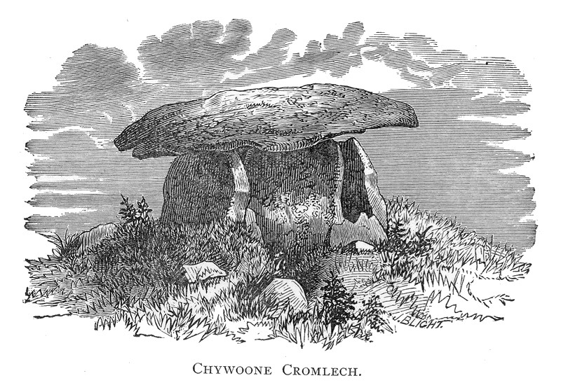
Firstly, Chun Quoit – quoits are neolithic monuments found throughout Cornwall (there are about a dozen known sites) consisting of upright granite slabs topped by a large capstone. They can also be called portal dolmens, chamber tombs or cromlechs. Some are in a better state of repair than others and Chun Quoit is perhaps one of the few which has been interferred with the least. Chun Quoit consists of four large uprights supporting a capstone which is estimated to weigh over 8 tonnes. It is also possible to see the remains of a circular stone cairn and associated kerbstones (the stone rubble at ground level) which would have originally surrounded the Quoit but not covering it leaving a the facade and the capstone visible.
Two hundred metres to the east of the quoit are the impressive remains of Chun Castle. Unlike many other Iron Age hillforts which utilise an earthen ditch and bank system Chun Castle is entirely stone built. It consists of two large concentric stone walls and is 85 metres in diameter. There is some evidence that the hillfort was built over an earlier enclosure represented by a shallow ditch and low bank on the southwest side. Inside the hillfort there is a stone lined well and escavations during the late 1920s found evidence for a later post Roman occupation of the hill fort. Iron Age occupation consisted of at least a dozen round houses which based on the pottery found date the site to the 3rd and 2nd centuries BC. Sitting high on the ridgeway known as the Tinners Way the site would have been visible from many miles around, from here it is possible to make out several other hillforts in the distance such as Caer Bran. Below the hillfort about 500metres to the north east is the site of Bosullow Trehyllys – a courtyard house settlement of the late Iron Age (see the earlier post on Chysauster and Carn Euny), it is unexcavated but appears to consist of at least three detached courtyard houses and a number of round houses.
2. Chysauster
I wanted to include a courtyard house settlement in the list and it was a choice between Carn Euny and Chysauster. In the end Chysauster won mainly because it is easier to get to but also because the visitor can get a good idea of size of this unique house type. However, I would recommend a visit to Carn Euny too – the fogou makes it well worth while. I have discussed both sites already in a previous post – Chysauster and Carn Euny – A Unique Settlement Type – so won’t say much more than that.
3. Treryn Dinas
Treryn Dinas falls into the category of Iron Age cliff castle or promontory fort – one of many coastal headlands with Iron Age defences in the form of earthen or stone ramparts and external ditches usually across the neck of the headland. The term ‘cliff castle’ does not denote a particular function, some were large enough to have settlements within their walls, such as The Rumps and Trevelgue Head, others were much smaller and perhaps served as trading posts or lookouts. Treryn Dinas, however, appears to more than that – the visitor only need to look at the position and surroundings of this site to realise it is special.
Overlooking the beach at Porthcurno, the ramparts enclose a large rocky headland which contains the Logan Rock – a substantial boulder perched on the outcrop which in times past would rock in the wind and was only dislodged in 1824 by cocky young lieutenant and the crew of the HMS Nimble. The local people were rightfully upset at this and the lieutenant was charged to replace the rock at his own expense and with the help of the admiralty it was eventually returned to its original position, although it is said to no longer rock as easily as it had done once before.
According to folklore the earliest inhabitants of the headland were the giants who protected the neighbouring communities in return for cattle and other necessaries. Giants are a common feature in Cornish folkore and seem to be particularly associated with large outcrops of granite which feature in the landscape. From an archaeological point of view Treryn Dinas has four lines of defence with the last crossing the low neck of the headland. It consists of a deep ditch and a stone faced wall behind which are the foundations of two buildings either side of the presumed entrance. The general view is that this site is one of spiritual significance which may date many centuries earlier than the Iron Age. Finds of Bronze Age pottery have been found wedged in the crevices of the outcrop, the Logan Rock itself may have been seen as supernatural and there is the problem of that fourth line of defence. You will note in the photograph below that this line of defence is not particulary defensible as it easily looked down from the landward side, in addition the amount of useful land on the headland is extremely limited and the only thing the fourth rampart is ‘protecting’ are the rocks themselves.
Looking to the headland – below the rock outcrop is the remains of the internal wall protecting the headland.
The substansial outer bank on the landward side.
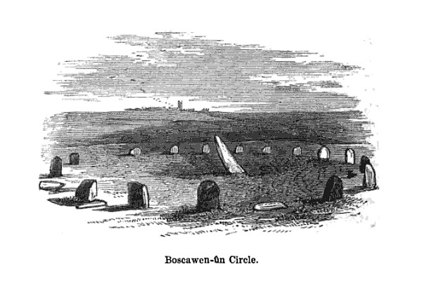
4. Boscawen-Un
In the parish of St Buryan is the stone circle of Boscawen-Un, dating to the early Bronze Age and consisting of nineteen stones there are several interesting features of the site. The most obvious is the stone which is slightly south of center, it leans sharply towards the north east and at its base there are two very faint relief carvings of axe heads. A past student once suggested to me that the stone itself looked like a large stone axehead which had been struck into the ground. Minor excavations have further revealed that its leaning position was intentional and not the result of subsidence. The second interesting feature of this stone circle is the large block of quartz to the south west which is part of the circle. Our understanding of the role of quartz within prehistoric rituals is poorly understood but there is an increasing amount of evidence which points to its importance.
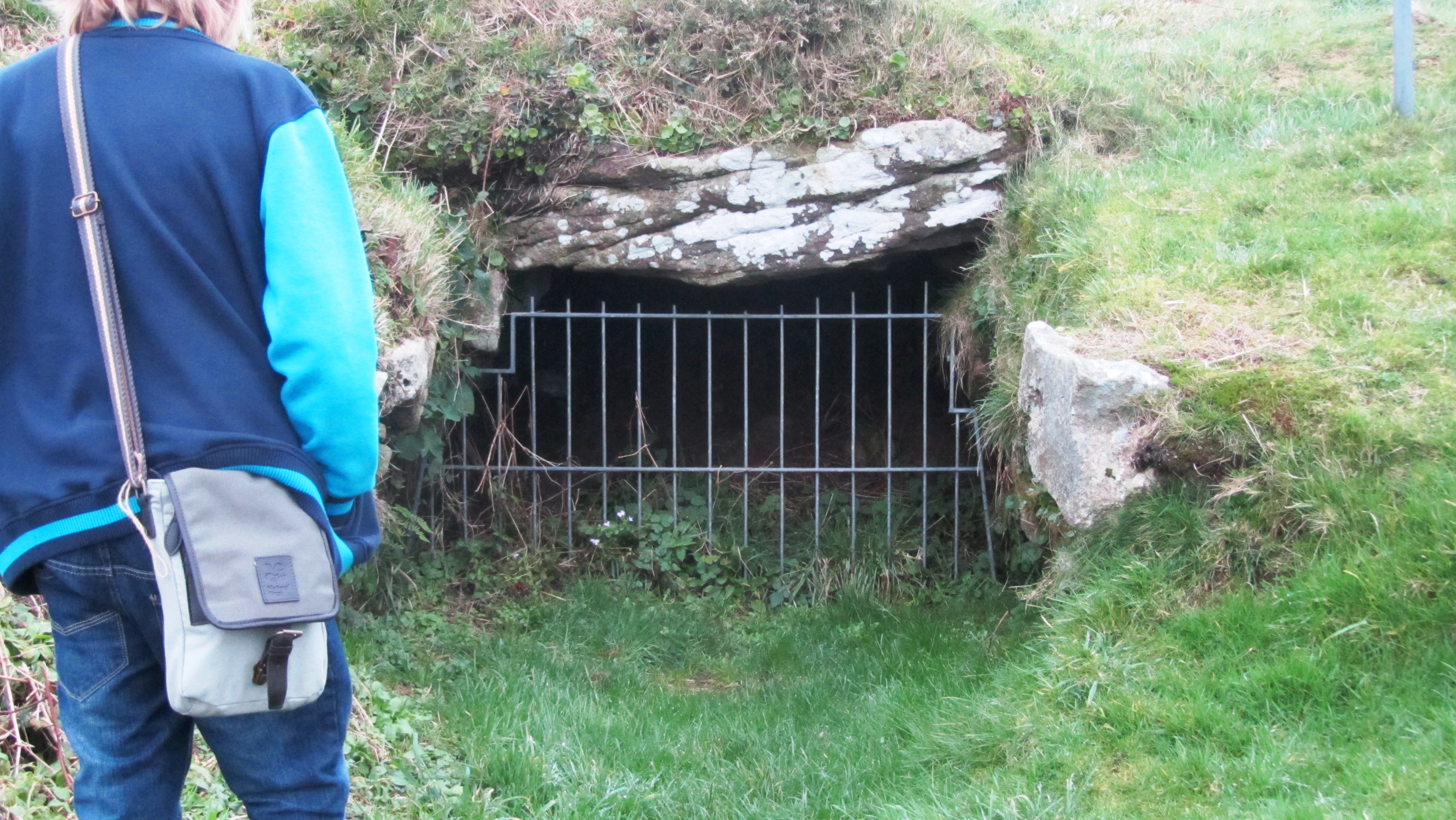
Okay, so now I really am cheating but the fact is any visit to Cornwall should definitly include a fogou and I couldn’t decide which I preferred – Carn Euny or Halligye are the easiest to get to and Halligye the largest (it can be found on the Trelowarren Estate, near Helston) however, Carn Euny does have a courtyard settlement, the nearby hillfort of Caer Bran and the fogou itself has a beehive shaped internal chamber. So you can see my dilemma…I have already written about fogous in an earlier blog so shall not rehash what we know and don’t know about these enigmatic structures.
The entrance to the fogou at Chysauster.
6. Carn Brea
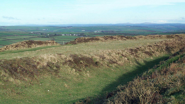
Situated between Redruth and Camborne is long hill easily visible from the A30, it is a hill with a long history beginning as far back as the Neolithic. Today two features stand out the most, firstly the the tall monument on the central summit erected in 1836 in the memory of Francis Bassett of Tehidy and the second is the small medieval castle perched on an outcrop. The latter was most likely a hunting lodge belonging to the Bassetts, an ancient local family and was first recorded in the fifteenth century. The land surrounding the hill was prime tin mining country and the flanks of the hill are covered in shafts and pits.
Heading further back in time the astute visitor might notice the remains of eleven Iron Age roundhouses on the saddle between the east and central summits, these are part of a much larger settlement on the hilltop, set within a substantial hillfort of forty-six acres. The defences are made up of two ramparts enclosing the hill. However, the occupation of Carn Brea began much earlier in the Neolithic. Surounding the eastern and central summits are another two smaller enclosures, of these the eastern summit has been partially excavated. The date range showed that the ramparts had been built somewhere between 4000 and 3500BC, making it the oldest known fortified settlement in Britain. There were traces of wooden buildings and Neolithic pottery, in addition a large number of flint arrowheads (700+) were uncovered along with evidence for the destruction of the site suggesting the site had been under attack (Cornish Archaeology, 1981, 20).
Looking east the 15th century castle can be seen in the distance. In the foreground the remains of one of the Iron Age roundhouses is visible as a semi circle of stones.
The path through the inner Neolithic enclosure wall.
Winter is the best time to visit – the outer ramparts are clearly visible.
7. Trevelgue Head
So many visitors to Cornwall will invariably end up in Newquay without realising the long and fascinating history of this seaside town. Just north of St Columb Porth on the road to Watergate Bay is the impressive cliff castle of Trevegue Head. It is the most heavily defended of all the cliff castles with seven lines of defence. The first ditch and bank is not so obvious as the next six with largest bank being roughly four metres high. Erosion over the centuries has seen much of the land disappear and it is suggested this included the original entrance. Excavation in th 1930s demonstrated that Trevelgue was continously occupied from the thrid century BC until the fifth/sixth century AD. At least fourteen roundhouses were identified (it is still possible to see the house platforms with a keen eye). Given its position in the landscape, the sheer scale of the defences, some of the artefacts found (bronze horse harness and Roman coins) in addition to the significant amount of evidence for both bronze and iron smelting, it is fair to say Trevelgue Head was most likely a high status site, the home ground of someone of great import.
The importance of this headland and other similar to it along the coast is further attested to by the presence of the two bowl barrows dating to the Bronze Age – these were opened in late 1800s but nothing is known of their contents. Further along the coast is Trevelgue Downs where a further two barrows can be seen. In the eastern barrow a crouched adult skeleton was found within a stone cist with a stone battlexe close to hand. From personal experience I have walked this cliff castle many times and it was not uncommon to espy tiny Mesolithic flints protruding from the exposed edges of the paths. Further testament to the sites long history.
Looking towards the end of the headland. On the right is the first of two Bronze Age barrows.
Eroded banks and ditches of Trevelgue Head.
8. Tintagel
It had to be on the list – perhaps one of the most controversial of all sites in Cornwall from local resistance to English Heritage’s plans for the site to the myriad of myths and legends associated with Tintagel – no where captures the imagination more. Like several other sites on this list I have already waxed lyrical about Tintagel so will not bore the reader with much of the same (but do follow the link if you want to seperate fact from fiction).
9. Castle an Dinas
An impressive example of an Iron Age hill fort found in mid Cornwall near St Columb Major. Measuring 260m across it would have been a formidable place in its heyday, the substantial ramparts are visible for many kilometres even today. There is some faint evidence for a much earlier enclosure on this hilltop possibly dating from the Neolithic or Bronze Age and the presence of two Bronze Age barrows within the hillfort is further testament to the importance of this place throughout prehistory. In the early 1960s a relatively small excavation was undertaken with the idea of prove the tradition of such places being re-used during the post-Roman phase and although they failed to do this a fine cobbled road was found.
The earthworks of Castle an Dinas – note the commanding view from the hillfort. Photo by Mike Hanncock (geograph.co.uk)
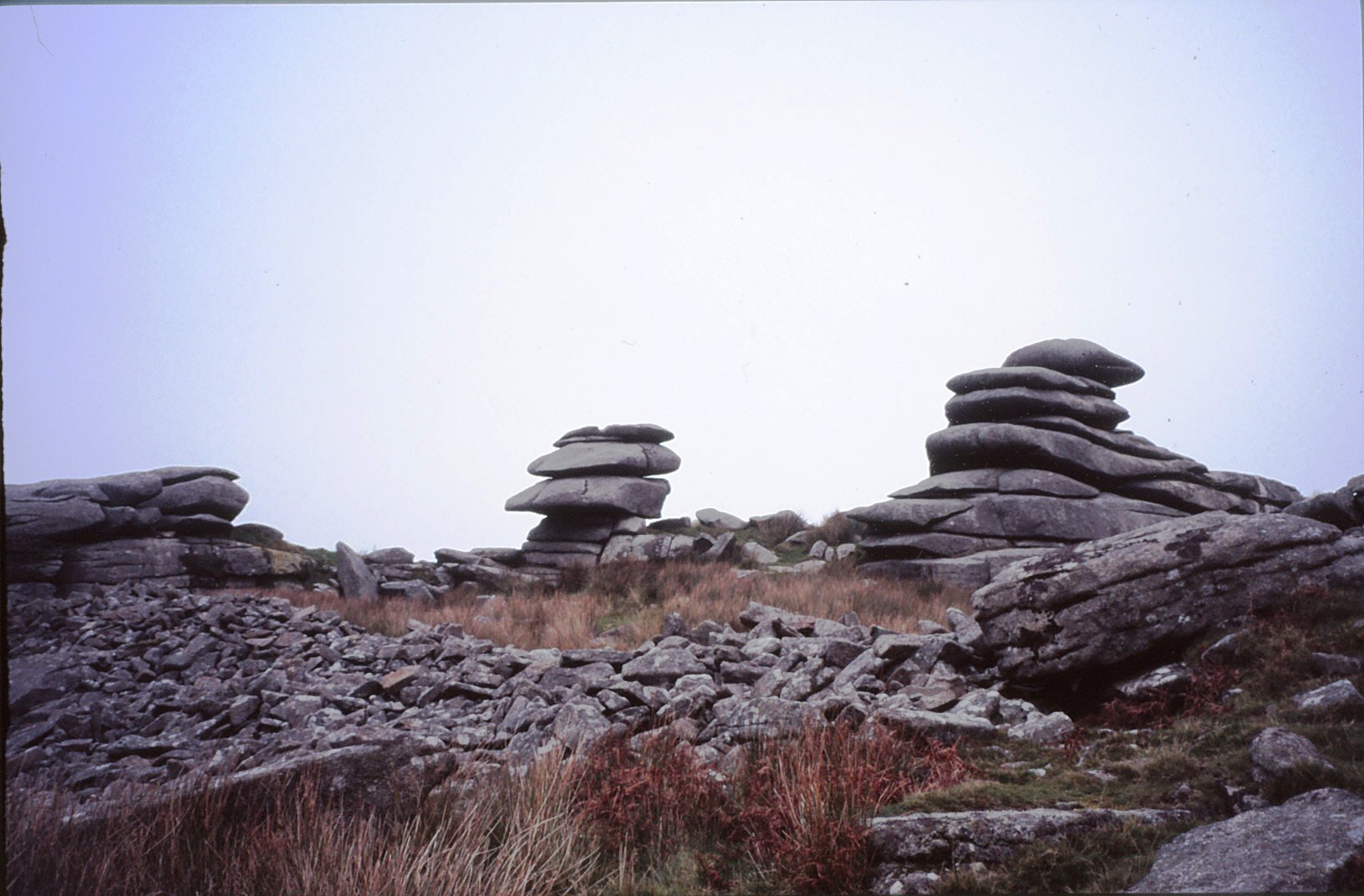
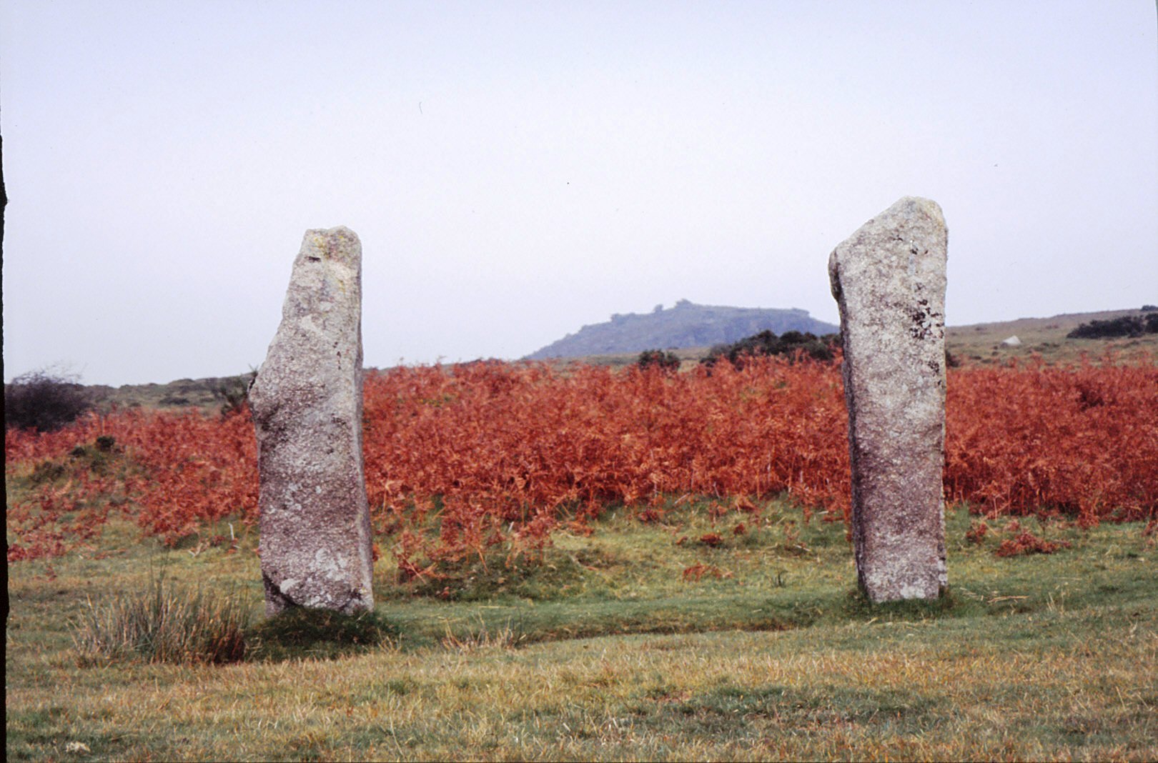
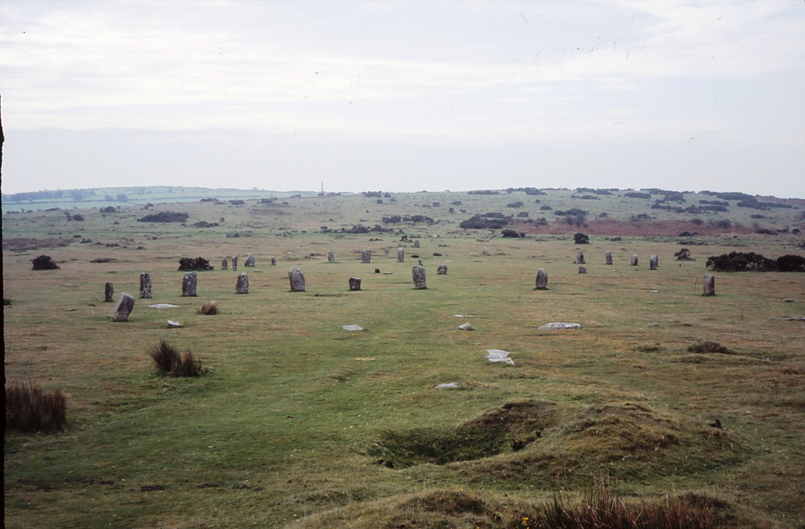
10. Bodmin Moor
Yes I know this really is cheating…but no list of sites to visit is complete with at least one from Bodmin Moor. However the problem is I could not choose just one, there are so many wonderful sites to visit on the moor. Like its much larger cousin in the next county over, Dartmoor, Bodmin Moor has a wide variety of archaeological sites to visit beginning way back into the Mesolithic (flint scatters possible representing seasonal camps as found on Butterstor) and the Neolithic such as Stowes Pound and Rough Tor which are thought to be tor enclosures similar to Carn Brea and Trencrom further to the west, but it is the Bronze Age which dominates the archaeological record.
There are stone circles, stone rows, menhirs, barrows (earthen mounds), cairns (stone mounds) and of the latter there is in excess of 300 known. The most well known barrow is the Rillaton barrow which is the largest on the moor and where an individual was buried with a bronze dagger, an urn and a beaten gold cup.
“…the distribution of the monuments throughout the whole of the upland suggests that its use had intensified enormously. Virtually every block of land (as defined for example by prominent hills and divided by rivers and streams) is marked by a group of cairns, as if all available land was claimed and accounted for. The analysis of fossil pollens fromthe ancient land surfaces sealed beneath the excavated cairns shows that by this date the upland was predominantly open grassland, with woodland confined to the steep valley sides.” (Herring P & Rose P Bodmin Moors Archaeological Heritage pp17-18)
There are sixteen known stone circles of which the best known is the Hurlers. All the circles seem to have been placed carefully within the landscape – nearly all are within sight of tor which is always to the north of the circle, with Roughtor being the most dominant (nine of the sixteen circles). The stone rows, menhirs and embanked avenues are not as numerous but still make up an important part of the ritual landscape.
A feature of the later Bronze Age landscape of the moor is represented by the vast numbers of settlements represented by field walls and the stone foundations of round houses. There are approximately 1500 prehistoric round houses representing around 200 settlements and although only three have been excavated they are assumed to be all by analogy with Dartmoor to belong in the second millenium BC. Often found associated with these settements are field systems of varying shape and size best seen from the air and on large scale maps.
Ar around 1000BC a deteriorating climate and soils resulted in most settlements being abandoned and the use of the moor being less intensive. The hillfort sites of Bury Castle, Cardinham and Berry Castle are the only easily identifiable settlements of the Iron Age, although it is assumed that the moor continued to be used for the seasonal grazing of livestock, much as parts of it are today.
Stowes Pound – the tumbled wall of stones in the foreground represents the early and possibly Neolithic enclosure wall.
Two upright menhirs frame the view to Stowes Pound and the Cheesewring.