
For the last five years or so I have been walking the ever-faithful Brad the Dog to a small but perfectly formed bay known locally as Fitzpatrick’s. During this time, I have found a variety of interesting objects on the beach, some have obviously been washed in and others have eroded out of the beach head and sand. I also noticed a few interesting humps and bumps and well that was it, my curiosity was well and truly piqued.
Multiple questions kept my mind occupied, such as, who was Fitzpatrick? Who lived in the house on the hill of which only humps, bumps and a rambling rose remained? Why do I keep finding ceramics on the beach? And what about the pre-colonial settlement of the area? As I began to research it became necessary to expand the overall area of interest to include the bays east of Fitzpatrick’s – Onetaunga Bay and Kendall’s Bay – and the bays west – Soldiers Bay and Island Bay – in order to get a fuller picture.
For the purpose of this article there are two distinct early phases of settlement and use of the area – the Maori pre-colonial and the early colonial up to 1900 – which will be the focus of this article and the next (part two). Later occupation of the area can be divided by the World Wars particularly the second World War and the construction of the Harbour Bridge which indelibly changed the face of the North Shore. But first let’s consider the bare essence of the area, without the human factor muddying the waters.
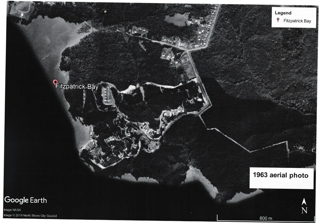
Note how much the landscape has changed between 1963 and 2019 below. 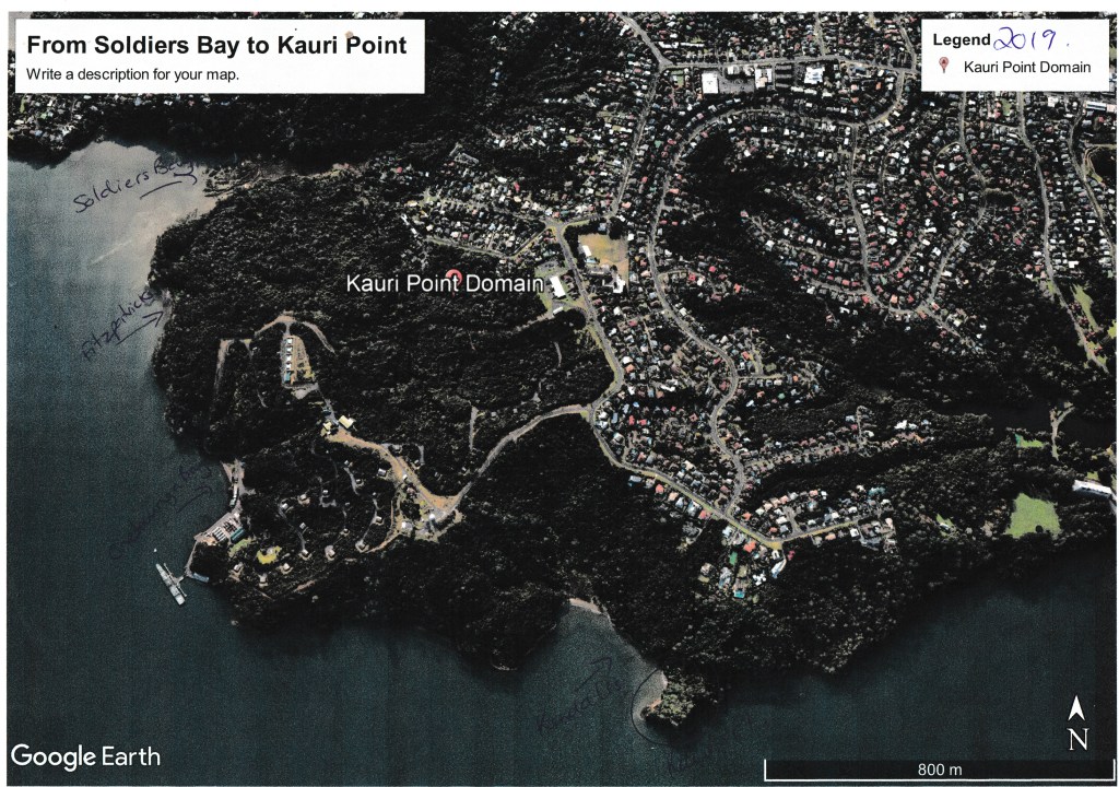
The Naval Base is in the middle of the dense bush that lines the coast.
The Geology and all that Natural Stuff…
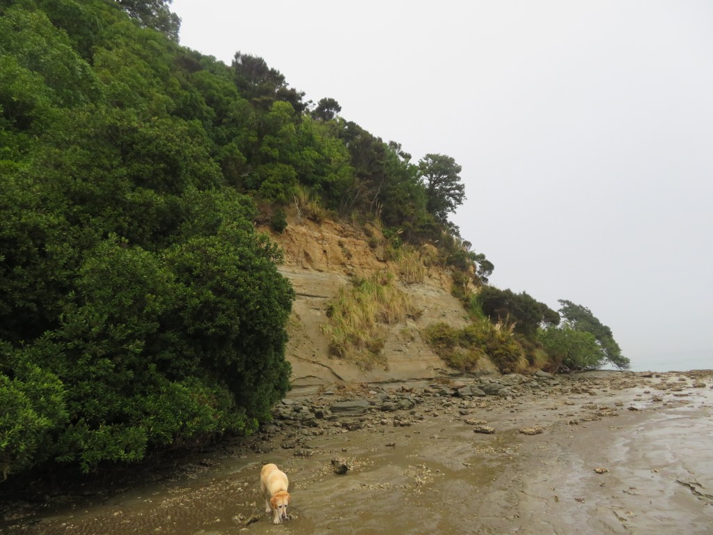
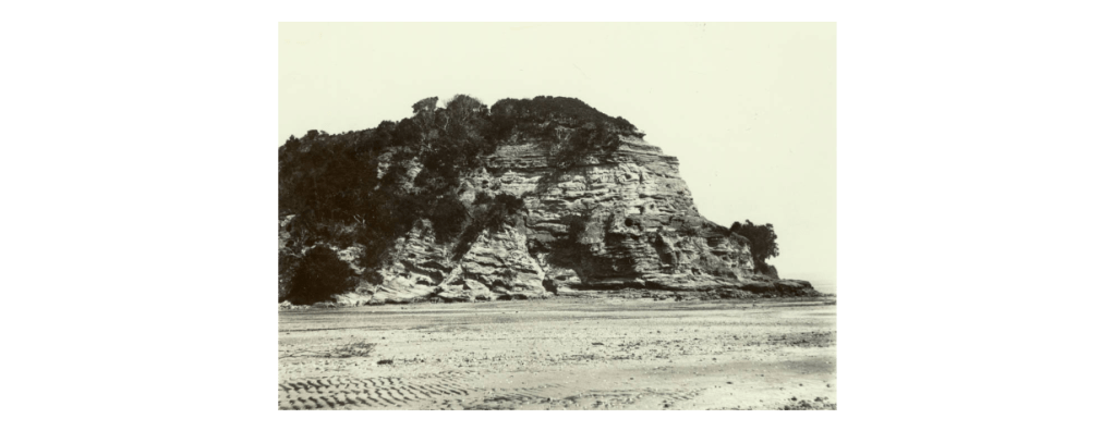
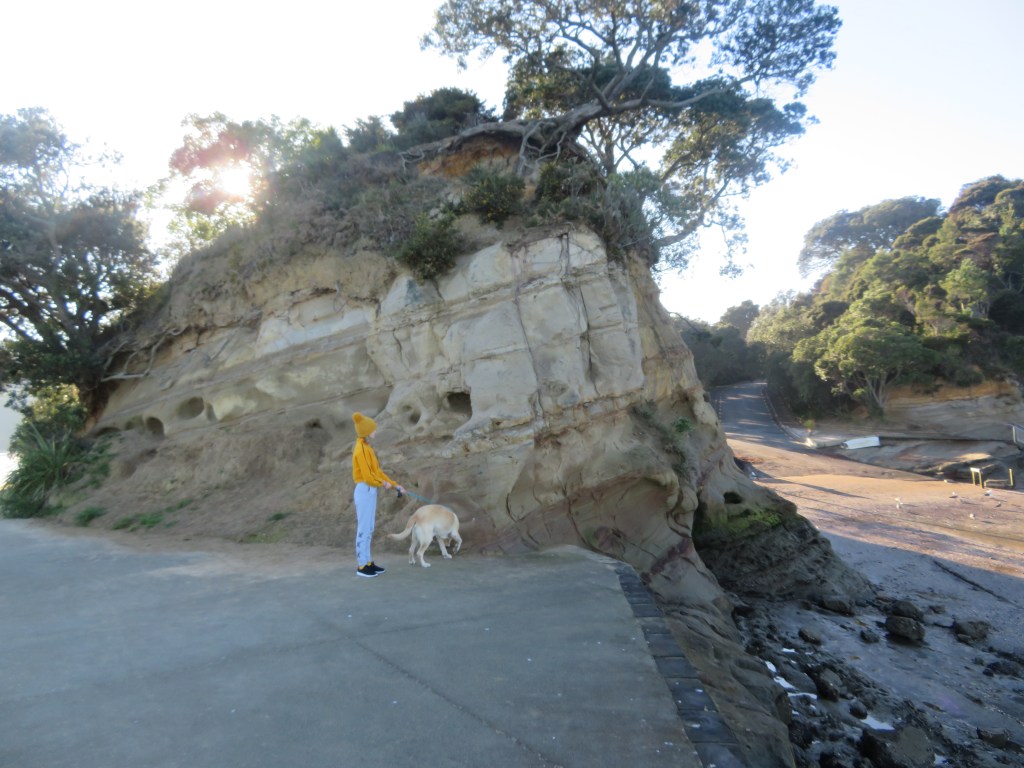
The area with Fitzpatrick’s Bay at its centre is situated on the north side of the Waitemata Harbour in the suburb of Birkenhead. Geologically speaking the Waitemata Harbour is a drowned late Pleistocene valley whose natural rock type is sandstone and mudstone. It is highly susceptible to coastal erosion, often resulting in steep sided promontories that continue to crumble particularly after heavy rain.
The current environment is one of invasive pine trees and impenetrable scrub bush although originally the hills behind the beaches were once thick with kauri, pohutakawa and other natives (small stands still survive in places). The presence of kauri caused the soil to be nutrient poor and therefore not the best for horticulture, unlike the landscapes on the opposite side of the harbour with its rich volcanic soils ideal for horticulture and therefore human settlement. However, the rich waters of the Waitemata made up for this deficiency particularly for the early inhabitants. On the southern edges of the Waitemata Harbour and opposite Kendall’s Bay is Meola Reef, also known as Te Tokaroa Reef – the area is well known to marine biologists as a shark spawning ground, here female sharks leave their young to fend for themselves in the relative safety of the inland harbour.
In addition to shark there are many other species of fish which frequent the harbour, such snapper, flounder and yellow-eyed mullet. The foreshore also provides an abundance of shell fish, predominately in the form of pipis, cockles and rock oysters.
The Maori
The Maori story of this part of Auckland differs considerably from other parts. The central area of Tamaki Makarau with its fertile volcanic cones was ideally suited to horticulture and thus heavily settled. The northern side of the inner Waitemata Harbour was not so suited to horticulture, the vast kauri forests having depleted the already thin soils of nutrients. So how was this part of Tamaki Makarau utilised by the Maori?
Our understanding of the settlement and subsistence patterns of this pre-Treaty of Waitangi time is restricted to the several defended promontories (pa) and the many shell middens which can be found around the shoreline.
The Pa
The term pa is taken to mean any settlement that consists of defensive earthworks such as banks and ditches. The pa in our area are mainly confined to the steep sided promontories that are usually adjacent to a protected beach where waka were able to land safely. The most well-known is Kauri Point or Te Matarae A Mana, named for Manaoterangi a chief of the Ngati Kawerau who flourished in this area from around 1720-1790. It is also the only pa to have any archaeological excavations undertaken (in response to the possible threat of the construction of a second harbour crossing, the first having completely destroyed Onewa Pa on Stokes Point in Northcote).
These excavations were undertaken by Janet Davidson in 1971 and consisted of a total of seven test pits in four areas. In the 1990 report of the excavation Davidson emphasises the strategic importance of the headland describing the approach from the landward side as being along a narrow and winding ridge which widens to become a flat-topped headland. The site has natural defences in the form of a steep scarp to the southern side which is enhanced by two incomplete ditches. The excavations and subsequent finds revealed that even given its impressive position the site was only used for a limited time. The middens found in three of the four areas produced well-preserved fish bone – but not much in terms of quantity; a single dog bone; pipi and cockle shell – the principal species, which was to be expected; as well as mussel and oyster shells. Interestingly, there were a large number of slipper shells whose flesh may have used as bait for fishing. The middens themselves were quite small and corresponded with the lack of structures found on the headland.
“In view of the apparently strategic location, this lack of evidence of prolonged or repeated occupation was surprising” (Davidson J 1990 ‘Test Excavations on the Headland Pa at Kauri Point, Birkenhead, Auckland in 1971’)
This was very different from other pa sites in Auckland and Davidson concluded that the headland had been constructed by people who visited the adjacent bay for seasonal fishing and that most of the activities happened in the bay below. The pa therefore may have had a more esoteric function such as the proclamation of the Kawerau Chiefs’ mana, an assertion of the group’s rights to the area and ultimately as a ‘just in case’ need for defence.
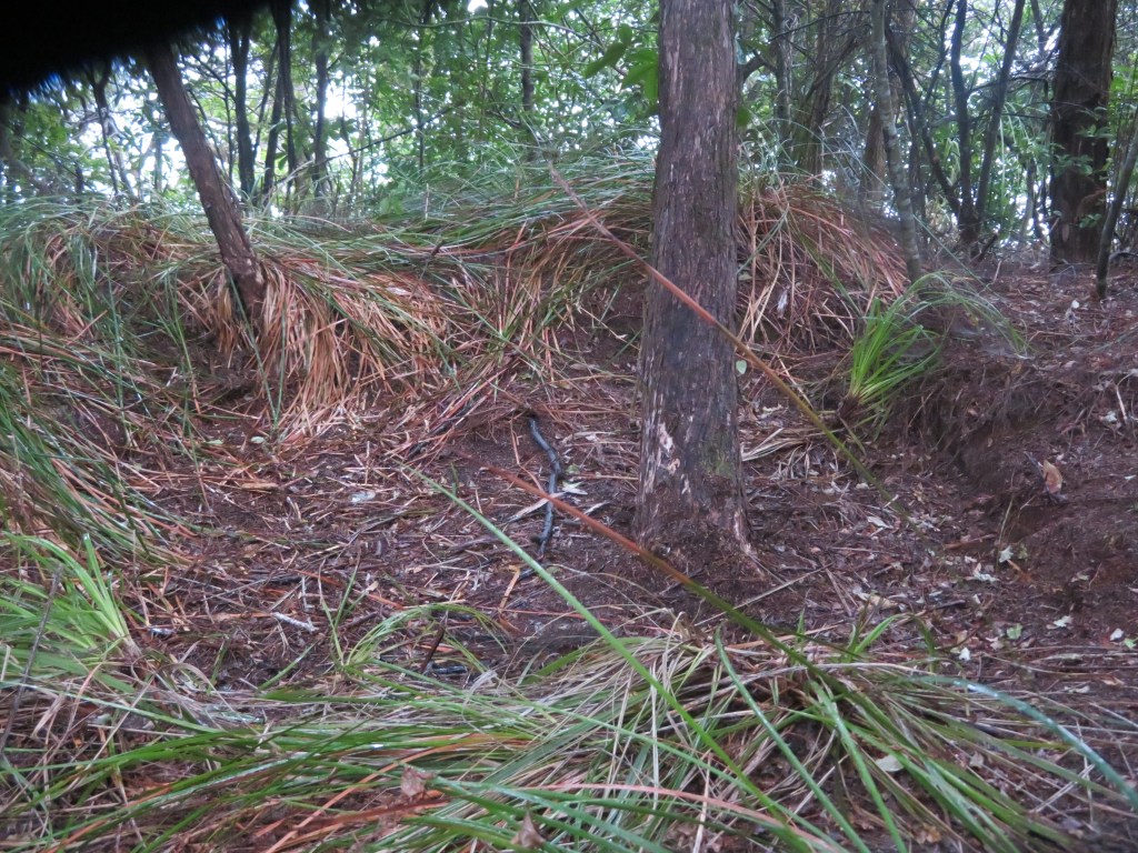
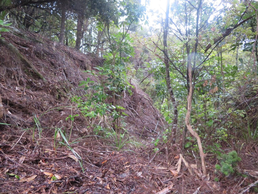
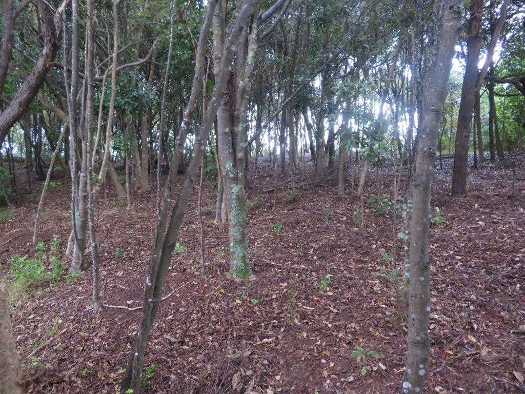
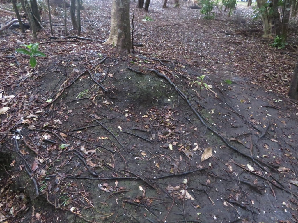
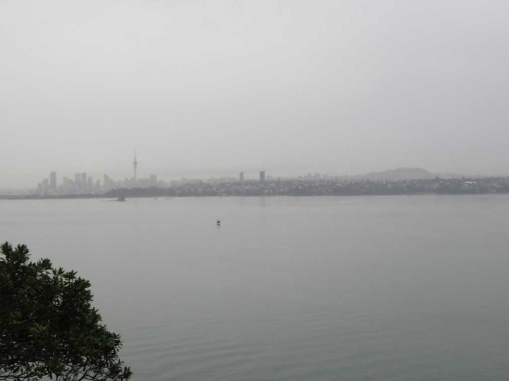
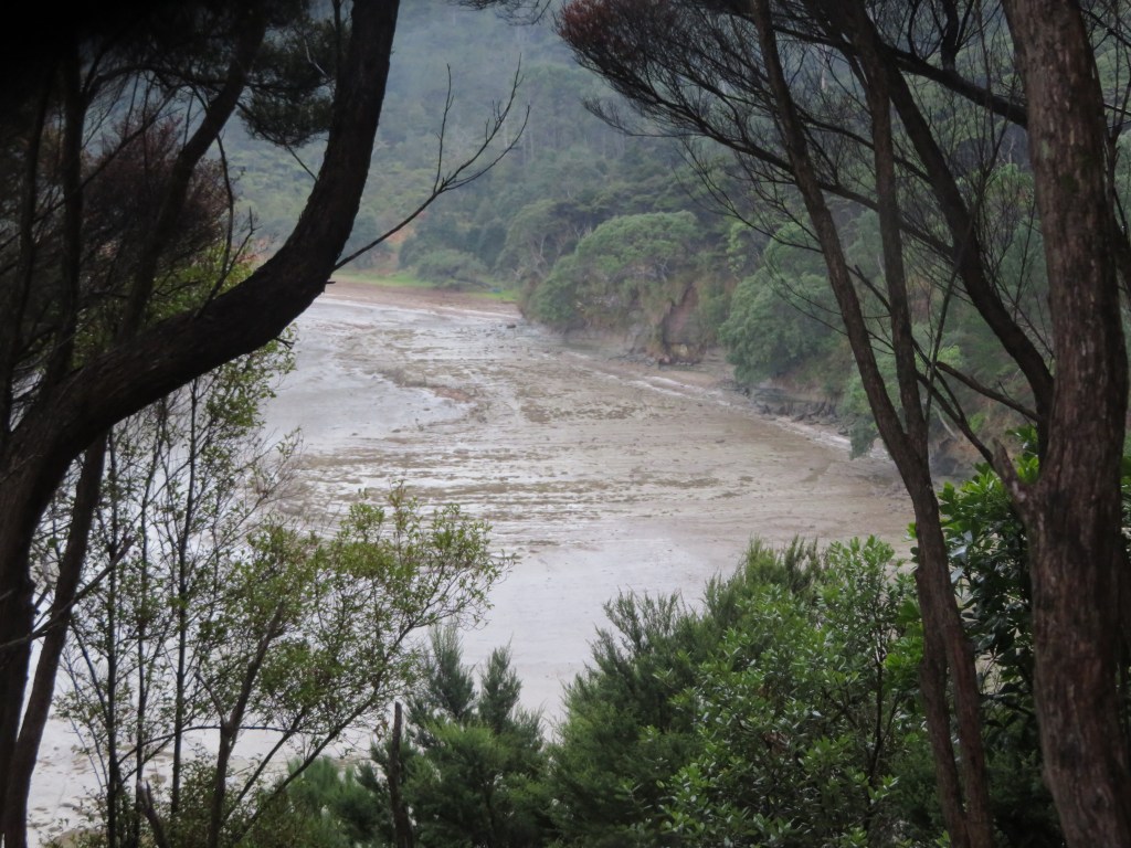
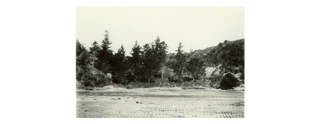
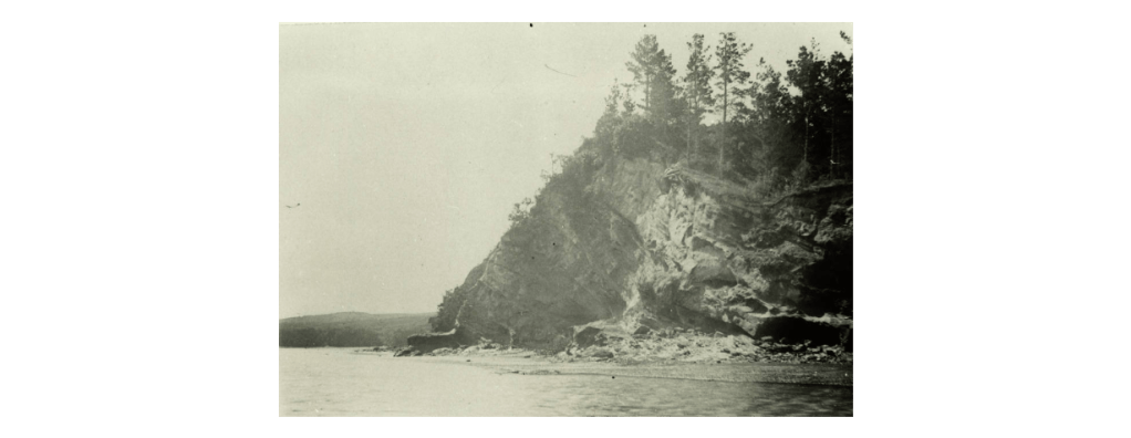
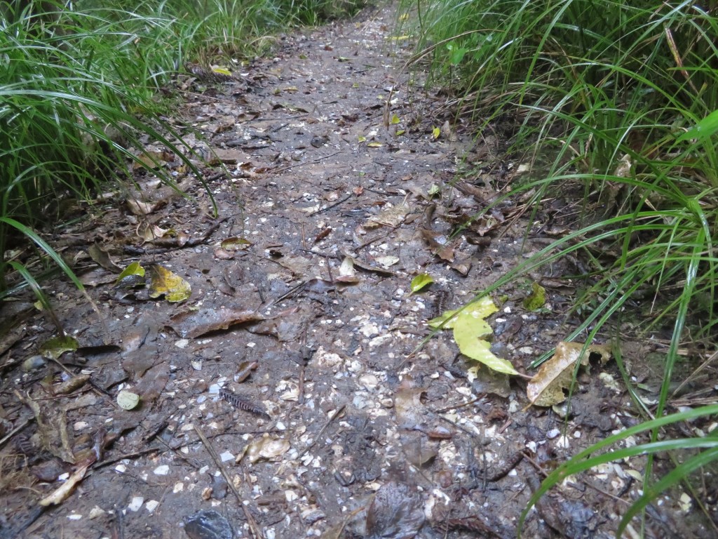
The photos below are a selection from Te Matarae – the first shows the overgrown nature of the eastern ditch; the second is of the interior which is flat to sloping; the third whilst not very clear is the remains of midden; the fourth is the view from the top out towards Auckland City and finally the last looks down onto Kendall’s Bay below.
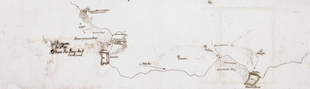
According to the “Cultural Heritage Inventory” published by North Shore City Council in June 1994 there are two further pa in the vicinity of Kauri Point. One was presumed to be located within the grounds of the Naval Base which sits in the middle of our research area and is inaccessible for security reasons. In 1899 a Colonel Boscawen did a rough drawing of the area to accompanying six photos he took. On the map he noted this particular pa which appears to be a major headland pa, was far greater in size than Te Matarae A Mana (Kauri Point). However, on closer inspection of Col Boscawen’s photos and map, it may be possible that this larger pa with its large ditches may not be in the Navy compound but further to the west and near to Soldiers Bay. Over a two-day period I attempted to prove or disprove this idea but the dense bush in the area was a significant issue. In addition, aerial photos have shown that even if the site was in the Naval base much of it would have been destroyed during the development of the land for the base. So as of now the issue is still unresolved…
Below are Col Boscawen photos of the various sites – 1. Te Matarae form landward – the ditches are faintly visible across the neck of the promontory. 2. Te Matarae from up on the hill which is now part of the Naval Base and assumed to be the pa site of Maunganui. 3. On Boscawen’s map this is labelled photo 5 and could be either Fitzpatrick Bay or Onetaunga Bay. 4. A view of the headland labelled photo 4 on the Boscawen’s map which is labelled as a Maori pa site and has two ditches drawn in. Once again this may be either at the eastern end of Fitzpatrick Bay or the headland on the Naval Base. 5. This headland at the western end of the beach as seen in number 3.
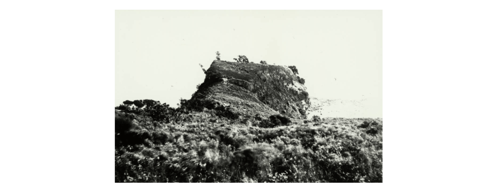
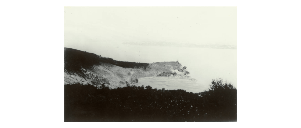
The second pa recorded is named as Maunganui and according to the “Inventory” Janet Davidson is thought to have identified ‘part of the Pa ditch in scrub just south and east of the trig at the corner of Onetaunga Road and the road to the Naval Base’. The general assumption is that it is situated on the ridge on which the Onetaunga trig is located, but there is still some doubt as later developments may have caused the landscape to take on forms which deceive the eye. It is interesting to note that Col Boscawen did not include this pa on his map of 1899, a site he would have been aware of, unless of course the large pa mentioned above was in fact Maunganui and this has become a case of mistaken identity.
Beyond Kauri Point and past Fitzpatrick’s are two further pa, one south of Island Bay and the second at Island Bay. The first is situated on top of a cliff about half way between Soldiers Bay and Island Bay. It has been recorded as consisting of a ten-metre square flat area with a small terrace forming the internal area of the Pa. There is ditch on the landward side whilst the other sides are formed by steep cliff faces or slopes.
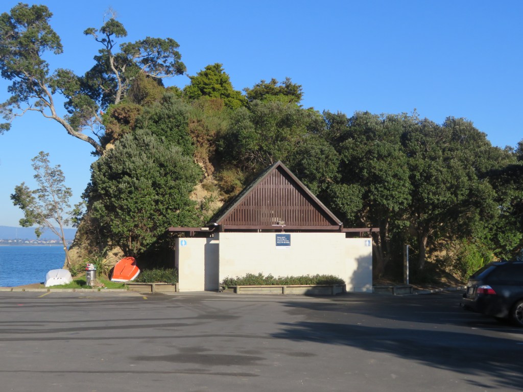
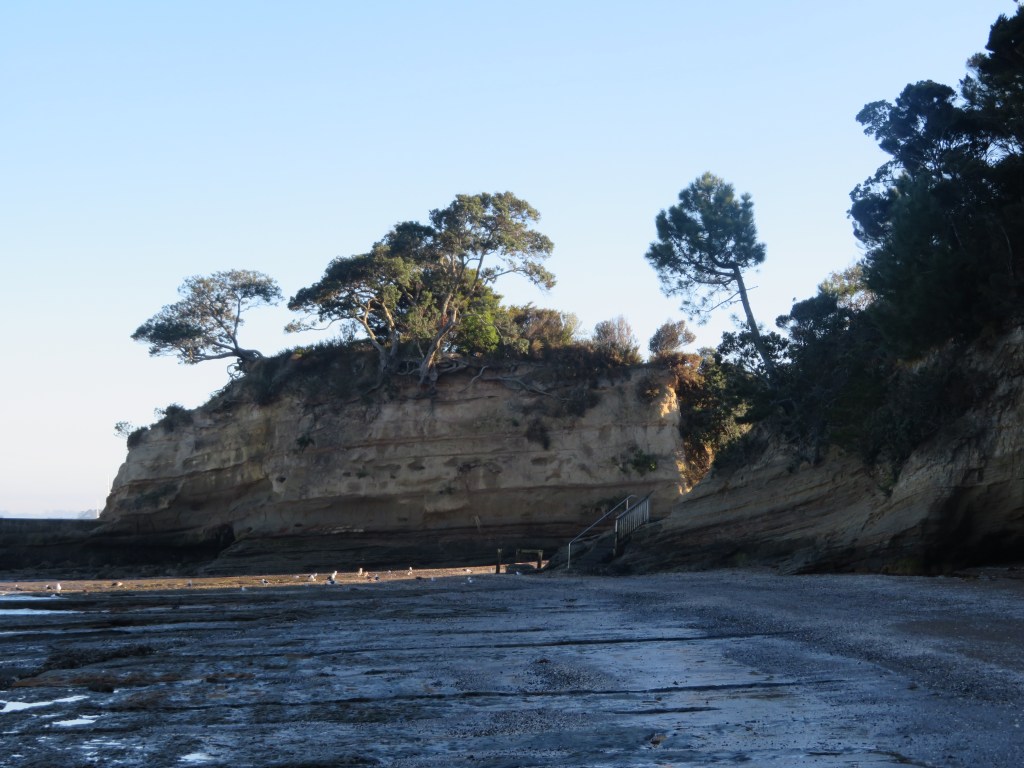
The photos below are of Island Bay – here a small promontory pa is joined today by a modern carpark which is reclaimed land. The pa itself has been extremely modified with the addition of concrete paths, a wharf and toilet block. The last photo shows the promontory in profile looking west.
The pa at Island Bay is situated on top of the island itself and it is approximately 15 metres by 20 metres in size; middens can be discerned on the northern and western sides. The middens appear to dominated by cockle shell, pipi and oyster. When last surveyed, charcoal, hangi stones and obsidian were also noted. It has been noted that the top of the island consists of some terracing which are not obvious until seen in profile.
The Middens
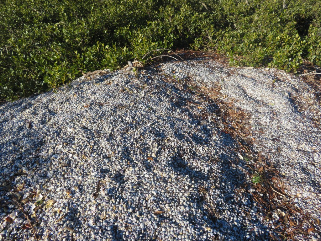
Already mentioned above is the Island Bay Pa midden, and in addition there are recorded middens at Kauri Point Domain and Soldiers Bay. The Kauri Point midden is regarded as the largest in the area and situated at the southern end of the Domain and is noticeable as a result of a stormwater drain cutting through it. Today grass has almost obliterated the view of the midden and it does appear to have eroded away quite a bit. However, previous surveys have found it to be three metres long and one metre high; three layers of shell have been discerned each separated by layers of sand and clay mix. Apart from cockle, pipi and scallop shells, hangi stones and charcoal are also present. Waterworn hangi stones are often to be seen on the beach, giving further emphasis to the issues of coastal erosion.
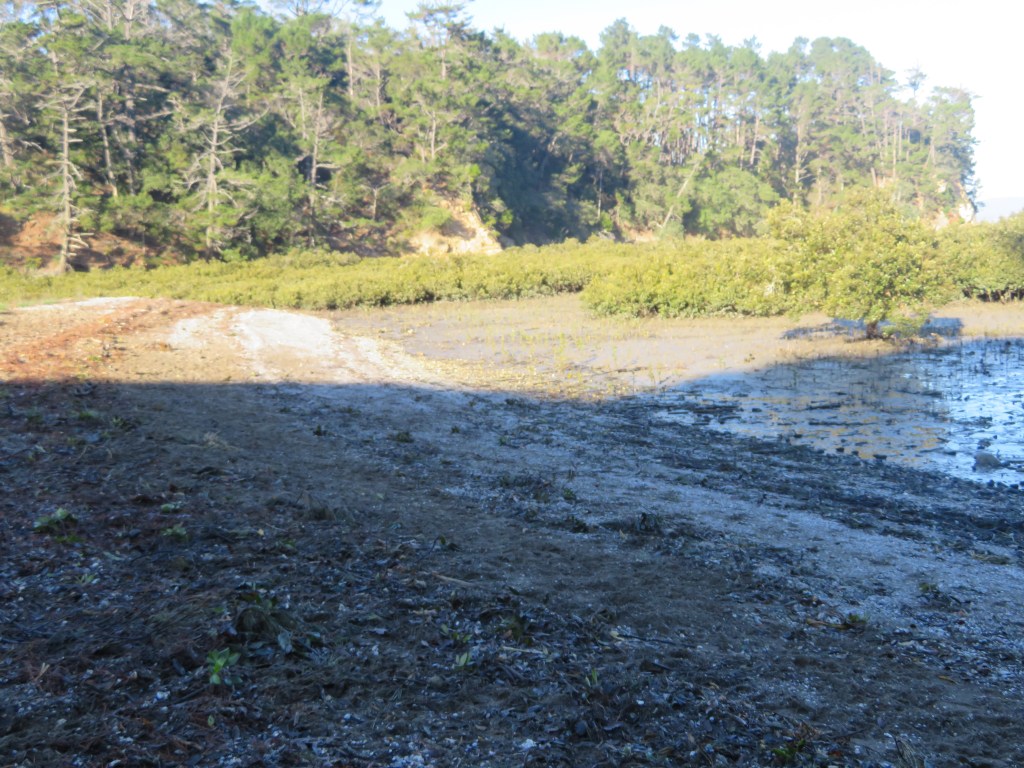
The midden at Soldiers Bay is situated on the small beach beyond the current mangroves. It has suffered much from erosion and when last surveyed was two metres long and spread over a height of three and half metres. Opposite and nearby are a further two smaller middens. In 1899 Colonel Boscawen drew a map to accompany half a dozen photos he took of the area. On this map he mentions the presence of ‘pipi shell mounds’ at the edge of a bay he called Quarryman’s Bay, which appears to be the combined bays of Soldiers Bay and Fitzpatrick’s Bay, and correspond with what can be seen today.

“The majority of the middens revisited are located in bays sheltered from the southerly winds…As for the pa, they are located on low cliff tips and are close to the deeper waters of the Upper Waitemata Harbour. They also have strategic views along prime fishing waters and are located along a major access route to the Kaipara Harbour located on the west coast.” (‘Archaeological Sites of Birkenhead’ by Richard Jennings in “Cultural Heritage Inventory” North Shore City Council June 1994)
Other Evidence
Other archaeological features which may be indicative of the Maori use of the area include a range of pits and terraces recorded at various places. Unfortunately, the later expansive development of the area means that much of the evidence has been destroyed, or what is being recorded may instead be the result of such development. The previously mentioned Colonel Boscawen also mentioned on his hand drawn map the presence of ‘fairly good soil, has appearance of old Maori cultivation’ in the area near to Quarryman’s Bay. A closer inspection of the beach area below Te Matarae revealed two possible house platforms above the high tide line and close to the cliff edge, these are hidden today by extensive regrowth and are not obvious from the beach. Each platform is roughly 5m x 12m.
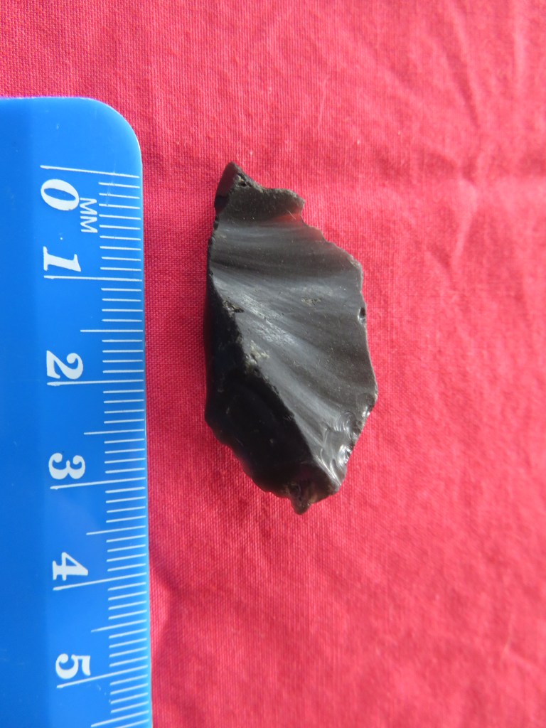
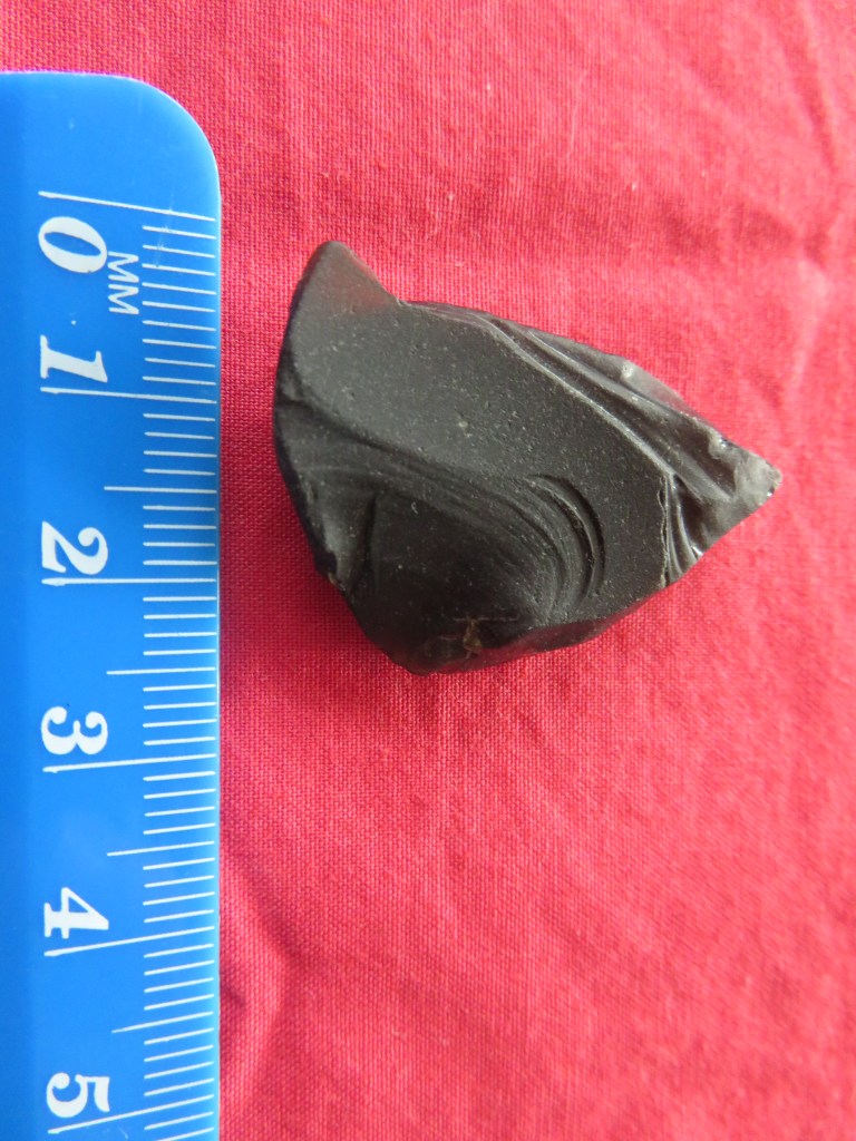
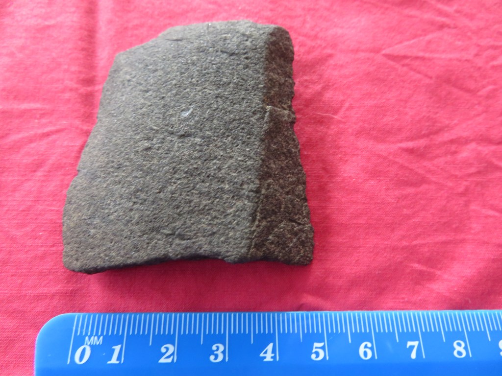
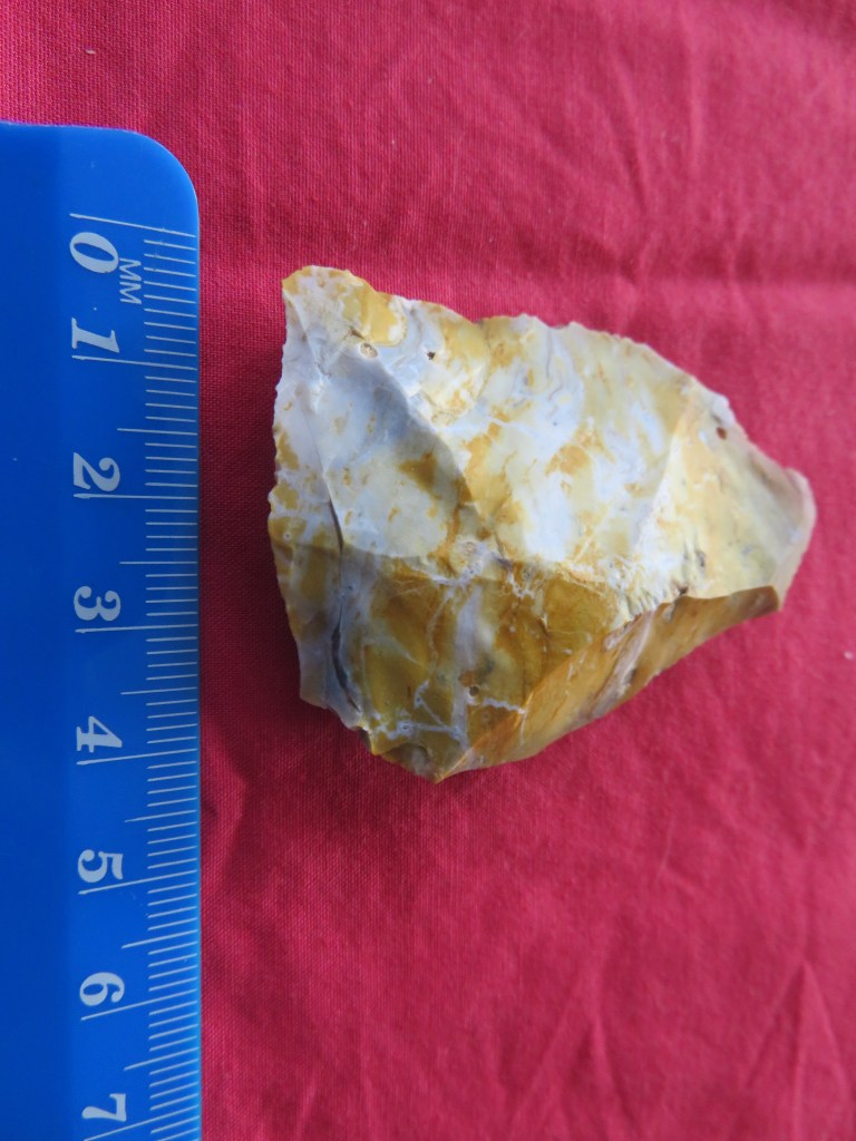
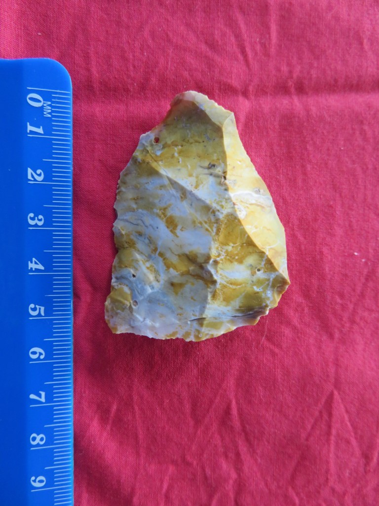
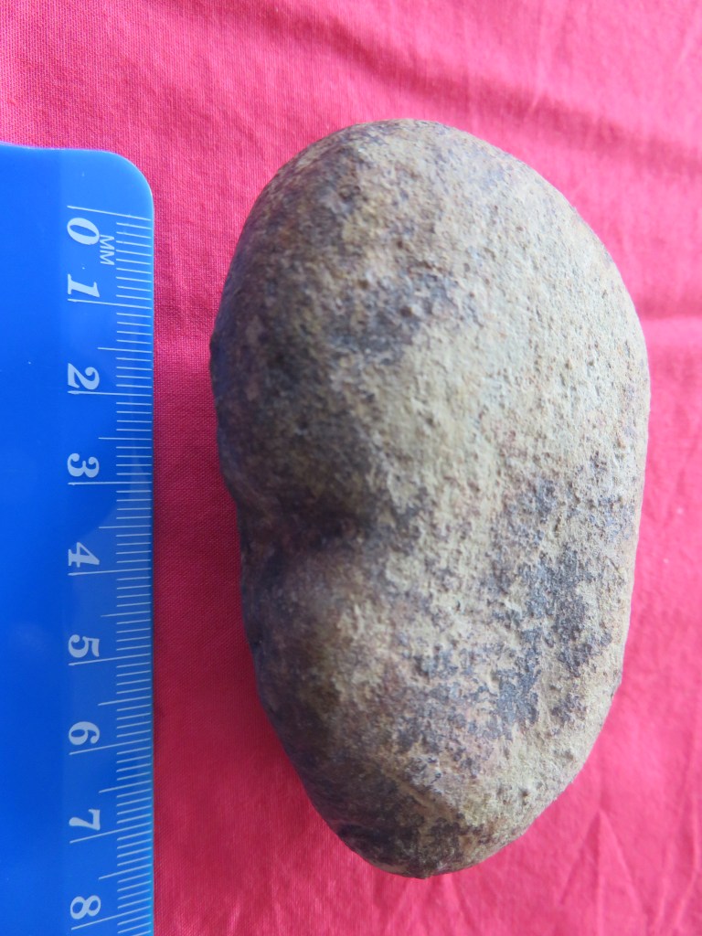
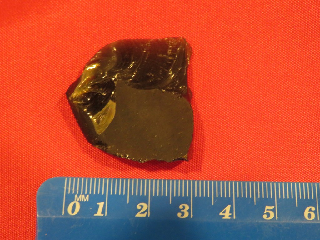
In addition to the actual archaeological sites there are two other sources of information which may serve to fill in a few of the gaps – beach finds (random artefacts found on the beaches of the area concerned) and oral tradition.
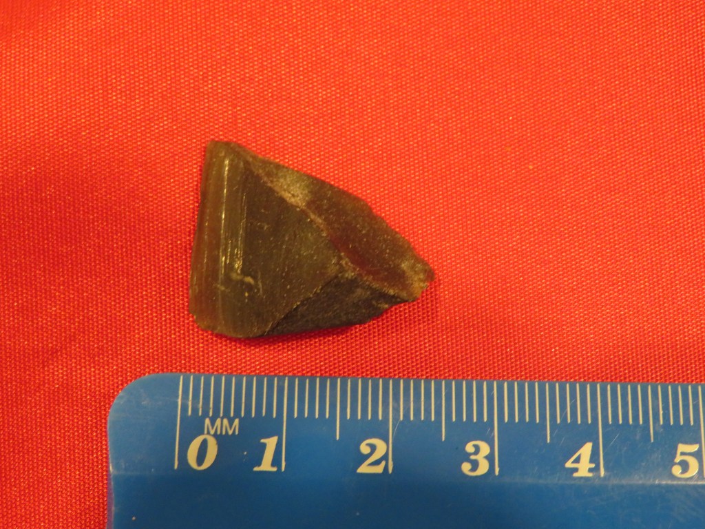
Below are selection of beach finds dating from this period – these were found mostly on Fitzpatrick’s Bay, Onetaunga Bay and Soldiers Bay. Please note that at no time did I or anyone else from whom I received information on these artefacts dig them up; they were found simply by eye on the foreshore below the tide line. What they can tell us though is that Maori were active in the area and had wide ranging contacts (the obsidian); the sinkers are indicative of a community taking advantage of the marine resources; the adze (and the pieces of adze) are suggestive of woodworking; and already mentioned are the hangi stones found in the tidal area as a result of erosion.
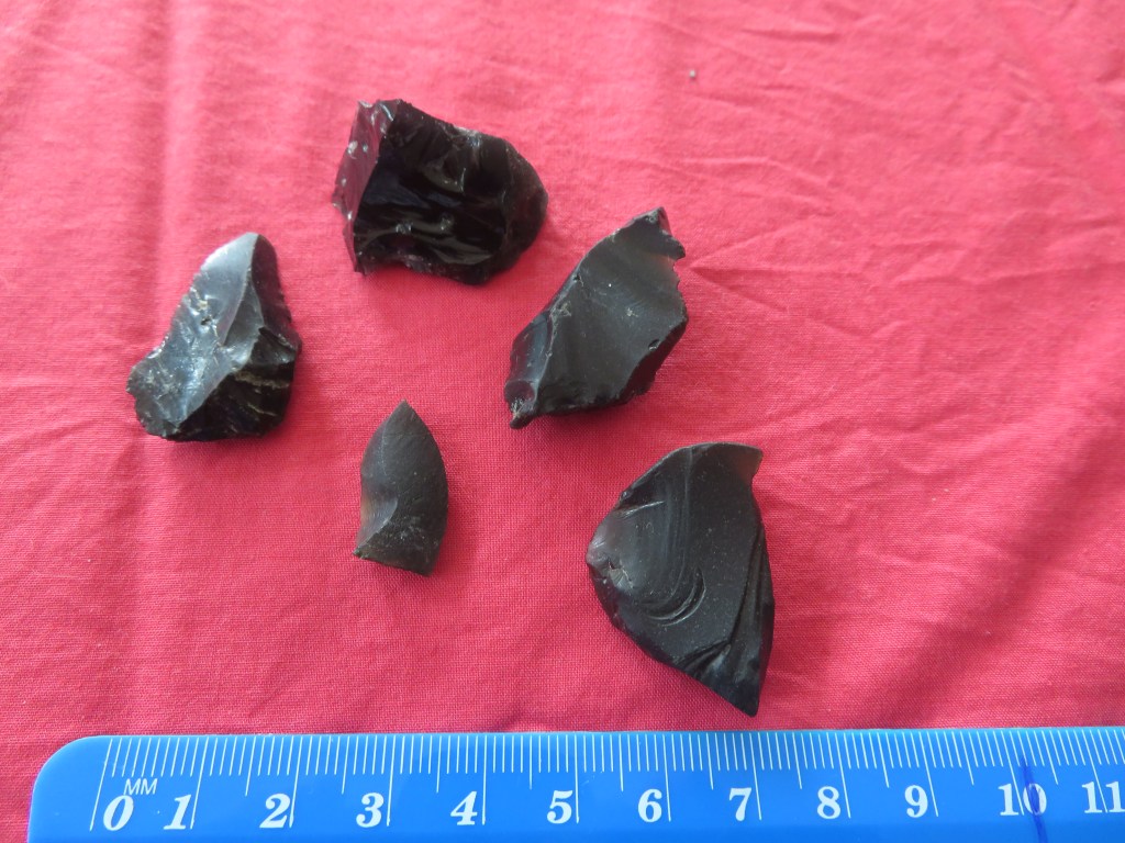
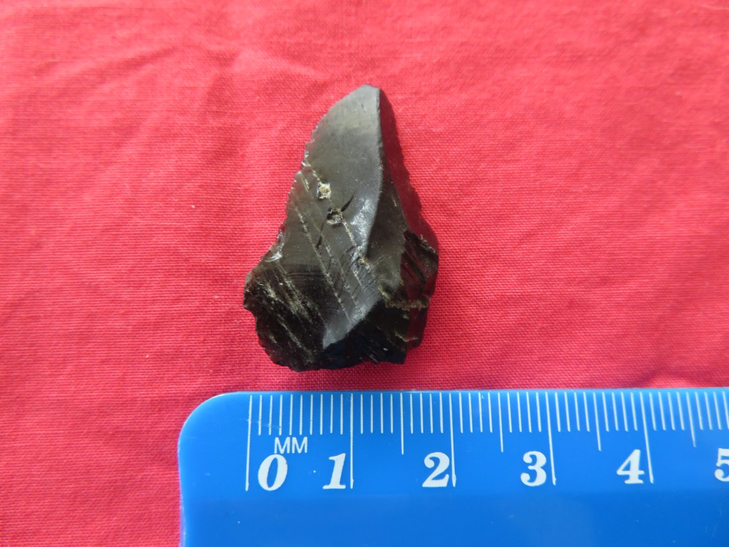
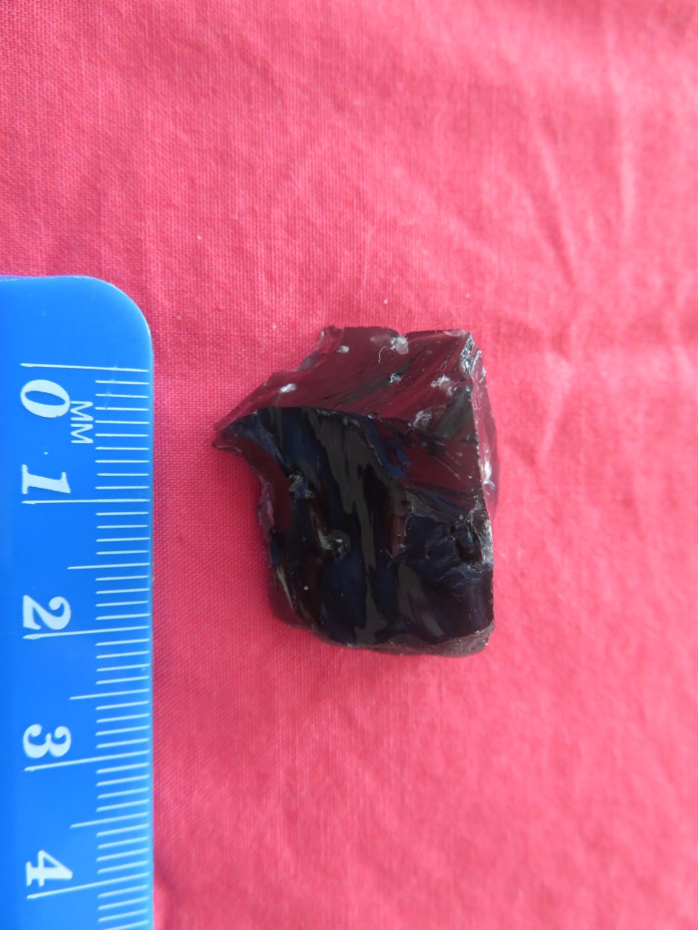
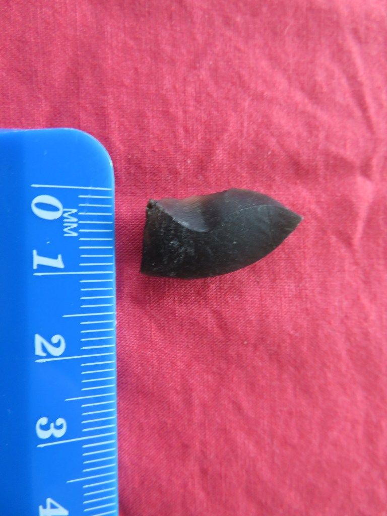
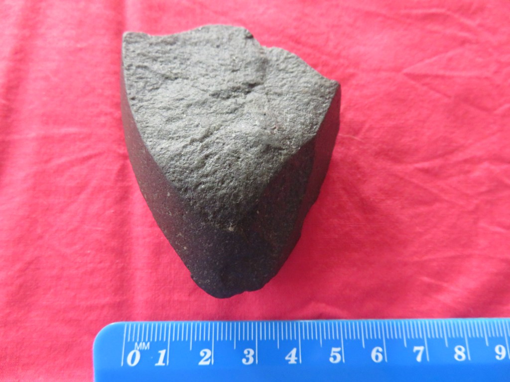
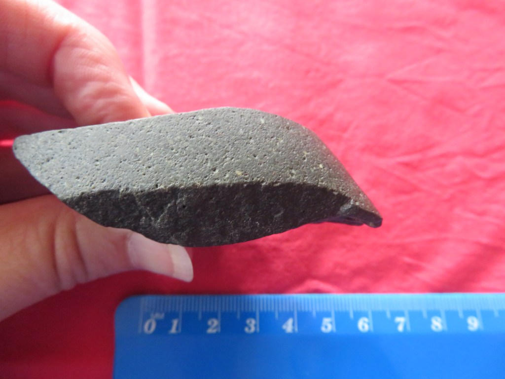
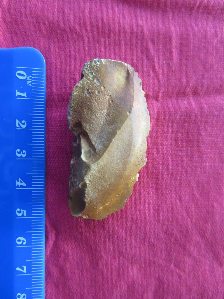


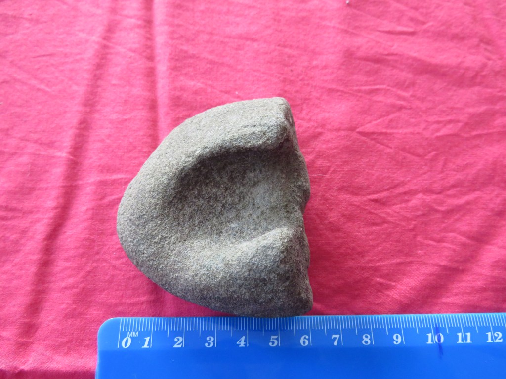

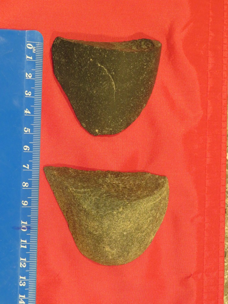

The last five photos are of artefacts found by a fellow dog walker who has kindly allowed me to photograph his finds. It should also be noted that he has found a broken adze head (used in wood working) and several other stone flakes. These items have been donated to the Auckland Museum and are undergoing processing as new acquisitions.
Our knowledge of Maori history prior to the arrival of the Europeans is based upon the rich oral histories passed down through the generations and here on the Waitemata this is no different. The name Waitemata can be translated as ‘the waters of the Te Mata’ – the reason for the name can be found in the oral history of the region. Some traditions tell of the canoe Te Arawa which arrived in Tamaki under Tamate Kapua. It was he who gave Tamaki its mauri or soul by placing a sacred rock from Hawaiki on the island called Te Mata (known today as Boat Rock which is just above the harbour bridge). It was the mauri was called Te Mata – hence the name, Waitemata. Often before a fishing expedition was undertaken, a carved sinker would be taken to Te Mata and a karakia said then the sinker was hung on the front of the waka. In Nagti Whatua tradition the first fish caught in the season would be used as an offering and placed on the rock called Te Mata.
The first hapu to live on the North Shore were the Kawerau with their main centres being in the Takapuna/Devonport area where land was easier to cultivate. The coastal area of the Waitemata appear to be less well populated but that is not to say no less important. Perhaps the site most well known in our area of concern is Te Matarae a Mana or Kauri Point. In the late 1700s the Waiohua and the Ngati Whatua were at war for the occupation of Tamaki. A great number of battles were fought with many chiefs being killed including Tamaki Kiwi. According to Maori history, the site was spared by the Nagti Whatua during their conquest of Tamaki because the chief Te Mana asked for protection from Tuperiri, one of the leaders of the conquest. Te Mana eventually died an old man in 1790, passing on the custodianship of Te Matarae and his people to Tuperiri.
However, this was not the end of the story – the son of Te Mana, Takarau, joined a large war party heading north against the Nga Puhi. The raid was successful and many Nga Puhi chiefs were killed. But in 1821 when Hongi Hika (Nga Puhi) returned from England he brought with him muskets and invaded Tamaki with devastating effect. Takarau was away at the time and so was spared; his people fared less well and those that could escaped into the hinterland, hiding in the bush until the 1830s, when a small contingent reoccupied Te Matarae. On the 13th of April 1841 all of the land in our area and beyond was sold as part of huge parcel of land, referred to as the Mahurangi Block.
Beyond the stories of battles and conquest, our understanding of how sites such as Te Matarae were utilised can also be gleaned from the oral traditions. George Graham recorded how the beach and village below Te Matarae became busier with many waka using the beach during the shark fishing season. Some fleets were said to come from as far away as Hauraki. This may account for the terraces above the beach which could be interpreted as house platforms.
Placenames are also an interesting source of information – all of the places we are looking at as part of this article have European names but of course once upon a time they had Maori names – so for example the bay west of Kauri Point was called Ngutuwera (translated as ‘burnt lips’). The bay below Kauri Point was called Rongohau or ‘nook sheltered from the wind’; here waka would take shelter during bad weather. The deep wooded gully which leads to Soldiers Bay was once called Tawhiwhi Kareao and its translation is interesting as it refers to the plant called supplejack which was used in lashing for the wakas. Island Bay was once called Te Waitioroa (‘the area of Toroa’) and was apparently named so because Toroa rested there on his way to Paremoremo. But it is not only landscape features which had names; actual parts of the harbour were given names such as Wairoria or ‘the swirling waters’ – a place west of Kauri Point where a strong tidal rip is always found.
From the archaeological, historical and oral traditions we can say that the use of the area by Maori was extensive. Settlement in many parts may not have been permanent in the European sense, but it was no less important.
“Ahi ka did not mean that occupation at each place had to be maintained all year round. However, reqular visiting and use of the camps or temporary settlement affirmed authority in the region.” (M. Kawharu 2004).
Bibliography
Davidson J (1990) ‘Test excavations on the headland Pa at Kauri Point, Birkenhead, Auckland in 1971’ Records of the Auckland Institute and Museum 27:1-18
Jennings R (1994) ‘Archaeological Sites of Birkenhead’ in “Cultural Heritage Inventory” North Shore City Council.
Kawharu M. (2004) ‘Tamaki Foreshore and Harbour Report’ Auckland City Council.
McClure M (1987) ‘The Story of Birkenhead’ Birkenhead City Council.
Simmons D (2013) ‘Greater Maori Auckland. Including Maori Placenames of Auckland’ Bush Press of New Zealand.


So interesting. Thank you.
LikeLiked by 1 person
Thank you – I’m glad you enjoyed it ☺
LikeLiked by 1 person
Hi, I just wanted to say thank you for your posts. I am doing a Masters Art Thesis about building and dwelling in Birkenhead, and your blog has and bibliographies have been are full of information and have been a great leaping off point for my own research. Thank you!! (I will definitely be referencing you in my own bibliography)
LikeLiked by 1 person
Thank you – I’m glad you’ve found the articles useful. Please feel free to contact me if you need any further help or have questions…
LikeLike