In the blog post below Isaac McIvor (The Past Before Us) argues why archaeology needs to be a part of the school curriculum here in Aotearoa New Zealand. This is a much needed conversation if we are to protect the archaeologyand heritage. The youngsters of today are the decision makers of tomorrow. Encouraging curiosity and pride in our shared past can only ever be a positive step in the the right direction.
Tag Archives: Archaeology


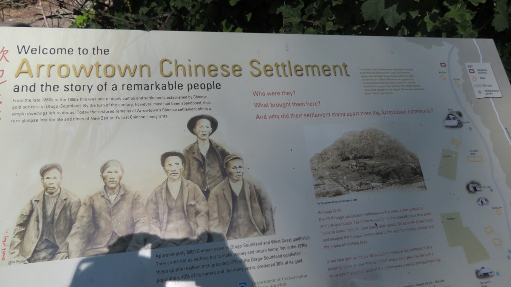
Discovering Aotearoa’s Rich Archaeological Heritage
A brief foray into what archaeology looks like in Aotearoa New Zealand.
The average kiwi, when questioned about archaeology in Aotearoa New Zealand will more often than not shrug their shoulders, mumble about pā and goldmines and then go on to say that surely archaeology is not a thing here? (something I have discussed in another blog here) After all, it’s not like in Europe or Egypt, is it?
So, lets break that down…
First, archaeology as a subject is defined as the study of the human past, where human modified/made objects and sites are studied in order to better understand our past. Aotearoa New Zealand has a human past and thus, yes there is archaeology to be studied. Interestingly, the country’s relatively short human past has meant that it is in a unique position to better understand the short term and long term effects of environmental changes. Not only how they have changed but also what factors have contributed to this are important questions when faced with an uncertain future. Such studies are often conducted using archaeological data sets. Excavations on Ōtata, an island in the Hauraki Gulf, has produced a significant data set allowing for comparisons with present day data. Read more about this here.
Archaeology as a subject incorporates a wide variety of disciplines from math’s, biology, physics, chemistry, art, history, geology and geography and much more. Because of this it is dynamic discipline, always changing and adjusting ideas as new information or techniques come to light.
The fact that archaeology here in Aotearoa New Zealand has a dedicated association (the New Zealand Archaeological Association), as well as laws protecting archaeological sites and taonga; in addition to a government agency (Heritage New Zealand Pouhere Taonga) and numerous archaeological contractors would all suggest that archaeology is very much present in our small corner of the world. As mentioned in a previous blog there are over seventy thousand archaeological sites recorded here – and these are just the ones we know of…
The New Zealand Archaeological Association
Heritage New Zealand Pouhere Taonga
Second, our archaeology may not be about romantic, mystical ruins or great depths of time, but it is all around us if you know where look. In its most basic form (because this is a blog and not a textbook) archaeology can be divided into two columns – sites and artefacts. It is perhaps important to note here that archaeology, history and cultural heritage are not separate subjects but are deeply intertwined, especially so here in New Zealand.
The first humans to arrive here were the Polynesian ancestors of the Māori, this is not the place to discuss their arrival except to say it is generally agreed that it happened around 800 years ago. Some of the earliest radiocarbon dates are from around the mid to late 1200s but that’s not to say people weren’t here before that, only that this is currently the earliest dates we have. At this point I should mention that there is no proven evidence for non-polynesian settlement of Aotearoa prior to their arrival.
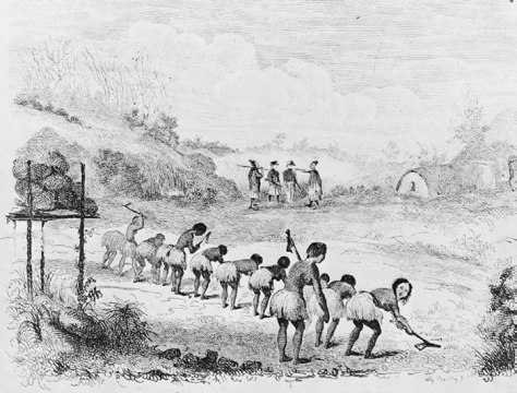
In 1642 Abel Tasman shined a brief light on the country and much later James Cook’s survey of New Zealand (1769) shone an even brighter light – the British (and the French and a few others) were not averse to new opportunities. The first to take advantage of this new land were the sealers and whalers and by the early 1800s the first settlers had arrived, usually missionaries with notions of spreading the word of God. Farmers, merchants, miners and anyone with an eye to making their fortune soon followed. All of whom left their mark archaeologically.
As mentioned above, the archaeology of Aotearoa can be divided into either sites or artefacts. A site is any place that has been used or modified by humans for any reason. An artefact can be defined on the same principles – an object that has been used, modified or created by humans. In this blog I will be touching upon some of the sites which can be found in the landscape of Aotearoa New Zealand (the subject of artefacts is perhaps too large for a simple blog).
Lets begin in ‘prehistory’ before the arrival of the Europeans…
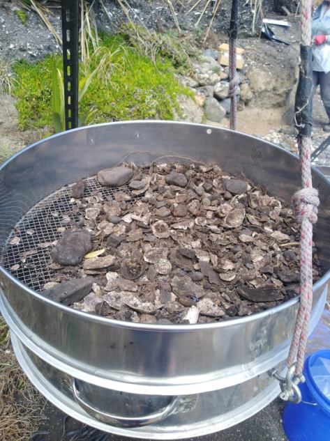
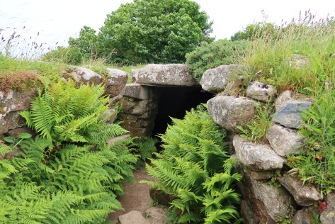
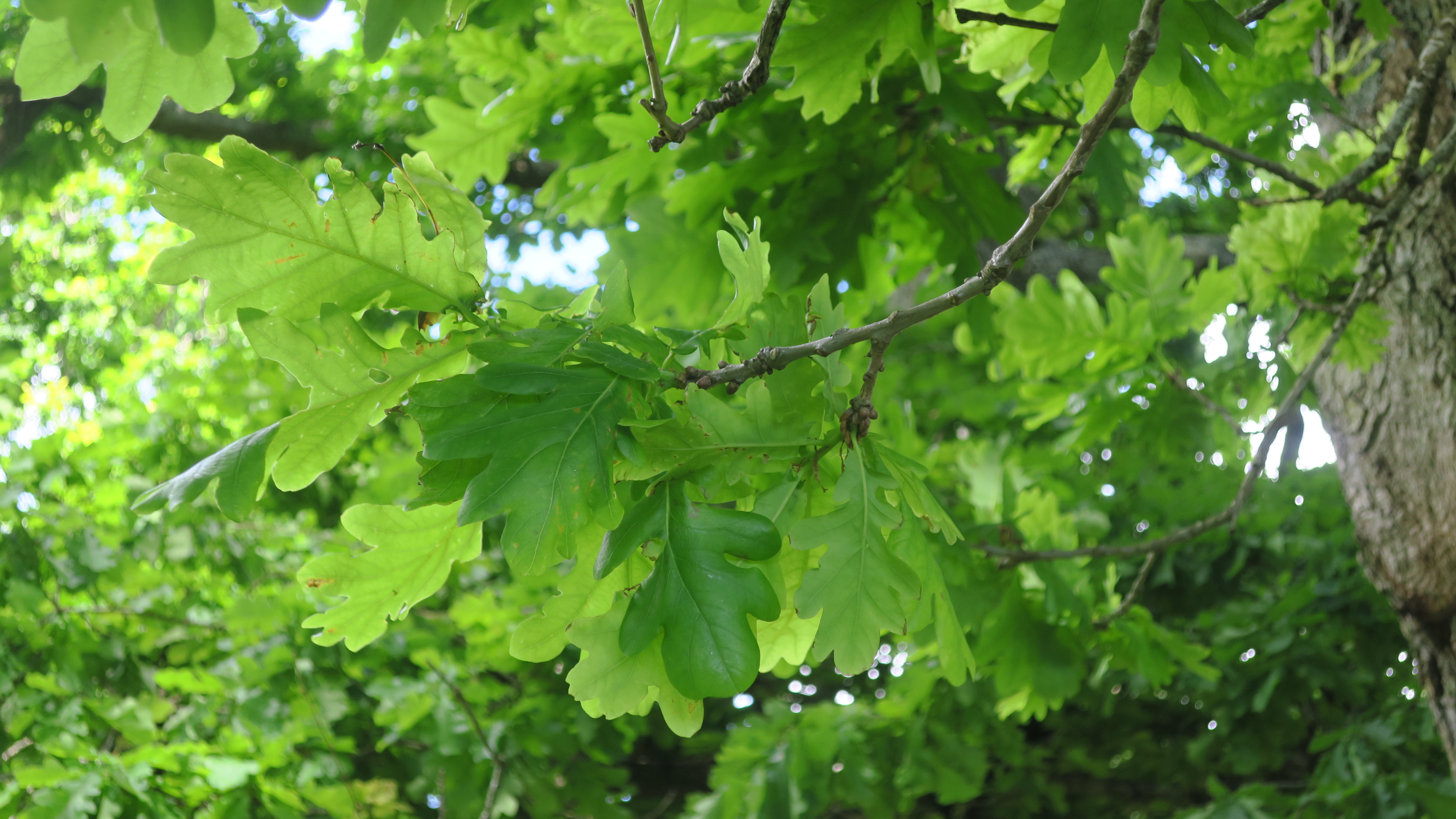
Middens – perhaps one of the most common archaeological sites known around the country, these sites present themselves as piles of broken shells and relate to the māori settlement of an area. Middens are useful to archaeologists as they can tell us a great deal of what resources were utilised, what the environment was like and they can provide material for dating (bird bones and or charcoal). They can be an archaeological site on its own or part of a larger archaeological site such as a pā.
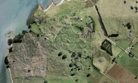
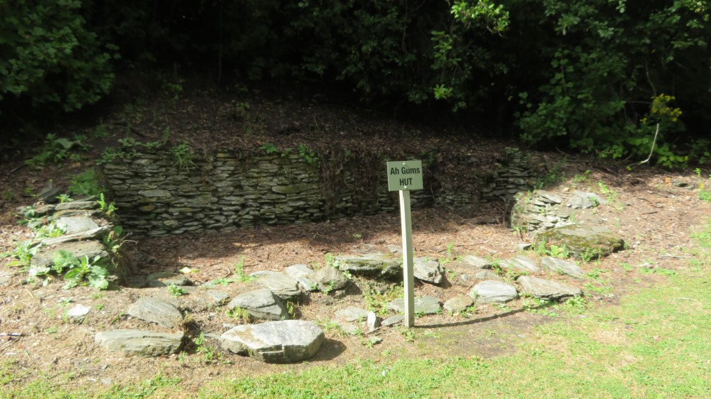
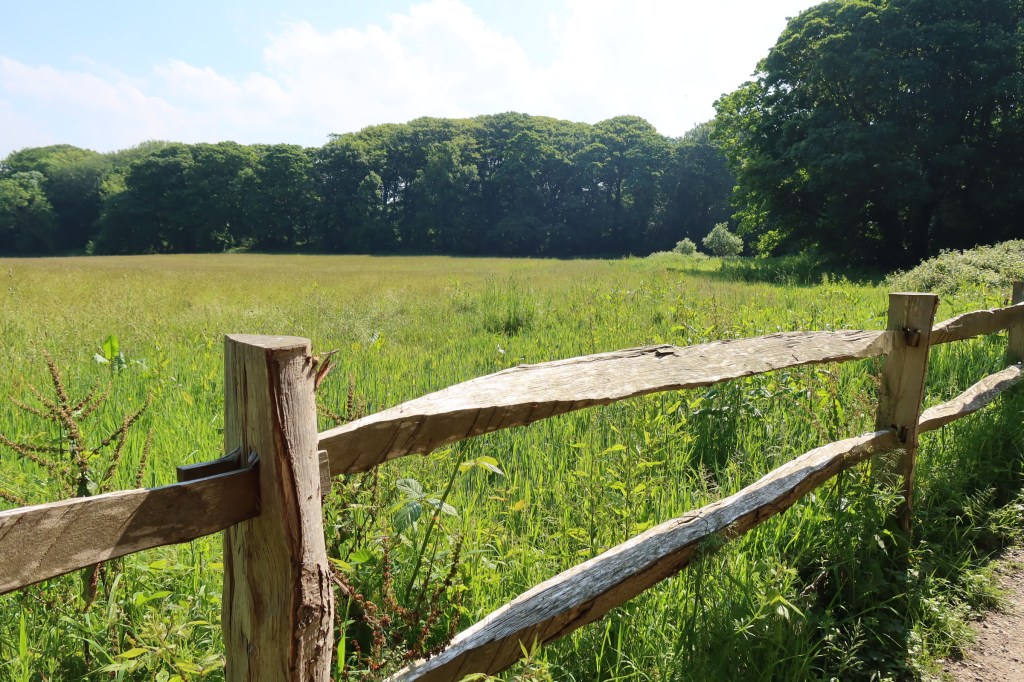
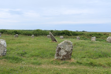
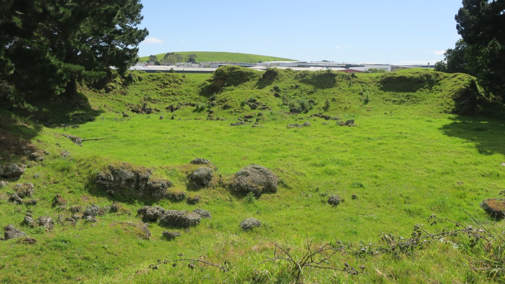
Pā – these are essentially defended settlements, most are found on high ground but there are examples of pā being found on low ground. The necessary element is for the site to have banks, ditches and evidence of palisading. Some pā can be complex sites with large numbers of banks and ditches covering many hectares others are much simpler. It is generally assumed that pā were used as places to retreat to in time of conflict and whilst this is a part of their story, it is not the whole story. The history and purpose of pā depends on the where and when. Each site needs to be considered within the wider physical and societal landscape.
Walking in the Te Pare Reserve, Hahei – Hereheretaura Pa in the distance. 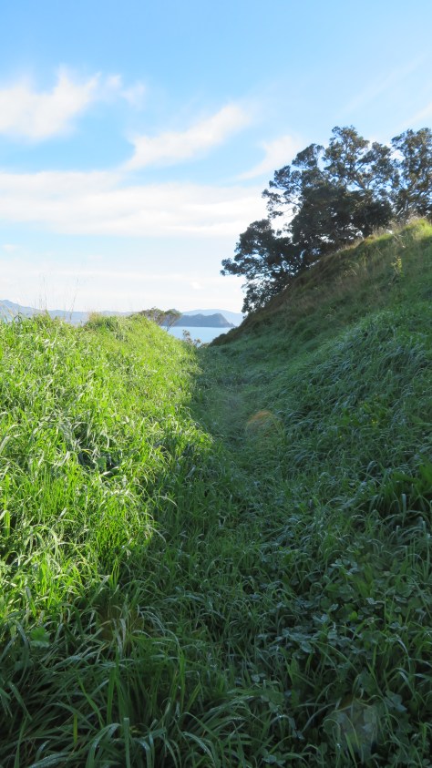
One of several bank and ditch arrangement at Hereheretaura Pa. 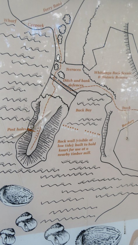
Plan of pā near Whitianga. 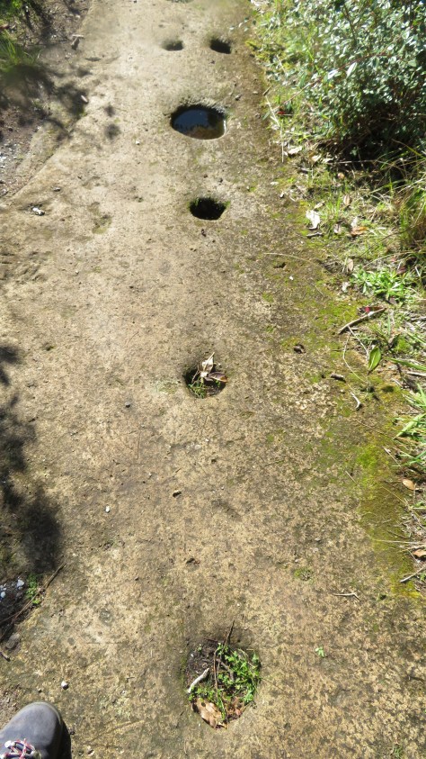
Palisade postholes in the rock at the Whitianga pā… 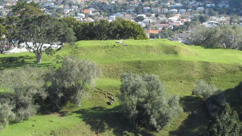
Terracing at Maungakiekei Auckland. 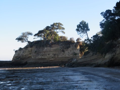
Island Bay pā, Auckland 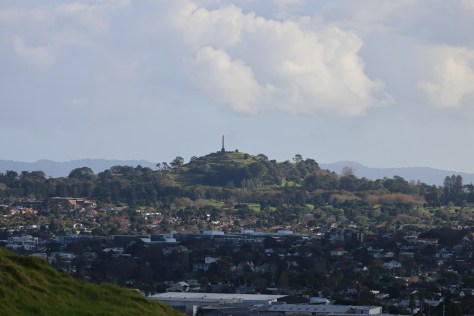
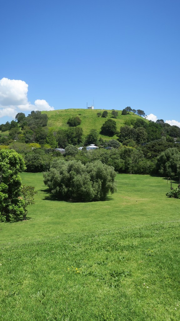
Maungakiekie, Auckland 
Maungarei (Mt Wellington), Auckland 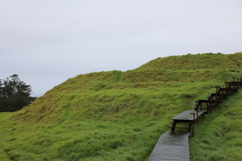
Maungawhau (Mt Eden), Auckland.
Kainga – unlike pā these are ‘undefended’ settlements or places. They can be either permenant or temporary, (the latter also known as ‘camps’) and can include a wide range of activities, not just places where people lived. Within this category a range of individual features might be found from postholes for wooden structures (houses, storage, fences), cooking areas, storage pits, middens and open spaces.

Gardens – horticulture was an important part of the economy for māori and continued to be so beyond the arrival of the Europeans. Evidence on the ground for gardens can be seen in clearance of stones and rocks from an area, often creating low stone walls. In the Auckland area the best example of this can be seen at Ōtuatua Stonefields in Mangere.

Rock Art – almost 90% of known rock art is found in the South Island, it can drawn (using charcoal or red pigment known as kōkōwai), painted, carved, cut or scraped from rock. The designs vary but can include people, birds, dogs, waka, geometric designs and occasional mythical creatures such as taniwha. The Te Ana Rock Art centre near Timaru conducts tours of the nearby rock shelters to view the rock art.
Burials and urupā – Māori buried people of high status close to settlements, then disinterred the bones and placed them in secret locations. Burial sites are tapu (sacred) and should not be disturbed. These practices changed in the late 19th century, when European-style urupā or cemeteries developed near marae. Archaeologists often refer to kōiwi and these are when human bones are found in an archaeological context either during excavation or accidentally (ie eroding from cliff or dune).
The arrival of Europeans created a whole range of archaeological sites, broadly speaking they can be divided into settlements, industry, roads and infrastucture, dump/midden sites and conflict.
Settlements – the name says it all, these are places were people lived and they can be large as a town or small as a single farmstead. Depending on size settlement sites will invariably include a number of other features which can be classed as sites, such as wells, drains, out buildings, churches, schools, hospitals, shops, inns, roads, gardens and much more. Many of these sites are still standing and usually come under a heading of ‘buildings archaeology’ or ‘heritage archaeology’. After the earthquakes of 2010/11 in Christchurch a vast amount of archaeological work was done ahead of the rebuild. Out of this The Christchurch Archaeology Project was born where the information and stories that emerged of Christchurch’s past could be made available to everyone.
Above shows the site of the Te Rongokaupō village on the Old Coach Road, Ohakune. A once thriving settlement now only humps and bumps in the landscape.
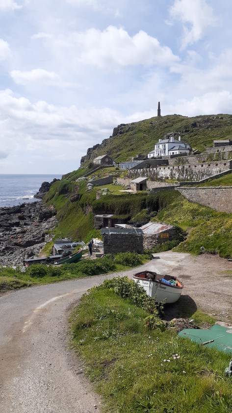
Industry – these are sites which include places that were worked by people to gain resources of some kind. Whaling/sealing stations are some of the earliest sites in this category. Mineral extractions left a range of site types from mines shafts, pumping stations, sluice gullies, out buildings, ore processing plants and more. Industrial sites such as these would often be associated with a nearby settlement which had evolved from a shanty town to a fully fledged and ‘proper’ town. In addition, other forms of industry such as milling (timber, paper and flour), brick kilns, lime kilns, gumdigging, breweries and iron works to name a few leave their mark on the landscape.
remains of an early brick kiln 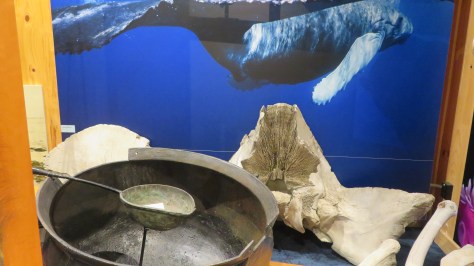
A display on whaling at the Kaikoura museum 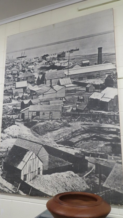
An old photograph of the mining in Thames 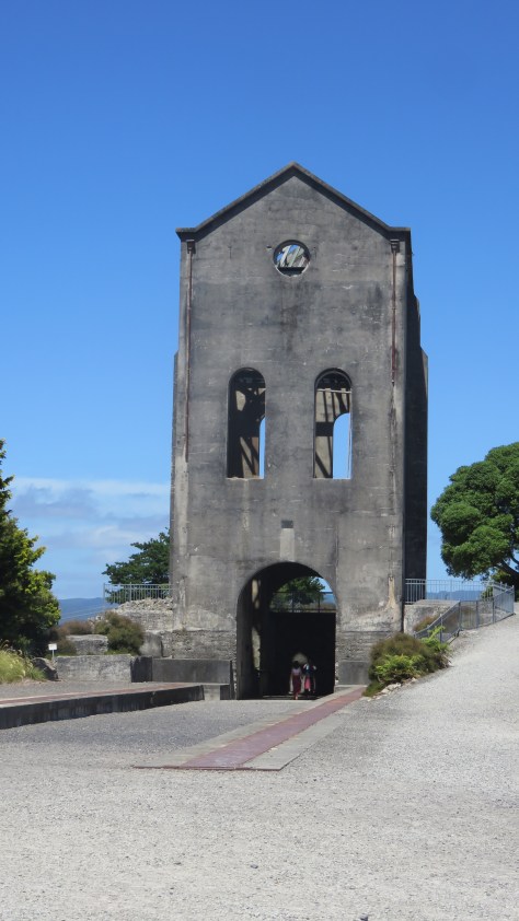
The pumphouse at Waihi. 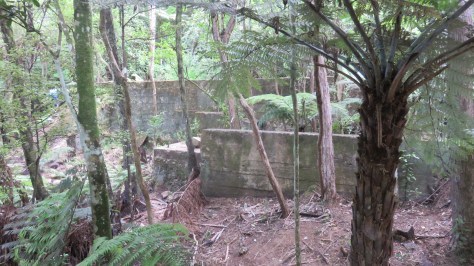
Mining remains at Karangahake Gorge 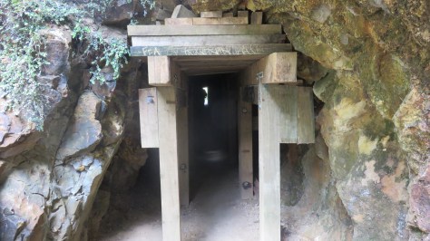
A mining tunnel at Karangahake gorge 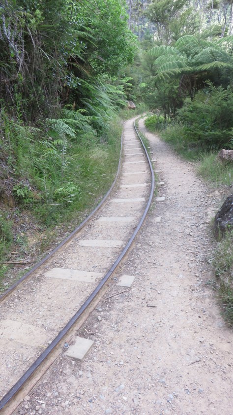
The tracks at Karangahake gorge 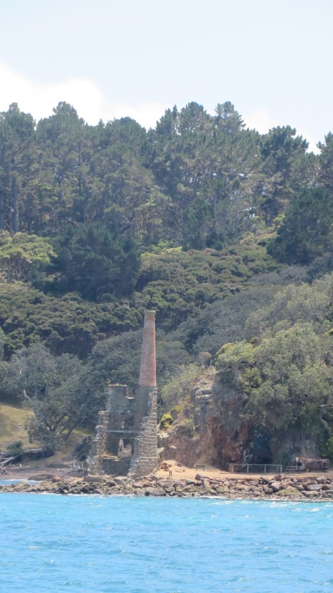
The ruins of the pumphouse on Kawau Island 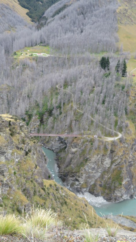
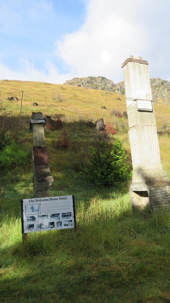
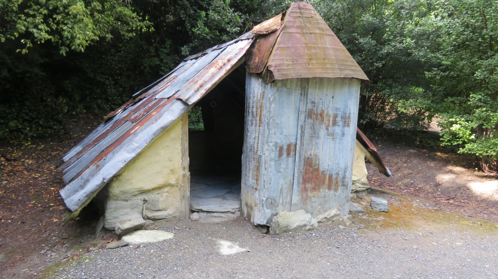
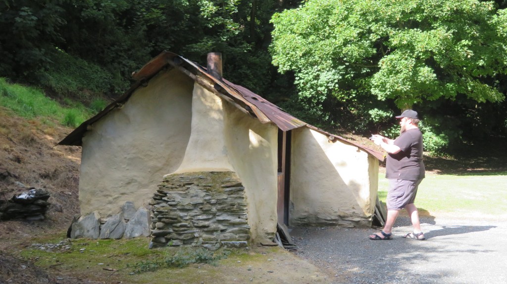
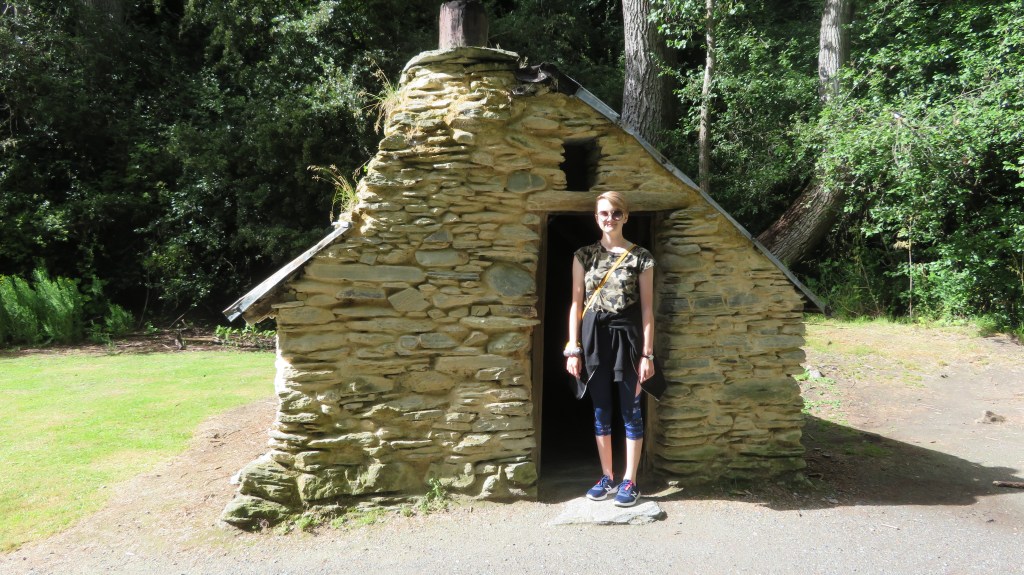
Skippers Gorge near Queenstown – one of several now abandoned settlements centered around the goldmining boom in the late 1800s
Roads and infrastructure – in the early days of Aotearoa New Zealand, the easiest way to travel was via water (this also goes for the period before European arrival). Wharves, jettys and quays are all evidence of this, looking at the placenames of early European settlements near the coast or rivers and the word ‘landing’ can often be found indicating a site where boats and the like would ‘land’ people and products.
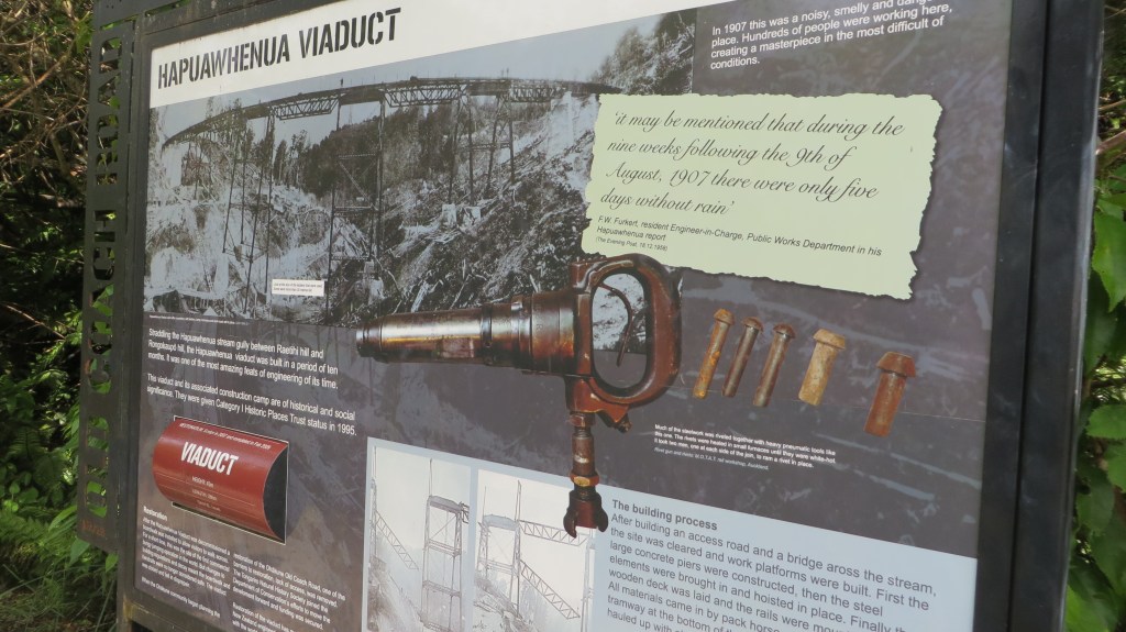
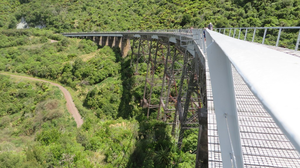
As the population grew so to did the need for actual roads, the name ‘old coach road’ is an obvious reference to an old road no longer in use. Roads, tracks and bridges all form the story of how people moved about the landscape. The railway made a late appearance and where no longer in use its route and any associated buildings add to the archaeological record.
Dump/midden sites – these are always found associated with a settlement or industrial site of some description. Often they are the only indicator that there was a settlement there at all (see my post on Fitzpatrick Bay here).
Conflict – here we can consider sites that relate to the various conflicts that have affected New Zealand over the years. In the 1800s wars with māori resulted in changes to pā construction (Ruapekapeka, Northland) and the creation of redoubts by European militia (Queen’s Redoubt, Waikato). In the early to mid 1900s there were various threats (perceived or otherwise) and a range of forts and coastal defences were constructed as part of this.
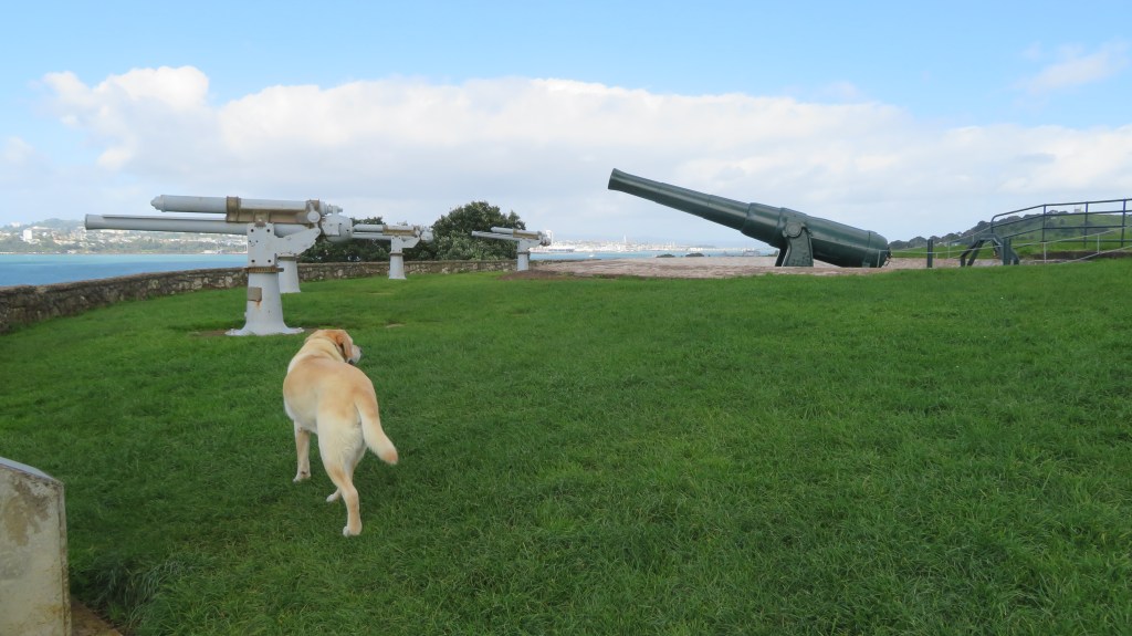
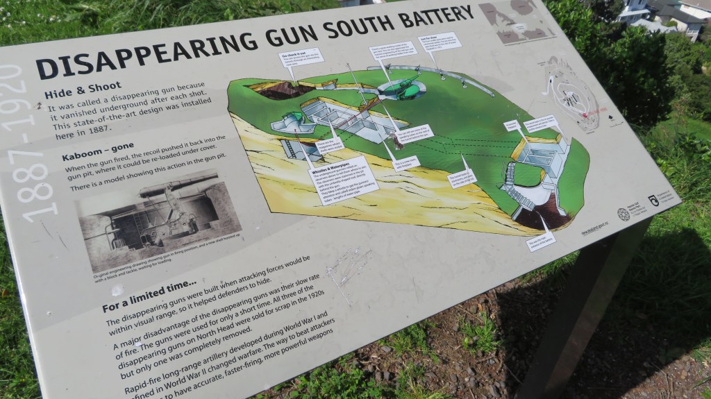
The above photos were taken on North Head, Devonport, Auckland – for more on this site read here.
That brings us to the end of our wee romp through some of the archaeological sites you might find in Aotearoa New Zealand. I hope you have enjoyed this read, feel free to check out some of my other posts.
Further Reading
Davidson J ‘The Prehistory of New Zealand’ (1984) – although over forty years old it is still a useful reference book if you can get hold of a copy.
Wilson J (ed) ‘From the Beginning’ (1987) another oldie but a goodie
Smith I ‘Pākehā Settlements in a Māori World – New Zealand Archaeology 1769-1860’ (2019)
King M ‘The Penguin History of New Zealand’ (2003) For serious history buffs…
Share this:

Beyond Stonehenge: Where To Find Lesser-Known Prehistoric Sites in England
Stonehenge may be the most famous, but fascinating prehistoric monuments and sites can be found across England.
Beyond Stonehenge: Where To Find Lesser-Known Prehistoric Sites in England
Share this:


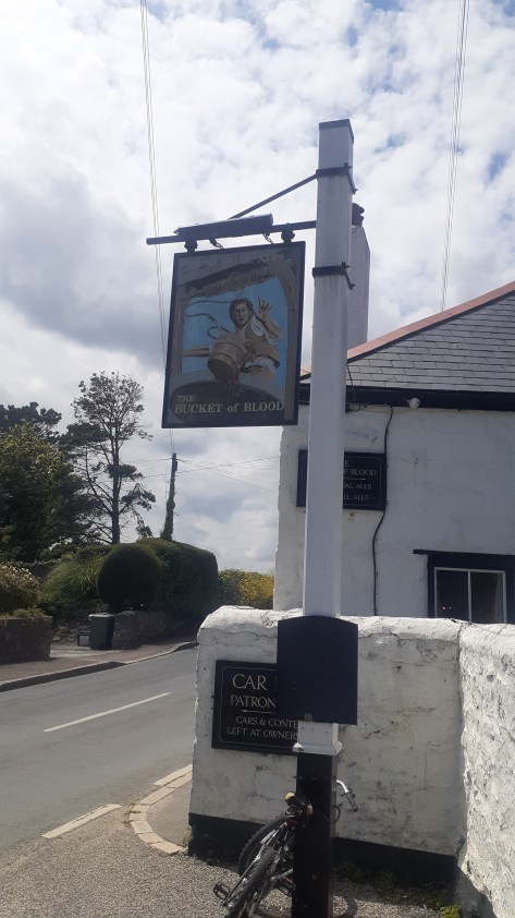
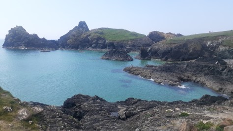
Exploring Cornwall: A Journey Through Grief and Beauty
It has been almost a year since our last journey to Cornwall and so it seems appropriate to tell you all a bit about that time.
Normally any trip to Cornwall is one of expectation, hope and joy but on this occasion, it was a time of sadness. On the day we arrived in Penzance, my mother-in-law passed away. We were half an hour away from seeing her when we got the call…
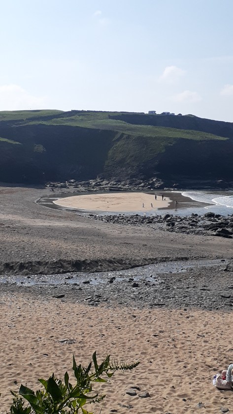
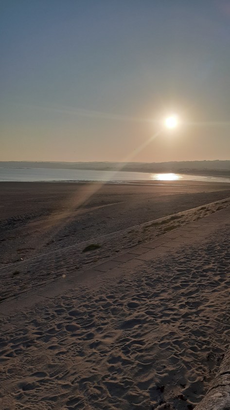
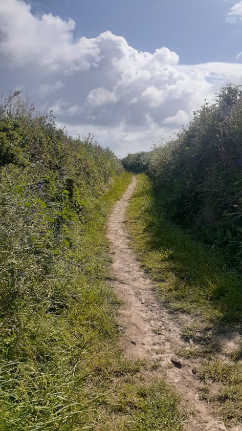
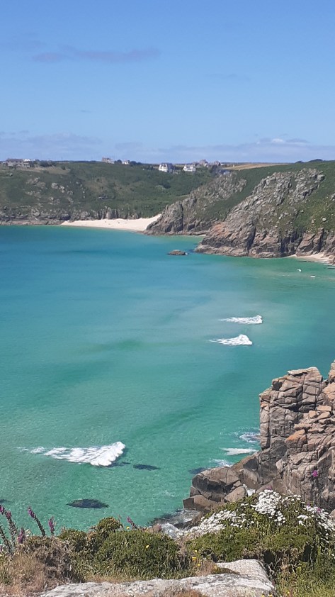
It was not an easy time but we did find moments to distract us, Cornwall, after all is a beautiful county filled with fascinating places. There were beach walks, pasty’s, drives down winding lanes, pub lunches, moors and visits to ancient places. Below is just a few of the places we visited in our down time between packing up a life well lived and saying goodbye. We knew it would be a long time before we came back and so we made the most of the time we had.

Getting fresh air and exercise became a part of our daily routine, early mornings sorting the house, followed by appointments with solicitors or funeral directors and then a good walk in ‘the nature’ to soothe the emotions. Cornwall is not short of a good walk. Below are a few photos from these walks.


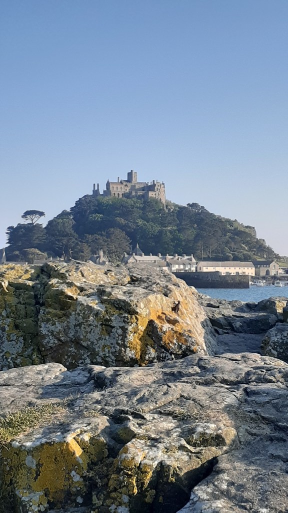
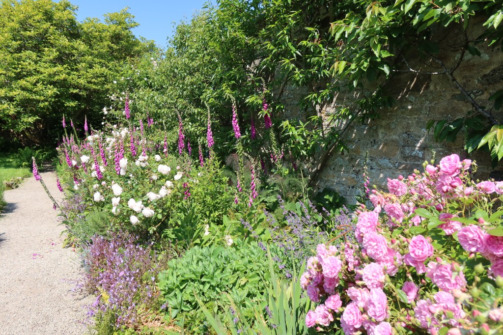
There were some days when we had more time on our hands and on these days we ventured a little further afield. As members of Heritage New Zealand we are allowed to visit both National Trust and English Heritage sites free of charge – Lanhydrock, Godolphin House, Restormel Castle. Tintagel and the gardens at St Michael’s Mount were all on the list.
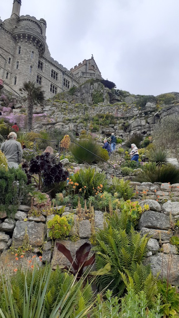
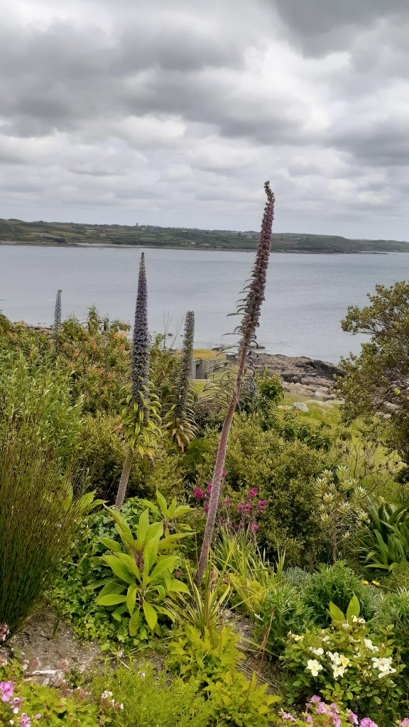
The Gardens at St Michael’s Mount
Why just the gardens? We had visited the house on several other occasions and given the time of year and how busy it was we thought a good nosey around the gardens – which are not always open – would be nice on a sunny day.
The gardens are situated on the lower terraces of the mount facing towards the Lizard Peninsula. They were first designed in 1878 for Sir John St Aubyn (later the first Lord St Levan). This part of the island has a microclimate and is able to grow a number of plants you would not expect.
The following are just a few photos of the gardens.


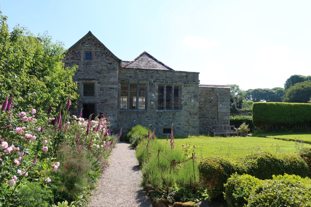
Godolphin House
One of my favourite houses to visit in this part of Cornwall is Godolphin House. Only open to the public a few times a year (the house is let out as a holiday let), although the gardens and estate are regularly open to enjoy for walks and cups of tea in the little cafe. The story of Godolphin House is one ‘enormous mineral wealth, heavy industry, agriculture, high political office, war, decline, ruin and eventual rescue – a living timeline through Cornwall’s history’.
As the above quote would imply Godolphin House has a long and winding story to tell and is perhaps one for an article of its own. For now enjoy the following photos and if you do ever get a chance to visit the house, do so.
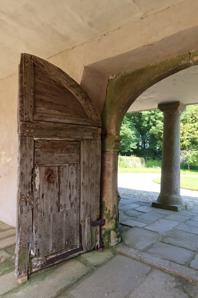
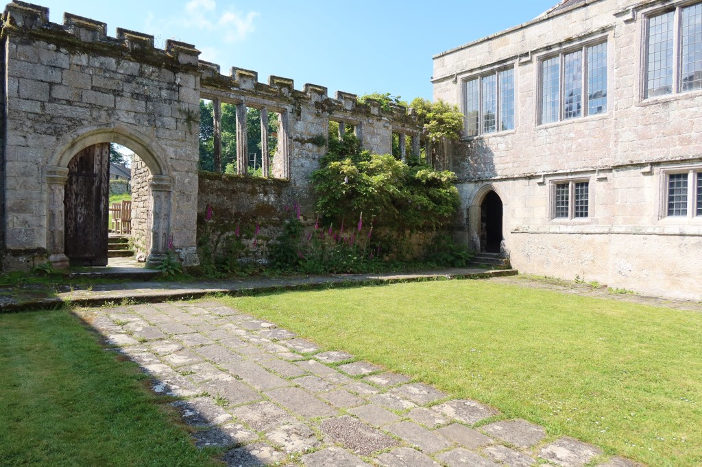
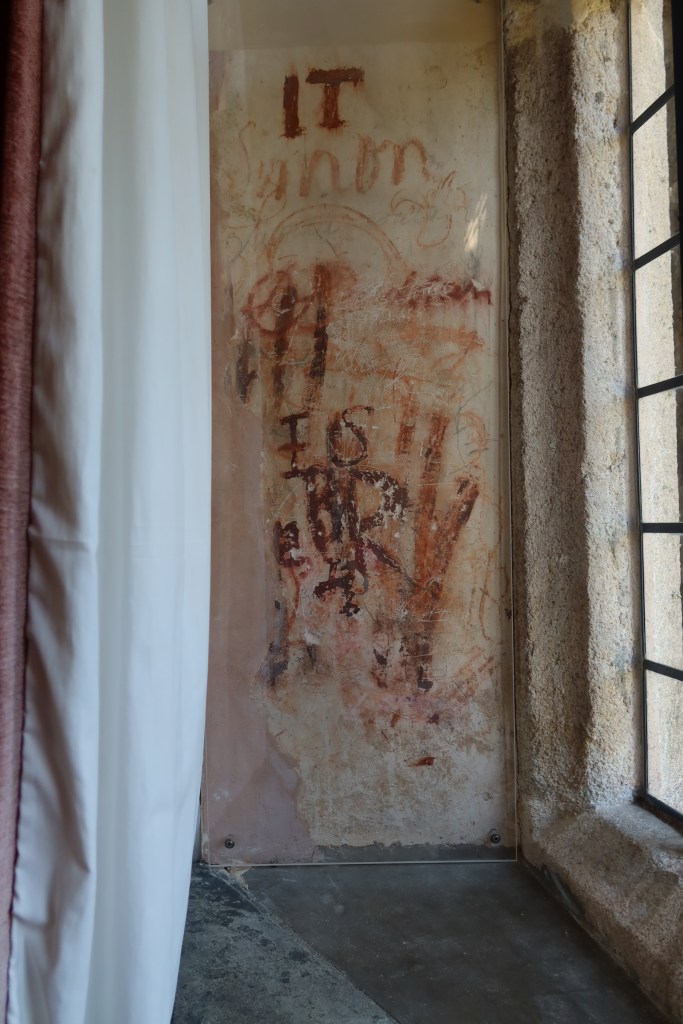
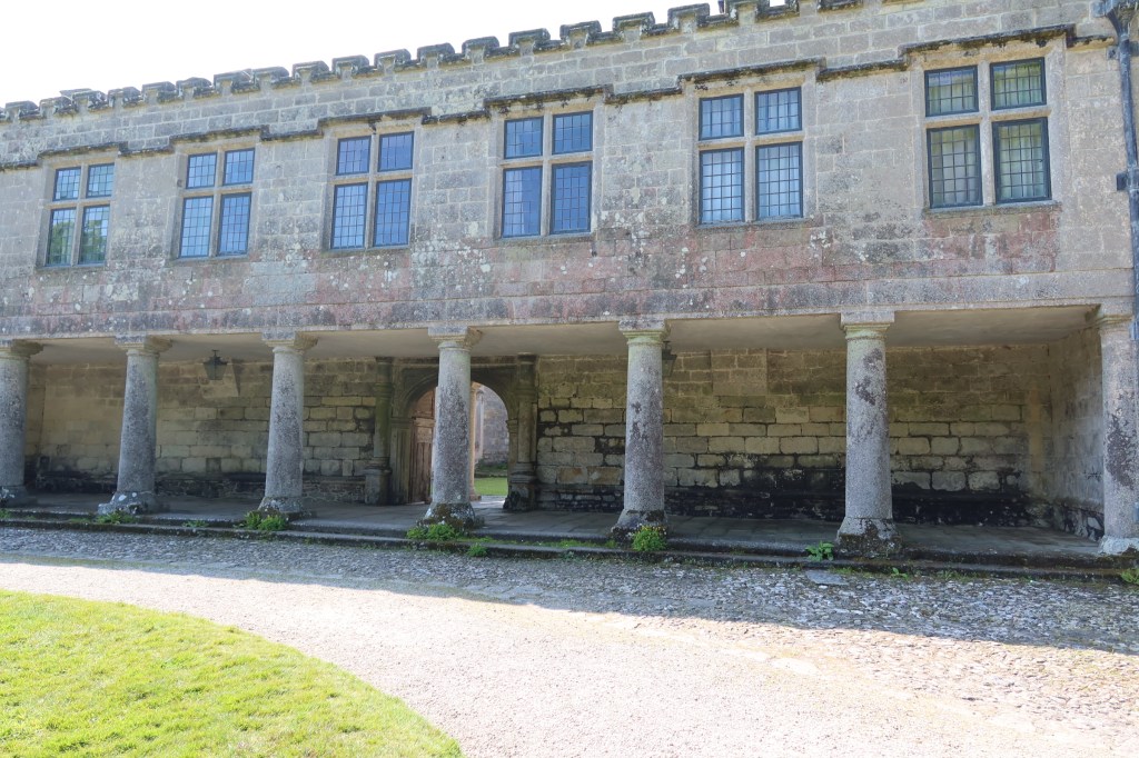
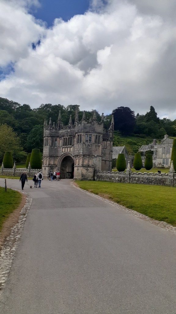
Lanhydrock
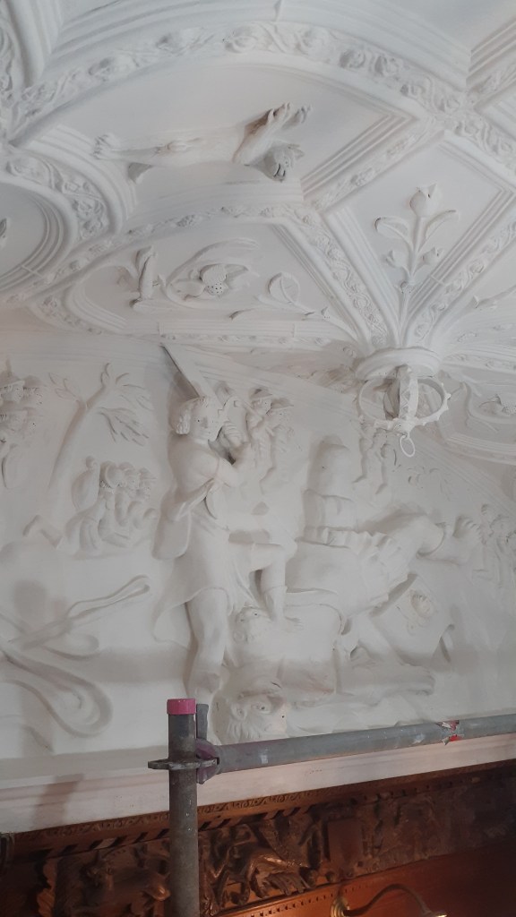
This particular National Trust House and Estate was much further afield. At the time of our visit the house and its contents were undergoing restoration work. Interestingly rather then block off sections and prevent people from viewing the work, the visitor was granted an opportunity to see what happens when a house of this size needs some love and attention. Our visit coincided with the restoration work on the ceiling of the hall and visitors were able to go onto the scaffolding and get a close look at a space that normally only the eagle eyed could view.
Below are a couple of photos of the ceiling.
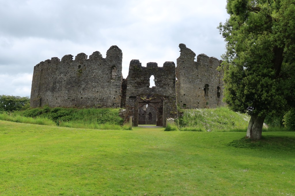
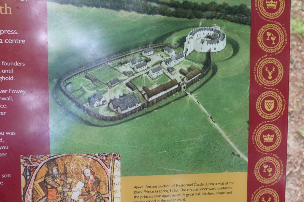
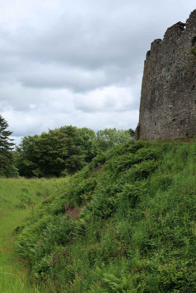
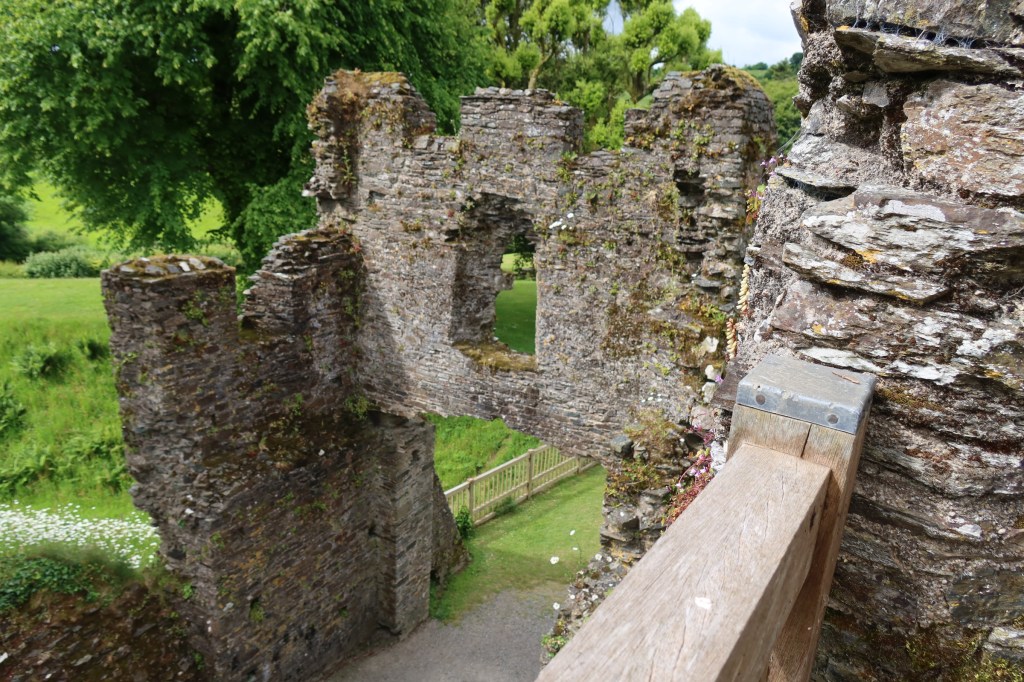
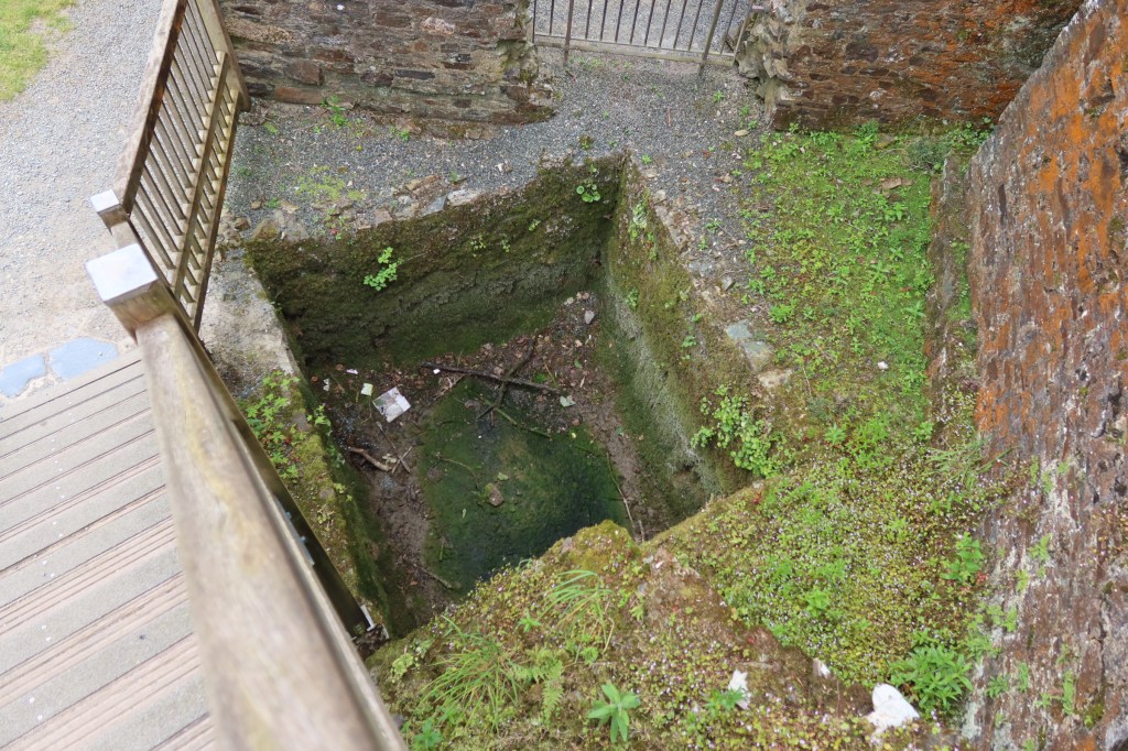
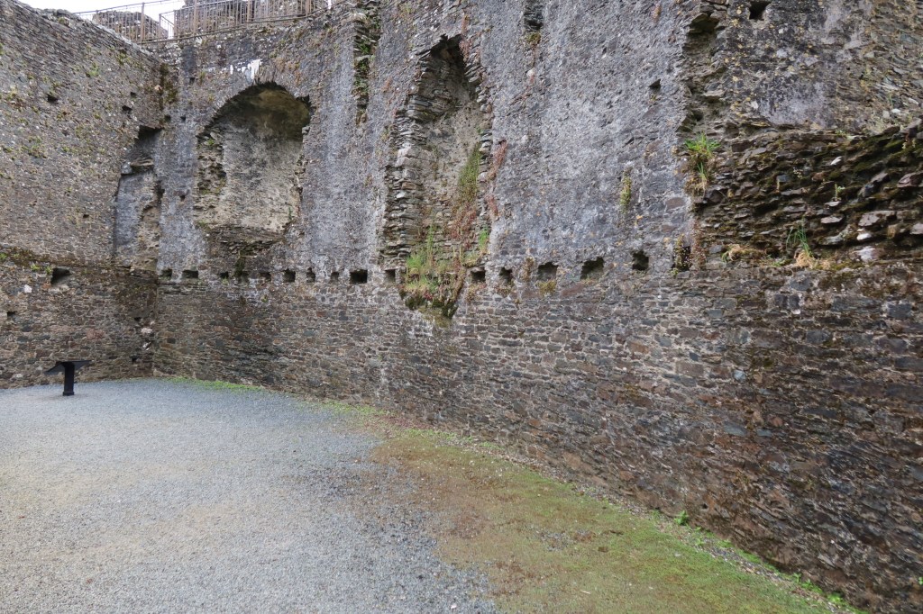
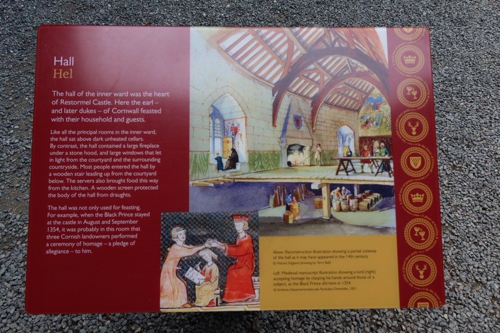
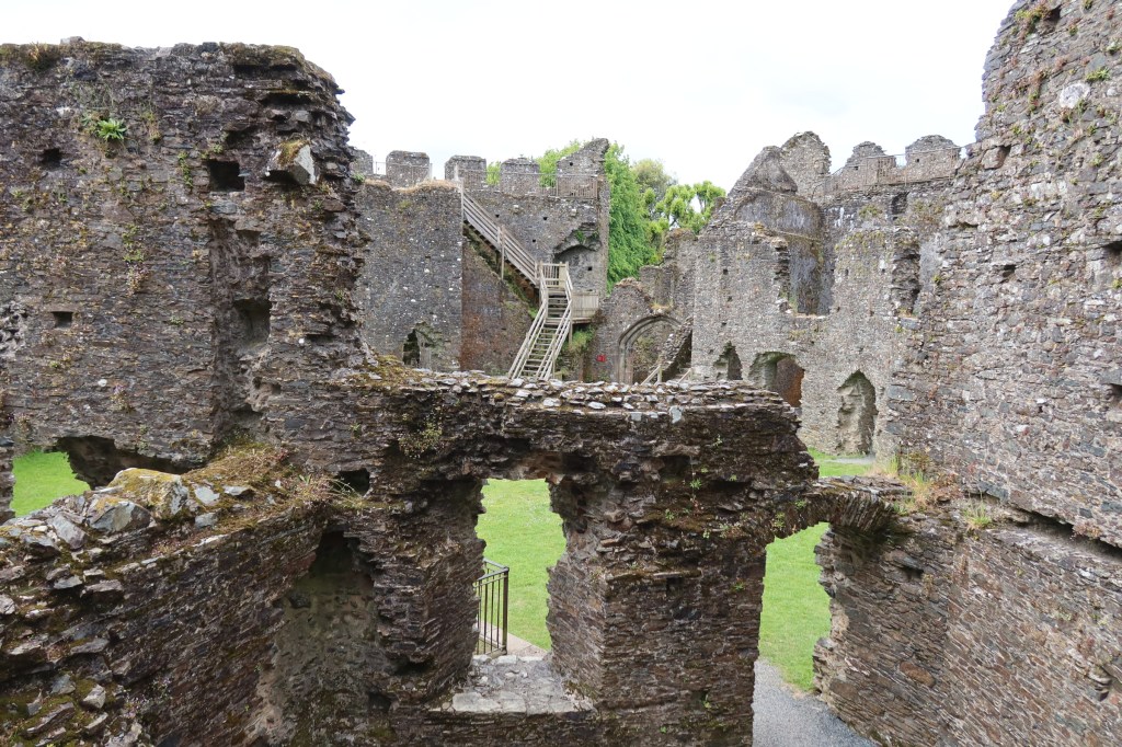
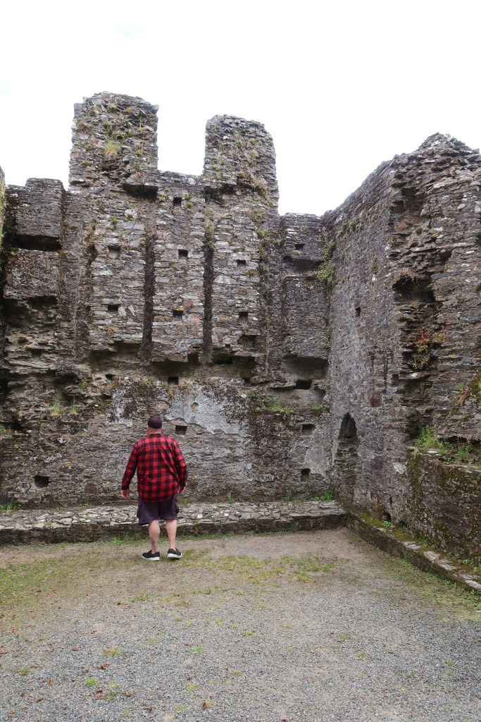
Restormal Castle
Our visit to Restormal Castle occurred as we were leaving the county, having done all we could. The castle providing a welcome pit stop and distraction.
The early history of the site is not well understood, there is some evidence for a mid 12th century date but it the history from the 13th century onwards which is better understood. From the mid 12th the land on which the castle stands belonged to the Cardinham’s – a powerful landowning family from central Cornwall. In 1268 Cardinhams’ heiress, Isolda de Tracy, granted to Richard Earl of Cornwall and King of the Romans, the town of Lostwithiel – a fishery on the river Fowey – and the castle of Restormel, complementing his castles at Launceston and Tintagel. In 1270 he acquired a fourth castle at Trematon.
Earl Richard died in 1272, only four years after acquiring Restormel, so it seems more probable that it was his son Edmund who built the present castle. Edmund’s work at Trematon Castle is documented and provides a parallel. However, by the 1330s (and after the castle had changed hands a few times) documents refer to the castle being in need of repair. 1337 saw the son of Edward III being made Duke of Cornwall (also Edward – the Black Prince), along with a significant endowment of land and properties – including Restormal Castle.
This was a high point in the history of the castle, with many repairs and improvements being made to it and the surrounding park land. Apparently more time and money was spent on the boundary to the park land than on any other feature, an indication of its importance as a hunting park.
The history of the castle and its surrounding is one of neglect, repair and neglect once again. More can be found on its history here.

These are just a tiny fraction of the many places a person can visit in Cornwall, so I hope you have enjoyed this short meander through the county.

In memory of Christine Rowe and Alan Dalton – gone too soon but never forgotten.
Share this:


It’s All A Lark
Just a few of my favourite things…
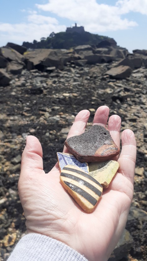
My addiction to beachcombing came about as I was walking my old dog, Brad, and I started to spot bits of pottery and glass in the sand of our favourite haunt. So begun a collection which I have written about elsewhere on here. But my curiosity and collecting did not stop with just one wee beach on the edge of the Waitemata…this blog is short catalogue of just some of the pieces I have found, these are prize possessions.
As some may be aware I live in New Zealand and as some may also be aware we have a relatively short history of human occupation – approximately 800 years give or take a decade or two – compared to other countries around the world. The finds below are restricted to the last one hundred and fifty years or so when Europeans first arrived in Aotearoa New Zealand and are by far the most numerous things to be found.
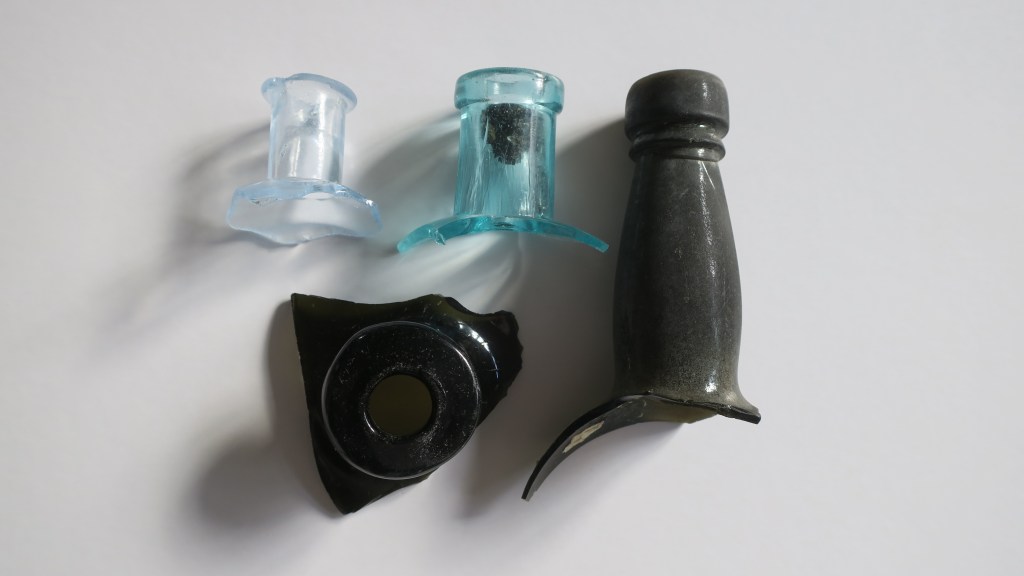
1, Glass stoppers
Long before plastic and screw tops many bottles were closed off with a glass stopper. The most common variety found are the ones in the picture below, used to seal sauce or relish bottles. Originally they would have had a ring of cork around the neck to ensure a tight seal. These very durable objects are a beachcombers delight. It is not a huge collection but each find of a glass stopper gives me an odd sense of joy…
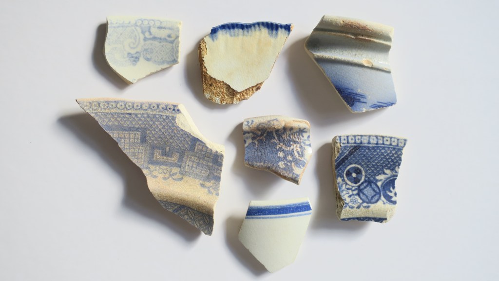
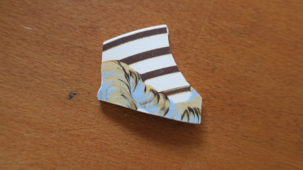
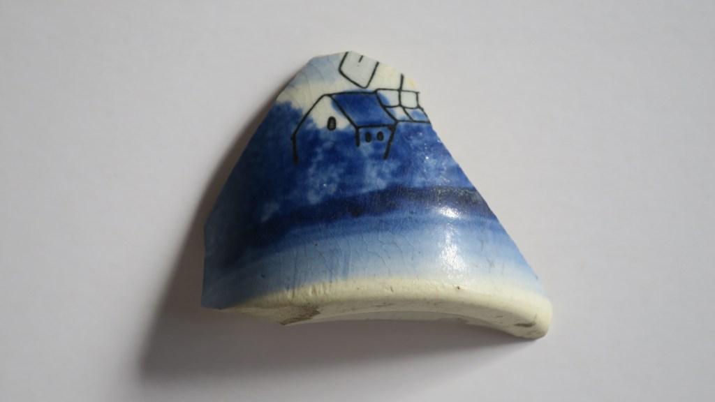
2. Ceramics
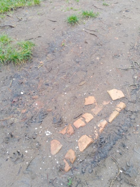
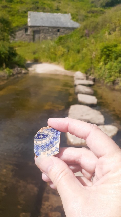
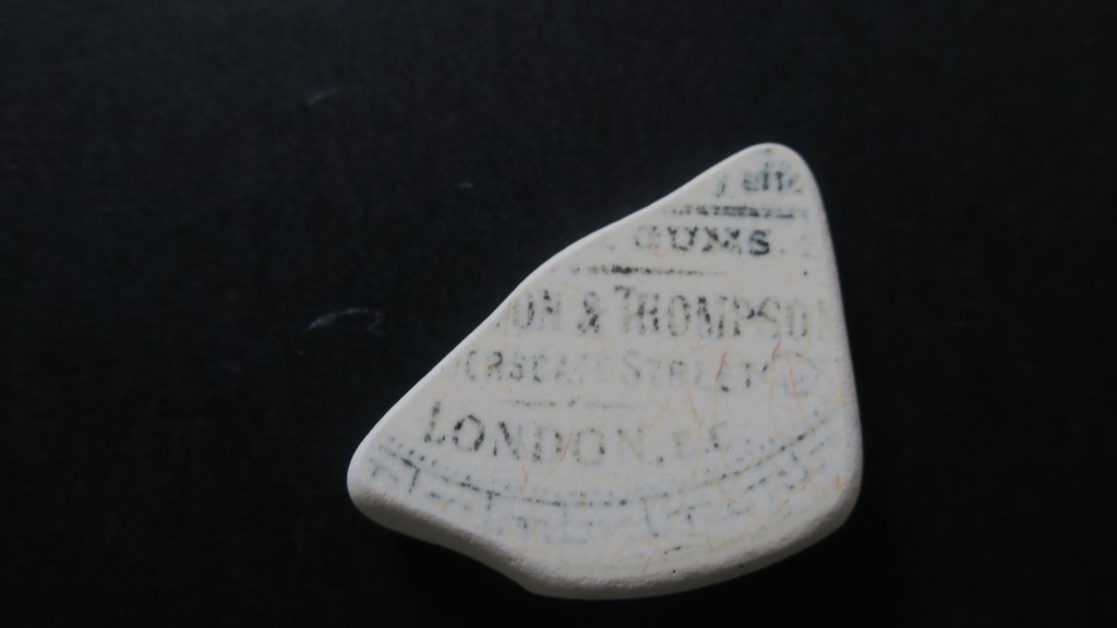
Sea pottery is also a relatively common find on beaches and waterways around the world and here in New Zealand it is no different. The variety of ceramics is often quite surprising, the most common are the plain white or cream pieces. But the most sought after are the early pieces of transfer print earthenwares imported from the UK or brought out with the first settlers. These come in a variety of patterns and colours, my favourite (along with many others) are the blue and white patterned pieces including the ever present ‘willow pattern’. I have written extensively on the ceramics found at Fitzpatrick’s Bay, please feel free to check it out here. Included in this category are also stonewares, I have yet to find a complete example but I have many neck sections and bases.
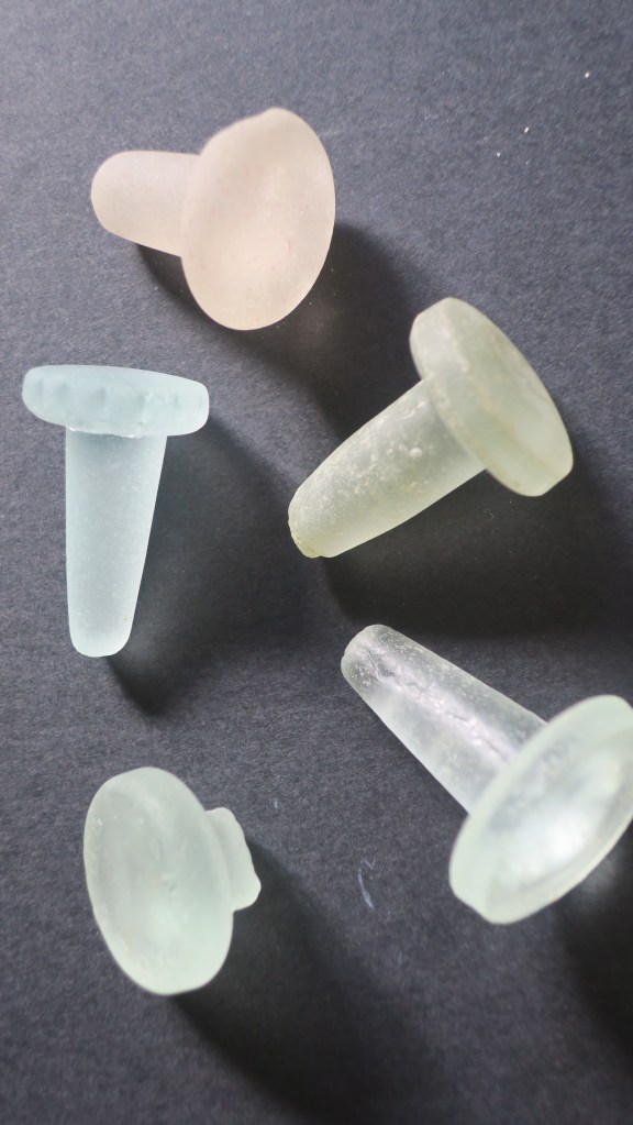
3. Glass
I have chosen to call this section glass as opposed to seaglass as there will be some who dispute my examples as seaglass. When I started to collect I was most surprised to find that there is an International Seaglass Association and they have defined true seaglass as;
Genuine sea or beach glass comes from discarded bottles, tableware, or household items and is found in oceans, lakes, and rivers. Genuine sea or beach glass tends to have: Lettering, embossed images, and distinguishing features such as handles, bottle necks, etc. A frosted patina on the surface with small “C”-shaped patterns, surface cracking, rounded edges, and small crevices where grains of sand may be found.
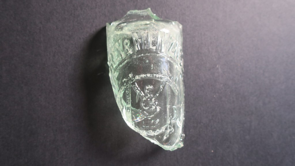
Much of the glass I find does fall into this category but the most interesting pieces are not so worn by tide and time. These are the bottle necks or fronts with lettering that can be researched. The other smaller (proper seaglass) pieces I collect go into the art pieces I make to sell at a local market (Magpie Designs)
The next photos shows a knarly chunk of sharp glass I found whilst larking under the harbour bridge. I wouldn’t normally have bothered to bring this home but the lettering got me curious. A quick search online found the following on the Auckland Museum website.
Grey & Menzies Ltd (1902-1962)
Established in 1902 following the merger of J Grey & Sons and Thames cordial manufacturer Menzies. The firm operated as Grey and Menzies until 1964 when a merger with CL Innes Ltd resulted in the soft drink brand of Innes Tartan. John Grey established J Grey cordial & aerated water manufacturers at Eden Cres. Auckland in 1874, and in 1880 his sons joined the business it became J Grey & Sons 1880-1902
Robert Menzies was born in Scotland in 1854 and came to New Zealand in 1858, working initially for Buteman Bros, Thames. He later worked for B Ballin (Thames), John Grey and George Gledhill before purchasing Buteman Bros. in partnership with Samuel Hirst to form Menzies & Co at Thames. In August 1902, with two partners he established Menzies Ltd, and leased a property in Stanley Street, Auckland but a month later joined with John Grey & Sons to form Grey & Menzies Ltd
The Grey and Menzies merger occurred in 1902 – the company now covered a considerable area including Northland, Auckland, South Auckland and Thames. The company began to introduce new lines including the ginger beer that became Tartan Dry Ginger Ale. In 1916 the company purchased the Paeroa spring, aerating and bottling the water in Auckland under the “Paeroa Water” label – later to become Lemon & Paeroa. In the early 1920s they began making Orange and Lemon Crush under license from the Crush Co’s reg’d USA patent office.”
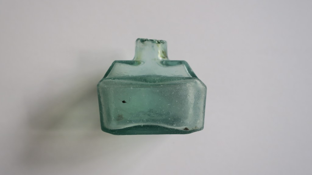
The next photo is of a sweet wee ink bottle, again found under the Harbour Bridge. It was a strange moment…I was about to leave the area having found very little that morning, thinking about a post I had seen on Instagram about these cute glass ink bottles when I spotted nestled in the seaweed one of the very same. Known as Boat ink bottles for their shape and distinctive lip used for a pen rest they come in a variety of colours. During a recent visit to the Dargaville Museum north of Auckland I saw a vast collection of these bottles in all their beautiful colours.
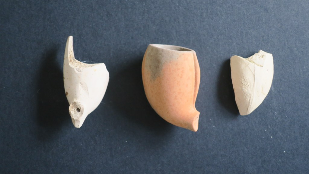
4. Clay Pipes
Finding clay pipes on the shores of Auckland’s harbour can be a bit hit and miss, however I do have a small collection of pipe stems and bowls. None of which have any visible decoration or makers mark, given the softness of the kaolin clay used to make these items it should not be surprising that it would easily wear away. Not so long ago I was sent pictures of a pipe stem found at Fitzpatrick’s Bay which did have a stamped name on it, ‘squatters budgeree’ which I have written about here.
For those who would like to know more about clay tobacco pipes in New Zealand the following links may be of interest. For those elsewhere there are a multitude of websites and books on the humble clay pipe.
Underground Overground, Christchurch

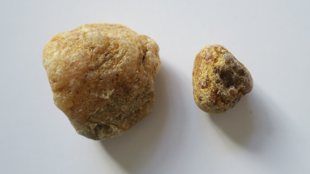
5. Kauri Gum
For those who are not familiar with Aotearoa New Zealand’s flora, there is a native tree called kauri. It is a slow growing hardwood which was much sought after by settlers and Māori alike. Its many attributes was the tendency to ooze sap which over time solidifies and becomes much like amber. Early settlers would often turn to gumdigging as a way of supplementing other income or when there was no other income.
The gum was used by Māori as a type of chewing gum (fresh gum), as a fire starter and when burnt and mixed with animal fat for tattoo moko. The early settlers used it in a variety of ways, much like amber for trinkets and jewellery. However, in the mid 1800s it was discovered that when mixed with linseed oil it made an effective varnish and as such was in great demand in the UK and Europe. Kauri gum became Auckland’s main export at this time – between 1850 and 1950 approximately 450,000 tons were exported. The growth of early Auckland owed much to this industry.
The area in which I live once had extensive kauri forests, so it is not surprising to find chunks of gum washing up (and down) onto the beaches. I collect them because of the history they remind me of. Below are a just a couple of the many pieces currently residing in my rockery…
For more on kauri gum read here.
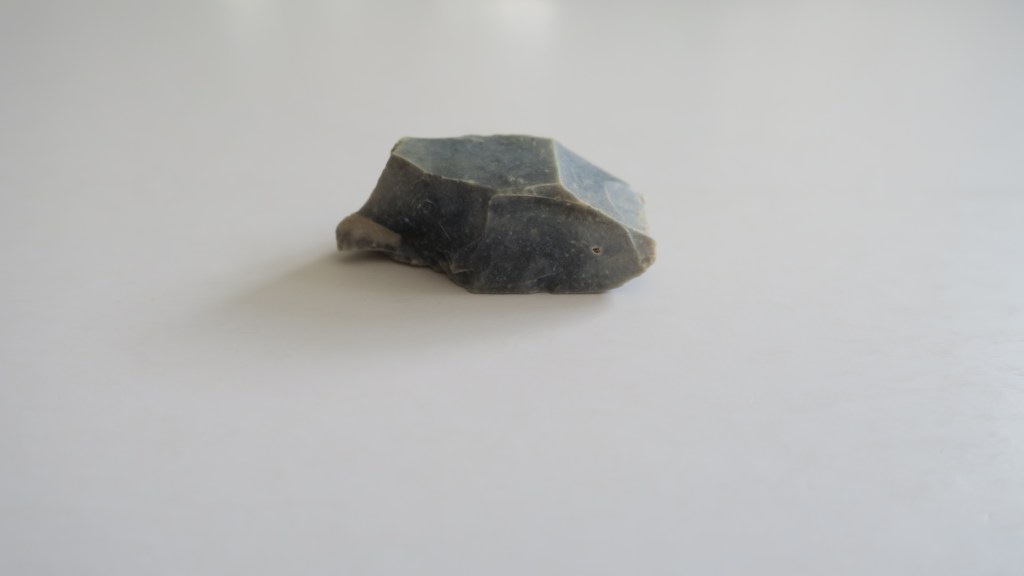
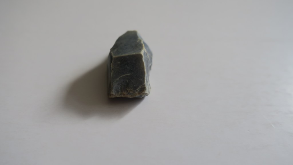
6. A Gun Flint
I only have one gun flint and only a partial one at that. Gun flints are part of the striking mechanism for a flintlock gun and were in use in the UK from the 17th to the 19th century. For more on how they were used read here. Here in New Zealand the musket, which also used a flintlock mechanism, contributed to a period in our history known as the Musket Wars.
‘After Europeans brought muskets (long-barrelled, muzzle-loading guns) to New Zealand, these weapons were used in a series of battles between Māori tribes, mostly between 1818 and 1840. As many as 20,000 people may have died, directly or indirectly. Tribal boundaries were also changed by the musket wars.’ From Te Ara Encyclopedia
Although there is no telling who used this particular gun flint (it was found at Fitzpatrick’s Bay) it is a sobering reminder of our past – the good and the bad.
7. A Fossil
No I’m not talking about the other half…but rather this small reminder that the earth is old and for me at least, a reminder that our time here is but a moment.
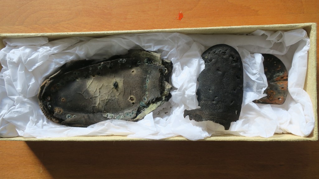
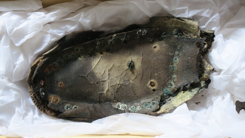
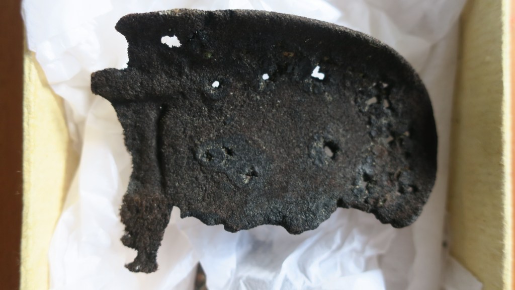
8. Shoes
Occasionally I find parts of shoes, sometimes they are modern (so many jandals) and head straight to the bin but other times they are much older. When I look at these shoes parts I wonder who wore them, what was their life like? Oddly shoes feel very personal and connect me to someone in the past – will a person in the future find the sole of my favourite ugg boots and wonder about me too?

9. A Mystery Object…
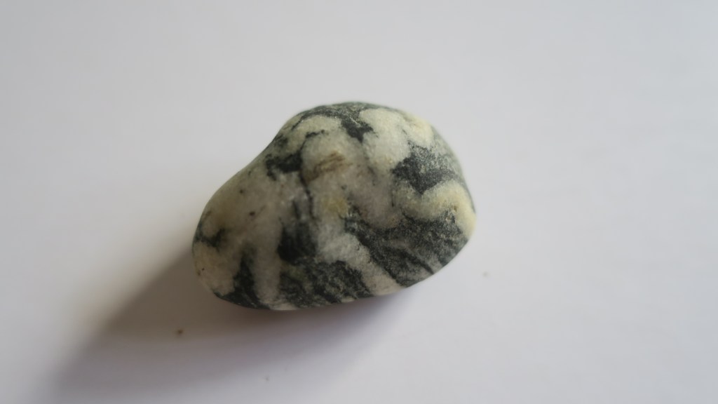
This final object confounds me and I hope there is someone out there who might be able to shed some light.
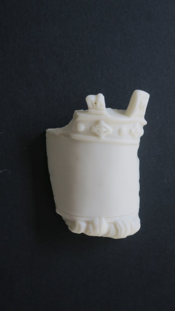
As you can see it is an interesting shape, being 6cm at its tallest, it looks like a crown with a blank space for perhaps a label (?) and locks of hair below. The material at first glance looks like milk glass but I am not sure as it it is quite matt and more like alabaster in appearance. All suggestions welcome…
And there you have it, just a few of my favourite things…
If you have enjoyed this blog please feel free to share, like and comment – tell me your favourite finds!
Share this:


My Top Five Archaeology Books
With a British Bias…And Why I Chose Them…
Books, they are my friends, they transport me into different worlds, past and present, real and imaginary. So imagine my difficulty in choosing just five to tell you about! Thus this will be the first in a short series of my top five book posts. Moving on…this particular post is centered around my favourite general books related to archaeology in the UK. Please note that the opinions in this blog are purely my own and are listed in no particular order.
1. ‘A Little History of Archaeology’ Brian Fagan
More often than not when studying archaeology at University, there is always one paper that is required – the history of archaeology. For some this can be the ‘dull as dishwater’ topic, the one you dread every week but for myself I always found it fascinating. Archaeology is such a strange discipline, it borrows from just about every other subject to become something unique, constantly evolving.
Brian Fagan’s book takes the reader on an adventure in archaeology around the world, from it’s very beginnings with antiquarians and collectors to the present day science based enquiry. There are tales of wandering antiquarians in the American Southwest at a time when Apache tribes were on the warpath to the Mesolithic finds trawled up from the North Sea. Ever wondered about how radiocarbon dating became a thing? Or why we have the ‘three age system’? The answers and more are all here.
Fagan writes in an engaging style with a hint of adventure and is more than a match for those ‘dull as dishwater’ lectures. I thoroughly enjoyed reading this book and highly recommend it to everyone interested in archaeology.

A History of Archaeology by Brian Fagan
2. ‘Ancestors’ Professor Alice Roberts
Subtitled ‘The Prehistory of Britain in Seven Burials’ Alice Roberts takes the reader on an interesting journey into the past via the dead. Regardless of our views on whether the dead should be disturbed/excavated, there are situations when this is inevitable and in this book Roberts picks apart these burials to tell the human story of British prehistory.
‘Burials are like time capsules – each one, a physical biography, written into a skeleton.’
From the back of the book
For each of the burials she chooses (which range from the paleolithic – the red lady of Paviland – to the Iron Age and the Pocklington Chariot), Roberts gives a history of the discovery of each burial as well as the research past and present that has gone into each discovery. She also widely discusses the new science of genomics and how it is changing the way we view the past in Britain.
Alice Roberts writes in chatty style, having seen her on tv many times I could easily hear her voice narrating the story in my head. Through her writing the reader gets a clear sense of her curiosity and knowledge, her willingness to explore avenues to find answers. Even when she is warning of caution she does so with friendly caution. It is up to the reader to draw their own conclusions. This is in essence why this book makes it to my top five, Alice Roberts does not lecture, she leads you along a path of discovery and allows you to come to your own conclusions.

Ancestors by Professor Alice Roberts
3. ‘The Old Stones’ Edited by Andy Burnham
For those interested in the megaliths that are found through the United Kingdom this is the go to book. Coming off the back of the successful website ‘The Megalithic Portal‘ this book details all the fabulous sites listed online with extra short essays on topics such as astronomy, archaeoacoustics, stone axes and more, written by users and contributors to the website. There are maps, photos and drawing galore as well as a well written introduction to the Neolithic and Bronze Age in the UK. It is the kind of book that you can dip into as and when you need to.
I would highly recommend this book to anyone who wants an adventure back through time, who has ever stood and stared at a stone circle and wondered why or for those who want to just make a walk in the countryside more interesting.
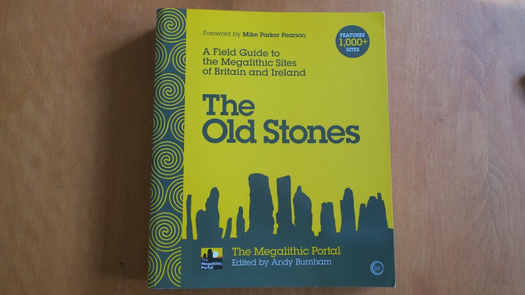

The Old Stone edited by Andy Burnham
4. ‘Mick’s Archaeology’ Mick Aston
For fans of the tv show ‘Time Team’ Mick Aston will be a familiar face, his shaggy hair and stripey jumpers are things of legend, and although no longer with us his legacy in archaeology remains strong. This book is for those who want to know more about Mick, his beginnings in archaeology (in Cornwall), the reasons behind Time Team, his love of teaching, landscape archaeology and all things monastic.
I met Mick on several occasions, twice with Time Team and once at tea whilst at a friends house in Cornwall. He was a lovely man with a genuine interest in everything around him. When you talked to him he really listened and was always open to ideas, even if they didn’t necessarily align with his own.
I recommend this book for lots of reason, not only because Mick Aston is a man I admire and respect but also because of his ethos that archaeology belongs to everyone not just the academics. His belief in the importance of community archaeology permeates this book and is also an ideal I hold dear.

Mick’s Archaeology by Mick Aston
5. ‘Drawing on Archaeology’ Victor Ambrus
Victor Ambrus was another Time Team regular, his reconstruction drawings bringing the past to life in a way that was very human. Todays digital reconstructions are nice but there is always a sense of life in the hand drawn pictures by Ambrus. Many of the drawings in this book are from sites featured on Time Team but not all.
Victor Ambrus draws/paints a site and then places people in it, using the site as it may have been used, there are animals, trees, birds and more. Reminding us all that a site was not isolated, it was part of an environment both natural and human. Some of his drawings depict characters we all know from the past, such as Henry VIII or King Cnut. There are scenes of warfare, crime and punishment, prehistoric rituals, medieval feasting, Mesolithic life and many more. Each of the drawings are accompanied by a short commentary by Ambrus with the background to the picture. Throughout the book you are constantly reminded of the lives that came before. I particularly like to look out for the wee dog that always seems to be barking at something…
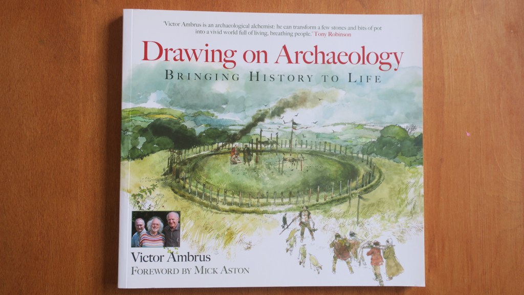

Drawing on Archaeology by Victor Ambrus
And there you have it…my top five books on archaeology, perhaps not the most conventional choices but they are the ones I have enjoyed reading the most and from which I have gained the most insight into what it means to be an archaeologist.
Share this:


Hampton Park – Te Puke o Tara
Back in October the Auckland Council hosted the Auckland Heritage Festival, where, as the name would suggest all things heritage and Auckland was celebrated. There are a wide range of events during the festival weeks from walks, talks, exhibitions and workshops. I was able to attend two events – a talk at the Devonport Museum on Mt Cambria (more on that down the page) and a walk ‘n’ talk at Hampton Park.
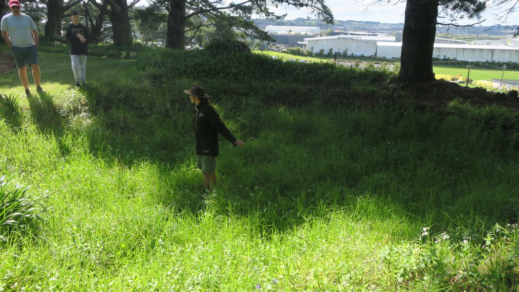
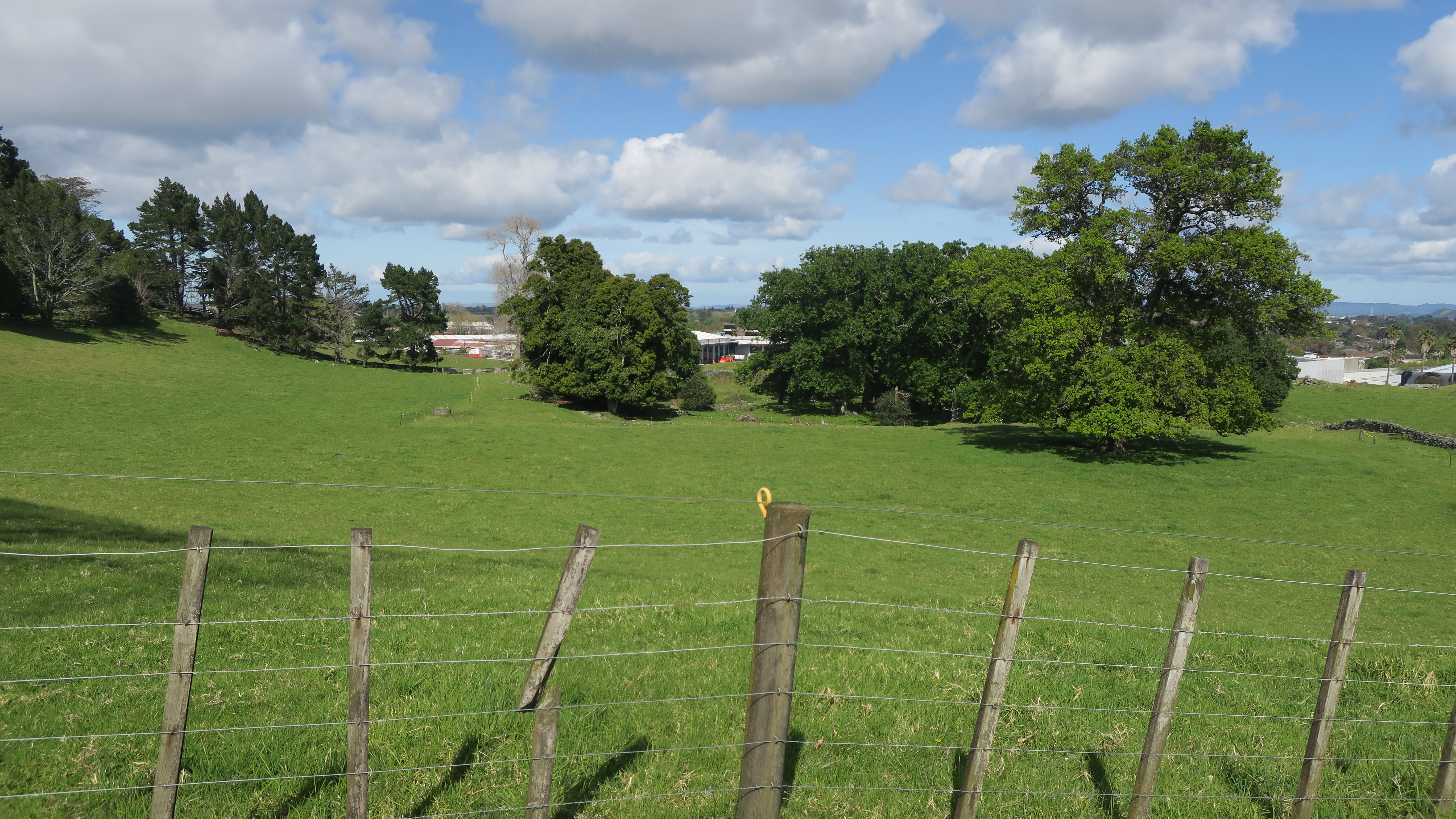
Hampton Park is situated in the heart of commercial Otara, a pocket of farm land amongst the warehouses, factories and offices. Having never been there or even for that matter heard of it, I was intrigued to find out more. The park is in fact a working farm and whilst the public are able to walk around it there are no proper footpaths and no other facilities (there is a house and it is lived in by the family who farm the park as well others – if visiting please respect their privacy).

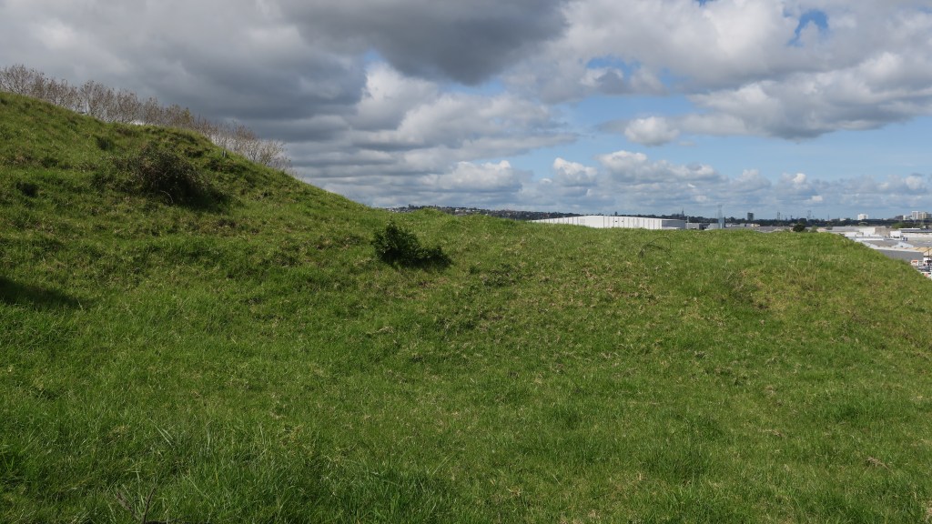
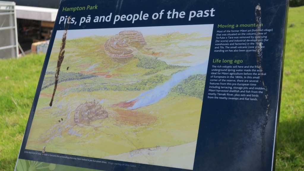
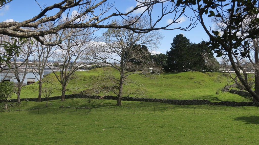
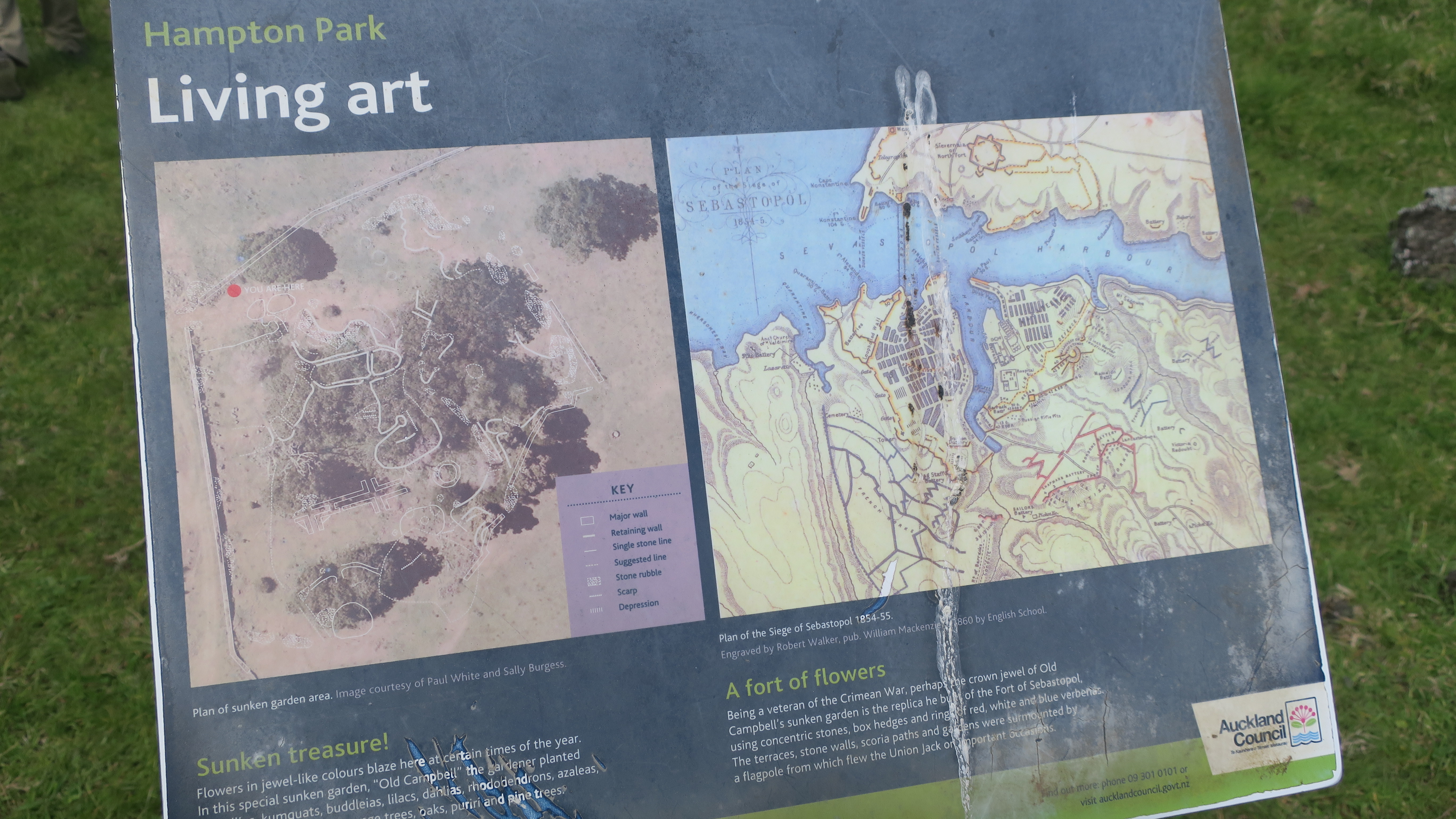
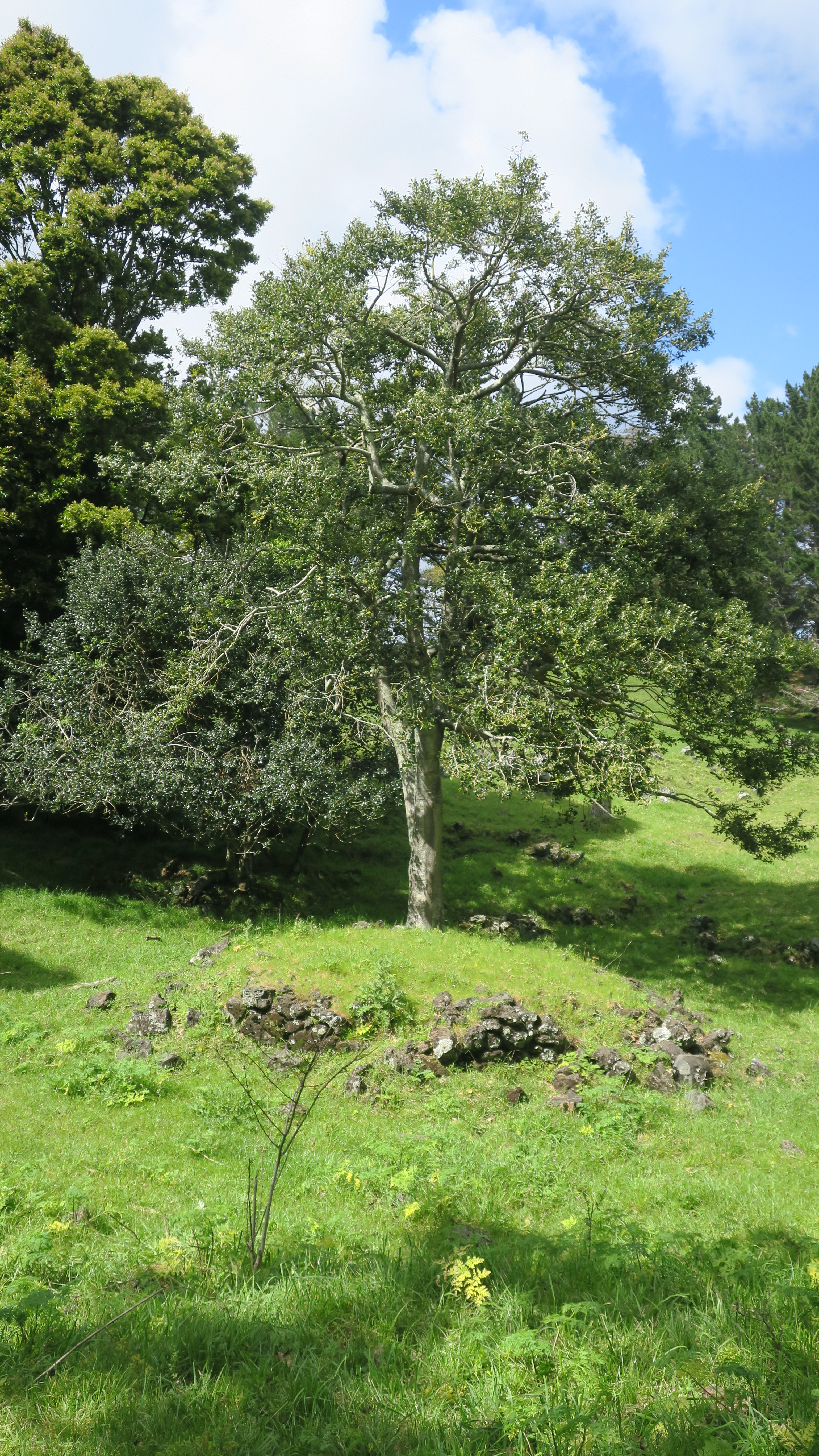
The story of Hampton Park begins long before people arrived in the area. Geologically it is part of the wider volcanic landscape of Auckland, here in Otara there are (or were) three volcanoes, the largest of which was called Te Puke o Taramainuku (‘the hill of Taramainuku’, a Tainui ancestor). The small scoria cone that sits in Hampton Park is the smallest of the three and is probably the smallest of all the Auckland volcanoes. It is so small that it has no formal name, simply being referred to as the Hampton Park volcano.
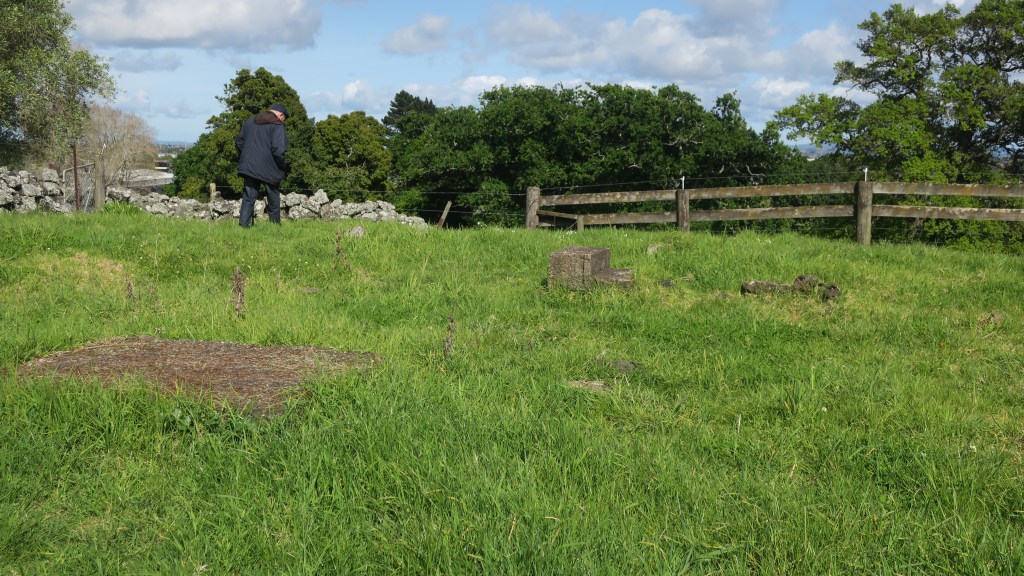
The beginnings of the human story in the area is much like the human story all over Tamaki Makaurau. Here like everywhere else Māori terraced the flanks of the cones and grew crops in the good volcanic soil. The larger cones would have provided a place of refuge when in need. The small cone in Hampton Park shows some evidence of terracing but later changes has blurred this somewhat. Alongside the driveway between the house and the church there is a large rectangular kumara pit which has remarkably survived. For more on the Māori use and occupation of the maunga of Tamaki Makaurau read here.
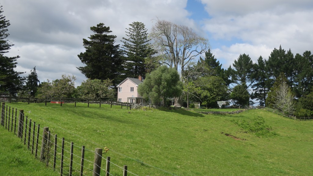
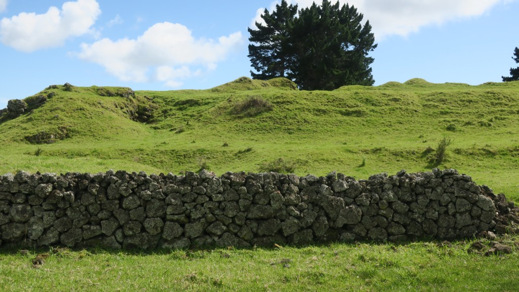
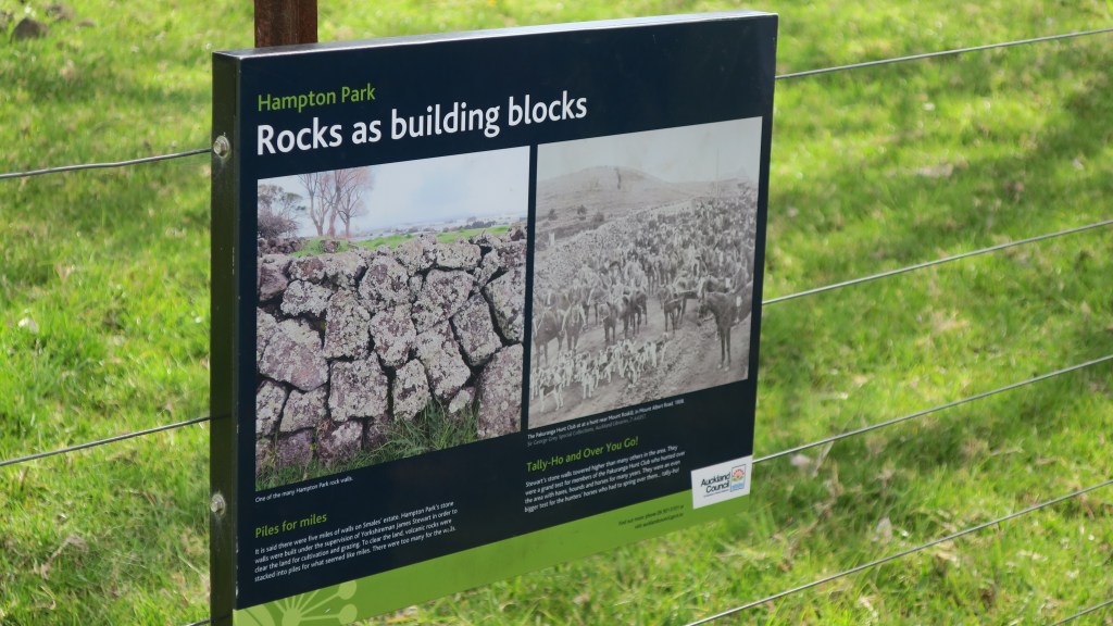
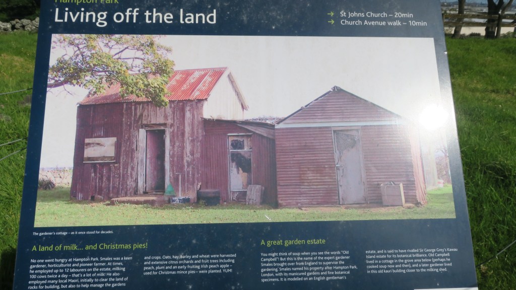
In 1852 the Rev. Gideon Smales, a Wesleyan missionary, bought 460 acres from the fencible Major Gray, settling there with his wife and children in 1855. The land was cleared of rocks, stone walls were built and crops and livestock brought in. Gideon Smales called the farm Hampton Park as he wished to model it on the English gentleman’s estate. It was said to have once rivalled Sir George Grey’s Kawau Island estate for its ‘botanical excellence’.
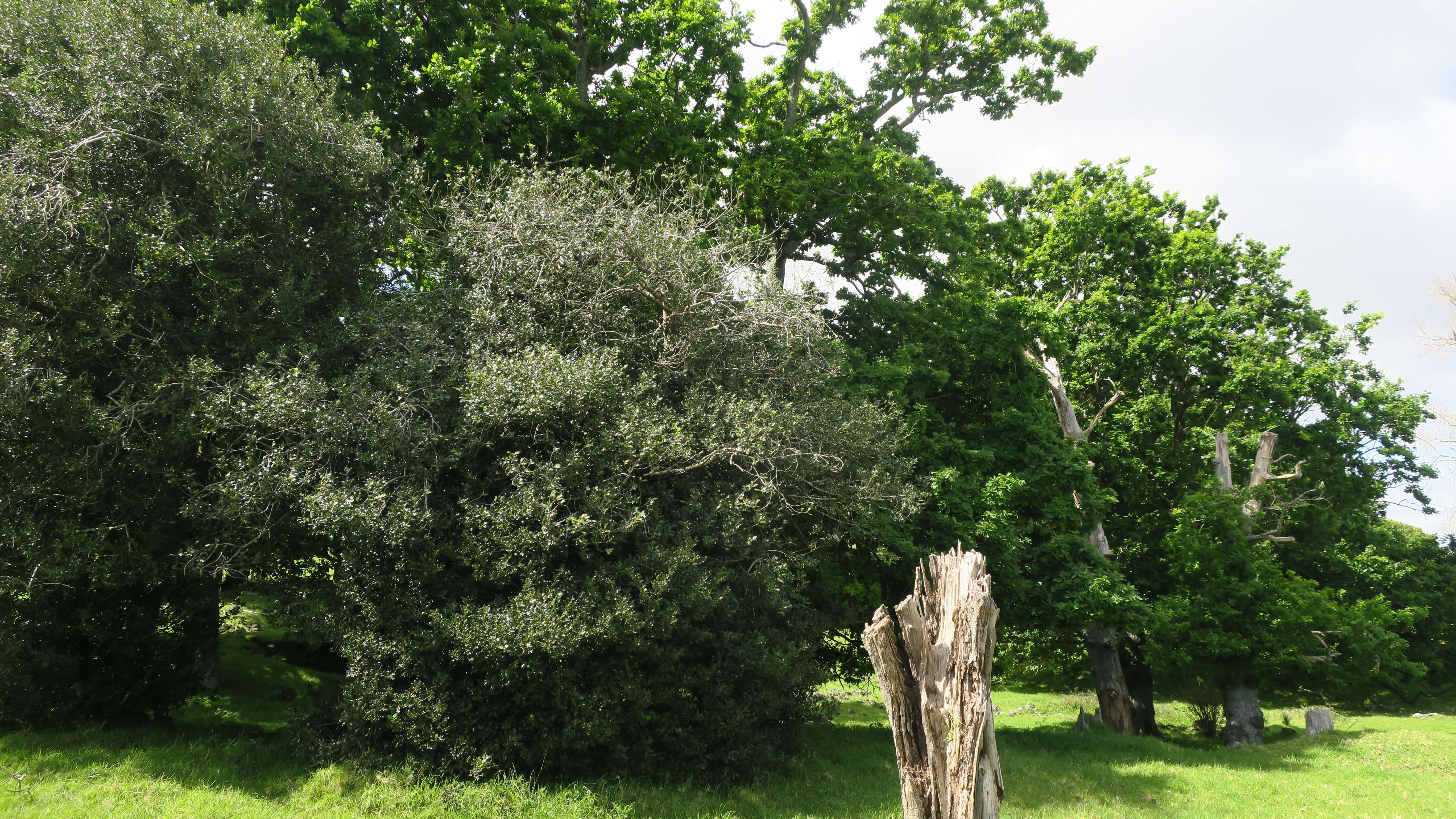
The farm grew oats, hay, barley, wheat and had an extensive orchard which included cider apple trees, pomegranates, oranges, figs and plums to name a few. In addition, to the more practical elements of the farm, the gardener – a veteran of the Crimean War – built a sunken garden in the form of the fort of Sebastopol. The remains of which can still be seen today. The excessive amount of stone on the estate resulted in it being used for a great many projects including the sunken garden, a rockery with a high stone wall and cave and of course the stone walls.
The stone walls which were constructed with the stone cleared away for cultivable fields was done so under the supervision of James Stewart who immigrated to New Zealand from Yorkshire. Due to the vast quantity of stone the walls were higher than was the norm and it was said there was over five miles of walls on the estate.
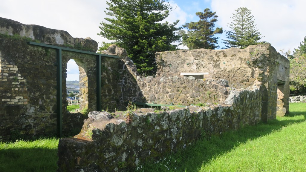
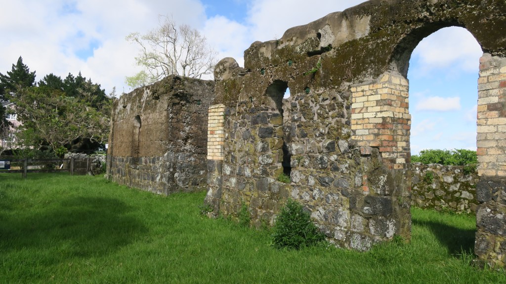
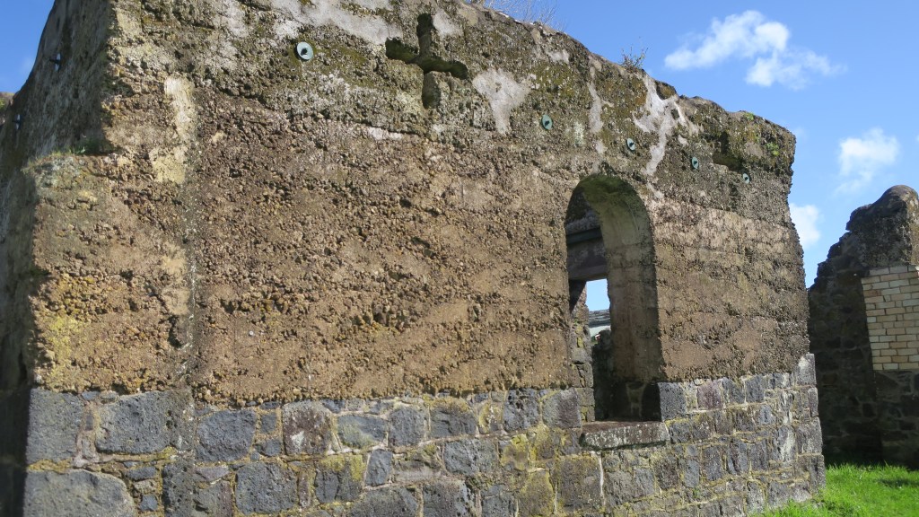
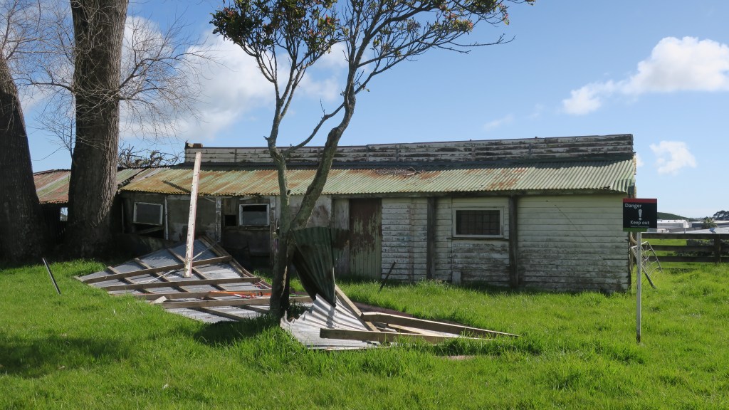
As is to be expected on a farm there are a number of buildings but perhaps the most striking are the remains of the stone stables, again built from stone quarried from the estate. Although not long after they were built a vagrant worker came to the estate looking for work, he was given a meal and allowed to sleep in the stables. That night the stables burnt down and the vagrant disappeared. They were never rebuilt properly although they were partly roofed over as barn and milking shed. Nearby are the derelict tin shed of the 1930s barn.
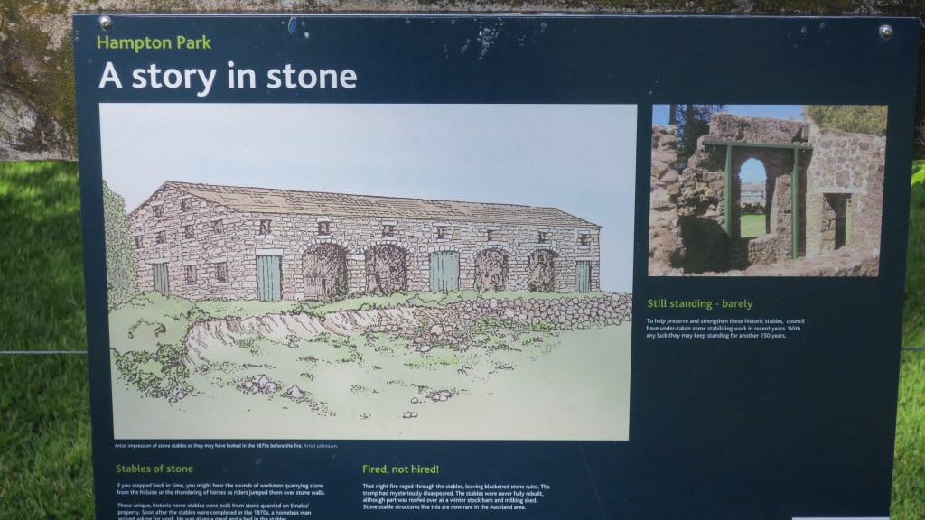
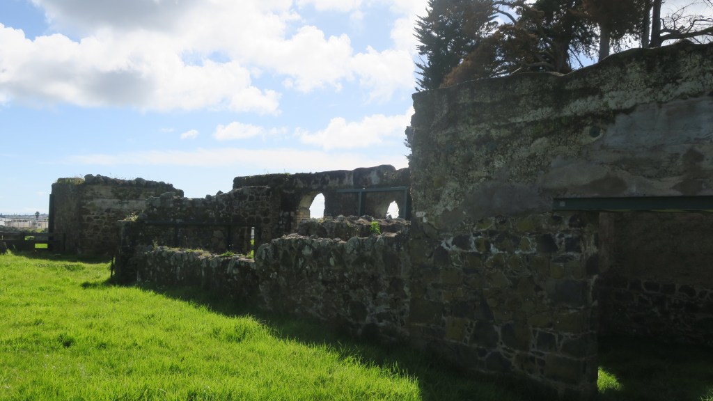
Two other buildings which still stand are the homestead and the church. The current homestead is the second to have stood on the estate, the first was burnt down in 1940 and the current homestead was built – only the front steps remain of the original house. The first homestead was built in 1855, it was three storied and had ten rooms which was later extended to eighteen rooms in 1869.
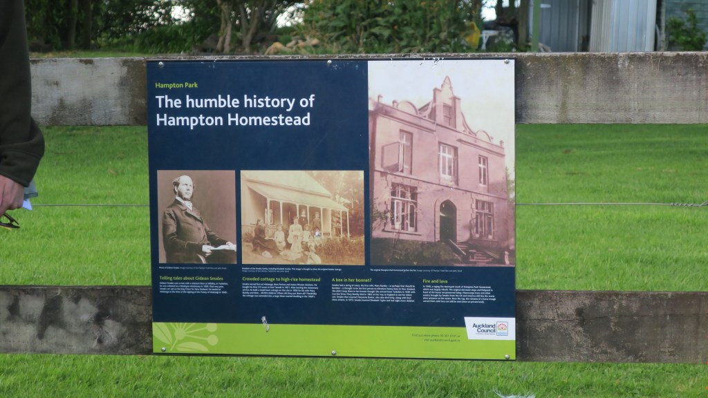
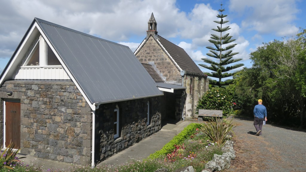
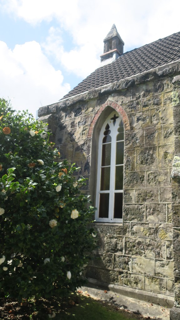
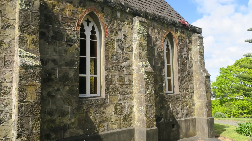
The small chapel – St John’s church – is also constructed using stone from a nearby quarry. Interestingly, the mortar for both the church and the house was made of burnt shell from Howick beach, the timber arrived via the Tamaki river and was brought overland by bullock teams. The first service to be held in the church was on Sunday the 12th January 1862. When the Rev. Gideon Smales died in 1894 he bequeathed the chapel and four acres jointly to the Anglican and Methodist Churches. It is still used today for services once a month.
The Missing Maunga
Beyond the settler history of the park there is another story that is reflected in the wider landscape of Auckland Tamaki Makaurau. As mentioned earlier the small volcano cone at Hampton Park is one of three in the immediate area, which may confuse the visitor, as nothing of the other two remain to be seen.
Te Puke o Taramainuku has been completely quarried away beginning in 1955 and now is vast expanse of factories, beyond is Greenmount or Matanginui which had minor quarrying from around 1870 which began in earnest during the 1960s. The quarry eventually became a landfill giving way to the gently sloping mound/hill we see today.

The quarrying of the volcanic cones around Auckland in the late 1800s up until the mid fairly recently was not an unusual. Many of the cities defining features were quarried away to make way for development and to use the raw material of scoria and basalt in the infrastructure of a city. An earlier event at the Devonport Museum told of the history of Takararo/Mt Cambria, another volcanic cone wedged between Takarunga/Mt Victoria and Maungauika/North Head which was mostly quarried away and only more recently became the pleasant parkland area it is today.
Other volcanoes that have been subjected to quarrying to the point of total removal include –
Te Apunga-o-Tainui/McLennan Hills; Waitomokia/Mt Gabriel; Ōtuataua Volcano/Quarry Hill; Maungataketake/Elletts Mountain; Te Pou Hawaiki (the second smallest cone and now a carpark);Te Tātua-a-Riukiuta/Three Kings; Rarotonga/Mt Smart; Maungarahiri/Little Rangitoto; Te Tauoma/Purchas Hill to name a few.
There are also many others which have been partially quarried, of the fifty three volcanoes in Auckland only thirteen appear to have been untouched by the bulldozer and the digger. This is not to say that those that remain have been completely untouched by human hands. For as long as there has been people in Tamaki Makaurau then the landscape and its features will have been adapted and utilised to suit the needs and requirements of its inhabitants.
For more information regarding the volcanoes of Auckland I recommend the following book –
B. W. Hayward (2019) The Volcanoes of Auckland. A field guide. Published by Auckland University Press
Share this:


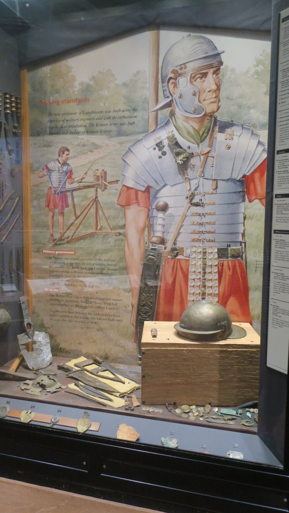
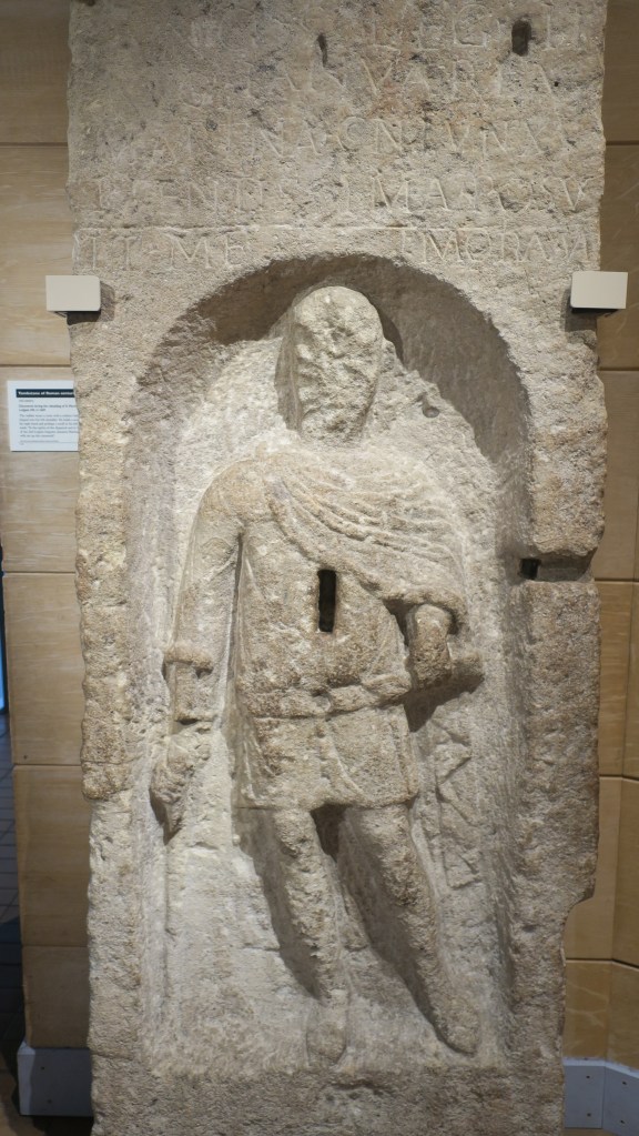
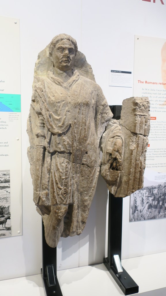
On the hunt for Roman London
People have always lived in the area that is now known as London, a visit to the London Museum will tell all you need to know about London before it was London. However, it was the Romans who gave the area its name – Londinium – and apart from a small hiccup in the first century AD they provided the structure that would become one of the most famous cities in the world.
Although later parts of the city’s history can be easier to spot, the evidence for Roman London is possible to find. The following is not an exhaustive guide, just a few pictures and the like of places as and when they were found.
The most obvious evidence for the Romans can be seen in the sections of the surviving wall that once surrounded the Londinium. Short sections of the wall survive in various places (one section is in an underground carpark) and are really the only upstanding remains left – all else having been destroyed and built over by later generations. The wall remained (with later additions and repairs) because it was useful. For those wishing to walk the wall – follow the road ‘London Wall’ which leads to and from the Museum of London, along the way there are several signposted places of interest.
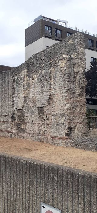
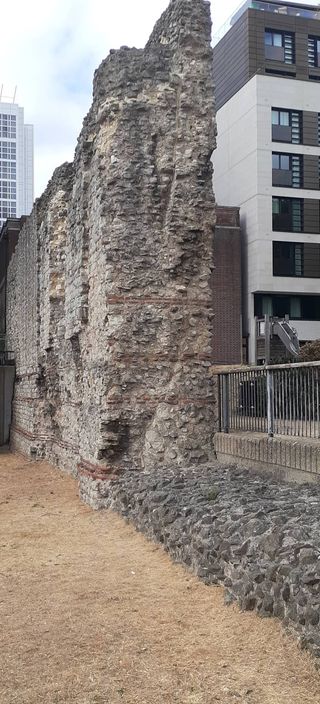
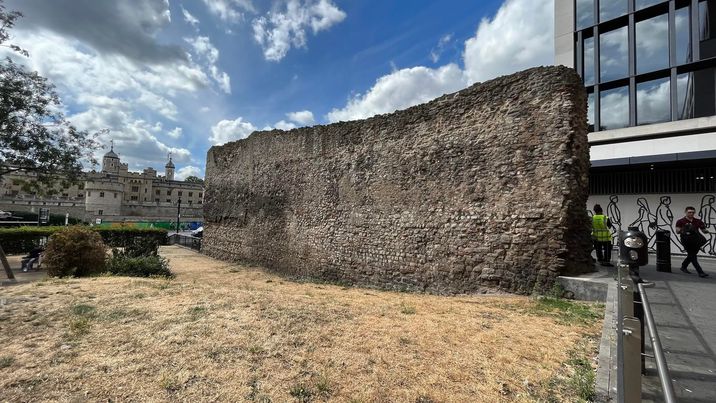

The above photos show a section of the wall at Tower Hill (first three pictures) and one of the bastions and wall section of the Cripplegate fort. The Roman fort formed part of the wall defences when it was built in the second century AD. Follow this link for an interactive map of other locations of the wall sections. Do keep in mind though that the Roman parts of the London wall are generally speaking the lower sections, later Londoners did alter, reinforce and reconstruct much of the upper sections as and when necessary.
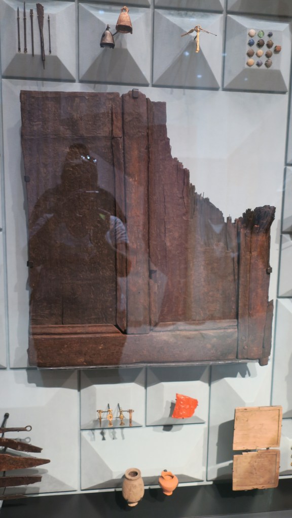
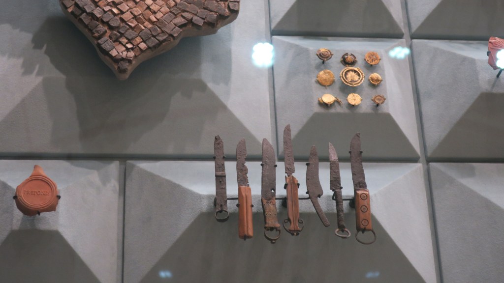
As mentioned before an essential place to start if you want to know more of London’s history is with the London Museum. More so if you want to learn about the Roman period and earlier as much of the evidence comes from excavations. The Roman galleries paint a fascinating picture of life at the time with the added bonus of a section of the Roman wall being just outside the museum (see above photo).
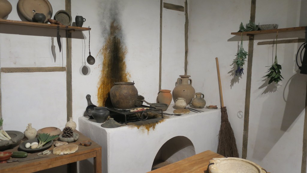
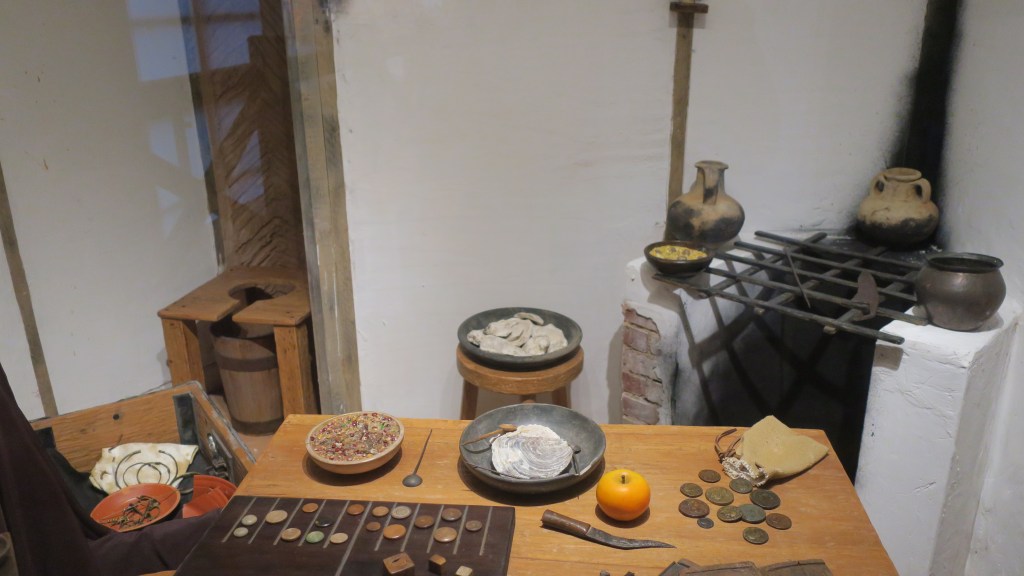
Part of the gallery is laid out as a series of ‘rooms’ where objects are given life like context. For example, cooking pots and utensils are placed within the context of kitchen befitting a Roman home.
There are also many of the usual museum type exhibits. It was particularly interesting to see the exhibit on the burial of the Roman woman found at Spitalfields.

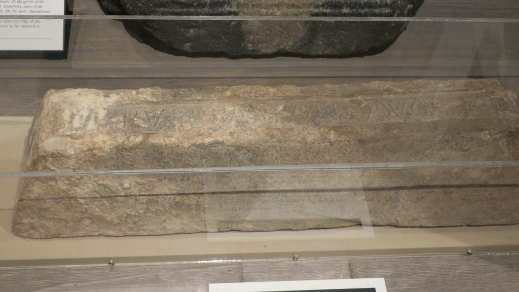
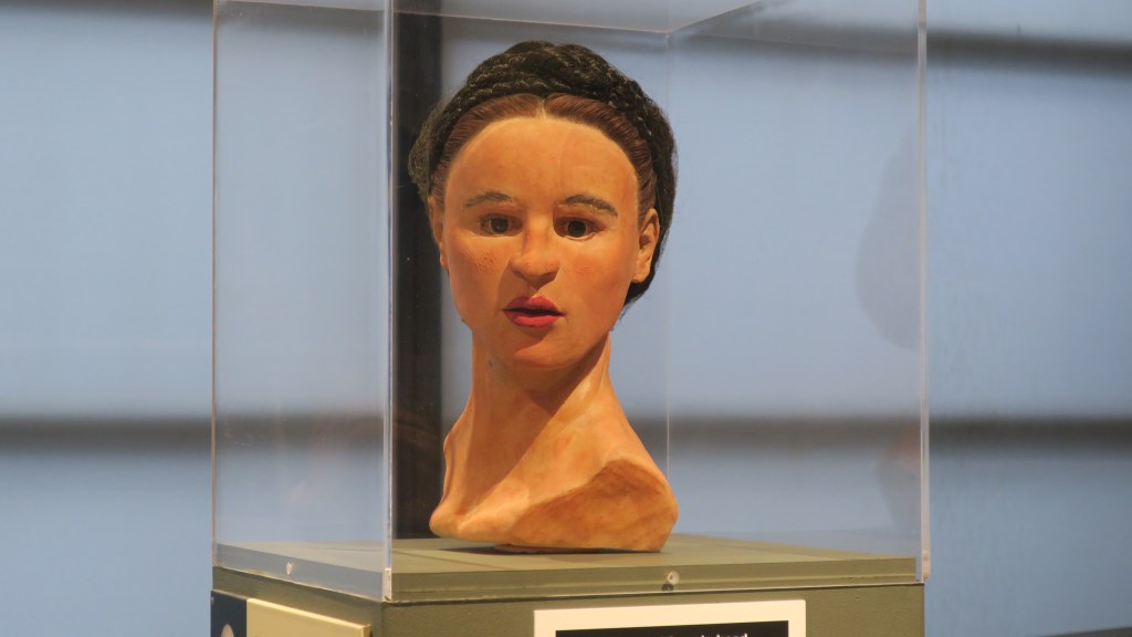
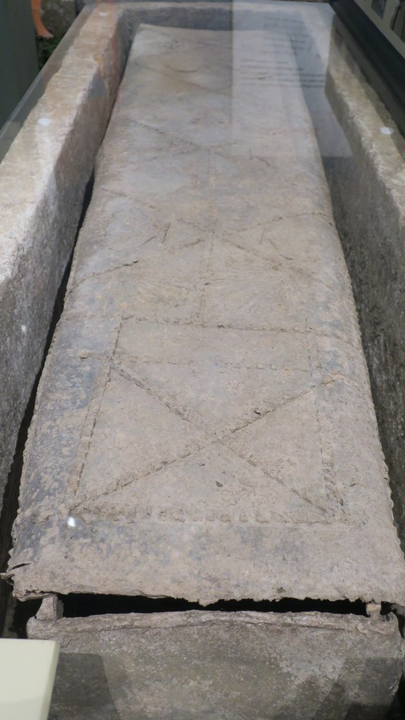
The above photos show a reconstruction of the Spitalfields woman and how she may have looked. Roman London was a cosmopolitan city and by AD120 the population was around 45,000. Many of the people living in Londinium came from all over the known world. The Spitalfields lady’s burial was of high status, not only did she have a stone sarcophagus but also a highly decorated lead coffin (above). Fragile glass vials were found with her as were pieces of Damascus silk. Chemical analysis indicated that she was one of the few known people to have actually come from Rome. Read here for more of her story.
Every generation since London’s inception has reimagined the city, demolishing that which did not fit or was not useful and rebuilding for their own purposes. Resulting in thick layers of history beneath the roads and buildings we see today. Every time a new road, building or train line is built the archaeologists move in to hastily uncover and record what can be seen, such as during the Cross Rail project. Many of these reports can be accessed via the Archaeological Data Service along with others such as 1 Poultry Lane and Tower Hamlets excavations.
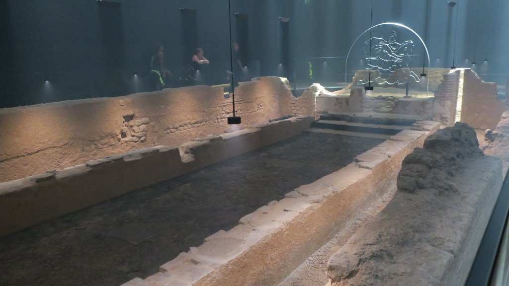
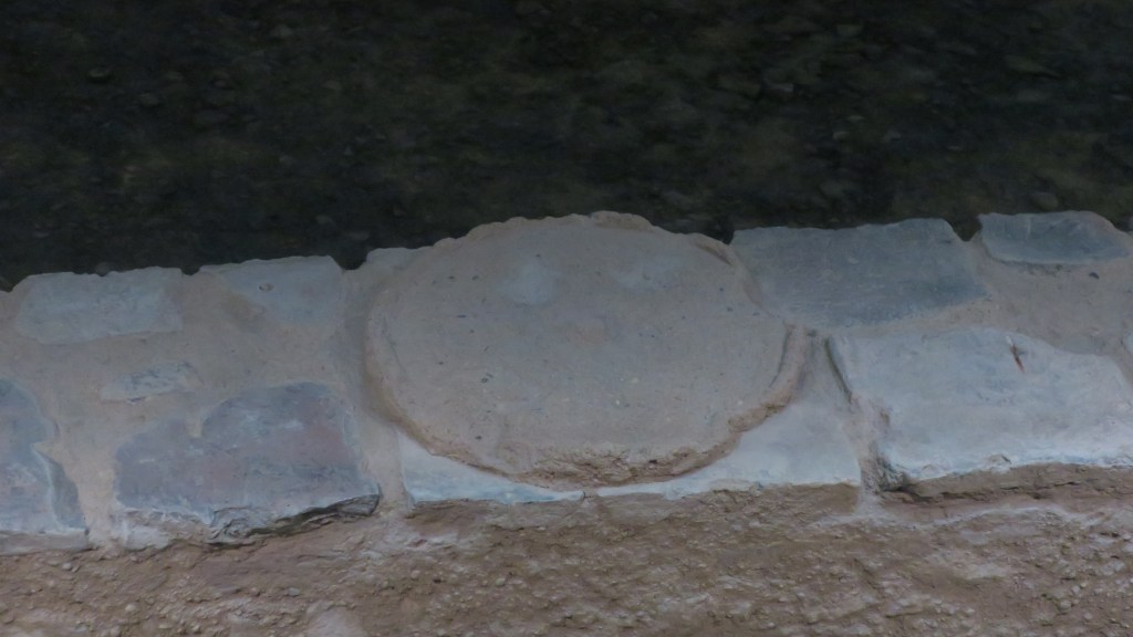
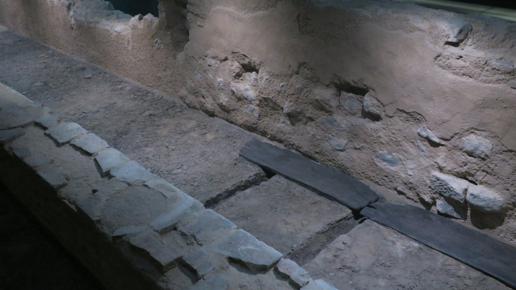
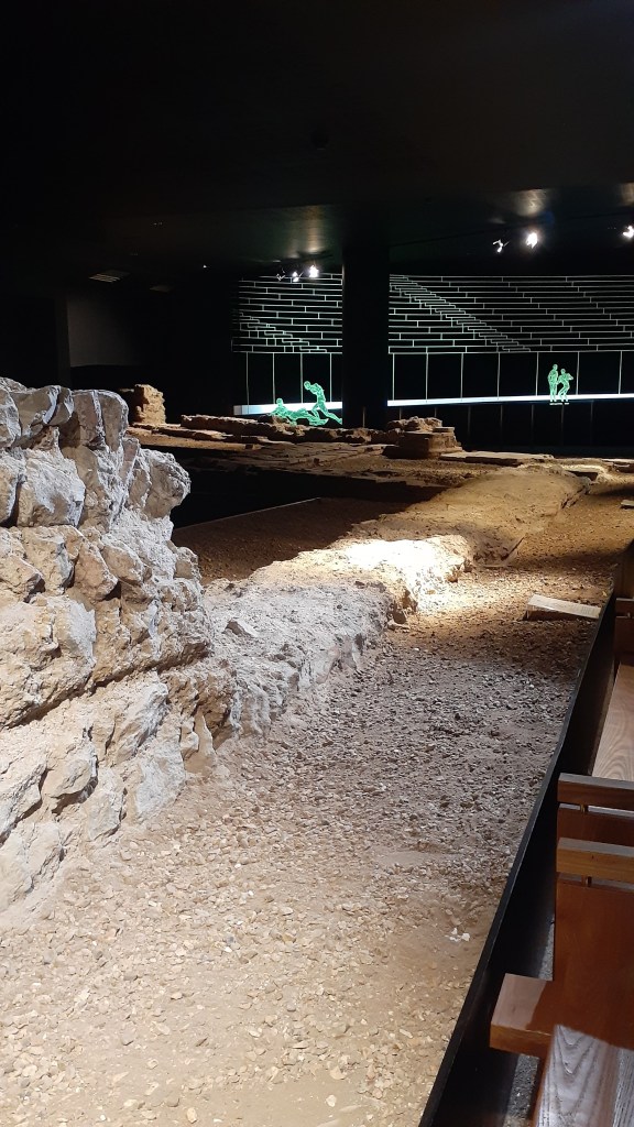
Most of what is excavated does not survive the process for numerous reasons, however in one case the remains of Roman temple has been preserved deep underground – the London Mithraeum. Located beneath Bloombergs European headquarters in the heart of the city is a well preserved and intriguing temple site dedicated to the eastern god Mithras.
The mysterious cult of Mithras first appeared in Rome in the 1st century AD. It spread across the Empire over the next 300 years, predominantly attracting merchants, soldiers and imperial administrators. Meeting in temples which were often constructed below ground, these were private, dark and windowless spaces. (From londonmithraeum.com).
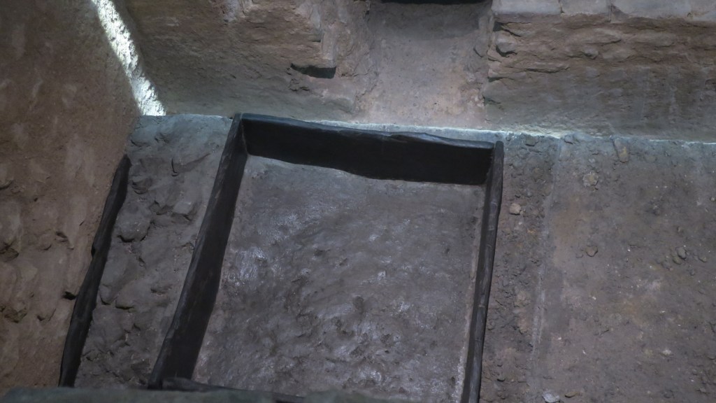
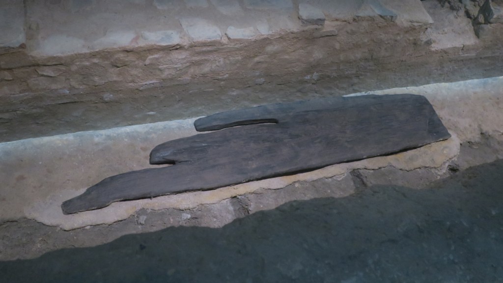
The temple was built in the third century AD and it lies on reclaimed land over what was once the river Walbrook; because of this a number of wooden artefacts survived. After the 1954 excavations the site was physically moved and reconstructed in the 1960s on the far side of the plaza where it sits now. During the construction of the Bloomberg center even more excavations were undertaken revealing even more about the sites fascinating past. As part of this process, it was decided to move the mithraeum back to (as close as possible) to its original position seven meters below modern ground level and open it to the public as educational and exciting place to learn about Roman London.
The experience is immersive – the visitor stands in a darkened room, surrounded by the sounds of the temple as it may have been, judicious use of lighting draws your attention to various spaces. Each session is timed and numbers limited (booking is essential but free). This allows for an unhurried and unharried visit of the mithraeum – evoking an atmosphere of quiet contemplation, similar to that felt when visiting a church.


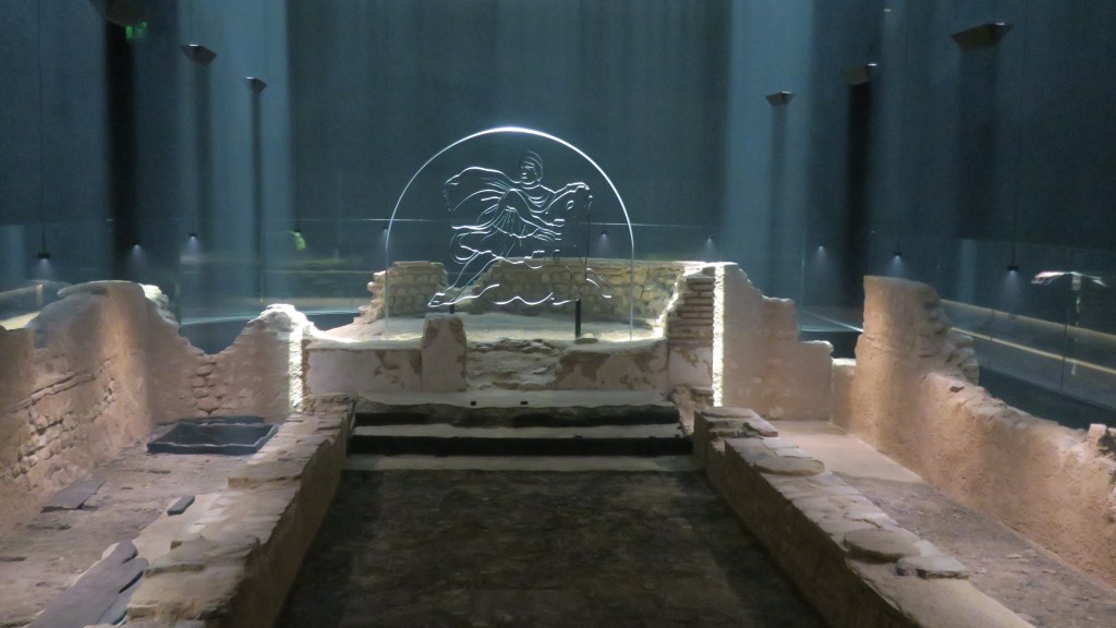
Although there is a small display of some of the many artefacts found during the 1954 excavations the sculpture featuring Mithras and the bull can be seen at the London Museum.
Another feature of Roman London which can still be traced above ground, so to speak, is that of the roads which ran in and out of the city. Some of the names may be familiar – Ermine St (now the A10/Kingsland Rd), Watling St (of which there are two…), not always easy to see or follow, later changes to the topography can blur the picture but it is always lovely when you accidentally find one such road…
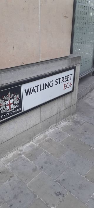
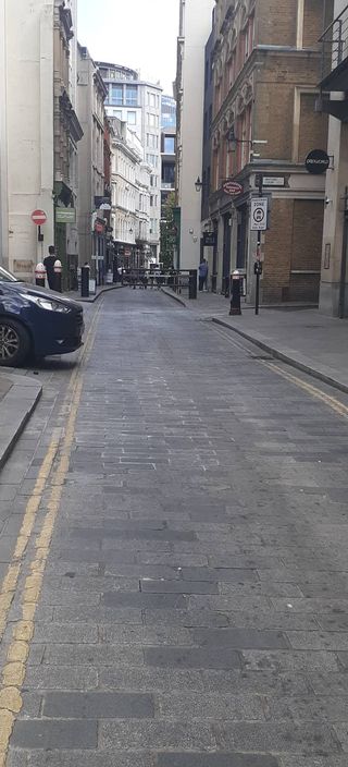
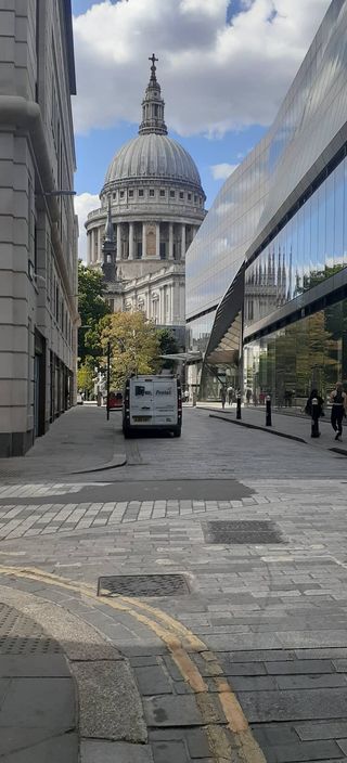
Here is the Watling Street which most likely ran south east past the mithraeum and across London Bridge heading towards Durovernum (Canterbury) and the coast. The site of todays London Bridge is roughly in the same position of the first proper bridge across the Thames built by the Romans.
Unlike later periods of London’s history the Roman story can be a little harder to find however it is well worth the effort should you make the attempt.
Postscript
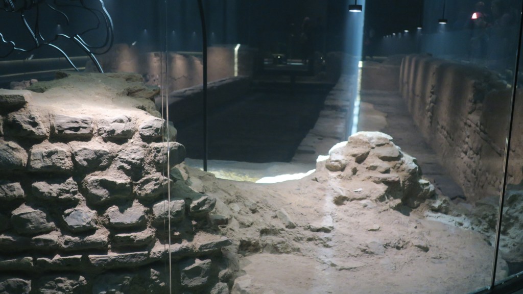
The above photos and information were gained when I visited London in 2022 but earlier this year (2024) I had the opportunity to return to London and during this time visited the Guildhall Art Gallery where it is possible to see the remains of the Roman amphitheatre. The gallery and access to the amphitheatre is free and well worth a visit. In the courtyard outside you can trace the footprint of the outer wall and imagine yourself watching gladiatorial contests.
In 1988, Museum of London archaeologists made an astonishing discovery that changed the face of Roman London. During an archaeological dig taking place in preparation for the new Art Gallery building project, it was found that the capital’s only Roman amphitheatre was located in Guildhall Yard. In 2002, the doors to the amphitheatre opened for the first time in nearly 2,000 years.
When short stretches of Roman wall were unearthed in Guildhall Yard the site became a protected monument. The City of London Corporation decided to integrate the remains into its proposals for a new Art Gallery and construction work began in 1992, alongside ongoing excavations. The surviving remains include a stretch of the stone entrance tunnel, east gate, and arena walls. They are protected in a controlled environment, 20 feet below the modern pavement, in which they can dry out slowly without damage to the ancient stonework. The original extent of the outer wall is marked by a circle of black paving stones in Guildhall Yard. (from the Guidlhall Art Gallery website).
The following are a few photos of my visit to the amphitheatre. In some of the photos you can see light effect people filling the space helping to give the visitor a sense of how the arena was used.
Here you can see a section of wall 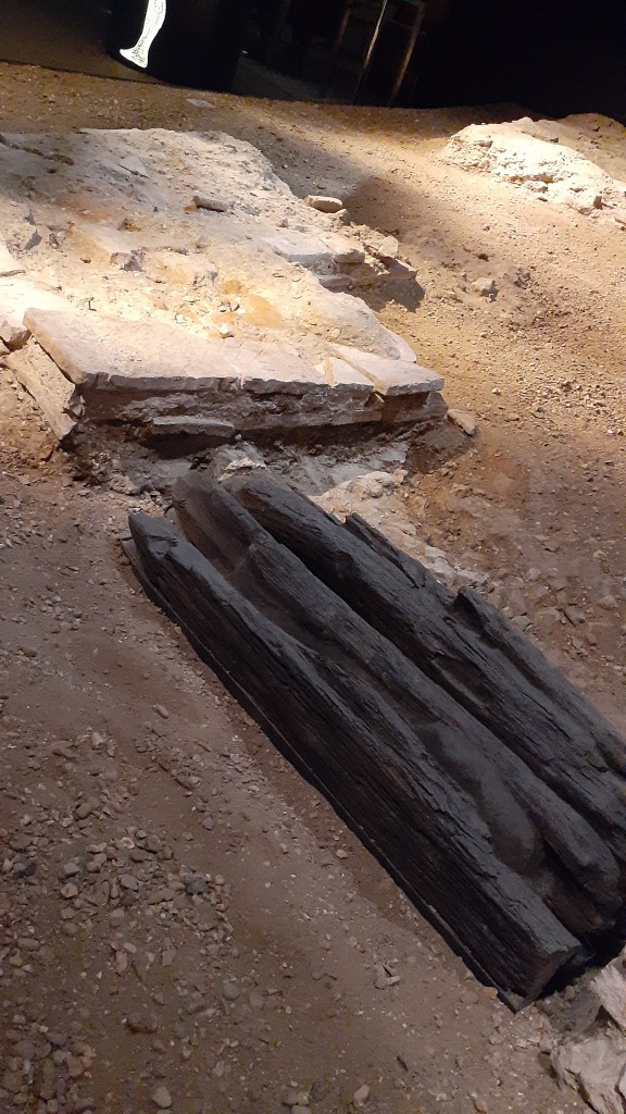
another drain but this time in wood 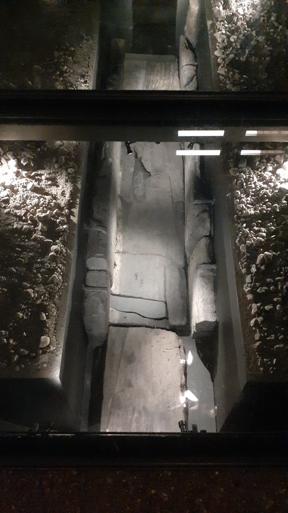
a stone lined drain 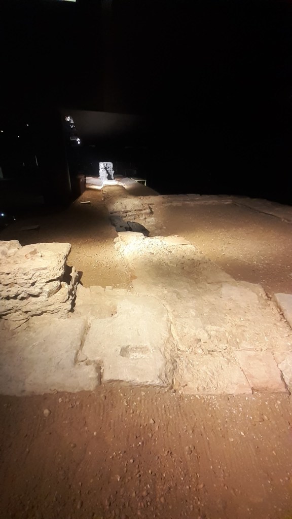
inside the arena 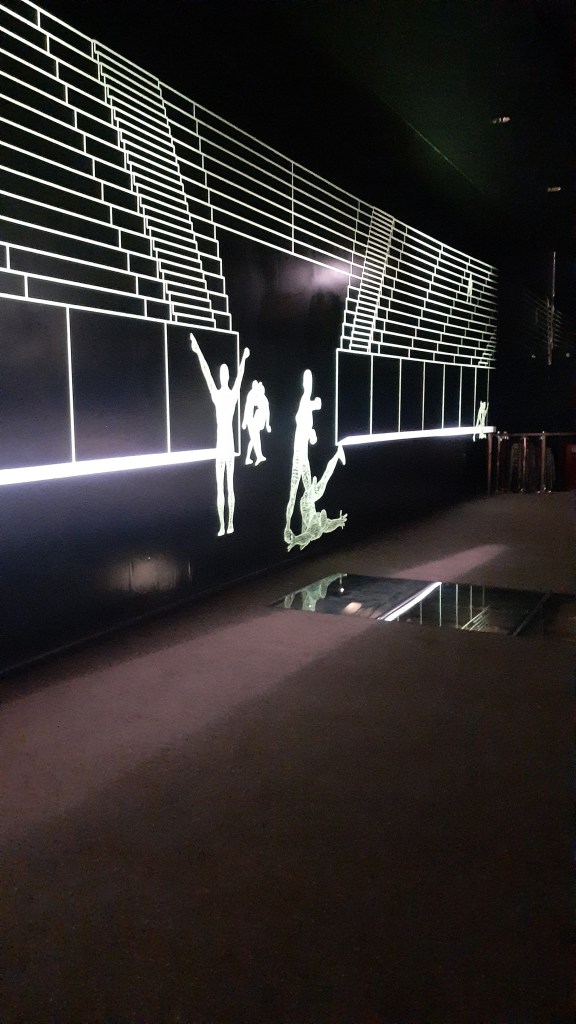
the winner!
Share this:


How to travel back in time…
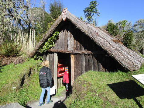
Experimental archaeology is the one path that virtually anyone can take to travel back in time; to get an idea of what life may have been like in the distant past. One such place which encapsulates this philosophy is Butser Ancient Farm, a place I had the chance to visit recently.
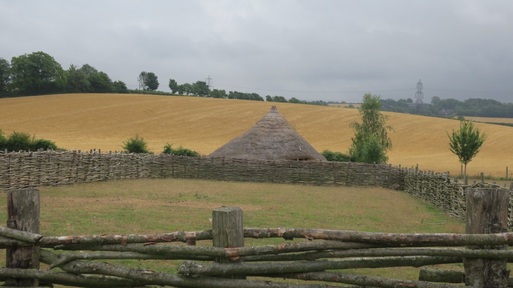
Butser began life in 1972, in a different location by the late Peter Reynolds, whose passion for experimental archaeology was contagious. The original farm was situated on Butser Hill, in what is now the Queen Elizabeth Country Park, in part because of the evidence for extensive Iron Age field systems on Butser Hill, still visible in the prehistoric field boundaries and earthworks that cover the landscape. However, it did not open to the public until 1974 and because of its popularity moved to a more accessible site at the bottom of Butser Hill. In 1991 the farm moved to its present location (near Chalton, Hampshire – just off the A3).
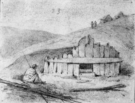
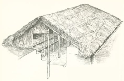
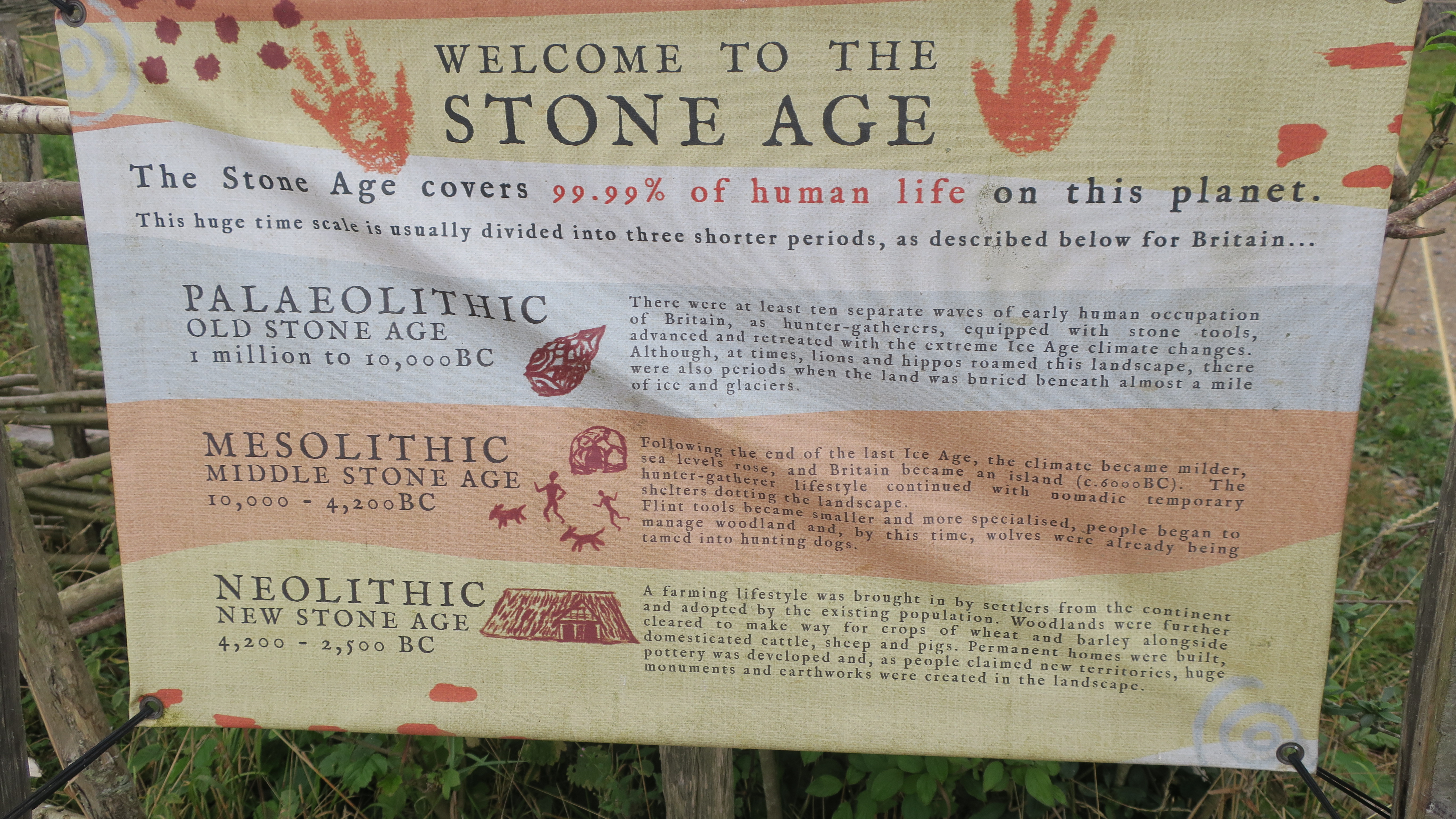
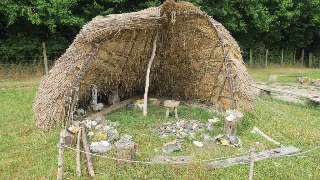
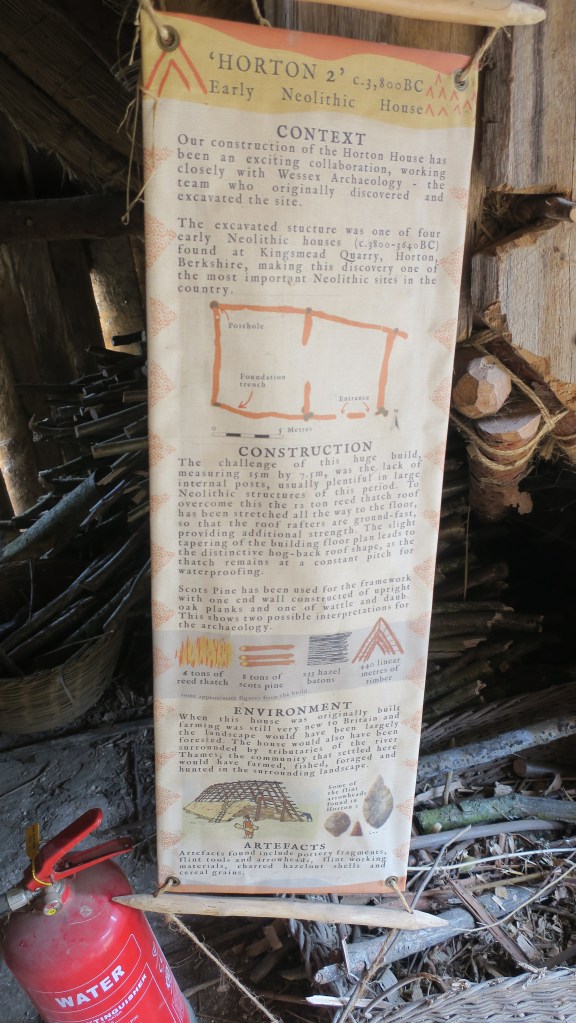
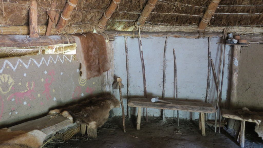
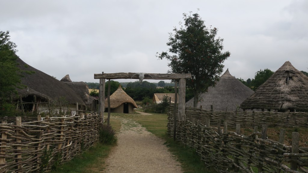
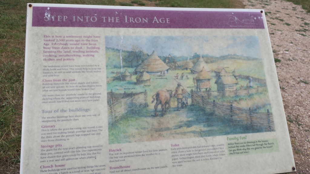
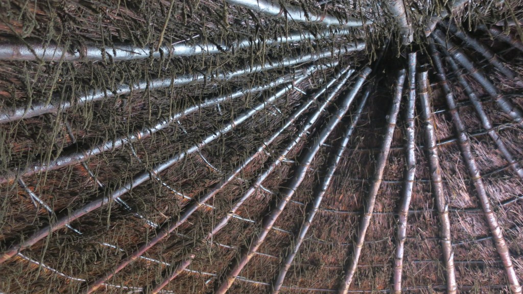
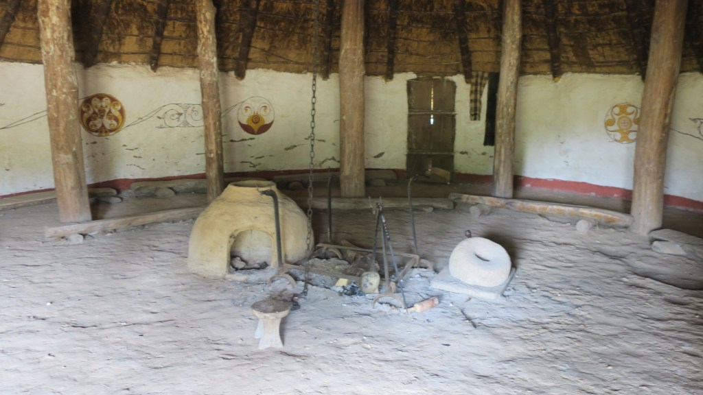
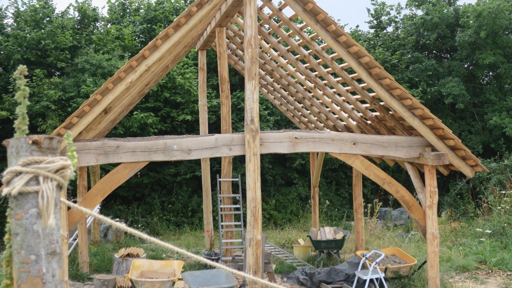
At Butser it is possible to see ten thousand years of history come to life; to see plans of archaeological sites rise up from the ground; to feel, touch, smell and absorb some of what it may have been like in the past is an experience that should not be missed. All of the buildings which have been reconstructed are based on actual archaeological sites that have been discovered through excavation.
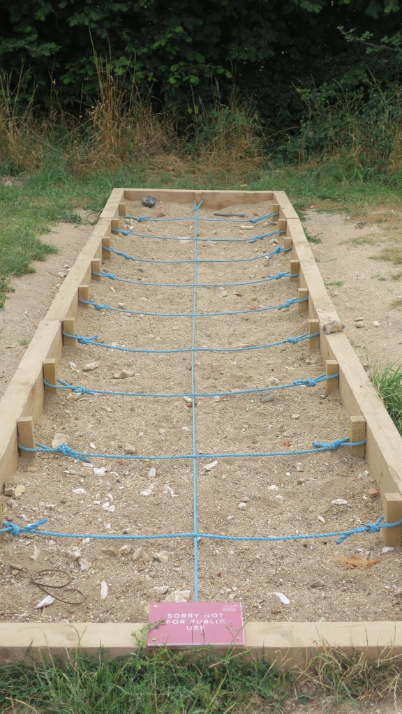
These excavations often only reveal the faintest of remains, the postholes and their layout is usually all archaeologists have to go on as to the type of building. The artefacts found and their position in the structure can also provide clues as to the use of the space inside and outside. Understanding all the fragmentary pieces of evidence can often take a leap of faith particularly for the general public. In this case Butser provides a physical and tangible connection to the past for the visitor.
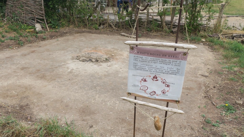
However, it is much more than that, it is a place where those who study the past can test theories in, not only ancient technologies and construction techniques but also in how sites degrade. Our understanding of how archaeological sites are formed depend very much on understanding how a place degrades, becoming the humps and bumps we see in the landscape.
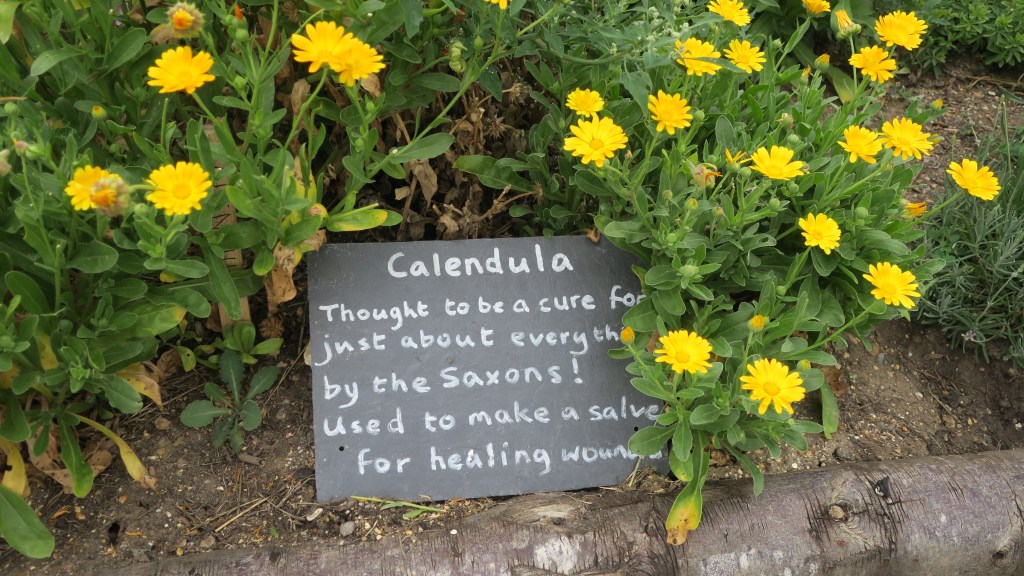
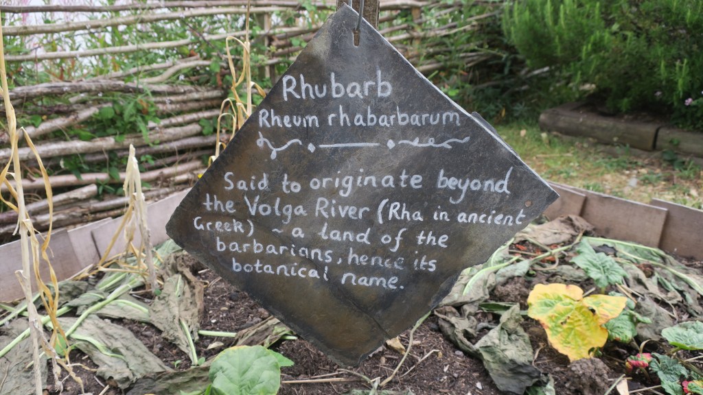
In addition to the buildings, there are also gardens containing plants that would have been in use at a particular time – known from faunal analysis during excavations. Ancient breeds of sheep, goat and pig are also a feature of the farm, giving the visitor a well-rounded experience. At certain times of the year, they also host various events such as flint knapping weekends, re-enactment groups, storytelling, solstice celebrations and more.
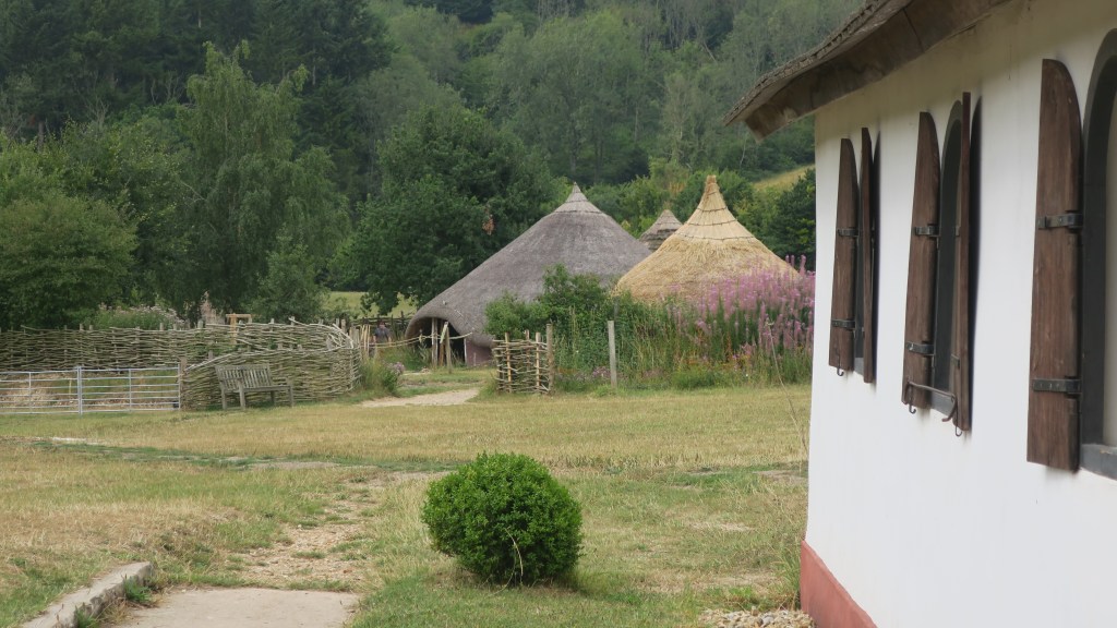
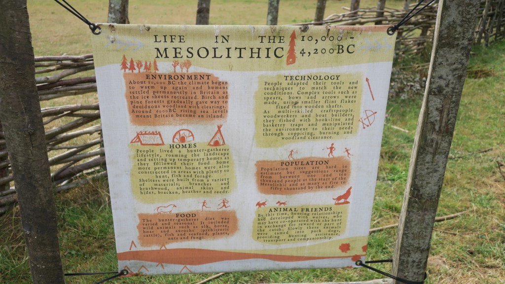
The following are few photos from my visit this year…beginning in the very distant past of the Mesolithic and Neolithic.
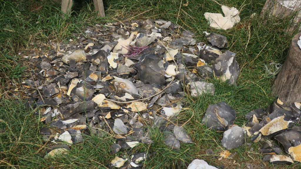


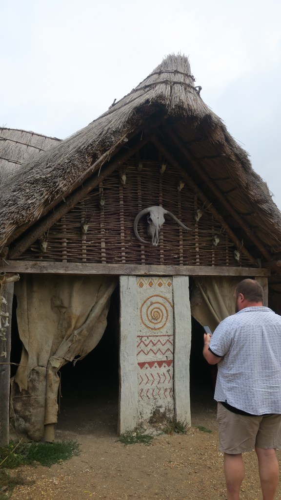
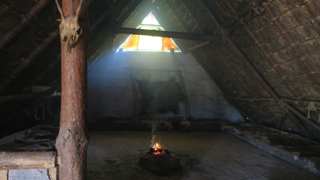

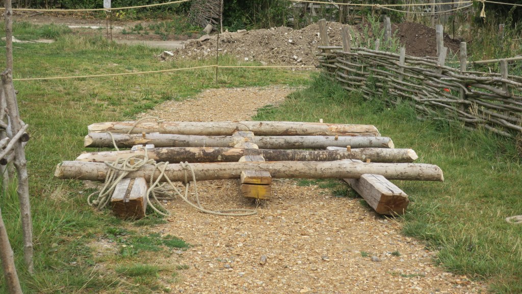
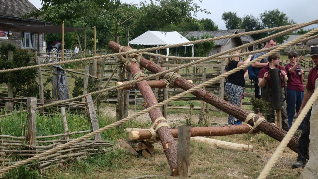
In the days preceding my visit the team at Butser along with volunteers from the HMS Queen Elizabeth had a go at erecting a megalith using only the types of technology available in the Neolithic. They moved and raised a 3.5 ton piece of Purbeck limestone using theorised prehistoric techniques. The stone is roughly the same weight as the smaller bluestones at Stonehenge, which were moved over 140 miles around 5000 years ago.
When performing such tasks it is also useful to observe what is left behind, these ephemeral remains are often the hardest to interpret.

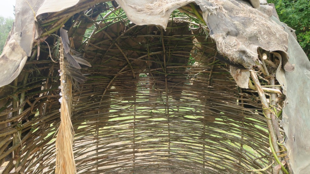
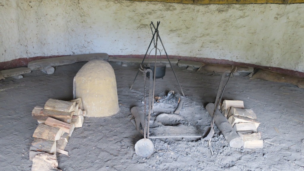
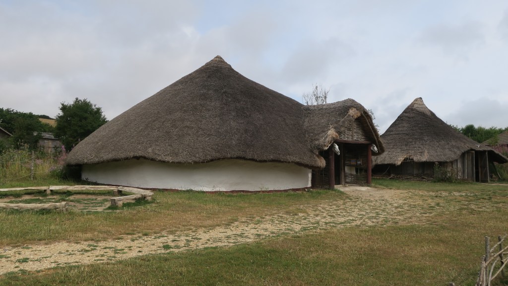
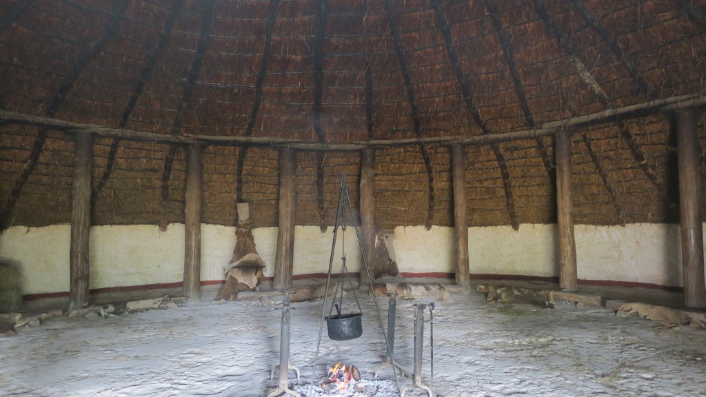
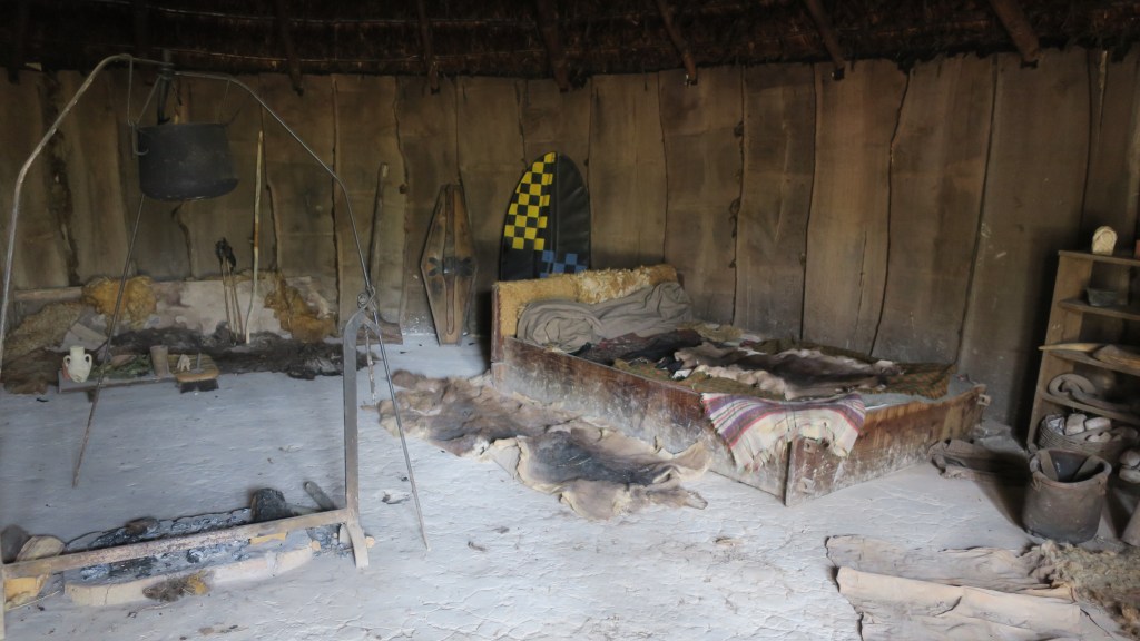
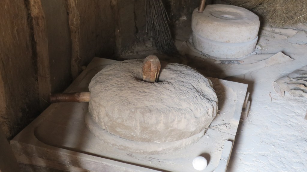
From the Neolithic we carefully saunter into the Bronze Age, the time of the roundhouse and metal working…


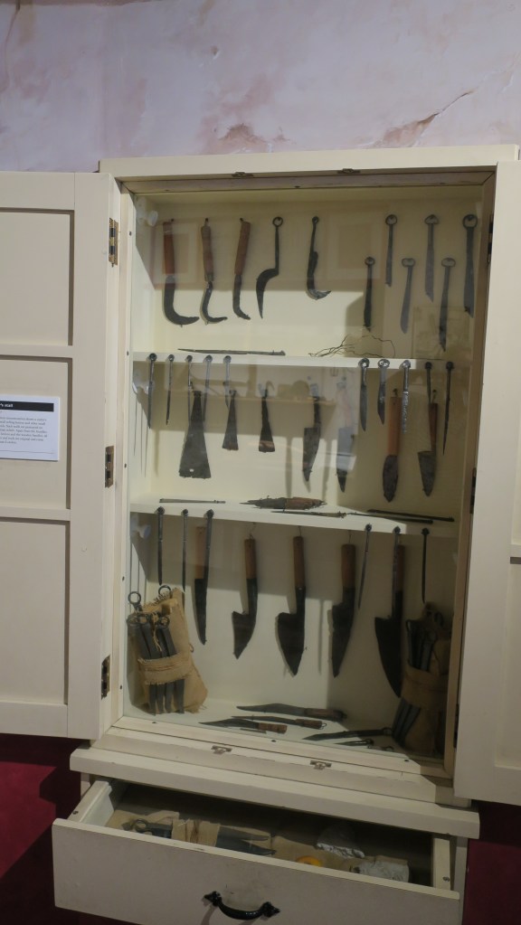
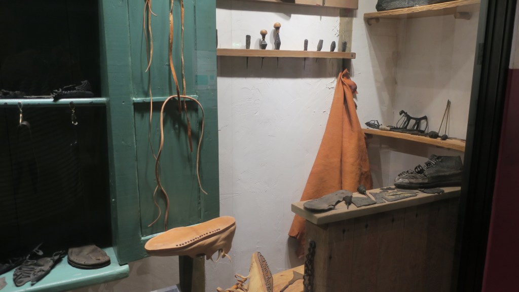
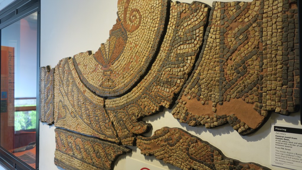
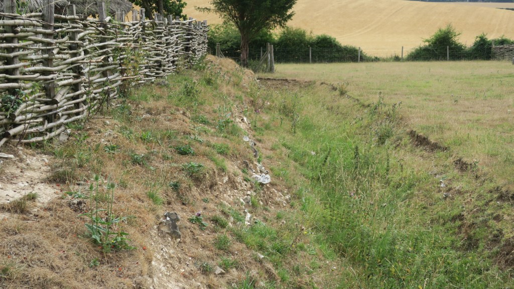
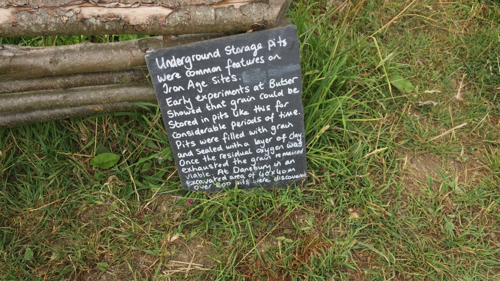
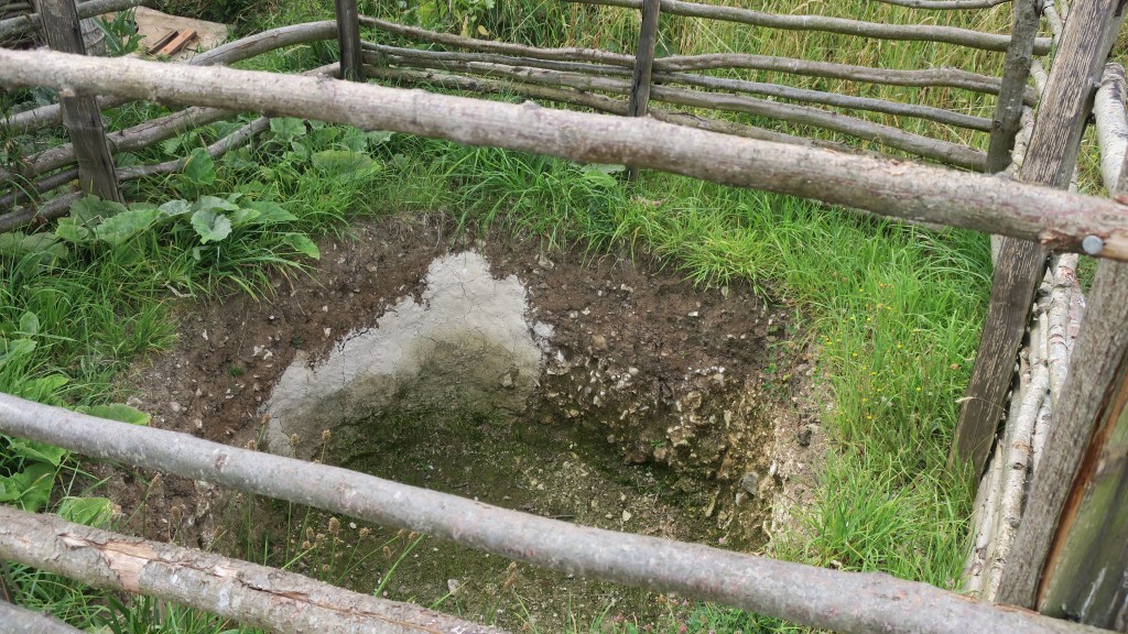
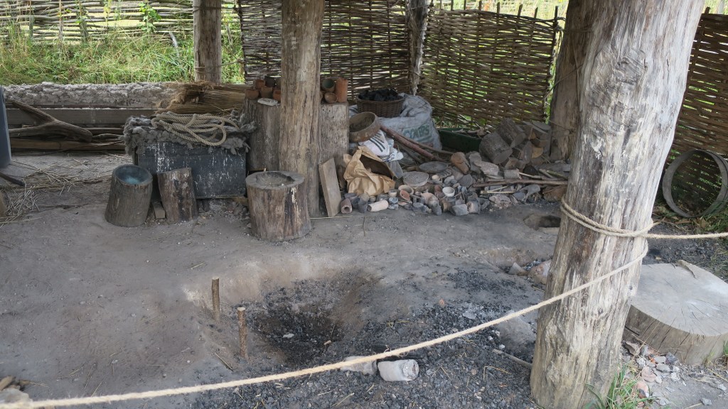
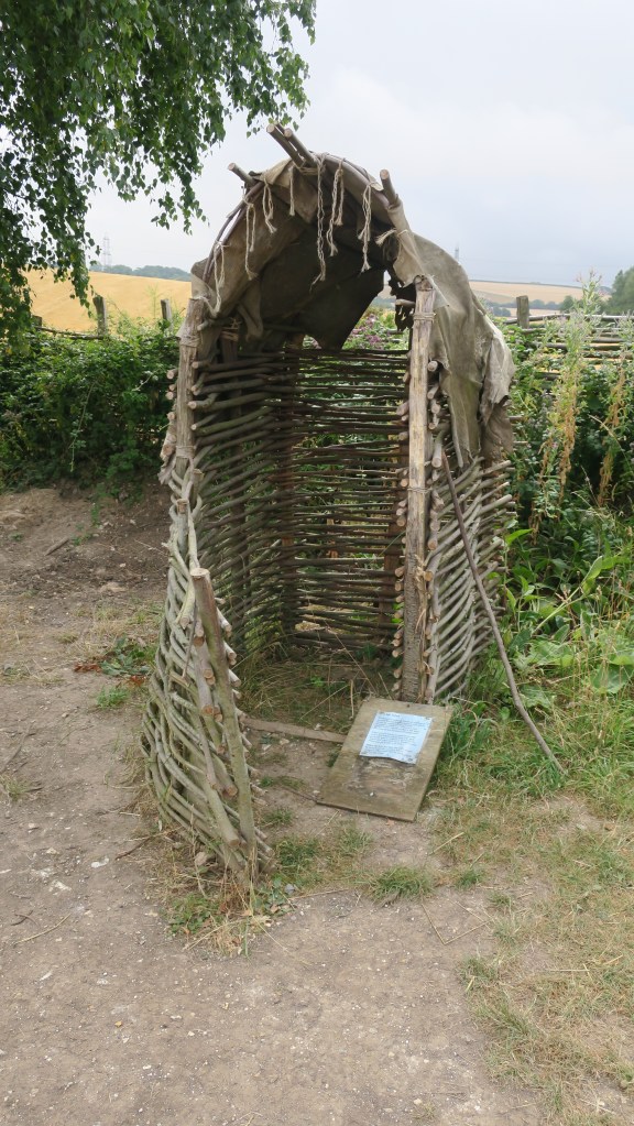
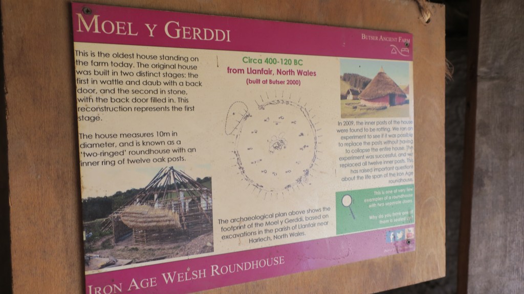
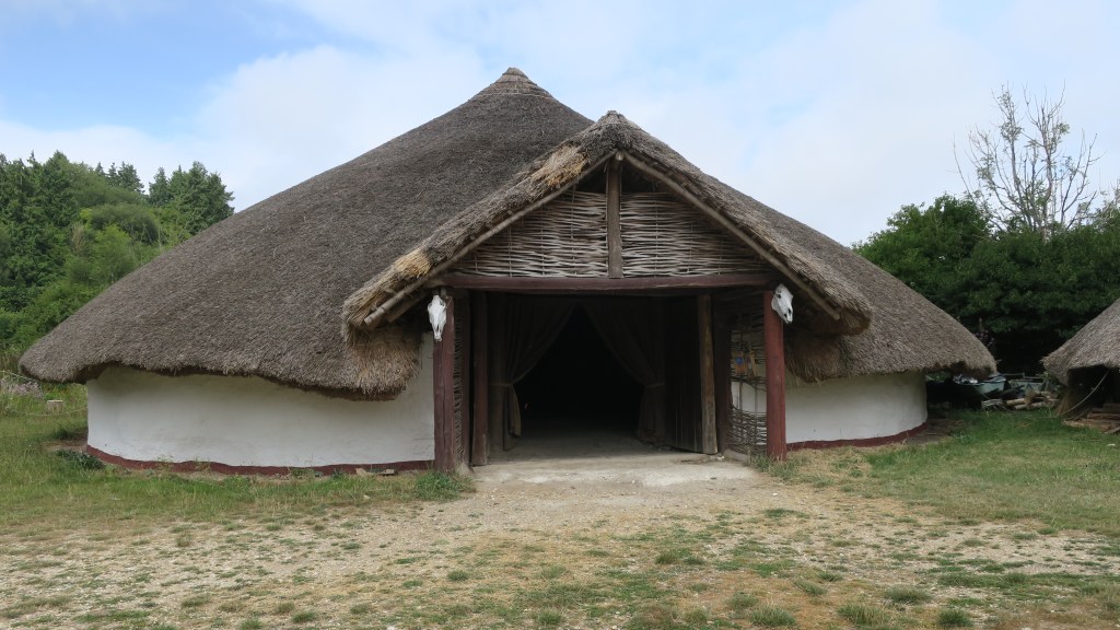
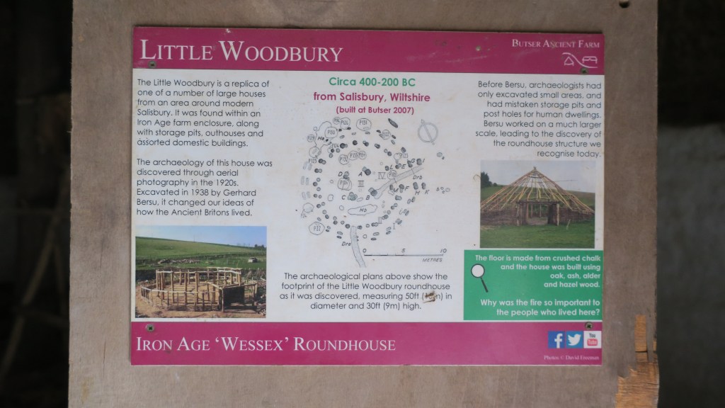
The Iron Age –

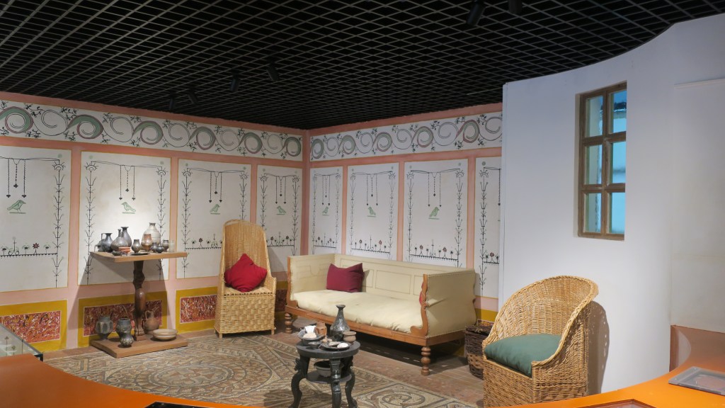
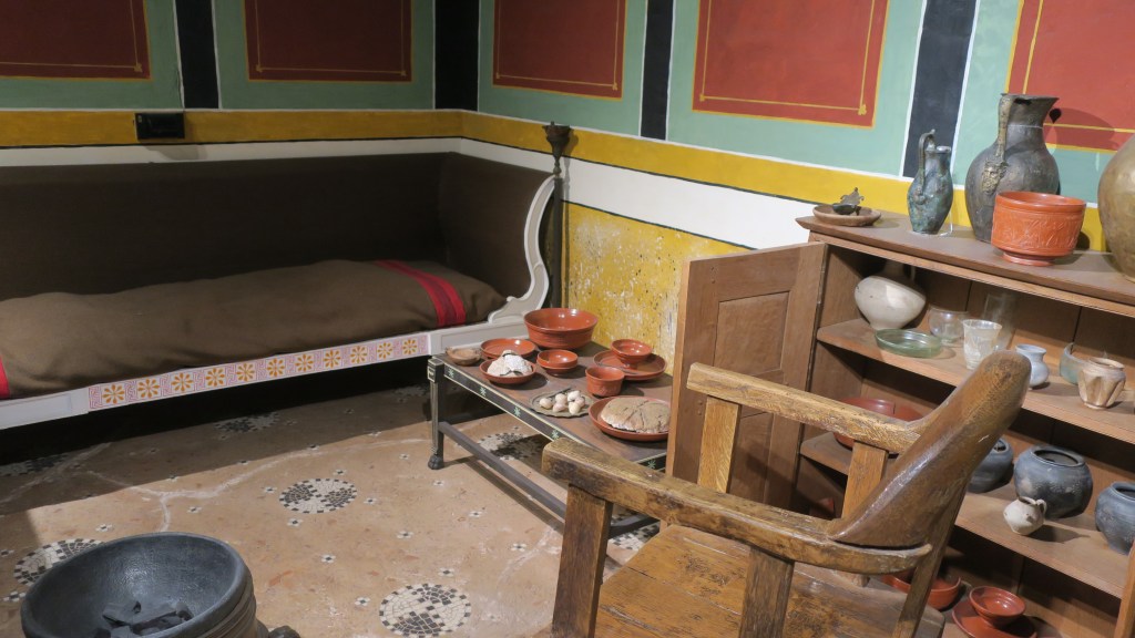
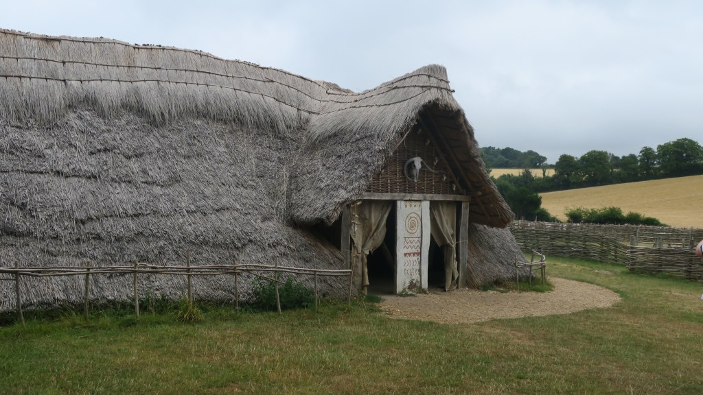
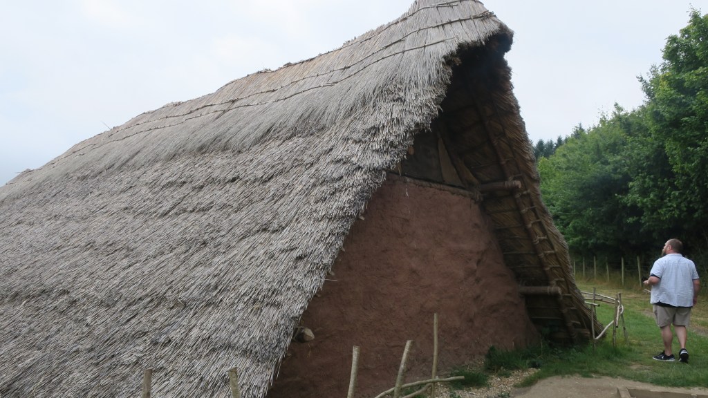
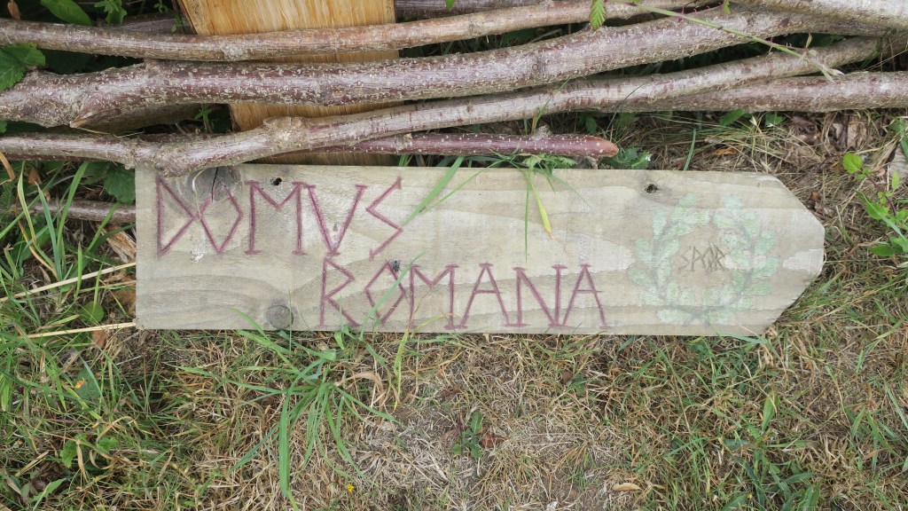
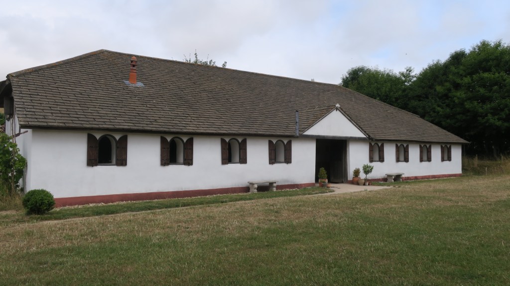
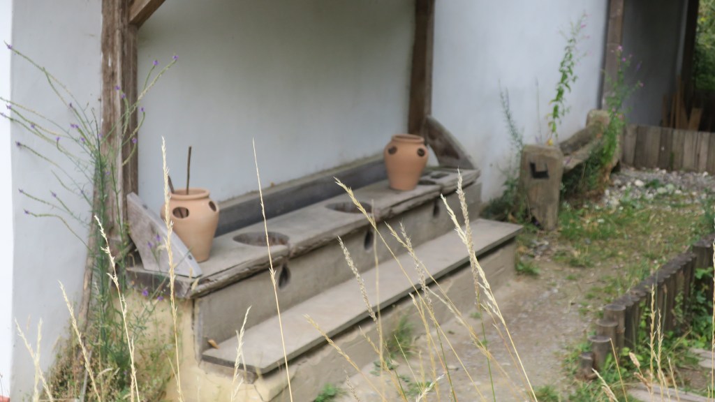
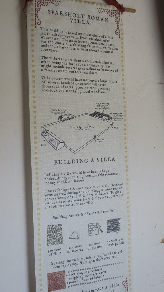
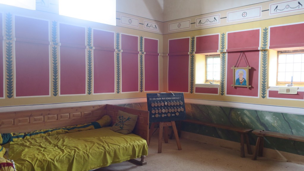
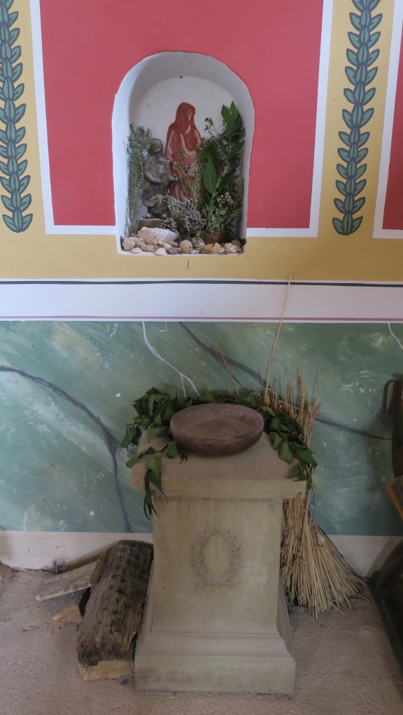
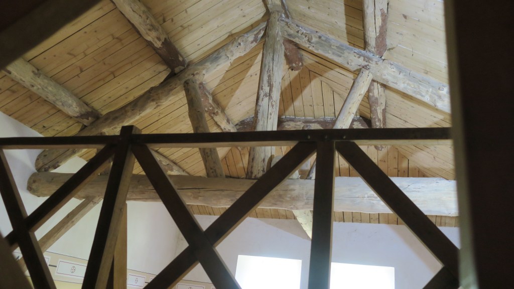
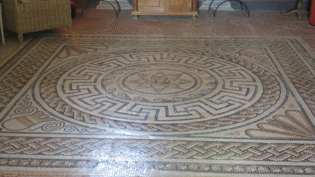
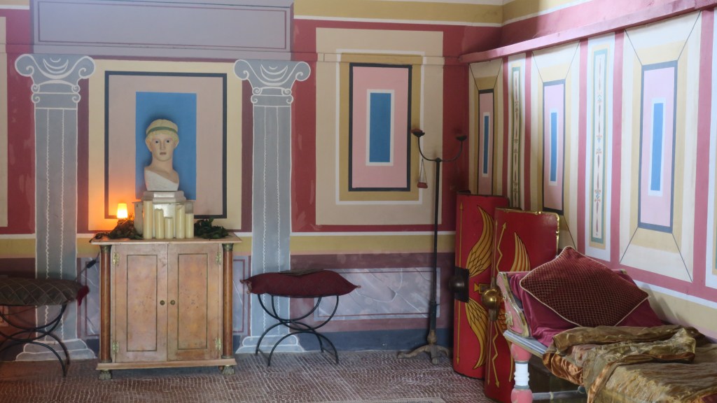
The Roman villa – as with all the structures at Butser the villa was built using only construction techniques known to be used in the Romano-British period. The mosaic is the only known reconstruction in the UK and the aim was to understand some of the finer points in mosaic construction but also to see what happens to it over time.
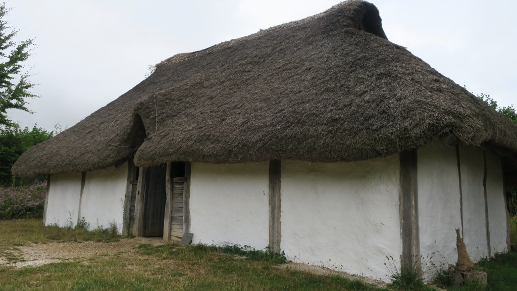
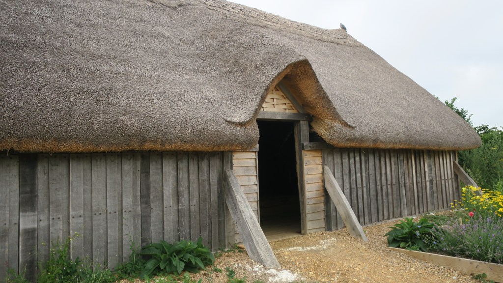
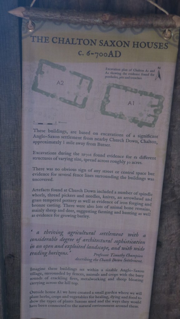
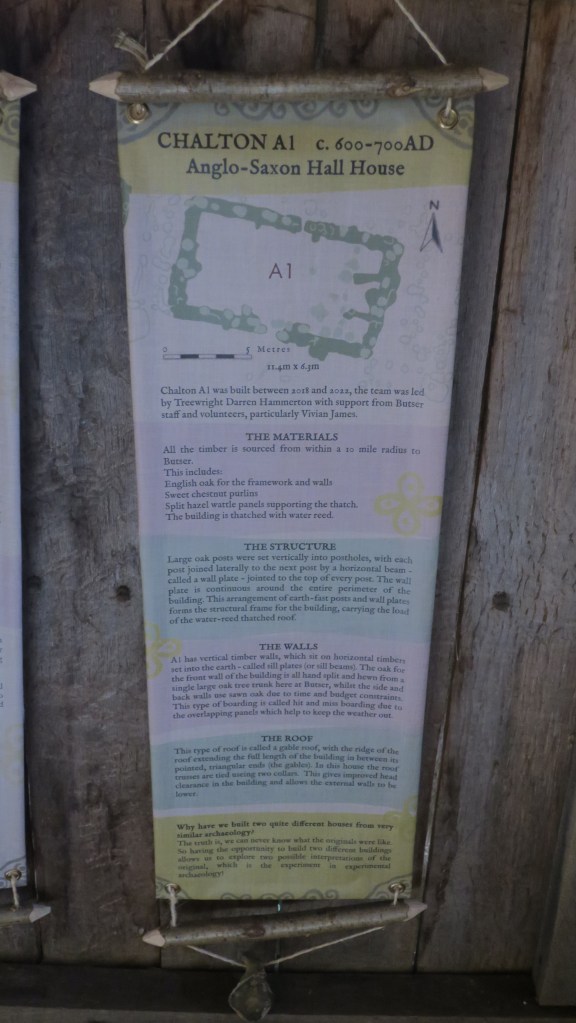
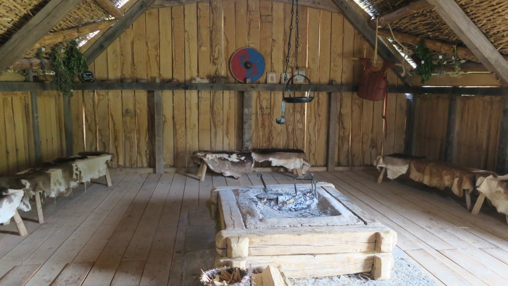
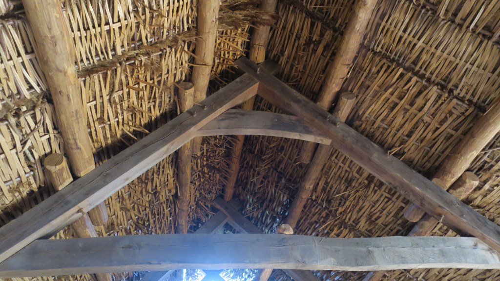
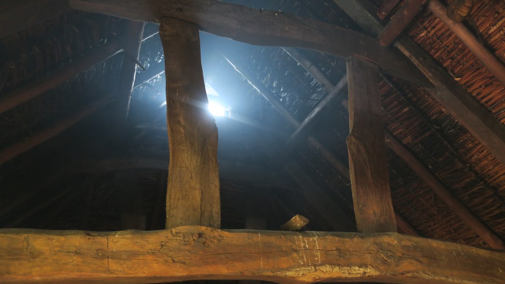
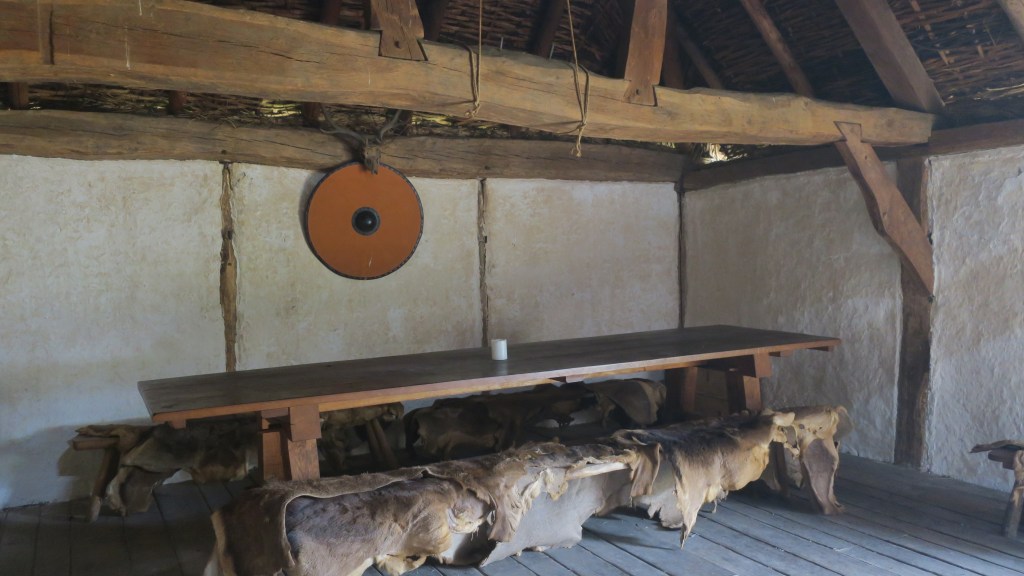
The Anglo-Saxon halls are the most recent addition to the farm and demonstrate two different types of building style.
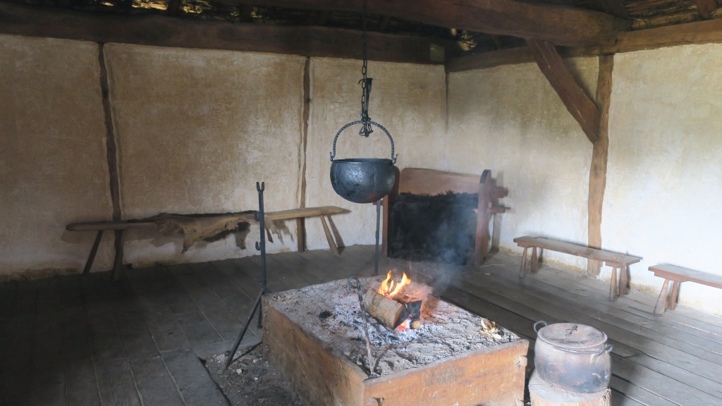
As mentioned before Butser also engages in research and education, none of the buildings, gardens or spaces are static museum pieces, they are constantly evolving – adding to our knowledge. Most years the farm is well attended by schools wide and far who get a hands on perspective of life in the past, archaeology and history.

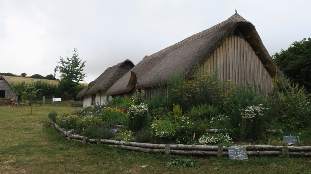
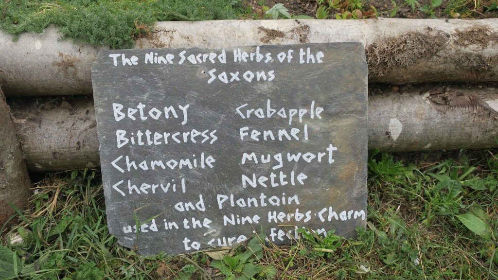
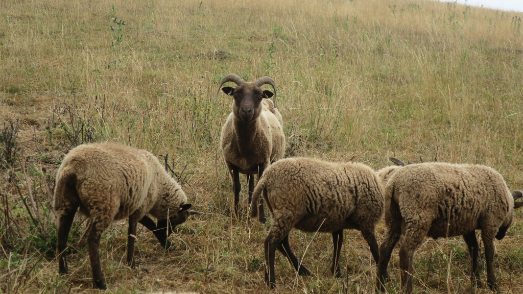
The gardens and the animals are an equally fascinating aspect to the farm, endeavoring to give a much more rounded picture of the past.
For more information I would highly recommend their website (and archive) – Butser Ancient Farm

