Tag Archives: Auckland History

Hampton Park – Te Puke o Tara

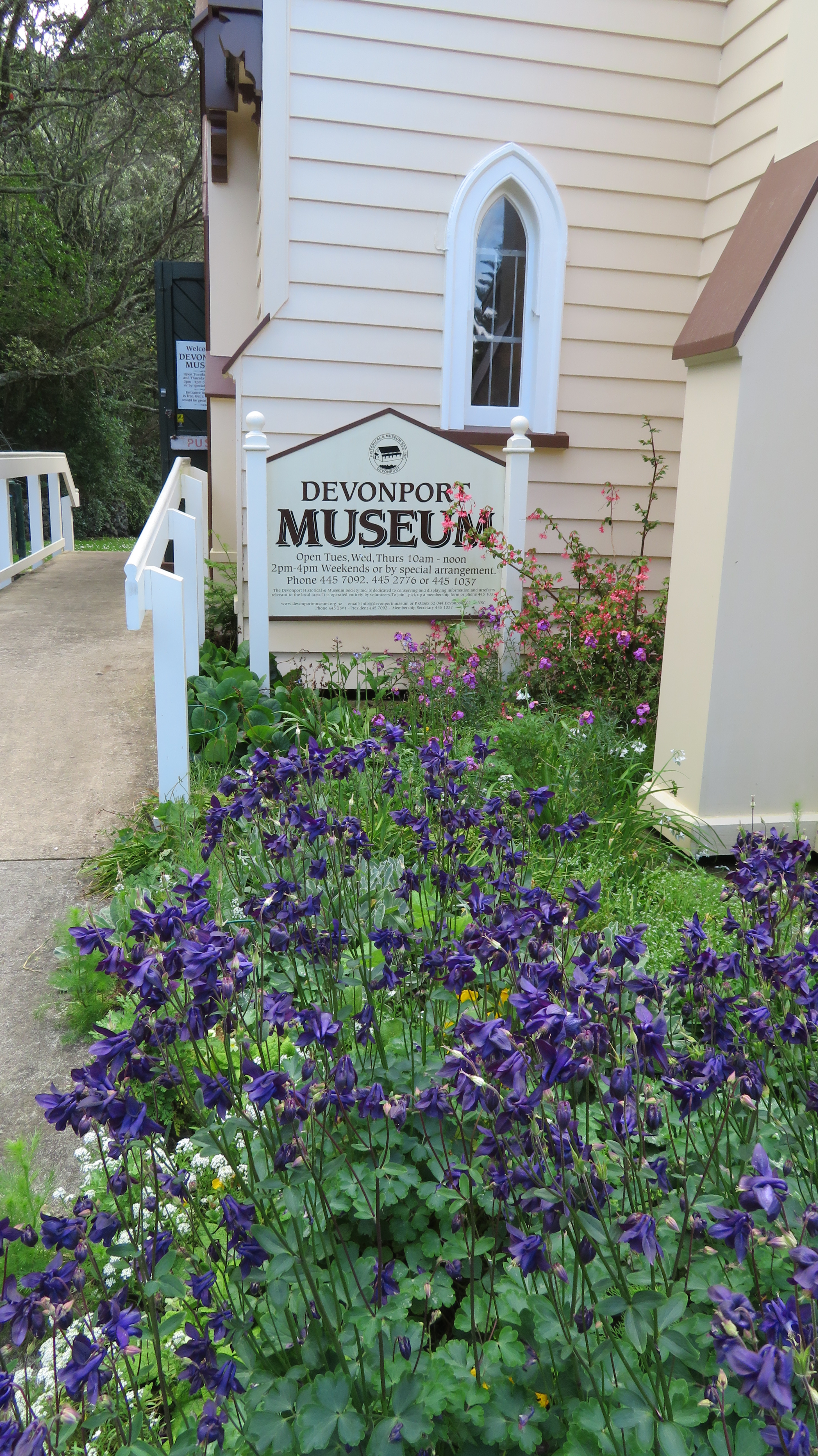
Back in October the Auckland Council hosted the Auckland Heritage Festival, where, as the name would suggest all things heritage and Auckland was celebrated. There are a wide range of events during the festival weeks from walks, talks, exhibitions and workshops. I was able to attend two events – a talk at the Devonport Museum on Mt Cambria (more on that down the page) and a walk ‘n’ talk at Hampton Park.

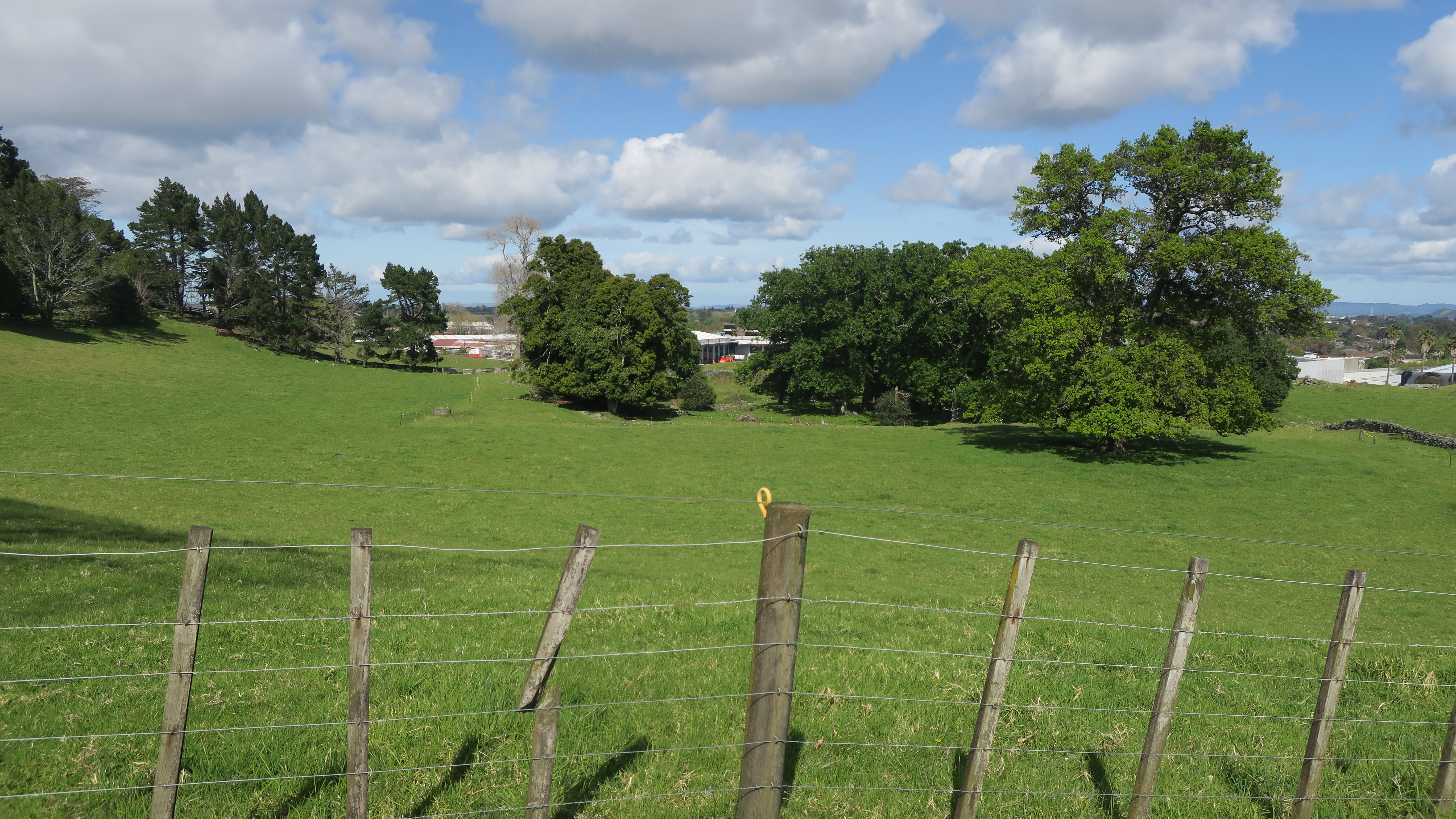
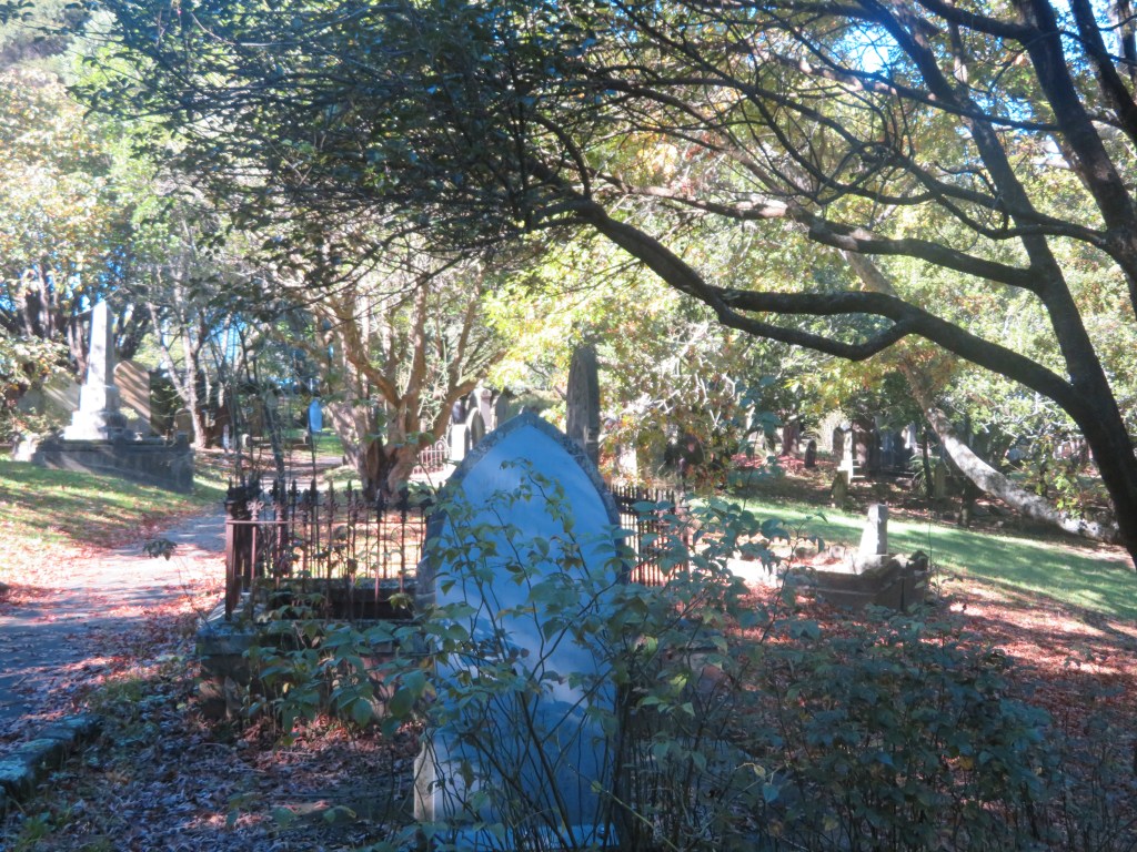
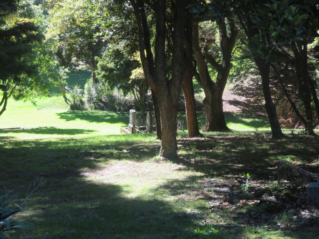
Hampton Park is situated in the heart of commercial Otara, a pocket of farm land amongst the warehouses, factories and offices. Having never been there or even for that matter heard of it, I was intrigued to find out more. The park is in fact a working farm and whilst the public are able to walk around it there are no proper footpaths and no other facilities (there is a house and it is lived in by the family who farm the park as well others – if visiting please respect their privacy).

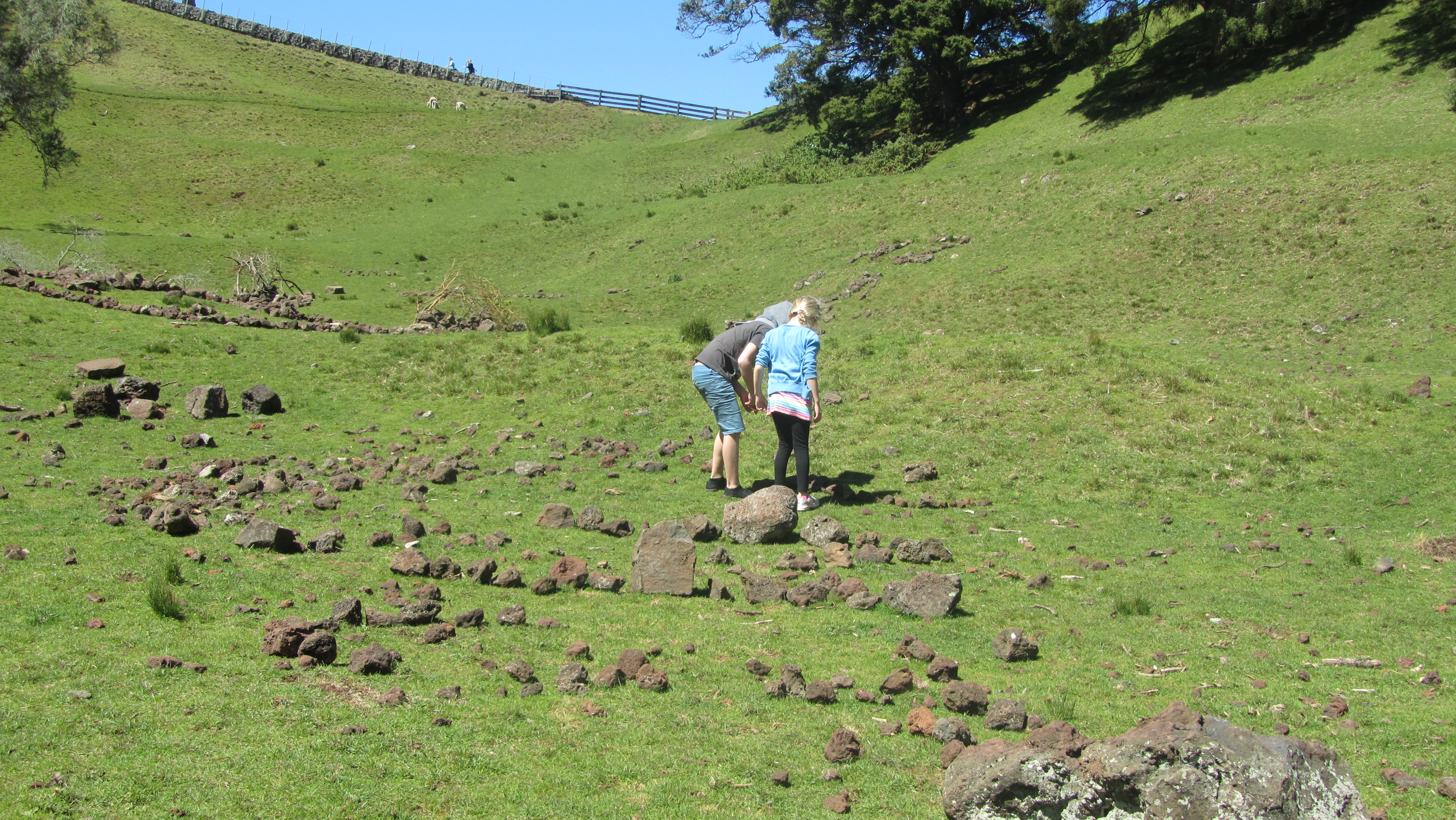
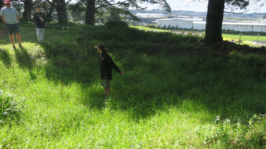
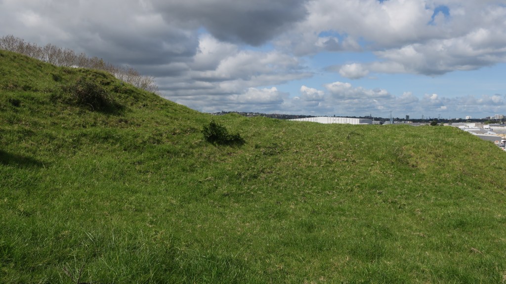
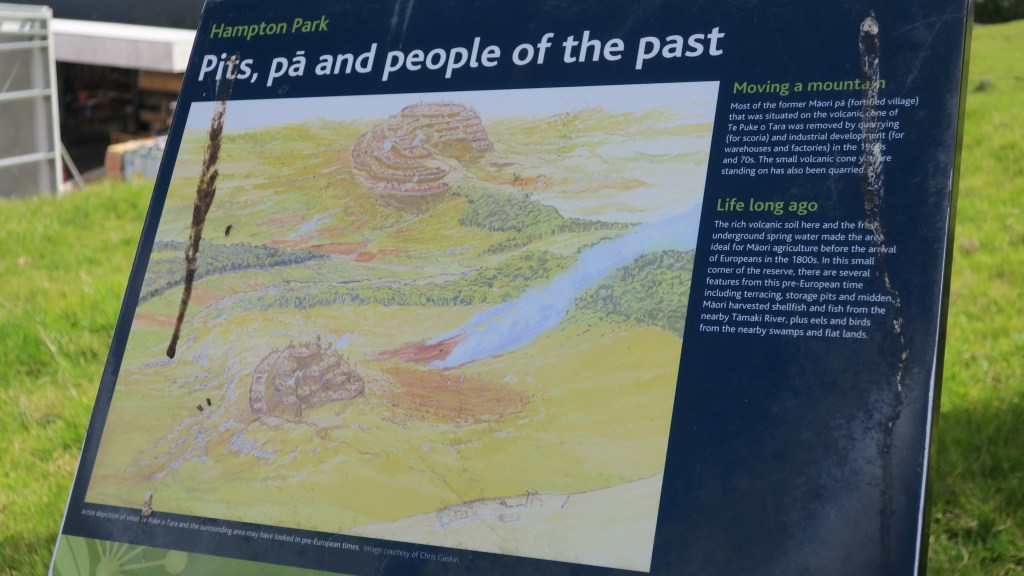
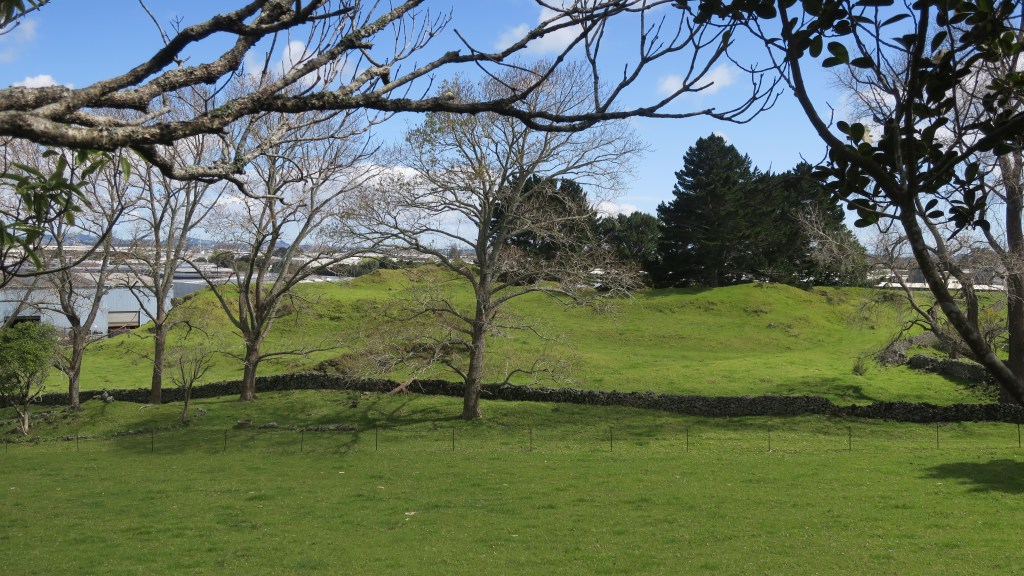
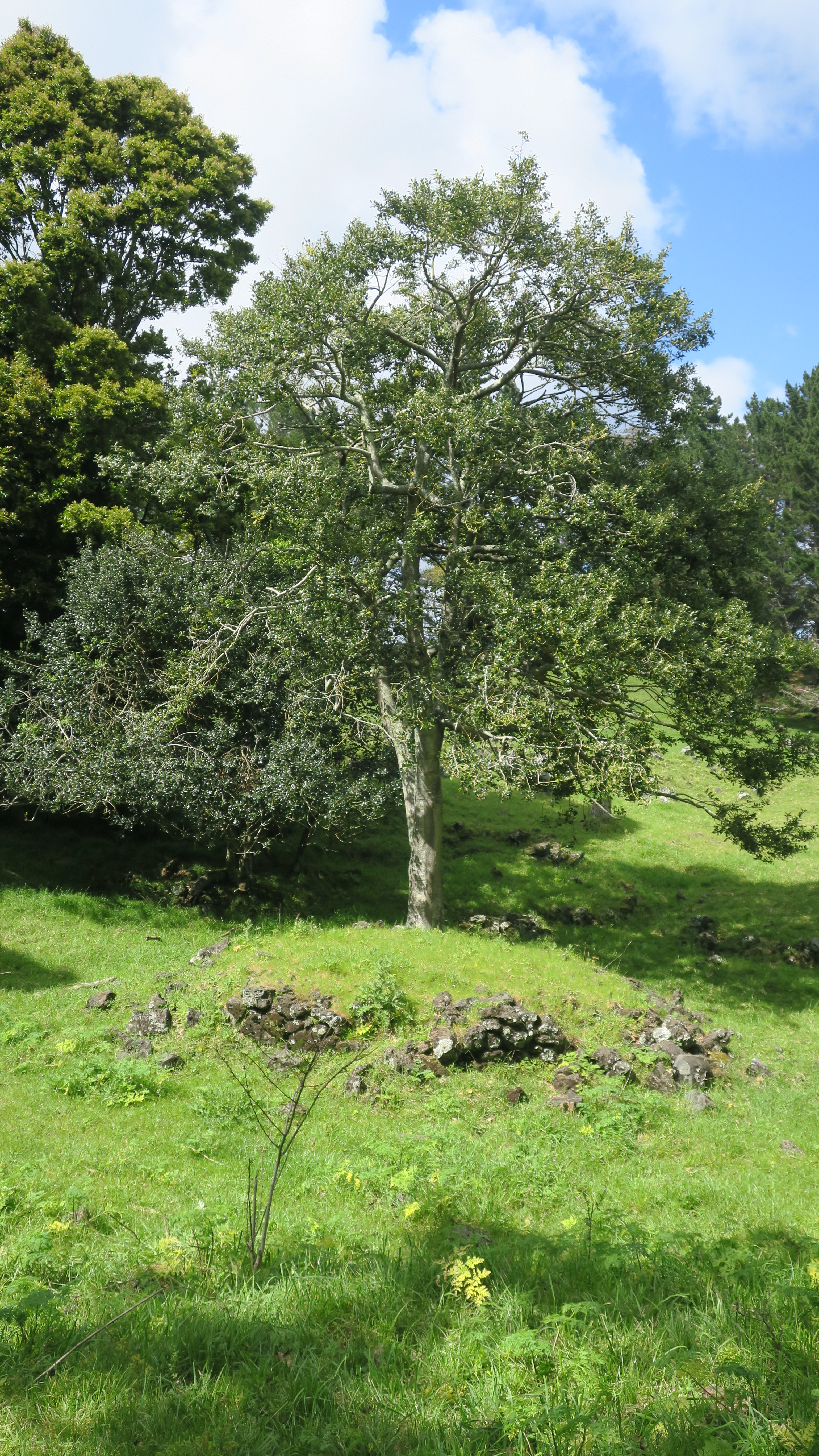
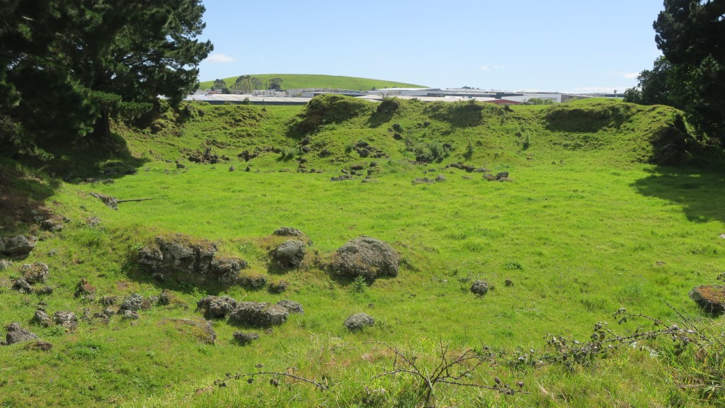
The story of Hampton Park begins long before people arrived in the area. Geologically it is part of the wider volcanic landscape of Auckland, here in Otara there are (or were) three volcanoes, the largest of which was called Te Puke o Taramainuku (‘the hill of Taramainuku’, a Tainui ancestor). The small scoria cone that sits in Hampton Park is the smallest of the three and is probably the smallest of all the Auckland volcanoes. It is so small that it has no formal name, simply being referred to as the Hampton Park volcano.

The beginnings of the human story in the area is much like the human story all over Tamaki Makaurau. Here like everywhere else Māori terraced the flanks of the cones and grew crops in the good volcanic soil. The larger cones would have provided a place of refuge when in need. The small cone in Hampton Park shows some evidence of terracing but later changes has blurred this somewhat. Alongside the driveway between the house and the church there is a large rectangular kumara pit which has remarkably survived. For more on the Māori use and occupation of the maunga of Tamaki Makaurau read here.

The large rectangular kumara pit between the house and the church.
Terracing on the sides of the Hampton Park volcano.

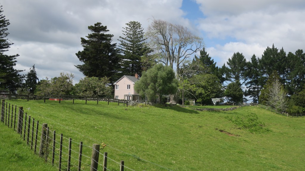
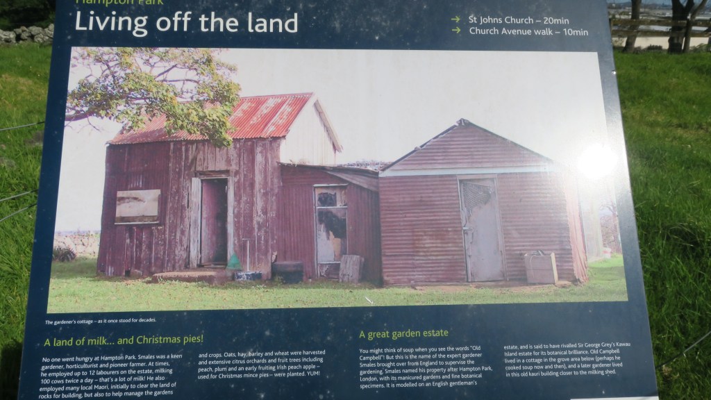
In 1852 the Rev. Gideon Smales, a Wesleyan missionary, bought 460 acres from the fencible Major Gray, settling there with his wife and children in 1855. The land was cleared of rocks, stone walls were built and crops and livestock brought in. Gideon Smales called the farm Hampton Park as he wished to model it on the English gentleman’s estate. It was said to have once rivalled Sir George Grey’s Kawau Island estate for its ‘botanical excellence’.

The current homestead.
One of the many stone walls found on the farm, in the background is the cone of Hampton Park volcano

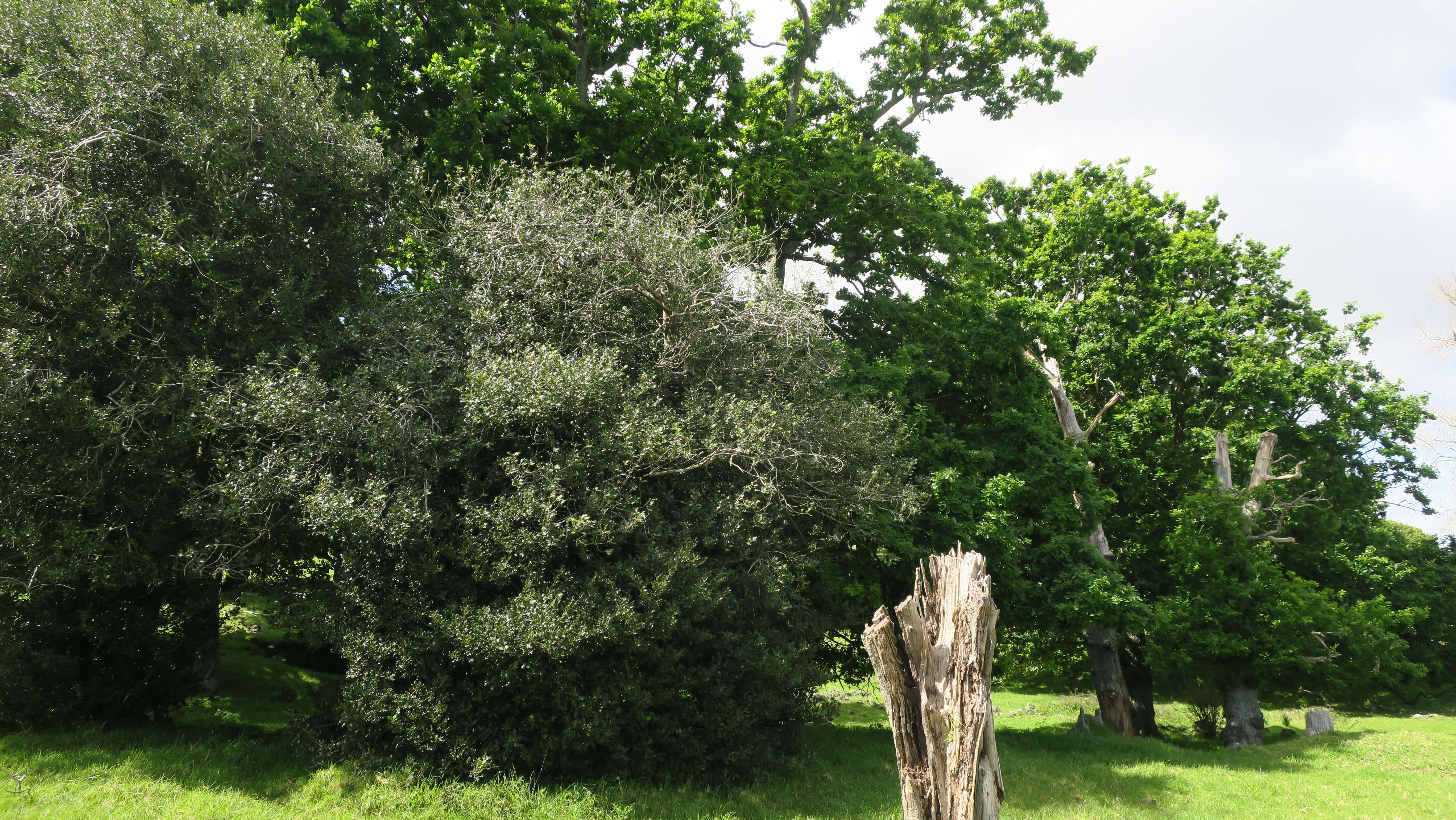
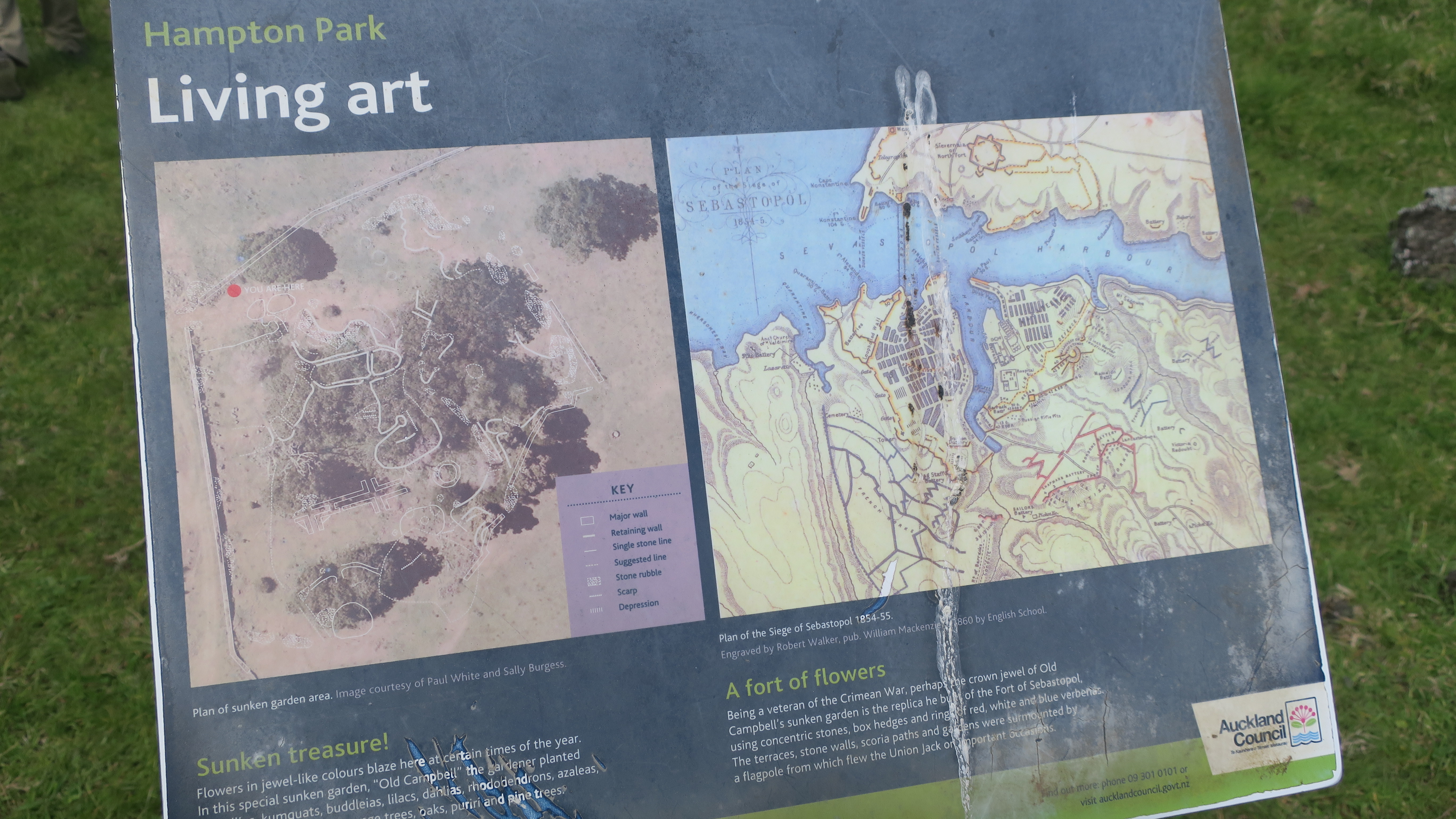
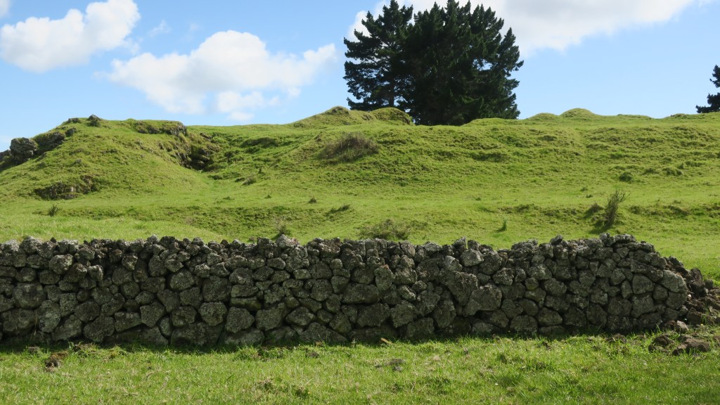
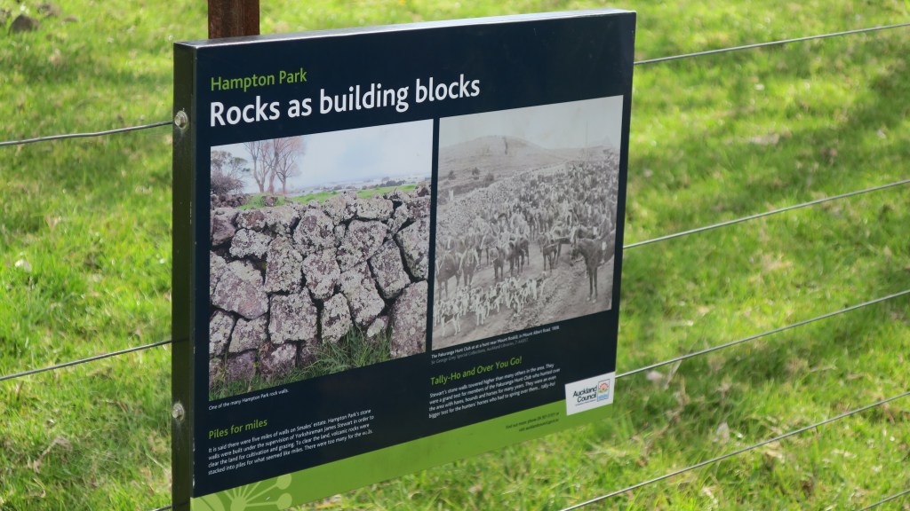
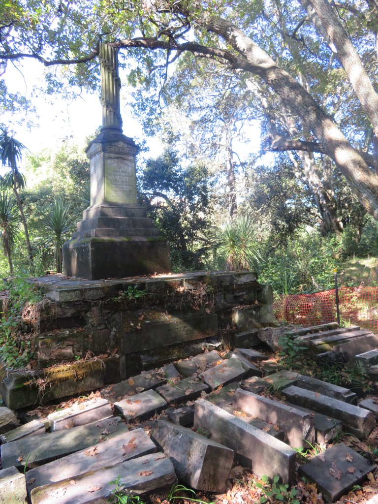
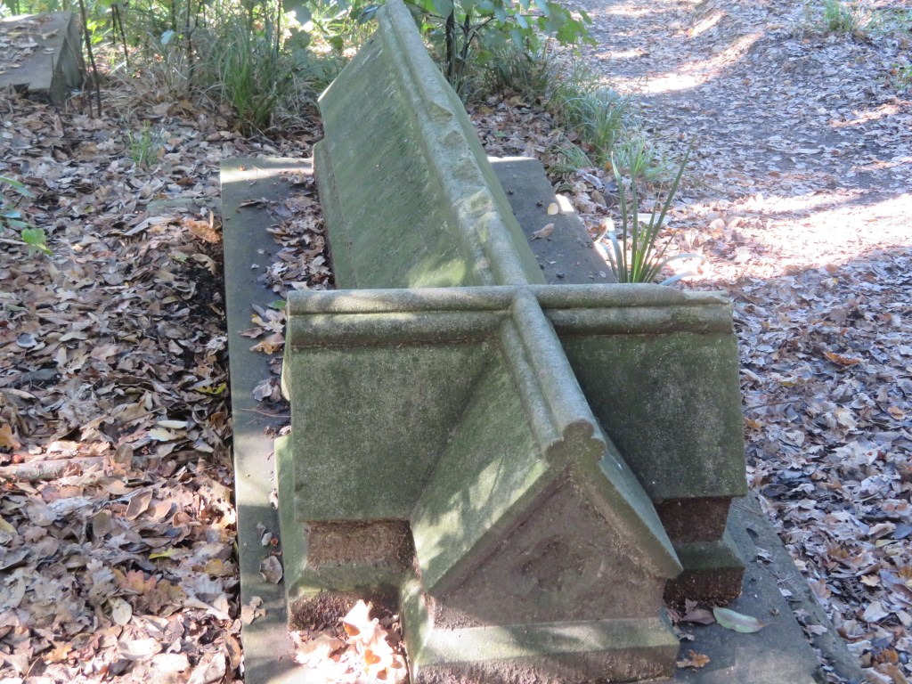
The farm grew oats, hay, barley, wheat and had an extensive orchard which included cider apple trees, pomegranates, oranges, figs and plums to name a few. In addition, to the more practical elements of the farm, the gardener – a veteran of the Crimean War – built a sunken garden in the form of the fort of Sebastopol. The remains of which can still be seen today. The excessive amount of stone on the estate resulted in it being used for a great many projects including the sunken garden, a rockery with a high stone wall and cave and of course the stone walls.

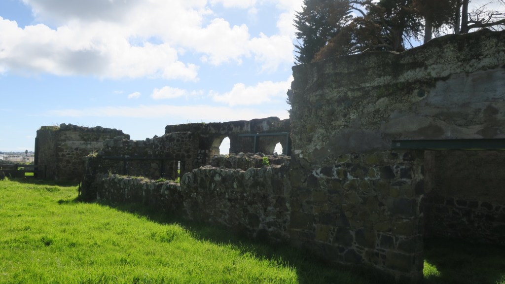
The stone walls which were constructed with the stone cleared away for cultivable fields was done so under the supervision of James Stewart who immigrated to New Zealand from Yorkshire. Due to the vast quantity of stone the walls were higher than was the norm and it was said there was over five miles of walls on the estate.

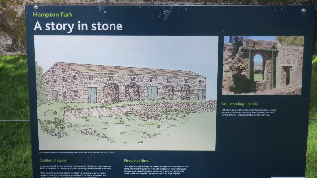
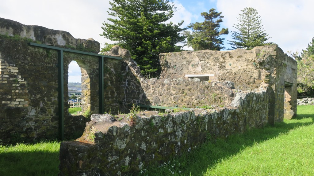
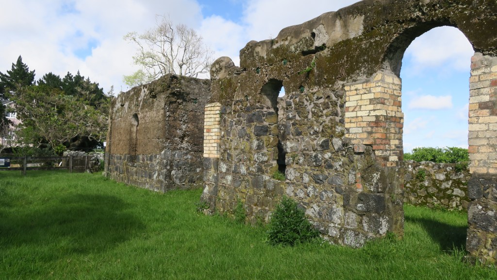
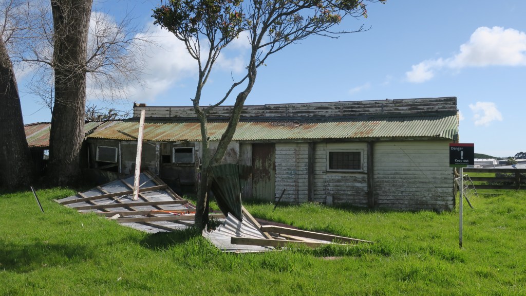
As is to be expected on a farm there are a number of buildings but perhaps the most striking are the remains of the stone stables, again built from stone quarried from the estate. Although not long after they were built a vagrant worker came to the estate looking for work, he was given a meal and allowed to sleep in the stables. That night the stables burnt down and the vagrant disappeared. They were never rebuilt properly although they were partly roofed over as barn and milking shed. Nearby are the derelict tin shed of the 1930s barn.

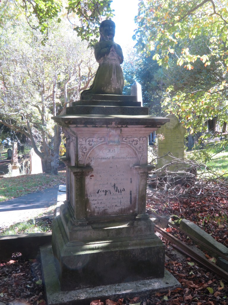
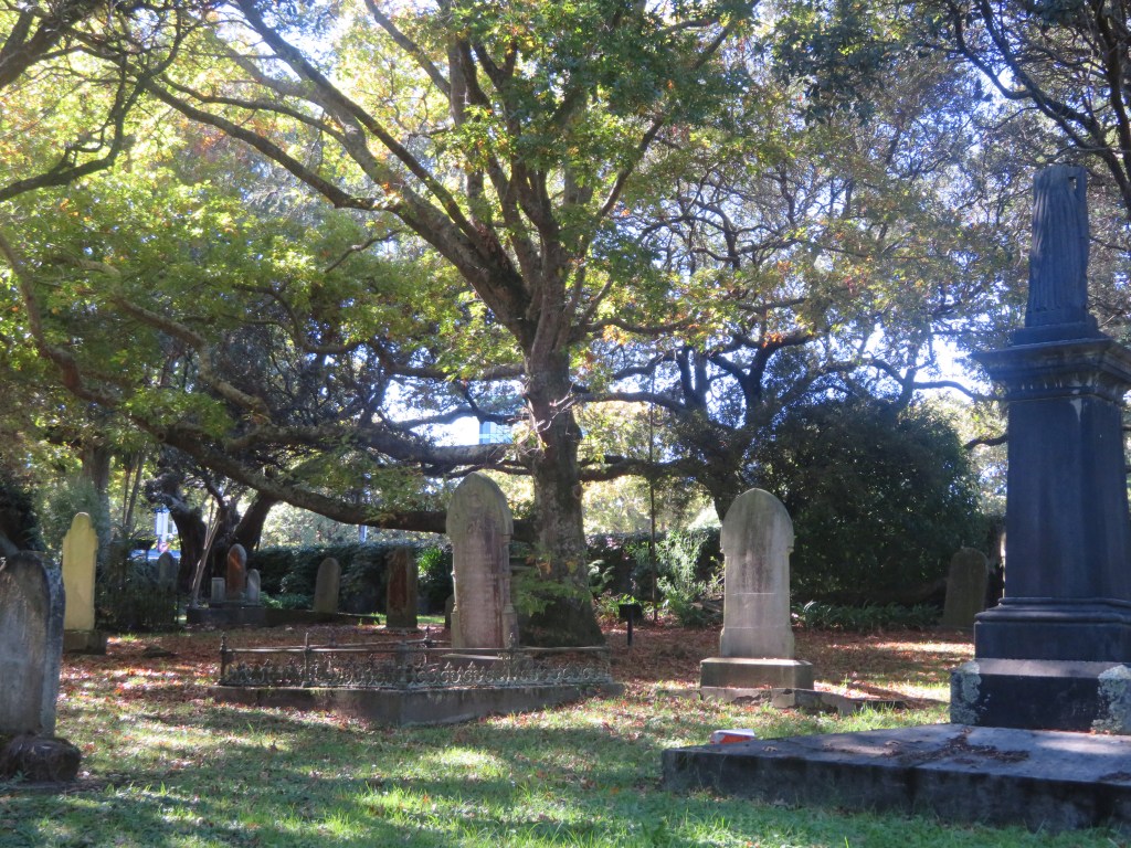
Two other buildings which still stand are the homestead and the church. The current homestead is the second to have stood on the estate, the first was burnt down in 1940 and the current homestead was built – only the front steps remain of the original house. The first homestead was built in 1855, it was three storied and had ten rooms which was later extended to eighteen rooms in 1869.

Images of the first two homesteads on site with the Rev. Gideon Smales on the left.

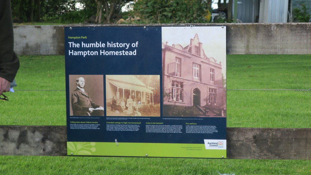
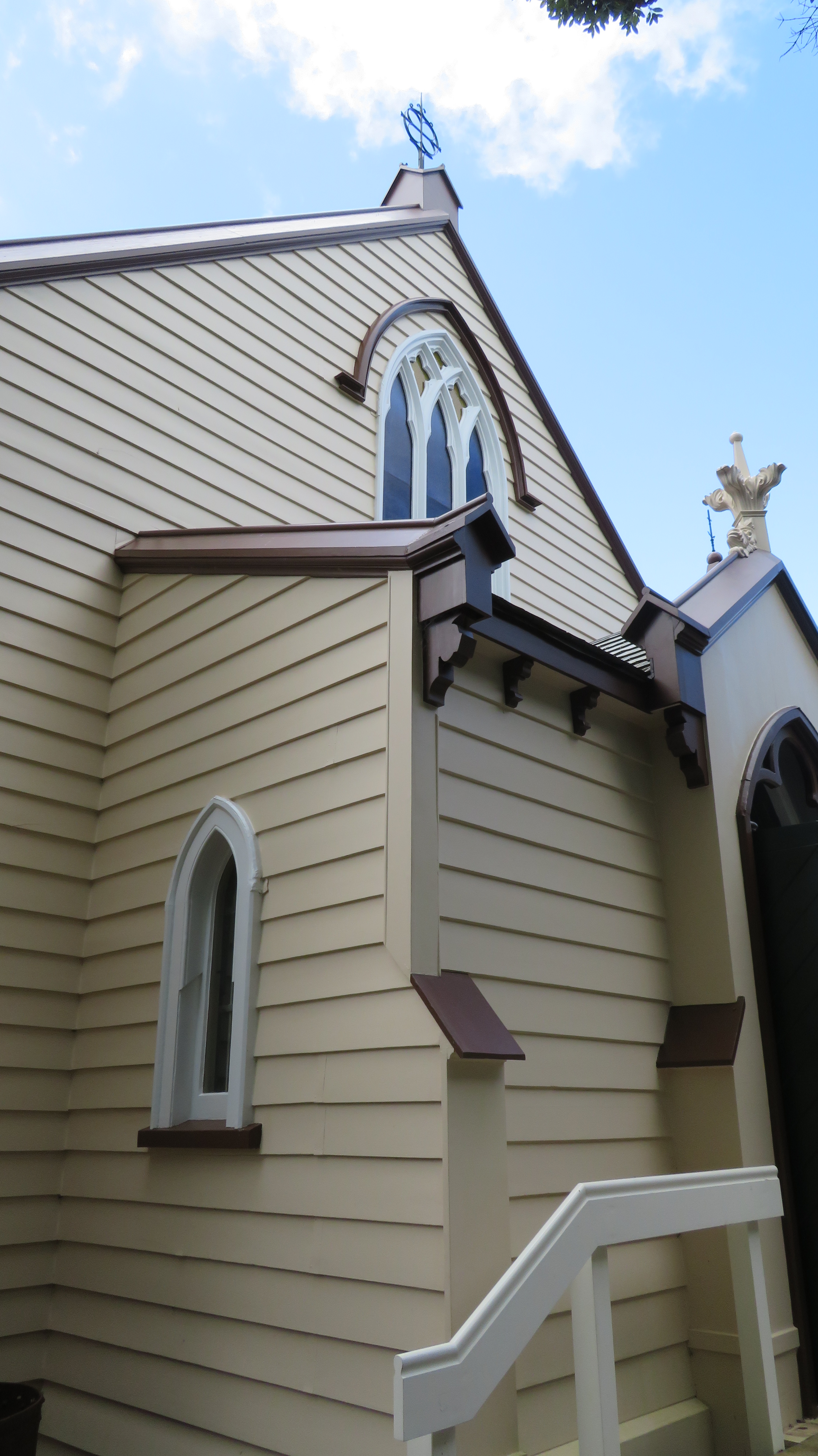
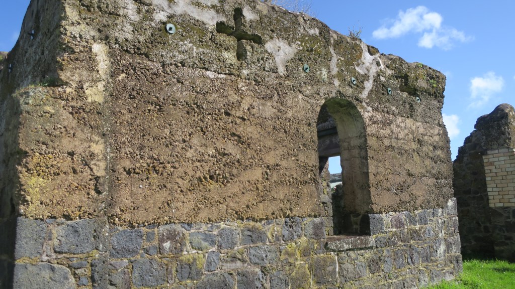
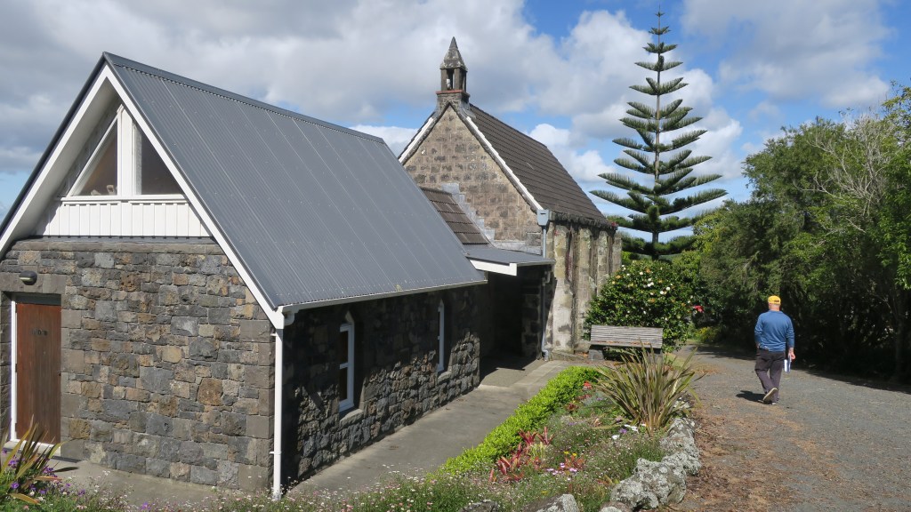
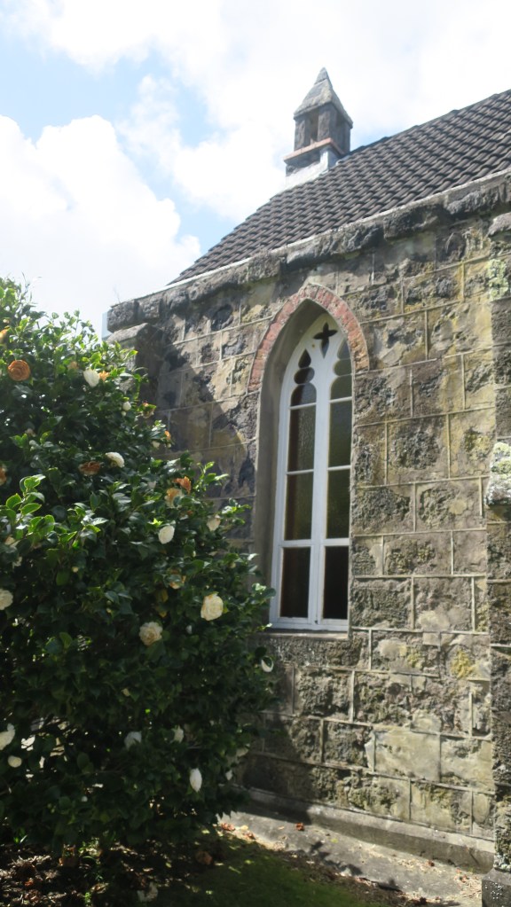
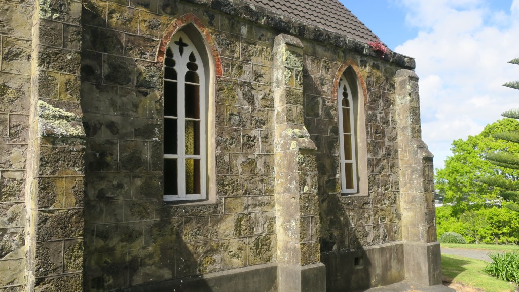
The small chapel – St John’s church – is also constructed using stone from a nearby quarry. Interestingly, the mortar for both the church and the house was made of burnt shell from Howick beach, the timber arrived via the Tamaki river and was brought overland by bullock teams. The first service to be held in the church was on Sunday the 12th January 1862. When the Rev. Gideon Smales died in 1894 he bequeathed the chapel and four acres jointly to the Anglican and Methodist Churches. It is still used today for services once a month.

The Missing Maunga

Beyond the settler history of the park there is another story that is reflected in the wider landscape of Auckland Tamaki Makaurau. As mentioned earlier the small volcano cone at Hampton Park is one of three in the immediate area, which may confuse the visitor, as nothing of the other two remain to be seen.

The inside of the Hampton Park volcano. The roofs of the industrial estate in the background is where Te Puke o Taramainuku would have stood and the green mound at the rear is all that is left of Matanginui (see below).

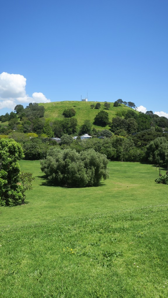
Te Puke o Taramainuku has been completely quarried away beginning in 1955 and now is vast expanse of factories, beyond is Greenmount or Matanginui which had minor quarrying from around 1870 which began in earnest during the 1960s. The quarry eventually became a landfill giving way to the gently sloping mound/hill we see today.

Another view of the missing maunga/volcanoes.

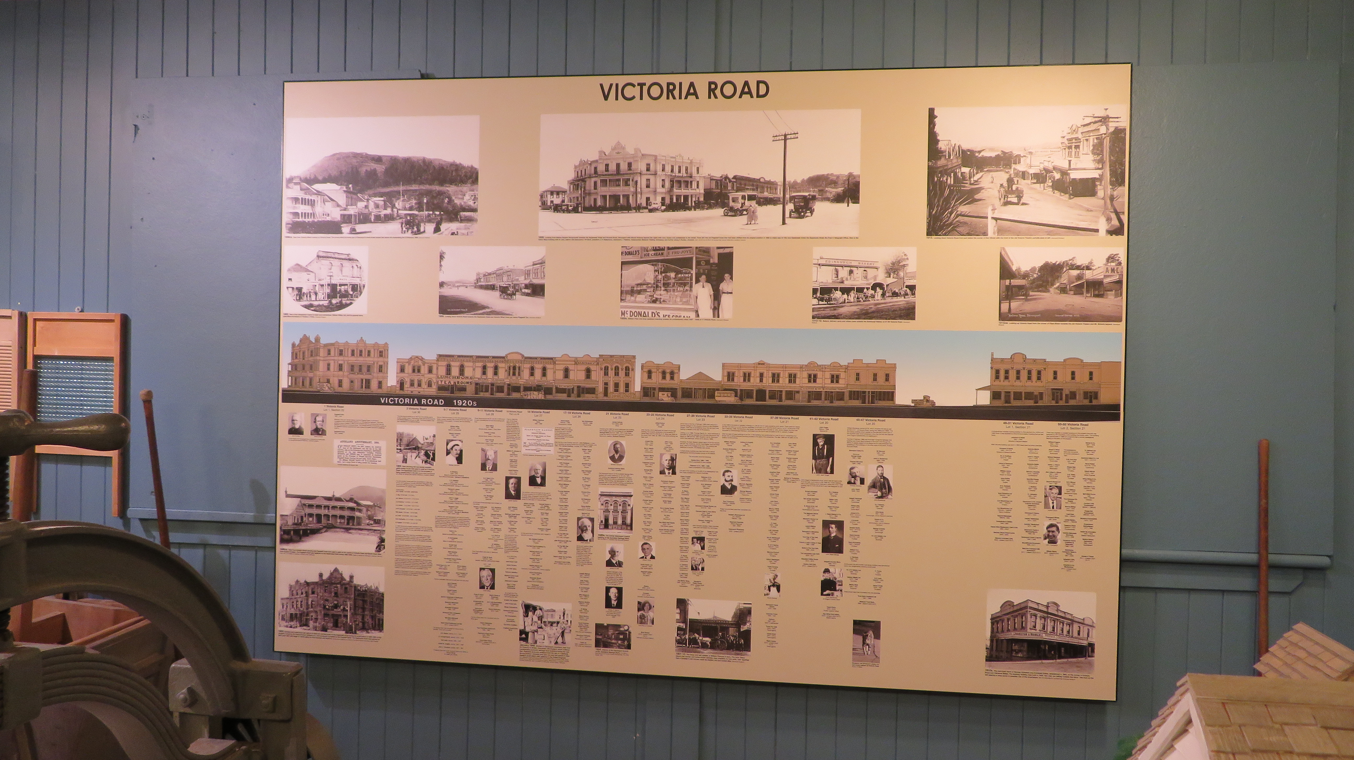
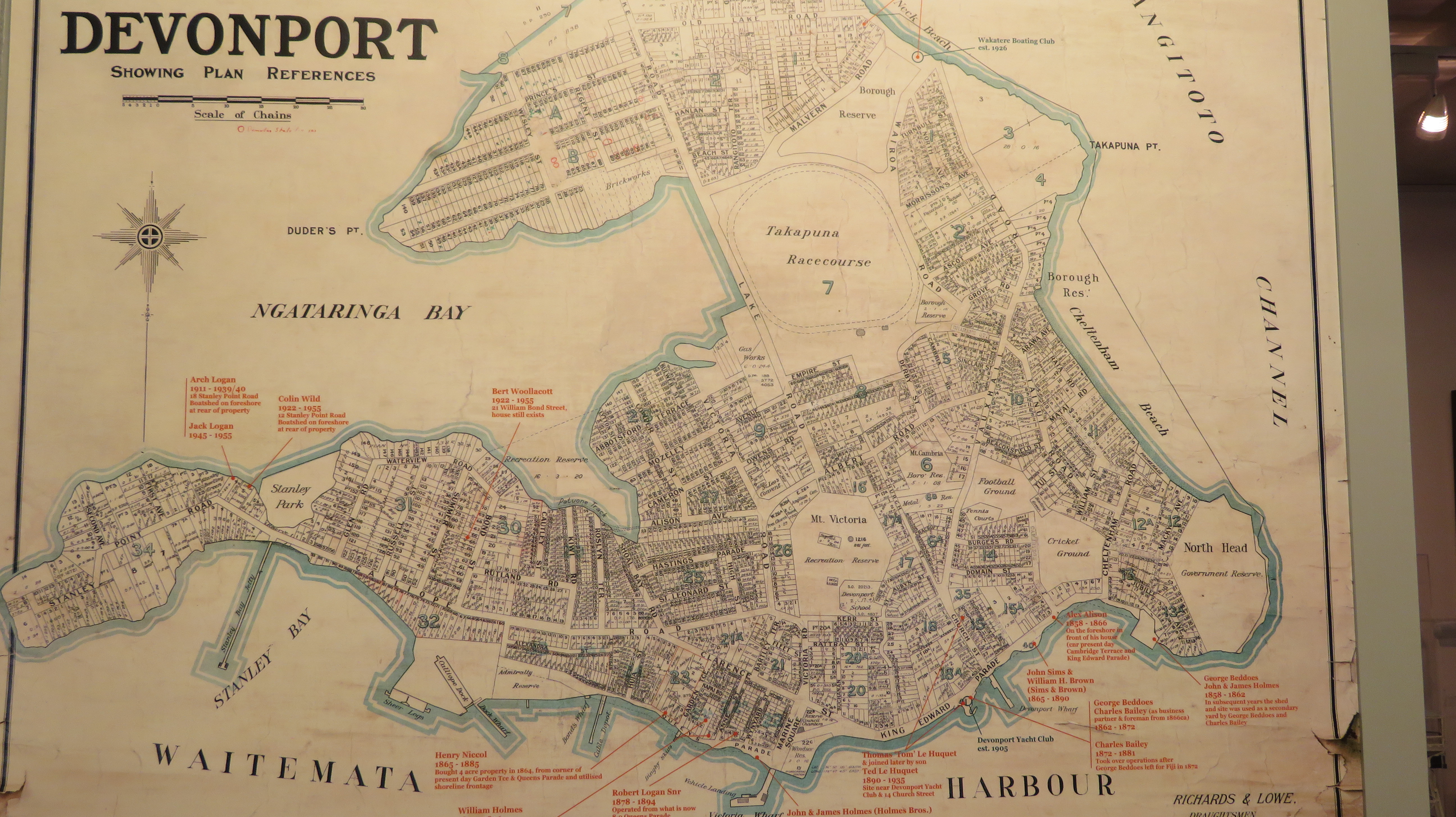
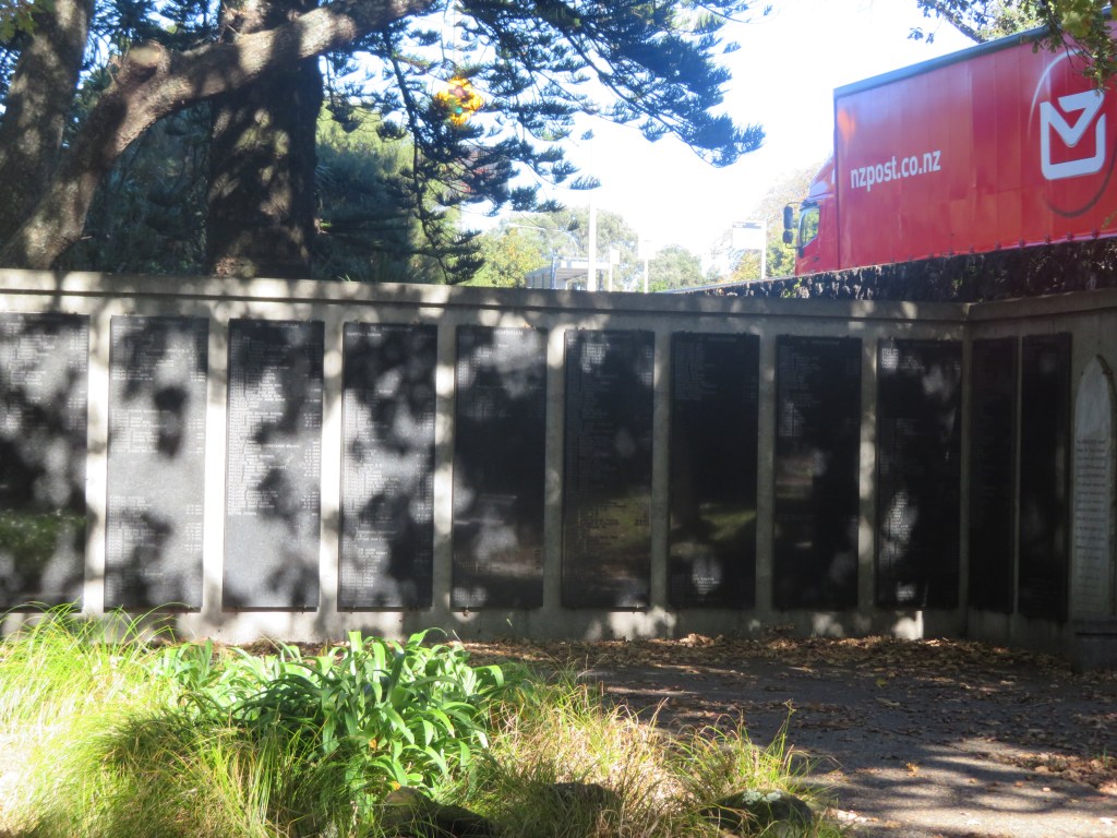
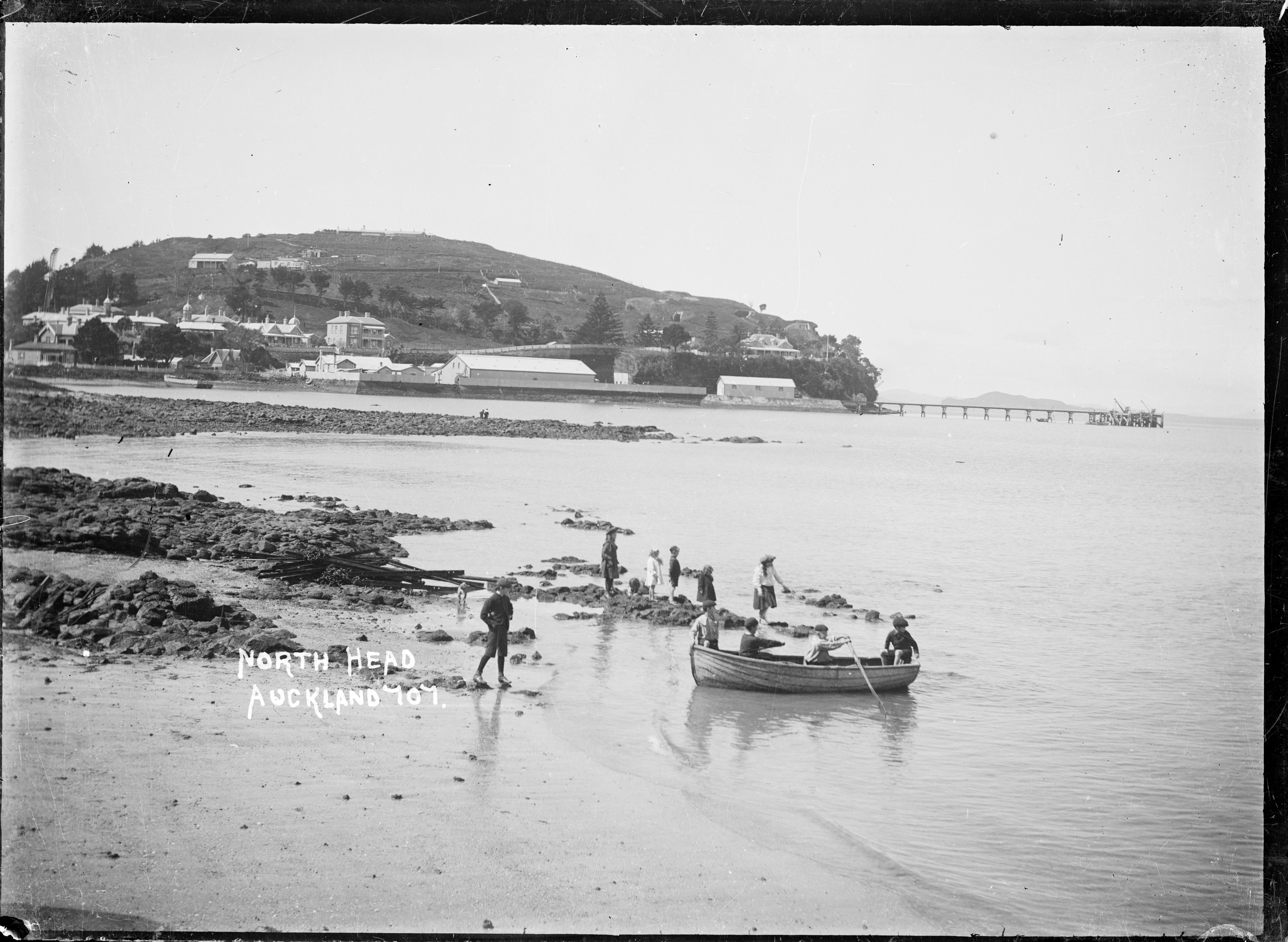
The quarrying of the volcanic cones around Auckland in the late 1800s up until the mid fairly recently was not an unusual. Many of the cities defining features were quarried away to make way for development and to use the raw material of scoria and basalt in the infrastructure of a city. An earlier event at the Devonport Museum told of the history of Takararo/Mt Cambria, another volcanic cone wedged between Takarunga/Mt Victoria and Maungauika/North Head which was mostly quarried away and only more recently became the pleasant parkland area it is today.

The parkland that was Takarora/Mt Cambria with Takarunga/Mt Victoria in the background.

Other volcanoes that have been subjected to quarrying to the point of total removal include –

Te Apunga-o-Tainui/McLennan Hills; Waitomokia/Mt Gabriel; Ōtuataua Volcano/Quarry Hill; Maungataketake/Elletts Mountain; Te Pou Hawaiki (the second smallest cone and now a carpark);Te Tātua-a-Riukiuta/Three Kings; Rarotonga/Mt Smart; Maungarahiri/Little Rangitoto; Te Tauoma/Purchas Hill to name a few.

There are also many others which have been partially quarried, of the fifty three volcanoes in Auckland only thirteen appear to have been untouched by the bulldozer and the digger. This is not to say that those that remain have been completely untouched by human hands. For as long as there has been people in Tamaki Makaurau then the landscape and its features will have been adapted and utilised to suit the needs and requirements of its inhabitants.

For more information regarding the volcanoes of Auckland I recommend the following book –

B. W. Hayward (2019) The Volcanoes of Auckland. A field guide. Published by Auckland University Press

Symonds St CEMETERY

Last week was New Zealand Archaeology Week and as part of this I joined a group of like minded people with the aim of learning a bit more about Auckland’s early history via the evidence provided with one of our earliest cemeteries – the Symonds St Cemetery. The commentary was provided by Dr Heather Battles and our hosts were the Auckland Archaeological Society/NZAA.

The above shows an aerial view of the cemetery as it is today and its divisions based on the religious affiliations of the interred.

The cemetery is one of New Zealand’s oldest urban cemeteries and was established in 1841, the same year Auckland became the capital of this fledgling colonial country. Although today it is part of the inner city back in the mid 1800s it was some distance from the colonial township.

This was unusual for the time – burials were usually found within a churchyard setting whilst in this case the churches for the various denominations were some distance from the cemetery itself. It has been suggested that concerns over public health were what prompted this new urban model but also it “reflected the influence of broader Enlightenment ideas on the new colony, which stressed the seperation between church and state” (from NZ Heritage listing summary).

Enlightenment values could also be seen in the idea of a cemetery for all – here religious affiliations became less important – to an extent…whilst the cemetery is the last resting place of a diverse range of religions, they are segregated within the cemetery itself. One of my earliest pieces of fieldwork as an undergrad student at Auckland University was to do a comparative study of two of the areas within the cemetery looking at the monuments and asking what can they tell us about colonial society. Unfortunately it has been quite some time since then and I do not remember much but what did stand out to me was how elaborate the Wesleyan monuments were when compared to the other parts of the cemetery which is in direct contrast to their sermons on humility and modesty.

The earliest phase of the cemetery was probably about 3.75 hectares but by 1842 it had expanded to around 7.5 hectares. This part of Auckland is one of many ups and downs and today you can see many of the monuments are beginning to tumble down the gully (if they haven’t already). The cemetery was divided into the four main denominations (Anglican, Catholic, Jewish and Wesleyan/non-conformist) on either side of the main route south out of Auckland. This ridgeway later became known as Symonds Street. The land size that each group received was based upon the census of the time.

The 1860s and 1870s saw a change in attitude towards the cemetery and some beautification occured, with trees being planted (some are still there today) and paths being laid. In turn the monuments start to become more elaborate. Eventually, space became an issue and the cemetery was closed to new burials in 1886 unless you already had family members interred there. At the same time a new urban cemetery was created at Waikumete. By 1909 Symonds Street Cemetery became a public reserve suffering from various modifications when the Grafton Bridge was built to span the steep sided gully. Much later in the mid 1960s further damage was done to the cemetery with the southern motorway was constructed. During this time some 4100 bodies were removed and reinterred in two memorial sites within the cemetery.

Today the cemetery is around 5.8 hectares with approximately 10,000 individuals interred there, however it is estimated only around a quarter of those have any kind of visible monuments. Even so it is still an important repository of information on early colonial Auckland and New Zealand.

Below are some images from the Catholic part of the cemetery.

The following images are also from the Catholic part of the cemetery, the first shows the Catholic church some distance away and separated by the southern motorway. The second photo shows the memorial plaque for those whose bodies were re-interred as a result of the motorway construction.

The pictures below are from the Anglican part of the cemetery and show some of the disrepair the monuments are in. The third photo along is of a very distinctive memorial in the shape of a church.

There are several well known New Zealanders buried in the cemetery such as William Hobson, New Zealand’s first Governor who signed the Treaty of Waitangi and died in 1842. The first picture is his memorial whilst the remaining two pictures are of Frederick Manning’s burial, another well known New Zealander.

The construction of Grafton Bridge caused some modifications to the cemetery below.
Last but no least is the walled Jewish cemetery, perhaps the most well kept area of the whole cemetery…

Further information

The construction of the motorway and its impact on the cemetery.

Timespanner

Symonds Street Cemetery – Our Auckland Stuff

https://www.symondsstreetcemetery.com/new-page

North Head Historic Reserve

One of the features of the Auckland landscape is the profusion of volcanic cones, all of which have been altered in some way by the people who have lived here – North Head is no exception.  Situated at the entrance of the harbour it has over time been used as a part of Aucklands strategic defences during times of unrest.


001635.tif
Looking across Torpedo Bay from Duders Beach to North Head.  Photo taken by William A Price 1909-1910.  Source – By National Library NZ on The Commons – https://www.flickr.com/photos/nationallibrarynz_commons/21281084976/, No restrictions, https://commons.wikimedia.org/w/index.php?curid=45247808

The Volcanic Story

Long before people walked the land there were volcanoes – a distinctive feature of Aucklands skyline – and although North Head is just one of many, it is one of the oldest and was formed over 50,000 years ago.  The following photos demonstrate the ancient geology of the headland – the different layers of scoria, ash and mud clearly visible.

The Maori Story

The story of Maori in the Devonport penninsula begins with the tradition of the arrival of the Tanui waka having put ashore at Torpedo Bay (a stretch of beach below the headland facing the inner harbour). Excavations were carried out in 2010 in the bay as part of the redevelopement of the Naval Museum and surrounding areas.  During this time a great deal was discovered about the use of Torpedo Bay during the colonial era but it was the unexpected prehistoric Maori finds which had the archaeologists most excited.

“Unexpected nationally significant prehistoric Maori archaeology was also found near the end of the investigation, including cooking ovens, moa bones and an adze.

Three species of Moa and at least five individuals have been identified from the lower two settlement layers. All of the species are known North Island Species of Coastal bush Moa (Anomalopteryx didiformis, Pachyornis geranoides and Euryapteryx curtus). As the only site in the Auckland, Coromandel Northland region with definitive evidence of hunted Moa rather than industrial Moa usage by Maori, the dating of this site will potentially answer long held questions concerning moa extinction in the North Island. It may dismiss the general belief that the Auckland Coromandel area was not associated with Moa hunting and is not a primary area of archaic settlement by early Polynesians and was therefore occupied later than other areas of settlement.

A small rectangular adze (hand tool) made from Motutapu greywacke was found in the prehistoric site. The Hauraki Gulf was a centre of adze production and the evidence found suggests that occupation of Torpedo Bay, at least during the Archaic period, was extensive, and that the people who inhabited the Bay played an active role in Motutapu greywacke adze production.

The preliminary radiocarbon dates indicate settlement at the site ranged between the early 15th century and the late 17th century. It could be one of the earliest sites discovered in Auckland.”  (from http://www.wasteminz.org.nz/wp-content/uploads/1b.Strong.pdf).


IMG_9486
An eroding shell midden on the north side of Maungauika.


Early photographs show the lower slopes of North Head (Maungauika) as being used by Maori  for gardens and early Europeans describe a Maori settlement at the foot of the hill with gardens and fish drying racks. Tradition also tells us that the Ngati Paoa settled Maungauika until the 1700s when Nga Puhi attacked and beseiged the pa.  The later European story of North Head has all but wiped clean the Maori history of the headland although it is still possible to see the occasional evidence of Maori occupation such as middens eroding out of paths and the occasional unexplainable terrace.

The Colonial Story

The first part of the colonial story begins with North Head being used as a pilot station from 1836 to guide ships into the newly established European settlement of Auckland.  In 1878 it was made into a public reserve with the stipulation that should it be necessary North Head would be re-appropiated for defence purposes.  By 1885 this became a reality as fears of a Russian invasion began to sweep New Zealand.

North Head became one of several defence forts that were set up to protect Aucklands harbour.  On the headland itself there were three defences – the North Battery, the South Battery and Fort Cautley on the summitt.  Each had there own heavy guns, an observation post and high earth ramparts with bullet proof gates and barbed wire.  In addition each had the very latest in military technology – an 8 inch disappearing gun. In addition to these defences a minefield was in place across the inner harbour to Bastion Point.

This slideshow requires JavaScript.

The above are photos of the North Battery.

Over the next twenty-five years these first fortifications were expanded and strengthened by convict labour who lived in a prison on the summit.  They dug out many of the tunnels and underground storerooms which are so popular with young explorers today.  With the threat of war once more looming in the early twentieth century new engines were put into the engine rooms, more searchlights were added, new barracks were built.


IMG_9440
The prison/barracks used to house the convict labour.


In all three instances (the Russian scare, WWI & WWII) not once were any of the guns fired in anger.  During WWII the headland became the regimental headquarters and main administrative centre for the Auckland’s coastal defences. Many of the guns were moved to Whangaparoa although North Head did become the site of the anti-submarine boom (a wire netting barrier covered by two guns at sea level) which protected the harbour from attack by submarine.

This slideshow requires JavaScript.

The South Battery and its disappearing gun.

By the end of the 1950s the army had left the headland although the navy still ran a training school on the summit.  In 1996 the navy had also left and now the area is administered by the Department of Conservation.

Observation posts and tunnels associated with the North and South Batteries.

The Engine Room – an independent source of electricity for the search lights etc.

This slideshow requires JavaScript.

One of the features for the defence of the Auckland Harbour was the minefield which went from North Head to Bastion Point.

This slideshow requires JavaScript.

So much to explore all around the headland…


For more information –

A History of NZ Coastal Defences

The Russian Scare

The Department of Conservation  A PDF can found here for a self guided walk around the headland.

An Auckland Icon – One Tree Hill and Cornwall Park.

During the last school holidays the kids and I decided to venture beyond the safe confines of the North Shore. Our destination? The well known and much loved Cornwall Park and One Tree Hill.  What follows is a brief description and overview of the history of this iconic parkland in the heart of Auckland.

Essentially the parkland most people know is in fact two parks, Cornwall Park and One Tree Hill, are separate entities under different management but with very similar objectives. At the heart of the area is the volcanic cone, the largest and most recent of the forty eight which make up the Auckland isthmus – it last erupted around 20,000 years ago.

The Maori Story
The Maori name for the hill is Maungakiekie which can be translated as ‘the mountain of the kiekie’. The kiekie or Freycinetia banksia is a type of vine which once grew on the slopes of the volcanoe and is better known as the fruit salad tree. Its fruit is edible.
However, this name seems to be a recent attribution as traditional histories dating from around the 16th century, do refer to the hill as Te Totara i Ahua or ‘the totara that stands alone’.

It is said that a branch of the Ngati Awa who were migrating from Northland to Taranaki had stopped for awhile in Tamaki (Auckland). During this time the chiefs’ son was born and was named Korokino. The cutting of the umbilical cord has great significance in Maori culture and Korokino’s was cut using a sharpened totara stick. The cord was then buried on the summit and the totara sprig was planted in the soil used as backfill. It took root and grew into a magnificent and tapu tree.

Unfortunately, it was gone by the late 1700s and no European ever saw it. Early colonists would often write of a large pohutakawa on the summit in the early 1800s and this is what gave rise to its modern name – One Tree Hill. However, the story of the tree then goes ‘pear-shaped’ as in the mid 1800s it is felled for firewood. In 1875 Logan Campbell replanted – possibly a puriri – within a stand of pines which served as a wind belt. But the native tree did not survive and all but one pine tree survived until 2000 when it too fell to an axe when the City Council deemed it unsafe.

One_Tree_Hill_Auckland_in_the_1990s

One Tree Hill, in the 1990s when the lone pine was still standing, (to the right of the obelisk). From wikimedia commons.

What most people will notice as they make their way to the summit is the how uneven the ground is, dips, hollows, banks and seemingly random humps and bumps will catch the unwary walker. These landscape features are the remains of the Maori settlement. There are at least one hundred and seventy terraces covering approximately forty five hectares and it is regarded as one of the largest pa (hillfort) in New Zealand. The traditional occupants of the site were the Wai O Hua tribe and their histories refer to it as the head pa of their paramount chief Kiwi Tamake in the early 1700s.

IMG_0244
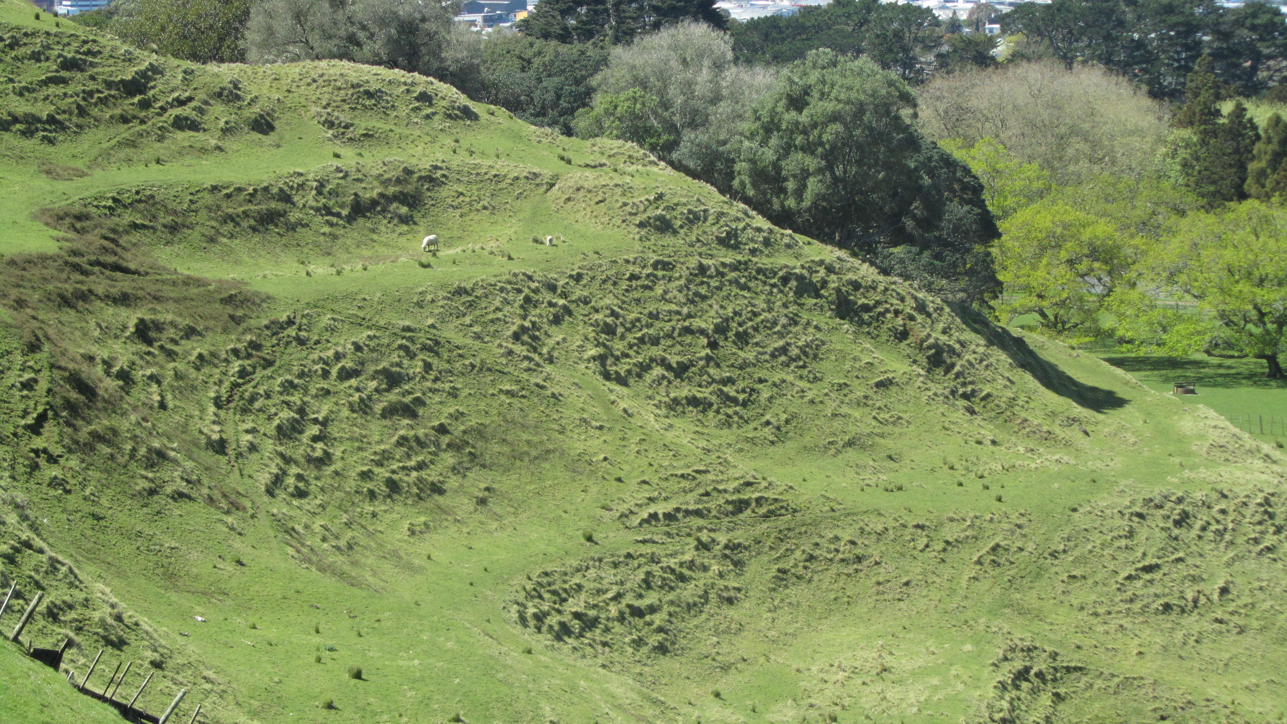
An example of some of the many terraces and platforms.

Perhaps one of the more unusual archaeological features in the park is the Rongo stone. Rongo stones are carved stones which are regarded as manifestations of a god and are used ritually to aid the growth and harvest of crops. This particular Rongo positioned on plinth near the BBQ area is not in it’s original context. It was originally rescued by Logan Campbell from the side of the road where it had been unceremoniously dumped and taken back to the Park. It is known as Te Toka i Tawhio or ‘the stone which has traveled around’.

IMG_0236

Humps and bumps in the landscape…


The eroded edge of a shell midden.

More terraces and platforms.

IMG_0248
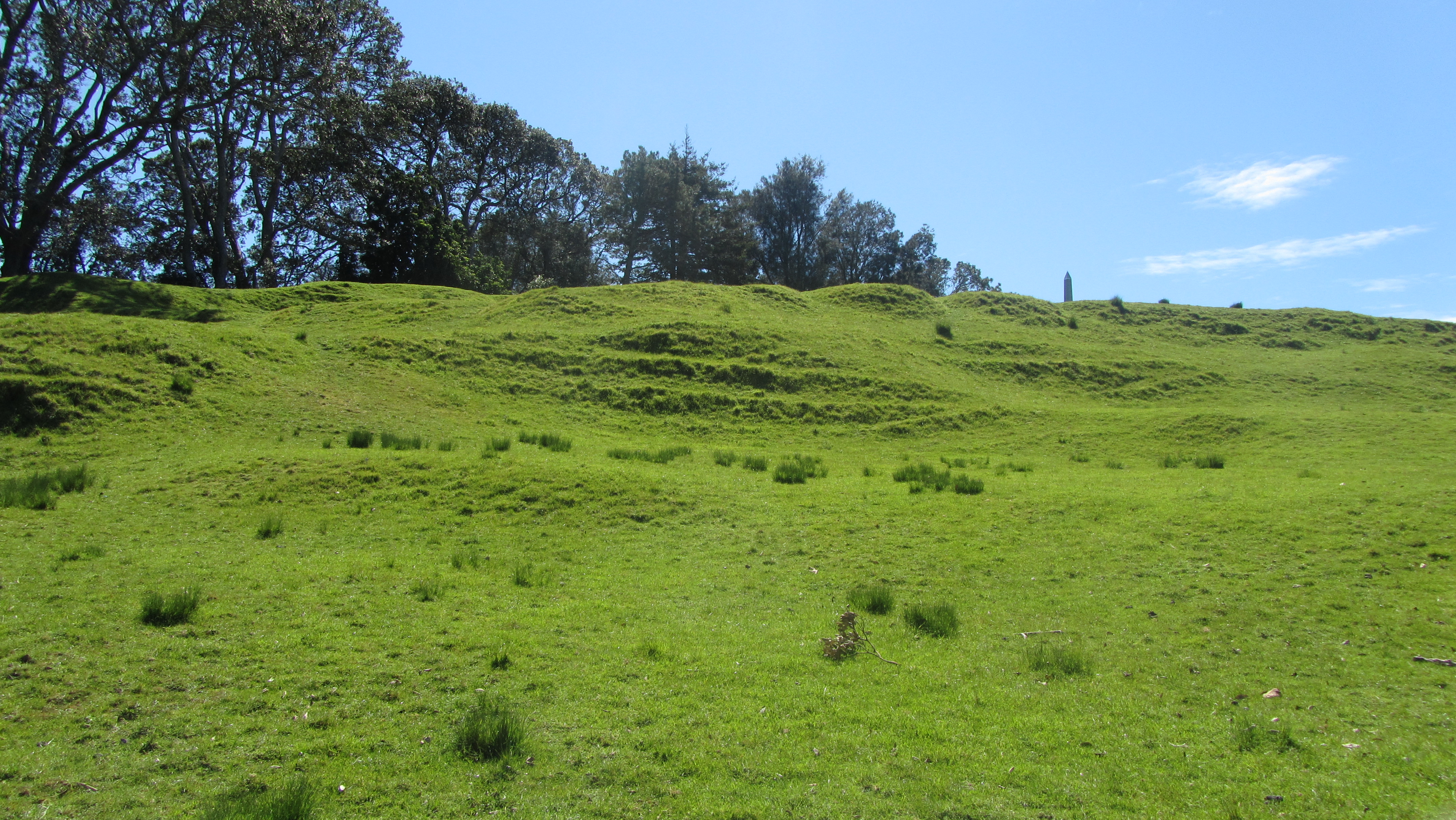
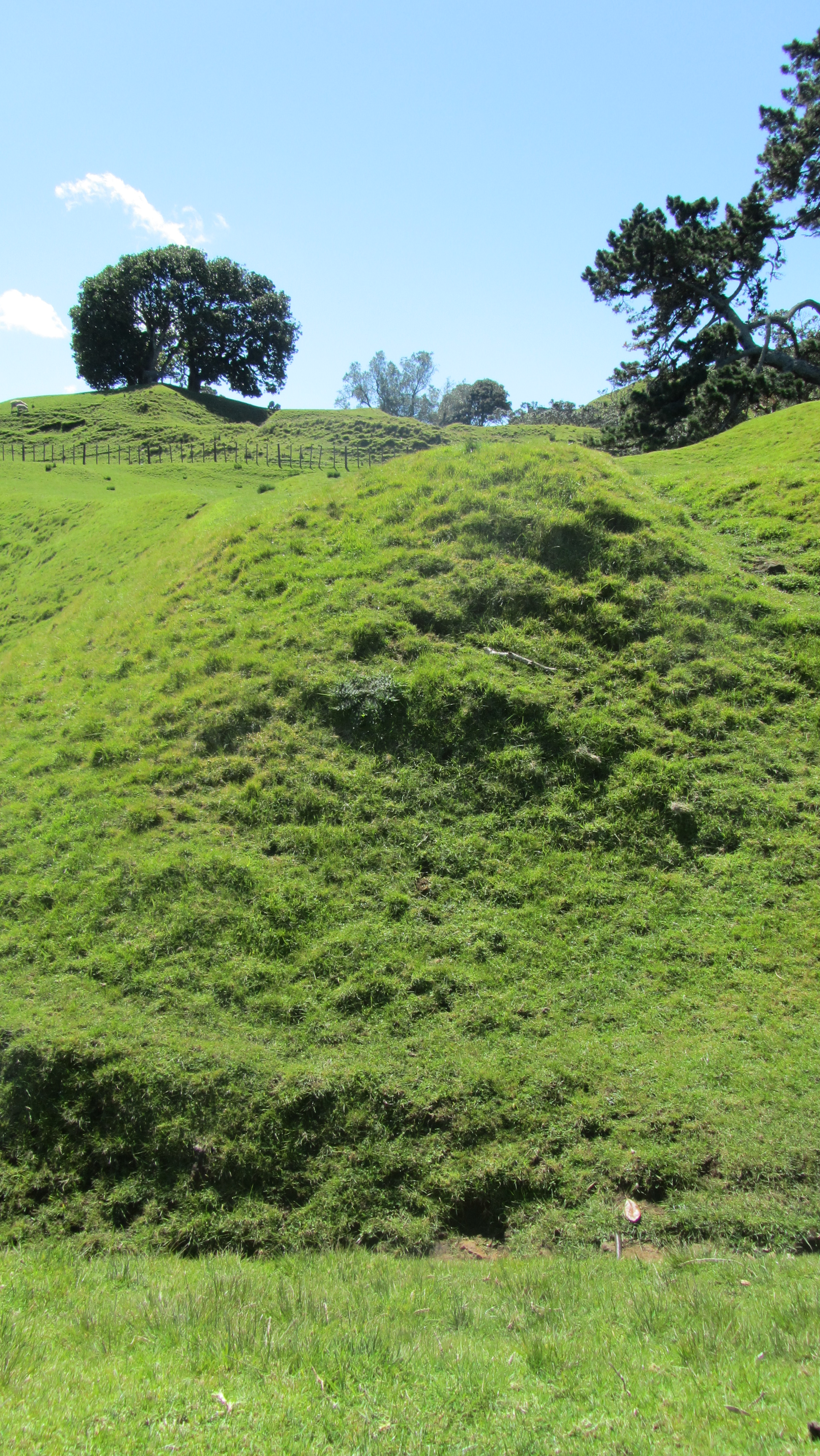
One of many defensive banks.


IMG_0243
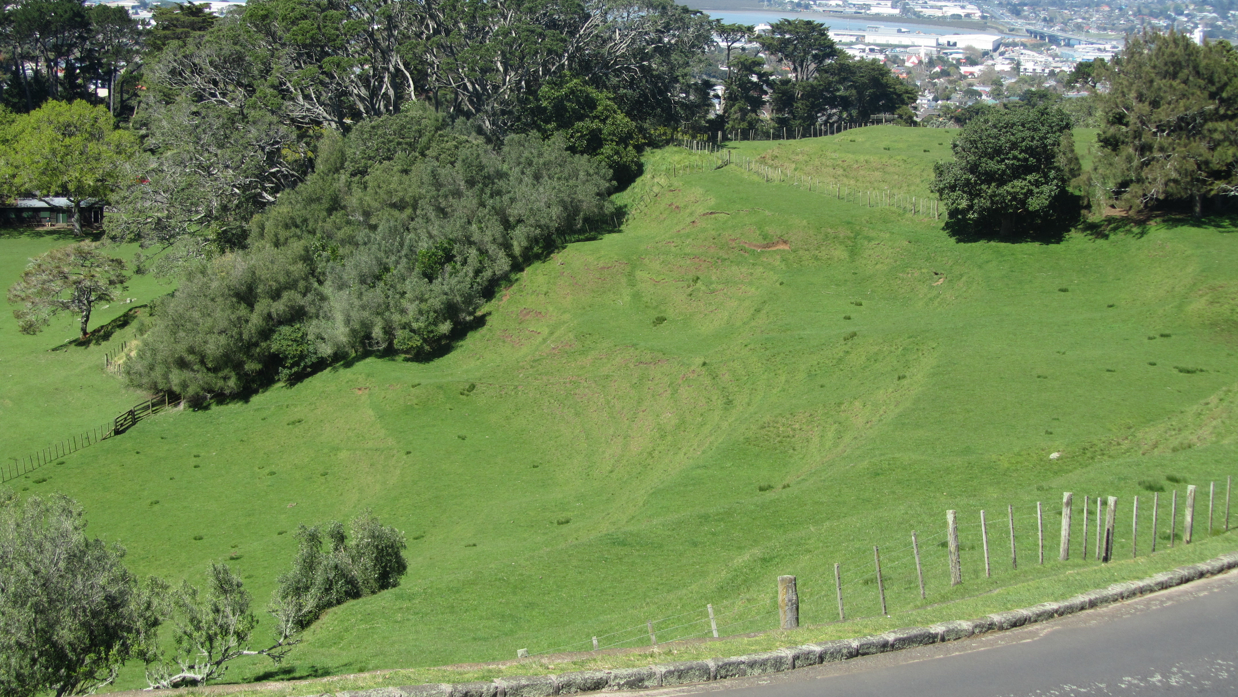
Building platforms overlooking one of the volcanic craters

IMG_0242
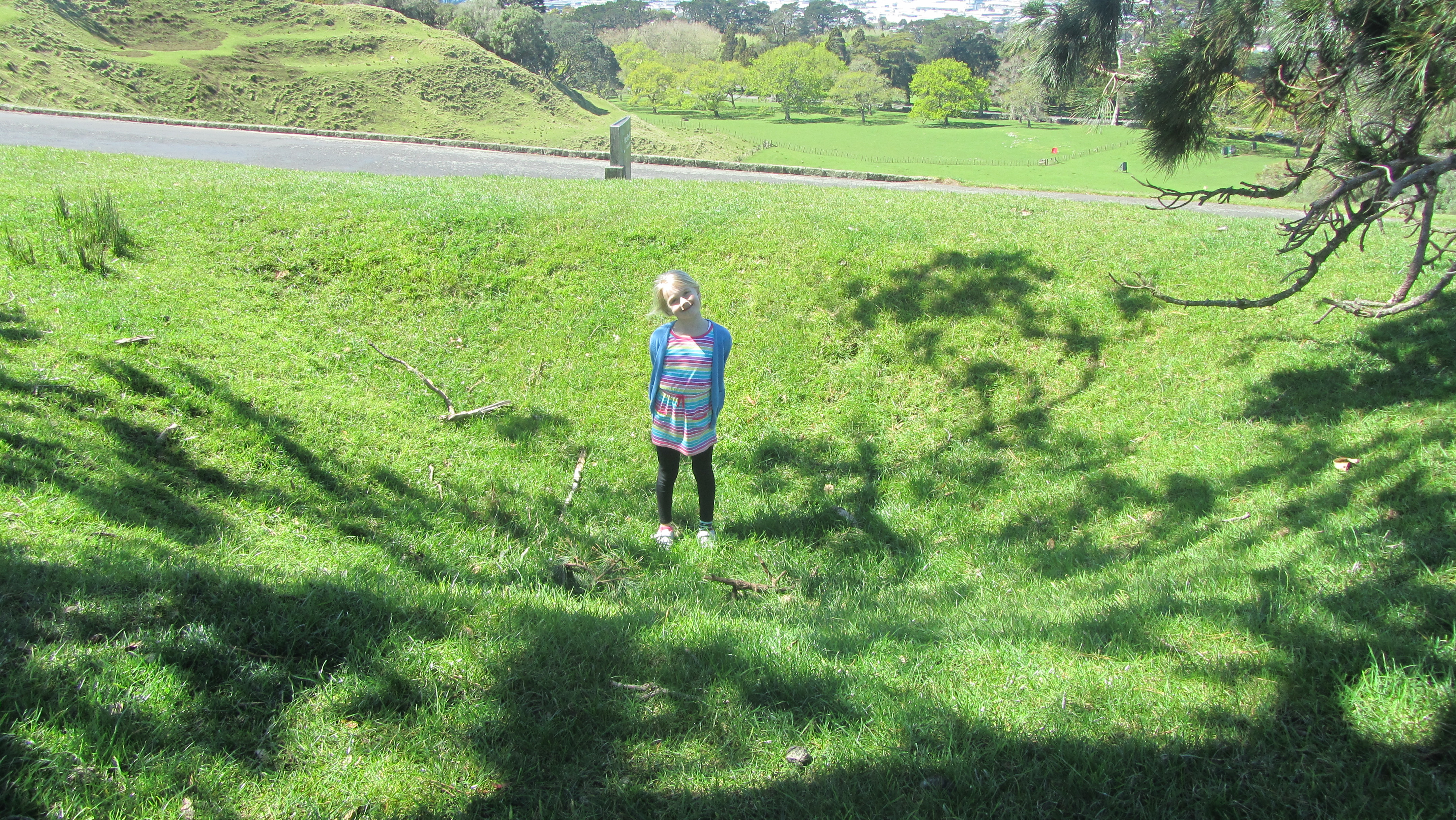
My daughter standing in one of the many hollows – possibly a storage pit for kumara.

IMG_0239
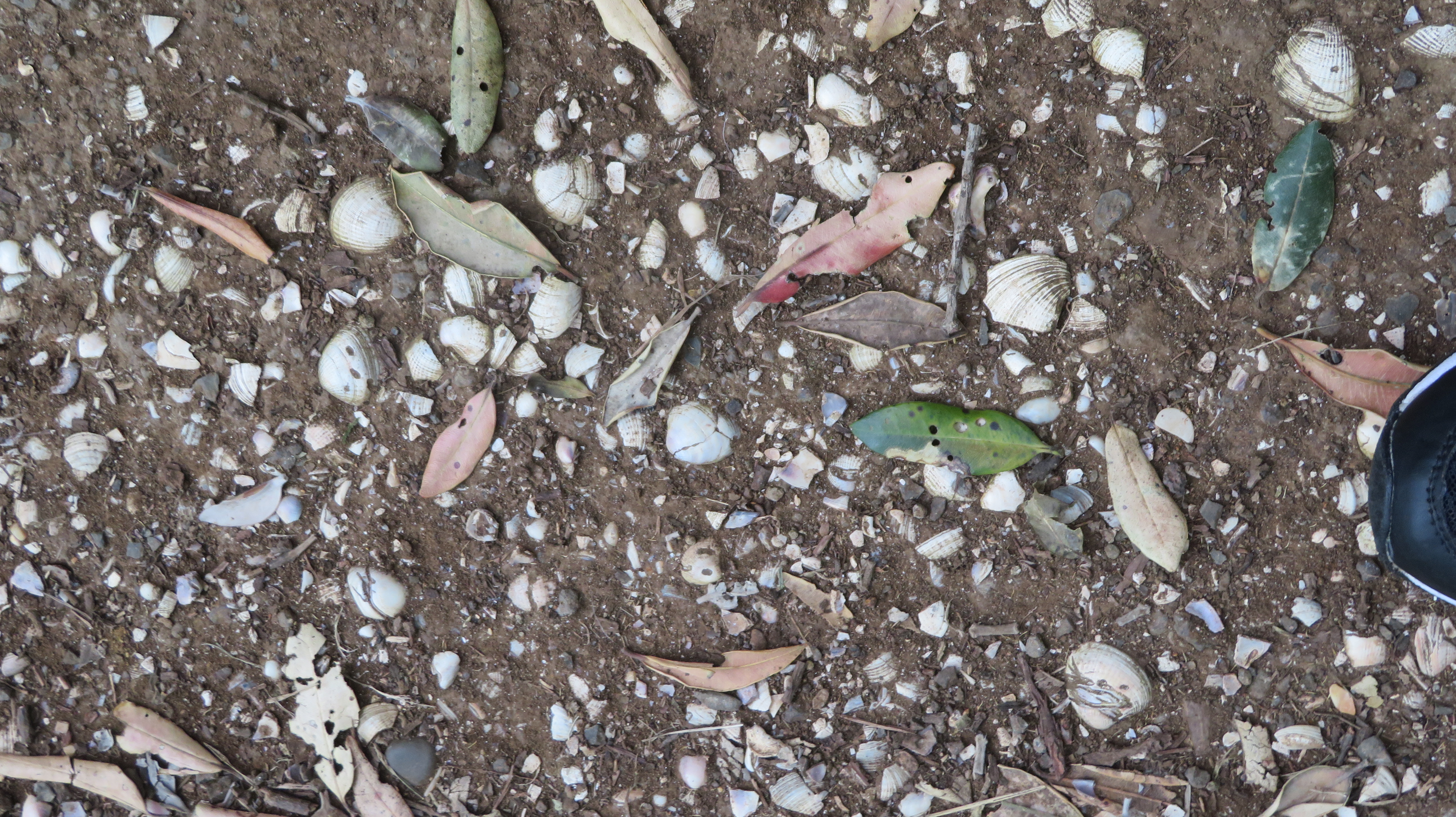
A large midden suffering under modern footsteps.

Terraces, defensive walls, storage pits, boundaries and middens are all part of the archaeology on One Tree Hill and attest to a well populated landscape. Which perhaps is what makes the next phase of the story even more unusual…

The Early Settlers
In 1840 Governor Hobson chose the Tamaki isthmus to be the capital of New Zealand. There were several reasons for this, the good harbours and fertile soils not withstanding however at the time it was a mostly deserted landscape.

“Terraced volcanic cones and numerous abandoned plantations testified, in 1840, to dense habitation in the days of old. But, paradoxically, so few Maori were living there in 1840 that Tamaki could almost be regarded at the time as a population void…there was no well-established tribe to be displaced” (R.C.J. Stone, 2007, Logan Campbell’s Auckland. Tales from the Early Years).

Into this early settler world came John Logan Campbell (1817-1912) for whom much of the early history of Auckland and Cornwall Park is intricately tied to.

John_Logan_Campbell,_ca_1880s
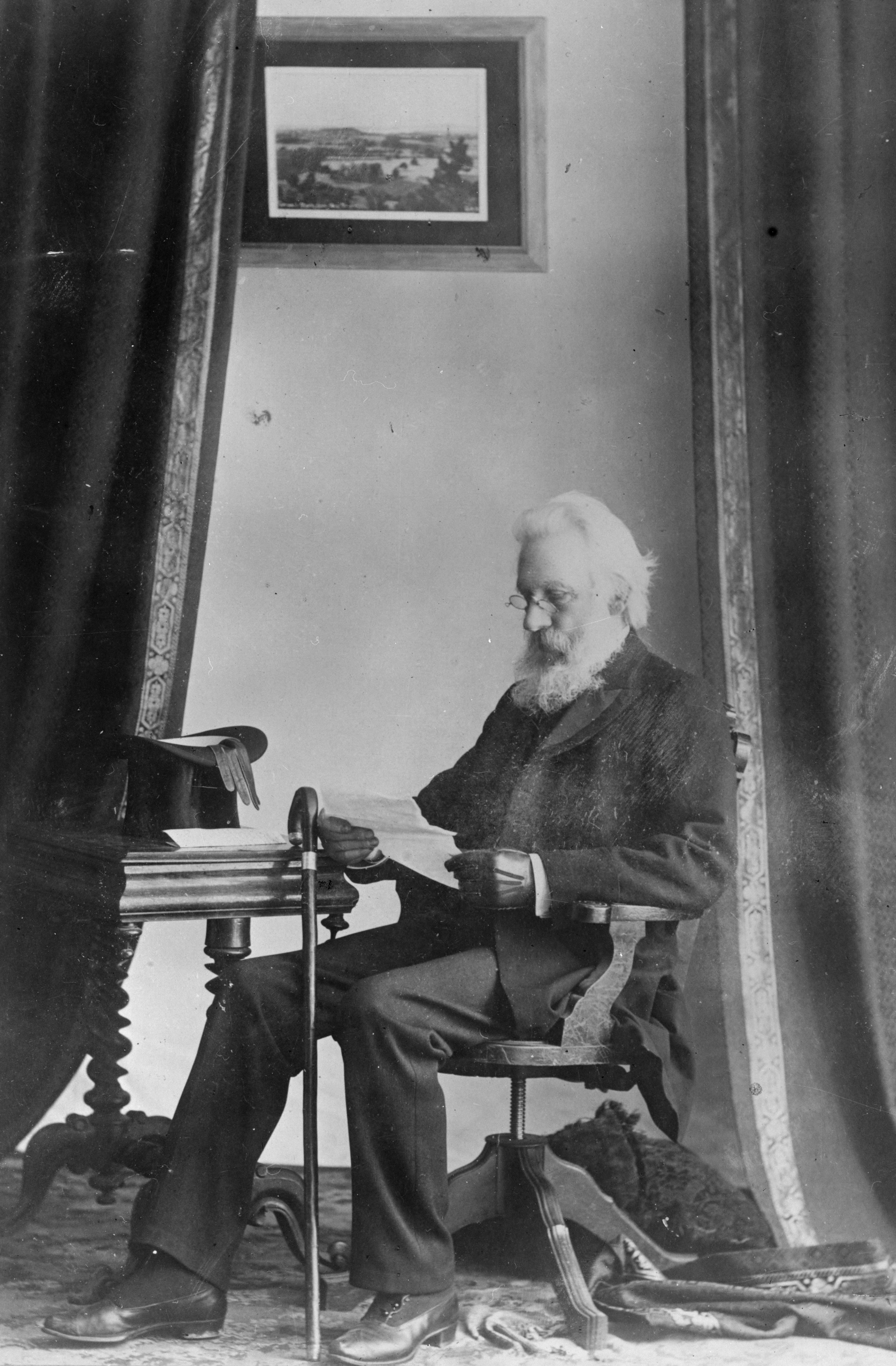
John Logan Campbell c.1880

Logan Campbell was born in Edinburgh and in 1839 graduated as a Doctor of Medicine, later that year he set sail for New South Wales, arriving in New Zealand in 1840. On that ship was also a William Brown who became Logan Campbell’s business partner. The two men built the first house in Auckland – Acacia Cottage – which still stands and they opened the first shop. Both men quickly took advantage of being ‘in at the ground floor’ as the new settlement of Auckland took off. Logan Campbell in particular rose in prominence rapidly and was/is regarded the ‘father of Auckland’.

The oldest remaining wooden structure in Auckland
The oldest remaining wooden structure in Auckland – Acacia Cottage.

In 1853 Logan Campbell and William Brown bought what was then known as the Mount Prospect Estate and renamed it One Tree Hill. By 1873 the partnership with Brown was dissolved and Logan Campbell became the sole owner. In 1901 he gifted the land to the city of Auckland during a Royal visit by the then Duke and Duchess of York and Cornwall (later King George V and Queen Mary) and it was renamed in their honor as Cornwall Park.
In 1903 the park was formally opened. 

When Logan Campbell died in 1912 he left instructions and funds for the construction of a monument to the Maori people whom he admired a great deal. However, it was not until the late 1930s that work began on the obelisk. It was completed in 1940 but the unveiling was not held until the 28th April 1948 after WWII was over in keeping with the Maori tradition of not holding ceremonies during times of war.

IMG_0150 - Copy
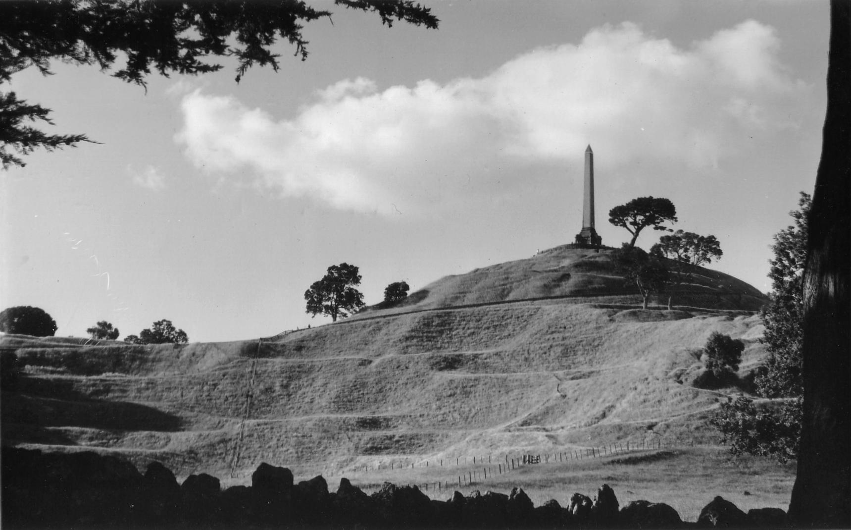
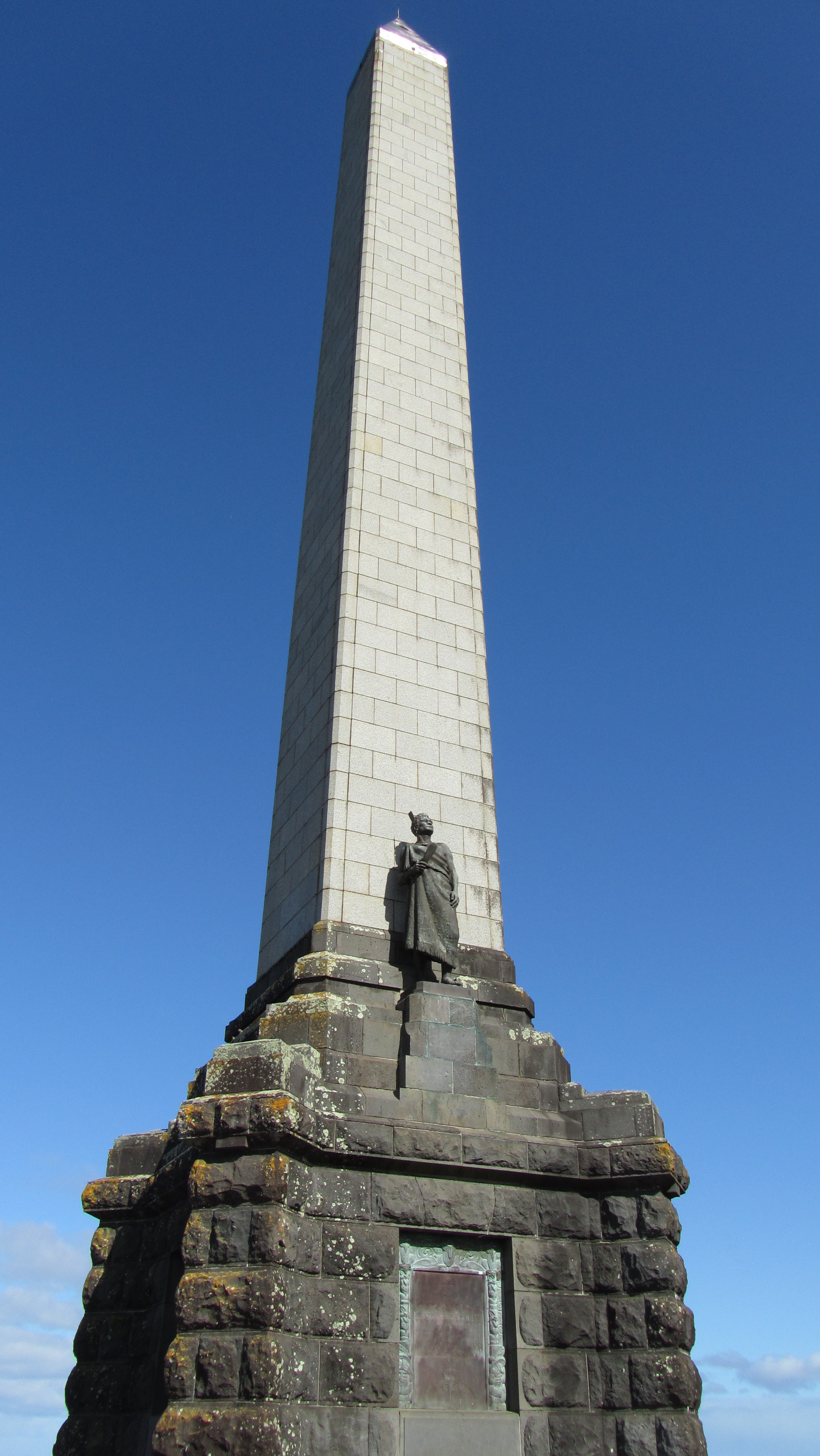
John Logan Campbell’s memorial to the achievements of the Maori people.

The obelisk is 33m high and was designed by Atkinson Abbott. Logan Campbell is buried at the foot of the monument under the flat paved forecourt.

Today
Today both parks are well used by Auckland residents and it is still farmed with sheep and cows wandering the slopes of the hill. It is a place where people meet, families picnic, dogs walk, joggers jog and children play. Every city needs its green spaces in order to breath and here in Auckland we are lucky to have this and so many other such spaces…

IMG_0245

Playing in the crater of an extinct volcano…


The Devonport Museum

A recent addition to my television viewing is a locally produced show – ‘Heritage Rescue’.  Along the veins of a reality tv show and borrowing loosely from home makeover shows and the UK’s ever popular ‘Time Team’ (the shows presenter once worked on the latter as a humble archaeologist), Heritage Rescue visits small local museums, spending time (usually around a week) and resources to inject new life into these establishments.  More often than not they operate purely on the fuel of volunteers.

One such museum was the Devonport Museum in Auckland – I am sorry to say that even though I have lived only a fifteen minute drive from this musuem I had never visited…a fact I hastened to amend after watching the two episodes dedicated to giving the wee museum a new lease of life.  Having never been to the museum prior to its appearance on the telly I can’t compare so the photos that follow are of the new look museum.

IMG_9268

The one thing that has obviously remained the same is the essential fabric of the building.  The museum is housed in an old Presbyterian church which was moved to it present day location in an old quarry on the side of Mt Cambria in 1978.

On entering the museum to the left there is a timeline of Devonports history with a superb diorama of the local landscape taking centre stage.  I was fascinated to learn that once upon time it was possible to get a boat through at high tide directly from Narrow Neck beach to the Ngatringa Bay past what is now the golf course and along the present day Seabreeze Rd.

Devonport itself is an area rich in history, not just because it was one of the earliest nineteenth century settlements but also it was well utilised by Maori with its safe landing beaches, excellent access to kai moana and fertile soils on the slopes of its volcanic cones.  Jutting out into the wider Hauraki Gulf it also provides an excellent vantage point of all who come and go into Auckland.  The museum effectively reflects this tapestry of Devonports past.

IMG_9254

There are displays on the history of ship/boat building in the area, we are told that the foreshore was a hive of industry in the nineteenth century.  The above picture shows a model of New Zealands one and only remaining wooden light house which can be found just off the tip of Devonport, no longer being used as a light house but preserved as a historic site.

IMG_9255

Shop window displays using real shop windows from the towns retail past gives the visitor an impression of what the main street may have once looked like.

This slideshow requires JavaScript.


IMG_9265

Here a display panel gives information on Devonports main street – Victoria Road – who lived/worked and played there.

Devonport is well known for it old villas and colonial cottages – the museum has two models of these types of houses on display.  The one on the right is complete with washing on the line and a larder stocked with local produce.

IMG_9253

An old map of Devonport – the Takapuna Racecourse is now a golf course…

Overall our visit to the Devonport museum was very enjoyable, helped along by a friendly and informative volunteer who was able to answer my questions.  There is even a kids corner with old fashioned games for the littlies to have a go at and in a seperate room a research space is well appointed for those to local/family histories.  It is well worth a visit if you are in the  area and even if you’re not.

IMG_9269

Devonport Museum website