During a recent holiday in Vietnam I visited the temple precinct of My Son, the principal religious center of the Champa. The following are a few photos (read many) of this day trip with a bit of background for good measure.
Who were the Champa?
Essentially the Champa were a collection of independent polities who ruled central and southern Vietnam from around the second century AD. The independent states became united in the fourth century under the rule of King Bhadravarman of Indrapura during the 4th century. Between the 7th and 10th centuries the Cham controlled the trade in spices and silk out of the South China Sea. Hoi An was the main port of the principality of Indrapura and whilst the capital of the Champa was in the area of the modern village of Dong Duang – both are situated near to My Son.
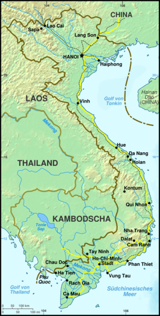
Map of Vietnam – Hoi An and Da Nang are roughly central on the coast.
From around the fourth century the Cham adopted Hinduism as their principle religion although many were eventually converted to Islam from the 10th century onwards. Today whilst the majority are Muslim there are still some that retain the Hindu faith and traditions.
The name Champa comes from the Sanskrit word ‘campaka’ which refers to species of flowering tree similar to a magnolia.
By 1832 the northern Vietnamese Emperor Minh Mang had annexed and absorbed the Cham polities
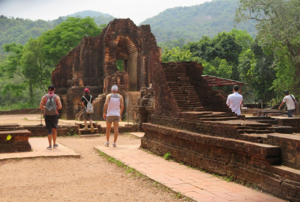
My Son
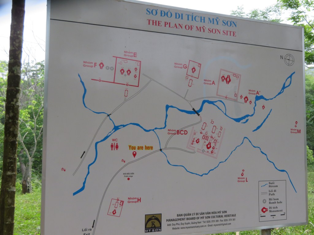
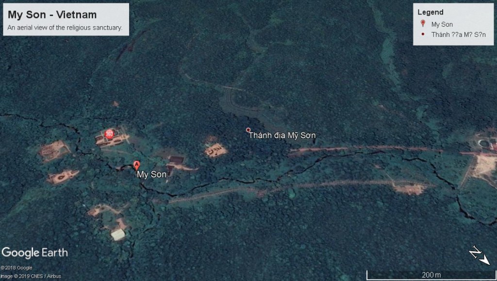
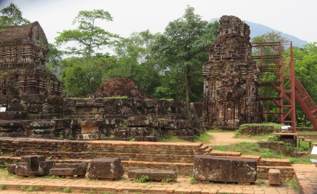
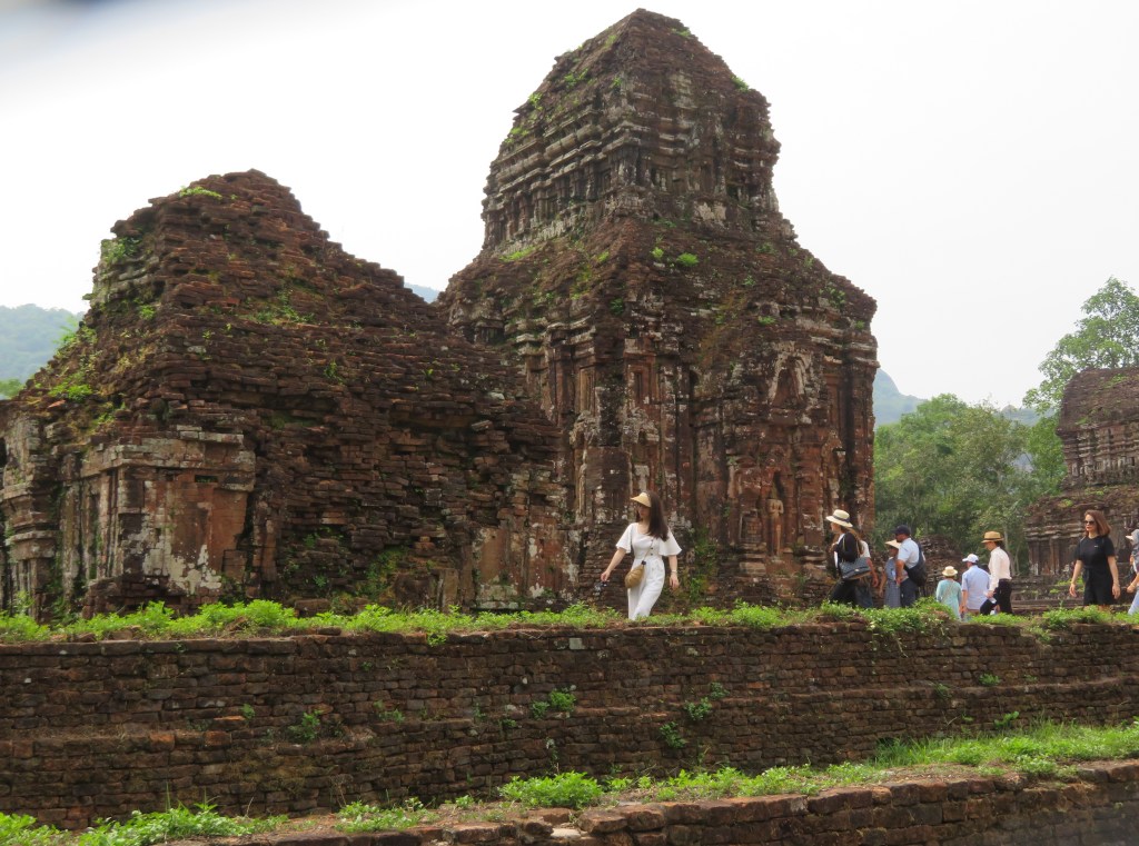
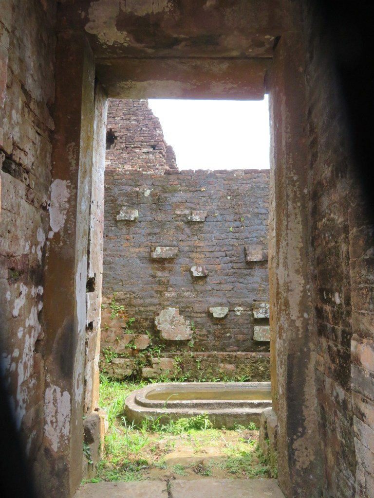
My Son is situated in a valley near the village of Duy Phu approximately 69km from DaNang and was the site of religious ceremonies for the HIndu Cham rulers between the 4th and 14th centuries. It also served as a royal burial place. There are in excess of seventy temples in addition to many stele containing important inscriptions in both Sanskrit and Cham.
An aerial view of the now jungle covered valley, the bare patches are some of the temples accessible to the visitor.
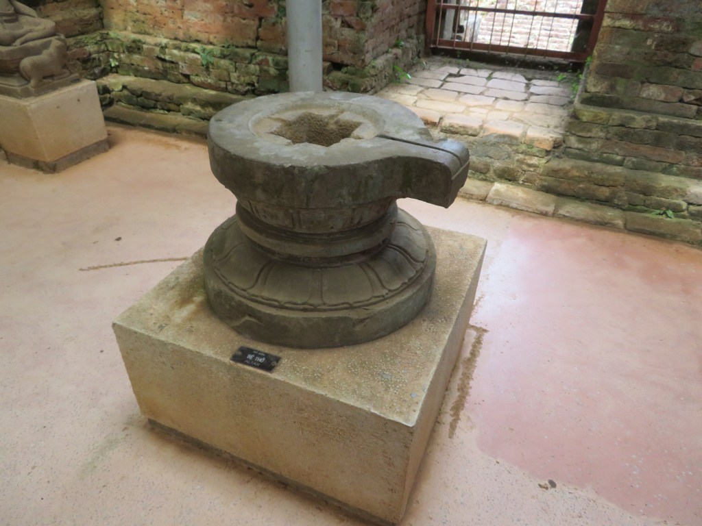
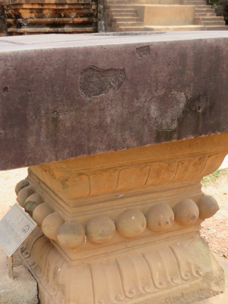
The Hinduism of the Champa was Shaiva with elements of local religious cults such as that of the earth goddess Lady Po Nagar. A number of the features at My Son are the linga – a black stone pillar representing Shiva and the yoni representing the mother.
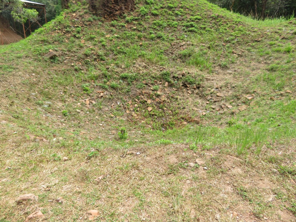
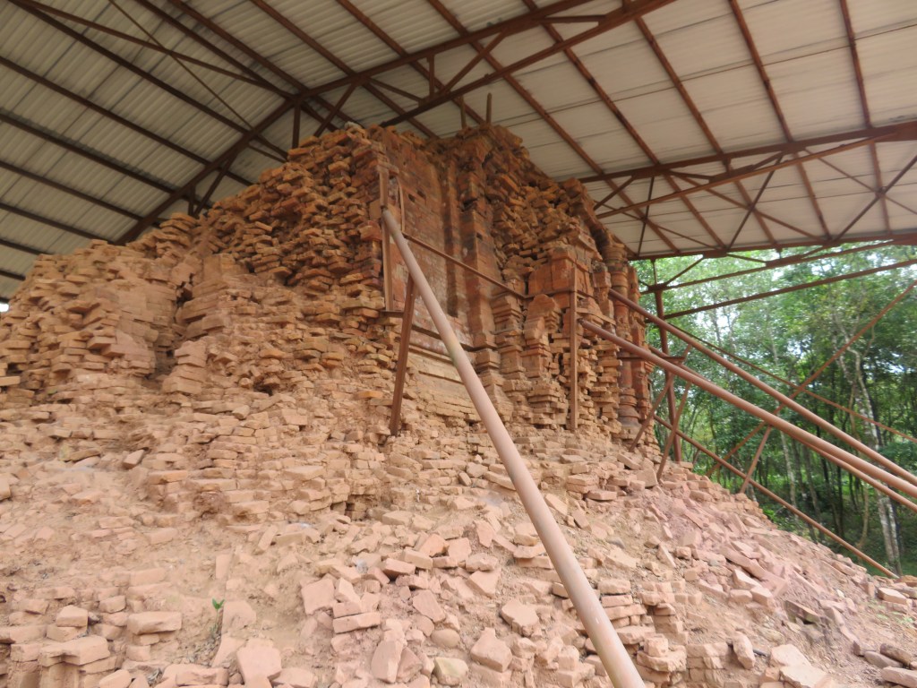
Unfortunately the valley was carpet bombed by the Americans during the Vietnam war and many of the temples were severely damaged and in some cases totally destroyed. In recent years efforts have been made to rebuild the temples (the work is ongoing).
A bomb crater
The hollows are indeed bomb craters – this part of the site has been left untouched – as awful as the bombing of such an important site is, the act is part of the history of My Son and as such needs to be remembered and preserved if we are to learn anything from it.
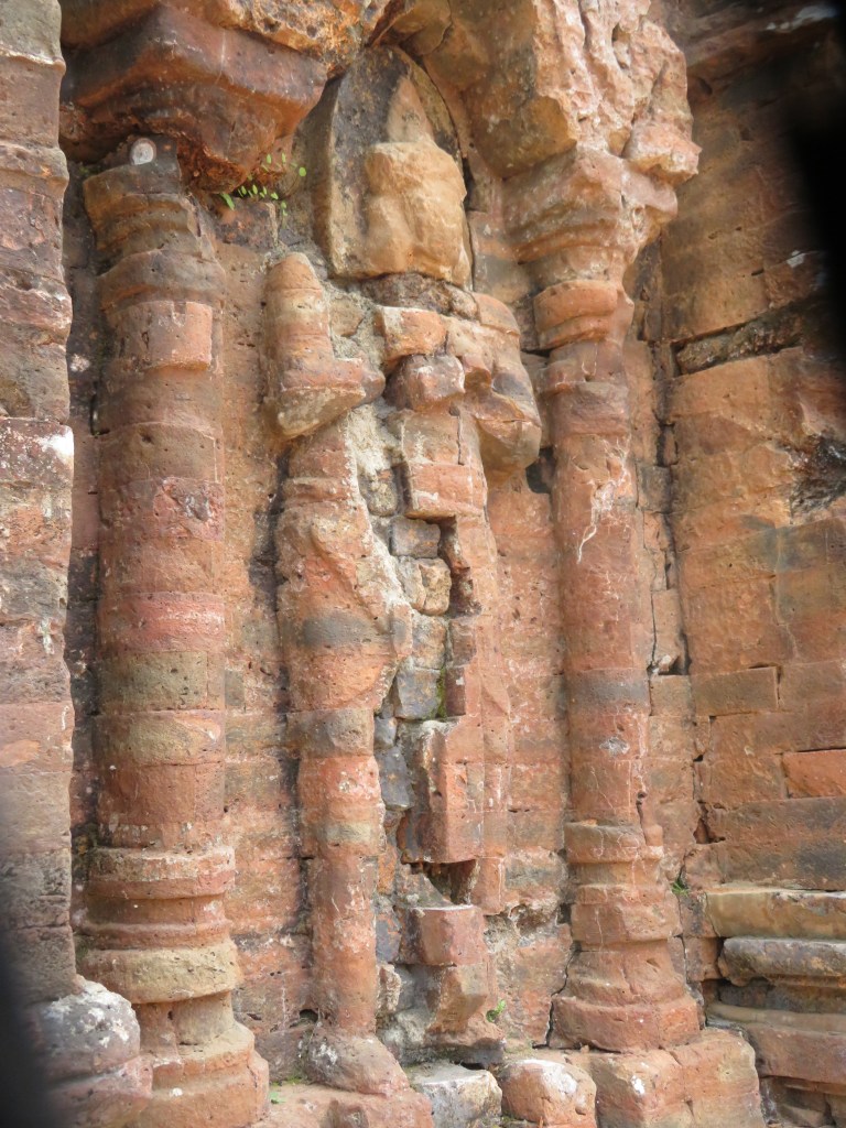
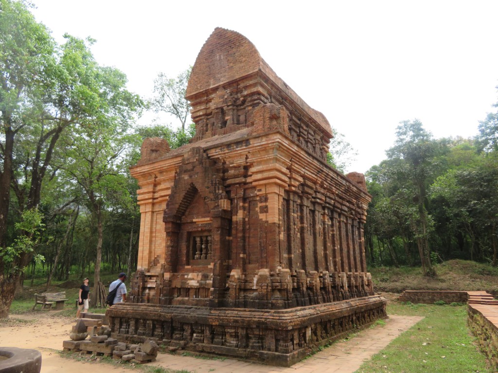
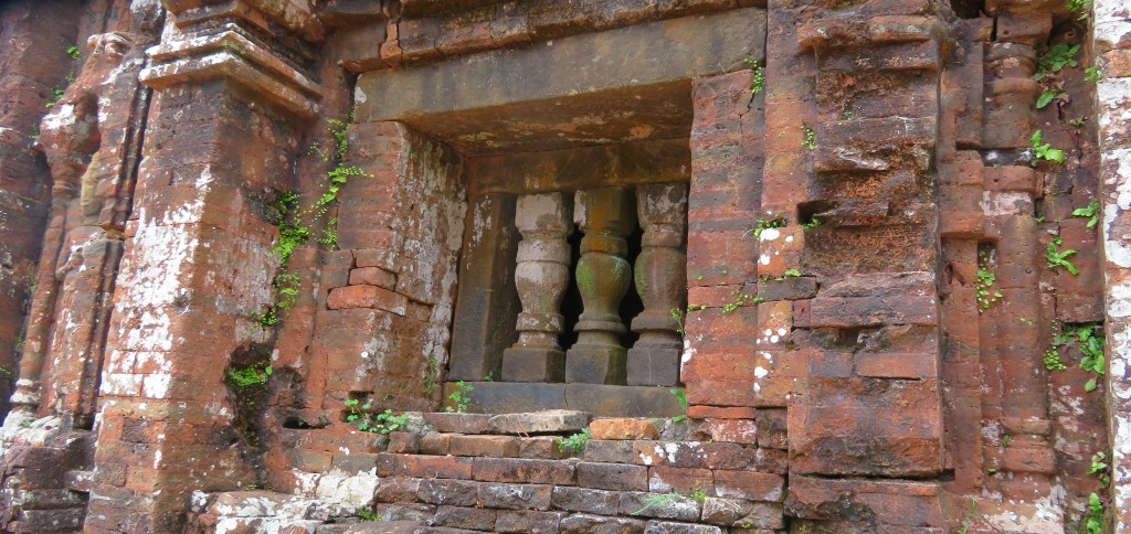
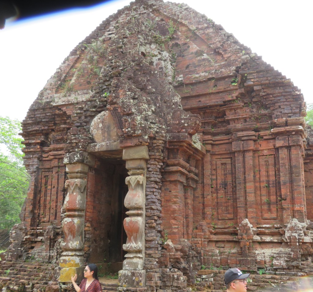
All but one of the temples are constructed from red brick (the only stone built temple is in the area known as B1). The decorative carvings which adorn the temple exteriors were cut directly into the bricks themselves. Although there has been some discussion about the type of mortar used in construction of the temples, it is now generally accepted that the mortar consisted of a sticky clay solution similar to the brick clay.
There are four types of buildings –
Kalan – the brick sanctuary used to house the diety.
Mandapa – the entry hallway associated with a sanctuary.
Kasagrha – ‘fire-house’ usually with a saddle shaped roof and used to house valuables or to cook for the diety.
Gopura – the gate tower leading into a walled temple complex.
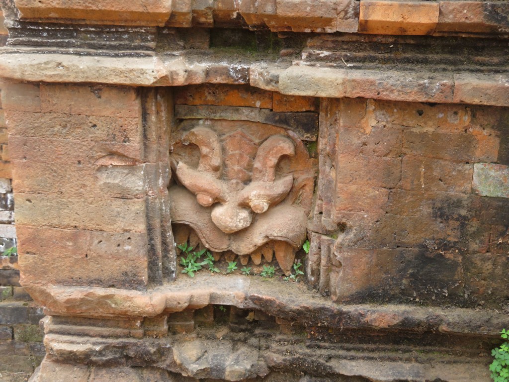
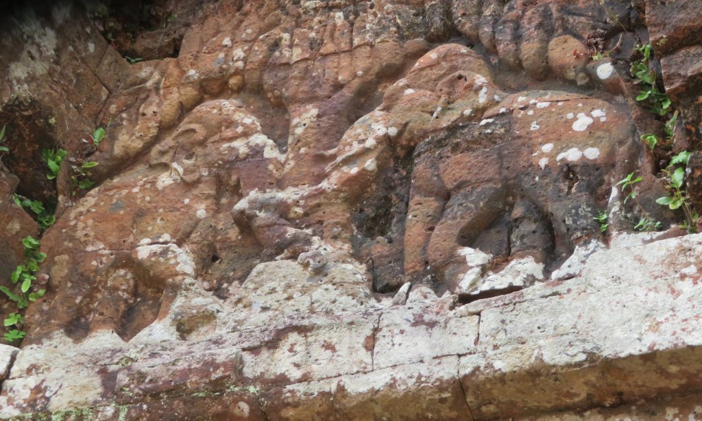
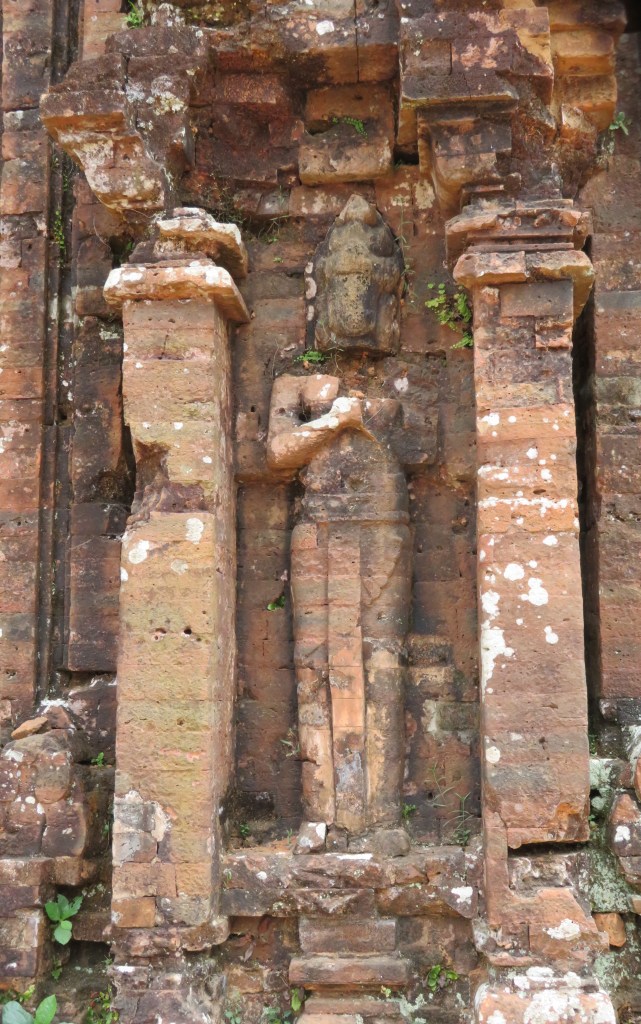
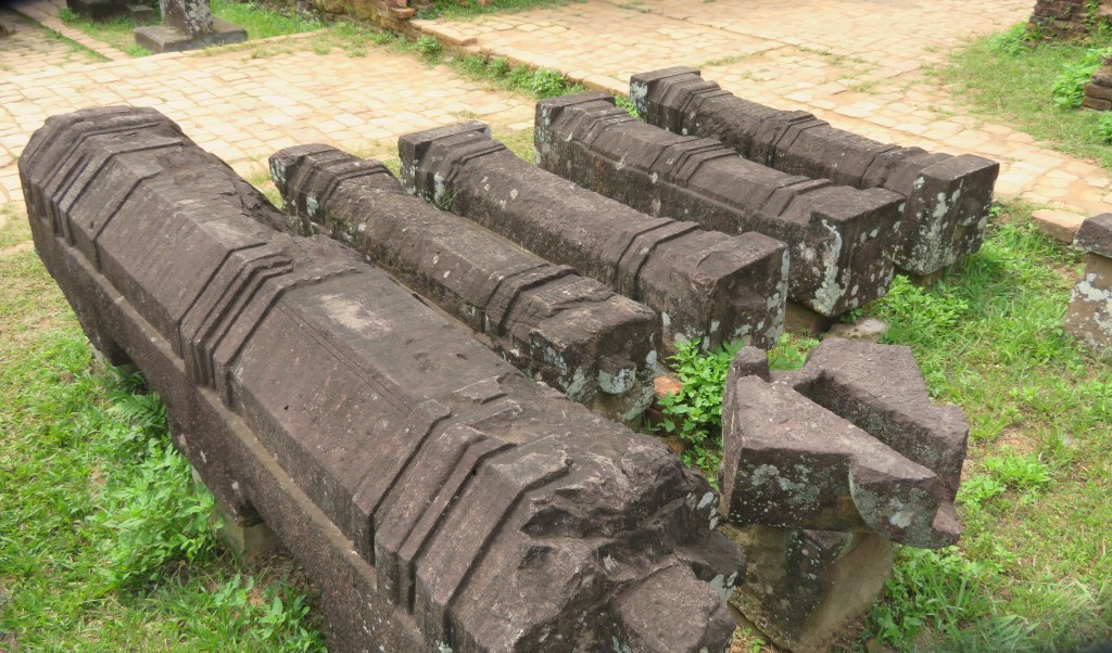
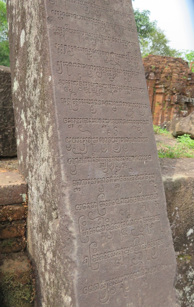
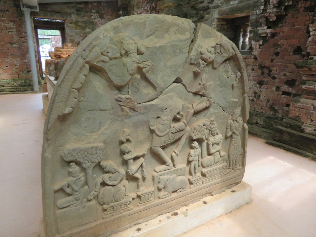
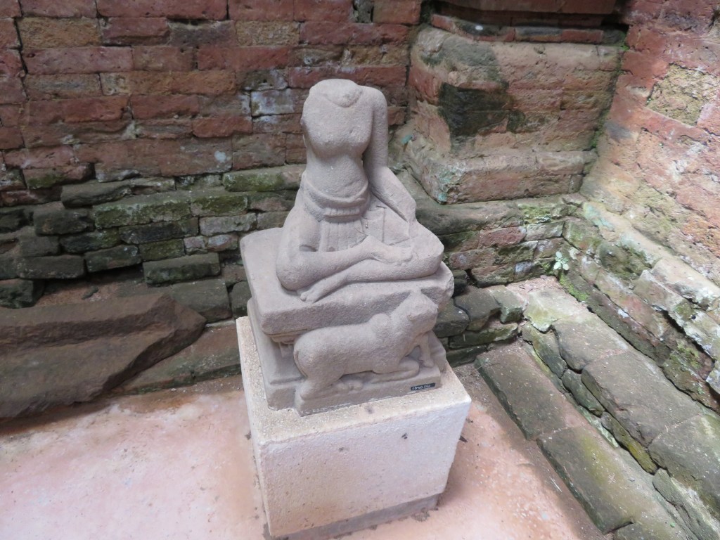
In addition to the many sculptures and statues there are numerous stele (32 known in total) dating between the 5th and 12th century. The stelae can refer to a foundation of a temple, altar or pedestal. As historical documents they are very useful as they list names of kings, cities and occasionally describe important historical events such as the wars between Champa and Cambodia in the 12th century. The statues and carvings are usually representations of Shiva, also there are guardian statues found outside the temples.
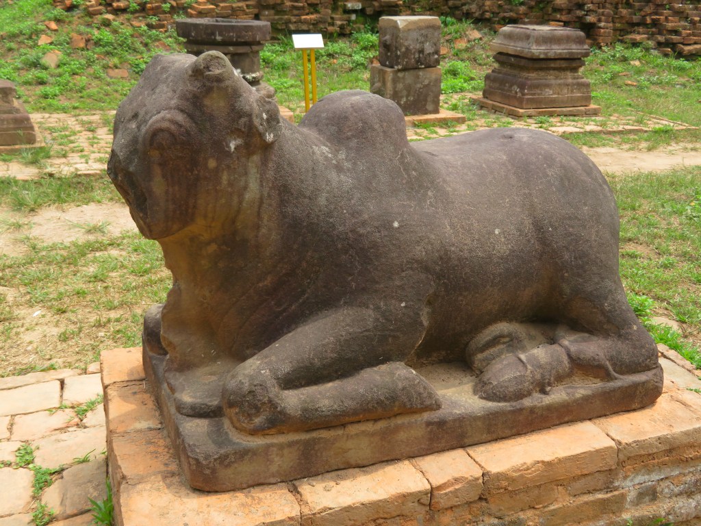
The sacred cow/bull.
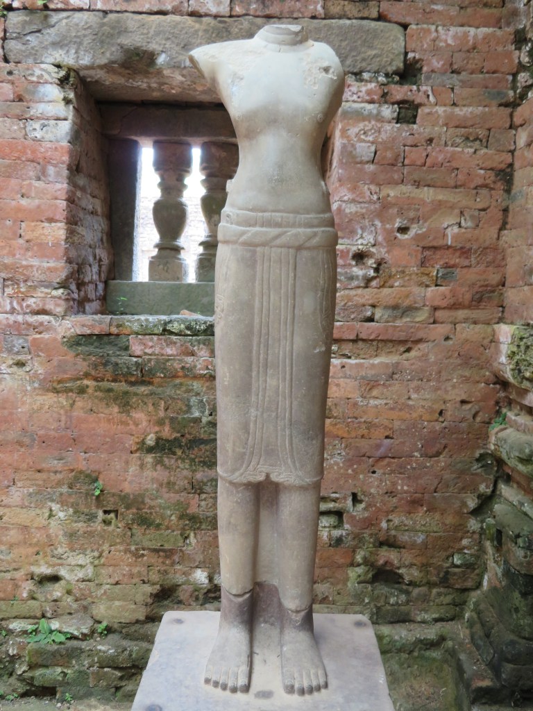
One of several guardian statues
The monuments of the My Son sanctuary are the most important constructions of the My Son civilization. The tower temples have a variety of architectural designs symbolizing the greatness and purity of Mount Meru, the mythical sacred mountain home of Hindu gods at the center of the universe, now symbolically reproduced on Earth in the mountainous homeland of the Cham people. They are constructed in fired brick with stone pillars and decorated with sandstone bas-reliefs depicting scenes from Hindu mythology. Their technological sophistication is evidence of Cham engineering skills while the elaborate iconography and symbolism of the tower-temples give insight into the content and evolution of Cham religious and political thought.
Going to Saveock is a bit like travelling back in time, seeing a peep of a thatched roundhouse roof only adds to the impression that you are somewhere else. Originally you would have had to wait on the other side of the train tracks, call the main station to see if any trains were coming and if they gave the all clear, open both sides of the gate then speed across – they had been known on the rare occasion to get it wrong. Today though there is a much safer way of getting into Saveock, a suitably narrow hedge lined drive leads down to the small holding and even though it is only a fifteen minute drive from Cornwall’s main city of Truro, it feels remote and tranquil – timeless.
So,where is Saveock? Well, it is a small holding situated in a tranquil river valley near Truro in Cornwall. On arrival at Saveock you are met with the ever smiling Jacqui Wood who is not only a well known and respected experimental archaeologist (did I mention the roundhouse?) and author of several books including Cliff Dreamer: The Goddess Returns, a new fictional story set in the turbulent times of our very distant ancestors. She also runs the Saveock Water Archaeology Centre where students of archaeology (age and experience no barrier) are instructed in the art of excavation, here they find their minds being opened to the endless possibilities that the study of the past can present to those willing to listen.
A reconstruction drawing of how a courtyard house such as those found at Chysauster might have been roofed.
I met Jacqui some fifteen years ago when during a chance conversation she told me about some curious stake holes, a green clay floor and associated flint tools which she happened upon whilst digging a flue to conduct an experiment in tin extraction. At the time I was teaching A level Archaeology and we thought it would be a good chance for the students to learn some excavation techniques in the field, after all in archaeology practical experience is far more useful way to learn. It was the beginning of many seasons of excavation, intriguing finds, the remodelling of cow shed to comfy quarters for the diggers and much more. My eldest spent the first few months of his life sleeping safely at the edge of a trench.
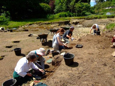
Volunteers and students at the trench face.
The site at Saveock covers a wide range of time as you would expect of a small river valley in the heart of Cornwall with fertile soils, natural springs and near a well known source of tin and possibly gold. The earliest phase belongs to the Mesolithic, the evidence for which comes firmly from those aforementioned stake holes, green clay floor and the associated flints.
“In the Mesolithic the main site trench was over a south facing peat bank on the bend of a river that was between two shallow lakes. This entire site has been purposely covered with various different coloured clays in an attempt to make the river bank a suitable place for dwellings. In the area A/2 the first phase of the site, is what we believe to be a Mesolithic dwelling platform covered with dense green clay surrounded by stony yellow clay in which the stakes to support the dwelling were driven.” (Jacqui Wood).
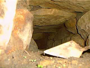
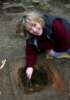
The second phase was and still is a bit confusing but it does seem entirely possible that it belongs in the Neolithic. When excavating it had been our intention to extend the trench to get a better picture of the Mesolithic features, so imagine our surprise when we came across a stone lined and capped drain covered in thick green clay that lead in one direction towards the river and in the other to another feature, rectangular in shape and lined with white quartz stones and spring fed. Several seasons later in 2005 Jacqui and her team uncovered another similar feature adjacent to the first original ‘pool’.
Dating the pool feature was problematic as it seemed to have been used over a long period of time.
Inside the stone capped drain looking roughly north.
The only other similar feature we have found was the platform around the Neolithic monument of Maeshowe in Orkney. This platform was made up of thick clay and when a trench was put through it a stone lined and capped drain was discovered which was almost identical to the one at Saveock. The presence of the quartz stone too would suggest a very early date, the use of quartz in Neolithic and Bronze Age ritual sites is well attested to. The pool itself became known as the ‘moon pool’ as the white quartz glows in the bright moonlight.
As for its function, well ritual seems a good an answer as any other but only because there appears to be no other alternative and believe me we considered a wide range of alternatives. Jacqui herself was always of the opinion that the word ‘ritual’ was used far too loosely in archaeological circles to explain seemingly unexplainable objects or sites. Later post excavation work on the mud we scooped up from the bottom of the pool (it couldn’t be excavated in the traditional manner as it kept filling with water) revealed some small finds which told a story of long usage and deposition. These included human hair, fingernails, Medieval straight pins, 128 small pieces of textile, parts of shoes, heather branches and perhaps most interesting was the broken half of iron pot or cauldron.
Many of these finds seemed to date to the last phase of usage at a time just before the pool was filled in and covered, a deliberate act to erase a pagan site. The lack of any finds earlier than the late Medieval may suggest that intervals the pool was clean out – thousands of years of deposition, not to mention silt, would have filled the pool considerably if it was not cleaned out regularly. Interestingly, in the layer just above the infill layer a broken glass bottle and a few sherds of pottery dated the closure of the pool to around the time of the English Civil War. Cornwall was at the time and even today a place where the rituals of time past were an important part of local society often overlooked by the Church. Cromwell’s puritan army would not have been so kind to Royalist (and pagan) Cornwall.
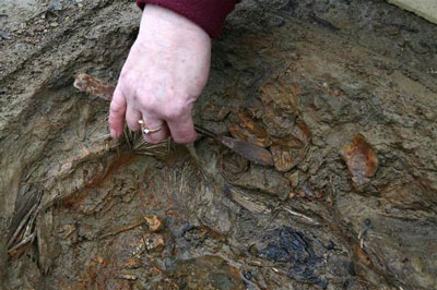
Perhaps one of the most intriguing episodes in the sites history comes from once more as a result of an extension of the trench with the Mesolithic features this time along the edge towards the marsh by the river. Whilst following the expected green clay floor and associated stake holes we encountered shallow pits with unusual contents cut into the clay floor. Because this area is essentially a waterlogged part of the site organic remains survived particularly well.
The clay floor with pits.
“When we excavated the first one we were surprised to find white feathers in it and thought it might have been perhaps a bird plucking pit, which was a common farming practice at the turn of the century. This turned out not to be the case when we found that the feathers were not plucked, but had been laid skin side out with white feathers inside. We took samples of the feathers to the bird expert at the local zoo and found them to be swan feathers.” (Jacqui Wood).
In addition a small amount of tiny stones were found surrounded by some sort of organic matter. Initially the assumption was that this was the crop of the swan but the stones were too pristine and it was concluded that the stones had been wrapped in leaves and deposited on purpose alongside claws from a range of other birds. The stones themselves were of an interest as they appeared to be brought to the site as they contained tiny nodules of beach flint an unusual feature given how far inland Saveock is. A suggestion from a local had us mounting an expedition to Swan Pool, some fifteen miles away on the coast and sure enough the stones at Swan Pool were identical to our small sample. Radiocarbon dates from the swan skin dated the pit to the 1640s, once again it seems dangerous ritual activities are occurring at a time when to be called a witch would mean certain death.
A pit being excavated.
A further eight pits were excavated that season, only two of them were intact the other six had had their contents removed in antiquity leaving just a few feathers and stones to show what their previous fill was. Excavation of this area was tough going, a thick layer of reeds impeded the work and as time went on more pits would be found, all with their contents removed that was until 2005 (two years after the first pit had been discovered).
Three pits were found in a row, two rectangular and one round in the middle. Of the three it was decided to excavate the middle round one, here the dig crew found the pit to be lined once again with swan feathers but also on either side the bodies of two magpies. In the midst of this were the remains of over fifty-five eggs and although the shells had rotted away the membranes were remaining. The eggs themselves appear to have come from a variety of birds, some even had full formed chicks ready to hatch inside them still.
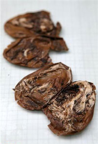
The egg membranes with chicks…
Further pits revealed the remains of a cat and dog skull. Perhaps the most astounding part of this whole story is the radiocarbon dates for the cat pit which was dated to around the mid 18th century and the dog pit which had a date of circa 1950s.
But as archaeologists we need to ask why? What was the purpose of the pits? There is the suggestion that these are the result of witchcraft based rituals and conversations with many experts in the field of witchcraft have yielded very little to enlighten us. If these pits are connected in some way to witchcraft or even pagan rituals of a different kind it is not one commonly known. This is not too surprising given that so much knowledge about traditions and rituals has faded away. Jacqui though has her own theory as to who and why; “My own theory (and it is only a theory) is that maybe if you got married and did not get pregnant in the first year, you might make an offering to St. Bride of a feather pit. If you finally got pregnant you had to go back to the pit and take out the contents and burn them and set the spirit of the swan free. If you never got pregnant then the pit remained untouched.”
Saint Bride or Brigit has many similarities to the Celtic deity of Brigid. The first of February is St Brigids feast day but also Imbolc where the goddess Brigid is remembered as one who brings the spring. Both are associated with healing, poetry and other domestic tasks. There is also a connection with the sacred wells. Today well dressing is done in the name of the Saint. Wells have long been a place of veneration, our modern wishing wells merely a continuation of a ritual act of deposition that begun in the Bronze Age if not earlier. The connection with the goddess and the saint at Saveock is slight but as we all know it is a place to start.
On a personal note I should like to mention that when the quartz lined pool was excavated it was myself and a friend who did the digging (we were the only ones willing to get so mucky). We spent the good part of a week in the mud and spring water. In late November of that same year I discovered I was pregnant with my eldest (who incidentally was born at midsummer) and a few days later my friend who had been digging too told me she too was pregnant – our children were born just a week apart.
More recent excavations have been looking in a completely different area of the farm and this time they have uncovered a hearth edged with smoky quartz crystals. Dating was provided by the large quantities of Bronze Age pottery found in association with the hearth. Work at Saveock is never dull but it is ongoing, so if you fancy have a holiday with a difference then check out the link below.
Jacqui excavating one of the pits.
For more information on the Saveock Water Archaeology Centre please go to the website www.archaeologyonline.org
Jacqui Wood’s book Cliff Dreamers is available to buy on Amazon along with her book on food through the ages Tasting the Past. Jacqui also has numerous articles published many of which can be found at www.academia.edu
Please Note – all photos except the featured image at the top of the article were provided by Jacqui Wood and the copyright belongs to her. The featured image at the top of the article is my own.
This article originally appeared in the Celtic Guide magazine December 2016.
If archaeology is your thing (and it’s certainly mine) then Cornwall is a great county to visit with a mulititude of sites to visit, especially if you want to get away from the crowds and sitting on the beach has lost its appeal. From the outset I should point out the following are my favourite sites/landscapes to visit (it was quite difficult to keep it to just ten and yes they are mostly prehistoric sites), others may have different views – the list is purely my own opinion. Feel free to comment on your favourites.
1. Chun Castle and Quoit
Okay so I have cheated a bit – here we have two very different sites but their proximity to each other I think allows for a bit of cheating…
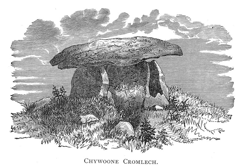
Firstly, Chun Quoit – quoits are neolithic monuments found throughout Cornwall (there are about a dozen known sites) consisting of upright granite slabs topped by a large capstone. They can also be called portal dolmens, chamber tombs or cromlechs. Some are in a better state of repair than others and Chun Quoit is perhaps one of the few which has been interferred with the least. Chun Quoit consists of four large uprights supporting a capstone which is estimated to weigh over 8 tonnes. It is also possible to see the remains of a circular stone cairn and associated kerbstones (the stone rubble at ground level) which would have originally surrounded the Quoit but not covering it leaving a the facade and the capstone visible.
Two hundred metres to the east of the quoit are the impressive remains of Chun Castle. Unlike many other Iron Age hillforts which utilise an earthen ditch and bank system Chun Castle is entirely stone built. It consists of two large concentric stone walls and is 85 metres in diameter. There is some evidence that the hillfort was built over an earlier enclosure represented by a shallow ditch and low bank on the southwest side. Inside the hillfort there is a stone lined well and escavations during the late 1920s found evidence for a later post Roman occupation of the hill fort. Iron Age occupation consisted of at least a dozen round houses which based on the pottery found date the site to the 3rd and 2nd centuries BC. Sitting high on the ridgeway known as the Tinners Way the site would have been visible from many miles around, from here it is possible to make out several other hillforts in the distance such as Caer Bran. Below the hillfort about 500metres to the north east is the site of Bosullow Trehyllys – a courtyard house settlement of the late Iron Age (see the earlier post on Chysauster and Carn Euny), it is unexcavated but appears to consist of at least three detached courtyard houses and a number of round houses.
2. Chysauster
I wanted to include a courtyard house settlement in the list and it was a choice between Carn Euny and Chysauster. In the end Chysauster won mainly because it is easier to get to but also because the visitor can get a good idea of size of this unique house type. However, I would recommend a visit to Carn Euny too – the fogou makes it well worth while. I have discussed both sites already in a previous post – Chysauster and Carn Euny – A Unique Settlement Type – so won’t say much more than that.
3. Treryn Dinas
Treryn Dinas falls into the category of Iron Age cliff castle or promontory fort – one of many coastal headlands with Iron Age defences in the form of earthen or stone ramparts and external ditches usually across the neck of the headland. The term ‘cliff castle’ does not denote a particular function, some were large enough to have settlements within their walls, such as The Rumps and Trevelgue Head, others were much smaller and perhaps served as trading posts or lookouts. Treryn Dinas, however, appears to more than that – the visitor only need to look at the position and surroundings of this site to realise it is special.
Overlooking the beach at Porthcurno, the ramparts enclose a large rocky headland which contains the Logan Rock – a substantial boulder perched on the outcrop which in times past would rock in the wind and was only dislodged in 1824 by cocky young lieutenant and the crew of the HMS Nimble. The local people were rightfully upset at this and the lieutenant was charged to replace the rock at his own expense and with the help of the admiralty it was eventually returned to its original position, although it is said to no longer rock as easily as it had done once before.
According to folklore the earliest inhabitants of the headland were the giants who protected the neighbouring communities in return for cattle and other necessaries. Giants are a common feature in Cornish folkore and seem to be particularly associated with large outcrops of granite which feature in the landscape. From an archaeological point of view Treryn Dinas has four lines of defence with the last crossing the low neck of the headland. It consists of a deep ditch and a stone faced wall behind which are the foundations of two buildings either side of the presumed entrance. The general view is that this site is one of spiritual significance which may date many centuries earlier than the Iron Age. Finds of Bronze Age pottery have been found wedged in the crevices of the outcrop, the Logan Rock itself may have been seen as supernatural and there is the problem of that fourth line of defence. You will note in the photograph below that this line of defence is not particulary defensible as it easily looked down from the landward side, in addition the amount of useful land on the headland is extremely limited and the only thing the fourth rampart is ‘protecting’ are the rocks themselves.
Looking to the headland – below the rock outcrop is the remains of the internal wall protecting the headland.
The substansial outer bank on the landward side.
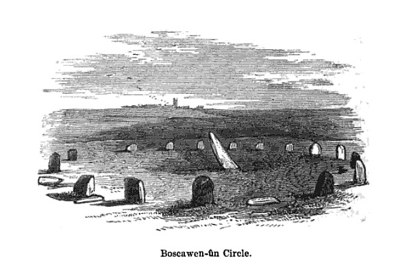
4. Boscawen-Un
In the parish of St Buryan is the stone circle of Boscawen-Un, dating to the early Bronze Age and consisting of nineteen stones there are several interesting features of the site. The most obvious is the stone which is slightly south of center, it leans sharply towards the north east and at its base there are two very faint relief carvings of axe heads. A past student once suggested to me that the stone itself looked like a large stone axehead which had been struck into the ground. Minor excavations have further revealed that its leaning position was intentional and not the result of subsidence. The second interesting feature of this stone circle is the large block of quartz to the south west which is part of the circle. Our understanding of the role of quartz within prehistoric rituals is poorly understood but there is an increasing amount of evidence which points to its importance.
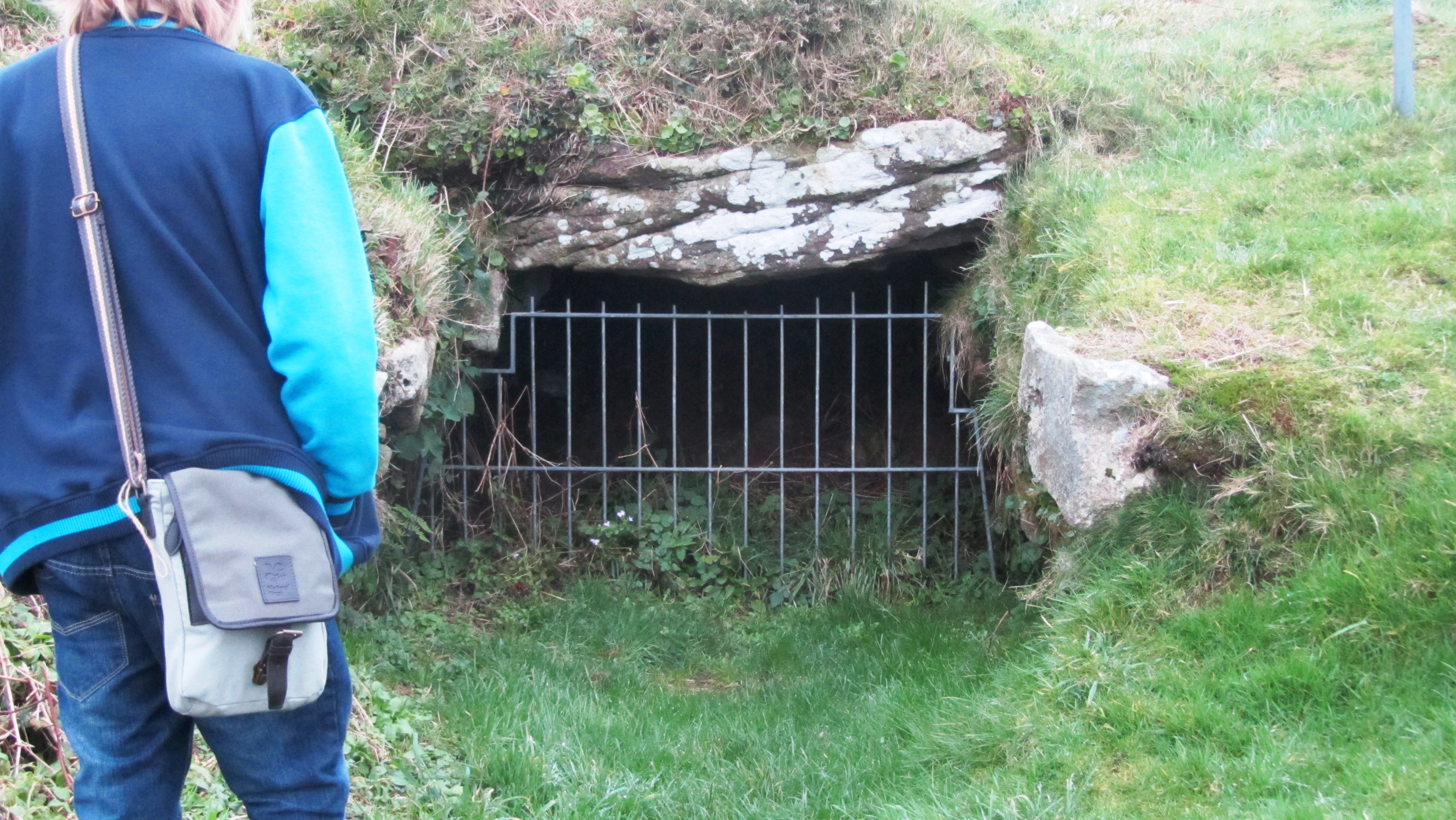
Okay, so now I really am cheating but the fact is any visit to Cornwall should definitly include a fogou and I couldn’t decide which I preferred – Carn Euny or Halligye are the easiest to get to and Halligye the largest (it can be found on the Trelowarren Estate, near Helston) however, Carn Euny does have a courtyard settlement, the nearby hillfort of Caer Bran and the fogou itself has a beehive shaped internal chamber. So you can see my dilemma…I have already written about fogous in an earlier blog so shall not rehash what we know and don’t know about these enigmatic structures.
The entrance to the fogou at Chysauster.
6. Carn Brea
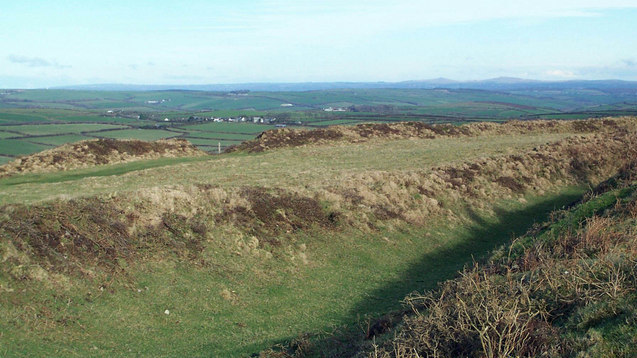
Situated between Redruth and Camborne is long hill easily visible from the A30, it is a hill with a long history beginning as far back as the Neolithic. Today two features stand out the most, firstly the the tall monument on the central summit erected in 1836 in the memory of Francis Bassett of Tehidy and the second is the small medieval castle perched on an outcrop. The latter was most likely a hunting lodge belonging to the Bassetts, an ancient local family and was first recorded in the fifteenth century. The land surrounding the hill was prime tin mining country and the flanks of the hill are covered in shafts and pits.
Heading further back in time the astute visitor might notice the remains of eleven Iron Age roundhouses on the saddle between the east and central summits, these are part of a much larger settlement on the hilltop, set within a substantial hillfort of forty-six acres. The defences are made up of two ramparts enclosing the hill. However, the occupation of Carn Brea began much earlier in the Neolithic. Surounding the eastern and central summits are another two smaller enclosures, of these the eastern summit has been partially excavated. The date range showed that the ramparts had been built somewhere between 4000 and 3500BC, making it the oldest known fortified settlement in Britain. There were traces of wooden buildings and Neolithic pottery, in addition a large number of flint arrowheads (700+) were uncovered along with evidence for the destruction of the site suggesting the site had been under attack (Cornish Archaeology, 1981, 20).
Looking east the 15th century castle can be seen in the distance. In the foreground the remains of one of the Iron Age roundhouses is visible as a semi circle of stones.
The path through the inner Neolithic enclosure wall.
Winter is the best time to visit – the outer ramparts are clearly visible.
7. Trevelgue Head
So many visitors to Cornwall will invariably end up in Newquay without realising the long and fascinating history of this seaside town. Just north of St Columb Porth on the road to Watergate Bay is the impressive cliff castle of Trevegue Head. It is the most heavily defended of all the cliff castles with seven lines of defence. The first ditch and bank is not so obvious as the next six with largest bank being roughly four metres high. Erosion over the centuries has seen much of the land disappear and it is suggested this included the original entrance. Excavation in th 1930s demonstrated that Trevelgue was continously occupied from the thrid century BC until the fifth/sixth century AD. At least fourteen roundhouses were identified (it is still possible to see the house platforms with a keen eye). Given its position in the landscape, the sheer scale of the defences, some of the artefacts found (bronze horse harness and Roman coins) in addition to the significant amount of evidence for both bronze and iron smelting, it is fair to say Trevelgue Head was most likely a high status site, the home ground of someone of great import.
The importance of this headland and other similar to it along the coast is further attested to by the presence of the two bowl barrows dating to the Bronze Age – these were opened in late 1800s but nothing is known of their contents. Further along the coast is Trevelgue Downs where a further two barrows can be seen. In the eastern barrow a crouched adult skeleton was found within a stone cist with a stone battlexe close to hand. From personal experience I have walked this cliff castle many times and it was not uncommon to espy tiny Mesolithic flints protruding from the exposed edges of the paths. Further testament to the sites long history.
Looking towards the end of the headland. On the right is the first of two Bronze Age barrows.
Eroded banks and ditches of Trevelgue Head.
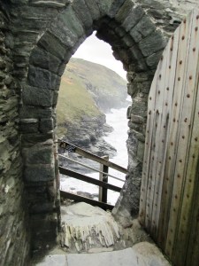
8. Tintagel
It had to be on the list – perhaps one of the most controversial of all sites in Cornwall from local resistance to English Heritage’s plans for the site to the myriad of myths and legends associated with Tintagel – no where captures the imagination more. Like several other sites on this list I have already waxed lyrical about Tintagel so will not bore the reader with much of the same (but do follow the link if you want to seperate fact from fiction).
9. Castle an Dinas
An impressive example of an Iron Age hill fort found in mid Cornwall near St Columb Major. Measuring 260m across it would have been a formidable place in its heyday, the substantial ramparts are visible for many kilometres even today. There is some faint evidence for a much earlier enclosure on this hilltop possibly dating from the Neolithic or Bronze Age and the presence of two Bronze Age barrows within the hillfort is further testament to the importance of this place throughout prehistory. In the early 1960s a relatively small excavation was undertaken with the idea of prove the tradition of such places being re-used during the post-Roman phase and although they failed to do this a fine cobbled road was found.
The earthworks of Castle an Dinas – note the commanding view from the hillfort. Photo by Mike Hanncock (geograph.co.uk)
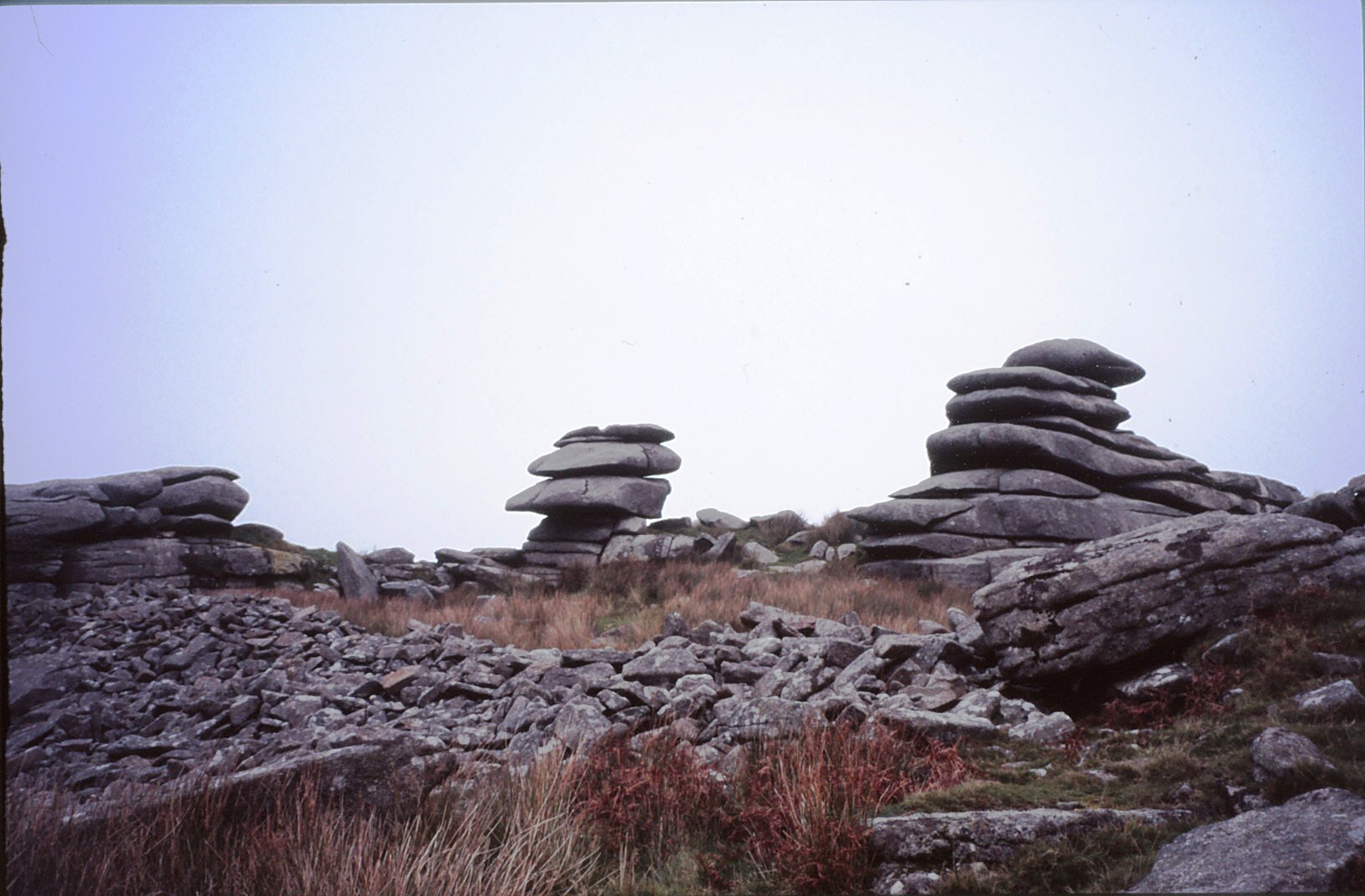
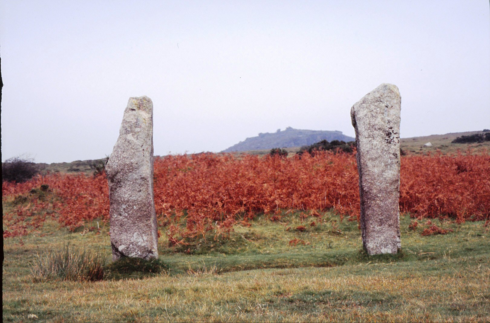
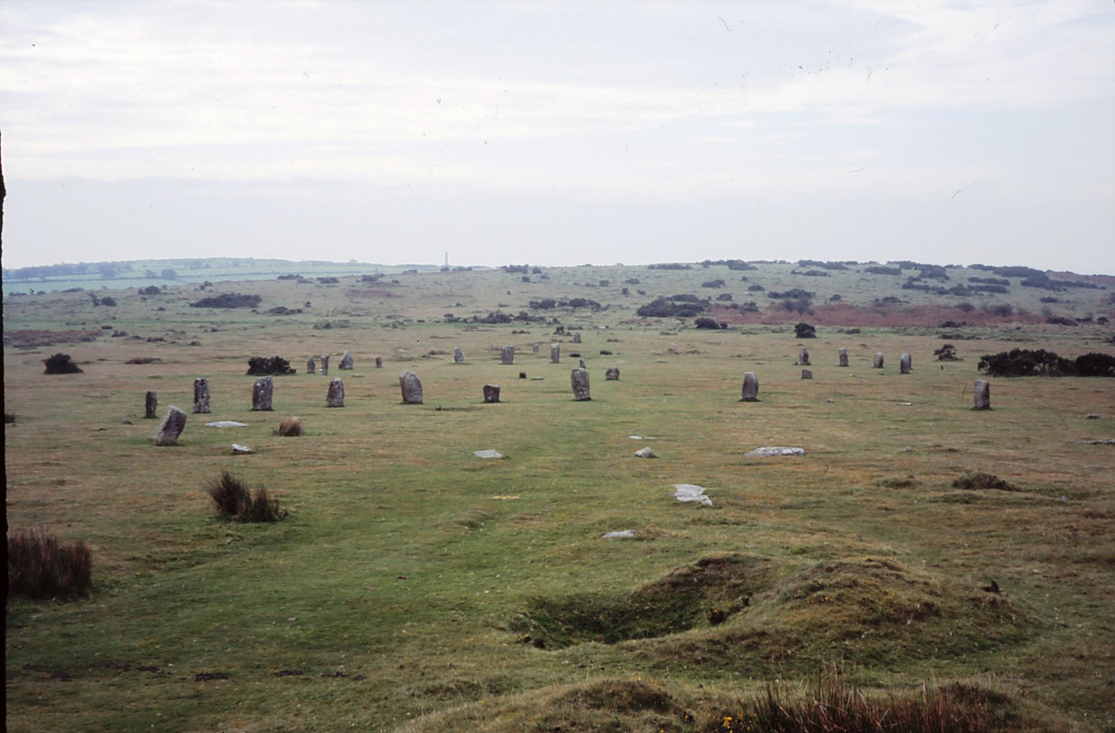
10. Bodmin Moor
Yes I know this really is cheating…but no list of sites to visit is complete with at least one from Bodmin Moor. However the problem is I could not choose just one, there are so many wonderful sites to visit on the moor. Like its much larger cousin in the next county over, Dartmoor, Bodmin Moor has a wide variety of archaeological sites to visit beginning way back into the Mesolithic (flint scatters possible representing seasonal camps as found on Butterstor) and the Neolithic such as Stowes Pound and Rough Tor which are thought to be tor enclosures similar to Carn Brea and Trencrom further to the west, but it is the Bronze Age which dominates the archaeological record.
There are stone circles, stone rows, menhirs, barrows (earthen mounds), cairns (stone mounds) and of the latter there is in excess of 300 known. The most well known barrow is the Rillaton barrow which is the largest on the moor and where an individual was buried with a bronze dagger, an urn and a beaten gold cup.
“…the distribution of the monuments throughout the whole of the upland suggests that its use had intensified enormously. Virtually every block of land (as defined for example by prominent hills and divided by rivers and streams) is marked by a group of cairns, as if all available land was claimed and accounted for. The analysis of fossil pollens fromthe ancient land surfaces sealed beneath the excavated cairns shows that by this date the upland was predominantly open grassland, with woodland confined to the steep valley sides.” (Herring P & Rose P Bodmin Moors Archaeological Heritage pp17-18)
There are sixteen known stone circles of which the best known is the Hurlers. All the circles seem to have been placed carefully within the landscape – nearly all are within sight of tor which is always to the north of the circle, with Roughtor being the most dominant (nine of the sixteen circles). The stone rows, menhirs and embanked avenues are not as numerous but still make up an important part of the ritual landscape.
A feature of the later Bronze Age landscape of the moor is represented by the vast numbers of settlements represented by field walls and the stone foundations of round houses. There are approximately 1500 prehistoric round houses representing around 200 settlements and although only three have been excavated they are assumed to be all by analogy with Dartmoor to belong in the second millenium BC. Often found associated with these settements are field systems of varying shape and size best seen from the air and on large scale maps.
Ar around 1000BC a deteriorating climate and soils resulted in most settlements being abandoned and the use of the moor being less intensive. The hillfort sites of Bury Castle, Cardinham and Berry Castle are the only easily identifiable settlements of the Iron Age, although it is assumed that the moor continued to be used for the seasonal grazing of livestock, much as parts of it are today.
Stowes Pound – the tumbled wall of stones in the foreground represents the early and possibly Neolithic enclosure wall.
Two upright menhirs frame the view to Stowes Pound and the Cheesewring.