Tag Archives: stonehenge

The First Archaeologists

People have always been interested in the past, as far back as Nabonidus who ruled Babylon from 555 – 539BC who had a keen interest in antiquities to such an extent he even excavated down into a temple to recover the foundation stone which had been laid some 2200 years prior.  Nabonidus also had a museum of sorts where he stored his collection.  During the Renaissance those with the wealth to travel and collect began to keep cabinets of curios.  In these you would find ancient artefacts displayed alongside minerals and natural history pieces. 

“…the Renaissance attitude to the examination of the past…involved travel, the study of buildings and the collection of works of art and manuscripts.” (K. Greene 1983).

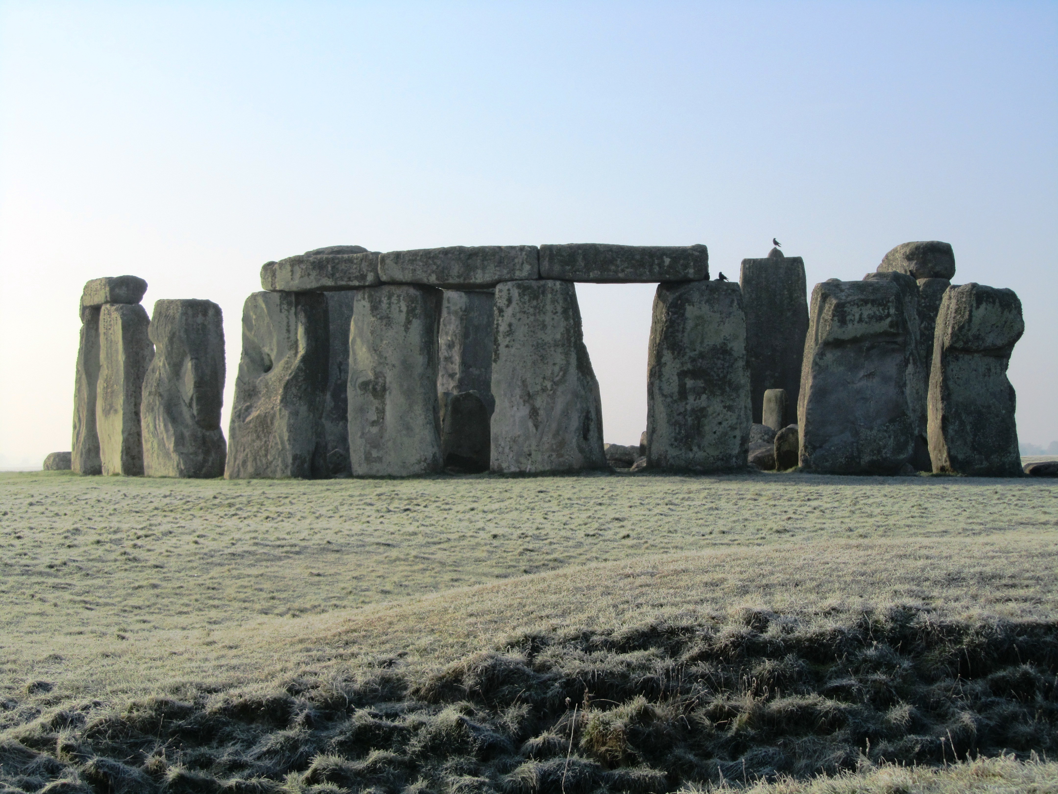
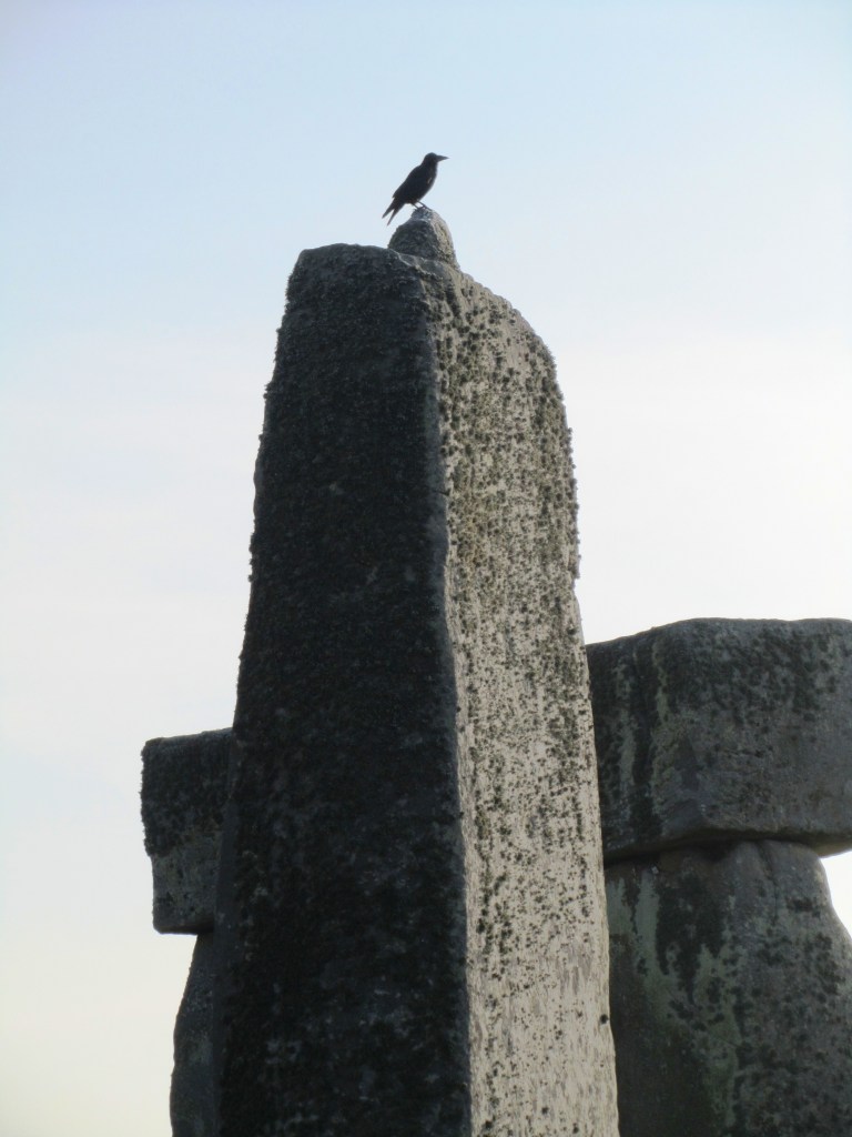
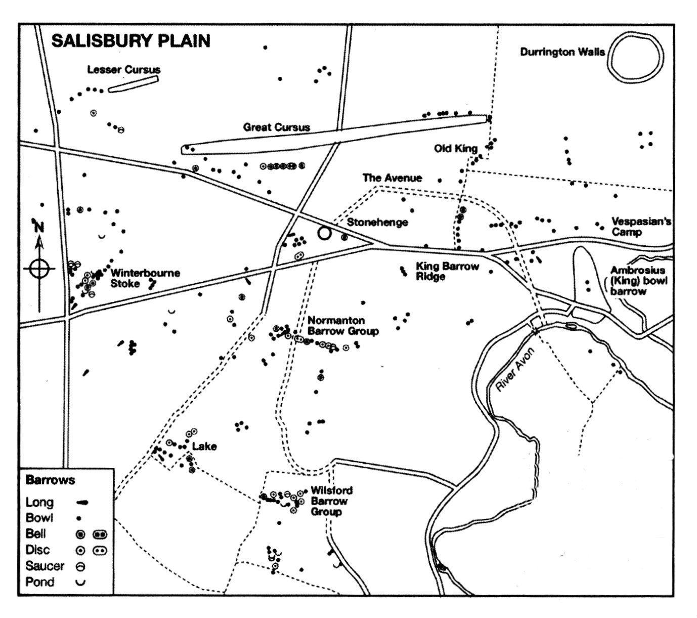
Initially it was classical antiquity which grabbed the attention of the well-to-do but after awhile eyes began to turn towards relics of their own past. The great stone monuments of North-western Europe became the immediate focus, places such as Carnac in Brittany and Stonehenge in Britain.  Some of these gentlemen scholars would make systematic and accurate surveys of the monuments, which are still useful today, even if there were the less scrupulous who dressed up treasure hunting as scholarly research.  These antiquarians were in essence the first archaeologists and their contributions can still be useful today.

In Britain several antiquarians stood out between the 16th and 18th centuries.  John Leland (1503-1552) held the post of Keeper of the Kings Library and such travelled extensively throughout Britain.  Even though his main interest was in genealogy and historical documents he also recorded non-literary evidence as part of his wider researches, one of the first to do so. 

William Camden (1551-1623) learnt not only Latin but also Welsh and Anglo-Saxon in order to study place-names.  At the age of 35 he published ‘Britannia’ a general guide to the antiquities of Britain.  His descriptions of the ancient monuments are very detailed and he was one of the first to make a note of cropmarks and their possible links to sites no longer visible – an important part of aerial photography today.  Camden was also interested in other forms of material culture such as pottery as a source of information on the past, a concept regarded eccentric at the time.

William Camden (portrait by Marcus Gheeraerts the Younger)

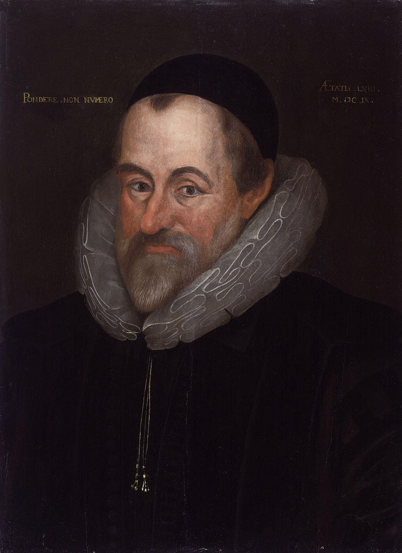
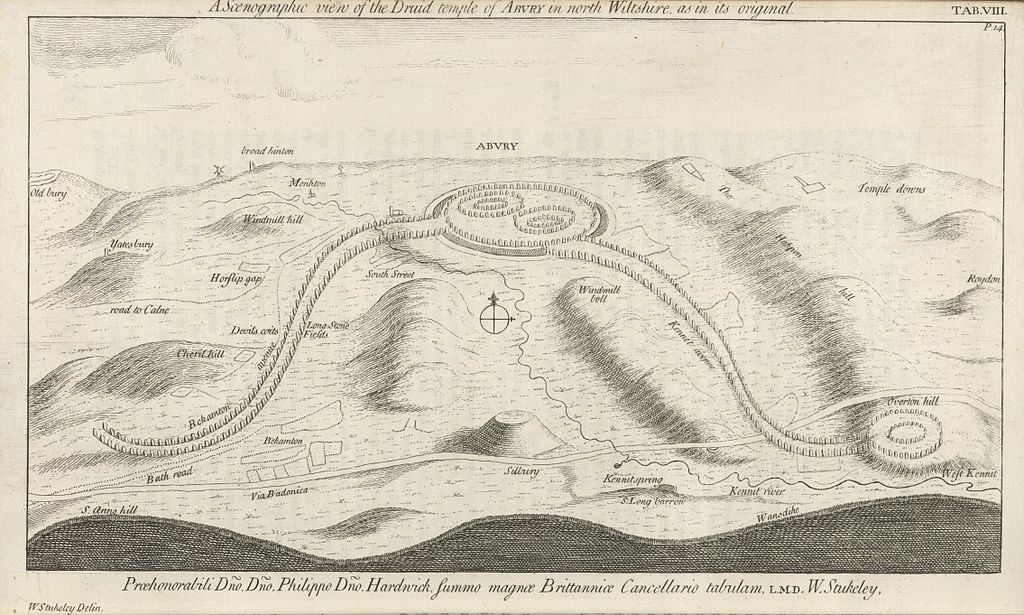
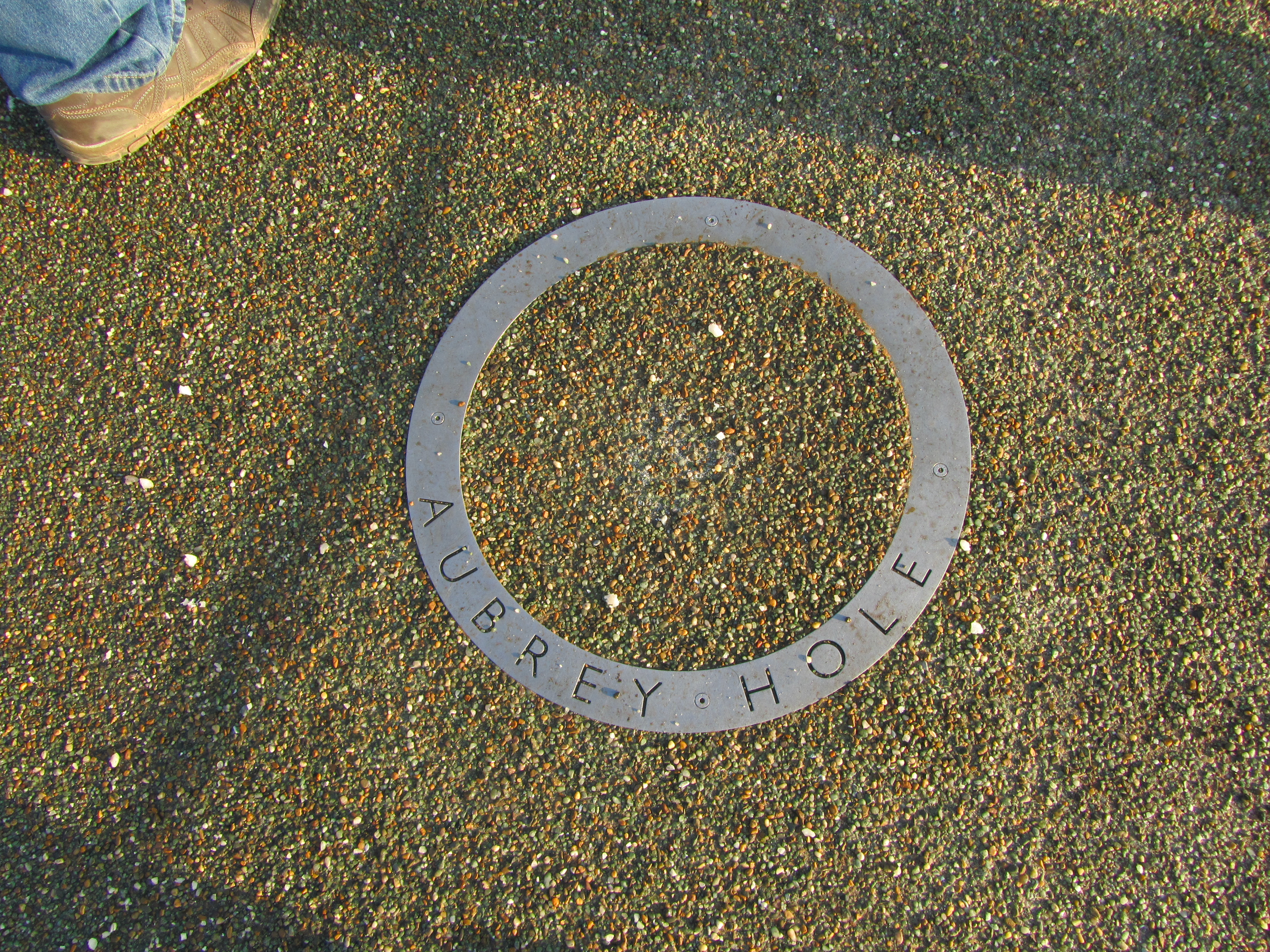
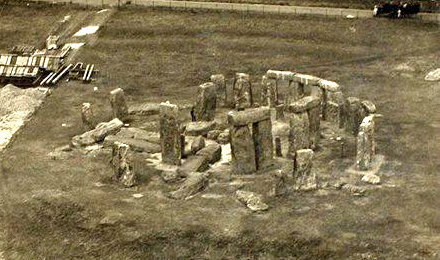
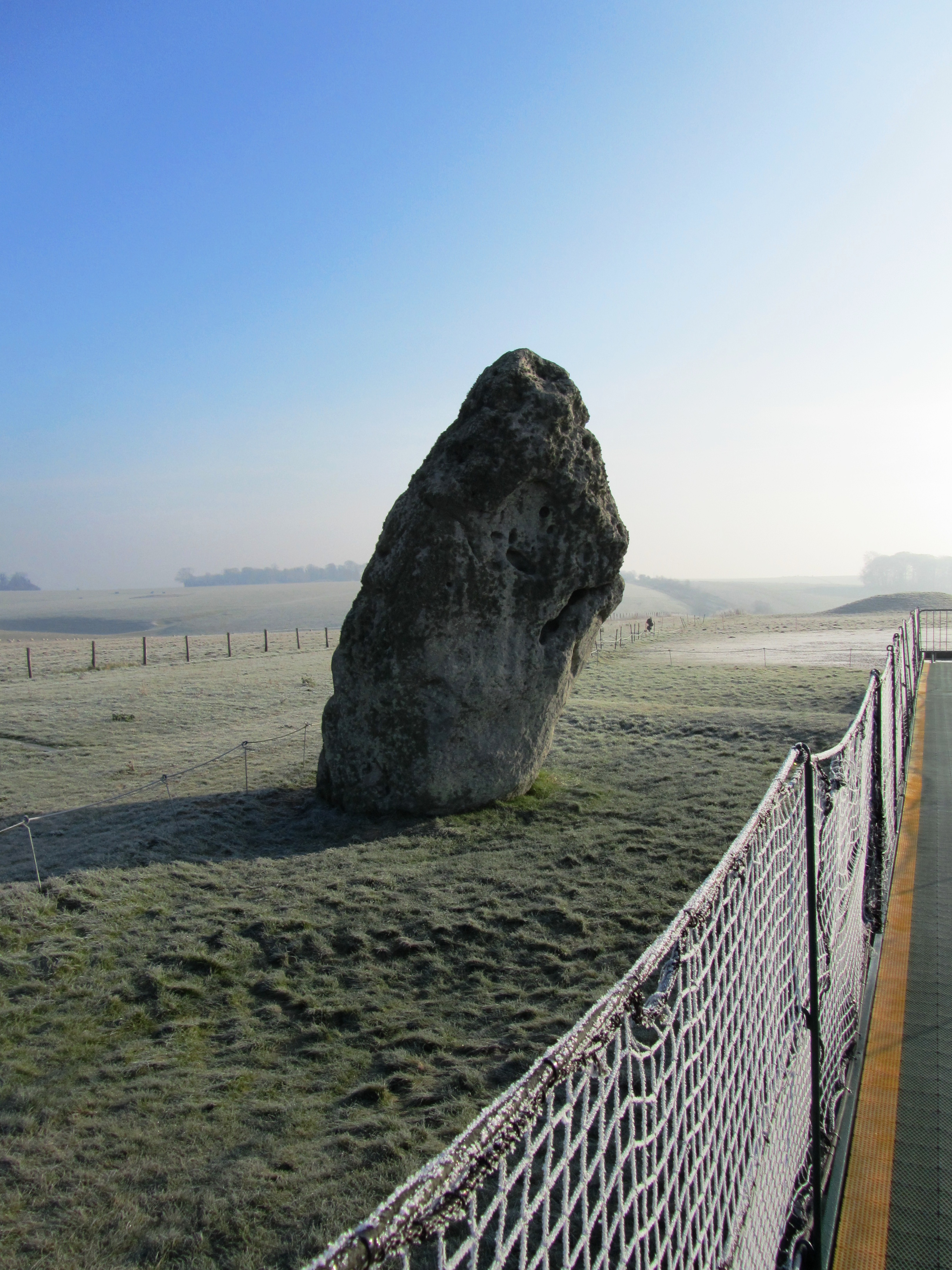
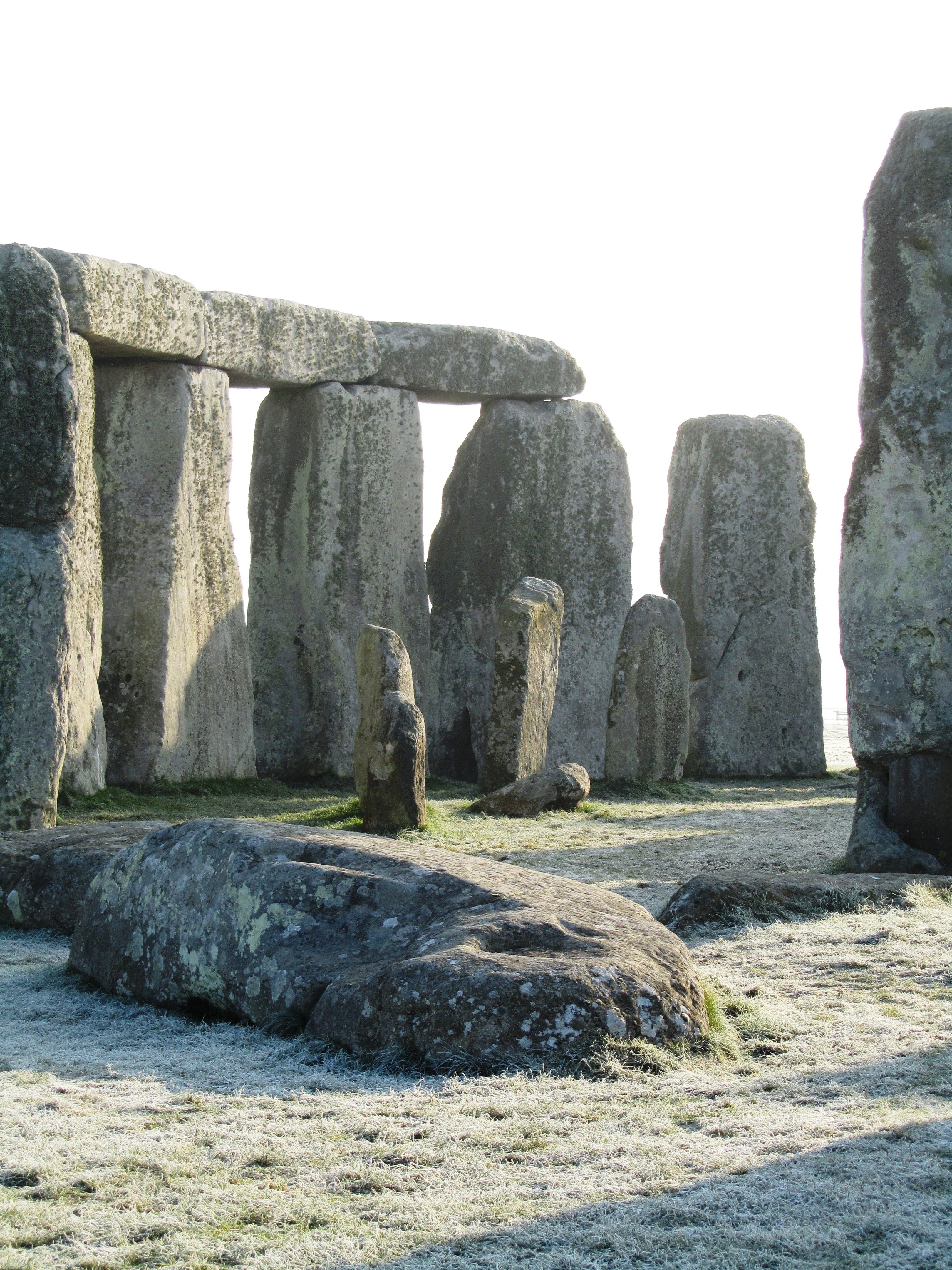
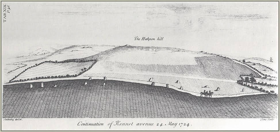
In the mid 17th century John Aubrey was one of the earliest writers to assign a pre-Roman date to sites such as Stonehenge, Avebury and Silbury Hill.  His belief that such places were built and used by the Celts and Druids was so revolutionary there are still some who won’t let it go.  Following in Aubrey’s footsteps was William Stukeley (1687-1765) who although trained as a physician spent a great deal of time conducting extensive fieldwork in Wessex during the 1720s.  His highly accurate and detailed surveys of Avebury, Stonehenge and Silbury Hill are still used today.  Stukeley’s recording of the avenue of stones (now destroyed) leading from Stonehenge to the Avon aided present day archaeologists in their search for them.  However, in 1729 he was ordained and then attempted to use his fieldwork to establish a theological connection between the Druids and Christianity.

William Stukeley’s drawing of the Kennet Avenue – sensible and accurate fieldwork…
And then there is the more fantastical of Stukeley’s drawings – his interpretation of the Avebury landscape and it’s Druidical temple…

“Just as Dr Stukeley may be said to be the patron saint of fieldwork in archaeology, so can the Rev. William be held to be the evil genius who presides over all crack-brained amateurs whose excess of enthusiasm is only balanced by their ignorance of method.” (K. Greene 1983)

At the same time, across Britain, lesser well known antiquarians were busy studying and recording their own local areas.  In the county of Cornwall this was no different.  The earliest known antiquarian was Richard Carew (1555-1620) of East Antony, he was a member of the “The Elizabethan Society of Antiquaries” and in 1602 published his county history, “Survey of Cornwall”.  Perhaps the most well known and often cited antiquarian was William Borlase (1695-1772) who like so many began collecting natural rocks and fossils found in the local copper works in Ludgvan where he was the local pastor.  In 1750 he was admitted as a Fellow of the Royal Society and by 1754 he had published “Antiquities of Cornwall” which he then followed with “Observations on the Ancient and Present State of the Islands of Scilly and their importance to the Trade of Great Britain” in 1756. 

Zennor Quoit as drawn by William Borlase (1769)
Zennor Quoit as seen today (photo from wikicommons – geography.co.uk – 902) This highlights why early antiquarian researchers should be dismissed immediately as having nothing to contribute to our understanding of the past.

Borlase’s great great grandson – William Copeland Borlase (1848-1899) – continued with the tradition of antiquarianism conducting some of the first excavations in Cornwall at Carn Euny in 1863.  Copeland Borlase published many articles and books on the antiquities of Cornwall, including a two volume book titled “Ancient Cornwall” in 1871 and a year later “Naenia Cornubiae: a decscriptive essay, illustrative of the sepulchres and funereal customs of the early inhabitants of the county of Cornwall”.  There were also a lecture on the tin trade and a monography on the Saints of Cornwall, not to mention a piece on the dolmens of Ireland and one on the mythologies of the Japanese.

William Copeland Borlase (1848-1899)

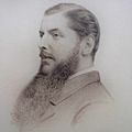
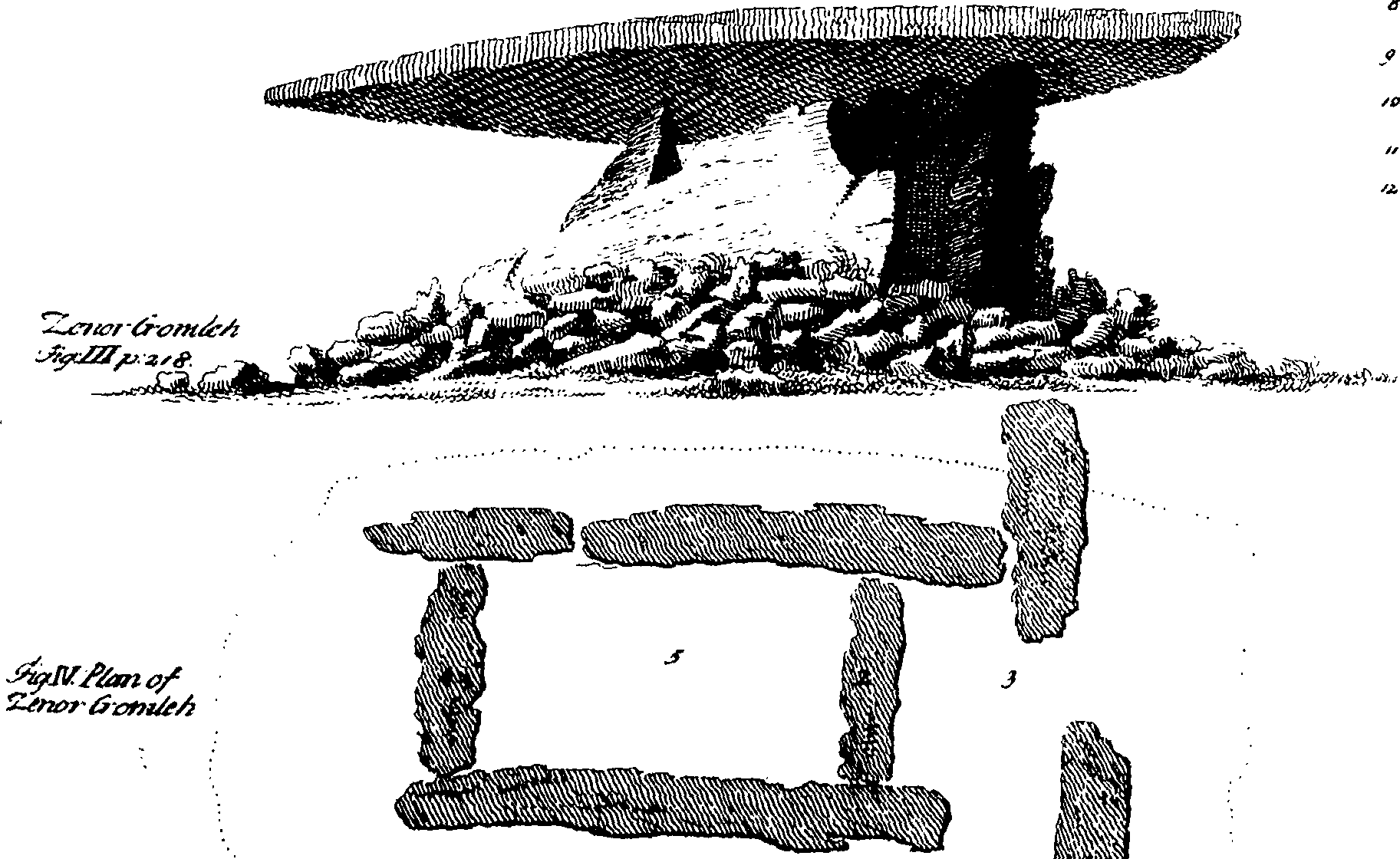
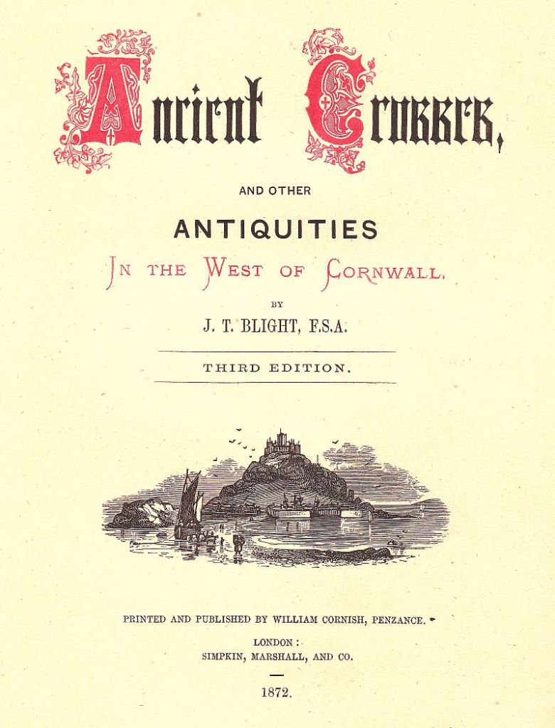
William Copeland Borlase also spent a great deal of time getting his hands dirty excavating large numbers of barrows in Cornwall.  He has been criticised for poor archaeological practice in only writing up a small percentage of those he excavated.  Nothing makes an archaeologist bury their face in their hands then the lack of a written record for an excavation.  Copeland Borlase often employed the services of John Thomas Blight (1835-1911) as an archaeological illustrator, although Blight was a well known antiquarian in his own right.  He published two books regarding the crosses and antiquities of Cornwall, one for the west and the other for the east of the county. 

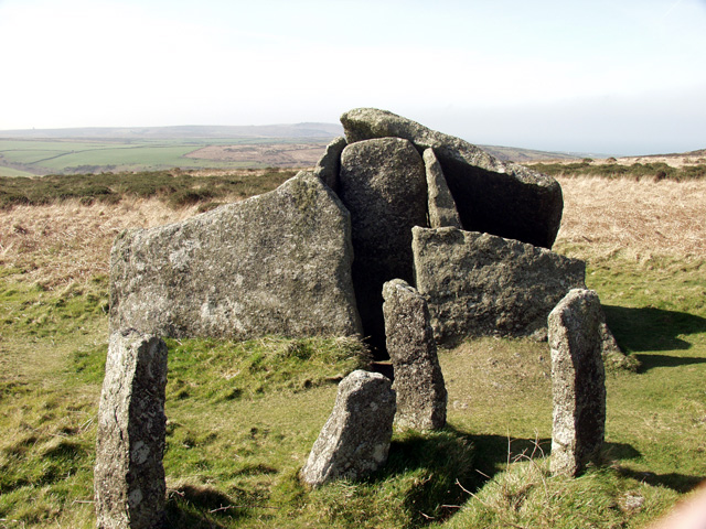
Blight’s drawings of Carwynnen Quoit were recently rediscovered by the lead archaeologist, Jacky Nowakowski, during her researches prior to the excavation and restoration of the quoit.  In particular, the pencil drawing which had actual measurements was very useful in the interpretation of a stone pavement discovered during the excavation when combined with modern techniques.  The archaeologists were able to get a better understanding of the positioning of the quoit within the Neolithic landscape.

Throughout the country there have been numerous societies which promoted the work of antiquarians beginning with the prestigious Royal Society.  Even Cornwall had its own Royal Institute of Cornwall which is still operating today and currently manages the Royal Cornwall Museum as well as the Courtney Library which holds all manner of documents dating back into the 1700s.  These early scholarly societies however, did not focus on one aspect of research, natural history, geology, botany and other gentlemanly pursuits were all encouraged.  This attitude of open discourse across a variety of disciplines is one of the hallmarks of good archaeological research today. 

Archaeology is defined as the “study of the past through the systematic recovery and analysis of material culture” (The Penguin Archaeology Guide).  It is the recovery, description and analyse of material culture with the purpose of understanding the behaviour of past societies.  Material culture is defined as anything which has been altered or used by humans – it can be as small as shark tooth with a hole drilled into it for a pendant or as large as a European cathedral.  To study archaeology in general is to be a ‘jack of all trades and master of none’ – as a subject it borrows from history, anthropology, geology, chemistry, physics, biology, environmental sciences, ethnography to name but a few.  Archaeologists have never been afraid of pilfering theories, methodologies and techniques from other disciplines.

The value of the early antiquarians does not necessarily lie in the outdated interpretations but in the production of often accurate and highly descriptive illustrations, field surveys and texts that are the basis of many manuscripts.  Some of these ancient sites are now lost and/or destroyed, and the antiquarian illustrations are all we have as a record.  Fieldwork will always be a fundamental part of archaeological work and the antiquarians of the past where the very first fieldworkers and the societies they belonged to provided the basis for the discipline of archaeology.

Green K. (1985) Archaeology – an Introduction. Routledge.

http://www.giantsquoit.org   A website detailing the excavations and restoration of Carwynnen Quoit.

Stonehenge – more than a ring of stones.

Stonehenge – a name that evokes a great many emotions in a great many people.  For some it is a place of pilgrimage, a place to connect with the ancestors and for others it is seen as a tourist trap or something to tick off the bucket list.  For centuries it has captured our imagination; never has a heritage site been so controversial – something which continues to this day.  In this post it is not my intention to give a full on thesis about Stonehenge, there are plenty of books/websites who do this already.  Instead it is simply an overview of what is currently understood about the site, its surrounding landscape and my own personal thoughts.

Stonehenge is situated on the Salisbury Plains, to the south is the busy A303, a main road between the south-west and London, and for many years the equally busy A344 ran alongside the site.  This latter road was removed sometime ago to improve the visitors experience.  Today there are ongoing discussions regarding the upgrading of the A303 and a proposed tunnel.  It is a highly emotive subject, on one hand I understand the need to improve the road situation (ask anyone who is stuck in a traffic jam on the A303) but as an archaeologist I am also aware of the sensitive nature of the surrounding heritage landscape (and yes I am on the fence).  Mike Pitts in his recent post discusses the pros and cons for those of you who are interested.

img_7543

For the visitor today the focus is on the large stone circle with its trilithons, they marvel at how it could have been built by ‘primitive man’ often leading to suggestions of alien intervention and lost technologies.  But such thoughts only serve to belittle our ancestors and our past.  Others may ask why did our ancestors build Stonehenge?  Often the answers are unimaginative and simple – sun-worship; display of power; ancient computer; druid temple – once more when we look only for one answer to a what is obviously a complicated site of great longevity we belittle their achievements.  Instead if Stonehenge was understood in terms of the wider landscape and as a site whose history spanned several millenia we might come to some small understanding of how and why.

In today’s world of instant gratification where everything has a beginning and an end,  it is hard to imagine beginning a project knowing you might not see it finished but this was a reality for the builders of Stonehenge.  It has lead some to suggest that it was not the end product which was important but the doing, the act of building which was in fact the purpose.  Suggesting a cyclical thought pattern which can be seen in other aspects of prehistoric life – round houses, stone circles, round barrows.  in addition, time itself was most likely viewed in cycles, the phases of the moon and the movement of the seasons are all cyclical events which would have been of great importance to prehistoric people trying to make sense of their world.

“So was Stonehenge ever ‘finished’?  The answer to that has to be no, because completion was never the intention of the people who created it.” (Pryor F. 2016 ‘Stonehenge: The Story of a Sacred Landscape).

It is well known that Stonehenge itself had many incarnations, perhaps meaning new and different things with each alteration or rebuild.  To understand Stonehenge it is important to consider it in the wider context of the surrounding landscape (there are literally hundreds of prehistoric monuments around it) in all the different phases.

The Mesolithic Story

The story of the Stonehenge landscape begins back in the Mesolithic, ongoing recent excavations at Blickmead are providing archaeologists with tantalising clues as to why this area was important to our ancestors.  The site is situated near a spring by the River Avon, excavations began in 2005 and almost immediately were fruitful.  Basically, the deposits consisted of an array of Mesolithic settlement debris, mostly flint fragments (tens of thousands) but also a great number of animal bones.  Interestingly, the site also yielded the largest collection of auroch bones ever found on a Mesolithic site in Britain so far.  Other animals which were hunted and consumed included red deer, wild boar and salmon – this has led archaeologists to suggest that feasting was a common occurence around the spring.  The spring itself is quite unusual as it has the tendency to stain flints and other materials a bright magenta pink – the importance of springs in later prehistory is well attested to.

70334941656960

In 1966 row of four large pit like features were found during upgrades to the old carpark close by Stonehenge.  When excavated one was found to be a the root-hole of a tree and the other three were holes dugs to hold large poles.   Examination of the material from these features gave a date range from between 8500 and 7000BC.  The posts would have been approximately 75cm in diameter and were from pine trees.  Later in 1988 another post-hole was discovered south and east of the original pits but it was contemporary.

So here we have a landscape already well populated by hunter-gatherer communities who revered certain natural features long before Stonehenge makes an appearance.  A landscape which had meaning to the people who inhabit it; who had traditions and memories of place.

At around 3500BC (Neolithic) with the arrival of farming these communities and their traditions had evolved and more permenant features began to make an appearance on the landscape.   Long barrows such as those at East and West Kennet or Winterbourne Stoke were the first to appear and by 3400BC the Stonehenge Cursus and Lesser Cursus was under construction.

Houghton_Arc_855.214_-_Stukely,_the_Druid_temple_of_Abury

3000BC – The first official phase of construction

In many parts of Britian at this time a new type of monument was being constructed, these were earthwork enclosures which are referred to as henges.  They consist of irregular cut ditches encircling a defined area with corresponding banks.  Stonehenge’s earliest phase was one such earthwork.  Here there were two entrances one faced north-east and the other faced south.  The north-easterly entrance remained in use for much of the sites lifetime and appears to be important to its function.  The entrance is aligned along a line of natural gullies which face towards the midsummer sunrise in one direction and the midwinter sunset in the other.


img_7542
The bank and ditch of the first phase of construction – often overlooked by the visitor as they focus on the stones.


These natural gullies would have been visible to the people of the Mesolithic and may have been why the large pine posts were erected where they were – the midsummer and midwinter solstices were just as important then as they were to the later prehistoric communities.

Inside the earthwork enclosure around the inner edge of the bank were fifty-six regularly spaced pits – these are now known as the Aubrey Holes.  There is some discussion as to what they were or what they contained – small stone uprights or wooden posts?  However, what is known is that eventually they did contain cremated human remains.  Similar deposits have been found in the partly filled ditch and cut into the bank suggesting that at this stage in its history Stonehenge was used as a cemetary, among other things.


img_7537
These circular markers define the spot where an Abrey Hole can be found.


The Building of the Stone Monument

At around 2500BC Stonehenge began to resemble a site we are much more familiar with. It is at this time that the massive sarsen stones from the Marlborough Downs were moved to the site and erected.  If that was not all at the same time the smaller but no less cumbersome, blue stones from the Preseli Mountains in Wales were transported and erected at Stonehenge.  The Heel stone was moved to its current position and four smaller sarsen stones (the station stones) were erected  inside the enclosure just inside the bank.

700251477253807002510254766070025459156180

The first two diagrams above demonstrate one theory of how the trilithon stones were erected.  The third diagram shows the sophistication of the construction, with each lintel fitting neatly into each other – borrowed from the Univeristy of Buckingham’s MOOC “Stonehenge”.


img_7536
The friendly raven accentuating the knob which would have ensured a lintel that did not move.


stonehenge 1917
Stonehenge in 1917 – taken from a hot air balloon.


In a mere one hundred years it seems the two main structures of the trilithon horseshoe and the circle was completed. Interestingly it seems that greater care was taken in the shaping and construction of the stones visible from the north-east side and the main entrance.  The bluestones were also erected at this time but not in the form we see today at Stonehenge.  Excavation has shown us that there were two concentric arcs of stone holes, known as the Q and R holes were found on the north and east sides of the central area.  It has been suggested that these were not representative of a complete circle as there is little to no evidence on the southern or western sides of corresponding holes.


img_7544
The Heel stone – it is thought that unlike the other sarsen stones which come from the Marlborough Downs, the Heel stone was always here and simply raised upright.


2200BC – Consolidation and Alterations

From this time on Stonehenge underwent a series of minor alterations although the large sarsen stones remained in their positions although much later in the Bronze Age shallow carvings of axeheads and the occasional dagger were added.  There are some 115 carvings and these have been dated stylistically to between 1750 and 1500BC.

The smaller bluestones however were rearranged and by 2200BC the incomplete circles were dismantled and repositioned to form a circle concentric to and just inside the circle of larger sarsen circle whilst a second oval of bluestones (spotted dolerite) was also formed within the trilithon setting.  Later a number of stones were removed from the oval to form the horseshoe setting which is seen today.


img_7541
The smaller stones are the remnants of the bluestone circle.


At around the same time the ditch was recut and a small bank was constructed and the Avenue was constructed.  This later feature follows the solstice alignment with ditches and banks for part of the way and then veers off to the east ending in a valley of the River Avon.  Recent excavations at the place where the Avenue meets the River Avon have uncovered evidence for a previously unknown henge monument made up of bluestones. These were likely to have been removed to supplement the bluestones already at Stonehenge.

Surrounding the monument are significant numbers of round barrows dating from the Bronze Age, some of which contained rich burials with artefacts made of bronze, gold, jet and amber.  Suggesting a society rather different from the one which was able to come together communally to construct Stonehenge and yet the place, the landscape and the site still had a powerful pull to these people – it is no different today…

Above are two of the many round barrows littering the landscape around Stonehenge.

stonehenge landscape after Aubrey Burl 1955
A map showing the distribuiton of barrows in the Stonehenge landscape.

The pictures above show a reconstruction of houses found during excavations at Durrington Walls which date to approximately the same time as when the main phase of construction at Stonehenge was underway.  It is interesting to note the layout of the houses with the ‘dresser’ opposite the door and the beds to the right as you enter.  This layout is reminiscent of house layouts at Skara Brae and later similar layouts are seen in Bronze Age roundhouses.

This slideshow requires JavaScript.


Stonehenge is a UNESCO World Heritage Site, it is one of the most popular tourist attractions in Britain; it evokes a variety of emotions; it is a British icon and yet so many people still only today see the stones.  Yes they are impressive but there is so much more to their story than what you see.  To really understand Stonehenge the curious need to look at the wider landscape and then look further again.  Afterall, not too far away is the equally astounding landscape surrounding Avebury.  What was the relationship between these two sacred landscapes?  What can they tell us about the people who lived at the time?  These landscapes were created by a people who viewed the world very differently to ourselves and carry a language, a dialogue that would have been obvious to those who lived in the Neolithic and even the Bronze Age.  In our modern world where landscapes are viewed as places to use – either to make money or in terms of leisure pursuits – it is often hard for us to step back in time to view the landscape as living breathing entity without which we could not survive.

Stonehenge and its surrounding landscape undoubtedly meant many things to the people who occupied it (and probably those further afield too), the stones themselves were taken from the land and perhaps used to create a space where the natural world could be contained; where a semblance of control was maintained; where perhaps a balance was found between the natural world and the constructed world.

There are a great deal of books and websites which delve into the Stonehenge enigma in far greater detail.  I have listed some of those below (browse Amazon for comprehensive lists).  In particular I would like to recommend the free online course run by Buckingham University via Iversity (click here for more details).

Further Reading

Pryor F (2016) Stonehenge: The Story of a Sacred Landscape

Parker-Pearson M  et al (2015) Stonehenge: Making Sense of Prehistoric Mystery

Parker Pearson M (2013) Stonehenge: Exploring the Greatest Stone Age Mystery

Bowden M et al (2015) The Stonehenge Landscape: Analysing the Stonehenge World Heritage Site.