In the blog post below Isaac McIvor (The Past Before Us) argues why archaeology needs to be a part of the school curriculum here in Aotearoa New Zealand. This is a much needed conversation if we are to protect the archaeologyand heritage. The youngsters of today are the decision makers of tomorrow. Encouraging curiosity and pride in our shared past can only ever be a positive step in the the right direction.
Category Archives: New Zealand


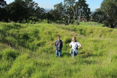
An Adventure to the East Cape
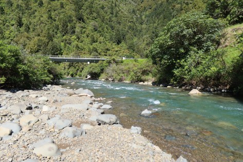
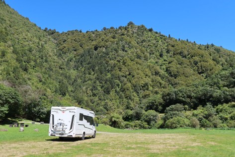
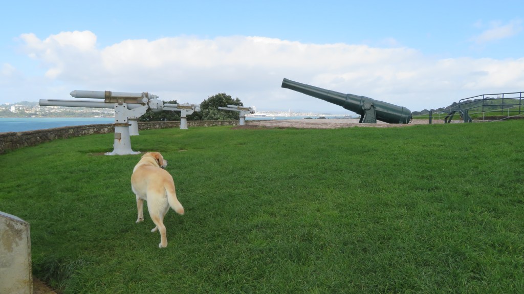
One of the great traditions in New Zealand is the ‘roadie’ – the road trip. As a country whose nearest neighbours are a minimum of a three-hour flight away it has always been considered a must do to explore our own backyard. Something we as a family have endeavored to do, even more so now we have ‘Miffo’ the motorhome. Recently we decided to take a week to explore the beautiful East Cape, an area we had yet to visit.
Our journey began as it always does with the husband being impatient and wanting to leave at the crack of dawn…the dog and I objected and we compromised – we left a short while after the crack of dawn. The drive from Auckland to Ohope Beach, our starting point, was predictable, much of the road was one we had travelled before. There was a brief stop in Katikati for a visit to the farmers market where we bought honey and we got slightly turned around when himself decided he did not want to pay the toll on the Tauranga East road. It was not a huge sum but sometimes it is very hard to get a Cornishman to part with his money. Apparently, it was the ‘principle’…eventually after a bit of swearing we found the free route.
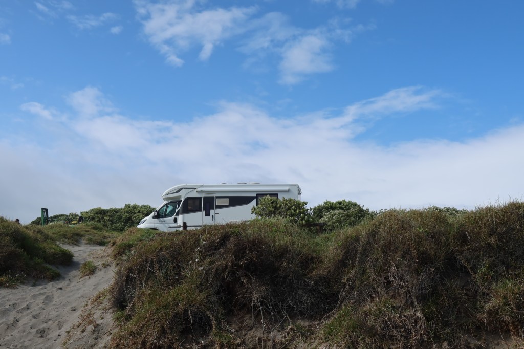
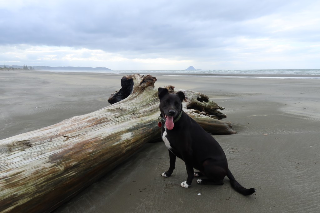
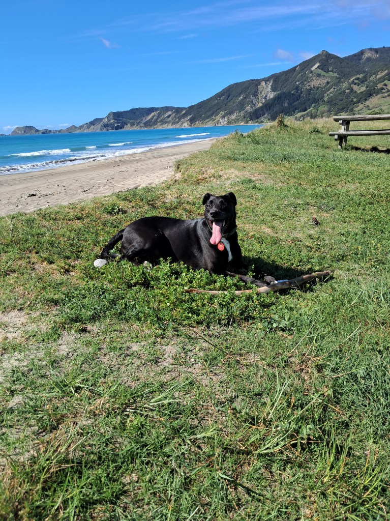
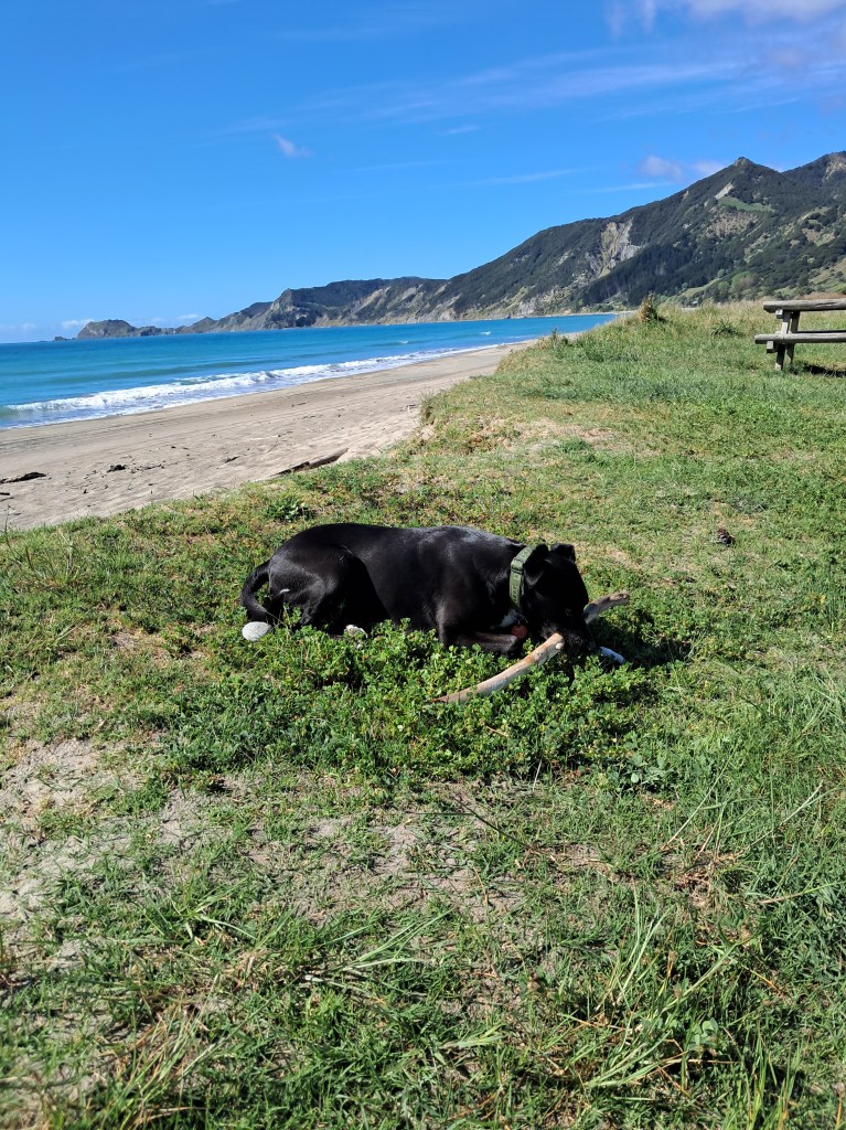
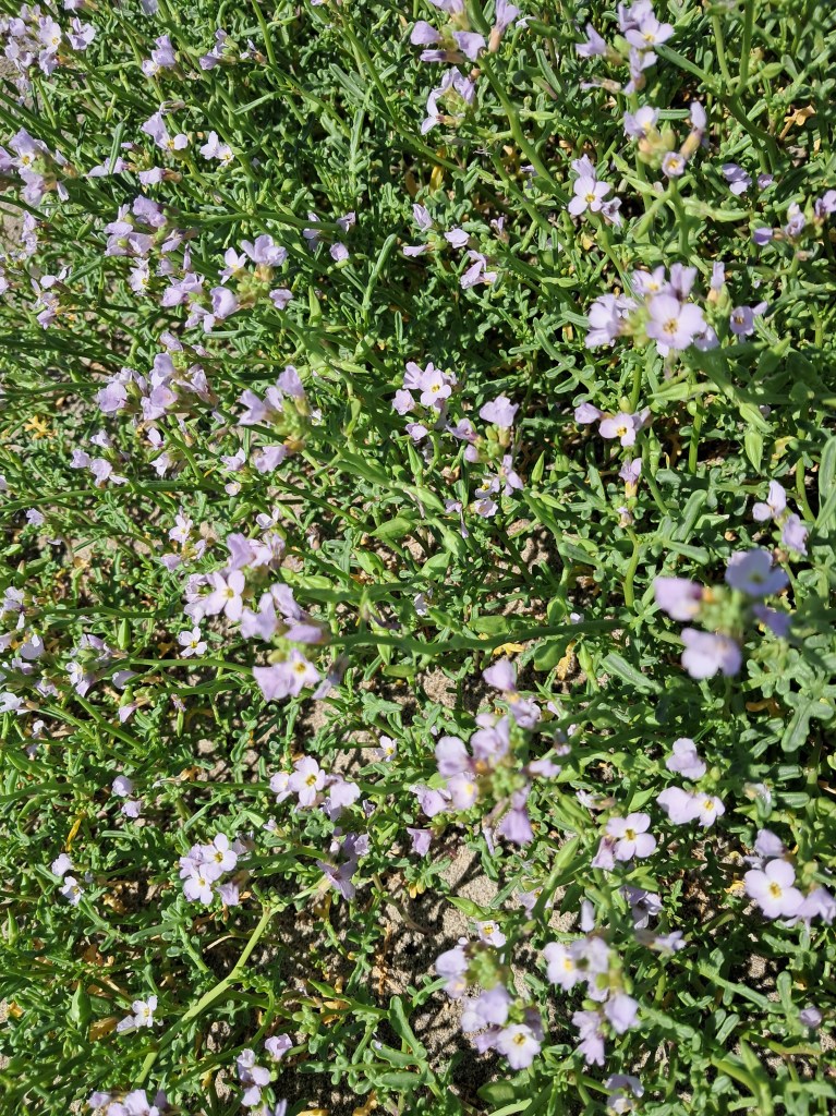
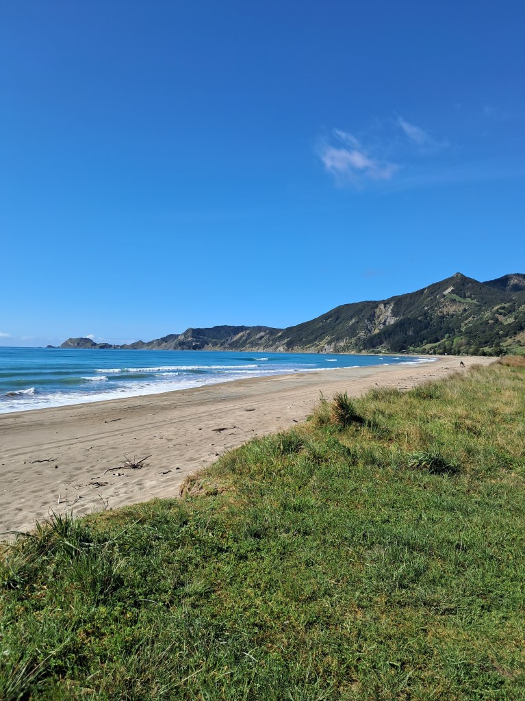
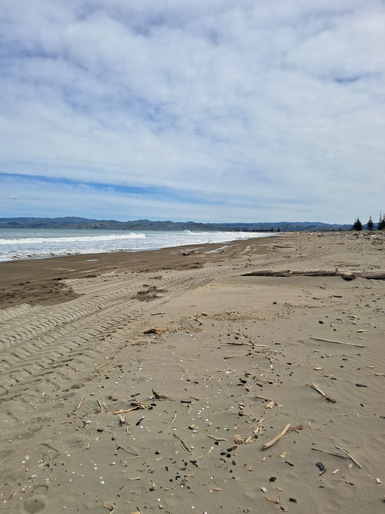
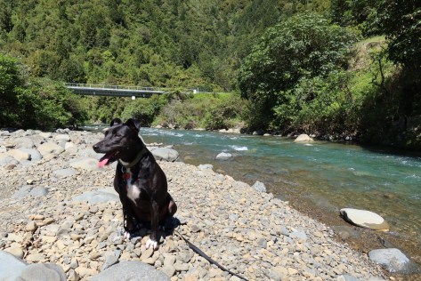
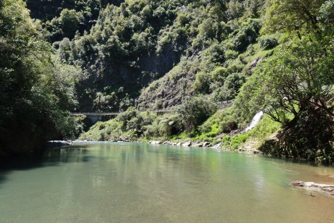
Our first night as mentioned was at Ohope Beach at the freedom camp at the far end of the harbour. Unsurprisingly, it was a popular spot being on the water and quiet. There was a typical husband moment where he lost his phone down one of the side panels in the sleeping area, it was eventually retrieved amidst much swearing and after borrowing a screwdriver (note to self – bring toolbox next time) from a neighbour so I could surgically retrieve said phone. After all that excitement we took a pre-dinner stroll across the dunes to the surf beach and for an Aucklander it was fabulous to have a beach as beautiful as this one to ourselves. The dog found what was to be the first of many sticks…
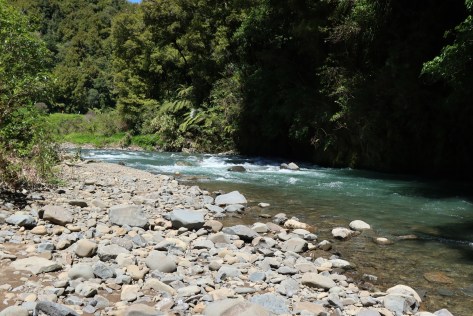
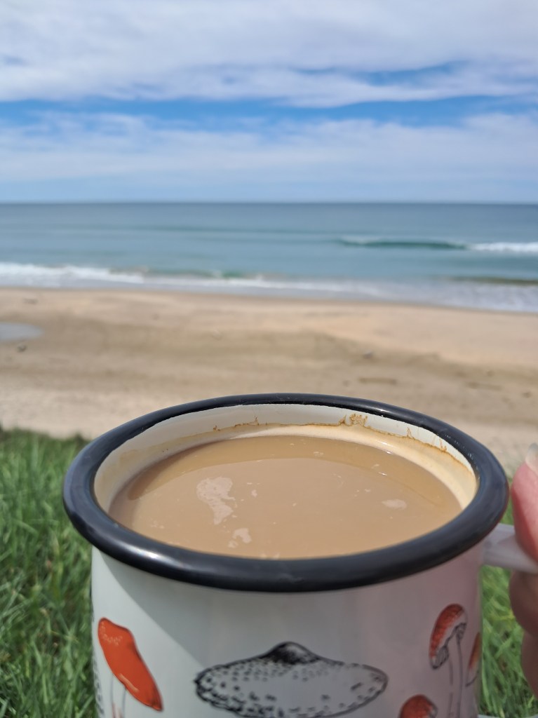
Day two started with the necessary walk and stick throwing for the dog, followed by a mercy mission into Whakatane. The husband had a footwear malfunction and required a new pair – hello Whakatane Warehouse! But it did enable me to purchase the necessary fridge magnets for our collection. After this short side quest we were on our way properly, our target for tonight’s camp was Te Kaha. Along the way, we had a few stops at some lovely beaches (the dog was happy, more sticks!). We arrived at Te Kaha at around lunch time and after some food and a cup of coffee and wee womble on the beach we decided to motor on to Waihau Bay. One of the joys of having a motorhome is the flexibility it offers, sometimes plans change and with our home on wheels we can go with the flow.
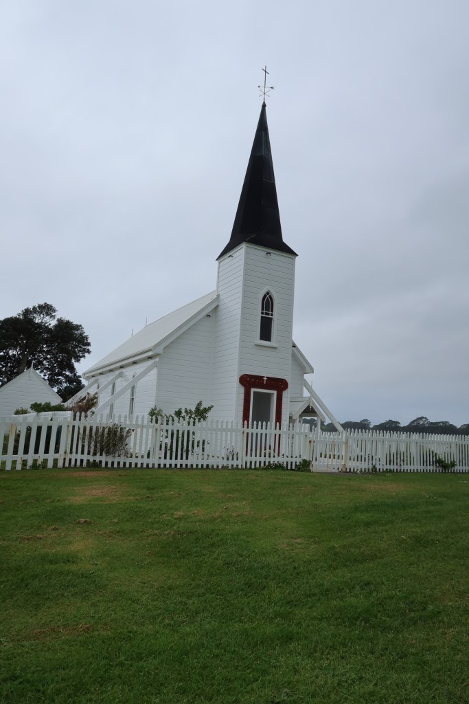
Before we reached Waihau Bay we stopped to admire the Kokorore Church. Perhaps one of the prettiest churches I have seen in New Zealand, perched on a small peninsula with its tall wooden spire, it is certainly eye catching. Visiting the small urupa (cemetary) at the rear of the church, it was clear that this was a family church with several names dominating the headstones. I was particularly touched to see the names of three young lads who I presumed to be brothers, who died in an accident in the late 80s. Such young lives to be cut so short, who might they have become, what might they have achieved. With a son the same age I could only imagine their family’s heartache.
Arriving at the campsite in Waihau Bay we were greeted by the friendly hosts and showed to spot under an old puriri tree. The campsite itself was perhaps a little dated but for the money was perfectly acceptable. It was situated on the main road but to be honest that was not a problem, I think we had a ‘rush hour’ the next morning around 8am where about half a dozen cars and two school buses went past. On the other side of the road was the beach and yes you guessed it more sticks for the dog!

Day three – we woke up to rain and when I attempted to take the dog for a walk on the beach promptly discovered how well the dunes protected the campsite – it was far windier and rainier than anticipated and was a walk cut short – even the dog was happy to leave the beach. An hour up the road and we stopped at the general store in Hicks Bay, a coffee for myself and what was to be the first of many pies for the Cornishman. The pie is worth a mention here, as it was a Ruatoria pie (Ruatoria is an East Cape town and thus this was a locally produced pie). The husband is always on the lookout for locally produced foodstuffs. His verdict on the pie (steak and cheese) was excellent, apparently, they had used proper cheese (not the fake stuff many pie producers use). I am an awful kiwi, not being a fan of ‘the pie’, so it is good that the husband makes up for my shortcomings.
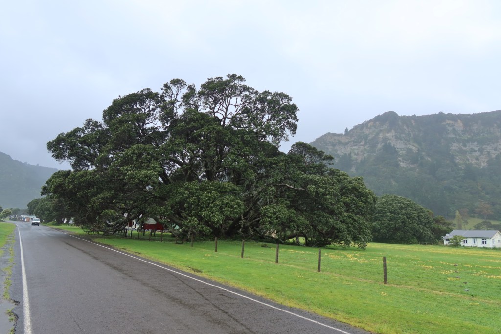
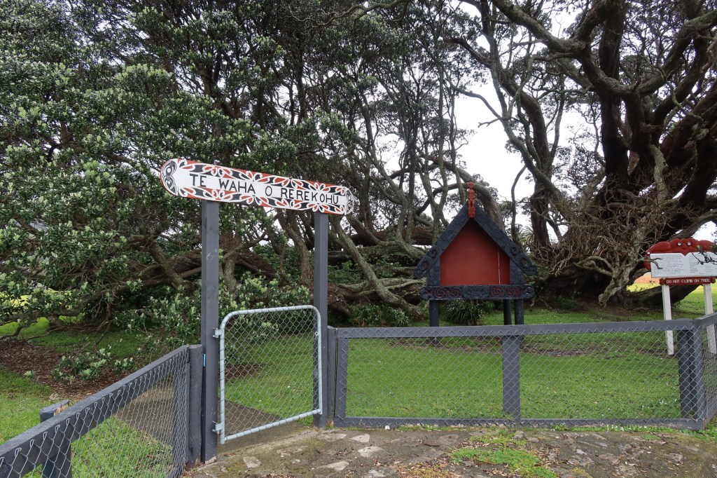
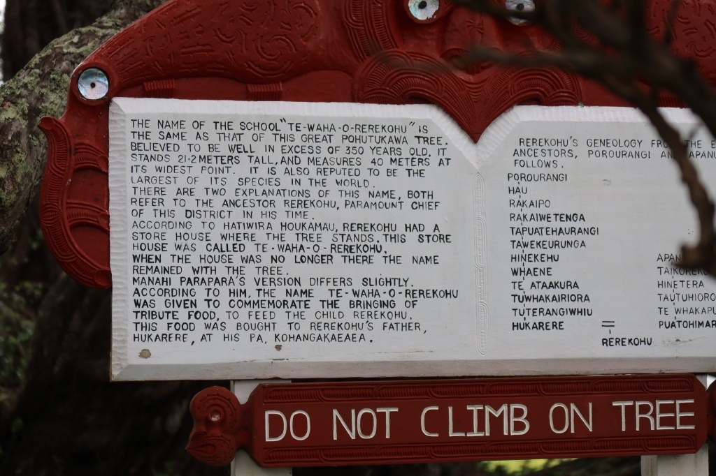
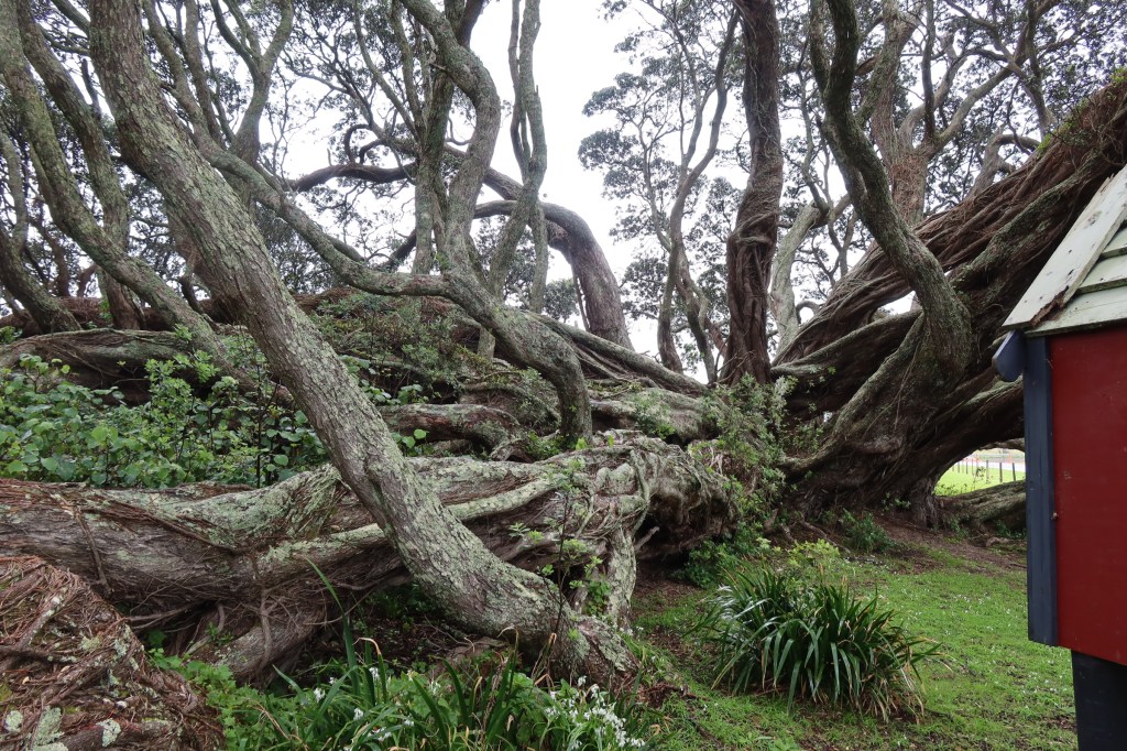
Not long after this we arrived in Te Araroa where we paid our respects to the country’s largest and reputedly oldest pohutakawa. Spent a short time communing with this ancient tree (350yrs approx.), even the husband was in awe and gave it a wee hug. I’ll make him a tree hugger yet…As I stared up and around at its twisted branches, I could only wonder what events that tree had witnessed. It was probably a only a sapling when Cook sailed past. It would be fabulous to do this trip in the summer when all the pohutakawa are in bloom – stunning!
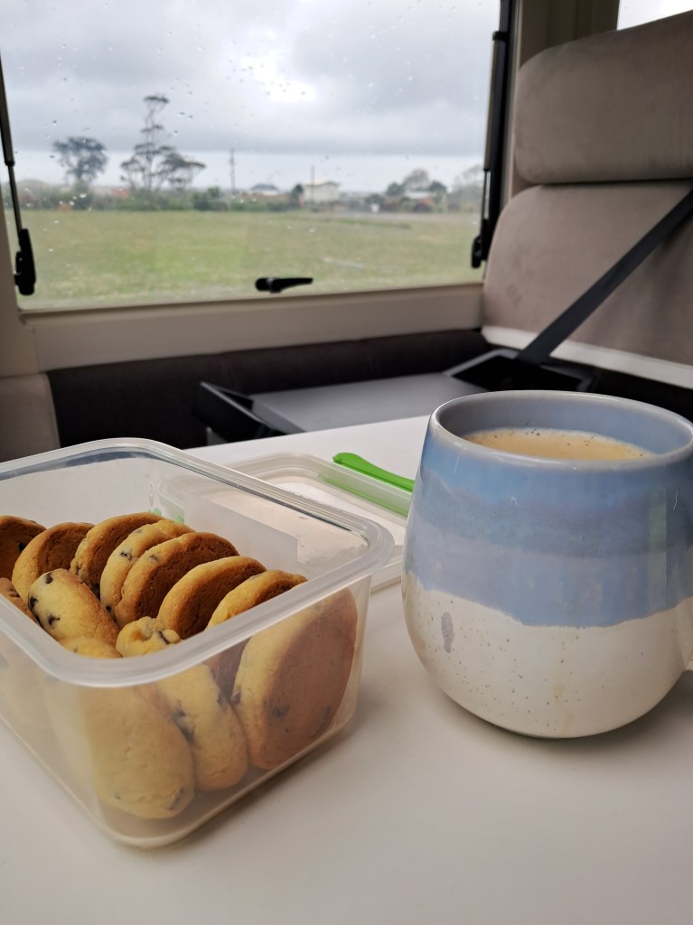
It had been our intention to spend the night at the East Cape Campground, but the rain and the wind hadn’t eased and was predicted to continue for the rest of the day. After a bit of discussion, we decided it was safer and ultimately more pleasant to wait out the rain in Te Araroa where there was an NZMCA park up area. The afternoon stretched out in front of us. Someone took a nap and so did the dog, I read, drank tea and ate biscuits.
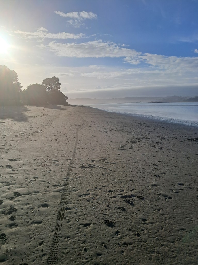
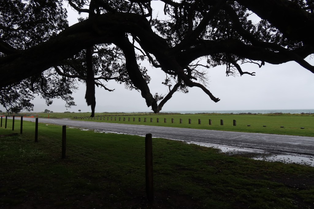
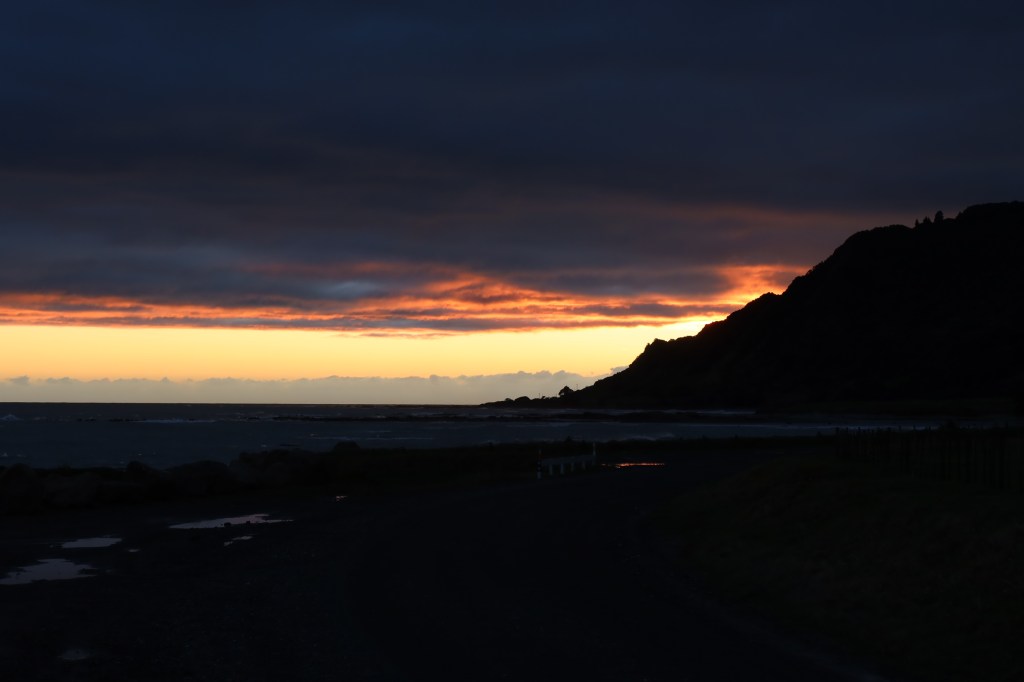
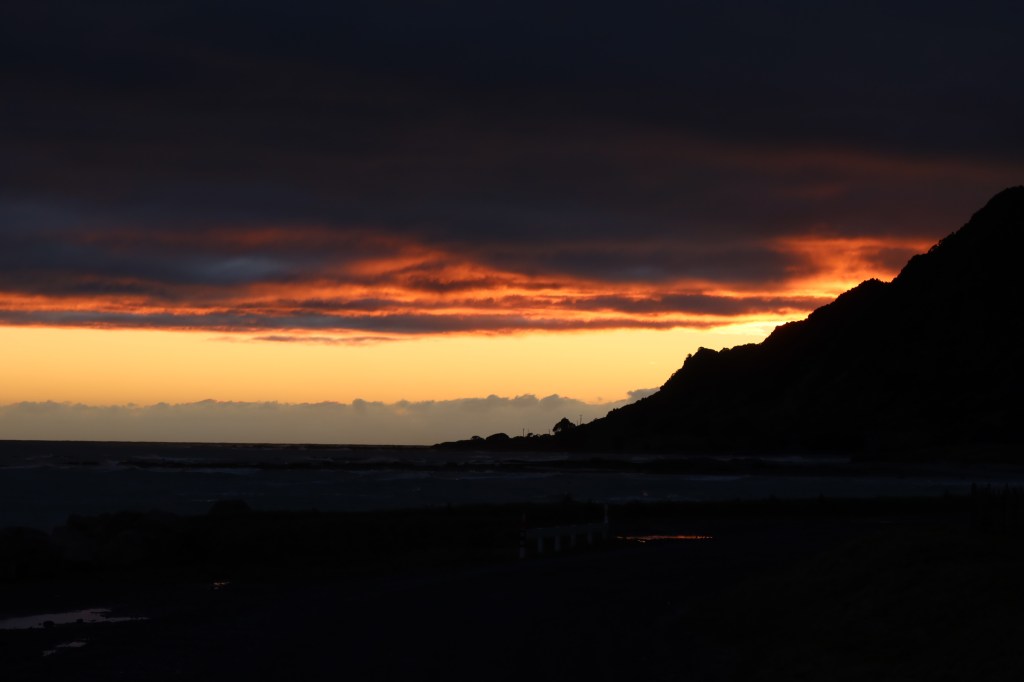
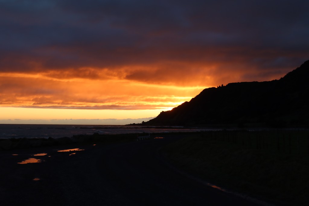
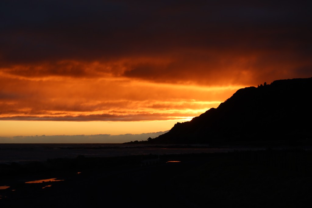
Day four – was awoken rudely by the husband who felt we should make an effort to see the sunrise. After a short drive along the dirt road that leads to the most easterly point (with me still in my pjs) we found a spot to park up. Turns out it was one of his better ideas…the East Cape is the first place in Aotearoa New Zealand to see the sunrise. It was stunning after all the rain the day before and we ate breakfast watching the morning begin in all its glorious colour. Once dressed and ready to face the rest of the day we then headed off, our final destination for the day would be Tatapouri.
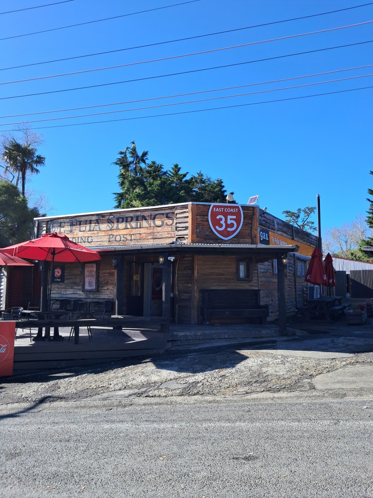
Along the way we stopped briefly at Te Puia Springs general store, the husband bought a pie. This time it was pork belly, he initially did not hold out much hope for the pie. He literally at his words, it was excellent!
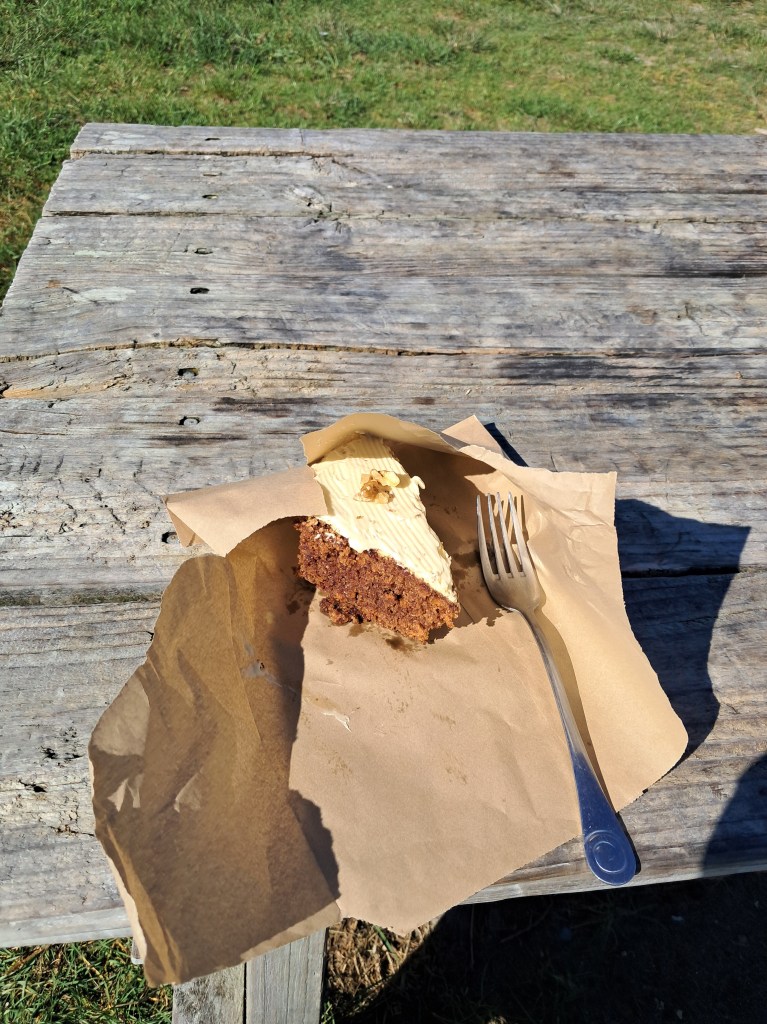
Our next stop was Tokomaru Bay where we stopped at Cafe 35 for you guessed it, another pie (I had a slice of lovely carrot cake). This time the pie was their world famous paua pie and it was apparently so good he had to go back and get another one for the freezer (as well as a pork belly pie for the freezer). The owners of the Cafe 35 make all their own pies and feature in book on Aotearoa New Zealand’s best pies – yes, we own a copy.
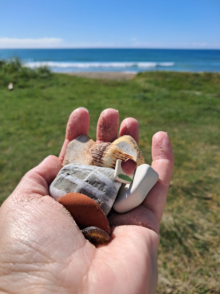
After a bit of walk along the beach finding a few treasures and throwing a stick or two for the dog we carried along state highway 35 (also known as Pie Way 35 for what should now be obvious reasons). This stretch of the highway was a challenging drive, with a great deal of ongoing remedial road works, lots of twists, turns, uneven surfaces and the odd wandering livestock. We came across four very confused calves who had made a break for freedom and then appeared to not know what to do with it once they had it.
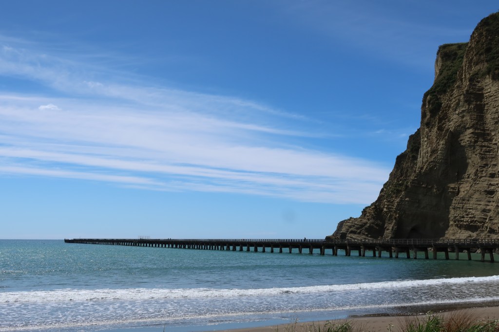
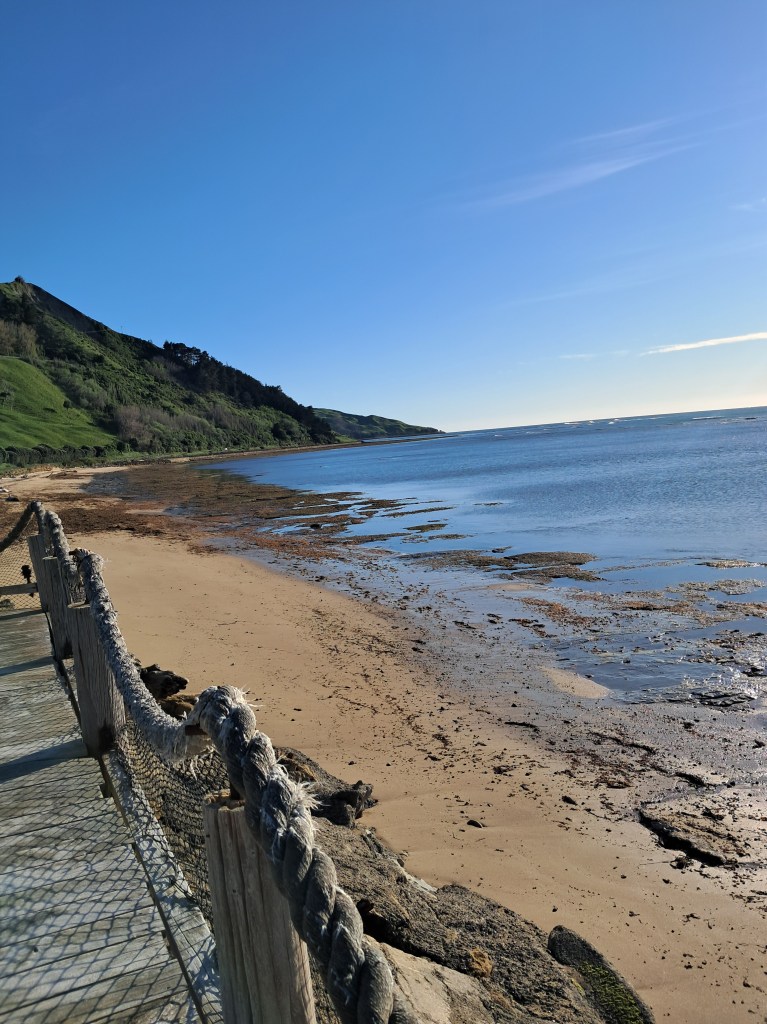
The next stop for the day was Tolaga Bay, where, yes, that’s right he bought another pie…but I think he was all pie’d out by this stage as the comments were less enthusiastic then earlier in the day. Did the obligatory stroll down Tolaga Bay wharf, I had a bit of lunch and a coffee and then we were off again, bumping along the highway to Tatapouri Bay Oceanside Campsite.
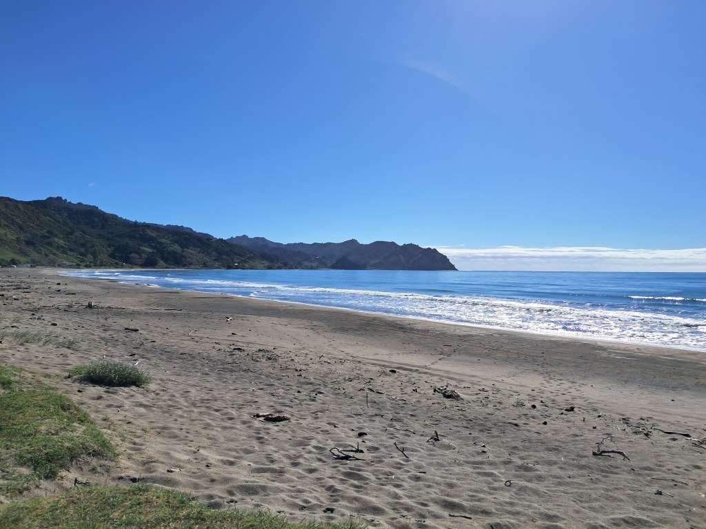
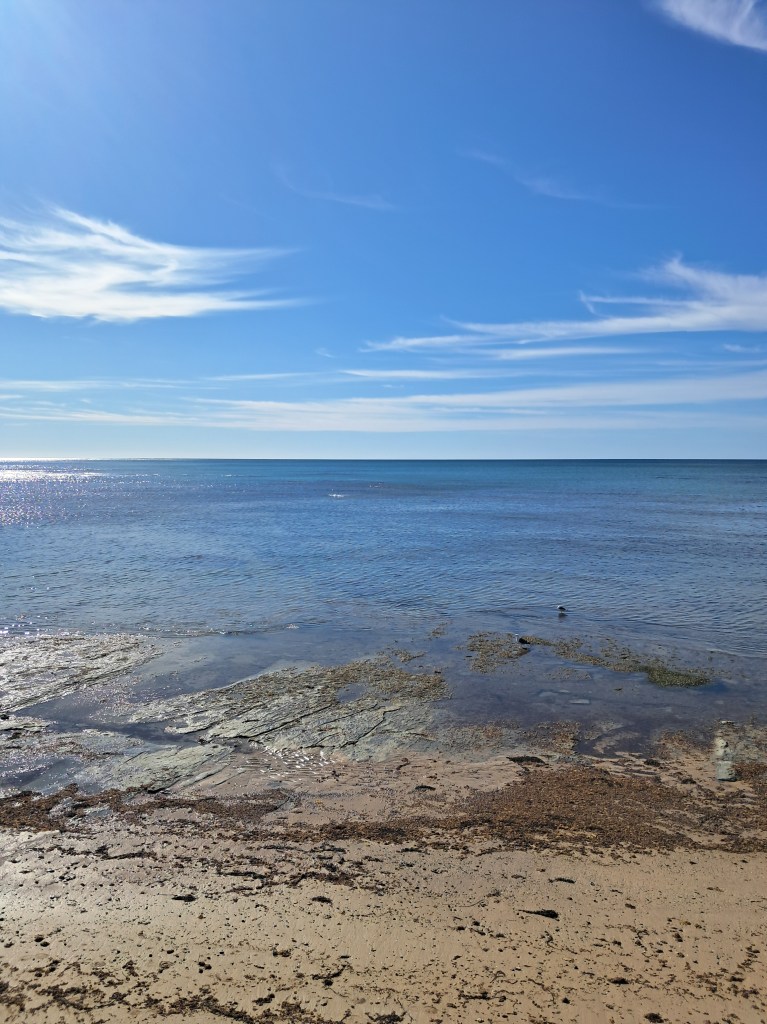
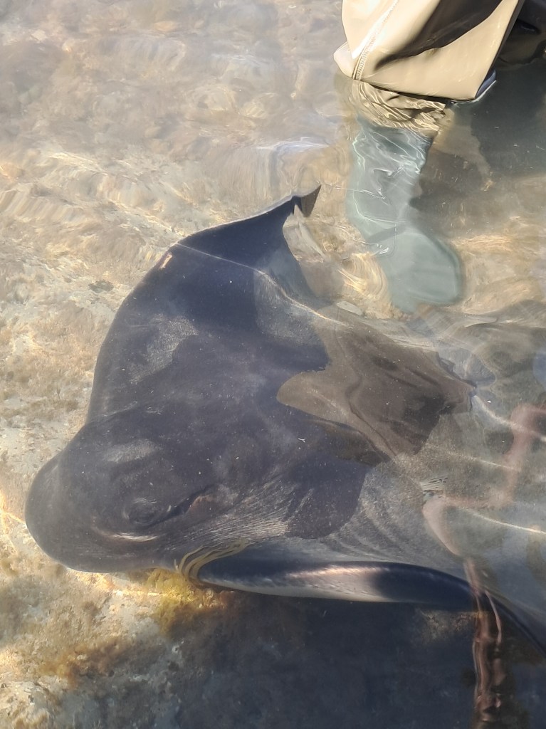
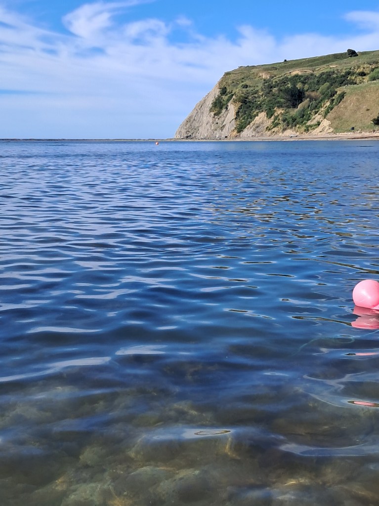
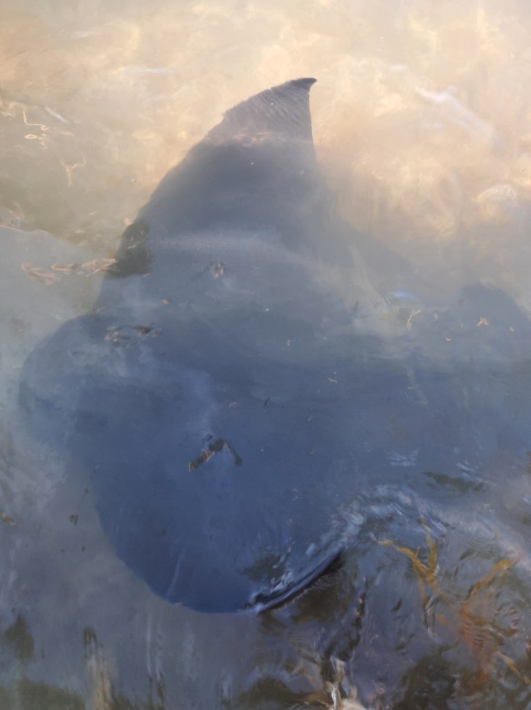
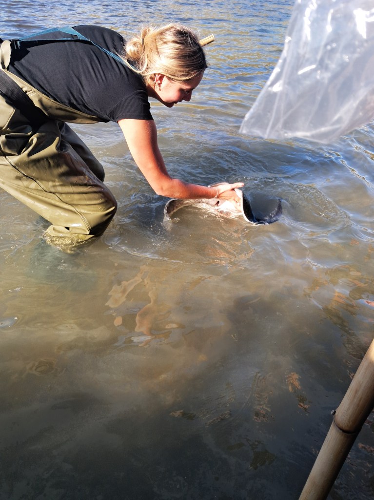
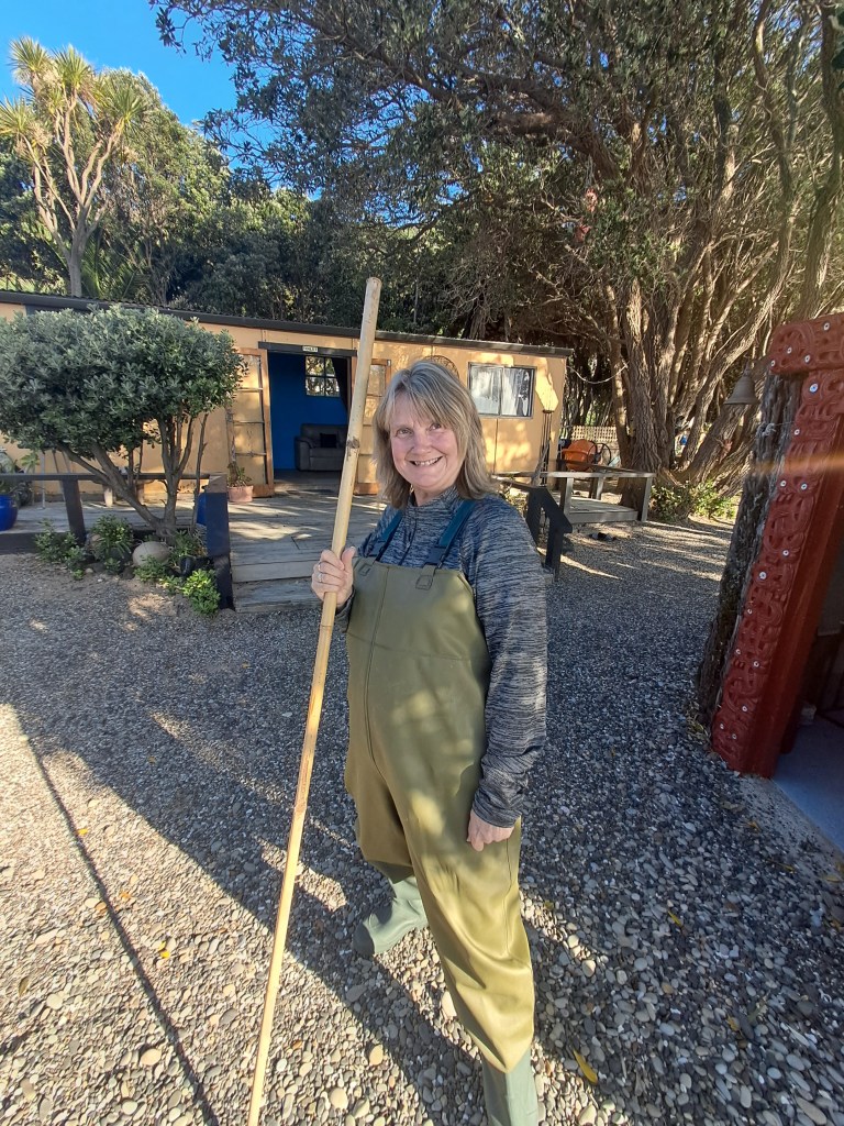
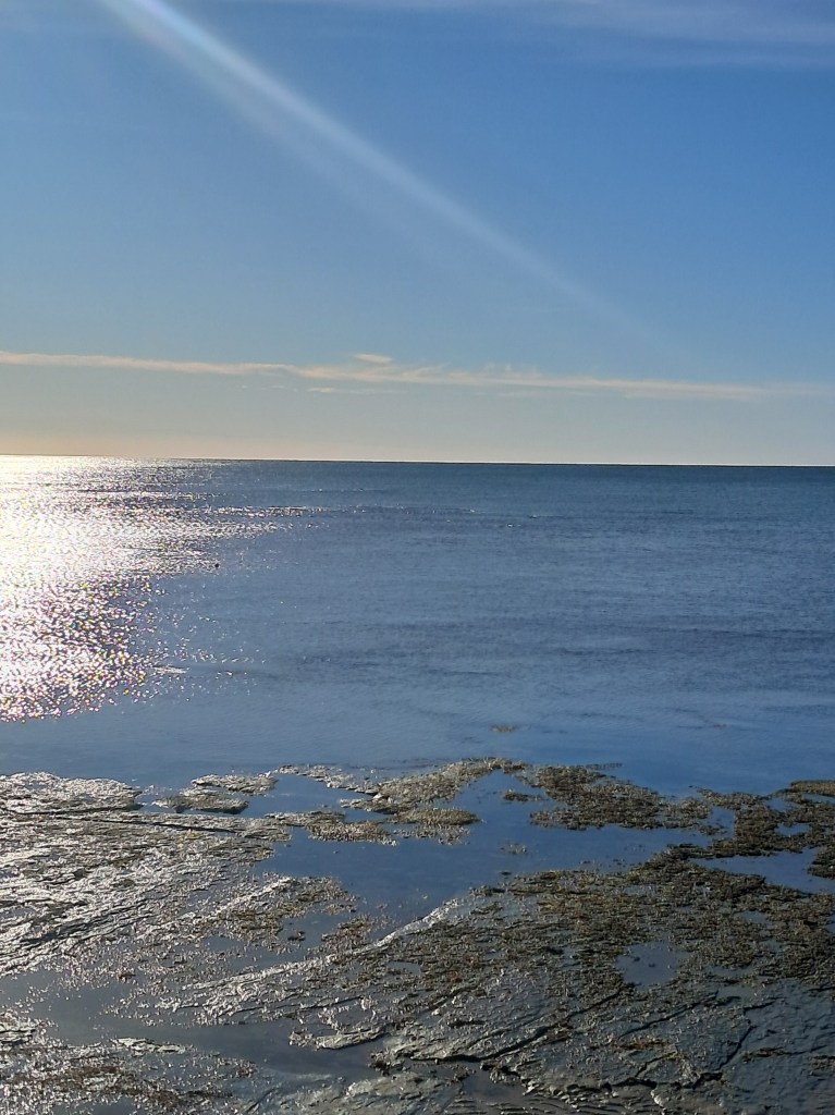
Day five – it was not a great night’s sleep, being beside the highway and so close to Gisborne the number of logging trucks that thundered past the campsite at all hours of the night was a problem, especially as they changed gear going up the hill. Having said that this is lovely campsite but perhaps next time I’d pick a spot further away from the road. But my morning was to greatly improve. Our purpose for stopping here was to join Dive Tatapouri on one of their Reef Tours where you get to do a meet and greet with the local stingray population. We were up early as we needed a low tide; the dog was feed and walked then given her lick mat to keep her occupied whilst we were busy.
The tour begins with donning some very attractive waders, you’re given a stick to help you walk out over the reef and of course a safety briefing. We are then led across the rocks out to a depth that was about knee high and before you know it there were eagle rays and short tail (named Moana) ray coming over to say hi. They are extremely friendly and reminded me of mischievous puppies, we were allowed to stroke them and give them a wee fishy treat. It was surprising how soft their skin is. The guides were very knowledgeable, explaining how all the rays in the bay were females – the males lived further out to sea with their own territories. I learnt that rays respond to heartbeats and that if you are swimming in the sea, it is more than likely that a ray (especially the eagle rays) will be near by checking you out. Overall, it was fantastic experience and one I would highly recommend.

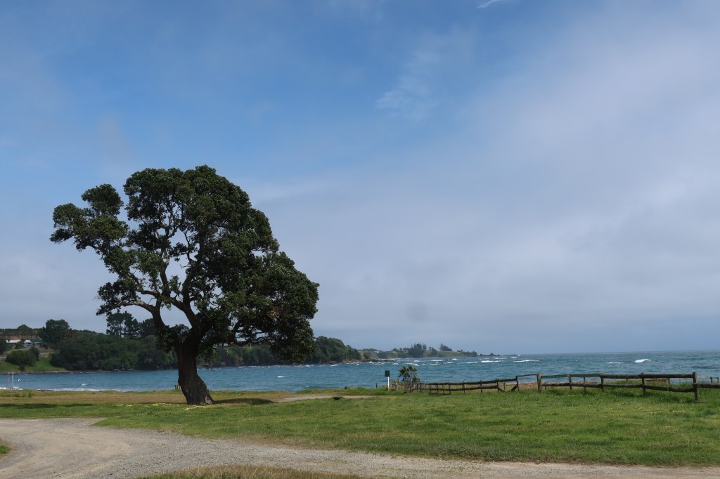
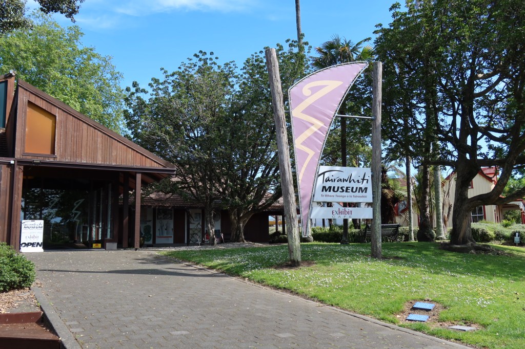
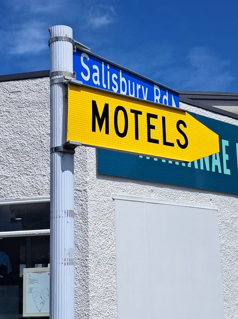
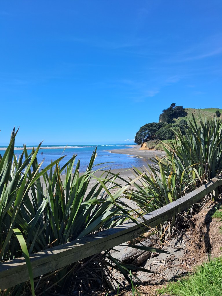
After our exciting morning we drove the short distance to Gisborne, where I paid a quick visit to the Tairawhiti Museum (Tairawhiti is the Māori name for the Gisborne area) and the husband got told off for walking the dog in a no dog park – oops! We then went in search of the ‘i’ site so I could buy some fridge magnets for the collection. Along the way we found another Salisbury road (our road in Auckland) and discovered our number was park – it’s the little things that keep life interesting…That night we parked up in the NZMCA park which was a very well looked after park in a great position across the road from the beach. Yes, there were walks and stick throwing for the dog. I also rescued a bag of small pieces of driftwood. Unfortunately, they were doing a major clean-up of the beach with trucks and diggers removing much of the larger pieces of timber that had washed up on the beach. One of the major issues in the area is when there is flooding etc much of the waste material from the forestry plantations washes down the rivers, onto beaches and out to sea.
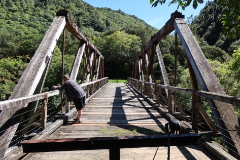
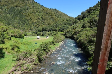
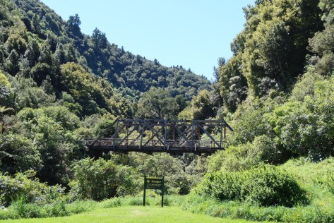
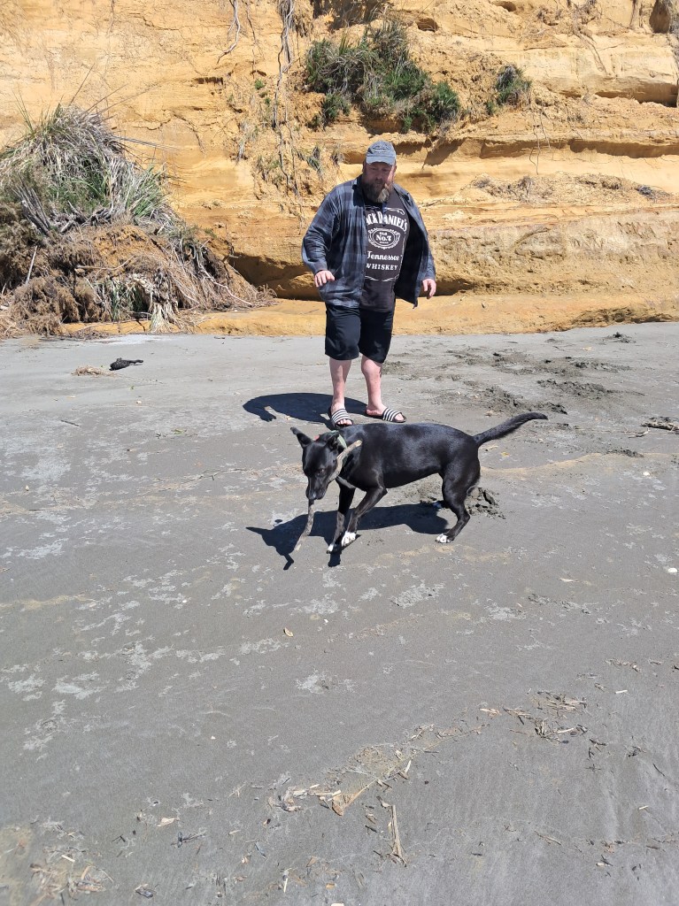
Day six started with the usual walk on the beach and stick throwing for the dog, dodging trucks and a digger going at speed! Our destination today was to be Opotiki via the beautiful (and long and twisty) Waioeka Gorge. Approximately halfway through the gorge is lovely wee campsite with fire pits, beside the river. We stopped here for some lunch and to stretch our legs, talking a loop walk across an old wooden bridge (the Manganuku Bridge) and along the river. The dog was grateful for the sniff stop.
The husband as per usual got to chatting to another motorhomer who had also stopped for break, and they recommended a freedom camp on the other side of Opotiki for our nights stop. It was an excellent recommendation. The freedom camp was at the Te Ahiaua Reserve at the northern end of Waiotahi Beach and even though it was on the main road between Whakatane and Opotiki it was peaceful night’s sleep.
The next day we meandered our way to Rotorua where we did the usual and went for a walk in the redwoods, the dog met some well-mannered pooches, sniffed out a tree with a possum in it and generally had a ball. We had intended to stay the night at the Lakeview Golf Course, but a lack of room had us moving on and we found ourselves at the Horahora Domain on Lake Karapiro – a freedom camp we have stayed at before. It was busy but once the jet skiers had gone home for the day all was quiet.
Day seven saw us head for home feeling grateful that we could have this time to explore a small part of our country.
Share this:


Discovering Aotearoa’s Rich Archaeological Heritage
A brief foray into what archaeology looks like in Aotearoa New Zealand.
The average kiwi, when questioned about archaeology in Aotearoa New Zealand will more often than not shrug their shoulders, mumble about pā and goldmines and then go on to say that surely archaeology is not a thing here? (something I have discussed in another blog here) After all, it’s not like in Europe or Egypt, is it?
So, lets break that down…
First, archaeology as a subject is defined as the study of the human past, where human modified/made objects and sites are studied in order to better understand our past. Aotearoa New Zealand has a human past and thus, yes there is archaeology to be studied. Interestingly, the country’s relatively short human past has meant that it is in a unique position to better understand the short term and long term effects of environmental changes. Not only how they have changed but also what factors have contributed to this are important questions when faced with an uncertain future. Such studies are often conducted using archaeological data sets. Excavations on Ōtata, an island in the Hauraki Gulf, has produced a significant data set allowing for comparisons with present day data. Read more about this here.
Archaeology as a subject incorporates a wide variety of disciplines from math’s, biology, physics, chemistry, art, history, geology and geography and much more. Because of this it is dynamic discipline, always changing and adjusting ideas as new information or techniques come to light.
The fact that archaeology here in Aotearoa New Zealand has a dedicated association (the New Zealand Archaeological Association), as well as laws protecting archaeological sites and taonga; in addition to a government agency (Heritage New Zealand Pouhere Taonga) and numerous archaeological contractors would all suggest that archaeology is very much present in our small corner of the world. As mentioned in a previous blog there are over seventy thousand archaeological sites recorded here – and these are just the ones we know of…
The New Zealand Archaeological Association
Heritage New Zealand Pouhere Taonga
Second, our archaeology may not be about romantic, mystical ruins or great depths of time, but it is all around us if you know where look. In its most basic form (because this is a blog and not a textbook) archaeology can be divided into two columns – sites and artefacts. It is perhaps important to note here that archaeology, history and cultural heritage are not separate subjects but are deeply intertwined, especially so here in New Zealand.
The first humans to arrive here were the Polynesian ancestors of the Māori, this is not the place to discuss their arrival except to say it is generally agreed that it happened around 800 years ago. Some of the earliest radiocarbon dates are from around the mid to late 1200s but that’s not to say people weren’t here before that, only that this is currently the earliest dates we have. At this point I should mention that there is no proven evidence for non-polynesian settlement of Aotearoa prior to their arrival.
In 1642 Abel Tasman shined a brief light on the country and much later James Cook’s survey of New Zealand (1769) shone an even brighter light – the British (and the French and a few others) were not averse to new opportunities. The first to take advantage of this new land were the sealers and whalers and by the early 1800s the first settlers had arrived, usually missionaries with notions of spreading the word of God. Farmers, merchants, miners and anyone with an eye to making their fortune soon followed. All of whom left their mark archaeologically.
As mentioned above, the archaeology of Aotearoa can be divided into either sites or artefacts. A site is any place that has been used or modified by humans for any reason. An artefact can be defined on the same principles – an object that has been used, modified or created by humans. In this blog I will be touching upon some of the sites which can be found in the landscape of Aotearoa New Zealand (the subject of artefacts is perhaps too large for a simple blog).
Lets begin in ‘prehistory’ before the arrival of the Europeans…
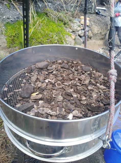
Middens – perhaps one of the most common archaeological sites known around the country, these sites present themselves as piles of broken shells and relate to the māori settlement of an area. Middens are useful to archaeologists as they can tell us a great deal of what resources were utilised, what the environment was like and they can provide material for dating (bird bones and or charcoal). They can be an archaeological site on its own or part of a larger archaeological site such as a pā.
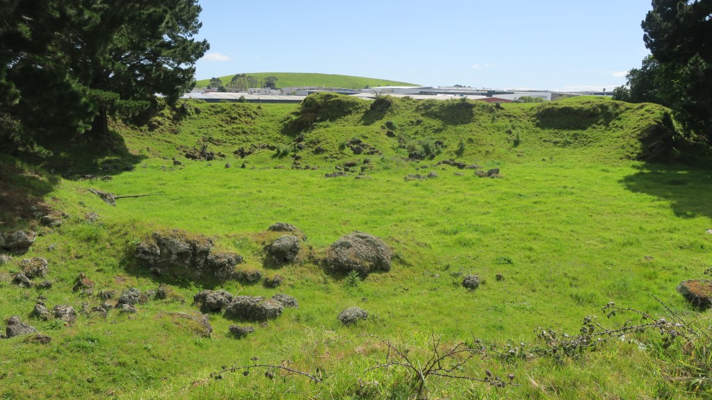
Pā – these are essentially defended settlements, most are found on high ground but there are examples of pā being found on low ground. The necessary element is for the site to have banks, ditches and evidence of palisading. Some pā can be complex sites with large numbers of banks and ditches covering many hectares others are much simpler. It is generally assumed that pā were used as places to retreat to in time of conflict and whilst this is a part of their story, it is not the whole story. The history and purpose of pā depends on the where and when. Each site needs to be considered within the wider physical and societal landscape.
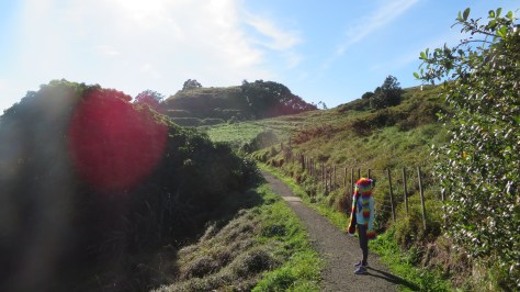
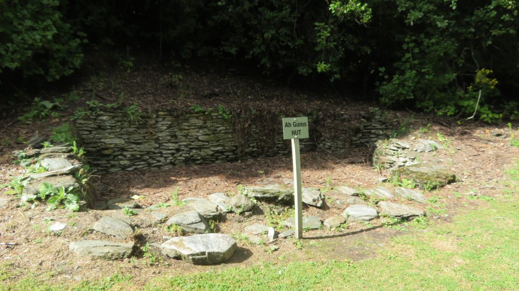
Walking in the Te Pare Reserve, Hahei – Hereheretaura Pa in the distance. 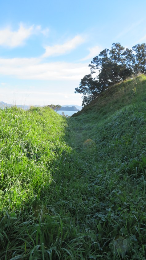
One of several bank and ditch arrangement at Hereheretaura Pa. 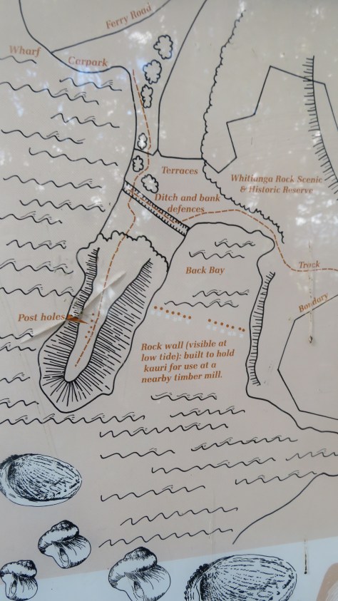
Plan of pā near Whitianga. 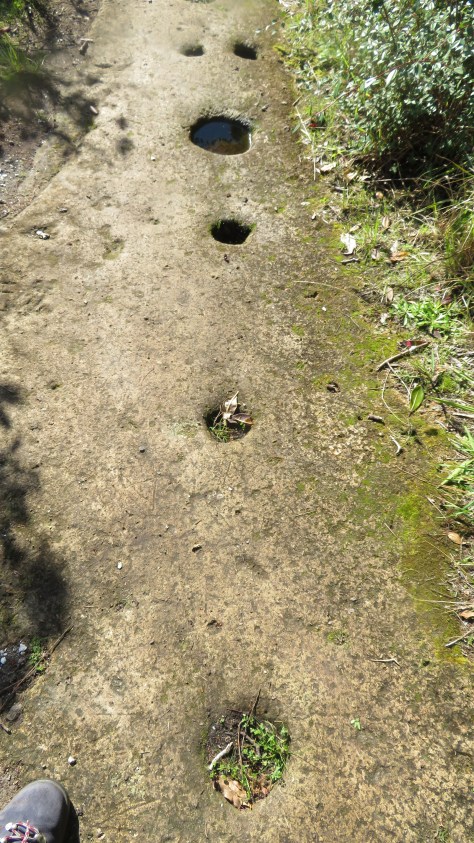
Palisade postholes in the rock at the Whitianga pā… 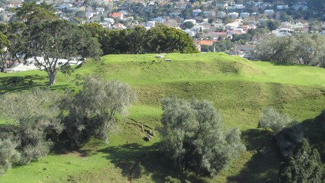
Terracing at Maungakiekei Auckland. 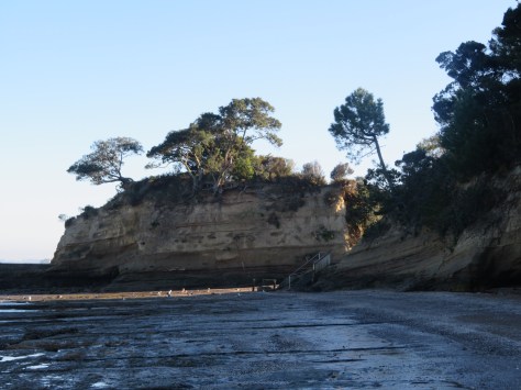
Island Bay pā, Auckland 
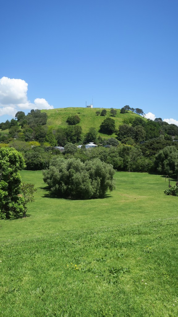
Maungakiekie, Auckland 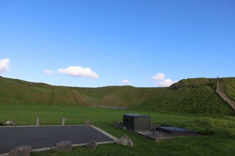
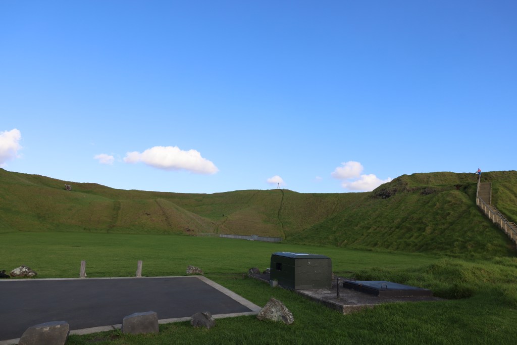
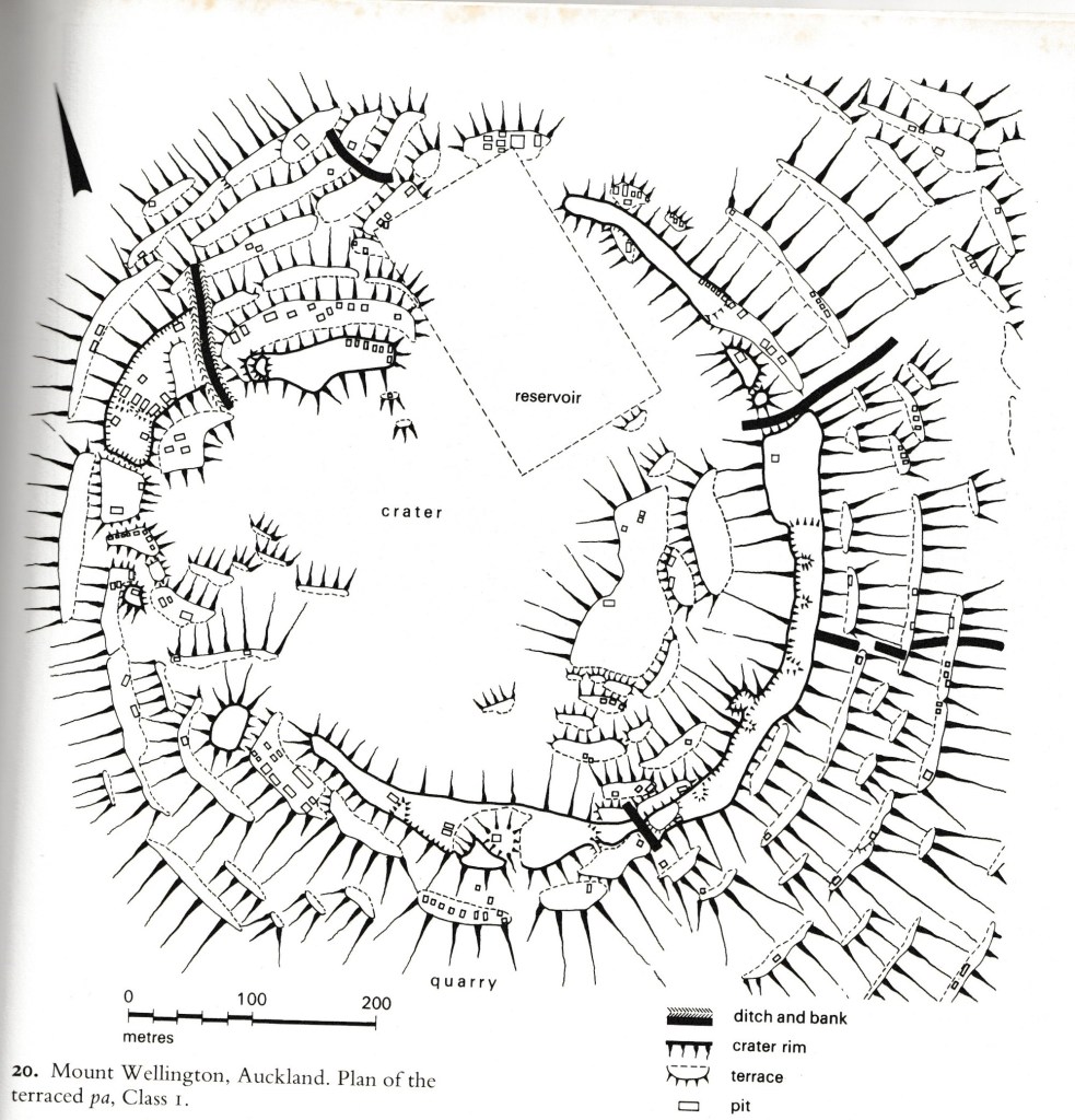
Maungarei (Mt Wellington), Auckland 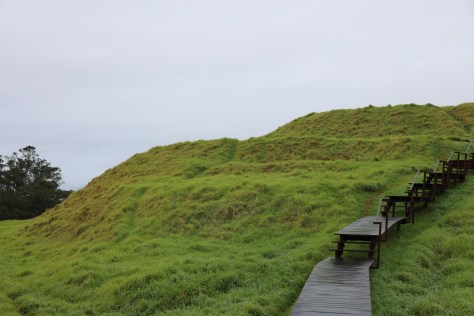
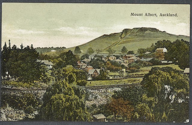
Maungawhau (Mt Eden), Auckland.
Kainga – unlike pā these are ‘undefended’ settlements or places. They can be either permenant or temporary, (the latter also known as ‘camps’) and can include a wide range of activities, not just places where people lived. Within this category a range of individual features might be found from postholes for wooden structures (houses, storage, fences), cooking areas, storage pits, middens and open spaces.

Gardens – horticulture was an important part of the economy for māori and continued to be so beyond the arrival of the Europeans. Evidence on the ground for gardens can be seen in clearance of stones and rocks from an area, often creating low stone walls. In the Auckland area the best example of this can be seen at Ōtuatua Stonefields in Mangere.

Rock Art – almost 90% of known rock art is found in the South Island, it can drawn (using charcoal or red pigment known as kōkōwai), painted, carved, cut or scraped from rock. The designs vary but can include people, birds, dogs, waka, geometric designs and occasional mythical creatures such as taniwha. The Te Ana Rock Art centre near Timaru conducts tours of the nearby rock shelters to view the rock art.
Burials and urupā – Māori buried people of high status close to settlements, then disinterred the bones and placed them in secret locations. Burial sites are tapu (sacred) and should not be disturbed. These practices changed in the late 19th century, when European-style urupā or cemeteries developed near marae. Archaeologists often refer to kōiwi and these are when human bones are found in an archaeological context either during excavation or accidentally (ie eroding from cliff or dune).
The arrival of Europeans created a whole range of archaeological sites, broadly speaking they can be divided into settlements, industry, roads and infrastucture, dump/midden sites and conflict.
Settlements – the name says it all, these are places were people lived and they can be large as a town or small as a single farmstead. Depending on size settlement sites will invariably include a number of other features which can be classed as sites, such as wells, drains, out buildings, churches, schools, hospitals, shops, inns, roads, gardens and much more. Many of these sites are still standing and usually come under a heading of ‘buildings archaeology’ or ‘heritage archaeology’. After the earthquakes of 2010/11 in Christchurch a vast amount of archaeological work was done ahead of the rebuild. Out of this The Christchurch Archaeology Project was born where the information and stories that emerged of Christchurch’s past could be made available to everyone.
Above shows the site of the Te Rongokaupō village on the Old Coach Road, Ohakune. A once thriving settlement now only humps and bumps in the landscape.
Industry – these are sites which include places that were worked by people to gain resources of some kind. Whaling/sealing stations are some of the earliest sites in this category. Mineral extractions left a range of site types from mines shafts, pumping stations, sluice gullies, out buildings, ore processing plants and more. Industrial sites such as these would often be associated with a nearby settlement which had evolved from a shanty town to a fully fledged and ‘proper’ town. In addition, other forms of industry such as milling (timber, paper and flour), brick kilns, lime kilns, gumdigging, breweries and iron works to name a few leave their mark on the landscape.
remains of an early brick kiln 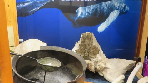
A display on whaling at the Kaikoura museum 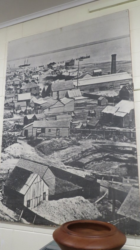
An old photograph of the mining in Thames 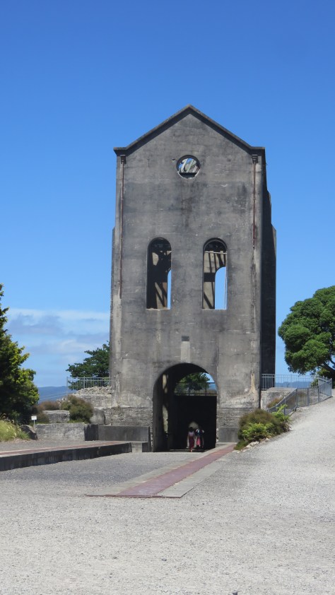
The pumphouse at Waihi. 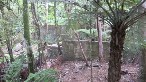
Mining remains at Karangahake Gorge 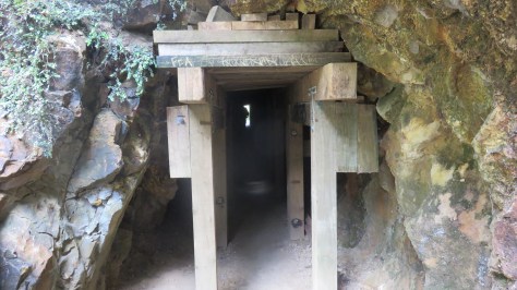
A mining tunnel at Karangahake gorge 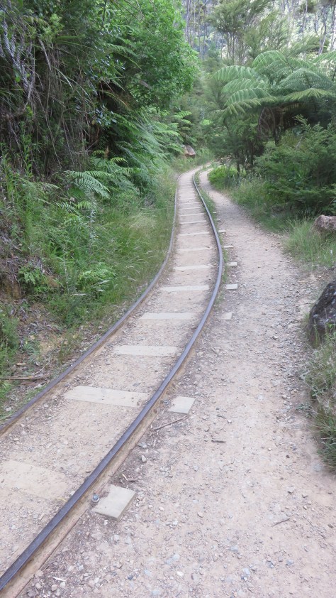
The tracks at Karangahake gorge 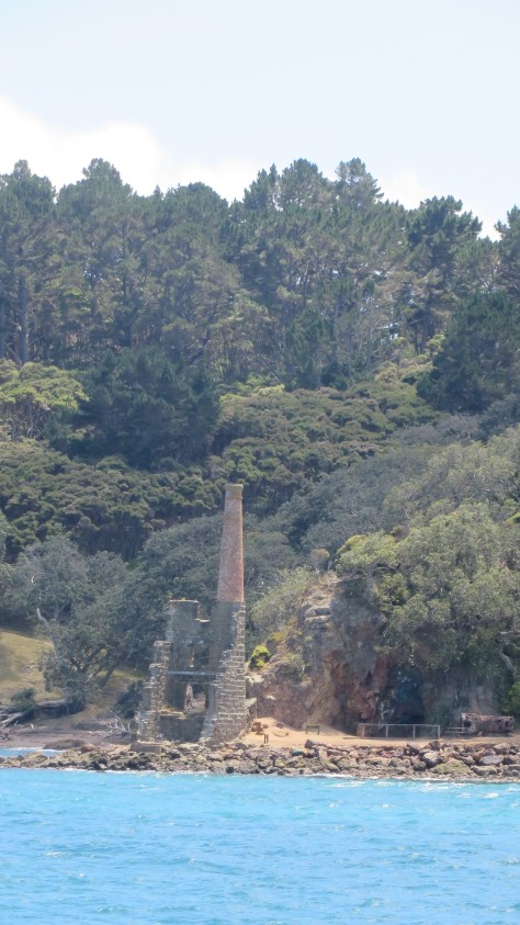
The ruins of the pumphouse on Kawau Island 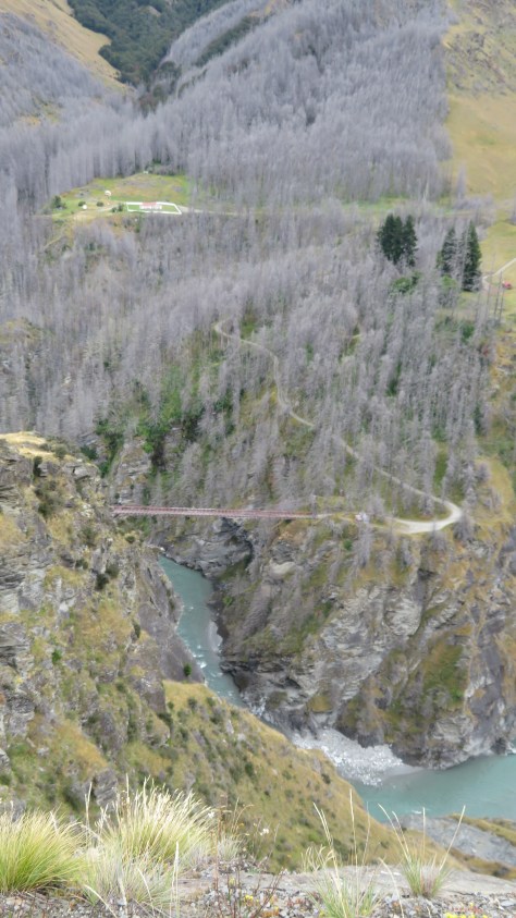
Skippers Gorge near Queenstown – one of several now abandoned settlements centered around the goldmining boom in the late 1800s
Roads and infrastructure – in the early days of Aotearoa New Zealand, the easiest way to travel was via water (this also goes for the period before European arrival). Wharves, jettys and quays are all evidence of this, looking at the placenames of early European settlements near the coast or rivers and the word ‘landing’ can often be found indicating a site where boats and the like would ‘land’ people and products.
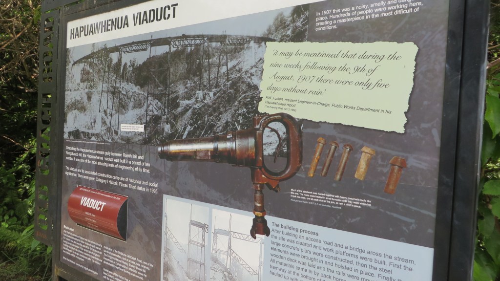
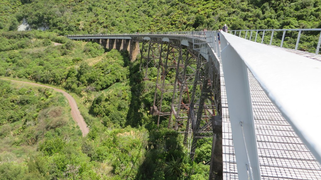
As the population grew so to did the need for actual roads, the name ‘old coach road’ is an obvious reference to an old road no longer in use. Roads, tracks and bridges all form the story of how people moved about the landscape. The railway made a late appearance and where no longer in use its route and any associated buildings add to the archaeological record.
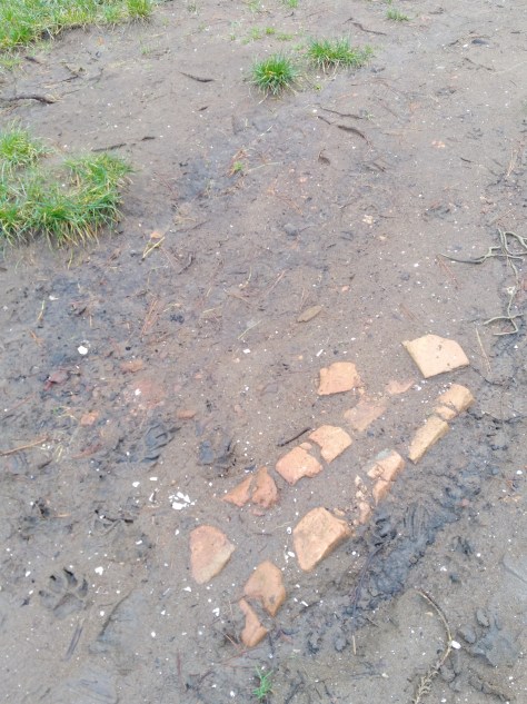
Dump/midden sites – these are always found associated with a settlement or industrial site of some description. Often they are the only indicator that there was a settlement there at all (see my post on Fitzpatrick Bay here).
Conflict – here we can consider sites that relate to the various conflicts that have affected New Zealand over the years. In the 1800s wars with māori resulted in changes to pā construction (Ruapekapeka, Northland) and the creation of redoubts by European militia (Queen’s Redoubt, Waikato). In the early to mid 1900s there were various threats (perceived or otherwise) and a range of forts and coastal defences were constructed as part of this.
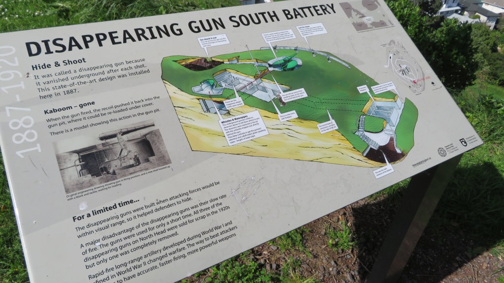
The above photos were taken on North Head, Devonport, Auckland – for more on this site read here.
That brings us to the end of our wee romp through some of the archaeological sites you might find in Aotearoa New Zealand. I hope you have enjoyed this read, feel free to check out some of my other posts.
Further Reading
Davidson J ‘The Prehistory of New Zealand’ (1984) – although over forty years old it is still a useful reference book if you can get hold of a copy.
Wilson J (ed) ‘From the Beginning’ (1987) another oldie but a goodie
Smith I ‘Pākehā Settlements in a Māori World – New Zealand Archaeology 1769-1860’ (2019)
King M ‘The Penguin History of New Zealand’ (2003) For serious history buffs…
Share this:


It’s All A Lark
Just a few of my favourite things…
My addiction to beachcombing came about as I was walking my old dog, Brad, and I started to spot bits of pottery and glass in the sand of our favourite haunt. So begun a collection which I have written about elsewhere on here. But my curiosity and collecting did not stop with just one wee beach on the edge of the Waitemata…this blog is short catalogue of just some of the pieces I have found, these are prize possessions.
As some may be aware I live in New Zealand and as some may also be aware we have a relatively short history of human occupation – approximately 800 years give or take a decade or two – compared to other countries around the world. The finds below are restricted to the last one hundred and fifty years or so when Europeans first arrived in Aotearoa New Zealand and are by far the most numerous things to be found.
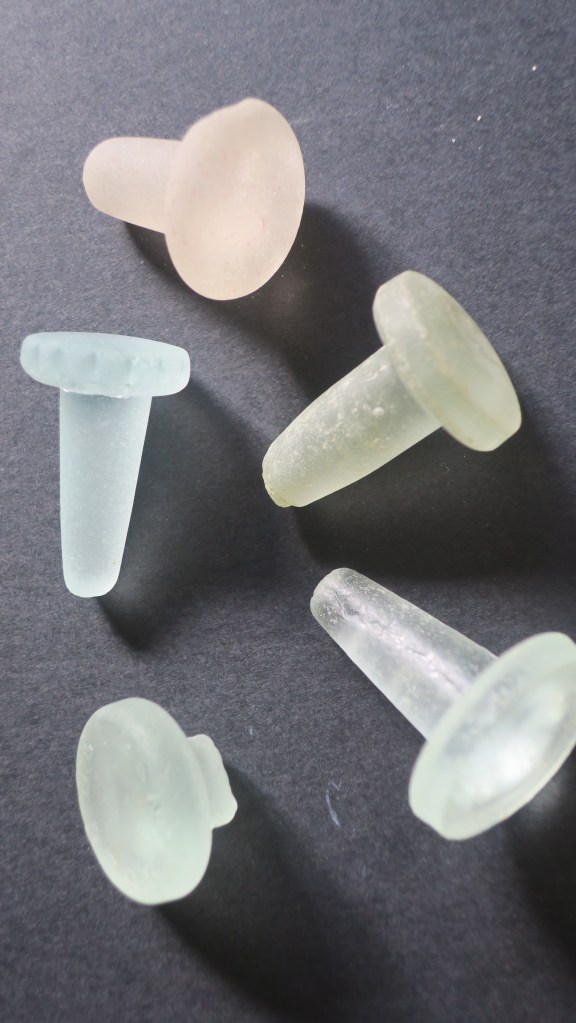
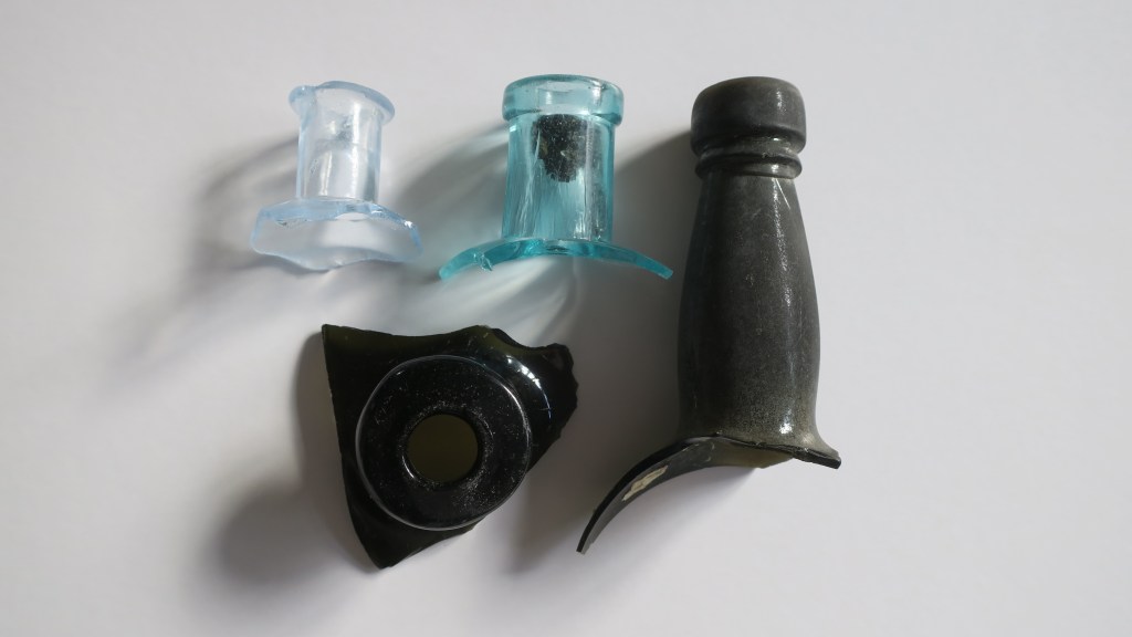
1, Glass stoppers
Long before plastic and screw tops many bottles were closed off with a glass stopper. The most common variety found are the ones in the picture below, used to seal sauce or relish bottles. Originally they would have had a ring of cork around the neck to ensure a tight seal. These very durable objects are a beachcombers delight. It is not a huge collection but each find of a glass stopper gives me an odd sense of joy…
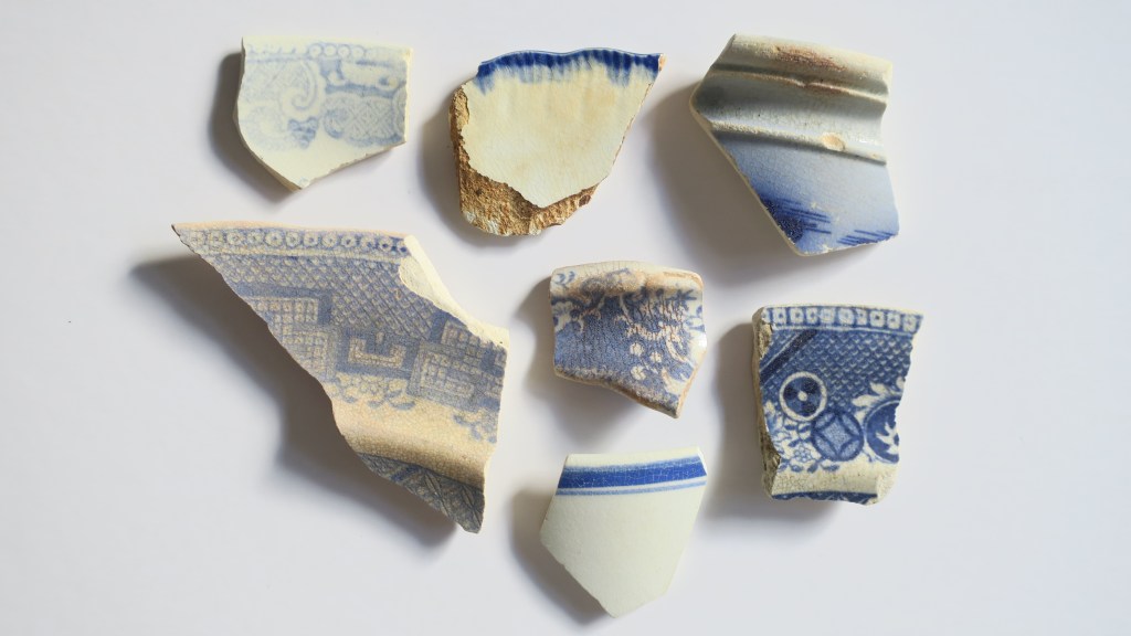
2. Ceramics
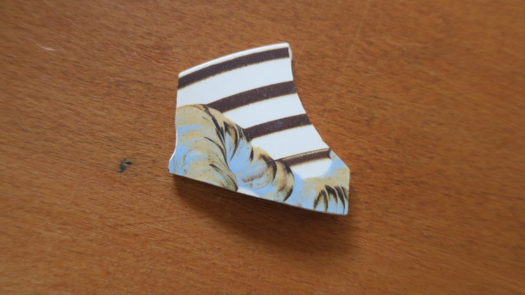
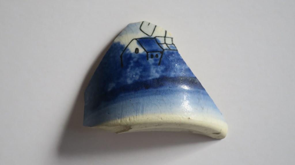
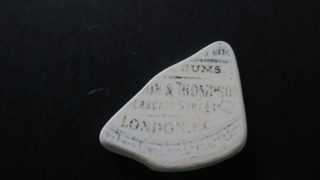
Sea pottery is also a relatively common find on beaches and waterways around the world and here in New Zealand it is no different. The variety of ceramics is often quite surprising, the most common are the plain white or cream pieces. But the most sought after are the early pieces of transfer print earthenwares imported from the UK or brought out with the first settlers. These come in a variety of patterns and colours, my favourite (along with many others) are the blue and white patterned pieces including the ever present ‘willow pattern’. I have written extensively on the ceramics found at Fitzpatrick’s Bay, please feel free to check it out here. Included in this category are also stonewares, I have yet to find a complete example but I have many neck sections and bases.
3. Glass
I have chosen to call this section glass as opposed to seaglass as there will be some who dispute my examples as seaglass. When I started to collect I was most surprised to find that there is an International Seaglass Association and they have defined true seaglass as;
Genuine sea or beach glass comes from discarded bottles, tableware, or household items and is found in oceans, lakes, and rivers. Genuine sea or beach glass tends to have: Lettering, embossed images, and distinguishing features such as handles, bottle necks, etc. A frosted patina on the surface with small “C”-shaped patterns, surface cracking, rounded edges, and small crevices where grains of sand may be found.
Much of the glass I find does fall into this category but the most interesting pieces are not so worn by tide and time. These are the bottle necks or fronts with lettering that can be researched. The other smaller (proper seaglass) pieces I collect go into the art pieces I make to sell at a local market (Magpie Designs)
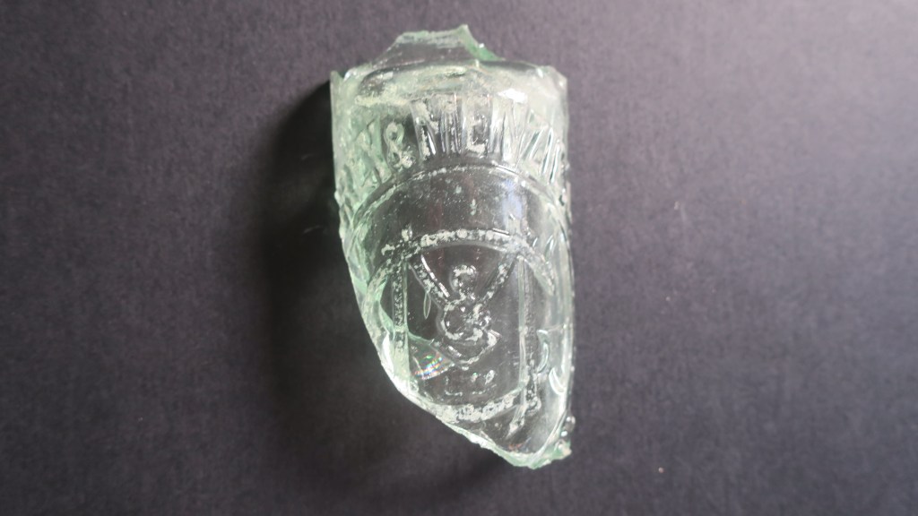
The next photos shows a knarly chunk of sharp glass I found whilst larking under the harbour bridge. I wouldn’t normally have bothered to bring this home but the lettering got me curious. A quick search online found the following on the Auckland Museum website.
Grey & Menzies Ltd (1902-1962)
Established in 1902 following the merger of J Grey & Sons and Thames cordial manufacturer Menzies. The firm operated as Grey and Menzies until 1964 when a merger with CL Innes Ltd resulted in the soft drink brand of Innes Tartan. John Grey established J Grey cordial & aerated water manufacturers at Eden Cres. Auckland in 1874, and in 1880 his sons joined the business it became J Grey & Sons 1880-1902
Robert Menzies was born in Scotland in 1854 and came to New Zealand in 1858, working initially for Buteman Bros, Thames. He later worked for B Ballin (Thames), John Grey and George Gledhill before purchasing Buteman Bros. in partnership with Samuel Hirst to form Menzies & Co at Thames. In August 1902, with two partners he established Menzies Ltd, and leased a property in Stanley Street, Auckland but a month later joined with John Grey & Sons to form Grey & Menzies Ltd
The Grey and Menzies merger occurred in 1902 – the company now covered a considerable area including Northland, Auckland, South Auckland and Thames. The company began to introduce new lines including the ginger beer that became Tartan Dry Ginger Ale. In 1916 the company purchased the Paeroa spring, aerating and bottling the water in Auckland under the “Paeroa Water” label – later to become Lemon & Paeroa. In the early 1920s they began making Orange and Lemon Crush under license from the Crush Co’s reg’d USA patent office.”
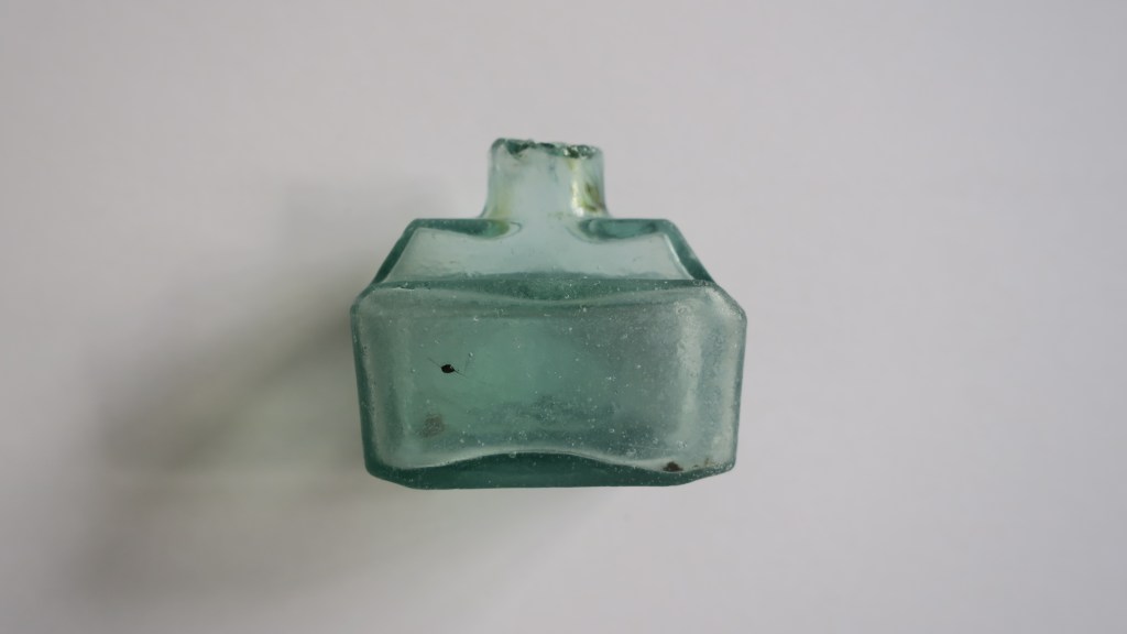
The next photo is of a sweet wee ink bottle, again found under the Harbour Bridge. It was a strange moment…I was about to leave the area having found very little that morning, thinking about a post I had seen on Instagram about these cute glass ink bottles when I spotted nestled in the seaweed one of the very same. Known as Boat ink bottles for their shape and distinctive lip used for a pen rest they come in a variety of colours. During a recent visit to the Dargaville Museum north of Auckland I saw a vast collection of these bottles in all their beautiful colours.
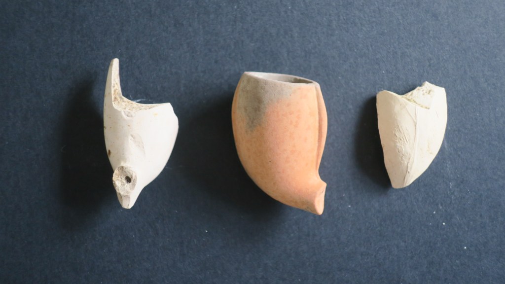
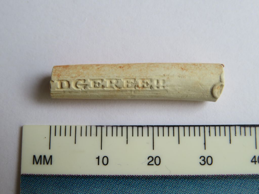
4. Clay Pipes
Finding clay pipes on the shores of Auckland’s harbour can be a bit hit and miss, however I do have a small collection of pipe stems and bowls. None of which have any visible decoration or makers mark, given the softness of the kaolin clay used to make these items it should not be surprising that it would easily wear away. Not so long ago I was sent pictures of a pipe stem found at Fitzpatrick’s Bay which did have a stamped name on it, ‘squatters budgeree’ which I have written about here.
For those who would like to know more about clay tobacco pipes in New Zealand the following links may be of interest. For those elsewhere there are a multitude of websites and books on the humble clay pipe.
Underground Overground, Christchurch

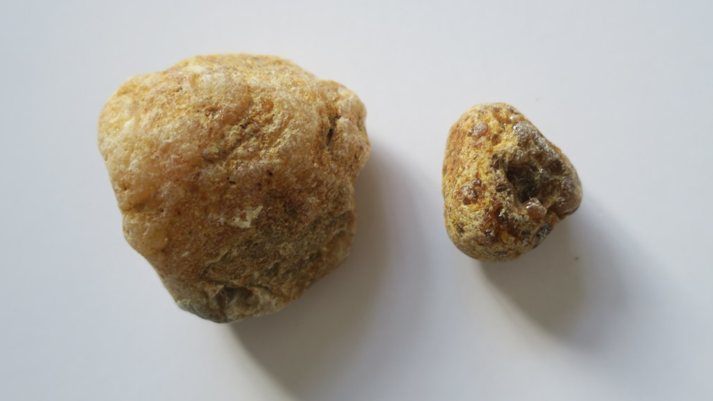
5. Kauri Gum
For those who are not familiar with Aotearoa New Zealand’s flora, there is a native tree called kauri. It is a slow growing hardwood which was much sought after by settlers and Māori alike. Its many attributes was the tendency to ooze sap which over time solidifies and becomes much like amber. Early settlers would often turn to gumdigging as a way of supplementing other income or when there was no other income.
The gum was used by Māori as a type of chewing gum (fresh gum), as a fire starter and when burnt and mixed with animal fat for tattoo moko. The early settlers used it in a variety of ways, much like amber for trinkets and jewellery. However, in the mid 1800s it was discovered that when mixed with linseed oil it made an effective varnish and as such was in great demand in the UK and Europe. Kauri gum became Auckland’s main export at this time – between 1850 and 1950 approximately 450,000 tons were exported. The growth of early Auckland owed much to this industry.
The area in which I live once had extensive kauri forests, so it is not surprising to find chunks of gum washing up (and down) onto the beaches. I collect them because of the history they remind me of. Below are a just a couple of the many pieces currently residing in my rockery…
For more on kauri gum read here.
6. A Gun Flint
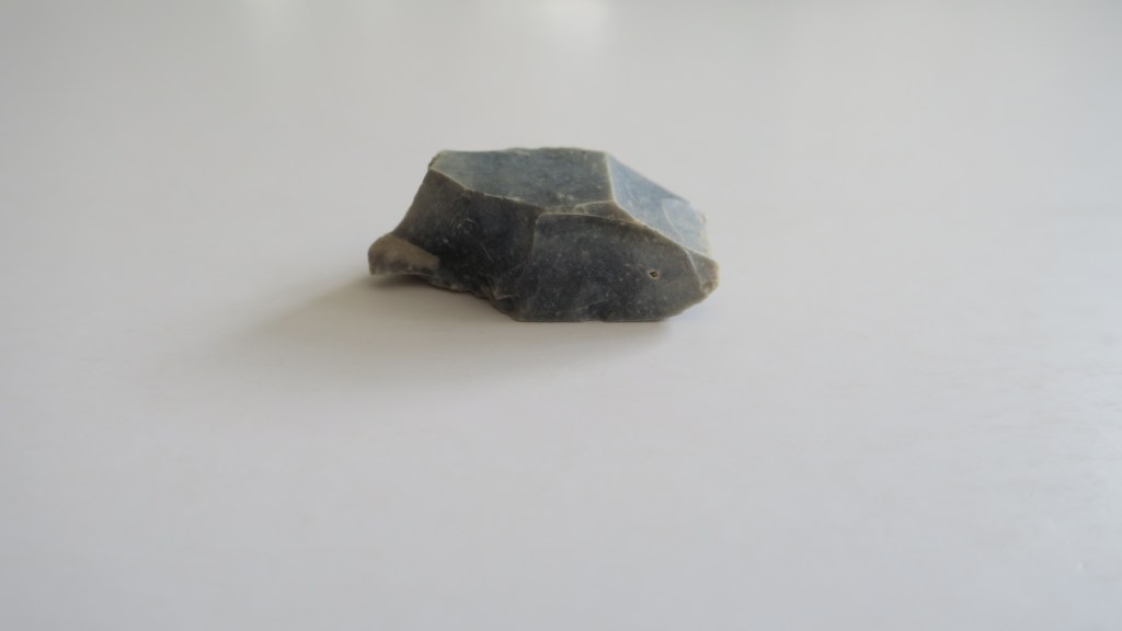
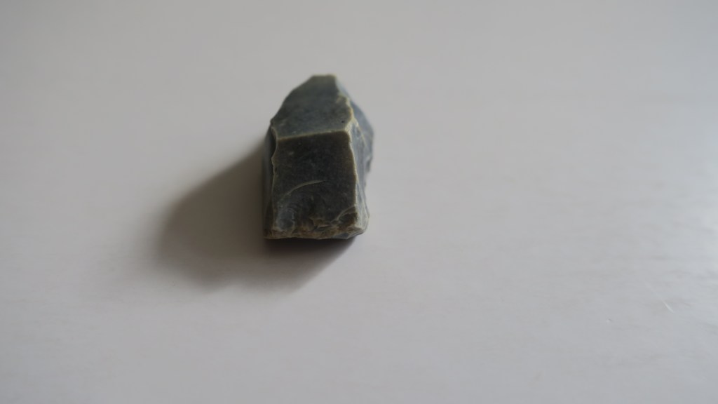
I only have one gun flint and only a partial one at that. Gun flints are part of the striking mechanism for a flintlock gun and were in use in the UK from the 17th to the 19th century. For more on how they were used read here. Here in New Zealand the musket, which also used a flintlock mechanism, contributed to a period in our history known as the Musket Wars.
‘After Europeans brought muskets (long-barrelled, muzzle-loading guns) to New Zealand, these weapons were used in a series of battles between Māori tribes, mostly between 1818 and 1840. As many as 20,000 people may have died, directly or indirectly. Tribal boundaries were also changed by the musket wars.’ From Te Ara Encyclopedia
Although there is no telling who used this particular gun flint (it was found at Fitzpatrick’s Bay) it is a sobering reminder of our past – the good and the bad.
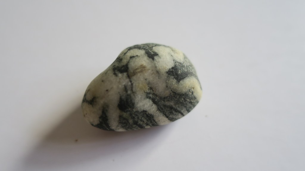
7. A Fossil
No I’m not talking about the other half…but rather this small reminder that the earth is old and for me at least, a reminder that our time here is but a moment.
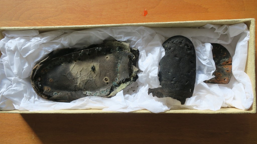
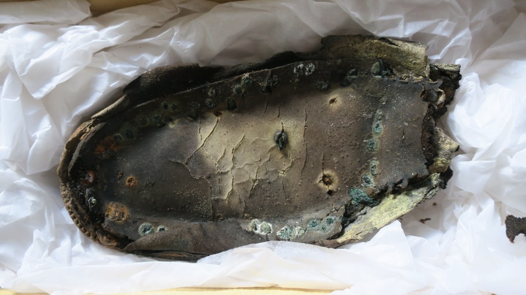
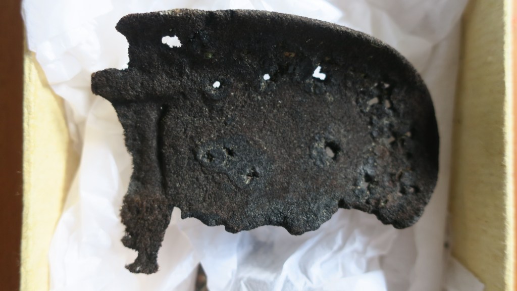
8. Shoes
Occasionally I find parts of shoes, sometimes they are modern (so many jandals) and head straight to the bin but other times they are much older. When I look at these shoes parts I wonder who wore them, what was their life like? Oddly shoes feel very personal and connect me to someone in the past – will a person in the future find the sole of my favourite ugg boots and wonder about me too?

9. A Mystery Object…
This final object confounds me and I hope there is someone out there who might be able to shed some light.
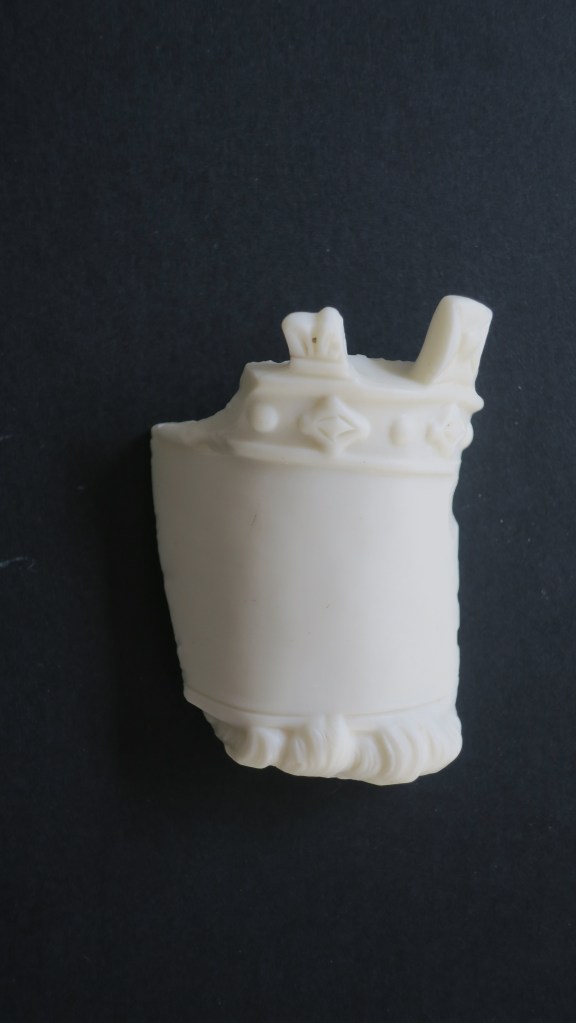
As you can see it is an interesting shape, being 6cm at its tallest, it looks like a crown with a blank space for perhaps a label (?) and locks of hair below. The material at first glance looks like milk glass but I am not sure as it it is quite matt and more like alabaster in appearance. All suggestions welcome…
And there you have it, just a few of my favourite things…
If you have enjoyed this blog please feel free to share, like and comment – tell me your favourite finds!
Share this:


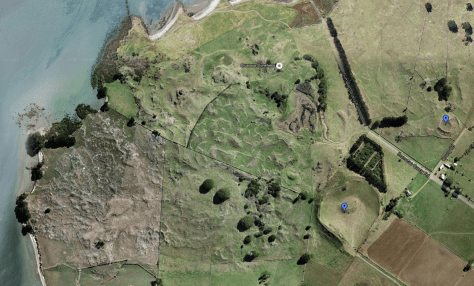
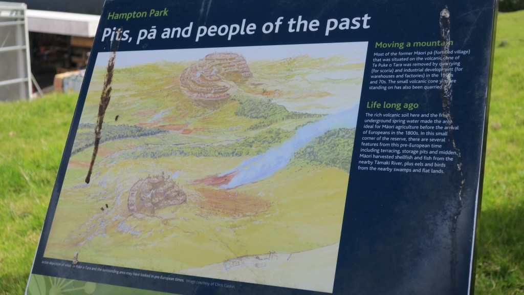
Hampton Park – Te Puke o Tara
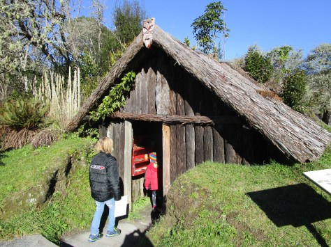
Back in October the Auckland Council hosted the Auckland Heritage Festival, where, as the name would suggest all things heritage and Auckland was celebrated. There are a wide range of events during the festival weeks from walks, talks, exhibitions and workshops. I was able to attend two events – a talk at the Devonport Museum on Mt Cambria (more on that down the page) and a walk ‘n’ talk at Hampton Park.
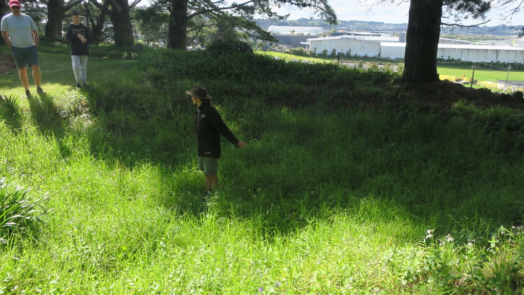
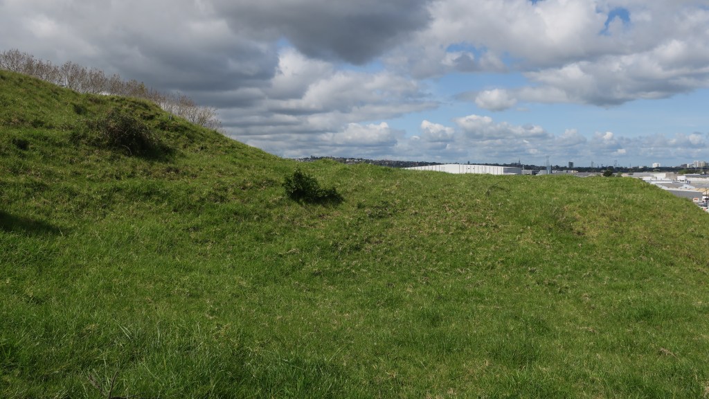
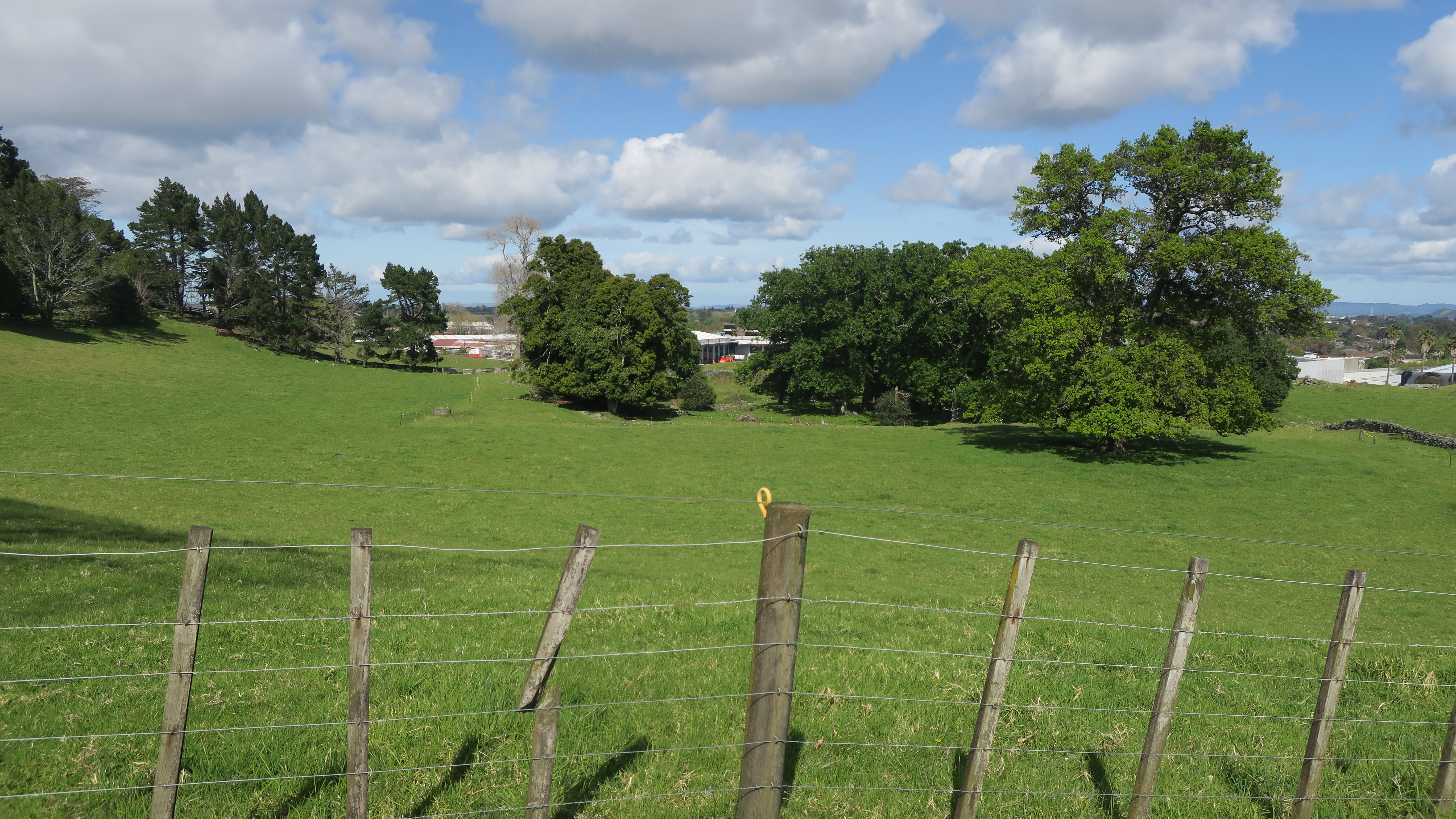
Hampton Park is situated in the heart of commercial Otara, a pocket of farm land amongst the warehouses, factories and offices. Having never been there or even for that matter heard of it, I was intrigued to find out more. The park is in fact a working farm and whilst the public are able to walk around it there are no proper footpaths and no other facilities (there is a house and it is lived in by the family who farm the park as well others – if visiting please respect their privacy).

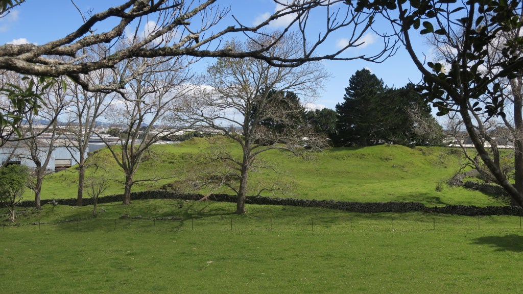
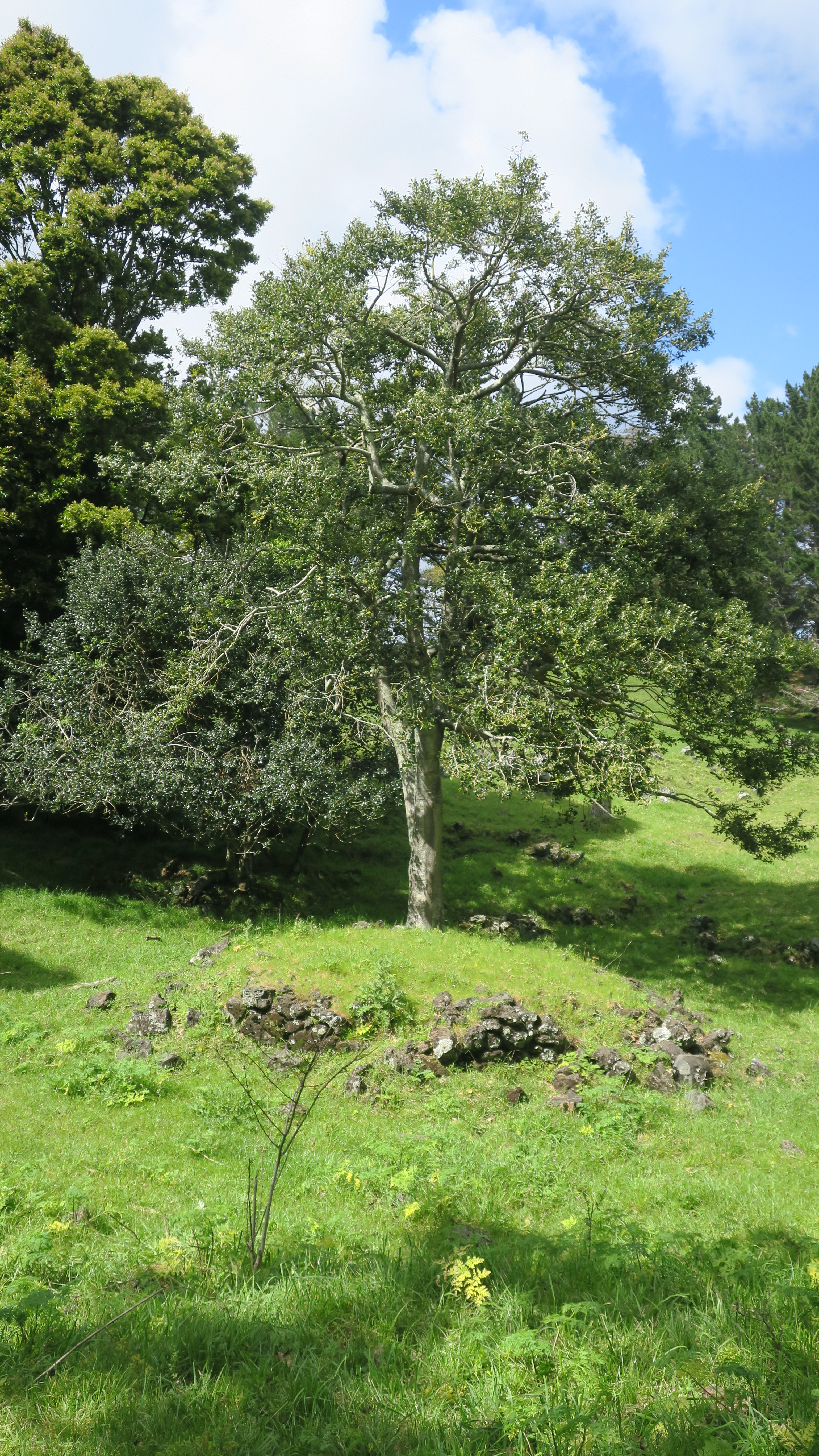
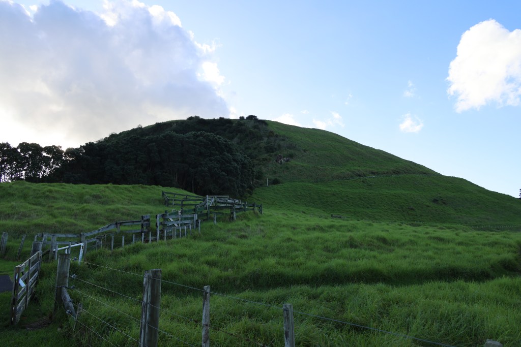
The story of Hampton Park begins long before people arrived in the area. Geologically it is part of the wider volcanic landscape of Auckland, here in Otara there are (or were) three volcanoes, the largest of which was called Te Puke o Taramainuku (‘the hill of Taramainuku’, a Tainui ancestor). The small scoria cone that sits in Hampton Park is the smallest of the three and is probably the smallest of all the Auckland volcanoes. It is so small that it has no formal name, simply being referred to as the Hampton Park volcano.
The beginnings of the human story in the area is much like the human story all over Tamaki Makaurau. Here like everywhere else Māori terraced the flanks of the cones and grew crops in the good volcanic soil. The larger cones would have provided a place of refuge when in need. The small cone in Hampton Park shows some evidence of terracing but later changes has blurred this somewhat. Alongside the driveway between the house and the church there is a large rectangular kumara pit which has remarkably survived. For more on the Māori use and occupation of the maunga of Tamaki Makaurau read here.
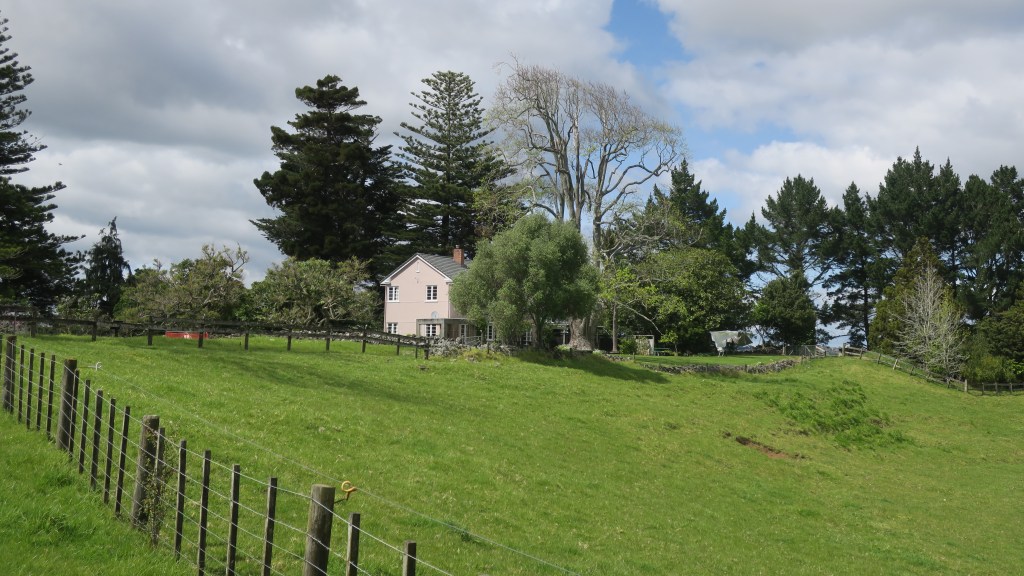
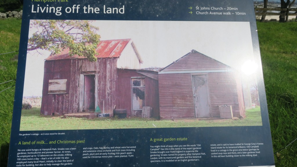
In 1852 the Rev. Gideon Smales, a Wesleyan missionary, bought 460 acres from the fencible Major Gray, settling there with his wife and children in 1855. The land was cleared of rocks, stone walls were built and crops and livestock brought in. Gideon Smales called the farm Hampton Park as he wished to model it on the English gentleman’s estate. It was said to have once rivalled Sir George Grey’s Kawau Island estate for its ‘botanical excellence’.
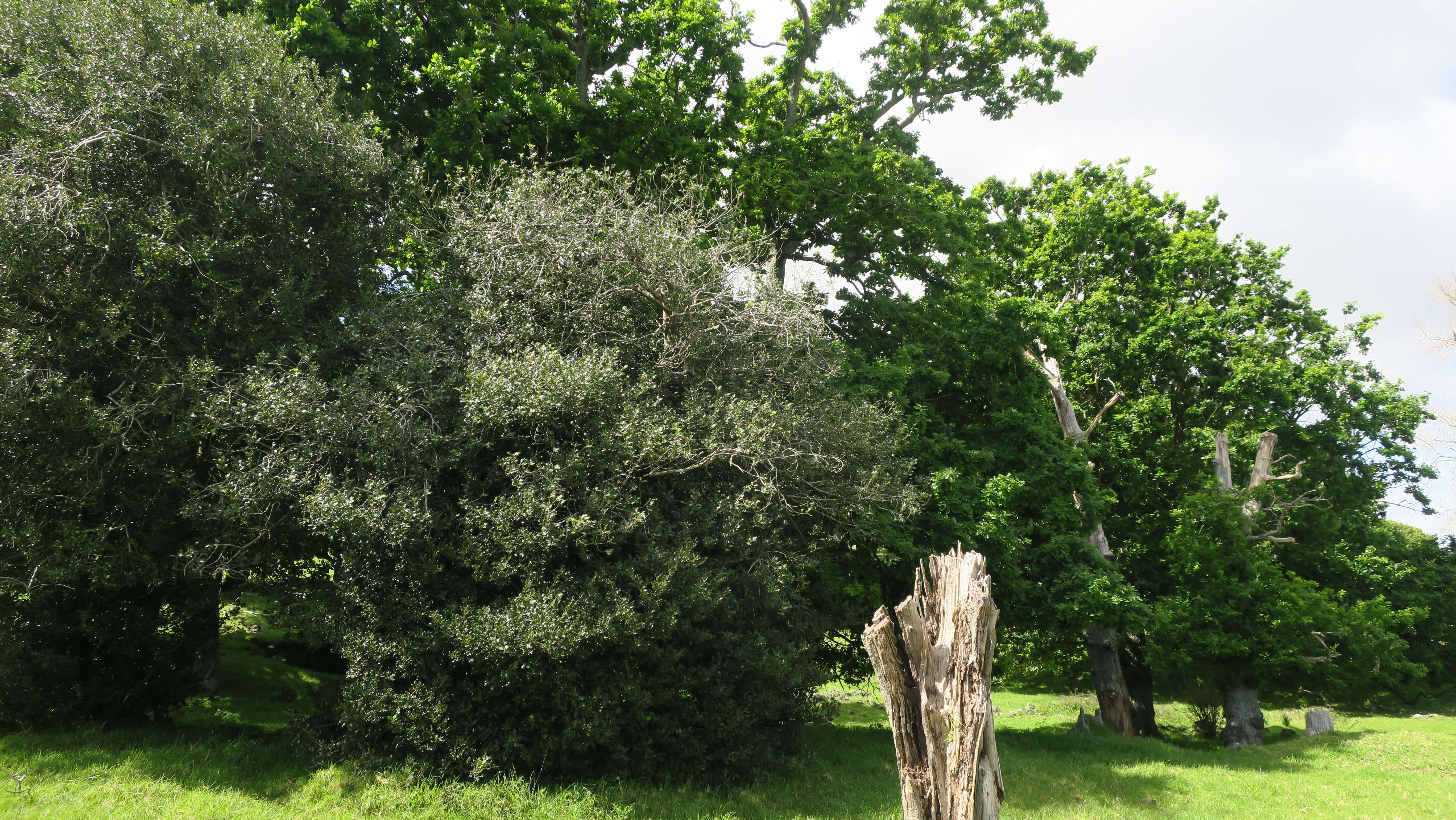
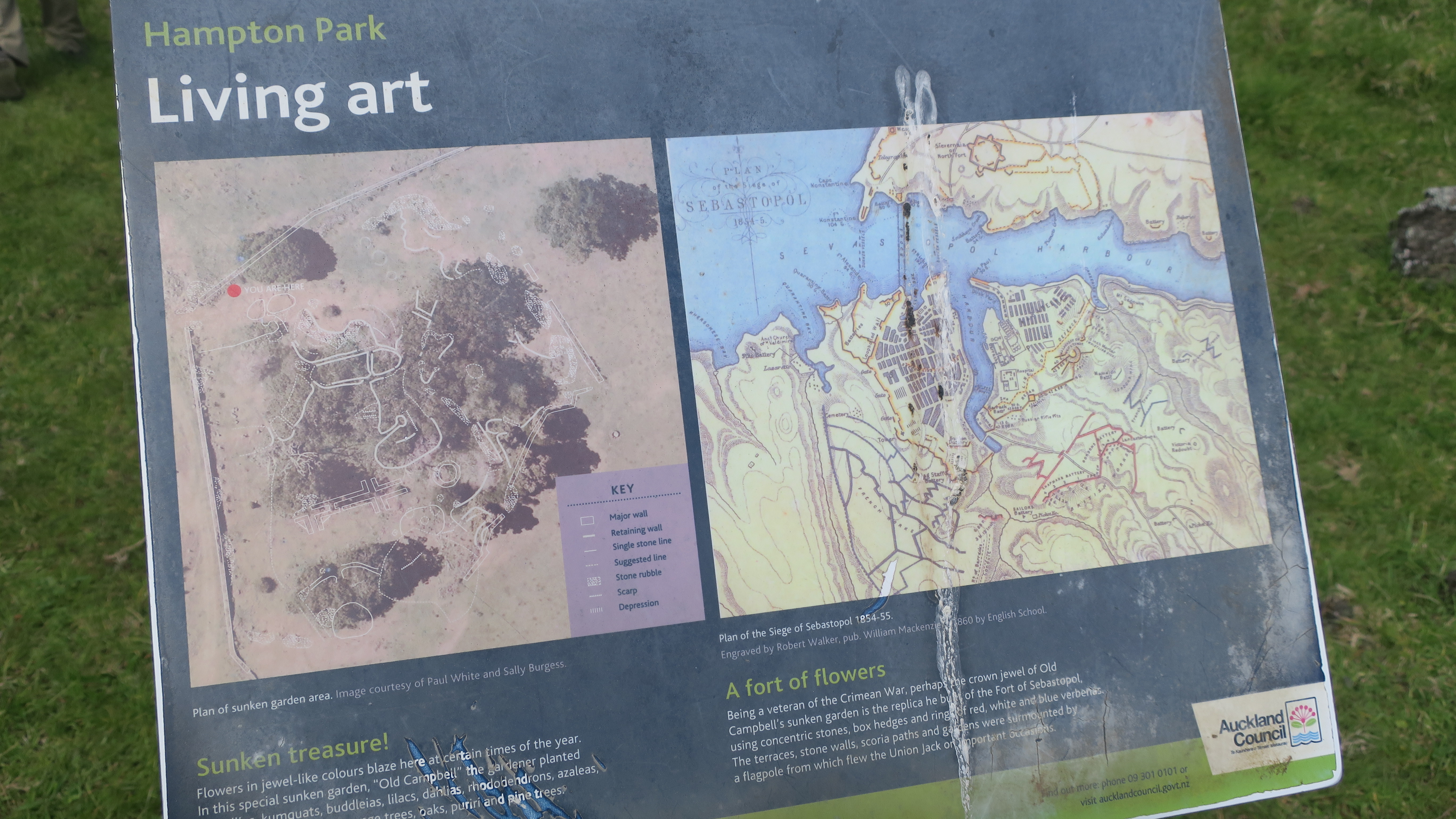
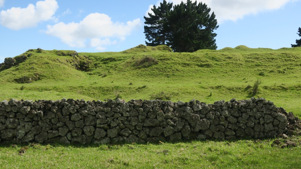
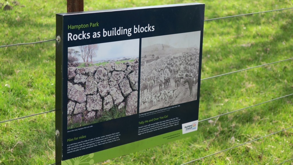
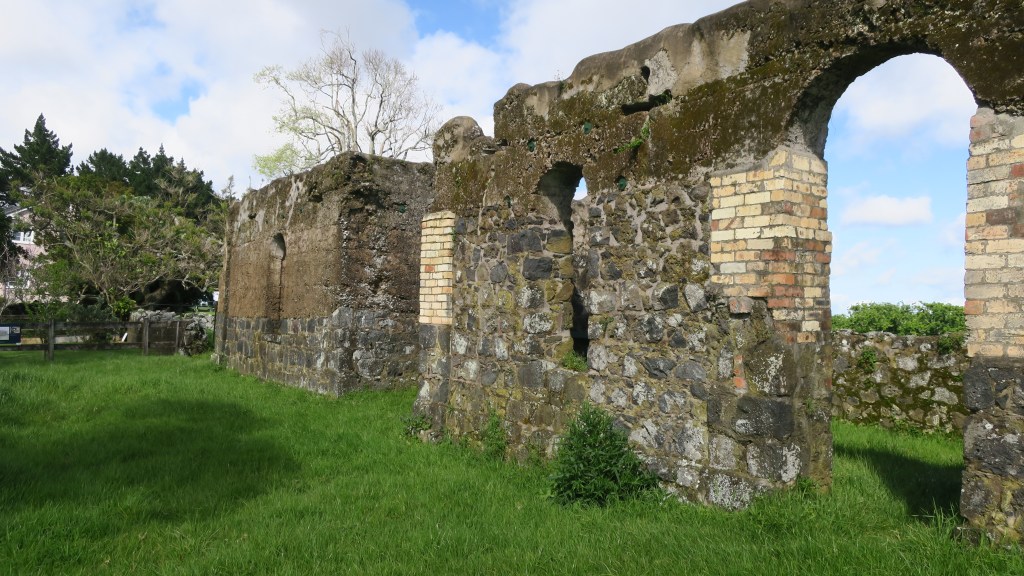
The farm grew oats, hay, barley, wheat and had an extensive orchard which included cider apple trees, pomegranates, oranges, figs and plums to name a few. In addition, to the more practical elements of the farm, the gardener – a veteran of the Crimean War – built a sunken garden in the form of the fort of Sebastopol. The remains of which can still be seen today. The excessive amount of stone on the estate resulted in it being used for a great many projects including the sunken garden, a rockery with a high stone wall and cave and of course the stone walls.
The stone walls which were constructed with the stone cleared away for cultivable fields was done so under the supervision of James Stewart who immigrated to New Zealand from Yorkshire. Due to the vast quantity of stone the walls were higher than was the norm and it was said there was over five miles of walls on the estate.
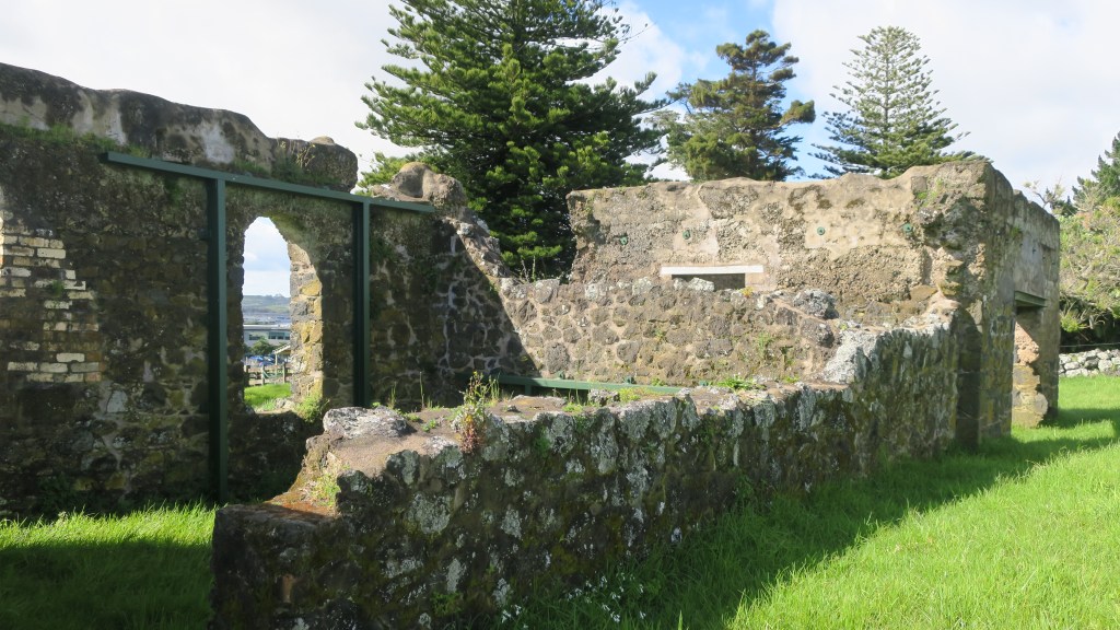
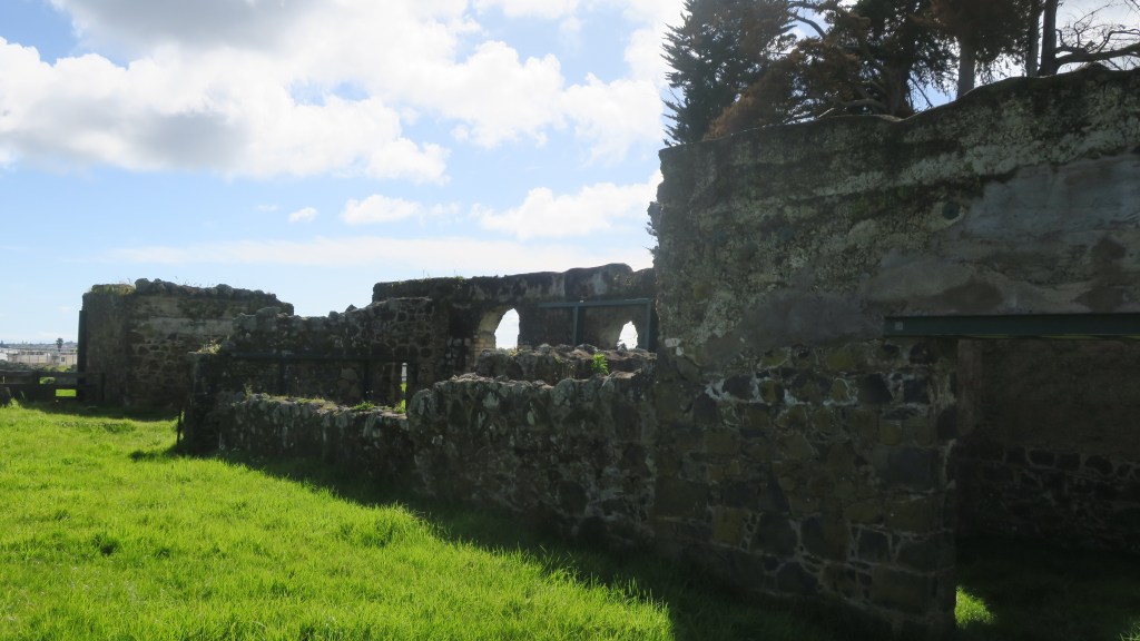
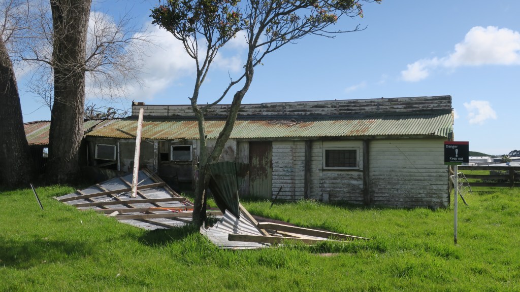
As is to be expected on a farm there are a number of buildings but perhaps the most striking are the remains of the stone stables, again built from stone quarried from the estate. Although not long after they were built a vagrant worker came to the estate looking for work, he was given a meal and allowed to sleep in the stables. That night the stables burnt down and the vagrant disappeared. They were never rebuilt properly although they were partly roofed over as barn and milking shed. Nearby are the derelict tin shed of the 1930s barn.
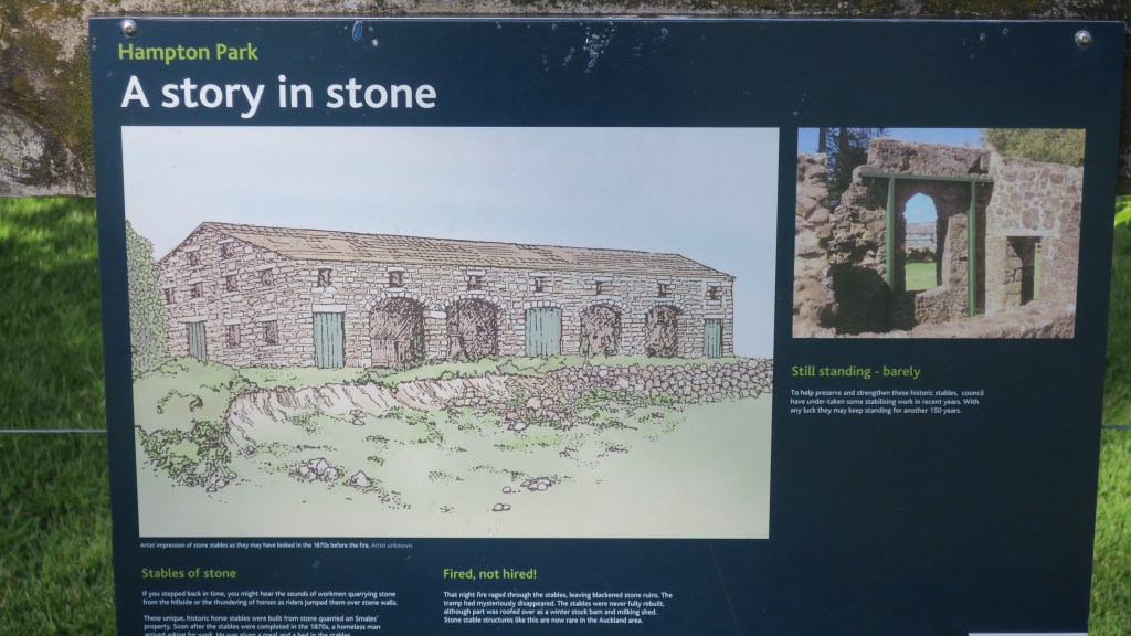
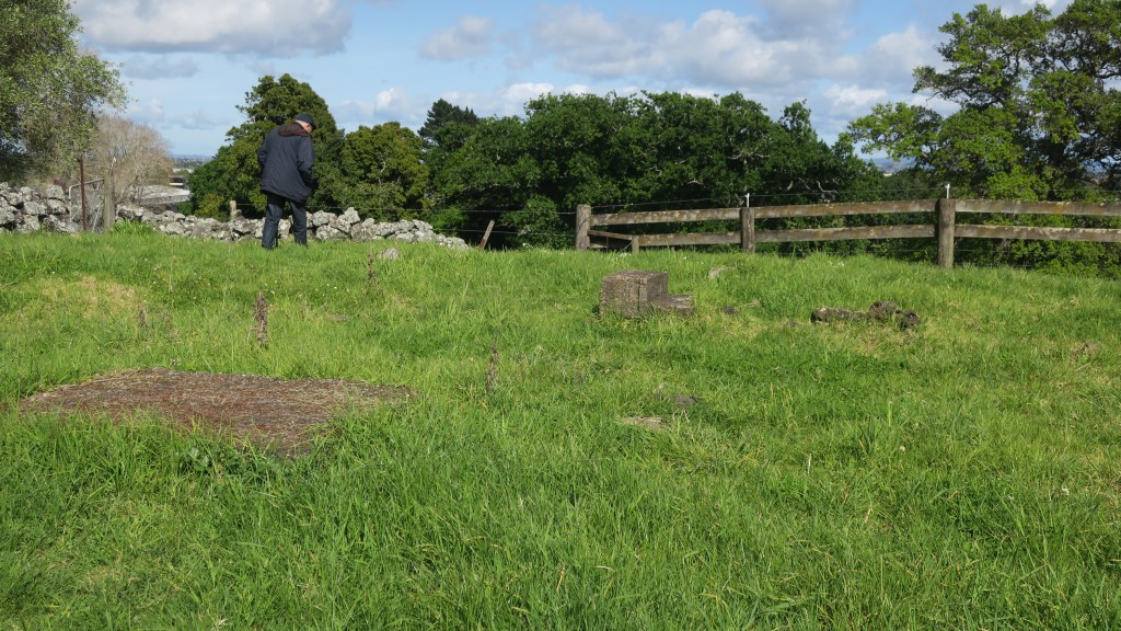
Two other buildings which still stand are the homestead and the church. The current homestead is the second to have stood on the estate, the first was burnt down in 1940 and the current homestead was built – only the front steps remain of the original house. The first homestead was built in 1855, it was three storied and had ten rooms which was later extended to eighteen rooms in 1869.
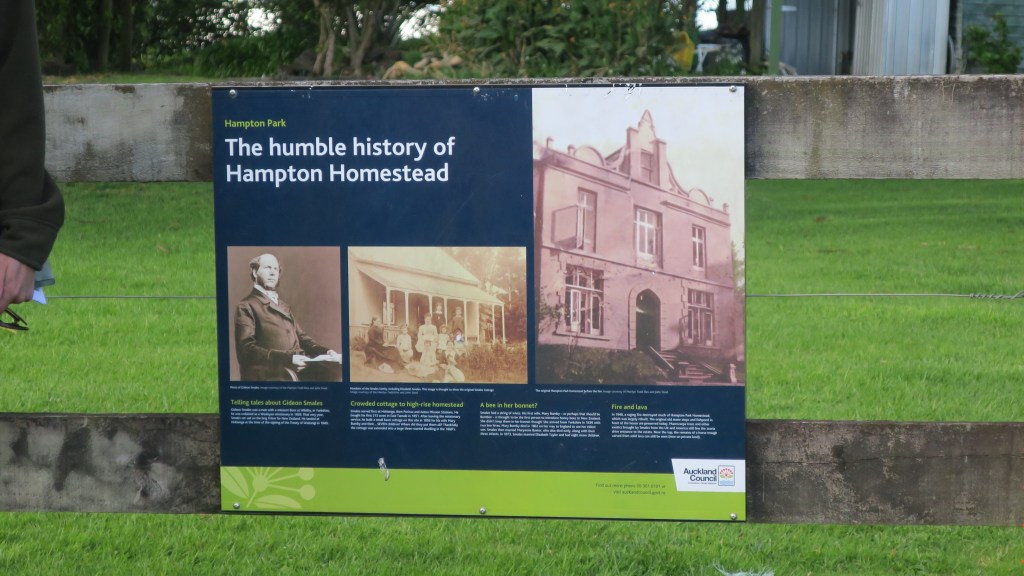
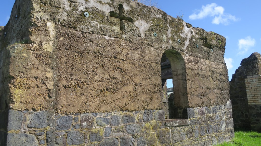
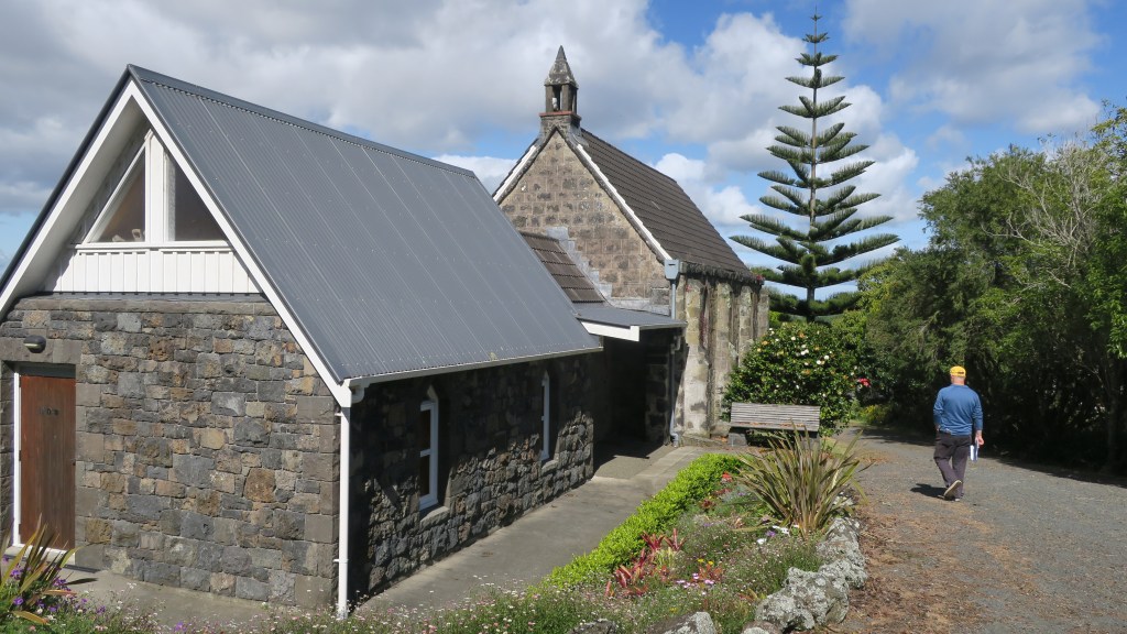
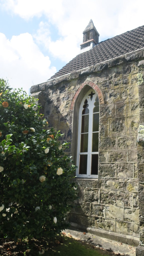
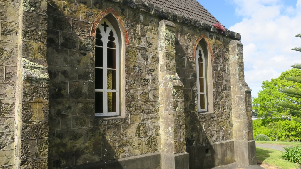
The small chapel – St John’s church – is also constructed using stone from a nearby quarry. Interestingly, the mortar for both the church and the house was made of burnt shell from Howick beach, the timber arrived via the Tamaki river and was brought overland by bullock teams. The first service to be held in the church was on Sunday the 12th January 1862. When the Rev. Gideon Smales died in 1894 he bequeathed the chapel and four acres jointly to the Anglican and Methodist Churches. It is still used today for services once a month.
The Missing Maunga
Beyond the settler history of the park there is another story that is reflected in the wider landscape of Auckland Tamaki Makaurau. As mentioned earlier the small volcano cone at Hampton Park is one of three in the immediate area, which may confuse the visitor, as nothing of the other two remain to be seen.
Te Puke o Taramainuku has been completely quarried away beginning in 1955 and now is vast expanse of factories, beyond is Greenmount or Matanginui which had minor quarrying from around 1870 which began in earnest during the 1960s. The quarry eventually became a landfill giving way to the gently sloping mound/hill we see today.

The quarrying of the volcanic cones around Auckland in the late 1800s up until the mid fairly recently was not an unusual. Many of the cities defining features were quarried away to make way for development and to use the raw material of scoria and basalt in the infrastructure of a city. An earlier event at the Devonport Museum told of the history of Takararo/Mt Cambria, another volcanic cone wedged between Takarunga/Mt Victoria and Maungauika/North Head which was mostly quarried away and only more recently became the pleasant parkland area it is today.
Other volcanoes that have been subjected to quarrying to the point of total removal include –
Te Apunga-o-Tainui/McLennan Hills; Waitomokia/Mt Gabriel; Ōtuataua Volcano/Quarry Hill; Maungataketake/Elletts Mountain; Te Pou Hawaiki (the second smallest cone and now a carpark);Te Tātua-a-Riukiuta/Three Kings; Rarotonga/Mt Smart; Maungarahiri/Little Rangitoto; Te Tauoma/Purchas Hill to name a few.
There are also many others which have been partially quarried, of the fifty three volcanoes in Auckland only thirteen appear to have been untouched by the bulldozer and the digger. This is not to say that those that remain have been completely untouched by human hands. For as long as there has been people in Tamaki Makaurau then the landscape and its features will have been adapted and utilised to suit the needs and requirements of its inhabitants.
For more information regarding the volcanoes of Auckland I recommend the following book –
B. W. Hayward (2019) The Volcanoes of Auckland. A field guide. Published by Auckland University Press
Share this:


Exploring Auckland’s Maunga
Perhaps one of the most dominant and much-loved landscape features of Tamaki Makaurau Auckland are the remains of long dead volcanoes. Fifty-three volcanoes have erupted in the Auckland area over many millennia (the most recent being Rangitoto), some exist in today’s landscape as basins or form lakes and many have been quarried away for stone used in the construction of roads and building, or to simply make room for the ever-developing city.
“For hundred of years, these volcanoes have played a key part in the lives of Māori and Pākehā – as sites for Māori pā and 20th century military fortifications, as kūmara gardens and parks, as sources of water and stone.” (B.Hayward ‘Volcanoes of Auckland’ 2019).
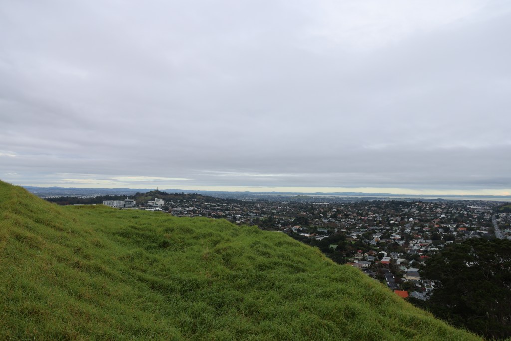
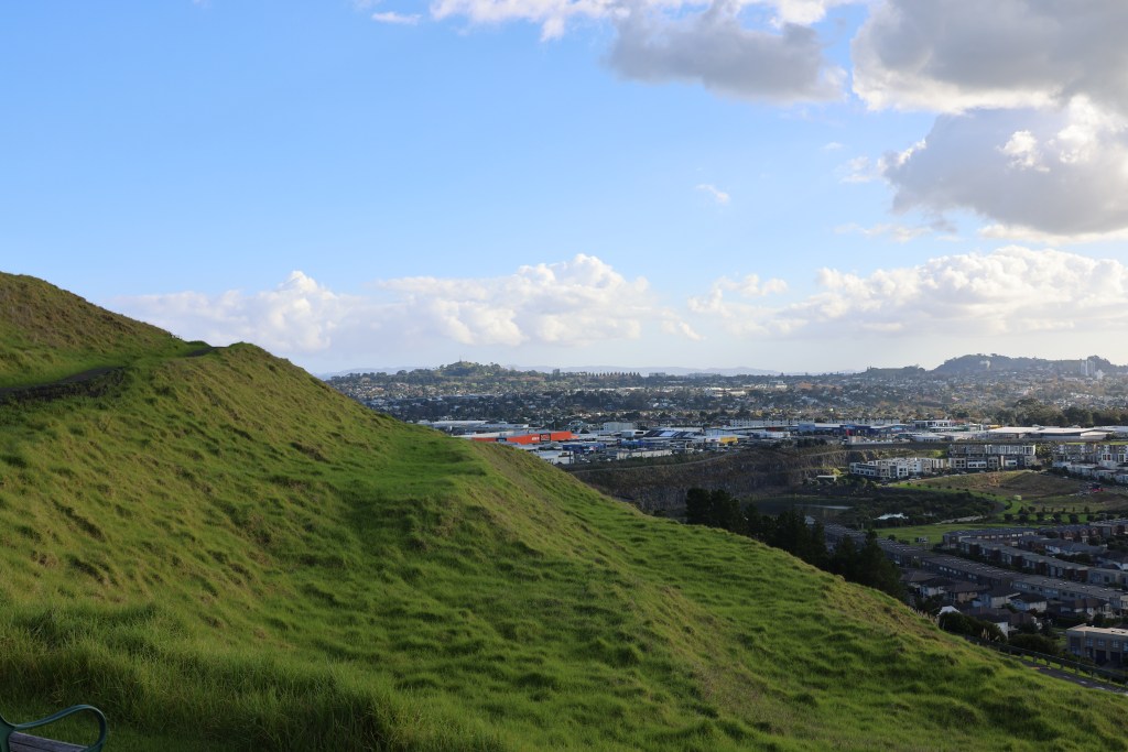
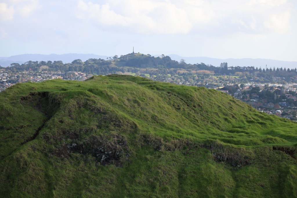
As an archaeologist my interest in the upstanding cones of Auckland’s past volcanoes relate to the features found on and near their slopes, to this extent with the company of the dog, the other half and one of the teens, it was decided to explore those we had seen from a distance as we zipped up and down the motorway.
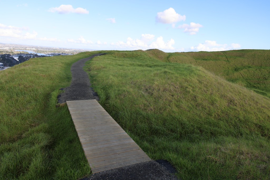
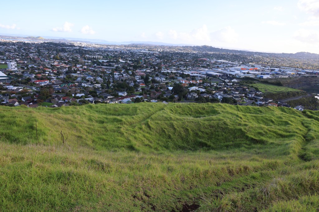
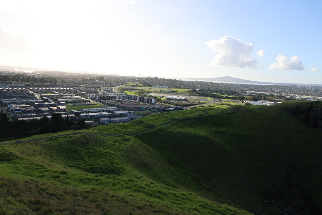
The four largest maunga (mountains/volcanic cones) in Auckland are Maungarei (Mt Wellington), Maungakiekie (One Tree Hill), Maungawhau (Mt Eden) and Mangere. Today’s visitor to these places may have a skewed view of the maunga, seeing them standing alone within a landscape of roads, housing developments and shopping centers. This was of course not always the case, using archaeology it is possible to strip back the layers of modern city life to see into the past. It is equally important to understand that the maunga were not static occupation sites. There were many changes over time, what we see today is simply the last phase of occupation. One of the most common assumption about all of Aucklands upstanding volcanic cones are that they were solely used for defence in times of upheaval. The common name for this type of site with its banks and ditches is pā – a Māori fortification which in turn has resulted in other misconceptions that will be touched upon below.
It is also important to know that remarkably little archaeological excavation work has been done on the maunga of Auckland. The most well known was the series of excavations done on Maungarei between 1960 and 1972 ahead of several developments (installation of water tank and road access).
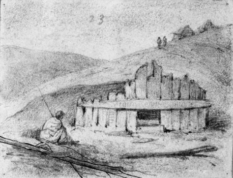
As mentioned above, a pā is seen as any type of settlement which has been fortified, their defining features are the banks and ditches surrounding an area of landscape. Situated mainly on hills, spurs and headlands (but not always, such as the ‘swamp pā’ found in the Waikato), there are some five thousand known pā in New Zealand, of which, the majority are found in areas good for horticulture. Other features can include, pits, terraces and house platforms.
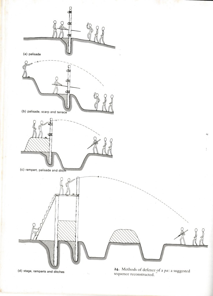
The above diagram is from A Fox (1976) ‘Prehistoric Maori Fortifications in the North Island of New Zealand’ depicting the variety of methods used in defence of a pā.
It is perhaps a mistake to assign a singular function to pā – they were used as places of refuge but they were also places were people lived (although not always and in some cases never), where they stored important food and water supplies; they could also be focal points for religious activity. The palisades and ditches were just as likely to be a symbolic boundary separating a sacred area from the everyday, then a fortification built during times of war.
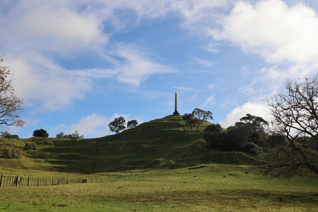
Maungakiekie (One Tree Hill) has four heavily defended summits but at its the very highest point there is an area which is regarded as important and sacred. Called Te Totara-i-ahua after the sacred lone tōtara that grew there in pre-European times (see earlier post) and it has the greatest amount of defenses surrounding it.
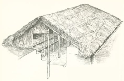
One of the most common features found at many pā including the maunga of Auckland are the storage pits. Unlike the ancestral tropical home of the Māori where important food staples could be grown all year round, Aotearoa’s more temperate climate required some lateral thinking by New Zealand’s first people.
Storage pits enable kumara tubers to be stored in conditions that protected them from extremes of temperature both for future planting and consumption. There are several types of storage pits – rua are small cave like structures that are dug into the ground and sealed with a wooden door. The type which is most obvious on Auckland’s maunga are the large rectangular storage pits dug into an area and topped with a pitched roof. Depending on the size the roof was supported by either a single line of central posts or a double line of posts. Other features within the storage pit itself include drainage channels that led to one corner of the structure and a sump – an important feature in Aotearoa’s rainy climate.
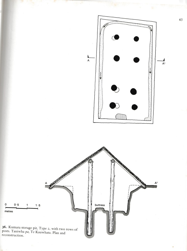
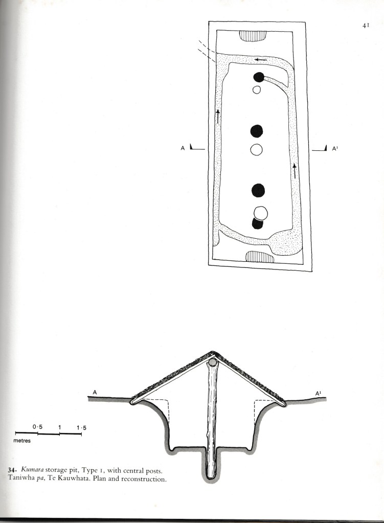
The above are from Fox A (1976) ‘Prehistoric Maori Fortifications in the North Island of New Zealand’ and show the two types of storage pits commonly seen on the maunga of Auckland.

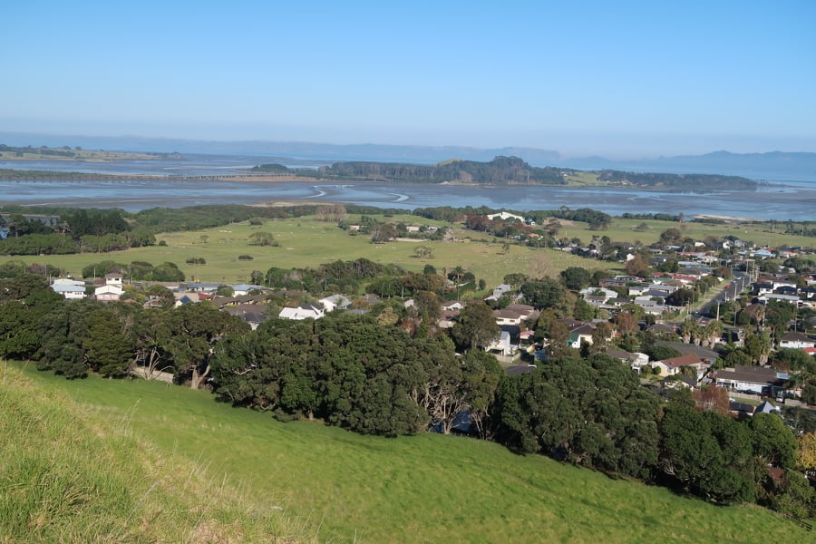
As mentioned before the maunga of Auckland existed within a landscape dotted with settlements and gardens. The fertile volcanic soils surrounding the maunga providing a perfect growing medium for kumara and later the potatoe. This combined with the easy access to other natural resources such as fish and shellfish from the nearby harbours east and west of the central maunga made the isthmus a desirable to place to live where resources were plentiful.
“The prospect from the summit is grand and nobly pleasing, I observed twenty villages in the valley below, and, with a single glance, beheld the largest portionn of cultivated land I had ever met in one place in New Zealand.” From Reverend John Butler – travelling with Samuel Marsden in 1820 as he climbed the summit of Maungarei.
The excavations of Maungarei produced radiocarbon dates for the earliest occupation on the lower slopes to the early 1500s. The period from the mid 1500s to the late 1600s was a time of intensive use. But after 1700 Maungarei does not feature in oral accounts of Māori history and was perhaps no longer an important place. The archaeology suggests that it was the two high points which were the most densely protected (tihi) by palisades and ditches. The lower terraces providing evidence of structures (postholes), hearths, fire scoops, midden deposits and storage pits.
“Maungarei was thus the location of repeated settlements, which were sometimes fortified, particularly late in the sequence, but often not.” From J Davidson (2011) ‘Archaeological investigations at Maungarei: A large Māori settlement on a volcanic cone in Auckland, New Zealand’ Tuhinga 22 Te Papa.
Increasingly, archaeological studies are showing that the pā as a site was a late feature of the landscape, dating from the 1500s onwards, not all were in use at the same time and not all functioned in the same way. This would appear to be the case for Tamaki Makaurau Auckland as well. For a long time it has been assumed that the widespread presence of pā in Auckland has meant that the area was in a constant state of flux.
“…Tamaki, in the years of Waiohua ascendency, was one of the most settled and extensively cultivated regions in Aotearoa…in spite of the received wisdom of historians to the contrary, was the the fact that tribes enjoyed long periods of relative peace.” From R C J Stone (2001) ‘From Tamaki-makau-rau to Auckland’ Auckland University Press.
Another of the common features of the maunga are the areas of flat ground surrounding cones. These terraces were used as places for living (some have house platforms), as places for storage pits and as places for gardens.
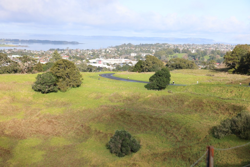
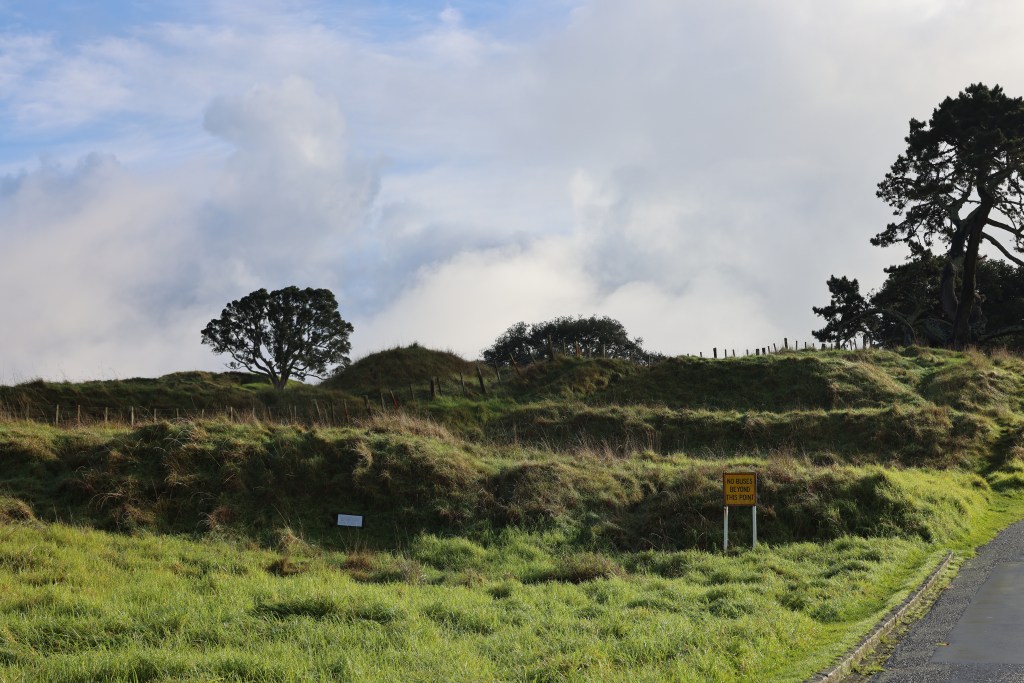
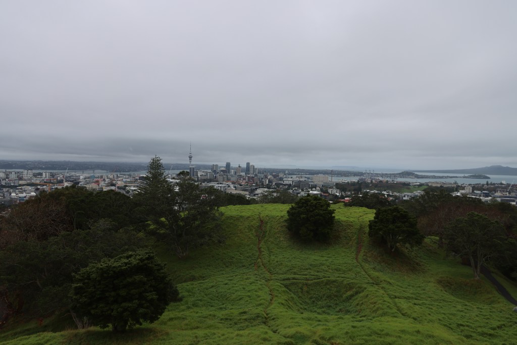
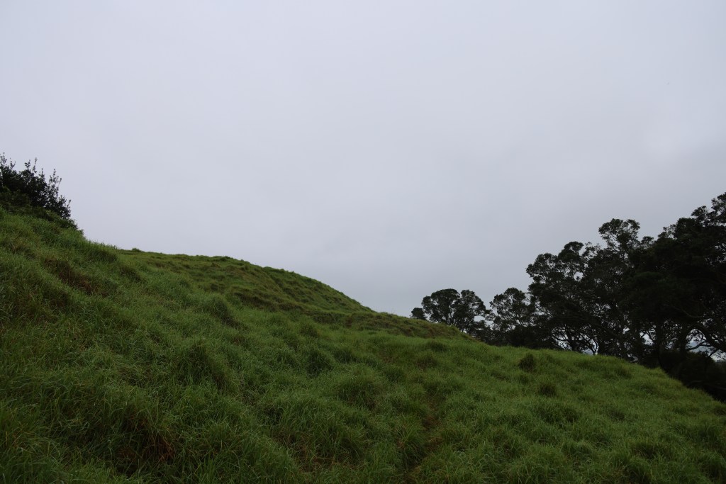

The above slideshow shows a fraction of the terraces that can be found on any given maunga in Auckland. These examples are from Maungakiekie, Mangere, Maungarei and Maungawhau.
But this is not to say that pā were never used for defence, the banks, ditches and palisades would suggest otherwise. Instead it is suggested that a more balanced view be taken when interpreting such places. Understanding that what we see in the landscape is but the final stage of a long and often complicated history – the evidence from the excavations at Maungarei are a good example of this.
Share this:


A Return to Otata
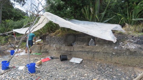
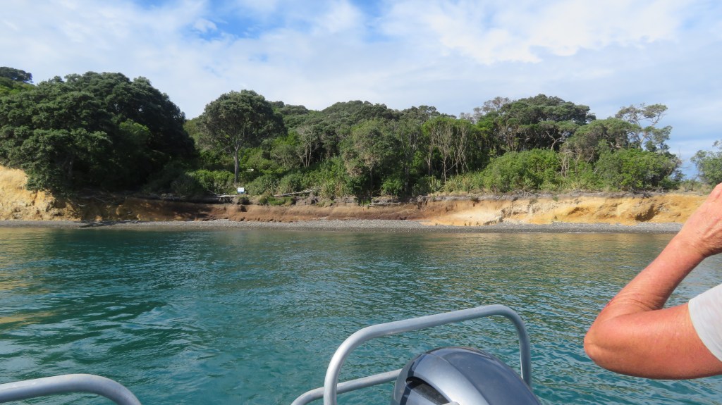
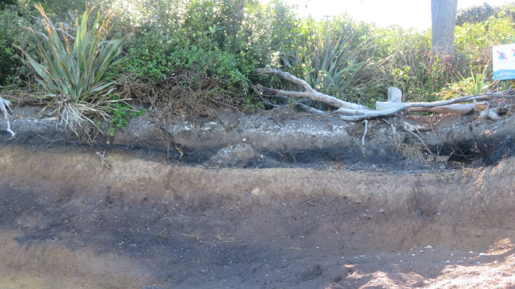
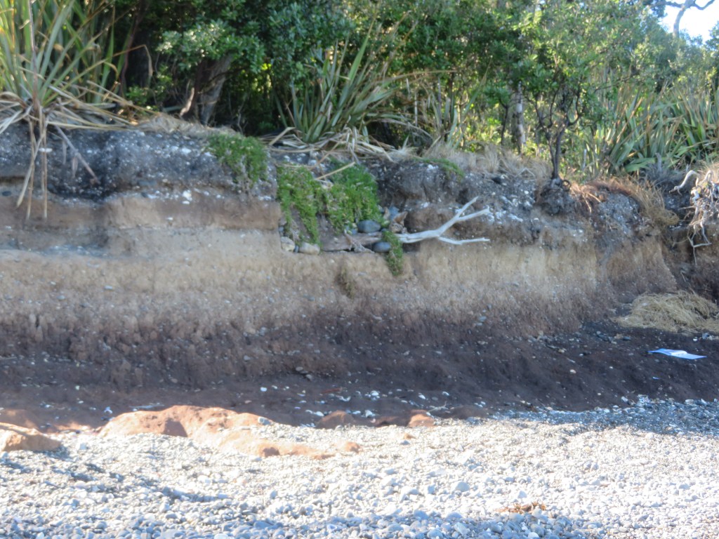
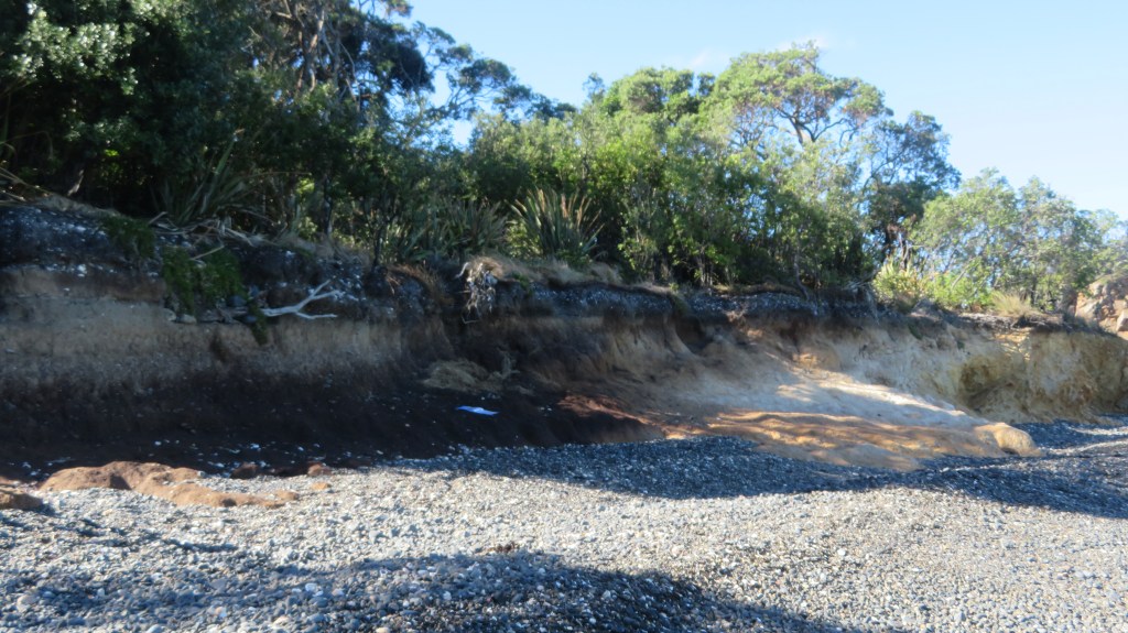
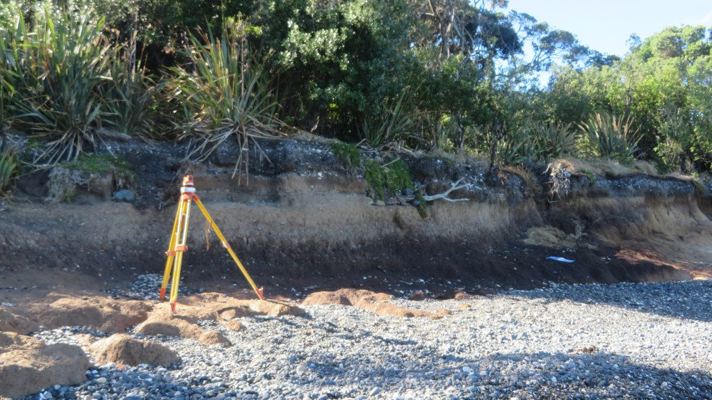
Auckland was recently subjected to what the meteorologists refer to as a ‘weather event’. High winds and a months worth of rainfall caused damage and chaos throughout the city. None more so than on the islands of the Hauraki Gulf including Otata.
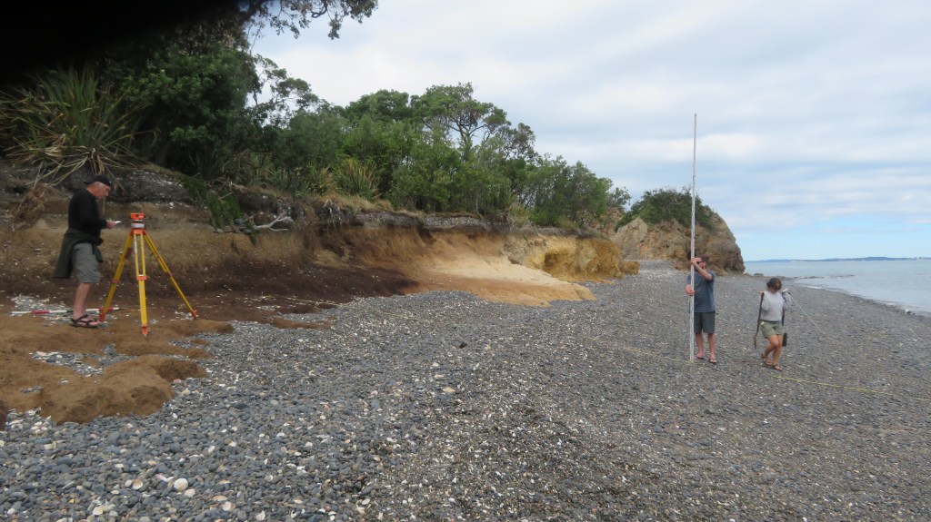
Reports came in of erosion and the lost of the shingle beach exposing the clay beds. It was decided that a visit to the island would be necessary, to assess and record the damage to the midden site. In addition, Louise Furey, the archaeology curator at the Auckland Museum, invited Bruce Hayward and Robert Brassey for a second opinion on the stratigraphy of the site (the former a geologist and the latter an archaeologist who had worked on the nearby islands of Motatapu and Tiritiri Matangi).
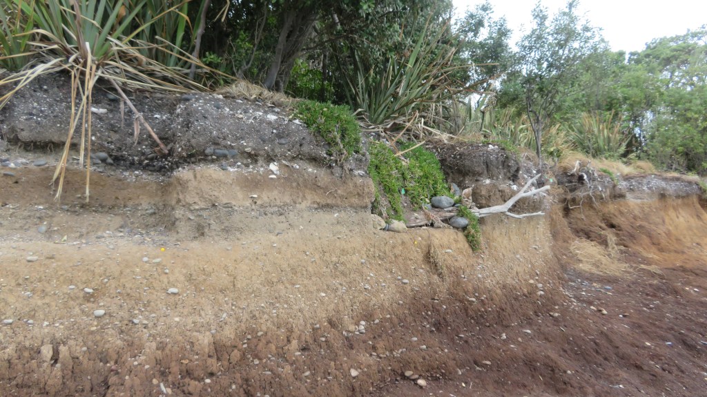
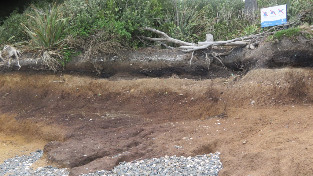
The first attempt to visit the island was thwarted, yet again by bad weather. However, on the second attempt we were graced with a stunning day with tides and winds in our favour and so we set off early morning. It was with some luck that only a few days earlier, the wind and tide redeposited much of the shingle back onto the beach, making landing on the island a little safer. On our arrival we could see that the sea had not been kind to the midden and much of the beach had indeed been washed away, leaving the midden sitting up high.
We spent the day measuring levels, recording and describing what could be seen. An Auckland Museum photography was on site to provide a photographic record of the midden in detail (look out for the video during Archaeology Week 2022). There was also a great deal of discussion regarding the stratigraphy – the outcomes of which can wait until the published report.
The following photos are of the site as it was seen on March 28th 2022 – these photos are my own.


For more information see a previous article on Otata here or visit the Noises website here and here for articles by Emma Ash (Assistant Archaeology Curator, Auckland Museum).
Coastal sites are always at the mercy of the environment and it can be heartbreaking to watch them year after year become less and less. The greatest shame is in the loss of the information that would have been gained if time and funds had allowed. Yes, it is true that excavation is destruction but when a site is under threat from elsewhere then surely it is time to step in and save that information for future generations. This is often done in urban areas before large developments are undertaken. Rescue archaeology shouldn’t just be about pre-development but also about the natural damage being done to archaeological sites.
Share this:


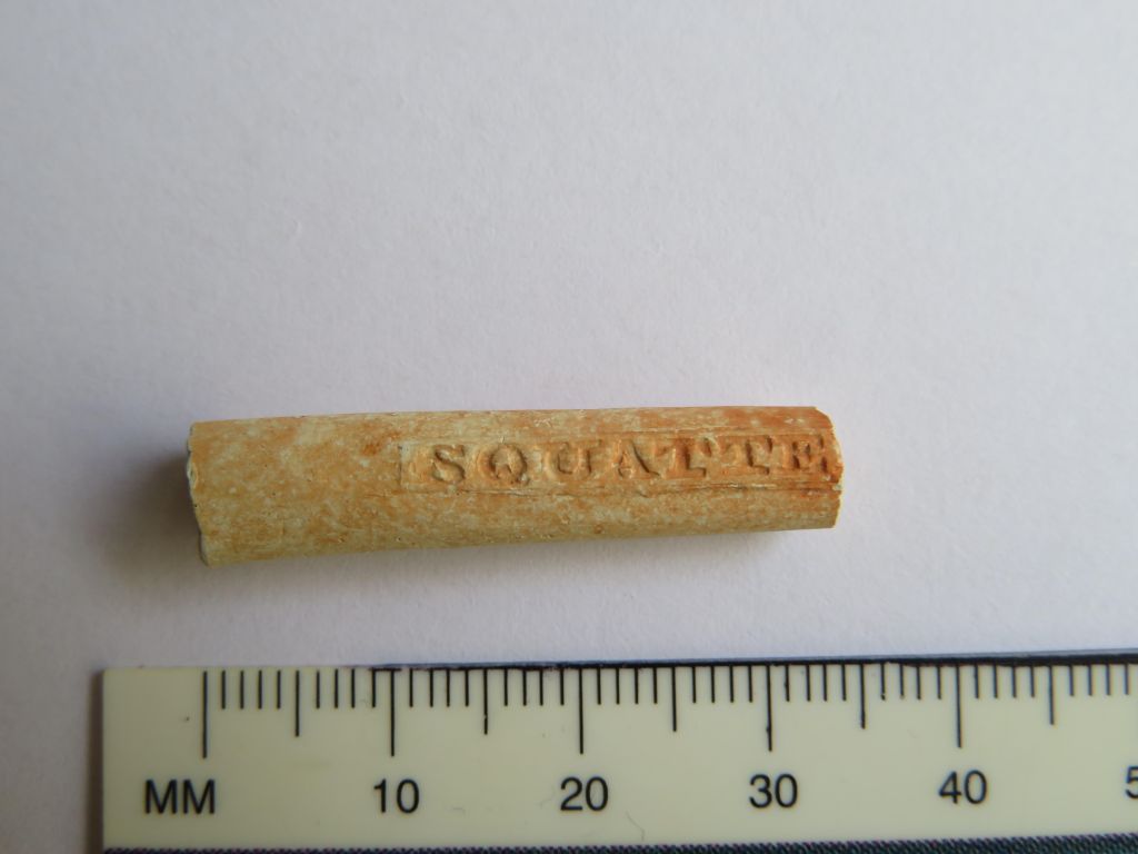
Squatters Budgeree !! – A small find with a big story…
Recently I was contacted by a reader of this blog who showed me a small but intriguing artefact he had found on the beach at Fitzpatrick’s Bay (Waitemata Harbour, Auckland, New Zealand). The photo was of a single piece of clay pipe stem, not all that unusual in itself. Clay pipes are one of the most common finds on any settler/colonial sites. However it was the legend stamped onto the opposing sides of the stem that caught my attention – ‘SQUATTERS BUDGEREE!!’ – yes there are two exclamation marks at the end of the legend.
Such an unusual name must have a good story…
A quick online search located an article published in the Australian Historical Archaeology journal which was able to provide the background to the name (see below for the reference to the article and link) and some eloquent discussion on the symbolism associated with this particular pipe.
This particular type of clay tobacco pipe was manufactured between 1840 and 1865 for the Australian market and was one of the ‘first commercial products specifically branded to appeal to the Australian colonial market’. It should be noted that these were most likely manufactured in the UK and not actually in Australia. Although Gojak and Courtney (2018) suggest that the mold was created by someone with local knowledge. When first manufactured the pipe itself spoke volumes about the political and social situation in Australia at the time.
Australia in the late 1830s and 1840s was undergoing a period of pastoral expansion which resulted in the dispossession and often violence towards indigenous people. Events came to a head with the Myall Creek massacre in 1838, here around thirty Indigenous people were murdered. This went against the then colonial government who tried to reign in the pastoralists and protect the Indigenous people. The government hunted down a number of those who were responsible for the massacre, seven of which were executed.
The symbolism therefore advocated for the pastoral interests at a time when there was a significant divide in colonial society…the symbolism of the pipe matched what many people already believed, that Aboriginal society was widely thought to be doomed…reflecting the belief in the inevitability of the strong and advanced overcoming the weak and primitive.
Gojak, D., & Courtney, K. (2018). Squatters Budgeree: a distinctive clay tobacco pipe produced for the Australian colonial market. Australasian Historical Archaeology, 36, 5–15
The bowl was decorated with coarse depictions of Indigenous people drinking alcohol on the side with word ‘budgeree!!’ And a pastoralist with animals under a cabbage tree on the side with the word ‘squatter’. The symbolism of the two opposing scenes clearly spoke to many in colonial Australia of the differences between the Aboriginal world of chaos and savagery and the world of the pastoralist – serene, productive, sobriety and quiet reflection. Even the exclamation marks at the end of the legend serve to emphasise the indignation of the pastoralists who felt they were being unfairly treated by the government in favour of the Indigenous people.
Unfortunately, all that was found at Fitzpatricks was a short fragment of stem but the words stamped on the stem are also a political statement. Both words originate in New South Wales – ‘squatter’ refers to the pastoralists who grazed their herds on land without government sanction, whilst ‘budgeree’ is a form of pidgin local dialect and comes from the Dharug language from Sydney. It means ‘something that is good’ or ‘someone who is doing well’. Thus the words can be read that the ‘pastoralists are doing really well’.
From this point on colonial society became split into two camps, those who supported the pastoralists and those who did not. Using the ‘Squatters Budgeree’ pipe became a political act – a way of displaying support for the pastoralists. Not dissimilar to our modern inclination of showing support for various causes on a t-shirt.
So, what is an Australian tobacco pipe doing in New Zealand? Other Squatter Budgeree pipes have occasionally turned up during excavations in New Zealand, such as, at Paremata on the Porirua Harbour and the Victoria Hotel site in Auckland. In the case of Paremata, a military site, it could be that it arrived as a personal item with troops from Australia at the time of the New Zealand wars. Whilst the excavation of the Victoria Hotel yielded a large number of clay pipes, amongst which was a variety of Australian themed types, including the Squatters Budgeree. At the time almost all of New Zealand’s imports came through Australia and it is most likely that these pipes were part of a general lot. It is equally possible that such pipes were sold in New Zealand from a job lot, so to speak, when the Squatter pipes went out of fashion after 1860.
In regard to our small but perfect specimen, the jury is out but given the bay’s proximity to the new settlement of Auckland, the connection to the harbour and of course our understanding of the early settlement of Fitzpatricks Bay – the reader can make their own judgements…
Reference – ‘Squatters Budgeree: a distinctive clay tobacco pipe produced for the Australian colonial market.’ By Denis Gojak and Kris Courtney. Australian Historical Archaeology Vol 36 2018 pp5-15.
https://www.jstor.org/stable/26775685
Written with special thanks to D J Payne who brought the pipe stem to my attention and provided the photos for this blog post. Please do not use the photos without permission.
Share this:


A Celebration of Language
Te Wiki o Te Reo Māori – Placenames in the Landscape.
Last week it was Te Wiki o Te Reo Māori – Māori Language Week and even if this post is a little late, it seemed a good idea to take a look at the names Māori gave to their places as a way of celebrating the language of New Zealand’s first people.
As you may already know as a landscape archaeologist I have a fondness for place names (see an earlier post on Cornish Place names) so felt it was about time I had a look at place names here in Aotearoa (New Zealand).
Place names in today’s Aotearoa are either of European origin or Māori, however it should be remembered that many of the places which today have a European name did indeed have a Māori name prior. As mentioned above the purposes of this blog it is the Māori names which are of interest. The European names will be considered in a separate article at a later date.
The need to give a place a name is universal to people across the world, it is our way of defining who we are and our relationship with the world surrounding us. The names of places can commemorate an event, define a landscape feature, be used to help travellers find their way, as a warning or as a way to signify a place of importance. In regard to Māori place names difficulties arise when trying to give a literal translation into English, for some words there are more than one meaning (as it is with English). Often the meanings behind a word are not easily definable. Words such a Mana and Tapu can be given an English interpretation but in actuality have a much more complex meaning to Māori. Add to this the fact that when Māori words were first written down by Europeans often the words were misheard and misspelt – a wrongly placed vowel can change the meaning of a word quite drastically.
What follows is just a few of the many place names and their interpretations.
One of the most important common words that make up Māori place names relate to features in the environment. Thus a word that begins with ‘Awa’ could refer to a river, gulley or valley; ‘Manga’ though is a stream or tributary and is not to be confused with ‘Maunga’ or mountain. The prefixes can be followed by other descriptive terms such as, iti/small, nui/big, roa/long. They can also have the names of people attached to them, the names of gods and the names of birds, fish and fruit. The latter often indicating the good places to forage for the said kai (food). From the perspective of the landscape archaeologist (or anyone interested in the past) the interpretation of place names can give us clues to the past, fleshing out the otherwise dry facts with the human story.
One of the most important part of any society is the ability to feed the people. As a result there are many place names which indicate the places that are good for food gathering and growing.
- Awatuna – eel (tuna) creek (awa).
- Kaipataki – to eat (kai) flounder (pataki).
- Kaipara – to eat (kai) fernroot (para).
- Motukanae – mullet (kanae) island (motu).
- Whenuapai – good (pai) land (whenua).
- Motukina – island (motu) of kina (a type of sea urchin).
- Otamahua – the place where (o) children (tama – short for tamariki) at seagull eggs (hua).
- Kaikoura – to eat (kai) crayfish (koura) – its full name is Te Ahi-Kai-koura-a-Tama-ki-te-rangi or where Tama the great traveller stayed and lit a fire to cook crayfish. A place where even today crayfish are sought after.
- Arowhenua – there are several possible interpretations of this name – good or desirable land; turning land for cultivation or to desire land.
- Hakapupu – estuary of shellfish.
- Ororoa – the place of roroa (a type of shellfish).
- Tahekeaua – a place to catch herrings by the waterfall – taheke (waterfall) aua (herring).
- Mararua – two (rua) plantations/places of cultivation (mara)
Other resources also appear in place names:
- Motukauatiti/Motukauatirahi – two bays (Corsair and Cass Bay) noted for the Kaikomako trees, the timber of which was good for firemaking.
- Omata – the place of flint/quartz – O meaning ‘the place of’ and mata can mean either flint, quartz, sometimes obsidian but also headland (interpretations can depend on what comes before or after the word).
- Otemata – the place of good flint or quartz.
- Ratanui – plenty (nui) of rata trees.
- Kaitieke – to eat the tieke (saddle-back, a native bird).
- Whangamata – obsidian/flint/quartz (mata) harbour (whanga) – obsidian is the most likely candidate as it washes upon the beach here from nearby Mayor Island.
- Anatoki – cave of the adze.

Then there are the names that serve to aid those navigating the landscape:
- Putarepo – the place at the end of the swamp where it could be crossed.
- Puhoi – refers to the slow tidal flow thus it was necessary to wait for high tide for the river to be navigable.
- Otira – the place of travellers – indicating an old campsite on the Otira River where food was prepared for the trip through the Hurunui Pass.
- Motuara – island (motu) path (ara) – most likely to mean an island in the path of canoes.
- Tauranga – resting place/safe anchorage for canoes.
- Kaiwaka – literally to eat (kai) canoes (waka) – may refer to the places where the swift flowing river has the ability to destroy a canoe.
- Mangawhata – the stream by the storehouse.
- Arapuni – two possible interpretations – a path to a camp or a path that has been blocked – Ara meaning path.
- Whangaruru – a sheltered (ruru) harbour (whanga).
There are also names that serve to warn people away from place:
- Kaitoke – to eat (kai) toke (worms) – indicating a place of poor soil.
- Mangakino – bad/useless (kino) stream (manga).
- Waikino – bad (kino) water (wai).
- Mangamate – stream (manga) of death (mate) – one wonders what happened here to warrant such a name.
- Otepopo – literally the place of the decay – or the place of Te Popo.
- Motutapu – sacred/forbidden (tapu) island (motu) – possible a name given after the eruptions of Rangitoto and the island was covered in volcanic ash.
- Matatapu – sacred headland.
Other places are simply descriptive:
- Maunganui – big (nui) mountain (maunga)
- Tauranga-Kohu – kohu means mist/fog and thus this name could indicate a place where the mists linger.
- Waihapa – crooked (hapa) water/stream (wai).
- Waihaha – noisy (haha) water/stream (wai).
- Pukekahu – hill (puke) of hawks (kahu).
- Pakowhai – village/settlement (pa) by the kowhai (native flowering tree).
- Mahoenui – the place of many mahoe trees.
- Ngaroto – the lakes.
- Rotoma – the lake of clear waters.
- Ngapuna – the springs
- Onehunga – the place of burial
A simple perusal of any map will show that certain prefixes are more common than others and for obvious reasons. Hills (puke), mountains (maunga) rivers (awa), streams (manga), lakes (roto), caves (rua), water (wai) and harbours (whanga) are prolific features of the landscape.
Other names are used to commemorate an event thus Ahuahu (Great Mercury Island) is literally translated as ‘to heap up’ but refers to when Paikea came to the island on the back of a whale, when he landed he was cold and so heaped the warm sand over himself hence the name.
Iwikatea (Balclutha) is a reference to a great battle that occurred here and where the bones of the slain remained for many years.
The Hokianga proper name is Hokianga-nui- a-Kupe or the ‘Great returning place of Kupe’ – it is from here that Kupe returned to Hawaikii.

Patumahoe literally translates as a weapon made of mahoe, a native tree. But further digging finds a tale of how ‘in a battle at this place a chief was killed with a mahoe stake’.
Tamaki-Makau-Rau (Auckland) is called thus because of its excellent soils and bountiful harbour there were often many fights to establish who would hold this prize – literally it is translated as ‘Tamaki of a hundred lovers’ – tamaki can be translated as battle.
Motu-toa can be translated as the island where warriors fought.
Rotoiti – the full name of this lake is Te Roto-iti-kite-a-Ihenga and is interpreted as the little lake that was discovered by Ihenga.
Te Tawa – here Ihenga pushed his canoe with a piece of tawa wood, it stuck in the ground and he left it there thus naming the place after it. Ihenga features in many of the interpretations of Aoteoroa’s places.
Kirikau – a place where a battle was fought in which the contestants were naked – kiri (skin) kau (bare).
Another grouping of place names relate to the cosmological – the deities, the supernatural and the movement of the sun, moon and stars.
- Tapuaenuku – the footsteps of the rainbow god.
- Te Puka-A-Maui – the anchor stone of Maui (Stewart Island).
- Ruataniwha – literally, the two taniwha (see earlier article on taniwha for more information) – in this case that there were two great taniwha who lived in a lake and fought over a boy who fell in. Their struggles formed the Tukituki and Waipawa Rivers.
- Oamaru – the place of the god Maru.
- Anakiwa – Cave of Kiwa – Kiwa was a man’s name but was also one of the gods of the sea.
- Omaui – the place of Maui.
- Oue – the moon on the fourth night.
- Otane – the moon on the twenty-seventh night – the place of the moon.
- Momorangi – offspring of Rangi (the sky god).
- Te Waka-A-Maui – an old name for the South Island – referring to the canoe (waka) from which Maui fished up the North Island.
- Otamarau – the place of Tamarau – a spirit who comes in the whirlwinds.
These are all just a few examples of the wide variety of names used by Māori, there are many more that have not been touched on in this article – to do so would be the work of whole of book. Place names not mentioned are those commemorating a particular person. Ihenga and Kupe have already been mentioned but there are many others such as Mangaotaki (the stream of Taki) or Hekura, the name of a woman from the Arai-te-uru canoe. Or Ohinemutu, the place of the young woman who was killed – she was the daughter of Ihenga who placed a memorial stone at the place of her death calling it Ohinemutu. There are also the places that were named after the arrival of the Europeans such as Hiona, the name given to a pa on the Whanganui River, by the missionaries – it is the Māori name for Zion. Or Maheno, an island – the name was given by the Europeans.
Then there are the names which are very old and come from the homeland of the first people to set foot in Aotearoa. Names such as, Maketu or Nuhaka, both names are after a place in Hawaikii. Then there is Atiu, one of the oldest names in Marlborough and is a possibly a name transferred from the Cook Islands.
As mentioned before this is but a small insight of the fascinating world of Te Reo and the place names of Aotearoa. From a landscape archaeologist point of view all of these names give an insight to how Māori viewed their world and the events that shaped their memories of places. Giving us key glimpses into the past. Putting flesh on the bones of the evidence.
Some further information:

