It has been almost a year since our last journey to Cornwall and so it seems appropriate to tell you all a bit about that time.
Normally any trip to Cornwall is one of expectation, hope and joy but on this occasion, it was a time of sadness. On the day we arrived in Penzance, my mother-in-law passed away. We were half an hour away from seeing her when we got the call…
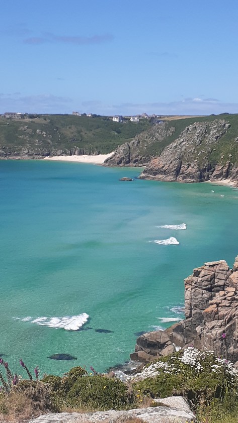
It was not an easy time but we did find moments to distract us, Cornwall, after all is a beautiful county filled with fascinating places. There were beach walks, pasty’s, drives down winding lanes, pub lunches, moors and visits to ancient places. Below is just a few of the places we visited in our down time between packing up a life well lived and saying goodbye. We knew it would be a long time before we came back and so we made the most of the time we had.
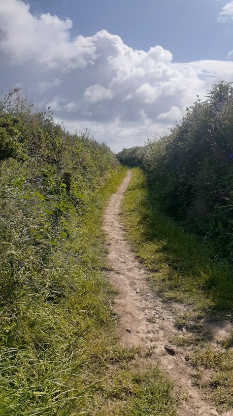
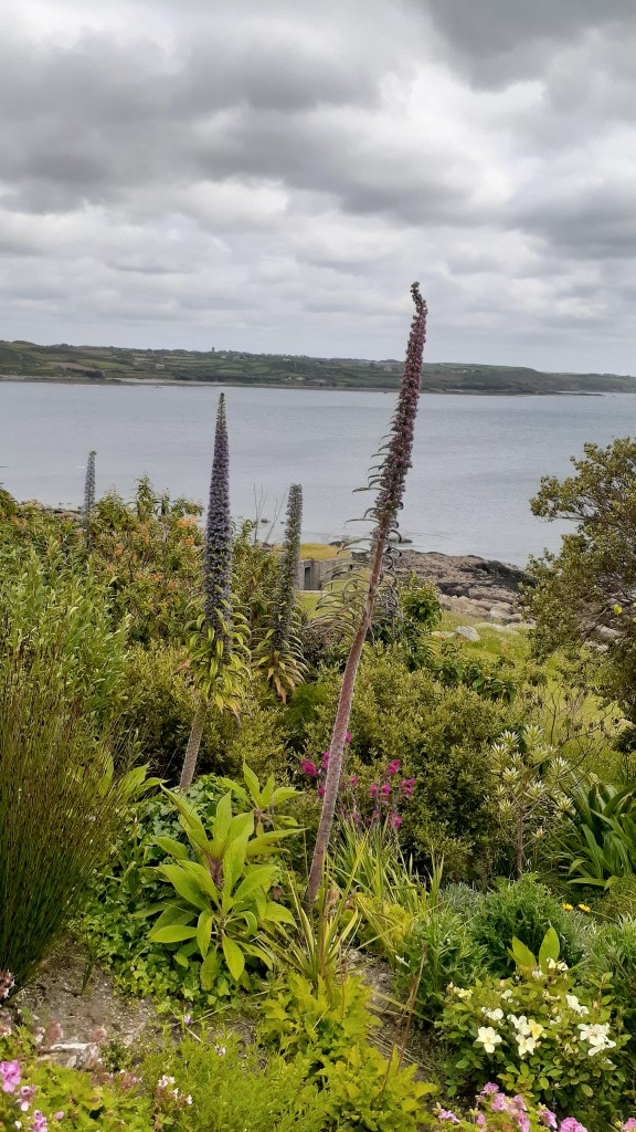
Getting fresh air and exercise became a part of our daily routine, early mornings sorting the house, followed by appointments with solicitors or funeral directors and then a good walk in ‘the nature’ to soothe the emotions. Cornwall is not short of a good walk. Below are a few photos from these walks.
Godrevy Beach, St Ives in the far distance.
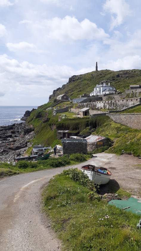
Cape Cornwall.
On the cliffs overlooking Hell’s Mouth.
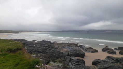
Gunwalloe Beach
Marazion Beach, looking towards Penzance.
On the way to Nanjizel
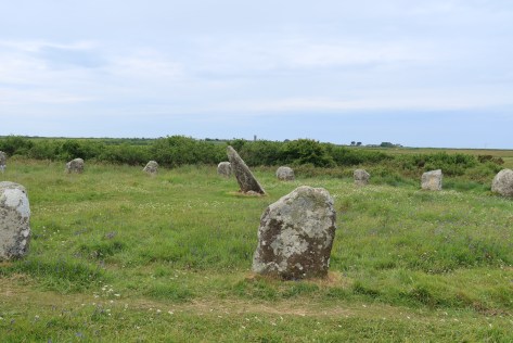
Men an Tol
On the cliff at Treryn Dinas, Porthcurno Beach in the distance.
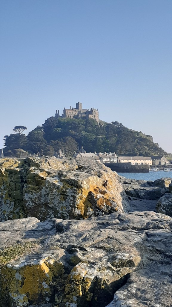
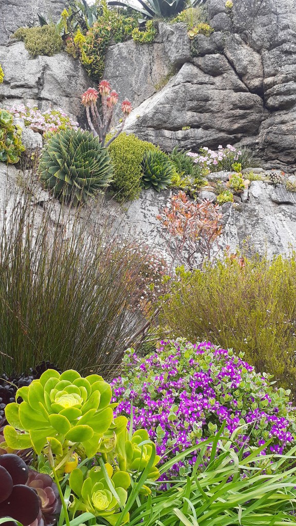
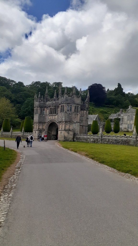
There were some days when we had more time on our hands and on these days we ventured a little further afield. As members of Heritage New Zealand we are allowed to visit both National Trust and English Heritage sites free of charge – Lanhydrock, Godolphin House, Restormel Castle. Tintagel and the gardens at St Michael’s Mount were all on the list.
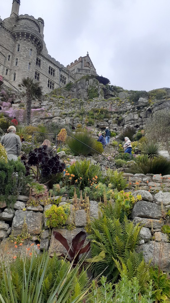
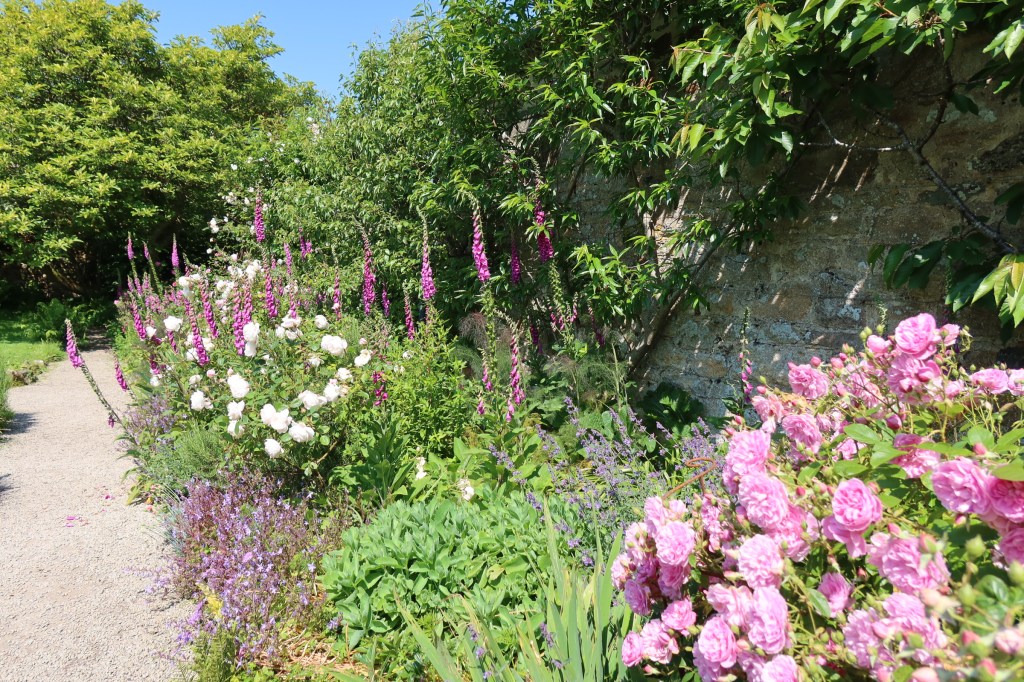
The Gardens at St Michael’s Mount
Why just the gardens? We had visited the house on several other occasions and given the time of year and how busy it was we thought a good nosey around the gardens – which are not always open – would be nice on a sunny day.
The gardens are situated on the lower terraces of the mount facing towards the Lizard Peninsula. They were first designed in 1878 for Sir John St Aubyn (later the first Lord St Levan). This part of the island has a microclimate and is able to grow a number of plants you would not expect.
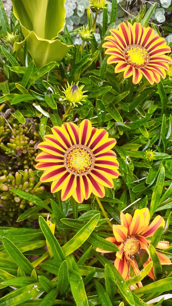
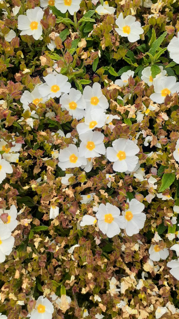
The following are just a few photos of the gardens.
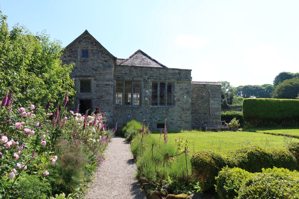
Godolphin House
One of my favourite houses to visit in this part of Cornwall is Godolphin House. Only open to the public a few times a year (the house is let out as a holiday let), although the gardens and estate are regularly open to enjoy for walks and cups of tea in the little cafe. The story of Godolphin House is one ‘enormous mineral wealth, heavy industry, agriculture, high political office, war, decline, ruin and eventual rescue – a living timeline through Cornwall’s history’.
As the above quote would imply Godolphin House has a long and winding story to tell and is perhaps one for an article of its own. For now enjoy the following photos and if you do ever get a chance to visit the house, do so.
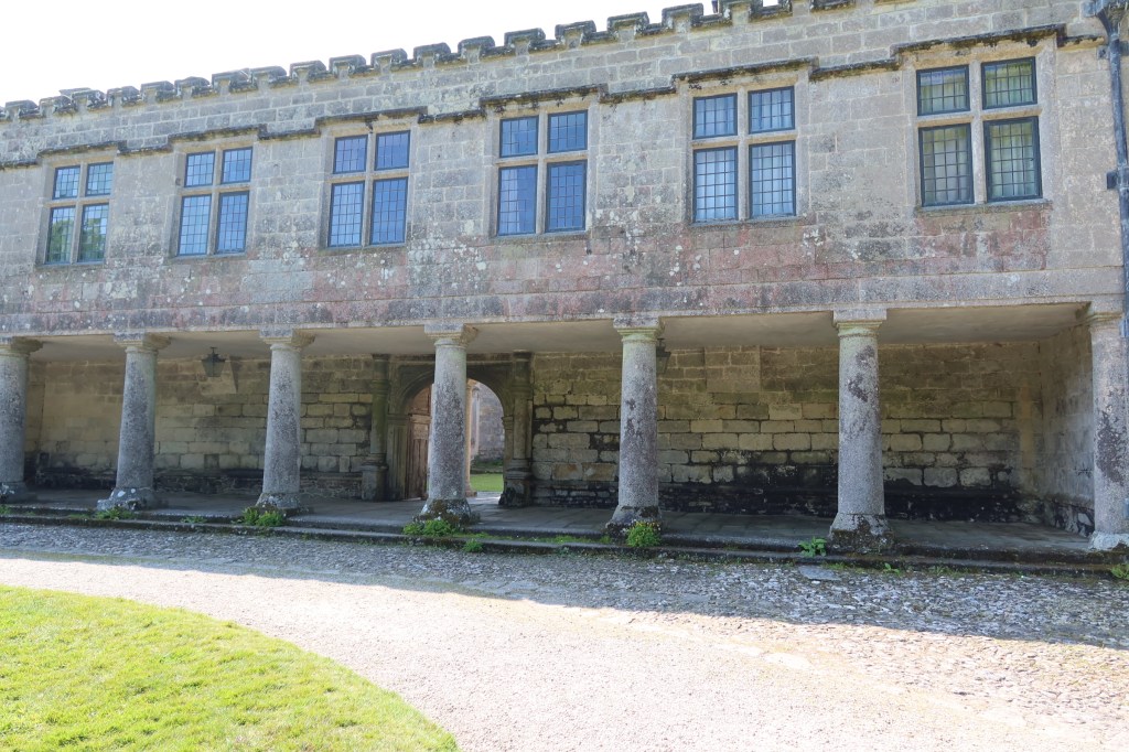
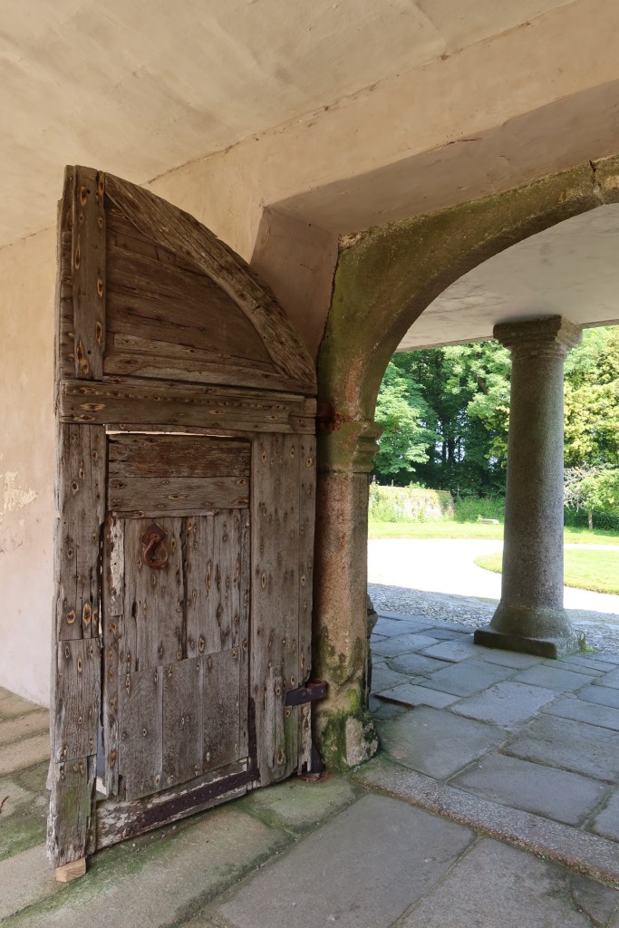
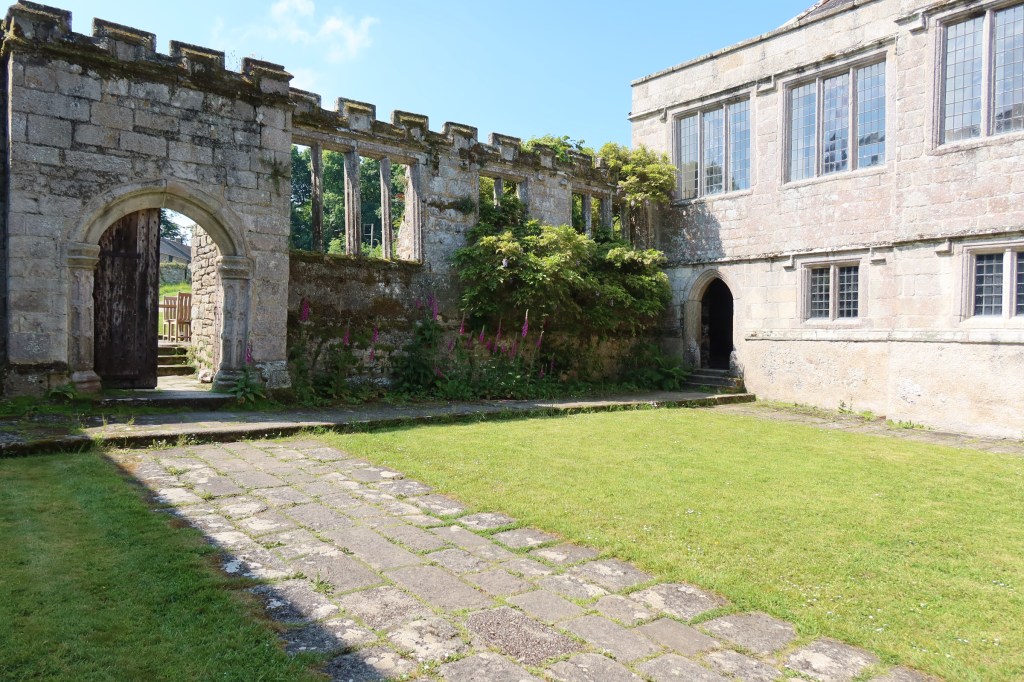
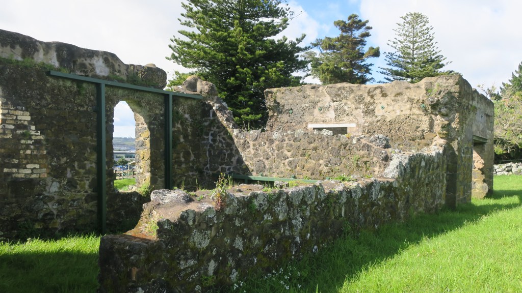
Lanhydrock
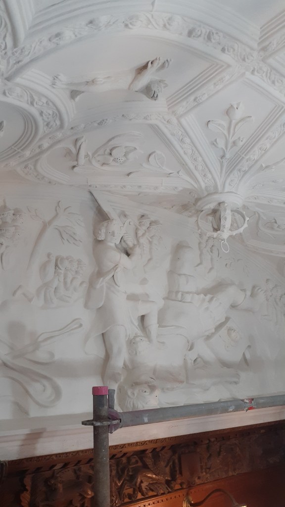
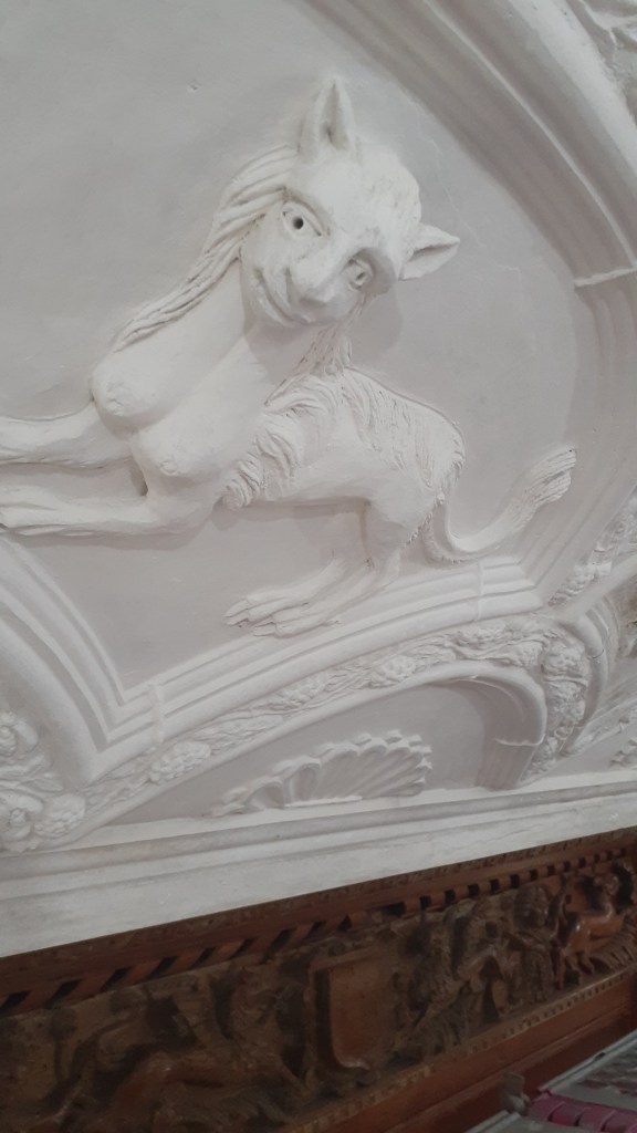
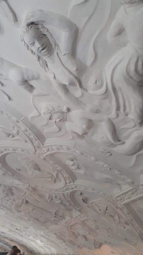
This particular National Trust House and Estate was much further afield. At the time of our visit the house and its contents were undergoing restoration work. Interestingly rather then block off sections and prevent people from viewing the work, the visitor was granted an opportunity to see what happens when a house of this size needs some love and attention. Our visit coincided with the restoration work on the ceiling of the hall and visitors were able to go onto the scaffolding and get a close look at a space that normally only the eagle eyed could view.
Below are a couple of photos of the ceiling.
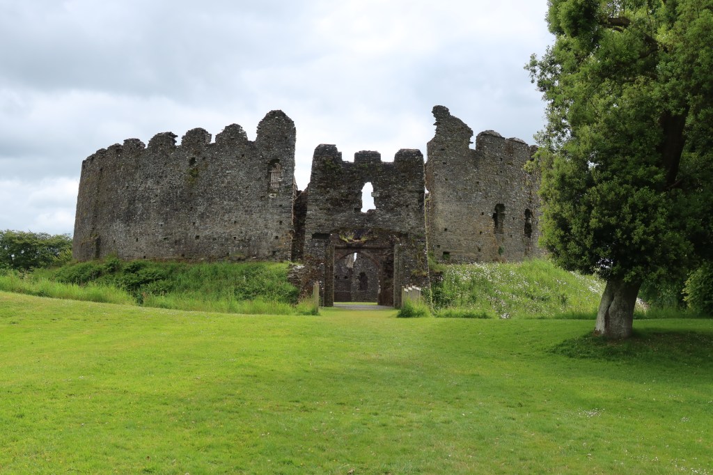
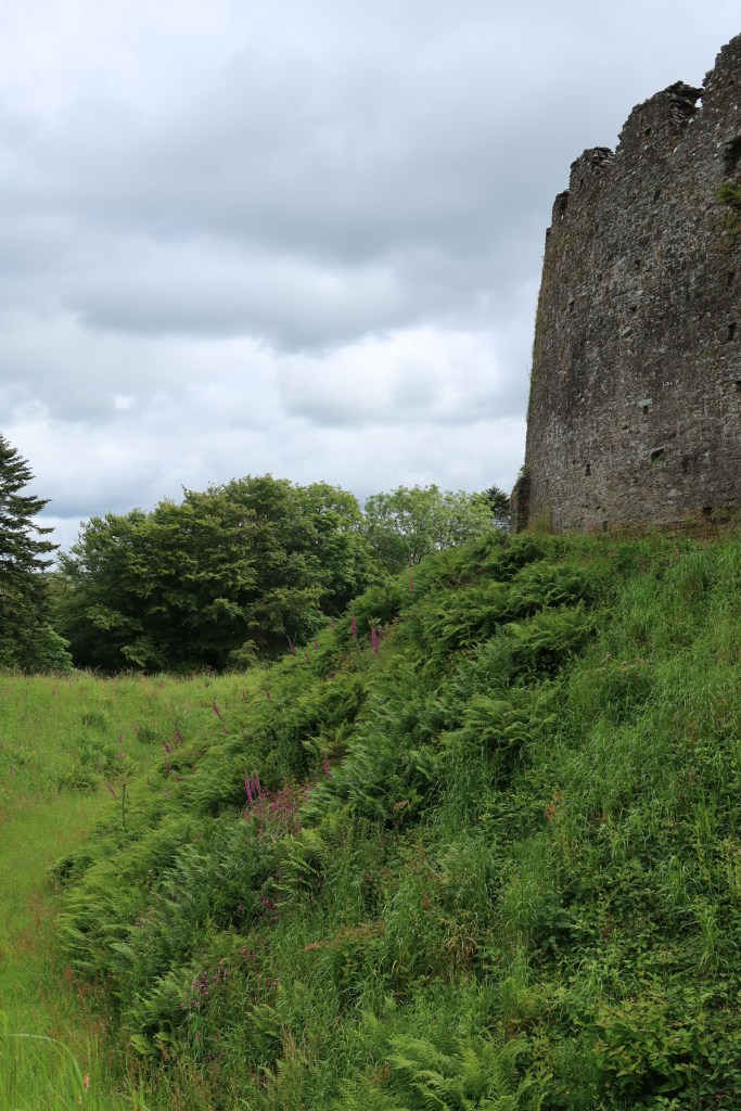
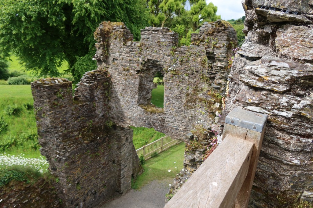
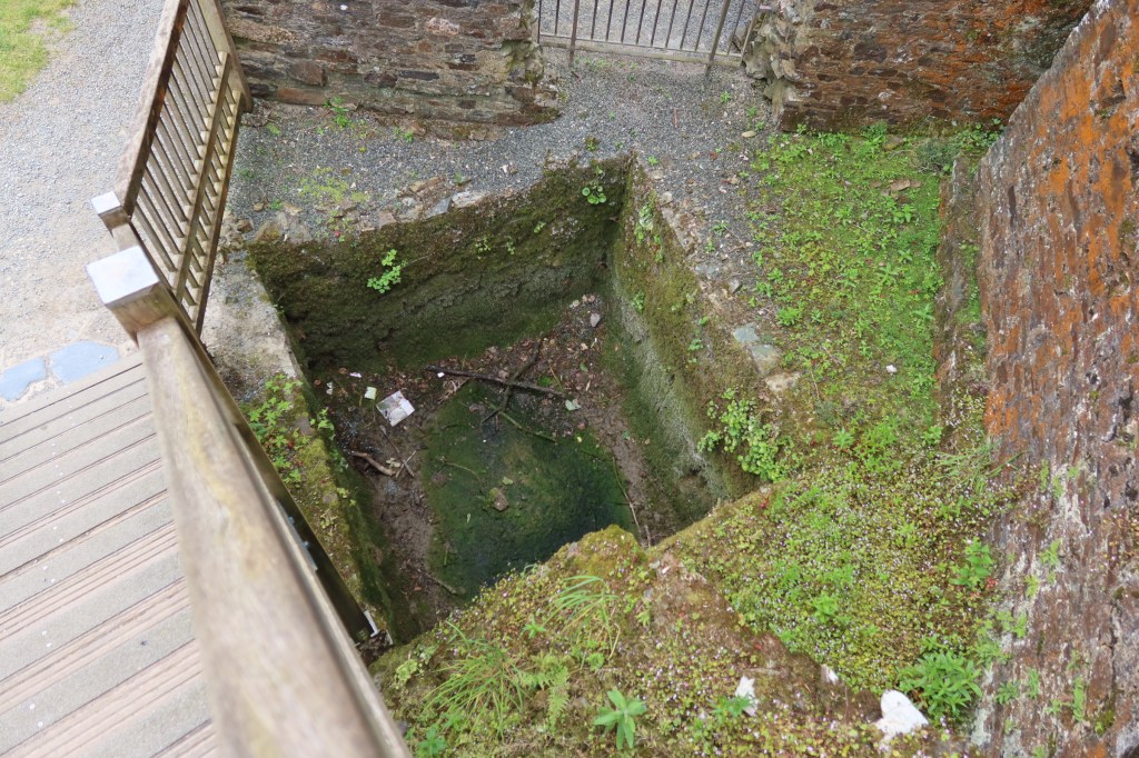
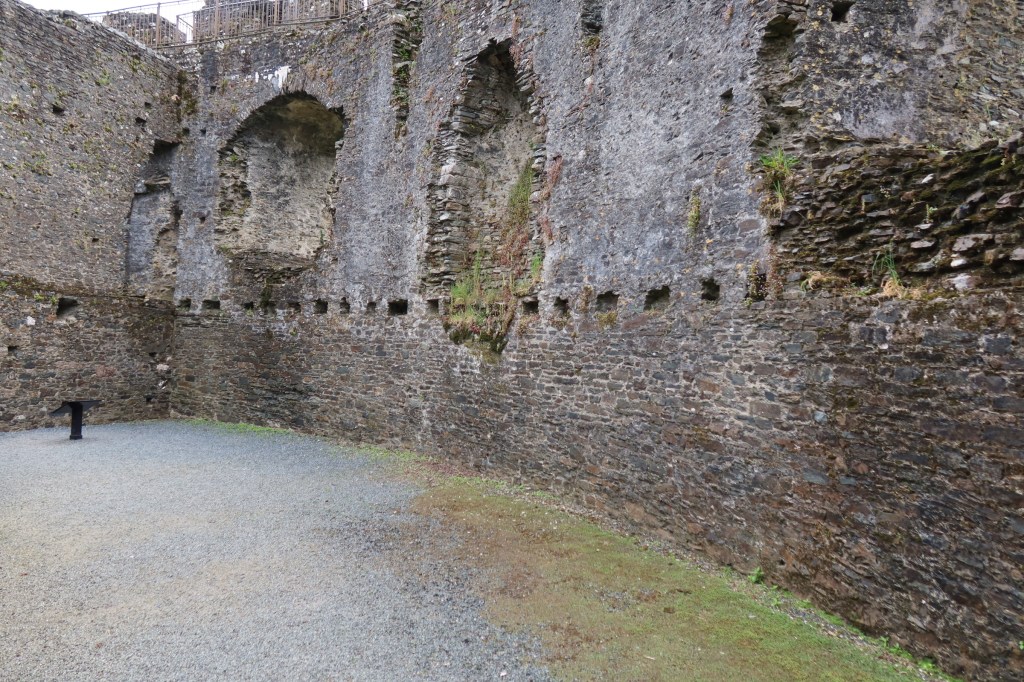
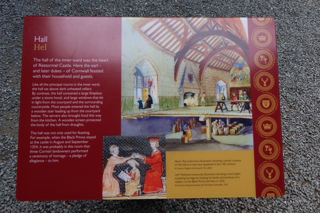
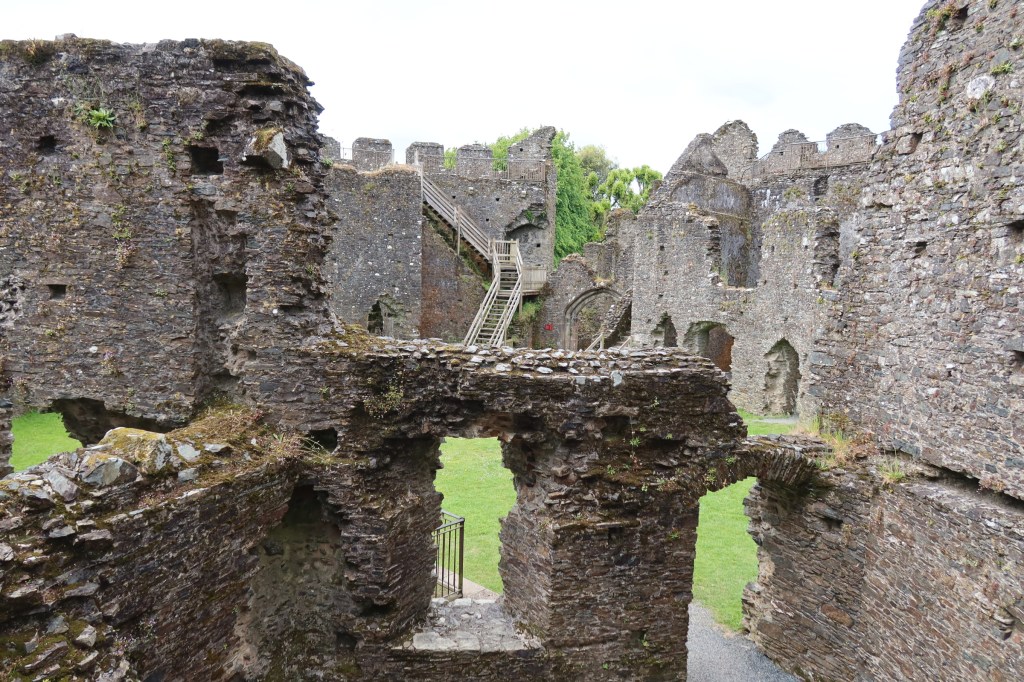
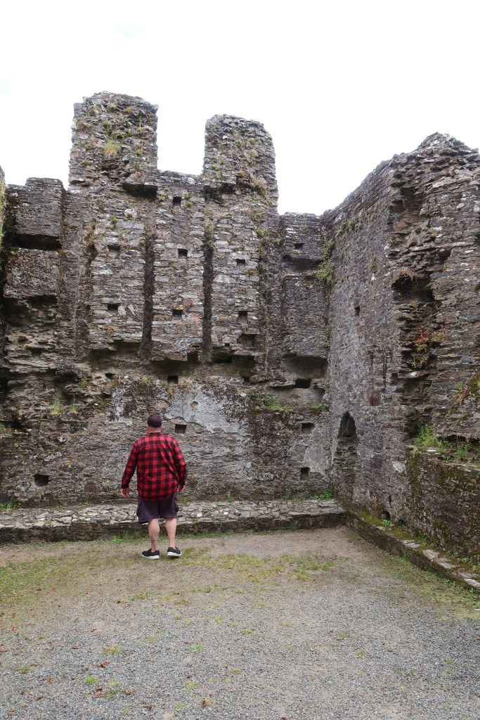
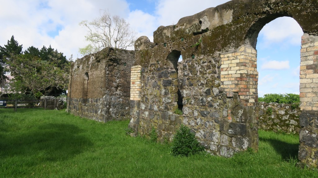
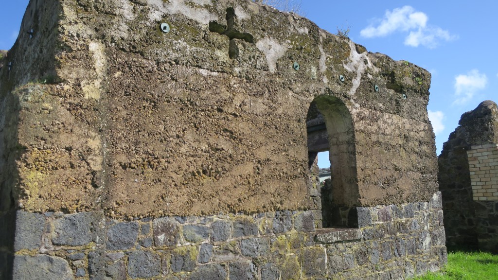
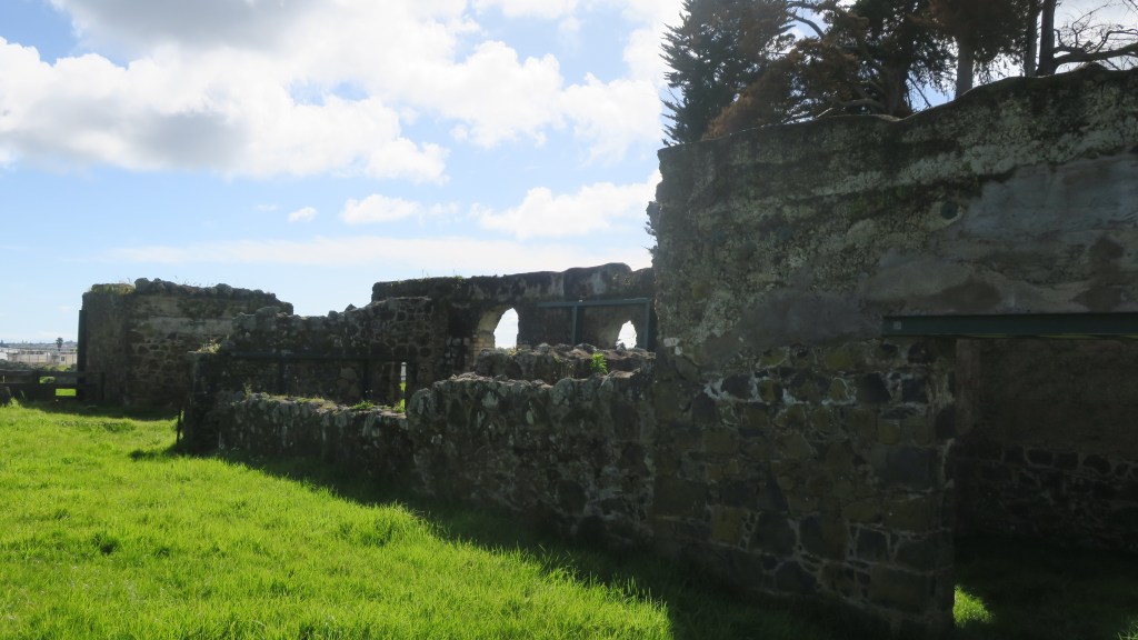
Restormal Castle
Our visit to Restormal Castle occurred as we were leaving the county, having done all we could. The castle providing a welcome pit stop and distraction.
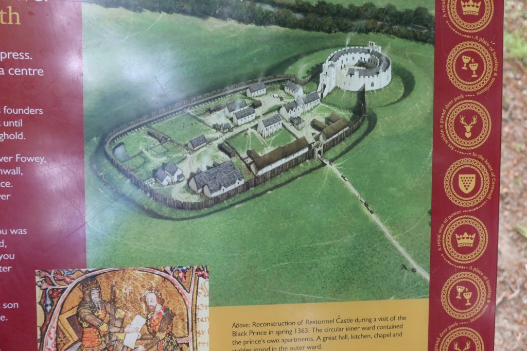
The early history of the site is not well understood, there is some evidence for a mid 12th century date but it the history from the 13th century onwards which is better understood. From the mid 12th the land on which the castle stands belonged to the Cardinham’s – a powerful landowning family from central Cornwall. In 1268 Cardinhams’ heiress, Isolda de Tracy, granted to Richard Earl of Cornwall and King of the Romans, the town of Lostwithiel – a fishery on the river Fowey – and the castle of Restormel, complementing his castles at Launceston and Tintagel. In 1270 he acquired a fourth castle at Trematon.
Earl Richard died in 1272, only four years after acquiring Restormel, so it seems more probable that it was his son Edmund who built the present castle. Edmund’s work at Trematon Castle is documented and provides a parallel. However, by the 1330s (and after the castle had changed hands a few times) documents refer to the castle being in need of repair. 1337 saw the son of Edward III being made Duke of Cornwall (also Edward – the Black Prince), along with a significant endowment of land and properties – including Restormal Castle.
This was a high point in the history of the castle, with many repairs and improvements being made to it and the surrounding park land. Apparently more time and money was spent on the boundary to the park land than on any other feature, an indication of its importance as a hunting park.
The history of the castle and its surrounding is one of neglect, repair and neglect once again. More can be found on its history here.
These are just a tiny fraction of the many places a person can visit in Cornwall, so I hope you have enjoyed this short meander through the county.
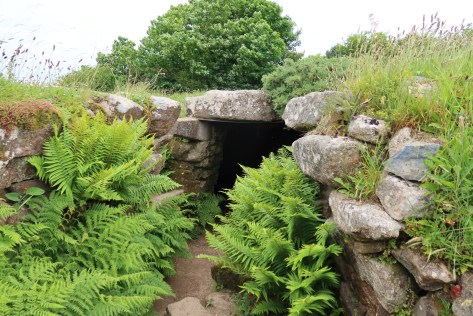
Boscawen Un stone circle
The fogou at Carn Euny
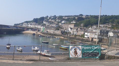
The village of Mousehole
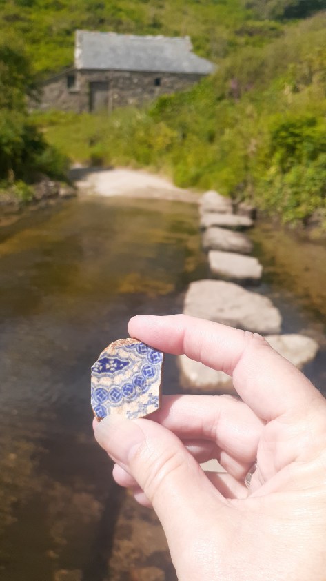
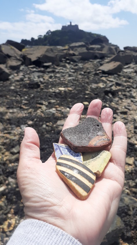
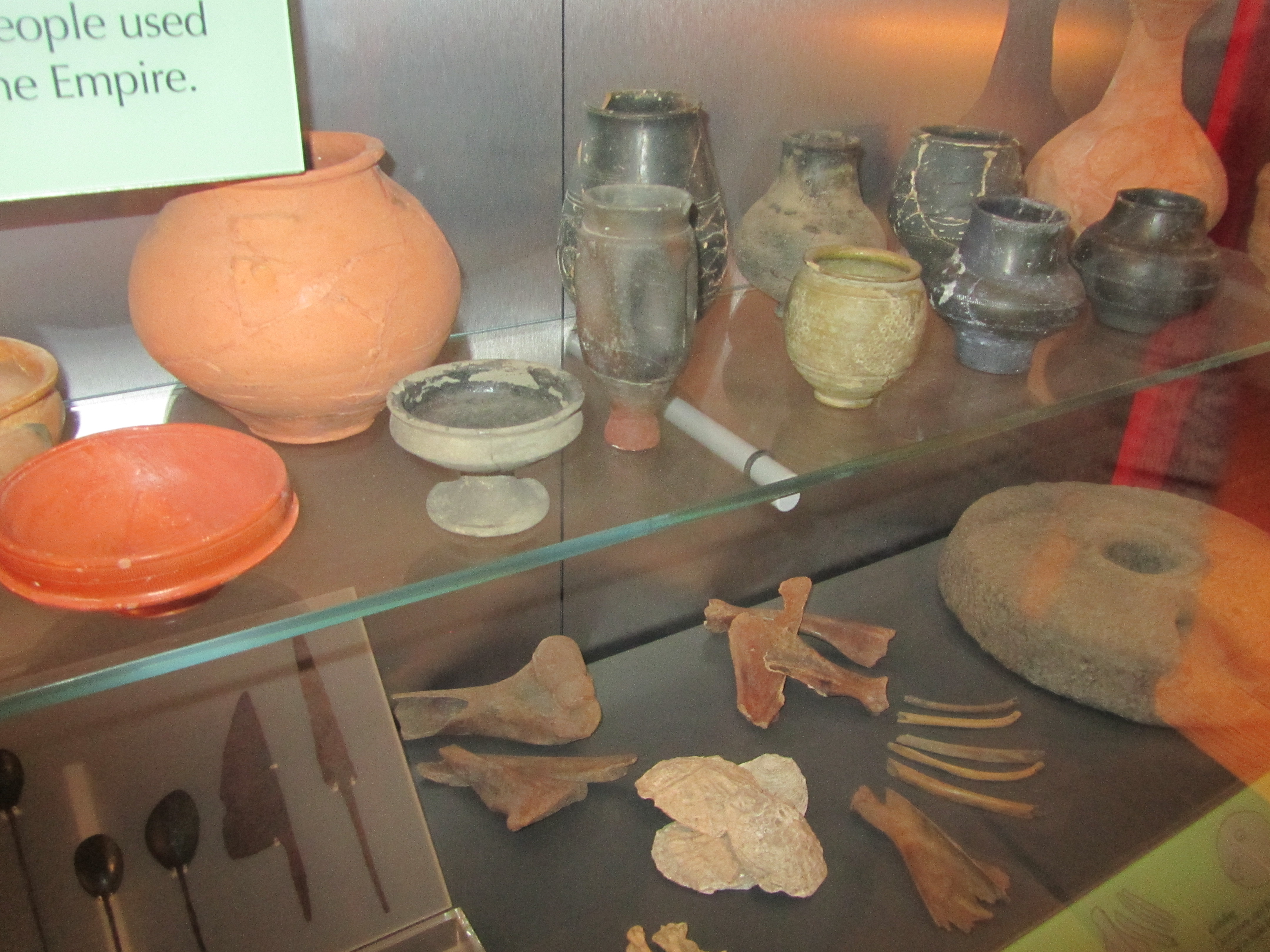
Finding pottery at Penberth cove
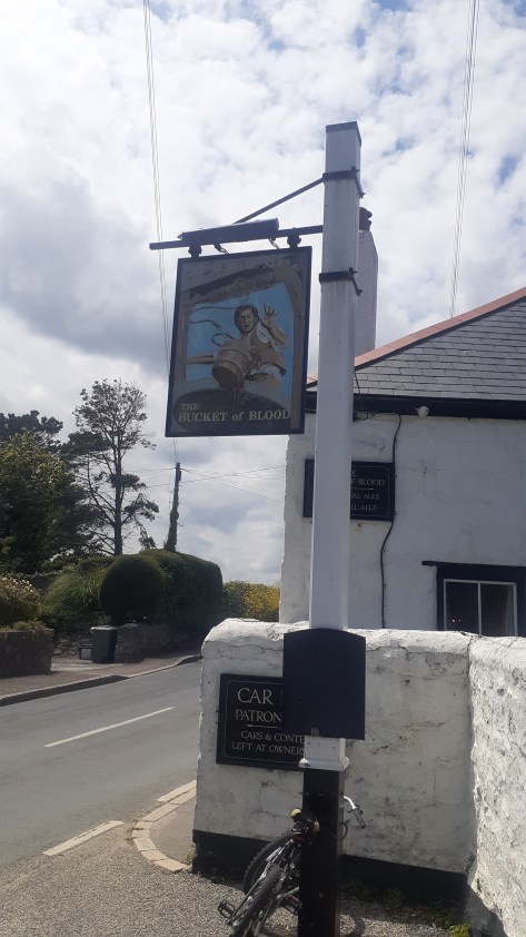
The Bucket of Blood
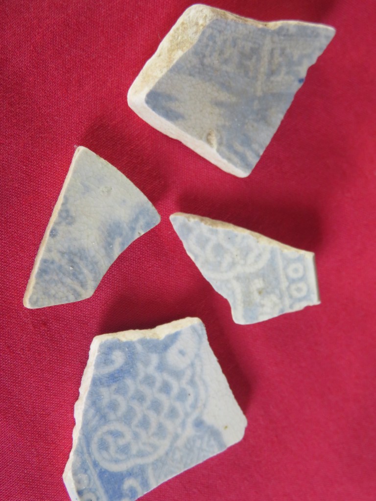
Finding pottery near St Michael’s Mount
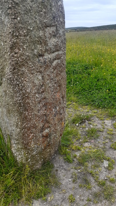
Men Scryfa – an inscribed stone near Men an Tol
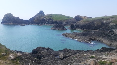
Kynance Cove
Looking towards Mounts Bay
In memory of Christine Rowe and Alan Dalton – gone too soonbut never forgotten.
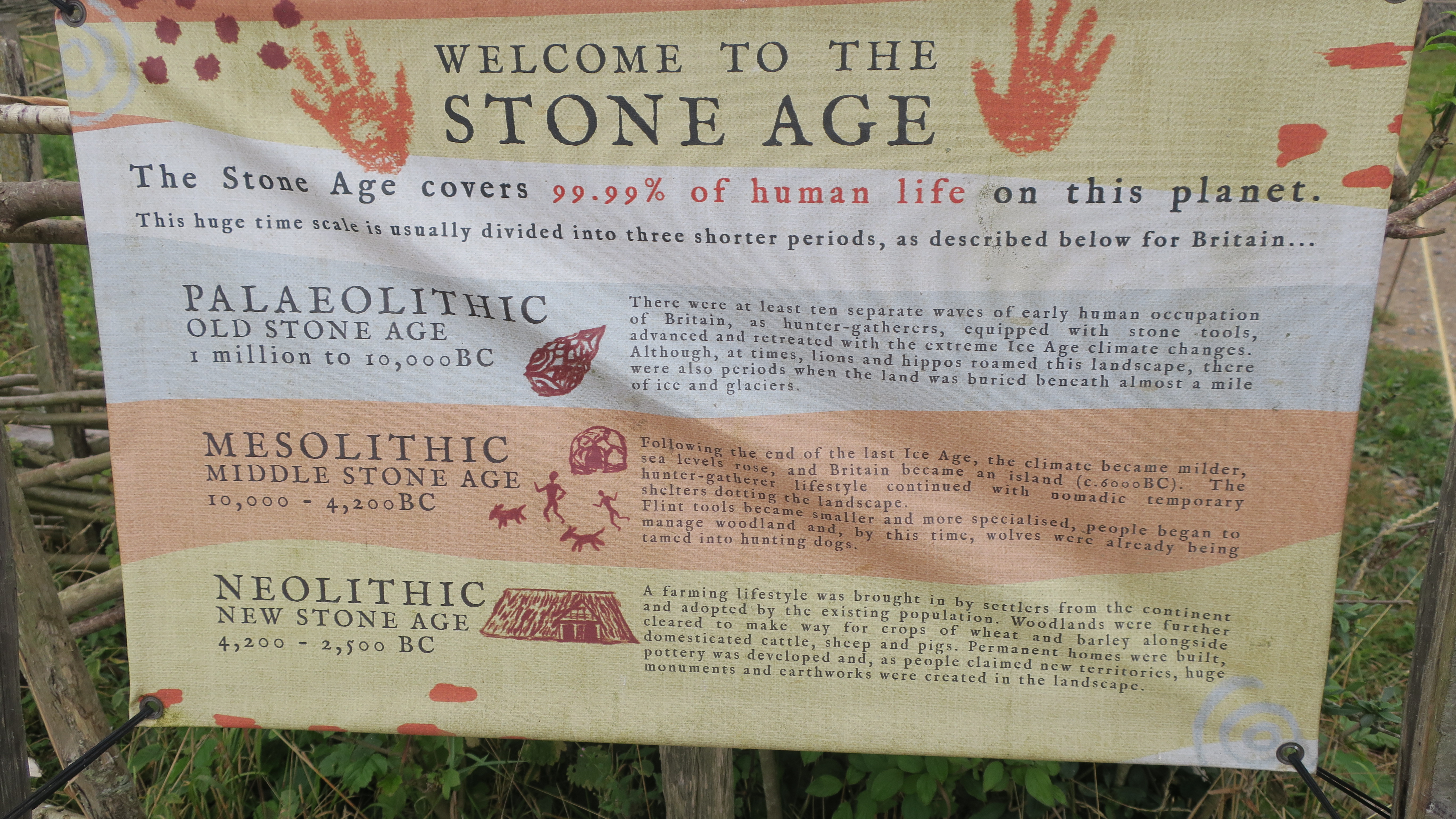
I was recently browsing a second hand bookshop (not an uncommon thing in my world) when I spied a small but curious book. The title ‘The Curious Cures of Old England’ had me hooked and on further investigation it found its way into my possession. The following is but a few of these curious and bizarre cures used by people when times were desperate.
Aches, pains, blemishes, maladies, disease, wounds and breakages, all of these and more have plagued our world since the beginning of time. The ways in which people have dealt with such issues has varied in terms of methodology and levels of success.
One of the most common ailments to afflict humankind is the headache and if blood letting was not your cup of tea then you could try one of the following.
Place a cabbage leaf or large lettuce leaf in your hat to cool your head.
Gargle mustard.
Tie a piece of hangman’s rope around your head, the fresher the better (these can be bought from your local hangman).
If the above was not available try a snakeskin.
Rub your temples with half an onion.
A poultice of raw potato.
And when all else fails there is always opium (please note I am not suggesting that you do this only that was what done ‘way back when’).
Headaches can sometimes be a precursor to other ailments such as the common cold, nowadays we take some paracetamol, drink plenty of fluids and spend the day in bed. In the past there were more inventive methods to deal with coughs and colds…
Soak a thick piece of toast in vinegar and bind it your throat.
Go to bed at night with a dirty sock or stocking around your neck with the heel (very specifically) on your larynx.
Extract the juice from a bucketful of snails by adding some brown sugar and hanging over a bowl in a meat cloth overnight – the resulting liquid was said to cure sore throats.
Stick orange peel up your nose.
A chesty cough can be healed with two drops of turpentine on a lump of sugar (please don’t try this at home).
Or strap rashers of bacon to the chest area (waste of good bacon…)
Or make a vest of brown paper and goose fat.
An earache can be helped by sticking a variety of things in your ear – snail juice, a cockroach dipped in oil or a garlic clove dipped in honey.
Serious bronchial problems can be solved by inhaling the breath of a cow.
A serious childhood complaint was that of whooping cough and our ancestors had some rather bizarre means of dealing with it.
Pass the child under the belly of a donkey (particularly popular in regions with a lot of donkeys).
Rub the feet with hogs lard and keep the child warm (the last is quite sensible).
Swallow four wood lice in a spoonful of jam or treacle.
‘A field mouse skinned and made into a pie, then eaten, the warm skin bound hair side to the throat and kept there nine days…’ (as from The Bedale Book of Witchcraft).
Or ‘catch a frog, open its mouth then cough into three times, then throw the frog over your left shoulder’ (also from the above book).
An Irish remedy from the 17th century says to put a live trout in the child’s mouth and then throw it back into the water – the trout will carry off the cough. But if you can’t manage a trout a frog is a good subsitute.
Pluck a hair from the child and feed it to the dog.
Tie a spider in a muslin bag and hang over the mantelpiece.
Make a broth from owls and feed to the child or try some fried mice or make cakes from barley and the child’s urine…
Sore eyes and cataracts had cures for which the wildlife of old England needed to be afraid of…
A 6th century cure tells the sufferer of cataracts to catch a fox and tear out its tongue, releasing it back into the wild. The tongue should be carried around wrapped in a red rag.
Or, bind the lungs of a hare over the eyes.
Or, lick the eyes of a frog (?!), chicken dung, a salve of a lizard, bats blood or blood taken from the tail of a black cat were all believed to be equally effective.
The Anglo Saxons used the lungs of a squirrel to bandage sore eyes.
If you didn’t fancy hurting an animal, the spittle of a starving peasant may well help…
The past was a dangerous place and physical injury/wounds were areal threat but don’t fret they had a cure for that too.
A mix of red wine and earthworms with the moss from a skull of a man recently dead applied to the wound was favored by some.
Skull moss could be replaced by blood or human fat however in these cases the ointment would be applied to the object which caused the wound as some form of sympathetic healing.
Some 16th century doctors (I use the word loosely) liked to use a salve made from cats boiled in oil…
If that doesn’t appeal try covering the wounds in spiders webs.
Minor cuts could be treated with toasted cheese, mouldy bread or tobacco and calf dung mixed with crushed earthworms.
Broken bones could be healed by swallowing powdered dog skull (or the more traditional tea of comfrey).
Plagues and pestilence were an unknowable part of life in times gone by and indeed as recent events have demonstrated it remains the case. In 1348 the Black Death struck England, devastating the population. It made regular reappearances up until the 17th century by which stage many realised prevention was better than a cure. Some preventative measures included –
Prayer
Onions – the smell of which was believed to purify the air.
Beer – as sold by the Green Dragon Tavern in Cheapside.
Stay indoors with the windows closed.
Don’t eat fish, waterfowl, poultry or beef.
Don’t cook in rainwater or olive oil.
Avoid exercise, sleeping during the day and bathing.
And, weirdly, catch syphilis…
If you did catch the Plague then possible remedies included – pressing roasted onions stuffed with treacle and figs against the buboes or drying a toad over an open fire and pressing against the swollen glands as a way of drawing out the disease. Not to mention the plague pills and cordials which all guaranteed prevention and/or cure against the plague.
Beyond the extreme case of the Black Death, there was cholera, tuberculosis and a whole range of fevers/sweating sicknesses/agues to contend with. Once again, the cures sometimes can be worse than the cause.
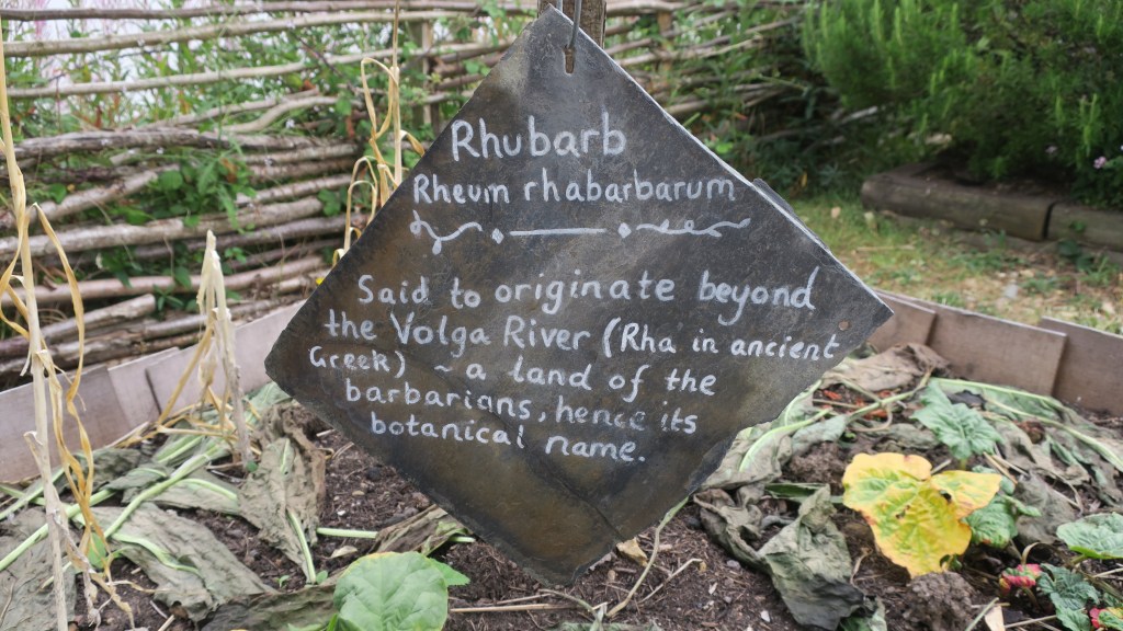
A cure for cholera involved the drinking of rhubarb juice or rosehip syrup.
A recipe for a life saving stew against tuberculosis (consumption) begins tamely – pieces of chicken flattened with dates and herbs, add pearls and gold and cook in a pot, in another pot…oh and the chicken, which is actually a cockerel has to be torn to pieces while still alive…
Or you can eat slugs…
Or drink snail soup.
For an ague the right foot of a black dog hung over the right arm.
Or, boil the contents of a horses hoof in water – although it is not clear if it should be drunk or bathed in…
Fasting for seven days, eating only seven sage leaves or woodlice rolled into balls or eating a spider could effect a cure for fevers, chills and sweating.
A Tudor remedy for sweating sickness was to take half a nutshell of unicorn’s horn in three large spoonfuls of dragon water, but only if you were rich enough.
Or, you could use a combination of mercury (please don’t), marigold, endive and nightshade.
Perhaps one of the most common cure all that many would have heard of was the act of blood letting either by way of leeches, cupping or scarification (small cuts into the skin). This particular form of healing has a history going back into the distant past, Hippocrates who lived in the 4th and 5th centuries BC and who is considered the father of medicine highly recommended it.
The biggest issue (and there were several) was regarding how much to take, some believed that the job wasn’t properly done until the patient had lost all sensation and fainted – today we would say they had gone into ‘shock’ – and for many this would have been their undoing.
Leeches have an interesting history in this story, they could be applied all over for bleeding purposes. All manner of issues could be solved with a good dose of leechcraft – earache, tonsilitis, gout, headaches and mental illness to name a few. Their use fell out of fashion in the 19th century only to be revived in the mid 20th century as an aid in skin grafts etc, the anticoagulant in leech saliva encourages blood flow and has anesthetic and an antibiotic qualities.
An extension of bloodletting was the next step in any serious illness to purge a body by means of vomiting etc. Seen as a means of curing all manner of ailments from headaches, fever, bowel disorders to deafness and insanity. For a price a person could buy any number of powerful laxatives and purging pills as a cure all. Unicorn horn being the most expensive…
I hope you have enjoyed this short romp through the weird and downright bizarre world of medicinal history, if you want more (you know you do) then I recommend reading Nigel Cawthorne’s book, ‘The Curious Cures of Old England’.
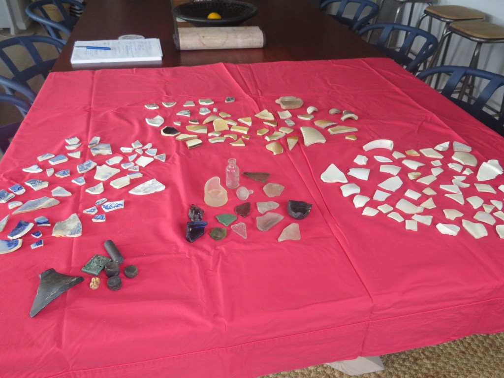
My addiction to beachcombing came about as I was walking my old dog, Brad, and I started to spot bits of pottery and glass in the sand of our favourite haunt. So begun a collection which I have written about elsewhere on here. But my curiosity and collecting did not stop with just one wee beach on the edge of the Waitemata…this blog is short catalogue of just some of the pieces I have found, these are prize possessions.
As some may be aware I live in New Zealand and as some may also be aware we have a relatively short history of human occupation – approximately 800 years give or take a decade or two – compared to other countries around the world. The finds below are restricted to the last one hundred and fifty years or so when Europeans first arrived in Aotearoa New Zealand and are by far the most numerous things to be found.
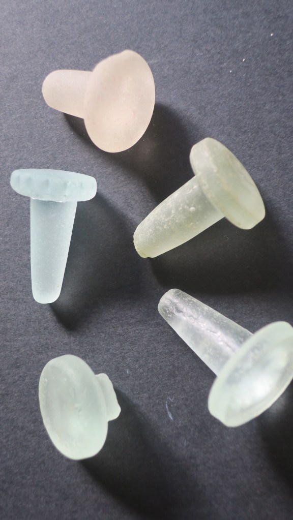
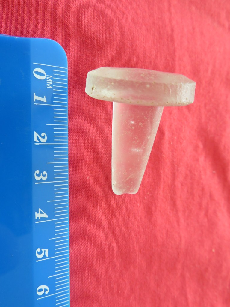
1, Glass stoppers
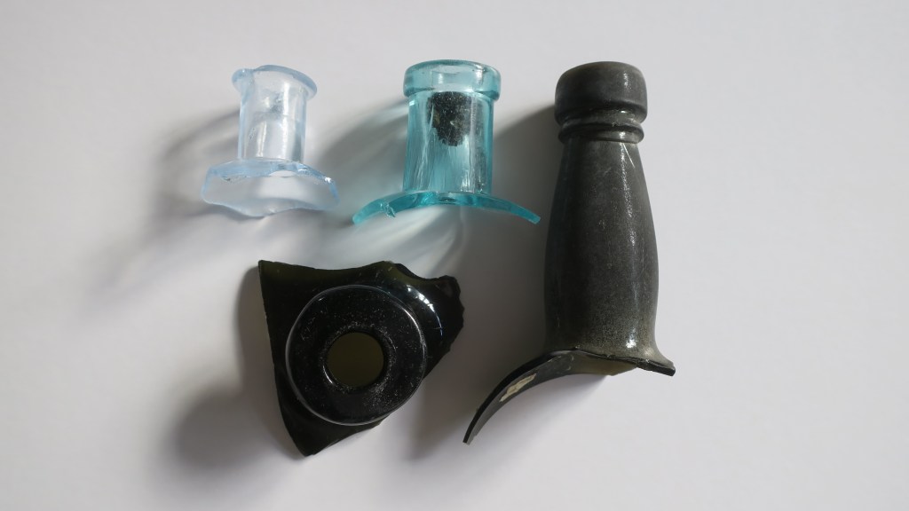
Long before plastic and screw tops many bottles were closed off with a glass stopper. The most common variety found are the ones in the picture below, used to seal sauce or relish bottles. Originally they would have had a ring of cork around the neck to ensure a tight seal. These very durable objects are a beachcombers delight. It is not a huge collection but each find of a glass stopper gives me an odd sense of joy…
2. Ceramics
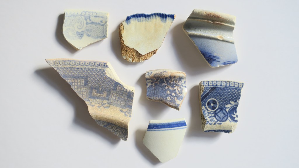
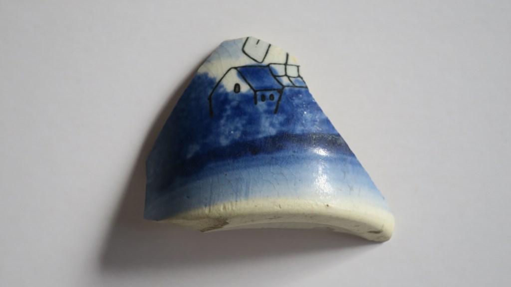
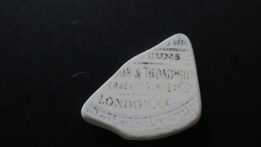
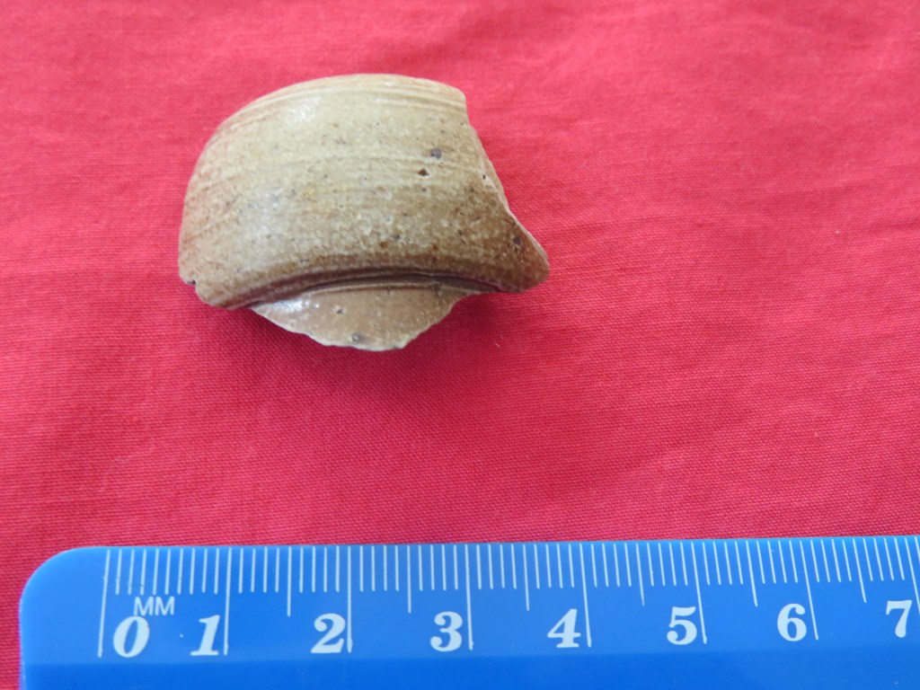
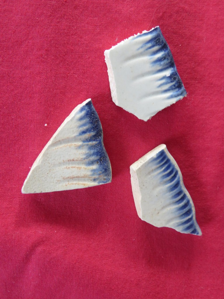
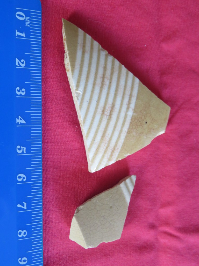
Sea pottery is also a relatively common find on beaches and waterways around the world and here in New Zealand it is no different. The variety of ceramics is often quite surprising, the most common are the plain white or cream pieces. But the most sought after are the early pieces of transfer print earthenwares imported from the UK or brought out with the first settlers. These come in a variety of patterns and colours, my favourite (along with many others) are the blue and white patterned pieces including the ever present ‘willow pattern’. I have written extensively on the ceramics found at Fitzpatrick’s Bay, please feel free to check it out here. Included in this category are also stonewares, I have yet to find a complete example but I have many neck sections and bases.
Just a small selection of my blue and whites…typical of what can be found.
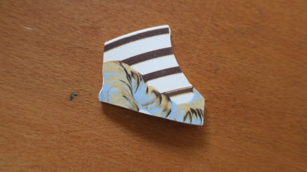
My one and only mocha ware piece.
And perhaps my favourite piece thus far, part of small cup with a hand painted house and windmill.
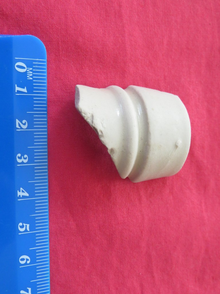
Unlike the pretty pieces often easily spotted, I thought I was very lucky to find amongst the detritus this well worn fragment of a toothpaste lid.
3. Glass
I have chosen to call this section glass as opposed to seaglass as there will be some who dispute my examples as seaglass. When I started to collect I was most surprised to find that there is an International Seaglass Association and they have defined true seaglass as;
Genuine sea or beach glass comes from discarded bottles, tableware, or household items and is found in oceans, lakes, and rivers. Genuine sea or beach glass tends to have:Lettering, embossed images, and distinguishing features such as handles, bottle necks, etc. A frosted patina on the surface with small “C”-shaped patterns, surface cracking, rounded edges, and small crevices where grains of sand may be found.
Much of the glass I find does fall into this category but the most interesting pieces are not so worn by tide and time. These are the bottle necks or fronts with lettering that can be researched. The other smaller (proper seaglass) pieces I collect go into the art pieces I make to sell at a local market (Magpie Designs)
The triangular piece is the top of a gin bottle with its distinct squat neck, on the right is a beer bottle.
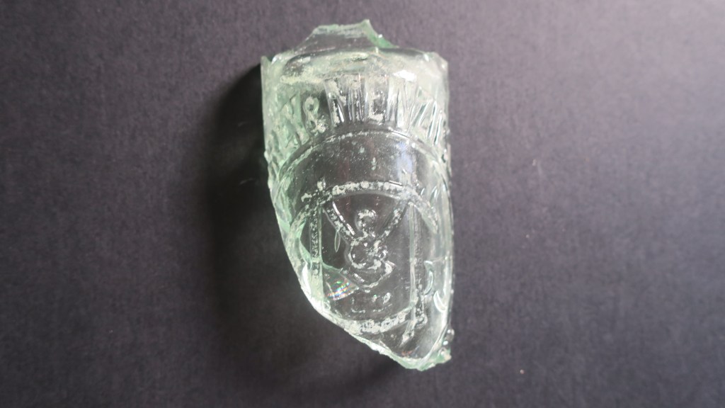
The next photos shows a knarly chunk of sharp glass I found whilst larking under the harbour bridge. I wouldn’t normally have bothered to bring this home but the lettering got me curious. A quick search online found the following on the Auckland Museum website.
Grey & Menzies Ltd (1902-1962) Established in 1902 following the merger of J Grey & Sons and Thames cordial manufacturer Menzies. The firm operated as Grey and Menzies until 1964 when a merger with CL Innes Ltd resulted in the soft drink brand of Innes Tartan. John Grey established J Grey cordial & aerated water manufacturers at Eden Cres. Auckland in 1874, and in 1880 his sons joined the business it became J Grey & Sons 1880-1902
Robert Menzies was born in Scotland in 1854 and came to New Zealand in 1858, working initially for Buteman Bros, Thames. He later worked for B Ballin (Thames), John Grey and George Gledhill before purchasing Buteman Bros. in partnership with Samuel Hirst to form Menzies & Co at Thames. In August 1902, with two partners he established Menzies Ltd, and leased a property in Stanley Street, Auckland but a month later joined with John Grey & Sons to form Grey & Menzies Ltd
The Grey and Menzies merger occurred in 1902 – the company now covered a considerable area including Northland, Auckland, South Auckland and Thames. The company began to introduce new lines including the ginger beer that became Tartan Dry Ginger Ale. In 1916 the company purchased the Paeroa spring, aerating and bottling the water in Auckland under the “Paeroa Water” label – later to become Lemon & Paeroa. In the early 1920s they began making Orange and Lemon Crush under license from the Crush Co’s reg’d USA patent office.”
Every object has a story…
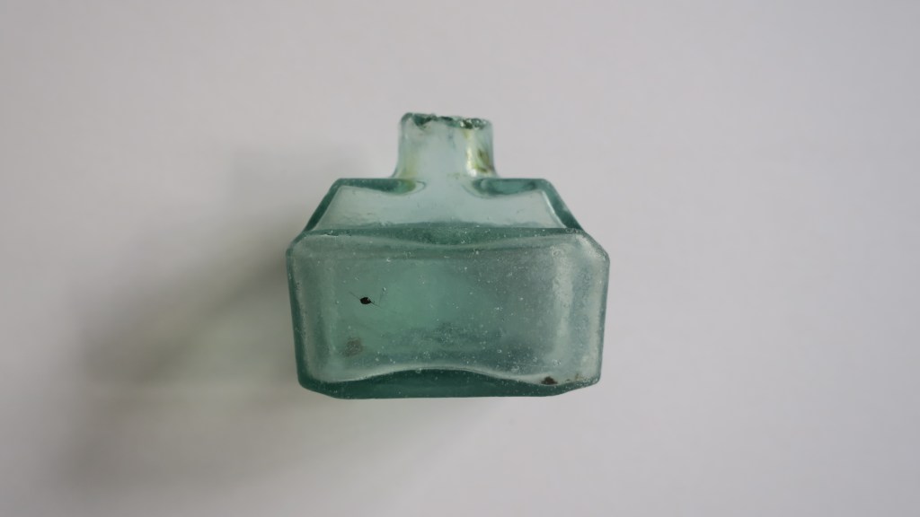
The next photo is of a sweet wee ink bottle, again found under the Harbour Bridge. It was a strange moment…I was about to leave the area having found very little that morning, thinking about a post I had seen on Instagram about these cute glass ink bottles when I spotted nestled in the seaweed one of the very same. Known as Boat ink bottles for their shape and distinctive lip used for a pen rest they come in a variety of colours. During a recent visit to the Dargaville Museum north of Auckland I saw a vast collection of these bottles in all their beautiful colours.
I did a happy dance, much to the dog’s surprise, when I found this.
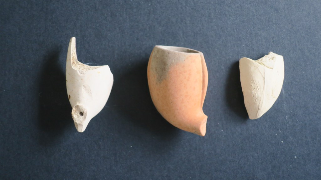
4. Clay Pipes
Finding clay pipes on the shores of Auckland’s harbour can be a bit hit and miss, however I do have a small collection of pipe stems and bowls. None of which have any visible decoration or makers mark, given the softness of the kaolin clay used to make these items it should not be surprising that it would easily wear away. Not so long ago I was sent pictures of a pipe stem found at Fitzpatrick’s Bay which did have a stamped name on it, ‘squatters budgeree’ which I have written about here.
For those who would like to know more about clay tobacco pipes in New Zealand the following links may be of interest. For those elsewhere there are a multitude of websites and books on the humble clay pipe.
As you can see pipe stems are far more numerous than bowls due to the tendency for stems to go soft with long use and be broken off and discarded. The center bowl is a much prized part of the collection being a terracotta bowl rather then the usual kaolin, which may be why it survived in better condition than the others.
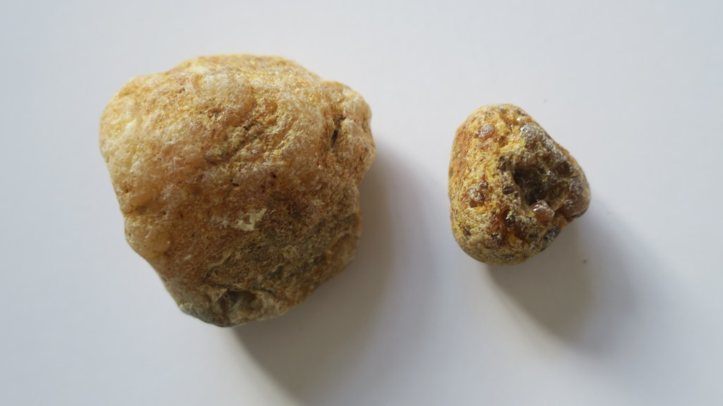
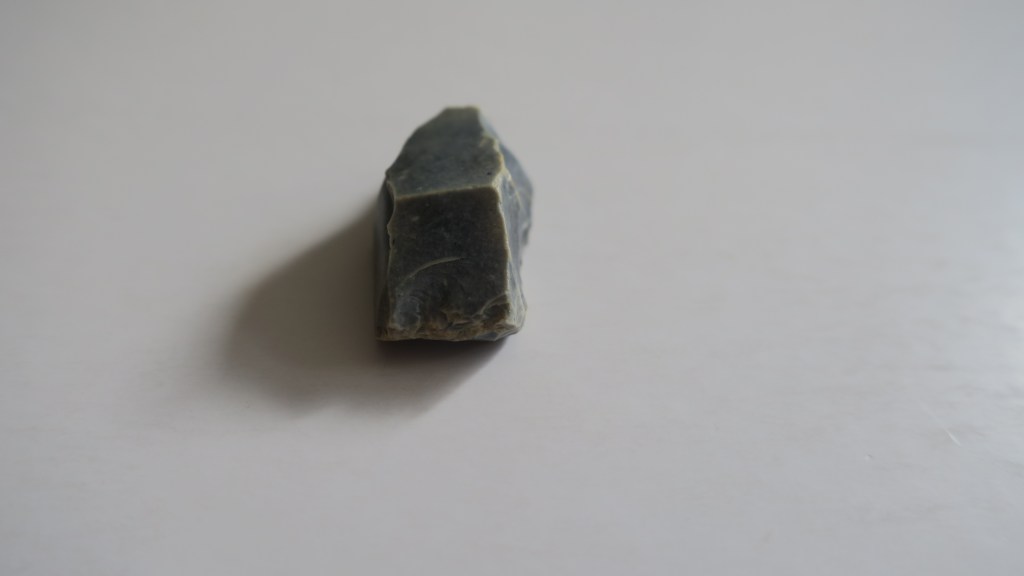
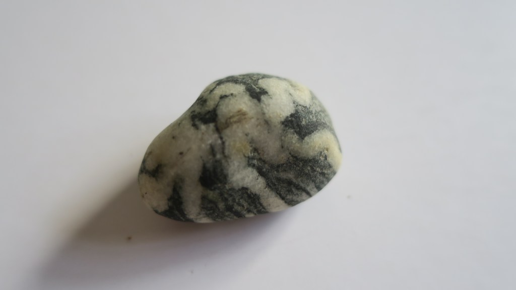
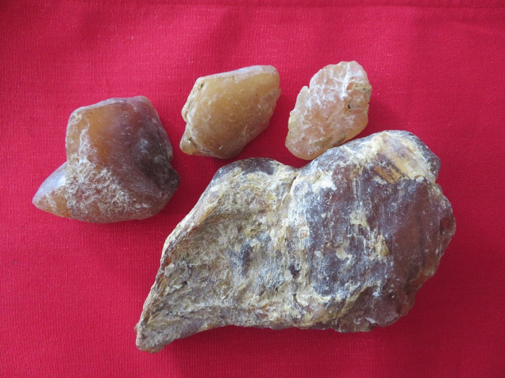
5. Kauri Gum
For those who are not familiar with Aotearoa New Zealand’s flora, there is a native tree called kauri. It is a slow growing hardwood which was much sought after by settlers and Māori alike. Its many attributes was the tendency to ooze sap which over time solidifies and becomes much like amber. Early settlers would often turn to gumdigging as a way of supplementing other income or when there was no other income.
The gum was used by Māori as a type of chewing gum (fresh gum), as a fire starter and when burnt and mixed with animal fat for tattoo moko. The early settlers used it in a variety of ways, much like amber for trinkets and jewellery. However, in the mid 1800s it was discovered that when mixed with linseed oil it made an effective varnish and as such was in great demand in the UK and Europe. Kauri gum became Auckland’s main export at this time – between 1850 and 1950 approximately 450,000 tons were exported. The growth of early Auckland owed much to this industry.
The area in which I live once had extensive kauri forests, so it is not surprising to find chunks of gum washing up (and down) onto the beaches. I collect them because of the history they remind me of. Below are a just a couple of the many pieces currently residing in my rockery…
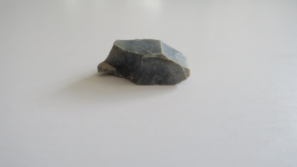
I only have one gun flint and only a partial one at that. Gun flints are part of the striking mechanism for a flintlock gun and were in use in the UK from the 17th to the 19th century. For more on how they were used read here. Here in New Zealand the musket, which also used a flintlock mechanism, contributed to a period in our history known as the Musket Wars.
‘After Europeans brought muskets (long-barrelled, muzzle-loading guns) to New Zealand, these weapons were used in a series of battles between Māori tribes, mostly between 1818 and 1840. As many as 20,000 people may have died, directly or indirectly. Tribal boundaries were also changed by the musket wars.’ From Te Ara Encyclopedia
Although there is no telling who used this particular gun flint (it was found at Fitzpatrick’s Bay) it is a sobering reminder of our past – the good and the bad.
7. A Fossil
No I’m not talking about the other half…but rather this small reminder that the earth is old and for me at least, a reminder that our time here is but a moment.
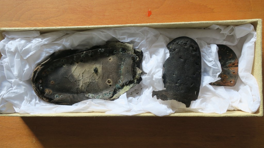
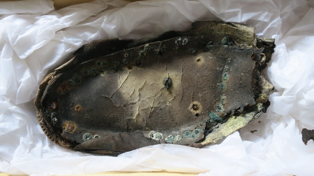
8. Shoes
Occasionally I find parts of shoes, sometimes they are modern (so many jandals) and head straight to the bin but other times they are much older. When I look at these shoes parts I wonder who wore them, what was their life like? Oddly shoes feel very personal and connect me to someone in the past – will a person in the future find the sole of my favourite ugg boots and wonder about me too?
This sole consists of several layers and the copper nails are evidenced by the green spots around the edge.
This piece appears to be part of a heel, the rust suggestive of a ferrous metal. I can hear the wearer tapping their way across the floorboards…
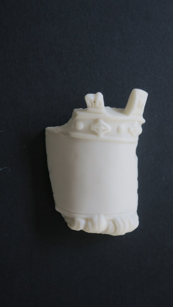
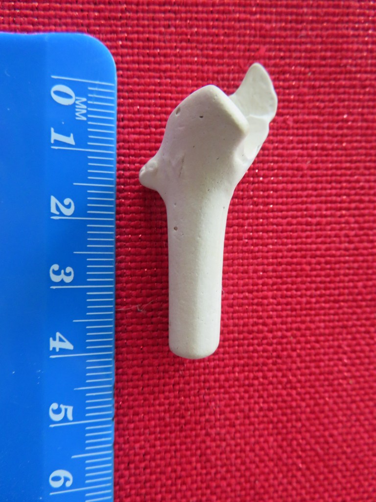
9. A Mystery Object…
This final object confounds me and I hope there is someone out there who might be able to shed some light.
As you can see it is an interesting shape, being 6cm at its tallest, it looks like a crown with a blank space for perhaps a label (?) and locks of hair below. The material at first glance looks like milk glass but I am not sure as it it is quite matt and more like alabaster in appearance. All suggestions welcome…
And there you have it, just a few of my favourite things…
If you have enjoyed this blog please feel free to share, like and comment – tell me your favourite finds!
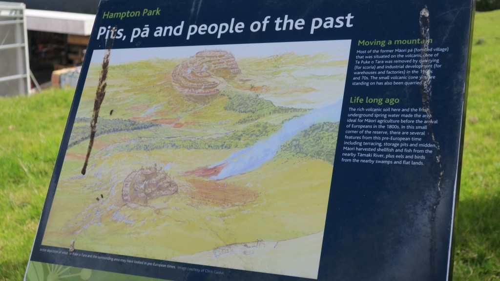
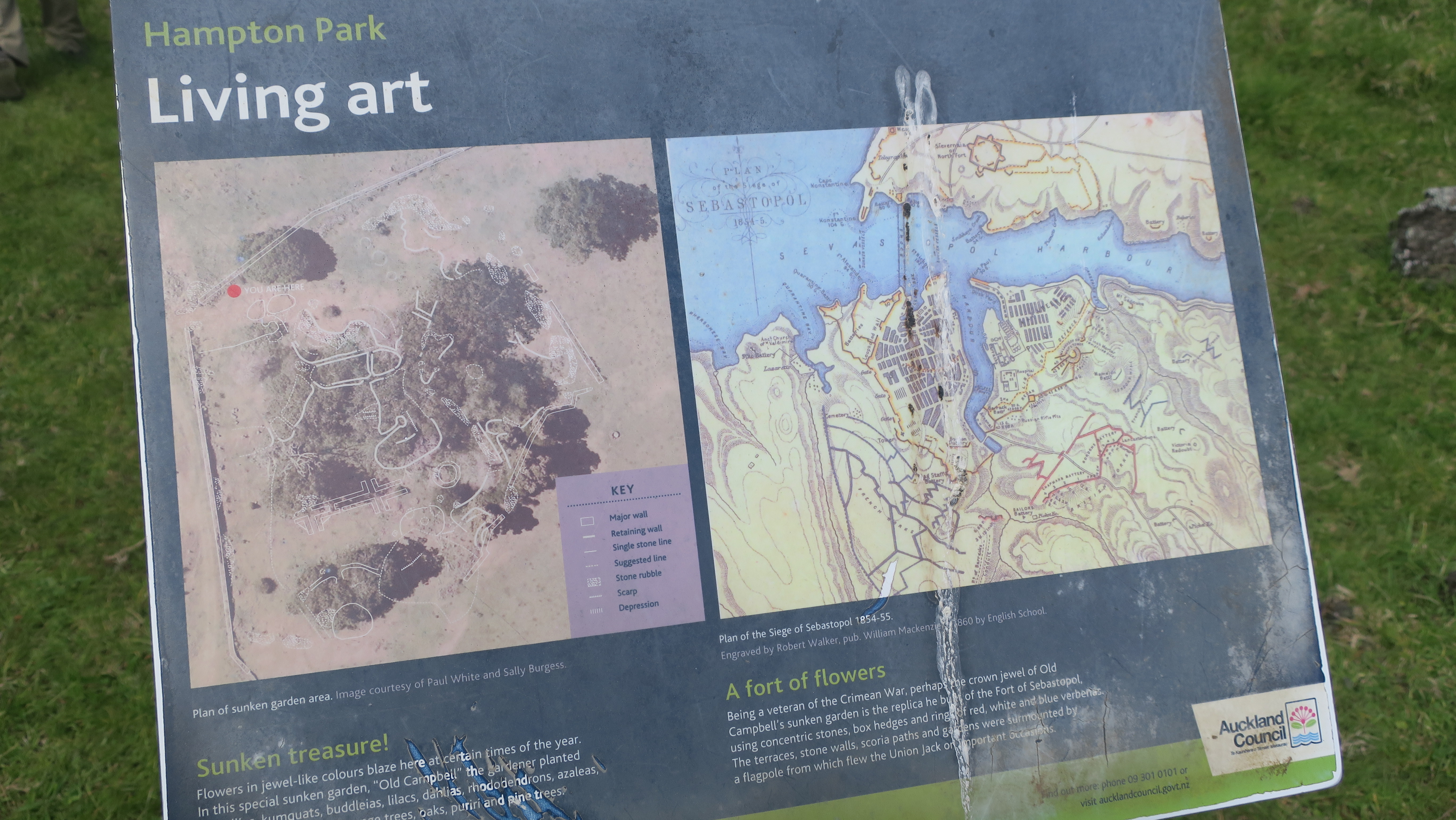
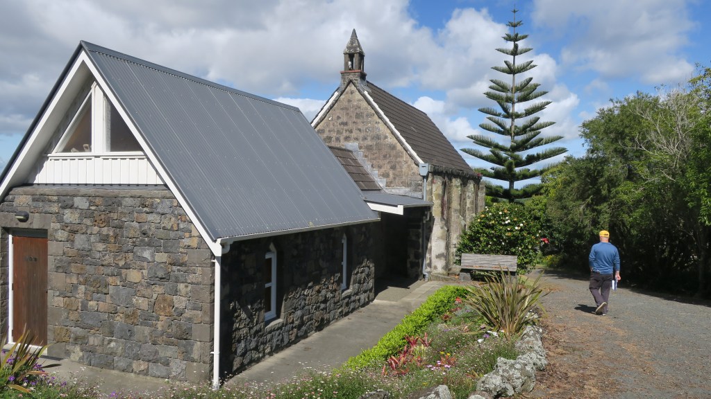
Back in October the Auckland Council hosted the Auckland Heritage Festival, where, as the name would suggest all things heritage and Auckland was celebrated. There are a wide range of events during the festival weeks from walks, talks, exhibitions and workshops. I was able to attend two events – a talk at the Devonport Museum on Mt Cambria (more on that down the page) and a walk ‘n’ talk at Hampton Park.
Hampton Park is situated in the heart of commercial Otara, a pocket of farm land amongst the warehouses, factories and offices. Having never been there or even for that matter heard of it, I was intrigued to find out more. The park is in fact a working farm and whilst the public are able to walk around it there are no proper footpaths and no other facilities (there is a house and it is lived in by the family who farm the park as well others – if visiting please respect their privacy).
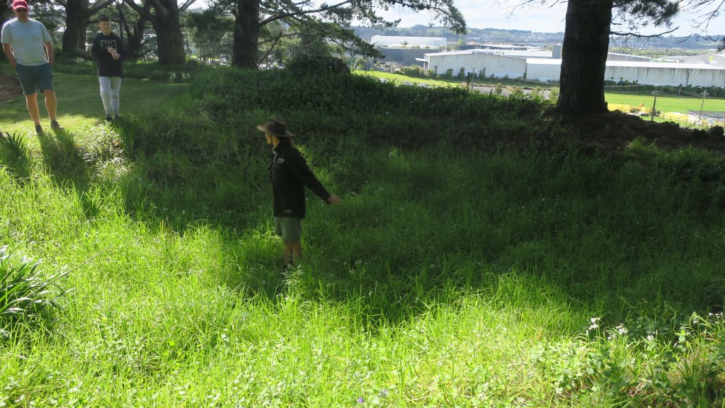
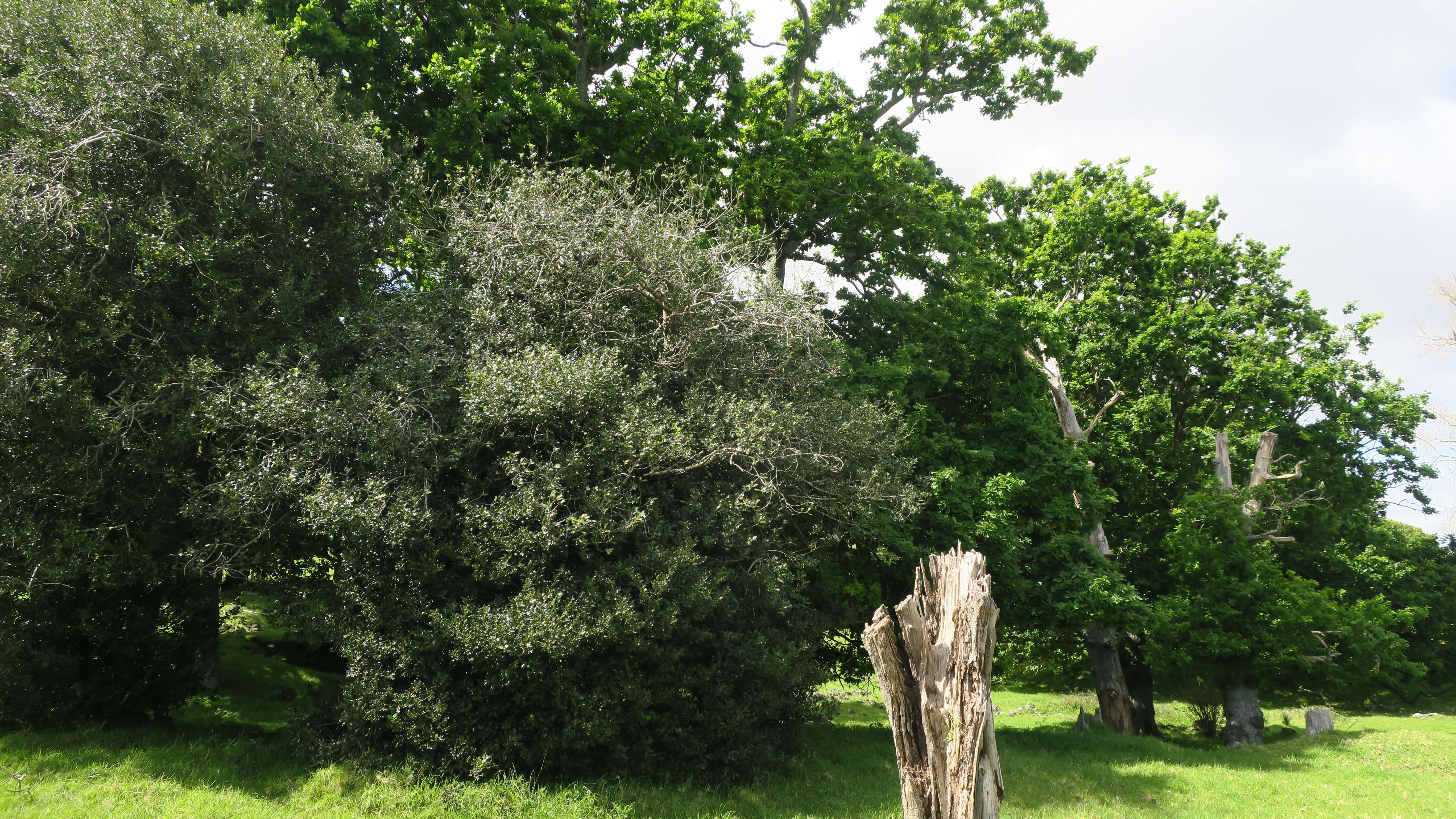
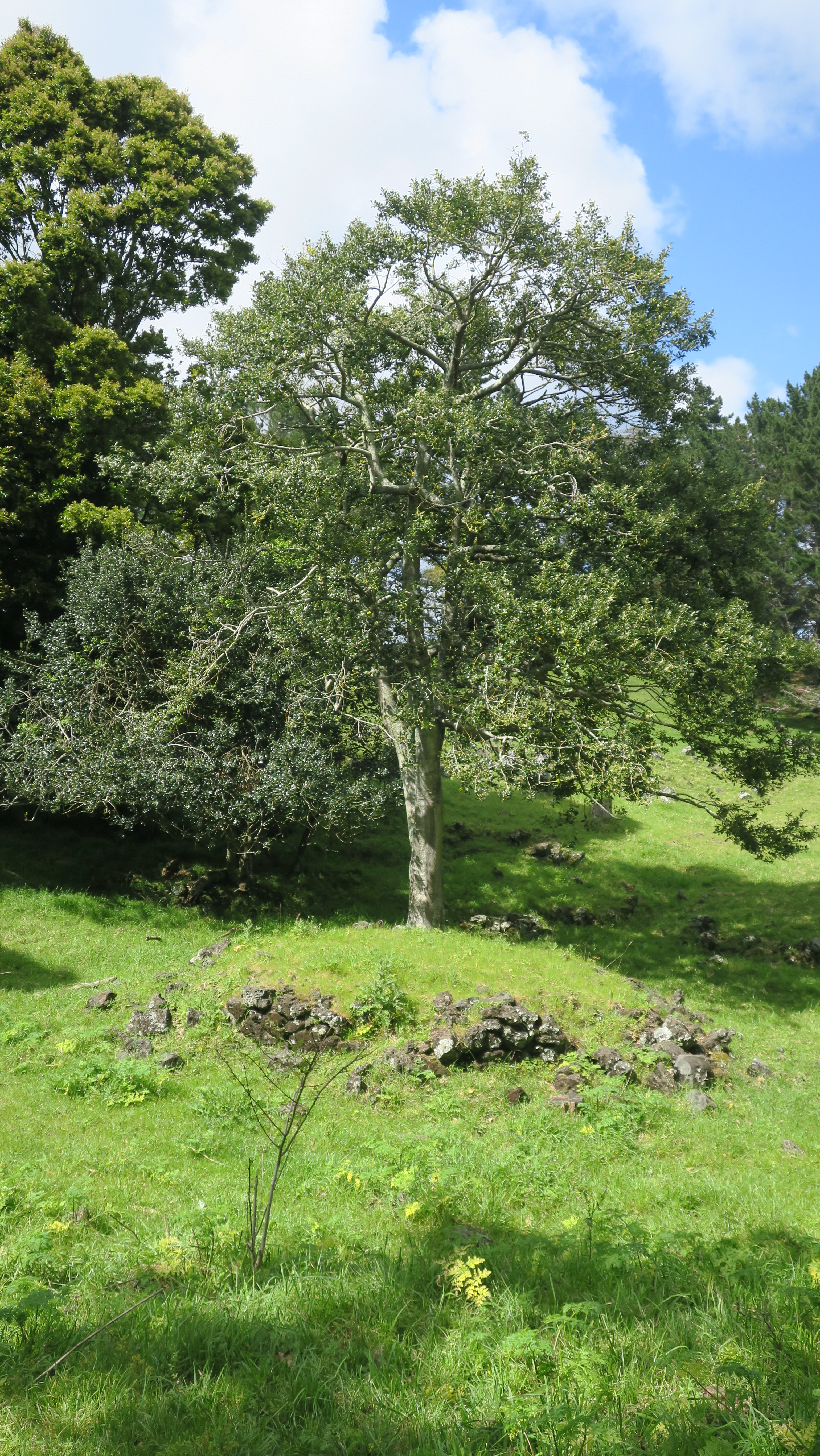
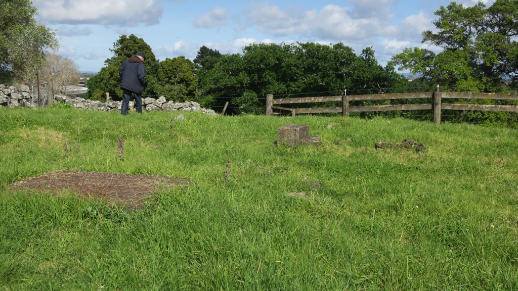
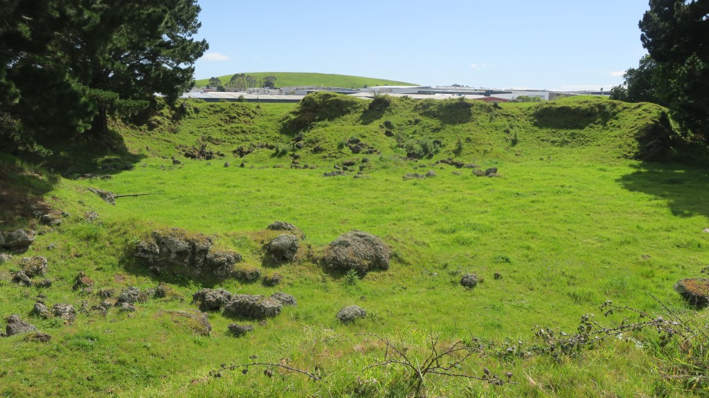
The story of Hampton Park begins long before people arrived in the area. Geologically it is part of the wider volcanic landscape of Auckland, here in Otara there are (or were) three volcanoes, the largest of which was called Te Puke o Taramainuku (‘the hill of Taramainuku’, a Tainui ancestor). The small scoria cone that sits in Hampton Park is the smallest of the three and is probably the smallest of all the Auckland volcanoes. It is so small that it has no formal name, simply being referred to as the Hampton Park volcano.
The beginnings of the human story in the area is much like the human story all over Tamaki Makaurau. Here like everywhere else Māori terraced the flanks of the cones and grew crops in the good volcanic soil. The larger cones would have provided a place of refuge when in need. The small cone in Hampton Park shows some evidence of terracing but later changes has blurred this somewhat. Alongside the driveway between the house and the church there is a large rectangular kumara pit which has remarkably survived. For more on the Māori use and occupation of the maunga of Tamaki Makaurau read here.
The large rectangular kumara pit between the house and the church.
Terracing on the sides of the Hampton Park volcano.
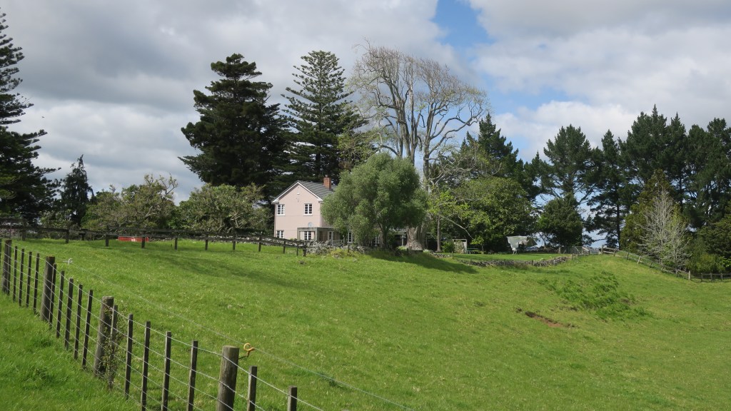
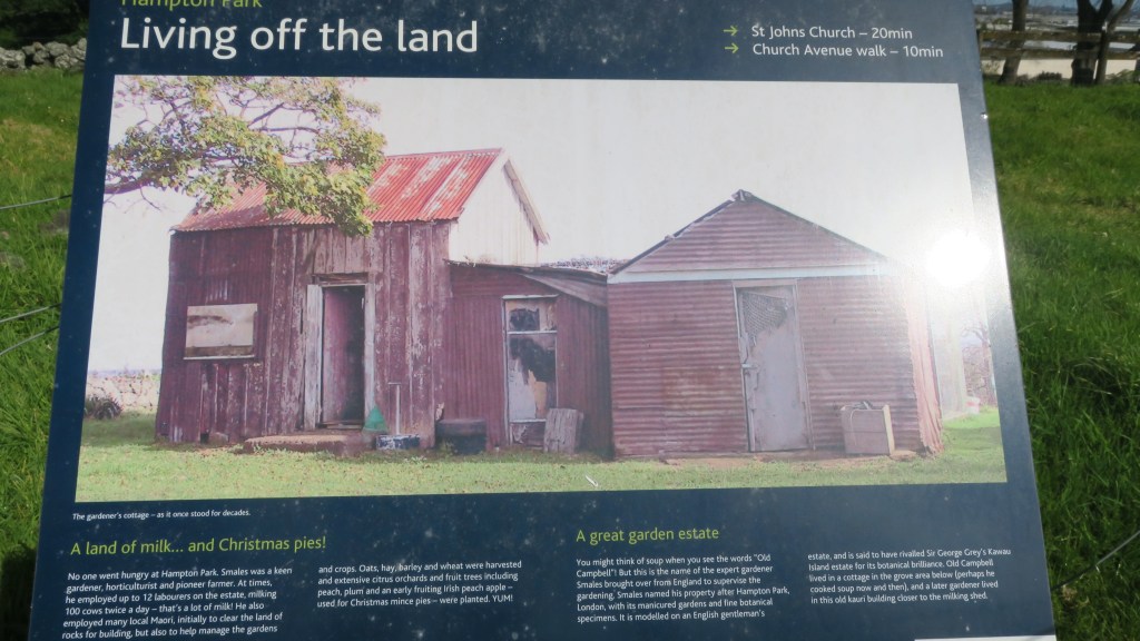
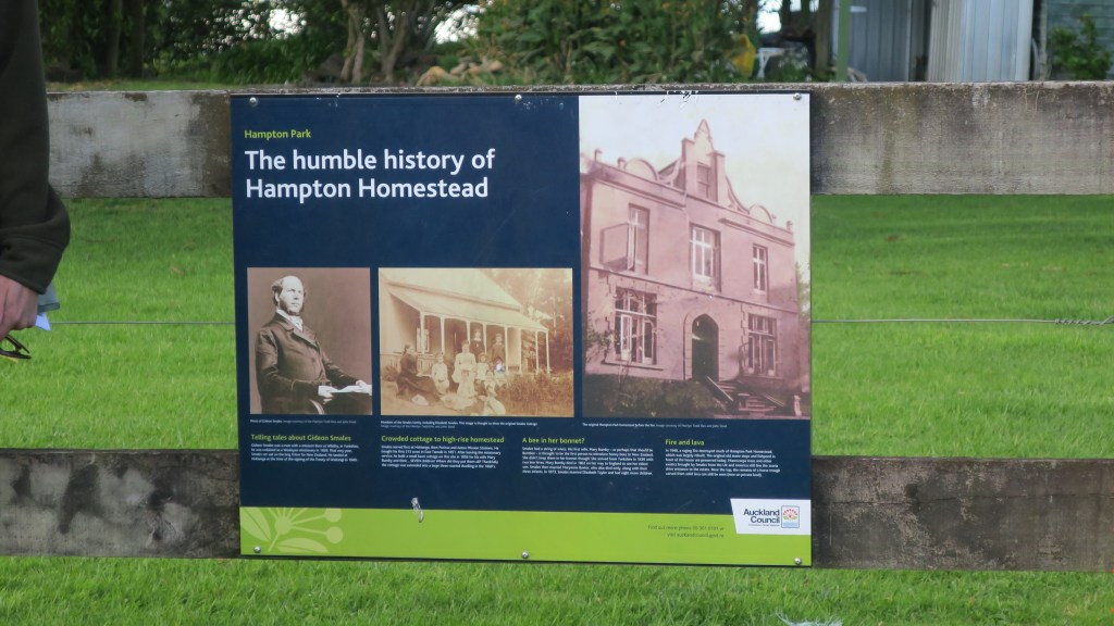
In 1852 the Rev. Gideon Smales, a Wesleyan missionary, bought 460 acres from the fencible Major Gray, settling there with his wife and children in 1855. The land was cleared of rocks, stone walls were built and crops and livestock brought in. Gideon Smales called the farm Hampton Park as he wished to model it on the English gentleman’s estate. It was said to have once rivalled Sir George Grey’s Kawau Island estate for its ‘botanical excellence’.
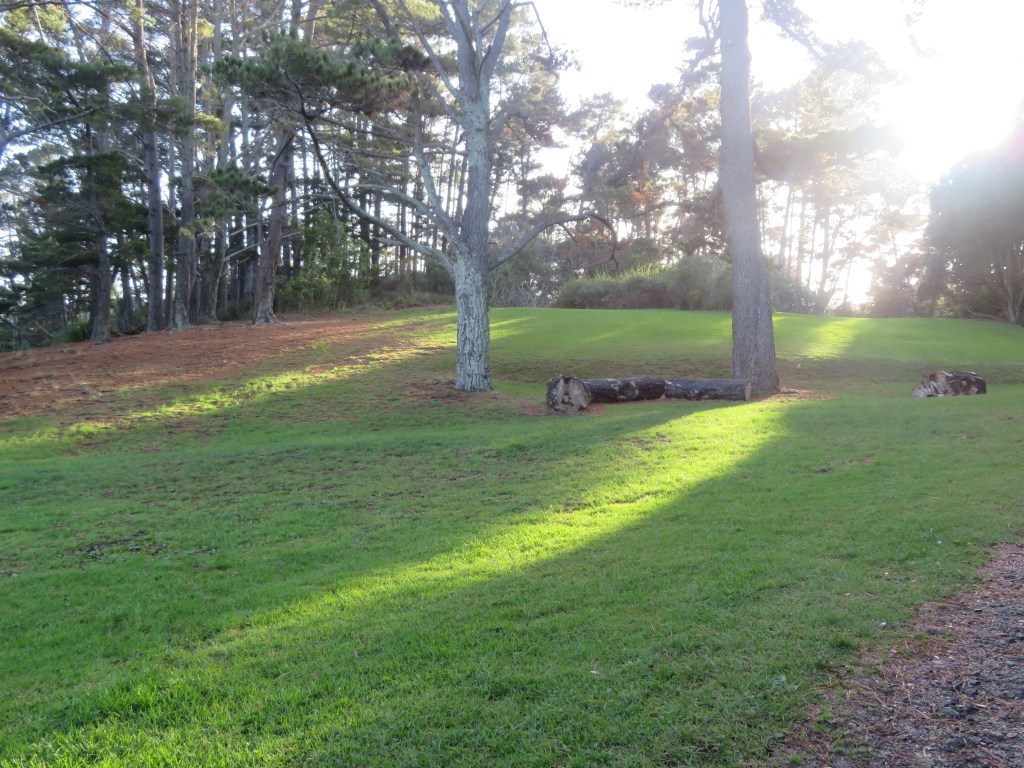
The current homestead.
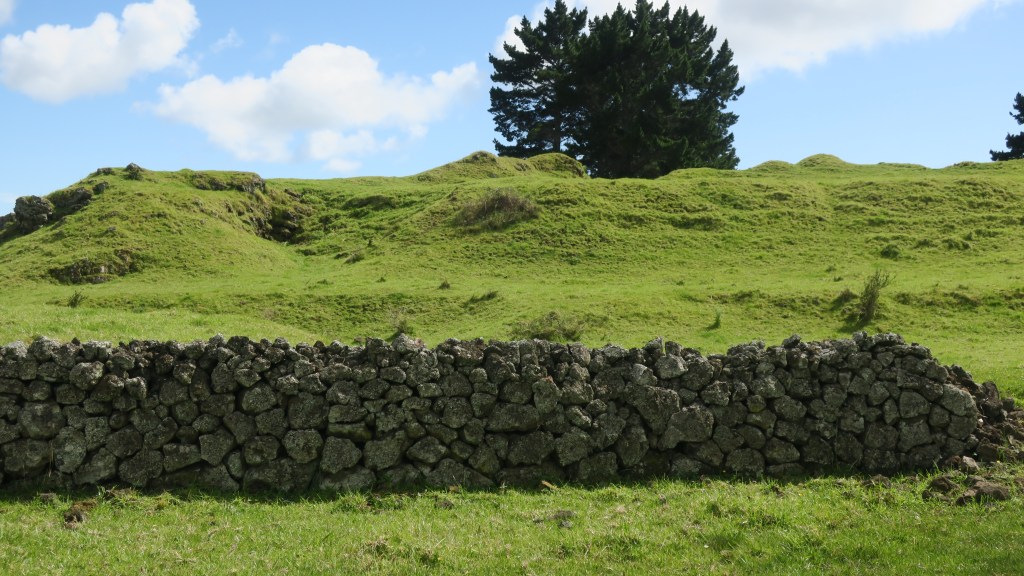
One of the many stone walls found on the farm, in the background is the cone of Hampton Park volcano
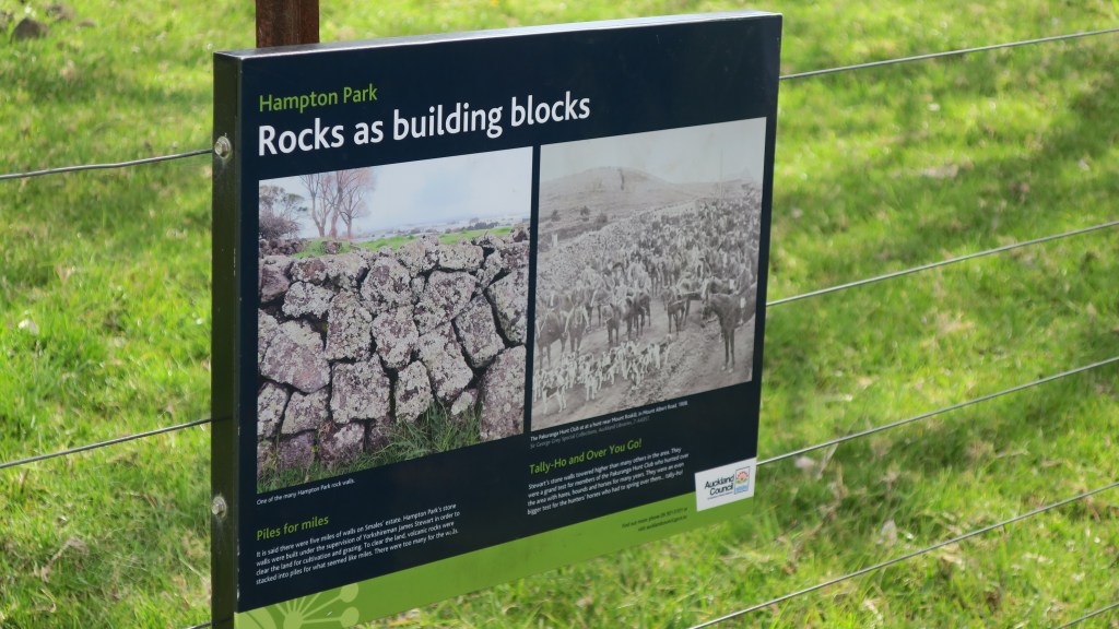
The farm grew oats, hay, barley, wheat and had an extensive orchard which included cider apple trees, pomegranates, oranges, figs and plums to name a few. In addition, to the more practical elements of the farm, the gardener – a veteran of the Crimean War – built a sunken garden in the form of the fort of Sebastopol. The remains of which can still be seen today. The excessive amount of stone on the estate resulted in it being used for a great many projects including the sunken garden, a rockery with a high stone wall and cave and of course the stone walls.
The stone walls which were constructed with the stone cleared away for cultivable fields was done so under the supervision of James Stewart who immigrated to New Zealand from Yorkshire. Due to the vast quantity of stone the walls were higher than was the norm and it was said there was over five miles of walls on the estate.
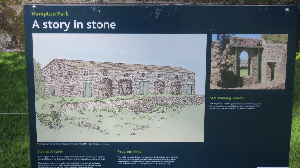
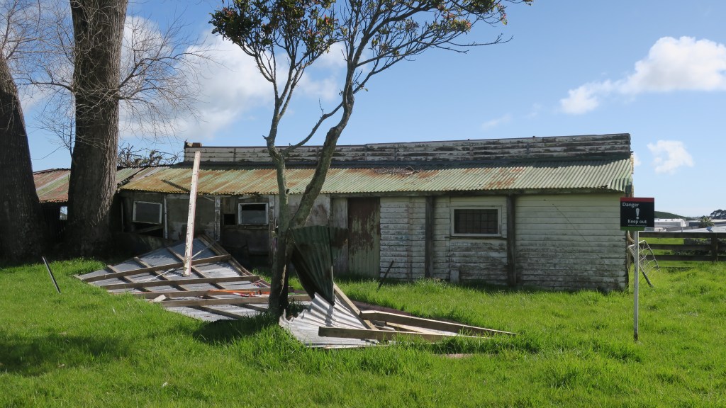
As is to be expected on a farm there are a number of buildings but perhaps the most striking are the remains of the stone stables, again built from stone quarried from the estate. Although not long after they were built a vagrant worker came to the estate looking for work, he was given a meal and allowed to sleep in the stables. That night the stables burnt down and the vagrant disappeared. They were never rebuilt properly although they were partly roofed over as barn and milking shed. Nearby are the derelict tin shed of the 1930s barn.
The 1930s barnThe site of a workers cottage
Two other buildings which still stand are the homestead and the church. The current homestead is the second to have stood on the estate, the first was burnt down in 1940 and the current homestead was built – only the front steps remain of the original house. The first homestead was built in 1855, it was three storied and had ten rooms which was later extended to eighteen rooms in 1869.
Images of the first two homesteads on site with the Rev. Gideon Smales on the left.
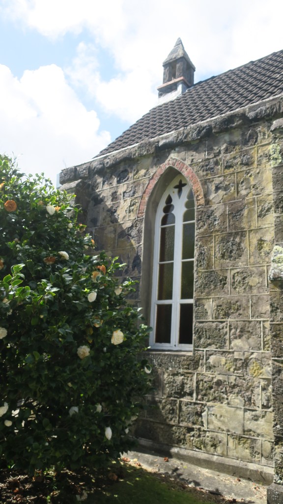
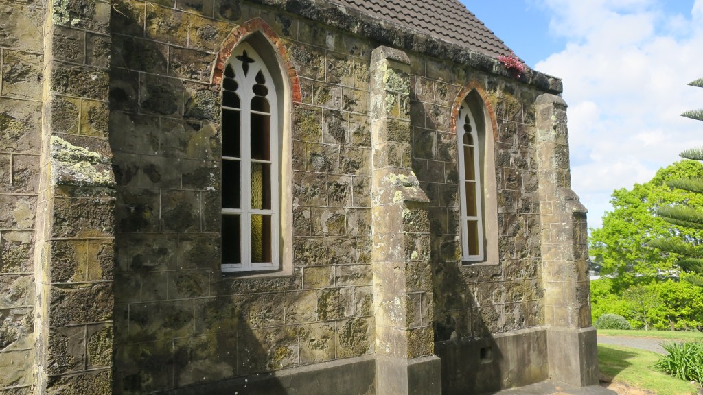
The small chapel – St John’s church – is also constructed using stone from a nearby quarry. Interestingly, the mortar for both the church and the house was made of burnt shell from Howick beach, the timber arrived via the Tamaki river and was brought overland by bullock teams. The first service to be held in the church was on Sunday the 12th January 1862. When the Rev. Gideon Smales died in 1894 he bequeathed the chapel and four acres jointly to the Anglican and Methodist Churches. It is still used today for services once a month.
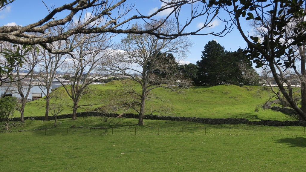
The Missing Maunga
Beyond the settler history of the park there is another story that is reflected in the wider landscape of Auckland Tamaki Makaurau. As mentioned earlier the small volcano cone at Hampton Park is one of three in the immediate area, which may confuse the visitor, as nothing of the other two remain to be seen.
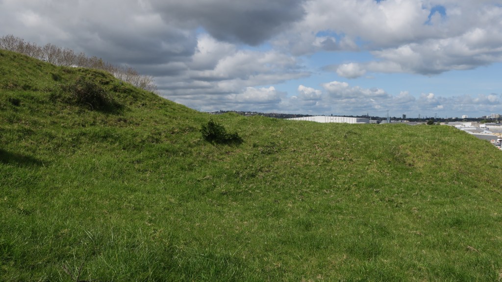
The inside of the Hampton Park volcano. The roofs of the industrial estate in the background is where Te Puke o Taramainuku would have stood and the green mound at the rear is all that is left of Matanginui (see below).
Te Puke o Taramainuku has been completely quarried away beginning in 1955 and now is vast expanse of factories, beyond is Greenmount or Matanginui which had minor quarrying from around 1870 which began in earnest during the 1960s. The quarry eventually became a landfill giving way to the gently sloping mound/hill we see today.
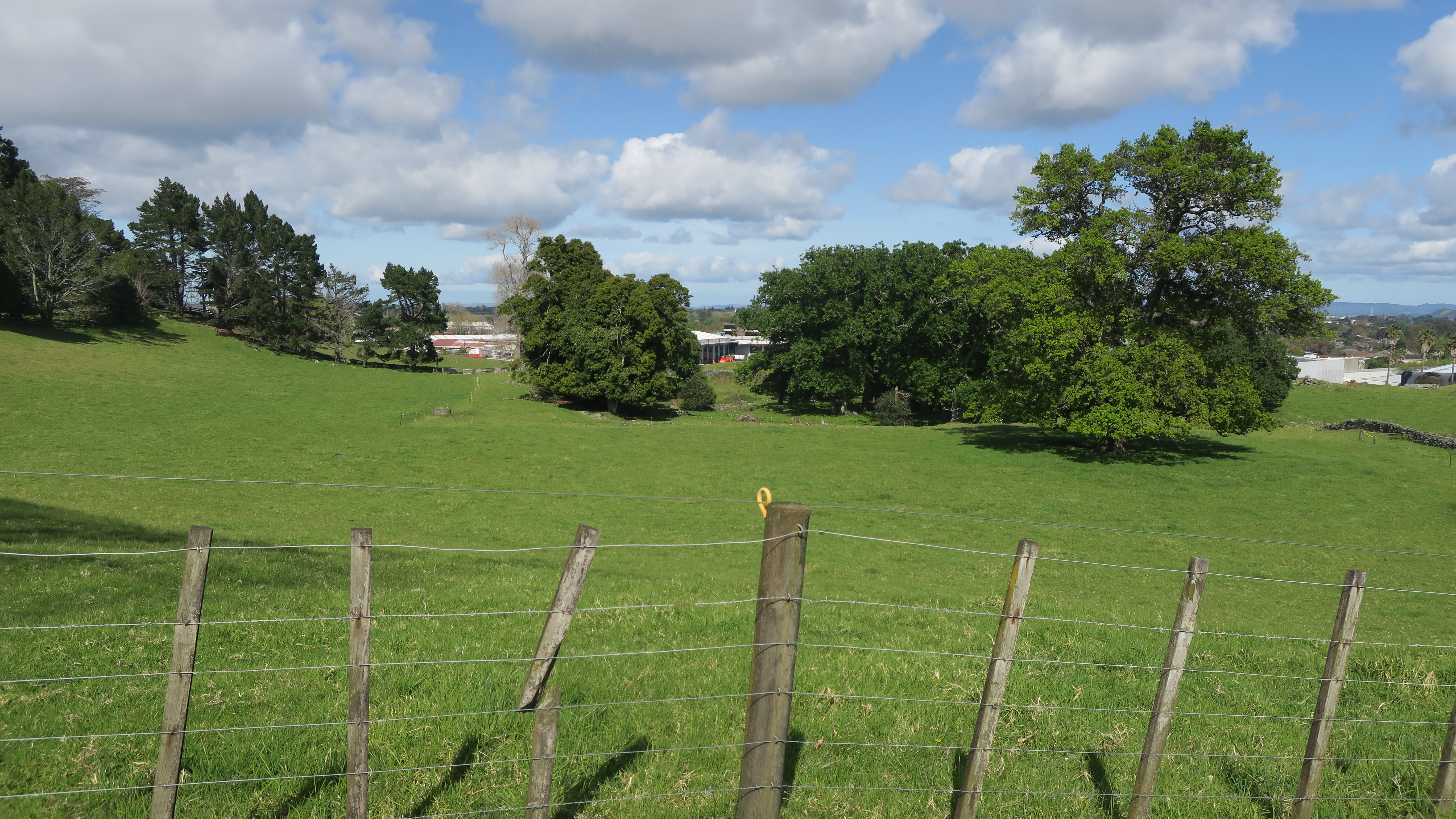
Another view of the missing maunga/volcanoes.
The quarrying of the volcanic cones around Auckland in the late 1800s up until the mid fairly recently was not an unusual. Many of the cities defining features were quarried away to make way for development and to use the raw material of scoria and basalt in the infrastructure of a city. An earlier event at the Devonport Museum told of the history of Takararo/Mt Cambria, another volcanic cone wedged between Takarunga/Mt Victoria and Maungauika/North Head which was mostly quarried away and only more recently became the pleasant parkland area it is today.
The parkland that was Takarora/Mt Cambria with Takarunga/Mt Victoria in the background.
Other volcanoes that have been subjected to quarrying to the point of total removal include –
Te Apunga-o-Tainui/McLennan Hills; Waitomokia/Mt Gabriel; Ōtuataua Volcano/Quarry Hill; Maungataketake/Elletts Mountain; Te Pou Hawaiki (the second smallest cone and now a carpark);Te Tātua-a-Riukiuta/Three Kings; Rarotonga/Mt Smart; Maungarahiri/Little Rangitoto; Te Tauoma/Purchas Hill to name a few.
There are also many others which have been partially quarried, of the fifty three volcanoes in Auckland only thirteen appear to have been untouched by the bulldozer and the digger. This is not to say that those that remain have been completely untouched by human hands. For as long as there has been people in Tamaki Makaurau then the landscape and its features will have been adapted and utilised to suit the needs and requirements of its inhabitants.
For more information regarding the volcanoes of Auckland I recommend the following book –
B. W. Hayward (2019) The Volcanoes of Auckland. A field guide. Published by Auckland University Press
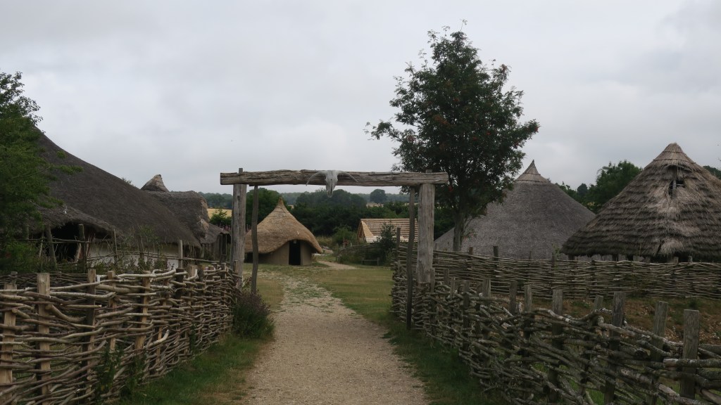
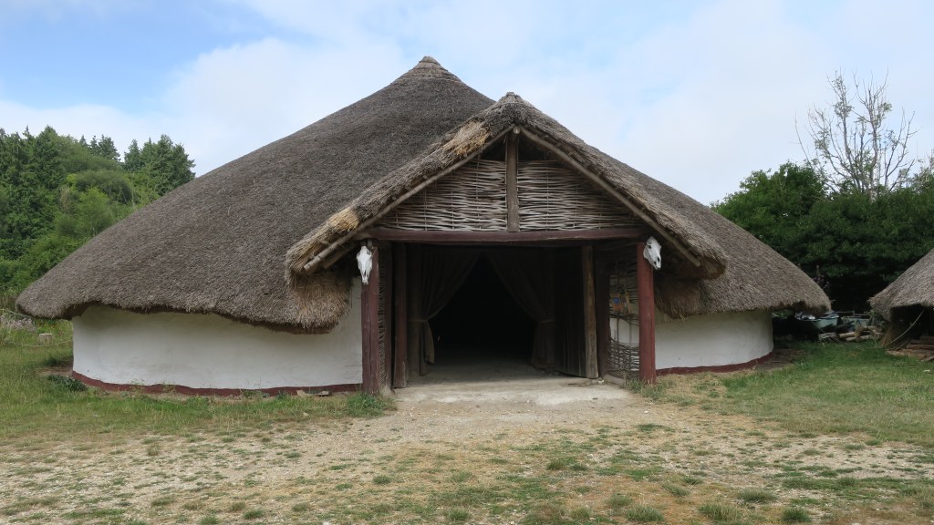
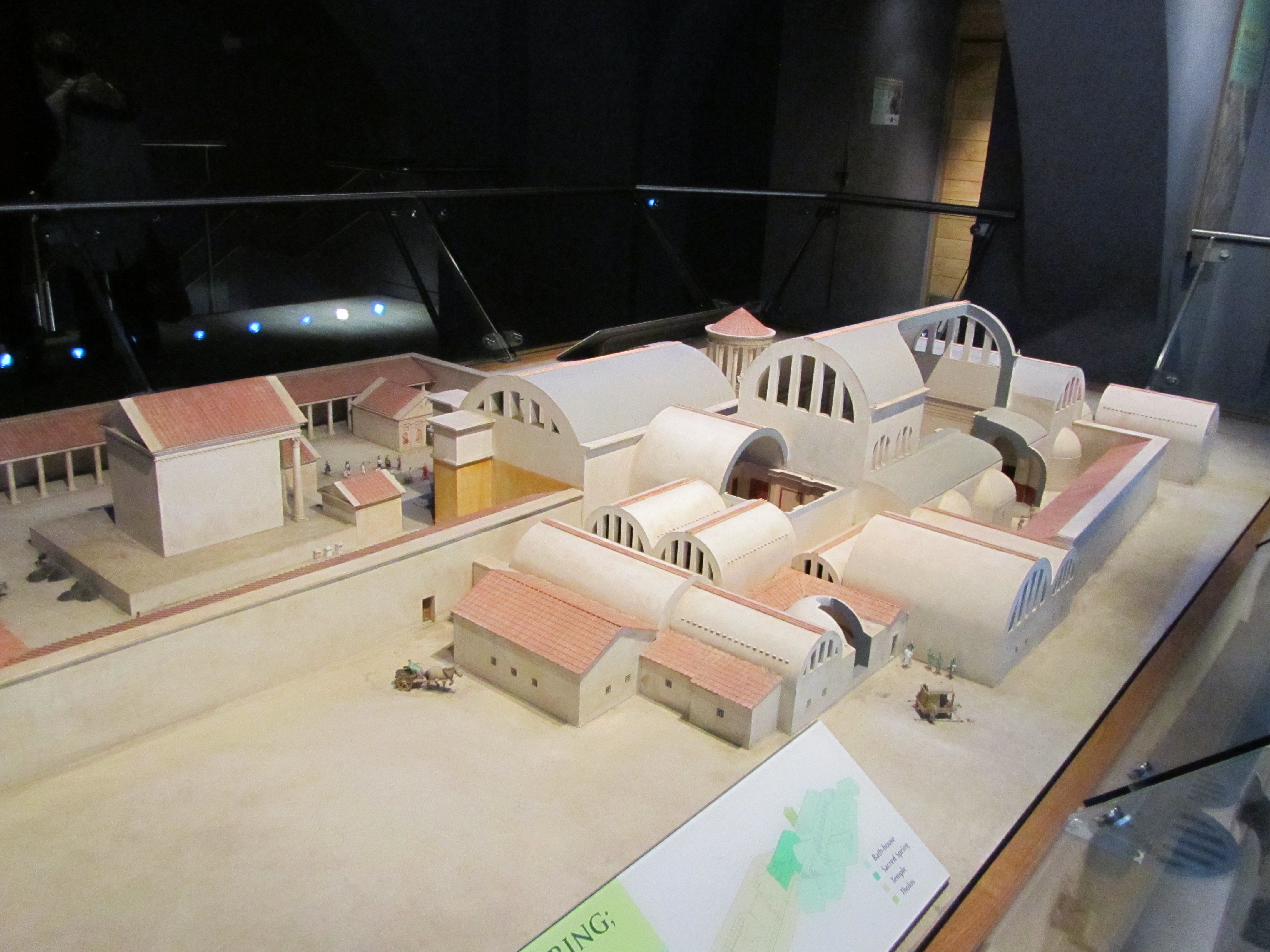
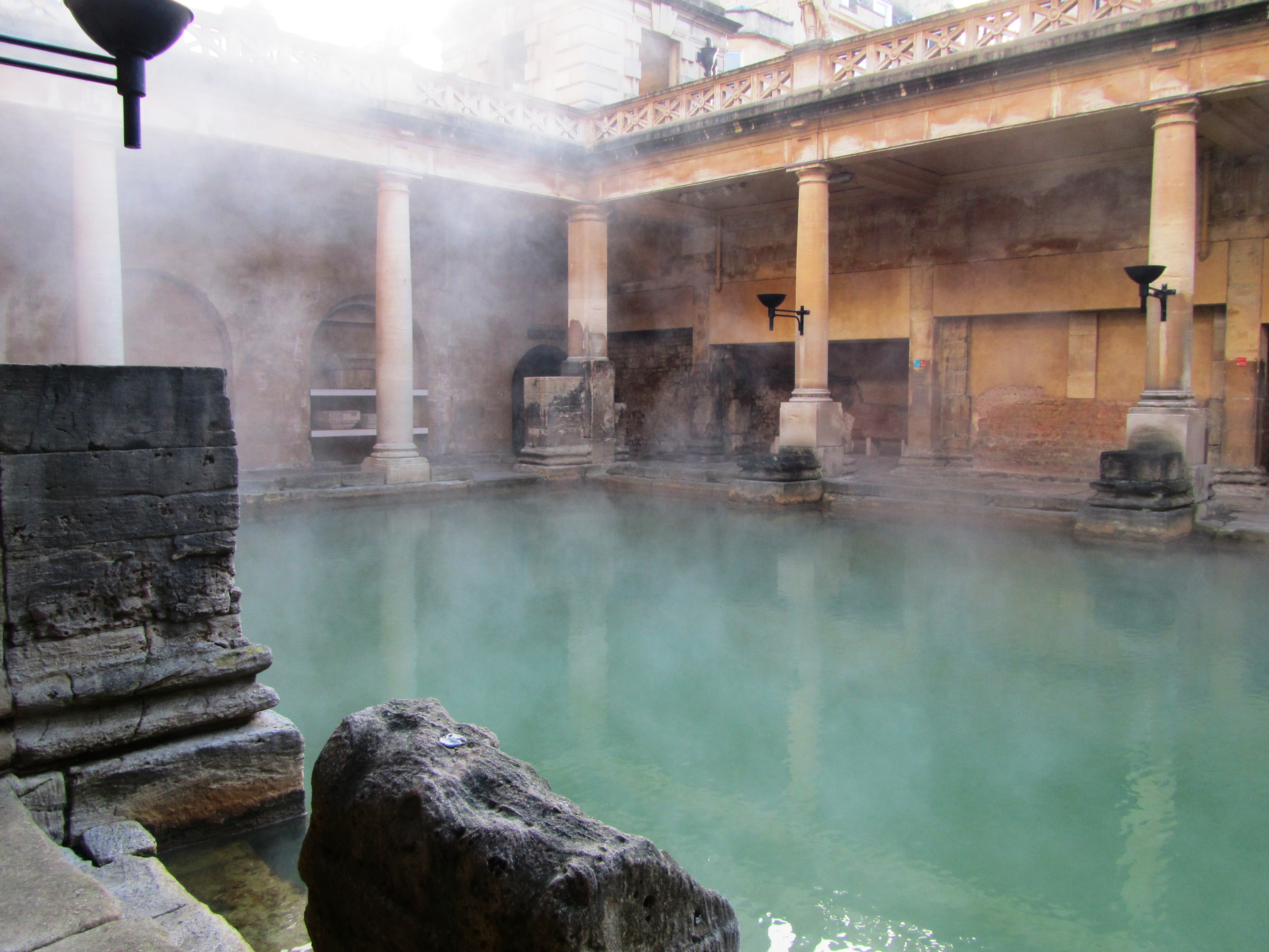
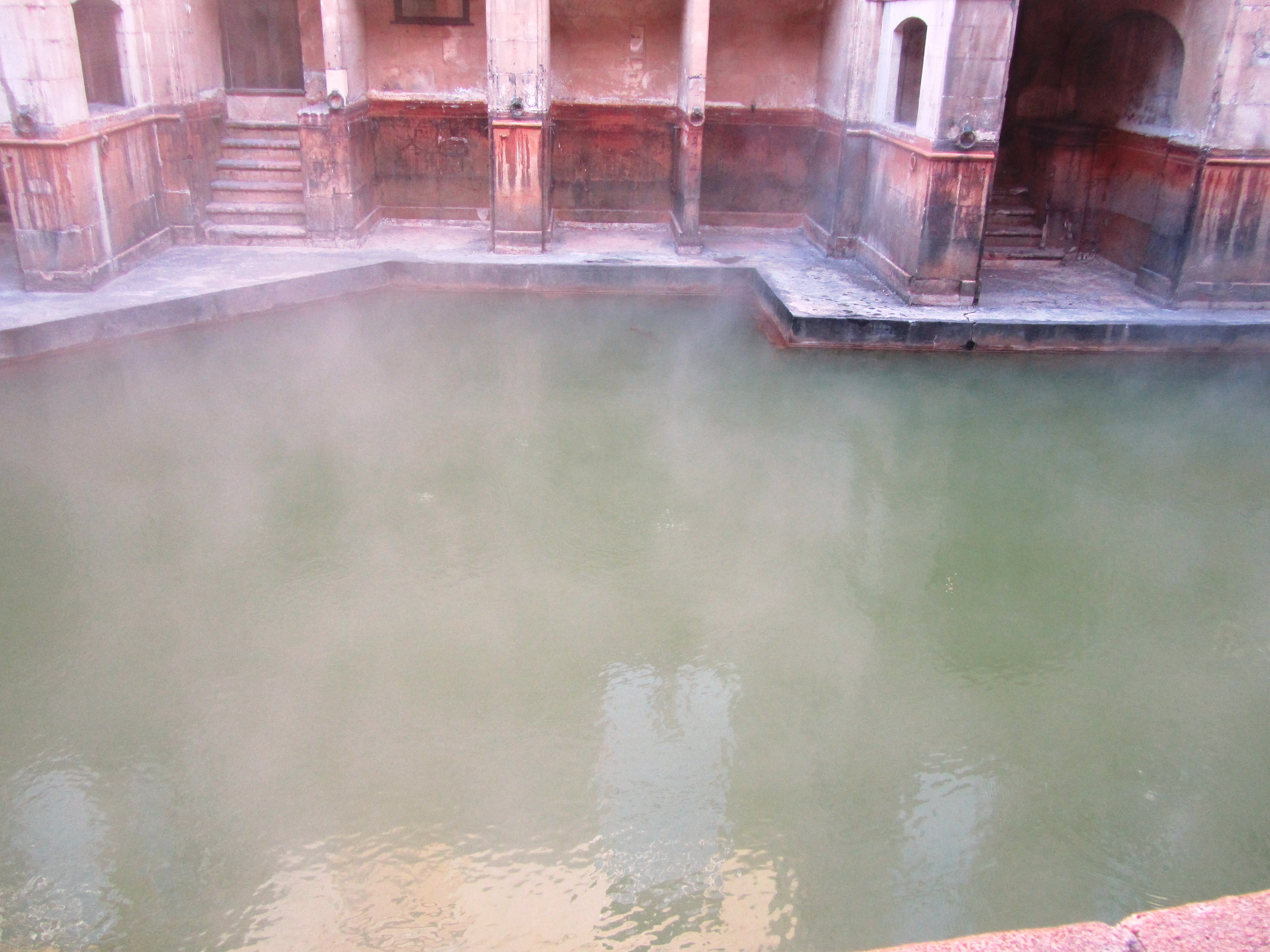
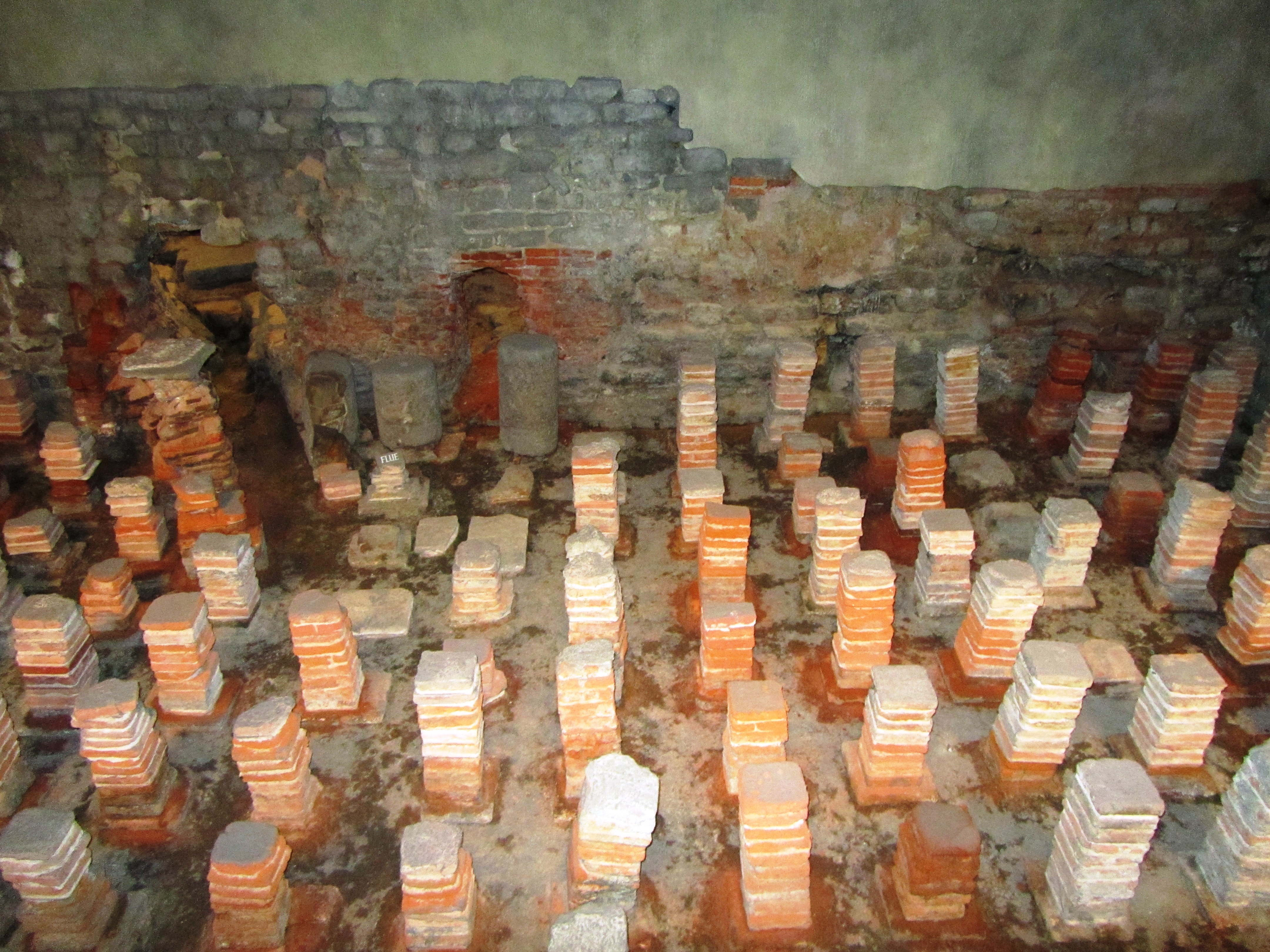
A view from the Roman villa back into the Iron Age.
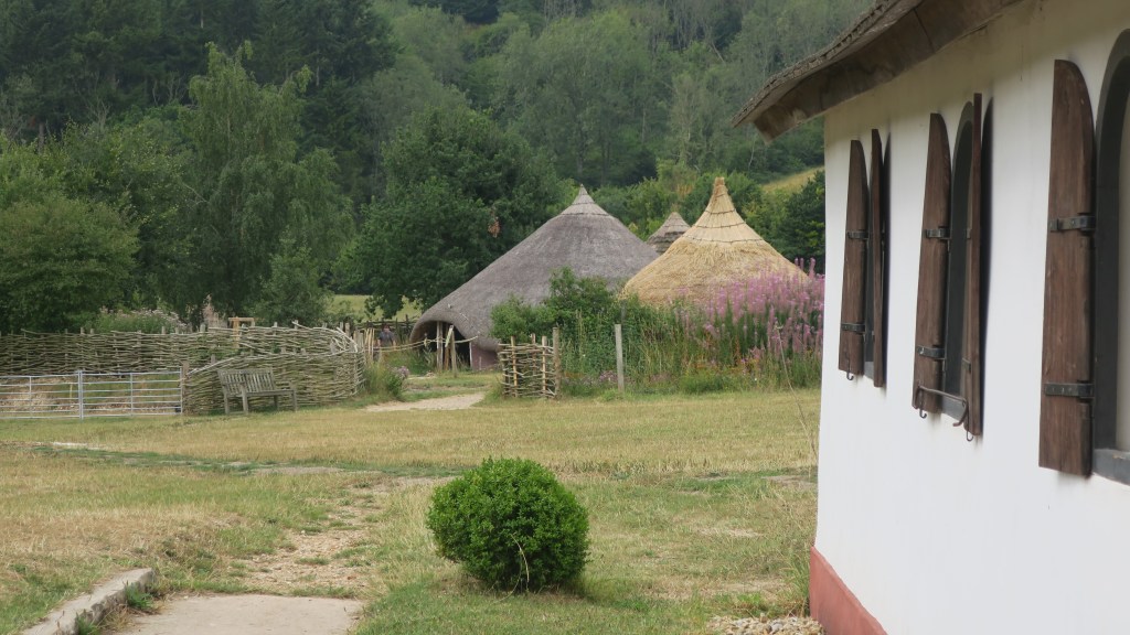
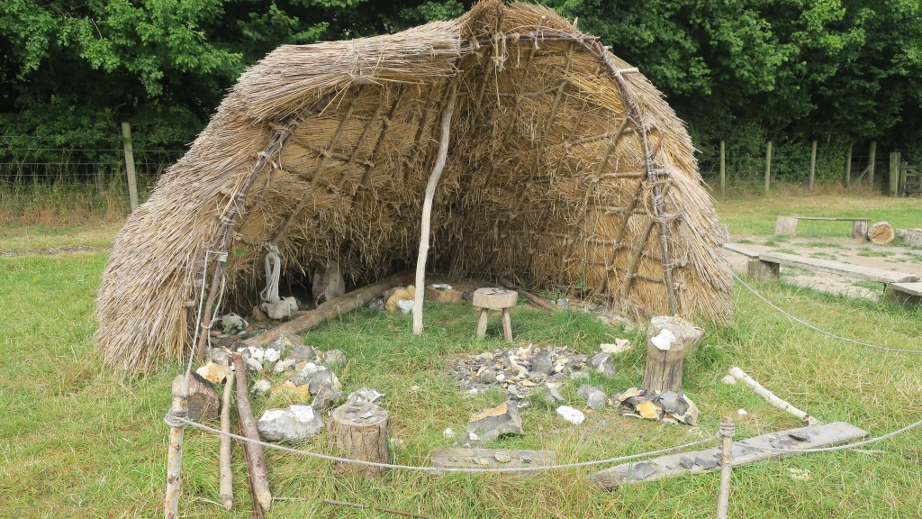
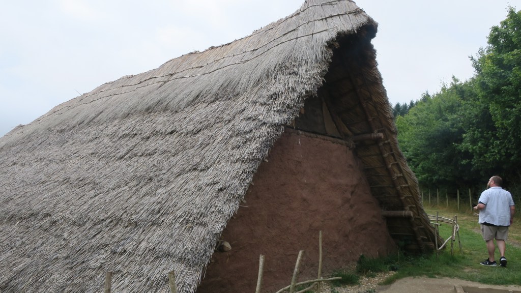
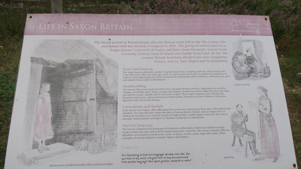
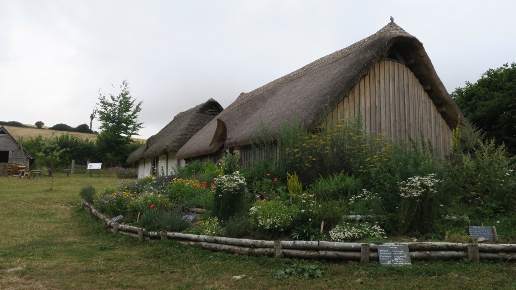
Experimental archaeology is the one path that virtually anyone can take to travel back in time; to get an idea of what life may have been like in the distant past. One such place which encapsulates this philosophy is Butser Ancient Farm, a place I had the chance to visit recently.
Butser began life in 1972, in a different location by the late Peter Reynolds, whose passion for experimental archaeology was contagious. The original farm was situated on Butser Hill, in what is now the Queen Elizabeth Country Park, in part because of the evidence for extensive Iron Age field systems on Butser Hill, still visible in the prehistoric field boundaries and earthworks that cover the landscape. However, it did not open to the public until 1974 and because of its popularity moved to a more accessible site at the bottom of Butser Hill. In 1991 the farm moved to its present location (near Chalton, Hampshire – just off the A3).
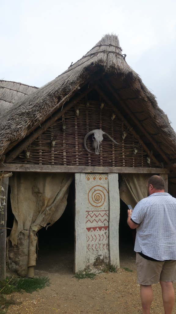
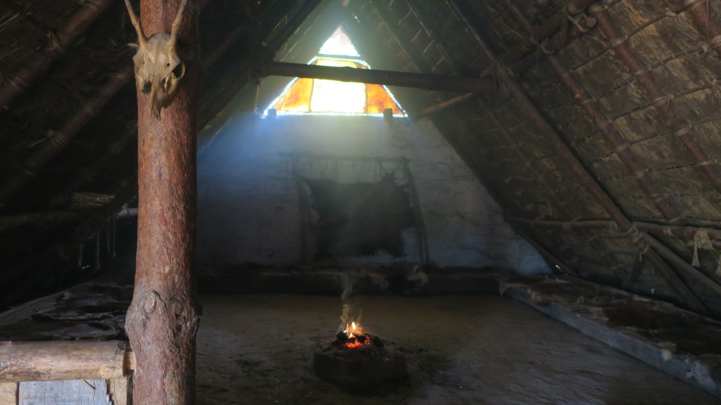
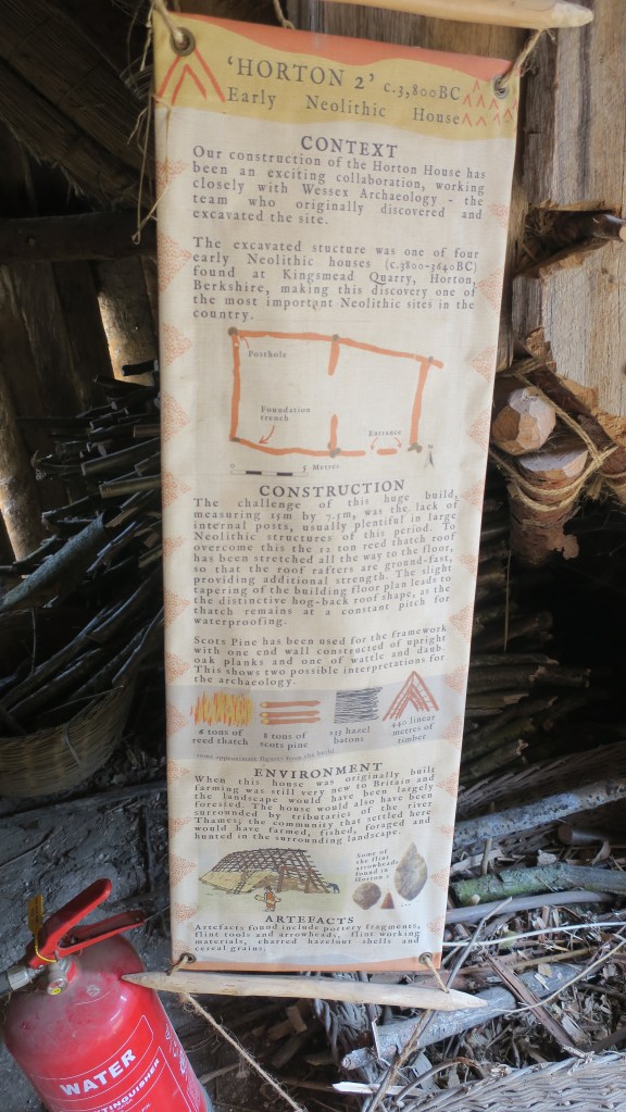
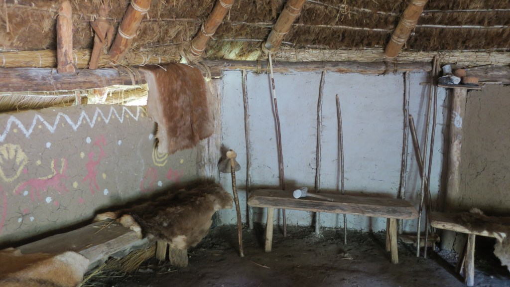
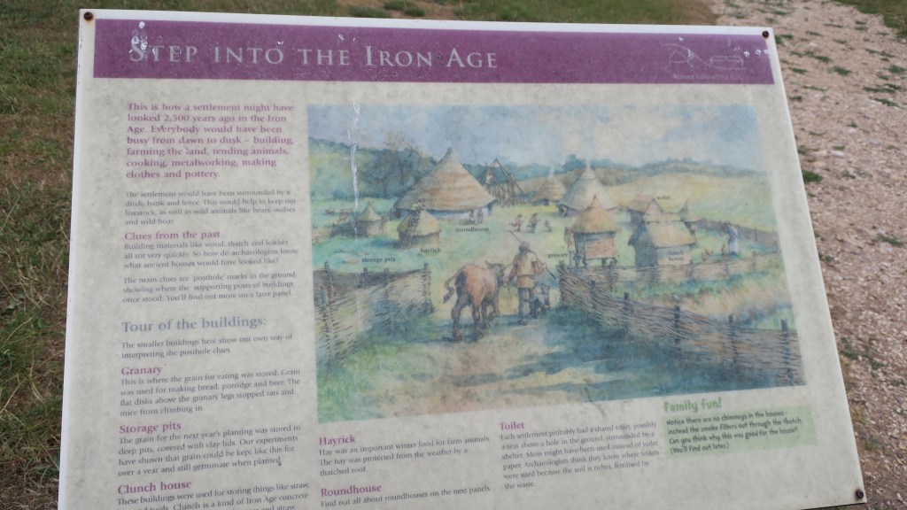
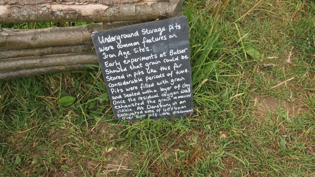
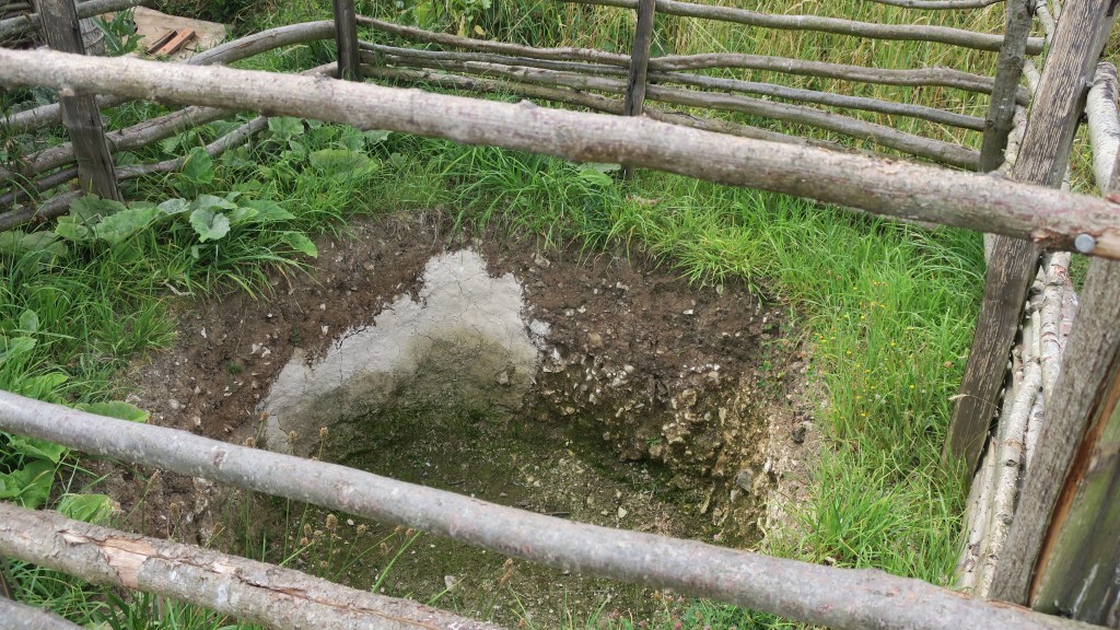
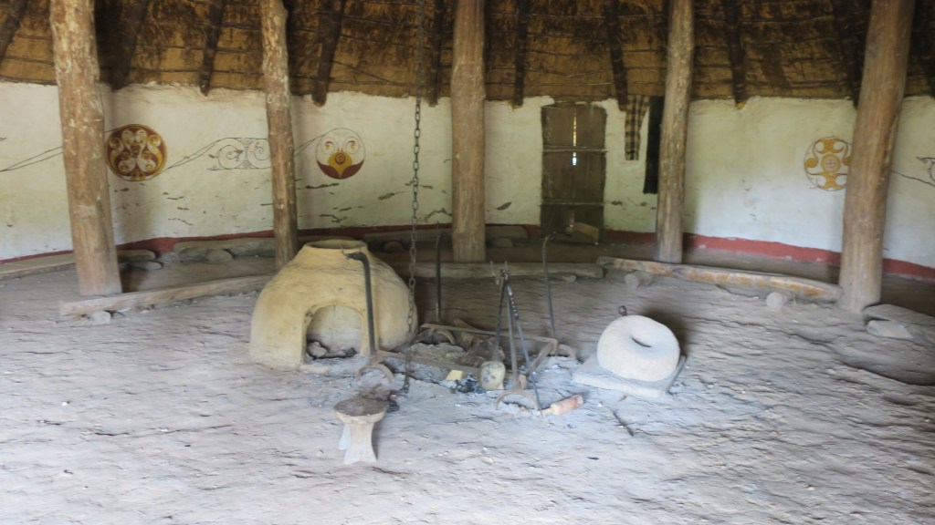
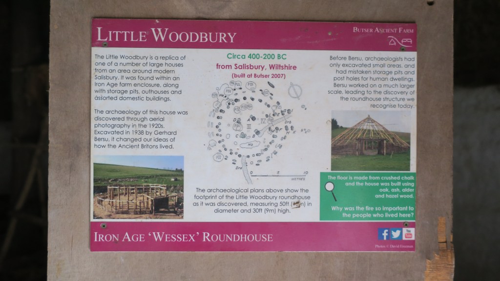
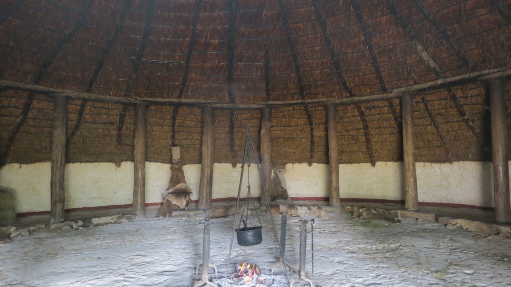
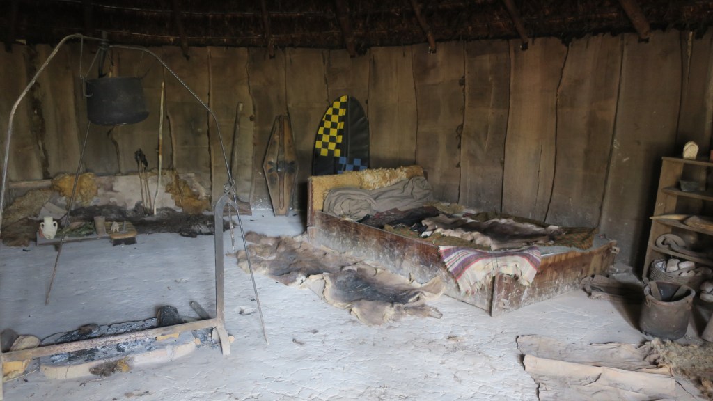
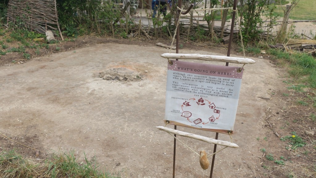
At Butser it is possible to see ten thousand years of history come to life; to see plans of archaeological sites rise up from the ground; to feel, touch, smell and absorb some of what it may have been like in the past is an experience that should not be missed. All of the buildings which have been reconstructed are based on actual archaeological sites that have been discovered through excavation.
These excavations often only reveal the faintest of remains, the postholes and their layout is usually all archaeologists have to go on as to the type of building. The artefacts found and their position in the structure can also provide clues as to the use of the space inside and outside. Understanding all the fragmentary pieces of evidence can often take a leap of faith particularly for the general public. In this case Butser provides a physical and tangible connection to the past for the visitor.
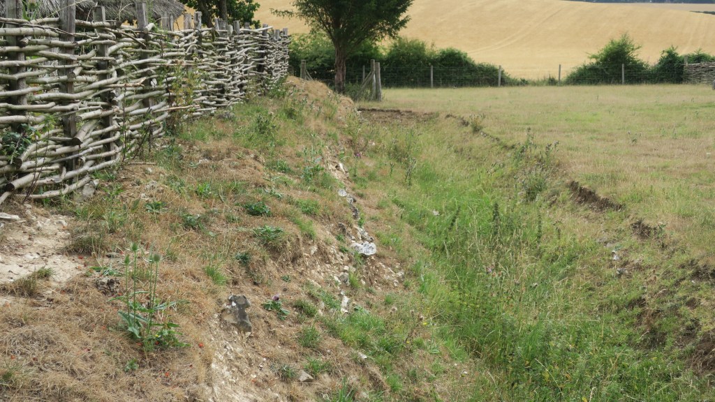
However, it is much more than that, it is a place where those who study the past can test theories in, not only ancient technologies and construction techniques but also in how sites degrade. Our understanding of how archaeological sites are formed depend very much on understanding how a place degrades, becoming the humps and bumps we see in the landscape.
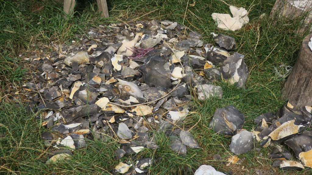
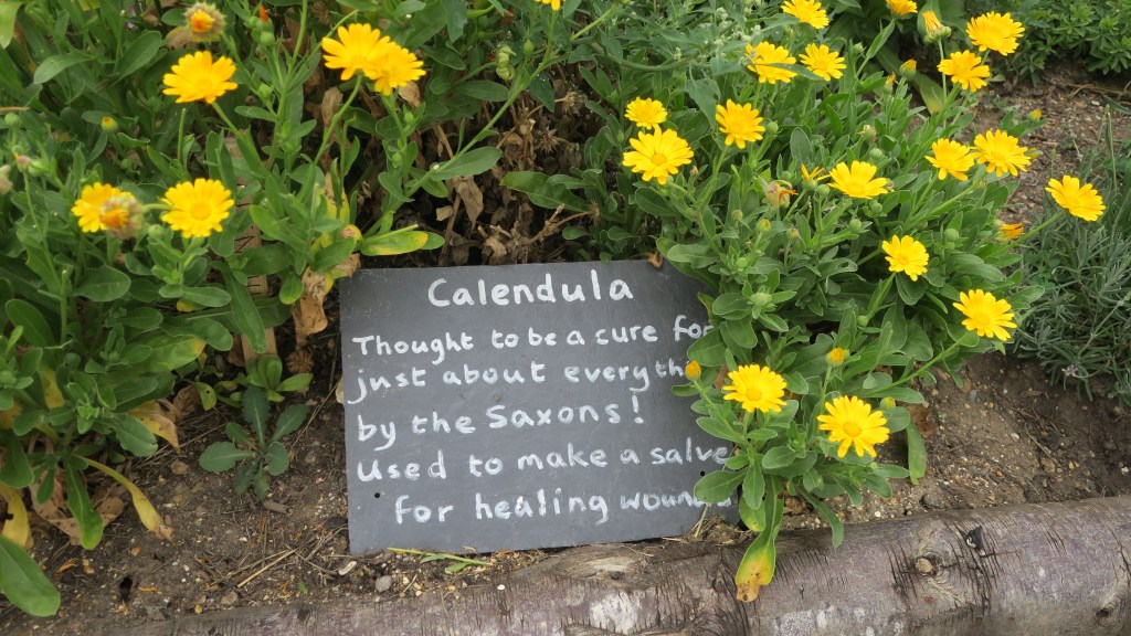
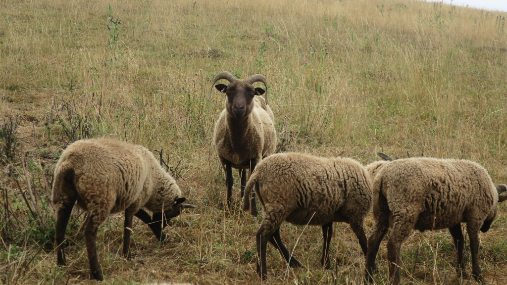
In addition to the buildings, there are also gardens containing plants that would have been in use at a particular time – known from faunal analysis during excavations. Ancient breeds of sheep, goat and pig are also a feature of the farm, giving the visitor a well-rounded experience. At certain times of the year, they also host various events such as flint knapping weekends, re-enactment groups, storytelling, solstice celebrations and more.
The following are few photos from my visit this year…beginning in the very distant past of the Mesolithic and Neolithic.
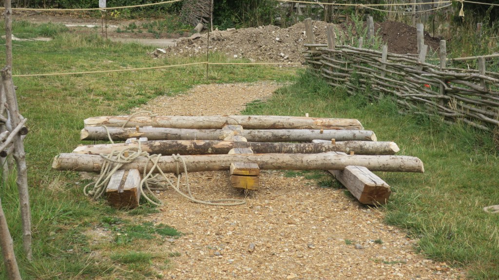
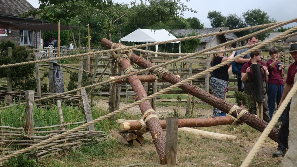
In the days preceding my visit the team at Butser along with volunteers from the HMS Queen Elizabeth had a go at erecting a megalith using only the types of technology available in the Neolithic. They moved and raised a 3.5 ton piece of Purbeck limestone using theorised prehistoric techniques. The stone is roughly the same weight as the smaller bluestones at Stonehenge, which were moved over 140 miles around 5000 years ago.
When performing such tasks it is also useful to observe what is left behind, these ephemeral remains are often the hardest to interpret.
A wooden raft used to move the stone across the land.part of the frame used to raise the stone.And it’s up!
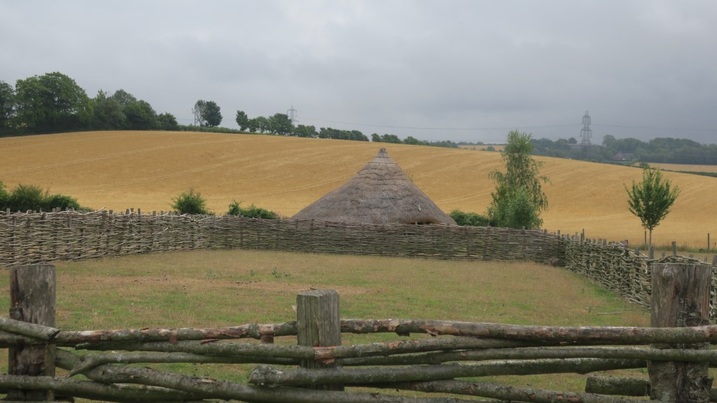
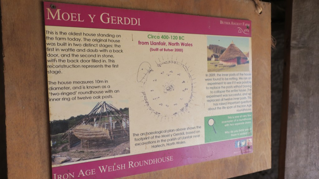
From the Neolithic we carefully saunter into the Bronze Age, the time of the roundhouse and metal working…
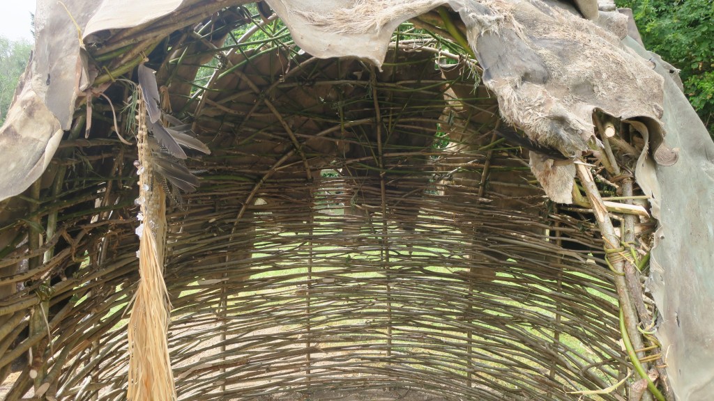
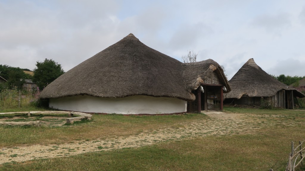
In the majority of cases the only evidence we have for roundhouses are the postholes left in the ground. What is less well understood is what were the walls and roofs made of and how. At Butser they have constructed the Bronze Age roundhouse using several different methods of wall construction.
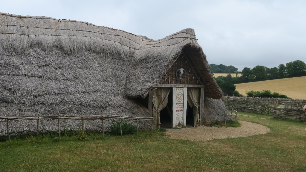
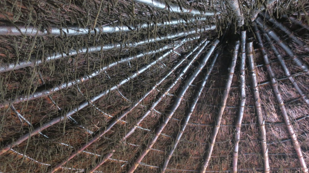
The Iron Age –
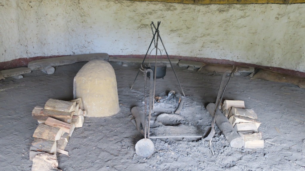
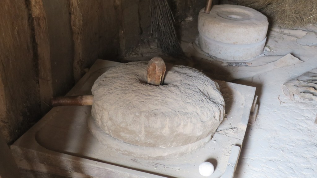
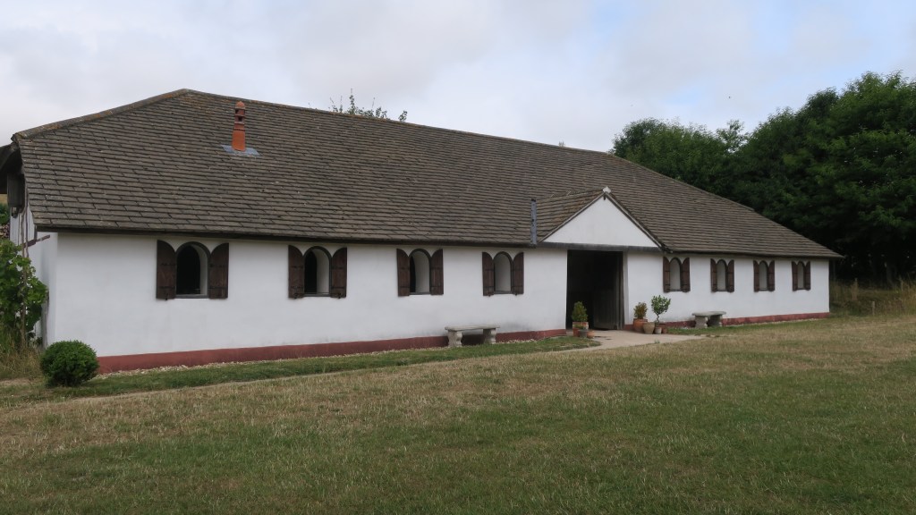
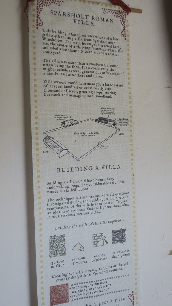
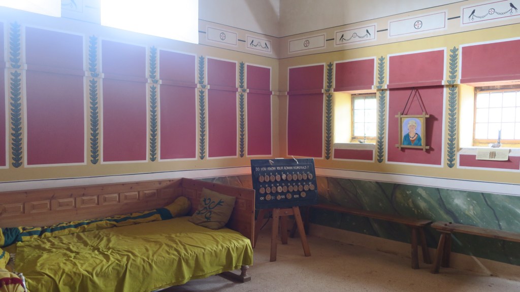
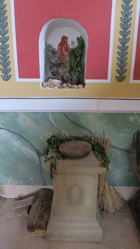
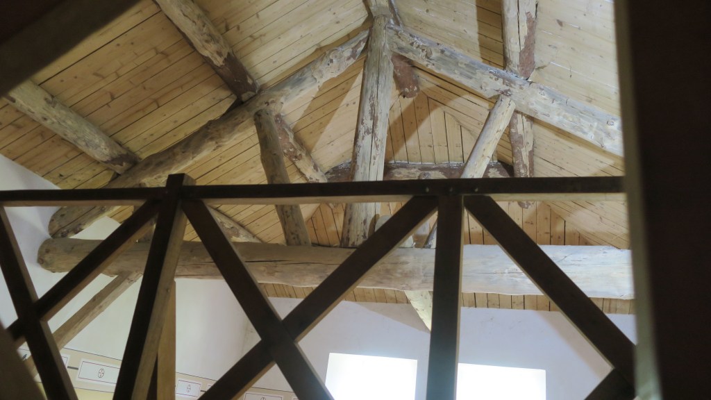
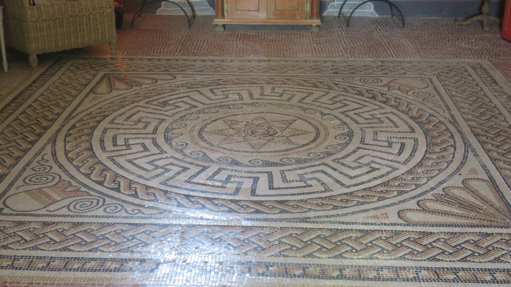
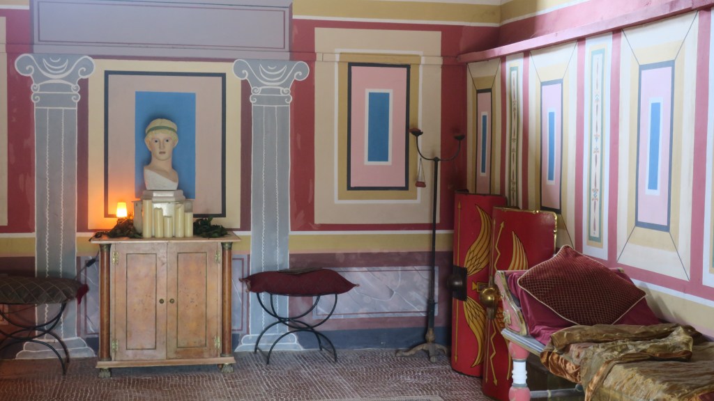
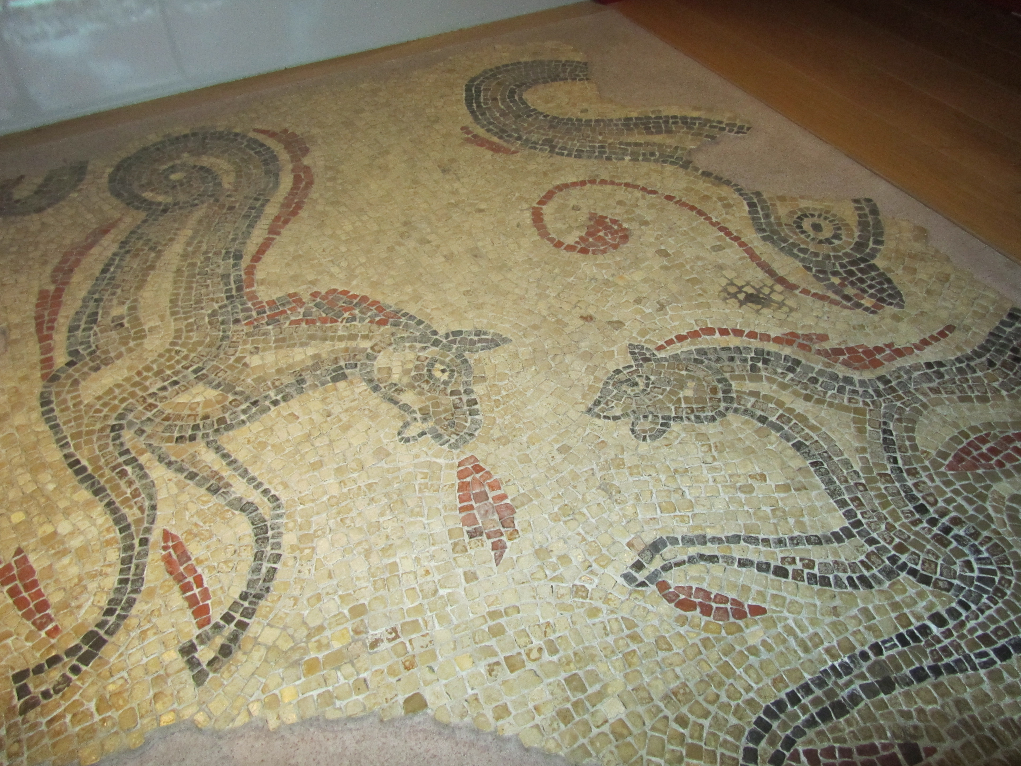
The Roman villa – as with all the structures at Butser the villa was built using only construction techniques known to be used in the Romano-British period. The mosaic is the only known reconstruction in the UK and the aim was to understand some of the finer points in mosaic construction but also to see what happens to it over time.
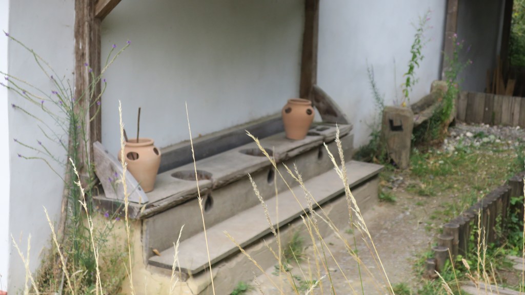
The loo…
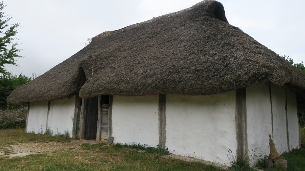
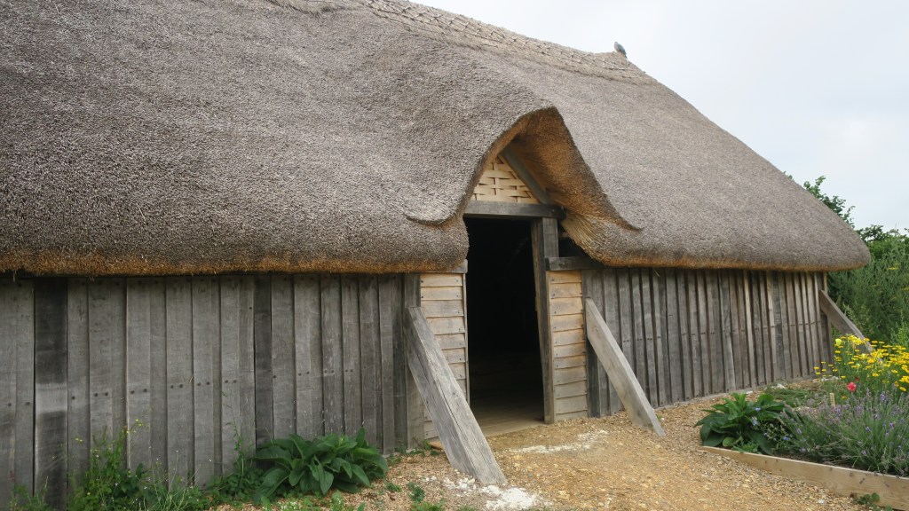
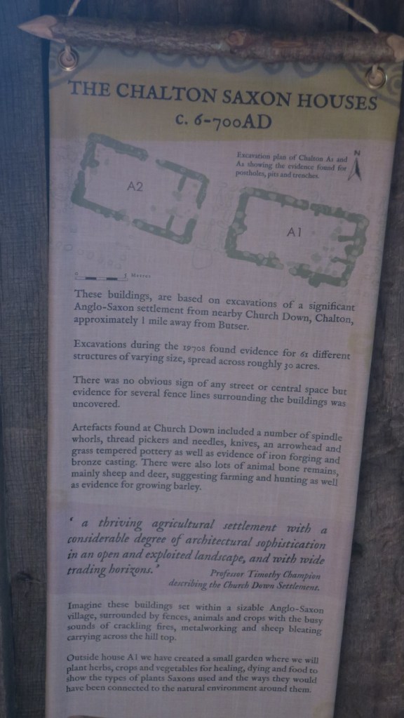
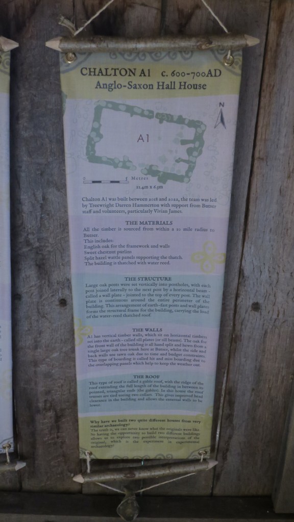
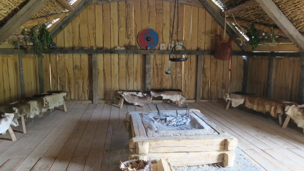
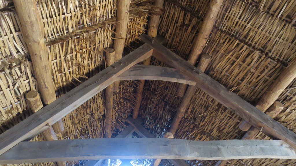
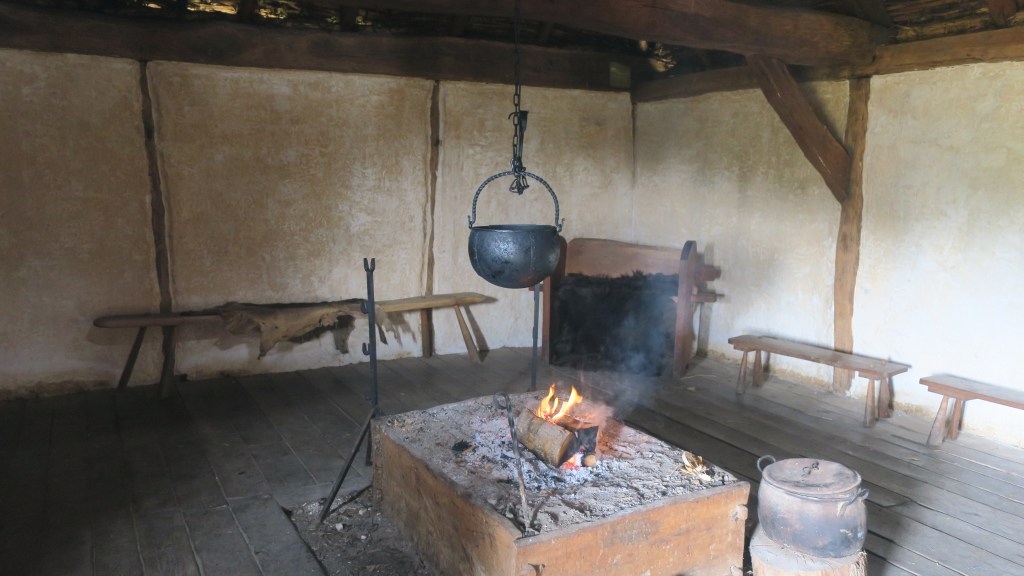
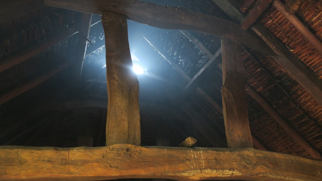
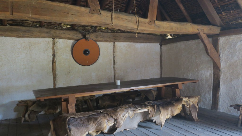
The Anglo-Saxon halls are the most recent addition to the farm and demonstrate two different types of building style.
As mentioned before Butser also engages in research and education, none of the buildings, gardens or spaces are static museum pieces, they are constantly evolving – adding to our knowledge. Most years the farm is well attended by schools wide and far who get a hands on perspective of life in the past, archaeology and history.
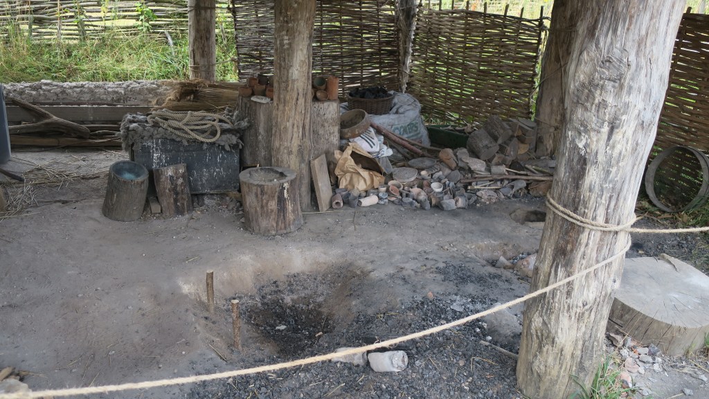
A building dedicated to hot technologies under construction – a dedicated space for smelting, metal casting, pottery firing, bead making etc.
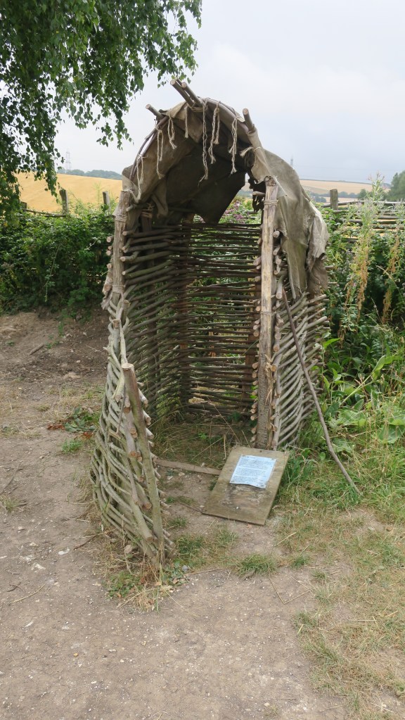
In several places around the farm are these curious structures. Used for school visits they give the children hands on experience at excavation and archaeological practices.
The archaeology of decay…
The gardens and the animals are an equally fascinating aspect to the farm, endeavoring to give a much more rounded picture of the past.
For more information I would highly recommend their website (and archive) – Butser Ancient Farm
In this the
second part of my small study of land use and settlement in the Upper Waitemata
we are staying within the area defined in part one – from Island Bay to
Kendall’s Bay, keeping within the coastal strip. This part will take a look at the early colonial/settler
history of the area, with the emphasis being on the early or pre-WWII. After this point in time there is plenty of
written records and several good books written on the history of Birkenhead and
I have no desire to rehash already well-known information.
In 1769
Captain James Cook sailed through the Hauraki Gulf past Waiheke Island and made
a note that there might be sheltered harbours to the west. The only other Europeans around at the end of
the eighteenth century were whalers and as of yet no records have been found of
any exploration into the upper Waitemata.
It appears that it is not until 1820 that Europeans began to show an
interest in this sheltered inland harbour.
Reverend
Samuel Marsden is often credited with being the first to explore the area, in
his diaries he states that he left the HMS Coromandel at Waiheke and was guided
by Te Morenga to Riverhead where he then travelled overland to the Kaipara
River – a route travelled by Maori for centuries.
During the
next twenty years there were undoubtedly forays by other Europeans into the
Waitemata, perhaps looking for timber and other such opportunities however
their stories are as yet unknown. In
1840 the HMS Herald was the next major ship to visit the Waitemata, onboard was
the Lieutenant Governor of NZ Hobson and the Surveyor General Felton
Matthew. They spent the next two weeks
exploring the harbour – Herald Island is named after the ship and of course
Hobsonville after the Governor who had initially favoured the place as the capital
of New Zealand.
Slightly
further afield from our area of study there are records from around this time
which make a note of sailors rowing up Hellyers Creek to a place called The
Lagoon to restock their freshwater supplies, however, “it has also been recorded that in 1841 a Mr Hellyer, lived on the bank
of the creek which now bears his name.
He brewed beer which no doubt was a great incentive to those earlier
seamen who rowed up the harbour…”
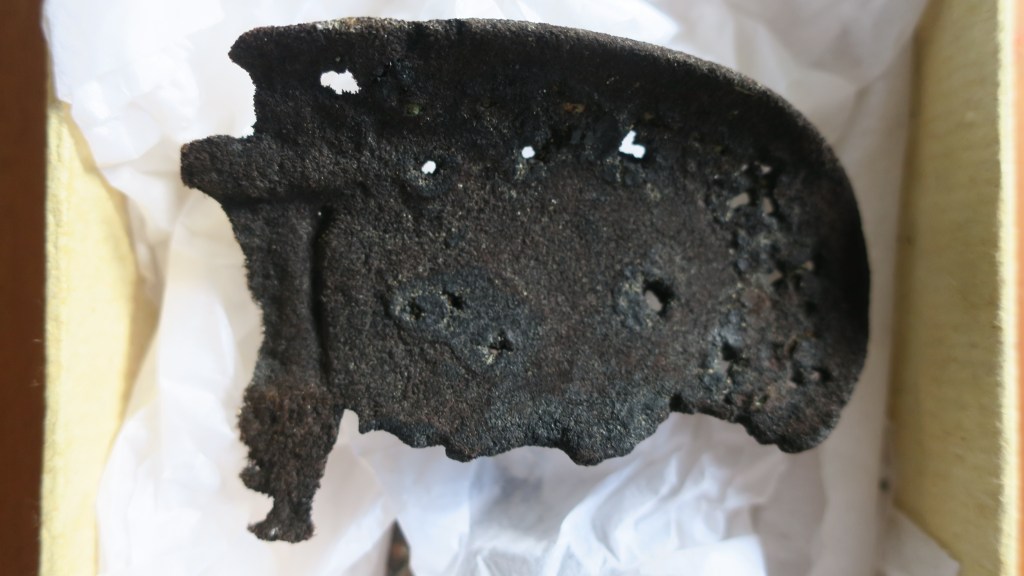
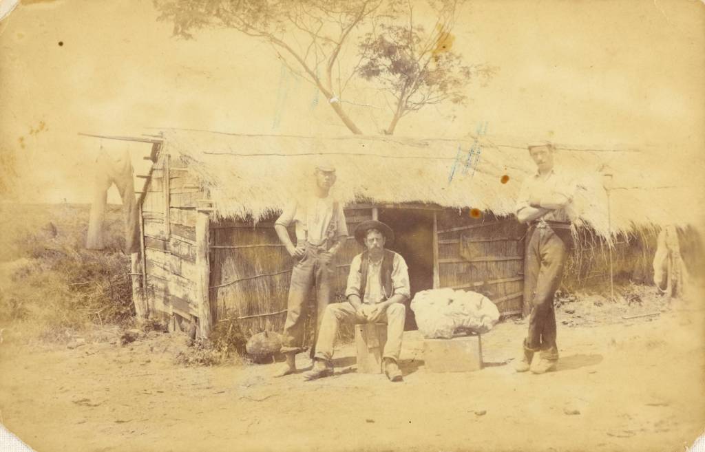
An early but seriously water worn pipe end found on the beach at Kendall’s Bay – it is easy to imagine the early sailor who dropped their pipe overboard as they sailed up the Waitemata.
In 1841 our
area of study was part of a large land purchase called the Mahurangi Block, it
extended from Takapuna/Devonport to Te Arai and encompassed the majority of the
present-day North Shore. The first parcels of land to be auctioned in 1844 were
between Northcote and Lake Pupuke. Much of the early purchases in the
Birkenhead area were part of a land speculation trend without the land being
settled or farmed. Significant chunks of
land sold were the area from Rangitira Rd/Beach Rd to Soldiers Bay which was
sold to William Brown in 1845 and the area from Balmain and Domain Rds to the
shore encompassing one hundred and ten acres being sold to a James Woolly also
in 1845. However, it does not seem that
either of them actually lived here. It
was common practice for land to bought speculatively and sold on in smaller
parcels to settlers fresh off the boat so to speak, such as the ‘Tramway
Company’ a land development company who bought large tracts of land in what is
now Birkenhead.
The earliest
settlers of the Birkenhead area who are known were Henry Hawkins, Hugh McCrum,
John Creamer, Joseph Hill, James Fitzpatrick and William Bradney. All of whom appeared to have had a go at
farming but little else is known about them.
Unfortunately,
those early settlers who chose the Birkenhead area were in for a hard time, as
mentioned in part one the soil was not conducive to farming in the traditional
sense. Settlement was a rather slow
process particularly when compared to other parts of the North Shore and
Auckland. Not surprising when faced with
the prospect of clearing the bush before they could even build themselves a
dwelling. Many of the early dwellings
were simple one room nikau whares, constructed of sod walls with a raupo or
nikau thatched roof. As they cleared the
bush often deposits of kauri gum would be found and sold ensuring a source of
income.
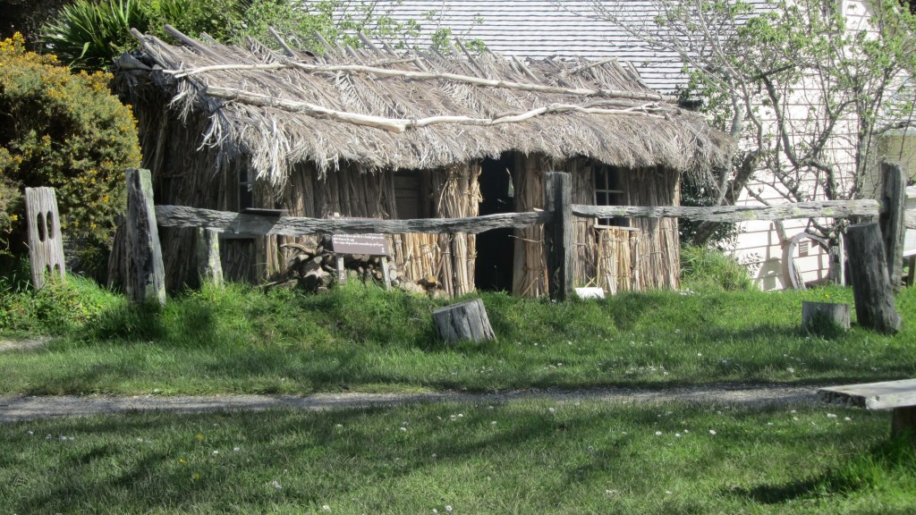
A reconstructed nikau/ raupo whare at Howick Historical Village – a living history museum in east Auckland.Lumps of kauri gum found at Kendall’s Bay.
Even though
most of these early farmers only managed a subsistence living, there were the
occasional success story. Birkenhead
became quite well known for its fruit orchards, the first of which was
established by Henry Hawkins. There are
two differing accounts as to where Hawkins had his orchard, some maintain it
was near Soldiers Bay and others say it was on the ridge where Birkenhead Ave
now runs. It is of course possible that
both are correct, one of the earliest estates to be subdivided and sold was the
Balmain Estate (also known as the Balmain Township) which extended over a much
wider area than just the Balmain Rd of today.
The steep sided valley of Soldiers Bay would appear to not be conducive
to a fruit orchard, the thick kauri groves would have been quite a hindrance to
say the least. However, an advertisement
in the local paper for 1855 has H J Hawkins selling 700 fruit trees from his
farm at The Glen, Soldiers Bay. Later in 1870-71 Hawkins is recorded as owning
allotment two and three in Birkenhead – this is situated on the ridge which is
now Birkenhead Ave.
Another
early settler is mentioned in relation to a dwelling on a map dated to 1849,
the house was owned by a John Crisp and was situated close to what is now
Fitzpatrick Bay. Unfortunately, I have been unable to corroborate this.
According to
a local history study of Island Bay and surroundings (Island Bay. A Brief History) there is an 1844 map which shows a
dwelling occupied by a Mr George Skey. The bottom part of the block was
developed into a small farm and sold as a going concern around 1849. It had its own jetty and a farm boundary
ditch, unfortunately I have been unable to track down this map to verify this
information and the area where the farm is said to be (and relatively well
preserved) is part of the Muriel Fisher Reserve which is currently closed due
to kauri dieback. Having said that, it
is definitely something to consider and requires further investigation.
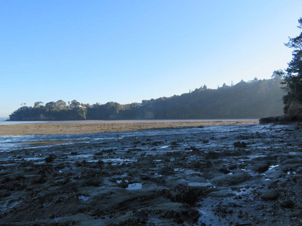
Soldiers Bay at low tide – the tree covered area to the left is part of the Muriel Fisher Reserve and the probable site of allotment 148.
Whilst the
1880-81 electoral roll lists a small block (allotment 148 – a trapezoidal block
which ran from what is now Rangitira Rd to the western edge of Soldiers Bay) of
twenty-three acres owned by a Mr Clement Partridge who is described as a
settler. The area of Island Bay was one
of those places where early land sales were of the speculative kind. It wasn’t until the “Tramway Company”, a land
development company, bought large tracts of land in the Birkenhead area
including Island Bay, that small dwellings began to appear. Like many of the
bays in the area, Island Bay was a summer place with the majority of dwellings
being bach’s and only a handful were occupied all year round. The road began as a dirt track mostly used by
gumdiggers and was previously known as Victoria Rd West prior to 1913.
What’s in a Name?
Placenames
often hold clues as to the early settlement of an area and its changing
history. In part one we already looked
at some of the Maori names for places and how they relate to not only how the
landscape was used but also how the people saw themselves within their
world. For Europeans the naming of
places can be a lot more prosaic and, in some cases, the reason for the name is
obvious such as Island Bay, so named for the small island at the end of the
road which was once separated from the mainland and only accessed at low tide
via stepping stones.
The island after which Island Bay is so named…
Others,
however, are much more difficult to ascertain – Kendall Bay is obviously a
European name but at this point in time there are no records of anyone with the
name of Kendall after whom the bay was so named. One possibility is that Kendall may be the
name of gumdigger or gum buyer situated at the bay – gumdigger camps were often
situated at the head of sheltered gullies near fresh water and near to the
coast. Kendall Bay satisfies all of
these requirements. Interestingly, the
bay is also known locally as Shark Bay, undoubtedly because of the shark
fishing grounds exploited by Maori and later Europeans.
Kendall’s Bay or Shark Bay on a foggy morning.
Interestingly,
Kauri Point is the one placename not to change and to be consistently included
in the majority of maps dating back to 1842 and up to the present day. It would be a fair guess to say the name came
about as a result of the large kauri stands which would have been easily
visible to the first people to sail up the harbour.
Names have
also changed through time or have been forgotten. The Upper Waitemata was once called Sandy Bay
on a nautical chart from 1841; another early map refers to Pt Shortland (1842),
the headland where the Naval Base currently is; on other maps the bay we know
today as Onetaunga Bay was once called Quarryman’s Bay.
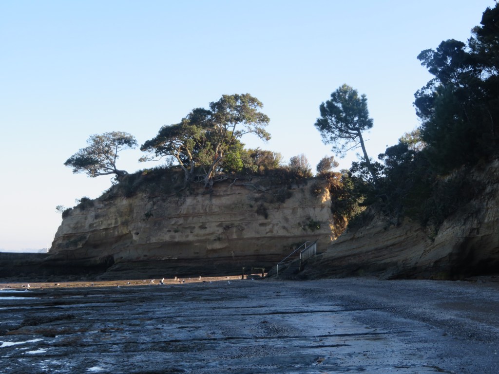
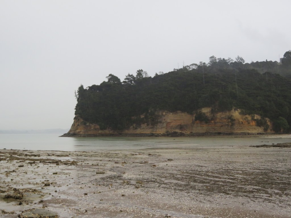
Quarryman’s Bay, like Brick Bay further up the harbour, refer to the early industrial endeavours of the area’s inhabitants. Both quarrying and brickmaking were popular industries in a land where traditional farming was problematic. One of the occupations of a potential early settler in the area was brickmaker (see below).
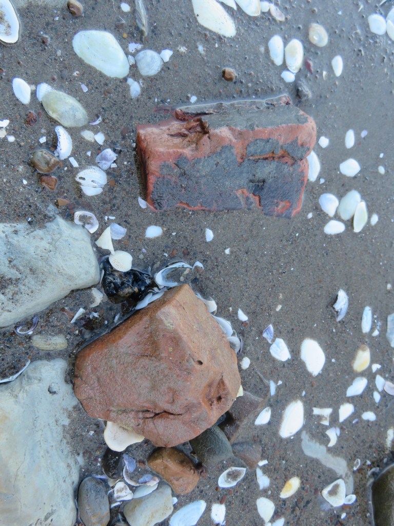
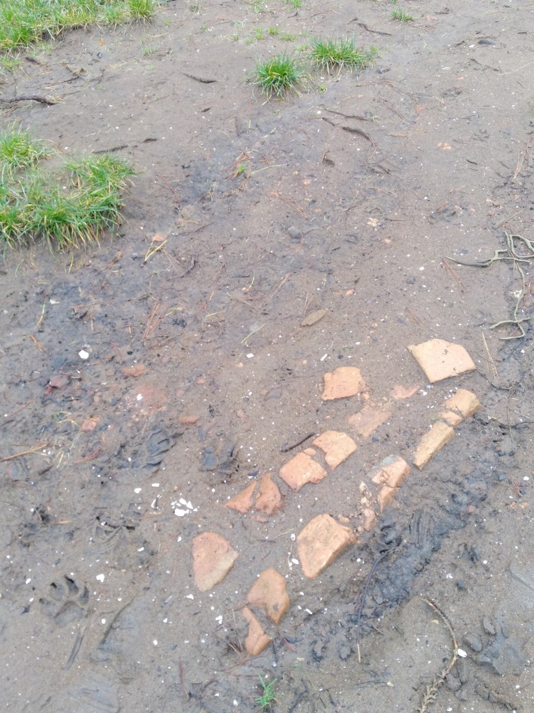
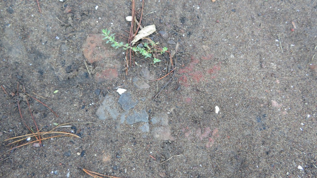
Just a few of the many bricks found on the beach at Fitzpatrick’s Bay – possibly either as a result of a small brick making industry or as a result of the demolition of the house on the hill which may have had a brick chimney.
Soldiers Bay
is an interesting case of a name that has been around for a long time but its
origins are hazy. The earliest mention that
I have been able to track down is dated to a map of 1863. Today the stream that runs down from the high
ground and empties into Soldiers Bay would have been a lot less silted up and
most likely navigable by waka or rowboat as far as the present-day
carpark. Today there is a causeway which
joins the bottom of Balmain Rd to the reserve which would not have been there
in the early days. This causeway was
most likely constructed in the early twentieth century when a caretakes lived
at the end of the reserve above Fitzpatrick’s Bay.
The modern causeway which now links Kauri Point Domain to the bottom of Balmain Rd – there are oral histories which tell of access to the beaches being further up the valley.
None of
which gives us any clue as to why Soldier’s Bay is so named…it has been
suggested that the bay gained its name as a result of an encampment of militia
during the unsettled times of the mid-1800s.
At the time, Hone Heke was ‘making life unpleasant’ for settlers in the
north, particularly the Hokianga, and many had moved south to take up land in
Birkenhead. To allay the fears of the
settlers a contingent of soldiers may have been positioned in various
places…hence Soldiers Bay. As mentioned
before the stream would have been navigable to the bottom of present-day
Balmain Rd, just before that though there is a flat spur which would have
provided a good position for an encampment, with a clear view of the harbour
and a fresh water supply.
The final
placename to consider is that of Fitzpatrick’s Bay, this small sandy bay is
today part of the Kauri Point Domain and is a popular recreational reserve for
the local area. There are two possible
people responsible for naming of the Bay – Charles Fitzpatrick or James
Fitzpatrick.
An
examination of Jury Lists and Electoral Rolls shows that a James Fitzpatrick
arrived on the Jane Gifford in 1842 with his wife and daughter. The Jury List of 1842-57 lists James as
living on the North Shore as a brickmaker; in the 1850s and 1860s he was still
living on the North Shore but was now a farmer and a freeholder. Whether or not he was actually living in the
Birkenhead area is difficult to say; Birkenhead itself was not so named until
1863 and up until that point there was very little distinction between
areas. In the 1870-71 electoral roll
James was listed as residing in Takapuna, allotment 15 – a survey of the
cadastral maps of 1868 shows that allotment 15 is in fact in Northcote
(Takapuna refers to Takapuna Parish of which included todays Takapuna,
Birkenhead, Northcote, Hillcrest, Birkdale, Beachhaven and so on). In 1890, James was still in the Takapuna
Parish but was now listed as a gumdigger.
Photo of gumdiggers outside a raupo whare on the Manukau Pennisula ca 1891 (from Auckland Libaries heritage Collections 07064)
Charles Fitzpatrick only appears twice in the lists; first in 1867 and as having a freehold land and house at Kauri Point however by 1890 he had moved to Morrinsville. Whilst only Charles is listed specifically as living in our area of study and he would appear to be the best option for the naming of Fitzpatrick Bay it is still not possible to rule out James.
Addendum
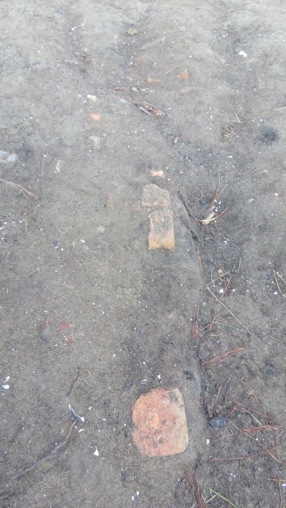
Not long after this post was written, I was contacted by a gentleman who currently lives south of Auckland near Hamilton. He was happy to confirm that James Fitzpatrick was indeed the correct person after whom the bay was named – James was his great great grandfather. He was also able to confirm that James did have a small brick kiln in the bay.
The first photo shows the slope near the beach where the brick kiln was situated; the second and third photos show one wall of the kiln in situ, but taken two years apart. Erosion, foot traffic and such has meant much of what was exposed has now disappeared. The last photo shows a close up of the soil with evidence for burning.
Fun in the Sun
The study
area today is made up of three different zones – residential (Island Bay),
defence (Onetaunga Bay) and recreational (Fitzpatrick Bay, Soldiers Bay and
Kendall Bay). In 1888 Governor William
Jervois permanently reserved for the purpose of recreation 133 acres of land
(allotment 162 and 163) in the Parish of Takapuna. It had been his hope that the area was turned
into a national park, a place of tranquillity for Aucklanders. This was the
area from Kendall Bay to the eastern end of Fitzpatrick Bay. In 1913 the Harbour Board acquired a further
forty-two acres which included Kauri Point (allotment 164) which had previously
been owned by Sir John Logan Campbell until his death in 1912. Further to this the area around Fitzpatrick
and Soldiers Bay were then added to the park in 1916. An article in the New Zeland Herald in 1916
stated that the reserve had a fine waterfront and had in the past had been much
used as a camping and picnic ground. It
also mentions a ‘good five roomed house’, our first mention of what was to be
known as the caretakers’ house.
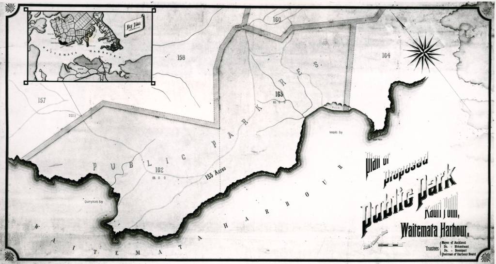
Photo of the proposed plan for a park at Kauri Point dated to 1913.
An article from 1900 also in the New Zealand
Herald also mentions how the Kauri Point Domain board had agreed to allow
campers for a small fee. Interestingly
they also denied a request for funds for a wharf. Reading through multiple articles the request
for a wharf in the area is one which is constantly brought up, eventually a
wharf was constructed but not at Fitzpatrick’s or Soldiers Bay but at Onetaunga
Bay and it was paid for and built without the help of the board or their funds.
The grassy area at Fitzpatrick’s used by campers since the 1900s if not earlier.
This marked
a new era for this inner harbour landscape; each of the small bays were
transformed in the summer months as families from the city side would spend the
warmer days living under canvas. In the 1920s and 1930s there were seven or
eight families holidaying at Kendall Bay, their camp was at the western end of
the bay where there is a level space and a freshwater stream. At Fitzpatrick’s the camp site was at the
northern end of the bay on the grassy area above the beach. Unlike elsewhere this part of the reserve was
owned by the Birkenhead Borough Council from 1929 who improved it and put in
place a caretaker.
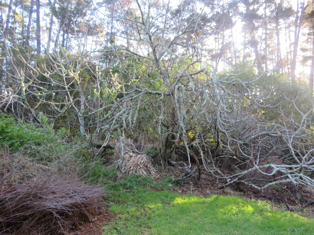
The site of the caretakers house – the bushes behind the pine trees conceal the remains of the house and the third photo shows a large rambling fig which was part of the garden.
The only
recorded caretaker was a William Henry Rickwood who lived in small house with
his family on the hill above Fitzpatricks.
Oral histories record how Williams’ wife would keep a small store
selling sweets, soft drinks and other useful supplies. There was also a ‘ponga-house’ where Mrs
Rickwood would provide hot water and often sold tea and scones to the visitors. There is very little that remains of this
house today, just a level area with an overgrown collection of European garden
plants such as figs and a rambling rose.
However, there is evidence of both the campers and the caretakers in
form of the rubbish they were throwing away.
Often along the bay sherds of old ceramics dating from the late 1800s to
the mid-1930s can be found, undoubtedly there is a European midden that has
eroded onto the beach.
A small selection of the beach finds found on the beach below the campground and caretakers house at Fitzpatrick’s.
As well as the tent sites at Kendall
Bay, there were other camping places, near the wharf at Onetaunga Bay and at
Fitzpatricks bay which is the beach at the present Kauri Point Domain. Pre-World War Two and back through the
Depression years, tents appeared each summer for a back-to-nature holiday by
bush and sea. Much of the housework was
left behind at home and there was no problem keeping the children amused. There
were good sandy beaches and the harbour water was clear and clean in those days
before the march of suburbia. (From a pamphlet of remembrances celebrating twenty years of
Kauri Point Centennial Park, available in the Birkenhead Library).
Island Bay
whilst listed as residential today was up until the construction of the Harbour
Bridge mainly a summer town, full of bachs occupied only in the summer by
families from across the water in the city. Unlike the other bays the land
around Island Bay was owned by a land development company, being subsequently
subdivided and sold off. However,
because of issues of transport and roads only a few of the blocks were
permanently occupied. Newspapers from
the early 1900s often have articles describing summer outings by the Ponsonby
Yacht Club to Soldiers Bay and area.
Defence
A final
chapter in the history of land use in our area is that of defence. Just prior to the Second World War in 1935
ninety acres of the Kauri Point Domain was taken for defence purposes. The area of Onetaunga Bay (once Quarryman’s
Bay) was developed for a storage facility for naval armaments. This unfortunately put paid to those carefree
summer campers who no longer came in the large numbers, the caretaker at Fitzpatrick’s
was still Mr Rickwood in 1938, as listed in the Wises Directory, but with the
outbreak of WWII everything changed.
In 1942 the
Americans had arrived in response to the Japanese threat in the South Pacific.
Kauri Point Domain, Fitzpatrick’s bay included, were given over to the Americans
and a large number of powder magazines were built. There are several unusual features on the
beach at Fitzpatrick’s Bay, which may relate to these days.
After the war the Domain reverted to being parkland but never again were campers allowed back to any of the bays. Today the Naval depot forms a large wedge between Kauri Point Domain and Kauri Point Centennial Park.
The wedge of buildings and land is the naval depot – Kauri Point Domain is to the top and Kauri Point Centennial Park the dark area to bottom and along.
This article was originally written several years ago for the ‘Mythology Magazine’ which is now defunct. My intention when writing this was to look at some of the myths and legends associated with the colonisation of the Pacific so please do bear in mind this is not an academic treatise on this subject (that is a far too large a subject for a simple blog…).
The islands of the
Pacific Ocean were one of the last places in the world to be colonised by
people. The how, when and why has
occupied archaeologists, anthropologists, linguists and historian for decades. For the European scientist these questions
need to be answered with solid evidence backing them. For the indigenous populations tradition told
them all they needed to know, the myths and legends providing all that was
needed by the way of explanation.
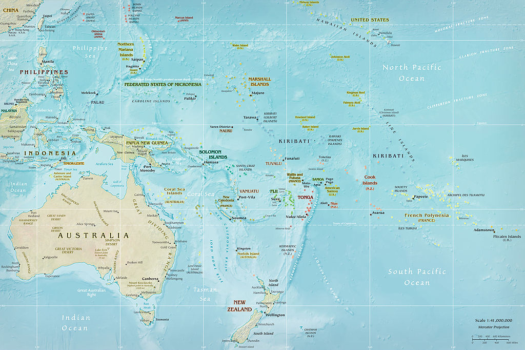
Map of Oceania
New Zealand, Hawaii and
Easter Island were the last landmasses to be colonised in the Pacific. These first peoples were at the end of a long
line of ancestors whose collective knowledge fuelled their ability and desire
to travel across vast tracts of ocean.
The Pacific region is made up of three distinct areas – Melanesia,
Micronesia and Polynesia. The first area
to have been settled by people was Melanesia; it consists of Vanuatu, Papua New
Guinea, Fiji, the Solomon Islands, the Bismarck Archipelago and New Caledonia. Dates for the first colonisation range
between some 50-30,000 years ago their ancestors originating from South East
Asia. Micronesia is situated north of
the Melanesian group and is made up of groups of islands including Kiribati,
Nauru, Marshall Islands (to name a few) and the US territories of Guam,
Northern Mariana Island and Wake Island.
Evidence for the settlement of this region is difficult to pin down; the
earliest archaeological evidence comes from the island of Saipan and is dated
to around 3500 years ago. The third
group of islands is Polynesia which covers a wide part of the Pacific. Generally speaking New Zealand, Hawaii and
Easter Island form the corners of a triangle within which all other islands sit
and are referred to as Polynesia.
The ancestors of the Polynesians
migrated from South East Asia a little later than the settlers of Micronesia,
passing through some parts of Micronesia and Melanesia, but rarely settling for
long. Fiji is an interesting case, as in
many ways it straddles the line between Melanesia and Polynesia. When the ancestors of the Polynesians arrived
in Fiji there was already a decent sized population and had been for
millennia. Yet today the visitor to Fiji
will see a multitude of faces, some are distinctly Melanesian looking (mainly
in the eastern islands) and others look more Polynesian. Fiji in many ways was a jumping off point for
the exploration further west, the next islands to be settled were Samoa and
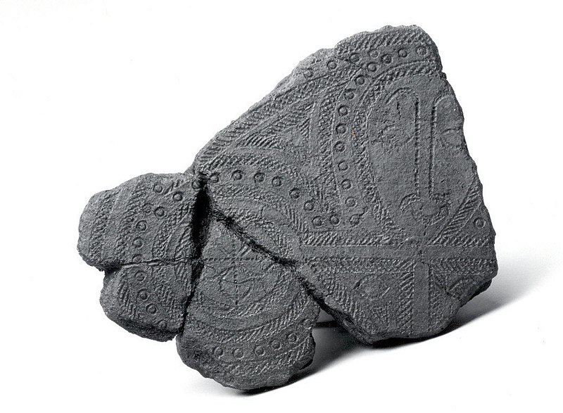
Tonga, both of which are not a great distance from Fiji. These early explorers are known as Lapita
people based on a distinctive type of pottery found on the archaeological sites.
The distinctive pottery of the Lapita Culture – this is a plaster reproduction photo courtesy of the Metropolitan Museum of Art.
“All island groups in island Melanesia and West Polynesia that lie in a south-east direction have Lapita settlements. None of these settlements have been found on other islands.” (G. Irwin. Pacific Migrations – ancient voyaging in Near Oceania. Te Ara: The Encylcopedia of New Zealand.)
These people were
exploring the region from as early as 3500 years ago (evidence found at the
Bismarcks) and by 3000 years ago were already as far as Samoa and Tonga. The archaeology tells us these were small
groups who travelled fast and light, they established only a few permanent
villages on each major island group and then they moved on. At this time the distinctive Polynesian
culture began to emerge in the west and by 2000 years ago people had begun to
move into the eastern part of the region.
By 700AD the majority of Polynesia had been settled with the last
migrations being to New Zealand, Hawaii, Easter Island and South America (the
only evidence for South America is the presence of the ‘kumara’ or sweet
potato, radiocarbon dates from kumara found in the Cook Islands indicate that
Polynesians had reached South America and returned by 1000AD at the latest).
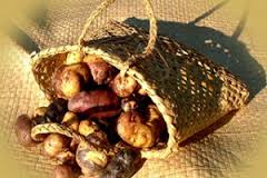
Kumara (or sweet potato) a staple food source.
All well and good you
might say, but what has this to do with the mythology of the region? To study the past of this region it is
important to not only use all those scientific tools we have at our disposal
but also use the traditional knowledge, stories and myths to provide a greater
depth of understanding. In Polynesia
there are many stories which have a commonality suggesting a shared ancestry.
In much of eastern Polynesia Hawaiki (the Maori name) does not refer to the islands we know as Hawaii but to a mythical land where the ancestors journeyed from – an ancient homeland. In New Zealand nearly all the Maori have traditions of such a voyage, in the Marquesas it called Havai’i, in the Tuamotus it is Havaiki and in the Cook Islands the ancient homeland is referred to as Avaiki. Not only is Hawaiki the ancient homeland but it is also a place where a persons spirit would go after death. The main island of the Hawaii group is so named because it is the site of two volcanoes which were regarded as a place of great supernatural importance and the home of the gods. Similarly the island of Ra’iatea in the Society Islands was previously known as Havai’i and it too has a volcano on it (albeit a extinct one) believed to be the entrance to the underworld and the home of the gods.
In Maori myth Hawaiki is in the east – the direction of the rising sun and the stars which bring the changing seasons. Thus it is not surprising that Hawaiki was associated with life, fertility and success. It is said that the first human life was created from the soil of Hawaiki by Tane (or sometimes Tiki). It is the place of highly valued resources such as the kumara which is said to grow wild there – this is interesting in itself because if you travel directly eastwards from New Zealand you will (eventually) land in South America, the homeland of the sweet potato.
“When the ancestors arrived in their waka, they brought with them many treasured plants and birds, also important atua and ritual objects such as mauri. In one way and another, Hawaiki was the ultimate source of the mana of all these. The crops flourished, the gods exerted their powers, the mauri ensured continuing fertility of the resources they protected, because of their origin in Hawaiki.” (M.Orbell 1995 Maori Myth and Legend)
The veneration of the east – many rituals are conducted facing east – is unusual for Polynesia and has led some to make the dubious suggestion that New Zealand was settled by people from South America. More recent studies have demonstrated that the first voyagers would have taken a south-west trajectory from either the Cook Islands or the Society Islands in order to land on the east coast of New Zealand. Over time it would seem this navigational knowledge was amalgamated with the traditions of an ancient homeland.
In other parts of eastern
Polynesia Hawaiki is in the west or sometimes even in the sky and in western
Polynesia it is called by another name – Pulotu, a word that can be
linguistically traced into Micronesia.
It is interesting to note that the largest island that forms part of
Samoa (western Polynesia) is called Savai’i and is a land associated in
tradition with many supernatural goings on.
Hawaiki was not only the land where the ancestors came from but also a
place of spirits, a place where the myths came into being.
As time went on many of these stories would become absorb into local tradition with familiar places becoming the setting to the story. Thus the story of Maui who fished up the islands can be found everywhere in Polynesia. In New Zealand it is said that the North Island was a giant stingray fished up out of the sea by Maui using his magic hook (the hills and valleys of the land are a result of his brothers greed when they hacked at the fish). On the tiny atolls of Manikihi and Rakahanga it is believed that these islands are all that remains of a single land which broke apart when Maui leapt from it into the heavens. In Hawaii tradition tells of the islands being a shoal of fish and how Maui enlists the help of Hina-the-bailer to bring the shoal together with his magic hook to form one mass. Maui hauled on the line, instructing his brothers to row without looking back, which of course they did, this resulted in the line breaking and the islands become separated for all time. In the Tuamotaus Maui and his brothers are once more fishing far from land, once more he has a magic hook and once more he pulls up an island but because his brothers did not listen to Maui the giant fish/island broke apart and became the land the Tuamotua people refer to as Havaiki, where Maui and his family reside.
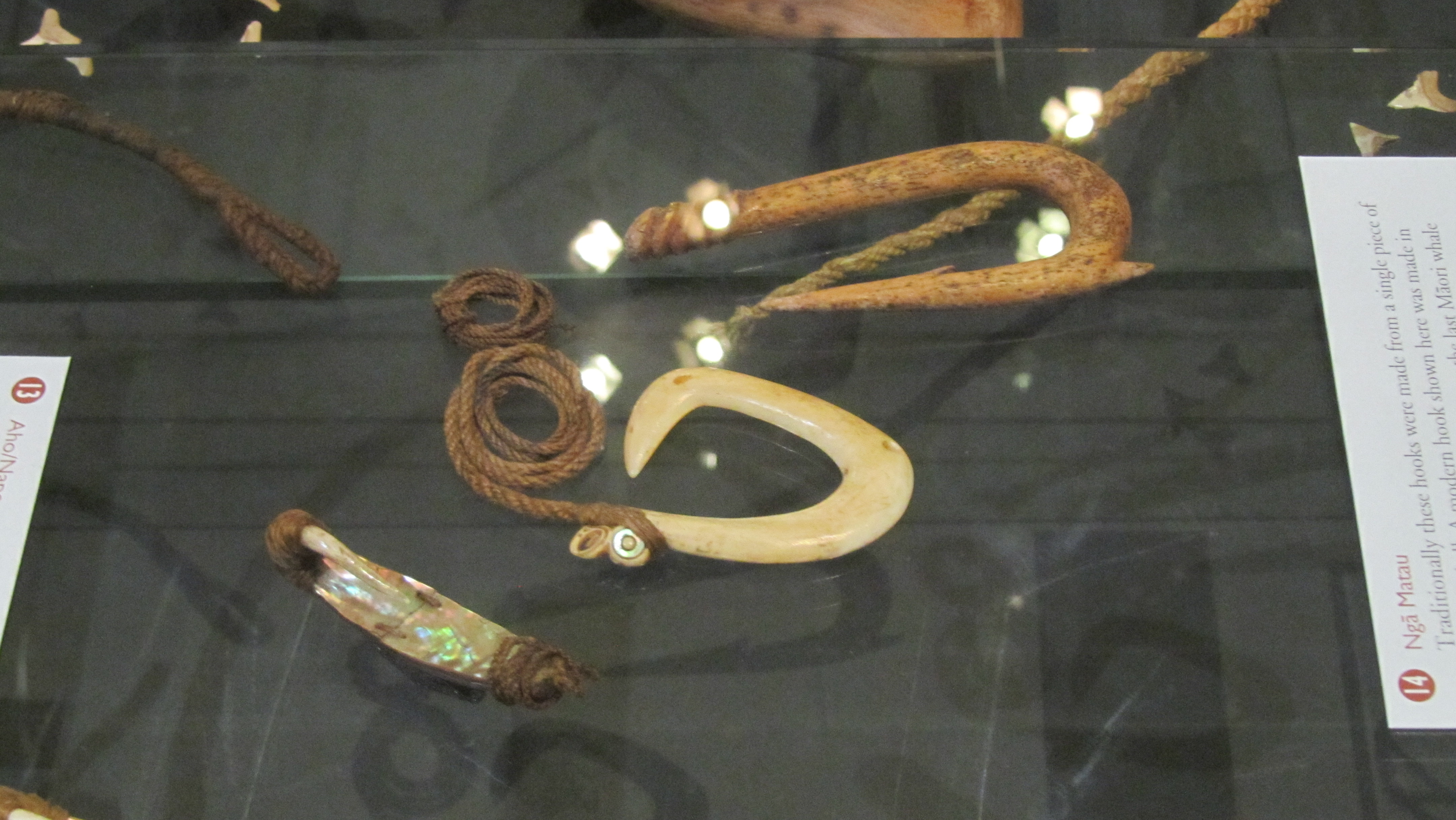
Fish hooks represented more than just a means of procuring fish, they also had a symbolic meaning and it is possible that some of the larger more ornate types were representative of the ancestral stories.
Maui is one of the most
well known of Polynesian deities, found in the stories throughout the region he
is often known as a trickster, part god and part human. He was of a time when the world was still new
and there much to do to make it bearable for people. Maui is said to be responsible for raising
the skies, snaring the sun, fishing up lands, stealing fire, controlling the
winds and arranging the stars. On the
island of Yap in Micronesia a demi-god figure called Mathikethik went fishing
with his two elder brothers, he also had a magic hook and on his first cast
brought up all sorts of crops, in particular taro, an island staple. On his second cast he brought up the island
of Fais. The similarities here with
Polynesian Maui are obvious and once again we can get a tantalising glimpse of
past movements of people.
Other characters common
to the stories of the Polynesia from Samoa in the west to Hawaii in the east
include Hina, said to be both the first woman and a goddess who is the guardian
of the land of the dead; Tinirau whose pet whale was murdered by Kae; Tawhaki
who visited the sky and Rata whose canoe was built by the little people of the
forest and was a great voyager and Whakatau the great warrior.
“…on every island the poets, priests and narrators drew from the same deep well of mythological past which the Polynesians themselves call the The Night of Tradition. For when their ancestors moved out from the Polynesian nucleus they carried with them the the knowledge of the same great mythological events, the names of their gods and of their many demi-gods and heroes. As time passed the Polynesian imagination elaborated and adapted old themes to suit fresh settings, and new characters and events were absorbed into the mythological system.” (R. Poignant 1985 Oceanic and Australasian Mythology).
Of course none of this
addresses the question of why. Why did
the first people leave their homelands and explore into the vast ocean,
particularly to places like New Zealand, South America, Easter Island and
Hawaii? What motivated them? The myths do in some way suggest possible
reasons, these are stories people would have heard over and over again as they
grew into adulthood. Stories of great
adventurers, of those who dared to do the impossible and it does seem that much
of the early migration was a result of simple human curiosity. Prestige and mana could be gained by person
willing to find new lands. In the places
they originally came from there was no food shortage and in some instances even
once they had discovered a new island, they would move on leaving but only a
small population behind. In the
traditions there are also stories told of people being banished and having to
find new places to live, in addition there are stories of battles lost and
people fleeing retribution. These too
could well be another window into the motivation behind Oceanic migration.
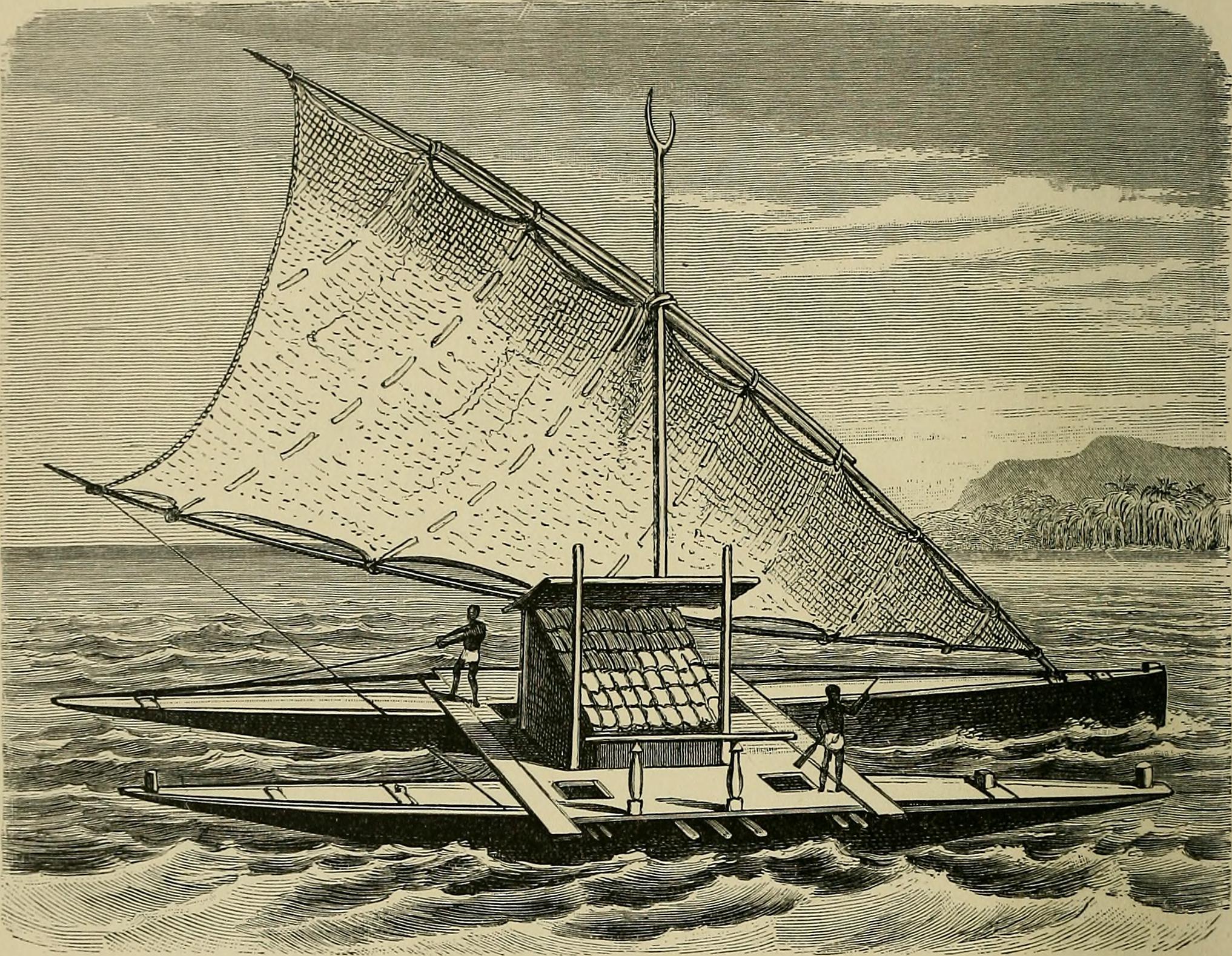
Ocean going craft as suggested in “The History of Mankind” (1896)
On their own the mythologies
of the Pacific cannot provide us with more than a unique insight into the mindset
of the peoples considered to be some of the greatest explorers of the past but when
combined with genetics, linguistics and archaeology it gives us the ability to
answer those questions of how, when and why.
Sources
Irwin G (2012) ‘Pacific
Migrations – Ancient Voyaging in Near Oceania’ Te Ara: The Enclyclopedia of New Zealand.
Ratzel F & Butler A J
(1869) History of Mankind
Poignant R (1985) Oceanic and Australasian Mythology
Going to Saveock is a bit like travelling back in time, seeing a peep of a thatched roundhouse roof only adds to the impression that you are somewhere else. Originally you would have had to wait on the other side of the train tracks, call the main station to see if any trains were coming and if they gave the all clear, open both sides of the gate then speed across – they had been known on the rare occasion to get it wrong. Today though there is a much safer way of getting into Saveock, a suitably narrow hedge lined drive leads down to the small holding and even though it is only a fifteen minute drive from Cornwall’s main city of Truro, it feels remote and tranquil – timeless.
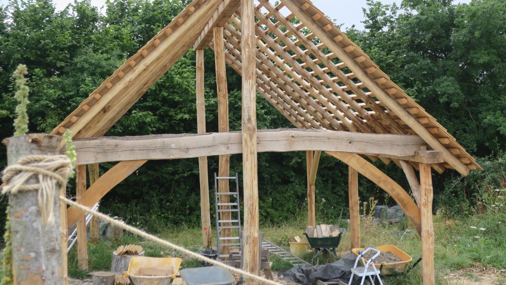
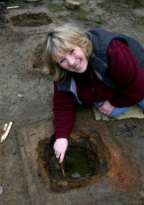
So,where is Saveock? Well, it is a small holding situated in a tranquil river valley near Truro in Cornwall. On arrival at Saveock you are met with the ever smiling Jacqui Wood who is not only a well known and respected experimental archaeologist (did I mention the roundhouse?) and author of several books including Cliff Dreamer: The Goddess Returns, a new fictional story set in the turbulent times of our very distant ancestors. She also runs the Saveock Water Archaeology Centre where students of archaeology (age and experience no barrier) are instructed in the art of excavation, here they find their minds being opened to the endless possibilities that the study of the past can present to those willing to listen.
A reconstruction drawing of how a courtyard house such as those found at Chysauster might have been roofed.
I met Jacqui some fifteen years ago when during a chance conversation she told me about some curious stake holes, a green clay floor and associated flint tools which she happened upon whilst digging a flue to conduct an experiment in tin extraction. At the time I was teaching A level Archaeology and we thought it would be a good chance for the students to learn some excavation techniques in the field, after all in archaeology practical experience is far more useful way to learn. It was the beginning of many seasons of excavation, intriguing finds, the remodelling of cow shed to comfy quarters for the diggers and much more. My eldest spent the first few months of his life sleeping safely at the edge of a trench.
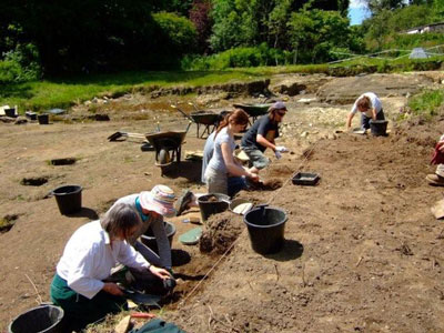
Volunteers and students at the trench face.
The site at Saveock covers a wide range of time as you would expect of a small river valley in the heart of Cornwall with fertile soils, natural springs and near a well known source of tin and possibly gold. The earliest phase belongs to the Mesolithic, the evidence for which comes firmly from those aforementioned stake holes, green clay floor and the associated flints.
“In the Mesolithic the main site trench was over a south facing peat bank on the bend of a river that was between two shallow lakes. This entire site has been purposely covered with various different coloured clays in an attempt to make the river bank a suitable place for dwellings. In the area A/2 the first phase of the site, is what we believe to be a Mesolithic dwelling platform covered with dense green clay surrounded by stony yellow clay in which the stakes to support the dwelling were driven.” (Jacqui Wood).
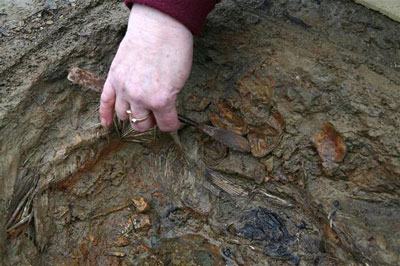
The second phase was and still is a bit confusing but it does seem entirely possible that it belongs in the Neolithic. When excavating it had been our intention to extend the trench to get a better picture of the Mesolithic features, so imagine our surprise when we came across a stone lined and capped drain covered in thick green clay that lead in one direction towards the river and in the other to another feature, rectangular in shape and lined with white quartz stones and spring fed. Several seasons later in 2005 Jacqui and her team uncovered another similar feature adjacent to the first original ‘pool’.
Dating the pool feature was problematic as it seemed to have been used over a long period of time.
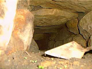
Inside the stone capped drain looking roughly north.
The only other similar feature we have found was the platform around the Neolithic monument of Maeshowe in Orkney. This platform was made up of thick clay and when a trench was put through it a stone lined and capped drain was discovered which was almost identical to the one at Saveock. The presence of the quartz stone too would suggest a very early date, the use of quartz in Neolithic and Bronze Age ritual sites is well attested to. The pool itself became known as the ‘moon pool’ as the white quartz glows in the bright moonlight.
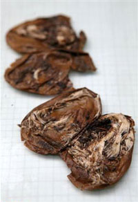
As for its function, well ritual seems a good an answer as any other but only because there appears to be no other alternative and believe me we considered a wide range of alternatives. Jacqui herself was always of the opinion that the word ‘ritual’ was used far too loosely in archaeological circles to explain seemingly unexplainable objects or sites. Later post excavation work on the mud we scooped up from the bottom of the pool (it couldn’t be excavated in the traditional manner as it kept filling with water) revealed some small finds which told a story of long usage and deposition. These included human hair, fingernails, Medieval straight pins, 128 small pieces of textile, parts of shoes, heather branches and perhaps most interesting was the broken half of iron pot or cauldron.
Many of these finds seemed to date to the last phase of usage at a time just before the pool was filled in and covered, a deliberate act to erase a pagan site. The lack of any finds earlier than the late Medieval may suggest that intervals the pool was clean out – thousands of years of deposition, not to mention silt, would have filled the pool considerably if it was not cleaned out regularly. Interestingly, in the layer just above the infill layer a broken glass bottle and a few sherds of pottery dated the closure of the pool to around the time of the English Civil War. Cornwall was at the time and even today a place where the rituals of time past were an important part of local society often overlooked by the Church. Cromwell’s puritan army would not have been so kind to Royalist (and pagan) Cornwall.
Perhaps one of the most intriguing episodes in the sites history comes from once more as a result of an extension of the trench with the Mesolithic features this time along the edge towards the marsh by the river. Whilst following the expected green clay floor and associated stake holes we encountered shallow pits with unusual contents cut into the clay floor. Because this area is essentially a waterlogged part of the site organic remains survived particularly well.
The clay floor with pits.
“When we excavated the first one we were surprised to find white feathers in it and thought it might have been perhaps a bird plucking pit, which was a common farming practice at the turn of the century. This turned out not to be the case when we found that the feathers were not plucked, but had been laid skin side out with white feathers inside. We took samples of the feathers to the bird expert at the local zoo and found them to be swan feathers.” (Jacqui Wood).
In addition a small amount of tiny stones were found surrounded by some sort of organic matter. Initially the assumption was that this was the crop of the swan but the stones were too pristine and it was concluded that the stones had been wrapped in leaves and deposited on purpose alongside claws from a range of other birds. The stones themselves were of an interest as they appeared to be brought to the site as they contained tiny nodules of beach flint an unusual feature given how far inland Saveock is. A suggestion from a local had us mounting an expedition to Swan Pool, some fifteen miles away on the coast and sure enough the stones at Swan Pool were identical to our small sample. Radiocarbon dates from the swan skin dated the pit to the 1640s, once again it seems dangerous ritual activities are occurring at a time when to be called a witch would mean certain death.
A pit being excavated.
A further eight pits were excavated that season, only two of them were intact the other six had had their contents removed in antiquity leaving just a few feathers and stones to show what their previous fill was. Excavation of this area was tough going, a thick layer of reeds impeded the work and as time went on more pits would be found, all with their contents removed that was until 2005 (two years after the first pit had been discovered).
Three pits were found in a row, two rectangular and one round in the middle. Of the three it was decided to excavate the middle round one, here the dig crew found the pit to be lined once again with swan feathers but also on either side the bodies of two magpies. In the midst of this were the remains of over fifty-five eggs and although the shells had rotted away the membranes were remaining. The eggs themselves appear to have come from a variety of birds, some even had full formed chicks ready to hatch inside them still.
The egg membranes with chicks…
Further pits revealed the remains of a cat and dog skull. Perhaps the most astounding part of this whole story is the radiocarbon dates for the cat pit which was dated to around the mid 18th century and the dog pit which had a date of circa 1950s.
But as archaeologists we need to ask why? What was the purpose of the pits? There is the suggestion that these are the result of witchcraft based rituals and conversations with many experts in the field of witchcraft have yielded very little to enlighten us. If these pits are connected in some way to witchcraft or even pagan rituals of a different kind it is not one commonly known. This is not too surprising given that so much knowledge about traditions and rituals has faded away. Jacqui though has her own theory as to who and why; “My own theory (and it is only a theory) is that maybe if you got married and did not get pregnant in the first year, you might make an offering to St. Bride of a feather pit. If you finally got pregnant you had to go back to the pit and take out the contents and burn them and set the spirit of the swan free. If you never got pregnant then the pit remained untouched.”
Saint Bride or Brigit has many similarities to the Celtic deity of Brigid. The first of February is St Brigids feast day but also Imbolc where the goddess Brigid is remembered as one who brings the spring. Both are associated with healing, poetry and other domestic tasks. There is also a connection with the sacred wells. Today well dressing is done in the name of the Saint. Wells have long been a place of veneration, our modern wishing wells merely a continuation of a ritual act of deposition that begun in the Bronze Age if not earlier. The connection with the goddess and the saint at Saveock is slight but as we all know it is a place to start.
On a personal note I should like to mention that when the quartz lined pool was excavated it was myself and a friend who did the digging (we were the only ones willing to get so mucky). We spent the good part of a week in the mud and spring water. In late November of that same year I discovered I was pregnant with my eldest (who incidentally was born at midsummer) and a few days later my friend who had been digging too told me she too was pregnant – our children were born just a week apart.
More recent excavations have been looking in a completely different area of the farm and this time they have uncovered a hearth edged with smoky quartz crystals. Dating was provided by the large quantities of Bronze Age pottery found in association with the hearth. Work at Saveock is never dull but it is ongoing, so if you fancy have a holiday with a difference then check out the link below.
Jacqui excavating one of the pits.
For more information on the Saveock Water Archaeology Centre please go to the website www.archaeologyonline.org
Jacqui Wood’s book Cliff Dreamers is available to buy on Amazon along with her book on food through the ages Tasting the Past. Jacqui also has numerous articles published many of which can be found at www.academia.edu
Please Note – all photos except the featured image at the top of the article were provided by Jacqui Wood and the copyright belongs to her. The featured image at the top of the article is my own.
This article originally appeared in the Celtic Guide magazine December 2016.
Holidaying in the UK in winter can be rather satisfying. Mainly because you don’t have to contend with the vast crowds which are usual in the warmer months at popular spots. One such place was the Roman bath complex in Bath, here we were able to meander around the buildings and displays without being jostled by eager tourists trying to capture the perfect selfie. This physical space allowed the imagination a chance to wander the halls of time. A multitude of questions and possible scenarios playing out in my minds eye and so ‘A Roman Moon’ was born.
The imposing stucture of Bath Abbey looms over the now open Great Bath – originally the Great Bath would have been roofed, most likely with an arched roof.
Looking down on the Great Bath.
Bath complexes in the Roman period were not simply places to wash and clean the body but also places to meet, socialise, to be seen and make those all important contacts. At the Roman town of Aquae Sulis (Bath) the baths rose to prominence from the late first century AD as a result of the natural hot springs which were a feature of the landscape and worshipped for many generations prior to the arrival of the Romans.
As with so many aspects of the Iron Age/Celtic landscape of the time, the natural springs here had its own diety who was recorded by the Romans with the name of Sulis. The Romans were very good at adopting and blending local cultures with their own as part of their overall colonisation package. For the Romans the local goddess Sulis had much in common with one of their own – Minerva. Thus the hot springs became dedicated to the amalgamated goddess of Sulis Minerva.
The very roman looking head of a statue believed to be Sulis Minerva herself – most likely stood within the sacred space of the actual temple.
The success of Aquae Sulis (even the towns name pays homage to the goddess – ‘the waters of Sulis’) is down to it also being a place of pilgrimage. People from all around would come to the town to make offerings or petitions to the goddess. One such method to ensure the goddess knew what was required was to write a message on a sheet of lead. For this purpose a trained scribe would be employed. Once the wording was just so the lead sheet was folded or rolled and then thrown into the sacred spring – a number of these have been recovered from the spring, mostly they were curses for relatively small wrong doings.
A few examples of the inscribed lead sheets.
As well as the lead sheets, other gifts were found during excavations. Thousands of coins (and even today people throw coins into the spring), jewellery, pewter dishes and cups usually inscribed with a dedication to Sulis Minerva. The cups may have been used to drink the waters (as we continue to do so today) or as libation vessels. The belief in the healing powers of the spring waters was an important part of the towns fame.
Some of the jewellery finds from the spring. It is interesting to note the continuity of ritual in this act of depositing important items into a watery context. For more on this read here.
And a few of the more everyday items found during excavations – people lived and worked here too.
Besides Sulis Minerva there were within the temple complex depictions of other deities.
A relief carving of the goddess Luna – the disc of the moon can be seen behind her head and she holds a whip for driving her chariot across the sky. This carving would have decorated one of the buildings in the temple precinct.
This massive pediment would have originally adorned the entrance to the temple of Sulis Minerva. Although interpreted as a gorgon others have suggested it may in fact be Oceanus or even the sun god Sol (or Bel, ‘the shining one’ if you are looking for Celtic diety which is also the nickname of our heroines bodyguard and friend…).
This unassuming relief carving is believed to depict the triple goddess, a distinctly Celtic personification. As to who and what this may be is a complicated discussion but foremost is the ability of the goddess to have many faces – to be one and the same. Often the triple goddess in modern pagan/wiccan practice refers to the maiden, the mother and the crone however there is no way of telling if this was the case in the past. An interesting take on this can be read here.
The rituals in Roman religion took place mostly outdoors, the temples buildings were often small affairs where only the priests or priestesses would be allowed to enter. Public ceremonies would have been conducted outside in the surrounding precinct. Within the precinct there would have been altars dedicated to the diety set up by individuals in anticpation of a divine favour or to give thanks, these would have been decorated in offerings of all kinds or with bowls of incense.
“The temple, in its original late first century form, was a purely classical building set on a high podium reached by a steep flight of steps. Its porch was dominated by four massive Corinthian columns supporting an ornate pediment. Behind lay a simple room, the cella, where only priests could enter to tend the flames kept burning around the life-sized cult statue of Sulis Minerva” (from ‘The Essential Roman Baths” – a guidebook).
The above is a selection of the numerous altar stones and memorials found in the Roman layers during excavations.
The complex at Aquae Sulis was quite extensive – with facilities for men and women to bath seperately which was rare and spoke volumes about the wealth of the town. At the heart of the complex is the Great Bath, a rectangular swimming bath surrounded by a walkway with alcoves for people to sit and relax in. The bath itself was and still is lined with 45 sheets of Mendip lead.
A model of the bath and temple complex in its heyday.
The Great Bath – looking across to one of the alcoves.
The East Bath – a rectangular tepid bath – the doors would have led to heated rooms known as tepidariums.
The remains of the extensive hypercaust system – ensuring visitors were kept warm and comfortable at all times.
One of many mosaics which would have adorned the floors of the rooms within the complex.
The arched overflow was part of the Roman engineering which kept the water flowing through the complex and still does today.
The dark interior of the circular bath, here bathers would complete their visit to the steam rooms with a cold plunge to rinse off – note the coins littering the bottom of the pool.
The complex at Aquae Sulis was quite extensive – with facilities for men and women to bath seperately which was rare and spoke volumes about the wealth of the town. At the heart of the complex is the Great Bath, a rectangular swimming bath surrounded by a walkway with alcoves for people to sit and relax in. The bath itself was and still is lined with 45 sheets of Mendip lead.
A model of the bath and temple complex in its heyday.
The Great Bath – looking across to one of the alcoves.
The East Bath – a rectangular tepid bath – the doors would have led to heated rooms known as tepidariums.
The remains of the extensive hypercaust system – ensuring visitors were kept warm and comfortable at all times.
One of many mosaics which would have adorned the floors of the rooms within the complex.
The arched overflow was part of the Roman engineering which kept the water flowing through the complex and still does today.
The above shows a reconstruction picture of how the town may have looked at its height based upon what has been discovered through various archaeological excavations. In “A Roman Moon” astute readers will note that I did away with the amphitheatre, replacing it with a Forum. Why? Well, to begin with the evidence for an amphitheatre is at this stage is quite thin on the ground and I am sure that a town of such importance would have had a Forum. In addition, you can also put it down to the authors whim, a bit of ‘literary licence’.
The river running beside the town is the Avon, known then as Afon which is Welsh for river (amusingly making the name of the River Avon, the River River)…
I hope you can see why the ancient town of Aquae Sulis inspired me to write ‘A Roman Moon’ – from the presence of Luna, the triple goddess and the sacred spring all play a part in Sarah’s story.