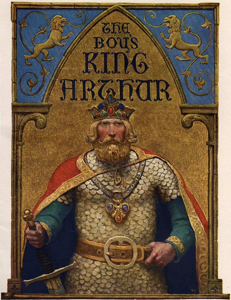
Why fleeting you might ask? Well in a nutshell, the visit occured a couple of years ago during a whirlwind trip to London with the family and after a protracted visit to the Natural History Museum followed by getting distracted by a well known sci-fi shop I was left with a mere two and half hours to see the Museum…As some of you are well aware this is not nearly enough time and so it was, a fleeting visit. The following are a few of the photos I took along with brief explanations.
One of the first gallerys I made my way to was the early Medieval gallery – I had long wanted to see the artefacts from Mound 1 at Sutton Hoo, the famous Anglo-saxon ship burial. Sutton Hoo is located near Woodbridge in Suffolk and is the remains of a 6th and 7th century AD cemetary. Mound 1 was excavated in 1939 providing the world with a fascinating glimpse of the artistic ability of our Anglo-saxon forebears. The artefacts were richer and more intricate than any other found before.
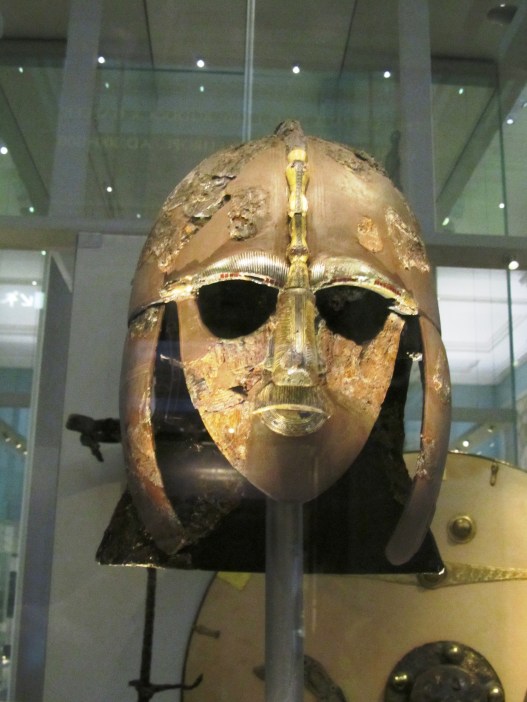
The most famous face of Anglo-saxon England – the helmet was in in a bad way when excavated and the above shows only the few remaining pieces which could be salvaged.
An ornate purse lid – would have originally covered a leather pouch which hung at the waist.
These ornate shoulder clasps are one of kind in Europe and were originally used to hold together the two halves of a stiff leather cuirass so it can fit the torso snugly in the Roman style.
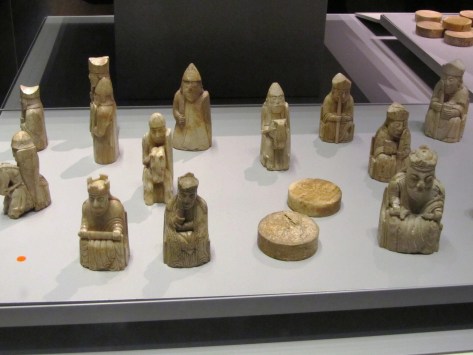
Not far from the Sutton Hoo treasure is the Lewis Chessmen. These fascinating wee carvings were discovered in 1831 in Uig on the Isle of Lewis (Outer Hebrides). They are 12th century in date and carved from walrus ivory; it is believed they were originally made in Trondheim in Norway – at the time the Outer Hebrides were ruled by Norway. A number of years ago, a travelling exhibition on the Vikings came to the Auckland Museum in New Zealand. Two of the Lewis Chessmen accompanied the exhibition and it was this that inspired me to write “A Viking Moon”.
The Lewis Chessmen
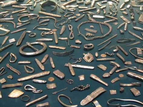
Staying with the Vikings we have the Cuerdale Hoard from Lancashire. The display at the museum is only part an enormous hoard of silver found in a lead chest beside the River Ribble. The hoard itself consisted of 7500 coins and 1200 pieces of silver bullion, weighing in at forty kilograms. The coins come from a variety of sources – mainly the eastern Viking kingdoms of England but also from King Alfred’s Wessex, Byzantium, Scandinavia, Islamic and Carolingian sources. The Ribble Valley was an important Viking route between the Irish Sea and York and this may have some bearing on why the hoard was found here.
Part of the Cuerdale Hoard
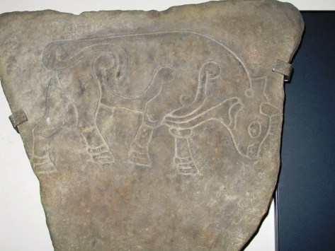
Staying in the early Medieval my next photo is of the Burghead Bull. The town of Burghead in Moray, Scotland occupies part of what was once a Pictish promontory fort of great importance. The Burghead Bulls were discovered in the late nineteenth century when much of the fort was destroyed to make way for more houses. Originally there were thirty panels carrying carved images of bulls, now however, only six remain – one of which is held at the British Museum. They are dated to 5th century AD and it has been suggested they formed a frieze set into the ramparts of the fort and possibly represent a warrior cult which celebrated strength and aggression. Regardless of what the bull represents it is a fabulous piece of Pictish art.
Burghead Bull
Travelling back in time I moved onto the Roman and Iron Age galleries (this was a flying visit, I had just recieved a text from an impatient husband…)
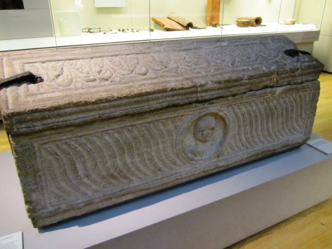
In the Roman gallery I took a moment to admire a stone sarcophagus found in London in 1853 within what was described as an extensive Roman cemetary outside the city wall to the east. It is dated to the early 4th century AD.
An early 4th century AD Roman stone sarcophagus.
Moving along swiftly I found myself in the British Iron Age and here I had to stop and admire the mirrors. Of all the artefacts from this period these are my favorite (and no its not because I have vain streak…). I have long held the belief that mirrors were more than a toilette item for these were never true mirrors that the modern person might be familiar with. Their surfaces were often burnished bronze and would at best reflect a fuzzy image. Instead I would suggest that the surface of a mirror acted in a similar way to the reflective surface of lake, pond or well providing access to the otherworld – a liminal space/place. Such places are well documented as being special, the vast numbersof artefacts found deposited into watery places at this time speaks for itself. Furthermore, it is surely no coincidence that later myths and stories use a mirror as a storytelling device (think Snow White).
The St Keverne Mirror (Cornwall) 120BC-80BC
The Desborough Mirror (50BC-50AD)
The Wetwang Mirror (Yorkshire) 210BC-160BC
Then of course something shiny caught my eye, first the Snettisham Torc and then the twisted gold torcs from the Ipswich Hoard. The Snettisham Torc was discovered in 1950 near the village of Snettisham in Norfolk. It is made up of a kilo of gold mixed with silver, there are 64 threads and each thread is 1.9mm wide, eight threads were pulled together and twisted then all were twisted again to make the torc. The terminal ends are hollow and were cast from a mould. The torc is dated to between 150BC and 50BC. The Ipswich Hoard was the second hoard to be found in the area, the first being Anglo-saxon in date. This particular hoard was discovered during the construction of a housing estate in 1968 by a digger driver and consisted of six twisted gold torcs. These torcs had less silver in them which has led the musuem to date their manufacture to around 75BC.
The Snettisham Torc
The Ipswich Hoard
Finally I wound my way through the Egyptian gallery and down the stairs to meet up with the family who were marvelling at the large statues from the ancient world. The following is a selection of the photos from this part of the museum.
This slideshow requires JavaScript.
There was so much else to see but I simply ran out of time and as we were flying out the next day any other sight seeing would have to wait until another visit – although I have heard recently that there are plans afoot for a downloadable VR experience for those who can’t visit in person.
Below are a few links which relate to the above photos.
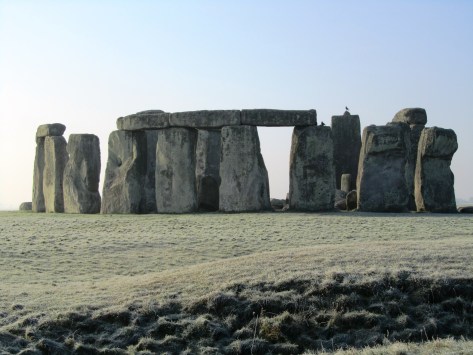
Stonehenge – a name that evokes a great many emotions in a great many people. For some it is a place of pilgrimage, a place to connect with the ancestors and for others it is seen as a tourist trap or something to tick off the bucket list. For centuries it has captured our imagination; never has a heritage site been so controversial – something which continues to this day. In this post it is not my intention to give a full on thesis about Stonehenge, there are plenty of books/websites who do this already. Instead it is simply an overview of what is currently understood about the site, its surrounding landscape and my own personal thoughts.
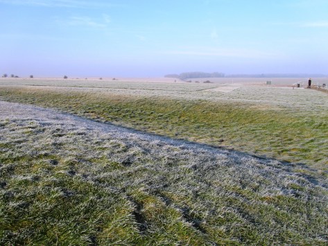
Stonehenge is situated on the Salisbury Plains, to the south is the busy A303, a main road between the south-west and London, and for many years the equally busy A344 ran alongside the site. This latter road was removed sometime ago to improve the visitors experience. Today there are ongoing discussions regarding the upgrading of the A303 and a proposed tunnel. It is a highly emotive subject, on one hand I understand the need to improve the road situation (ask anyone who is stuck in a traffic jam on the A303) but as an archaeologist I am also aware of the sensitive nature of the surrounding heritage landscape (and yes I am on the fence). Mike Pitts in his recent post discusses the pros and cons for those of you who are interested.
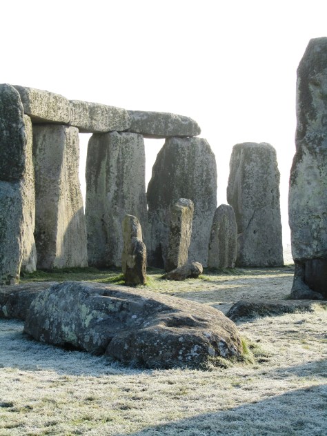
For the visitor today the focus is on the large stone circle with its trilithons, they marvel at how it could have been built by ‘primitive man’ often leading to suggestions of alien intervention and lost technologies. But such thoughts only serve to belittle our ancestors and our past. Others may ask why did our ancestors build Stonehenge? Often the answers are unimaginative and simple – sun-worship; display of power; ancient computer; druid temple – once more when we look only for one answer to a what is obviously a complicated site of great longevity we belittle their achievements. Instead if Stonehenge was understood in terms of the wider landscape and as a site whose history spanned several millenia we might come to some small understanding of how and why.
In today’s world of instant gratification where everything has a beginning and an end, it is hard to imagine beginning a project knowing you might not see it finished but this was a reality for the builders of Stonehenge. It has lead some to suggest that it was not the end product which was important but the doing, the act of building which was in fact the purpose. Suggesting a cyclical thought pattern which can be seen in other aspects of prehistoric life – round houses, stone circles, round barrows. in addition, time itself was most likely viewed in cycles, the phases of the moon and the movement of the seasons are all cyclical events which would have been of great importance to prehistoric people trying to make sense of their world.
“So was Stonehenge ever ‘finished’? The answer to that has to be no, because completion was never the intention of the people who created it.” (Pryor F. 2016 ‘Stonehenge: The Story of a Sacred Landscape).
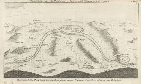
It is well known that Stonehenge itself had many incarnations, perhaps meaning new and different things with each alteration or rebuild. To understand Stonehenge it is important to consider it in the wider context of the surrounding landscape (there are literally hundreds of prehistoric monuments around it) in all the different phases.
The Mesolithic Story
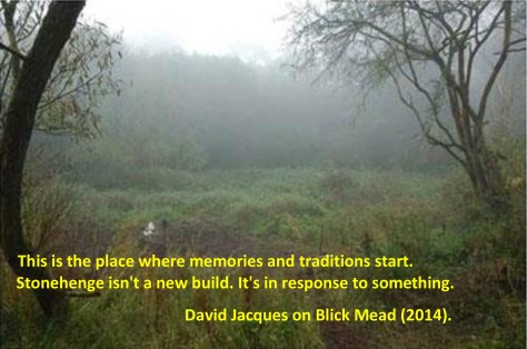
The story of the Stonehenge landscape begins back in the Mesolithic, ongoing recent excavations at Blickmead are providing archaeologists with tantalising clues as to why this area was important to our ancestors. The site is situated near a spring by the River Avon, excavations began in 2005 and almost immediately were fruitful. Basically, the deposits consisted of an array of Mesolithic settlement debris, mostly flint fragments (tens of thousands) but also a great number of animal bones. Interestingly, the site also yielded the largest collection of auroch bones ever found on a Mesolithic site in Britain so far. Other animals which were hunted and consumed included red deer, wild boar and salmon – this has led archaeologists to suggest that feasting was a common occurence around the spring. The spring itself is quite unusual as it has the tendency to stain flints and other materials a bright magenta pink – the importance of springs in later prehistory is well attested to.
In 1966 row of four large pit like features were found during upgrades to the old carpark close by Stonehenge. When excavated one was found to be a the root-hole of a tree and the other three were holes dugs to hold large poles. Examination of the material from these features gave a date range from between 8500 and 7000BC. The posts would have been approximately 75cm in diameter and were from pine trees. Later in 1988 another post-hole was discovered south and east of the original pits but it was contemporary.
So here we have a landscape already well populated by hunter-gatherer communities who revered certain natural features long before Stonehenge makes an appearance. A landscape which had meaning to the people who inhabit it; who had traditions and memories of place.
At around 3500BC (Neolithic) with the arrival of farming these communities and their traditions had evolved and more permenant features began to make an appearance on the landscape. Long barrows such as those at East and West Kennet or Winterbourne Stoke were the first to appear and by 3400BC the Stonehenge Cursus and Lesser Cursus was under construction.
3000BC – The first official phase of construction
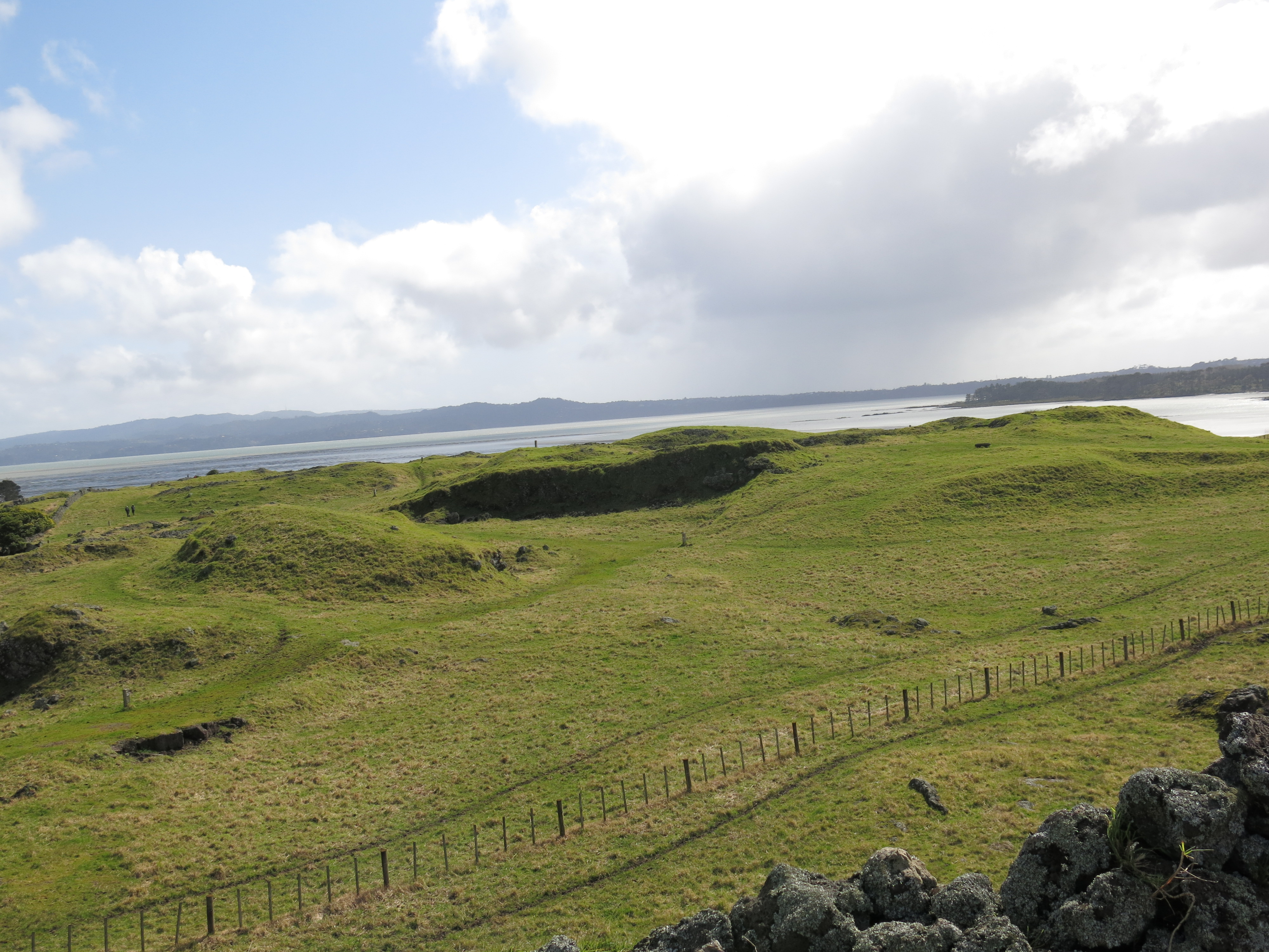
In many parts of Britian at this time a new type of monument was being constructed, these were earthwork enclosures which are referred to as henges. They consist of irregular cut ditches encircling a defined area with corresponding banks. Stonehenge’s earliest phase was one such earthwork. Here there were two entrances one faced north-east and the other faced south. The north-easterly entrance remained in use for much of the sites lifetime and appears to be important to its function. The entrance is aligned along a line of natural gullies which face towards the midsummer sunrise in one direction and the midwinter sunset in the other.
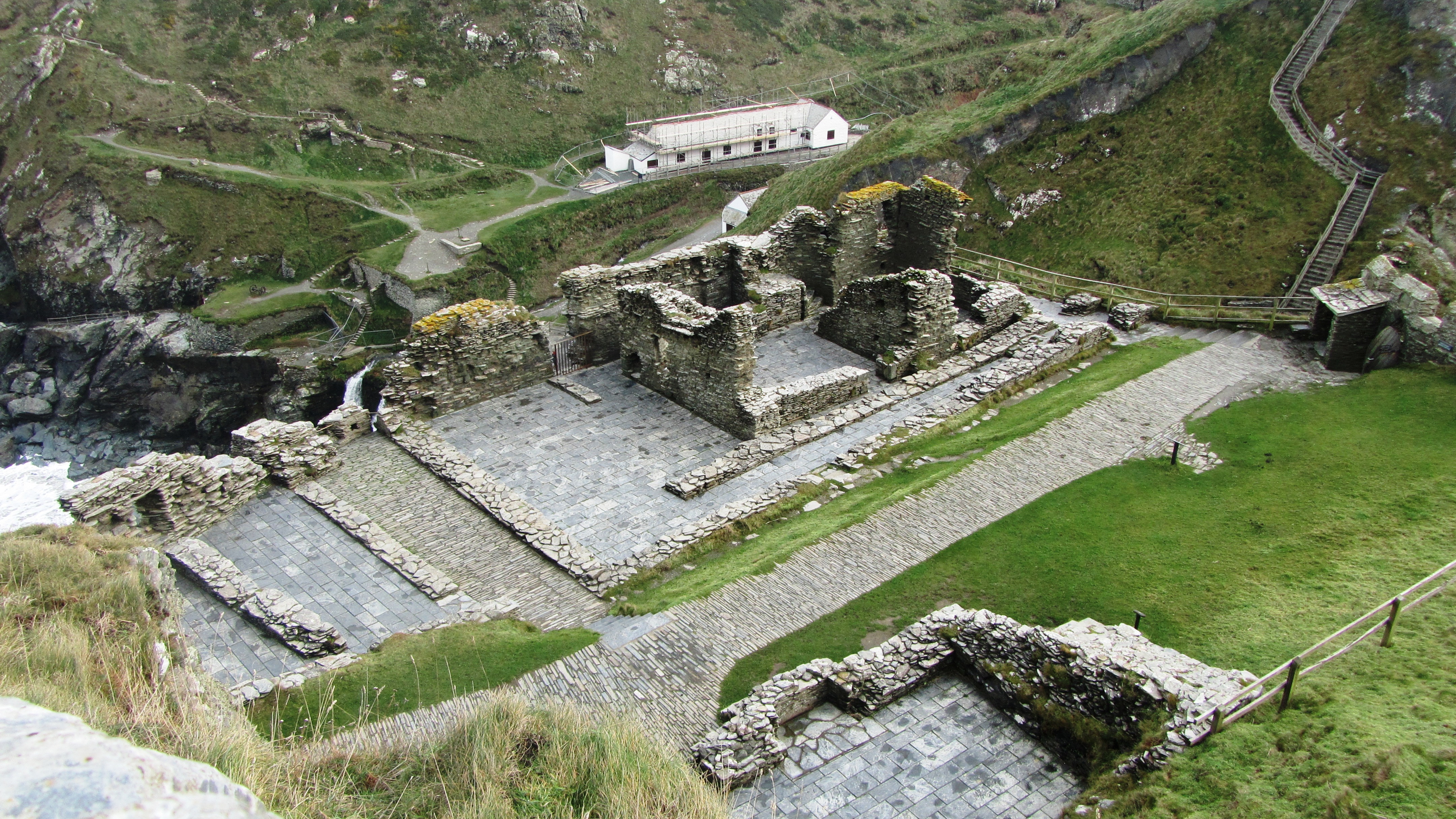
The bank and ditch of the first phase of construction – often overlooked by the visitor as they focus on the stones.
These natural gullies would have been visible to the people of the Mesolithic and may have been why the large pine posts were erected where they were – the midsummer and midwinter solstices were just as important then as they were to the later prehistoric communities.
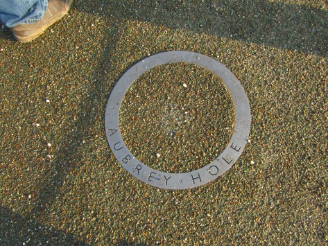
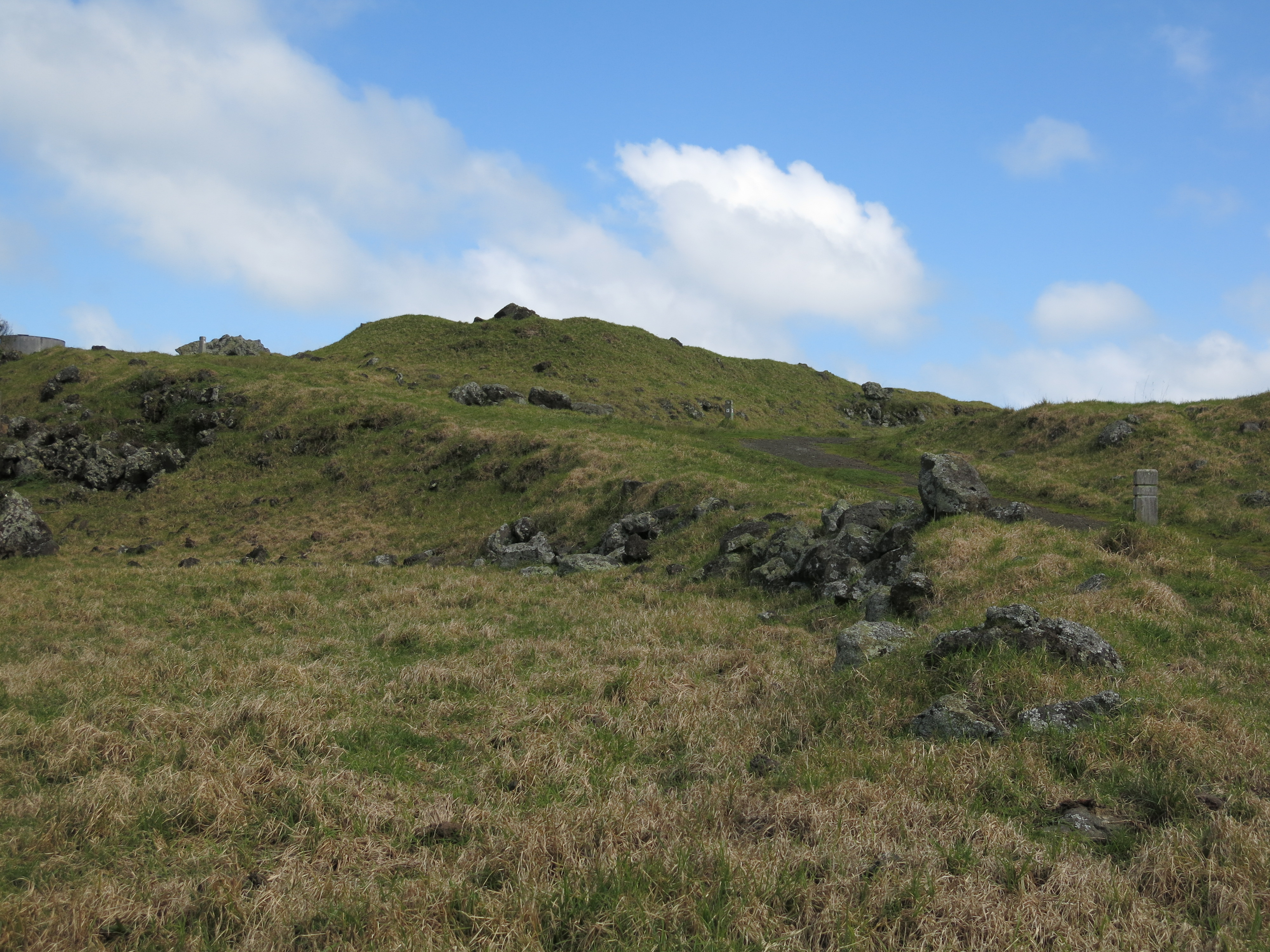
Inside the earthwork enclosure around the inner edge of the bank were fifty-six regularly spaced pits – these are now known as the Aubrey Holes. There is some discussion as to what they were or what they contained – small stone uprights or wooden posts? However, what is known is that eventually they did contain cremated human remains. Similar deposits have been found in the partly filled ditch and cut into the bank suggesting that at this stage in its history Stonehenge was used as a cemetary, among other things.
These circular markers define the spot where an Abrey Hole can be found.
The Building of the Stone Monument
At around 2500BC Stonehenge began to resemble a site we are much more familiar with. It is at this time that the massive sarsen stones from the Marlborough Downs were moved to the site and erected. If that was not all at the same time the smaller but no less cumbersome, blue stones from the Preseli Mountains in Wales were transported and erected at Stonehenge. The Heel stone was moved to its current position and four smaller sarsen stones (the station stones) were erected inside the enclosure just inside the bank.
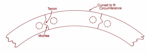
The first two diagrams above demonstrate one theory of how the trilithon stones were erected. The third diagram shows the sophistication of the construction, with each lintel fitting neatly into each other – borrowed from the Univeristy of Buckingham’s MOOC “Stonehenge”.
The friendly raven accentuating the knob which would have ensured a lintel that did not move.
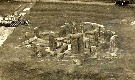
Stonehenge in 1917 – taken from a hot air balloon.
In a mere one hundred years it seems the two main structures of the trilithon horseshoe and the circle was completed. Interestingly it seems that greater care was taken in the shaping and construction of the stones visible from the north-east side and the main entrance. The bluestones were also erected at this time but not in the form we see today at Stonehenge. Excavation has shown us that there were two concentric arcs of stone holes, known as the Q and R holes were found on the north and east sides of the central area. It has been suggested that these were not representative of a complete circle as there is little to no evidence on the southern or western sides of corresponding holes.
The Heel stone – it is thought that unlike the other sarsen stones which come from the Marlborough Downs, the Heel stone was always here and simply raised upright.
2200BC – Consolidation and Alterations
From this time on Stonehenge underwent a series of minor alterations although the large sarsen stones remained in their positions although much later in the Bronze Age shallow carvings of axeheads and the occasional dagger were added. There are some 115 carvings and these have been dated stylistically to between 1750 and 1500BC.
The smaller bluestones however were rearranged and by 2200BC the incomplete circles were dismantled and repositioned to form a circle concentric to and just inside the circle of larger sarsen circle whilst a second oval of bluestones (spotted dolerite) was also formed within the trilithon setting. Later a number of stones were removed from the oval to form the horseshoe setting which is seen today.
The smaller stones are the remnants of the bluestone circle.
At around the same time the ditch was recut and a small bank was constructed and the Avenue was constructed. This later feature follows the solstice alignment with ditches and banks for part of the way and then veers off to the east ending in a valley of the River Avon. Recent excavations at the place where the Avenue meets the River Avon have uncovered evidence for a previously unknown henge monument made up of bluestones. These were likely to have been removed to supplement the bluestones already at Stonehenge.
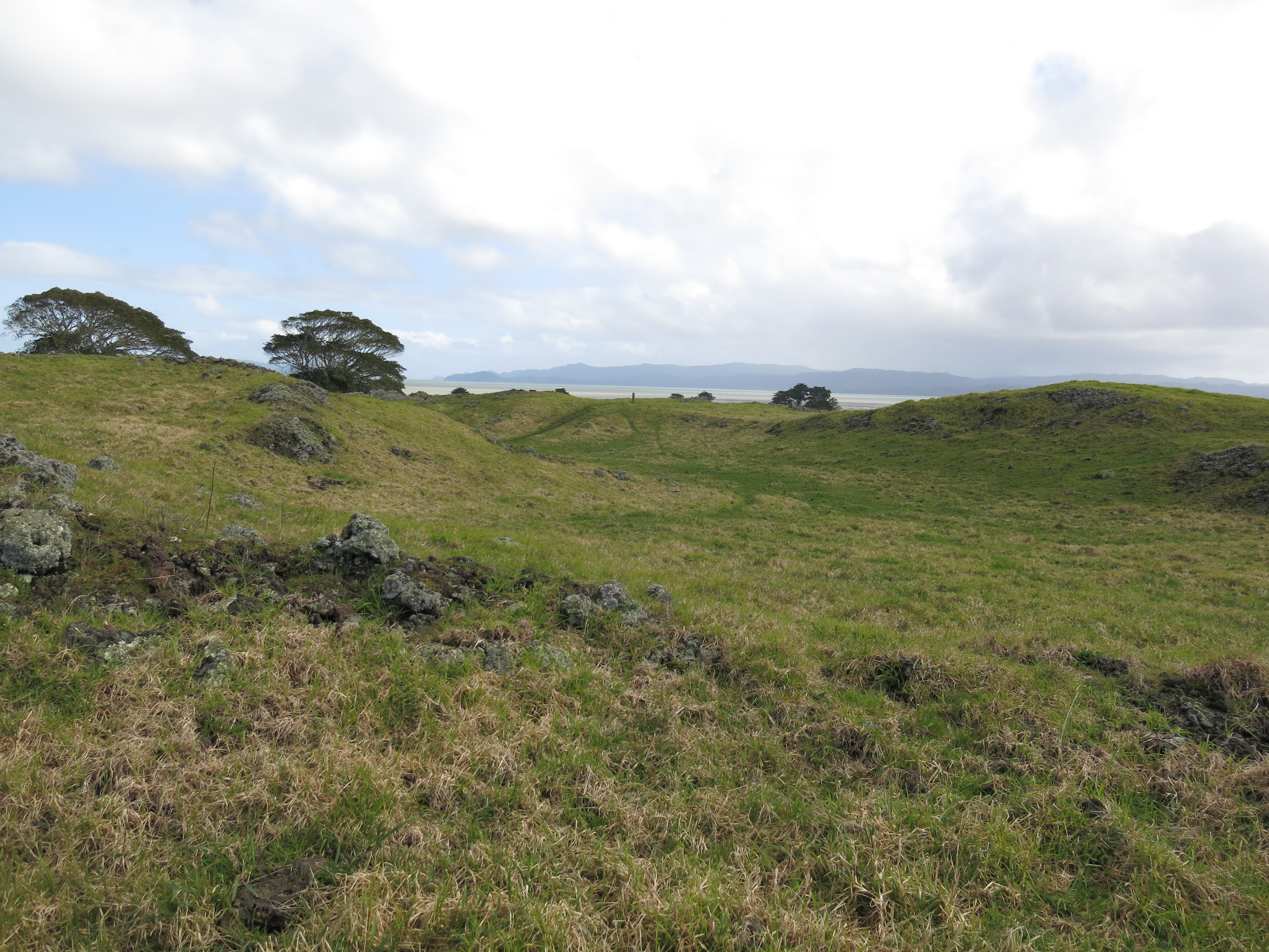
Surrounding the monument are significant numbers of round barrows dating from the Bronze Age, some of which contained rich burials with artefacts made of bronze, gold, jet and amber. Suggesting a society rather different from the one which was able to come together communally to construct Stonehenge and yet the place, the landscape and the site still had a powerful pull to these people – it is no different today…
Above are two of the many round barrows littering the landscape around Stonehenge.
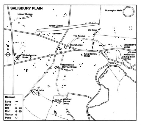
A map showing the distribuiton of barrows in the Stonehenge landscape.
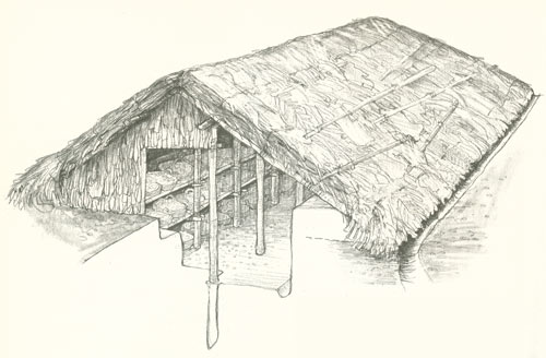
The pictures above show a reconstruction of houses found during excavations at Durrington Walls which date to approximately the same time as when the main phase of construction at Stonehenge was underway. It is interesting to note the layout of the houses with the ‘dresser’ opposite the door and the beds to the right as you enter. This layout is reminiscent of house layouts at Skara Brae and later similar layouts are seen in Bronze Age roundhouses.
This slideshow requires JavaScript.
Stonehenge is a UNESCO World Heritage Site, it is one of the most popular tourist attractions in Britain; it evokes a variety of emotions; it is a British icon and yet so many people still only today see the stones. Yes they are impressive but there is so much more to their story than what you see. To really understand Stonehenge the curious need to look at the wider landscape and then look further again. Afterall, not too far away is the equally astounding landscape surrounding Avebury. What was the relationship between these two sacred landscapes? What can they tell us about the people who lived at the time? These landscapes were created by a people who viewed the world very differently to ourselves and carry a language, a dialogue that would have been obvious to those who lived in the Neolithic and even the Bronze Age. In our modern world where landscapes are viewed as places to use – either to make money or in terms of leisure pursuits – it is often hard for us to step back in time to view the landscape as living breathing entity without which we could not survive.
Stonehenge and its surrounding landscape undoubtedly meant many things to the people who occupied it (and probably those further afield too), the stones themselves were taken from the land and perhaps used to create a space where the natural world could be contained; where a semblance of control was maintained; where perhaps a balance was found between the natural world and the constructed world.
There are a great deal of books and websites which delve into the Stonehenge enigma in far greater detail. I have listed some of those below (browse Amazon for comprehensive lists). In particular I would like to recommend the free online course run by Buckingham University via Iversity (click here for more details).
Further Reading
Pryor F (2016) Stonehenge: The Story of a Sacred Landscape
Parker-Pearson M et al (2015) Stonehenge: Making Sense of Prehistoric Mystery
Parker Pearson M (2013) Stonehenge: Exploring the Greatest Stone Age Mystery
Bowden M et al (2015) The Stonehenge Landscape: Analysing the Stonehenge World Heritage Site.
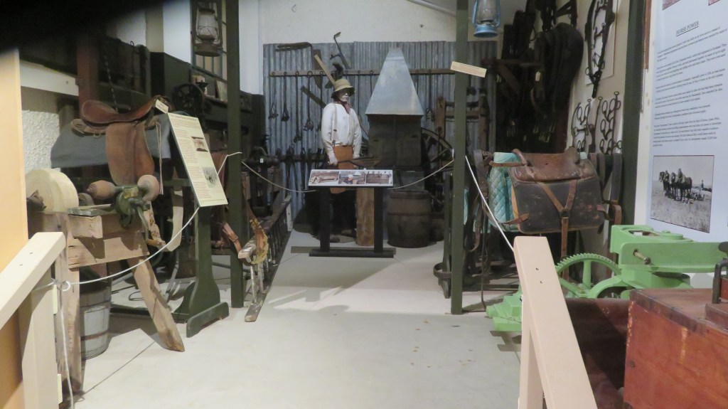
Whenever I go somewhere new my first stop (after a leg stretch and a coffee) is usually to the local museum. I have a deep fondness for museums and the people who put their heart and soul into their creation and upkeep. The Mercury Bay Museum was one of those musuems where the peoples love of their town and surroundings was evident.
Our first visit to Whitianga on the Coromandel Peninsula was in the winter and unfortunately the musuem was closed however we had much better luck on our second visit. Situated on The Esplanade just opposite the wharf, this small but well thought out musuem tells the history of the area beginning with Kupe who gave the local area the name Te Whitianga nui a Kupe or The Big Crossing Place of Kupe.
Originally the site of the museum was an urupa or cemetary for the local Maori iwi called Ngati Hei up until the 1870s. But when European curio hunters violated the tapu of the site members of the Ngati Hei removed the remains of their people and reinterred them safely elsewhere. The Maori history of the area represents only a small part of the musuem and was my one criticism of this otherwise outstanding museum. The displays of Maori artefacts were not clearly labelled and the display was largely restricted to the walls of the walkway as you entered and could be easily overlooked – personally I think the museum designers may have missed a beat in down playing the 800 years or so of Maori history.
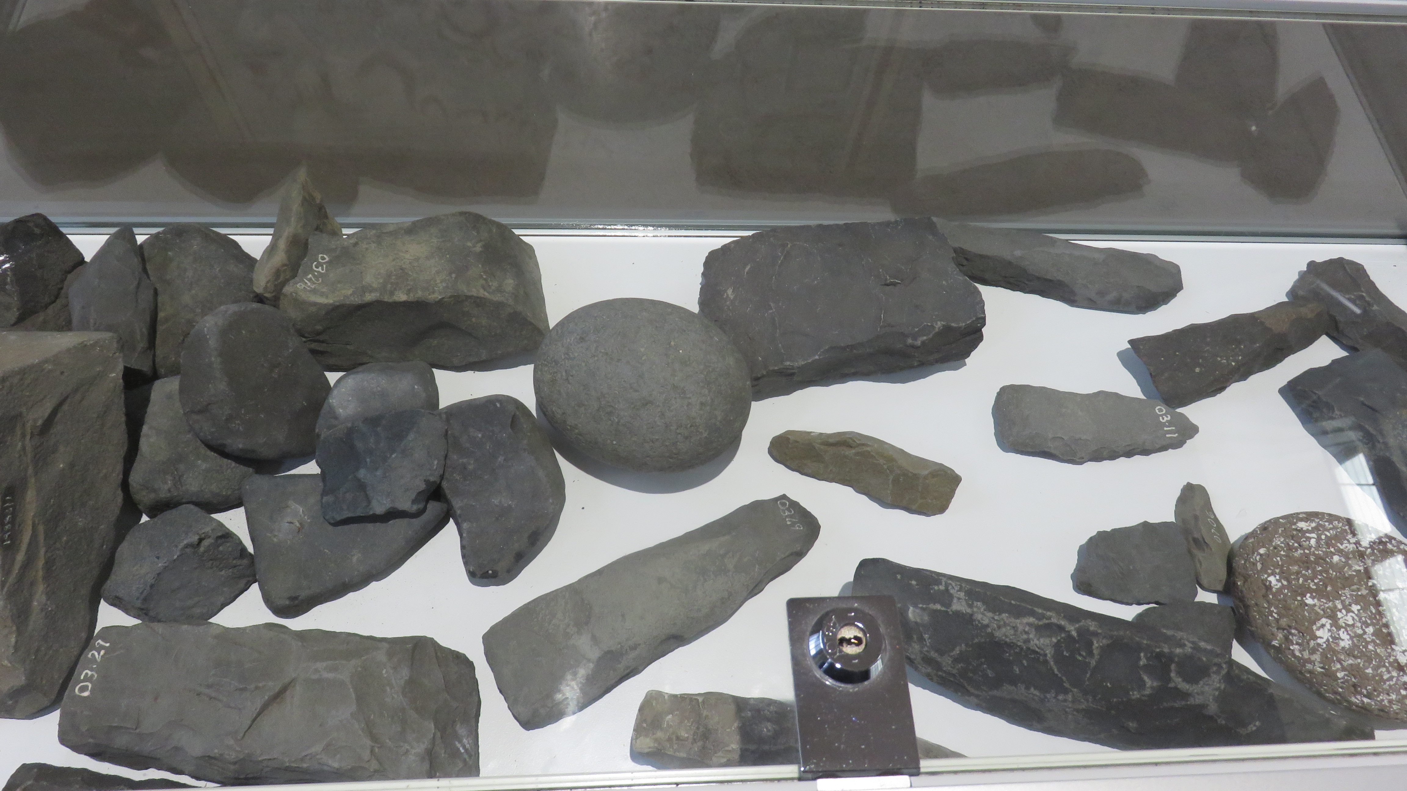
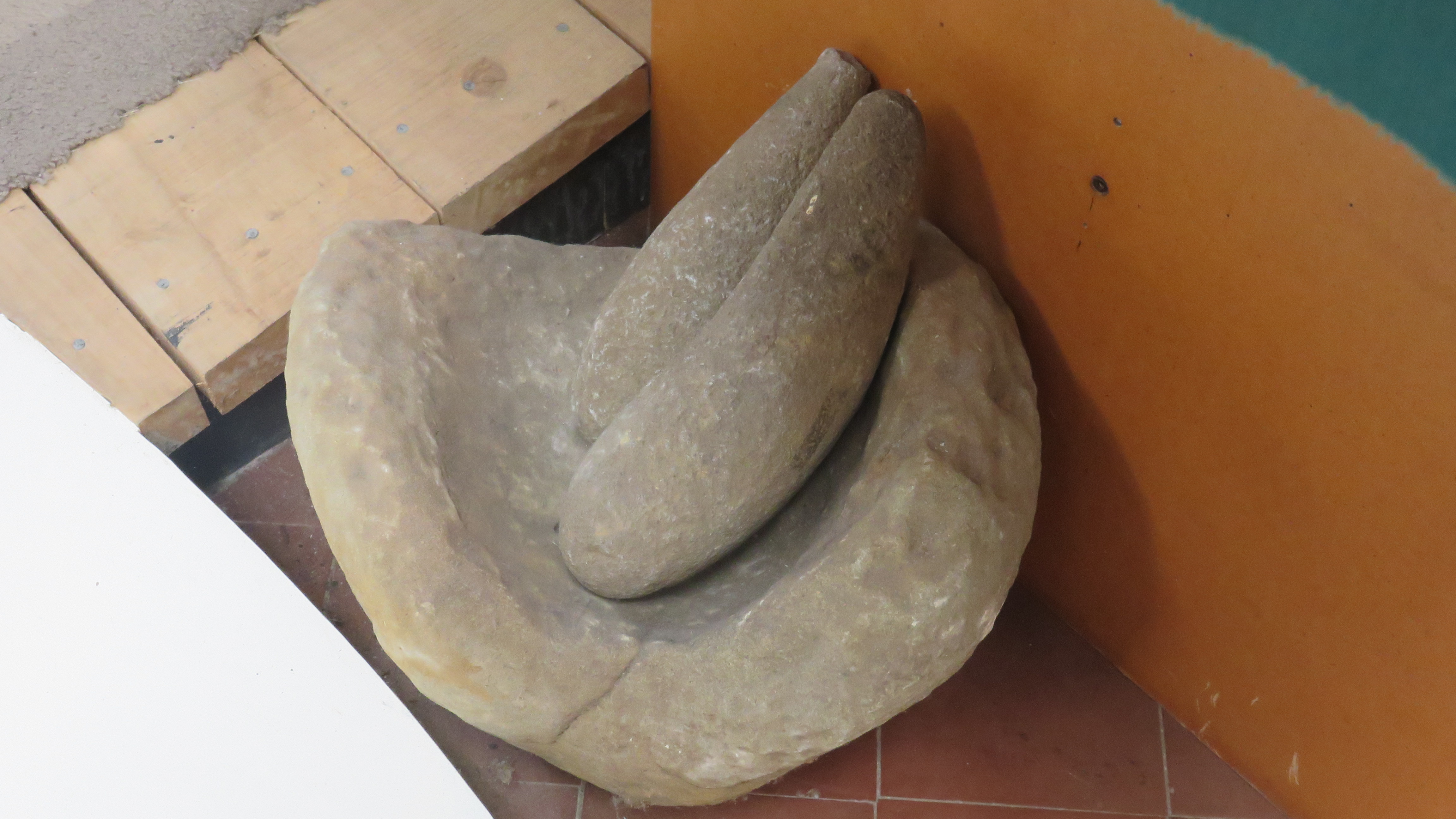
Examples of Tahanga basalt stone tools (and other random stone tools) – this material was traded far and wide – the lack of information on this dispay was disappointing, only personal knowledge helped be identify what the objects were.
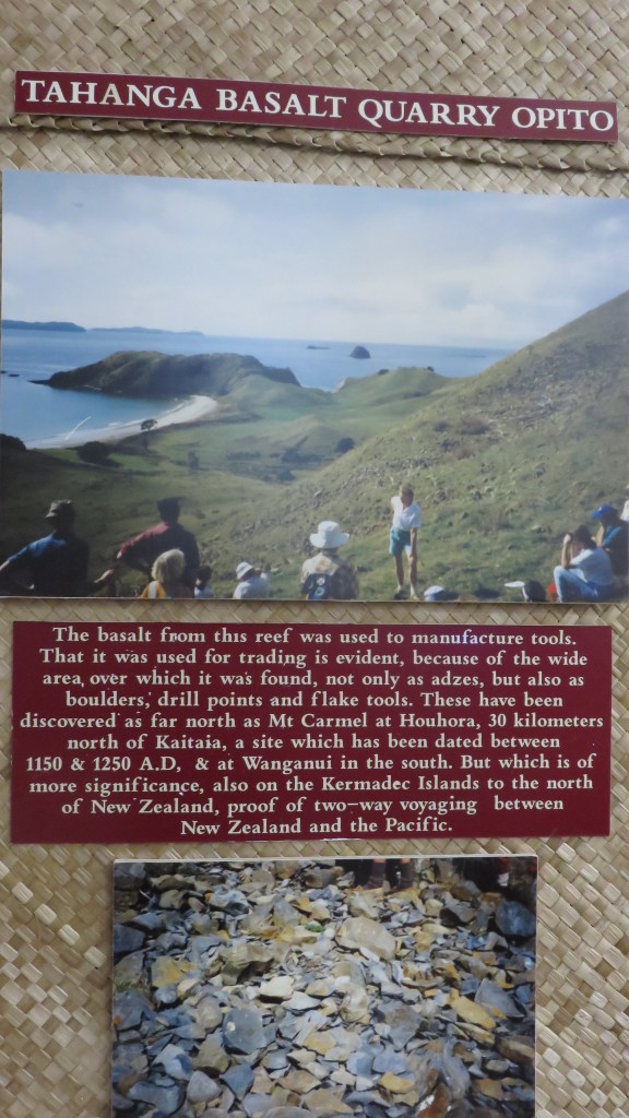
Poster on the wall about the Tahanga basalt quarry at Opito
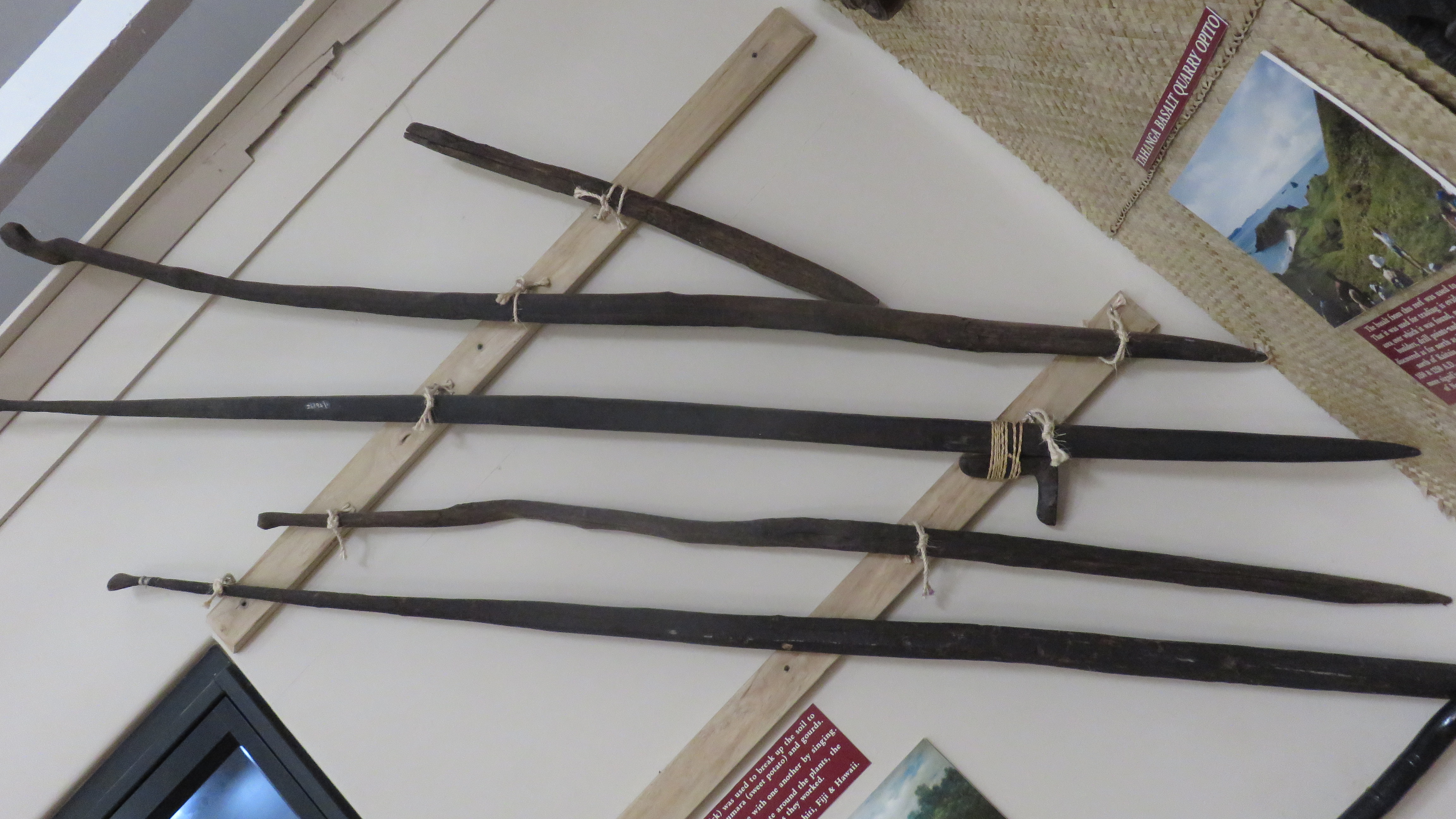
A display of Maori digging sticks.
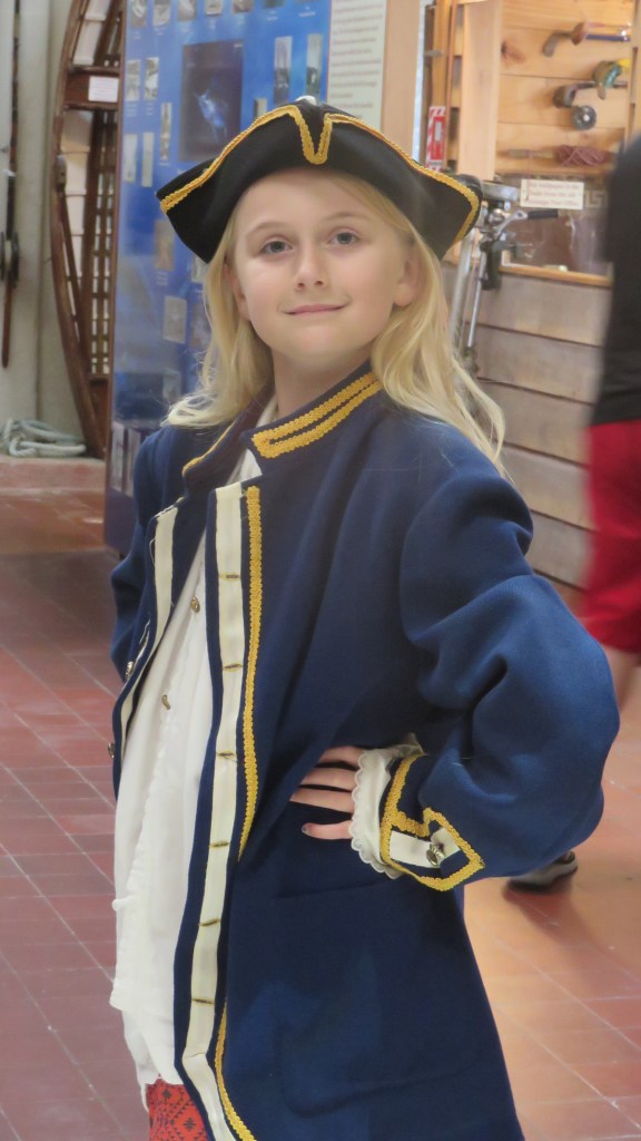
The Museum is very child friendly – my daughter in particular enjoyed dressing up as Captain Cook who visited the area in 1769 on the HMS Endeavour. It was he who gave the area its European name of Mercury Bay after taking his longitude and latitude from the viewing of the transit of the sun across the planet Mercury.
Time to dress up…
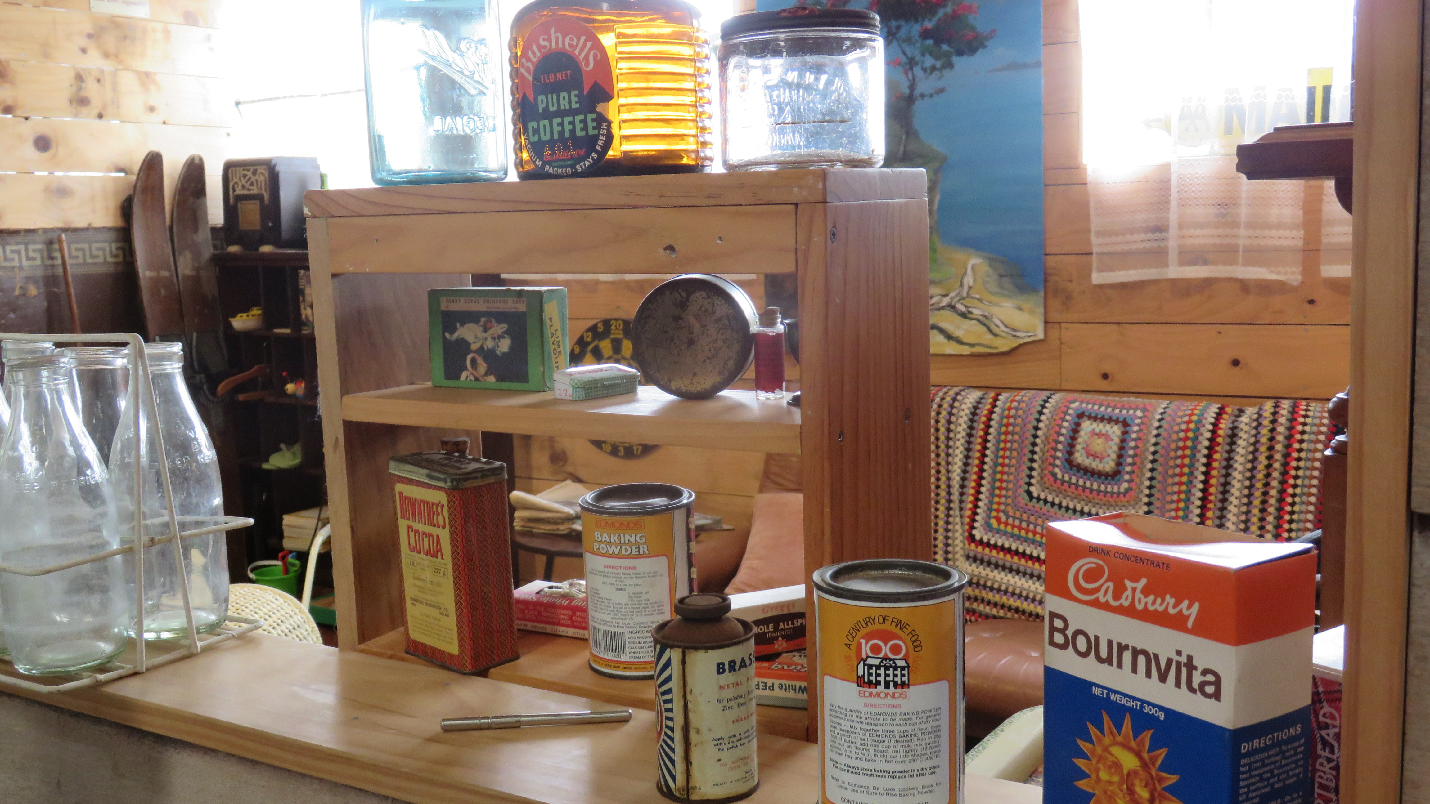
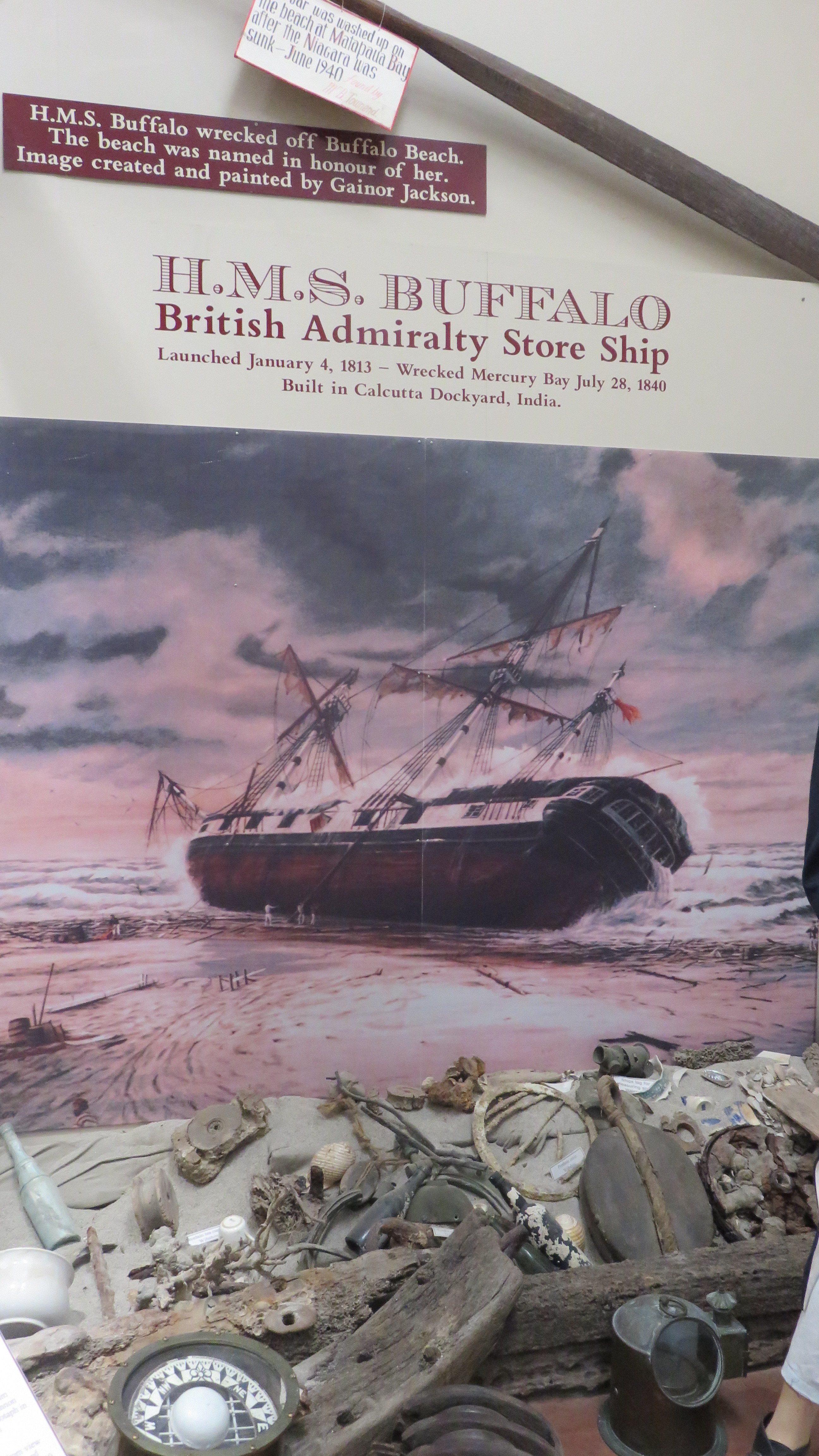
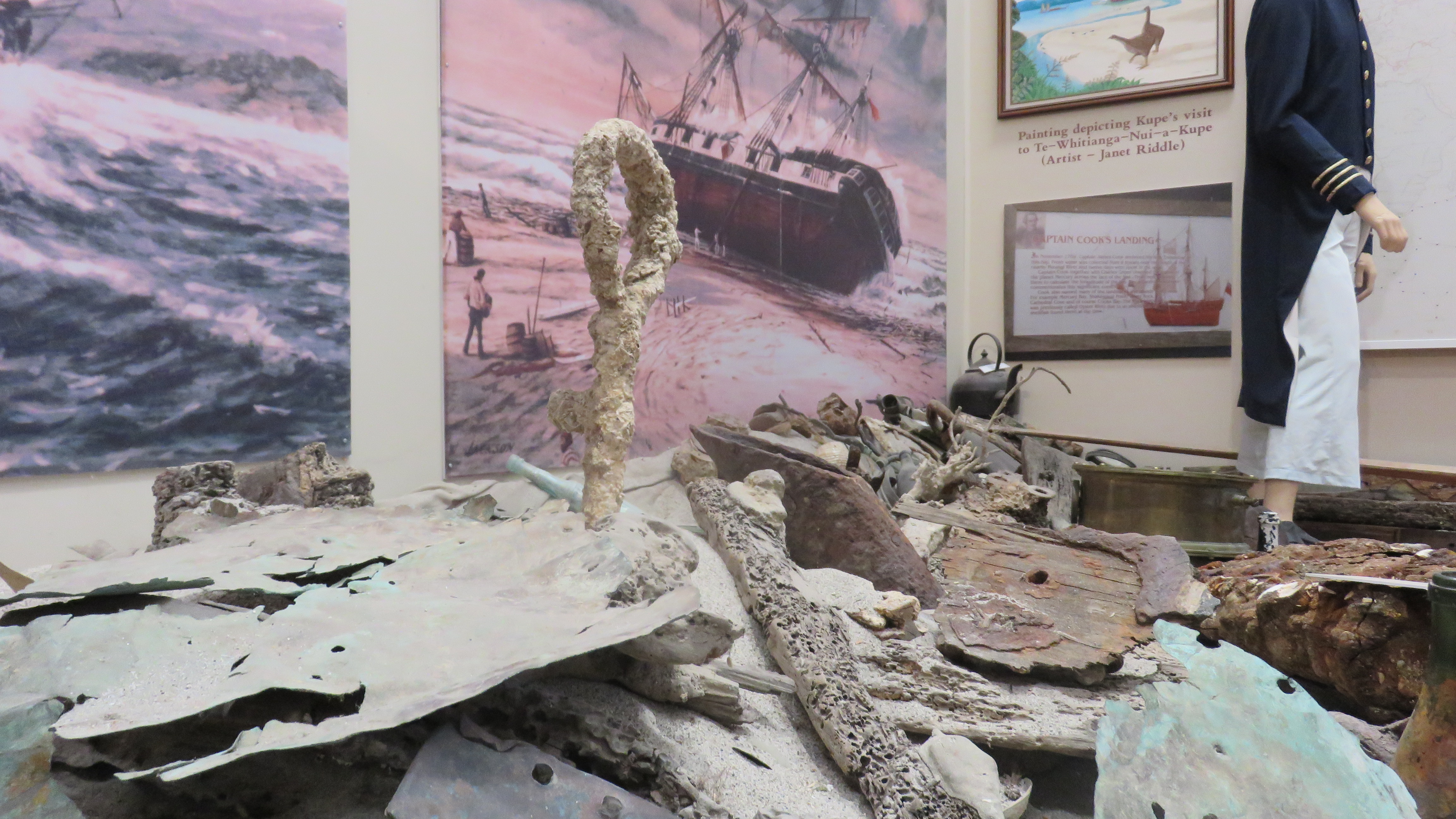
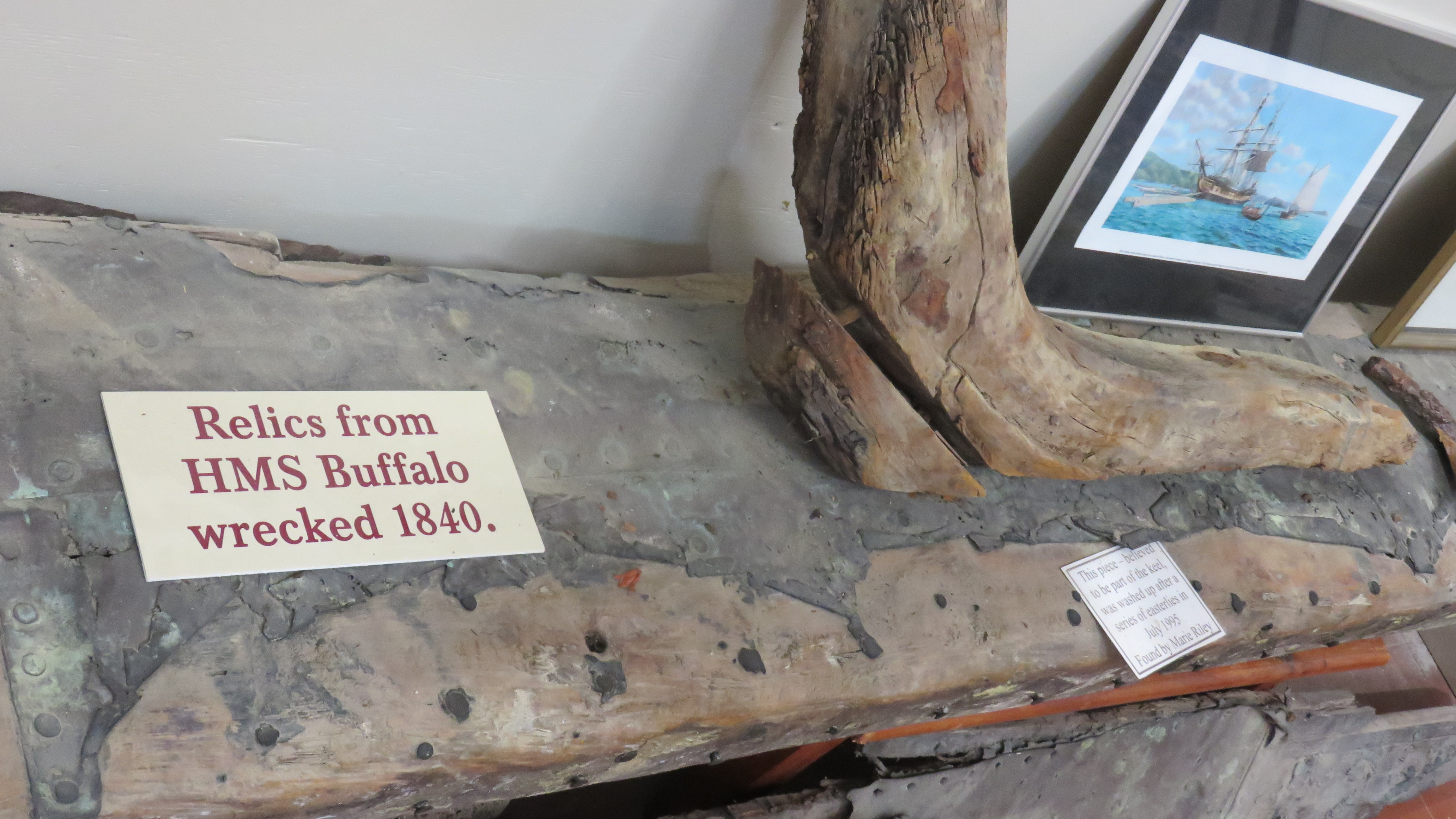
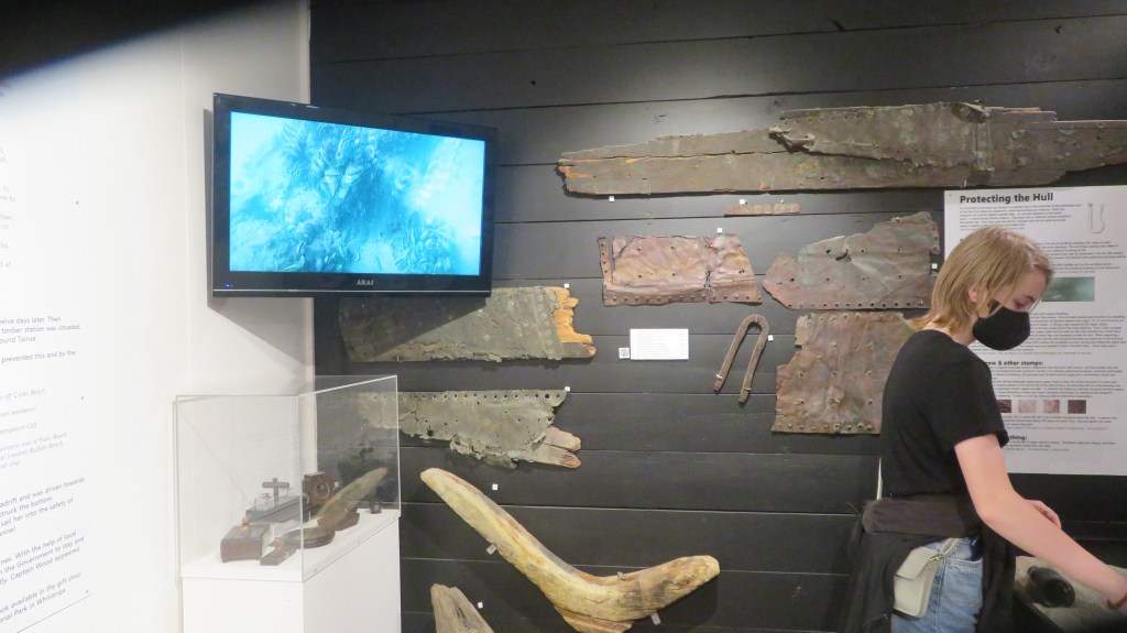
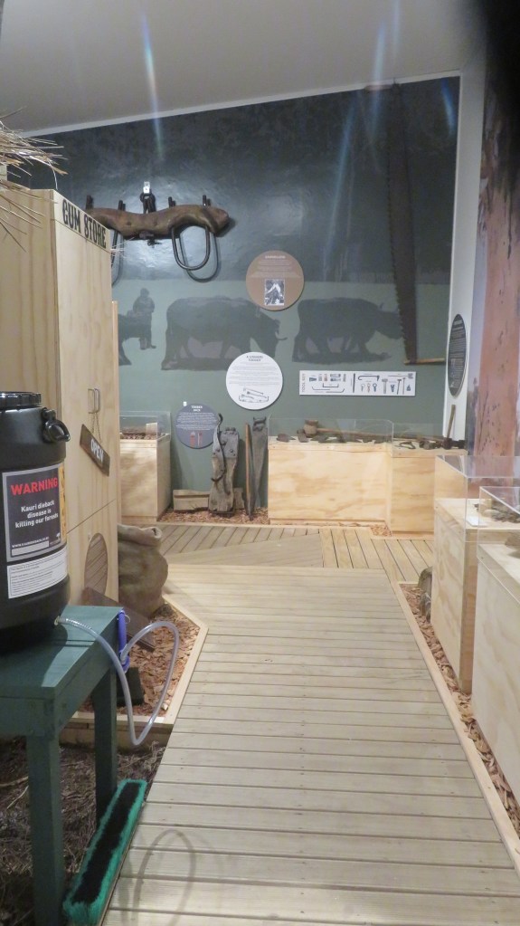
As you head further into the museum there is a significant display on the wreck of The Buffalo which gave the local beach its name (Buffalo Beach), the Kauri room and shanty shack – Kauri were an important part of the economy in the 1800s, either as logs or from the fossilied resin/gum – a 1950s school room, a 1960s bach, a smithy, two rooms displaying birds of the area and displays regarding the importance of the fishing industry (commercially and recreationally) and agriculture to the area. A butter churn display harks back to the days when the museum was once a dairy factory producing butter from cream from all over the Mercury Bay area. The musuem also holds an extensive collection of photos covering the life and times of Mercury Bay and its residents.
A Second Visit to the Mercury Bay Museum – February 2022
It had been a while since we had visited the Coromandel and even longer since we had been to Whitianga, so after many months of not venturing far from home we decided to have a short weekend break away.
I had heard that the Museum was in the throes of upgrading and improving many of its exhibits. A visit was needed to see for myself the work that was being done. Although the main bones of the museum are still intact and there is still work to be done, it was obvious the direction the museum was taking. Early Maori and their subsequent interaction with James Cook and his crew when he arrived in the bay was the focus for the front section of the museum.
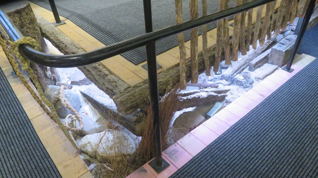
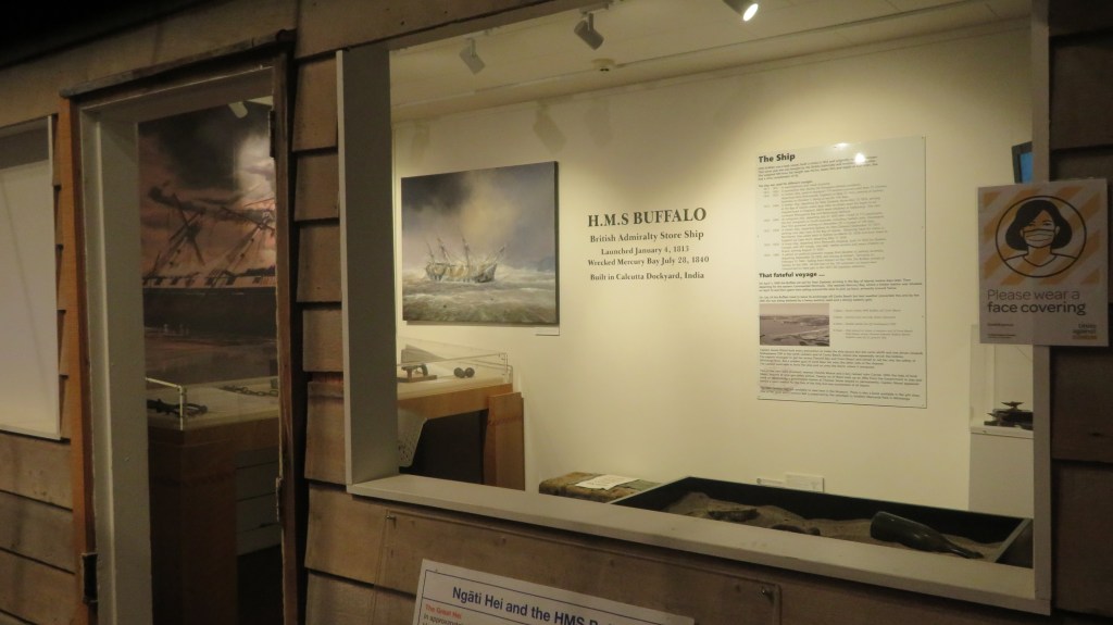
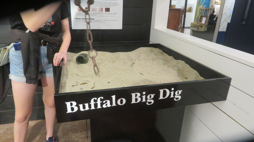
The rest of the museum was divided into distinct sections, the story of the Buffalo now had it’s own dedicated space, along with the story of the Kauri forests and the wildlife (past and present) of the area. Farming and fishing – the two main industries of the Coromandel – also had obvious and dedicated areas. Within each space there were opportunities for visitors to engage with the exhibits such as the ‘excavation’ of remains from the Buffalo or the watching the process of a milking pump.
All in all it was another enjoyable visit to the Mercury Bay Museum – I look forward to visiting again when all the work has been completed. The following are a few photos of this most recent visit.
A good use of space under the ramp leading down into the museum connecting the panels on early Maori to the time of Cook’s visit to the bay.
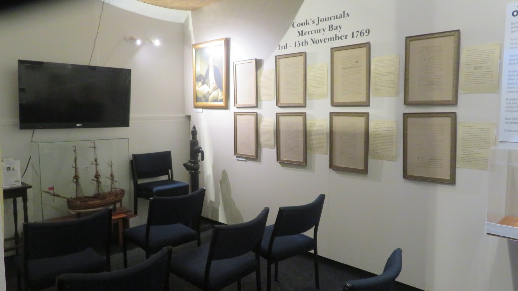
An audio visual presentation of Captain Cooks visit to the area alongside sections of his journals.
The brand new section on the past milling/logging and long term protection of the kauri forest.
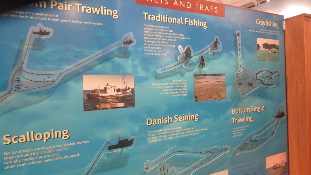
An information board on the different types of fishing methods – good to see that traditional methods have been integrated as part of the story.
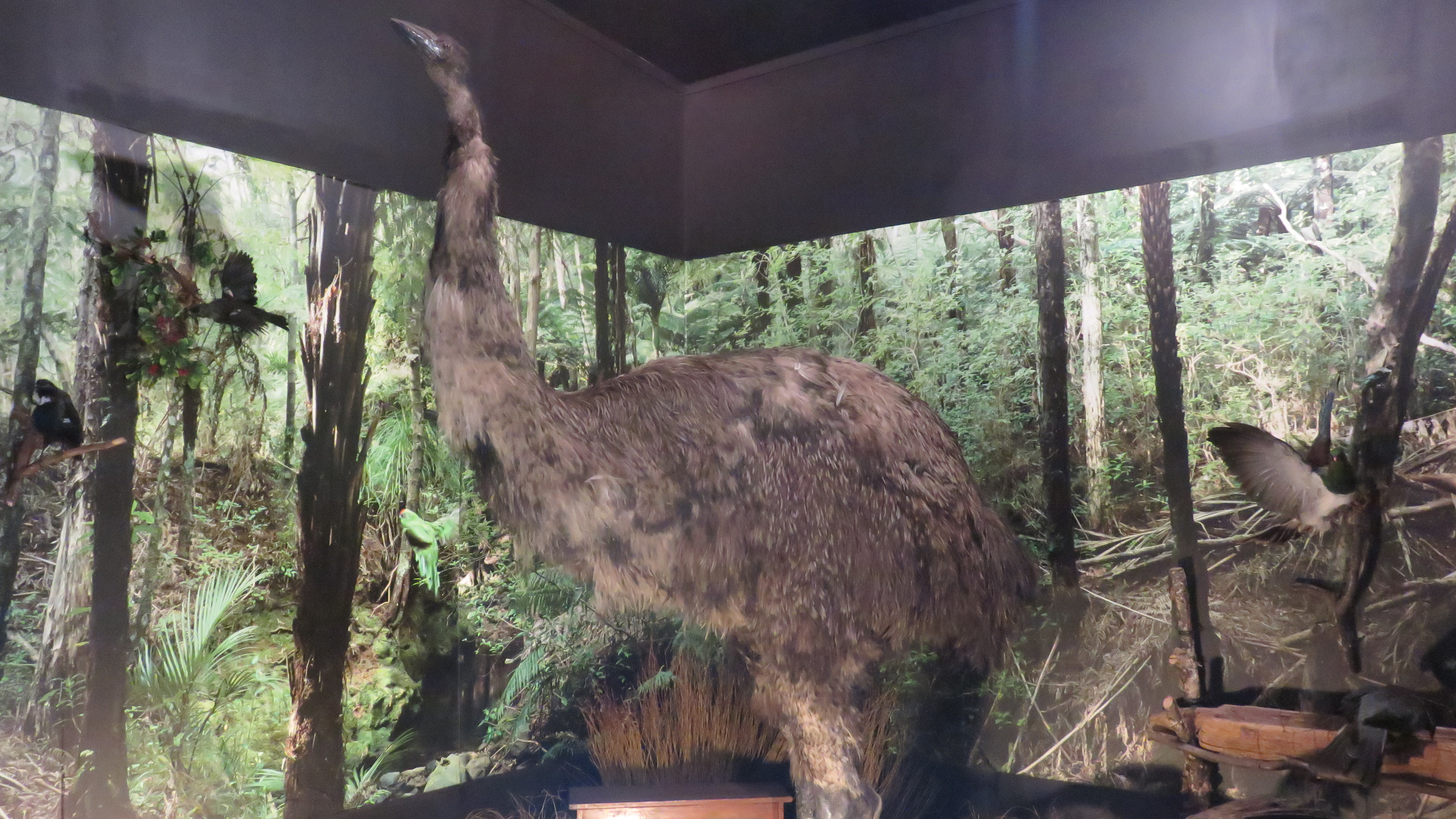
Everyone’s favourite – the moa…
There is a tendency for museums to over stuff the displays when it comes to rural life in the past – it is often hard to absorb information when there is so much clamoring for your attention. The above display was easily digestible with just the right amount of information to hold a visitors attention.
A small but perfect display on the Women’s Institute.
If archaeology is your thing (and it’s certainly mine) then Cornwall is a great county to visit with a mulititude of sites to visit, especially if you want to get away from the crowds and sitting on the beach has lost its appeal. From the outset I should point out the following are my favourite sites/landscapes to visit (it was quite difficult to keep it to just ten and yes they are mostly prehistoric sites), others may have different views – the list is purely my own opinion. Feel free to comment on your favourites.
1. Chun Castle and Quoit
Okay so I have cheated a bit – here we have two very different sites but their proximity to each other I think allows for a bit of cheating…
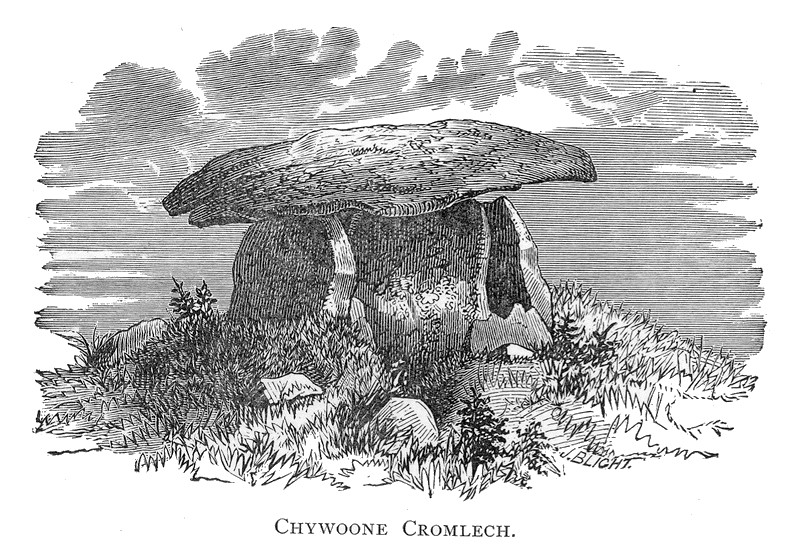
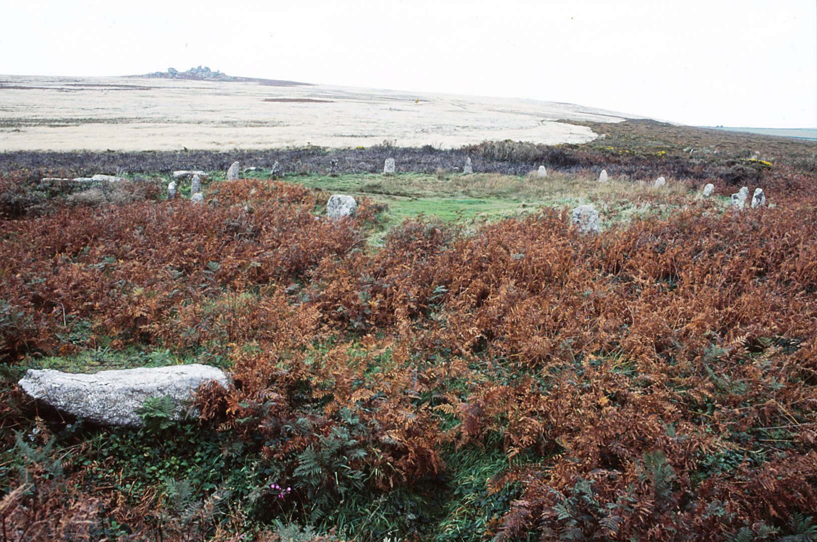
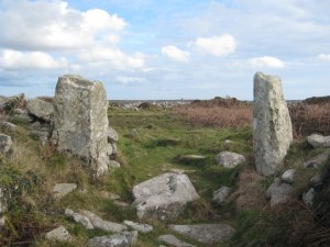
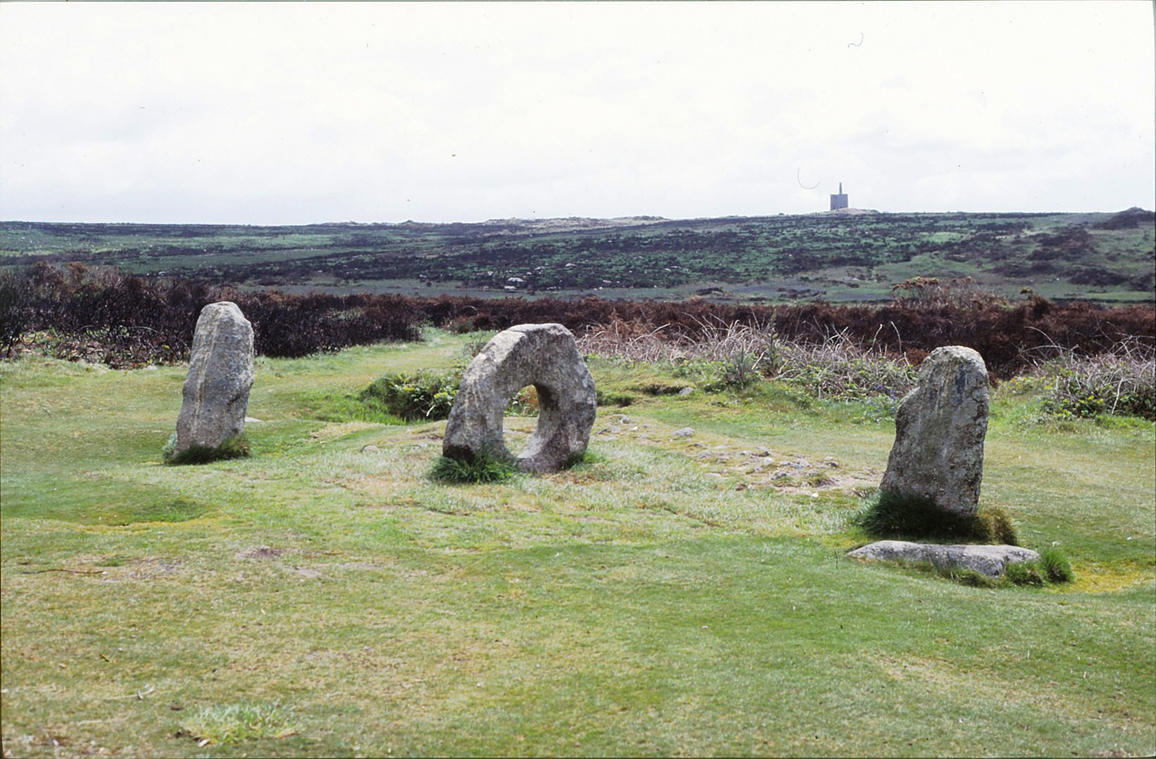
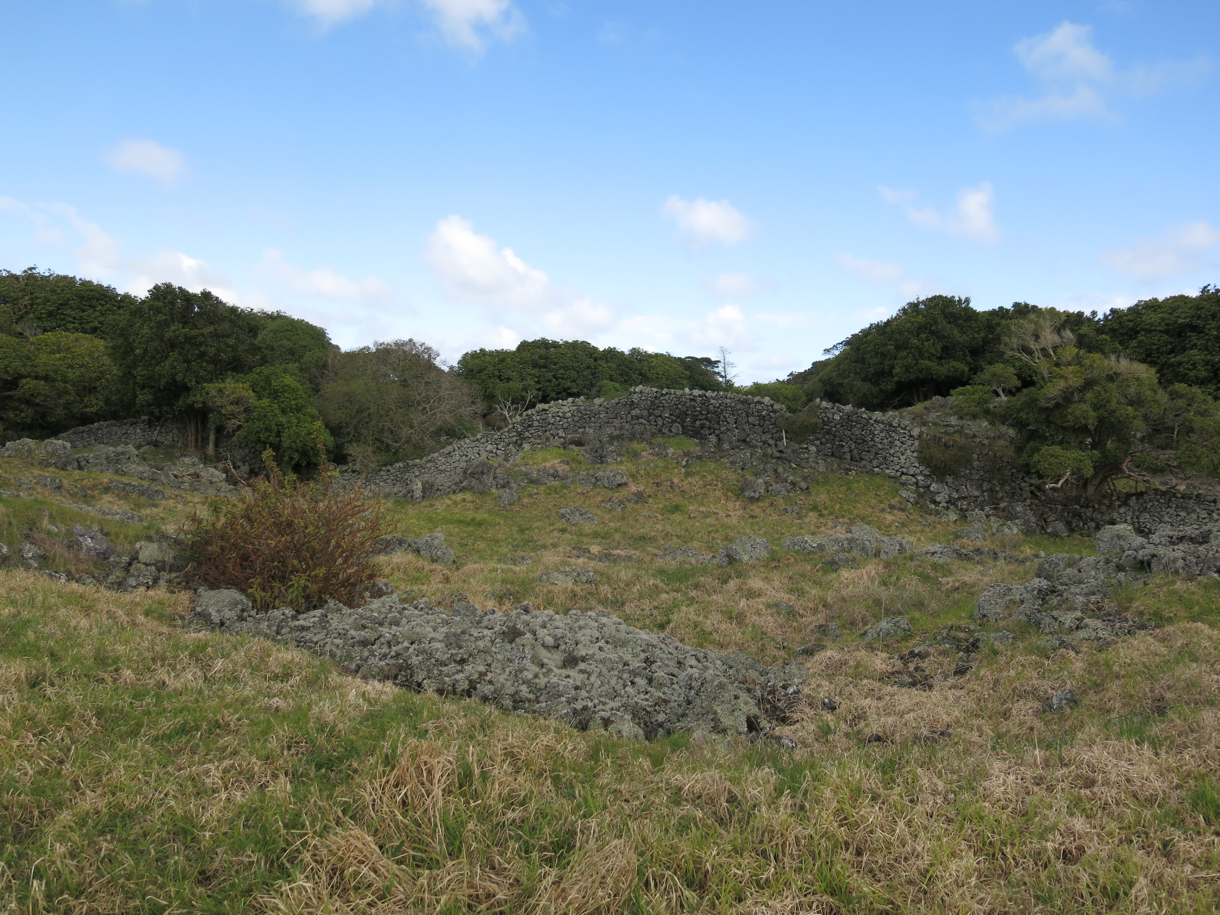
Firstly, Chun Quoit – quoits are neolithic monuments found throughout Cornwall (there are about a dozen known sites) consisting of upright granite slabs topped by a large capstone. They can also be called portal dolmens, chamber tombs or cromlechs. Some are in a better state of repair than others and Chun Quoit is perhaps one of the few which has been interferred with the least. Chun Quoit consists of four large uprights supporting a capstone which is estimated to weigh over 8 tonnes. It is also possible to see the remains of a circular stone cairn and associated kerbstones (the stone rubble at ground level) which would have originally surrounded the Quoit but not covering it leaving a the facade and the capstone visible.
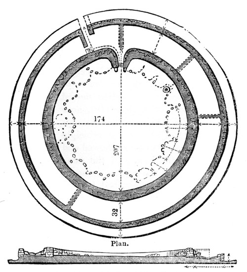
Two hundred metres to the east of the quoit are the impressive remains of Chun Castle. Unlike many other Iron Age hillforts which utilise an earthen ditch and bank system Chun Castle is entirely stone built. It consists of two large concentric stone walls and is 85 metres in diameter. There is some evidence that the hillfort was built over an earlier enclosure represented by a shallow ditch and low bank on the southwest side. Inside the hillfort there is a stone lined well and escavations during the late 1920s found evidence for a later post Roman occupation of the hill fort. Iron Age occupation consisted of at least a dozen round houses which based on the pottery found date the site to the 3rd and 2nd centuries BC. Sitting high on the ridgeway known as the Tinners Way the site would have been visible from many miles around, from here it is possible to make out several other hillforts in the distance such as Caer Bran. Below the hillfort about 500metres to the north east is the site of Bosullow Trehyllys – a courtyard house settlement of the late Iron Age (see the earlier post on Chysauster and Carn Euny), it is unexcavated but appears to consist of at least three detached courtyard houses and a number of round houses.
2. Chysauster
I wanted to include a courtyard house settlement in the list and it was a choice between Carn Euny and Chysauster. In the end Chysauster won mainly because it is easier to get to but also because the visitor can get a good idea of size of this unique house type. However, I would recommend a visit to Carn Euny too – the fogou makes it well worth while. I have discussed both sites already in a previous post – Chysauster and Carn Euny – A Unique Settlement Type – so won’t say much more than that.
3. Treryn Dinas
Treryn Dinas falls into the category of Iron Age cliff castle or promontory fort – one of many coastal headlands with Iron Age defences in the form of earthen or stone ramparts and external ditches usually across the neck of the headland. The term ‘cliff castle’ does not denote a particular function, some were large enough to have settlements within their walls, such as The Rumps and Trevelgue Head, others were much smaller and perhaps served as trading posts or lookouts. Treryn Dinas, however, appears to more than that – the visitor only need to look at the position and surroundings of this site to realise it is special.
Overlooking the beach at Porthcurno, the ramparts enclose a large rocky headland which contains the Logan Rock – a substantial boulder perched on the outcrop which in times past would rock in the wind and was only dislodged in 1824 by cocky young lieutenant and the crew of the HMS Nimble. The local people were rightfully upset at this and the lieutenant was charged to replace the rock at his own expense and with the help of the admiralty it was eventually returned to its original position, although it is said to no longer rock as easily as it had done once before.
According to folklore the earliest inhabitants of the headland were the giants who protected the neighbouring communities in return for cattle and other necessaries. Giants are a common feature in Cornish folkore and seem to be particularly associated with large outcrops of granite which feature in the landscape. From an archaeological point of view Treryn Dinas has four lines of defence with the last crossing the low neck of the headland. It consists of a deep ditch and a stone faced wall behind which are the foundations of two buildings either side of the presumed entrance. The general view is that this site is one of spiritual significance which may date many centuries earlier than the Iron Age. Finds of Bronze Age pottery have been found wedged in the crevices of the outcrop, the Logan Rock itself may have been seen as supernatural and there is the problem of that fourth line of defence. You will note in the photograph below that this line of defence is not particulary defensible as it easily looked down from the landward side, in addition the amount of useful land on the headland is extremely limited and the only thing the fourth rampart is ‘protecting’ are the rocks themselves.
Looking to the headland – below the rock outcrop is the remains of the internal wall protecting the headland.
The substansial outer bank on the landward side.
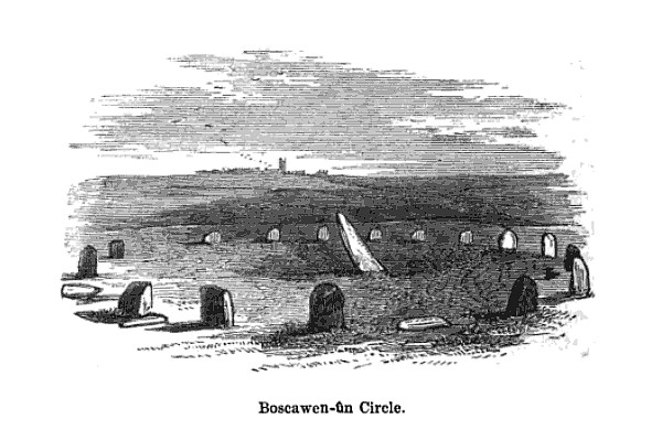
4. Boscawen-Un
In the parish of St Buryan is the stone circle of Boscawen-Un, dating to the early Bronze Age and consisting of nineteen stones there are several interesting features of the site. The most obvious is the stone which is slightly south of center, it leans sharply towards the north east and at its base there are two very faint relief carvings of axe heads. A past student once suggested to me that the stone itself looked like a large stone axehead which had been struck into the ground. Minor excavations have further revealed that its leaning position was intentional and not the result of subsidence. The second interesting feature of this stone circle is the large block of quartz to the south west which is part of the circle. Our understanding of the role of quartz within prehistoric rituals is poorly understood but there is an increasing amount of evidence which points to its importance.
Okay, so now I really am cheating but the fact is any visit to Cornwall should definitly include a fogou and I couldn’t decide which I preferred – Carn Euny or Halligye are the easiest to get to and Halligye the largest (it can be found on the Trelowarren Estate, near Helston) however, Carn Euny does have a courtyard settlement, the nearby hillfort of Caer Bran and the fogou itself has a beehive shaped internal chamber. So you can see my dilemma…I have already written about fogous in an earlier blog so shall not rehash what we know and don’t know about these enigmatic structures.
The entrance to the fogou at Chysauster.
6. Carn Brea
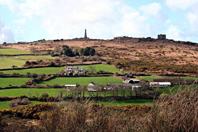
Situated between Redruth and Camborne is long hill easily visible from the A30, it is a hill with a long history beginning as far back as the Neolithic. Today two features stand out the most, firstly the the tall monument on the central summit erected in 1836 in the memory of Francis Bassett of Tehidy and the second is the small medieval castle perched on an outcrop. The latter was most likely a hunting lodge belonging to the Bassetts, an ancient local family and was first recorded in the fifteenth century. The land surrounding the hill was prime tin mining country and the flanks of the hill are covered in shafts and pits.
Heading further back in time the astute visitor might notice the remains of eleven Iron Age roundhouses on the saddle between the east and central summits, these are part of a much larger settlement on the hilltop, set within a substantial hillfort of forty-six acres. The defences are made up of two ramparts enclosing the hill. However, the occupation of Carn Brea began much earlier in the Neolithic. Surounding the eastern and central summits are another two smaller enclosures, of these the eastern summit has been partially excavated. The date range showed that the ramparts had been built somewhere between 4000 and 3500BC, making it the oldest known fortified settlement in Britain. There were traces of wooden buildings and Neolithic pottery, in addition a large number of flint arrowheads (700+) were uncovered along with evidence for the destruction of the site suggesting the site had been under attack (Cornish Archaeology, 1981, 20).
Looking east the 15th century castle can be seen in the distance. In the foreground the remains of one of the Iron Age roundhouses is visible as a semi circle of stones.
The path through the inner Neolithic enclosure wall.
Winter is the best time to visit – the outer ramparts are clearly visible.
7. Trevelgue Head
So many visitors to Cornwall will invariably end up in Newquay without realising the long and fascinating history of this seaside town. Just north of St Columb Porth on the road to Watergate Bay is the impressive cliff castle of Trevegue Head. It is the most heavily defended of all the cliff castles with seven lines of defence. The first ditch and bank is not so obvious as the next six with largest bank being roughly four metres high. Erosion over the centuries has seen much of the land disappear and it is suggested this included the original entrance. Excavation in th 1930s demonstrated that Trevelgue was continously occupied from the thrid century BC until the fifth/sixth century AD. At least fourteen roundhouses were identified (it is still possible to see the house platforms with a keen eye). Given its position in the landscape, the sheer scale of the defences, some of the artefacts found (bronze horse harness and Roman coins) in addition to the significant amount of evidence for both bronze and iron smelting, it is fair to say Trevelgue Head was most likely a high status site, the home ground of someone of great import.
The importance of this headland and other similar to it along the coast is further attested to by the presence of the two bowl barrows dating to the Bronze Age – these were opened in late 1800s but nothing is known of their contents. Further along the coast is Trevelgue Downs where a further two barrows can be seen. In the eastern barrow a crouched adult skeleton was found within a stone cist with a stone battlexe close to hand. From personal experience I have walked this cliff castle many times and it was not uncommon to espy tiny Mesolithic flints protruding from the exposed edges of the paths. Further testament to the sites long history.
Looking towards the end of the headland. On the right is the first of two Bronze Age barrows.
Eroded banks and ditches of Trevelgue Head.
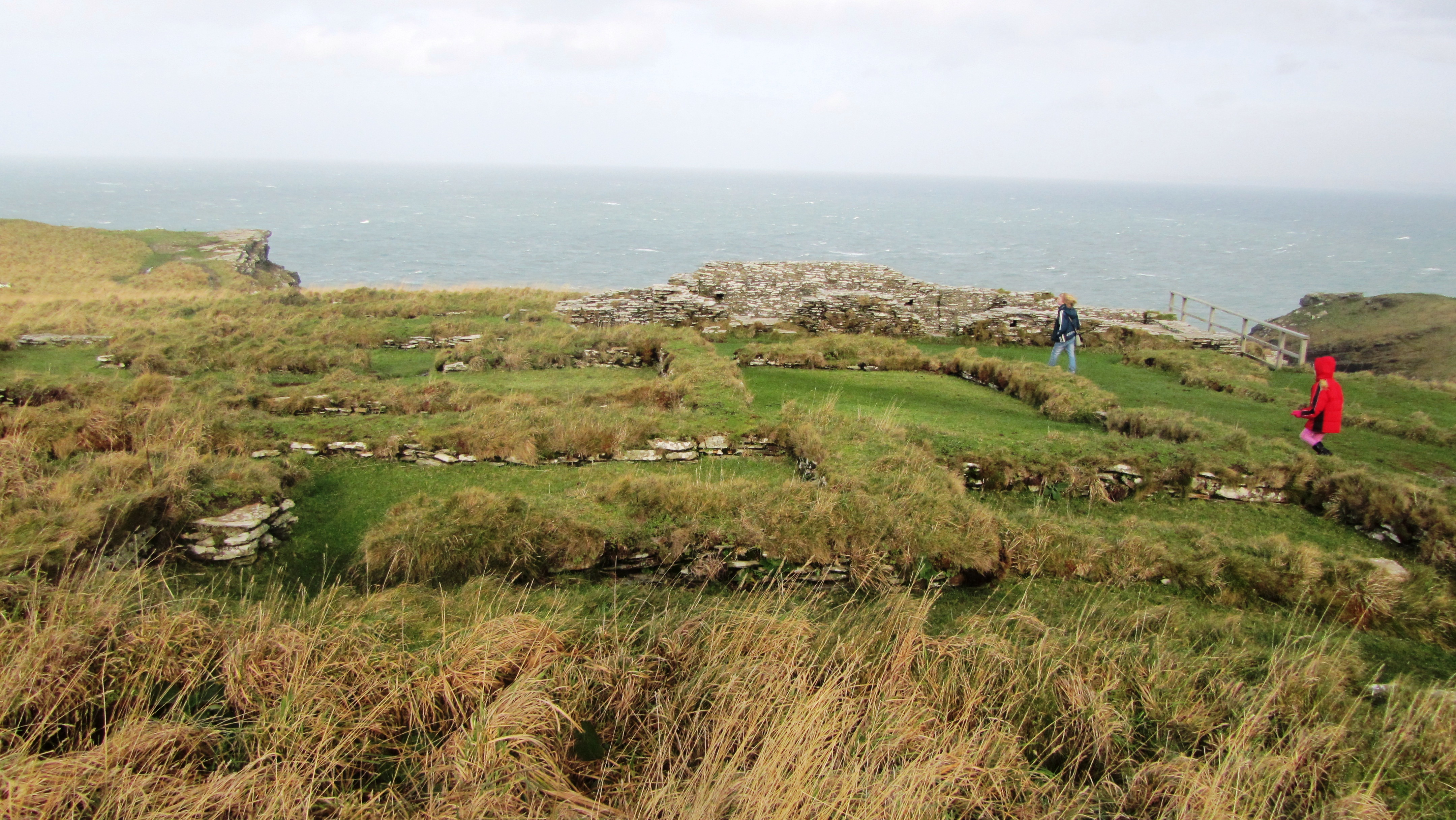
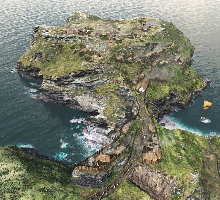
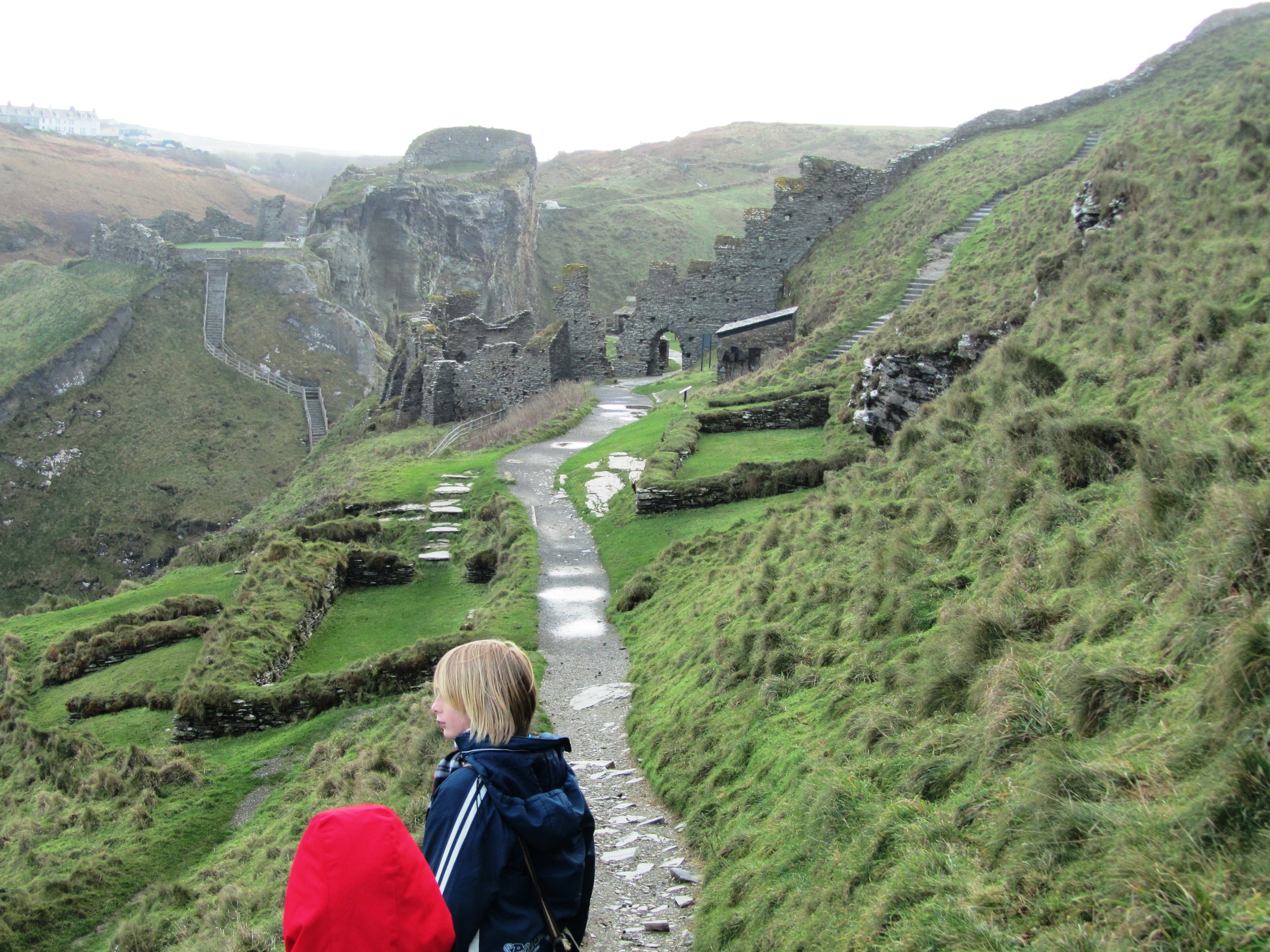
8. Tintagel
It had to be on the list – perhaps one of the most controversial of all sites in Cornwall from local resistance to English Heritage’s plans for the site to the myriad of myths and legends associated with Tintagel – no where captures the imagination more. Like several other sites on this list I have already waxed lyrical about Tintagel so will not bore the reader with much of the same (but do follow the link if you want to seperate fact from fiction).
9. Castle an Dinas
An impressive example of an Iron Age hill fort found in mid Cornwall near St Columb Major. Measuring 260m across it would have been a formidable place in its heyday, the substantial ramparts are visible for many kilometres even today. There is some faint evidence for a much earlier enclosure on this hilltop possibly dating from the Neolithic or Bronze Age and the presence of two Bronze Age barrows within the hillfort is further testament to the importance of this place throughout prehistory. In the early 1960s a relatively small excavation was undertaken with the idea of prove the tradition of such places being re-used during the post-Roman phase and although they failed to do this a fine cobbled road was found.
The earthworks of Castle an Dinas – note the commanding view from the hillfort. Photo by Mike Hanncock (geograph.co.uk)
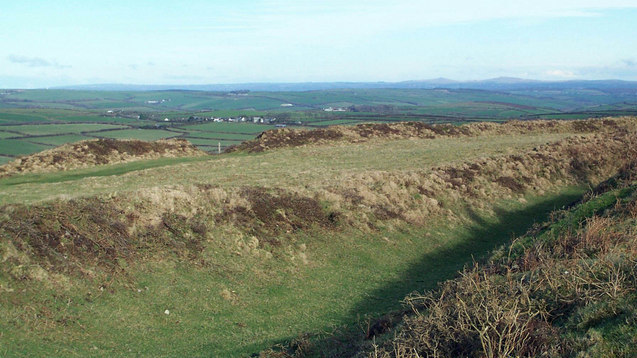
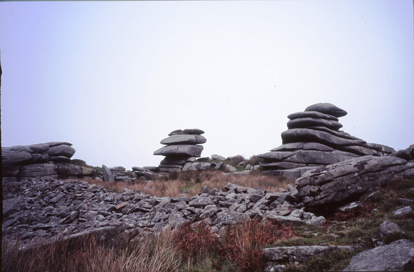
10. Bodmin Moor
Yes I know this really is cheating…but no list of sites to visit is complete with at least one from Bodmin Moor. However the problem is I could not choose just one, there are so many wonderful sites to visit on the moor. Like its much larger cousin in the next county over, Dartmoor, Bodmin Moor has a wide variety of archaeological sites to visit beginning way back into the Mesolithic (flint scatters possible representing seasonal camps as found on Butterstor) and the Neolithic such as Stowes Pound and Rough Tor which are thought to be tor enclosures similar to Carn Brea and Trencrom further to the west, but it is the Bronze Age which dominates the archaeological record.
There are stone circles, stone rows, menhirs, barrows (earthen mounds), cairns (stone mounds) and of the latter there is in excess of 300 known. The most well known barrow is the Rillaton barrow which is the largest on the moor and where an individual was buried with a bronze dagger, an urn and a beaten gold cup.
“…the distribution of the monuments throughout the whole of the upland suggests that its use had intensified enormously. Virtually every block of land (as defined for example by prominent hills and divided by rivers and streams) is marked by a group of cairns, as if all available land was claimed and accounted for. The analysis of fossil pollens fromthe ancient land surfaces sealed beneath the excavated cairns shows that by this date the upland was predominantly open grassland, with woodland confined to the steep valley sides.” (Herring P & Rose P Bodmin Moors Archaeological Heritage pp17-18)
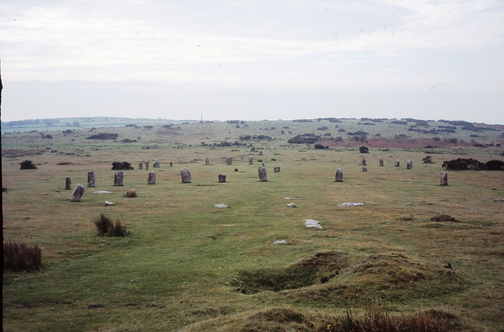
There are sixteen known stone circles of which the best known is the Hurlers. All the circles seem to have been placed carefully within the landscape – nearly all are within sight of tor which is always to the north of the circle, with Roughtor being the most dominant (nine of the sixteen circles). The stone rows, menhirs and embanked avenues are not as numerous but still make up an important part of the ritual landscape.
A feature of the later Bronze Age landscape of the moor is represented by the vast numbers of settlements represented by field walls and the stone foundations of round houses. There are approximately 1500 prehistoric round houses representing around 200 settlements and although only three have been excavated they are assumed to be all by analogy with Dartmoor to belong in the second millenium BC. Often found associated with these settements are field systems of varying shape and size best seen from the air and on large scale maps.
Ar around 1000BC a deteriorating climate and soils resulted in most settlements being abandoned and the use of the moor being less intensive. The hillfort sites of Bury Castle, Cardinham and Berry Castle are the only easily identifiable settlements of the Iron Age, although it is assumed that the moor continued to be used for the seasonal grazing of livestock, much as parts of it are today.
Stowes Pound – the tumbled wall of stones in the foreground represents the early and possibly Neolithic enclosure wall.
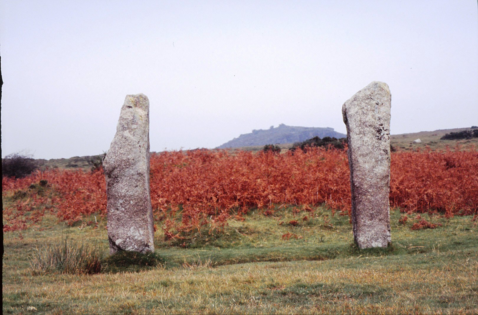
Two upright menhirs frame the view to Stowes Pound and the Cheesewring.
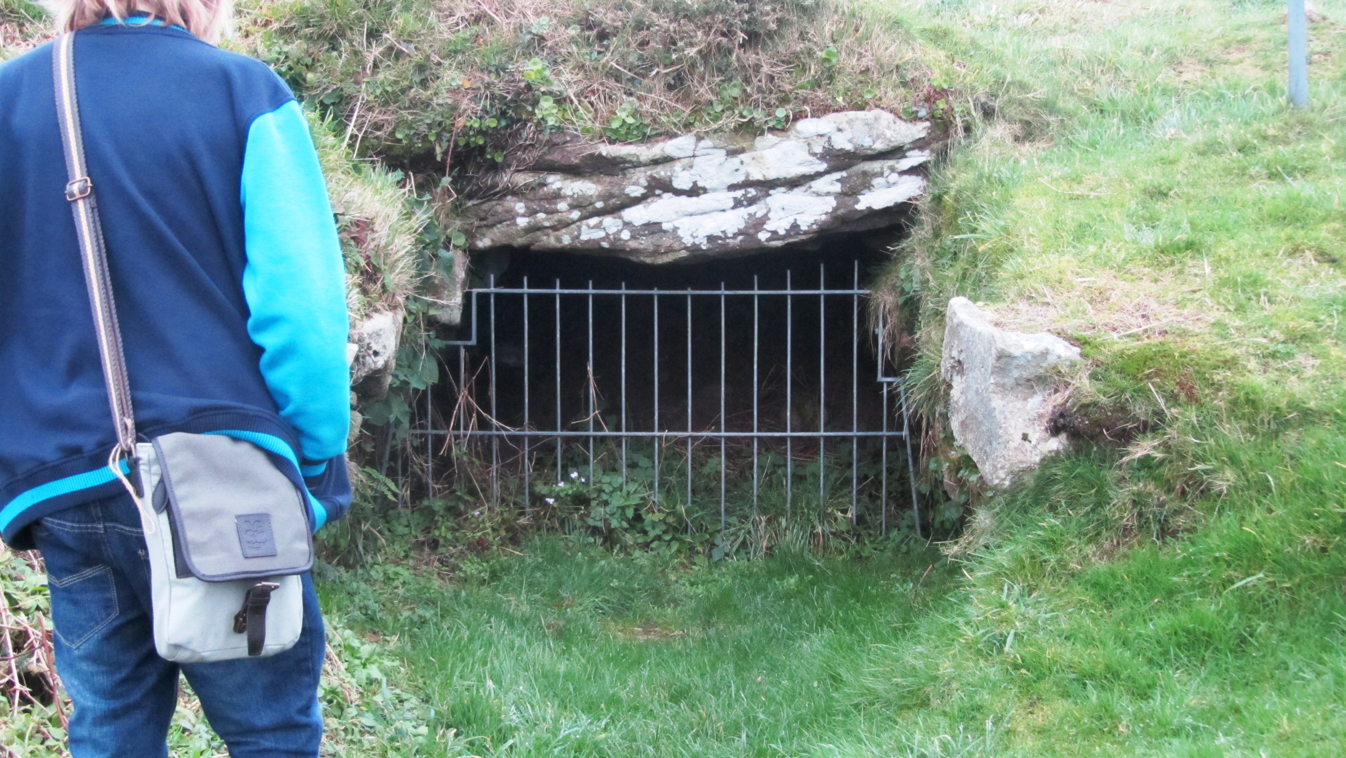
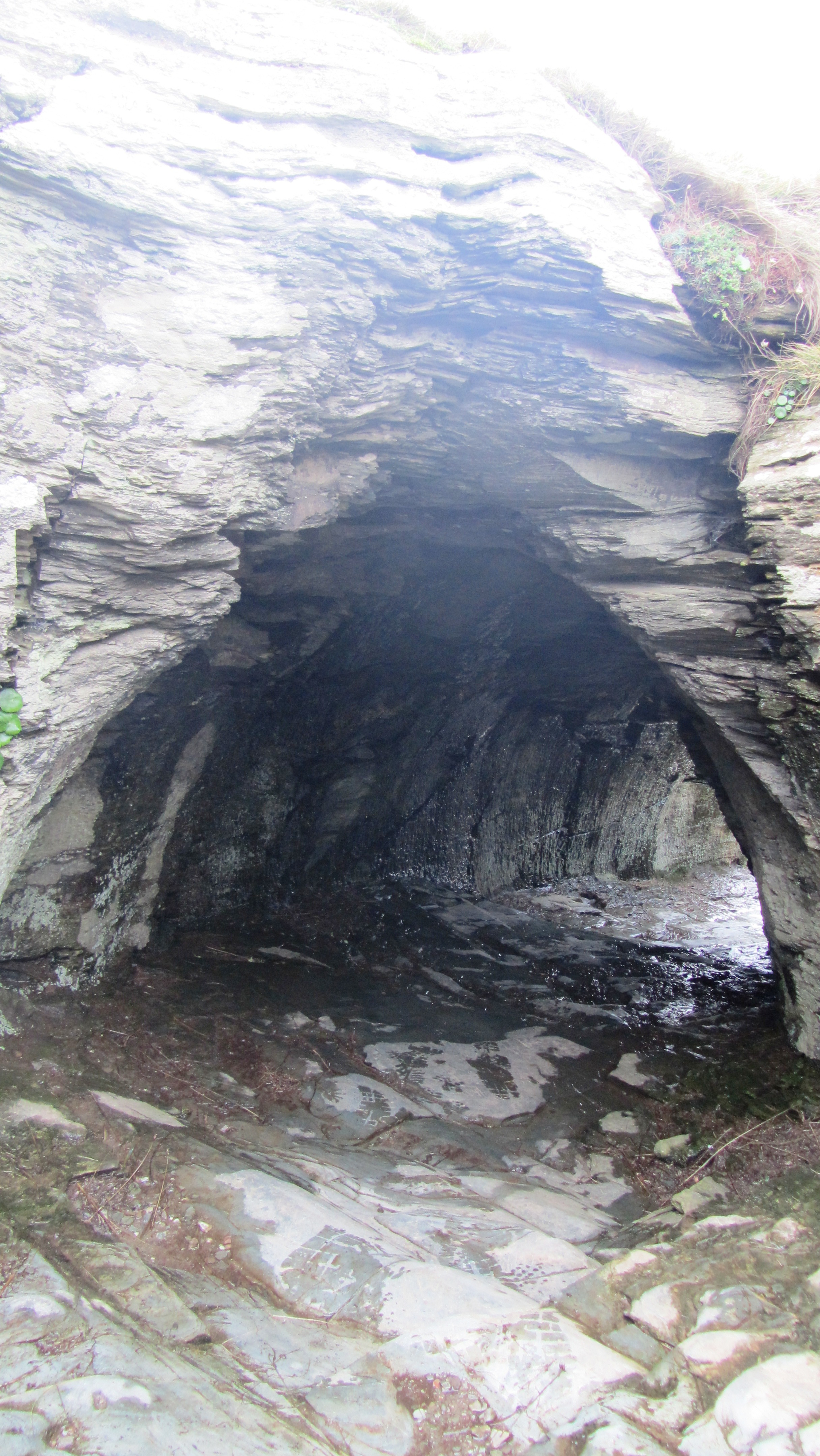
Before we delve too deeply into fogous and the mystery surrounding them it is probably a good idea to describe what a fogou is. The word ‘fogou’ is very simply Cornish for ‘cave’ and this gives us our first clue. It is, in essence a subterranean (or semi-subterranean) structure. Occasionally other writers will compare the Cornish fogou with the Scottish or Irish souterrain but beware of this pitfall; the Cornish will not thank you for it.
The structures in themselves are “…a low passage walled with dry masonry and roofed with large stone slabs, generally but not invariable underground and generally attached to an Iron Age settlement.” (Weatherhill, Pool and Thomas 1980 ‘The Principle Antiquities of the Land’s End District’).
The passagway at Halligye Fogou on the Trelowarren Estate – photo by Jim Champion (geograph.co.uk)
Typically, fogous vary between 12 to 15 metres in length and 1.5 to 1.8 metres in width. The passage walls have a degree of curvature with courses of corbelled masonry to reduce roof width and in most cases the passage itself curves or branches making it difficult to see the end as you enter. Most have a wide accessible entrance today, but it does seem that for many the original access point was a low restrictive doorway called a ‘creep’.
As mentioned before fogous are almost always associated with a settlement dating to the Iron Age and for many they would have been the only stone structure within that settlement. The distribution of these sites is restricted to areas west of the Fal Estuary with the majority being in West Penwith. There are at least twelve sites known for certain and at least another a dozen or so possible sites suggested from placenames, fieldnames and those described by past antiquarians. For example, the West Penwith Survey identified one such site at Lower Leah from a description left by J T Blight in 1850 of a subterranean chamber in which burial urns and fused tin were found.
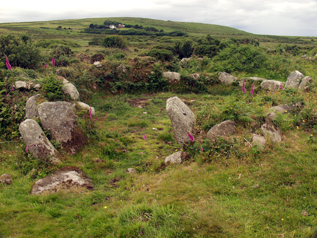
No two fogous are exactly alike and to further emphasise this, the structures at Carn Euny and Bosporthennis each have what is known as a ‘beehive hut’. The name is something of misnomer as the structures were highly unlikely to have anything to do with bees or bee keeping. The name was given due to the shape of the chamber, which resembles a beehive.
Excavations at Carn Euny during the 1960s and 70s depict a settlement which was occupied for about seven hundred years from around 500BC. There were several phases, the earliest consisted of timber structures and the last was the construction of the stone courtyard houses which are visible today. The ‘beehive hut’ is associated with the earliest phase of settlement, a second phase of roundhouses are associated with the construction of the long passage and by the time the courtyard houses were constructed the passage was made to link into the courtyard house north of it.
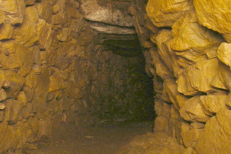
Inside the fogou
Inside the beehive
The entrance to the fogou at Carn Euny – not the original entrance.
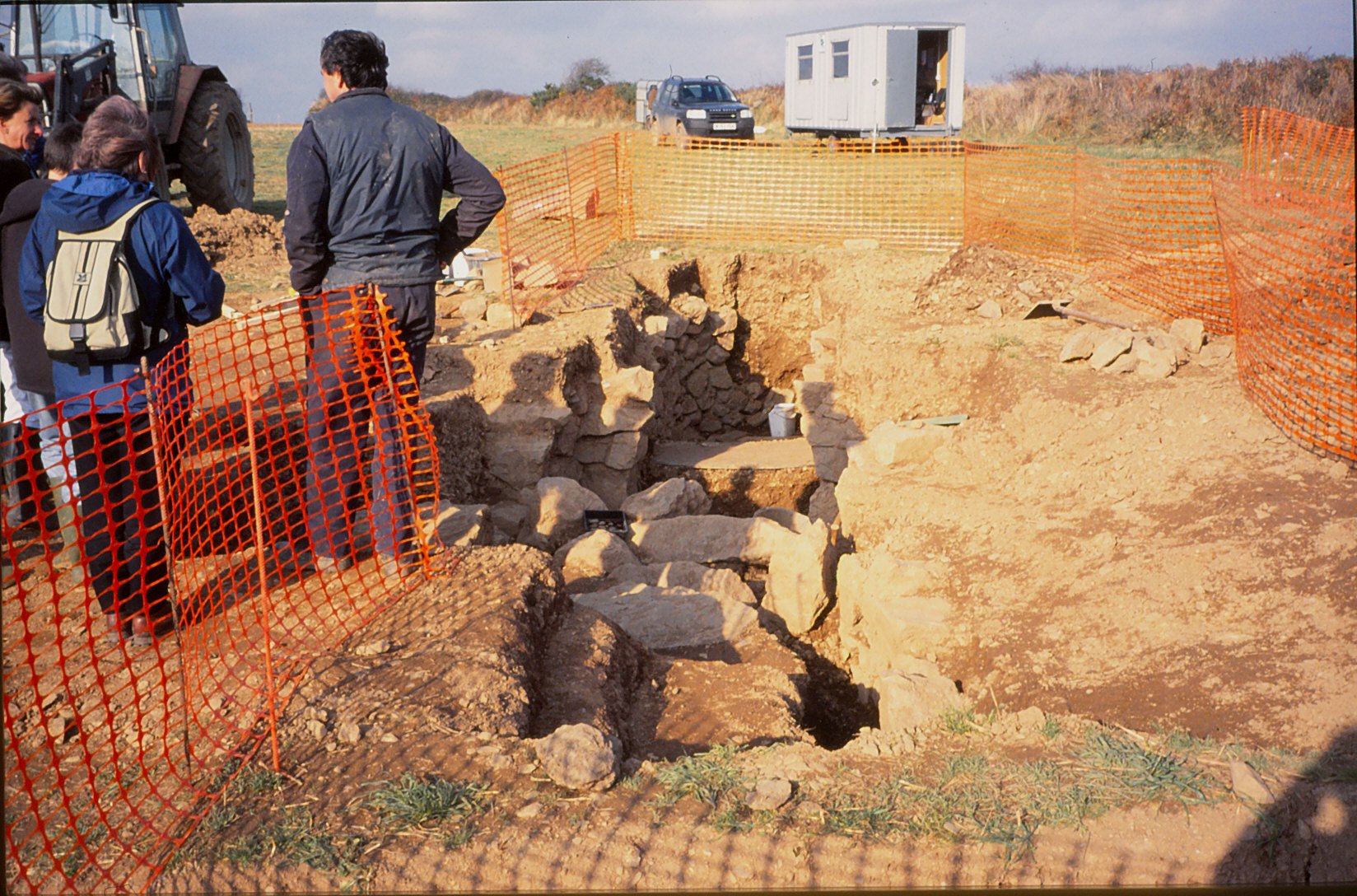
The most recent fogou to be excavated is that of Boden Vean on the Lizard Pennisula. This particular site was first recorded in 1816 by the vicar of Manaccan and then was promptly lost. In 1991 the current landowner was having some pipe work done in a field when a cavity emerged and the fogou was rediscovered. Geophysical survey identified several anomalies, one of which turned out to be a Bronze Age roundhouse and subsequent excavations demonstrated that the fogou was part of an enclosed Iron Age settlement known as a ‘round’ (which can rather confusingly be anything but round…).
Bodean Fogou under excavation.
Fogous and their Function
What were fogous used for? This is the heart of the mystery. The lack of consensus, of agreement as to what the function of a fogou is defines Cornish archaeology and archaeologists. There are three possible explanations – a place of refuge, storage and ritual. Lets’ examine each of these in turn.
Refuge – this particular theory has generally fallen out of favour. The argument against this theory relates to the accessibility of the fogou. When most fogous were built the only access was through the creep and whilst it is an easy enough task to crawl through if you are young, fit and not claustrophobic, an elderly or infirm person would find it difficult. The second point against this theory is the lack of an exit strategy. It would be an easy enough task for any would be raiders to smoke out the people hiding in these passages, there are no air vents and no other way out. The third and final nail in the coffin relates to the overall position of these structures within the landscape, many are situated within easy distance of well defended site such at Carn Euny with the hillfort of Caer Bran only a short distance uphill.
The orignal entrance at Carn Euny known as the creep.
Storage – for many archaeologists this is the prevailing theory. Comparisons are often made to souterrains found in Brittany, Scotland and Ireland which did have a more utilitarian purpose and are often of very different dates. However, Ian Cooke suggests that the fogou is not an imported concept, they “…represent a continuation of long established local megalithic traditions.” (Antiquities of West Cornwall 3 Carn Euny Village and Fogou).
In Cornwall there is a tradition of building places of storage, these are called ‘crows’ or ‘hulls’. A crow is a small stone hovel used to store tools, fuel and in some cases livestock. They are often built into the side of a field hedge or bank and most are at best two centuries old. A hull is a chamber dug out of the ground and faced with stone; often there will be a lintelled doorway to prevent collapse. They are found close to settlements and were used to store perishable foods. These structures were common from around fourteenth or fifteenth century.
However, the argument against the use of fogous as a place of storage considers how damp and airless they are (a visit to any fogou requires a pair waterproof shoes at anytime of the year). Research has shown that the only foodstuffs suitable to storing in this environment are beer and dairy produce. There is also the accessibility issue, clambering down the creep with a barrel of beer is not the most efficient means of storing your excess foodstuffs. It is possible that the fogou did change in use over time, the later opening up of the fogou during its last phase at Carn Euny would have made it a better option for the storing of foodstuffs.
A secondary argument also looks at the effort required to build the fogou and as mentioned before, at the time of construction it would have been the only stone building in the settlement. Both suggest that the fogou was a socially important structure, which leads us the final possible explanation.
Ritual – some archaeologists tend to shy away from using ‘ritual’ to describe a sites function. This is a backlash from criticism in the 80s and 90s when archaeologists were accused of using ‘ritual’ as a definition when nothing else fitted. The term was certainly bandied about…even so, the idea of the fogou as a place of ritual does need to be examined because interpretations as places of storage or refuge are at this point unsatisfactory.
The entrance to the fogou at Chysauster.
Ian Cooke has spent a substantial amount of time recording and analysing fogous throughout Cornwall. For him and many others involved in earth mysteries fogous were definitely places of ritual. Cooke found that all but two were ‘symbolically’ aligned to the rising midsummer sun and the two that weren’t were aligned on the setting of the midsummer sun. He says symbolically as at the time no light would have entered the passages. The importance of midsummer needs no explanation here. Some archaeologists have questioned these alignments but have noted the monumental nature of the fogou, drawing analogies with a medieval church within a settlement of less substantial structures (P. Herring 1994 CA Journal 33).
Cooke also noted how “…the majority of fogous, where sufficient remains can be traced, have the northern end of their long curved passage aligned north-east to correspond with the prevailing direction taken by the subterranean mineral lodes…” Drawing a connection between the tin trade and the construction of the fogous, perhaps it is not unsurprising then when we here of small finds of fused tin found inside the passages and in the backfill of the creep such as at Carn Euny.
“…the rationale behind building fogous was the need to provide a place of contact between the plunderers of the earth and the dieites believed to control the fertility of the land and the mineral wealth beneath it, and that these places were used for the performance of rituals related to the pagan religion of Iron Age West Cornwall in which a Sun God and Earth Mother Goddess formed the central element.” (Ian Cooke The Mother and the Sun 1993).
It has also been suggested fogous may have been a place where important rituals took place which relate to transformation such as when a child becomes an adult or during death. The dark places of the world have always represented an otherworldliness to human beings, even to this day, caves are regarded as special places.
The more sceptical who argue against a ritual function point out, “by and large fogous lack obvious design features or contexts that make them stand out as undoubted ritual structures,” (P. Rose ‘Shadows in the Imagination: Encounters with caves in Cornwall CA Journal 2000/1). The argument follows that because we have been unable to identify any elements within Celtic belief that may be associated with the fogou then a ritual function is unlikely.
However lets briefly consider what we do know, it is fairly well understood that the people of the Celtic Iron Age attributed all aspects of the world around them with a spirit of some kind and that ‘no activity however trivial would have been entered into without some thought for the attitudes of those who inhabited the other world’ (B Cunliffe Facing the Ocean 1995). Surely this would have extended to the extraction of tin and other metals from the ground.
“As tin extraction is an activity that is unique to Cornwall, particularly west Cornwall, is it not possible that the fogou is a unique regional response to this,” (TM Rowe Cornwall in Prehistory 2005). The continuing fertility of the land and its mineral wealth would have been important concerns in this period.
All of the folk stories which surround fogous can be traced back to one of three themes.
It’s the location of hidden treasure.
They have impossibly long passages.
Associated with demons, witches, giants and other ‘dangerous’ creatures.
Thus, Piskey’s Hall was long thought to contain fairy treasure, at Boleigh there was a belief that the passage ran for many miles under the Penwith landscape and at Pendeen Vau there is a tale of a young woman dressed in white and carrying a red rose appearing at the mouth of the fogou on Christmas day. It is said if you see her you will die within the year.
There were giants at the fogous of Lower Boscaswell and Higher Bodinar and at Boleigh it is said that the Penwith witches were in the habit of meeting the Devil here.
It is not difficult to see how such stories might begin. Treasure seekers have for centuries dug holes in curious mounds in search of riches, the mound covering a fogou would have been no different. Should you ever visit a fogou without a torch (not recommended, by the way) the passage will seem to go on forever, it often feels as if time has stood still and the passage is never ending. As for demons, giants, witches and ladies in white foretelling your death, well, the ever active imagination of the human species may well be responsible.
Or, perhaps local folklore can give us hints about the fogou, as it is with a game of Chinese whispers, folk memory can distort ancient knowledge of a place as time goes by and other influences intervene. Stories of lost treasure might relate to knowledge of precious mineral lodes; the fear of the never ending passage may be just an extension of the fogou representing the underworld; the association of the devil and witches perhaps an attempt in early Christian fervour to discourage people away from ancient places of worship. For those who follow the path of the Goddess today, the role of the witch in the past is a manifestation of the Goddess, hence the persecution (put very simply).
Final thoughts
So are we any closer in solving this archaeological mystery? In short, no. Like so much when we are dealing with a time so very distant from our own it is difficult to make assumptions about sites such as fogous when the evidence is so sparse. It has been suggested in order to get a much clearer idea of the function a detailed excavation of a fogou undisturbed since time of abandonment would be ideal.
Even so, solving this mystery is left to the individual, only he or she can decide how these places were used and that is why fogous are special places – they are different things for different folks.
NB when visiting a fogou please take a torch and if you don’t like spiders, don’t look up…really, do not look up!
Links
Not a comprehensive list of links but a starting point for further investigation.
In the far west of Cornwall lies a trackway that has been trodden by many feet over many millennia. Once a central part of a wider network of tracks it is now only used by ramblers, dog walkers, horse riders and those interested in the sites along its way. What it was called in the past is unknown but today it has become known as the Tinners Way.
Paths and tracks traverse the landscape creating a maze of possible routes from A to B and are probably one of the least understood aspects of the past in Britain. The greatest issue is in the understanding of the chronology of this particular site type.
“Unmetalled roads and trackways are extremely difficult to date. They have no constructional material to aid interpretation and artefacts are rarely present. This difficulty is compounded by the fact that their form has remained unchanged from prehistoric to modern times and that many were in continuous use for centuries, even millennia” (Prehistoric Roads, Trackways and Canals – Historic England 2011)
Historic England/English Heritage have defined a trackway as a ‘linear route which has been marked on the ground surface over time by the passage of traffic. Trackways are usually relatively short routes for local use’. In west Cornwall the Tinners Way has been identified as one such trackway, one which in all likelihood has a lengthy history going back into prehistory. It follows the granite backbone of West Penwith passing by and sometimes through archaeological sites as well as the remains of later of tin mining.
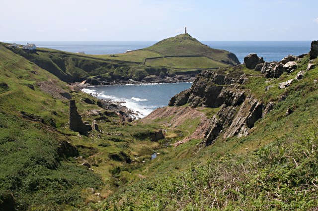
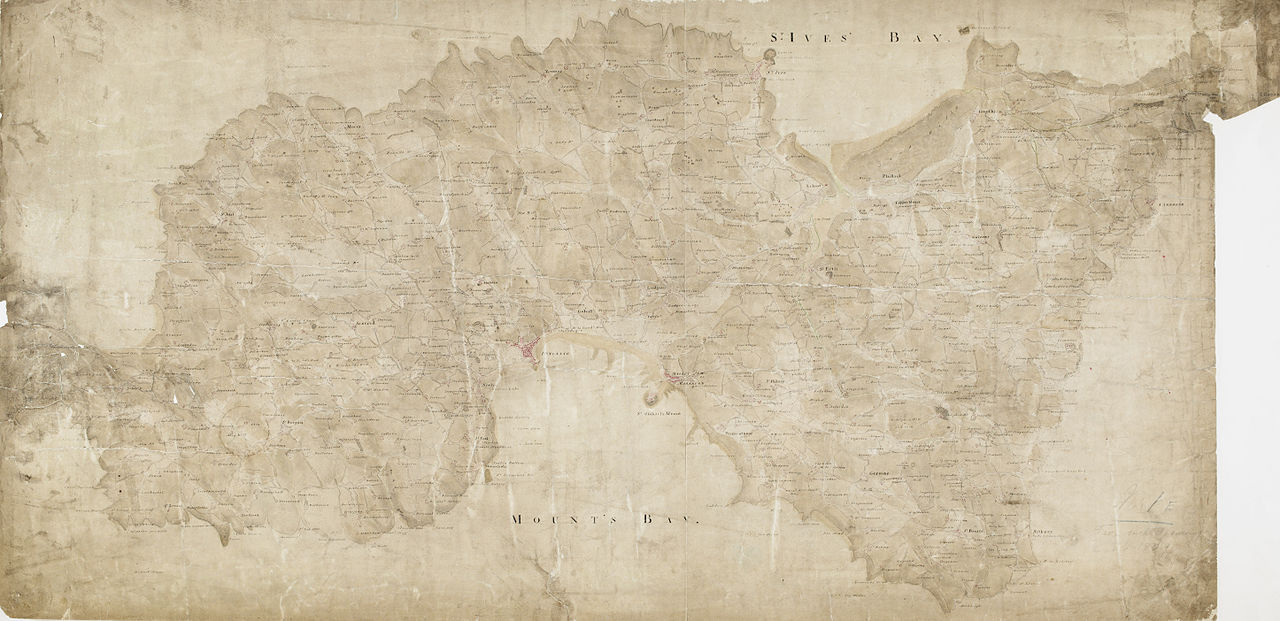
So, from where does the Tinners Way begin and where does it end? Well the answer to that would very much depend on from what direction you are coming as it travels between Cape Cornwall and St Ives. For our purposes here we will begin at Cape Cornwall in the very far west, stopping at various points and ending up on the Island in St Ives.
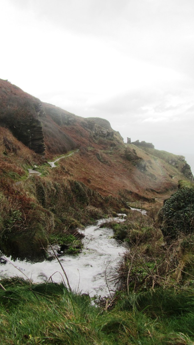
Kenidjack Valley with Cape Cornwall in the background – photo by Tony Aitkin (geograph.co.uk)
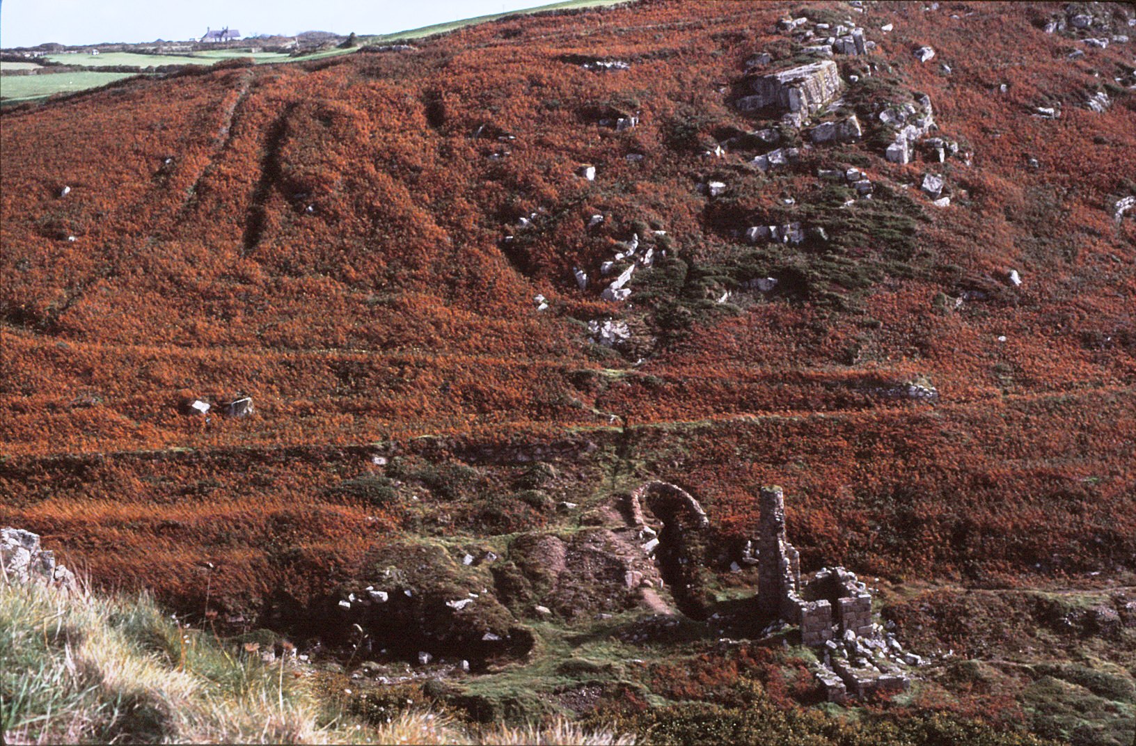
It is probable that the Kenidjack Valley which runs alongside the Cape was the source of one of the earliest and most accessible deposits of alluvial tin ore. Tin was an important resource to the Cornish economy from the Bronze Age into the 19th century.
The bracken covered sides of Kenidjack Valley hide the remains of alluvial mining.
.
A view of one of the trio of stone circles known as the Tregeseal stone circles with Carn Kenidjack in the background.
From here the trackway heads inland and up onto the moors of Penwith past Carn Kenidjack and the Tregeseal Stone Circles not to mention the mysterious holed stones. Continuing on to the fascinating sites of Chun Quoit and Chun Castle.
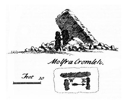
Chun Quoit – drawing by William Copeland Borlase 1872
Back long before metals were exploited in Cornwall our Neolithic ancestors built great stone tombs, archaeologically these are known as quoits or chambered cairns. Although this is not the place to go into a lengthy discussion on the function of such sites it should be pointed out that many of these sites do seem to appear in significant places in the landscape and thus would seem to have a function beyond simple burial. Along the Tinners Way there are several quoits which serve to mark the way – Zennor Quoit, Mulfra Quoit, and of course Chun Quoit with the possibility of more having been ravaged by time.
Just past Chun Quoit are the remains of what was once a great stone walled hillfort – Chun Castle. The walls are still impressive even after the attempts at removal for use in other building projects (the pavement on Market Jew St in Penzance is made up of stone from the hillfort). Originally occupied in the Iron Age it straddles the trackway, interestingly it was later occupied in the 5th and 6th centuries – a time of unease – and the evidence does seem to suggest it was used as a stronghold for the storage of tin ore.
Plan drawing of Chun Castle by Charles Knight 1845.
The imposing gateway of Chun Castle – photo by Rod Allday (geograph.co.u
All along the Tinners Way there is evidence of tin mining (hence the name) – old mine shafts can be a hazard for those wandering off the beaten track (please remember to keep your dogs under control when walking along here). Much of the visible mining remains date from the 17th to the 19th centuries.
The pumping engine house over the Greenbarrow shaft of Wheal Malkin often referred to as Ding Dong Mine – photo by Rod Allday (geograph.co.uk)
On leaving Chun Castle you pass the overgrown Iron Age courtyard house settlement of Bosullow Trehyllys – see an earlier article on the more well known courtyard house settlements of Chysauster and Carn Euny. From here the trackway follows the well trod path past the Men-an-Tol and Men Scryfa.
Men-an-Tol – the moorland behind is covered in disused mining shafts. In the far distance is the abovementioned pumphouse of Ding Dong Mine.
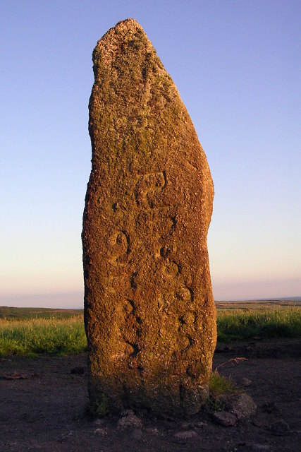
The first was probably once a chambered tomb which has suffered at the hands of people over a very long time. The latter an inscribed stone dating to the 5th/6th century and is a memorial stone to “Rialobrani Cunovali Fili’ – roughly translated as ‘the royal raven son of the glorious prince’. It’s position along this important route undoubtedly deliberate.
The Men Scryfa Stone – photo by Jim Champion (geograph.co.uk)
Not far from Men Scryfa is the Four Parish Stone. This stone indicates the point in which the boundaries of the four ancient parishes of Zennor, Gulval, Madron and Morvah meet. This is not the modern civil parish boundaries but the much older church boundaries. A document from the 17th century mentions this place in the landscape, referring to it as ‘Meane Crouse’ or ‘stone cross’ suggesting the presence of a stone cross which marked this important crossroads. Any traveller to Cornwall will note how stone crosses covered in moss and worn by weather are often found at road junctions.
From here the landscape is dominated by the impressive tor known as Carn Galva and whilst not the highest point in West Penwith (Watch Croft the adjacent tor takes that accolade) it is the most atmospheric of tors with its giant granite boulders standing silent sentinel over the millennia. It is now generally believed that Carn Galva is one of the few Neolithic enclosures to be found in Cornwall – Carn Brea, Helman Tor and Trencrom are the more well known.
One of the many remains of roundhouses to be found at Bodrifty – behind can be seen the high ground leading to Zennor Hill and Carn Glava. Photo by Alan Simkins (geograph.co.uk)
Further on the walker can take a minor side trip to see the Nine Maidens stone circle and the remains of a roundhouse settlement probably dating to the late Bronze Age/early Iron Age (Bodrifty). Nearby the farmer at Bodrifty Farm has recreated a roundhouse and it is possible to visit but do ask first. After Bodrifty the trackway goes past Mulfra Quoit.
Mulfra Quoit – drawing by William Borlase 1769.
Alternatively and the most likely direction for the trackway to follow is across the moorland of Bosporthennis Common between the highpoint of The Beacon and Mulfra Hill to the parish boundary stone known as the Bishops Head and Foot.
“Used over generations, these trackways created permanent scars across hills and valleys, and formed a web of easily followed routes which were later utilised to mark the extent of private estates which had superseded previous communal use of tribal lands. When the system of parishes was established about the 12th century additional use was made of these muddy tracks to form their boundaries in conjunction with streams and prominent rocks” (Antiquities of West Cornwall – The Tinners Way. Ian Cooke 1991)
It is often speculated that the old parish boundaries are based on ancient trackways and at the Bishops Head and Foot there are important paths which traverse Penwith from Zennor to Castle-an- Dinas and Chysauster (both important Iron Age sites) and on to Mounts Bay. The Tinners Way as already demonstrated follows several sections of parish boundaries along the high ground. The trackway then continues through the parish of Towednack along the base of Rosewall Hill covered in old mining shafts and then onto the village of St Ives and The Island.
The view from the Lady Downs in Towednack looking east. In the distance it is possible to see Perran Sands and St Agnes Beacon. Photo by Sheila Russell (geograph.co.uk)
Although today there stands a small chapel to St Nicholas on the Island it is thought that originally the headland was a much older promontory fort. Its position which overlooks Porthmeor Beach and the wider expanse of St Ives bay including the entry to Hayle Harbour and with views all the way up the coast would suggest it was an important site.
The Island at St Ives – Porthmeor Beach is in the foreground. Photo by Chris Dixon (geograph.co.uk)
The Hayle Estuary was an important trading port on this coast until the Medieval period. Dredging in the now silted harbour has in the past brought up finds from all periods including the Roman period and earlier. Overlooking the harbour is the ancient enclosure of Trencrom Hill which as mentioned before can be dated to the Neolithic and later.
“It used to be thought that the earliest routes in Britain were prehistoric ‘ridgeways’, long distance trackways…This idea grew up in the early years of archaeological studies when the most obvious prehistoric monuments, such as Bronze Age burial mounds and Iron Age hillforts, were found concentrated in upland areas.” (Pre-industrial Roads, Trackways and Canals Historic England 2011).
Even though there is no concrete way of dating this particular route there are certainly a lot of indicators which point to it being an important part of the landscape in West Penwith with a long and fascinating history.
A useful wee book to read if you can get hold of one is “The Tinners Way”by Ian Cooke. It is in essence a guidebook for walkers wishing to do the the Tinners Way, detailing the route and the various features along the way.
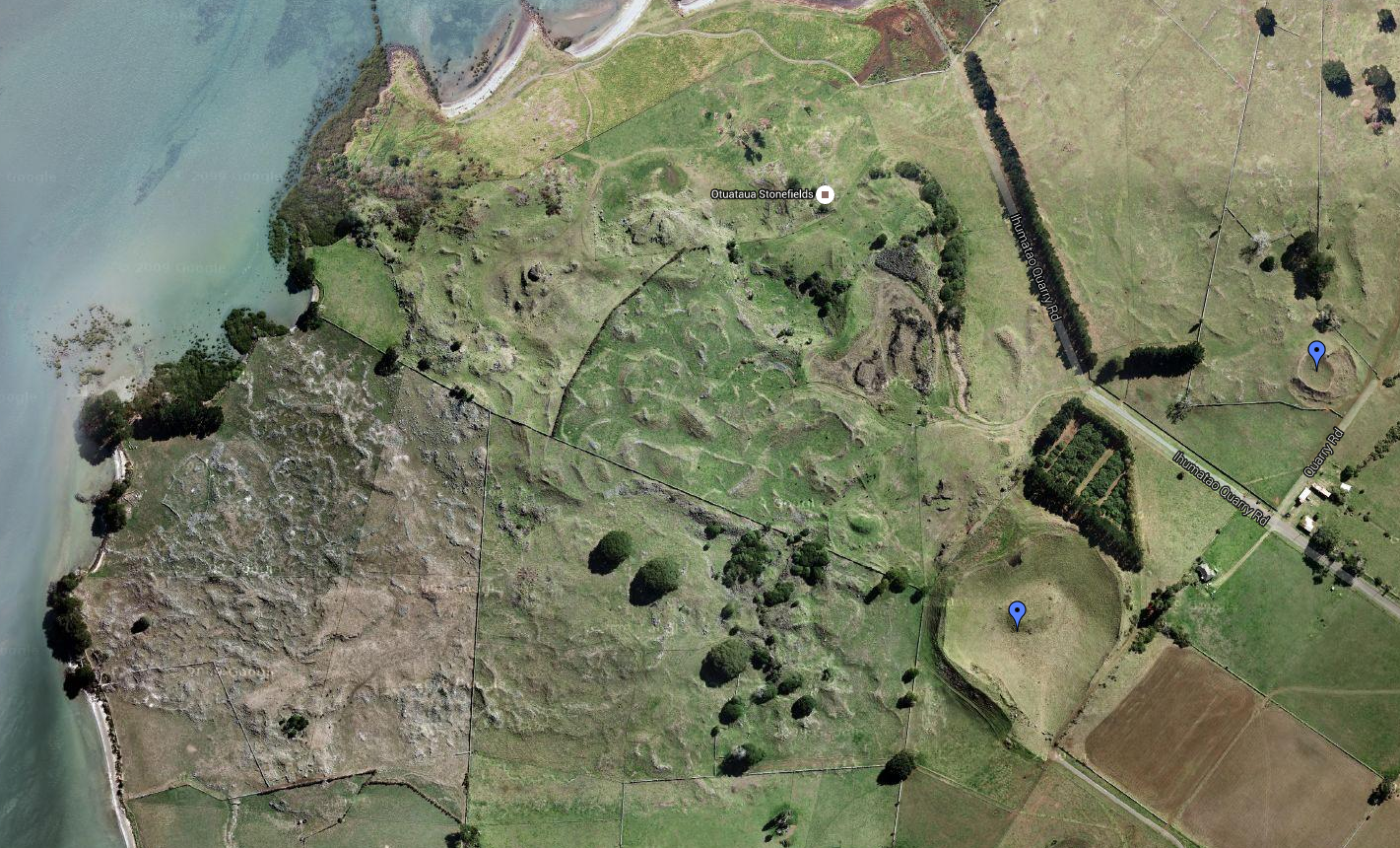
There are not many places within the city of Auckland where a person is able to get up close and personal with the early archaeology of the region, but the Ōtuataua Stonefields is one such place. Although this small pocket is classed as a protected site, it is part of a much wider area called Ihuamāto which sadly is under threat by developers. The stonefields did not exist in isolation and whilst the archaeology is not obvious to the untrained eye, it is undoubtedly there. It would be shameful if the council allowed work to proceed with out a full archaeological investigation. In general attitudes in New Zealand towards archaeology is a case of “there’s not a lot of archaeology here” with the implication because we do not have the lengthy timeframes as elsewhere in the world it is not as important. But this is erroneous and a result of a lack of knowledge – there are over 70,000 archaeological sites listed in New Zealand…The stonefields and Ihuamāto are an important part of New Zealand’s very early history and to say otherwise would deny a people their past and demonstrate a dismal lack of understanding.
Aerial view of the stonefields – the pale lines are stones piled along the natural ridges.
The story of this landscape begins much further back in time with three significant eruptions and subsequent lava flows that began some ninety thousand years ago and ended around fifteen thousand years ago. As with much of the isthmus of Tamaki Makaurau Auckland the volcanic activity served to create rich, well drained soils ideal for gardening.
Two hundred years ago there were some 8000 hectares of volcanic stonefields in the Auckland area, today the 100 hectare reserve of Ōtuataua is all which remains. Dated to around 1300AD and situated near the international airport the reserve was established in 2001 to protect this important part of the archaeological record and is one of the last places where we can see large scale remains of how people once lived and worked in the volcanic areas of Auckland.
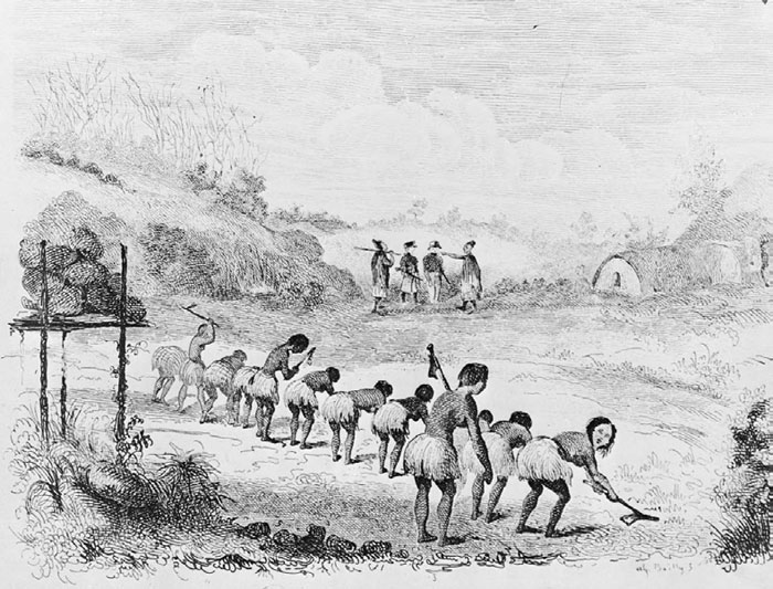
When the first Polynesians arrived in Aotearoa they bought with them the full range of tropical plants however the shorter growing season and colder temperatures meant that many of these tropical plants could not be grown. Only plants such as the kumara (sweet potato), taro, yams and gourds had any success, particularly in the volcanic stonefields of Auckland.
Depiction of Māori digging in their gardens.Kumara in a kete.
There are two opposing theories as to how the settlement and gardens evolved at Ōtuataua –
The initial focus was around the freshwater springs at the edge of the lava fields which then expanded to the volcanic cones later in the mid fourteenth to fifteenth centuries.
Horticulture began on the volcanic cones and expanded outwards onto the lava fields; with the fortification of the cones occurring at a later date.
At Ōtuataua it is possible to see low mounds of the volcanic scoria stone scattered throughout an area referred to as the mound garden used mainly to grow kumara they extended the growing season by about a month.
“The mounds were built as special garden plots, which used the stone’s heat absorbing properties to help warm the earth and retain moisture. Archaeologists have found that these types of mounds often contain specially modified soil, with added organic matter and ground shell.”
(from ‘The Ōtuataua Stonefields – Official Opening Commemorative Brochure’ Manukau City Council)
The mound garden looking towards the later European dry stone wall.
It is safe to say that there is probably not a single stone which has not been moved by human hands. Walking towards the sea, you come across an area of low hills and gullies. The gully floors seem unnaturally free of stone, here the stone has been stacked on top of the hillocks to leave the gully floors free for cultivation.
On nearby Puketūtū Island, similar gardens were once present (very little if nothing remains of them today). In 1938 G. Fairfield recorded being told by a kaumātua from Māngere that “…each cultivation and sheltering wall was named after a particular ancestor or historical event…giving family groups their rights to occupy certain parts of the garden. In the corners of each of these walls there were upright stones that were never moved and considered tapu as they marked the limits of each family unit.” (from Shfiting Grounds: Deep Histories of Tamaki Makaurau Auckland L. Mackintosh pp29)
It would be fair to say that the same was occurring at Ōtuataua and beyond, thus creating a landscape that was deeply intertwined with the identity of those who lived and worked upon it.
The cleared gullies of the gardens as seen from the pā – the Manakau harbour in the background.
Other interesting archaeological features at Ōtuataua include the pā (hillfort or defended settlement) which utilised the volcanic cone. Auckland has many volcanic cones, all of which were used and settled by the Māori throughout history. Here at Ōtuataua it is no different. Unfortunately this particular cone has been extensively quarried for scoria before the site became a reserve resulting in the loss of a large part of the pā. However, it is still possible to make out the terraces on the southern side – these are the level areas cut into the lower slopes and were where Māori lived.
The pā looking southwest.A stone revetment below a terrace on the south side of the pā.A defensive bank of the pā – looking towards the west and the mouth of the harbour.
Although the presence of a defensive structure such as the pā would suggest a time of unrest much of the Ōtuataua area consists of undefended settlements and gardens which tells a different story. One which is often left out of the histories. Past interpretations of pā have seen them as solely defensive structures used during periods of warfare and whilst this may be true on one level, it is likely that similar to the gardens, they represent more than the utilitarian. It has been recently suggested that pā could also have been part of the identity of the wider group/iwi, having a great deal to do with display and status (see another article on Kauri Point). When seen as a complete landscape the story of Ōtuataua becomes more than just gardens, houses and pā.
A second interesting feature is the site referred to as ‘The Big House’. On an outcrop about half way between the mound garden and the gullies is a rectangular outline of stone. This is believed to be the foundation of what was once a large house or structure, nearby are several shell middens. Having never been excavated it is difficult to say what this structure was used for but the presence of the shell middens on the slopes below would indicate meals were eaten here. Perhaps it was a communal place to share food whilst working in the gardens?
All over Ōtuataua shell middens can be found, not surprising given the proximity to the coast. Fishing, shell fish gathering and horticulture were the mainstays of the local economy.
A shell midden – the small white flecks are pieces of shell, note the deep rich colour of the soil, perfect for growing crops.This large mound on the edge of the pā is a very substantial midden…
In Polynesia crops such as kumara are left in the ground until they are needed however here in New Zealand with its cooler climate the early settlers found they could not do this as the kumara will rot. Instead it became necessary to harvest the kumara and store it. At Ōtuataua the visitor will occasionally come across a shallow depression in the ground, roughly rectangular in shape and usually found on slopes or ridges (for good drainage). These are all that remains of the storage pits for kumara. Originally these pits would have had timber walls and thatched roofs. It is interesting to note that the storage pits here at Ōtuataua are outside of the defended pā, further evidence that the people felt secure and safe here on the edge of the Manukau Harbour – war was not as endemic to Tamaki Makaura as previously thought.
A reconstruction drawing of how a kumara storage structure may have looked.
Above right is a depiction of a kumara storage pit with its timber frontage. On the left is a Rongo stone – these are representations of the god of agriculture and peace. They were considered tapu and left in the fields to encourage fertility of the land.
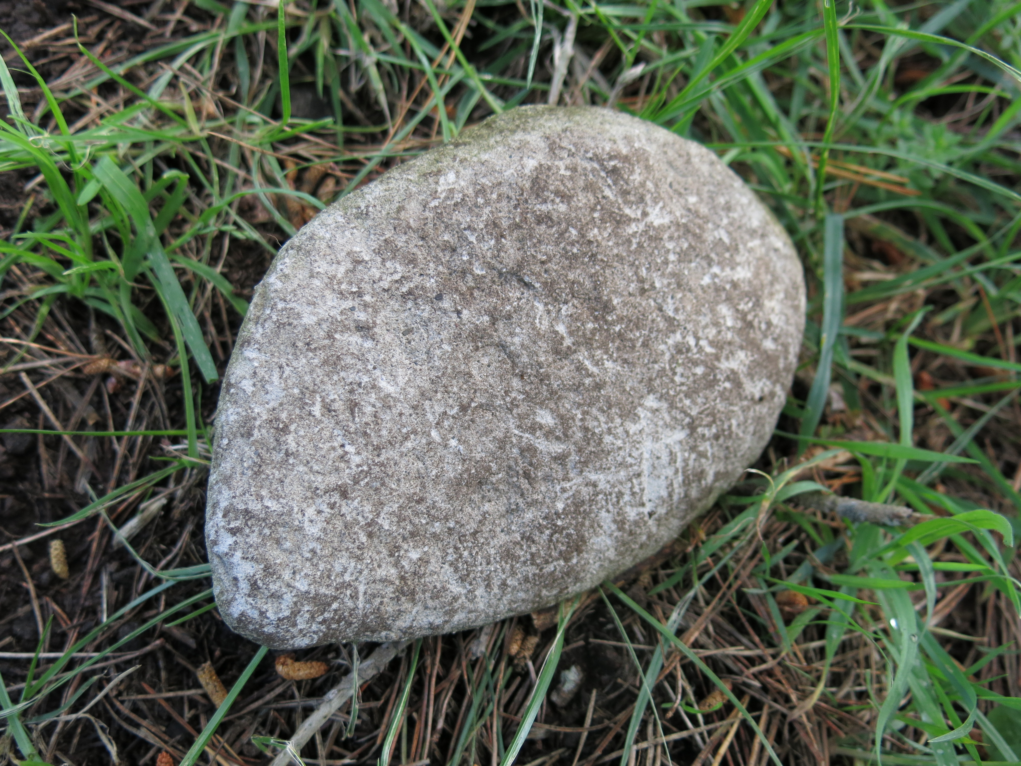
NB – During my visit to the stonefields, trying not to lose both the kids and the dog I was walking along the edge of a eroded shell midden when my eye was caught by an unusual stone. Unusual because it was not scoria and was very smooth on one side. The flip side was shaped to fit into the palm of your hand and although I am not much of an expert I am reasonably certain this was a rubbing stone for turning root vegetables such as taro or fern roots into pulp. A necessary procedure if you wanted to eventually eat it.
“When you hear the Cornish folk mentioning the names of their villages, hills, and other landmarks, you will notice something un-English about them. In the accent and cadence of some of the placenames there is an echo of the goblin world. Is there not, in such names as Ogbeare, Killeganogue and Poulza, an oddity – a twist that is just on the edge of the bizarre.”
(Hopkins T. ‘Our Beautiful Homeland: Cornwall’ date unknown)
It is true that the first thing a visitor to Cornwall will notice is the placenames, they are very ‘un-English’ in particular the further west you go. My interest in them began many years ago as a student writing a masters dissertation on the landscape continuity on the north coast of West Penwith.
The study of placenames can be highly complex, after all names do change for whatever reasons and in the case of Cornwall the names are often in Cornish which as a language has also undergone many changes. The Cornish language is related to both the Welsh and Breton languages, all of which are regarded as being descended from the language spoken by the ‘Celts’. The relationship with these Brittonic languages is often used as evidence for the age of a particular placename, albeit in a general sense.
“The name of a village or farm or field may describe the locality as it was when the name was given, or refer to a natural or man-made feature nearby, or include the name of a pioneer farmer or priest (the latter often termed a ‘saint’). Names can seldom be translated with the certainty aimed a in normal translation between languages; generally they can only be interpreted, with a greater or less degree of probability, as unconscious and unintended messages from the past which are seldom free from ambiguity or obscurity. The prime rule in placename interpretation is to attempt none until all available forms of the name have been considered, and then to place greater reliance on earlier rather than later forms.” (Pool P. A. S. 1990 ‘The Fieldnames of West Penwith).
The distribution of Cornish placenames is not uniform across the county, those places nearest the Tamar River – the natural boundary between Cornwall and Devon – have a greater tendency to be more English than those in the far west. In my dissertation I surveyed an area of the north coast of west Penwith (within the parishes of Morvah and Zennor) and of the forty placenames to be found on the Tithe map of 1841 only one had an English name – the hamlet of Wicca.
Below are a handful of the most common prefixes used in Cornish placenames and their meaning (from Weatherhill C. 1998 ‘Cornish Placenames and Language’)
Bos – as in Boscastle, Boscawen or Bosavern. Also found as Bot-, Bo-, Boj-, Bus-, and Bod-. Meaning dwelling or home it seems to be a very early form whose usage dwindles by 1500. It is often followed by a persons name such as Bodilly on the Lizard which can be translated as ‘the dwelling of Deli’.
Car-/Gear-/Caer-/Cr- as in Caervallack, Carwythenack or Carvossa. Meaning an enclosed settlement and occasionally a ‘fort’. Often found associated with late prehistoric farmsteads within round enclosures as well as Iron Age hillforts. Carvedras near Truro can be translated as ‘Modret’s fort’.
Carn – as is in Carn Brea, Carn Meal or Carn Clew. One of the most common still in use today and is used in reference to prominent rock formations, on hilltops it can translated to ‘tor’ whilst at other locations it might mean ‘crag’ or ‘rockpile’. Occasionally it may even refer to a Bronze Age Barrow.
Carn Brea – the rocky tor visible on the hill top. (geograph.co.uk – 1185968)
Chy-/Che-/Ch-/Ty- as in Chun, Chyanvounder or Chynoweth. Meaning either ‘cottage’ or ‘house’. Thus Chyandour can be translated as ‘house by the water/stream’. This prefix replaces the earlier ‘Bos’.
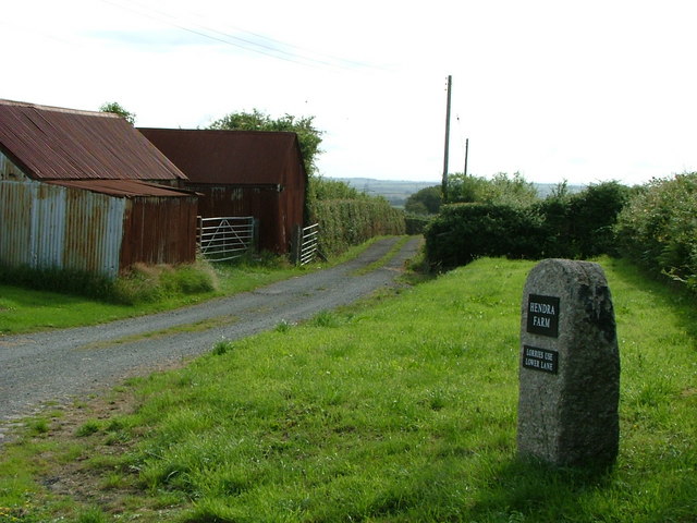
Hen – as in Hendra or Henscath. Meaning old as in former, ancient. Hendra can in its simple form mean ‘old farm’ but is better interpreted as ‘farm which still stands on its original site.
Entrance to Hendra Farm (geograph.co.uk – 210812)
Lan – as in Lamorran or Lanzeague. Meaning ‘church enclosure’ it became redundant by 1500, historians usually take the presence of this prefix as an indicator for an early church site often surrounded by an enclosure which in some cases is a reused prehistoric site.
Tre-/Trev-/Tr- as in Tregenna or Tregeseal to name but two – this is by far and away the most common of all prefixes. Meaning “farming settlement’ and later used to denote a larger settlement such as village. They are often followed by a persons name such as Tregiffian or ‘Gifyan’s farm’ and in other cases it might be followed by a descriptive word such as Trencrom or ‘the farm on the curve’.
Venton-/Fenton- as in Venton Vedna or Ventonraze. Meaning ‘a well’ in the sense of a natural spring, an artificially dug well is ‘Peeth’. Often the prefix is followed by a name of a saint such as Venton Uny or ‘the well of St Euny’ others might be followed by a distinguishing feature such as Ventonwyn or ‘the white well’.
Of course understanding the meaning behind the names is not the only source of information. Looking at the distribution of certain placenames within a given area may hint at the evolution of the human landscape. In some areas it is possible to see the stratigraphy of the landscape. An essential part of such a study involves the use of maps.
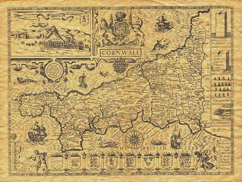
John Speed’s Map of Cornwall 1614
No study of the landscape can be conducted without a good range of maps. Early Ordnance Survey maps and Tithe maps are crucial in understanding any landscape before modern incursions such as motorways, housing subdivisions, caravan parks and business parks, make an appearance. Even in the case of West Penwith the choice of the 1841 Tithe Map during my dissertation was to ensure that any more recent names attached to barn conversions and holiday lets did not lead to false results. Maps can also show features which may no longer be obvious on the ground such as hedges which may have later been removed and mining remains among others.
An early drawing for large scale OS map of Lands End. Two points of interest are – the tin and copper mines are indicated by a dotted lines, also the circular marking on the left indicate the area around Sancreed and the hillfort of Caer Bran. It was not until 1816 that the recording of archaeologica sites on OS maps became obligatory.
Of course very early maps can be quite frustrating as often the information included is not clear and/or very selective according to who made the map and why. Just because a settlement does not appear on one map does not mean it did not exist at the time of surveying. For example, the Domesday Book records only a handful of settlements in the whole of West Penwith. It seems highly unlikely that the region was all but empty, but given this was an economic text and not a history one it is not too surprising either. To this extent gaining insight from a wide range of maps is often the best course of action.
Another source of information which can often be overlooked in the study of past landscapes are fieldnames. Although they are less well documented and it is not until the Tithe Apportionment of 1841 that fieldnames are properly recorded, albeit by this stage most are in English. It is also important to note that by their very nature fieldnames are transient, their names can change as their usage does. However there is on occasion names which stick and just occasionally these names can hint at a previously unknown archaeological site or field usage. For example Park an Vellan could suggest the presence of a mill (vellan being a form of melyn or mill) and Park Menheere suggests the presence of standing stone.
In the case of later English fieldnames some may well have been directly translated from the Cornish and are thus older than expected. So Spring Field may have originally been Park an Venton or Barrow Field was Gweal Creeg.
A view of fields near the hamlet of Zennor demonstrating the higgly-piggly nature of the fields systems. (geograph.co.uk – 633)
The study of placenames, maps and fieldnames is one of the least intrusive forms of research a person can do and yet can yield a myriad of information that in some cases was not known. When combined with other sources such as documents and aerial photography it becomes a powerful part of archaeological research providing fresh insight into our ancient landscapes.
An aerial photo giving a birds eye view over a portion of the West Penwith coastline (copyright Tom Corser 2009)
Once you have got your eye in so to speak, it will be forever impossible to go for a simple walk in the landscape. I am doomed to be wandering the landscape always looking for patterns, asking what does that name mean and is it in it’s original form.
Sources:
Gelling M. (2000) Place-Names in the Landscape Phoenix Press
Hopkins R. T. (?) Our Beautiful Homeland: Cornwall Blackie and Son Ltd
Pool P. A. S (1990) The Fieldnames of West Penwith Published by the Author
Weatherhill C. (1998) Cornish Place Names and Language Sigma Leisure
On a cold and damp day in January the family and I decided to visit the famous site of Tintagel Castle in North Cornwall.
Walking down the valley towards Tintagel Haven the castle’s outer ward can be seen in the distance.
For hundreds of years the site of Tintagel Castle has fascinated visitors and locals alike. Even without knowing any of its past the place oozes with untold stories and imaginations can run riot (which they have). The Fiction
The title page from N C Wyeth’s ‘The Boys King Arthur’.
Ask almost anyone about Tintagel Castle and immediately King Arthur and Merlin will come to the fore. It was Geoffrey of Monmouth who wrote the History of the Kings of Britain sometime between the 1135 and 1138 who associated Tintagel with King Arthur as the place where Arthur’s father Uther Pendragon seduced/tricked Igerna into bedding him (Merlin and magic appear to be involved…) and so Tintagel became known as the place where King Arthur was conceived. It should be noted that at no time did Geoffrey of Monmouth ever suggest that Tintagel was Arthur’s home or that the castle belonged to him. The only connection was and is the story of his conception. “The History nowhere claims that Arthur was born at Tintagel, or that he ever visited the place later in life, or that in any sense the stronghold became his property when he was King…On so slight a foundation, almost every subsequent writer was able to expand the conception of Arthur at Tintagel to his birth there and, by implication, ownership and even residency.” (Thomas C. 1993) Whilst it is understandable, after all this part of Cornwall with its dramatic coastline rather lends itself to stories of magic, romance, skulduggery and drama. It seems a shame that the Arthur connections – real or imaginary – detract from the true story of the headland and its castle. The Facts The remains the visitor sees today can be divided roughly into two phases of occupation, post-Roman (5th- 7th centures AD) and after 1100AD. The occupation of the headland in the post-Roman era was originally believed to have represented the remains of early Celtic monastery. This theory has now been rejected and instead it is believed that the site is that of a “…high status secular settlement probably used by the Kings of Dumnonia between the Roman withdrawal in 410AD until the end of the seventh century AD, and it has now been identified as the Durocornouis (fortress of the Cornish)…” (Weatherhill C. 2009).
Site A – the larger walls at the rear are the remains of the chapel whilst the low dry stone walls in the foreground are post Roman/early Medieval in date.
The buildings which are associated with this phase can be found clustered around the later medieval chapel, below on the cliff edge (just above the iron gate) and further along the headland. Many of the buildings were revealed after a scrub fire on the headland. Excavations have produced vast quantities of Mediterranean pottery such as amphorae dating to the fifth and sixth centuries. The amount of imported pottery exceeds the amounts found on all other known post-Roman sites in Britain. An often overlooked feature of the headland is the indentation known as Arthur’s footprint. It is an eroded hollow in the rock on the highest point of the headland and shaped roughly like a footprint. Its association with Arthur is irrelevant as it is more likely an indication of ceremonies enacted here during the post-Roman period if not earlier. In parts of Ireland and Scotland there are places which also have footprint type impression in rock and are associated with inauguration ceremonies of important people well into medieval times. Symbolically, placing a foot in a specific place is representative of a persons right to rule over the surrounding territory. Is it not possible that this example here at Tintagel was something similar and equally ancient. “It can be wondered. therefore, if the occasions when the Dumnonian ruler and his court – or any other major chieftain in the post-roman south-west – came to Tintagel included public recognition of a king as replacing his dead predecessor, and whether this rock-marking figured in ceremonies.” (Thomas C 1993). Perhaps the importance of Tintagel during this period cannot be over emphasised enough. In 2016 three weeks of excavations were carried out by the Cornwall Archaeological Unit as part of a long term research project undertaken by English Heritage. During this time the team dug opened trenches in two different parts of the island opening a small but fascinating window into Tintgels past. Over 200 sherds of imported Mediterranean pottery were found alongside some fragments of high quality glass vessels. All pointing to Tintagel being a place of great importance – unfortunately the dubious connection with King Arthur reared its head in the newspapers with headlines such as ‘Kings Arthurs Palace Found’ for which there is no evidence at all…For more well informed facts regarding last summers excavation follow this link to the EH blog – English Heritage Blog – Tintagel Castle Dig.
Reconstruction drawing of TIntagel in the post-Roman period – drawings based on the 1930s excavations – Picture from the English Heritage Blog site (see link above).
Site B – the low walls in the foreground are post Roman whilst the inner and outer ward seen in the background are 12th century.
The second phase of settlement belongs in the twelfth century and is the result of building works done under the auspices of Richard the Earl of Cornwall. Richard was made Earl of Cornwall in 1227 and in 1233 bought Bossiney and Tintagel from Gervase de Hornicote although it does seem that building works had already begun by this time. Much of the impressive remains the visitor sees today are the ruins of Richards castle. The inner ward is on the island and the outer ward is on the mainland side. Originally there appears to have been a bridge between the two as by this time the land bridge had all but eroded away.
The remains of the Great Hall of the inner ward.
A reconstruction drawing of the 12th century Great Hall taken from an information board.
One question does need to be asked at this point – why did the Earl of Cornwall build a substantial castle here in Tintagel? It is far from the centers of Cornish commerce and it is no where near the main routes into and out of Cornwall. It defends nothing but open water. In short it has no military value or function and is that not what castles are for? So then, why Tintagel? Richard was the second son of King John and by all accounts was an ambitious and educated man who had decided to make a statement. He would have read Geoffry of Monmouth’s History and would have been told about Tintagel being the ancient seat of the rulers of Dumnonia. His decision to build a flashy castle here was his way of saying to the Cornish people and others – “Here I am, your Earl – from this ancient seat of power I will rule”.
Final Facts ·The headland has two freshwater wells. ·The Chapel is dedicated to St Juliot and is 12th century in date but seems to have earlier origins (see photo below). ·The tunnel is an enigma, dug into the stone bedrock of the island with small iron tools, it is most likely medieval in date and it has been suggested it was a cool store for foodstuffs such as meat (see photos below). ·Merlin’s Cave is a great place to explore at low tide but is unlikely to have anything to do with the Merlin of Arthurian myth. ·The beach below the headland is known as the Haven. In the end, it is fair to say the story of Tintagel Castle is not complete. I, as much as the next person have a great affection of the Arthurian stories and if such stories provide impetus for the average person to visit Tintagel then all the better. But personally the facts are the clincher – it is they which make the better story. Sources Thomas C. 1993 Tintagel – Arthur and Archaeology English Heritage/Batsford. Weatherhill C. 2009 Cornovia Ancient sites of Cornwall and Scilly 4000BC – 1000AD. Halsgrove.
From inside Merlins Cave looking out at the Haven –
The feature known as the tunnel.
Inside the tunnel – note the work marks on the wall indicating metal tools were used to dig the tunnel out of the rock.
The remains of the 12th century chapel dedicated to St Juliot.
Sheep have been reintroduced to the island in an effort to keep the vegetation under control.
The Post Medieval doorway framing the view of Glebe Point.