Category Archives: Archaeology

Land Use and Settlement in the Upper Waitemata – Part Two

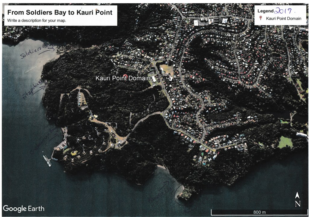
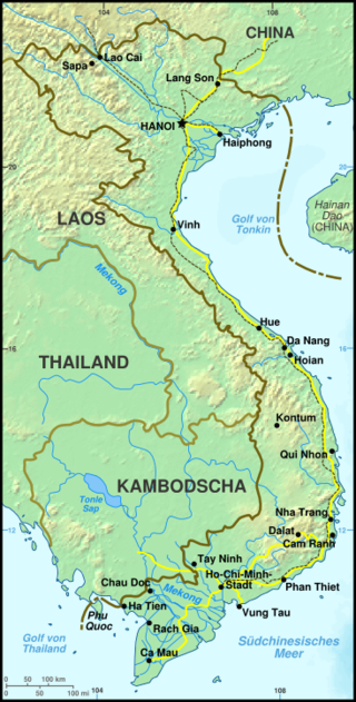
In this the second part of my small study of land use and settlement in the Upper Waitemata we are staying within the area defined in part one – from Island Bay to Kendall’s Bay, keeping within the coastal strip.  This part will take a look at the early colonial/settler history of the area, with the emphasis being on the early or pre-WWII.  After this point in time there is plenty of written records and several good books written on the history of Birkenhead and I have no desire to rehash already well-known information.

In 1769 Captain James Cook sailed through the Hauraki Gulf past Waiheke Island and made a note that there might be sheltered harbours to the west.  The only other Europeans around at the end of the eighteenth century were whalers and as of yet no records have been found of any exploration into the upper Waitemata.  It appears that it is not until 1820 that Europeans began to show an interest in this sheltered inland harbour. 

Reverend Samuel Marsden is often credited with being the first to explore the area, in his diaries he states that he left the HMS Coromandel at Waiheke and was guided by Te Morenga to Riverhead where he then travelled overland to the Kaipara River – a route travelled by Maori for centuries.

During the next twenty years there were undoubtedly forays by other Europeans into the Waitemata, perhaps looking for timber and other such opportunities however their stories are as yet unknown.  In 1840 the HMS Herald was the next major ship to visit the Waitemata, onboard was the Lieutenant Governor of NZ Hobson and the Surveyor General Felton Matthew.  They spent the next two weeks exploring the harbour – Herald Island is named after the ship and of course Hobsonville after the Governor who had initially favoured the place as the capital of New Zealand.

Slightly further afield from our area of study there are records from around this time which make a note of sailors rowing up Hellyers Creek to a place called The Lagoon to restock their freshwater supplies, however, “it has also been recorded that in 1841 a Mr Hellyer, lived on the bank of the creek which now bears his name.  He brewed beer which no doubt was a great incentive to those earlier seamen who rowed up the harbour…”

An early but seriously water worn pipe end found on the beach at Kendall’s Bay – it is easy to imagine the early sailor who dropped their pipe overboard as they sailed up the Waitemata.

In 1841 our area of study was part of a large land purchase called the Mahurangi Block, it extended from Takapuna/Devonport to Te Arai and encompassed the majority of the present-day North Shore. The first parcels of land to be auctioned in 1844 were between Northcote and Lake Pupuke. Much of the early purchases in the Birkenhead area were part of a land speculation trend without the land being settled or farmed.  Significant chunks of land sold were the area from Rangitira Rd/Beach Rd to Soldiers Bay which was sold to William Brown in 1845 and the area from Balmain and Domain Rds to the shore encompassing one hundred and ten acres being sold to a James Woolly also in 1845.  However, it does not seem that either of them actually lived here.  It was common practice for land to bought speculatively and sold on in smaller parcels to settlers fresh off the boat so to speak, such as the ‘Tramway Company’ a land development company who bought large tracts of land in what is now Birkenhead.

The earliest settlers of the Birkenhead area who are known were Henry Hawkins, Hugh McCrum, John Creamer, Joseph Hill, James Fitzpatrick and William Bradney.  All of whom appeared to have had a go at farming but little else is known about them.

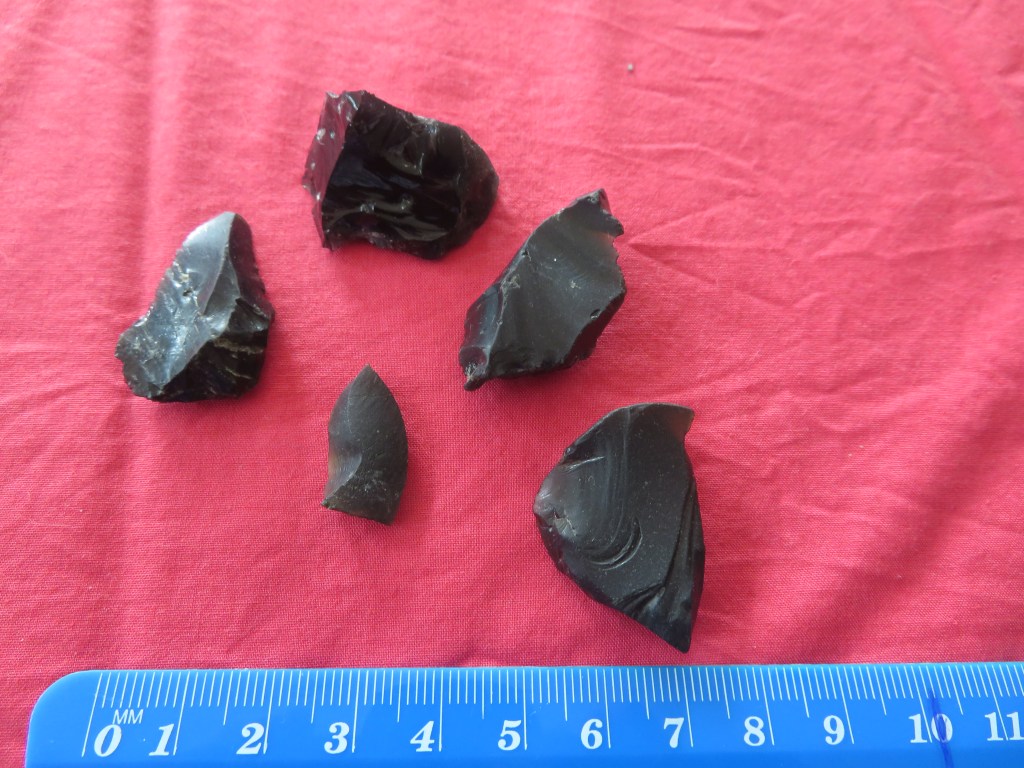
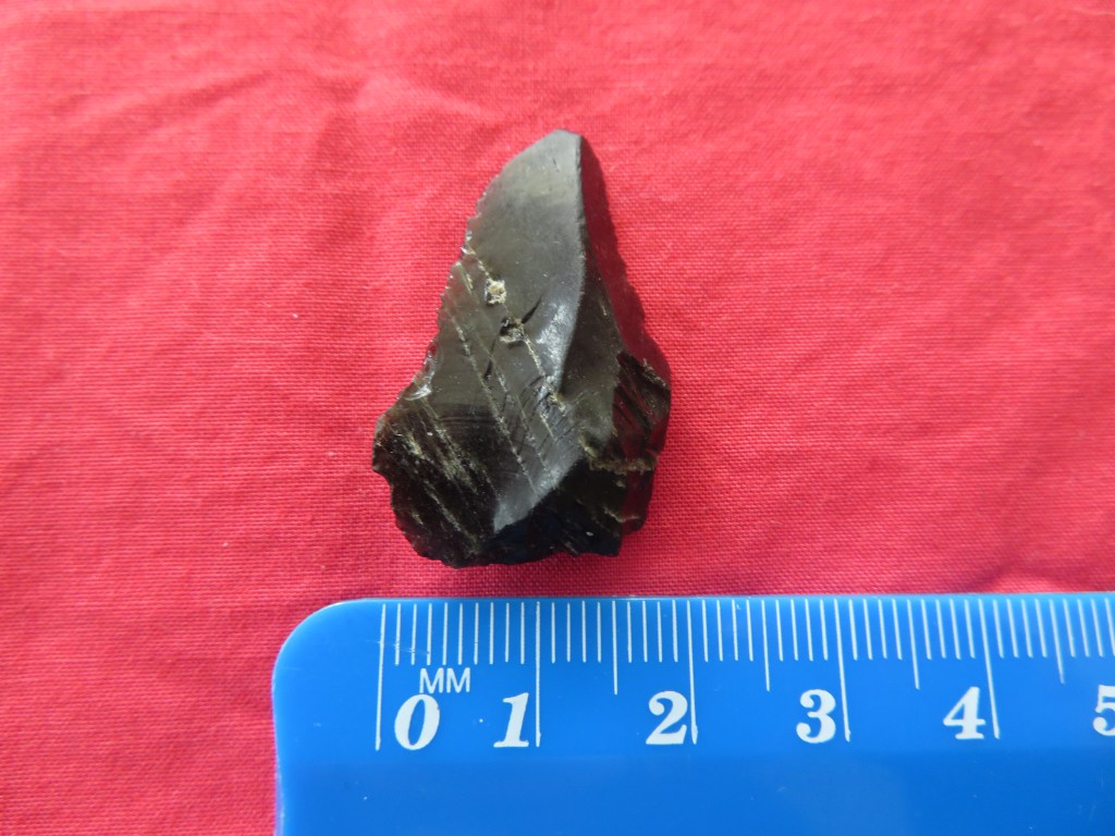
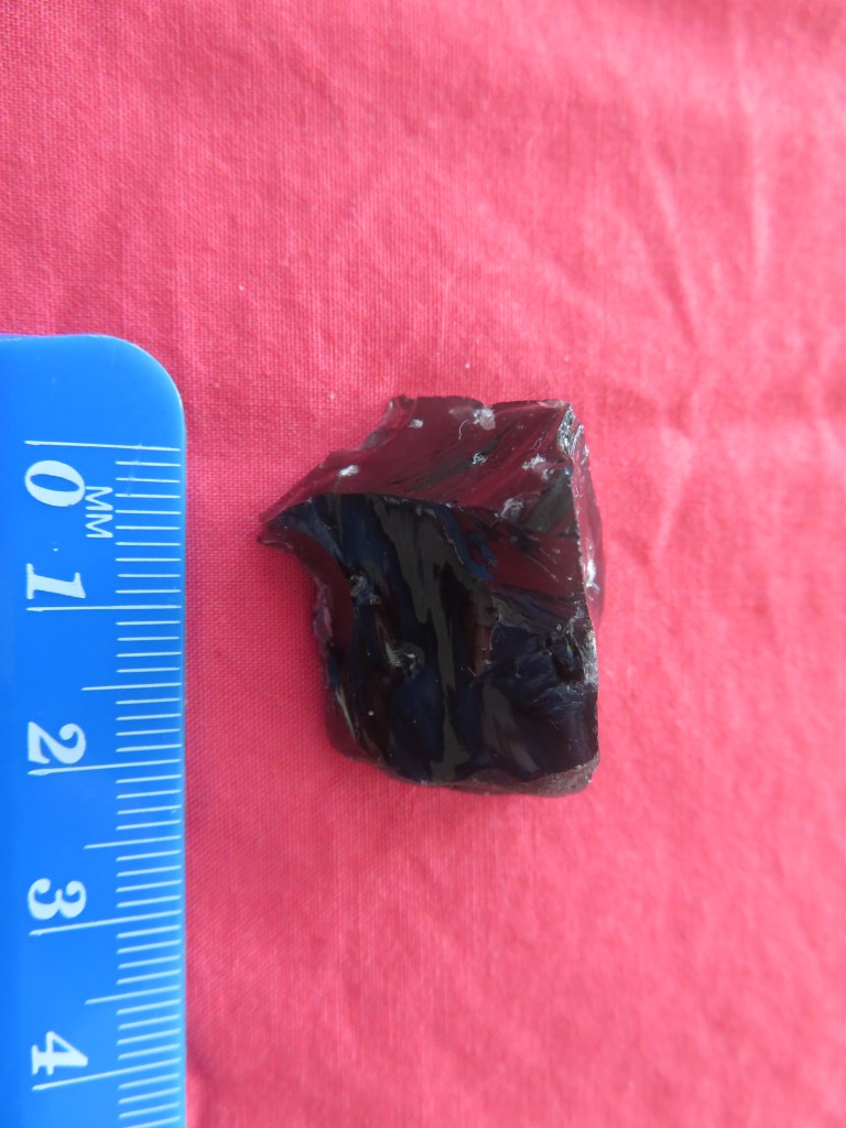
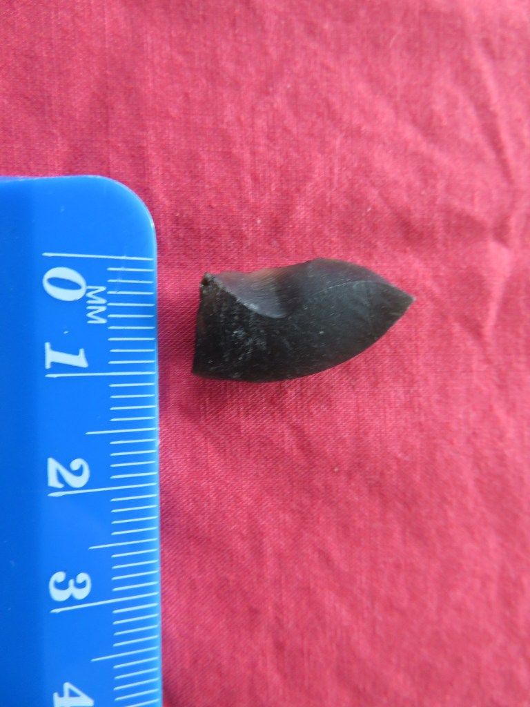
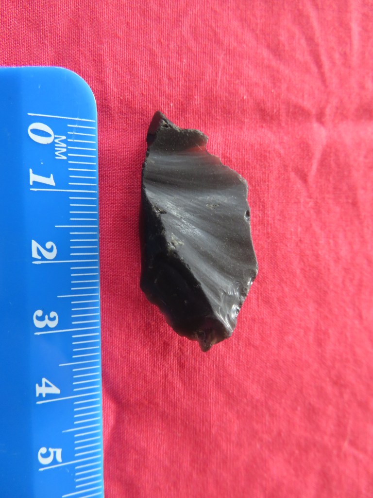
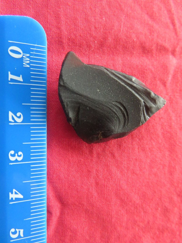
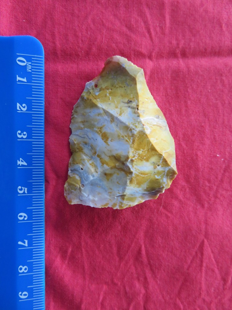
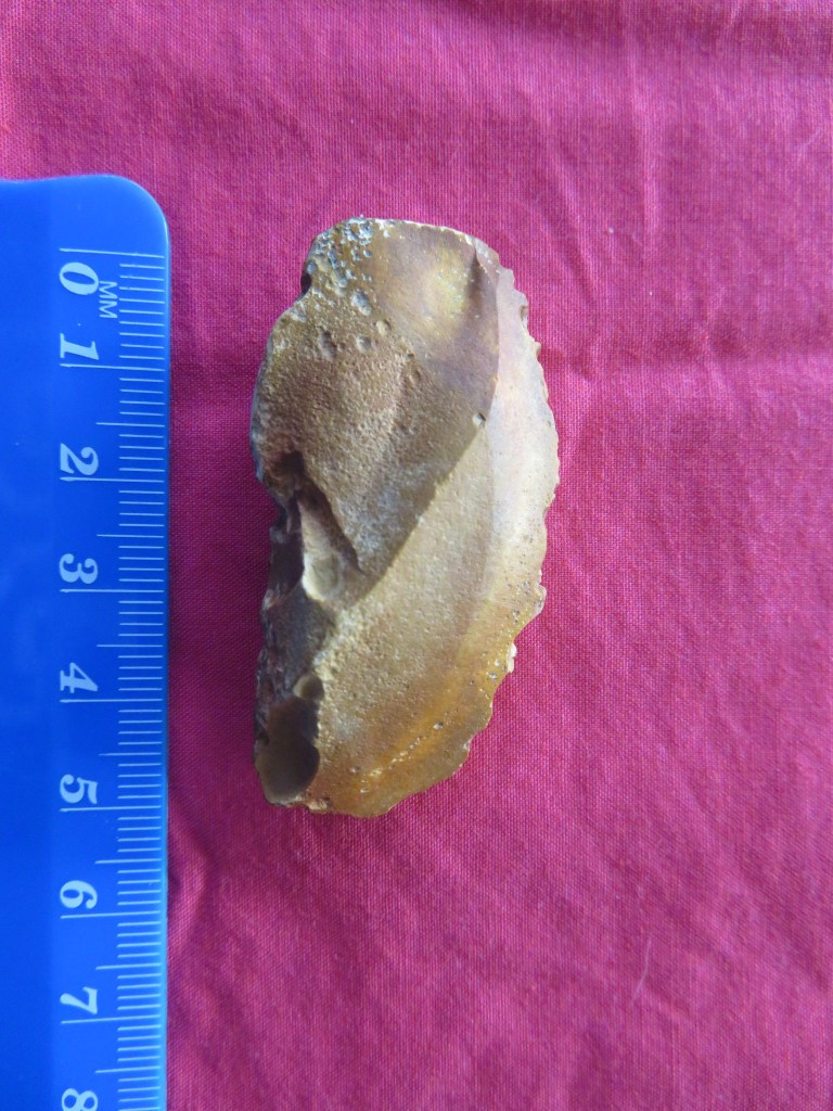
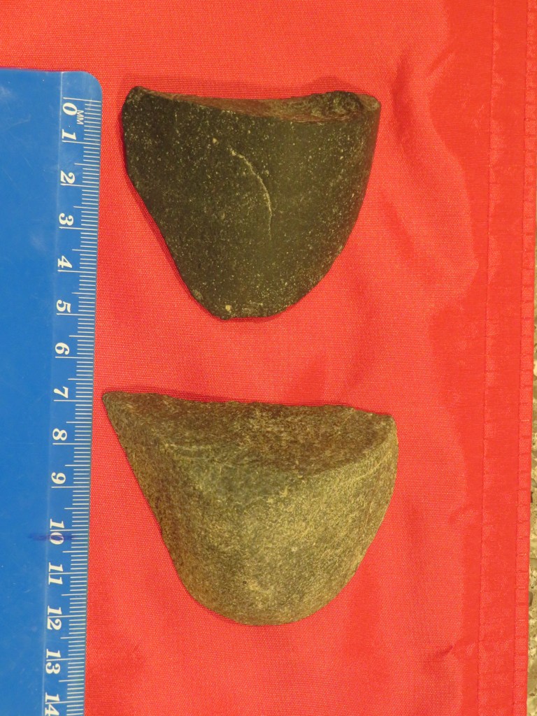
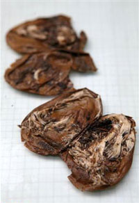
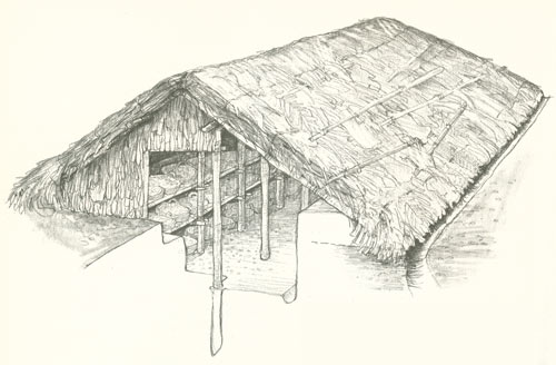
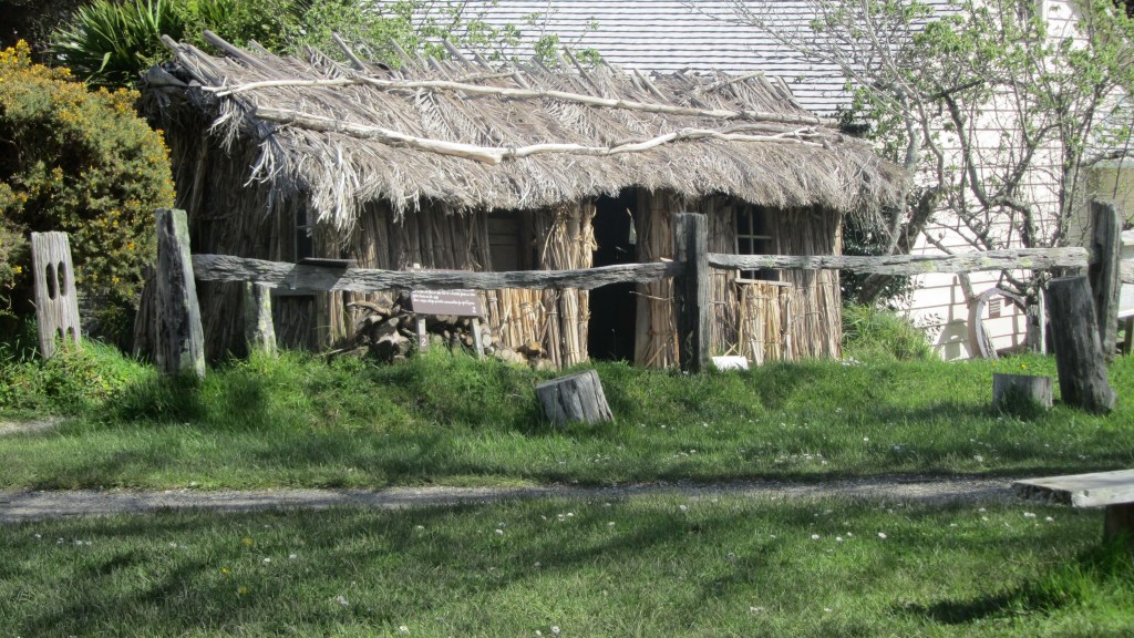
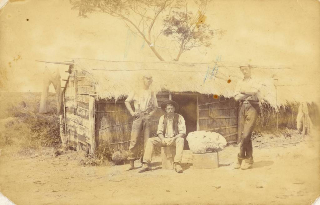
Unfortunately, those early settlers who chose the Birkenhead area were in for a hard time, as mentioned in part one the soil was not conducive to farming in the traditional sense.  Settlement was a rather slow process particularly when compared to other parts of the North Shore and Auckland.  Not surprising when faced with the prospect of clearing the bush before they could even build themselves a dwelling.  Many of the early dwellings were simple one room nikau whares, constructed of sod walls with a raupo or nikau thatched roof.  As they cleared the bush often deposits of kauri gum would be found and sold ensuring a source of income. 

A reconstructed nikau/ raupo whare at Howick Historical Village – a living history museum in east Auckland.
Lumps of kauri gum found at Kendall’s Bay.

Even though most of these early farmers only managed a subsistence living, there were the occasional success story.  Birkenhead became quite well known for its fruit orchards, the first of which was established by Henry Hawkins.  There are two differing accounts as to where Hawkins had his orchard, some maintain it was near Soldiers Bay and others say it was on the ridge where Birkenhead Ave now runs.  It is of course possible that both are correct, one of the earliest estates to be subdivided and sold was the Balmain Estate (also known as the Balmain Township) which extended over a much wider area than just the Balmain Rd of today.  The steep sided valley of Soldiers Bay would appear to not be conducive to a fruit orchard, the thick kauri groves would have been quite a hindrance to say the least.  However, an advertisement in the local paper for 1855 has H J Hawkins selling 700 fruit trees from his farm at The Glen, Soldiers Bay. Later in 1870-71 Hawkins is recorded as owning allotment two and three in Birkenhead – this is situated on the ridge which is now Birkenhead Ave. 

Another early settler is mentioned in relation to a dwelling on a map dated to 1849, the house was owned by a John Crisp and was situated close to what is now Fitzpatrick Bay. Unfortunately, I have been unable to corroborate this.

According to a local history study of Island Bay and surroundings (Island Bay. A Brief History) there is an 1844 map which shows a dwelling occupied by a Mr George Skey. The bottom part of the block was developed into a small farm and sold as a going concern around 1849.  It had its own jetty and a farm boundary ditch, unfortunately I have been unable to track down this map to verify this information and the area where the farm is said to be (and relatively well preserved) is part of the Muriel Fisher Reserve which is currently closed due to kauri dieback.  Having said that, it is definitely something to consider and requires further investigation. 

Soldiers Bay at low tide – the tree covered area to the left is part of the Muriel Fisher Reserve and the probable site of allotment 148.

Whilst the 1880-81 electoral roll lists a small block (allotment 148 – a trapezoidal block which ran from what is now Rangitira Rd to the western edge of Soldiers Bay) of twenty-three acres owned by a Mr Clement Partridge who is described as a settler.  The area of Island Bay was one of those places where early land sales were of the speculative kind.  It wasn’t until the “Tramway Company”, a land development company, bought large tracts of land in the Birkenhead area including Island Bay, that small dwellings began to appear. Like many of the bays in the area, Island Bay was a summer place with the majority of dwellings being bach’s and only a handful were occupied all year round.  The road began as a dirt track mostly used by gumdiggers and was previously known as Victoria Rd West prior to 1913.

What’s in a Name?

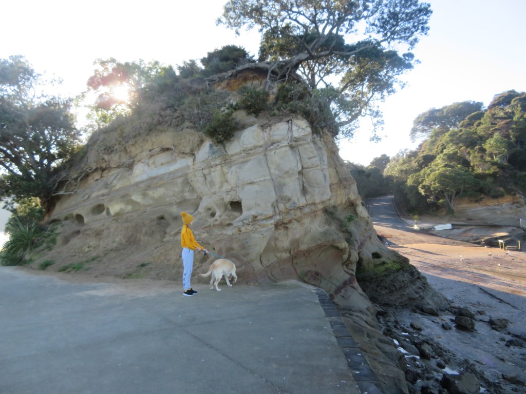
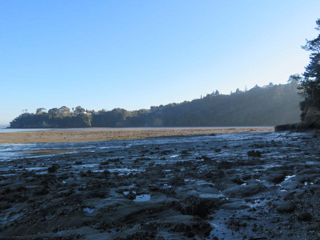
Placenames often hold clues as to the early settlement of an area and its changing history.  In part one we already looked at some of the Maori names for places and how they relate to not only how the landscape was used but also how the people saw themselves within their world.  For Europeans the naming of places can be a lot more prosaic and, in some cases, the reason for the name is obvious such as Island Bay, so named for the small island at the end of the road which was once separated from the mainland and only accessed at low tide via stepping stones. 

The island after which Island Bay is so named…

Others, however, are much more difficult to ascertain – Kendall Bay is obviously a European name but at this point in time there are no records of anyone with the name of Kendall after whom the bay was so named.  One possibility is that Kendall may be the name of gumdigger or gum buyer situated at the bay – gumdigger camps were often situated at the head of sheltered gullies near fresh water and near to the coast.  Kendall Bay satisfies all of these requirements.  Interestingly, the bay is also known locally as Shark Bay, undoubtedly because of the shark fishing grounds exploited by Maori and later Europeans.

Kendall’s Bay or Shark Bay on a foggy morning.

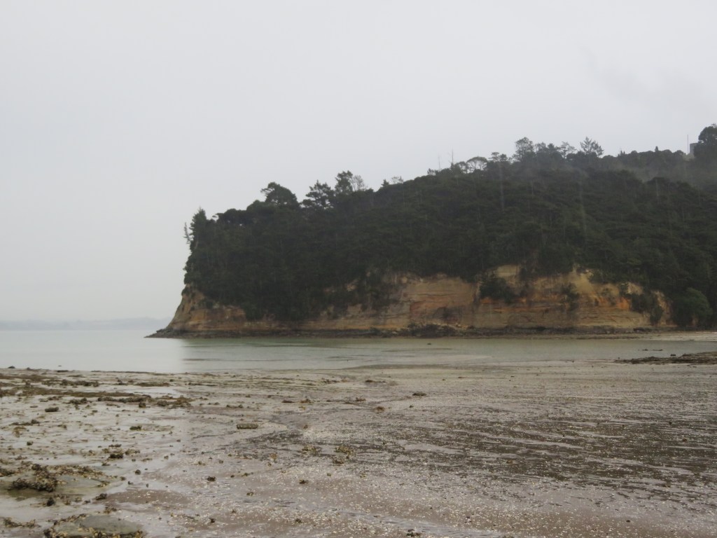
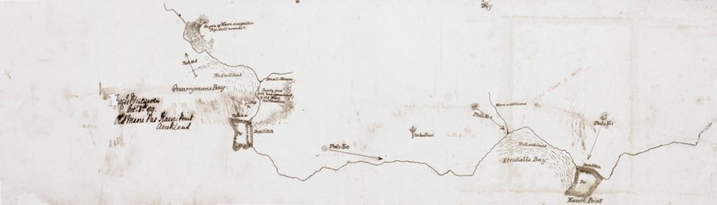
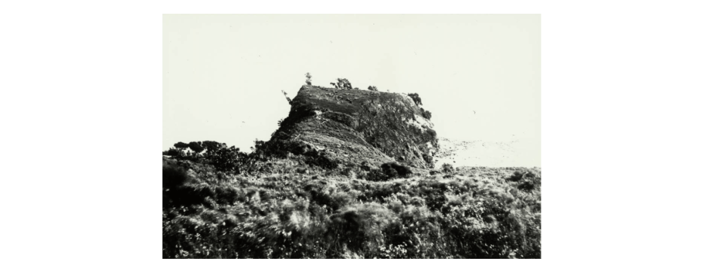
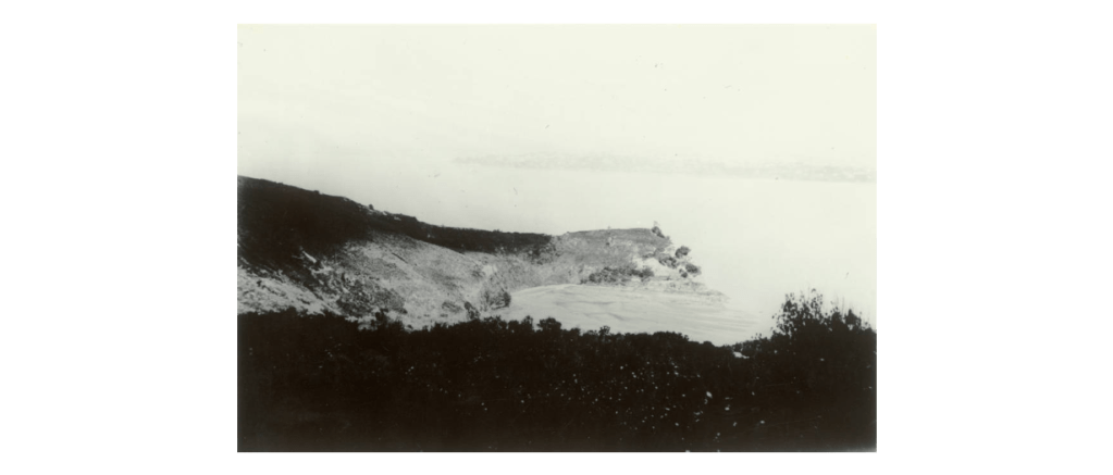
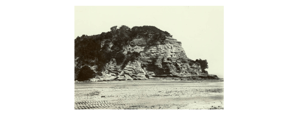
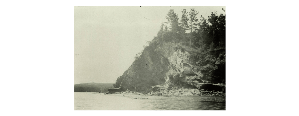
Interestingly, Kauri Point is the one placename not to change and to be consistently included in the majority of maps dating back to 1842 and up to the present day.  It would be a fair guess to say the name came about as a result of the large kauri stands which would have been easily visible to the first people to sail up the harbour.

Names have also changed through time or have been forgotten.  The Upper Waitemata was once called Sandy Bay on a nautical chart from 1841; another early map refers to Pt Shortland (1842), the headland where the Naval Base currently is; on other maps the bay we know today as Onetaunga Bay was once called Quarryman’s Bay.  

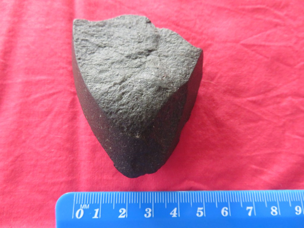
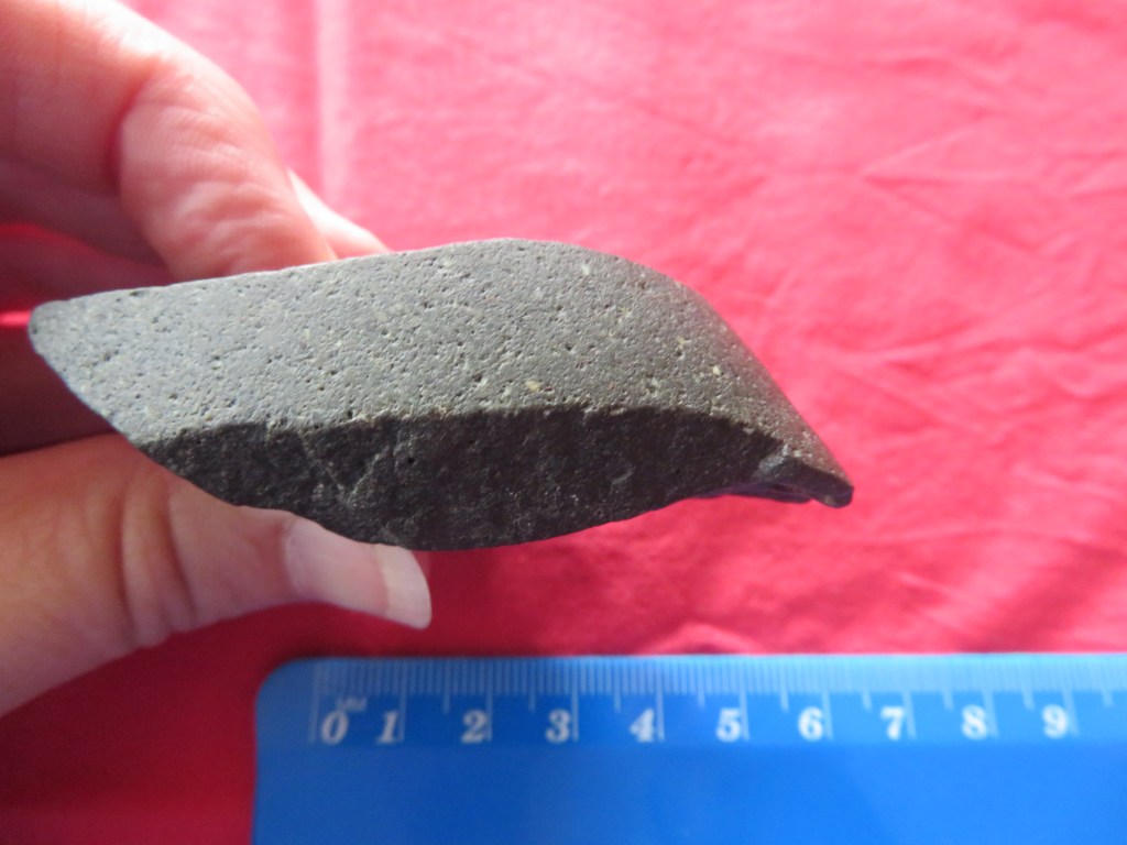
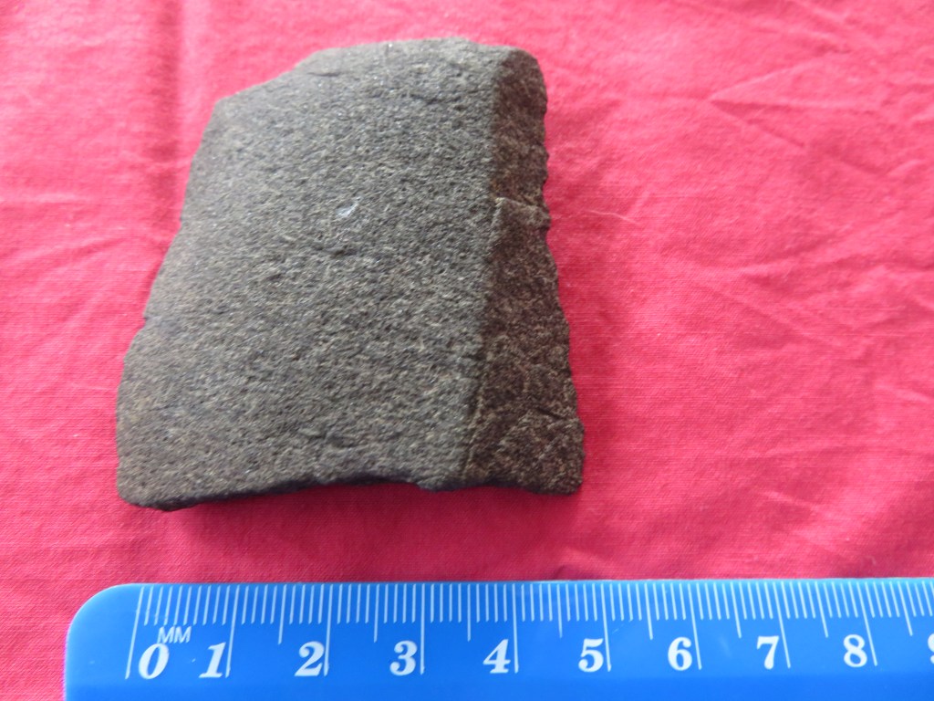
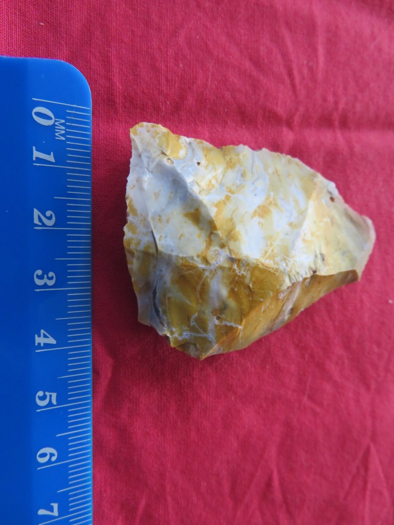
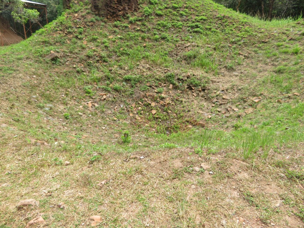
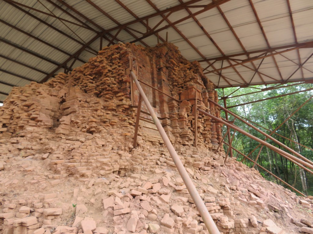
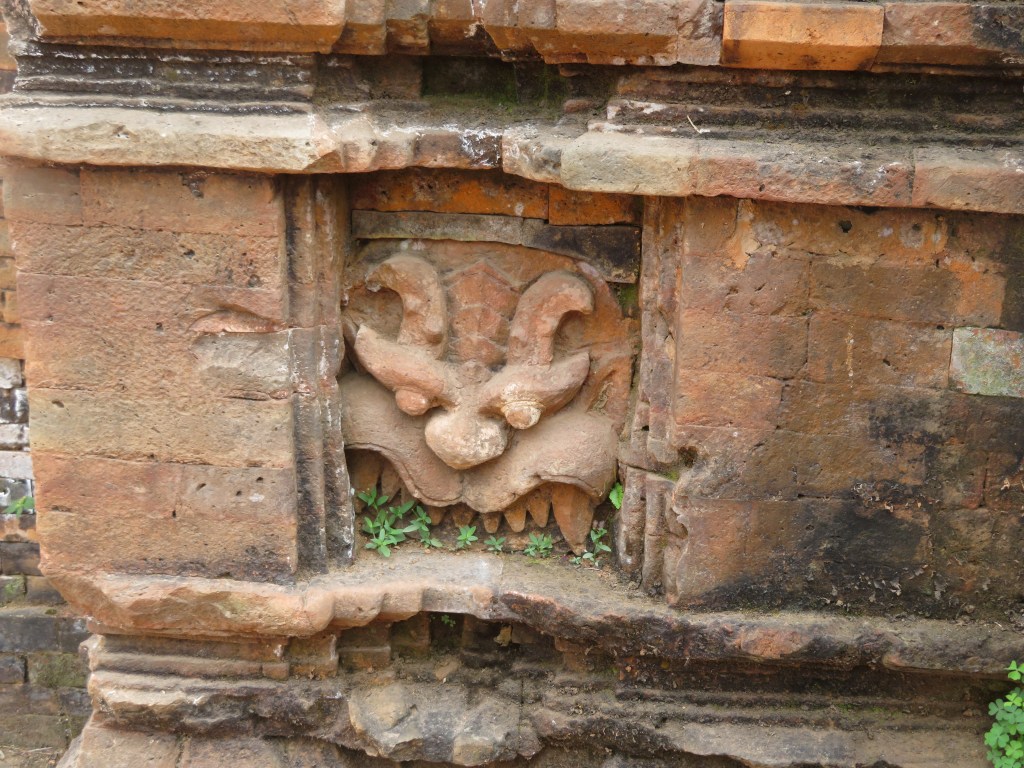
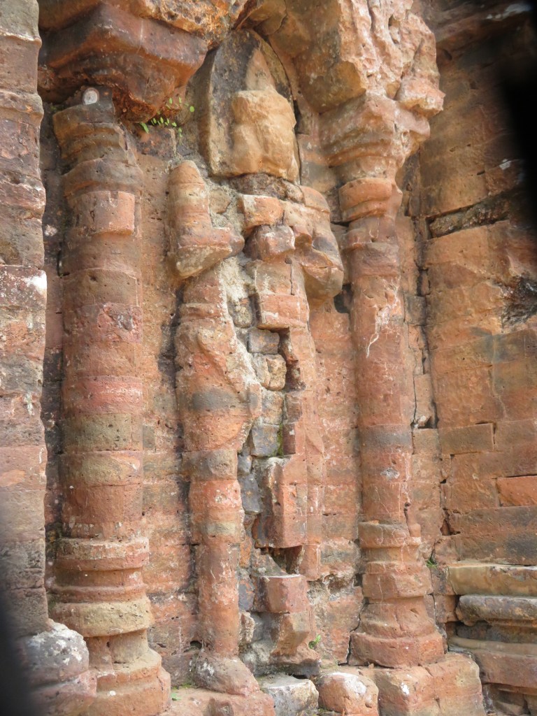
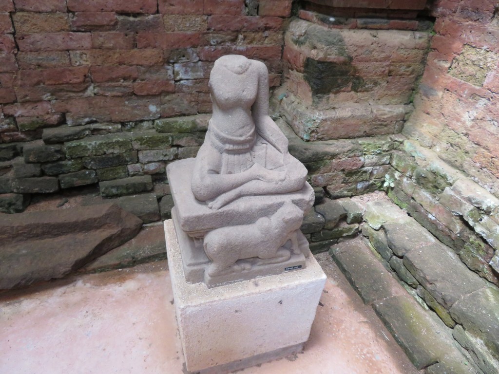
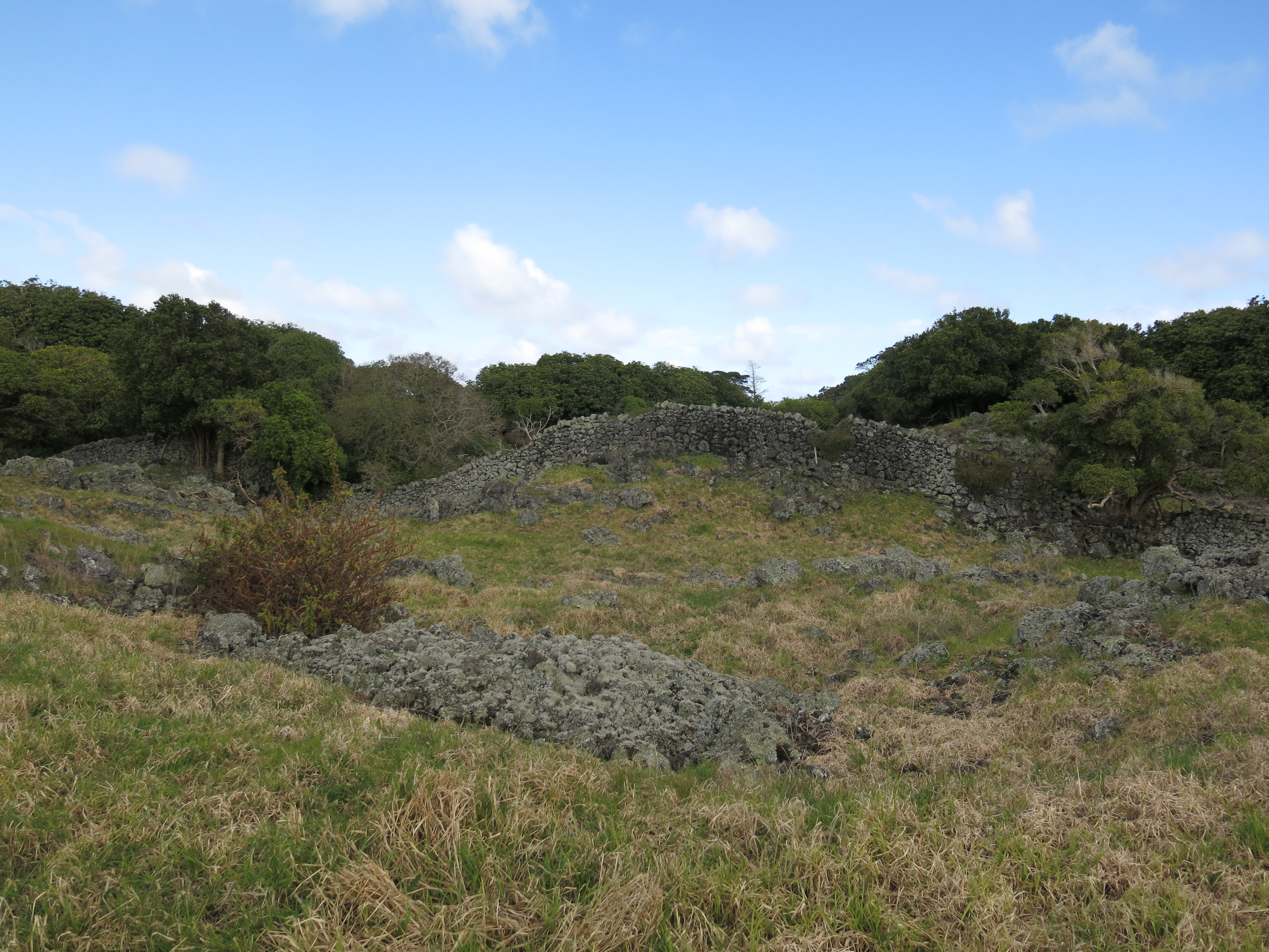
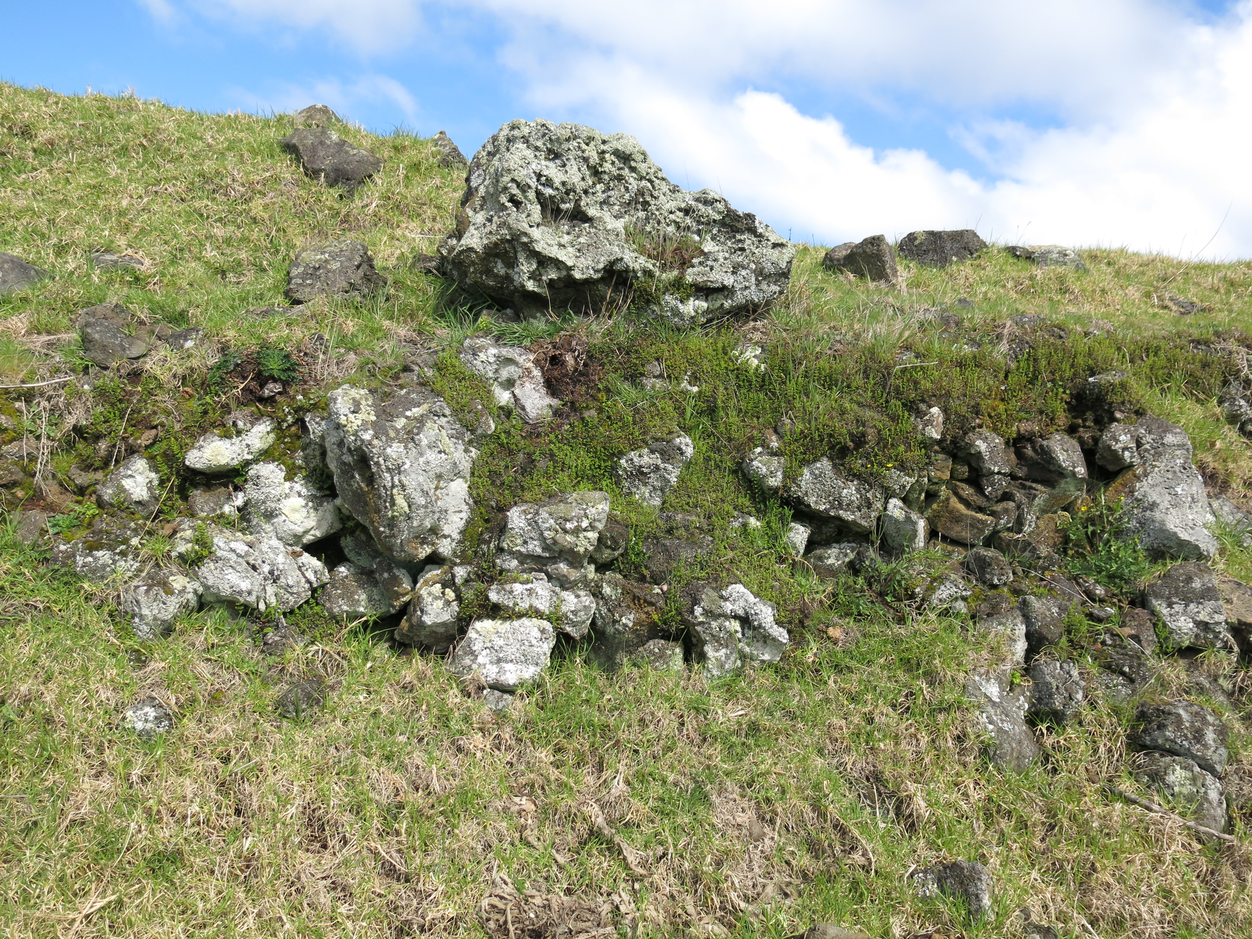
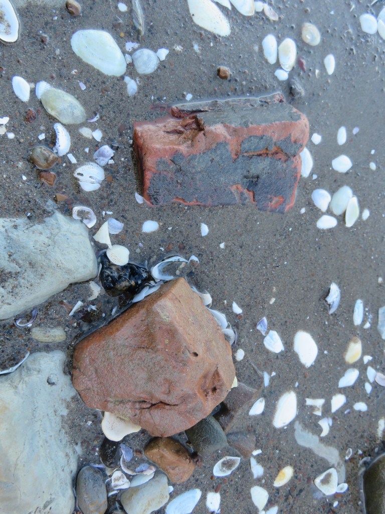
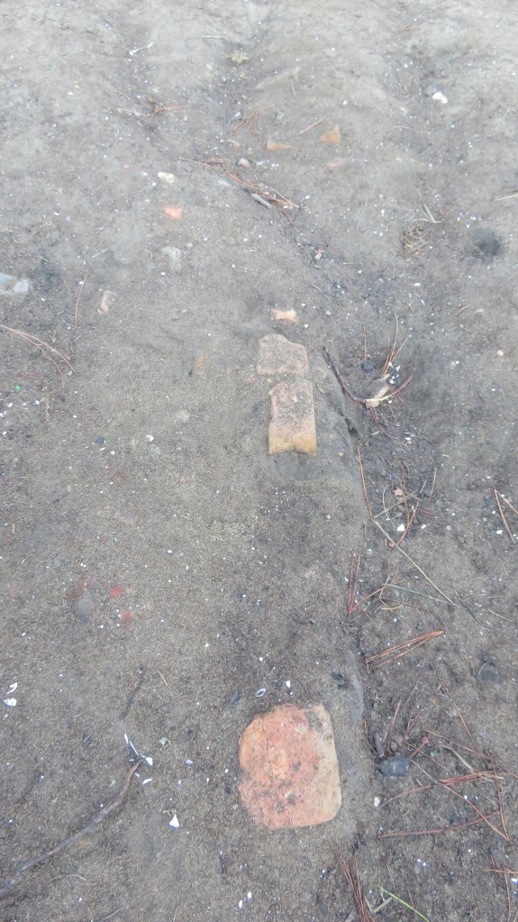
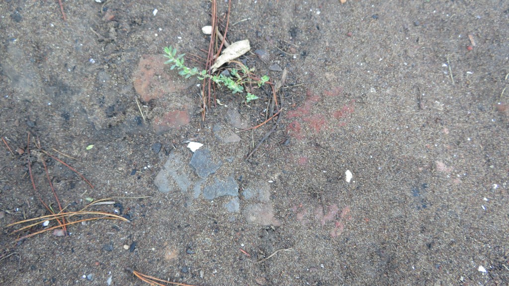
Quarryman’s Bay, like Brick Bay further up the harbour, refer to the early industrial endeavours of the area’s inhabitants.  Both quarrying and brickmaking were popular industries in a land where traditional farming was problematic.  One of the occupations of a potential early settler in the area was brickmaker (see below).

Just a few of the many bricks found on the beach at Fitzpatrick’s Bay – possibly either as a result of a small brick making industry or as a result of the demolition of the house on the hill which may have had a brick chimney.

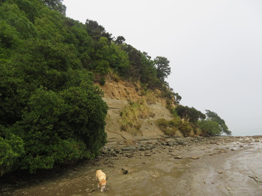
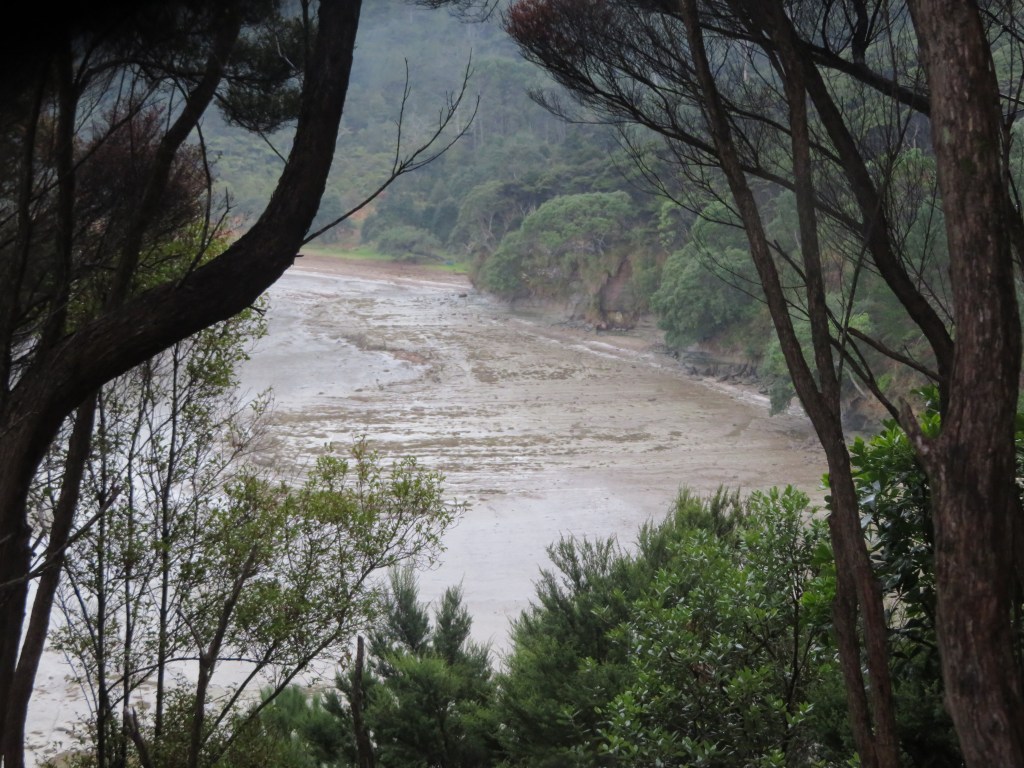
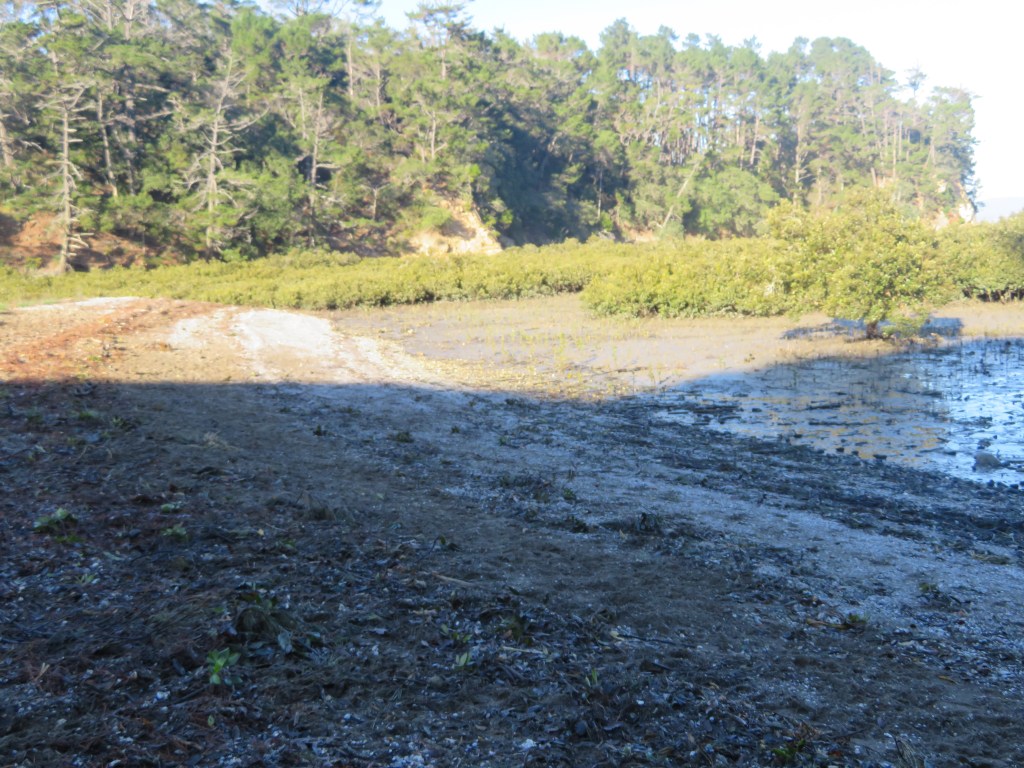
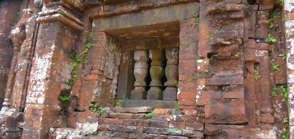
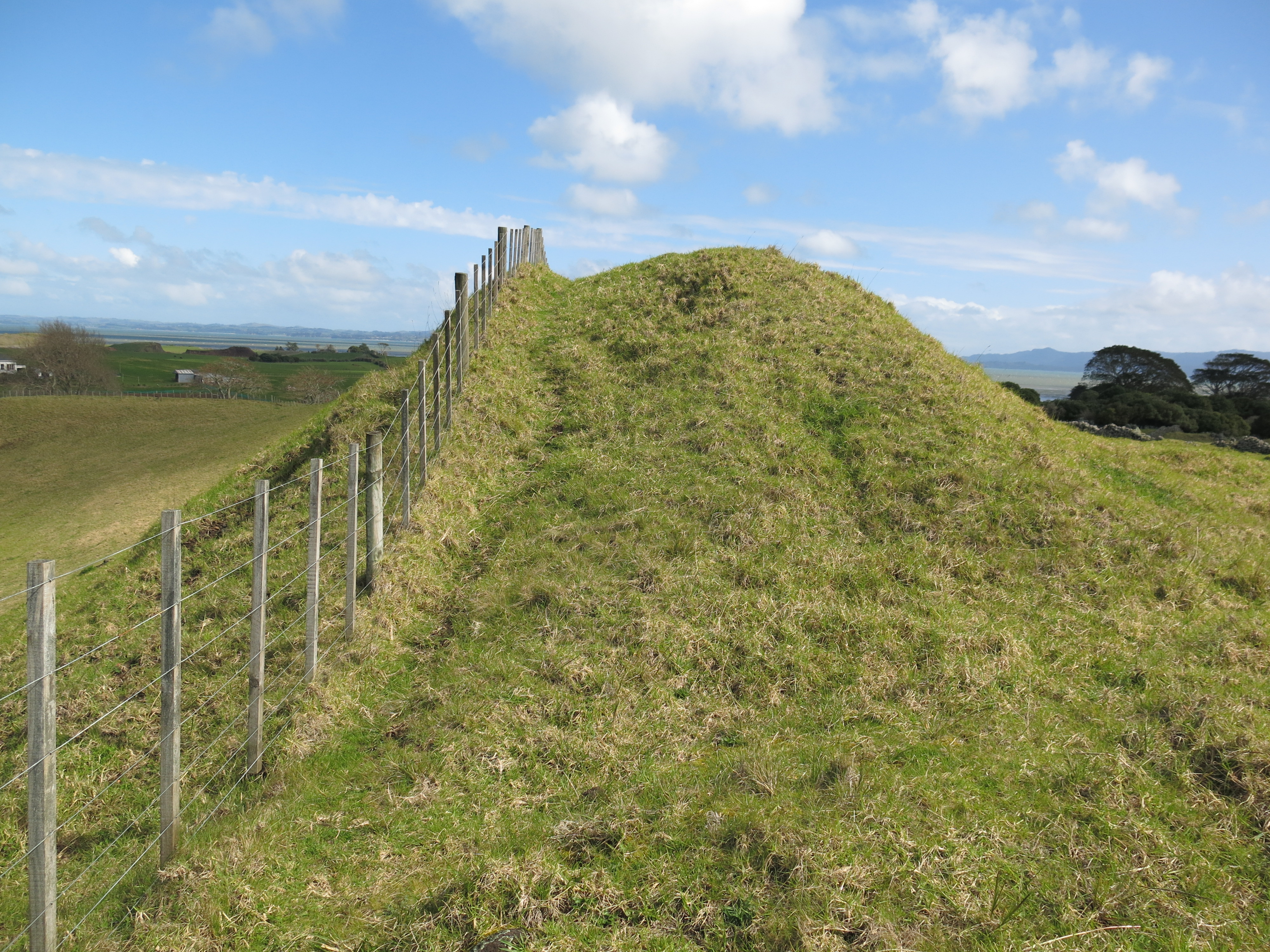
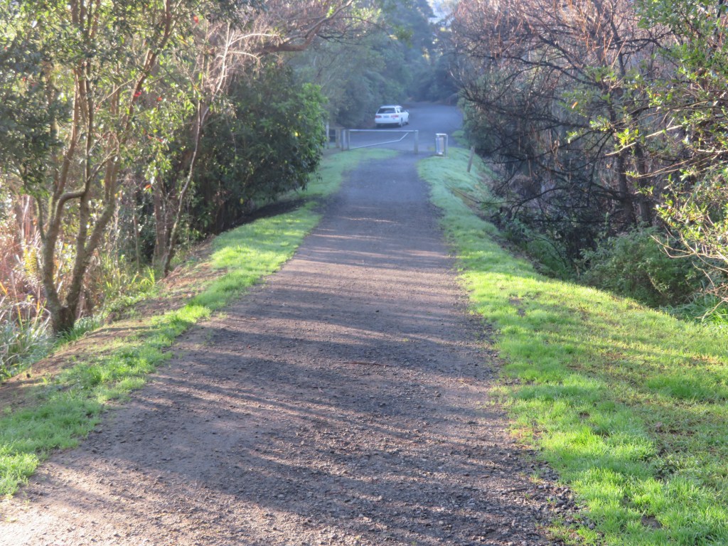
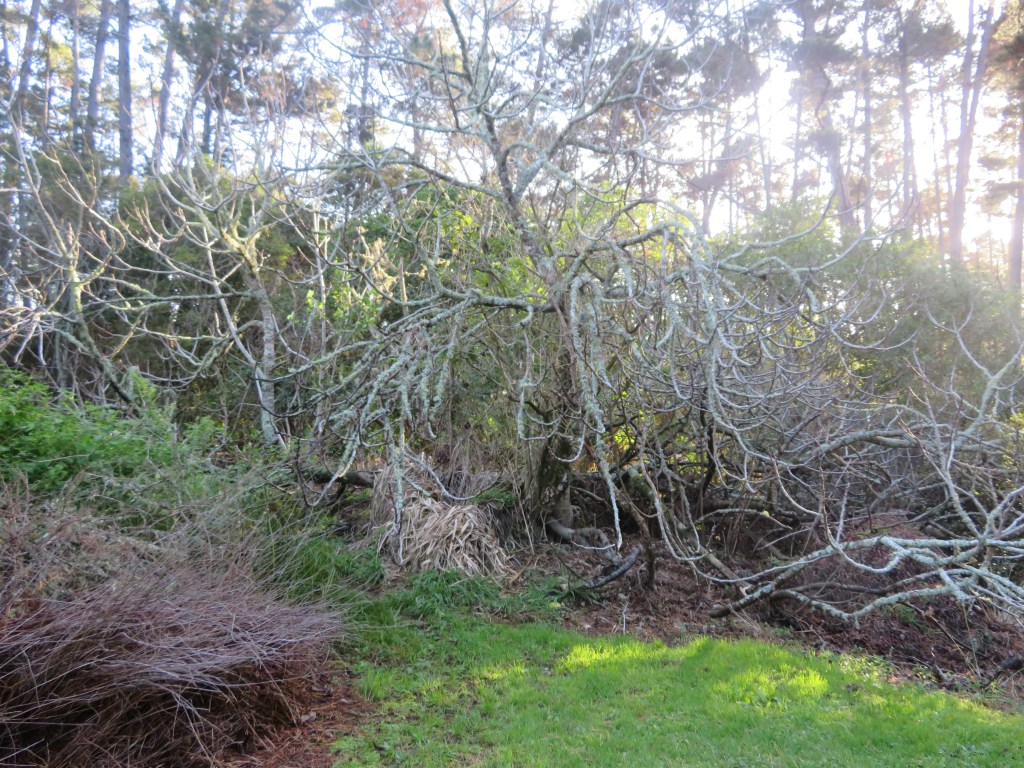
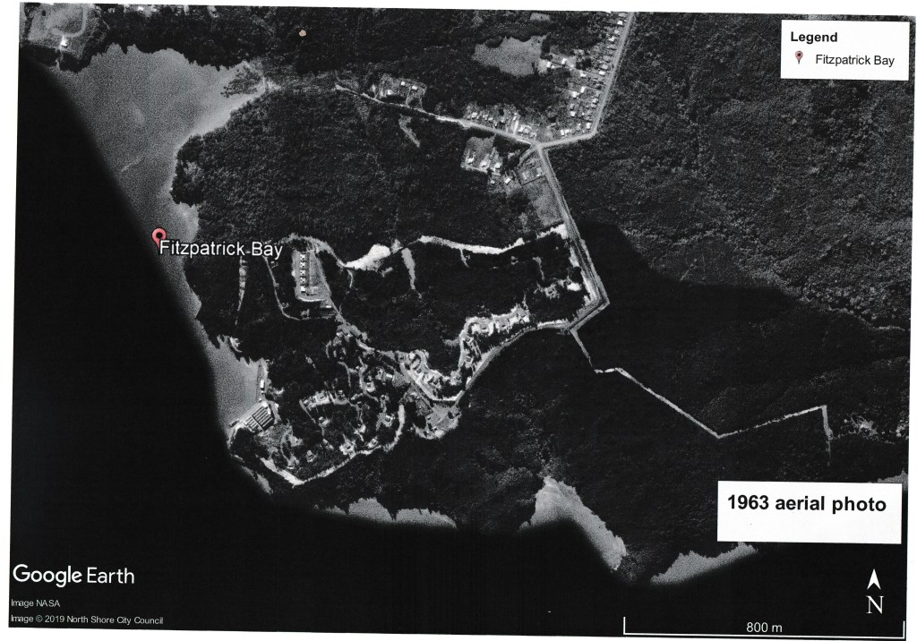
Soldiers Bay is an interesting case of a name that has been around for a long time but its origins are hazy.  The earliest mention that I have been able to track down is dated to a map of 1863.  Today the stream that runs down from the high ground and empties into Soldiers Bay would have been a lot less silted up and most likely navigable by waka or rowboat as far as the present-day carpark.  Today there is a causeway which joins the bottom of Balmain Rd to the reserve which would not have been there in the early days.  This causeway was most likely constructed in the early twentieth century when a caretakes lived at the end of the reserve above Fitzpatrick’s Bay.

The modern causeway which now links Kauri Point Domain to the bottom of Balmain Rd – there are oral histories which tell of access to the beaches being further up the valley.

None of which gives us any clue as to why Soldier’s Bay is so named…it has been suggested that the bay gained its name as a result of an encampment of militia during the unsettled times of the mid-1800s.  At the time, Hone Heke was ‘making life unpleasant’ for settlers in the north, particularly the Hokianga, and many had moved south to take up land in Birkenhead.  To allay the fears of the settlers a contingent of soldiers may have been positioned in various places…hence Soldiers Bay.  As mentioned before the stream would have been navigable to the bottom of present-day Balmain Rd, just before that though there is a flat spur which would have provided a good position for an encampment, with a clear view of the harbour and a fresh water supply.

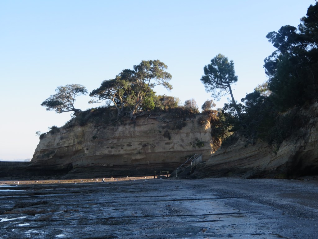
The final placename to consider is that of Fitzpatrick’s Bay, this small sandy bay is today part of the Kauri Point Domain and is a popular recreational reserve for the local area.  There are two possible people responsible for naming of the Bay – Charles Fitzpatrick or James Fitzpatrick. 

An examination of Jury Lists and Electoral Rolls shows that a James Fitzpatrick arrived on the Jane Gifford in 1842 with his wife and daughter.  The Jury List of 1842-57 lists James as living on the North Shore as a brickmaker; in the 1850s and 1860s he was still living on the North Shore but was now a farmer and a freeholder.  Whether or not he was actually living in the Birkenhead area is difficult to say; Birkenhead itself was not so named until 1863 and up until that point there was very little distinction between areas.  In the 1870-71 electoral roll James was listed as residing in Takapuna, allotment 15 – a survey of the cadastral maps of 1868 shows that allotment 15 is in fact in Northcote (Takapuna refers to Takapuna Parish of which included todays Takapuna, Birkenhead, Northcote, Hillcrest, Birkdale, Beachhaven and so on).  In 1890, James was still in the Takapuna Parish but was now listed as a gumdigger.

Photo of gumdiggers outside a raupo whare on the Manukau Pennisula ca 1891 (from Auckland Libaries heritage Collections 07064)

Charles Fitzpatrick only appears twice in the lists; first in 1867 and as having a freehold land and house at Kauri Point however by 1890 he had moved to Morrinsville.  Whilst only Charles is listed specifically as living in our area of study and he would appear to be the best option for the naming of Fitzpatrick Bay it is still not possible to rule out James. 

Addendum

Not long after this post was written, I was contacted by a gentleman who currently lives south of Auckland near Hamilton. He was happy to confirm that James Fitzpatrick was indeed the correct person after whom the bay was named – James was his great great grandfather. He was also able to confirm that James did have a small brick kiln in the bay.

Fun in the Sun

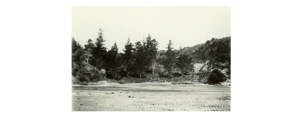
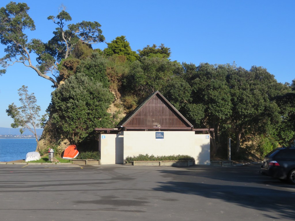
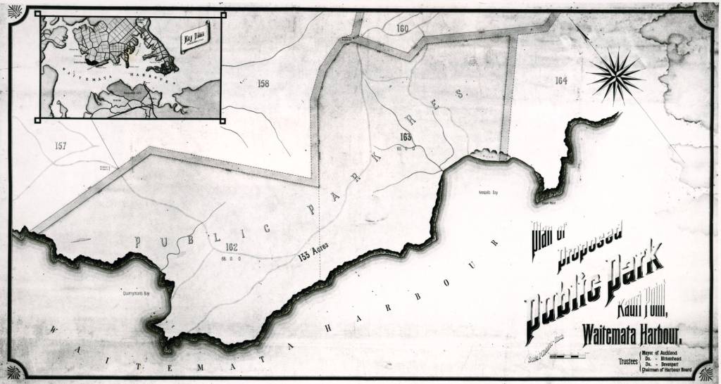
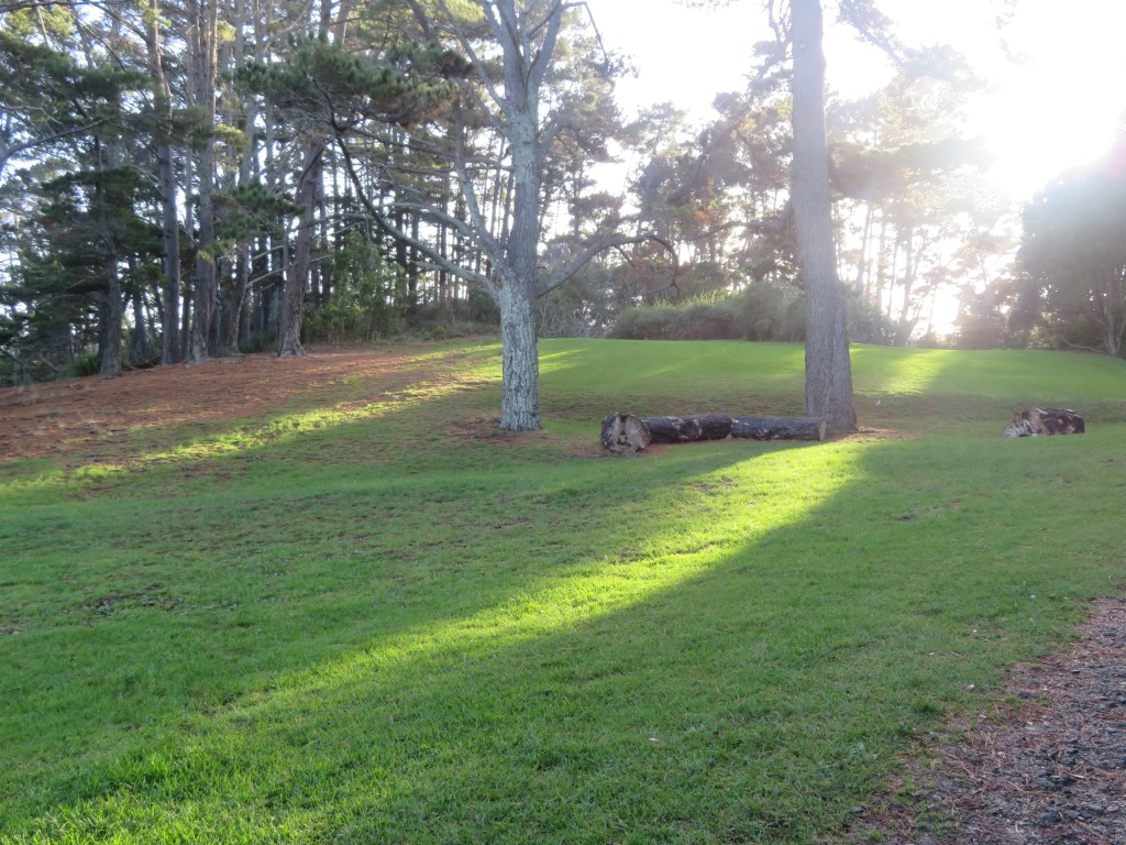
The study area today is made up of three different zones – residential (Island Bay), defence (Onetaunga Bay) and recreational (Fitzpatrick Bay, Soldiers Bay and Kendall Bay).  In 1888 Governor William Jervois permanently reserved for the purpose of recreation 133 acres of land (allotment 162 and 163) in the Parish of Takapuna.  It had been his hope that the area was turned into a national park, a place of tranquillity for Aucklanders. This was the area from Kendall Bay to the eastern end of Fitzpatrick Bay.  In 1913 the Harbour Board acquired a further forty-two acres which included Kauri Point (allotment 164) which had previously been owned by Sir John Logan Campbell until his death in 1912.  Further to this the area around Fitzpatrick and Soldiers Bay were then added to the park in 1916.  An article in the New Zeland Herald in 1916 stated that the reserve had a fine waterfront and had in the past had been much used as a camping and picnic ground.  It also mentions a ‘good five roomed house’, our first mention of what was to be known as the caretakers’ house.

Photo of the proposed plan for a park at Kauri Point dated to 1913.

 An article from 1900 also in the New Zealand Herald also mentions how the Kauri Point Domain board had agreed to allow campers for a small fee.  Interestingly they also denied a request for funds for a wharf.  Reading through multiple articles the request for a wharf in the area is one which is constantly brought up, eventually a wharf was constructed but not at Fitzpatrick’s or Soldiers Bay but at Onetaunga Bay and it was paid for and built without the help of the board or their funds.

The grassy area at Fitzpatrick’s used by campers since the 1900s if not earlier.

This marked a new era for this inner harbour landscape; each of the small bays were transformed in the summer months as families from the city side would spend the warmer days living under canvas. In the 1920s and 1930s there were seven or eight families holidaying at Kendall Bay, their camp was at the western end of the bay where there is a level space and a freshwater stream.  At Fitzpatrick’s the camp site was at the northern end of the bay on the grassy area above the beach.  Unlike elsewhere this part of the reserve was owned by the Birkenhead Borough Council from 1929 who improved it and put in place a caretaker. 

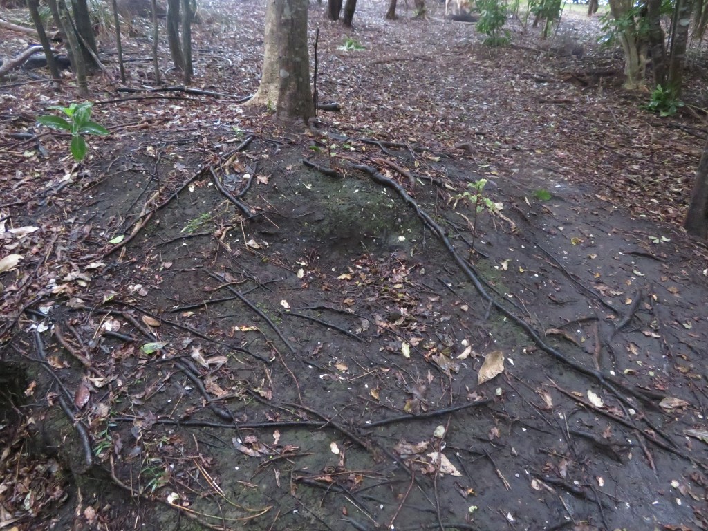
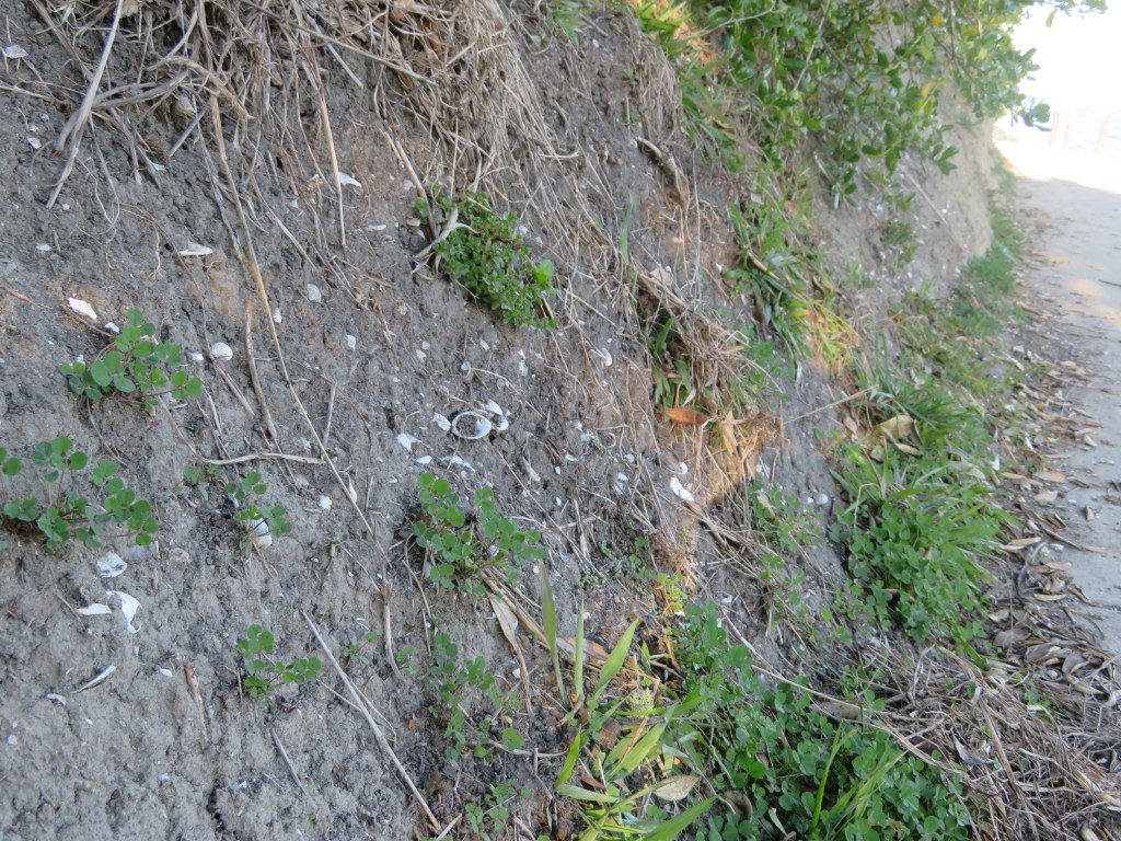
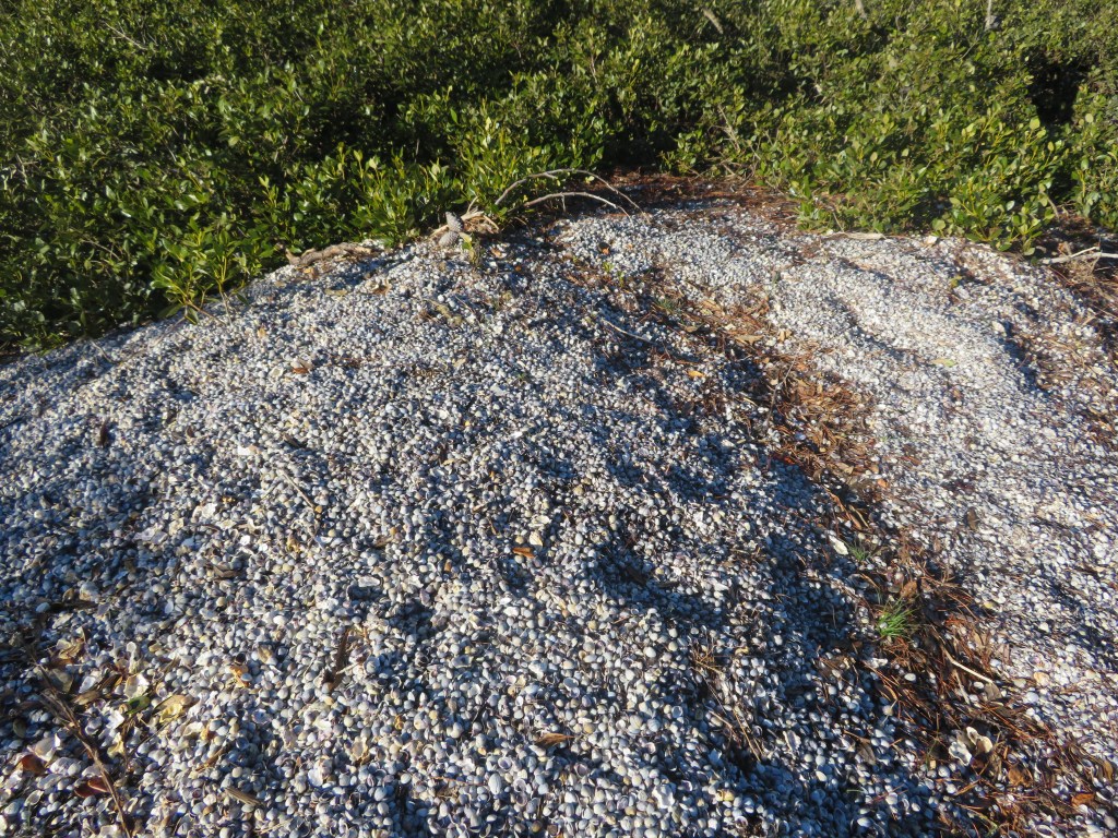
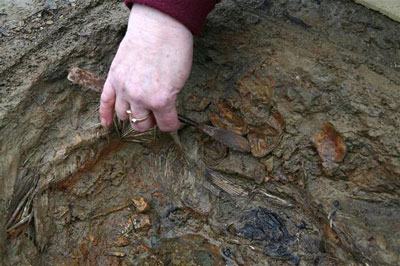
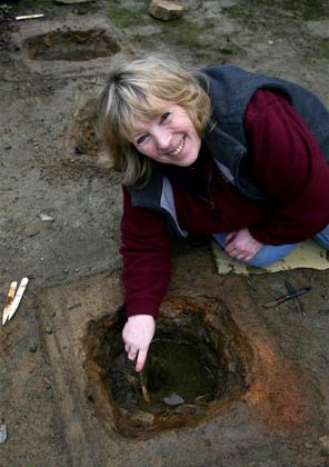
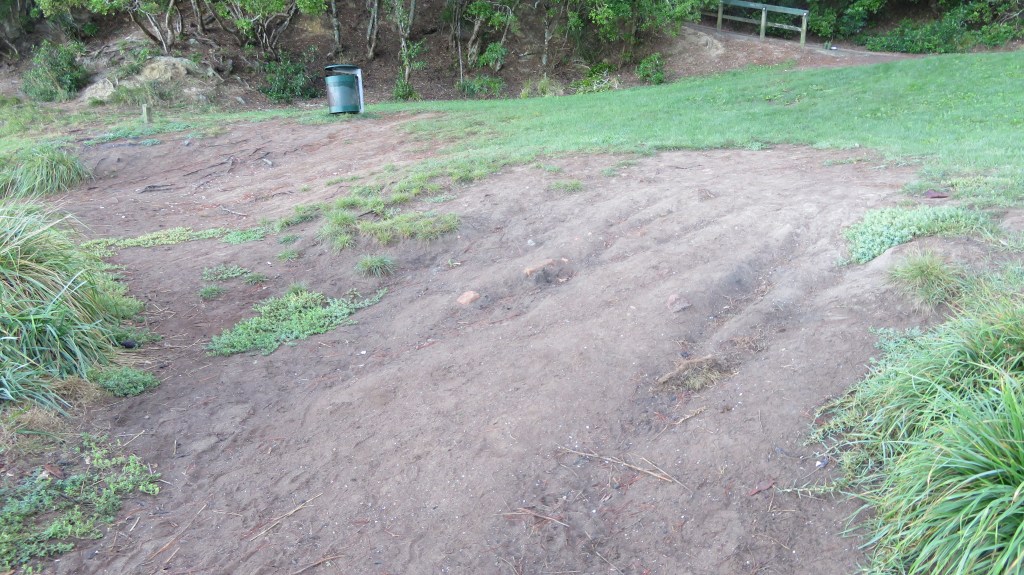
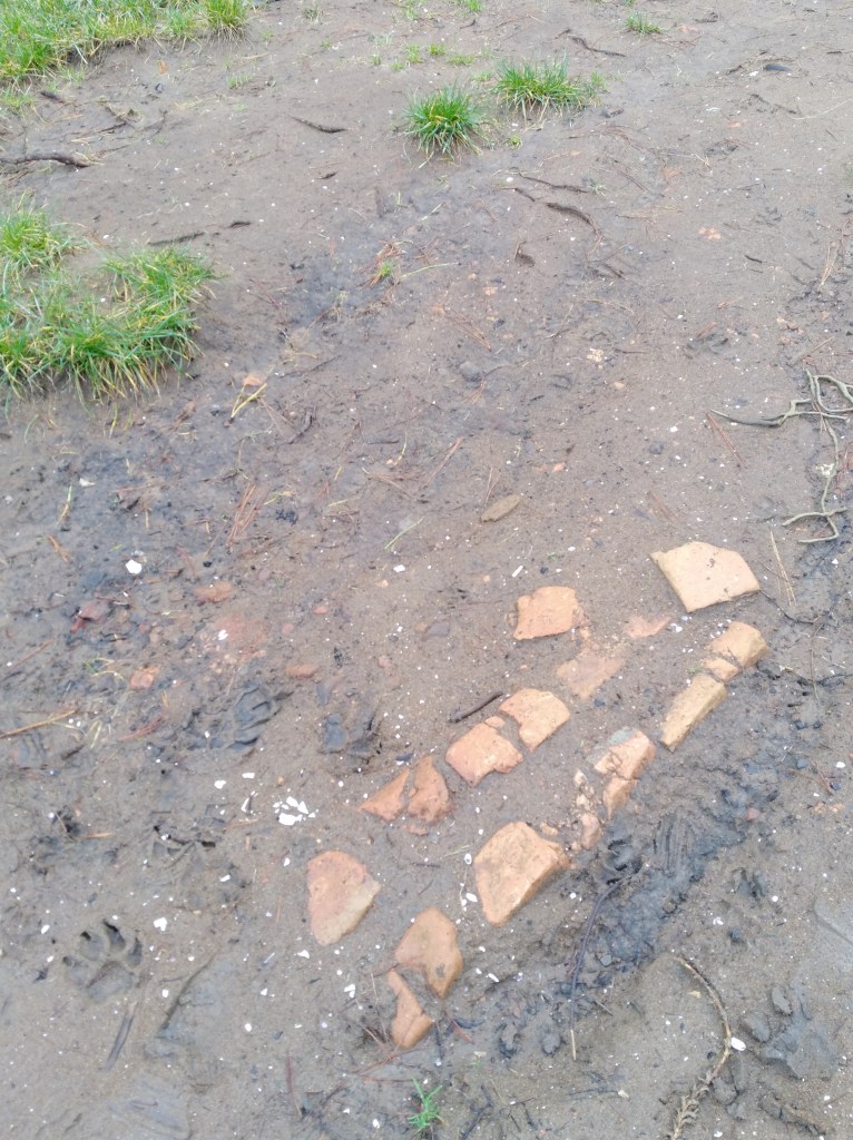
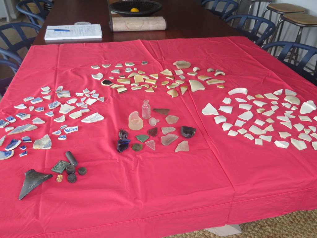
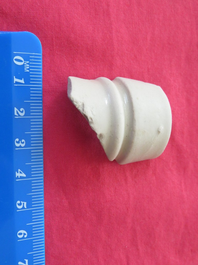
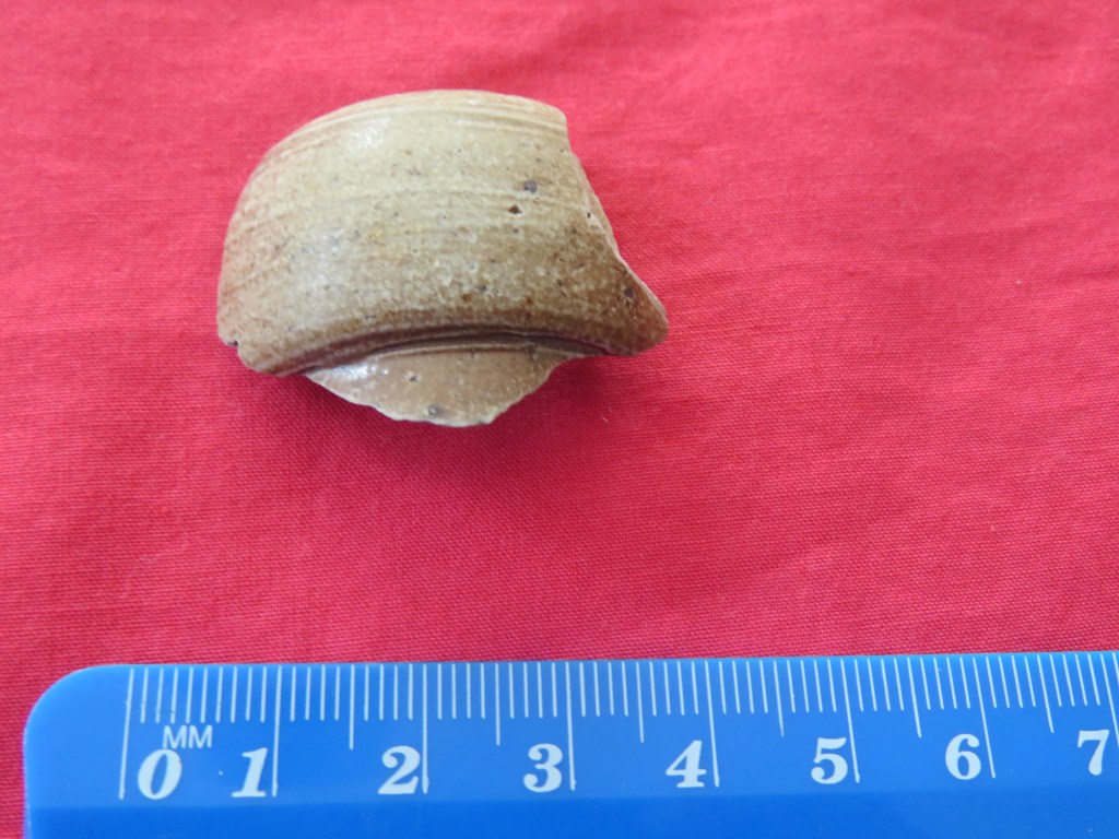
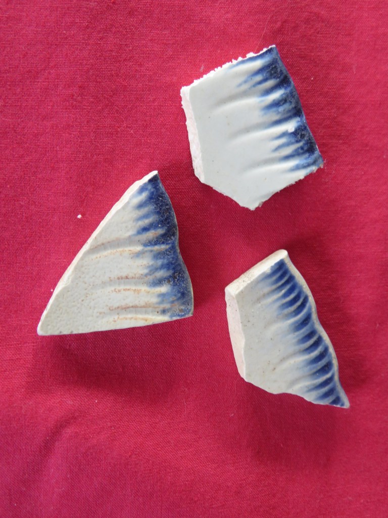
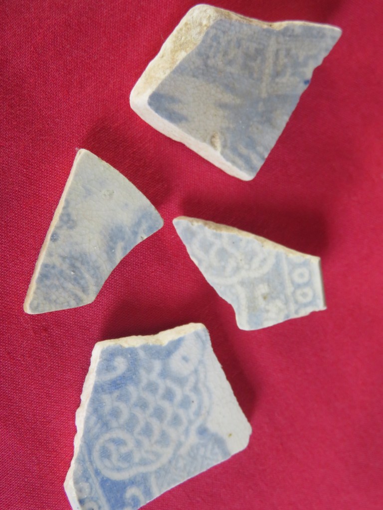
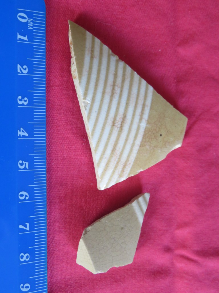
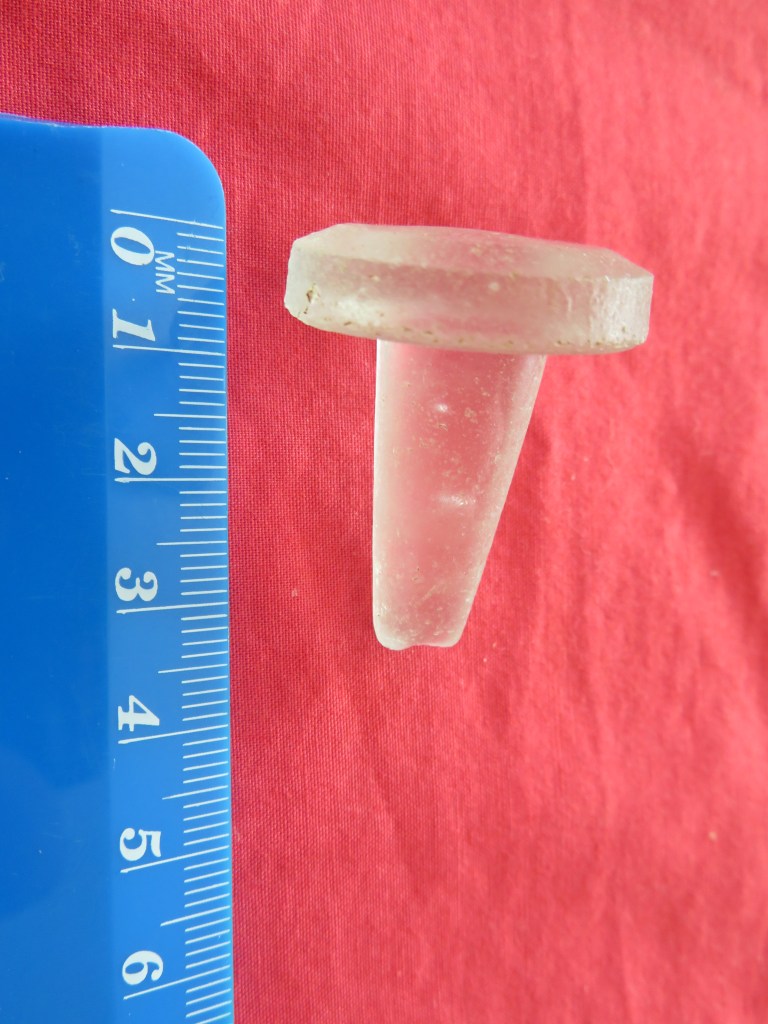
The only recorded caretaker was a William Henry Rickwood who lived in small house with his family on the hill above Fitzpatricks.  Oral histories record how Williams’ wife would keep a small store selling sweets, soft drinks and other useful supplies.  There was also a ‘ponga-house’ where Mrs Rickwood would provide hot water and often sold tea and scones to the visitors.  There is very little that remains of this house today, just a level area with an overgrown collection of European garden plants such as figs and a rambling rose.  However, there is evidence of both the campers and the caretakers in form of the rubbish they were throwing away.  Often along the bay sherds of old ceramics dating from the late 1800s to the mid-1930s can be found, undoubtedly there is a European midden that has eroded onto the beach. 

As well as the tent sites at Kendall Bay, there were other camping places, near the wharf at Onetaunga Bay and at Fitzpatricks bay which is the beach at the present Kauri Point Domain.  Pre-World War Two and back through the Depression years, tents appeared each summer for a back-to-nature holiday by bush and sea.  Much of the housework was left behind at home and there was no problem keeping the children amused. There were good sandy beaches and the harbour water was clear and clean in those days before the march of suburbia. (From a pamphlet of remembrances celebrating twenty years of Kauri Point Centennial Park, available in the Birkenhead Library).

Island Bay whilst listed as residential today was up until the construction of the Harbour Bridge mainly a summer town, full of bachs occupied only in the summer by families from across the water in the city. Unlike the other bays the land around Island Bay was owned by a land development company, being subsequently subdivided and sold off.  However, because of issues of transport and roads only a few of the blocks were permanently occupied.  Newspapers from the early 1900s often have articles describing summer outings by the Ponsonby Yacht Club to Soldiers Bay and area. 

Defence

A final chapter in the history of land use in our area is that of defence.  Just prior to the Second World War in 1935 ninety acres of the Kauri Point Domain was taken for defence purposes.  The area of Onetaunga Bay (once Quarryman’s Bay) was developed for a storage facility for naval armaments.  This unfortunately put paid to those carefree summer campers who no longer came in the large numbers, the caretaker at Fitzpatrick’s was still Mr Rickwood in 1938, as listed in the Wises Directory, but with the outbreak of WWII everything changed.

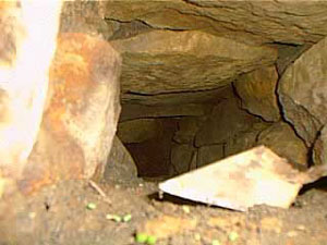
In 1942 the Americans had arrived in response to the Japanese threat in the South Pacific. Kauri Point Domain, Fitzpatrick’s bay included, were given over to the Americans and a large number of powder magazines were built.  There are several unusual features on the beach at Fitzpatrick’s Bay, which may relate to these days.

After the war the Domain reverted to being parkland but never again were campers allowed back to any of the bays.  Today the Naval depot forms a large wedge between Kauri Point Domain and Kauri Point Centennial Park.

The wedge of buildings and land is the naval depot – Kauri Point Domain is to the top and Kauri Point Centennial Park the dark area to bottom and along.

Sources

McClure M (1987) ‘The Story of Birkenhead’

Auckland Libraries Heritage Collections

‘Island Bay – A Brief History’ – unknown author.

‘Birkenhead The Kauri Suburb’

Papers Past – New Zealand

Electoral Rolls – Ancestry.com

‘Kauri Point Centennial Park Management Plan’ Birkenhead City Council 1989.

‘North Shore Heritage. A Thematic Review Report’ Auckland City Council 2011.

Early Land Use and Settlement on the Upper Waitemata – A Case Study – part one

For the last five years or so I have been walking the ever-faithful Brad the Dog to a small but perfectly formed bay known locally as Fitzpatrick’s. During this time, I have found a variety of interesting objects on the beach, some have obviously been washed in and others have eroded out of the beach head and sand. I also noticed a few interesting humps and bumps and well that was it, my curiosity was well and truly piqued.

Multiple questions kept my mind occupied, such as, who was Fitzpatrick? Who lived in the house on the hill of which only humps, bumps and a rambling rose remained? Why do I keep finding ceramics on the beach? And what about the pre-colonial settlement of the area? As I began to research it became necessary to expand the overall area of interest to include the bays east of Fitzpatrick’s – Onetaunga Bay and Kendall’s Bay – and the bays west – Soldiers Bay and Island Bay – in order to get a fuller picture.

For the purpose of this article there are two distinct early phases of settlement and use of the area – the Maori pre-colonial and the early colonial up to 1900 – which will be the focus of this article and the next (part two). Later occupation of the area can be divided by the World Wars particularly the second World War and the construction of the Harbour Bridge which indelibly changed the face of the North Shore. But first let’s consider the bare essence of the area, without the human factor muddying the waters.

The Geology and all that Natural Stuff…

The area with Fitzpatrick’s Bay at its centre is situated on the north side of the Waitemata Harbour in the suburb of Birkenhead. Geologically speaking the Waitemata Harbour is a drowned late Pleistocene valley whose natural rock type is sandstone and mudstone. It is highly susceptible to coastal erosion, often resulting in steep sided promontories that continue to crumble particularly after heavy rain.

The current environment is one of invasive pine trees and impenetrable scrub bush although originally the hills behind the beaches were once thick with kauri, pohutakawa and other natives (small stands still survive in places). The presence of kauri caused the soil to be nutrient poor and therefore not the best for horticulture, unlike the landscapes on the opposite side of the harbour with its rich volcanic soils ideal for horticulture and therefore human settlement. However, the rich waters of the Waitemata made up for this deficiency particularly for the early inhabitants. On the southern edges of the Waitemata Harbour and opposite Kendall’s Bay is Meola Reef, also known as Te Tokaroa Reef – the area is well known to marine biologists as a shark spawning ground, here female sharks leave their young to fend for themselves in the relative safety of the inland harbour.

In addition to shark there are many other species of fish which frequent the harbour, such snapper, flounder and yellow-eyed mullet. The foreshore also provides an abundance of shell fish, predominately in the form of pipis, cockles and rock oysters.

The Maori

The Maori story of this part of Auckland differs considerably from other parts. The central area of Tamaki Makarau with its fertile volcanic cones was ideally suited to horticulture and thus heavily settled. The northern side of the inner Waitemata Harbour was not so suited to horticulture, the vast kauri forests having depleted the already thin soils of nutrients. So how was this part of Tamaki Makarau utilised by the Maori?

Our understanding of the settlement and subsistence patterns of this pre-Treaty of Waitangi time is restricted to the several defended promontories (pa) and the many shell middens which can be found around the shoreline.

Colonel Boscawen’s hand drawn map of 1899 to accompany his photos taken at the same time. He was very interested in Maori settlement and was a prolific photographer.

The Pa

The term pa is taken to mean any settlement that consists of defensive earthworks such as banks and ditches. The pa in our area are mainly confined to the steep sided promontories that are usually adjacent to a protected beach where waka were able to land safely. The most well-known is Kauri Point or Te Matarae A Mana, named for Manaoterangi a chief of the Ngati Kawerau who flourished in this area from around 1720-1790. It is also the only pa to have any archaeological excavations undertaken (in response to the possible threat of the construction of a second harbour crossing, the first having completely destroyed Onewa Pa on Stokes Point in Northcote).

Te Matarae A Mana (Kauri Point) from the beach below.

These excavations were undertaken by Janet Davidson in 1971 and consisted of a total of seven test pits in four areas. In the 1990 report of the excavation Davidson emphasises the strategic importance of the headland describing the approach from the landward side as being along a narrow and winding ridge which widens to become a flat-topped headland. The site has natural defences in the form of a steep scarp to the southern side which is enhanced by two incomplete ditches. The excavations and subsequent finds revealed that even given its impressive position the site was only used for a limited time. The middens found in three of the four areas produced well-preserved fish bone – but not much in terms of quantity; a single dog bone; pipi and cockle shell – the principal species, which was to be expected; as well as mussel and oyster shells. Interestingly, there were a large number of slipper shells whose flesh may have used as bait for fishing. The middens themselves were quite small and corresponded with the lack of structures found on the headland.

This unassuming dent in the ground is the remains of one of Davidson’s excavation pits.

“In view of the apparently strategic location, this lack of evidence of prolonged or repeated occupation was surprising” (Davidson J 1990 ‘Test Excavations on the Headland Pa at Kauri Point, Birkenhead, Auckland in 1971’)

This was very different from other pa sites in Auckland and Davidson concluded that the headland had been constructed by people who visited the adjacent bay for seasonal fishing and that most of the activities happened in the bay below. The pa therefore may have had a more esoteric function such as the proclamation of the Kawerau Chiefs’ mana, an assertion of the group’s rights to the area and ultimately as a ‘just in case’ need for defence.

The photos below are a selection from Te Matarae – the first shows the overgrown nature of the eastern ditch; the second is of the interior which is flat to sloping; the third whilst not very clear is the remains of midden; the fourth is the view from the top out towards Auckland City and finally the last looks down onto Kendall’s Bay below.

According to the “Cultural Heritage Inventory” published by North Shore City Council in June 1994 there are two further pa in the vicinity of Kauri Point. One was presumed to be located within the grounds of the Naval Base which sits in the middle of our research area and is inaccessible for security reasons. In 1899 a Colonel Boscawen did a rough drawing of the area to accompanying six photos he took. On the map he noted this particular pa which appears to be a major headland pa, was far greater in size than Te Matarae A Mana (Kauri Point).  However, on closer inspection of Col Boscawen’s photos and map, it may be possible that this larger pa with its large ditches may not be in the Navy compound but further to the west and near to Soldiers Bay.  Over a two-day period I attempted to prove or disprove this idea but the dense bush in the area was a significant issue. In addition, aerial photos have shown that even if the site was in the Naval base much of it would have been destroyed during the development of the land for the base.  So as of now the issue is still unresolved…

Below are Col Boscawen photos of the various sites – 1. Te Matarae form landward – the ditches are faintly visible across the neck of the promontory. 2. Te Matarae from up on the hill which is now part of the Naval Base and assumed to be the pa site of Maunganui. 3. On Boscawen’s map this is labelled photo 5 and could be either Fitzpatrick Bay or Onetaunga Bay. 4. A view of the headland labelled photo 4 on the Boscawen’s map which is labelled as a Maori pa site and has two ditches drawn in. Once again this may be either at the eastern end of Fitzpatrick Bay or the headland on the Naval Base. 5. This headland at the western end of the beach as seen in number 3.

The second pa recorded is named as Maunganui and according to the “Inventory” Janet Davidson is thought to have identified ‘part of the Pa ditch in scrub just south and east of the trig at the corner of Onetaunga Road and the road to the Naval Base’. The general assumption is that it is situated on the ridge on which the Onetaunga trig is located, but there is still some doubt as later developments may have caused the landscape to take on forms which deceive the eye.  It is interesting to note that Col Boscawen did not include this pa on his map of 1899, a site he would have been aware of, unless of course the large pa mentioned above was in fact Maunganui and this has become a case of mistaken identity.

Beyond Kauri Point and past Fitzpatrick’s are two further pa, one south of Island Bay and the second at Island Bay. The first is situated on top of a cliff about half way between Soldiers Bay and Island Bay. It has been recorded as consisting of a ten-metre square flat area with a small terrace forming the internal area of the Pa. There is ditch on the landward side whilst the other sides are formed by steep cliff faces or slopes.

A grassy reserve above Island Bay – may be the remnants of terracing associated with the above mentioned pa.

The photos below are of Island Bay – here a small promontory pa is joined today by a modern carpark which is reclaimed land. The pa itself has been extremely modified with the addition of concrete paths, a wharf and toilet block. The last photo shows the promontory in profile looking west.

The pa at Island Bay is situated on top of the island itself and it is approximately 15 metres by 20 metres in size; middens can be discerned on the northern and western sides.  The middens appear to dominated by cockle shell, pipi and oyster. When last surveyed, charcoal, hangi stones and obsidian were also noted. It has been noted that the top of the island consists of some terracing which are not obvious until seen in profile.

The midden at Island Bay on the eastern edge of the promontory – now very badly eroded – the white flecks are shell.

The Middens

Already mentioned above is the Island Bay Pa midden, and in addition there are recorded middens at Kauri Point Domain and Soldiers Bay. The Kauri Point midden is regarded as the largest in the area and situated at the southern end of the Domain and is noticeable as a result of a stormwater drain cutting through it. Today grass has almost obliterated the view of the midden and it does appear to have eroded away quite a bit. However, previous surveys have found it to be three metres long and one metre high; three layers of shell have been discerned each separated by layers of sand and clay mix. Apart from cockle, pipi and scallop shells, hangi stones and charcoal are also present. Waterworn hangi stones are often to be seen on the beach, giving further emphasis to the issues of coastal erosion.

A midden eroding out onto the path just above the beach at Kendall’s Bay at the foot of Te Matarae/Kauri Point.

The midden at Soldiers Bay is situated on the small beach beyond the current mangroves. It has suffered much from erosion and when last surveyed was two metres long and spread over a height of three and half metres. Opposite and nearby are a further two smaller middens. In 1899 Colonel Boscawen drew a map to accompany half a dozen photos he took of the area. On this map he mentions the presence of ‘pipi shell mounds’ at the edge of a bay he called Quarryman’s Bay, which appears to be the combined bays of Soldiers Bay and Fitzpatrick’s Bay, and correspond with what can be seen today.

“The majority of the middens revisited are located in bays sheltered from the southerly winds…As for the pa, they are located on low cliff tips and are close to the deeper waters of the Upper Waitemata Harbour. They also have strategic views along prime fishing waters and are located along a major access route to the Kaipara Harbour located on the west coast.” (‘Archaeological Sites of Birkenhead’ by Richard Jennings in “Cultural Heritage Inventory” North Shore City Council June 1994)

Other Evidence

Other archaeological features which may be indicative of the Maori use of the area include a range of pits and terraces recorded at various places. Unfortunately, the later expansive development of the area means that much of the evidence has been destroyed, or what is being recorded may instead be the result of such development. The previously mentioned Colonel Boscawen also mentioned on his hand drawn map the presence of ‘fairly good soil, has appearance of old Maori cultivation’ in the area near to Quarryman’s Bay. A closer inspection of the beach area below Te Matarae revealed two possible house platforms above the high tide line and close to the cliff edge, these are hidden today by extensive regrowth and are not obvious from the beach. Each platform is roughly 5m x 12m.

Although hard to see in a photo this flat area is one of two which are visible in the undergrowth at the beach edge below Te Matarae/Kauri Point. They measure approximately seven metres in width and twelve metres in length.

In addition to the actual archaeological sites there are two other sources of information which may serve to fill in a few of the gaps – beach finds (random artefacts found on the beaches of the area concerned) and oral tradition.

Below are selection of beach finds dating from this period – these were found mostly on Fitzpatrick’s Bay, Onetaunga Bay and Soldiers Bay. Please note that at no time did I or anyone else from whom I received information on these artefacts dig them up; they were found simply by eye on the foreshore below the tide line. What they can tell us though is that Maori were active in the area and had wide ranging contacts (the obsidian); the sinkers are indicative of a community taking advantage of the marine resources; the adze (and the pieces of adze) are suggestive of woodworking; and already mentioned are the hangi stones found in the tidal area as a result of erosion.

The last five photos are of artefacts found by a fellow dog walker who has kindly allowed me to photograph his finds. It should also be noted that he has found a broken adze head (used in wood working) and several other stone flakes. These items have been donated to the Auckland Museum and are undergoing processing as new acquisitions.

Our knowledge of Maori history prior to the arrival of the Europeans is based upon the rich oral histories passed down through the generations and here on the Waitemata this is no different. The name Waitemata can be translated as ‘the waters of the Te Mata’ – the reason for the name can be found in the oral history of the region. Some traditions tell of the canoe Te Arawa which arrived in Tamaki under Tamate Kapua. It was he who gave Tamaki its mauri or soul by placing a sacred rock from Hawaiki on the island called Te Mata (known today as Boat Rock which is just above the harbour bridge). It was the mauri was called Te Mata – hence the name, Waitemata. Often before a fishing expedition was undertaken, a carved sinker would be taken to Te Mata and a karakia said then the sinker was hung on the front of the waka. In Nagti Whatua tradition the first fish caught in the season would be used as an offering and placed on the rock called Te Mata.

The first hapu to live on the North Shore were the Kawerau with their main centres being in the Takapuna/Devonport area where land was easier to cultivate. The coastal area of the Waitemata appear to be less well populated but that is not to say no less important. Perhaps the site most well known in our area of concern is Te Matarae a Mana or Kauri Point. In the late 1700s the Waiohua and the Ngati Whatua were at war for the occupation of Tamaki. A great number of battles were fought with many chiefs being killed including Tamaki Kiwi. According to Maori history, the site was spared by the Nagti Whatua during their conquest of Tamaki because the chief Te Mana asked for protection from Tuperiri, one of the leaders of the conquest. Te Mana eventually died an old man in 1790, passing on the custodianship of Te Matarae and his people to Tuperiri.

However, this was not the end of the story – the son of Te Mana, Takarau, joined a large war party heading north against the Nga Puhi. The raid was successful and many Nga Puhi chiefs were killed. But in 1821 when Hongi Hika (Nga Puhi) returned from England he brought with him muskets and invaded Tamaki with devastating effect. Takarau was away at the time and so was spared; his people fared less well and those that could escaped into the hinterland, hiding in the bush until the 1830s, when a small contingent reoccupied Te Matarae. On the 13th of April 1841 all of the land in our area and beyond was sold as part of huge parcel of land, referred to as the Mahurangi Block.

Beyond the stories of battles and conquest, our understanding of how sites such as Te Matarae were utilised can also be gleaned from the oral traditions. George Graham recorded how the beach and village below Te Matarae became busier with many waka using the beach during the shark fishing season. Some fleets were said to come from as far away as Hauraki. This may account for the terraces above the beach which could be interpreted as house platforms.

Placenames are also an interesting source of information – all of the places we are looking at as part of this article have European names but of course once upon a time they had Maori names – so for example the bay west of Kauri Point was called Ngutuwera (translated as ‘burnt lips’). The bay below Kauri Point was called Rongohau or ‘nook sheltered from the wind’; here waka would take shelter during bad weather. The deep wooded gully which leads to Soldiers Bay was once called Tawhiwhi Kareao and its translation is interesting as it refers to the plant called supplejack which was used in lashing for the wakas. Island Bay was once called Te Waitioroa (‘the area of Toroa’) and was apparently named so because Toroa rested there on his way to Paremoremo. But it is not only landscape features which had names; actual parts of the harbour were given names such as Wairoria or ‘the swirling waters’ – a place west of Kauri Point where a strong tidal rip is always found.

From the archaeological, historical and oral traditions we can say that the use of the area by Maori was extensive. Settlement in many parts may not have been permanent in the European sense, but it was no less important.

Ahi ka did not mean that occupation at each place had to be maintained all year round. However, reqular visiting and use of the camps or temporary settlement affirmed authority in the region.” (M. Kawharu 2004).

Bibliography

Davidson J (1990) ‘Test excavations on the headland Pa at Kauri Point, Birkenhead, Auckland in 1971’ Records of the Auckland Institute and Museum 27:1-18

Jennings R (1994) ‘Archaeological Sites of Birkenhead’ in “Cultural Heritage Inventory” North Shore City Council.

Kawharu M. (2004) ‘Tamaki Foreshore and Harbour Report’ Auckland City Council.

McClure M (1987) ‘The Story of Birkenhead’ Birkenhead City Council.

Simmons D (2013) ‘Greater Maori Auckland. Including Maori Placenames of Auckland’ Bush Press of New Zealand.

My Son – Temples in the Jungle

During a recent holiday in Vietnam I visited the temple precinct of My Son, the principal religious center of the Champa. The following are a few photos (read many) of this day trip with a bit of background for good measure.

Who were the Champa?

Essentially the Champa were a collection of independent polities who ruled central and southern Vietnam from around the second century AD. The independent states became united in the fourth century under the rule of King Bhadravarman of Indrapura during the 4th century. Between the 7th and 10th centuries the Cham controlled the trade in spices and silk out of the South China Sea. Hoi An was the main port of the principality of Indrapura and whilst the capital of the Champa was in the area of the modern village of Dong Duang – both are situated near to My Son.

Map of Vietnam – Hoi An and Da Nang are roughly central on the coast.

From around the fourth century the Cham adopted Hinduism as their principle religion although many were eventually converted to Islam from the 10th century onwards. Today whilst the majority are Muslim there are still some that retain the Hindu faith and traditions.

The name Champa comes from the Sanskrit word ‘campaka’ which refers to species of flowering tree similar to a magnolia.

By 1832 the northern Vietnamese Emperor Minh Mang had annexed and absorbed the Cham polities

My Son

My Son is situated in a valley near the village of Duy Phu approximately 69km from DaNang and was the site of religious ceremonies for the HIndu Cham rulers between the 4th and 14th centuries. It also served as a royal burial place. There are in excess of seventy temples in addition to many stele containing important inscriptions in both Sanskrit and Cham.

An aerial view of the now jungle covered valley, the bare patches are some of the temples accessible to the visitor.

The Hinduism of the Champa was Shaiva with elements of local religious cults such as that of the earth goddess Lady Po Nagar. A number of the features at My Son are the linga – a black stone pillar representing Shiva and the yoni representing the mother.

Unfortunately the valley was carpet bombed by the Americans during the Vietnam war and many of the temples were severely damaged and in some cases totally destroyed. In recent years efforts have been made to rebuild the temples (the work is ongoing).

The hollows are indeed bomb craters – this part of the site has been left untouched – as awful as the bombing of such an important site is, the act is part of the history of My Son and as such needs to be remembered and preserved if we are to learn anything from it.

All but one of the temples are constructed from red brick (the only stone built temple is in the area known as B1). The decorative carvings which adorn the temple exteriors were cut directly into the bricks themselves. Although there has been some discussion about the type of mortar used in construction of the temples, it is now generally accepted that the mortar consisted of a sticky clay solution similar to the brick clay.

There are four types of buildings –

  1. Kalan – the brick sanctuary used to house the diety.
  2. Mandapa – the entry hallway associated with a sanctuary.
  3. Kasagrha – ‘fire-house’ usually with a saddle shaped roof and used to house valuables or to cook for the diety.
  4. Gopura – the gate tower leading into a walled temple complex.

In addition to the many sculptures and statues there are numerous stele (32 known in total) dating between the 5th and 12th century. The stelae can refer to a foundation of a temple, altar or pedestal. As historical documents they are very useful as they list names of kings, cities and occasionally describe important historical events such as the wars between Champa and Cambodia in the 12th century. The statues and carvings are usually representations of Shiva, also there are guardian statues found outside the temples.


The monuments of the My Son sanctuary are the most important constructions of the My Son civilization. The tower temples have a variety of architectural designs symbolizing the greatness and purity of Mount Meru, the mythical sacred mountain home of Hindu gods at the center of the universe, now symbolically reproduced on Earth in the mountainous homeland of the Cham people. They are constructed in fired brick with stone pillars and decorated with sandstone bas-reliefs depicting scenes from Hindu mythology. Their technological sophistication is evidence of Cham engineering skills while the elaborate iconography and symbolism of the tower-temples give insight into the content and evolution of Cham religious and political thought.  

From the UNESCO world heritage centre website
https://whc.unesco.org/en/list/949

The First Archaeologists

People have always been interested in the past, as far back as Nabonidus who ruled Babylon from 555 – 539BC who had a keen interest in antiquities to such an extent he even excavated down into a temple to recover the foundation stone which had been laid some 2200 years prior.  Nabonidus also had a museum of sorts where he stored his collection.  During the Renaissance those with the wealth to travel and collect began to keep cabinets of curios.  In these you would find ancient artefacts displayed alongside minerals and natural history pieces. 

“…the Renaissance attitude to the examination of the past…involved travel, the study of buildings and the collection of works of art and manuscripts.” (K. Greene 1983).

Initially it was classical antiquity which grabbed the attention of the well-to-do but after awhile eyes began to turn towards relics of their own past. The great stone monuments of North-western Europe became the immediate focus, places such as Carnac in Brittany and Stonehenge in Britain.  Some of these gentlemen scholars would make systematic and accurate surveys of the monuments, which are still useful today, even if there were the less scrupulous who dressed up treasure hunting as scholarly research.  These antiquarians were in essence the first archaeologists and their contributions can still be useful today.

In Britain several antiquarians stood out between the 16th and 18th centuries.  John Leland (1503-1552) held the post of Keeper of the Kings Library and such travelled extensively throughout Britain.  Even though his main interest was in genealogy and historical documents he also recorded non-literary evidence as part of his wider researches, one of the first to do so. 

William Camden (1551-1623) learnt not only Latin but also Welsh and Anglo-Saxon in order to study place-names.  At the age of 35 he published ‘Britannia’ a general guide to the antiquities of Britain.  His descriptions of the ancient monuments are very detailed and he was one of the first to make a note of cropmarks and their possible links to sites no longer visible – an important part of aerial photography today.  Camden was also interested in other forms of material culture such as pottery as a source of information on the past, a concept regarded eccentric at the time.

William Camden (portrait by Marcus Gheeraerts the Younger)

In the mid 17th century John Aubrey was one of the earliest writers to assign a pre-Roman date to sites such as Stonehenge, Avebury and Silbury Hill.  His belief that such places were built and used by the Celts and Druids was so revolutionary there are still some who won’t let it go.  Following in Aubrey’s footsteps was William Stukeley (1687-1765) who although trained as a physician spent a great deal of time conducting extensive fieldwork in Wessex during the 1720s.  His highly accurate and detailed surveys of Avebury, Stonehenge and Silbury Hill are still used today.  Stukeley’s recording of the avenue of stones (now destroyed) leading from Stonehenge to the Avon aided present day archaeologists in their search for them.  However, in 1729 he was ordained and then attempted to use his fieldwork to establish a theological connection between the Druids and Christianity.

William Stukeley’s drawing of the Kennet Avenue – sensible and accurate fieldwork…
And then there is the more fantastical of Stukeley’s drawings – his interpretation of the Avebury landscape and it’s Druidical temple…

“Just as Dr Stukeley may be said to be the patron saint of fieldwork in archaeology, so can the Rev. William be held to be the evil genius who presides over all crack-brained amateurs whose excess of enthusiasm is only balanced by their ignorance of method.” (K. Greene 1983)

At the same time, across Britain, lesser well known antiquarians were busy studying and recording their own local areas.  In the county of Cornwall this was no different.  The earliest known antiquarian was Richard Carew (1555-1620) of East Antony, he was a member of the “The Elizabethan Society of Antiquaries” and in 1602 published his county history, “Survey of Cornwall”.  Perhaps the most well known and often cited antiquarian was William Borlase (1695-1772) who like so many began collecting natural rocks and fossils found in the local copper works in Ludgvan where he was the local pastor.  In 1750 he was admitted as a Fellow of the Royal Society and by 1754 he had published “Antiquities of Cornwall” which he then followed with “Observations on the Ancient and Present State of the Islands of Scilly and their importance to the Trade of Great Britain” in 1756. 

Zennor Quoit as drawn by William Borlase (1769)
Zennor Quoit as seen today (photo from wikicommons – geography.co.uk – 902) This highlights why early antiquarian researchers should be dismissed immediately as having nothing to contribute to our understanding of the past.

Borlase’s great great grandson – William Copeland Borlase (1848-1899) – continued with the tradition of antiquarianism conducting some of the first excavations in Cornwall at Carn Euny in 1863.  Copeland Borlase published many articles and books on the antiquities of Cornwall, including a two volume book titled “Ancient Cornwall” in 1871 and a year later “Naenia Cornubiae: a decscriptive essay, illustrative of the sepulchres and funereal customs of the early inhabitants of the county of Cornwall”.  There were also a lecture on the tin trade and a monography on the Saints of Cornwall, not to mention a piece on the dolmens of Ireland and one on the mythologies of the Japanese.

William Copeland Borlase (1848-1899)

William Copeland Borlase also spent a great deal of time getting his hands dirty excavating large numbers of barrows in Cornwall.  He has been criticised for poor archaeological practice in only writing up a small percentage of those he excavated.  Nothing makes an archaeologist bury their face in their hands then the lack of a written record for an excavation.  Copeland Borlase often employed the services of John Thomas Blight (1835-1911) as an archaeological illustrator, although Blight was a well known antiquarian in his own right.  He published two books regarding the crosses and antiquities of Cornwall, one for the west and the other for the east of the county. 

Blight’s drawings of Carwynnen Quoit were recently rediscovered by the lead archaeologist, Jacky Nowakowski, during her researches prior to the excavation and restoration of the quoit.  In particular, the pencil drawing which had actual measurements was very useful in the interpretation of a stone pavement discovered during the excavation when combined with modern techniques.  The archaeologists were able to get a better understanding of the positioning of the quoit within the Neolithic landscape.

Throughout the country there have been numerous societies which promoted the work of antiquarians beginning with the prestigious Royal Society.  Even Cornwall had its own Royal Institute of Cornwall which is still operating today and currently manages the Royal Cornwall Museum as well as the Courtney Library which holds all manner of documents dating back into the 1700s.  These early scholarly societies however, did not focus on one aspect of research, natural history, geology, botany and other gentlemanly pursuits were all encouraged.  This attitude of open discourse across a variety of disciplines is one of the hallmarks of good archaeological research today. 

Archaeology is defined as the “study of the past through the systematic recovery and analysis of material culture” (The Penguin Archaeology Guide).  It is the recovery, description and analyse of material culture with the purpose of understanding the behaviour of past societies.  Material culture is defined as anything which has been altered or used by humans – it can be as small as shark tooth with a hole drilled into it for a pendant or as large as a European cathedral.  To study archaeology in general is to be a ‘jack of all trades and master of none’ – as a subject it borrows from history, anthropology, geology, chemistry, physics, biology, environmental sciences, ethnography to name but a few.  Archaeologists have never been afraid of pilfering theories, methodologies and techniques from other disciplines.

The value of the early antiquarians does not necessarily lie in the outdated interpretations but in the production of often accurate and highly descriptive illustrations, field surveys and texts that are the basis of many manuscripts.  Some of these ancient sites are now lost and/or destroyed, and the antiquarian illustrations are all we have as a record.  Fieldwork will always be a fundamental part of archaeological work and the antiquarians of the past where the very first fieldworkers and the societies they belonged to provided the basis for the discipline of archaeology.

Green K. (1985) Archaeology – an Introduction. Routledge.

http://www.giantsquoit.org   A website detailing the excavations and restoration of Carwynnen Quoit.

The Terracotta Warriors – An Exhibition of Immortality.

The Terracotta Warriors are famed throughout the world and have been on my bucket list for quite some time. So imagine my excitement when I heard that a handful were to visit New Zealand.  The following is just a few photos of the exhibition on at Te Papa, Wellington until April

But first some background

Like many of the great archeoloagical discoveries the terracotta army and the mausoleum of the first emperor Qin was really quite accidental. It was in the spring of 1974 that the local villagers decided to sink a new well a good couple of kilometres from the already well known mausoleum of Emperor Qin. After digging down for about five metres through numerous archaeological layers they eventually began to bring up bronze objects and parts of the warriors themselves.

The importance of the villagers finds was eventually realised and it was this discovery which was to form a catalyst for further extensive research and excavation in the area. The First Emperor’s Mausoleum refers to the complex of funerary remains which pertain to the burial of the First Emperor, it is a massive area with a vast complex of structures.

“…the most important remains of the tomb complex include the cemetary’s architectural structures, tomb tunnels, tomb burial chambers, the gate watchtowers, walls, roads and coffins, as well as accompanying tombs, pits and mausoleum villages. The mausoleum is also the product of supreme engineering and architectural efforts, including the construction of massive dykes and channels to prevent flooding, underground sluice walls, drainage channels, man-made lakes and ponds and so on. There are also a large number of facilities that are protective of, and associated with, these mausoleum structures, such as the remains of factories and workplaces, kilns and the tombs of those working on the mausoleum. There would o be fording places, wharfs and the like.” (Terracotta Warriors: Guardians of Immortality – edited by Rebecca Rice)

With that one paragraph we realise that there is so much more to a site, a place than just the sensational. A fact which is important to remember when dealing with any archaeological site…

Whilst the terracotta warriors are the main attraction for this travelling exhibition there are also a wide range of artefacts on display from many burial sites and dated over a wide period of time. Please excuse the poor quality of some of the photos, flash photography was not allowed, (all photos are my own).

Just a few of the bronze items found in the burials of the Qin and Han Dynasty.  These are three legged cauldrons – the one the front is Han Dynasty (206BCE-220CE), the one at the rear belongs to the Warring States (before the Qin) 475-221CE.
Pottery will always have a part to play in deciphering the past – these examples belong to the Han Dynasty. The tubular one in the middle was for storing grain and the other two are simply described as pottery bowls.
These delightful pottery fish are from the Qin Dynasty (221-206BCE) and are believed to be childrens toys, they were thought to originally contain a small stone causing them to rattle.
Not the best photograph…but this jade and agate pendant is from the Western Zhou Dynasty (1046-771BCE).  “The sound of tinkling that accompanied the wearing of such pendants both regulated the wearers pace and kept evil thoughts at bay”.
These seemingly plain and uninteresting discs of jade actually have a far greater meaning than their appearance might suggest. 
The ancient Chinese fashioned jade in the circular shape they imagined Heaven to be. Jade discs like these were used to worship Heaven, and were placed on the bodies of the dead to ensure immortality”. 
Here we have examples of belt buckles. The object to the front is gold inlaid with agate, 
hematitie, turquoise and shell – it is dated to the Western Han dynasty (206BCE – 9CE).  It is made from a single sheet of gold and hammered into design that includes animals both real
and mythical. The belt buckle to the rear is made from bronze and is dated to the Han dynasty.
Again excuse the photo quality – described as ‘sword blade with inlaid openwork hilt’, it is a very mundane description for what is 
an impressive artefact.  The blue decoration are inlaid turquoise. The sword is dated to the Spring and Autumn
period (771-475BCE).
The display of bronze arrowheads reminds us that whilst many of the atefacts speak of great artisanal skill 
and a culture rich in meaning it was also one where martial rule was equally important.  These arrows are dated to the Qin dynasty (221-206BCE) and were for use with the crossbow and instrumental weapon in the defeat of the nomadic tribes.  
“Over 40,000 arrowheads have been excavated from the Terracotta Army Pit 1. Each archer would have carried sets of 70, 100 or 114 arrows in hemp quivers on their back”.
Decoration was everywhere in ancient China – the above is one of many roof tile-ends, I particularly liked the deer motif. These objects protected the rooflines and eaves of a building. The deer symbolises longevity. It is dated to the Warring States period (475-221BCE).
This is a much larger roof tile end and was excavated from the site of the Qin Yellow Mountain Palace. It is thought that the abstract pattern represents two dragons in mirror image. It is a pattern/imagery associated the most with the First Emperor.

As soon as the First Emperor became King of Qin excavations and building started at Mt Li (the location of the tomb), while after he won the empire more than 700,000 consripts from all parts of the country worked there…they dug through three subterrnean streams and poured molten copper nd bronze to make the outer coffin, and the tomb was file with models of palaces, pavilions and offices as well as fine vessels, precious tones and rarities. Artisans were ordered to fix up crossbows so that any theif breaking in would be shot. All the country’s rivers, the Yellow River and the yangtze were reproduced in quicksilver and by some mechanical means made to flow into a miniature ocean. The heavenly constellations were shown above and the regions of the Earth below. The candles were made of whale oil to ensure their burning forever.


(Sima Qian – Records of the Grand Historian)

At this stage in time the First Emperor’s actual tomb has yet to be excavate but the high levels of mercury recorded might suggest that the above quote was not an exageration…Sima did not mention the terracotta army in his description of the Emperor’s burial. The army occupies four large pits and it is estimated there are 8000 soldiers with only 3000 excavated. On average each soldier stands 180cm tall and weigh around 100-300 kilograms. There are foot soldiers, archers, armoured officers, wooden carriages and horses. All face east and it has been suggested that they are there to protect the Emperor in the spirit world from those he killed during his conquest of China…

Armoured military officer
Armoured General
The kneeling archer
The chariot horses – the hole visible on the side show where a wooden chariot would have been attached.


A modern replica in bronze of a chariot – the detail even down to the all the individual reins and straps was fascinating to see.

After the Qin Dynasty the Han Dynasty rose to prominence and whilst their style of rule was quite different from the the First Emperor they did continue with the tradition of large scale mausoleums. The following photos are from the tomb of Emperor Jing of Han (157-141BCE); a Han general’s tomb at Yangjiawan (also of the Western Han – 206BCE-9C).

These small figures are the Han version of the First Emperor’s army – orignally they would have had wooden movable arms and have been clothed. There purpose was also to protect the Emperor Jing in the afterlife.
One of pair on isplay these two lion like mythological creatures date to the Eastern Han dynasty (25-220CE). It is thought the may have been placed in front of a nobles tomb.

The above are the remains of a tomb gate from the Eastern Han dynasty. These were regarded as doorways between Heaven and Earth, the iconography suggests a celestial journey needed to reach Heaven after death. The battle scenes on the horizontal lintel hint at possible challenges on that journey.

And Now For Some Humour…

I originally wrote this article for Hubpages but over the last couple of years I have seriously neglected that writing avenue.  Anyway, I thought I would republish here might amuse some of you lovely readers.

Can Archaeology Be Funny?
It would depend on who you spoke to but in short, yes! It is often a humour born out of discomfort, sunburn, blistered hands, sitting through lectures that can test even the most ardent follower of archaeological theory. And lets not forget the constant need to defend ones subject choice. Whatever you do never ask an archaeologist about dinosaurs or worse – aliens…it is often hard to judge their reaction…

BBC meme
All of that aside, here is a short article with a few funny bits just to lighten the moment before we head into another (more serious) article. Have fun, don’t take it seriously and feel free to add your own funny moments in the comments.

An Alternative Glossary
Activity Area – Scatter of artefacts where archaeologists like to imagine something happened.
Artefact – (UK spelling) Any object that looks as if people made or used it.
BP – Nothing to do with petrol, simply an abbreviation for ‘Before Present’. As archaeologists tend to live in the past, their ‘Present’ is actually 1950 (the year radiocarbon dating was invented).
Barrow – A tumulus.
Culture – Archaeological term for regional groups of similar artefacts, often equated with different peoples, it is also the thing which grows on mugs and plates found in the excavation hut.
Dating Methods – Courtship rituals adopted by archaeologists who want to dig together…
Gender Archaeology – Feminist archaeology.
Hypothesis – A guess.
Lecturer – One who talks in someone else’s sleep.
Living Floor – Floor on which archaeologists think people lived.
Megalith – A big stone.
Microlith – A small stone.
Necropolis – An area of tombs; a kind of city set apart for the dead…think Cheltenham (UK)…
Posthole – Any hole too small to be a storage pit.
Ritual – All-purpose explanation used when nothing else comes to mind.
Spoilheap – Mound of discarded dirt resulting from an excavation, usually placed in the exact spot the dig director decides to excavate in the last two day of the dig…
Storage Pit – Any hole to big to be a posthole.
Theoretical Archaeology – Last resort of the desperate; those who can’t dig or just don’t like getting dirty/have an aversion to fresh air.
Theory – A series of hypotheses.
Tumulus – A barrow.

12875766_f520

This Is Important…
There are a few basic rules everyone about to embark on their first excavation needs to remember and they are as follows.
1.  The most interesting part of the site will be under your spoilheap, or at least outside   the area you are digging in.

2.  The most important find will turn up on the last day or when you are pressed for times and funds (have you ever excavated a cremation burial by the light of a jeeps headlights?).

3.  Finding anything worthwhile will involve extending your dig and in any case it will not be what you are looking for.

4.  If in doubt, hack it out.

5.  Only falsify data where absolutely necessary: every site is unique, excavation destroys it, so nobody can ever redo your work and prove your wrong.

6.  Painted potsherds are always found face down.

7.  The number potsherds rises the longer you sit on the box they are stored in.

8.  The number of mutates (big grindstones) recovered at the site depends on the distance to the excavations vehicle.
(From: Bahn P. 1989 Bluff Your Way In Archaeology)

12875764

wJQZVdb

How to Read Archaeological Texts

It takes a special kind of person who happily reads archaeological reports without falling asleep – that is true dedication. The problem arises with the language used by those who write, designed to bamboozle, often causing the reader to glaze over. This is deliberate, the true aim is not to disseminate their knowledge but in effort to fool their bosses and keep their jobs (because as we all know working archaeologists are rare breed).
Below you will find a list of some of these phrases and what they mean in reality – hope it helps keep you awake!

‘Just possible’ – I’m pretty certain but I can’t actually prove it; the reader will see how cautious and clever I am being.
‘There is some evidence pointing towards…’ – There isn’t any but it would be nice if there were.
‘The evidence suggests that…’ – If it were twisted beyond recognition.
‘It would be premature to suggest’ – But wouldn’t it be fun.
‘All the evidence taken together points to…’ – It all points in different directions.
‘No right thinking scholar can doubt’ or ‘the discerning reader will observe…‘ – These are my final trump cards.
‘Further research may indicate…’ – Mine certainly doesn’t.
‘Adverse excavation conditions…’ – the recording was terrible.
‘There was no evidence of…’ – if there was, we didn’t see it.
‘The object crumbled to dust on exposure to air’ – Joe sat on it.
‘The relationship between the layers was uncertain…’ – Joe dug it away when we weren’t looking.
‘It was not possible…‘ – We didn’t think of it until afterwards.
‘A flimsy structure’ – Moira planned the postholes.
(From: Rahtz P. 1985 Invitation to Archaeology)


Hope this has given you a giggle – do keep in mind though it is entirely ‘tongue-in-cheek’- except the alien and dinosaur thing…seriously don’t mention it…

Thanks for reading!


Saveock – An Archaeological Mystery…

Going to Saveock is a bit like travelling back in time, seeing a peep of a thatched roundhouse roof only adds to the impression that you are somewhere else. Originally you would have had to wait on the other side of the train tracks, call the main station to see if any trains were coming and if they gave the all clear, open both sides of the gate then speed across – they had been known on the rare occasion to get it wrong. Today though there is a much safer way of getting into Saveock, a suitably narrow hedge lined drive leads down to the small holding and even though it is only a fifteen minute drive from Cornwall’s main city of Truro, it feels remote and tranquil – timeless.

So,where is Saveock?  Well, it is a small holding situated in a tranquil river valley near Truro in Cornwall.  On arrival at Saveock you are met with the ever smiling Jacqui Wood who is not only a well known and respected experimental archaeologist (did I mention the roundhouse?) and author of several books including Cliff Dreamer: The Goddess Returns, a new fictional story set in the turbulent times of our very distant ancestors. She also runs the Saveock Water Archaeology Centre where students of archaeology (age and experience no barrier) are instructed in the art of excavation, here they find their minds being opened to the endless possibilities that the study of the past can present to those willing to listen.

I met Jacqui some fifteen years ago when during a chance conversation she told me about some curious stake holes, a green clay floor and associated flint tools which she happened upon whilst digging a flue to conduct an experiment in tin extraction. At the time I was teaching A level Archaeology and we thought it would be a good chance for the students to learn some excavation techniques in the field, after all in archaeology practical experience is far more useful way to learn. It was the beginning of many seasons of excavation, intriguing finds, the remodelling of cow shed to comfy quarters for the diggers and much more. My eldest spent the first few months of his life sleeping safely at the edge of a trench.


taking-another-slice-of-tre
Volunteers and students at the trench face.

The site at Saveock covers a wide range of time as you would expect of a small river valley in the heart of Cornwall with fertile soils, natural springs and near a well known source of tin and possibly gold. The earliest phase belongs to the Mesolithic, the evidence for which comes firmly from those aforementioned stake holes, green clay floor and the associated flints.

 
“In the Mesolithic the main site trench was over a south facing peat bank on the bend of a river that was between two shallow lakes. This entire site has been purposely covered with various different coloured clays in an attempt to make the river bank a suitable place for dwellings. In the area A/2 the first phase of the site, is what we believe to be a Mesolithic dwelling platform covered with dense green clay surrounded by stony yellow clay in which the stakes to support the dwelling were driven.” (Jacqui Wood).
The second phase was and still is a bit confusing but it does seem entirely possible that it belongs in the Neolithic. When excavating it had been our intention to extend the trench to get a better picture of the Mesolithic features, so imagine our surprise when we came across a stone lined and capped drain covered in thick green clay that lead in one direction towards the river and in the other to another feature, rectangular in shape and lined with white quartz stones and spring fed. Several seasons later in 2005 Jacqui and her team uncovered another similar feature adjacent to the first original ‘pool’.
Dating the pool feature was problematic as it seemed to have been used over a long period of time.

B2-insidedrydrain
Inside the stone capped drain looking roughly north.

The only other similar feature we have found was the platform around the Neolithic monument of Maeshowe in Orkney. This platform was made up of thick clay and when a trench was put through it a stone lined and capped drain was discovered which was almost identical to the one at Saveock. The presence of the quartz stone too would suggest a very early date, the use of quartz in Neolithic and Bronze Age ritual sites is well attested to. The pool itself became known as the ‘moon pool’ as the white quartz glows in the bright moonlight.
As for its function, well ritual seems a good an answer as any other but only because there appears to be no other alternative and believe me we considered a wide range of alternatives. Jacqui herself was always of the opinion that the word ‘ritual’ was used far too loosely in archaeological circles to explain seemingly unexplainable objects or sites. Later post excavation work on the mud we scooped up from the bottom of the pool (it couldn’t be excavated in the traditional manner as it kept filling with water) revealed some small finds which told a story of long usage and deposition.  These included human hair, fingernails, Medieval straight pins, 128 small pieces of textile, parts of shoes, heather branches and perhaps most interesting was the broken half of iron pot or cauldron.


Many of these finds seemed to date to the last phase of usage at a time just before the pool was filled in and covered, a deliberate act to erase a pagan site. The lack of any finds earlier than the late Medieval may suggest that intervals the pool was clean out – thousands of years of deposition, not to mention silt, would have filled the pool considerably if it was not cleaned out regularly. Interestingly, in the layer just above the infill layer a broken glass bottle and a few sherds of pottery dated the closure of the pool to around the time of the English Civil War. Cornwall was at the time and even today a place where the rituals of time past were an important part of local society often overlooked by the Church. Cromwell’s puritan army would not have been so kind to Royalist (and pagan) Cornwall.

Perhaps one of the most intriguing episodes in the sites history comes from once more as a result of an extension of the trench with the Mesolithic features this time along the edge towards the marsh by the river. Whilst following the expected green clay floor and associated stake holes we encountered shallow pits with unusual contents cut into the clay floor. Because this area is essentially a waterlogged part of the site organic remains survived particularly well.


Area-L-2
The clay floor with pits.

“When we excavated the first one we were surprised to find white feathers in it and thought it might have been perhaps a bird plucking pit, which was a common farming practice at the turn of the century. This turned out not to be the case when we found that the feathers were not plucked, but had been laid skin side out with white feathers inside. We took samples of the feathers to the bird expert at the local zoo and found them to be swan feathers.” (Jacqui Wood).

 
In addition a small amount of tiny stones were found surrounded by some sort of organic matter. Initially the assumption was that this was the crop of the swan but the stones were too pristine and it was concluded that the stones had been wrapped in leaves and deposited on purpose alongside claws from a range of other birds. The stones themselves were of an interest as they appeared to be brought to the site as they contained tiny nodules of beach flint an unusual feature given how far inland Saveock is. A suggestion from a local had us mounting an expedition to Swan Pool, some fifteen miles away on the coast and sure enough the stones at Swan Pool were identical to our small sample. Radiocarbon dates from the swan skin dated the pit to the 1640s, once again it seems dangerous ritual activities are occurring at a time when to be called a witch would mean certain death.


3)-egg-pit-9
A pit being excavated.


A further eight pits were excavated that season, only two of them were intact the other six had had their contents removed in antiquity leaving just a few feathers and stones to show what their previous fill was. Excavation of this area was tough going, a thick layer of reeds impeded the work and as time went on more pits would be found, all with their contents removed that was until 2005 (two years after the first pit had been discovered).
Three pits were found in a row, two rectangular and one round in the middle. Of the three it was decided to excavate the middle round one, here the dig crew found the pit to be lined once again with swan feathers but also on either side the bodies of two magpies. In the midst of this were the remains of over fifty-five eggs and although the shells had rotted away the membranes were remaining. The eggs themselves appear to have come from a variety of birds, some even had full formed chicks ready to hatch inside them still.

2)-chicks-in-eggs-from-pit
The egg membranes with chicks…

Further pits revealed the remains of a cat and dog skull.  Perhaps the most astounding part of this whole story is the radiocarbon dates for the cat pit which was dated to around the mid 18th century and the dog pit which had a date of circa 1950s.

But as archaeologists we need to ask why? What was the purpose of the pits? There is the suggestion that these are the result of witchcraft based rituals and conversations with many experts in the field of witchcraft have yielded very little to enlighten us. If these pits are connected in some way to witchcraft or even pagan rituals of a different kind it is not one commonly known. This is not too surprising given that so much knowledge about traditions and rituals has faded away. Jacqui though has her own theory as to who and why;
“My own theory (and it is only a theory) is that maybe if you got married and did not get pregnant in the first year, you might make an offering to St. Bride of a feather pit. If you finally got pregnant you had to go back to the pit and take out the contents and burn them and set the spirit of the swan free. If you never got pregnant then the pit remained untouched.”

Saint Bride or Brigit has many similarities to the Celtic deity of Brigid. The first of February is St Brigids feast day but also Imbolc where the goddess Brigid is remembered as one who brings the spring. Both are associated with healing, poetry and other domestic tasks. There is also a connection with the sacred wells. Today well dressing is done in the name of the Saint. Wells have long been a place of veneration, our modern wishing wells merely a continuation of a ritual act of deposition that begun in the Bronze Age if not earlier. The connection with the goddess and the saint at Saveock is slight but as we all know it is a place to start.

On a personal note I should like to mention that when the quartz lined pool was excavated it was myself and a friend who did the digging (we were the only ones willing to get so mucky). We spent the good part of a week in the mud and spring water. In late November of that same year I discovered I was pregnant with my eldest (who incidentally was born at midsummer) and a few days later my friend who had been digging too told me she too was pregnant – our children were born just a week apart.
More recent excavations have been looking in a completely different area of the farm and this time they have uncovered a hearth edged with smoky quartz crystals. Dating was provided by the large quantities of Bronze Age pottery found in association with the hearth. Work at Saveock is never dull but it is ongoing, so if you fancy have a holiday with a difference then check out the link below.


Jacqui Wood 1
Jacqui excavating one of the pits.


For more information on the Saveock Water Archaeology Centre please go to the website www.archaeologyonline.org
Jacqui Wood’s book Cliff Dreamers is available to buy on Amazon along with her book on food through the ages Tasting the Past. Jacqui also has numerous articles published many of which can be found at www.academia.edu

Please Note – all photos except the featured image at the top of the article were provided by Jacqui Wood and the copyright belongs to her.  The featured image at the top of the article is my own.

This article originally appeared in the Celtic Guide magazine December 2016.

Sacred Waters

The original article from which this post comes from was first published in June 2014 for The Celtic Guide, a free to download magazine.

Water – it is life giving and for some life changing.  It shows us a reflection of ourselves and without it we and all around us would cease to exist.  It is essential to our being.  Many cultures, past and present, have recognised this simple fact.  For the ancient Egyptians it was from water that all creation began, in ancient Mesopotamia water was regarded as a symbol of absolute wisdom.  In many situations water is given anthropomorphic qualities which are almost always female.  Interpretations of the meaning behind the names for the Rivers Dee and Don in Scotland range from ‘the goddess’ to ‘the mother’.  Identification with the female is common thread across the world’s cultures.


Today the most sacred river to Hindus is the river Ganges; it is worshipped as the goddess Ganga who descended from heaven to earth.  To bathe in the waters of the Ganges is to wash away your sins; her waters are seen as both pure and purifying.  It is also believed the Ganges flows in heaven, earth and the netherworld and is regarded as a crossing point of all beings, the living and the dead.  Thus it is very desirable to have the ashes of a loved one scattered on the Ganges.  This belief in the sanctity of the river, and all rivers, began early in Indian culture and has continued uninterrupted for several thousand years.


Heading far to the west and much closer to home, we arrive in Britain and ask ourselves was water important to our ancestors?  The answer would be a definitive “Yes”.  In fact, the importance of watery places in Britain’s past is a given for archaeologists and other like-minded individuals.  There have over the years been numerous outstanding excavations and archaeological finds to back this up.


The relationship people had with water in both Britain and Irelands past can be seen as far back as the Neolithic.  During this time people were beginning to make their mark on the landscape constructing sizable and (fairly) permanent monuments such as Stonehenge, Ness of Brodgar and New Grange.  Such sites are usually part of a wider ‘sacred’ landscape, often surrounded by many other monuments of varying type and size but what is of interest to us here is their relationship to water.  Thus the Stonehenge sacred landscape is bounded by the River Avon in the south and east, whilst New Grange and associated sites are nestled in what is known as the Bend in the Boyne (the river Boyne).  The Ness of Brodgar, as well as a large number of other sites, in Orkney is situated on thin strip of land with the saltwater Loch of Stenness on one side and the freshwater Loch of Harry on the other.  In this landscape there is very little to differentiate the water from the sky.


loch harry
The view from Maes Howe in Orkney looking towards the Stones of Stenness and what would later be known as the Ness of Brodgar in the top right corner.  This sacred landscape is bounded by expanses of water. (please excuse quality of the photo – it was taken a long time ago before digital…)


The reasons for the placement of such sites near rivers may never be fully understood but it is possible to say the symbolism is inherent but as Francis Pryor says in his book Britain BC (2003) “…it would be very easy to oversimplify our reading of that complex, layered symbolism that contained within it the shared histories of the people who created, nourished and guarded it.  To say, for example, that water symbolised a soul’s journey to the next world is banal.  It may have done – indeed it probably did – but it also marked boundaries in this world, and provided corridors along which people could move without crossing too many tribal frontiers.”


The Neolithic would have been a very alien world to our modern minds and trying to assess the symbolism of a natural phenomenon is fraught with numerous pitfalls.  Regardless, it is important to take heed the role of waterways in Neolithic life.  The lifestyle of the Neolithic would have been reasonably mobile, with people moving around the landscape following the seasons. 


Where people moved around the land, pathways between places would be emphasised, and monuments placed beside them.  Given the scale of many Neolithic monuments, they may also have been placed at locales where groups were in closer proximity at certain times of the year.” (Barnatt J. ‘Monuments in the Landscape: Thoughts from the Peak’ Prehistoric Ritual and Religion. Eds. A Gibson and D. Simpson).

After the Neolithic we have the Bronze Age, a period heralded, as the name would suggest, by the appearance of metal objects (bronze, copper and gold) within the archaeological record.  We also see an increasing (albeit gradual) degree of sedentary behaviour, with family type groups concentrating their activities at permanently laid out farms and fields.  Many (but not all) of the monuments of the Bronze Age began to reflect this more localised behaviour with smaller monuments being built by these groups for their own use.  The monuments are now found in all manner of landscapes and it would it appear that water is no longer of importance.  However, excavations at sites such as Flag Fen, Lincolnshire and the finds from Duddington Loch, Edinburgh or the Rivers Thames, Trent or Witham to name a few all suggest that watery places were still of great ritual importance.

In the early days of discovery such finds were often attributed to accidental loss however the excavations at Flag Fen have seem to indicate the majority of the items deposited were done intentionally and with no desire to retrieve them.  In 1984 Francis Pryor began excavating a post alignment at Flag Fen.  It was 10m wide and consisted of five roughly parallel rows of posts.  During the 1989 dig season the excavators began to find some unusual artefacts, some three hundred and twenty metal objects, mostly made of bronze and dating from the Bronze Age.  Swords, daggers, jewellery, axe-heads, spearheads and pieces of a metal shield were amongst the artefacts uncovered.  Interestingly every object had been deliberately damaged before being placed carefully into the water.  The deliberate destruction of artefacts prior to deposition at Flag Fen is not an isolated example.


At Duddington Loch a number of bronze objects were found, mostly weapons, and once more all had been broken or burnt prior to deposition.  Still in Scotland, Late Bronze Age swords were found in the River Tay and three Late Bronze Age shields were recovered from a bog in Yetholm, Roxburgshire.  Another feature of Bronze Age deposition is its longevity, At Flag Fen and the bog sites of Ireland such as Dowris, Co. Offaly; Mooghaun, Co. Clare and the Bog of Cullen in Co. Tipperary deposition did not occur as a single event rather it was the result of many individual events over a number of years.  In the case of the Irish bogs over two hundred bronze artefacts have been found, deposited over a number of years.


A_guide_to_the_antiquities_of_the_bronze_age_in_the_Department_of_British_and_mediæval_antiquities_(1904)_(14596843508)
A few of the items recovered from Dunaverney Bog in County Antrim, Ireland.  From ‘A Guide to the Antiquities of the Bronze Age in the Department of British and Medieval Antiquities’ 1904 Charles Hercules – The British Museum.


The tradition of deposition in watery places continues into the Iron Age. Still the weapons appear in rivers, for example, the Battersea Shield found in the River Thames, a horned helmet from under the Waterloo Bridge and the Witham Shield from the River Witham. An excavation at Fiskerton in Lincolnshire also discovered a causeway that led to Lindsey a significant patch of dry land which is essentially an island bounded by the rivers Humber and Trent to the north and east and the Witham and fens to the south.  Here the archaeologists found swords, spearheads and other artefacts deposited into the wet ground.  Interestingly it has been suggested that the deposits coincided with periods when the causeway was being rebuilt around the time of lunar eclipses.


320px-British_Museum_Battersea_Shield
The Battersea Shield – photo by Babelstone (CC0 commons.wikimedia.org)


Similar to the Bronze Age, the bogs and lakes of the west seem to be the place of choice for ritual deposition.  The most well known is Llyn Cerrig Bach (originally a lake) in Anglesey.  From here some one hundred and fifty objects were recovered.  The finds from Lylyn Cerrig Bach are regarded as the most important collection of La Tene style metalwork in Britain to be found.  The artefacts found included two slave chains, swords, spearheads, a bronze trumpet, cauldrons, iron bars, blacksmith tools and animal bones.  Once more all had been deliberately broken and deposited over a long period of time, approximately from 300BC to 100AD.  In fact there may have been a double whammy of sacredness here, as it has been suggested that islands represented sacred spaces because they were bounded by water on all sides.

This connection between water and the deposition of weapons is embodied by the later legends of King Arthur.  In Malory’s version King Arthur instructs Sir Bedivere “…take thou Excalibur, my good sword, and go with it to yonder waterside, and when thou comest there I charge thee throw my sword in that water”.  For some this could be regarded as a cultural memory, a continuation of a ritual performed by our ancestors for many generations.


King_Arthur_Sir_Bedivere_throwing_Excalibur_into_the_lake_by_Walter_Crane
Sir Bedivere throws Excalibur into a lake – painting by John Garrick 1862.


But it is not only lakes and rivers that were important there were also the peat bogs.  Finds from peat bogs are of a relatively common occurrence given the use of peat for fuel.  Of course the most famous of all bog deposits are the human bodies.  Bog bodies are well known in several European contexts for example, Tollund Man found in a Danish bog.  However, there are also examples from Germany, Holland, Norway and Sweden.  The tradition goes right back to the Mesolithic and culminates in the Iron Age and early Roman period.   


One of the most dramatic discoveries in Britain was that of ‘Lindow Man’ found in a peat bog at Lindow Moss in Cheshire.  The remains were of a young male (mid 20s) who had been violently killed from a blow to his head, strangled and a cut to his throat.  A detailed examination of the remains suggests he was of a high status.  His teeth were healthy, his nails manicured and his beard and moustache neatly trimmed, in addition there were none of the usual signs on the bones that he had ever done any heavy manual labour.  Radiocarbon dating has his death and deposition at somewhere in the mid first century AD.


Many reasons for such a grisly deposition have been put forth, from murder and violent robbery to human sacrifice.  Sacrifice in the Iron Age was well known and took many forms either as the sacrifice of an object, an animal or a person. 


“The Celts did not love their deities; they made contracts with them as they did in their own society.  By making offerings into pits, wells, springs, peat bogs and all watery places, no doubt with the solemn attendant ritual, the druids were in fact ‘binding’ the gods into making reciprocal gifts to mankind…” (A Ross ‘Ritual and Druids’ in The Celtic World ed M Green).


It would seem that the greater the ‘ask’ the greater the sacrifice.  The Lindow man was deposited at a time of turmoil in Britain, northern England was not properly subjugated by the Romans until well into the first century AD, perhaps he represents a last ditch attempt by the Druids asking for the Gods intervention?  Perhaps his grisly death is a reflection of ‘destroying’ an object before it is deposited into its watery grave?  Throughout Britan and Ireland there have been almost two hundred documented cases of bodies found in bogs.  Not all are dated to the Iron Age and not all can be given a ritual explanation.


Any discussion on the sacredness of watery places needs to include springs and wells. Unfortunately, the majority of springs have been tampered with, cleared out and utilised to such a degree in our history the evidence is very sparse indeed.  Some prehistoric sites are associated with springs through proximity such as Swallowhead springs which is near the Neolithic monuments of Silbury Hill and West Kennet long barrow.  However, the best preserved piece of evidence comes from the town of Bath.  Here we have the very famous Roman baths based around the springs dedicated to the goddess Sulis Minerva.  The impressive complex of baths and temples built by the Romans began some fifteen years after the Boudiccan rebellion.  It does seem this was an attempt to do honour to a local deity – Sulis – by aligning it with one of the more significant Roman deities – Minerva.  It is well recorded by the Romans the importance of this site to the local people.  Thousands of coins of both Roman and Celtic type have been found in or near the hot springs in addition to many curse tablets of a Roman date. 

This slideshow requires JavaScript.


This tradition of offerings to a spring or well continues into the modern day.  Throwing a coin into a well to make a wish is a common practice as is the tradition of well dressing.  Every summer throughout the counties of Britain wells are cleaned up and made pretty.  The longevity of this practice is well attested, in 960 a canon was issued that expressly forbade the ‘worship of fountains’ and yet it could not be suppressed, eventually the church turned these pagan sites into Christian holy wells.  In some cases the well or spring has a special tree nearby, a Clootie tree.  The clootie is a piece of cloth that has been dipped in the spring’s water and then tied to the tree, after which a supplication is given to the saint or deity of the spring.  Many of these springs are associated with healing, in some cases the clootie represents the ailment and it is believed that once it has perished then so will the ailment. 


Furthermore it is not unusual for a church to be built near a sacred spring or well such as St Oswalds in Cumbria or at Golant in Cornwall.  Some have even embraced the sacred well as is the case for St Winefride’s well in Holywell, Wales.  In fact the overall sanctity continues well into the Christian era, monasteries can be found on islands (St Michael’s Mount or Lindisfarne) and many other Christian religious houses are situated close to rivers. 


St._Winifrids_Well,_Holywell.jpeg.jpeg
St Winifreds Well, Holywell, Wales. A renown place of healing, it continues to be popular today. This image is available from the National Libary of Wales.


This article merely scratches the surface but from reading and research it soon becomes apparent that water in all its forms has played a major role in the history and prehistory of our world.  It has defined where we live and it has defined how we live, indeed if we live at all.  That our ancestors’ revered water should be of no surprise to us and yet often it is. 


“Water is life’s mater and matrix, mother and medium.  There is no life without water.” Albert Szent-Gyorgi


“Nothing is weaker than water, yet for overcoming what is hard and strong, nothing surpasses it.”  Lao Tzu

A recent interesting blog from the British Museum which talks about the Thames – “Secrets of the Thames”.


Early Archaeology in Auckland – Ōtuataua Stonefields.

There are not many places within the city of Auckland where a person is able to get up close and personal with the early archaeology of the region, but the Ōtuataua Stonefields is one such place.  Although this small pocket is classed as a protected site, it is part of a much wider area called Ihuamāto which sadly is under threat by developers.  The stonefields did not exist in isolation and whilst the archaeology is not obvious  to the untrained eye, it is undoubtedly there.  It would be shameful if the council allowed work to proceed with out a full archaeological investigation.  In general attitudes in New Zealand towards archaeology is a case of “there’s not a lot of archaeology here” with the implication because we do not have the lengthy timeframes as elsewhere in the world it is not as important.  But this is erroneous and a result of a lack of knowledge –  there are over 70,000 archaeological sites listed in New Zealand…The stonefields and Ihuamāto are an important part of New Zealand’s very early history and to say otherwise would deny a people their past and demonstrate a dismal lack of understanding.

otuataua
Aerial view of the stonefields – the pale lines are stones piled along the natural ridges.

The story of this landscape begins much further back in time with three significant eruptions and subsequent lava flows that began some ninety thousand years ago and ended around fifteen thousand years ago. As with much of the isthmus of Tamaki Makaurau Auckland the volcanic activity served to create rich, well drained soils ideal for gardening.

Two hundred years ago there were some 8000 hectares of volcanic stonefields in the Auckland area, today the 100 hectare reserve of Ōtuataua is all which remains.  Dated to around 1300AD and situated near the international airport the reserve was established in 2001 to protect this important part of the archaeological record and is one of the last places where we can see large scale remains of how people once lived and worked in the volcanic areas of Auckland.

When the first Polynesians arrived in Aotearoa they bought with them the full range of tropical plants however the shorter growing season and colder temperatures meant that many of these tropical plants could not be grown.  Only plants such as the kumara (sweet potato), taro, yams and gourds had any success, particularly in the volcanic stonefields of Auckland.

There are two opposing theories as to how the settlement and gardens evolved at Ōtuataua –

  1. The initial focus was around the freshwater springs at the edge of the lava fields which then expanded to the volcanic cones later in the mid fourteenth to fifteenth centuries.
  2. Horticulture began on the volcanic cones and expanded outwards onto the lava fields; with the fortification of the cones occurring at a later date.

At Ōtuataua it is possible to see low mounds of the volcanic scoria stone scattered throughout an area referred to as the mound garden used mainly to grow kumara they extended the growing season by about a month.

“The mounds were built as special garden plots, which used the stone’s heat absorbing properties to help warm the earth and retain moisture.  Archaeologists have found that these types of mounds often contain specially modified soil, with added organic matter and ground shell.”

(from ‘The Ōtuataua Stonefields – Official Opening Commemorative Brochure’ Manukau City Council)

img_0060
The mound garden looking towards the later European dry stone wall.

It is safe to say that there is probably not a single stone which has not been moved by human hands. Walking towards the sea, you come across an area of low hills and gullies. The gully floors seem unnaturally free of stone, here the stone has been stacked on top of the hillocks to leave the gully floors free for cultivation.

On nearby Puketūtū Island, similar gardens were once present (very little if nothing remains of them today). In 1938 G. Fairfield recorded being told by a kaumātua from Māngere that “…each cultivation and sheltering wall was named after a particular ancestor or historical event…giving family groups their rights to occupy certain parts of the garden. In the corners of each of these walls there were upright stones that were never moved and considered tapu as they marked the limits of each family unit.” (from Shfiting Grounds: Deep Histories of Tamaki Makaurau Auckland L. Mackintosh pp29)

It would be fair to say that the same was occurring at Ōtuataua and beyond, thus creating a landscape that was deeply intertwined with the identity of those who lived and worked upon it.

img_0061
The cleared gullies of the gardens as seen from the pā – the Manakau harbour in the background.
img_0058

Other interesting archaeological features at Ōtuataua include the pā (hillfort or defended settlement) which utilised the volcanic cone.  Auckland has many volcanic cones, all of which were used and settled by the Māori throughout history.  Here at Ōtuataua it is no different. Unfortunately this particular cone has been extensively quarried for scoria before the site became a reserve resulting in the loss of a large part of the pā. However, it is still possible to make out the terraces on the southern side – these are the level areas cut into the lower slopes and were where Māori lived.


Although the presence of a defensive structure such as the pā would suggest a time of unrest much of the Ōtuataua area consists of undefended settlements and gardens which tells a different story. One which is often left out of the histories. Past interpretations of pā have seen them as solely defensive structures used during periods of warfare and whilst this may be true on one level, it is likely that similar to the gardens, they represent more than the utilitarian. It has been recently suggested that pā could also have been part of the identity of the wider group/iwi, having a great deal to do with display and status (see another article on Kauri Point). When seen as a complete landscape the story of Ōtuataua becomes more than just gardens, houses and pā.

A second interesting feature is the site referred to as ‘The Big House’.  On an outcrop about half way between the mound garden and the gullies is a rectangular outline of stone.  This is believed to be the foundation of what was once a large house or structure, nearby are several shell middens.  Having never been excavated it is difficult to say what this structure was used for but the presence of the shell middens on the slopes below would indicate meals were eaten here.  Perhaps it was a communal place to share food whilst working in the gardens?

All over Ōtuataua shell middens can be found, not surprising given the proximity to the coast.  Fishing, shell fish gathering and horticulture were the mainstays of the local economy.

img_0063
A shell midden – the small white flecks are pieces of shell, note the deep rich colour of the soil, perfect for growing crops.
img_0066
This large mound on the edge of the pā is a very substantial midden…

In Polynesia crops such as kumara are left in the ground until they are needed however here in New Zealand with its cooler climate the early settlers found they could not do this as the kumara will rot. Instead it became necessary to harvest the kumara and store it. At Ōtuataua the visitor will occasionally come across a shallow depression in the ground, roughly rectangular in shape and usually found on slopes or ridges (for good drainage).  These are all that remains of the storage pits for kumara.  Originally these pits would have had timber walls and thatched roofs.  It is interesting to note that the storage pits here at Ōtuataua are outside of the defended pā, further evidence that the people felt secure and safe here on the edge of the Manukau Harbour – war was not as endemic to Tamaki Makaura as previously thought.

a17369enz
A reconstruction drawing of how a kumara storage structure may have looked.


Above right is a depiction of a kumara storage pit with its timber frontage. On the left is a Rongo stone – these are representations of the god of agriculture and peace. They were considered tapu and left in the fields to encourage fertility of the land.

NB – During my visit to the stonefields, trying not to lose both the kids and the dog I was walking along the edge of a eroded shell midden when my eye was caught by an unusual stone.  Unusual because it was not scoria and was very smooth on one side.  The flip side was shaped to fit into the palm of your hand and although I am not much of an expert I am reasonably certain this was a rubbing stone for turning root vegetables such as taro or fern roots into pulp.  A necessary procedure if you wanted to eventually eat it.


See the following article for more information on Otuataua  – Photo-essay: Ihumatao and the Otautaua Historic Reserve

Reading – L. MacIntosh Shifting Grounds: Deep Histories of Tamaki Makaurau Auckland Bridget Williams Books 2021.

img_0059