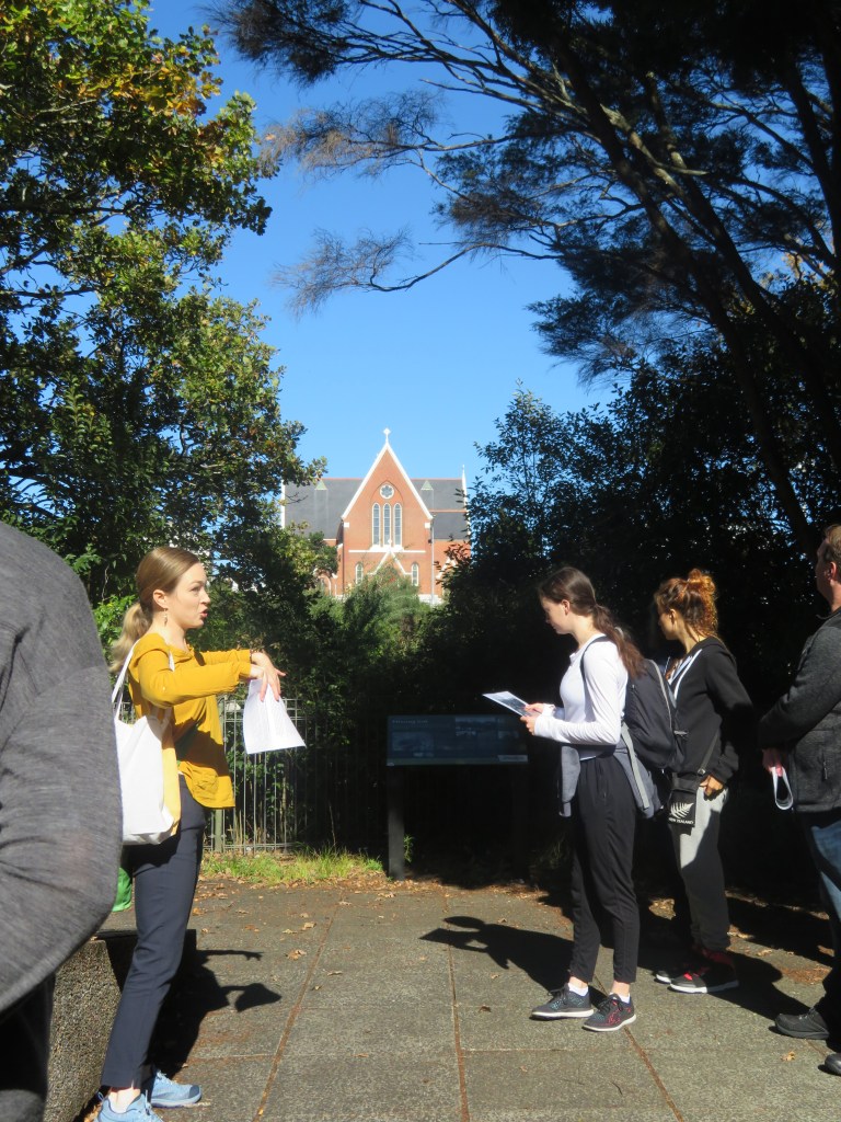
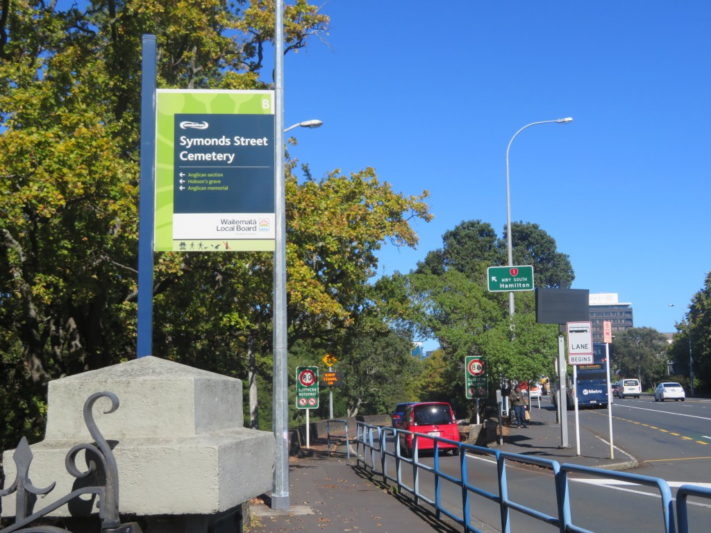
Last week was New Zealand Archaeology Week and as part of this I joined a group of like minded people with the aim of learning a bit more about Auckland’s early history via the evidence provided with one of our earliest cemeteries – the Symonds St Cemetery. The commentary was provided by Dr Heather Battles and our hosts were the Auckland Archaeological Society/NZAA.
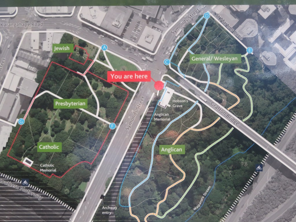
The above shows an aerial view of the cemetery as it is today and its divisions based on the religious affiliations of the interred.
The cemetery is one of New Zealand’s oldest urban cemeteries and was established in 1841, the same year Auckland became the capital of this fledgling colonial country. Although today it is part of the inner city back in the mid 1800s it was some distance from the colonial township.
This was unusual for the time – burials were usually found within a churchyard setting whilst in this case the churches for the various denominations were some distance from the cemetery itself. It has been suggested that concerns over public health were what prompted this new urban model but also it “reflected the influence of broader Enlightenment ideas on the new colony, which stressed the seperation between church and state” (from NZ Heritage listing summary).
Enlightenment values could also be seen in the idea of a cemetery for all – here religious affiliations became less important – to an extent…whilst the cemetery is the last resting place of a diverse range of religions, they are segregated within the cemetery itself. One of my earliest pieces of fieldwork as an undergrad student at Auckland University was to do a comparative study of two of the areas within the cemetery looking at the monuments and asking what can they tell us about colonial society. Unfortunately it has been quite some time since then and I do not remember much but what did stand out to me was how elaborate the Wesleyan monuments were when compared to the other parts of the cemetery which is in direct contrast to their sermons on humility and modesty.
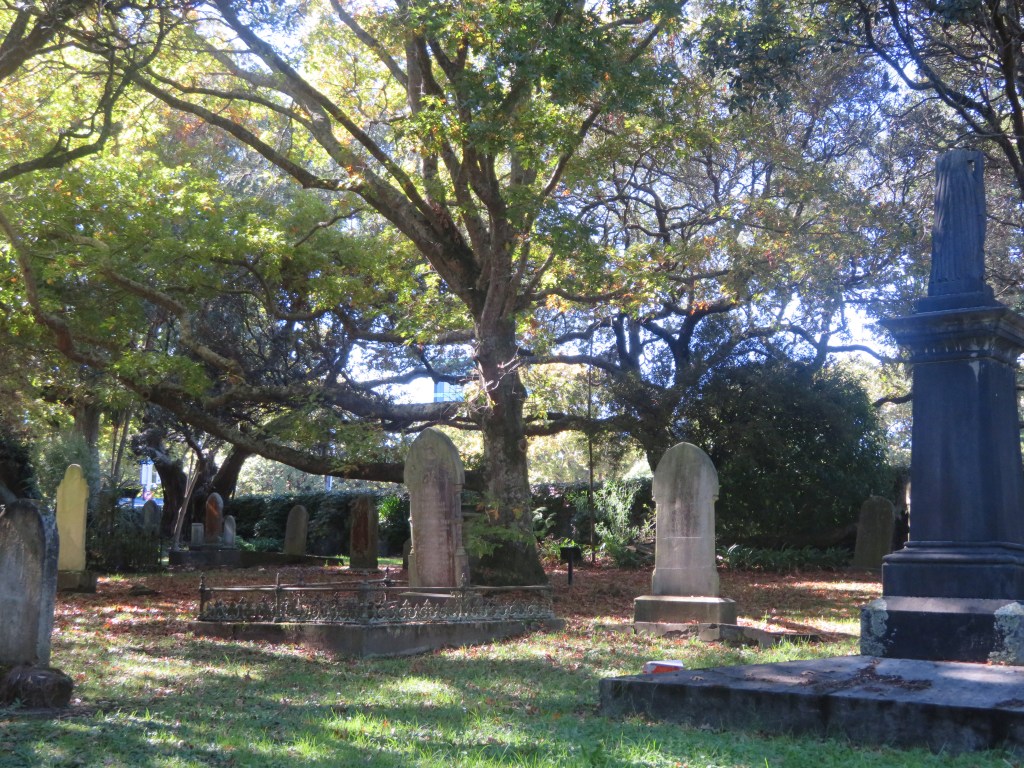
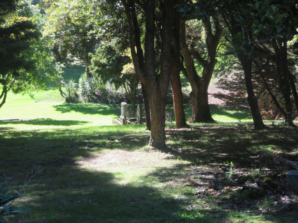
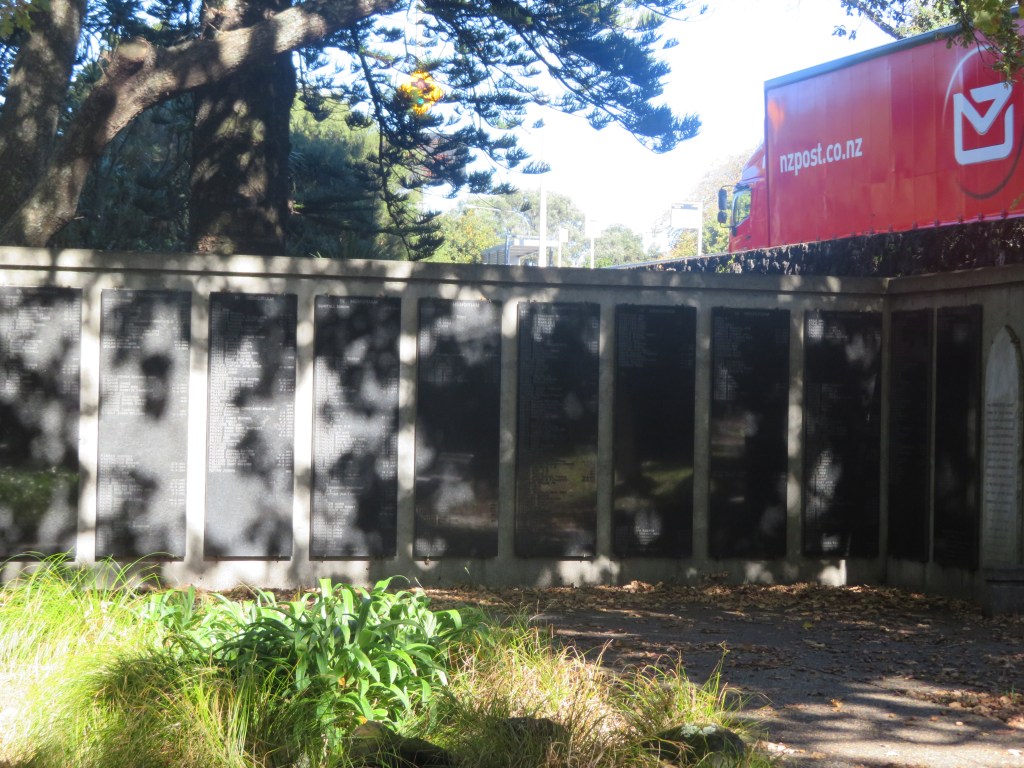
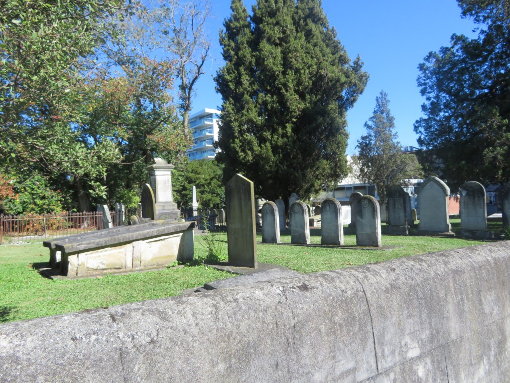
The earliest phase of the cemetery was probably about 3.75 hectares but by 1842 it had expanded to around 7.5 hectares. This part of Auckland is one of many ups and downs and today you can see many of the monuments are beginning to tumble down the gully (if they haven’t already). The cemetery was divided into the four main denominations (Anglican, Catholic, Jewish and Wesleyan/non-conformist) on either side of the main route south out of Auckland. This ridgeway later became known as Symonds Street. The land size that each group received was based upon the census of the time.
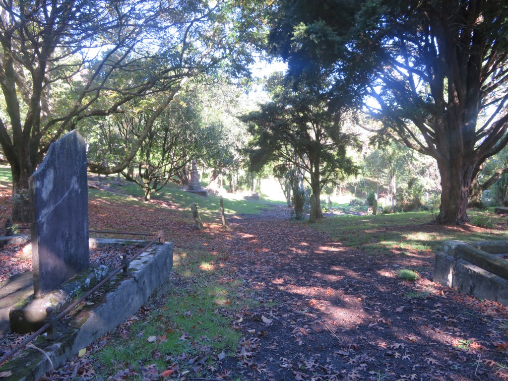
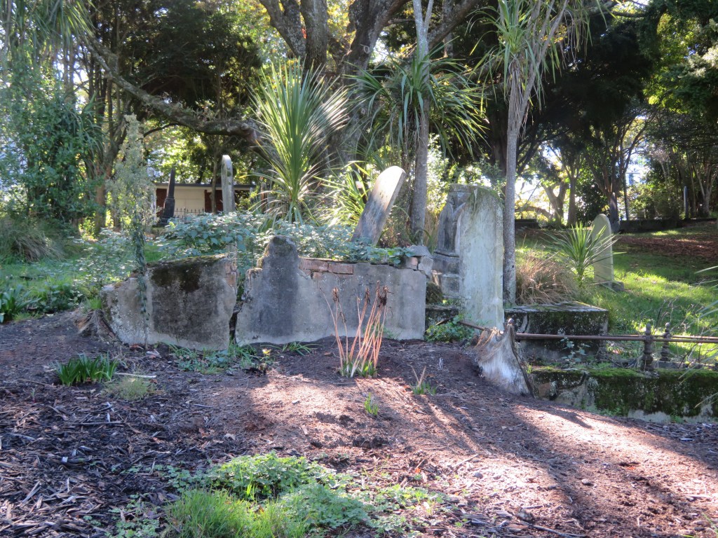
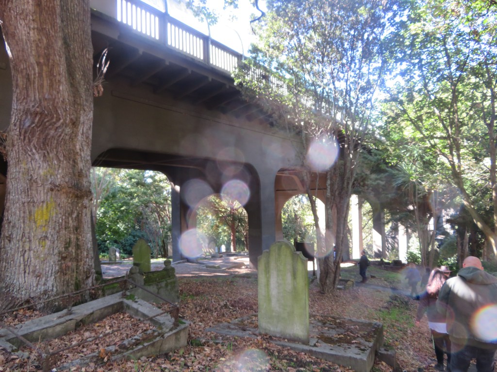
The 1860s and 1870s saw a change in attitude towards the cemetery and some beautification occured, with trees being planted (some are still there today) and paths being laid. In turn the monuments start to become more elaborate. Eventually, space became an issue and the cemetery was closed to new burials in 1886 unless you already had family members interred there. At the same time a new urban cemetery was created at Waikumete. By 1909 Symonds Street Cemetery became a public reserve suffering from various modifications when the Grafton Bridge was built to span the steep sided gully. Much later in the mid 1960s further damage was done to the cemetery with the southern motorway was constructed. During this time some 4100 bodies were removed and reinterred in two memorial sites within the cemetery.
Today the cemetery is around 5.8 hectares with approximately 10,000 individuals interred there, however it is estimated only around a quarter of those have any kind of visible monuments. Even so it is still an important repository of information on early colonial Auckland and New Zealand.
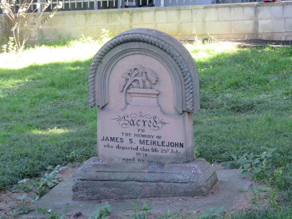
Below are some images from the Catholic part of the cemetery.
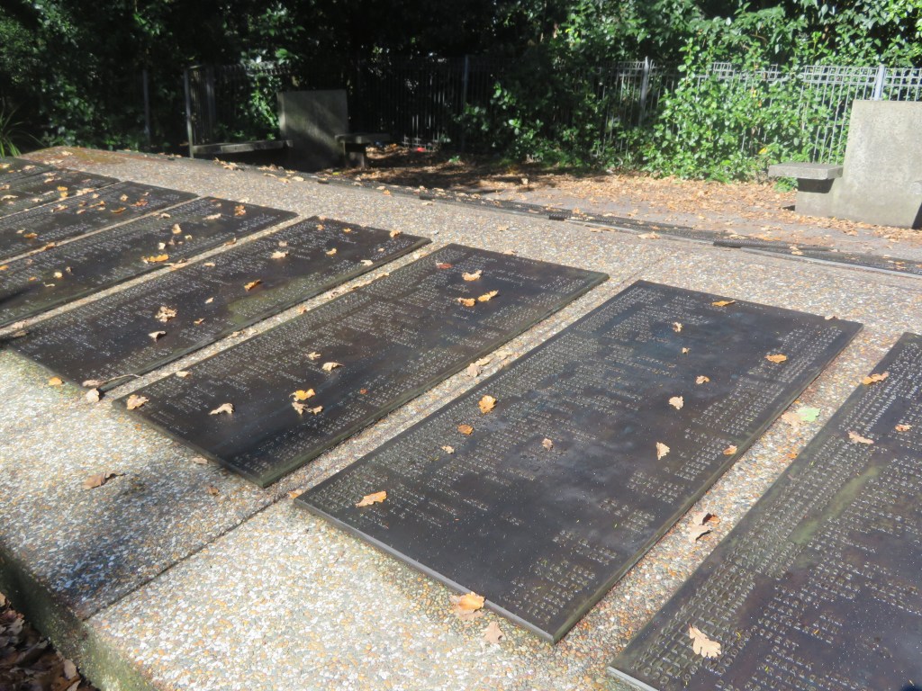
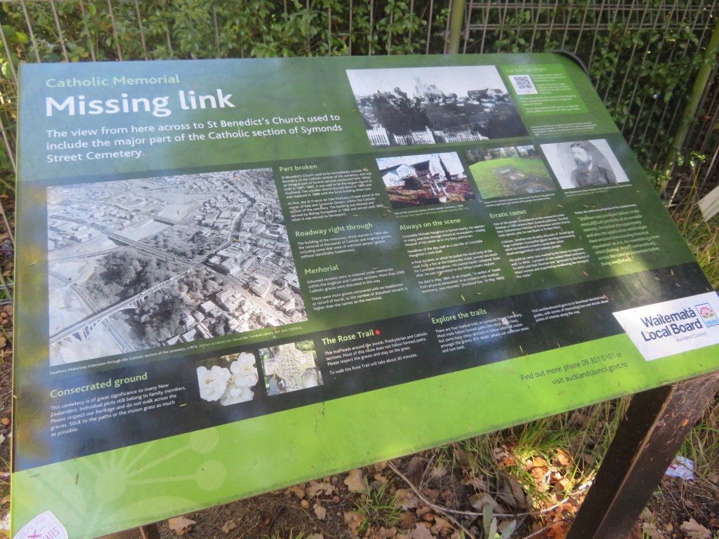
The following images are also from the Catholic part of the cemetery, the first shows the Catholic church some distance away and separated by the southern motorway. The second photo shows the memorial plaque for those whose bodies were re-interred as a result of the motorway construction.
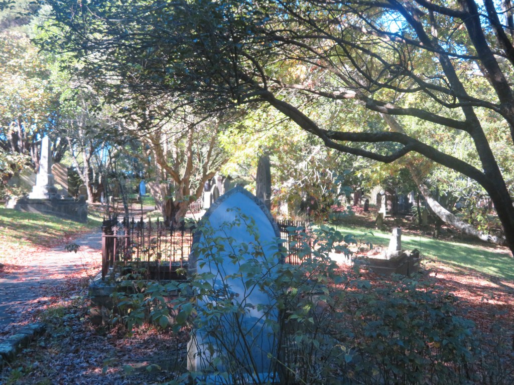
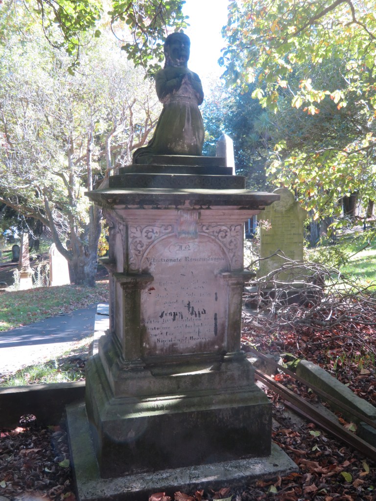
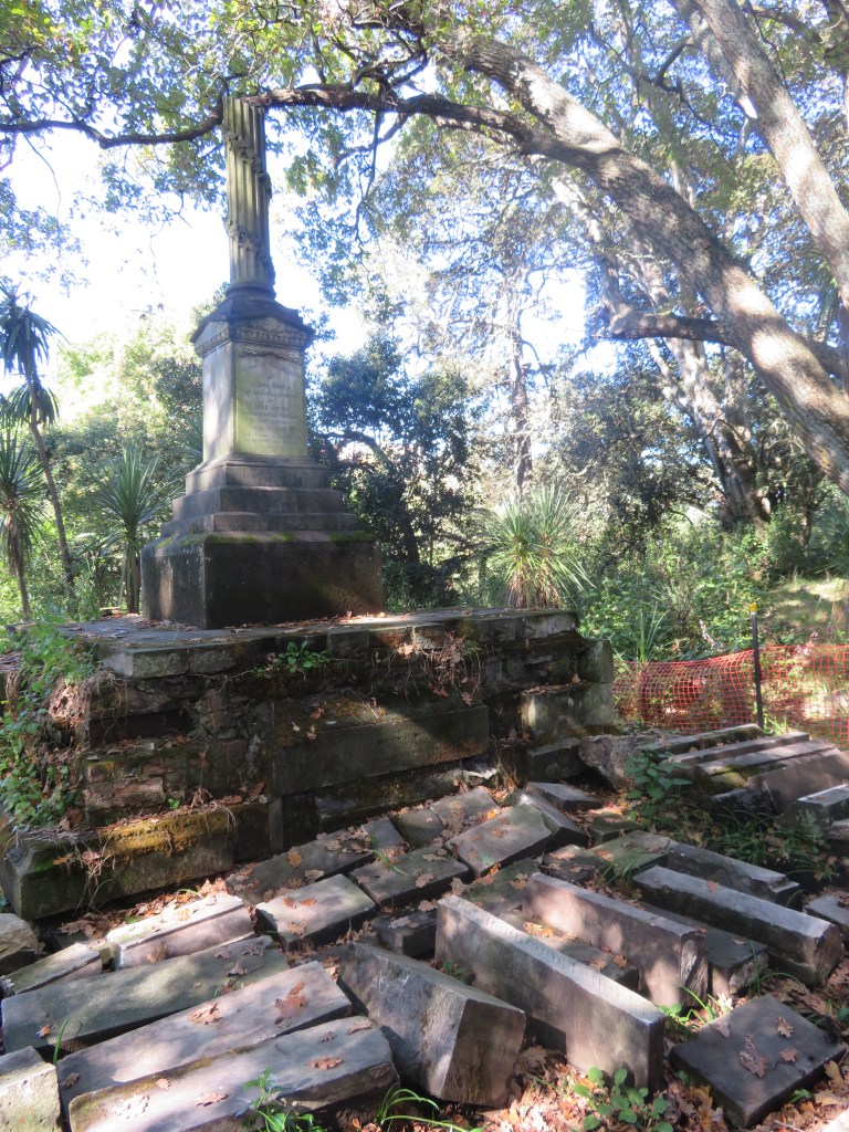
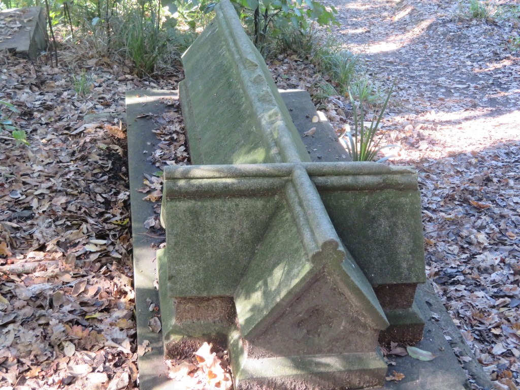
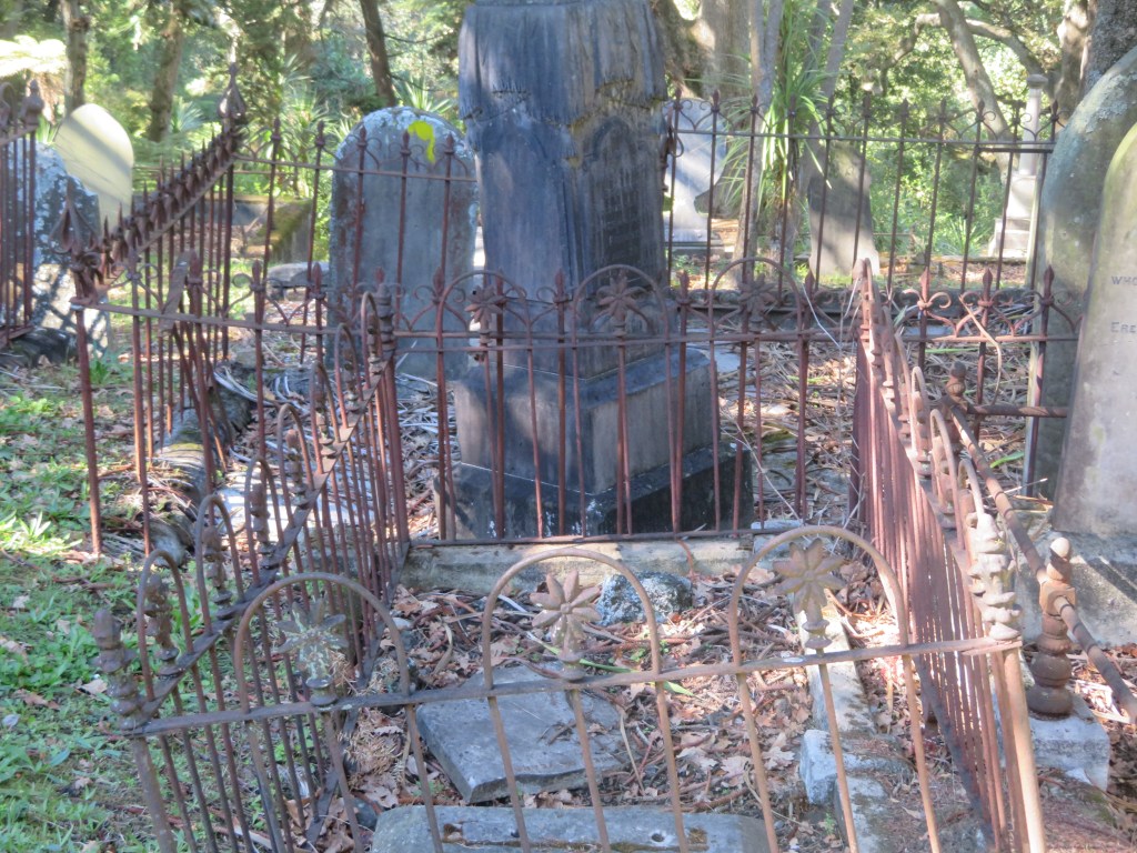
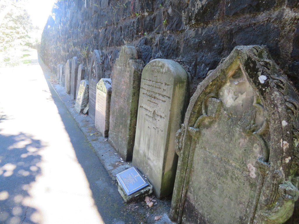
The pictures below are from the Anglican part of the cemetery and show some of the disrepair the monuments are in. The third photo along is of a very distinctive memorial in the shape of a church.
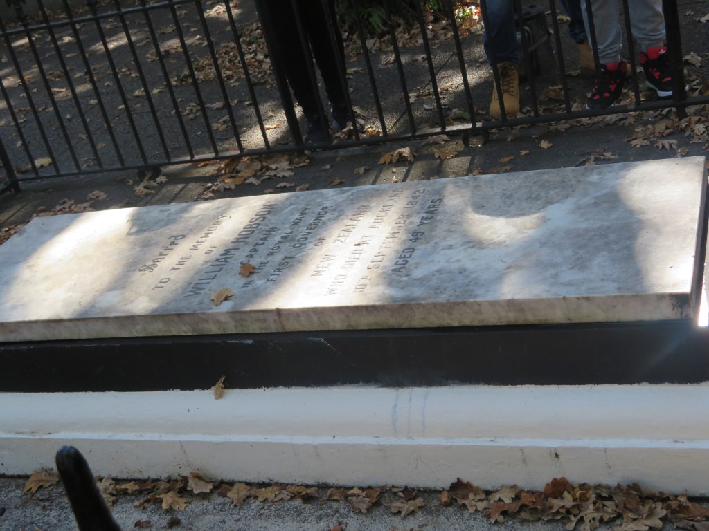
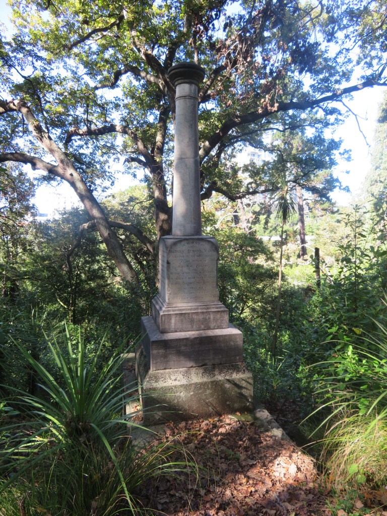
There are several well known New Zealanders buried in the cemetery such as William Hobson, New Zealand’s first Governor who signed the Treaty of Waitangi and died in 1842. The first picture is his memorial whilst the remaining two pictures are of Frederick Manning’s burial, another well known New Zealander.
The construction of Grafton Bridge caused some modifications to the cemetery below.
The motorway on ramp
Memorials to those re-interred when the motorway was built
Behind this wall is the motorway on ramp – headstones of those who were moved to make way for the on ramp.
Last but no least is the walled Jewish cemetery, perhaps the most well kept area of the whole cemetery…
This article was originally written several years ago for the ‘Mythology Magazine’ which is now defunct. My intention when writing this was to look at some of the myths and legends associated with the colonisation of the Pacific so please do bear in mind this is not an academic treatise on this subject (that is a far too large a subject for a simple blog…).
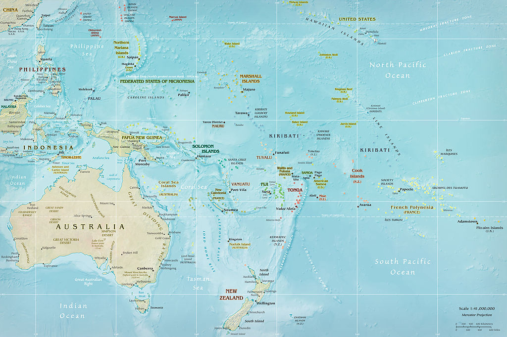
The islands of the
Pacific Ocean were one of the last places in the world to be colonised by
people. The how, when and why has
occupied archaeologists, anthropologists, linguists and historian for decades. For the European scientist these questions
need to be answered with solid evidence backing them. For the indigenous populations tradition told
them all they needed to know, the myths and legends providing all that was
needed by the way of explanation.
Map of Oceania
New Zealand, Hawaii and
Easter Island were the last landmasses to be colonised in the Pacific. These first peoples were at the end of a long
line of ancestors whose collective knowledge fuelled their ability and desire
to travel across vast tracts of ocean.
The Pacific region is made up of three distinct areas – Melanesia,
Micronesia and Polynesia. The first area
to have been settled by people was Melanesia; it consists of Vanuatu, Papua New
Guinea, Fiji, the Solomon Islands, the Bismarck Archipelago and New Caledonia. Dates for the first colonisation range
between some 50-30,000 years ago their ancestors originating from South East
Asia. Micronesia is situated north of
the Melanesian group and is made up of groups of islands including Kiribati,
Nauru, Marshall Islands (to name a few) and the US territories of Guam,
Northern Mariana Island and Wake Island.
Evidence for the settlement of this region is difficult to pin down; the
earliest archaeological evidence comes from the island of Saipan and is dated
to around 3500 years ago. The third
group of islands is Polynesia which covers a wide part of the Pacific. Generally speaking New Zealand, Hawaii and
Easter Island form the corners of a triangle within which all other islands sit
and are referred to as Polynesia.
The ancestors of the Polynesians
migrated from South East Asia a little later than the settlers of Micronesia,
passing through some parts of Micronesia and Melanesia, but rarely settling for
long. Fiji is an interesting case, as in
many ways it straddles the line between Melanesia and Polynesia. When the ancestors of the Polynesians arrived
in Fiji there was already a decent sized population and had been for
millennia. Yet today the visitor to Fiji
will see a multitude of faces, some are distinctly Melanesian looking (mainly
in the eastern islands) and others look more Polynesian. Fiji in many ways was a jumping off point for
the exploration further west, the next islands to be settled were Samoa and
Tonga, both of which are not a great distance from Fiji. These early explorers are known as Lapita
people based on a distinctive type of pottery found on the archaeological sites.
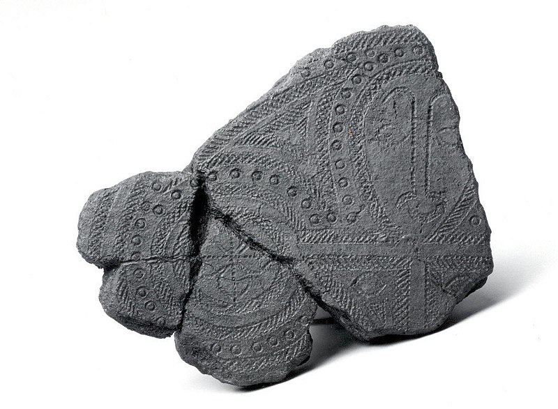
The distinctive pottery of the Lapita Culture – this is a plaster reproduction photo courtesy of the Metropolitan Museum of Art.
“All island groups in island Melanesia and West Polynesia that lie in a south-east direction have Lapita settlements. None of these settlements have been found on other islands.” (G. Irwin. Pacific Migrations – ancient voyaging in Near Oceania. Te Ara: The Encylcopedia of New Zealand.)
These people were
exploring the region from as early as 3500 years ago (evidence found at the
Bismarcks) and by 3000 years ago were already as far as Samoa and Tonga. The archaeology tells us these were small
groups who travelled fast and light, they established only a few permanent
villages on each major island group and then they moved on. At this time the distinctive Polynesian
culture began to emerge in the west and by 2000 years ago people had begun to
move into the eastern part of the region.
By 700AD the majority of Polynesia had been settled with the last
migrations being to New Zealand, Hawaii, Easter Island and South America (the
only evidence for South America is the presence of the ‘kumara’ or sweet
potato, radiocarbon dates from kumara found in the Cook Islands indicate that
Polynesians had reached South America and returned by 1000AD at the latest).
Kumara (or sweet potato) a staple food source.
All well and good you
might say, but what has this to do with the mythology of the region? To study the past of this region it is
important to not only use all those scientific tools we have at our disposal
but also use the traditional knowledge, stories and myths to provide a greater
depth of understanding. In Polynesia
there are many stories which have a commonality suggesting a shared ancestry.
In much of eastern Polynesia Hawaiki (the Maori name) does not refer to the islands we know as Hawaii but to a mythical land where the ancestors journeyed from – an ancient homeland. In New Zealand nearly all the Maori have traditions of such a voyage, in the Marquesas it called Havai’i, in the Tuamotus it is Havaiki and in the Cook Islands the ancient homeland is referred to as Avaiki. Not only is Hawaiki the ancient homeland but it is also a place where a persons spirit would go after death. The main island of the Hawaii group is so named because it is the site of two volcanoes which were regarded as a place of great supernatural importance and the home of the gods. Similarly the island of Ra’iatea in the Society Islands was previously known as Havai’i and it too has a volcano on it (albeit a extinct one) believed to be the entrance to the underworld and the home of the gods.
In Maori myth Hawaiki is in the east – the direction of the rising sun and the stars which bring the changing seasons. Thus it is not surprising that Hawaiki was associated with life, fertility and success. It is said that the first human life was created from the soil of Hawaiki by Tane (or sometimes Tiki). It is the place of highly valued resources such as the kumara which is said to grow wild there – this is interesting in itself because if you travel directly eastwards from New Zealand you will (eventually) land in South America, the homeland of the sweet potato.
“When the ancestors arrived in their waka, they brought with them many treasured plants and birds, also important atua and ritual objects such as mauri. In one way and another, Hawaiki was the ultimate source of the mana of all these. The crops flourished, the gods exerted their powers, the mauri ensured continuing fertility of the resources they protected, because of their origin in Hawaiki.” (M.Orbell 1995 Maori Myth and Legend)
The veneration of the east – many rituals are conducted facing east – is unusual for Polynesia and has led some to make the dubious suggestion that New Zealand was settled by people from South America. More recent studies have demonstrated that the first voyagers would have taken a south-west trajectory from either the Cook Islands or the Society Islands in order to land on the east coast of New Zealand. Over time it would seem this navigational knowledge was amalgamated with the traditions of an ancient homeland.
In other parts of eastern
Polynesia Hawaiki is in the west or sometimes even in the sky and in western
Polynesia it is called by another name – Pulotu, a word that can be
linguistically traced into Micronesia.
It is interesting to note that the largest island that forms part of
Samoa (western Polynesia) is called Savai’i and is a land associated in
tradition with many supernatural goings on.
Hawaiki was not only the land where the ancestors came from but also a
place of spirits, a place where the myths came into being.
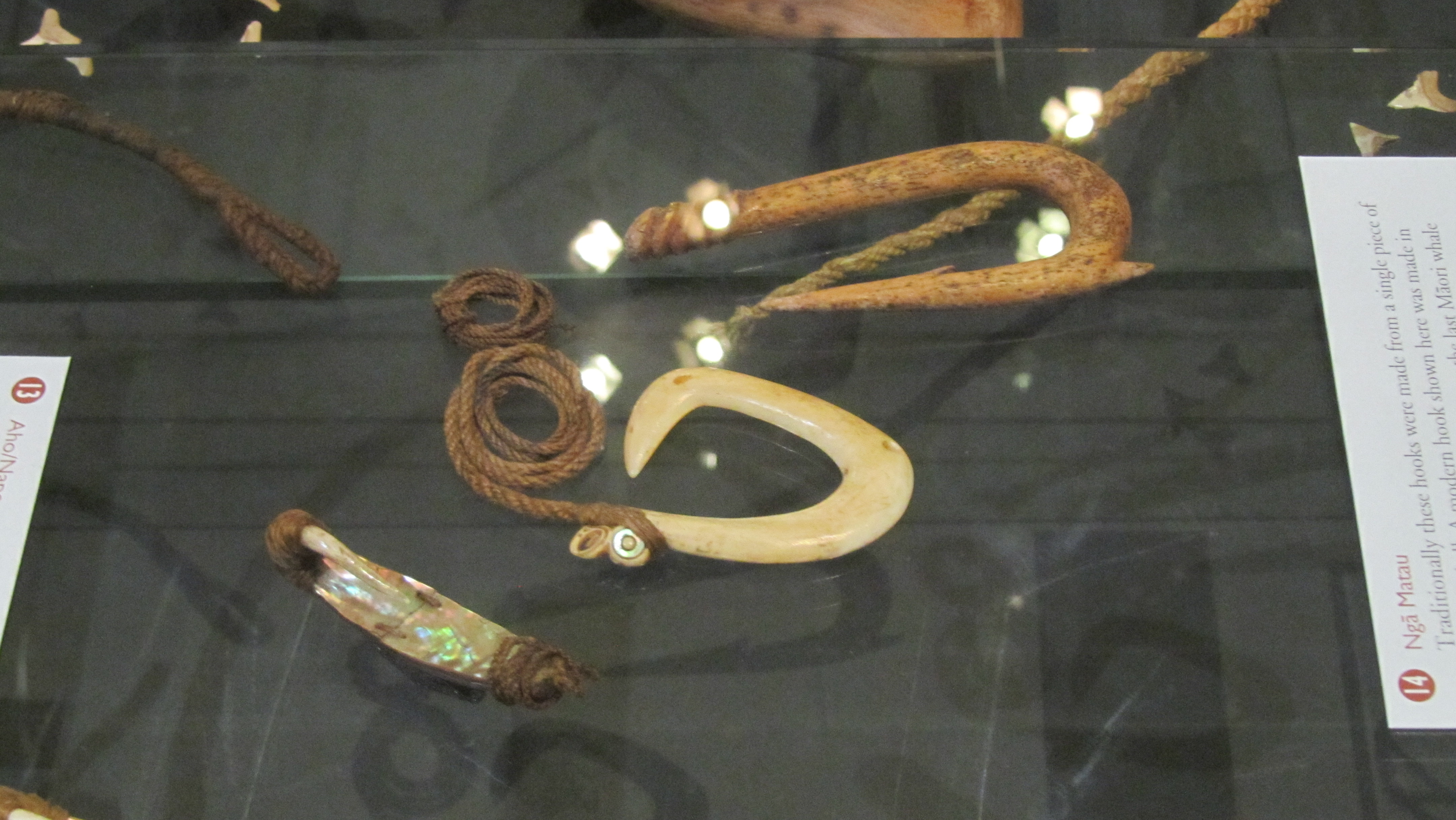
As time went on many of these stories would become absorb into local tradition with familiar places becoming the setting to the story. Thus the story of Maui who fished up the islands can be found everywhere in Polynesia. In New Zealand it is said that the North Island was a giant stingray fished up out of the sea by Maui using his magic hook (the hills and valleys of the land are a result of his brothers greed when they hacked at the fish). On the tiny atolls of Manikihi and Rakahanga it is believed that these islands are all that remains of a single land which broke apart when Maui leapt from it into the heavens. In Hawaii tradition tells of the islands being a shoal of fish and how Maui enlists the help of Hina-the-bailer to bring the shoal together with his magic hook to form one mass. Maui hauled on the line, instructing his brothers to row without looking back, which of course they did, this resulted in the line breaking and the islands become separated for all time. In the Tuamotaus Maui and his brothers are once more fishing far from land, once more he has a magic hook and once more he pulls up an island but because his brothers did not listen to Maui the giant fish/island broke apart and became the land the Tuamotua people refer to as Havaiki, where Maui and his family reside.
Fish hooks represented more than just a means of procuring fish, they also had a symbolic meaning and it is possible that some of the larger more ornate types were representative of the ancestral stories.
Maui is one of the most
well known of Polynesian deities, found in the stories throughout the region he
is often known as a trickster, part god and part human. He was of a time when the world was still new
and there much to do to make it bearable for people. Maui is said to be responsible for raising
the skies, snaring the sun, fishing up lands, stealing fire, controlling the
winds and arranging the stars. On the
island of Yap in Micronesia a demi-god figure called Mathikethik went fishing
with his two elder brothers, he also had a magic hook and on his first cast
brought up all sorts of crops, in particular taro, an island staple. On his second cast he brought up the island
of Fais. The similarities here with
Polynesian Maui are obvious and once again we can get a tantalising glimpse of
past movements of people.
Other characters common
to the stories of the Polynesia from Samoa in the west to Hawaii in the east
include Hina, said to be both the first woman and a goddess who is the guardian
of the land of the dead; Tinirau whose pet whale was murdered by Kae; Tawhaki
who visited the sky and Rata whose canoe was built by the little people of the
forest and was a great voyager and Whakatau the great warrior.
“…on every island the poets, priests and narrators drew from the same deep well of mythological past which the Polynesians themselves call the The Night of Tradition. For when their ancestors moved out from the Polynesian nucleus they carried with them the the knowledge of the same great mythological events, the names of their gods and of their many demi-gods and heroes. As time passed the Polynesian imagination elaborated and adapted old themes to suit fresh settings, and new characters and events were absorbed into the mythological system.” (R. Poignant 1985 Oceanic and Australasian Mythology).
Of course none of this
addresses the question of why. Why did
the first people leave their homelands and explore into the vast ocean,
particularly to places like New Zealand, South America, Easter Island and
Hawaii? What motivated them? The myths do in some way suggest possible
reasons, these are stories people would have heard over and over again as they
grew into adulthood. Stories of great
adventurers, of those who dared to do the impossible and it does seem that much
of the early migration was a result of simple human curiosity. Prestige and mana could be gained by person
willing to find new lands. In the places
they originally came from there was no food shortage and in some instances even
once they had discovered a new island, they would move on leaving but only a
small population behind. In the
traditions there are also stories told of people being banished and having to
find new places to live, in addition there are stories of battles lost and
people fleeing retribution. These too
could well be another window into the motivation behind Oceanic migration.
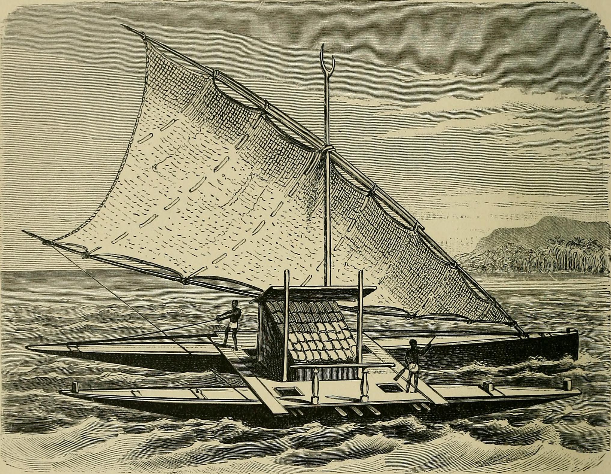
Ocean going craft as suggested in “The History of Mankind” (1896)
On their own the mythologies
of the Pacific cannot provide us with more than a unique insight into the mindset
of the peoples considered to be some of the greatest explorers of the past but when
combined with genetics, linguistics and archaeology it gives us the ability to
answer those questions of how, when and why.
Sources
Irwin G (2012) ‘Pacific
Migrations – Ancient Voyaging in Near Oceania’ Te Ara: The Enclyclopedia of New Zealand.
Ratzel F & Butler A J
(1869) History of Mankind
Poignant R (1985) Oceanic and Australasian Mythology
One of the features of the Auckland landscape is the profusion of volcanic cones, all of which have been altered in some way by the people who have lived here – North Head is no exception. Situated at the entrance of the harbour it has over time been used as a part of Aucklands strategic defences during times of unrest.
Long before people walked the land there were volcanoes – a distinctive feature of Aucklands skyline – and although North Head is just one of many, it is one of the oldest and was formed over 50,000 years ago. The following photos demonstrate the ancient geology of the headland – the different layers of scoria, ash and mud clearly visible.
The Maori Story
The story of Maori in the Devonport penninsula begins with the tradition of the arrival of the Tanui waka having put ashore at Torpedo Bay (a stretch of beach below the headland facing the inner harbour). Excavations were carried out in 2010 in the bay as part of the redevelopement of the Naval Museum and surrounding areas. During this time a great deal was discovered about the use of Torpedo Bay during the colonial era but it was the unexpected prehistoric Maori finds which had the archaeologists most excited.
“Unexpected nationally significant prehistoric Maori archaeology was also found near the end of the investigation, including cooking ovens, moa bones and an adze.
Three species of Moa and at least five individuals have been identified from the lower two settlement layers. All of the species are known North Island Species of Coastal bush Moa (Anomalopteryx didiformis, Pachyornis geranoides and Euryapteryx curtus). As the only site in the Auckland, Coromandel Northland region with definitive evidence of hunted Moa rather than industrial Moa usage by Maori, the dating of this site will potentially answer long held questions concerning moa extinction in the North Island. It may dismiss the general belief that the Auckland Coromandel area was not associated with Moa hunting and is not a primary area of archaic settlement by early Polynesians and was therefore occupied later than other areas of settlement.
A small rectangular adze (hand tool) made from Motutapu greywacke was found in the prehistoric site. The Hauraki Gulf was a centre of adze production and the evidence found suggests that occupation of Torpedo Bay, at least during the Archaic period, was extensive, and that the people who inhabited the Bay played an active role in Motutapu greywacke adze production.
The preliminary radiocarbon dates indicate settlement at the site ranged between the early 15th century and the late 17th century. It could be one of the earliest sites discovered in Auckland.” (from http://www.wasteminz.org.nz/wp-content/uploads/1b.Strong.pdf).
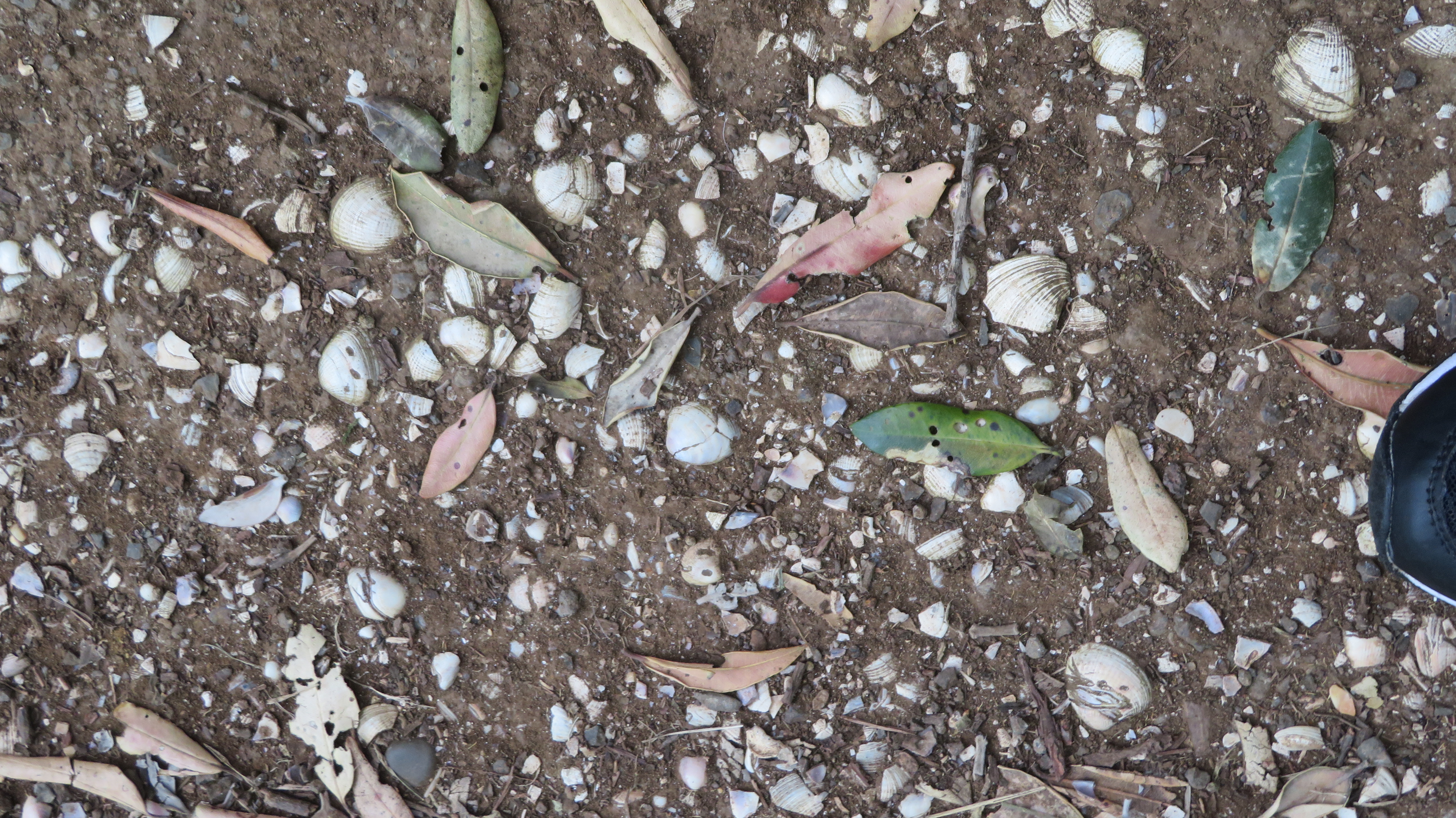
An eroding shell midden on the north side of Maungauika.
Early photographs show the lower slopes of North Head (Maungauika) as being used by Maori for gardens and early Europeans describe a Maori settlement at the foot of the hill with gardens and fish drying racks. Tradition also tells us that the Ngati Paoa settled Maungauika until the 1700s when Nga Puhi attacked and beseiged the pa. The later European story of North Head has all but wiped clean the Maori history of the headland although it is still possible to see the occasional evidence of Maori occupation such as middens eroding out of paths and the occasional unexplainable terrace.
The view north towards open sea.
The view south (west) towards the city and township of Devonport – Torpedo Bay is in the foreground.
The view towards Rangitoto.
The Colonial Story
The first part of the colonial story begins with North Head being used as a pilot station from 1836 to guide ships into the newly established European settlement of Auckland. In 1878 it was made into a public reserve with the stipulation that should it be necessary North Head would be re-appropiated for defence purposes. By 1885 this became a reality as fears of a Russian invasion began to sweep New Zealand.
North Head became one of several defence forts that were set up to protect Aucklands harbour. On the headland itself there were three defences – the North Battery, the South Battery and Fort Cautley on the summitt. Each had there own heavy guns, an observation post and high earth ramparts with bullet proof gates and barbed wire. In addition each had the very latest in military technology – an 8 inch disappearing gun. In addition to these defences a minefield was in place across the inner harbour to Bastion Point.
This slideshow requires JavaScript.
The above are photos of the North Battery.
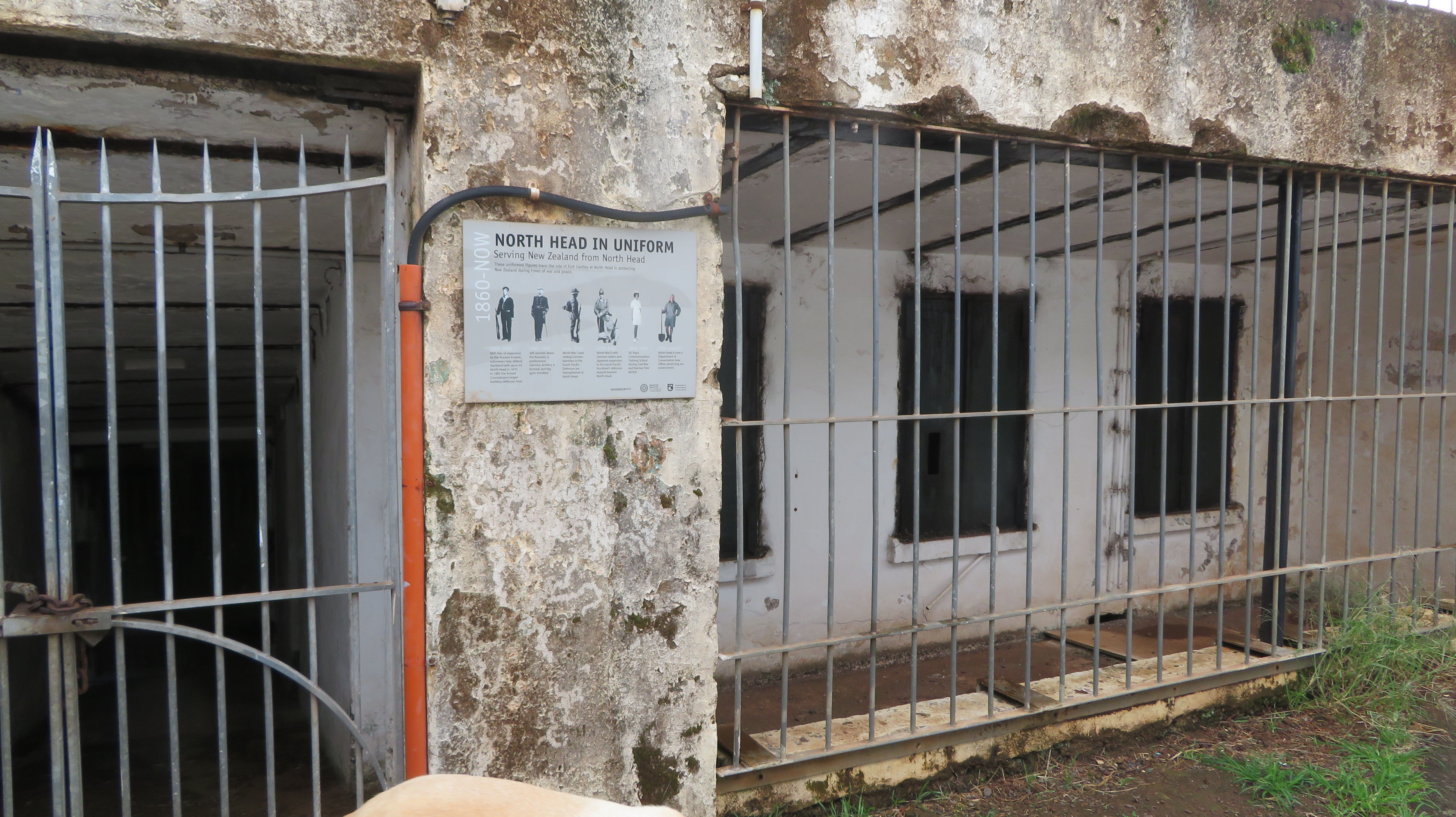
Over the next twenty-five years these first fortifications were expanded and strengthened by convict labour who lived in a prison on the summit. They dug out many of the tunnels and underground storerooms which are so popular with young explorers today. With the threat of war once more looming in the early twentieth century new engines were put into the engine rooms, more searchlights were added, new barracks were built.
The prison/barracks used to house the convict labour.
In all three instances (the Russian scare, WWI & WWII) not once were any of the guns fired in anger. During WWII the headland became the regimental headquarters and main administrative centre for the Auckland’s coastal defences. Many of the guns were moved to Whangaparoa although North Head did become the site of the anti-submarine boom (a wire netting barrier covered by two guns at sea level) which protected the harbour from attack by submarine.
This slideshow requires JavaScript.
The South Battery and its disappearing gun.
The latter barracks on the summit.
The only stone building on the summit – once the kitchen block.
The disappearing gun pit…
The remains of the summit battery.
By the end of the 1950s the army had left the headland although the navy still ran a training school on the summit. In 1996 the navy had also left and now the area is administered by the Department of Conservation.
Observation posts and tunnels associated with the North and South Batteries.
The Engine Room – an independent source of electricity for the search lights etc.
This slideshow requires JavaScript.
One of the features for the defence of the Auckland Harbour was the minefield which went from North Head to Bastion Point.
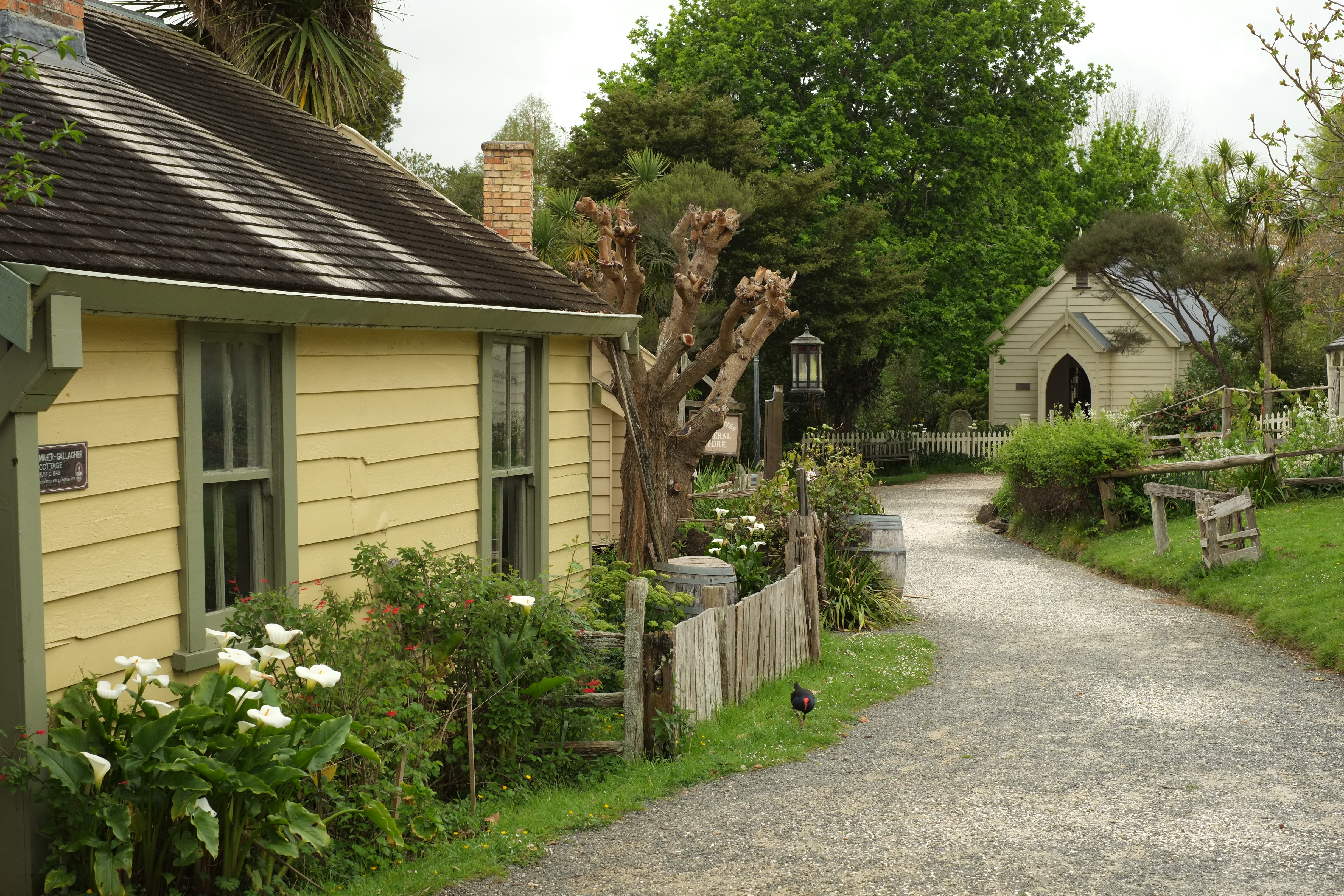
Tucked away in east Auckland is the suburb of Howick, here you can find a gem of living history – the Howick Historical Village.
Over the years the family and I have visited the village on numerous occasions, it is pleasant escape from the technology and mass produced entertainment which so very much a part of our lives today. Although the bones of the place are immovable the addition of monthly live days and special events makes every visit different in some way.
The Village depicts life as it was in nineteenth century New Zealand with particular emphasis on the fencible settlement of Howick. Colonial Howick was originally founded by Governor George Grey who concerned about the potential threats from both Maori and the French. He established a chain of settlements around the southern part of Auckland as both an early warning system and a line of defence for the burgeoning new town.
Governor Grey originally requested troops to man these settlements however, it was decided to send retired soldiers to settle the area as members of the Royal New Zealand Fencible Corps, these were men who had served in the wars of Britain in the 1830s and 1840s. To be eligible to emigrate under the scheme the veterans had to be under 48 years of age and of ‘good character’ with ‘industrious habits’. If they qualified they were given free passage to New Zealand with their families, a cottage and an acre of land. In return they were required to partake in certain military activities and after seven years the land and the cottage would be theirs. Although they were given a small pension they were also expected to undertake work of some kind in the new colony.
Between 1847 and 1854 some 2500 fencibles and their families arrived in New Zealand, doubling the population of Auckland at the time. Other fencible villages included Panmure, Otahuhu and Onehunga. The live days at the Village have volunteers dressed in costume doing activities you might see on any given day in a fencible/colonial village including soldiers parading, wood turning, blacksmithing, ladies doing the chores such as washing, sewing and baking. There are also special themed days such as ‘A Colonial Christmas’ or an Easter egg hunt or a summer fete.
This slideshow requires JavaScript.
The Village today is based around Bell House which was given to the Howick Historical Society in 1972, negotiations at the time then secured a further five acres of land which later became the seven acres it is today. It took eight years of fundraising and working bees by many volunteers to turn it into a living museum. Many of the cottages on site were donated and transported to the village, of which there are now thirty buildings. It was officially opened on the 8th of March 1980.
This slideshow requires JavaScript.
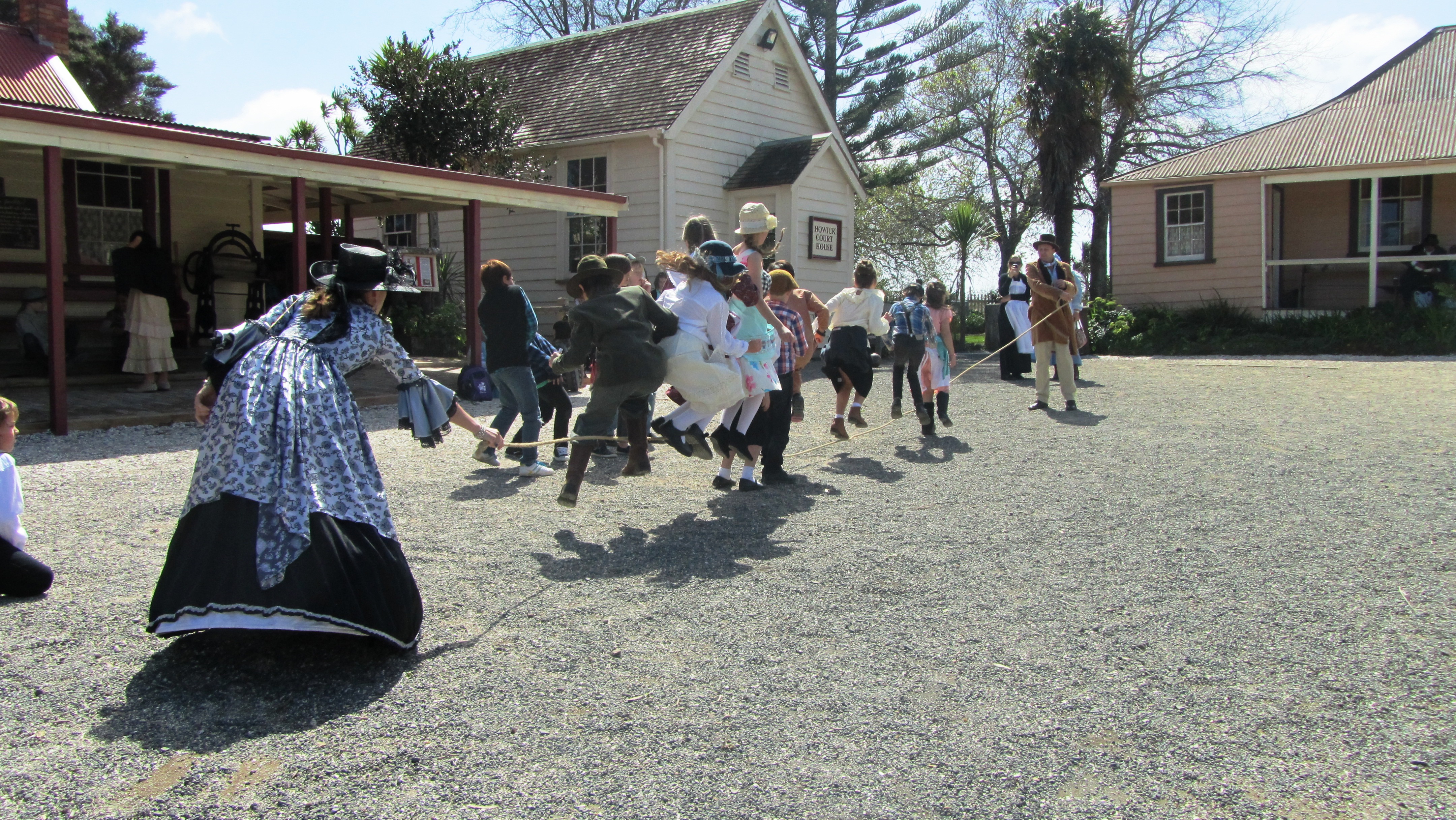
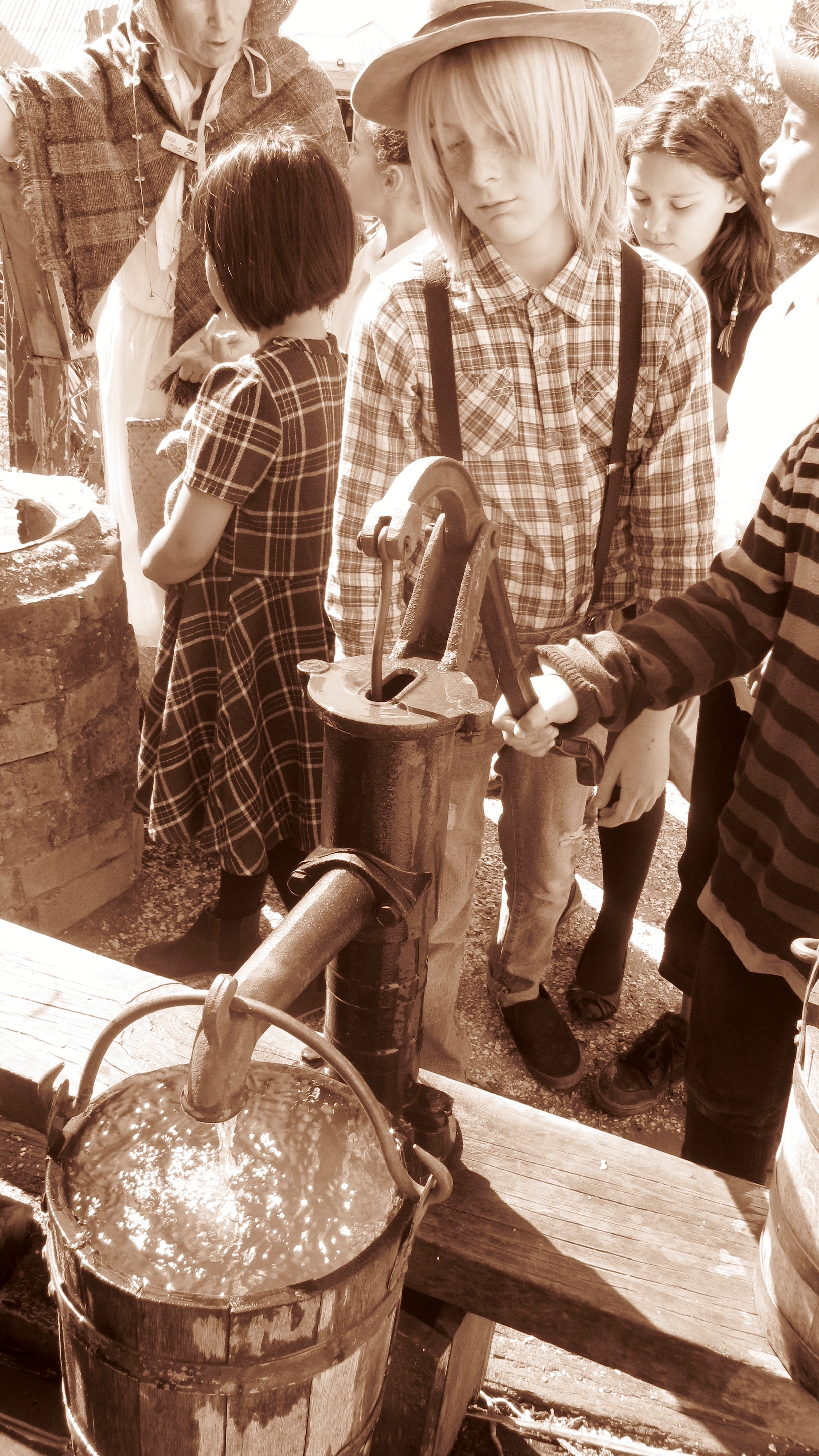
Today the village is enjoyed by school groups as part of their education outside of the classroom modules and students on school holiday programmes – children are encouraged to dress in period appropiate costumes, leaving technology behind. Having attended during a school visit with my sons class, I can vouch for it being throughly enjoyed by all. On that occasion, the students learnt how to churn butter, played games of the times, baked bread in a wood fired oven, drew water from a well and attended a session in a nineteenth century school.
A school group playing skip rope.
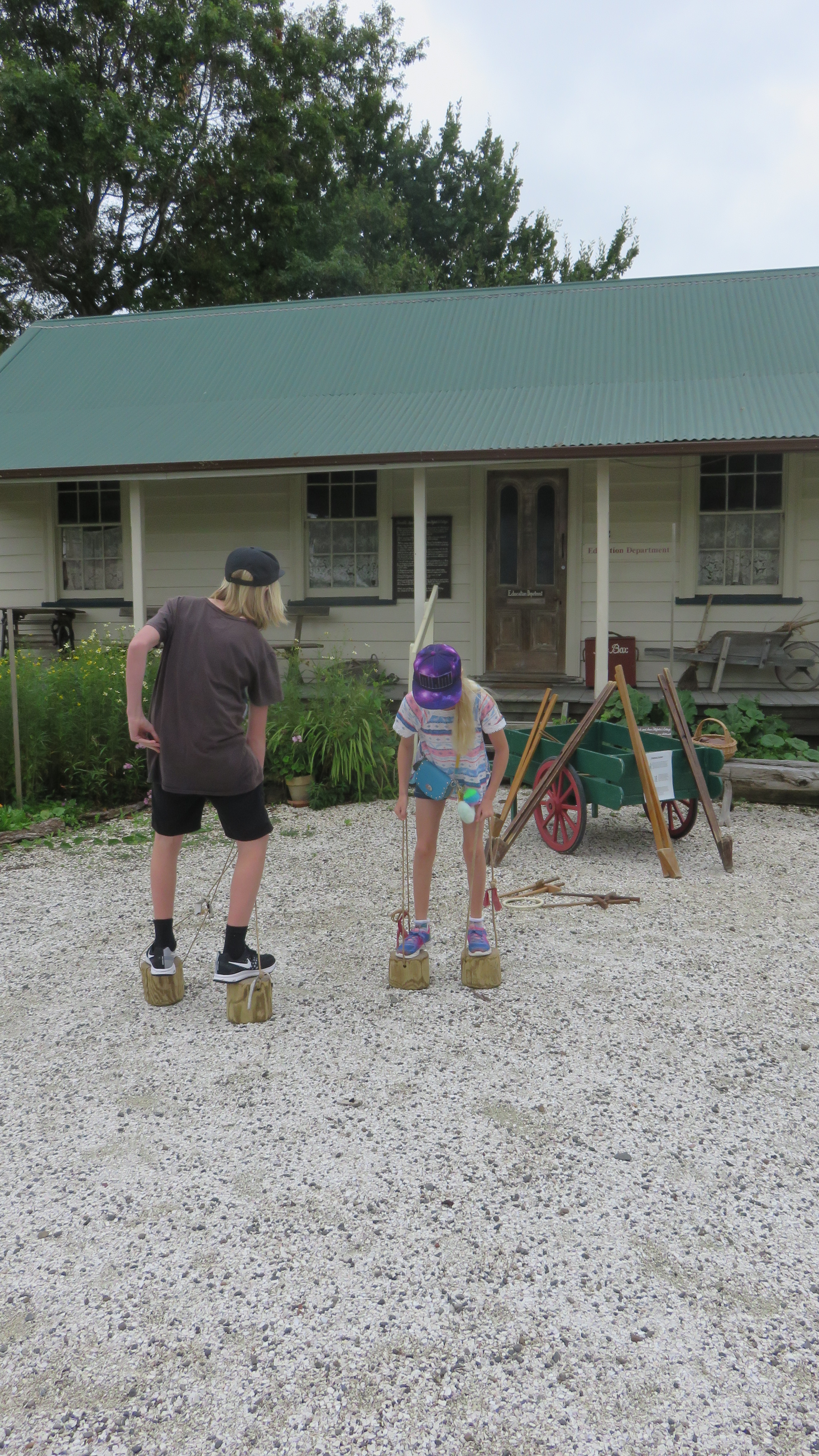
My son and daughter trying their hand at walking on blocks.
“Seriously?! This was the only way to get water?!” All round disbelief from the tweens.
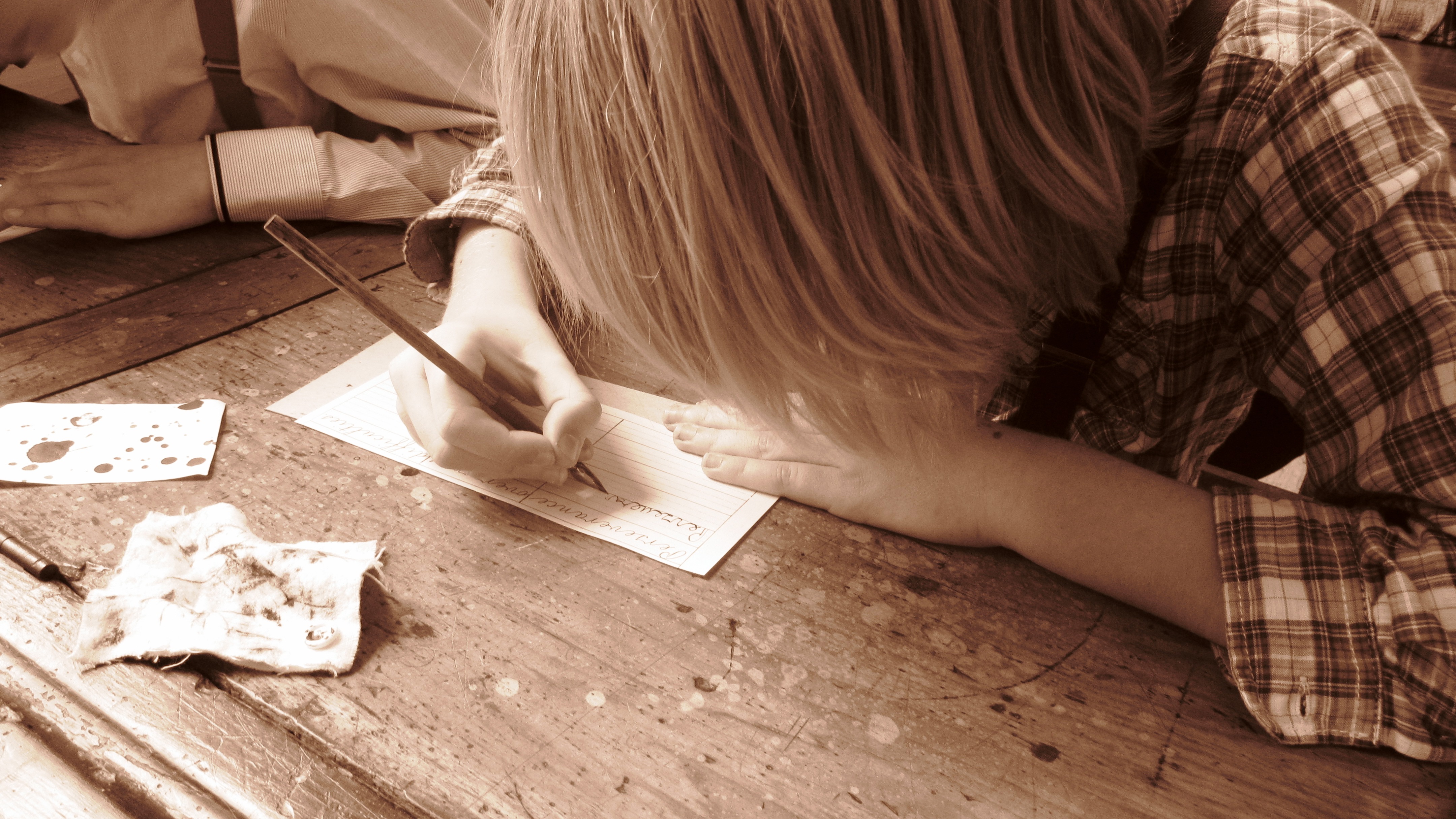
Practising writing in cursive made doubly hard by using a ink pen.
One of the striking aspects of the village are the gardens which have in themselves become an important heritage project with links to the Heritage Tree Crops Association and Auckland Seed Savers. Vegetables, herbs and eggs from the free range chickens are often available to buy at the main entrance. Another less well known part of the village is its research library which contains many documents and photographs for the early days of Howick – a vital resource for those who interested in the history of the area or those researching family trees.
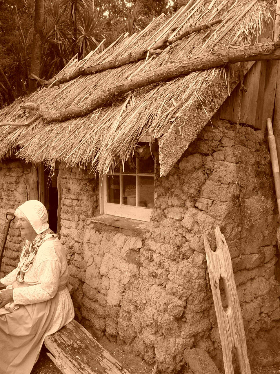
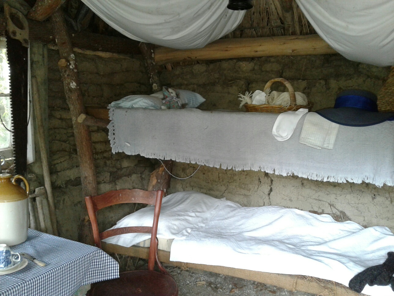
A traditional cob and reed roof cottage.
Inside the cob cottage.
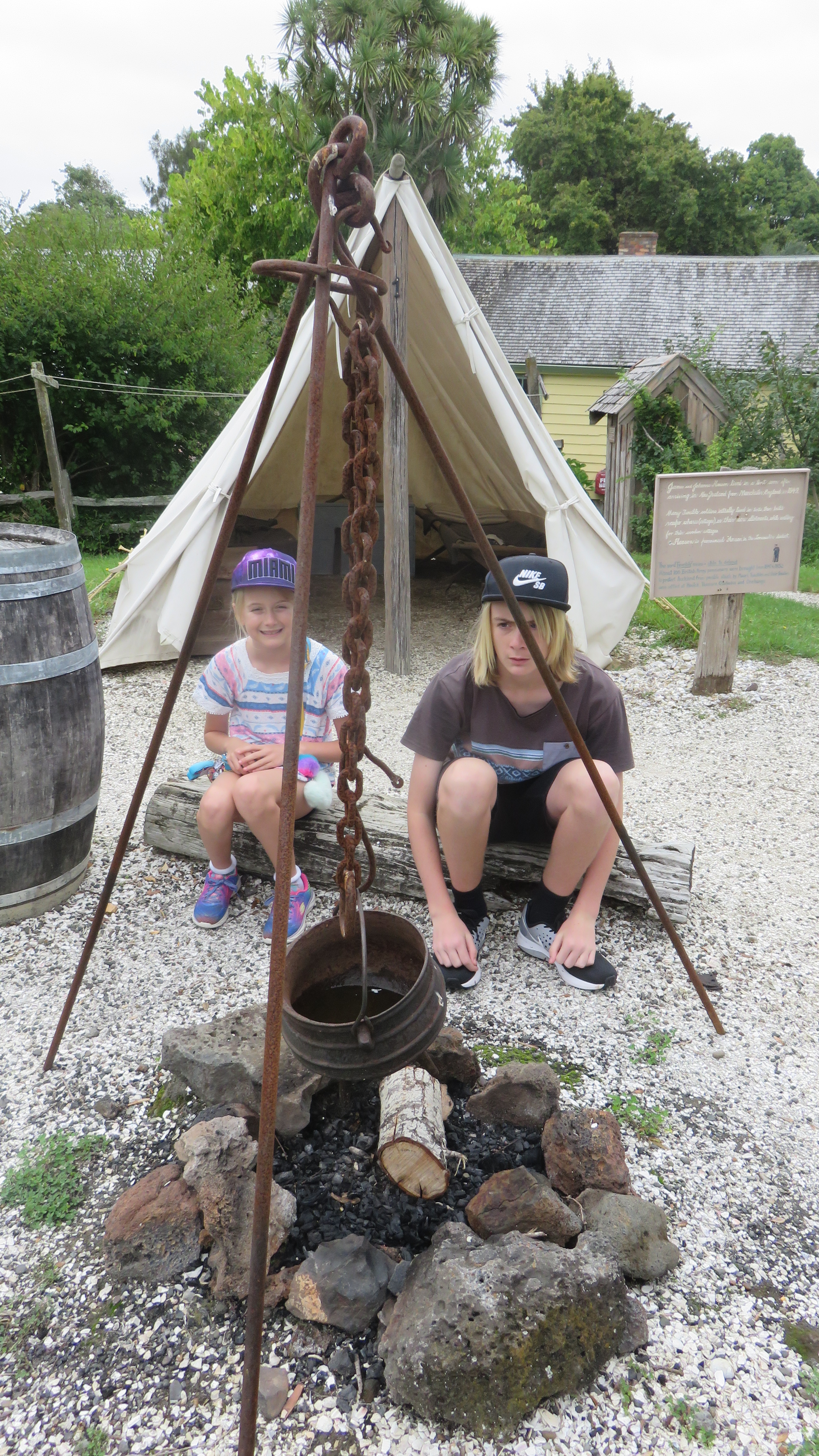
A soldiers camp with two very unlikely looking soldiers…
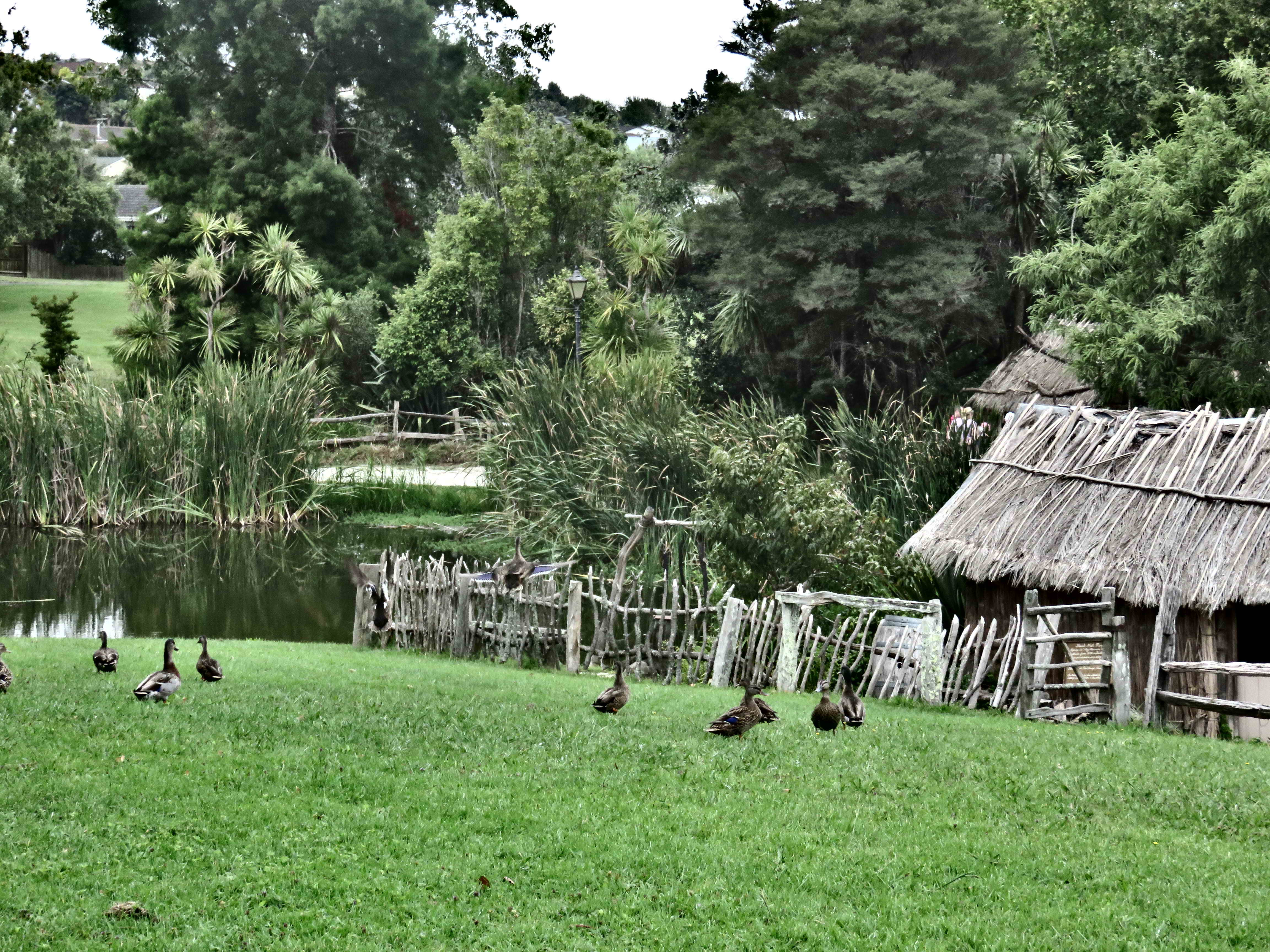
A view of the village, looking over the green.
For more information on The Howick Historical Village go to:-
During the last school holidays the kids and I decided to venture beyond the safe confines of the North Shore. Our destination? The well known and much loved Cornwall Park and One Tree Hill. What follows is a brief description and overview of the history of this iconic parkland in the heart of Auckland.
Essentially the parkland most people know is in fact two parks, Cornwall Park and One Tree Hill, are separate entities under different management but with very similar objectives. At the heart of the area is the volcanic cone, the largest and most recent of the forty eight which make up the Auckland isthmus – it last erupted around 20,000 years ago.
The Maori Story
The Maori name for the hill is Maungakiekie which can be translated as ‘the mountain of the kiekie’. The kiekie or Freycinetia banksia is a type of vine which once grew on the slopes of the volcanoe and is better known as the fruit salad tree. Its fruit is edible.
However, this name seems to be a recent attribution as traditional histories dating from around the 16th century, do refer to the hill as Te Totara i Ahua or ‘the totara that stands alone’.
It is said that a branch of the Ngati Awa who were migrating from Northland to Taranaki had stopped for awhile in Tamaki (Auckland). During this time the chiefs’ son was born and was named Korokino. The cutting of the umbilical cord has great significance in Maori culture and Korokino’s was cut using a sharpened totara stick. The cord was then buried on the summit and the totara sprig was planted in the soil used as backfill. It took root and grew into a magnificent and tapu tree.
Unfortunately, it was gone by the late 1700s and no European ever saw it. Early colonists would often write of a large pohutakawa on the summit in the early 1800s and this is what gave rise to its modern name – One Tree Hill. However, the story of the tree then goes ‘pear-shaped’ as in the mid 1800s it is felled for firewood. In 1875 Logan Campbell replanted – possibly a puriri – within a stand of pines which served as a wind belt. But the native tree did not survive and all but one pine tree survived until 2000 when it too fell to an axe when the City Council deemed it unsafe.
One Tree Hill, in the 1990s when the lone pine was still standing, (to the right of the obelisk). From wikimedia commons.
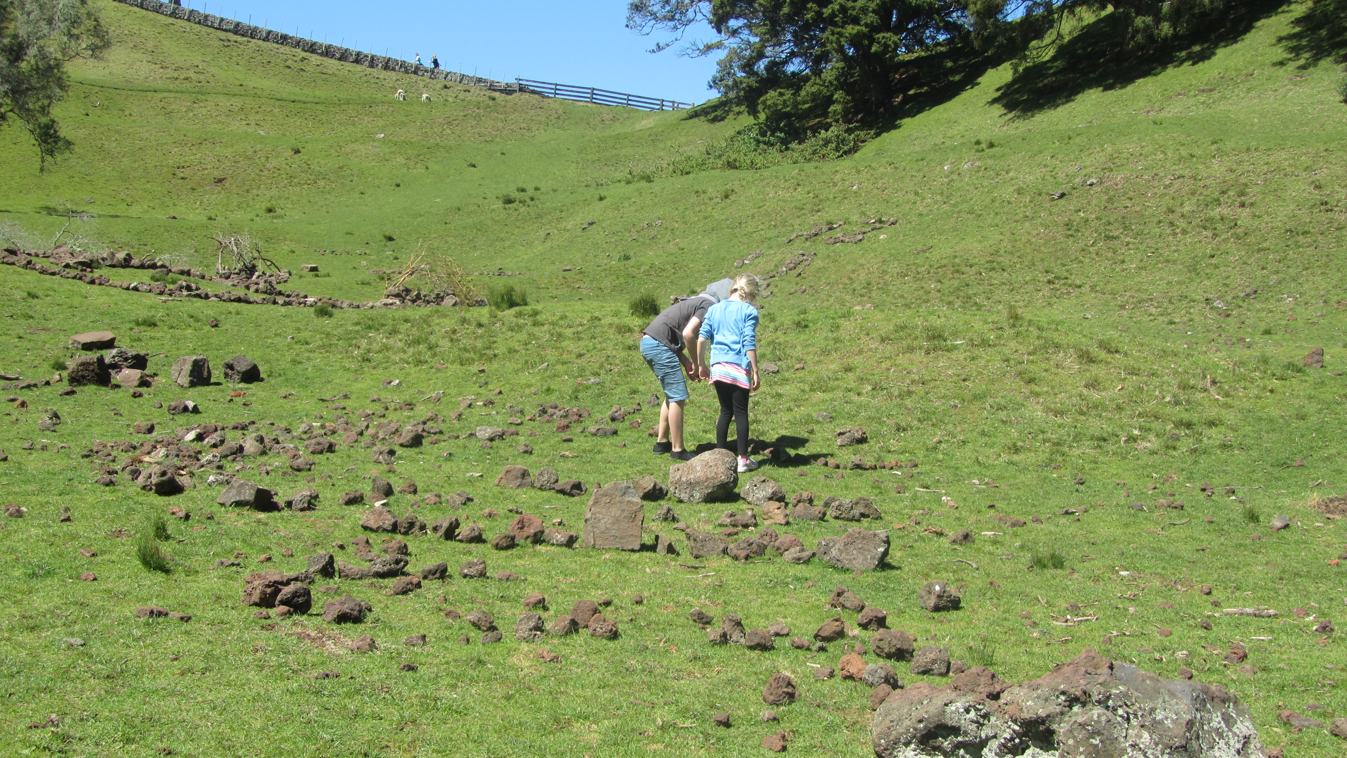
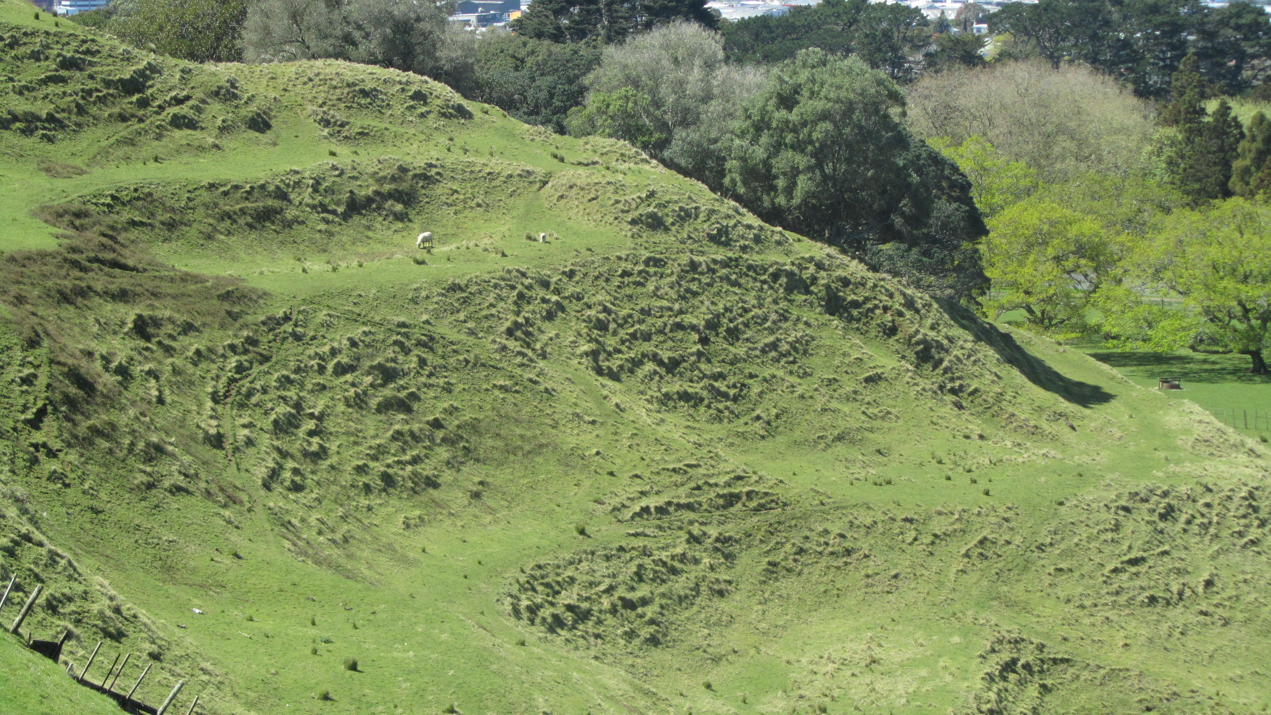
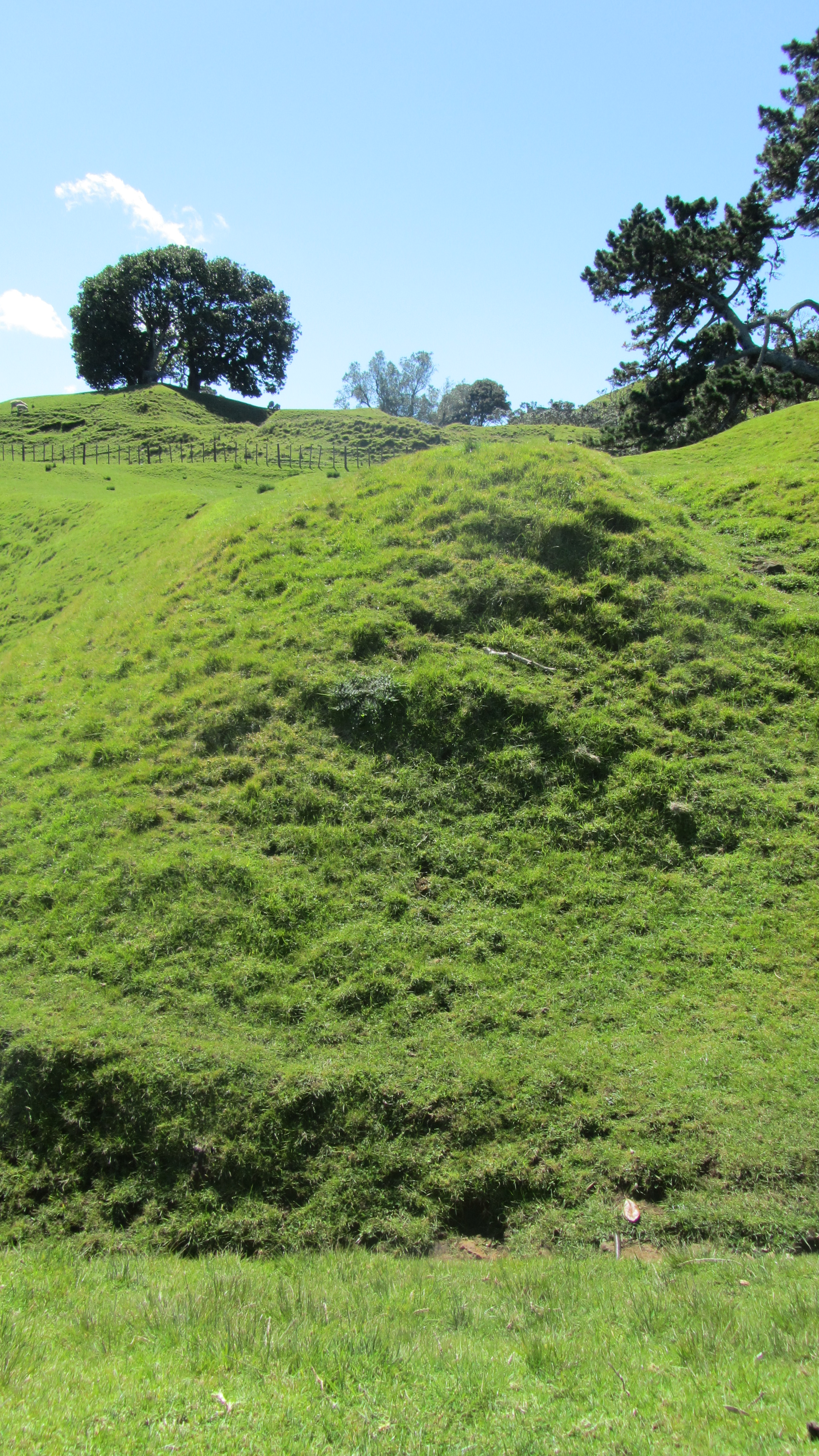
What most people will notice as they make their way to the summit is the how uneven the ground is, dips, hollows, banks and seemingly random humps and bumps will catch the unwary walker. These landscape features are the remains of the Maori settlement. There are at least one hundred and seventy terraces covering approximately forty five hectares and it is regarded as one of the largest pa (hillfort) in New Zealand. The traditional occupants of the site were the Wai O Hua tribe and their histories refer to it as the head pa of their paramount chief Kiwi Tamake in the early 1700s.
An example of some of the many terraces and platforms.
Perhaps one of the more unusual archaeological features in the park is the Rongo stone. Rongo stones are carved stones which are regarded as manifestations of a god and are used ritually to aid the growth and harvest of crops. This particular Rongo positioned on plinth near the BBQ area is not in it’s original context. It was originally rescued by Logan Campbell from the side of the road where it had been unceremoniously dumped and taken back to the Park. It is known as Te Toka i Tawhio or ‘the stone which has traveled around’.
Humps and bumps in the landscape…
The eroded edge of a shell midden.
Terracing at Maungakiekei Auckland.
More terraces and platforms.
One of many defensive banks.
Building platforms overlooking one of the volcanic craters
My daughter standing in one of the many hollows – possibly a storage pit for kumara.
A large midden suffering under modern footsteps.
Terraces, defensive walls, storage pits, boundaries and middens are all part of the archaeology on One Tree Hill and attest to a well populated landscape. Which perhaps is what makes the next phase of the story even more unusual…
The Early Settlers
In 1840 Governor Hobson chose the Tamaki isthmus to be the capital of New Zealand. There were several reasons for this, the good harbours and fertile soils not withstanding however at the time it was a mostly deserted landscape.
“Terraced volcanic cones and numerous abandoned plantations testified, in 1840, to dense habitation in the days of old. But, paradoxically, so few Maori were living there in 1840 that Tamaki could almost be regarded at the time as a population void…there was no well-established tribe to be displaced” (R.C.J. Stone, 2007, Logan Campbell’s Auckland. Tales from the Early Years).
Into this early settler world came John Logan Campbell (1817-1912) for whom much of the early history of Auckland and Cornwall Park is intricately tied to.
John Logan Campbell c.1880
Logan Campbell was born in Edinburgh and in 1839 graduated as a Doctor of Medicine, later that year he set sail for New South Wales, arriving in New Zealand in 1840. On that ship was also a William Brown who became Logan Campbell’s business partner. The two men built the first house in Auckland – Acacia Cottage – which still stands and they opened the first shop. Both men quickly took advantage of being ‘in at the ground floor’ as the new settlement of Auckland took off. Logan Campbell in particular rose in prominence rapidly and was/is regarded the ‘father of Auckland’.
The oldest remaining wooden structure in Auckland – Acacia Cottage.
In 1853 Logan Campbell and William Brown bought what was then known as the Mount Prospect Estate and renamed it One Tree Hill. By 1873 the partnership with Brown was dissolved and Logan Campbell became the sole owner. In 1901 he gifted the land to the city of Auckland during a Royal visit by the then Duke and Duchess of York and Cornwall (later King George V and Queen Mary) and it was renamed in their honor as Cornwall Park.
In 1903 the park was formally opened.
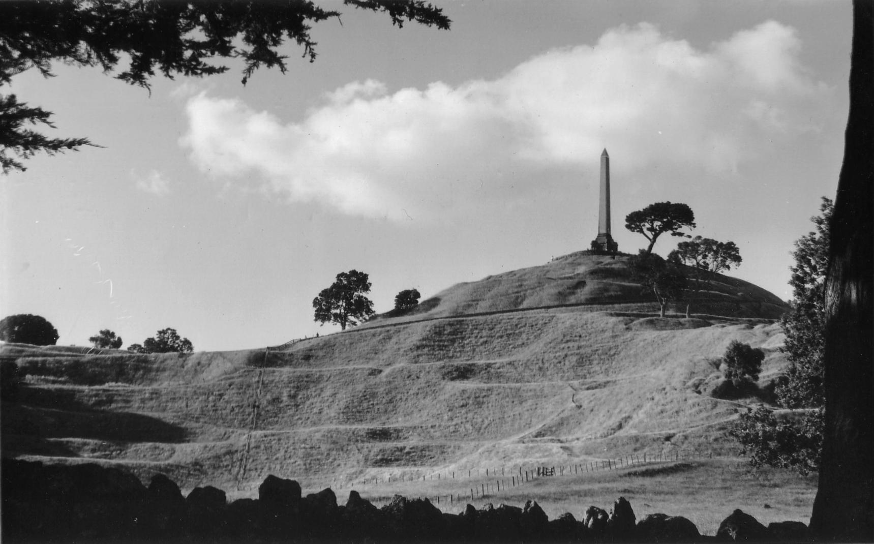
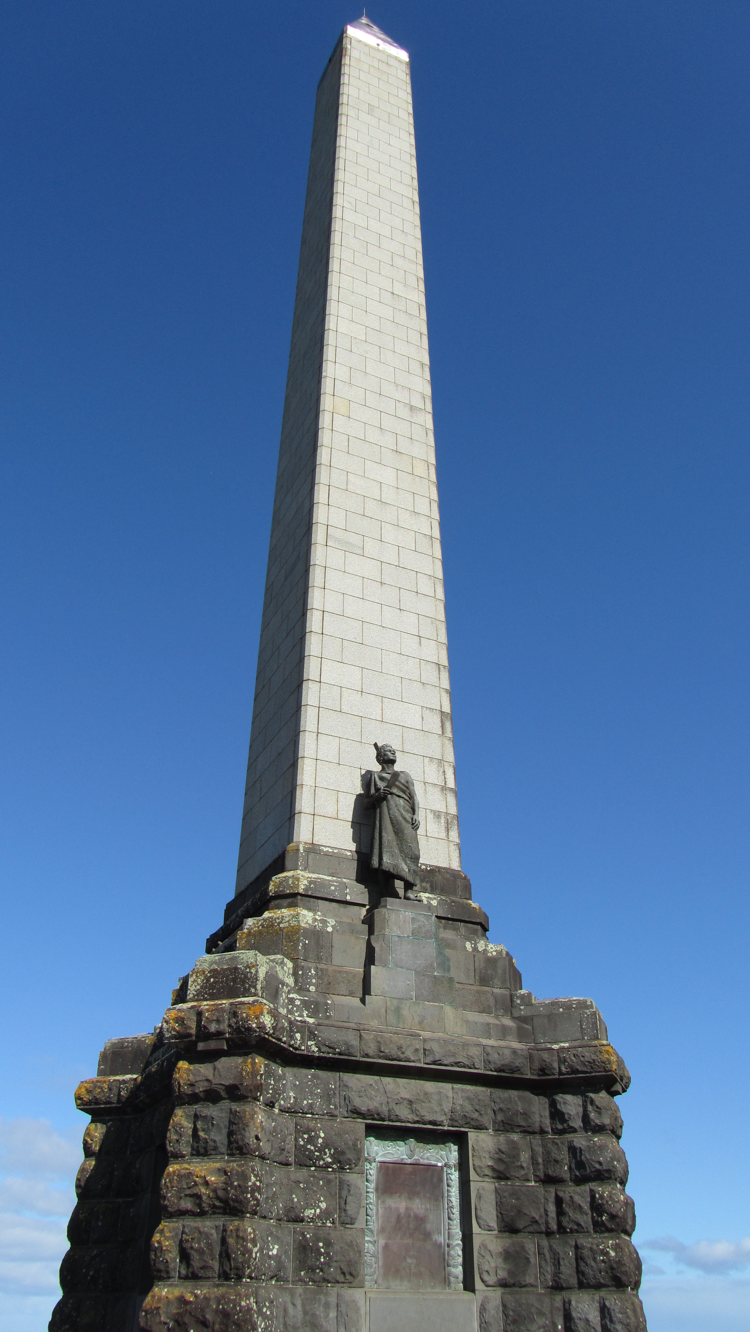
When Logan Campbell died in 1912 he left instructions and funds for the construction of a monument to the Maori people whom he admired a great deal. However, it was not until the late 1930s that work began on the obelisk. It was completed in 1940 but the unveiling was not held until the 28th April 1948 after WWII was over in keeping with the Maori tradition of not holding ceremonies during times of war.
John Logan Campbell’s memorial to the achievements of the Maori people.
The obelisk is 33m high and was designed by Atkinson Abbott. Logan Campbell is buried at the foot of the monument under the flat paved forecourt.
Today
Today both parks are well used by Auckland residents and it is still farmed with sheep and cows wandering the slopes of the hill. It is a place where people meet, families picnic, dogs walk, joggers jog and children play. Every city needs its green spaces in order to breath and here in Auckland we are lucky to have this and so many other such spaces…
A recent addition to my television viewing is a locally produced show – ‘Heritage Rescue’. Along the veins of a reality tv show and borrowing loosely from home makeover shows and the UK’s ever popular ‘Time Team’ (the shows presenter once worked on the latter as a humble archaeologist), Heritage Rescue visits small local museums, spending time (usually around a week) and resources to inject new life into these establishments. More often than not they operate purely on the fuel of volunteers.
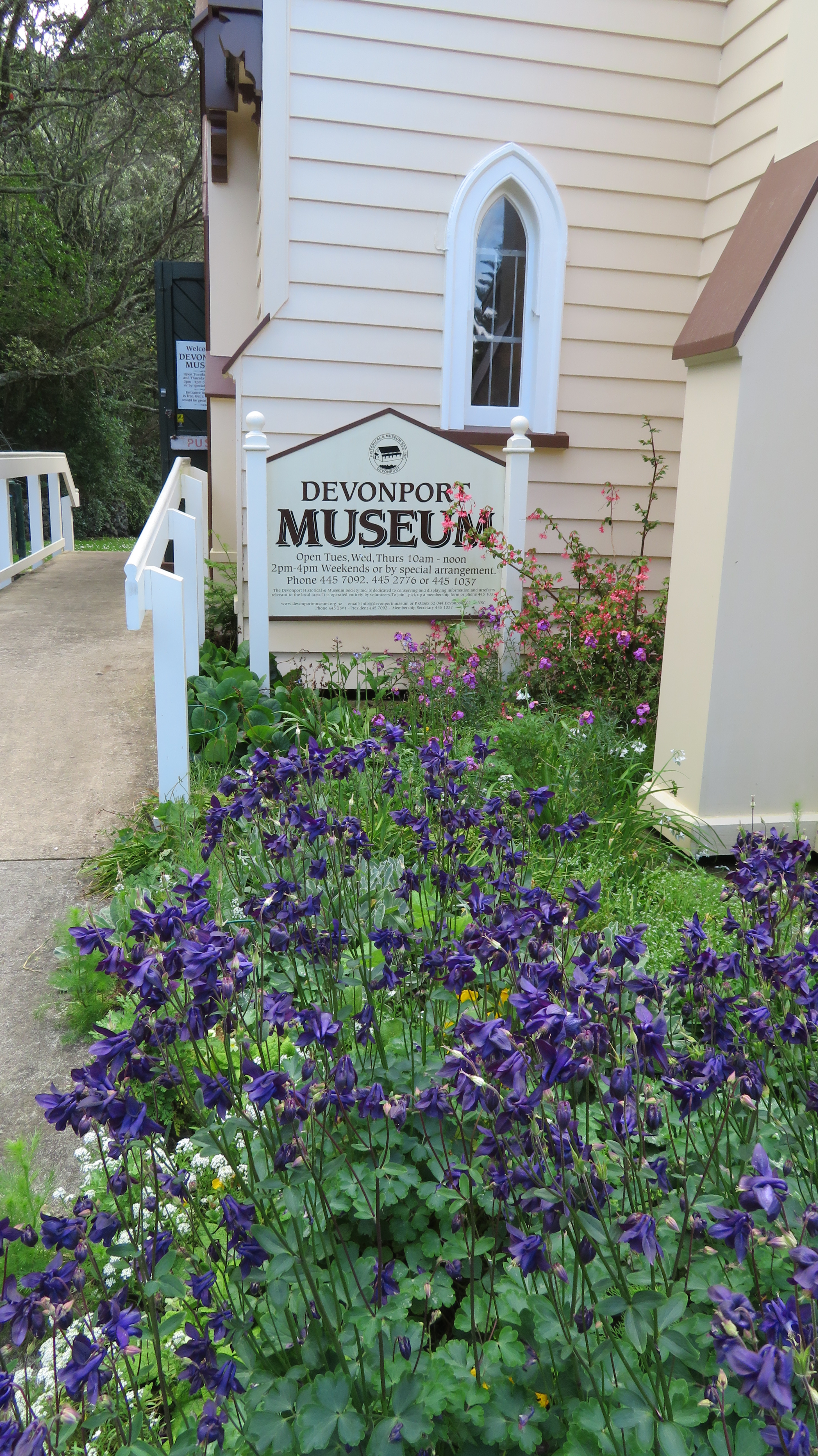
One such museum was the Devonport Museum in Auckland – I am sorry to say that even though I have lived only a fifteen minute drive from this musuem I had never visited…a fact I hastened to amend after watching the two episodes dedicated to giving the wee museum a new lease of life. Having never been to the museum prior to its appearance on the telly I can’t compare so the photos that follow are of the new look museum.
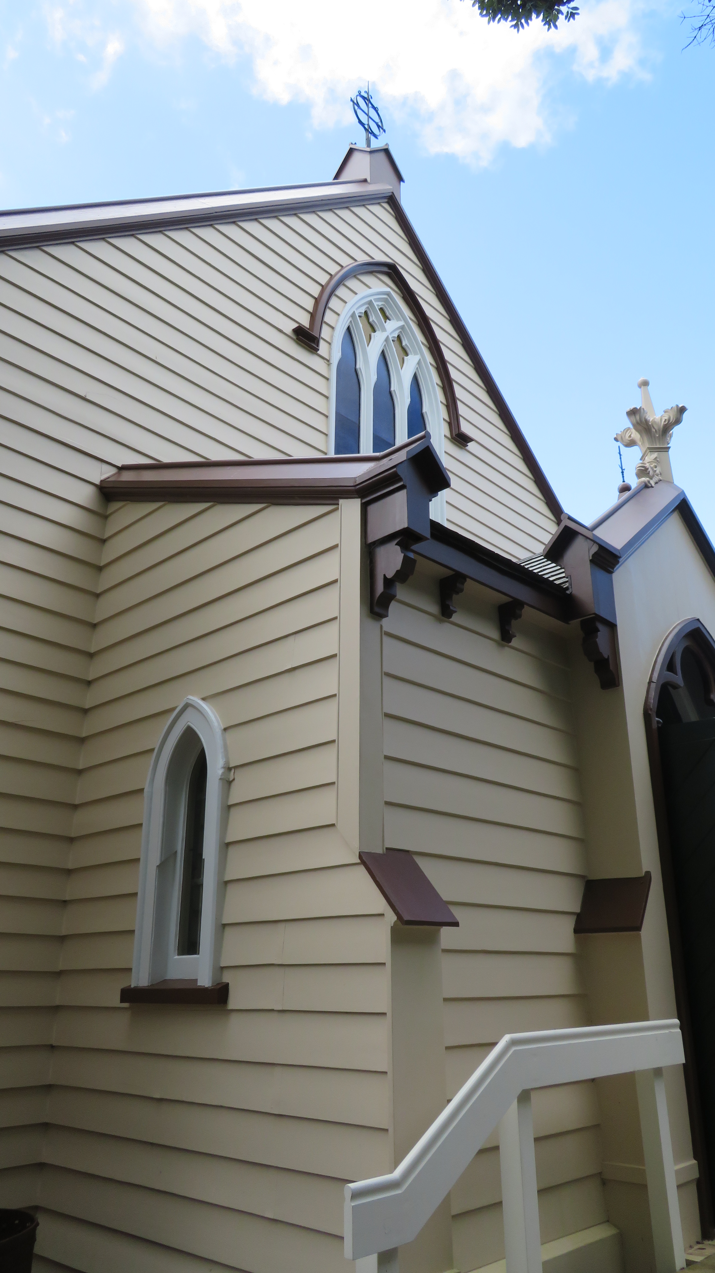
The one thing that has obviously remained the same is the essential fabric of the building. The museum is housed in an old Presbyterian church which was moved to it present day location in an old quarry on the side of Mt Cambria in 1978.
On entering the museum to the left there is a timeline of Devonports history with a superb diorama of the local landscape taking centre stage. I was fascinated to learn that once upon time it was possible to get a boat through at high tide directly from Narrow Neck beach to the Ngatringa Bay past what is now the golf course and along the present day Seabreeze Rd.
Some of the precious taonga on display.
Samples of goods from the later brickworks
Devonport itself is an area rich in history, not just because it was one of the earliest nineteenth century settlements but also it was well utilised by Maori with its safe landing beaches, excellent access to kai moana and fertile soils on the slopes of its volcanic cones. Jutting out into the wider Hauraki Gulf it also provides an excellent vantage point of all who come and go into Auckland. The museum effectively reflects this tapestry of Devonports past.
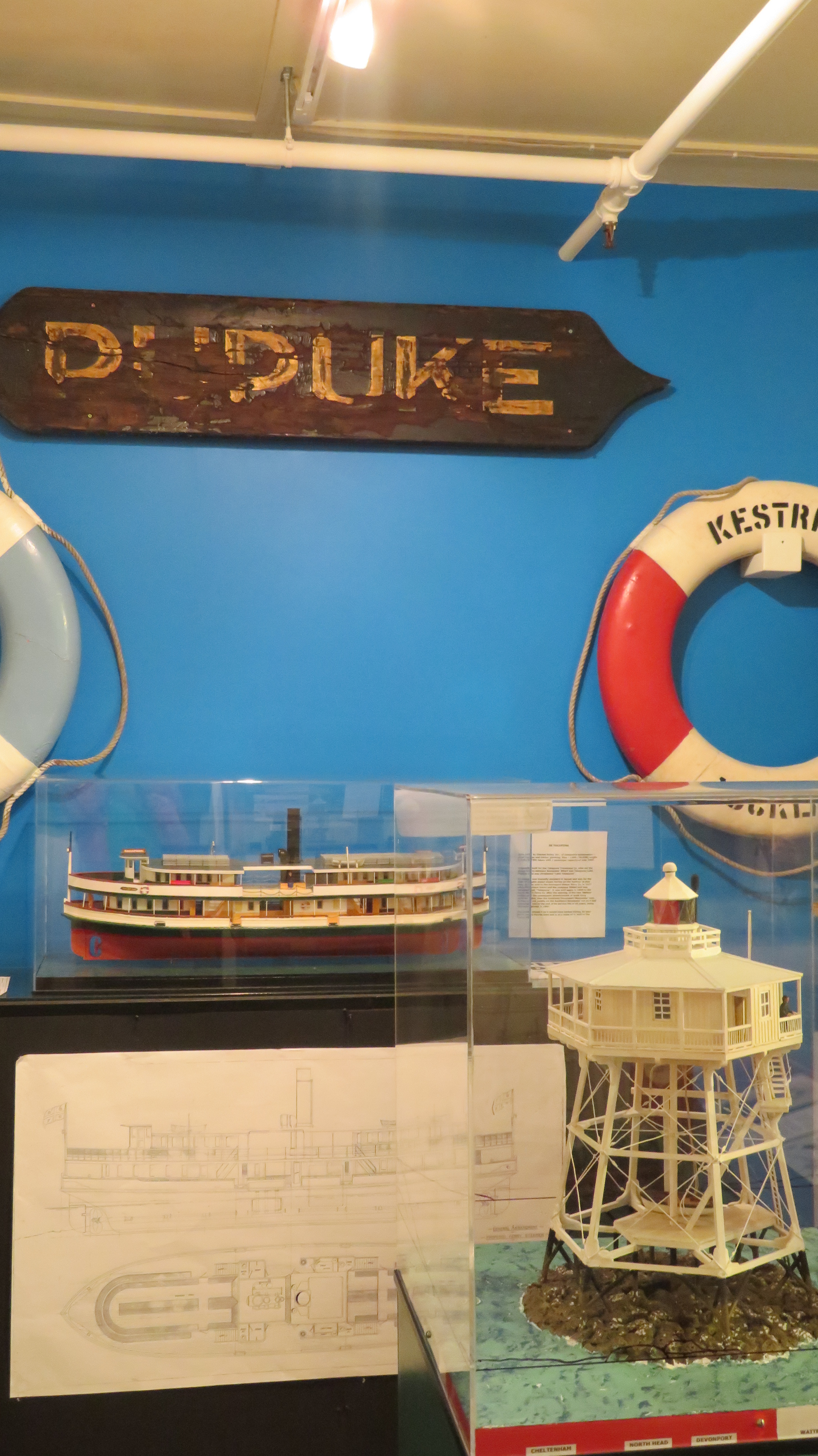
There are displays on the history of ship/boat building in the area, we are told that the foreshore was a hive of industry in the nineteenth century. The above picture shows a model of New Zealands one and only remaining wooden light house which can be found just off the tip of Devonport, no longer being used as a light house but preserved as a historic site.
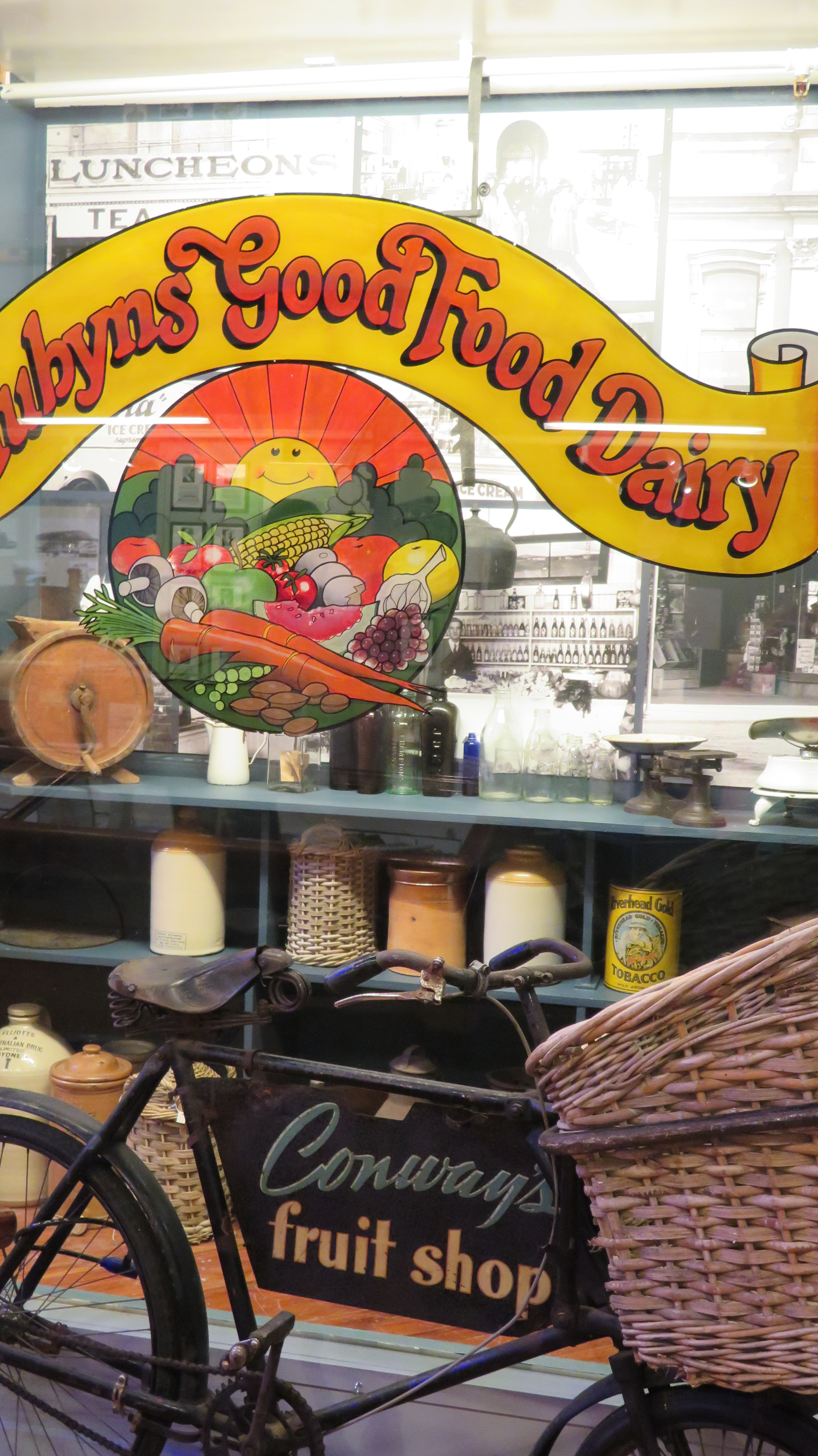
Shop window displays using real shop windows from the towns retail past gives the visitor an impression of what the main street may have once looked like.
This slideshow requires JavaScript.
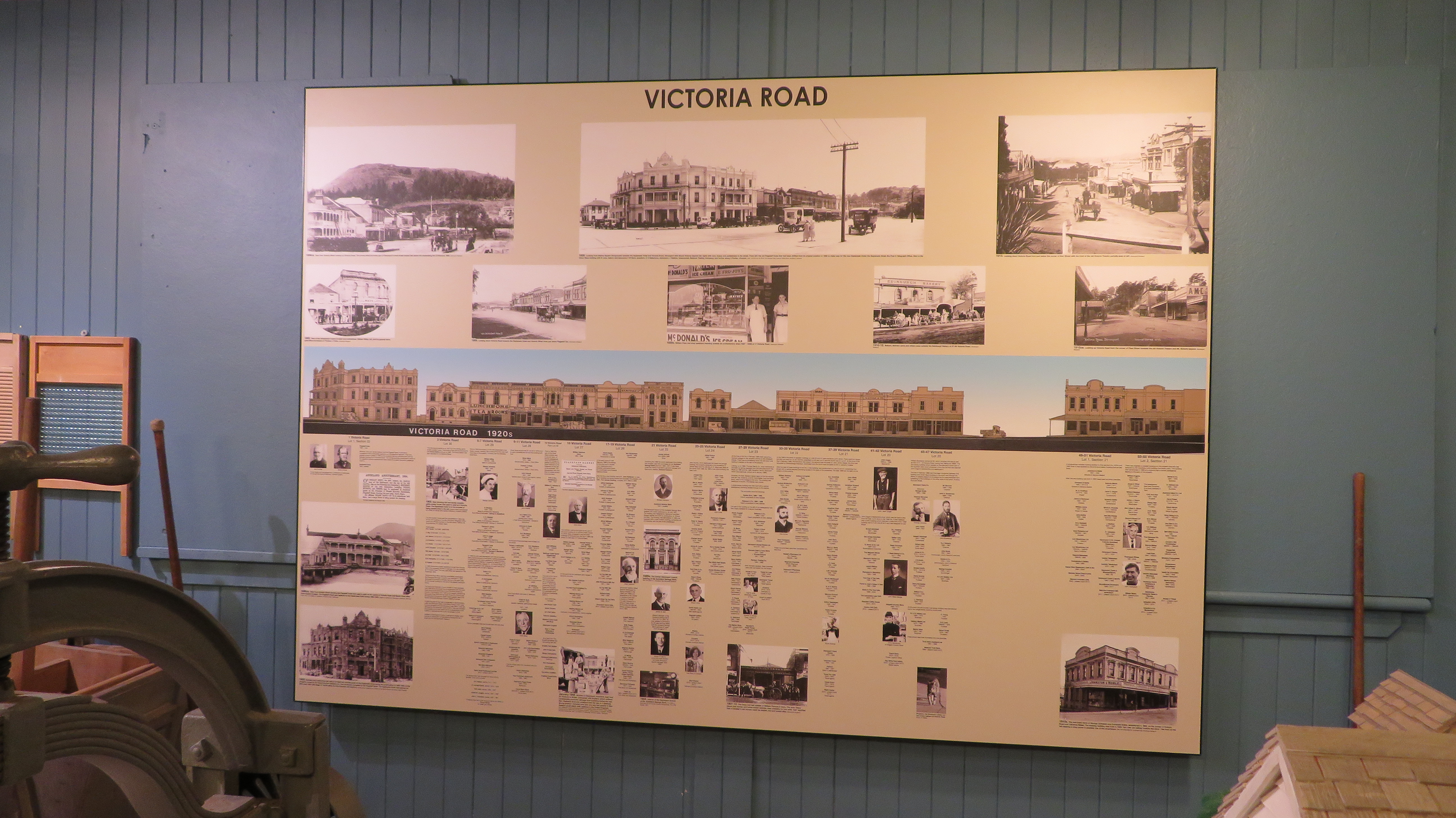
Here a display panel gives information on Devonports main street – Victoria Road – who lived/worked and played there.
Devonport is well known for it old villas and colonial cottages – the museum has two models of these types of houses on display. The one on the right is complete with washing on the line and a larder stocked with local produce.
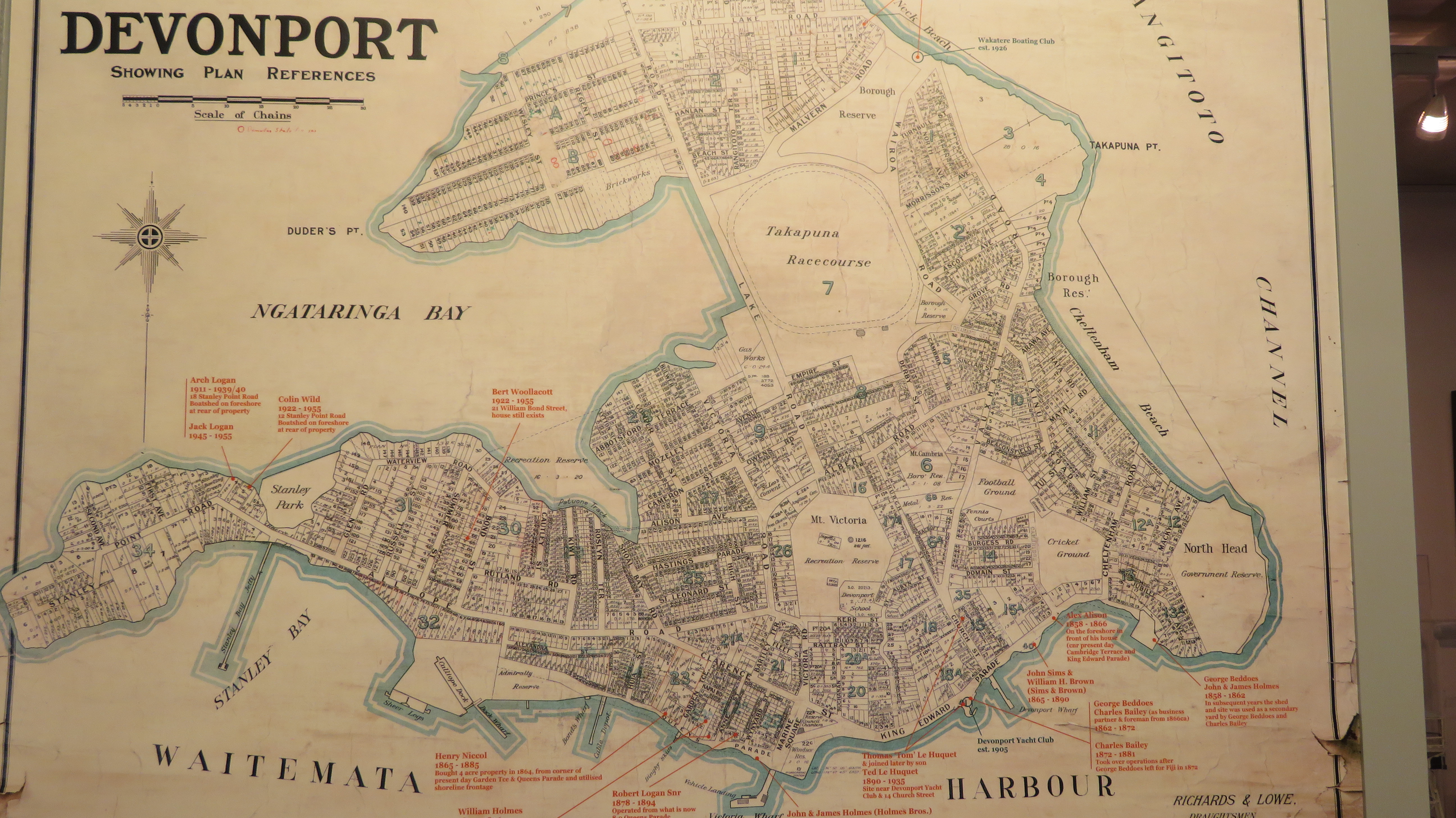
An old map of Devonport – the Takapuna Racecourse is now a golf course…
Overall our visit to the Devonport museum was very enjoyable, helped along by a friendly and informative volunteer who was able to answer my questions. There is even a kids corner with old fashioned games for the littlies to have a go at and in a seperate room a research space is well appointed for those to local/family histories. It is well worth a visit if you are in the area and even if you’re not.
On June 10th 1886 Mt Tarawera erupted along a line of craters that extended sixteen kilometres and the space of a few hours the nearby village of Te Wairoa and the world famous Pink and White Terraces were covered in over a metre of volcanic mud and ash.
The death toll for the area was believed to have been as high as 153 – Te Wairoa at the time was a bustling village with two tourist hotels serving visitors to the Pink and White Terraces, two stores, a school, a blacksmith and a bakery. By the end of the day not a single village house was left standing.
Today the site of Te Wairoa consists of several hectares of fields within which the visitor can walk amongst the excavated remains on the village. There is also a lovely river walk and a musuem dedicated to the Maori and Victorian artefacts recovered from the site. The following are a few of the photos which I took during a visit in 2015.
Some of the displays from the museum
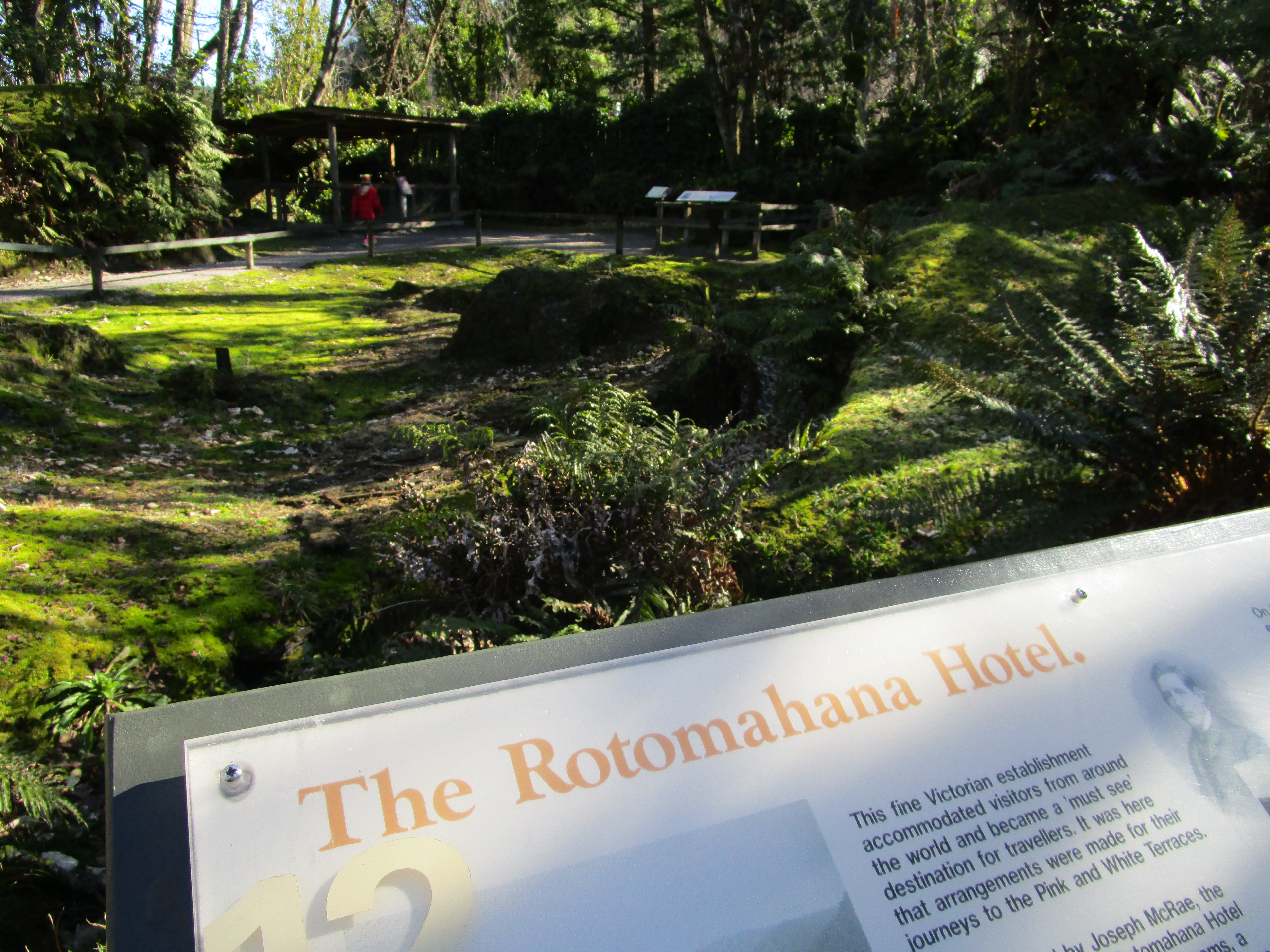
The remains of the Rotomahana Hotel.
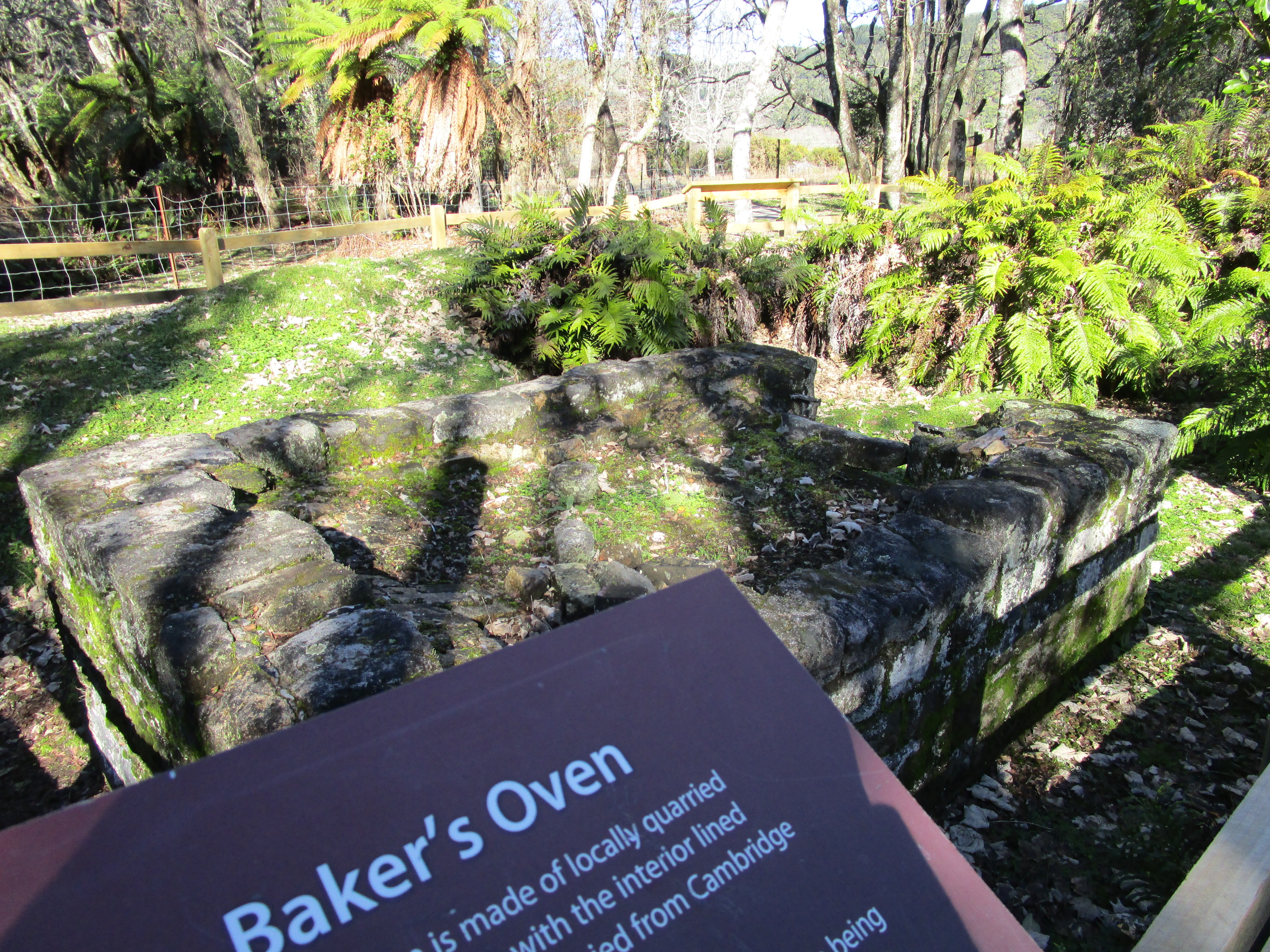
and the bakers oven…
The unexcavated remains of two of the many houses in the area.
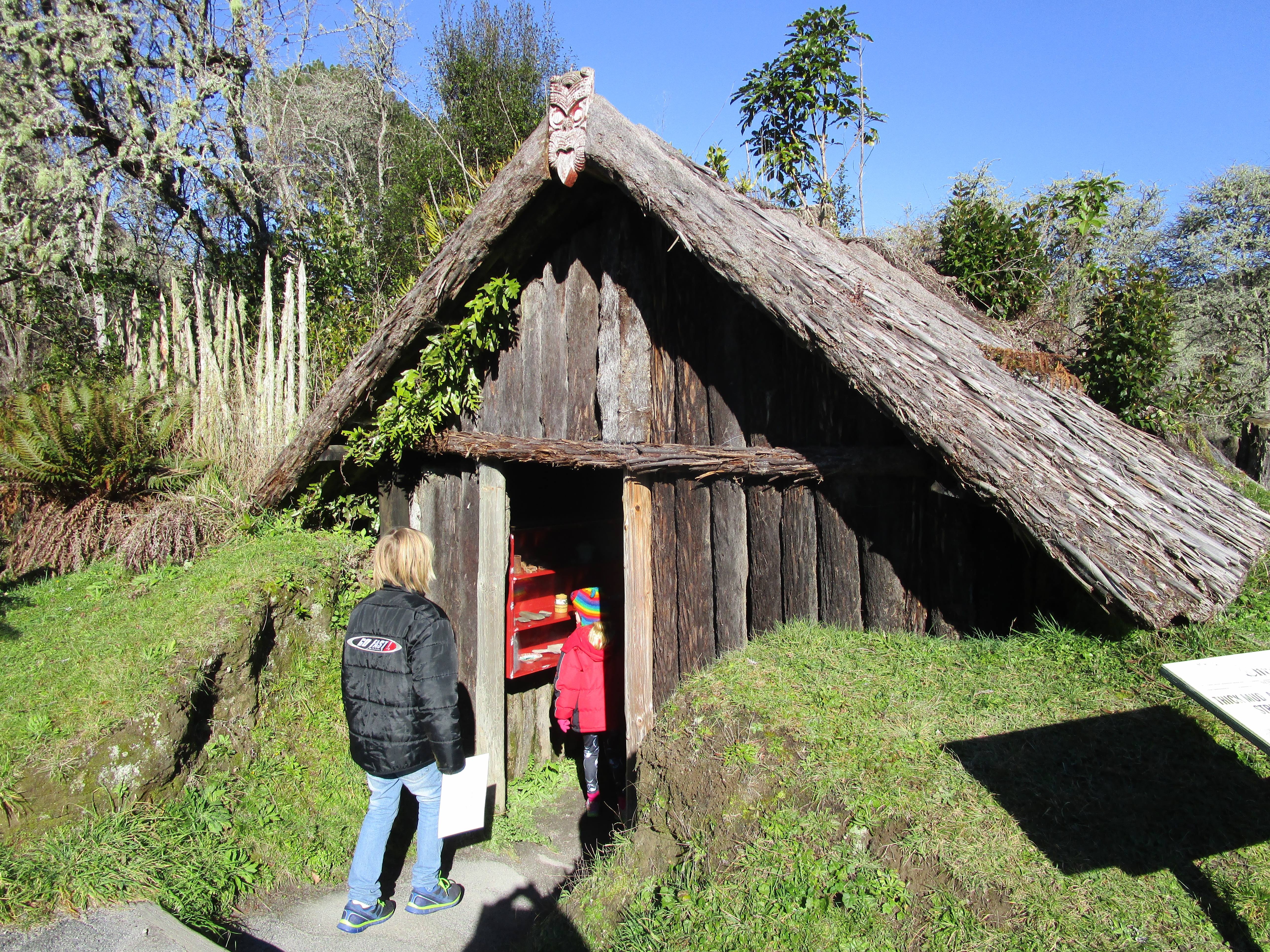
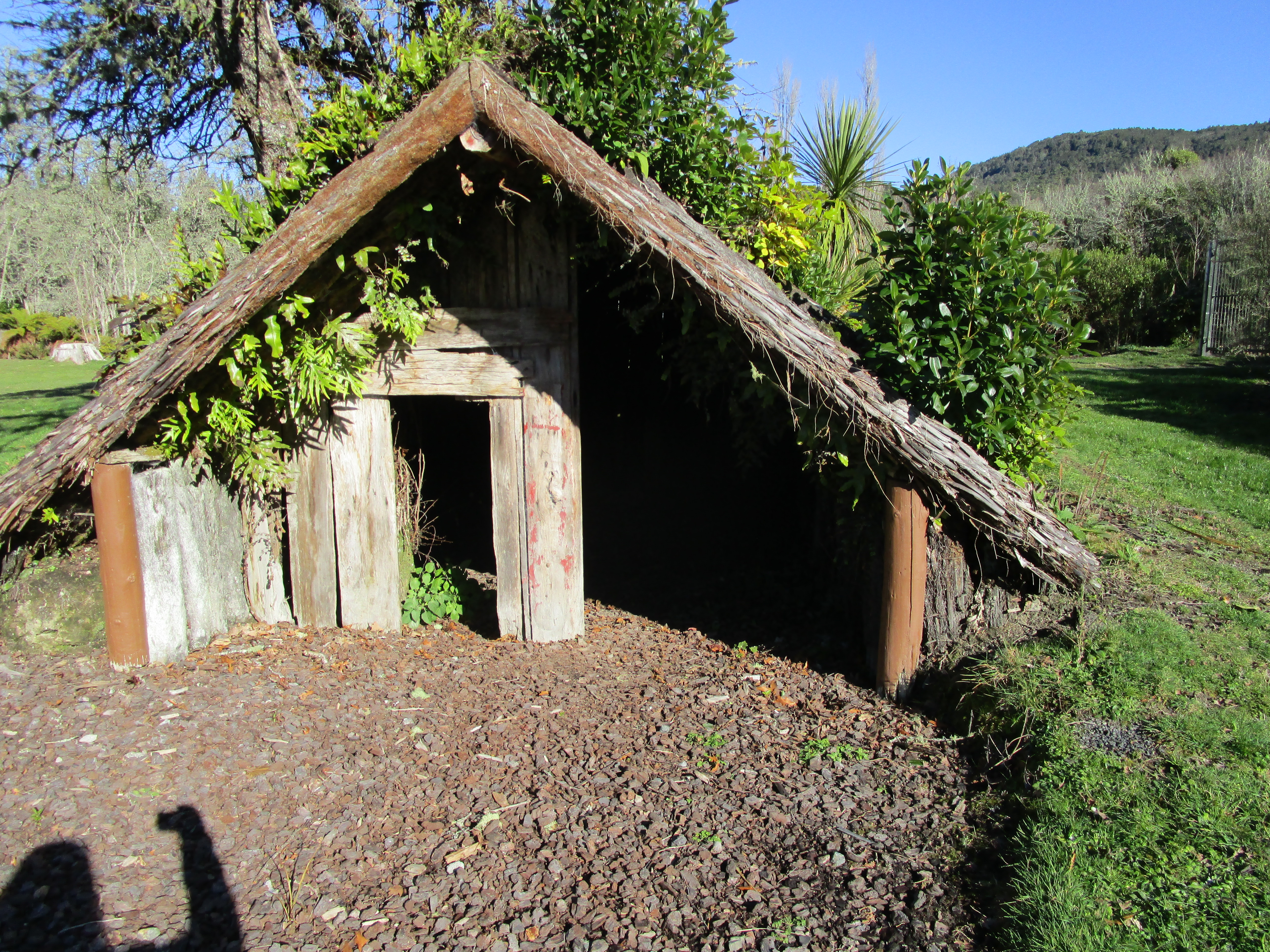
A reconstruction of a simple Maori house – all of these were destroyed by the mud and ash. Today their remains are marked by wooden frames and the stones of fireplaces.
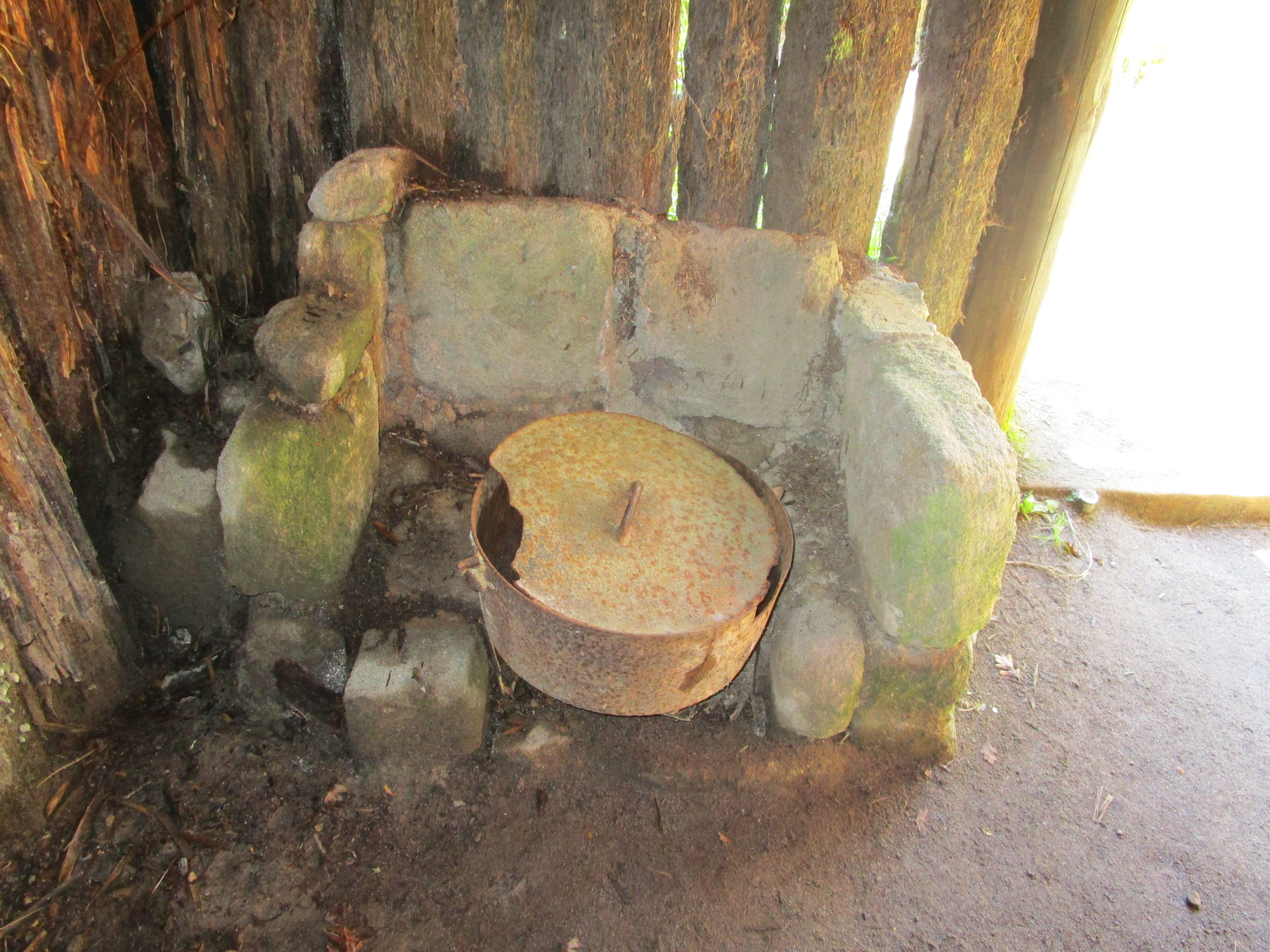
The hearth inside the above reconstructed house.
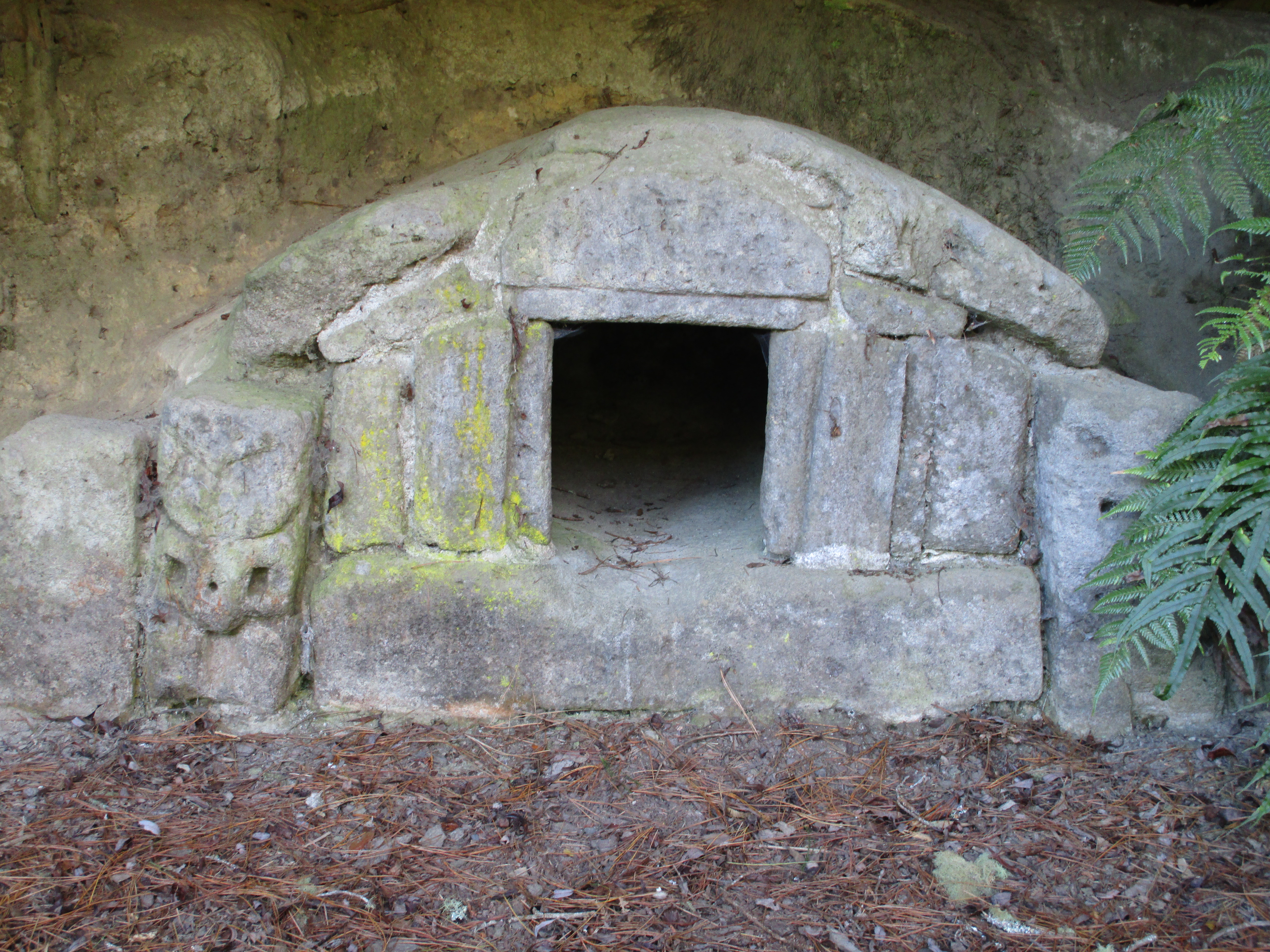
A Maori storehouse found under the ash layer beside the stream. It is a rare example of the use of stone in building practices.
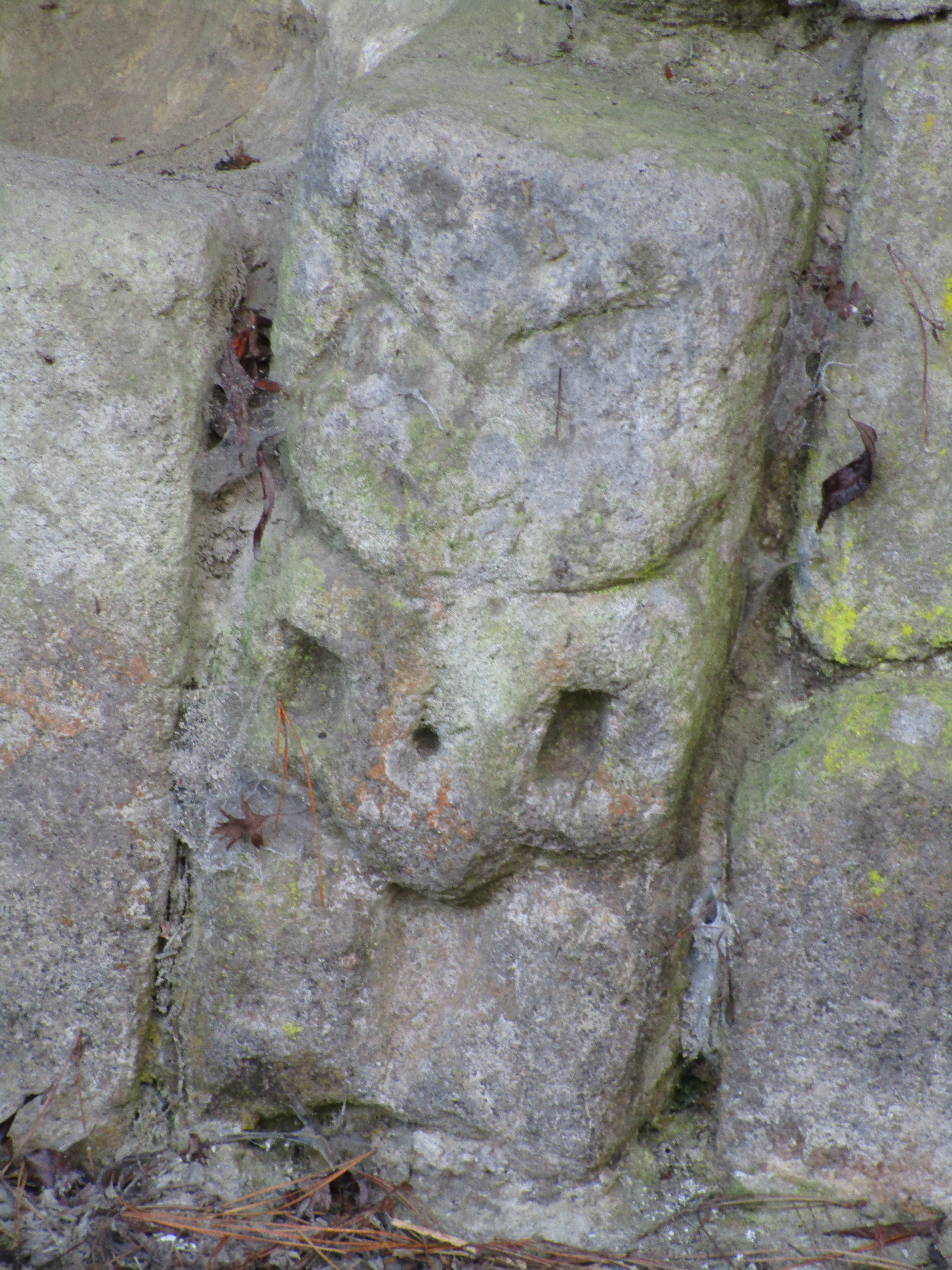
A close up of the carving to the side of the storehouse.
The above is the house of Tuhoto, a 100yr old tohunga (tribal priest) who bore the brunt of the blame for the disaster. He had openly condemned the people for their decadent lifestyle and had predicted that disaster would fall on the community. When the mountain exploded, he like so many was buried in his hut and local Maori were so angry they refused to dig him out. He was eventually rescued by the Europeans (four days later) but died not long after in a sanitorium.
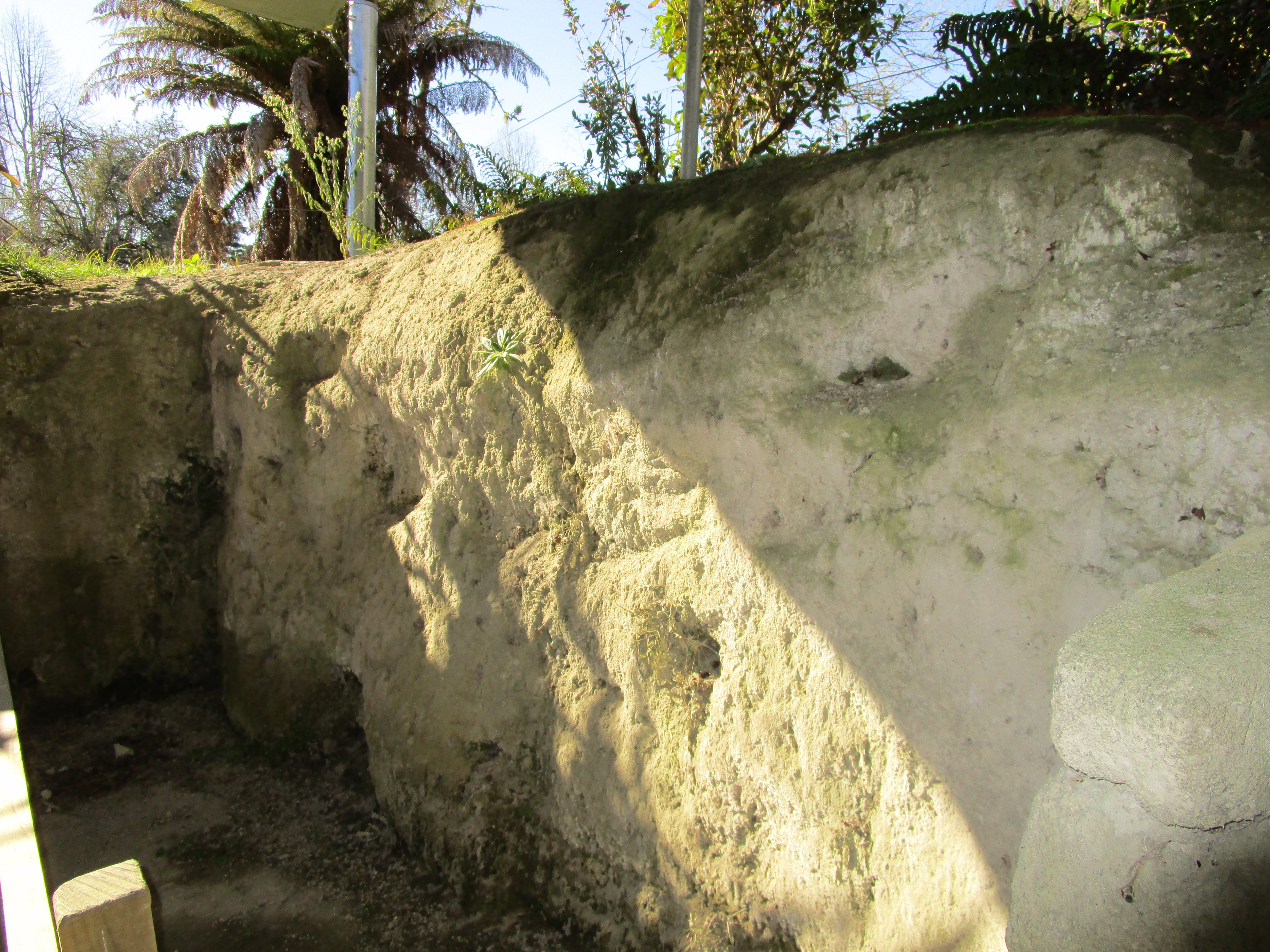
Inside an excavated house – showing the depth of the mud and ash that fell on Te Wairoa.
The Coromandel is a place rich in Maori history, the most obvious archaeological site are the many pa found on the coastal headlands. The following are a few photos taken during a weekend in the coastal township of Whitianga.
Before we get to the photos, it is probably necessary for me to give you a brief explanation on what a Pa is, particularly for those of you who are not familiar with the term. The word ‘pa’ can refer to any Maori settlement, defended or otherwise, but most commonly it is used to refer to a type of site known as a hillfort – fortified settlements with palisades and defensive terraces. The majority of pa sites are found in the North Island from Lake Taupo northwards – over 5000 have been recorded to date. You can read more about Pa here.
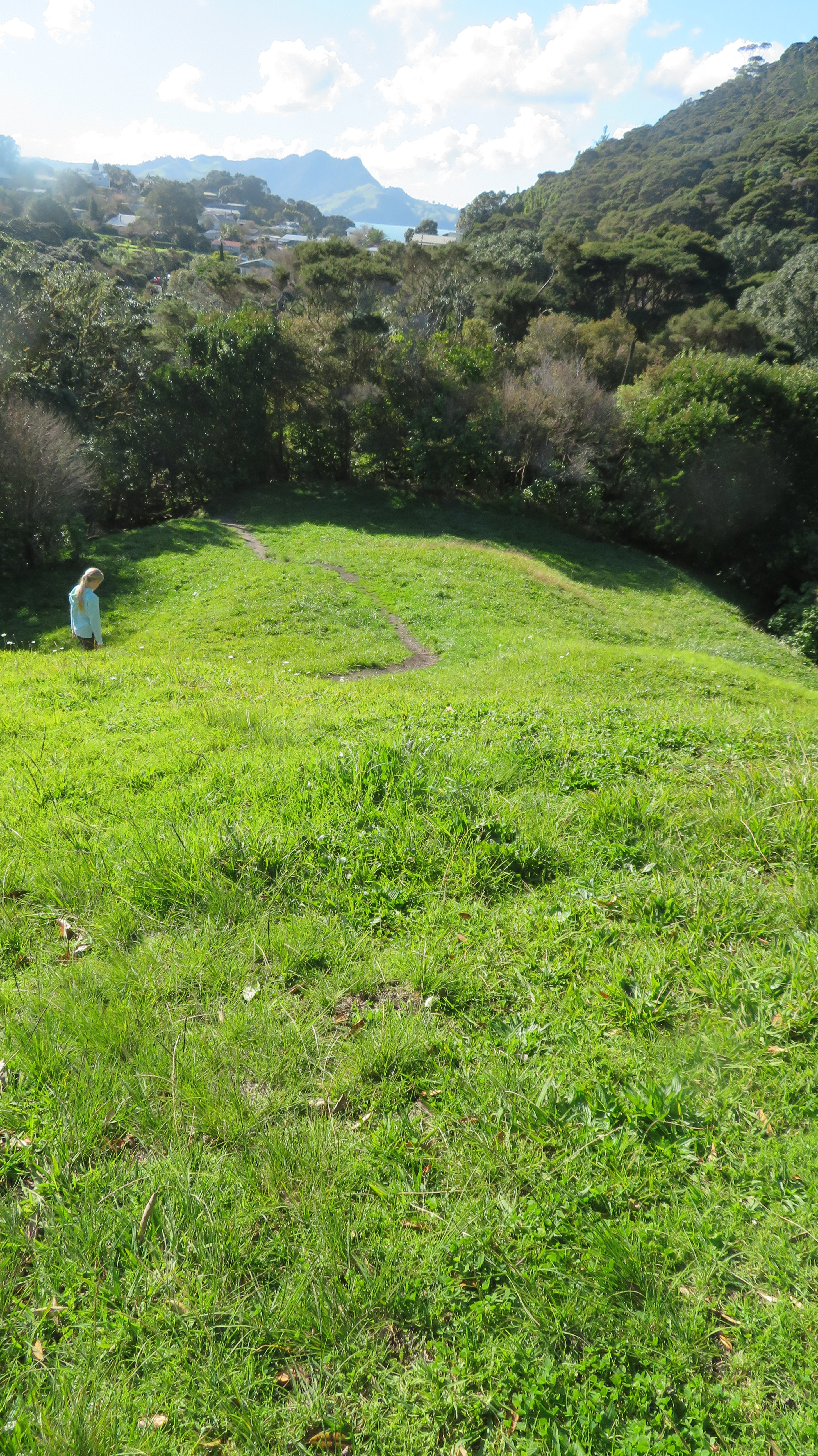
The two Pa mentioned in the title of this blog are the Hereheretaura Pa and Whitianga Rock – both were Ngati Hei strongholds, although the latter suffered during a raid by a war party of Ngai te Rangi. The reserve where Hereheretaura Pa can be found is at the southern end of Hahei Beach is one of two pa in the reserve. The other – Hahei Pa – is on the ridge above the track (seen below) but with minimal defensive earthworks unlike Hereheretaura Pa.
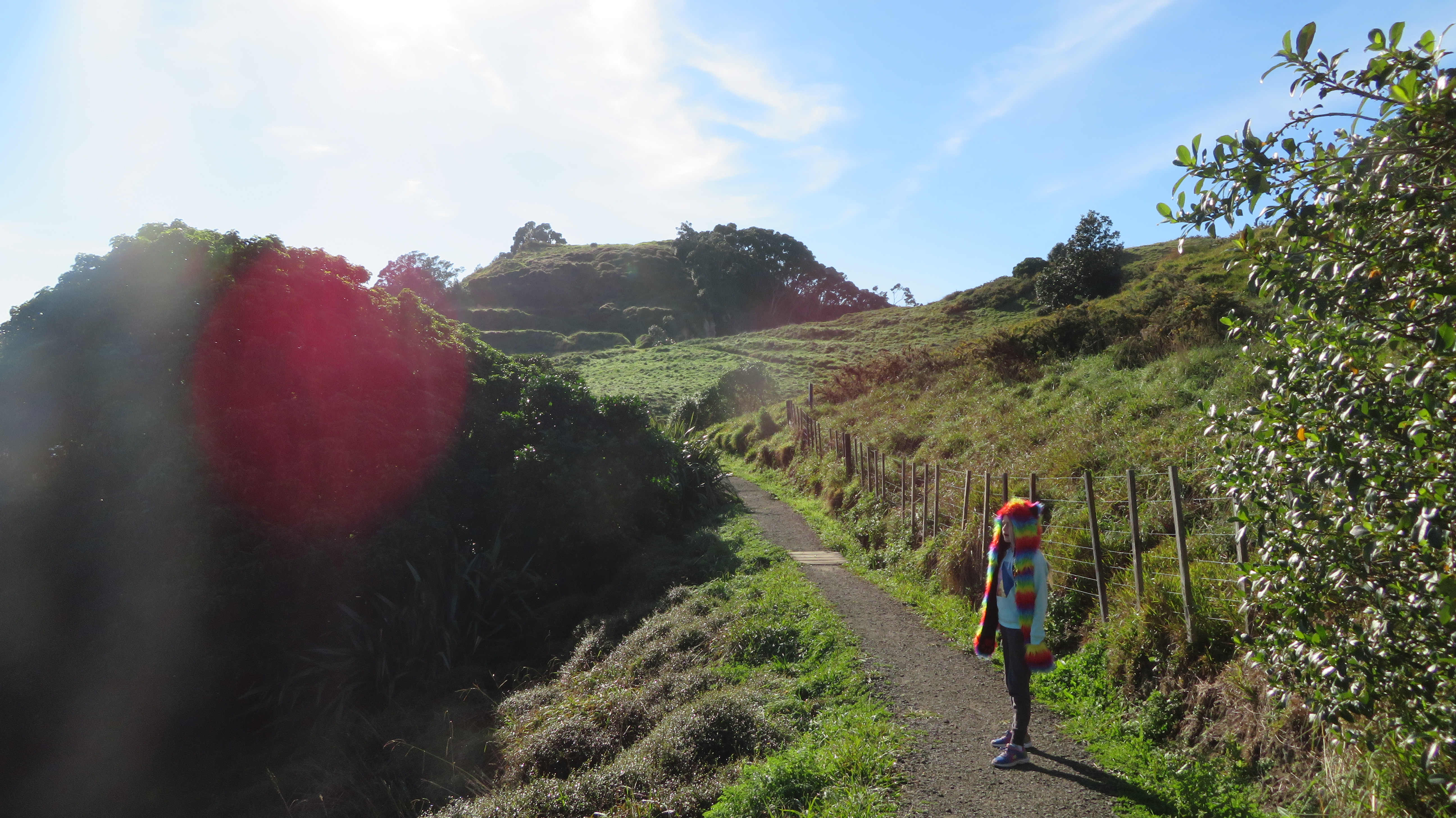
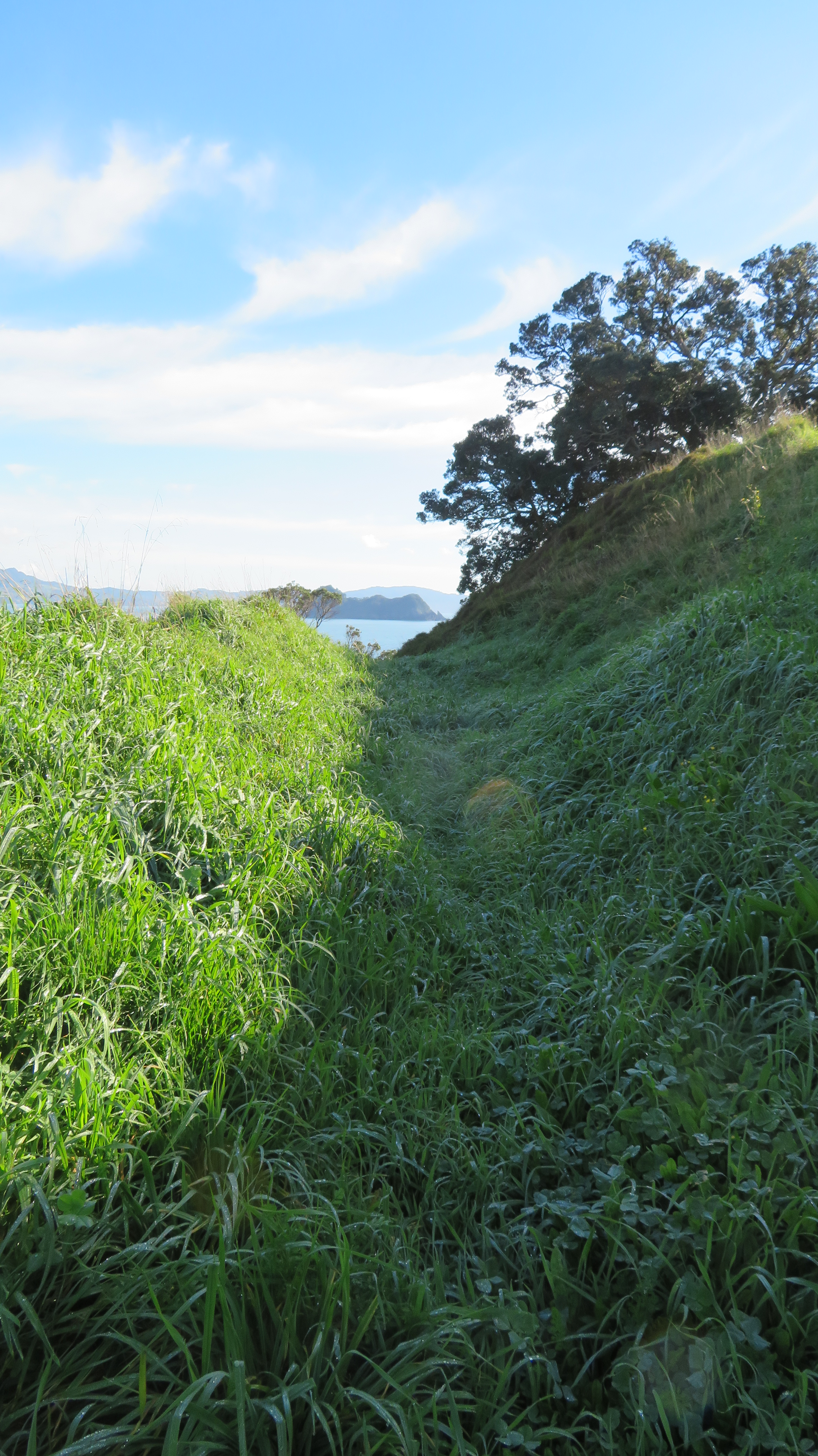
Walking in the Te Pare Reserve – Hereheretaura Pa in the distance.
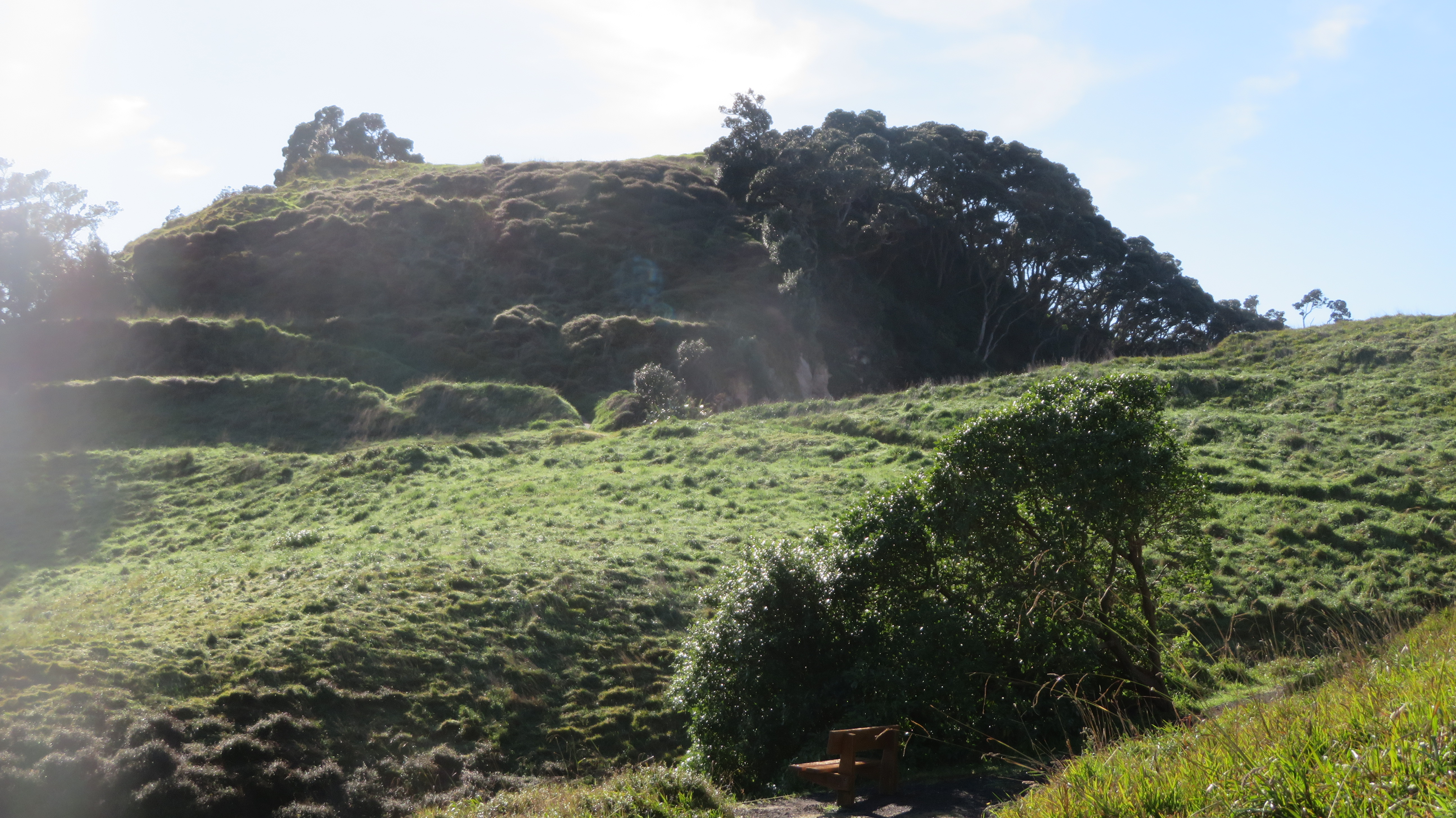
Hereheretaura Pa – the lines of banks and ditches can be seen in the early morning light.
One of several bank and ditch earthworks clearly visible at Hereheretaura Pa.
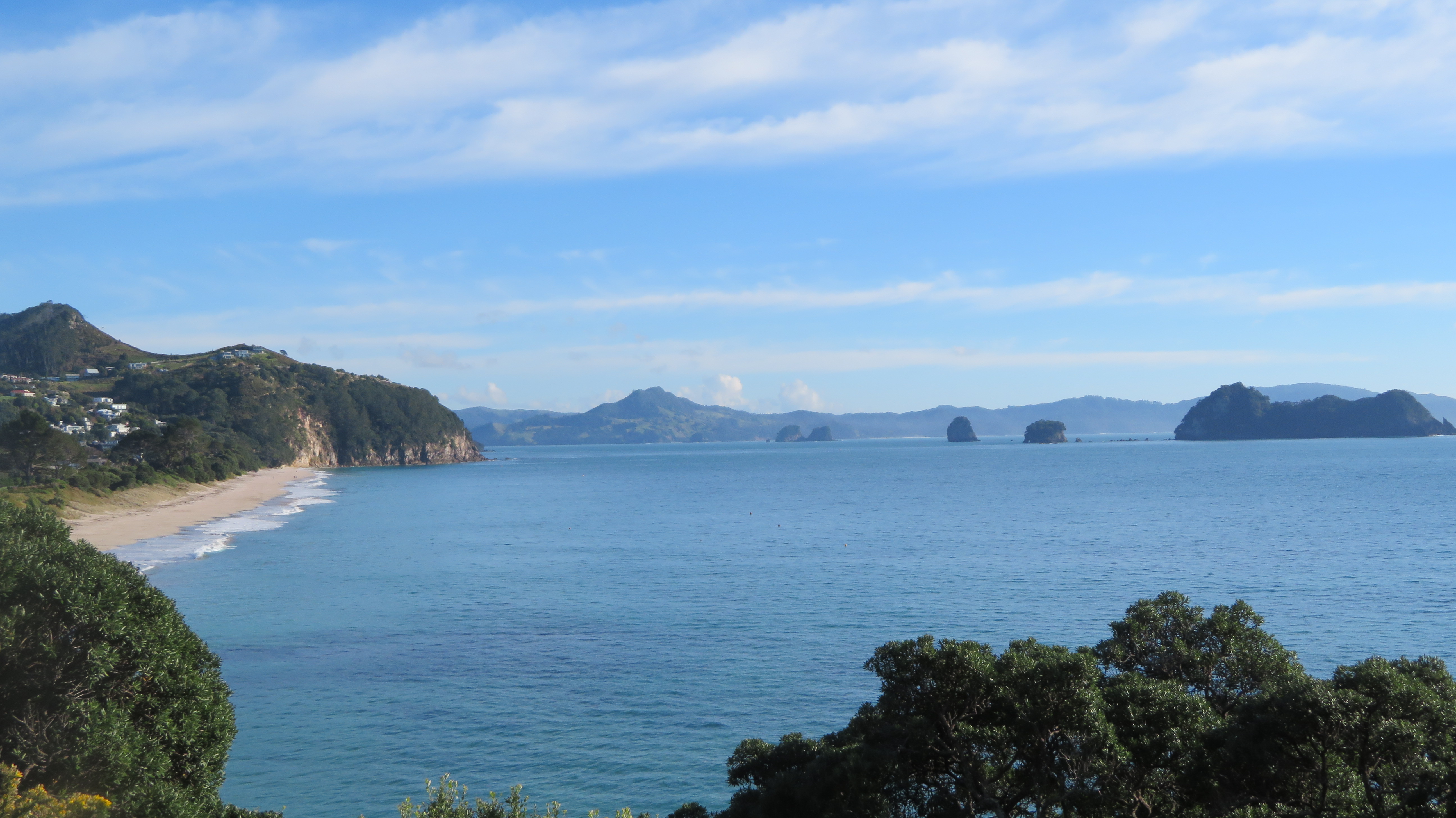
The view from Hereheretaura Pa looking northwards.
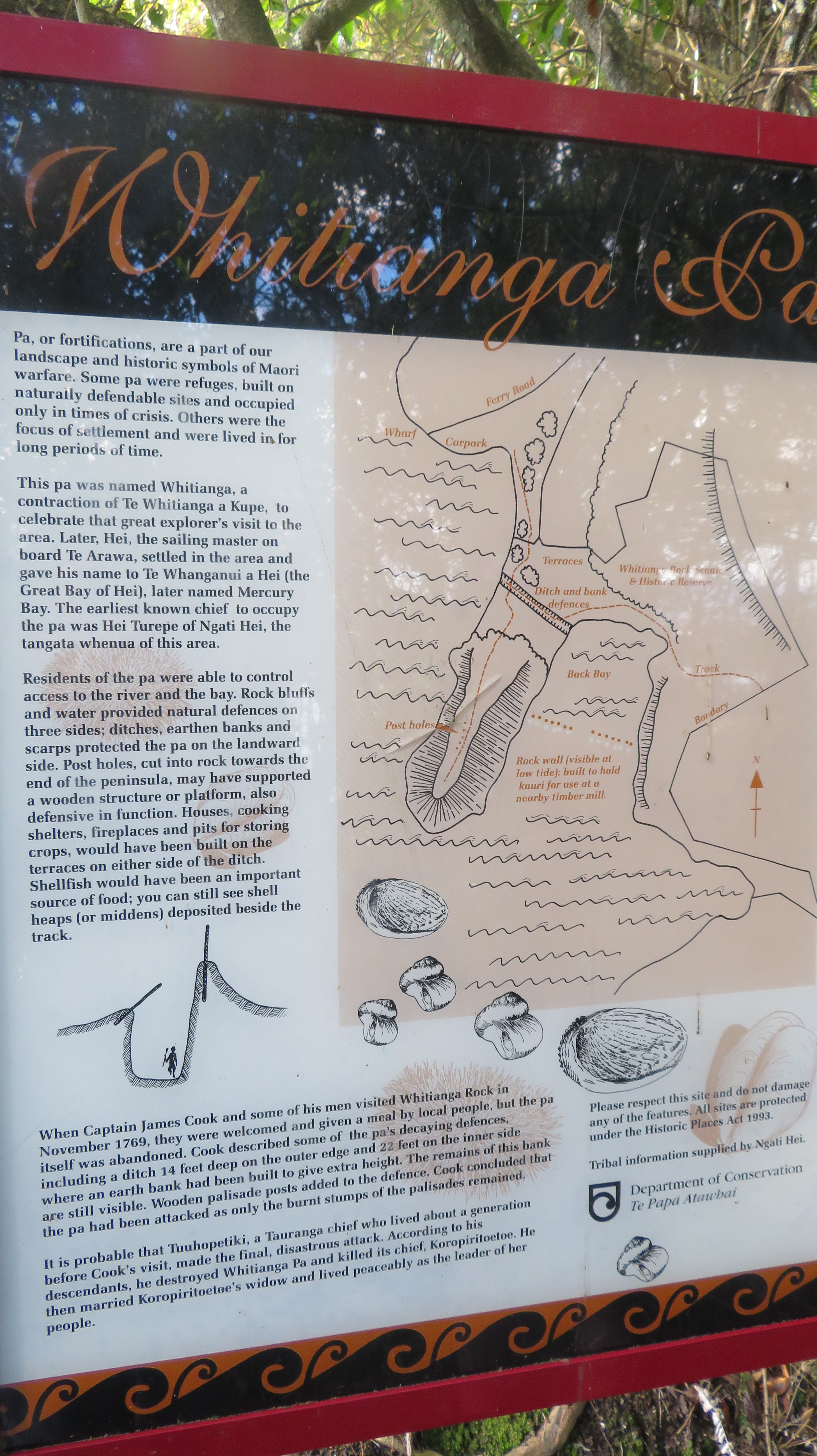
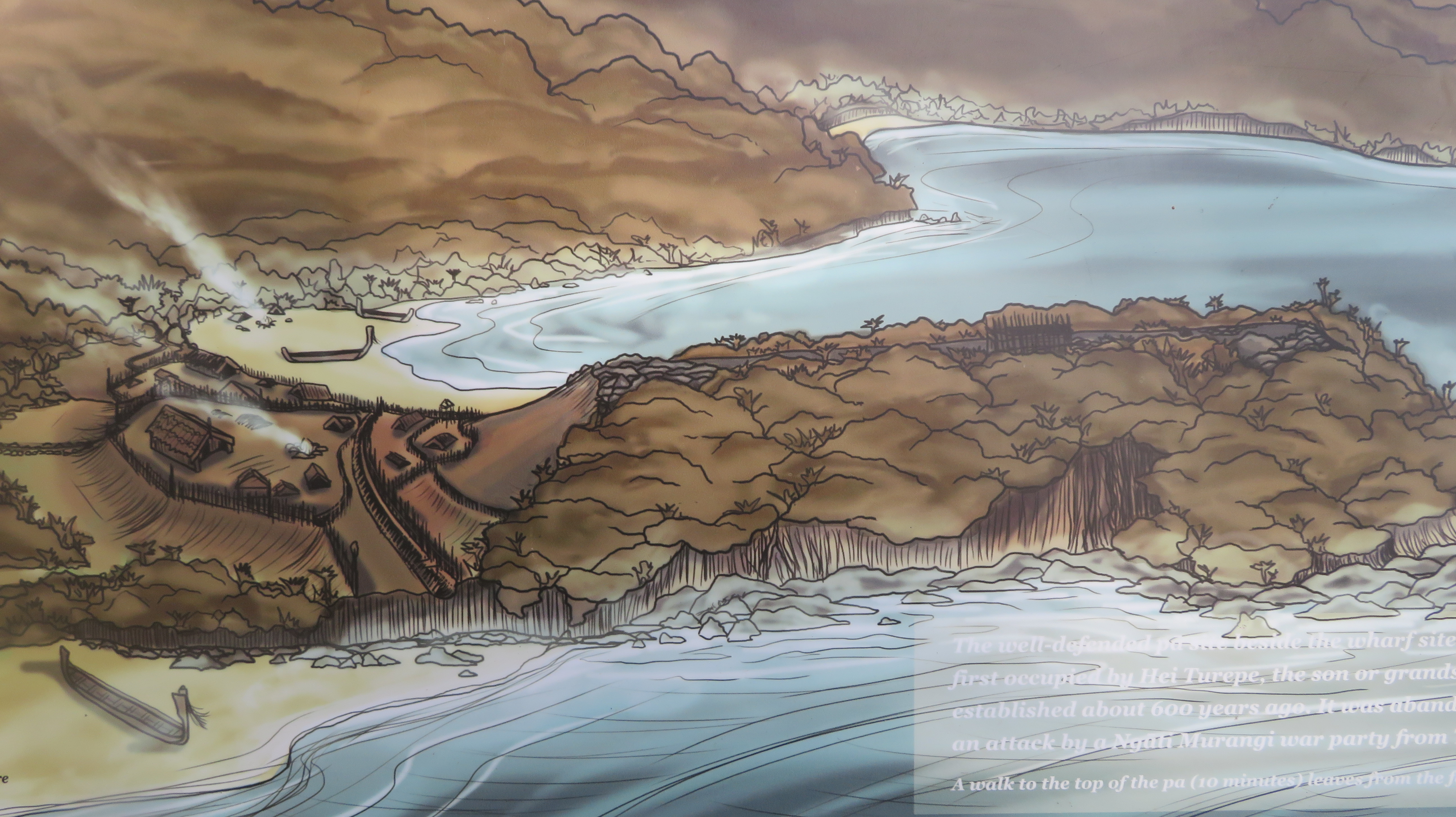
Whitianga Rock is on the opposite side of the estuary from Whitianga, a short ferry ride across from town takes you to the start point for a walk around the site. The site is positioned on a thin finger of land jutting into the estuary harbour with steep cliffs on three sides. By the time Captain James Cook arrived in 1769 the site had already been abandoned, even so it impressed Cook enough for him to state;
“A little with[in] the entrance of the river on the East side is a high point or peninsula jutting out into the River on which are the remains of one of their Fortified towns, the Situation is such that the best Engineer in Europe could not have choose’d a better for a small number of men to defend themselves against a greater, it is strong by nature and made more so by Art”.
Information board at the start of the walk.
House terraces on the landward side.
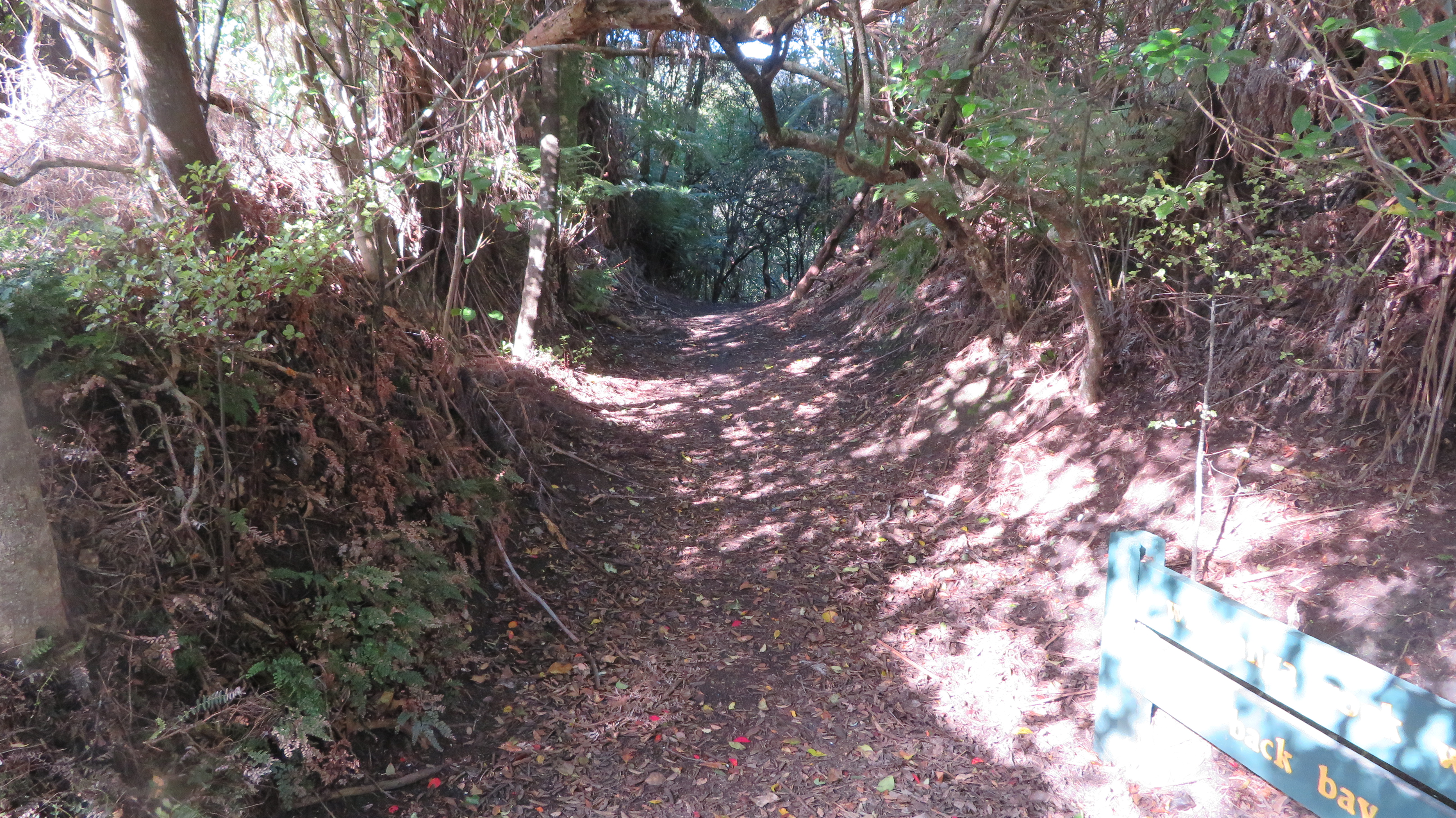
The first bank and ditch earthworks and now a path down to Brick Bay.
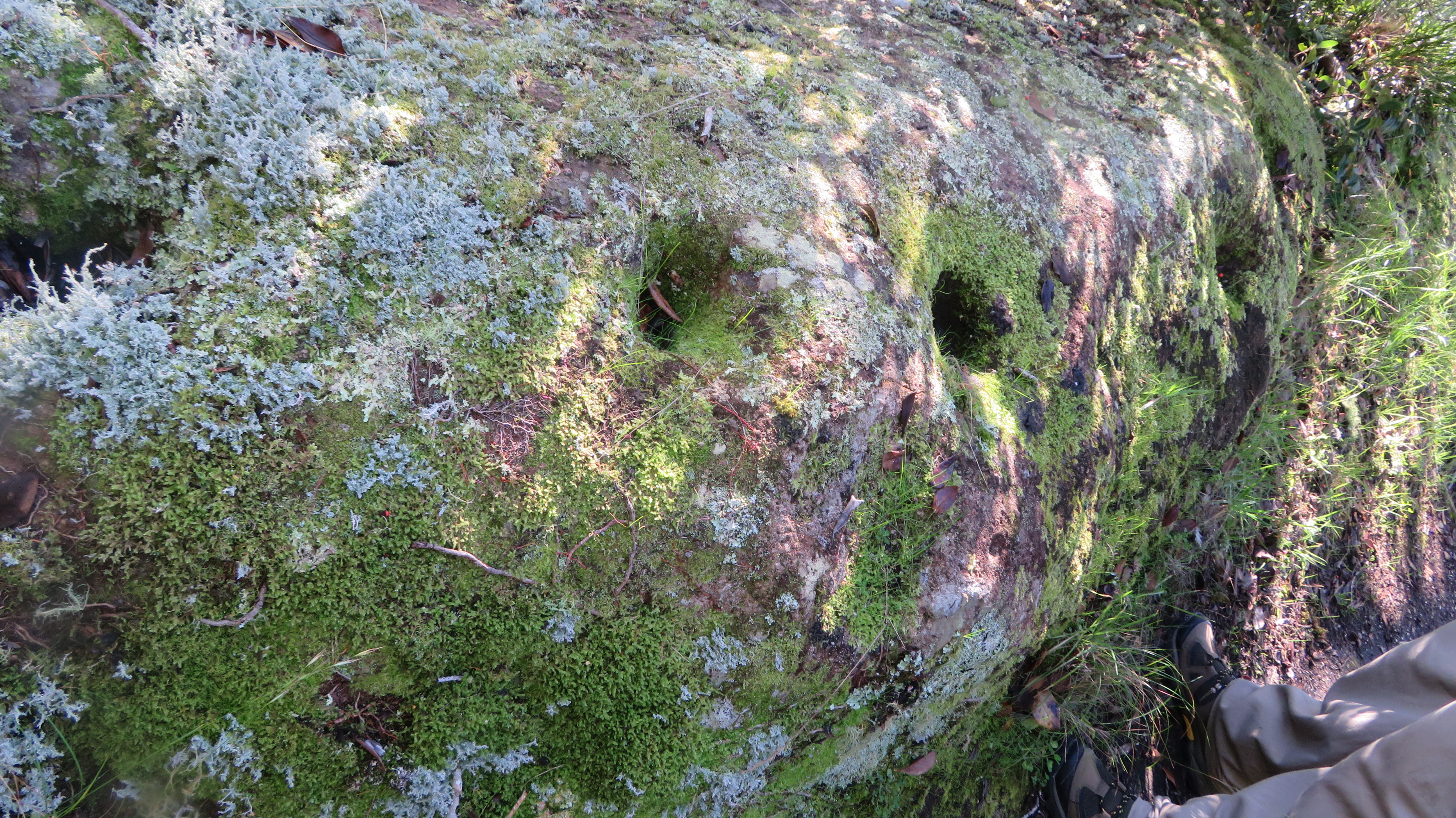
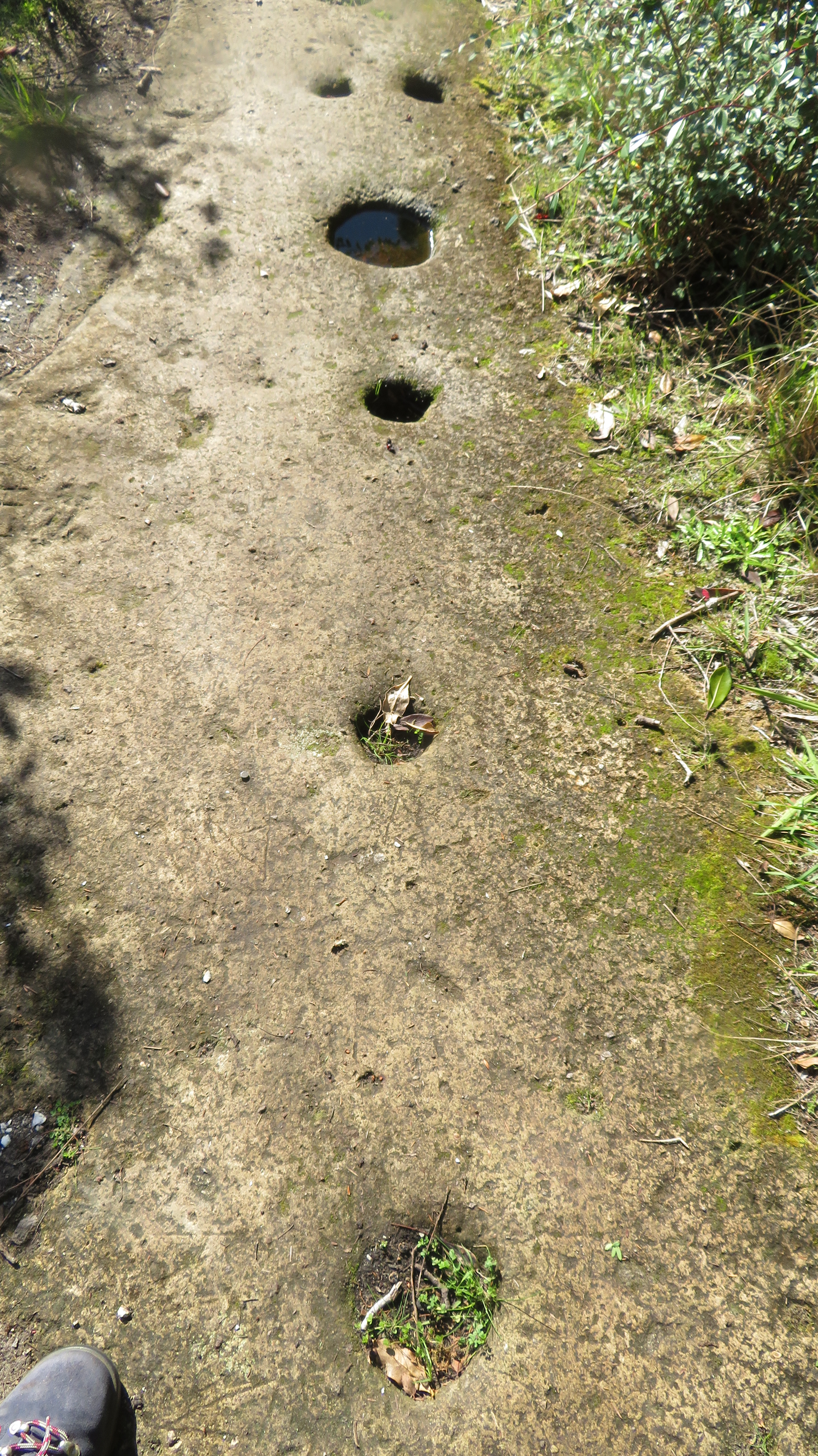
Post holes for palisades ground into rock.
More palisade postholes…
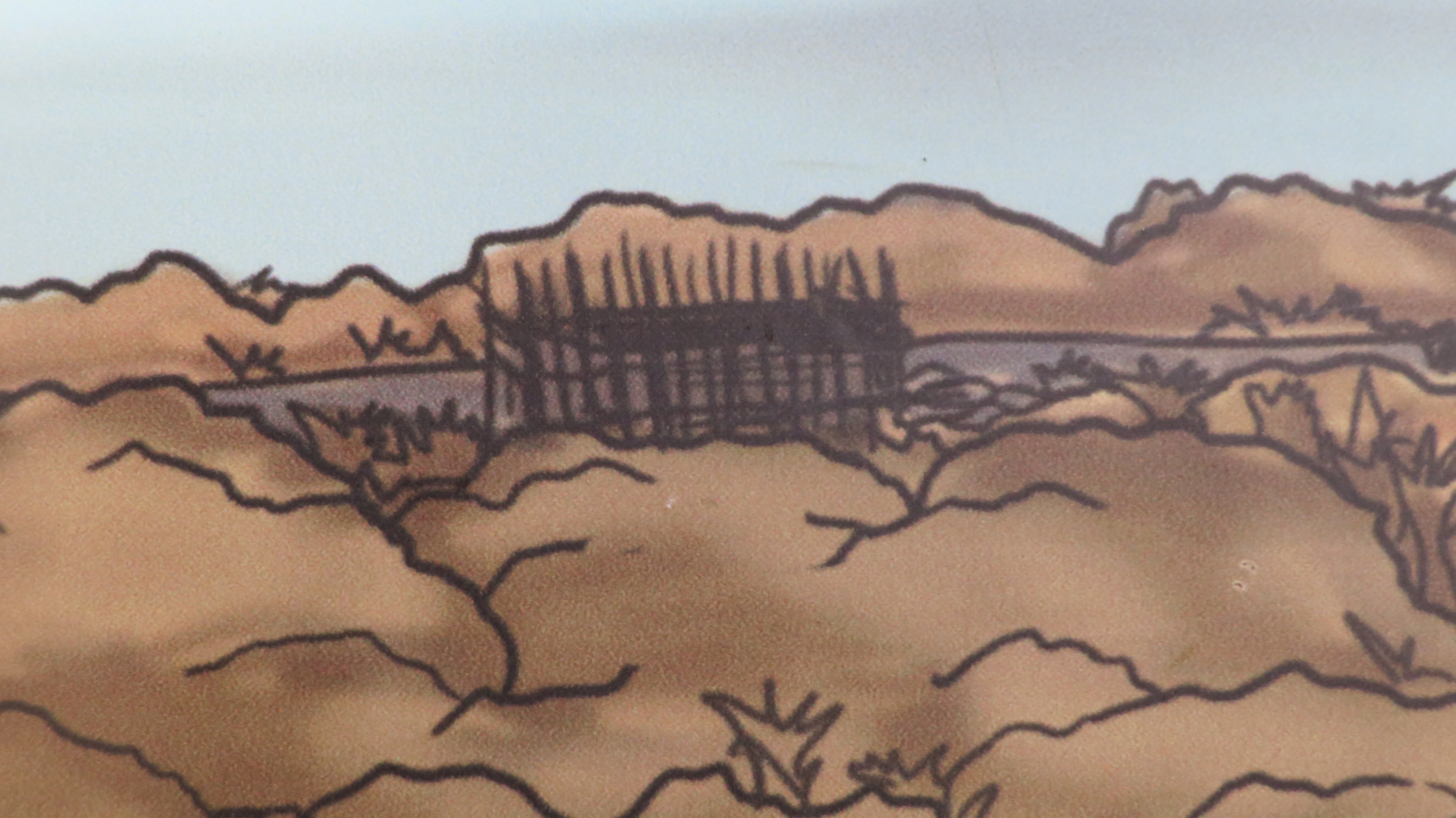
An artists recreation of the palisade as evidenced by the postholes in the previous picture.
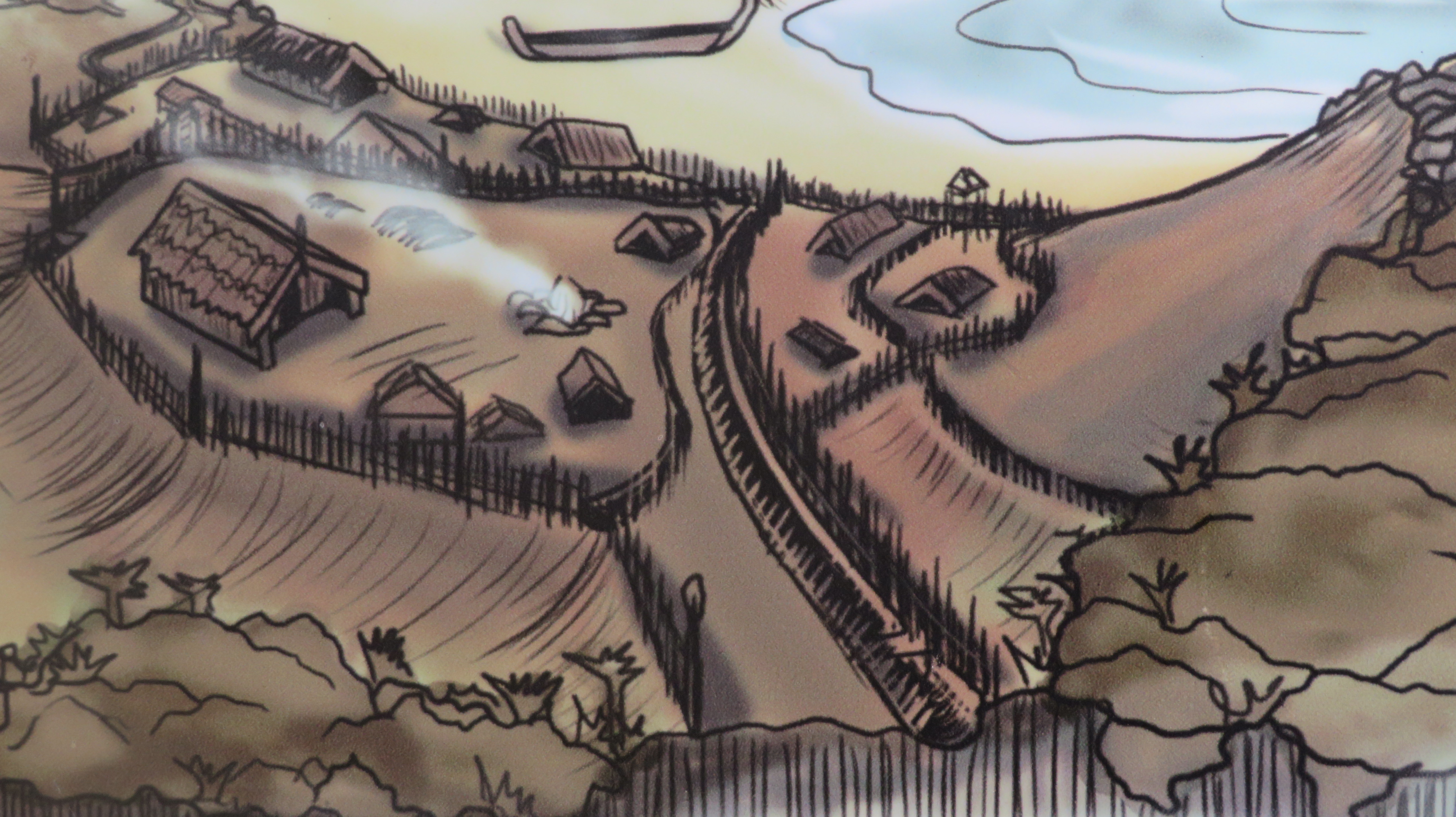
An artist reconstruction of how the site looked prior to the devastating raid. The line across the middle is the earthwork mentioned above which is now a lane leading to Brick Bay on the southern side.
Artist reconstruction
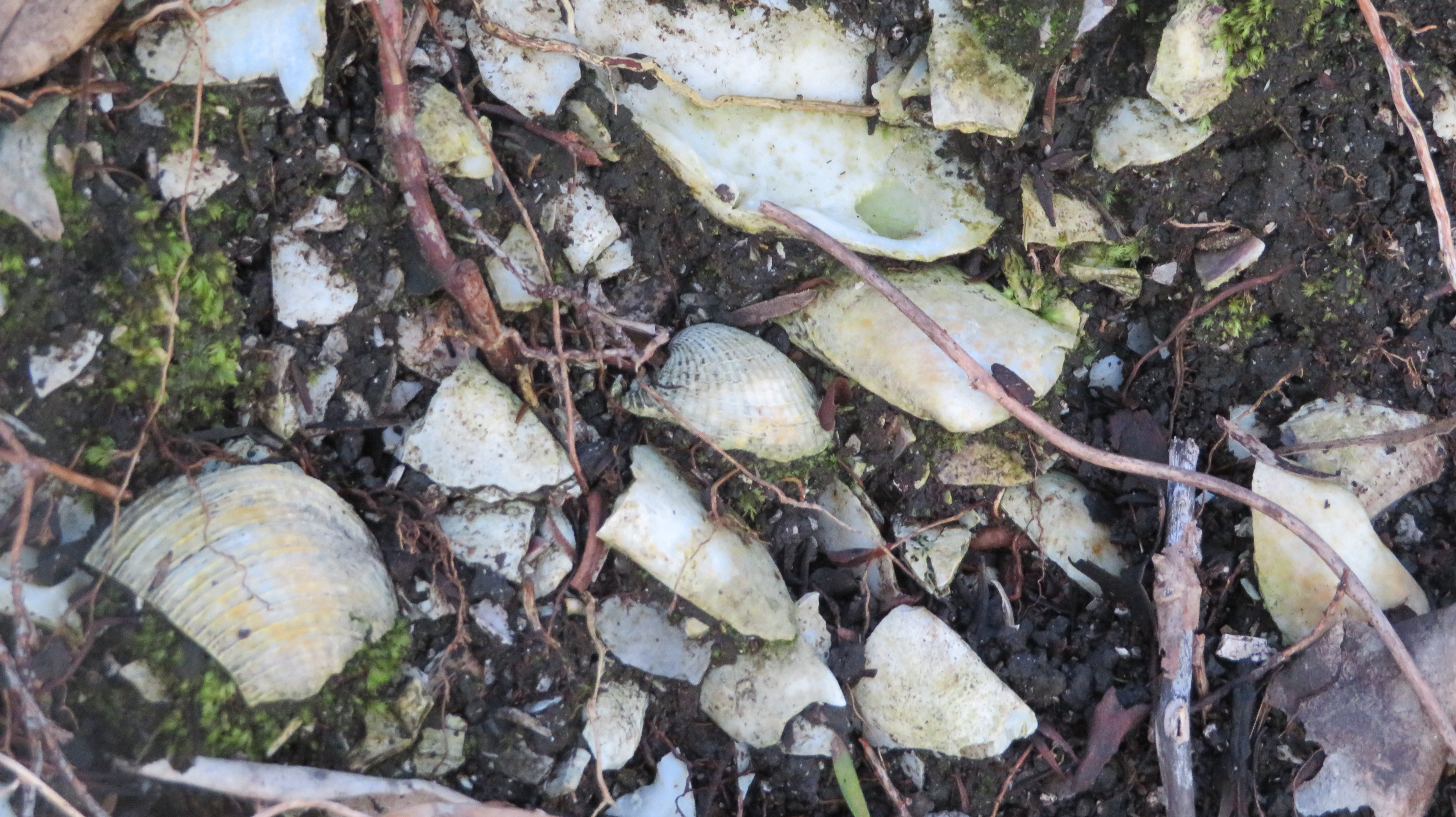
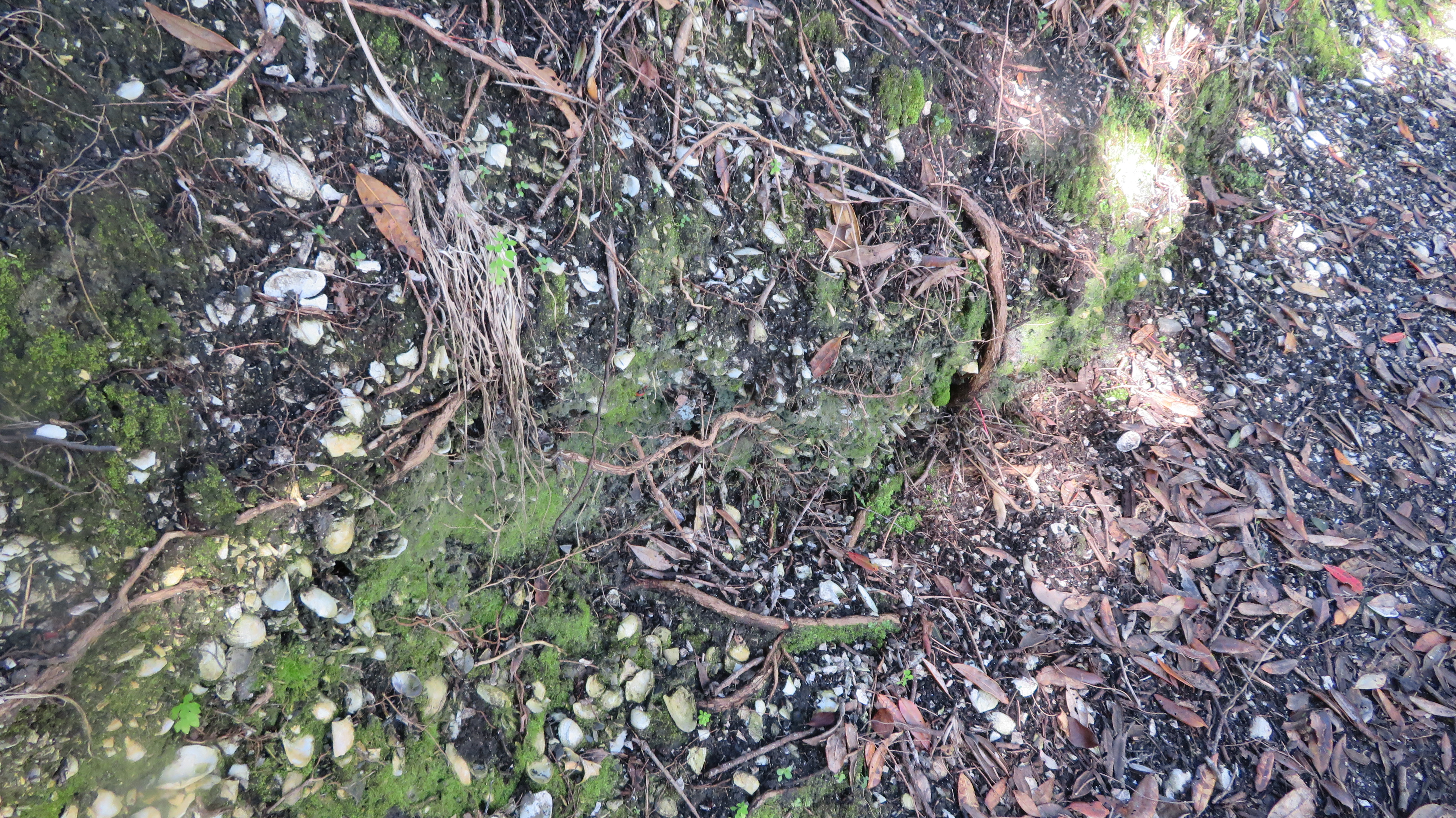
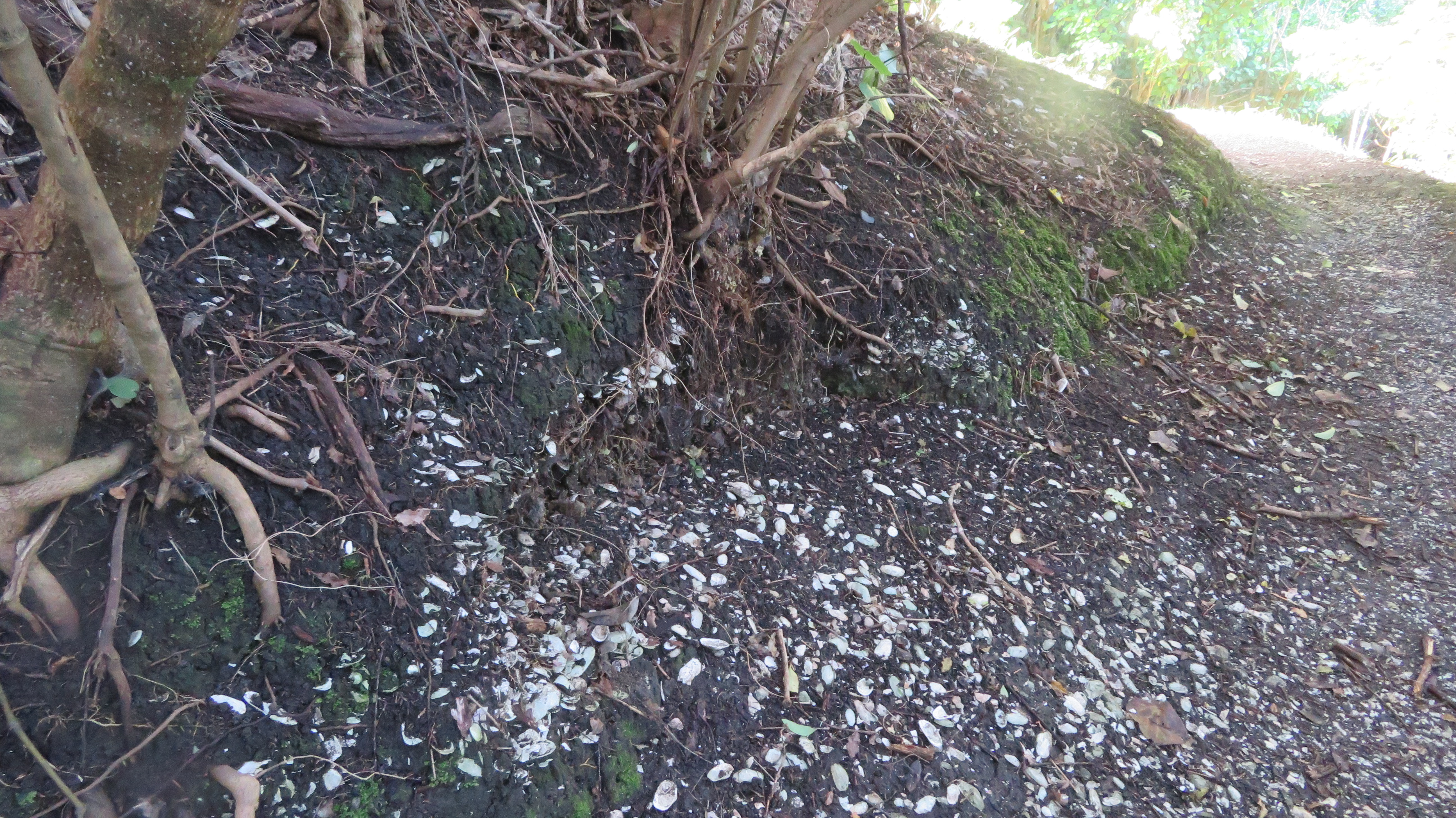
All across the site are numerous shellfish middens – not surprising given the sites position.
Yesterday was the first day of New Zealand Archaeology Week, it is the first time in New Zealand that archaeology has been celebrated with its own ‘week’. As part of this celebration of the past I attended a lecture at the Auckland Museum about the long term archaeological project being undertaken on Great Mercury Island entitled The Changing Face of Archaeology – The application of technology to the Ahuahu Great Mercury Island Archaeological Project. The lecture was delivered by Louise Furey, Rebecca Phillipps and Joshua Emmitt.
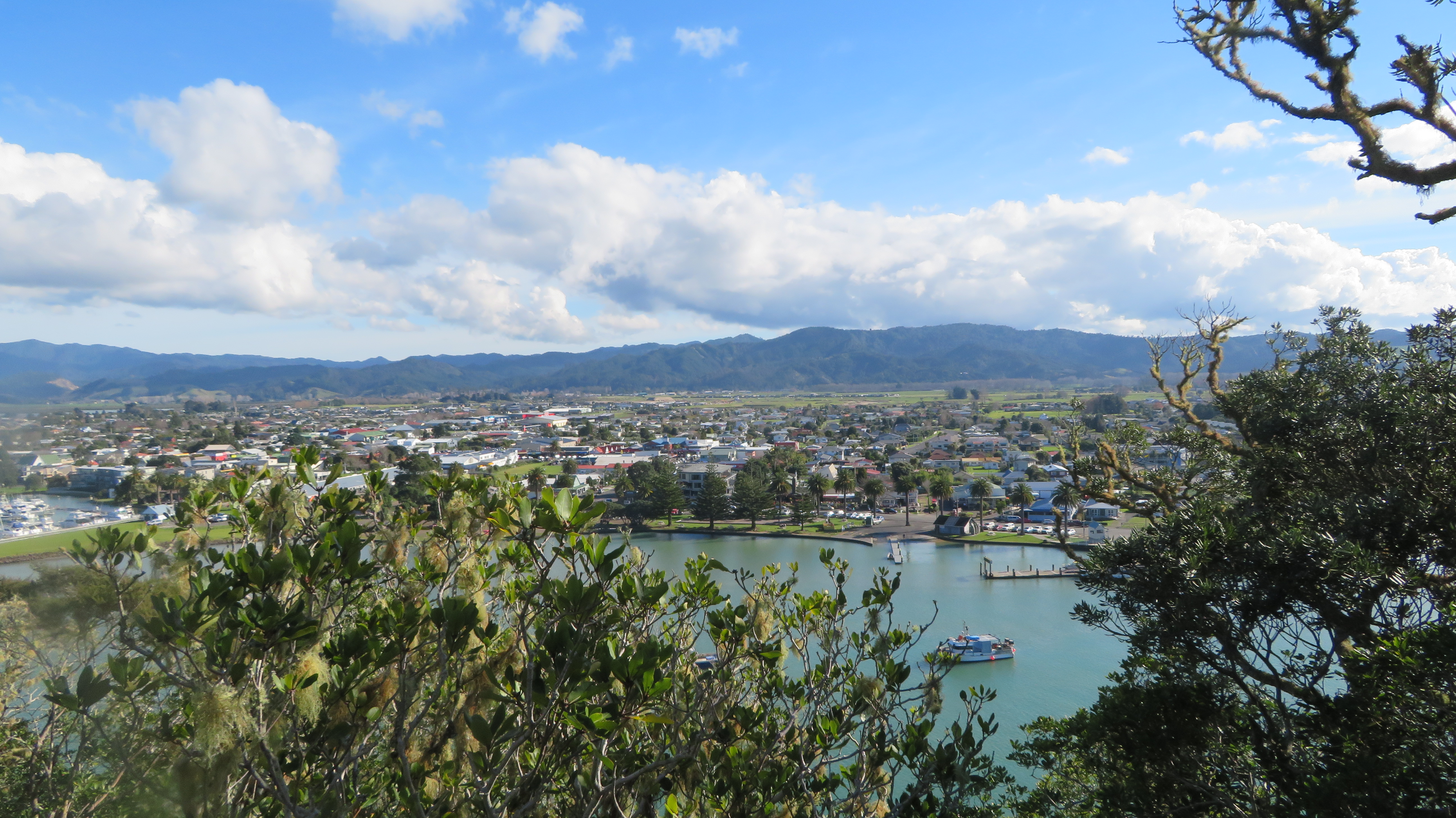
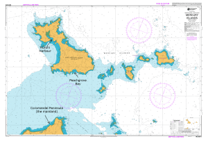
Great Mercury Island is situated off the east coast of the Coromandel Penninsula and as the name would suggest is the largest island in the Mercury Group. The purpose of the project is to examine the history of the Maori occupation on the island. As an island it provides the ideal opportunity to study a landscape as a whole and how people utilised and interacted with that landscape over time. This post is not a comprehensive study of the archaeology of the island, it is only a brief foray into what is a complex landscape. I have included links for those who wish to read more about the work that is being carried out by the archaeologists.
There is certainly plenty of archaeology on the island to keep the archaeologists busy for quite some time. Of that which is visible above ground there are twenty-three Pa (defended sites with ditches and banks), large areas of gardens (recognisable by the lines of cleared stones), kumara storage pits, stone working sites and shell middens. As recent excavations have indicated there is even more evidence lying beneath the surface.
Prior to the current project the island was subject to two other single event excavations. The first being undertaken in 1954 in the early days of New Zealand Archaeology by then then newly appointed lecturer in archaeology at the University of Auckland Jack Golson. With a party of archaeology students he excavated a terrace on the Stingray Point Pa (Matakawau) identifying two kumara pits, each pit had more than 80 post holes suggesting a long period of rebuilding/maintenance of the roof structures. Golson’s work was never published although this is soon to be rectified.
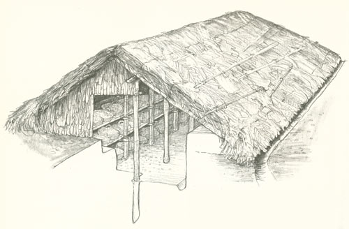
A reconstruction drawing of how such storage structures may have looked like.
In 1984 Professor Geoffrey Irwin of the University of Auckland excavated a Pa in Huruhi Harbour and in 2009 a sever storm eroded about ten metres of sand from White’s Beach to reveal a shell midden with a rich charcoal layer. Bones from dogs and fish were found within the midden which was dated by radiocarbon to c.1400AD.
In 2012 the University of Auckland and the Auckland Museum began working in conjunction with Ngati Hei on the previously mentioned long term project. The island is visited on regular basis with the main excavation season being held in Febuary, which is also a training dig for archaeology students from the university. The lecture held yesterday focused on some of the finds from the excavations such as the large quantities of obsidian flakes, some of which come from as far afield as Taupo, Mayor Island and closer to home on the Coromandel Peninsula. Although the work/research is still ongoing it is becoming clearer how important Ahuahu is in our understanding of the early prehistory of New Zealand.
Because ultimately excavation is destruction it has long been universally acknowledged how important it is to record as much detail as possible. In the past this was often a labour intensive activity, if done at all. Today’s archaeologists now have a raft of technological tools at there disposal and at Great Mercury they are taking full advantage of what is available. The technology being used on site to record every find, feature and layer includes total stations, laser scanners and drones are in everyday tools for these excavations.
One area that was investigated was a blackened sand layer about 20cm deep (part of a sand dune) which had been exposed by erosion in Coralie Bay. A 5mx5m square was excavated, with all finds being collected and their position recorded. An interesting feature was a series of stones seemingly sitting on the surface, once excavated it revealed itself to be a windbreak protecting a cooking area. On its eastern side a several circular, shallow fire scoops were found, along with postholes for shelters and a number of obsidian flakes.
Further excavation revealed a new layer of information some 30cm below – here the bones of seal, white pointer shark teeth and lots of obsidian flakes were found. This part of the site was interpreted as a butchery area.
This is only a brief rundown of some of the work being done on Ahuahu and for more information please follow some of the links below. You Tube has several video’s of work being done on the island – the following are links to a couple to get you started if you are interested.


 An example of some of the many terraces and platforms.
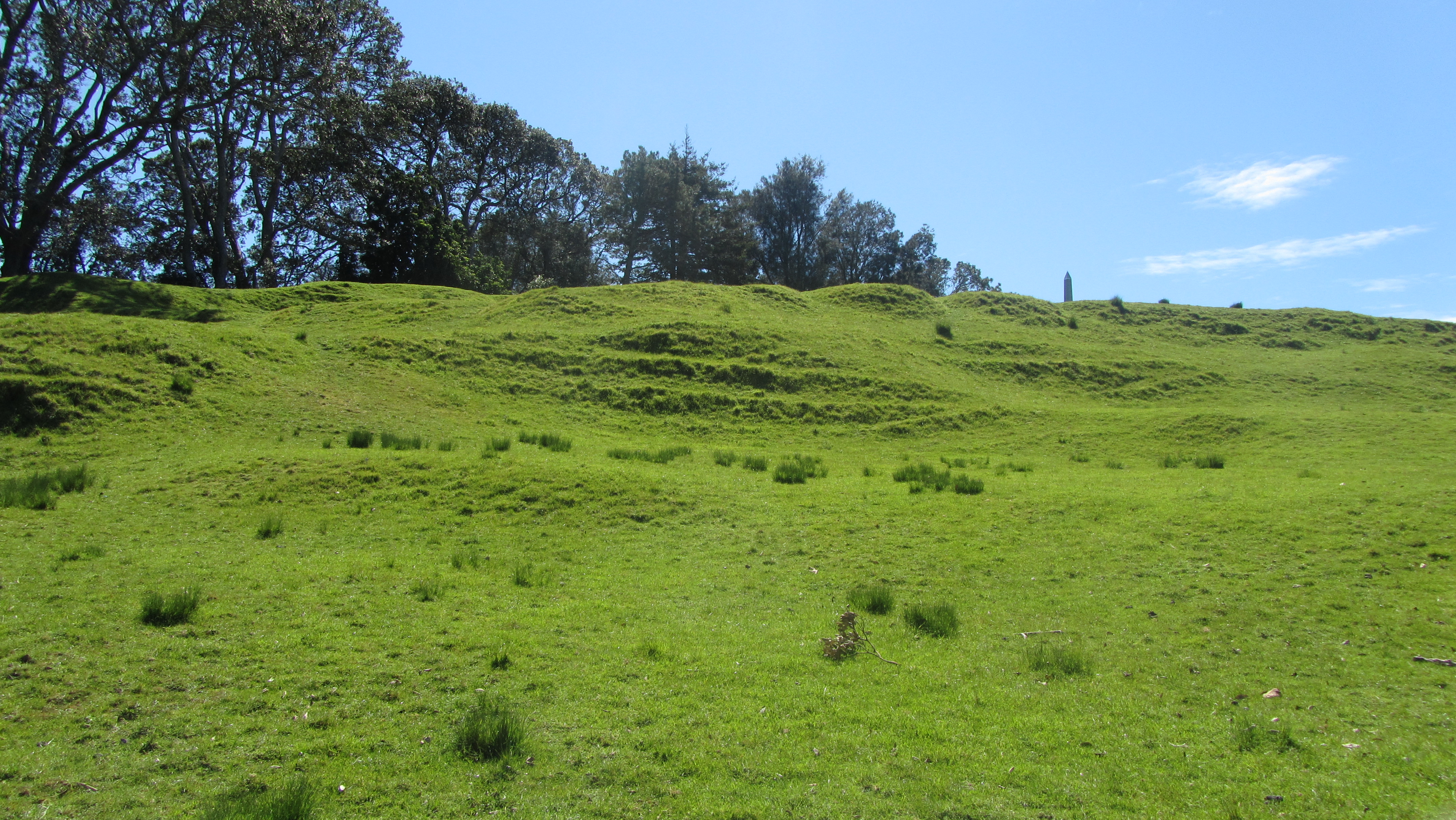


 One of many defensive banks.
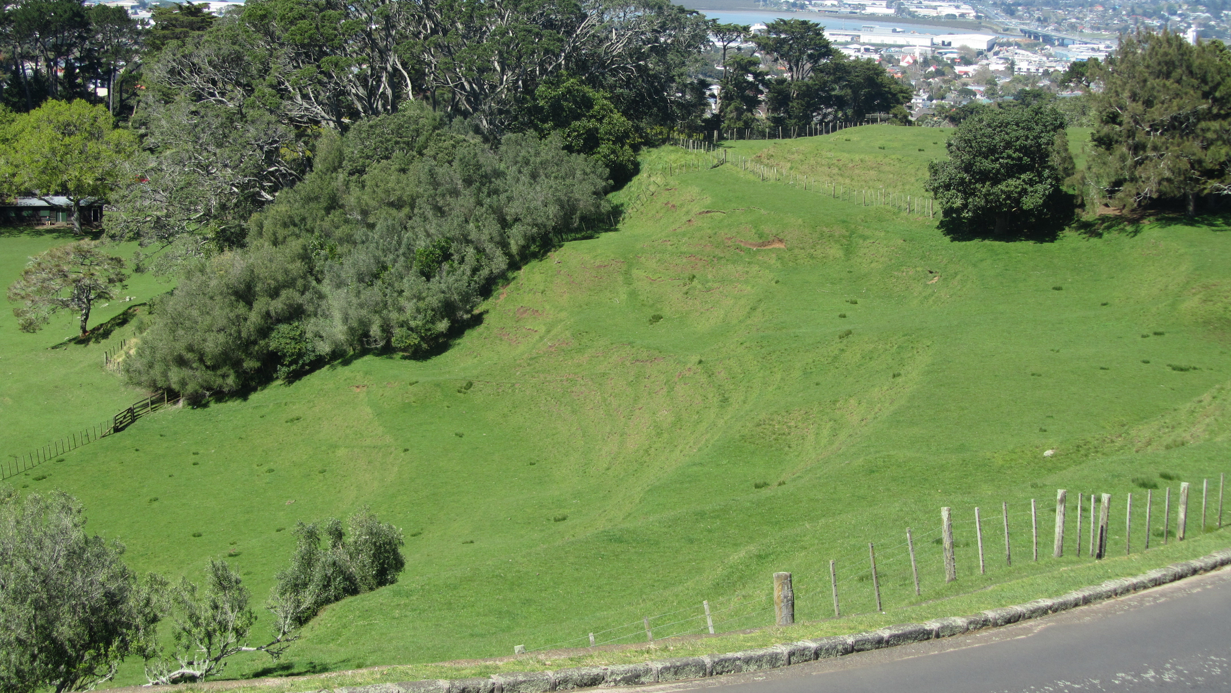 Building platforms overlooking one of the volcanic craters
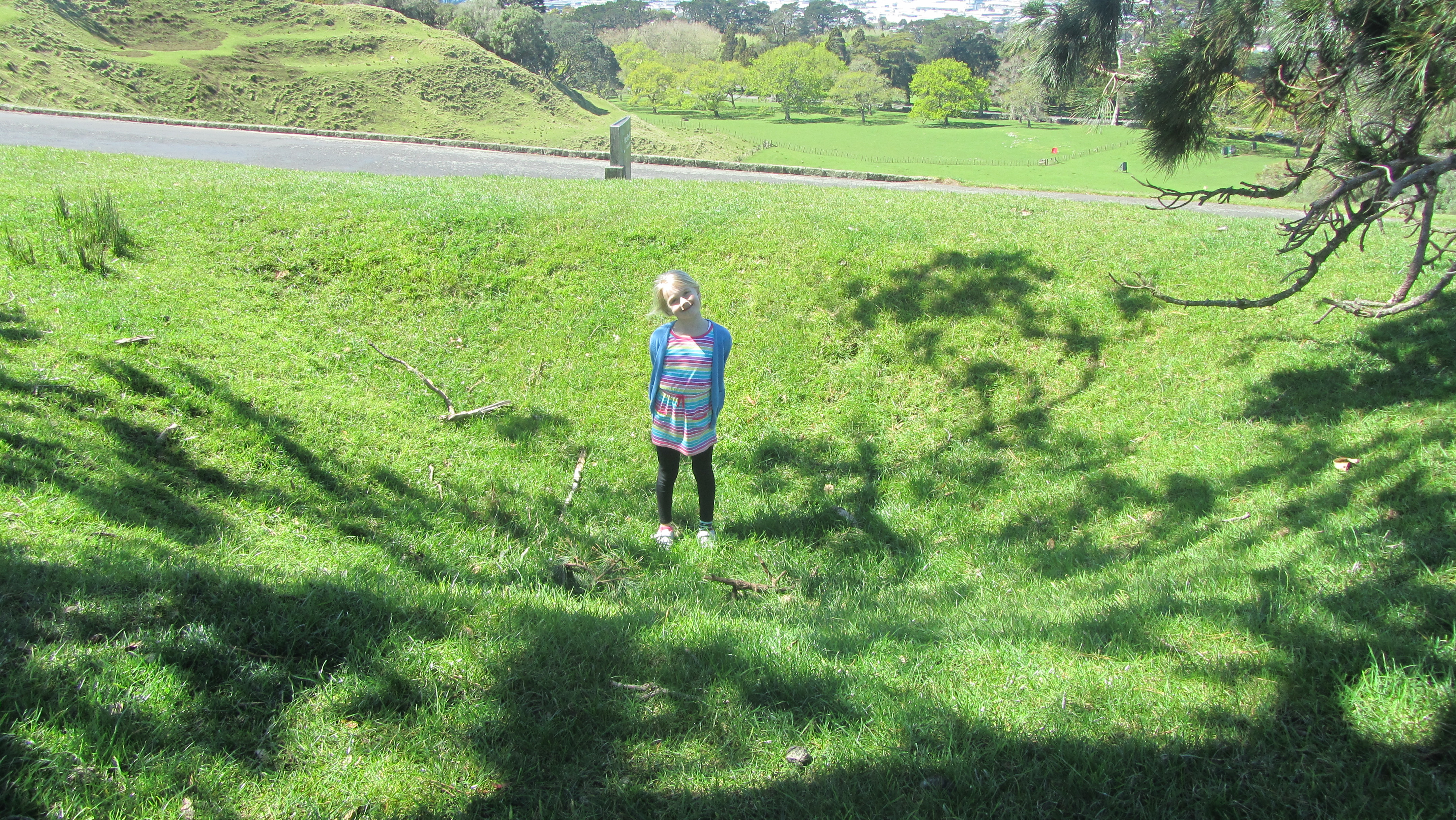 My daughter standing in one of the many hollows – possibly a storage pit for kumara.
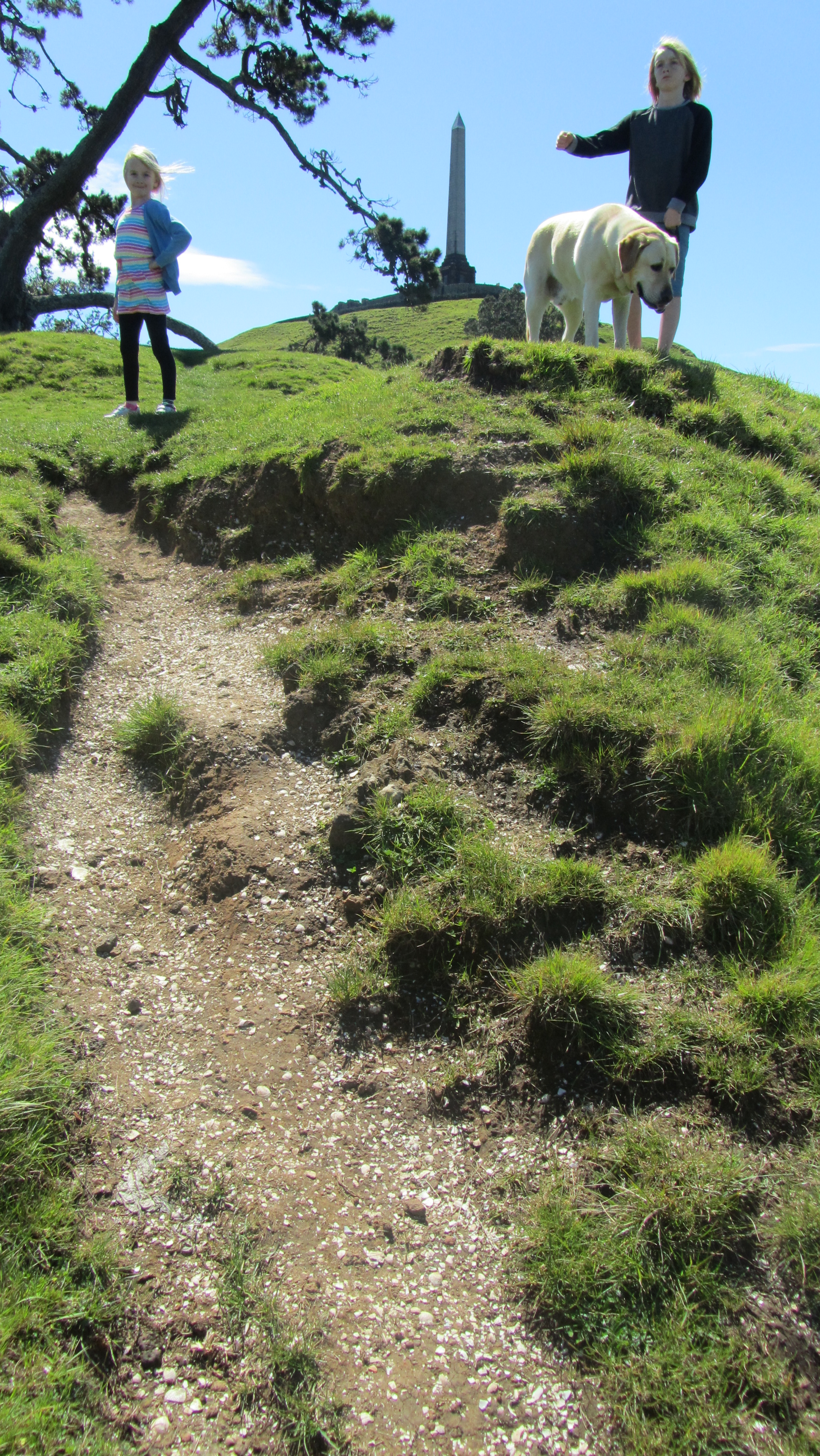 A large midden suffering under modern footsteps.
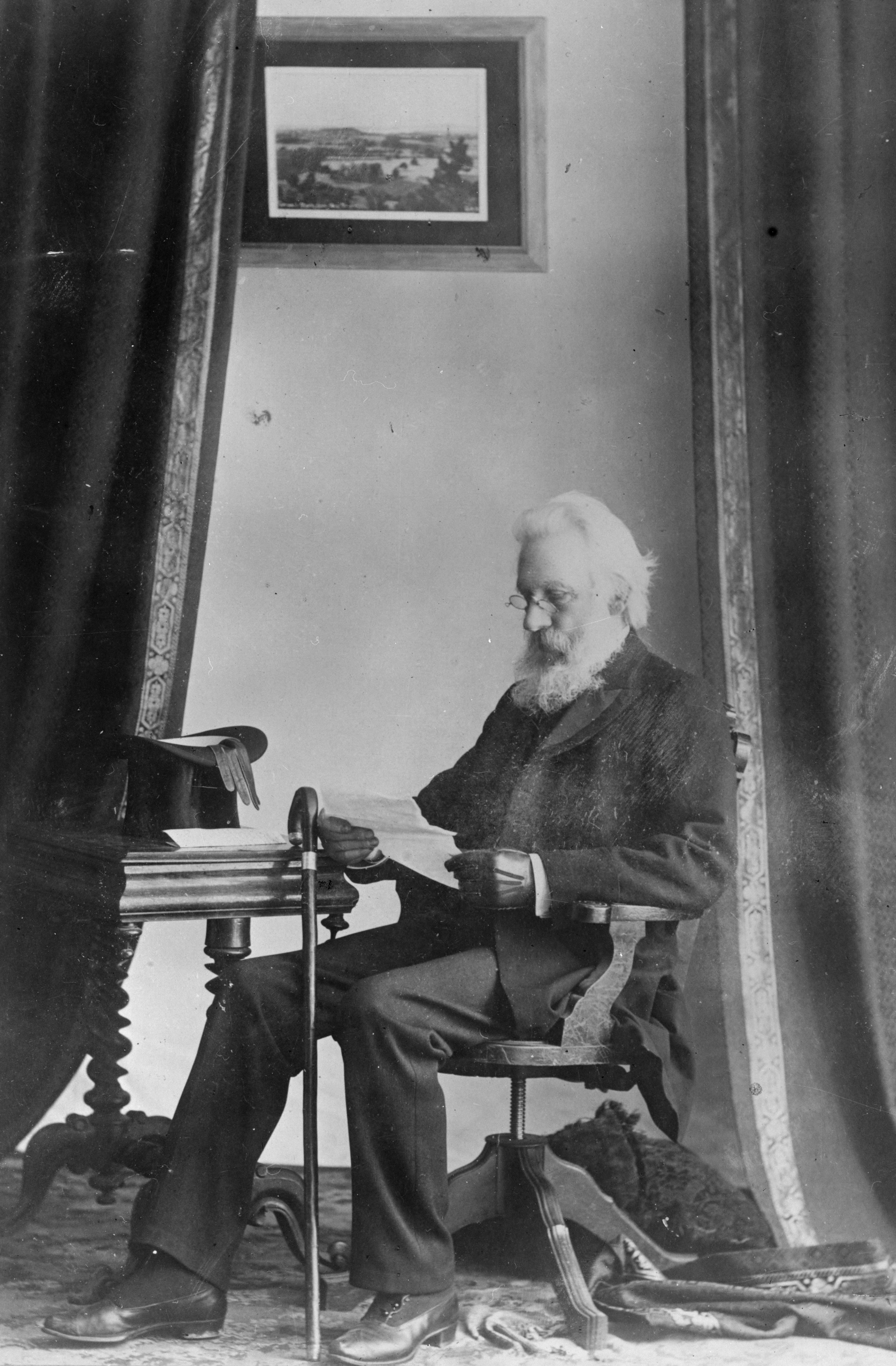 John Logan Campbell c.1880
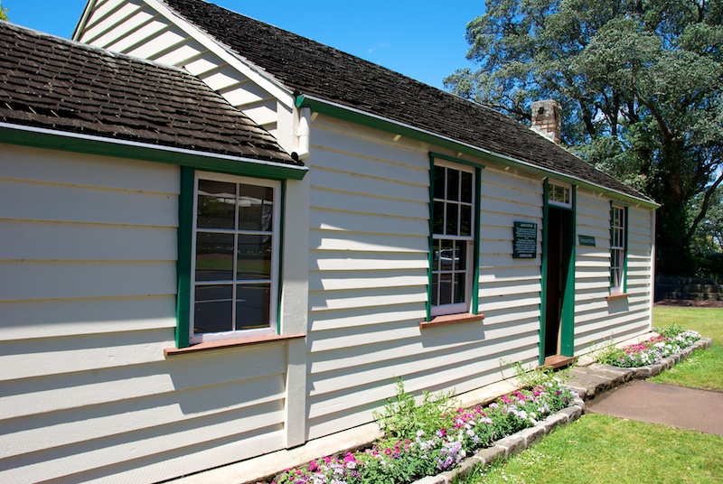
 John Logan Campbell’s memorial to the achievements of the Maori people.