Do you believe in time travel? If you are reading this then it is likely you do, even if only a little bit. Most people think that time travel is all very sciency and not something likely to happen in their lifetimes. Well, what if I was to tell you that it is possible, but you have to be a bit canny about it.
As someone whose passion is archaeology, history and the past I often find myself coming across interesting bits and bobs in the course of research etc. Which is precisely what happened to me last week in the course of looking for an old photo for a project I was working on.
I live in Auckland, New Zealand – which you will know if you’ve read any of my other posts 🙂 – and we have a fabulous resource called the library (yes, I know you have those too) and apart from books they have a wonderful local history resource you can access online here. Naturally, I disappeared down a rabbit hole roughly the size of four suburbs – Northcote, Birkenhead, Birkdale and Beachhaven to be precise.
These particular suburbs are my stomping ground, and I was intrigued to see how they had changed over time. The following is just a few of the photos of places in this small part of Auckland from back when the roads were made of dirt, the car was a rarity or non-existent, and the houses were few and far between. Alongside them are photos I have taken in the last week to compare and see the changes.
Let’s start in Northcote Point…
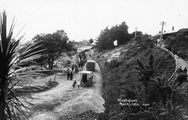
The road leaving Northcote Wharf in 1910. Photo by William Price – Auckland Library Heritage Collection NO113085.
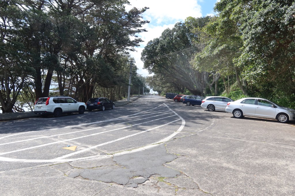
The same road leaving Northcote Wharf.
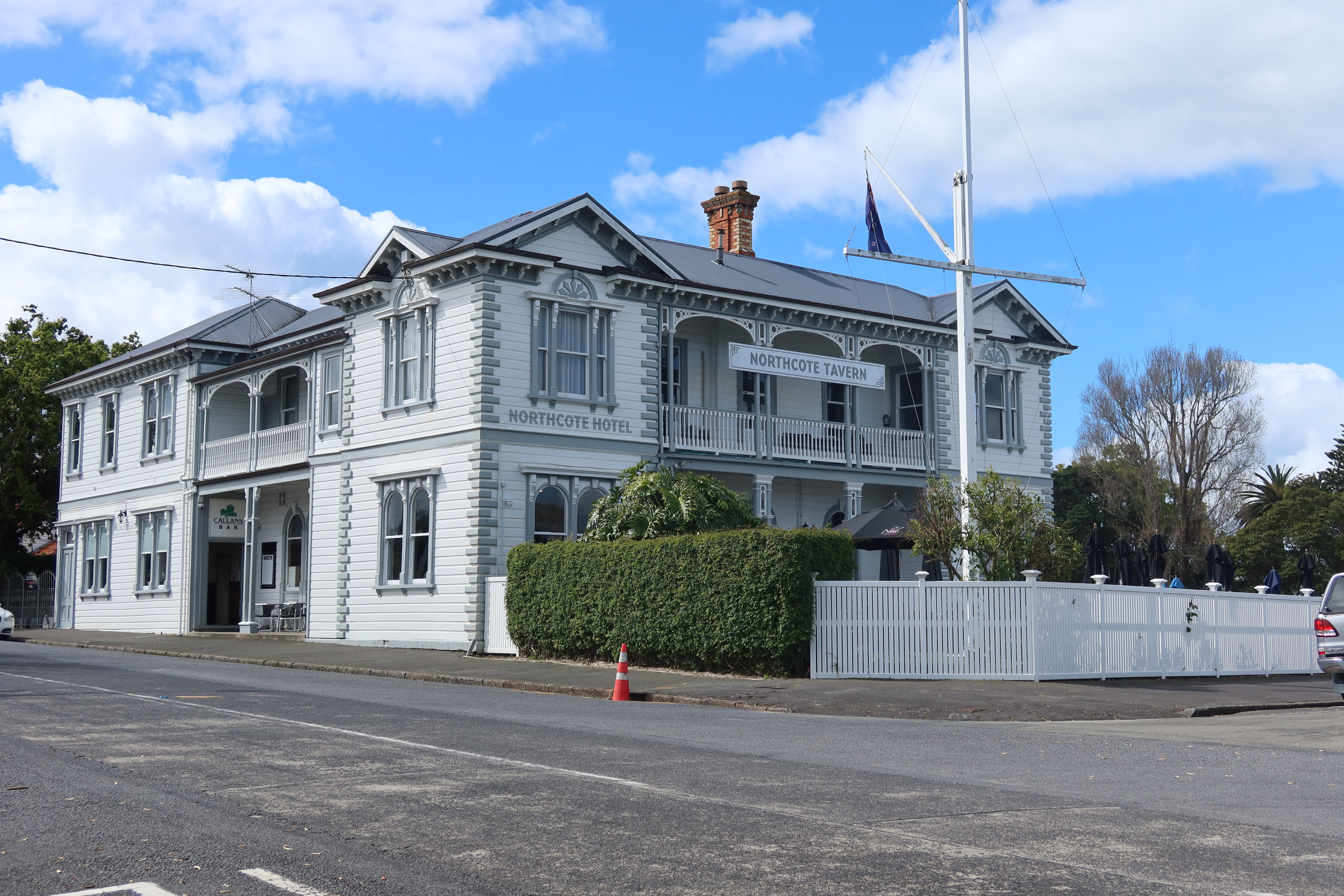
A local icon – The Northcote Tavern. The first photo is from the early 1900s and was taken by William Price – Auckland Libraries Heritage Collection NO113057. The second photo is my own (2026).
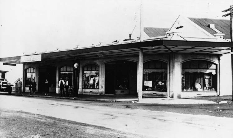
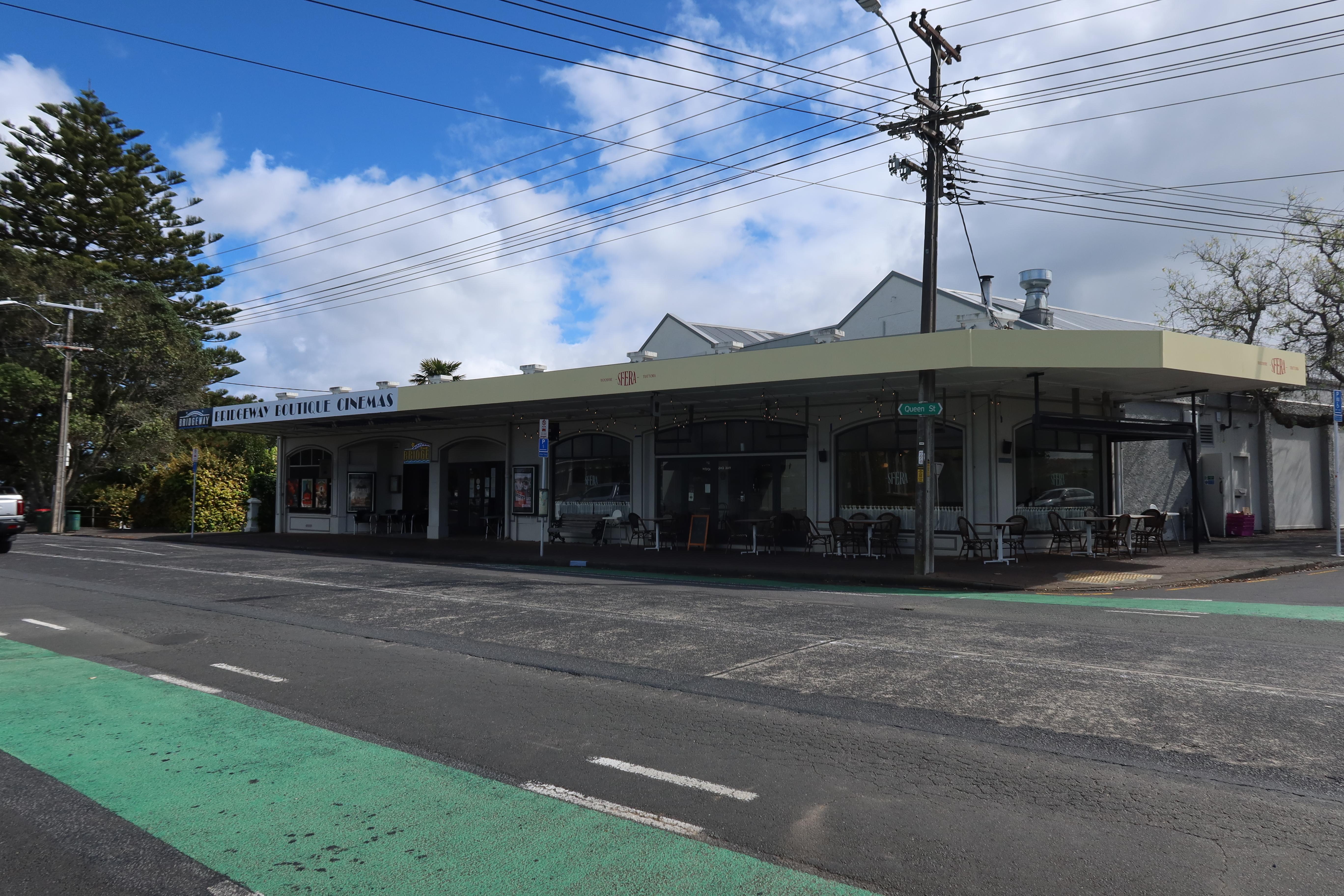
The Bridgeway Theatre – on the left in the 1920s and on the right in 2026. Before 1959 it was called Kings Cinema and had the offices of the Auckland Star attached along with a chemist, a hairdresser, tobacconist, a repair shop and a bus depot. Photo courtesy of Auckland Libraries Heritage Collection No113040.
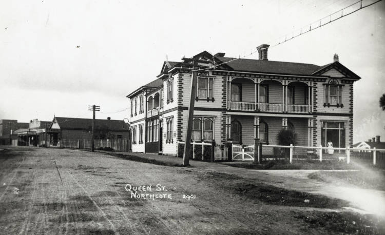
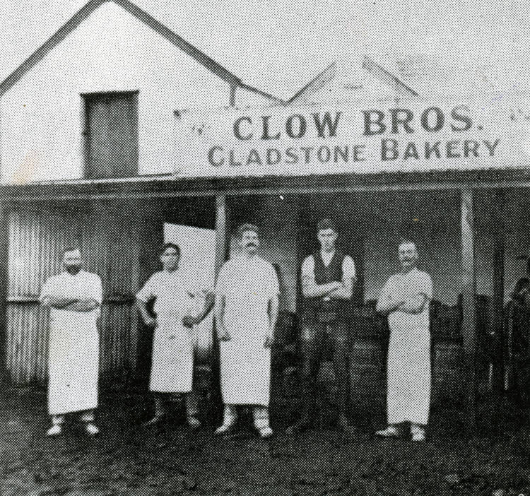
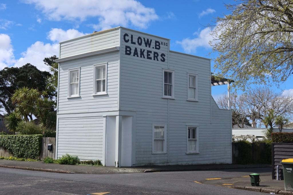
The following photo shows Clow Brothers Bakery in Gladstone Rd in 1880. All signs of the bakery are long gone however they did have a couple of bakeshops, one on the corner of Hinemoa St and Maritime Terrace and one on Queen St, Northcote Point. The second photo shows the latter building still wearing its Clow Brothers signage.
Courtesy of the Auckland Libraries Heritage Collection BO379.
Photo – my own 2026.
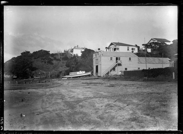
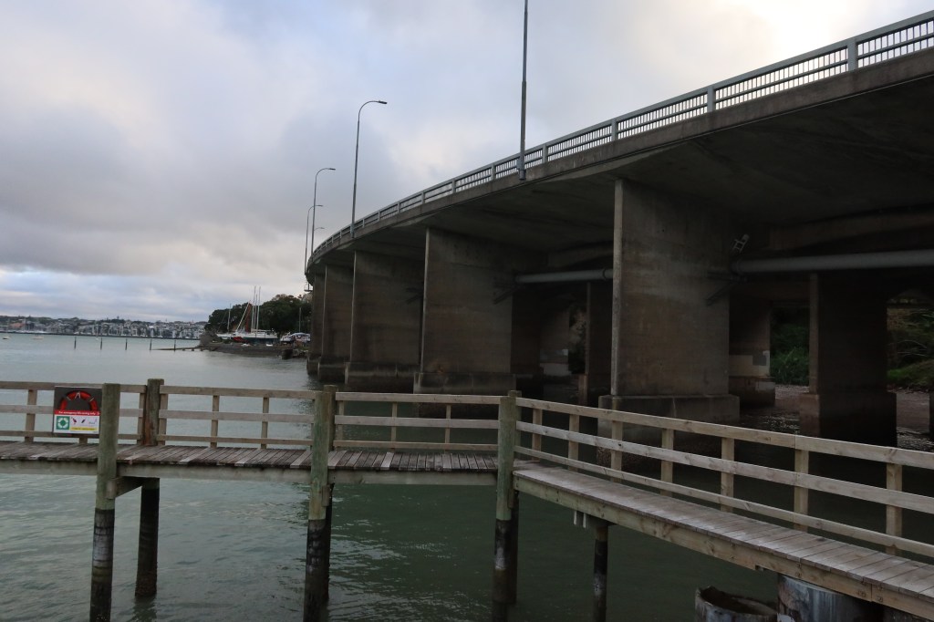
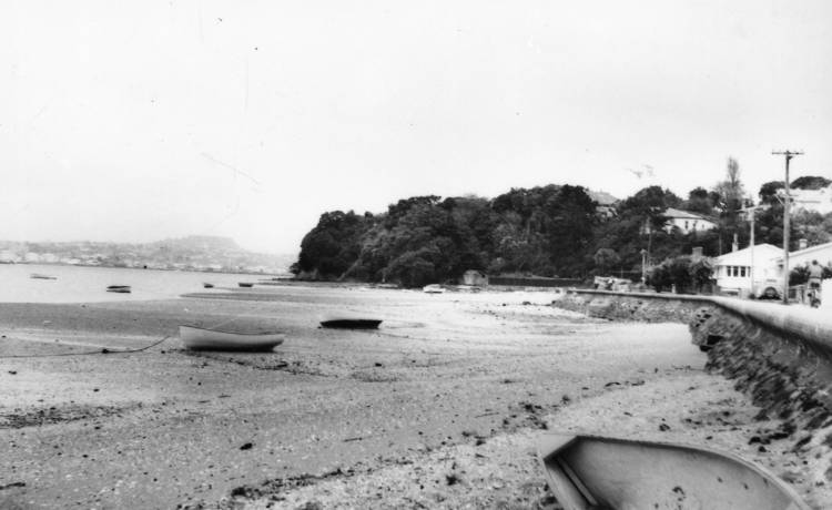
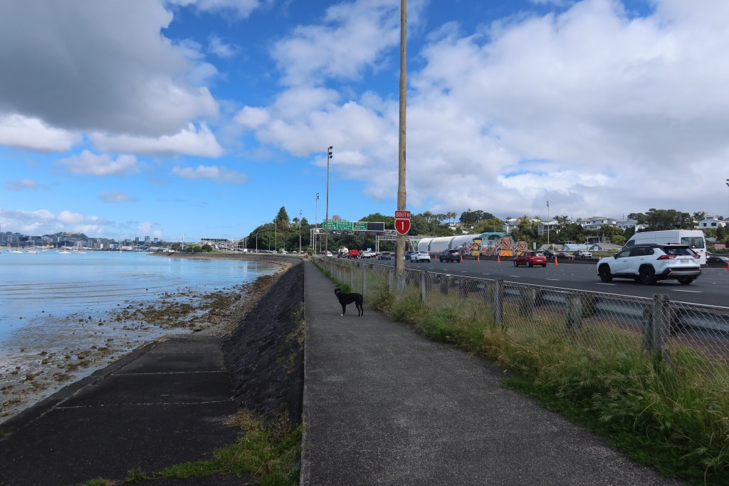
On the eastern side of Northcote Point is Sulphur Beach and Stokes Point, a place where the changes are most dramatic. Here the motorway and harbour bridge has replaced a place of industry and a local beach.
Stokes Point 1914, Baily and Lowe Boatbuilders. Photo by Henry Winkelmann, courtesy of the Auckland Libraries Heritage Collection 1-WO231.
As the motorway soars above the foreshore, the site of the old boatyard disappears and yet a remnant of its memory is ever present in the today’s boat yard tucked onto a slim wedge of land under the harbour bridge. Photo my own 2026.
Sulphur Beach 1956, photo by Philip Henry George LaVie. Courtesy of Auckland Libraries Heritage Collection NO113029.
Today’s Sulphur Beach is dominated by the motorway south and north – photo my own 2026.
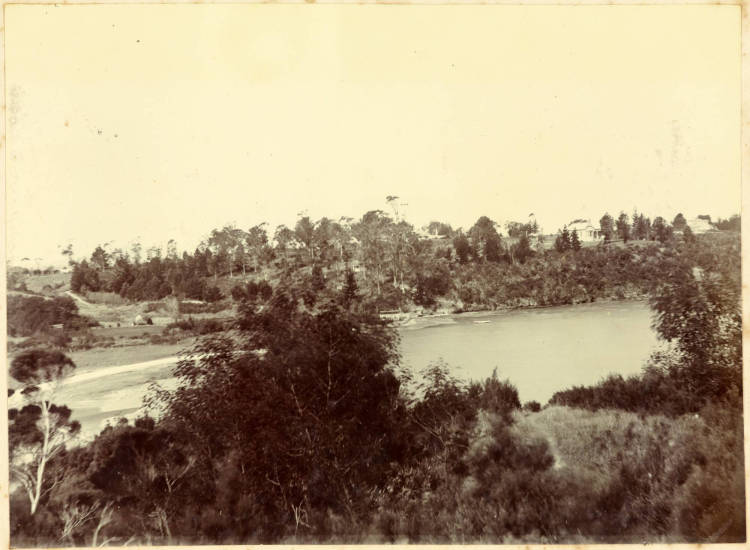
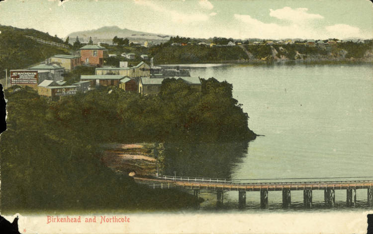
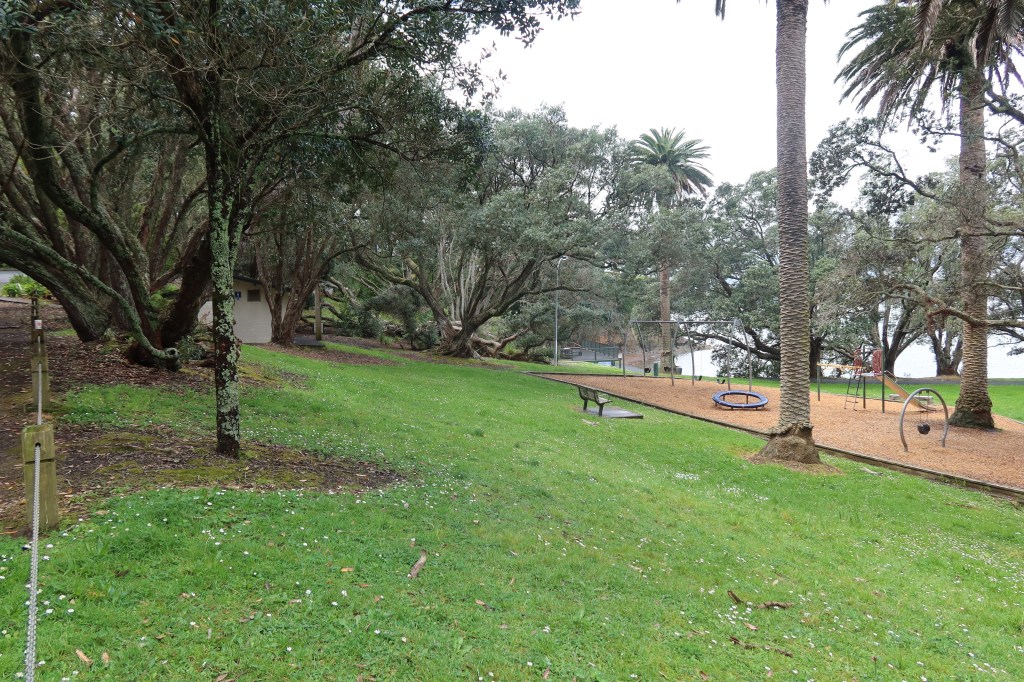
Over the hill to the west of Northcote Point is Little Shoal Bay, the road, the playing fields and the carpark is largely reclaimed land.
Photo taken by Jospeh Hibbs between 1890 and 1900 who appears to be taking the photo from a vantage point on the hill above (Maritime Terrace). Courtesy of Auckland Libraries Heritage Collection 3-ALB61-14.
A hand tinted postcard with Birkenhead Wharf in the foreground, Little Shoal Bay and Northcote Point in the background. Photo taken by Henry Winkelmann in 1908, courtesy of Auckland Libraries Heritage Collection.
Hinemoa Park – the reclaimed section of land just above the wharf in the postcard above. Photo my own 2026.
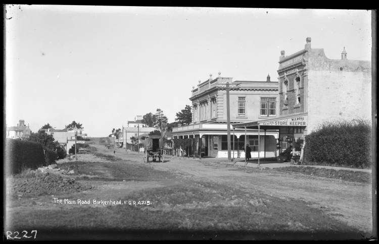
Hinemoa St (lower) circa 1918. On the right is W F Ross General Store, Rugby Rd with the Hellaby’s Building on the corner. Further along is the Post Office and S W Cope General Store. Opposite on the left is a poultry shop and a chemist. Photo by Frederick George Radcliffe, courtesy of the Auckland Libraries Heritage Collection 35-RO227.
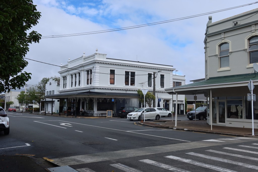
Hinemoa St (lower) – Rugby Road in the center with the two buildings mentioned above still present and correct even if their use is somewhat different today. Photo my own 2026.
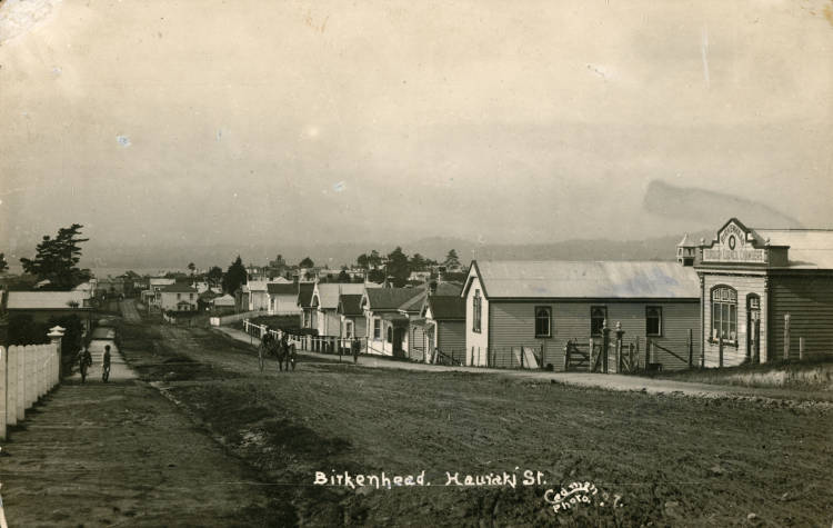
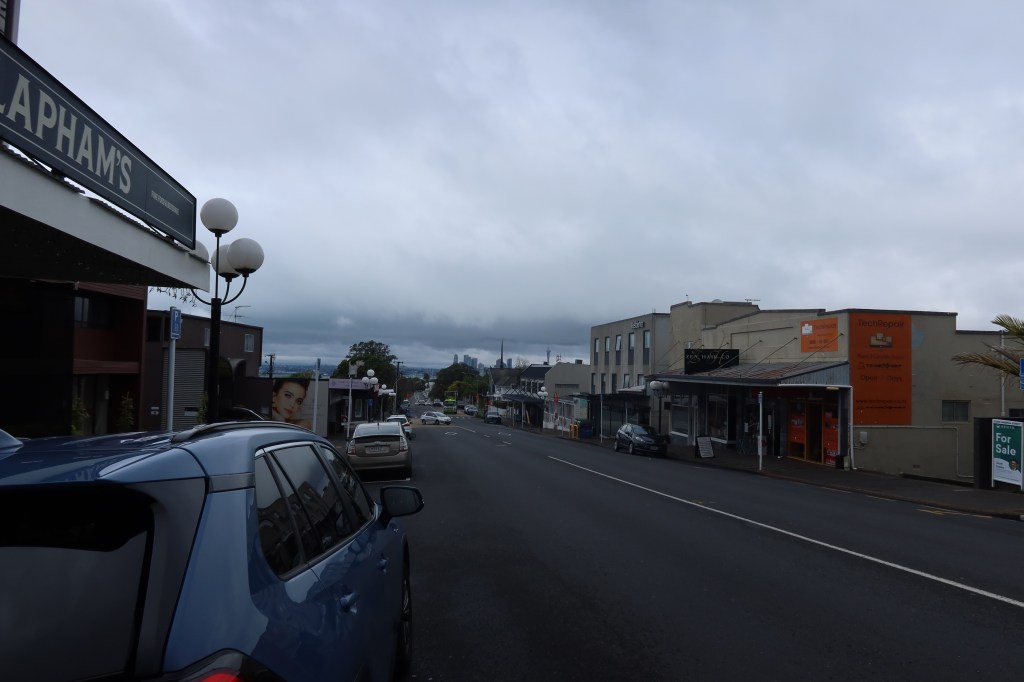
Hinemoa St (upper) was once known as Hauraki St, it was renamed in 1967. This photo looks south towards the shops in the previous pictures and was taken around 1920 (photographer unknown). The building top right is the old council chambers. Photo courtesy of the Auckland Libraries Heritage Collection B0434
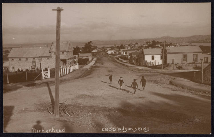
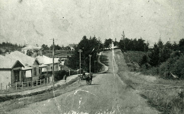
This photo was taken in the 1900s, at the top of Hinemoa St, near to where the current roundabout and library are. The building on the left was the Forresters Hall. Photo by William Thompson Wilson, courtesy of the Auckland Libraries Heritage Collection 1924-241
Hinemoa St today, photo taken from roughly the same position as the second one above. Photo my own 2026.
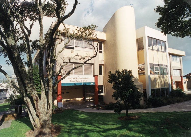
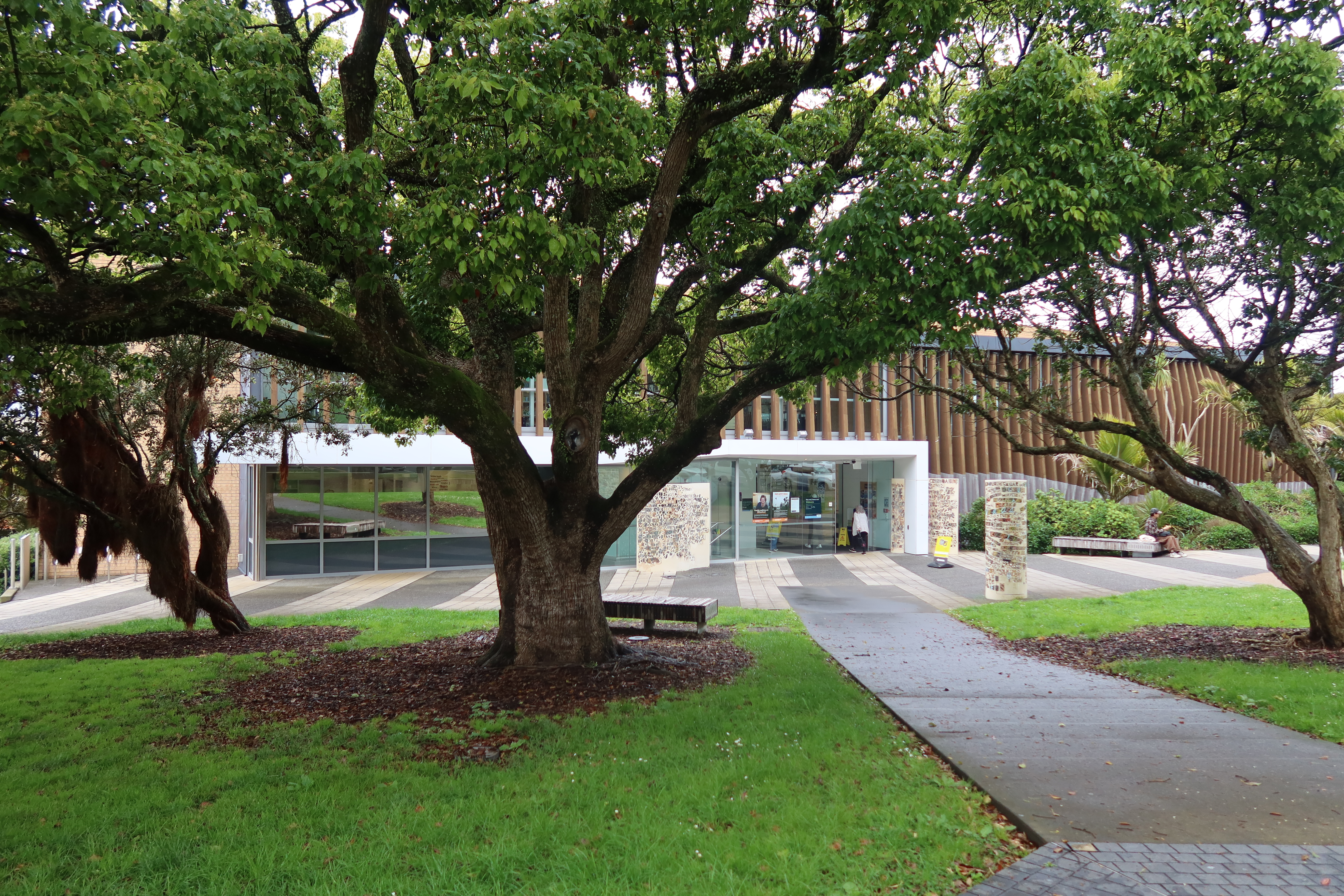
Jumping forward in time the photos below are of the Birkenhead Library in 1995 (photographer unknown) and 2026. The difference a few short decades can make. (1995 photo courtesy of Auckland Libraries Heritage Collection BO315, photo below is my own 2026).
Leaving Birkenhead, we head towards Birkdale and Beach Haven.
A familiar road to locals is Waipa St, photographed here in the 1910s – photo courtesy of Auckland Libraries Heritage Collection BO326.
Waipa St 2026 – horse and cart replaced with cars, dirt road with tarmac and many more houses. The only consistent feature are the cottages of the left of both photos. Photo my own 2026.
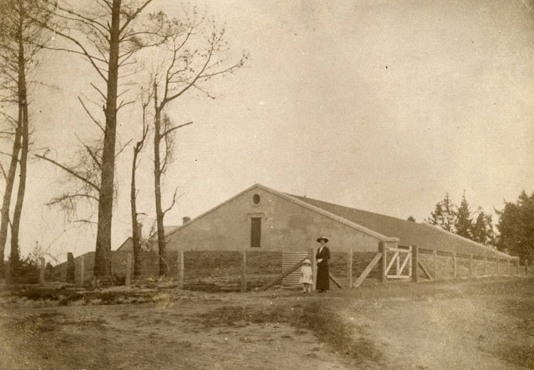
Taken in 1900s this photo is of the old reservoir at Verrans Corner/Waipa St (then known as Bagots Hill). In 1911 Birkenhead Borough Council raised a loan of twenty-five thousand pounds to bring water from Lake Pupuke to Verrans Corner and in April 1913 the water supply was formally turned on.
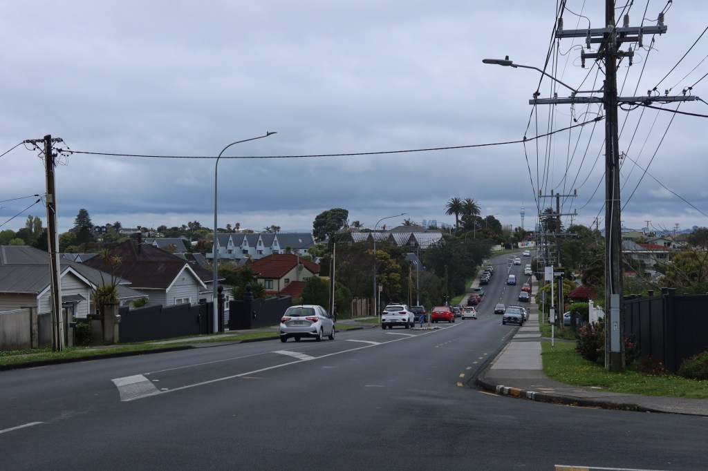
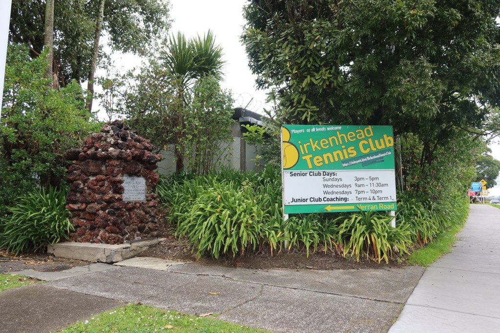
Today the old reservoir is long gone although the land is still used by Watercare as a pump station. This photo is of the corner where the woman and child stood in the above photo. Photo my own 2026.
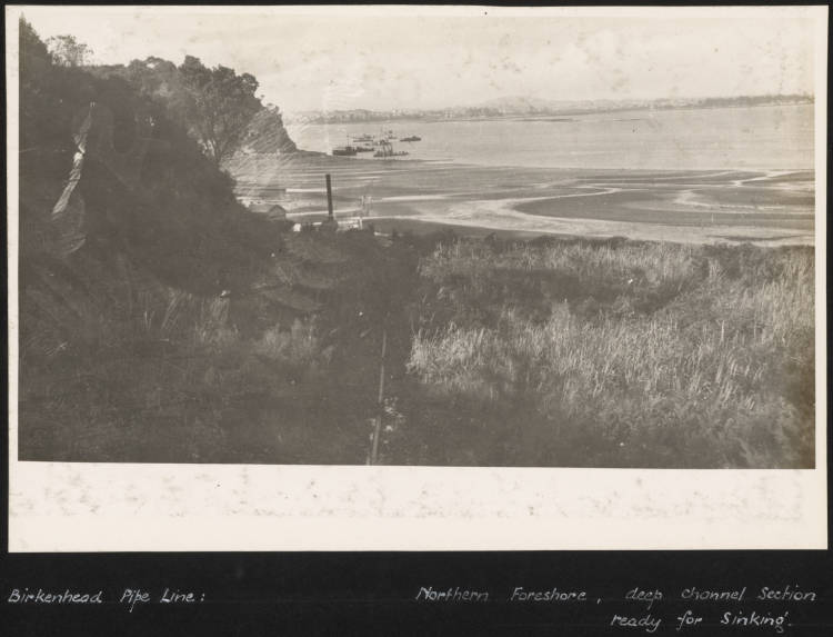
Keeping with the theme of water supply, the photo below shows the pipeline from the city to Birkenhead coming ashore at Kendells Bay and being assembled prior to sinking. It had not taken long for the demand for water to outstrip supply and Lake Pupuke water levels dropped significantly. As part of the solution, it was decided to pipe the water from the other side of the harbour. This photo was taken in 1934 and is courtesy of Auckland Libraries Heritage Collection 1166-ALB226-43
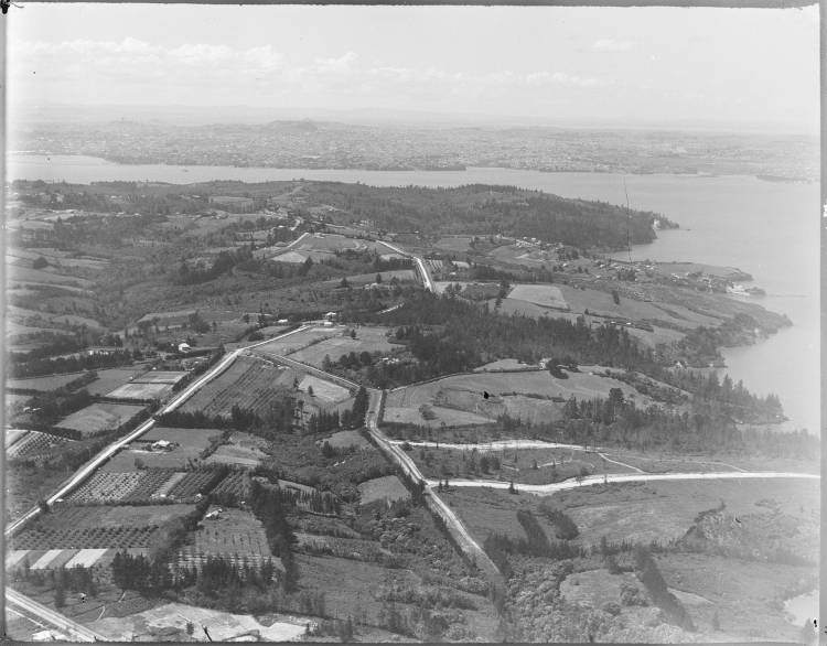
The following photo is an aerial picture of a part of Beach Haven. It was taken some time in the 1920s/1930s and looks south over Beach Haven. To help orientate ourselves, Beach Haven Road is bottom left and Rangitira Rd runs diagonally left to right leading to Verran Rd top left and Island Bay top right.
The standout feature is of course, the lack of houses. Prior to the building of the Harbour Bridge much of Beach Haven and Birkdale was farmland serving the inhabitants of Auckland city.
Before the Harbour Bridge was built, much of Birkdale and Beach Haven was farmland producing much of the food consumed by the ever-increasing city of Auckland. If you would like to know more, I would highly recommend Matt Elliot’s ‘Strawberry Land‘ .
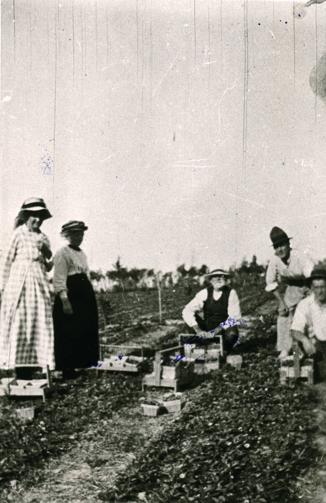
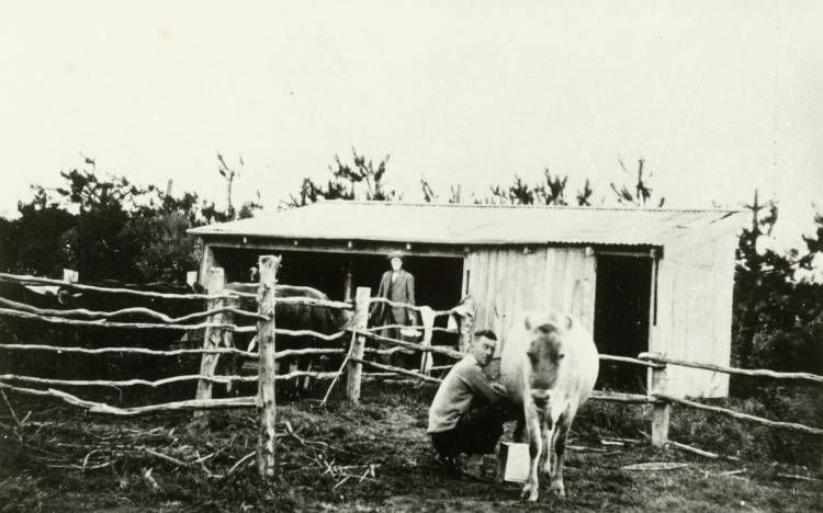
Below are a couple of photos that emphasise the rural nature of this now suburban landscape.
Strawberries were an important part of the farming economy in Birkdale and Beach Haven. This photo is of Woods Farm taken some time in the 1910s. Today, Woods Farm makes up part of Shepards Park. Photo Courtesy of Auckland Libraries Heritage Collection BO406.
Another photo from Woods Farm taken in the 1920s. The two gentlemen in the picture are Bob Walton and George Wood. Photo courtesy of Auckland Libraries Heritage Collection BO389.
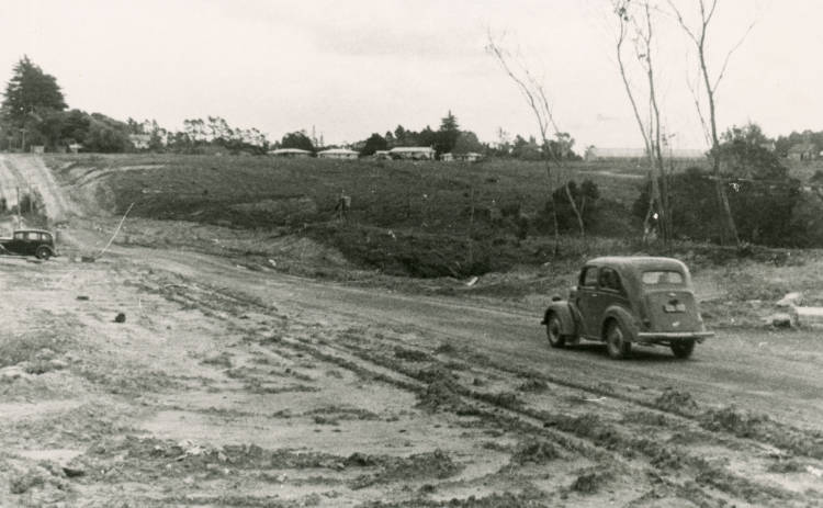
Of course, this foray into the past via our heritage photos could go on forever…but I will stop here and leave you with a bit of detective work, the photo below is of Eskdale Road in Birkdale taken in the 1950s. If your local, can you guess from where the photo was taken?