Auckland was recently subjected to what the meteorologists refer to as a ‘weather event’. High winds and a months worth of rainfall caused damage and chaos throughout the city. None more so than on the islands of the Hauraki Gulf including Otata.
Reports came in of erosion and the lost of the shingle beach exposing the clay beds. It was decided that a visit to the island would be necessary, to assess and record the damage to the midden site. In addition, Louise Furey, the archaeology curator at the Auckland Museum, invited Bruce Hayward and Robert Brassey for a second opinion on the stratigraphy of the site (the former a geologist and the latter an archaeologist who had worked on the nearby islands of Motatapu and Tiritiri Matangi).
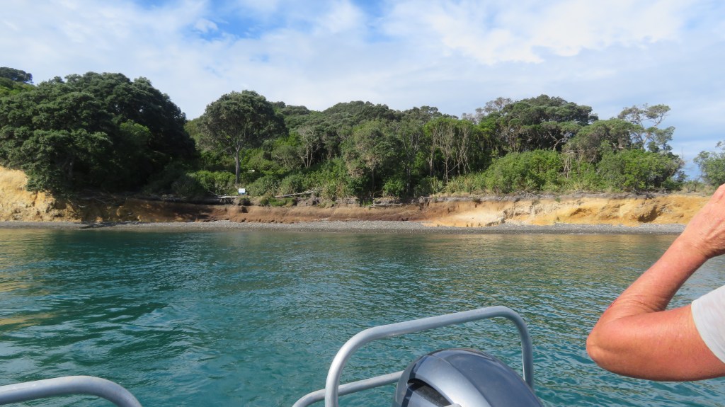
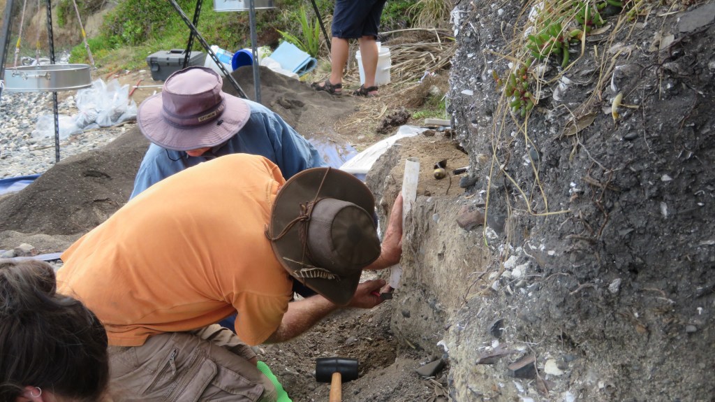
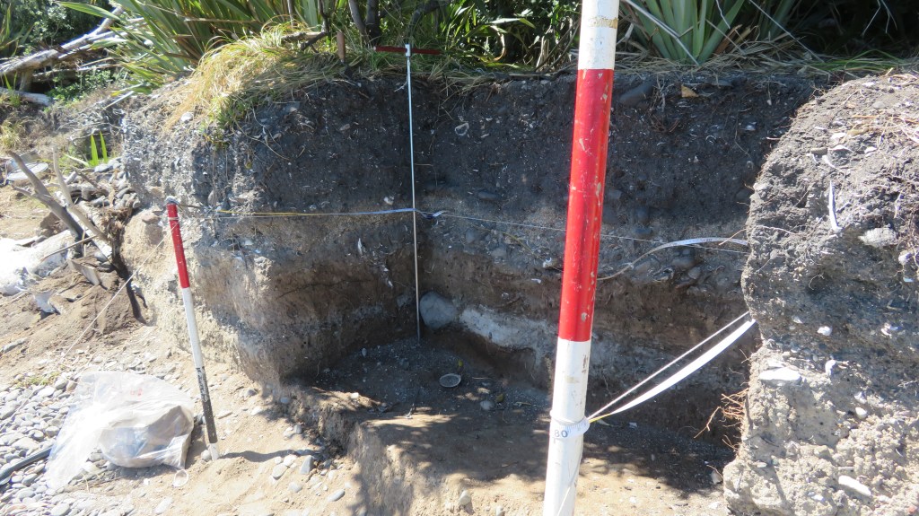
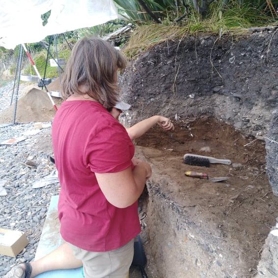
The first attempt to visit the island was thwarted, yet again by bad weather. However, on the second attempt we were graced with a stunning day with tides and winds in our favour and so we set off early morning. It was with some luck that only a few days earlier, the wind and tide redeposited much of the shingle back onto the beach, making landing on the island a little safer. On our arrival we could see that the sea had not been kind to the midden and much of the beach had indeed been washed away, leaving the midden sitting up high.
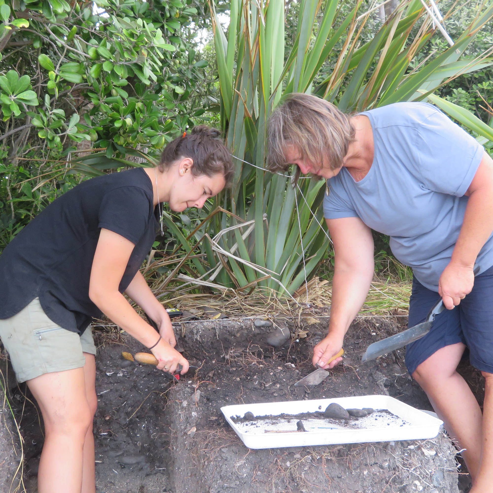
We spent the day measuring levels, recording and describing what could be seen. An Auckland Museum photography was on site to provide a photographic record of the midden in detail (look out for the video during Archaeology Week 2022). There was also a great deal of discussion regarding the stratigraphy – the outcomes of which can wait until the published report.
The following photos are of the site as it was seen on March 28th 2022 – these photos are my own.
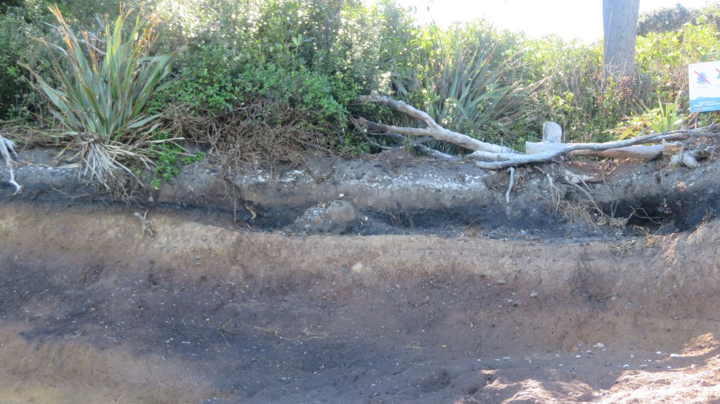
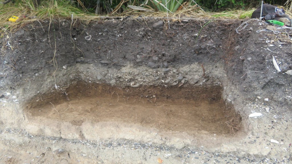
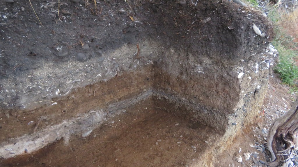
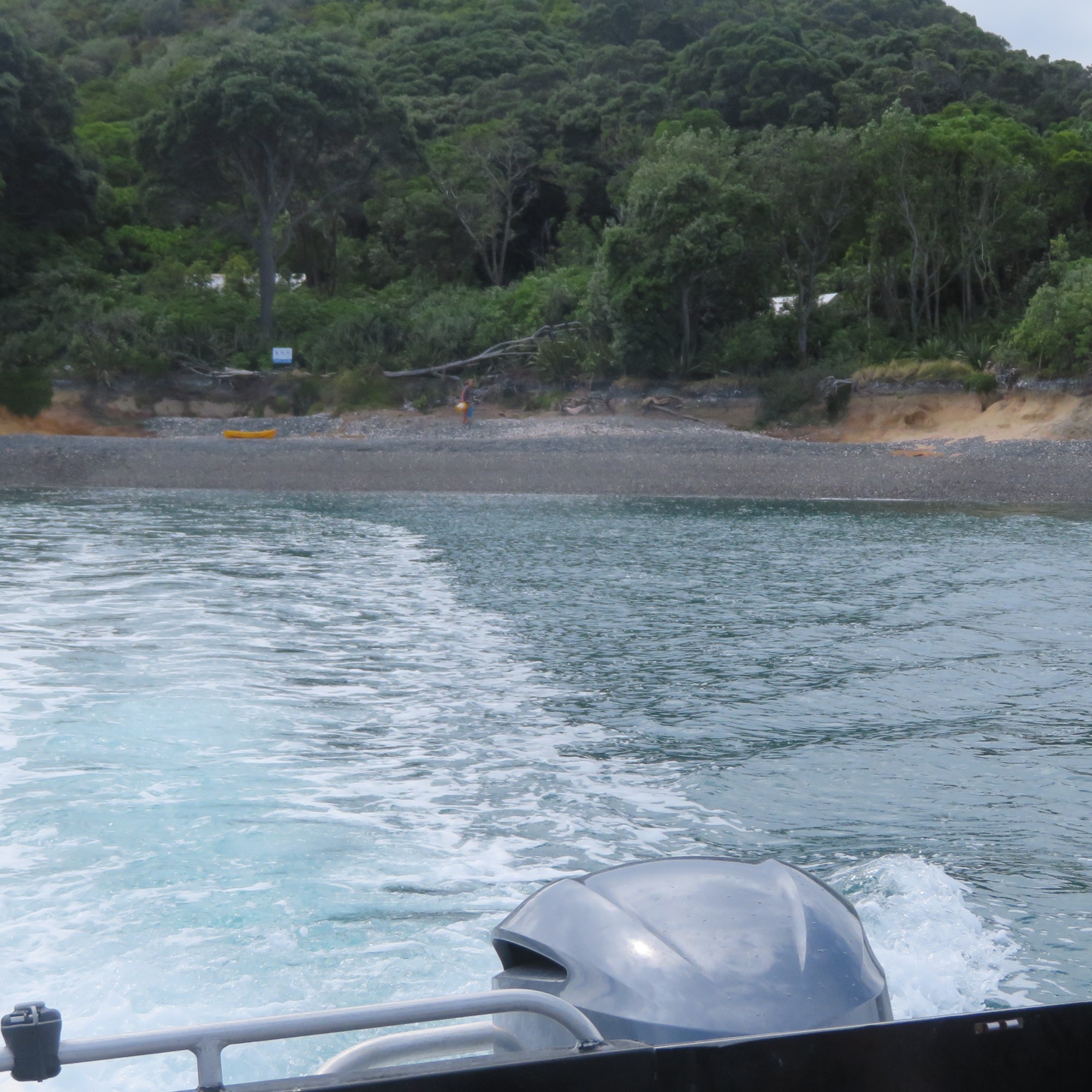
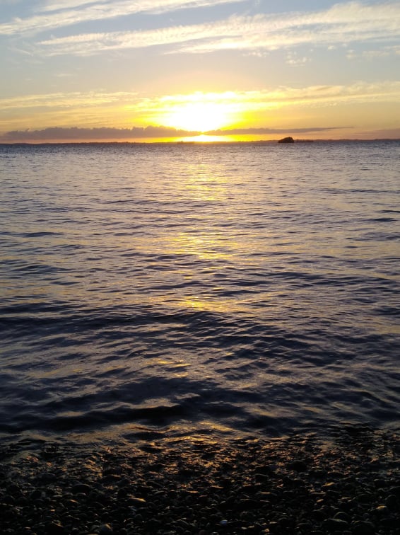
Main Beach from the boat – the grey band is the remaining shingle, the dark brown band is the clay and above that are the midden layers.
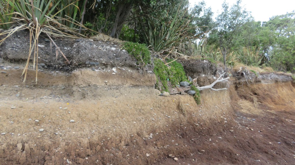
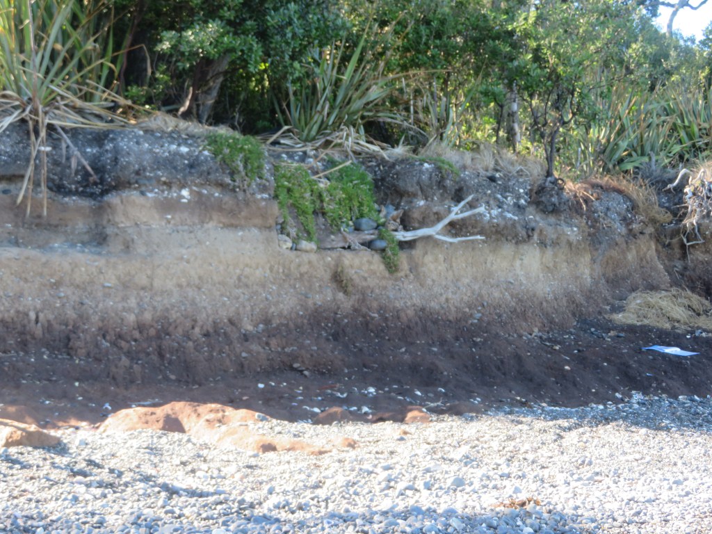
The area of last years excavation – where the cobbles and branch is sticking out of the edge is where I excavated last year. The base of this square was at ankle height but is now almost chest height.
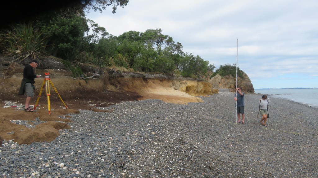
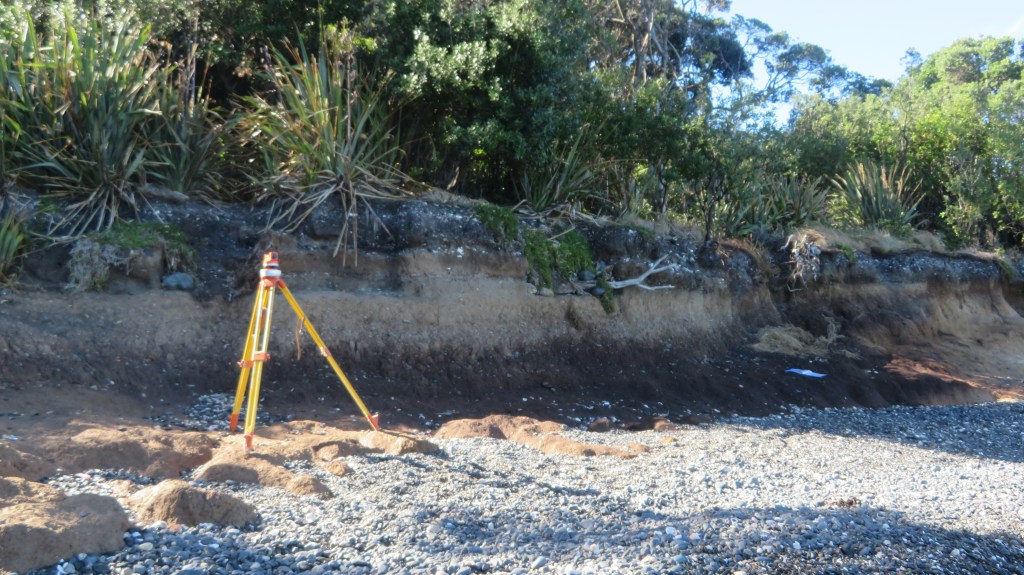
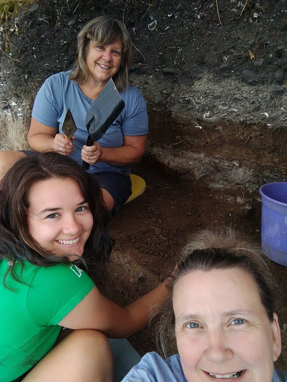
Taking levels.
For more information see a previous article on Otata here or visit the Noises website here and here for articles by Emma Ash (Assistant Archaeology Curator, Auckland Museum).
Coastal sites are always at the mercy of the environment and it can be heartbreaking to watch them year after year become less and less. The greatest shame is in the loss of the information that would have been gained if time and funds had allowed. Yes, it is true that excavation is destruction but when a site is under threat from elsewhere then surely it is time to step in and save that information for future generations. This is often done in urban areas before large developments are undertaken. Rescue archaeology shouldn’t just be about pre-development but also about the natural damage being done to archaeological sites.
Otata Island is the largest of several island that make up the Noises island group. Situated on the edge of the Hauraki Gulf, its nearest neighbour is the island of Rakino.
View of Rakino Island from the beach at Otata.
In 2018 a storm swept away some five meters of the shoreline and in doing so exposed a large midden, approximately 50m in length. Concerned that even more of the shoreline and thus the midden could be lost during subsequent storms the landowners (the Neureuter Family) contacted the Auckland Museum for assistance.
The beach at Otata, the excavation site is just pass the tripod legs of the sieves. For those who know this island well, the beach has been dramatically transformed in the last 2-3 years – in places the erosion issue is plain to see.
In March 2020 (just prior to New Zealand’s month long lockdown) archaeologists from the Auckland Museum, led by curator Louise Furey, along with representatives from Ngai Tai ki Tamaki and the family began a week long excavation. The following year they were back again for another week of digging (- it was at this time I was given the opportunity to participate).
One of the aims on both occasions was to record vital information before the midden was lost to erosion – a common issue for archeology in New Zealand where so many sites are situated in coastal areas and are vulnerable to climatic conditions. The fragility of the shoreline was evident during the 2021 excavation, when large chunks of the edge would crumble away with the slightest touch – the square I was excavating was reduced by a third by the end of the dig. It is not hard to imagine what a storm surge could do.
Of equal importance is another of the aims of the project was provide an environmental baseline for the understanding the marine environment around Otata and how it has changed over time.
“For archaeologists the most exciting feature of the Otata midden is the rich diversity of species contained within it. Middens with an abundant range of species are rare in the Hauraki Gulf and only a few have undergone full analysis”
E. Ash ‘Excavating Otata Island: A Midden Revealed’ Auckland Museum Blog.
The partnership with the Ngai Tai ki Tamaki provided another dimension to understanding the archaeology. Mataurangi Maori – the knowledge and oral histories of local iwi – can serve as a valuable aid for the understanding of archaeological sites. In the case of Otata, the archaeology appears to support the ancestral stories, aiding our understanding of how early Maori used the Hauraki Gulf.
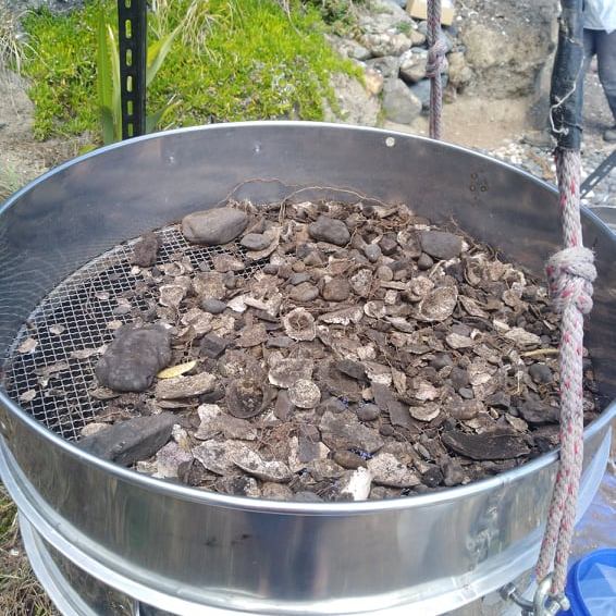
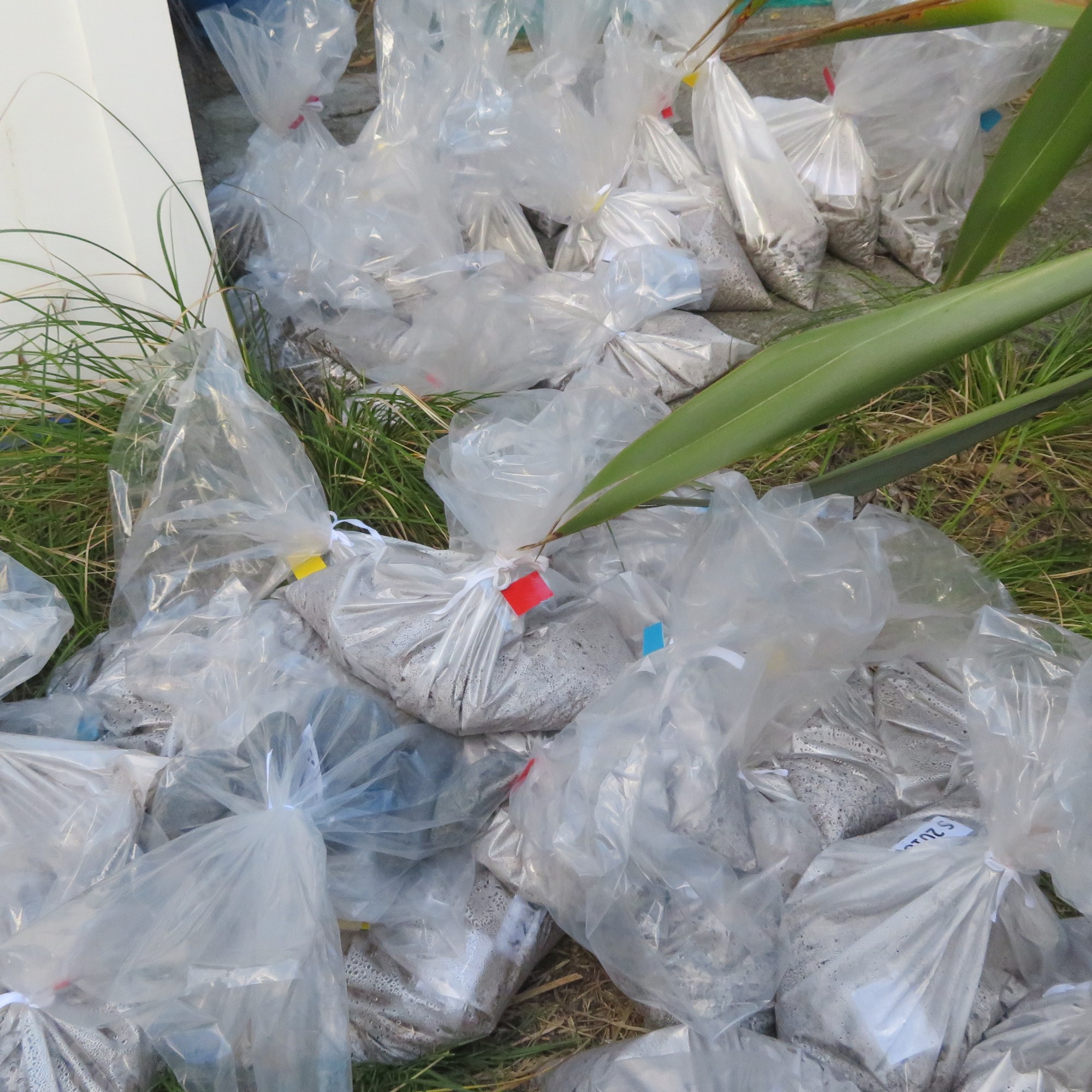
Because of the size of the midden, it would have been impractical to excavate large areas, instead a sampling strategy was employed. In total over the two weeks, seven one meter squares were hand trowelled, using a system of 5cm spits (unless features were identified) with the material from each spit being sieved (6mm and 3mm). The sieved material was then bagged up to be taken back to the museum for further analysis. In both years the samples taken from the island weighed in at approximately 500kgs.
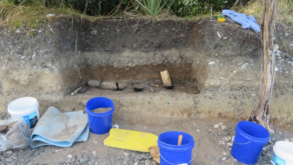
The sieving area with the excavation behind (2021) – the exposed face of the midden allowed us to dig directly into the midden.
From these samples it is the intention to identify and quantify the types of shellfish, fish and birds that were found on and around the island. This gives us an idea of foraging behaviour, food preferences and seasonality.
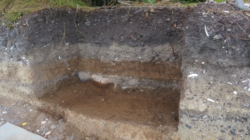
During the 2020 dig one of the squares dug down into a large hangi which consisted of quantities of burnt shell, a dense charcoal layer and large stones (see Emma Ash’s blog below for more details). Also discovered during that week was a cultural layer sealed below a layer of volcanic ash (tephra) from the eruption of Rangitoto. Only one other site in the Gulf has a similar stratigraphy – the Sunde site on Motatapu Island. It was this lower layer which was the focus of attention during the 2021 dig.
The plan for the 2021 dig was to excavate four one meter squares, each of which was further divided into four quadrants and all but two of the quadrants were excavated.
On a personal level this was fascinating week, not only did I have the opportunity to be digging what, I am sure, will turn out to be a very important site but I was in the enviable position of camping on beautiful island in the Hauraki Gulf. It had been some years since I had last been on a dig so I was a tad nervous about stuffing up…anyway lets just say it was a bit like riding a bike, once learnt never forgotten – at least that’s what they say, I haven’t ridden a bike since I was a child so goodness knows how that would go.
The following are a few photos from the 2021 excavation and my experience (please note these are my own photos).
The upper cultural layers found above the tephra, note the blackened stones , the white flecks are degraded shell.
One of several obsidian flakes found at the interface between the tephra and the upper layers.
Removing an intact sample of the tephra stratigraphy for later analysis.
You would be forgiven for thinking we were castaways…
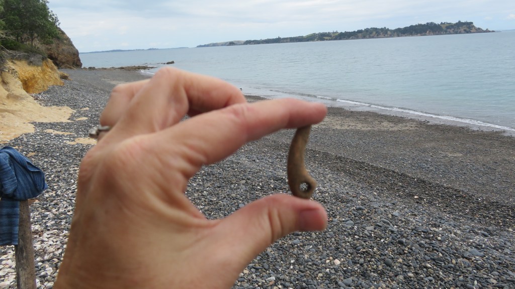
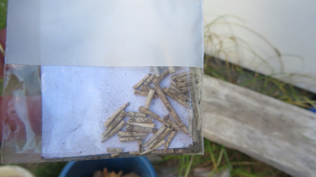
A favourite find – a bone lure point.
Areas E and F – partway through the tephra layer. The light gray layer was full of shell and bone.
Areas E and F – now below the tephra and into an earlier cultural layer in which a hollow had been dug for a fire and large stones were placed around the edge.
These are ‘Dentalium nanum’ beads – a form of tusk shell commonly found in New Zealand waters and used for personal ornamentation by Maori and is more typically found at sites in the Coromandel. These were very carefully excavated from the ashy layer associated with the fire feature in the above picture.
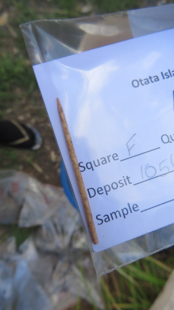
A very fine bone needle, found below aforementioned feature and to the edge of square F.
Recording the sections…
And we’re finished – square E and half of square F.
Another look at the final stratigraphy looking south east.
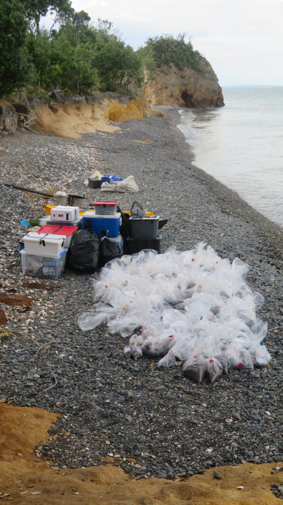
Our gear and many, many bags of samples waiting for pick up…
As a final note I would like to thank Louise Furey (and company – you know who you are) from the the Auckland Museum for inviting me along on the dig this year. I came home tired, smelly, covered in mozzie bites and just a little crispy but even so it was a thoroughly enjoyable experience and one I shall not forget in a hurry…much like riding a bike…