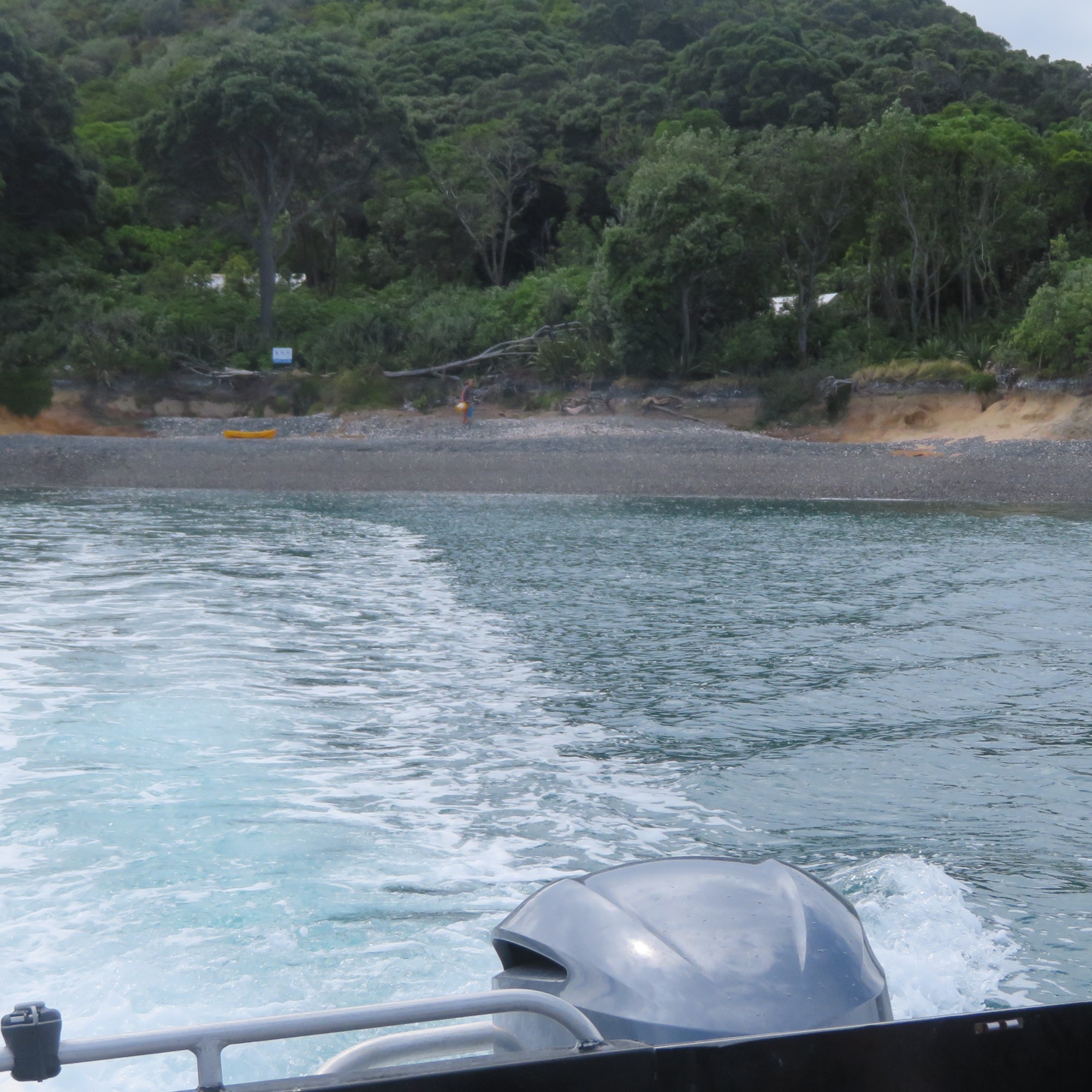
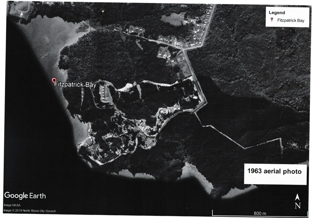
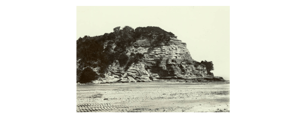
Otata Island is the largest of several island that make up the Noises island group. Situated on the edge of the Hauraki Gulf, its nearest neighbour is the island of Rakino.
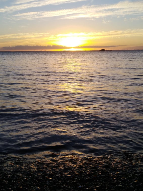
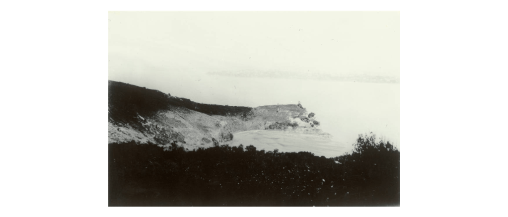
View of Rakino Island from the beach at Otata.
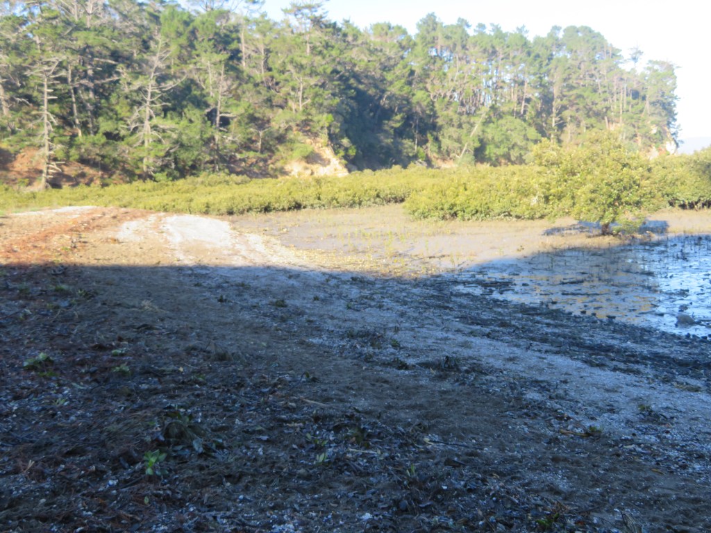
In 2018 a storm swept away some five meters of the shoreline and in doing so exposed a large midden, approximately 50m in length. Concerned that even more of the shoreline and thus the midden could be lost during subsequent storms the landowners (the Neureuter Family) contacted the Auckland Museum for assistance.
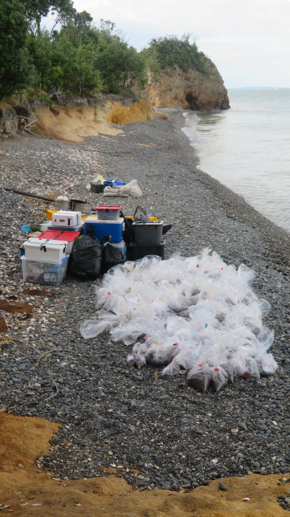
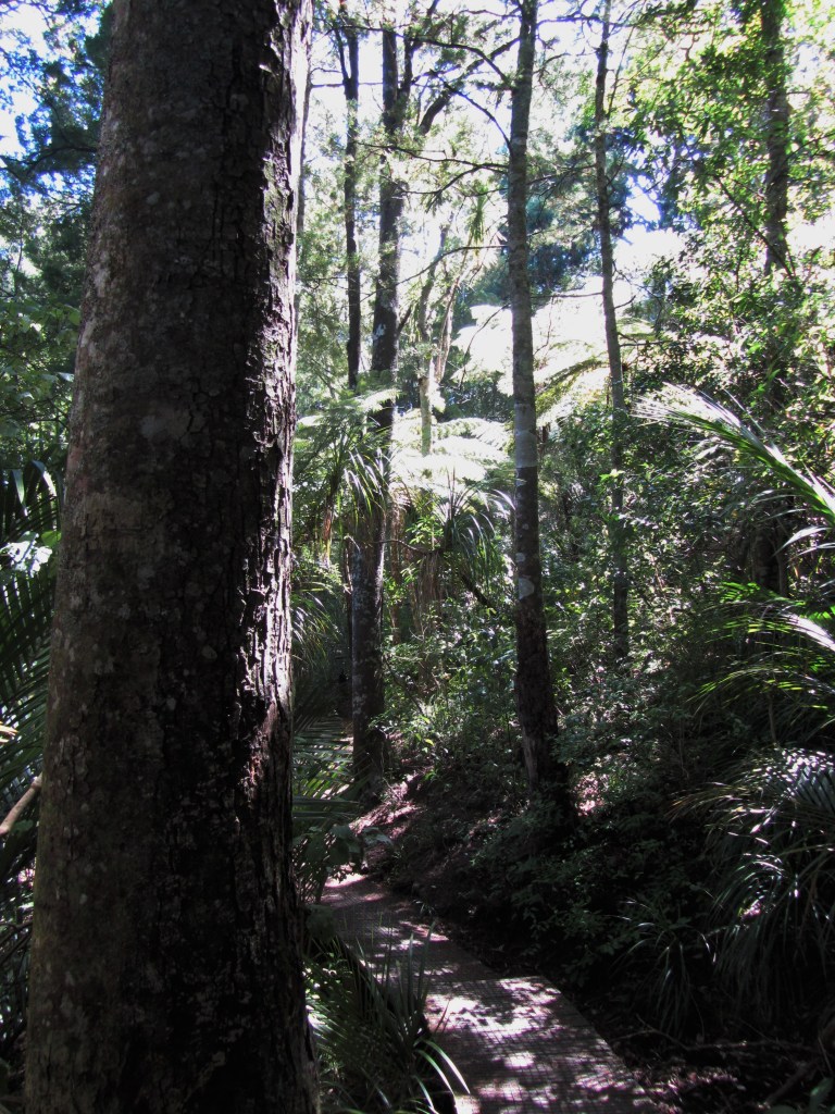
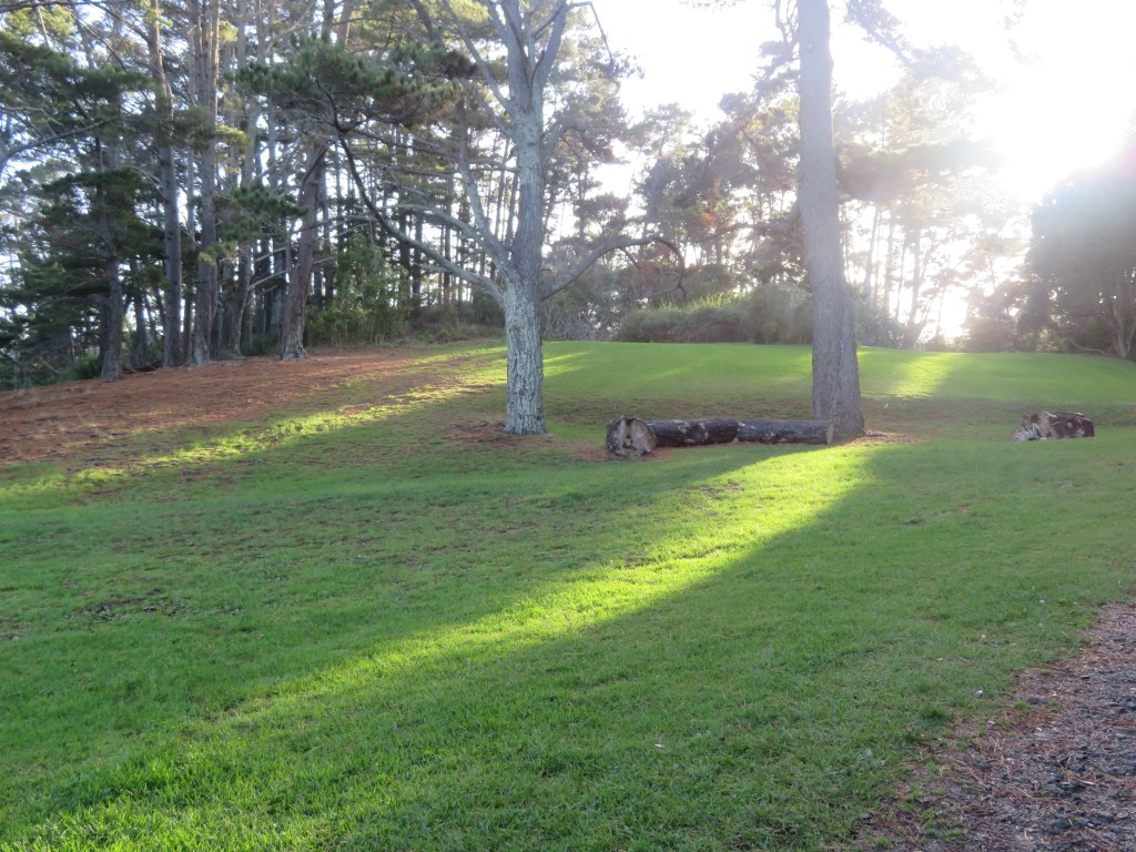
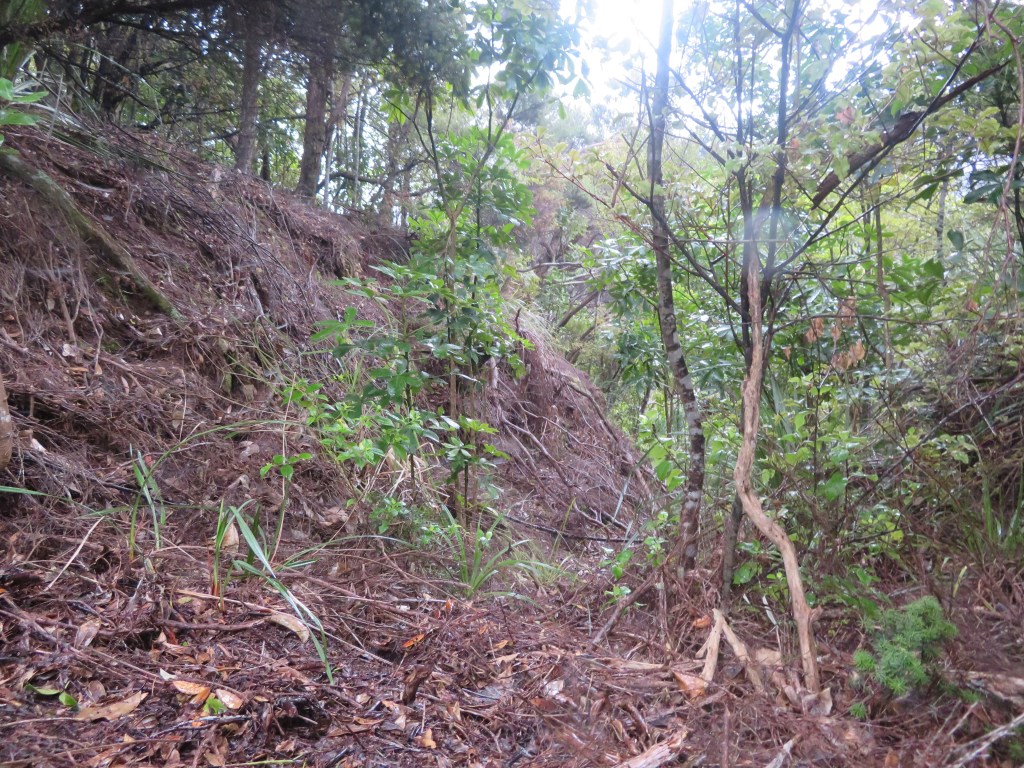
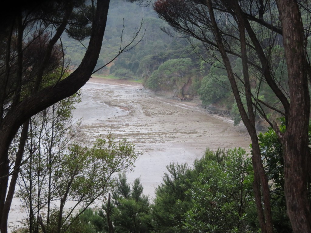
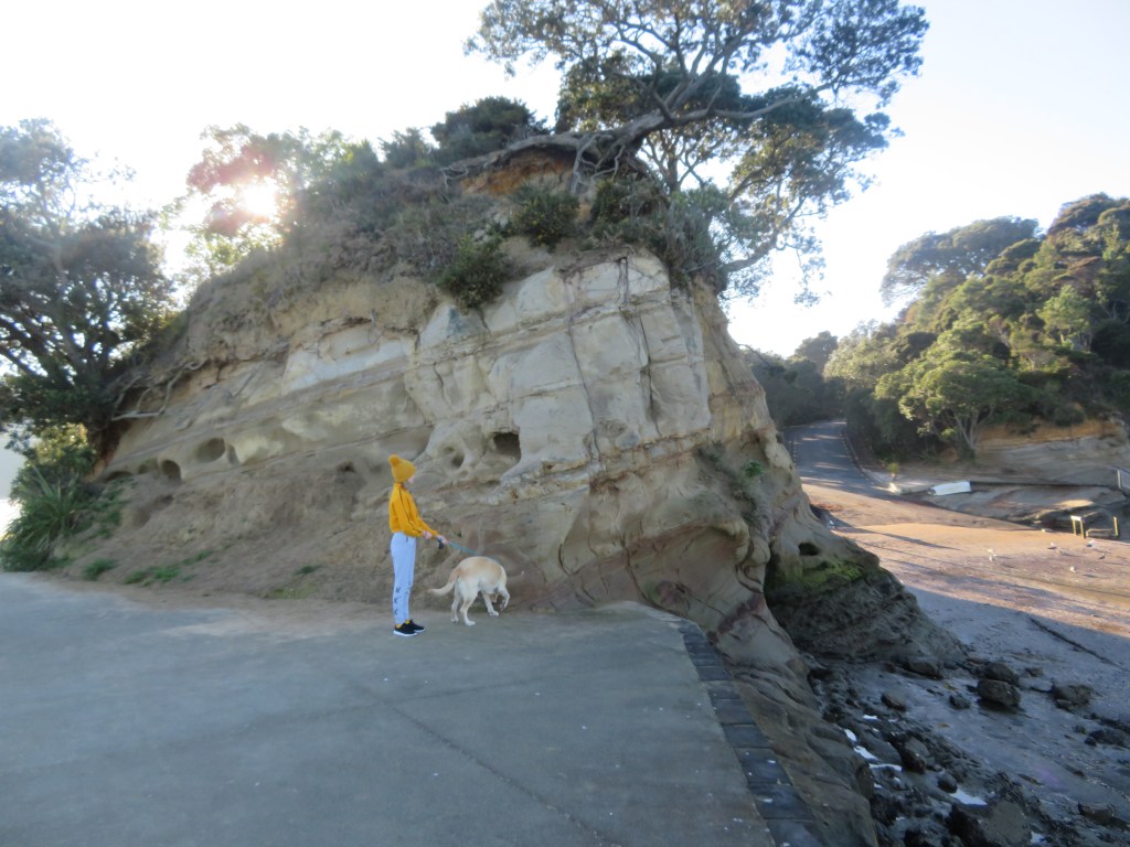
The beach at Otata, the excavation site is just pass the tripod legs of the sieves. For those who know this island well, the beach has been dramatically transformed in the last 2-3 years – in places the erosion issue is plain to see.
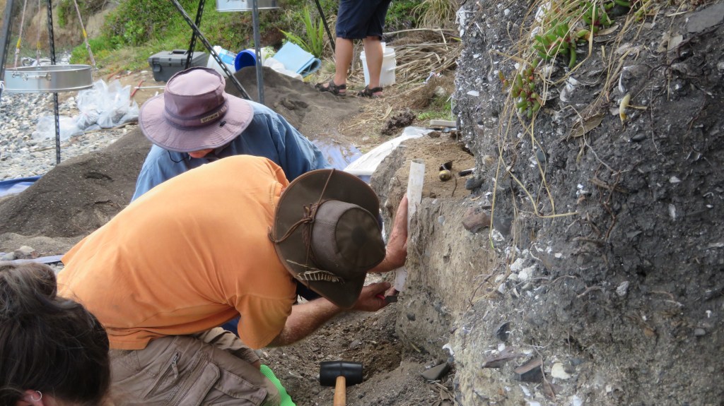
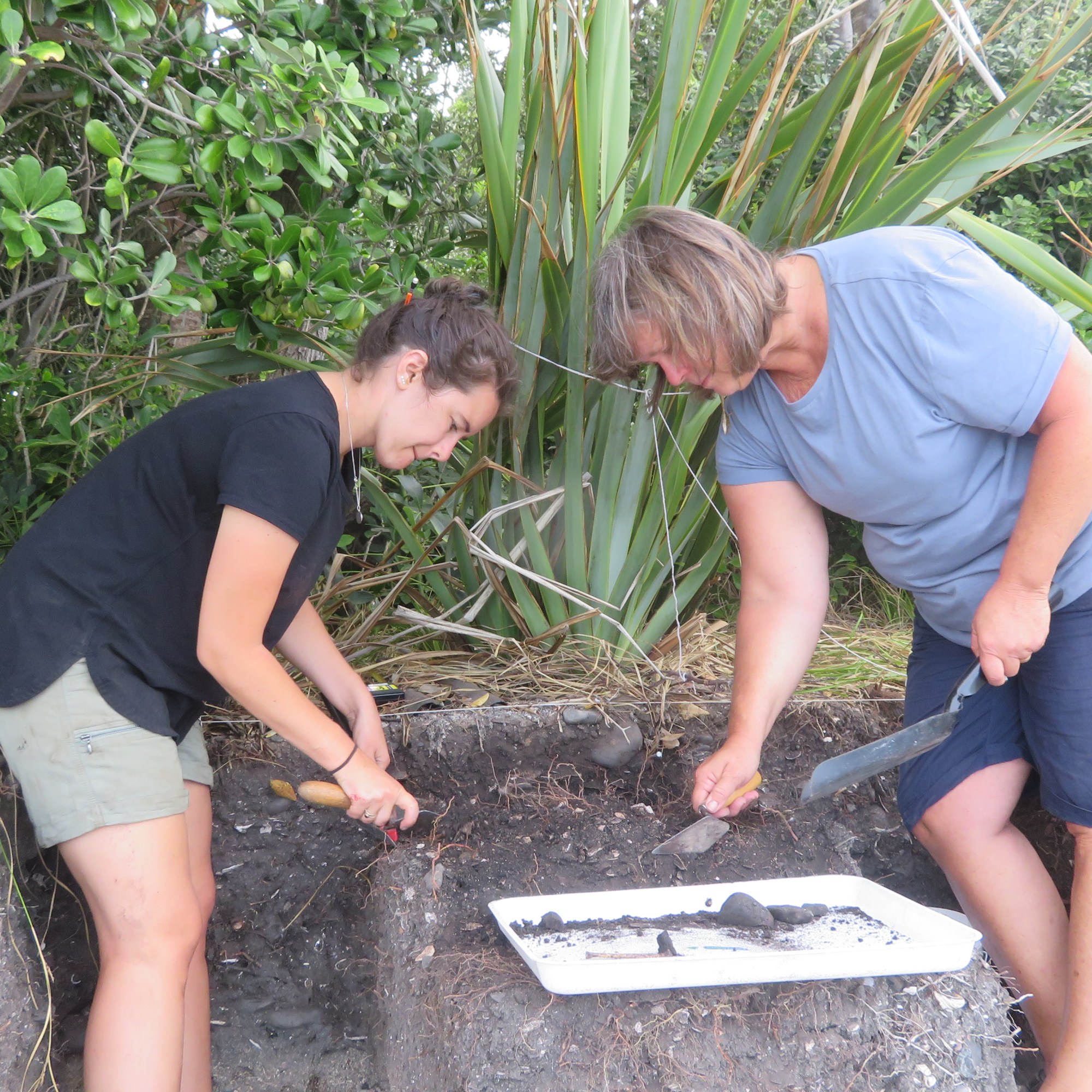
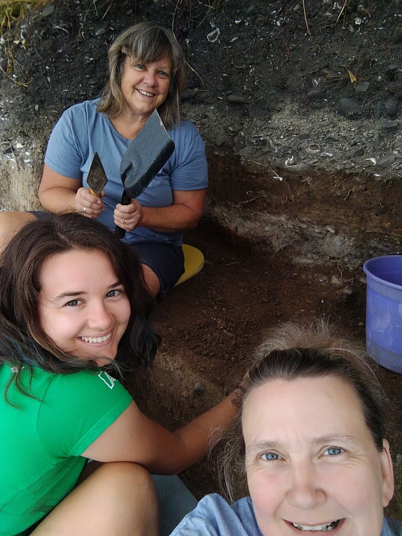
In March 2020 (just prior to New Zealand’s month long lockdown) archaeologists from the Auckland Museum, led by curator Louise Furey, along with representatives from Ngai Tai ki Tamaki and the family began a week long excavation. The following year they were back again for another week of digging (- it was at this time I was given the opportunity to participate).
One of the aims on both occasions was to record vital information before the midden was lost to erosion – a common issue for archeology in New Zealand where so many sites are situated in coastal areas and are vulnerable to climatic conditions. The fragility of the shoreline was evident during the 2021 excavation, when large chunks of the edge would crumble away with the slightest touch – the square I was excavating was reduced by a third by the end of the dig. It is not hard to imagine what a storm surge could do.
Of equal importance is another of the aims of the project was provide an environmental baseline for the understanding the marine environment around Otata and how it has changed over time.
“For archaeologists the most exciting feature of the Otata midden is the rich diversity of species contained within it. Middens with an abundant range of species are rare in the Hauraki Gulf and only a few have undergone full analysis”
E. Ash ‘Excavating Otata Island: A Midden Revealed’ Auckland Museum Blog.
The partnership with the Ngai Tai ki Tamaki provided another dimension to understanding the archaeology. Mataurangi Maori – the knowledge and oral histories of local iwi – can serve as a valuable aid for the understanding of archaeological sites. In the case of Otata, the archaeology appears to support the ancestral stories, aiding our understanding of how early Maori used the Hauraki Gulf.
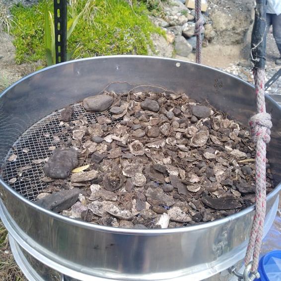
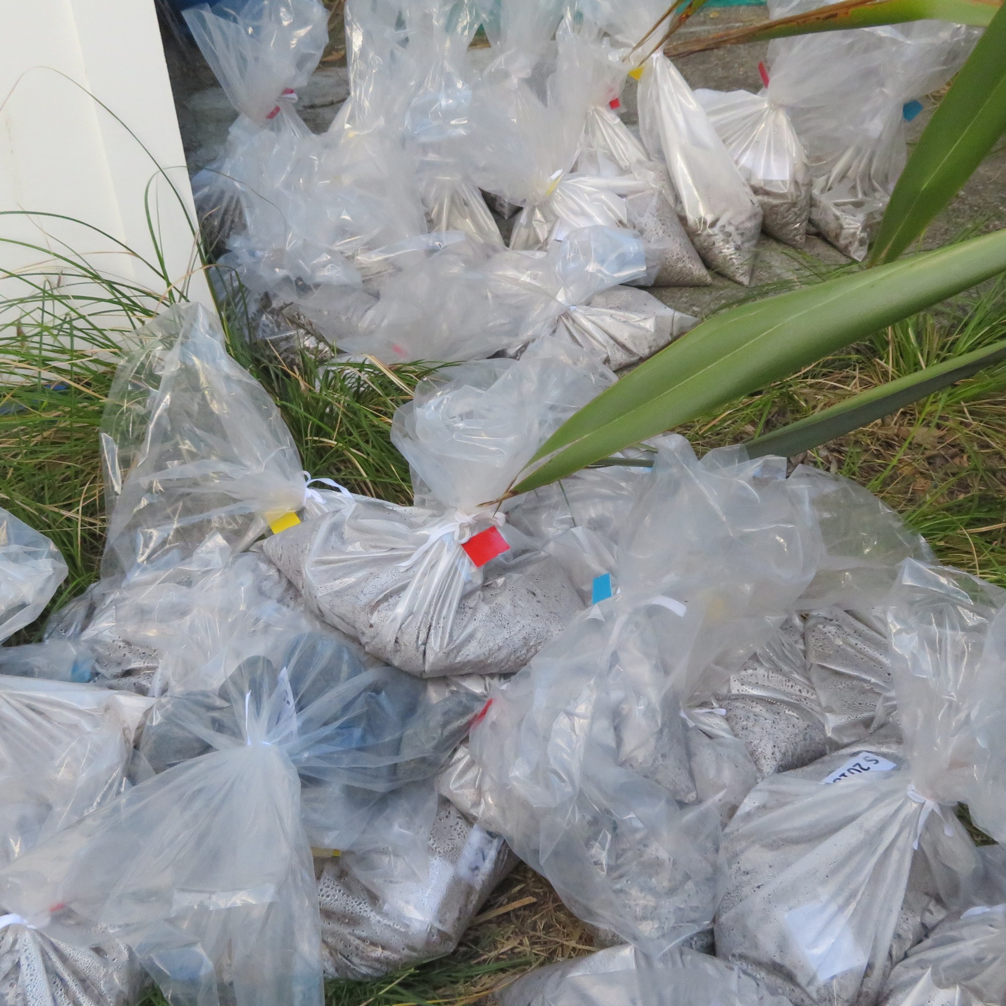
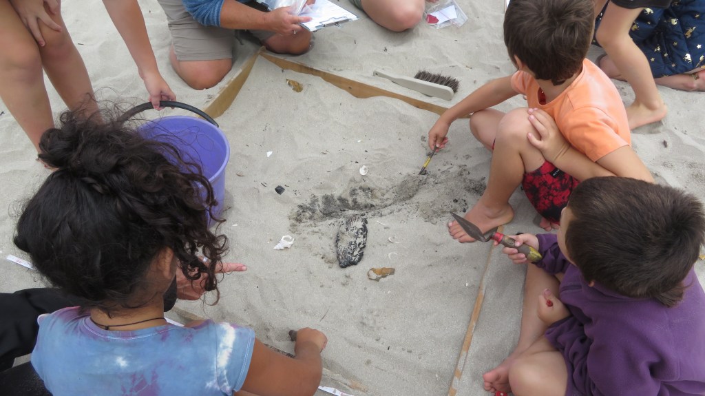
Because of the size of the midden, it would have been impractical to excavate large areas, instead a sampling strategy was employed. In total over the two weeks, seven one meter squares were hand trowelled, using a system of 5cm spits (unless features were identified) with the material from each spit being sieved (6mm and 3mm). The sieved material was then bagged up to be taken back to the museum for further analysis. In both years the samples taken from the island weighed in at approximately 500kgs.
The sieving area with the excavation behind (2021) – the exposed face of the midden allowed us to dig directly into the midden.
From these samples it is the intention to identify and quantify the types of shellfish, fish and birds that were found on and around the island. This gives us an idea of foraging behaviour, food preferences and seasonality.
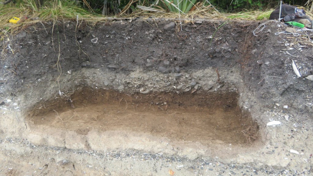
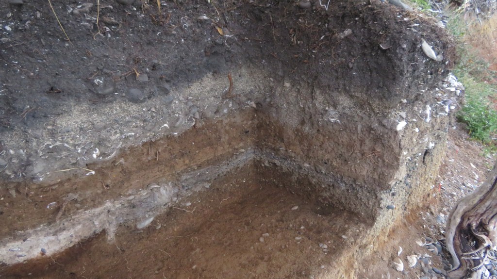
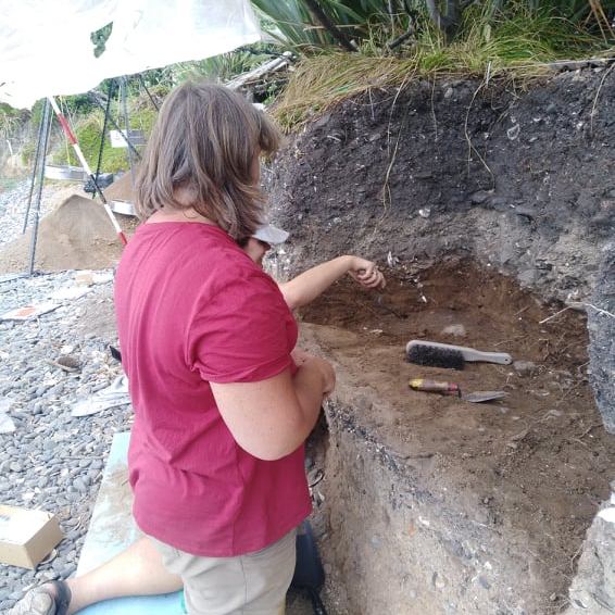
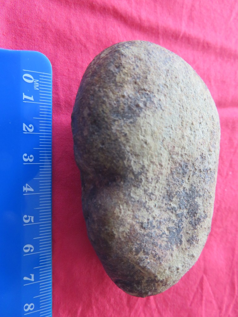
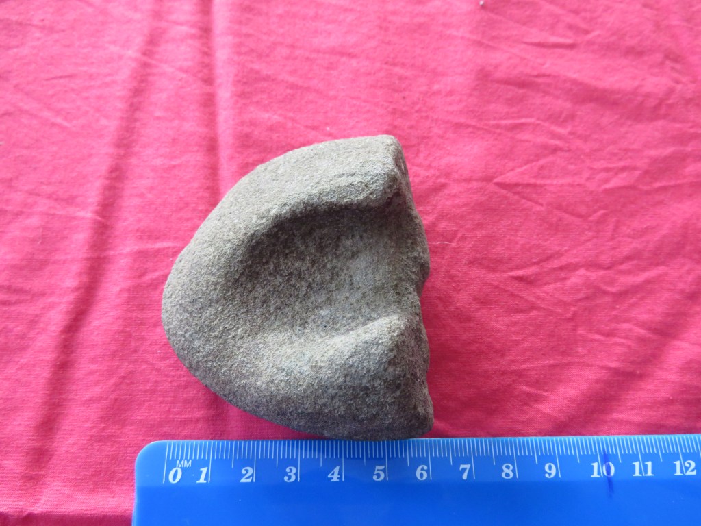
During the 2020 dig one of the squares dug down into a large hangi which consisted of quantities of burnt shell, a dense charcoal layer and large stones (see Emma Ash’s blog below for more details). Also discovered during that week was a cultural layer sealed below a layer of volcanic ash (tephra) from the eruption of Rangitoto. Only one other site in the Gulf has a similar stratigraphy – the Sunde site on Motatapu Island. It was this lower layer which was the focus of attention during the 2021 dig.
The plan for the 2021 dig was to excavate four one meter squares, each of which was further divided into four quadrants and all but two of the quadrants were excavated.
On a personal level this was fascinating week, not only did I have the opportunity to be digging what, I am sure, will turn out to be a very important site but I was in the enviable position of camping on beautiful island in the Hauraki Gulf. It had been some years since I had last been on a dig so I was a tad nervous about stuffing up…anyway lets just say it was a bit like riding a bike, once learnt never forgotten – at least that’s what they say, I haven’t ridden a bike since I was a child so goodness knows how that would go.
The following are a few photos from the 2021 excavation and my experience (please note these are my own photos).
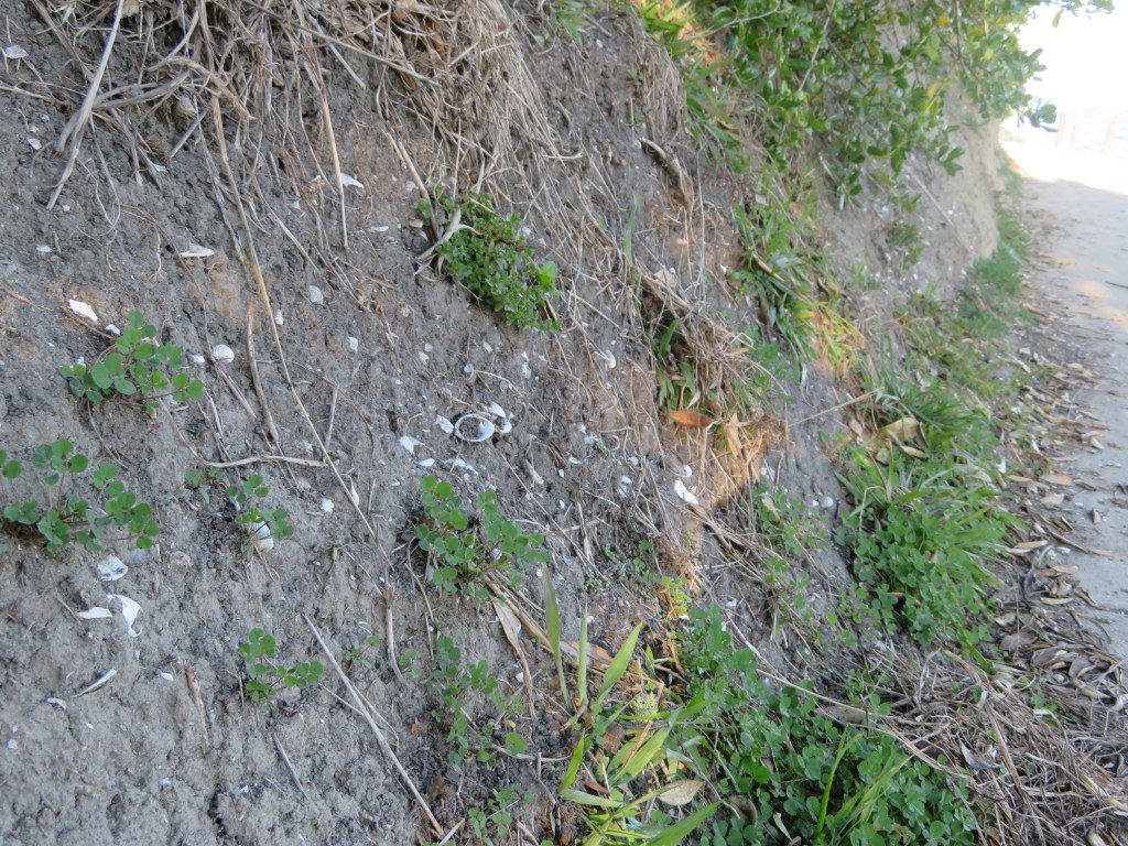
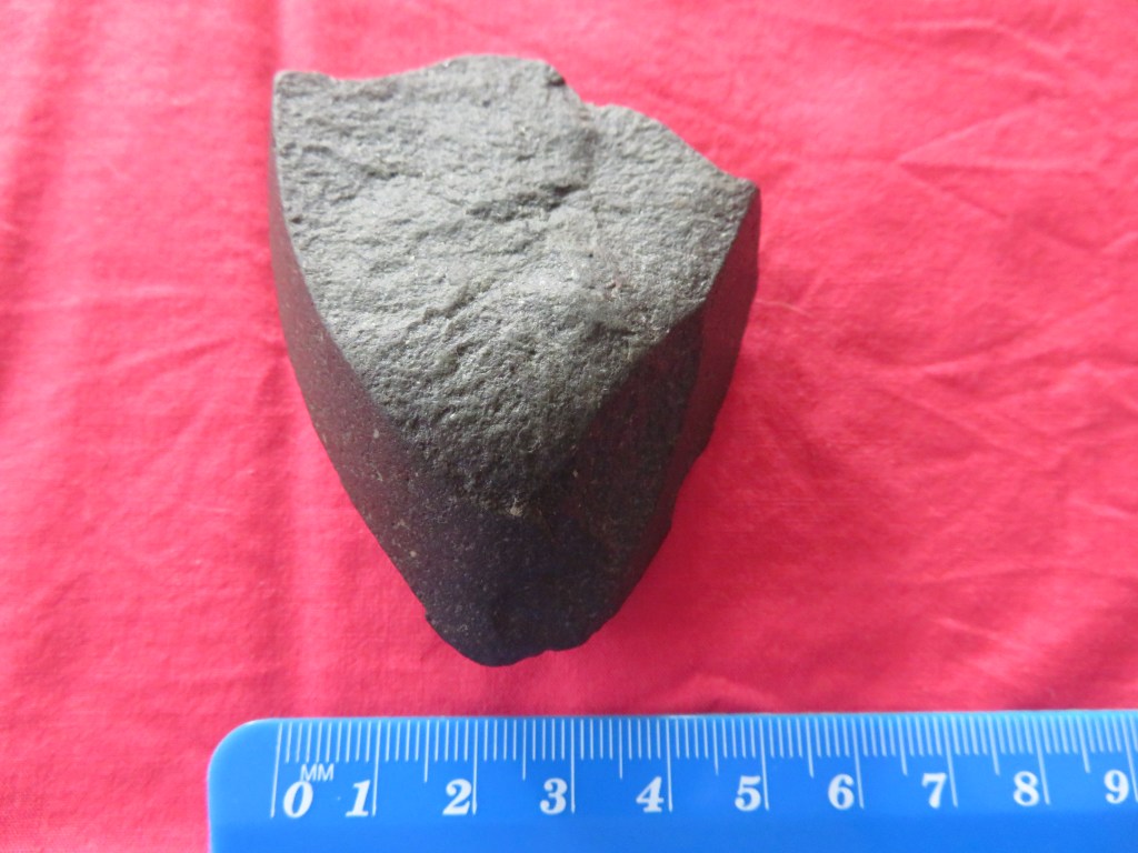
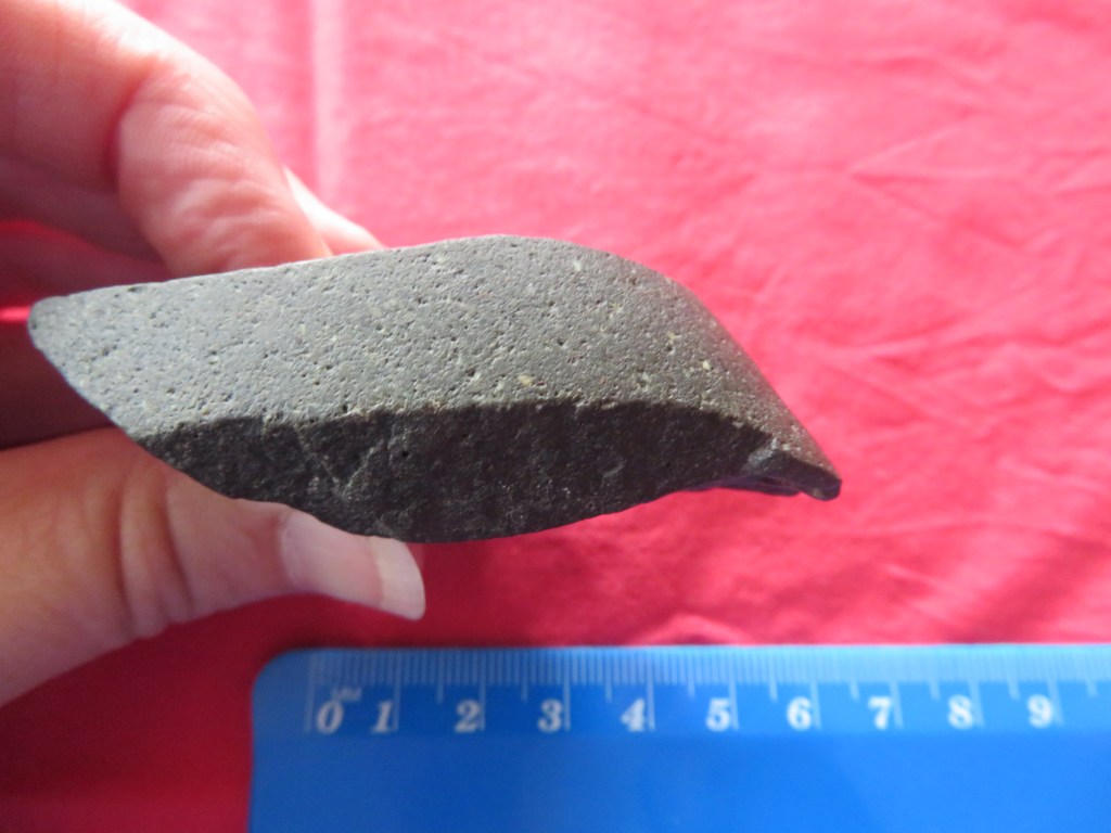
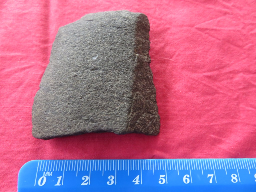
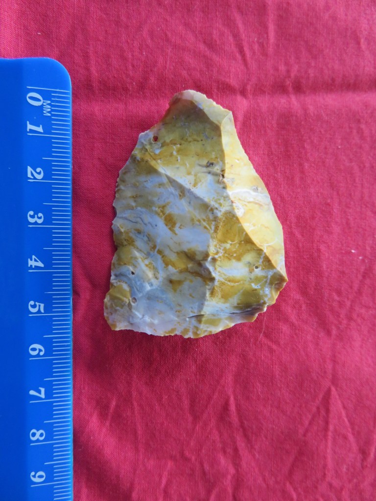
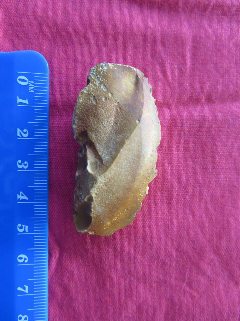
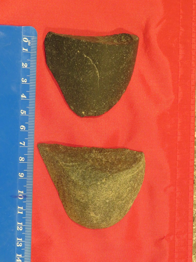
The upper cultural layers found above the tephra, note the blackened stones , the white flecks are degraded shell.
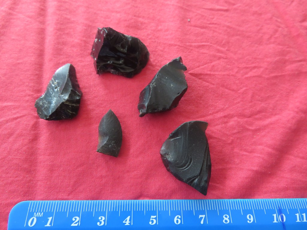
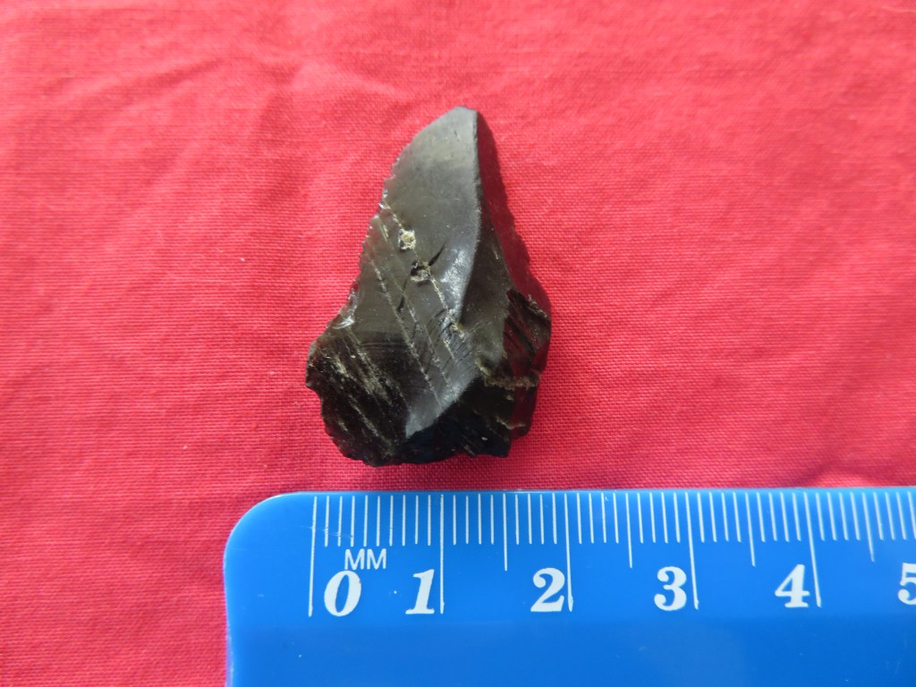
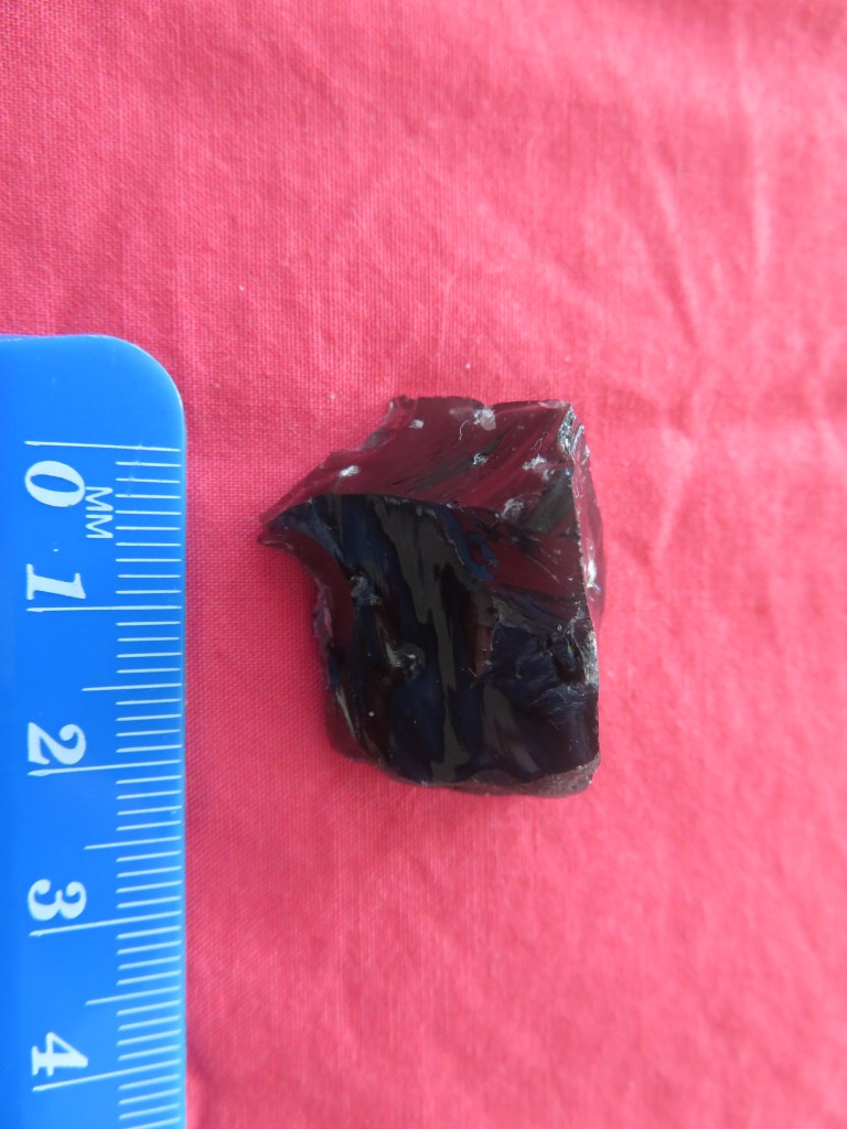
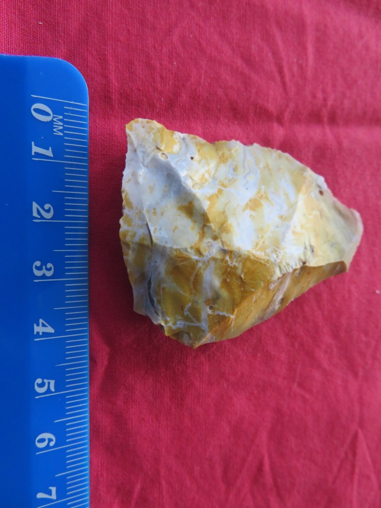
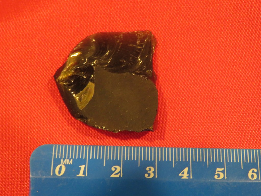
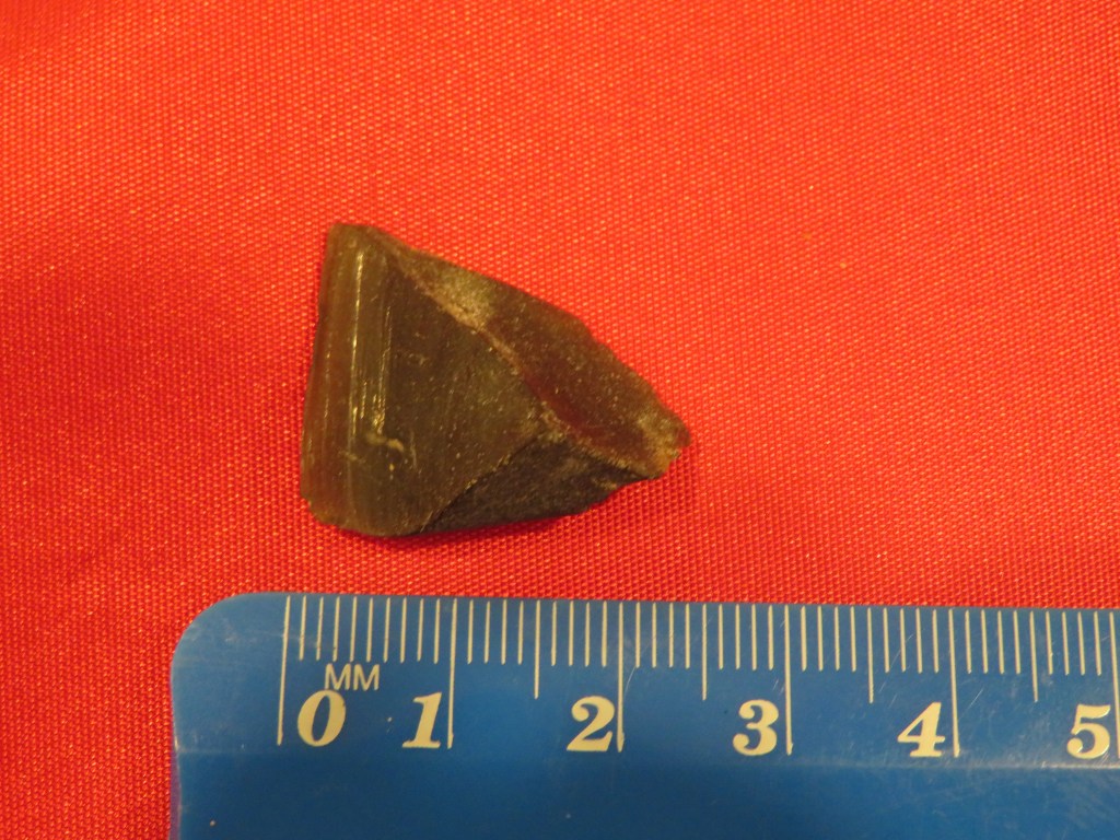
One of several obsidian flakes found at the interface between the tephra and the upper layers.
Removing an intact sample of the tephra stratigraphy for later analysis.
You would be forgiven for thinking we were castaways…
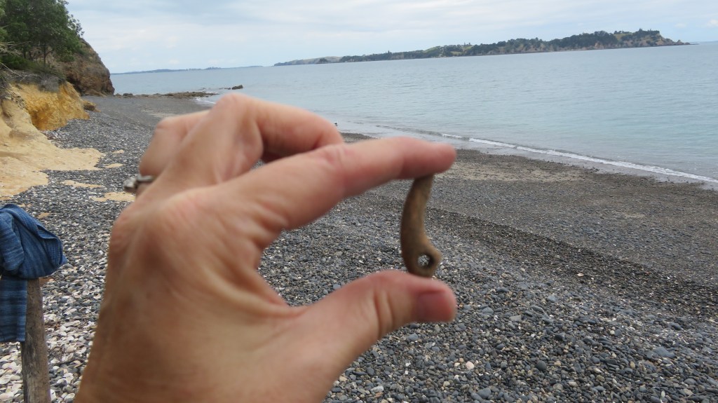
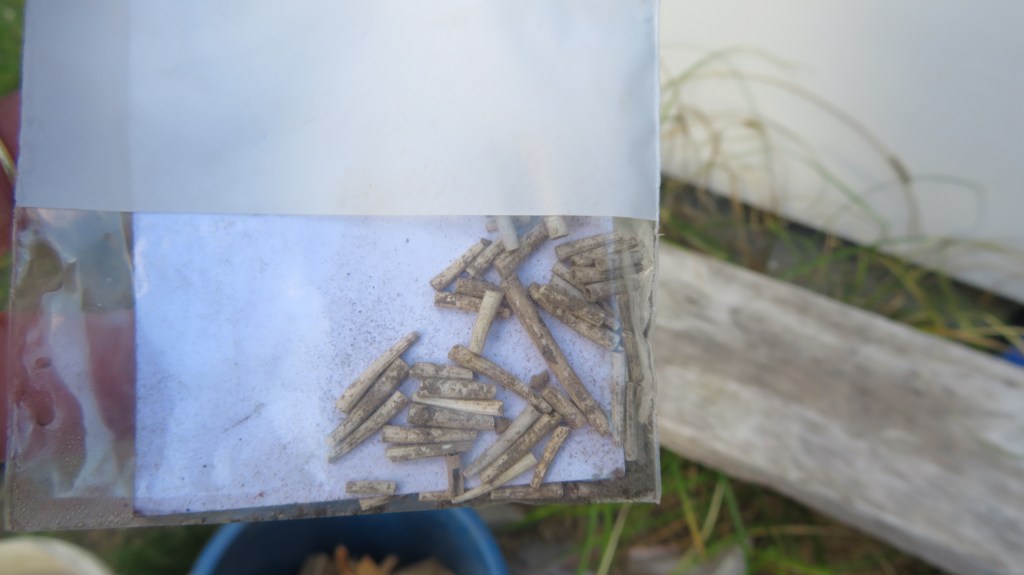
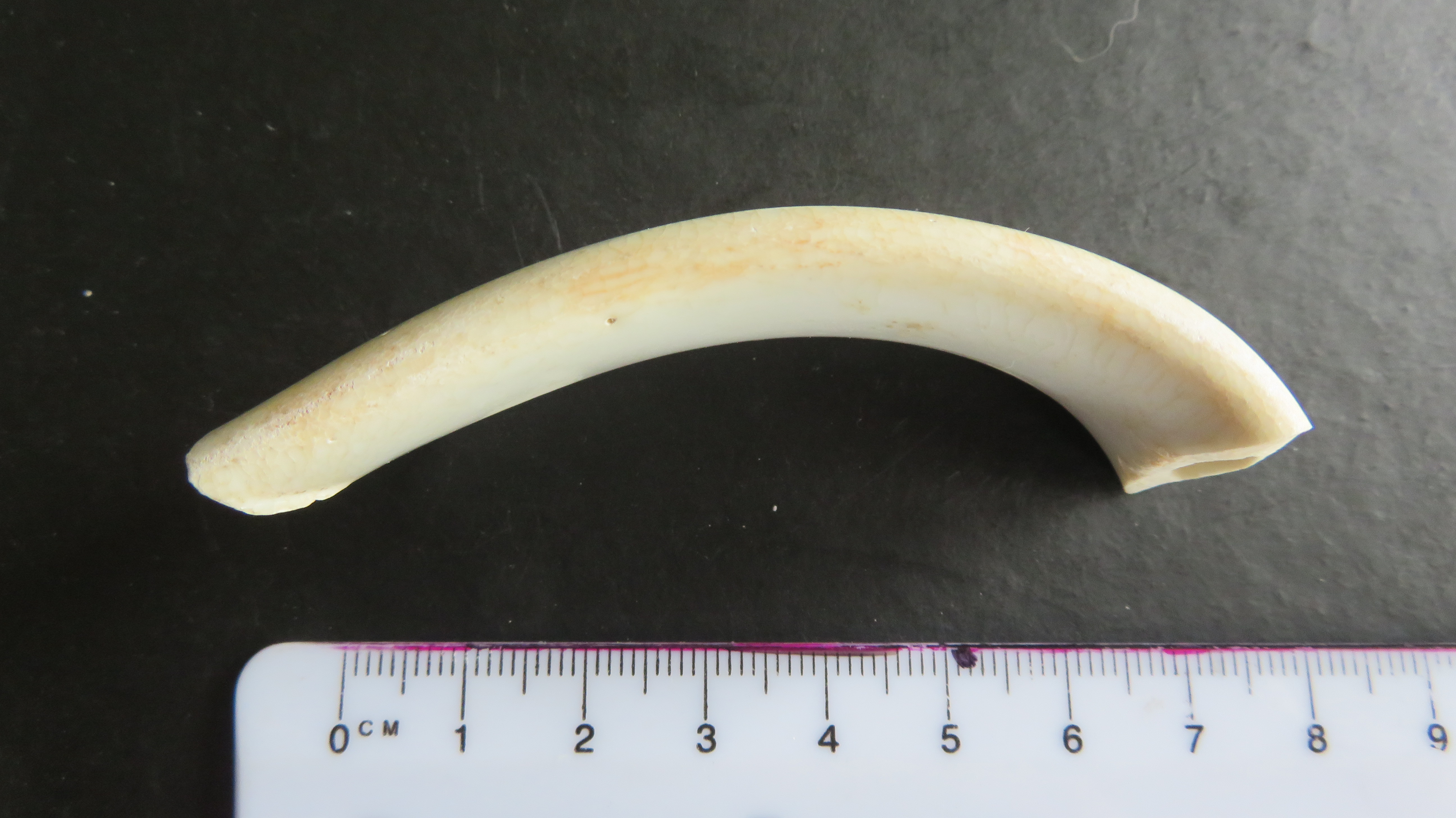
A favourite find – a bone lure point.
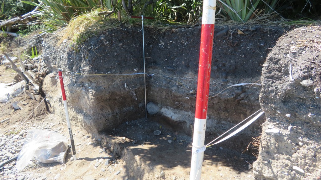
Areas E and F – partway through the tephra layer. The light gray layer was full of shell and bone.
Areas E and F – now below the tephra and into an earlier cultural layer in which a hollow had been dug for a fire and large stones were placed around the edge.
These are ‘Dentalium nanum’ beads – a form of tusk shell commonly found in New Zealand waters and used for personal ornamentation by Maori and is more typically found at sites in the Coromandel. These were very carefully excavated from the ashy layer associated with the fire feature in the above picture.
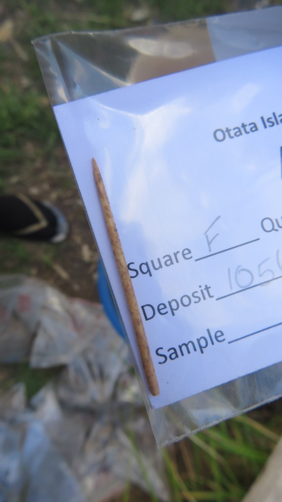
A very fine bone needle, found below aforementioned feature and to the edge of square F.
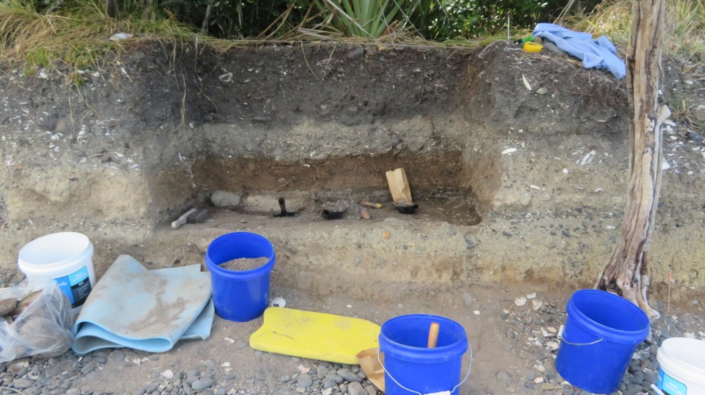
Recording the sections…
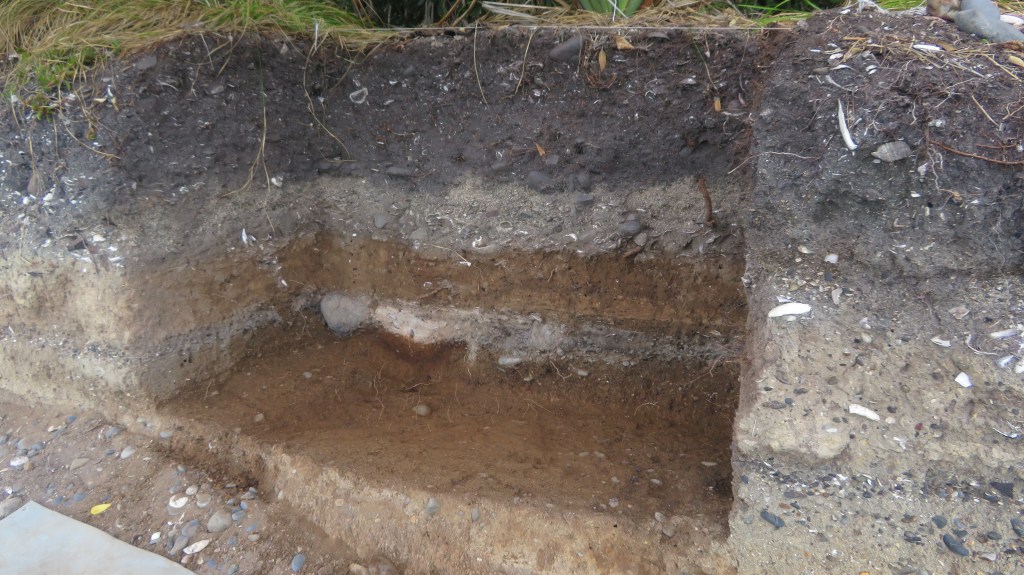
And we’re finished – square E and half of square F.
Another look at the final stratigraphy looking south east.
Our gear and many, many bags of samples waiting for pick up…
As a final note I would like to thank Louise Furey (and company – you know who you are) from the the Auckland Museum for inviting me along on the dig this year. I came home tired, smelly, covered in mozzie bites and just a little crispy but even so it was a thoroughly enjoyable experience and one I shall not forget in a hurry…much like riding a bike…
I am a serial collector of bits and bobs from the foreshore.
If I lived in the UK some might call me a mudlark but here in New Zealand I cannot lay claim to such a title. Generally speaking I pick up shells, stones and bits of seaglass that catch my eye, these end up either in my garden or in a bowl on the bookshelf – (at which my husband spends an inordinate amount of time tutting at…). However, I also have an eye for ceramics and it these which are the subject of this particular article.
If you are a regular reader of this blog you may have read two previous articles regarding the area around Fitzpatrick’s Bay on the Inner Waitemata (read here). As I have previously mentioned it is one of my favourite places to walk to even more so because of the untold history of the area. The ceramics that I have picked up from the beach have all been found below the tide line and I believe they provide further evidence for the range of occupation of the beach and area above it.
The following is a summary of these ceramic pieces.
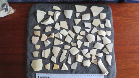
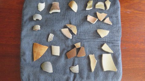
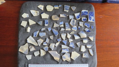
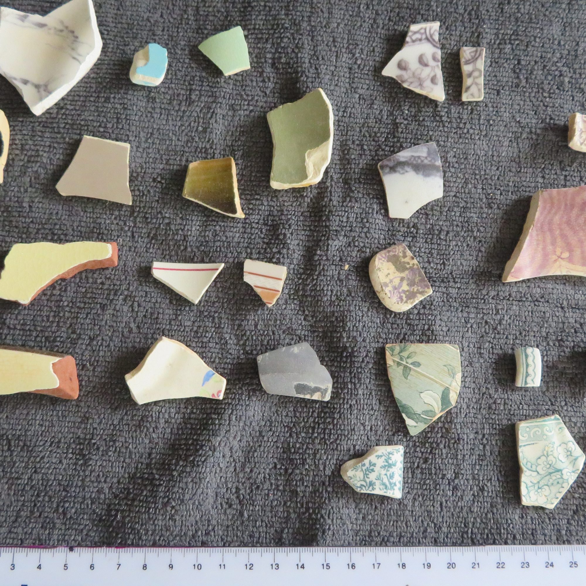
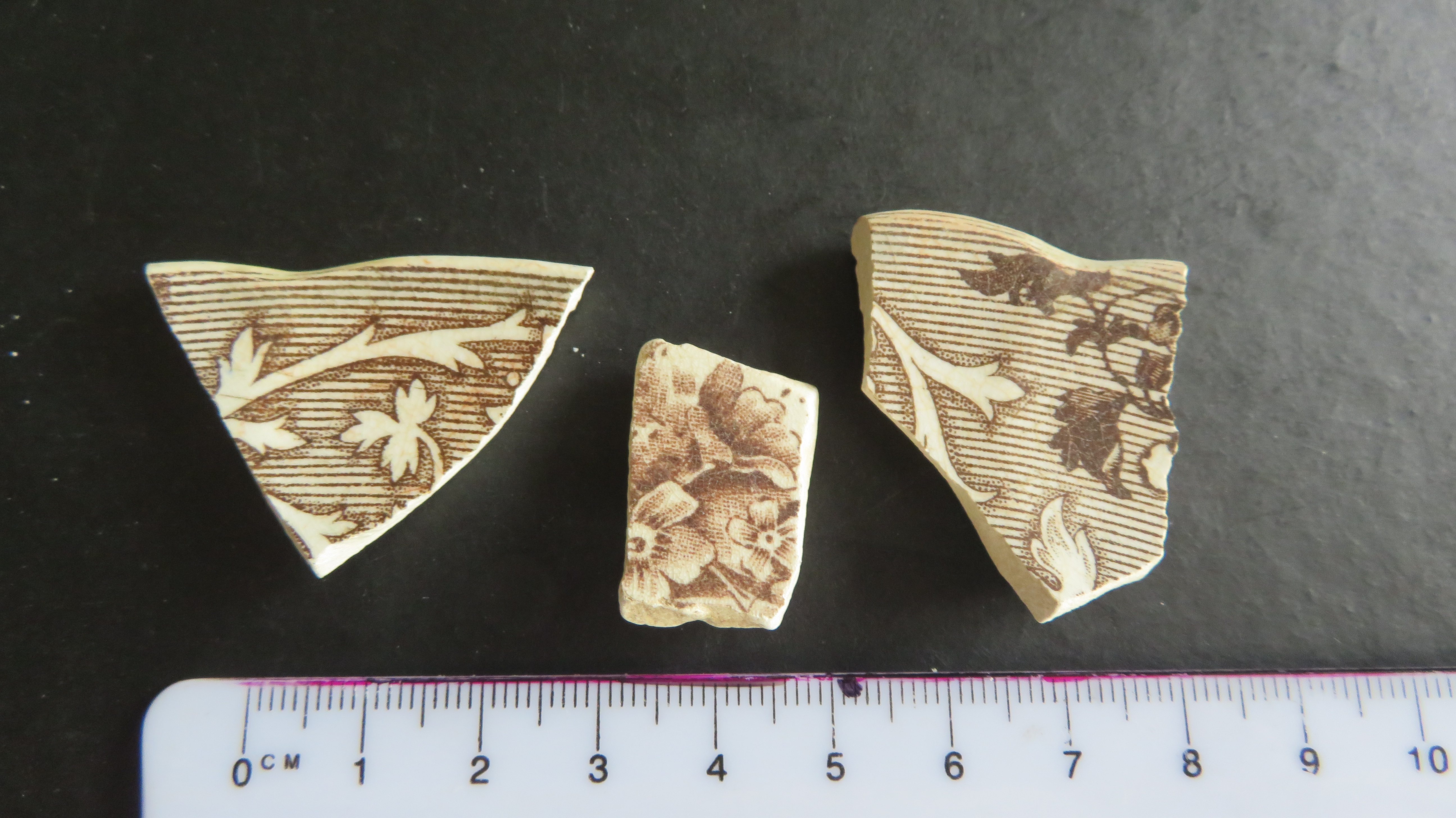
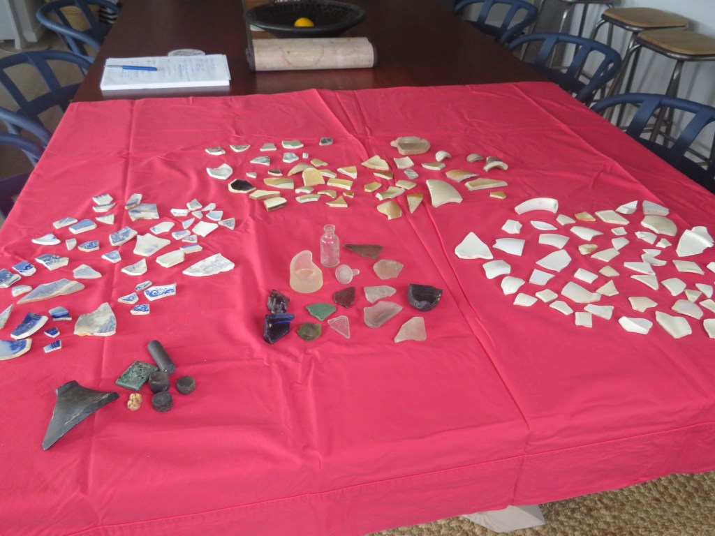
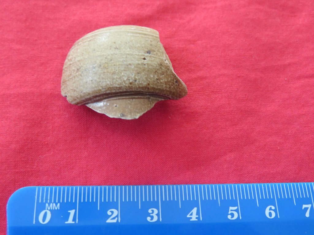
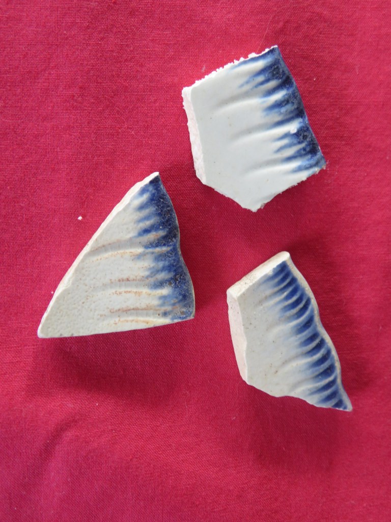
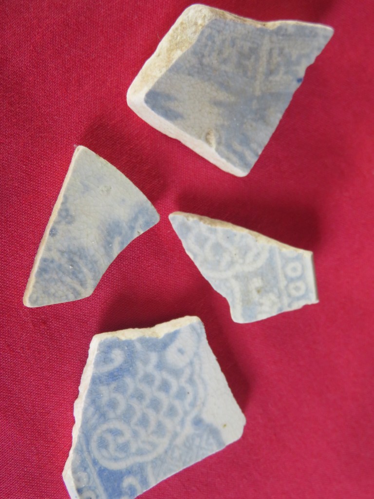
There is a total of 1.7 kilograms of ceramic sherds in the collection which equates to two hundred and twenty-three sherds. For ease of assessment I divided the collection into four groups; whiteware, blue and white, stoneware and others.
The total number of sherds found on the foreshore laid out in their groupings.
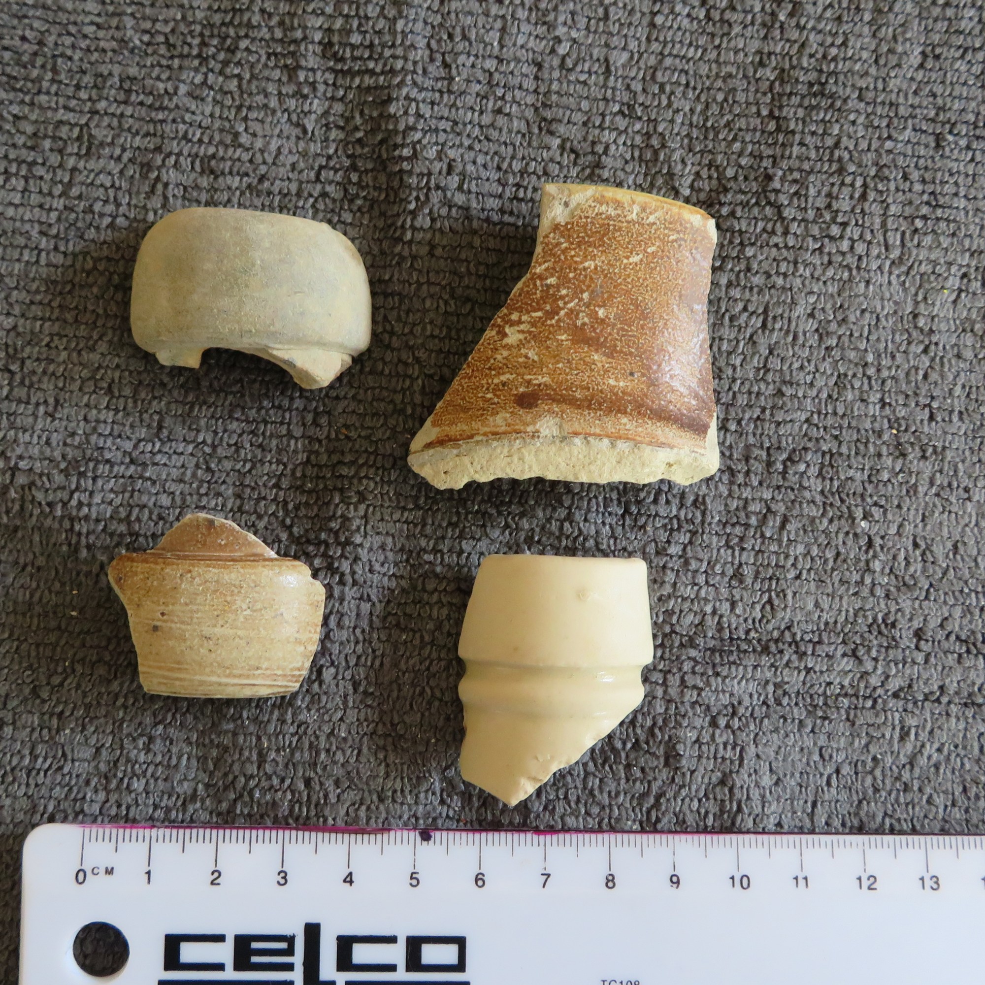
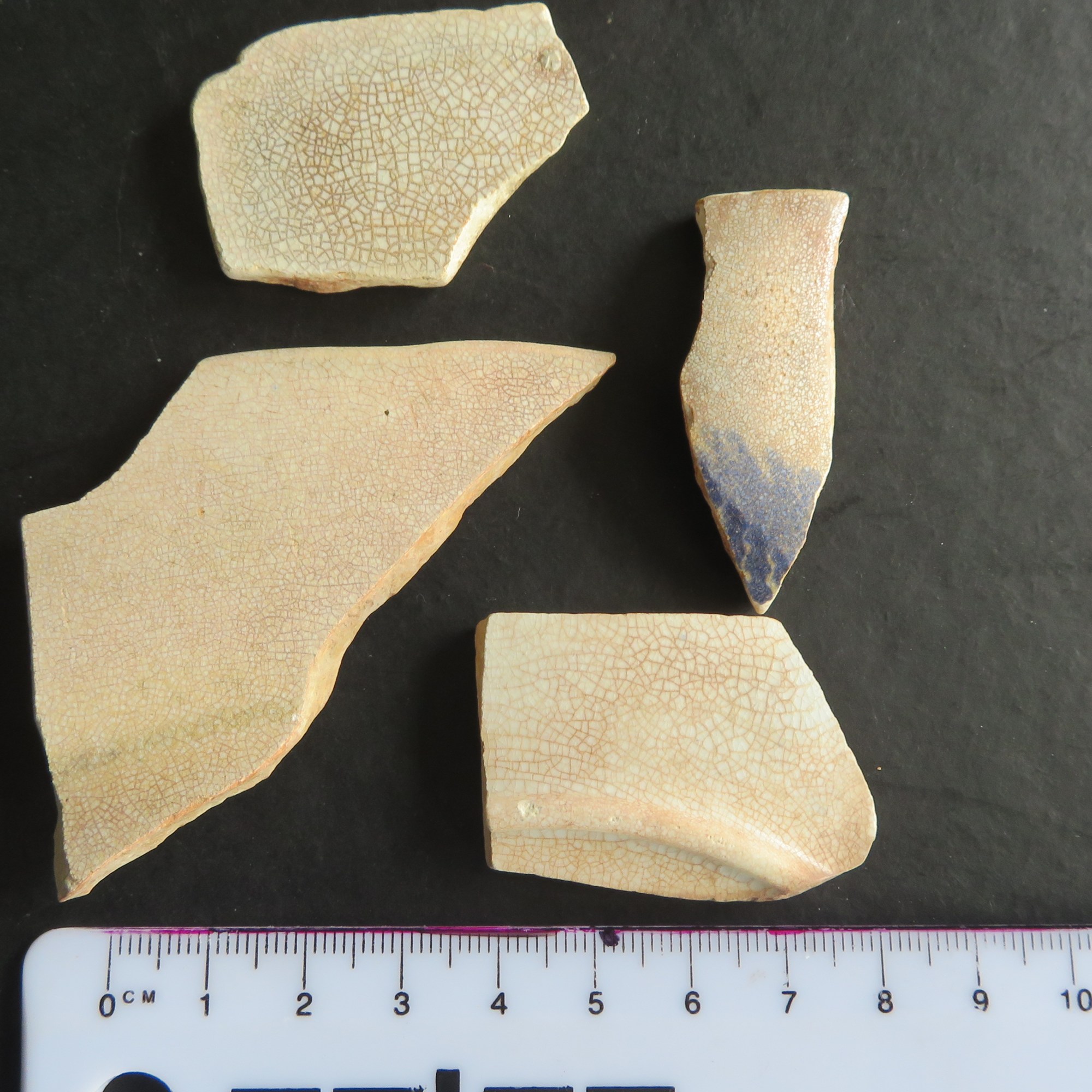
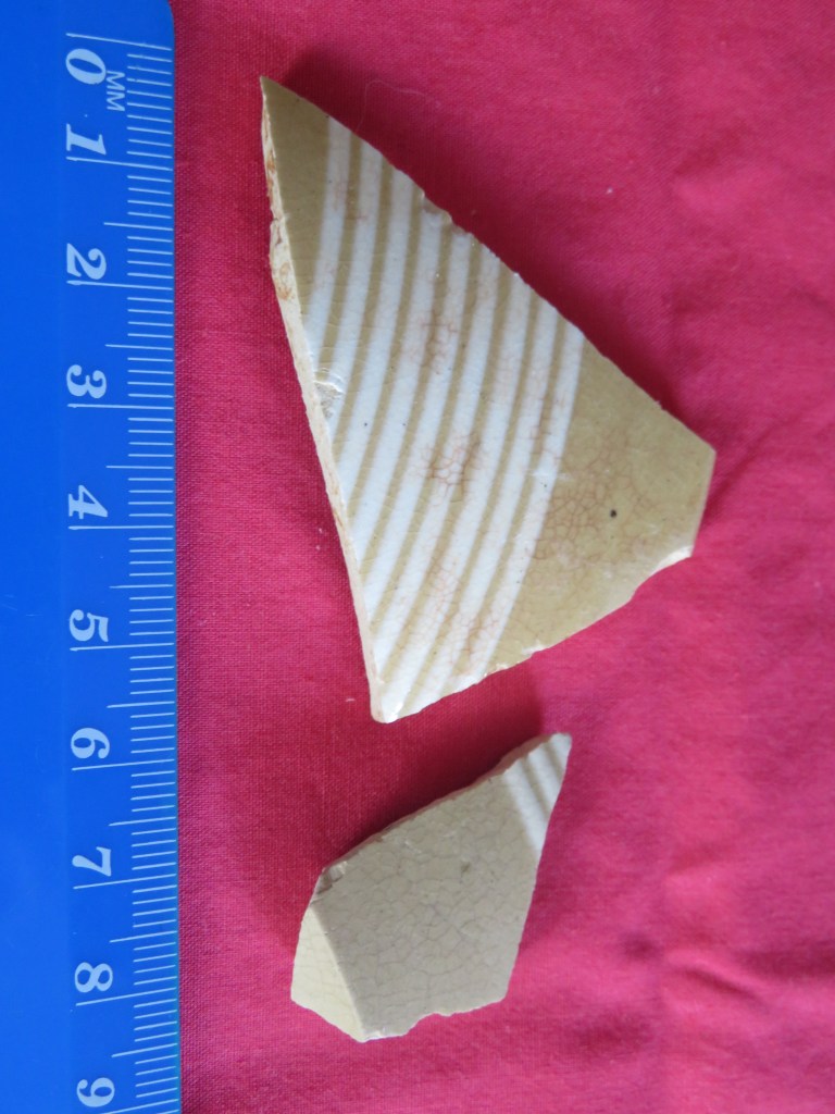
Whiteware
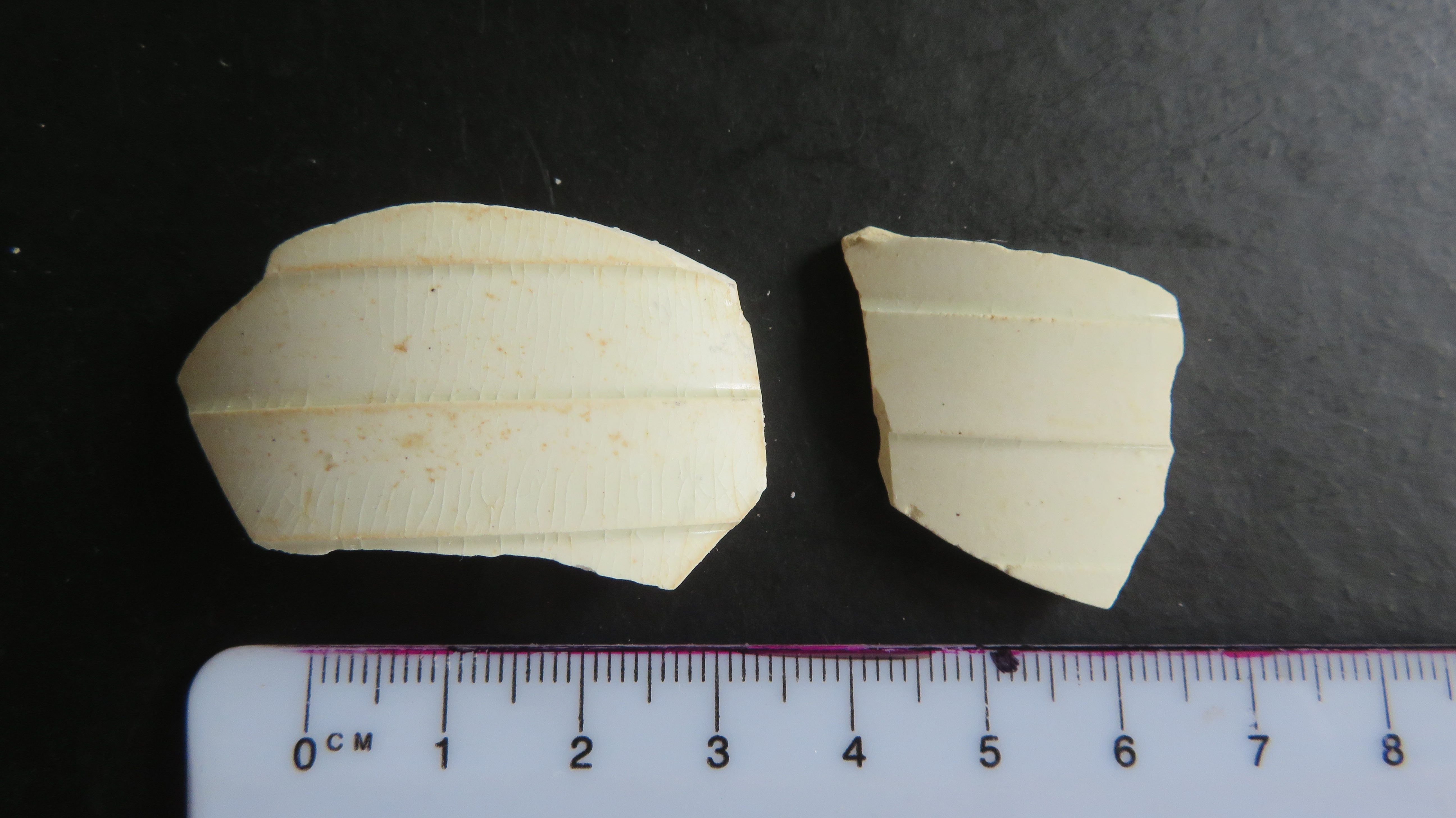
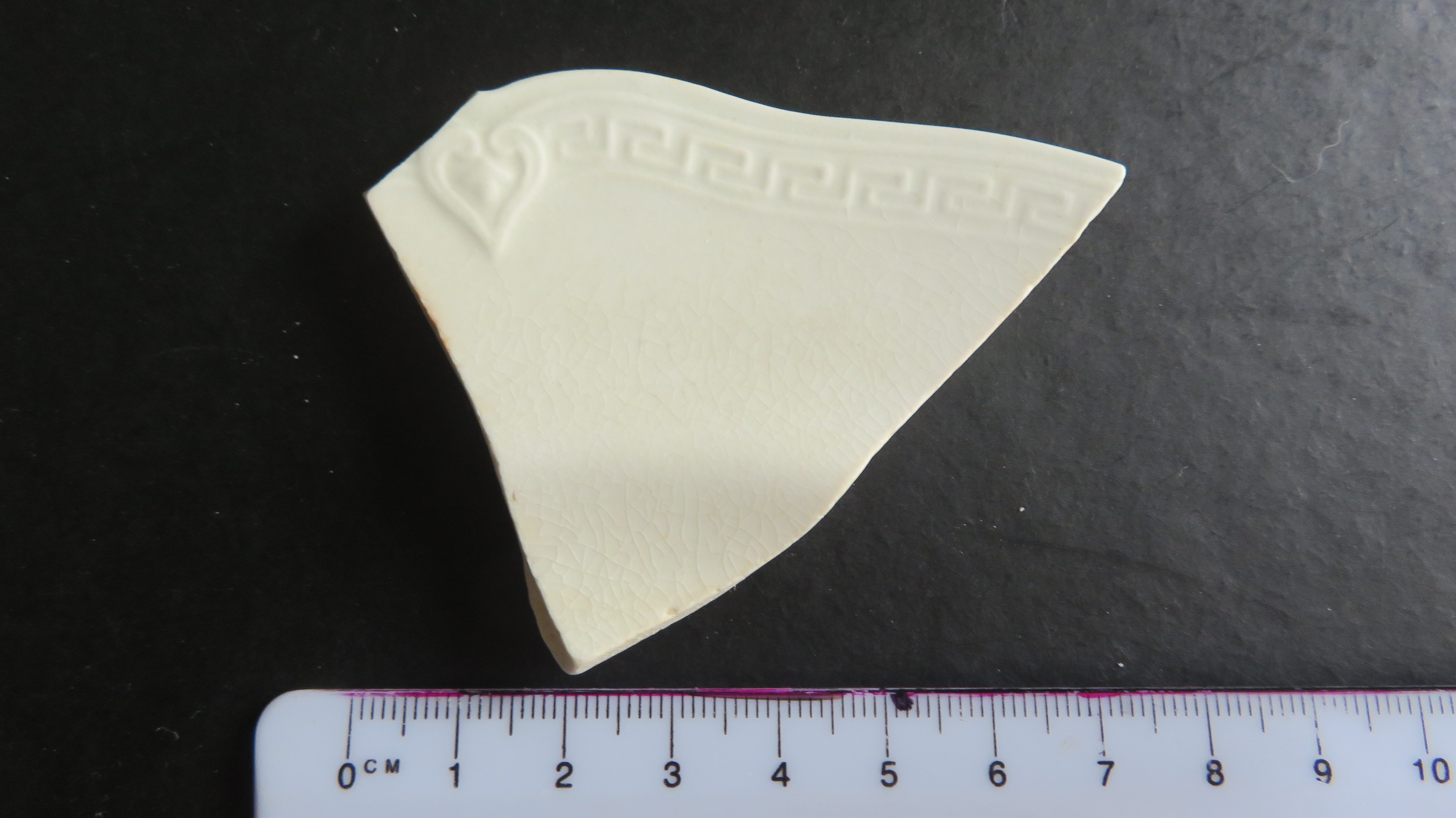
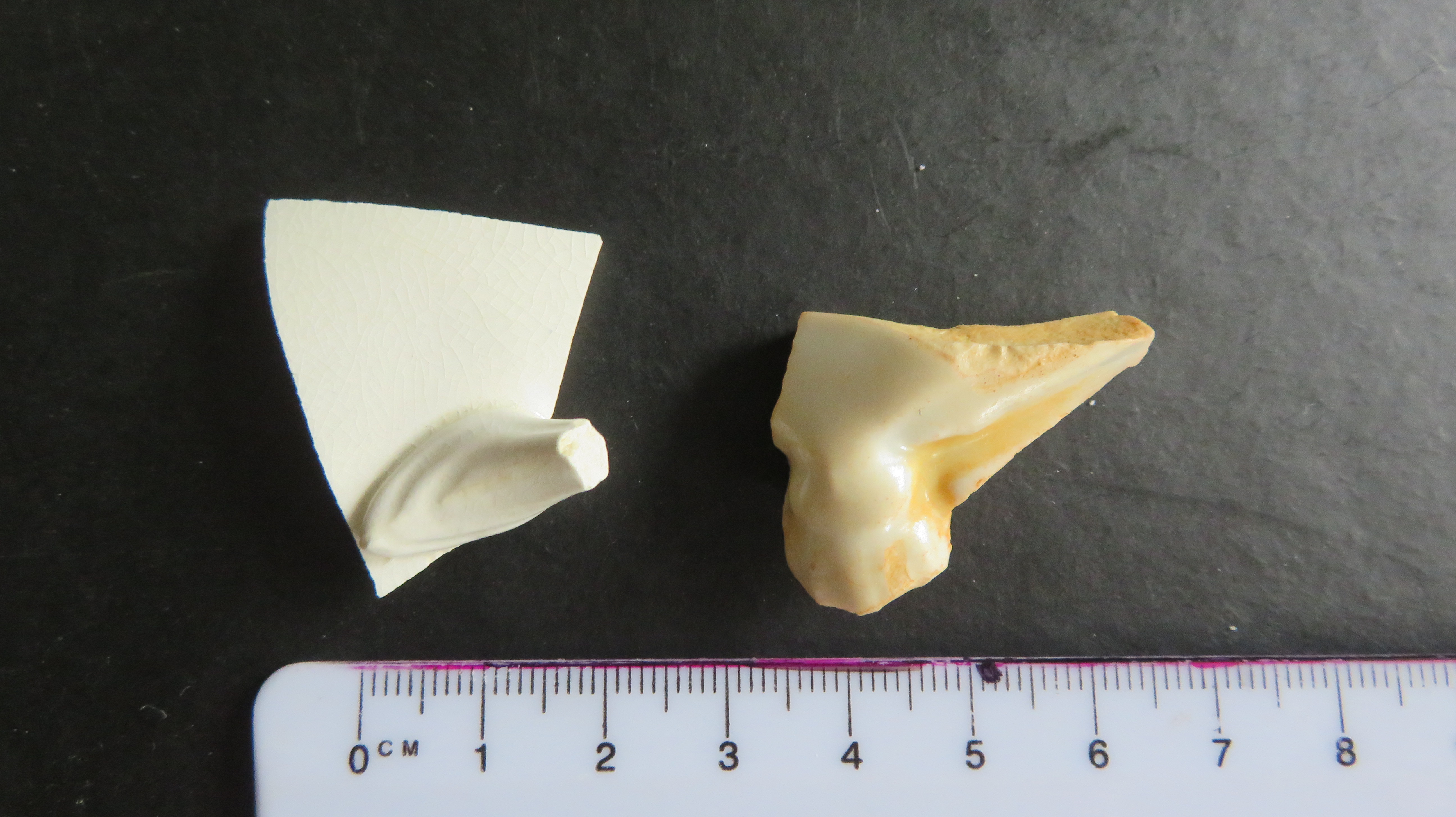
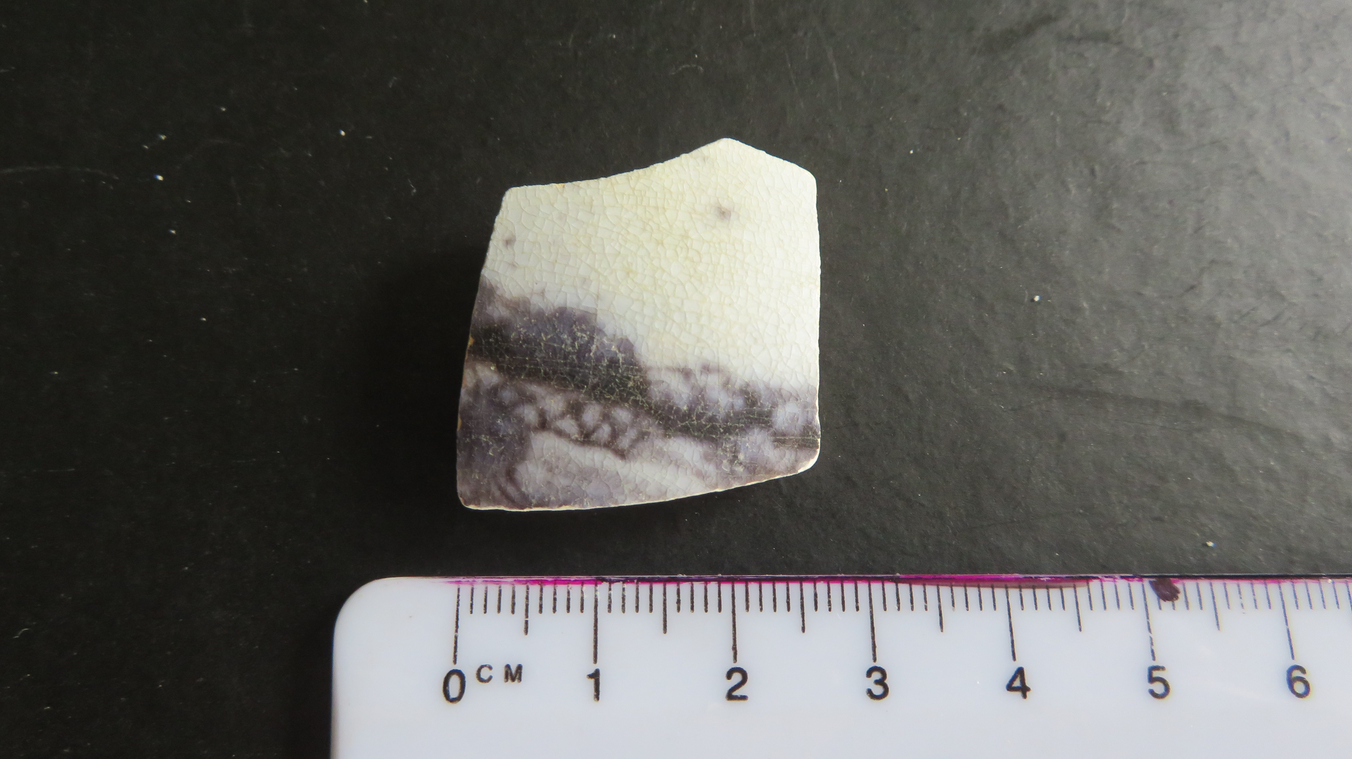
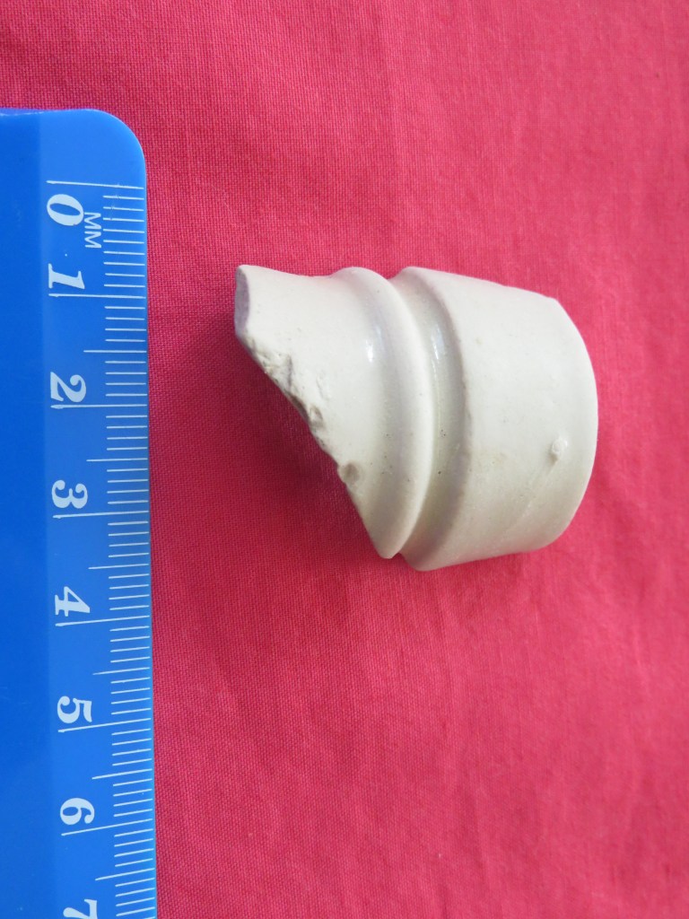
This group is so named not because of the fabric type but simply because it consists of plain and generally undecorated sherds of a white and in some cases yellowy colour. Of the seventy individual sherds twelve represent vessel bases and fifteen vessel rims. Two rim sherds had molded decoration as did two body sherds. There was a single large handle, most likely from a teapot, in addition there was body sherd with the base of a fine handle indicating it came from tea cup. Two further sherds had a wide banded molded decoration. One of the more interesting pieces in this group was the molded foot of a vessel (see picture).
Several pieces appear to be yellow ware – a type of pottery so named as a result of the clay used which turns yellow as a result of impurities in the clay. This particular ceramic type is mostly American in origin and had its peak of production between 1860 and 1870.
The vessels represented are mostly from plates, cups/saucers and bowls.
The date range based on fabric type for this group appears to be from the mid nineteenth to the mid twentieth century.
All of the whiteware group.
Stoneware
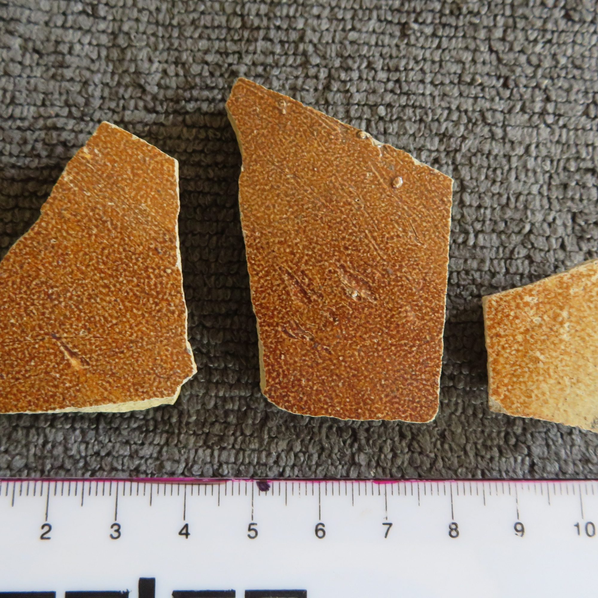
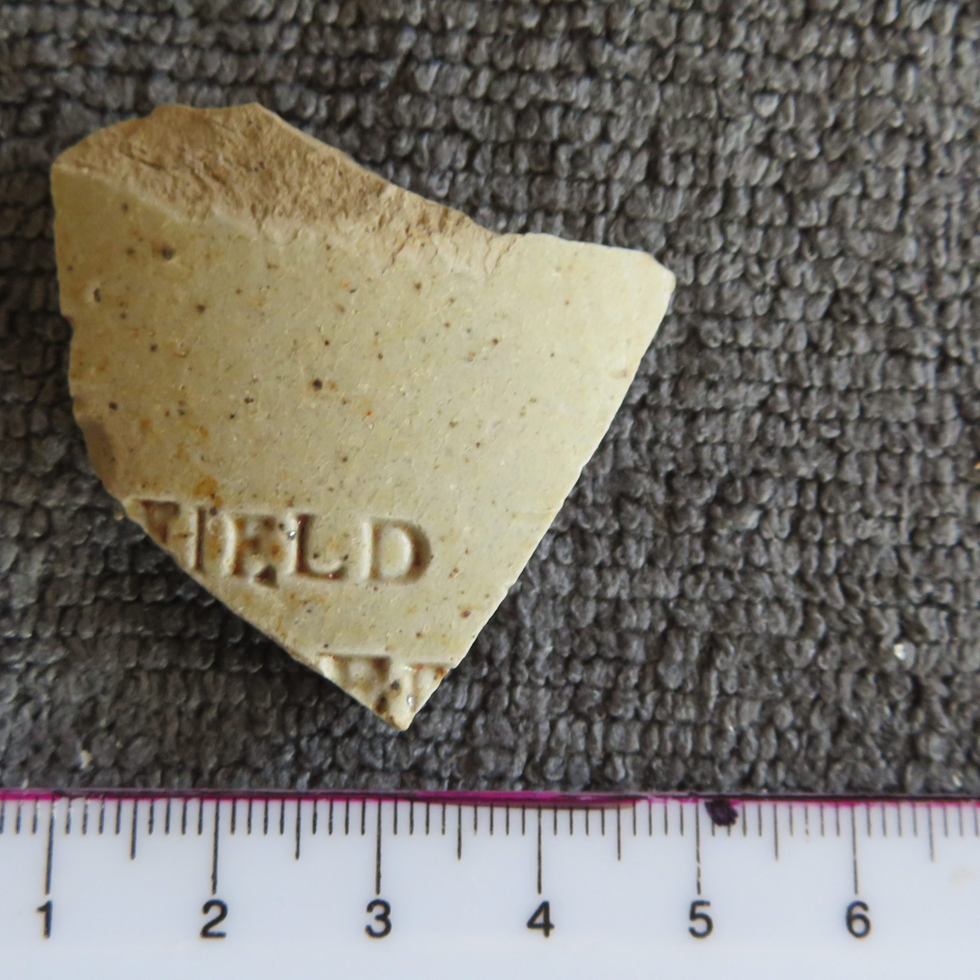
Stoneware refers to a type of pottery fired at high temperatures (1200degrees Celsius) which then becomes non-porous through vitrification and therefore any glazing is purely decorative. Generally, this type of ceramic is used to bottles (ie ginger beer), jugs and large containers.
In the group found at Fitzpatrick’s four were bottle rims (two of which are of a type found on ginger beer bottles), three represent the shoulders of large containers and two are bases, the remaining eighteen are body sherds. There are approximately sixteen vessels represented.
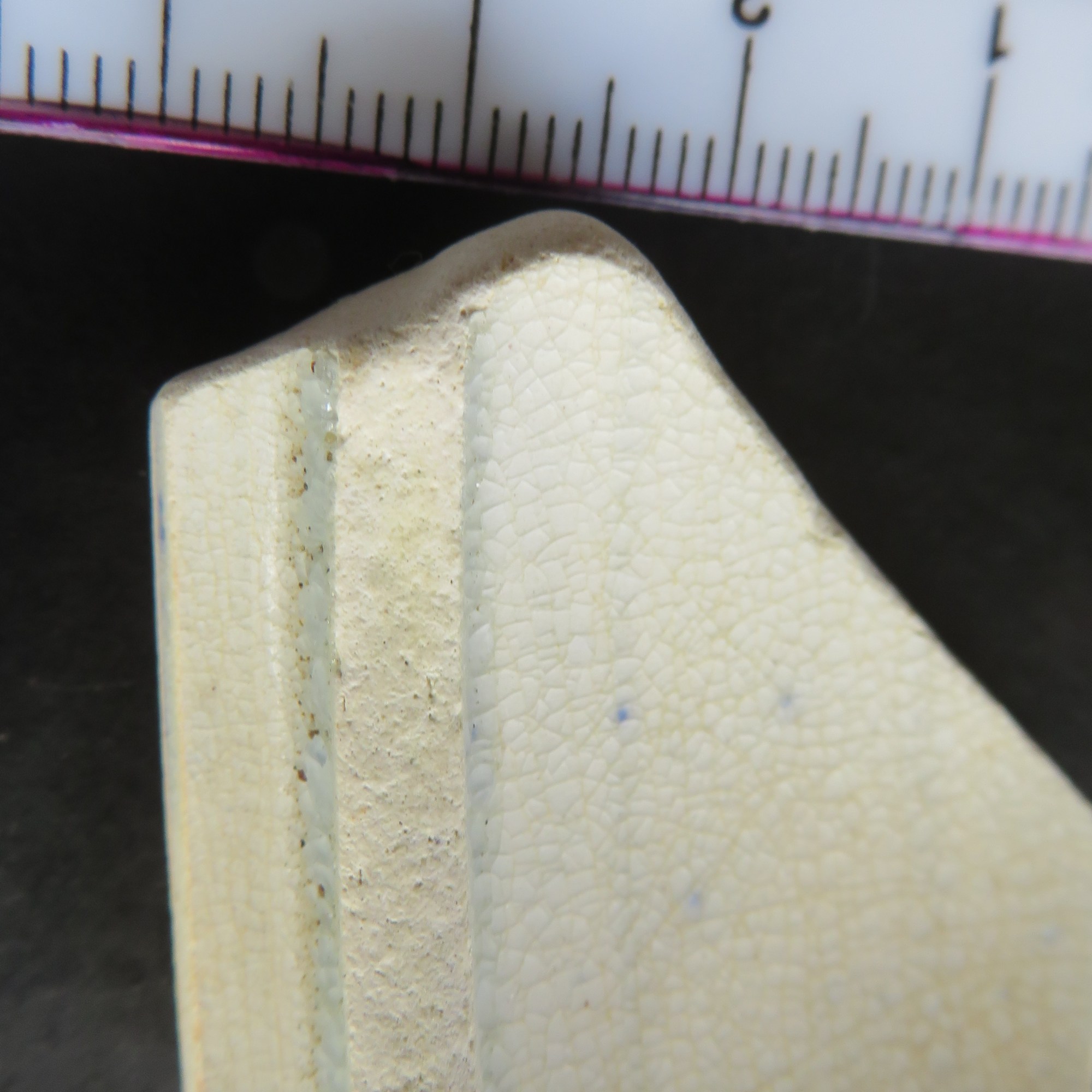
Fabric types range in colour from a creamy brown to medium grey; the sherds range in thickness from 3.5mm – 13mm.
Only one has part of name stamped on the exterior – ‘…FIELD’
The total range of stonewares.
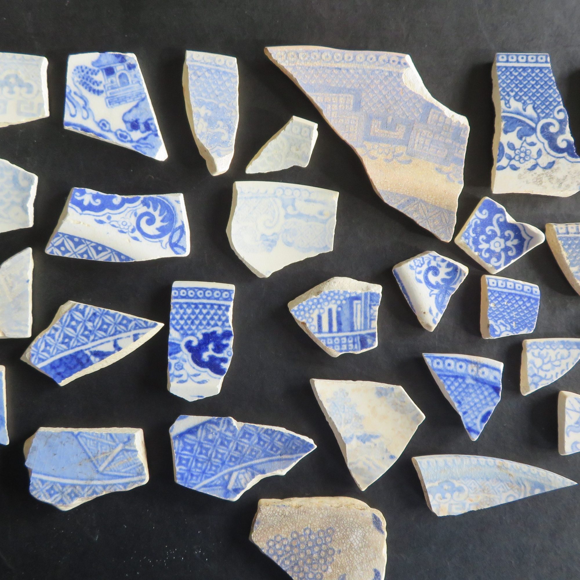
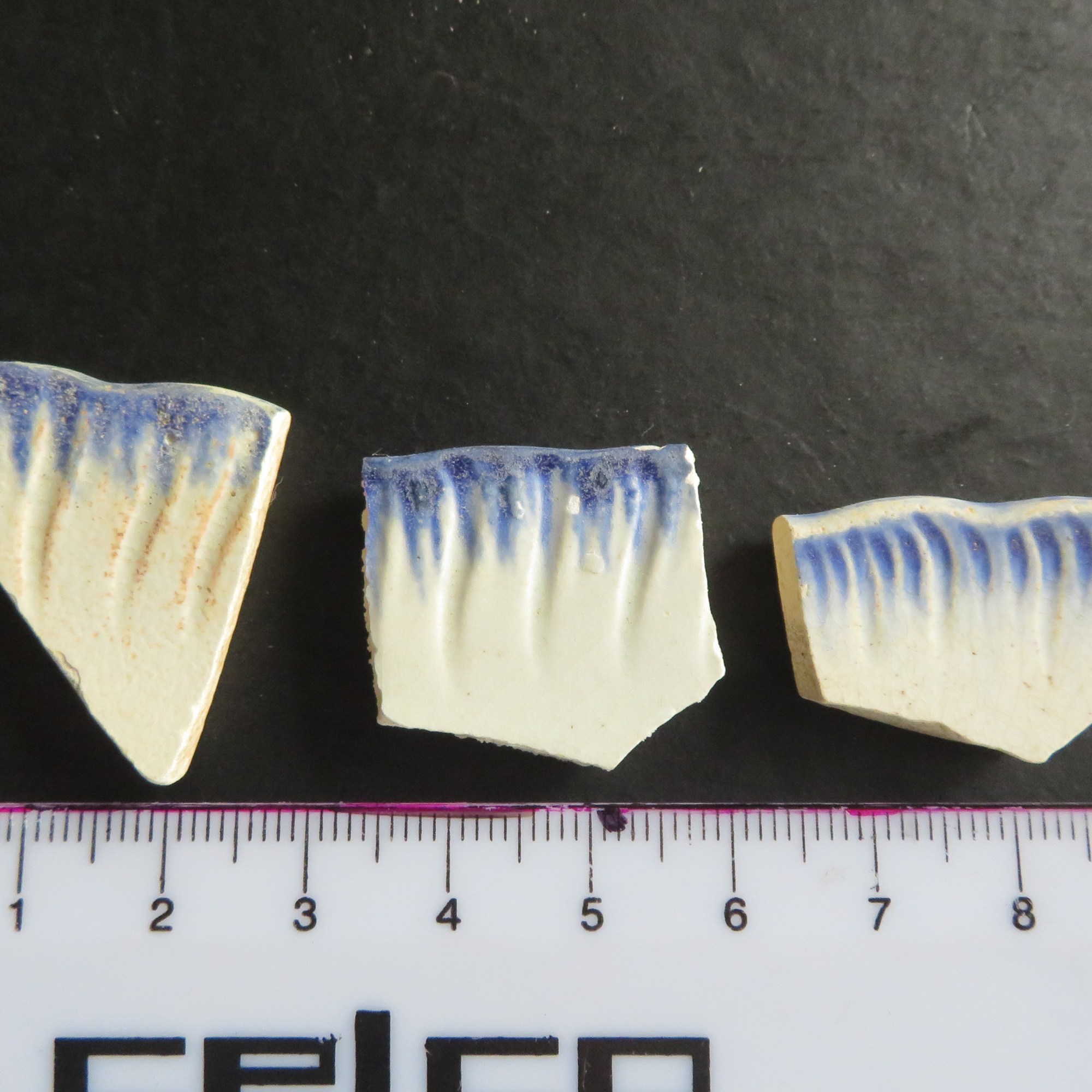
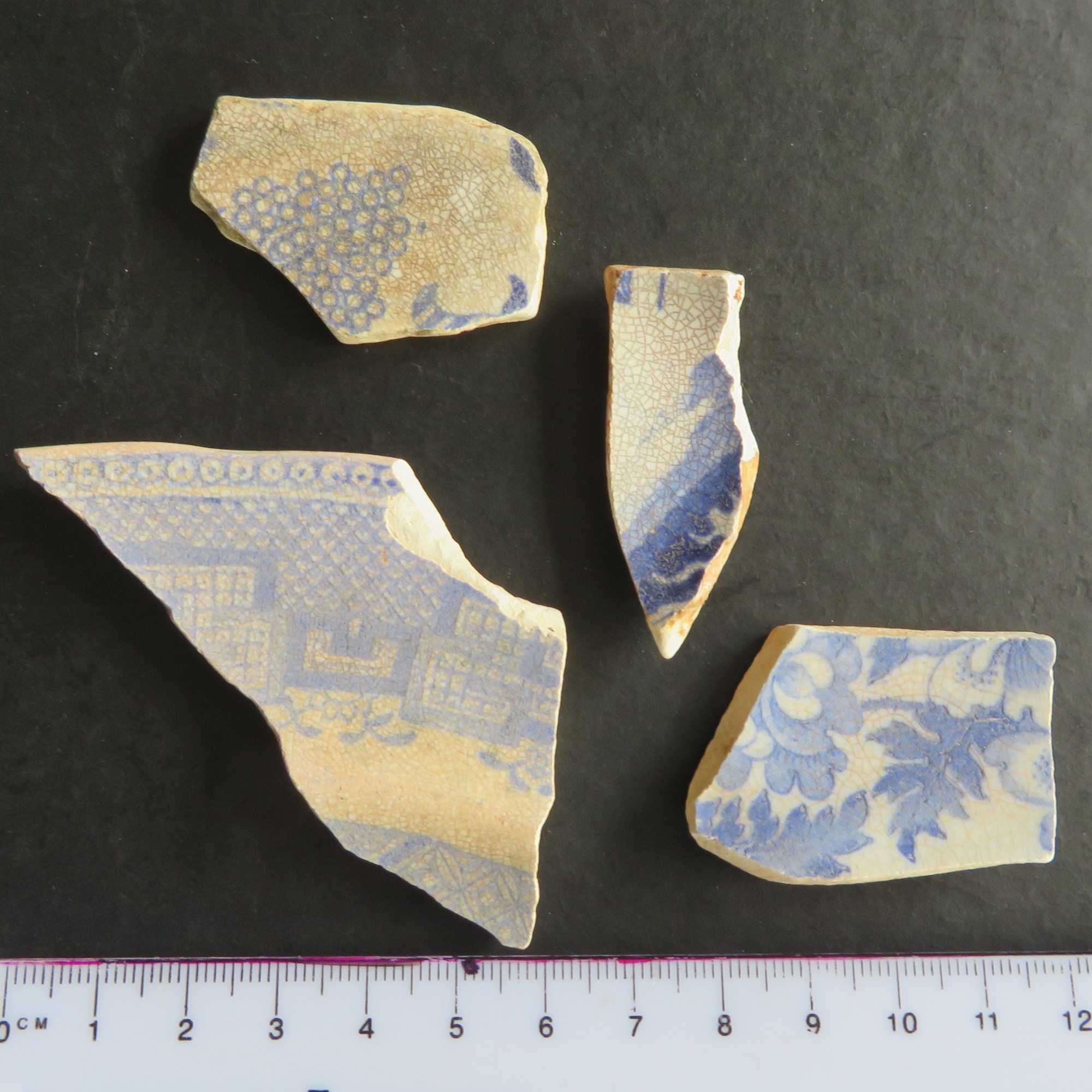
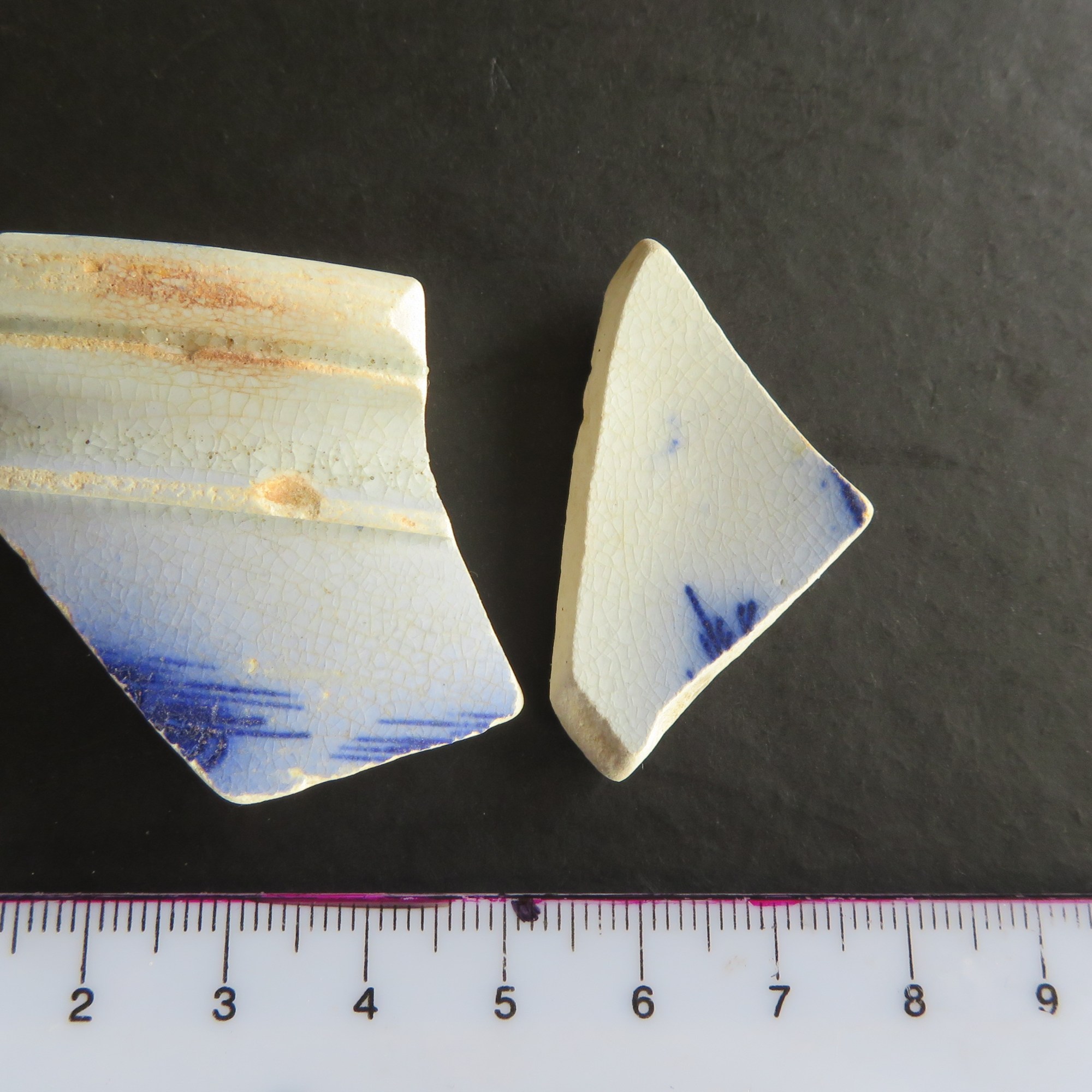
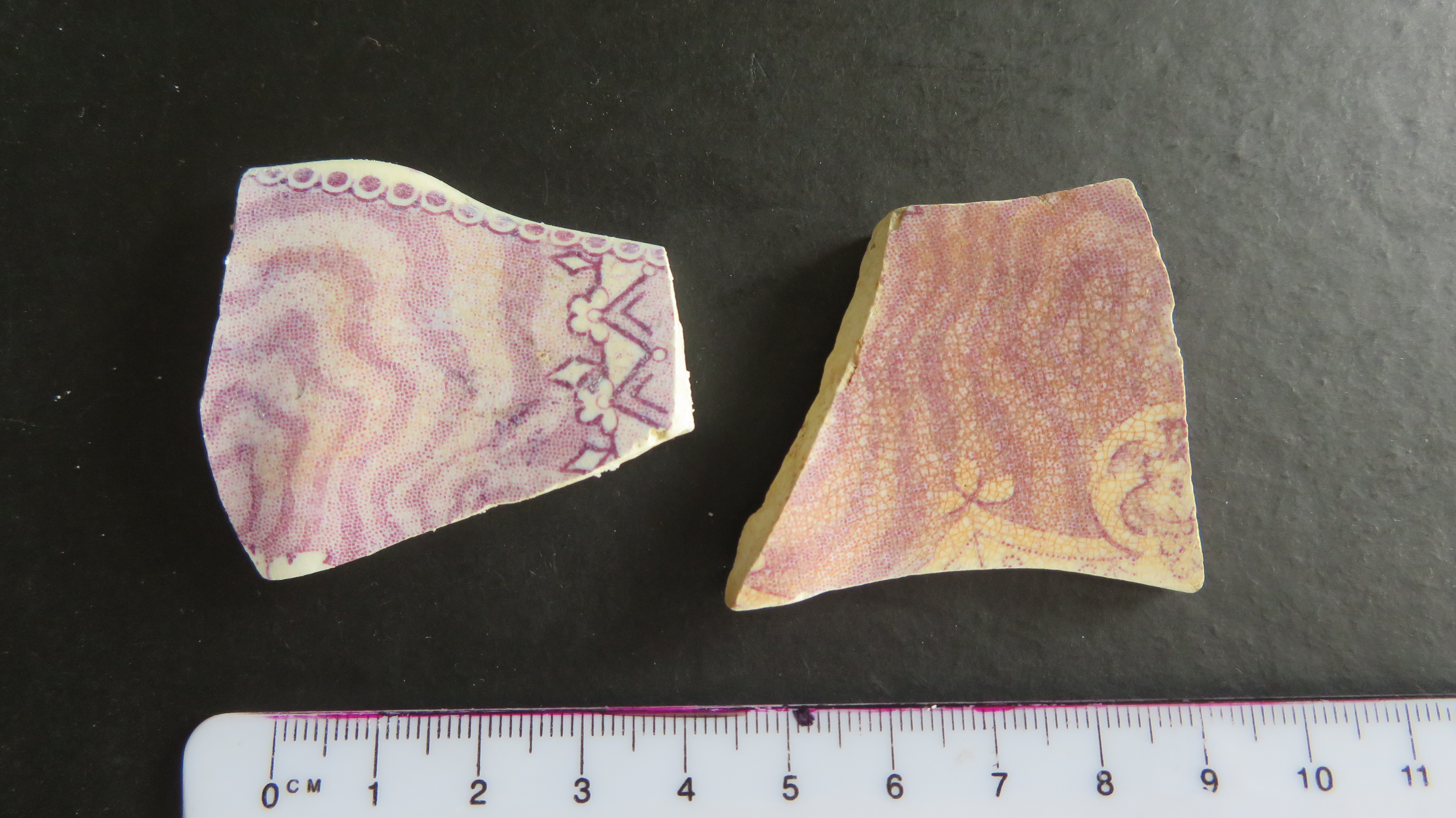
Blue and White
As the name would suggest this group consists of sherds which have blue and white decoration. Of the seventy-two sherds, twenty-two are rims pieces and eleven are bases. The majority of the sherds are transfer print, with the ubiquitous Willow Pattern being well represented (twenty-four sherds). Flow ware, a blurred transfer printing technique (1820-1900) is also represented (ten sherds) as is edge molded ware – feather/shell pattern (1830 – 1860).
Two sherds are possibly pearlware – indicated by a bluish concentration of glaze in vessel crevices. Pearlware was developed by Josiah Wedgewood in 1779 but was in decline by 1820. If these pieces are indeed pearlware it is possible they represent heirloom pieces and not an early date for settlement in the area.
Several pieces are heavily discoloured with much paler decoration suggesting an older date to the newer shinier looking sherds. In addition, there are several sherds with blue annular decoration most likely dating to the early 1900s.
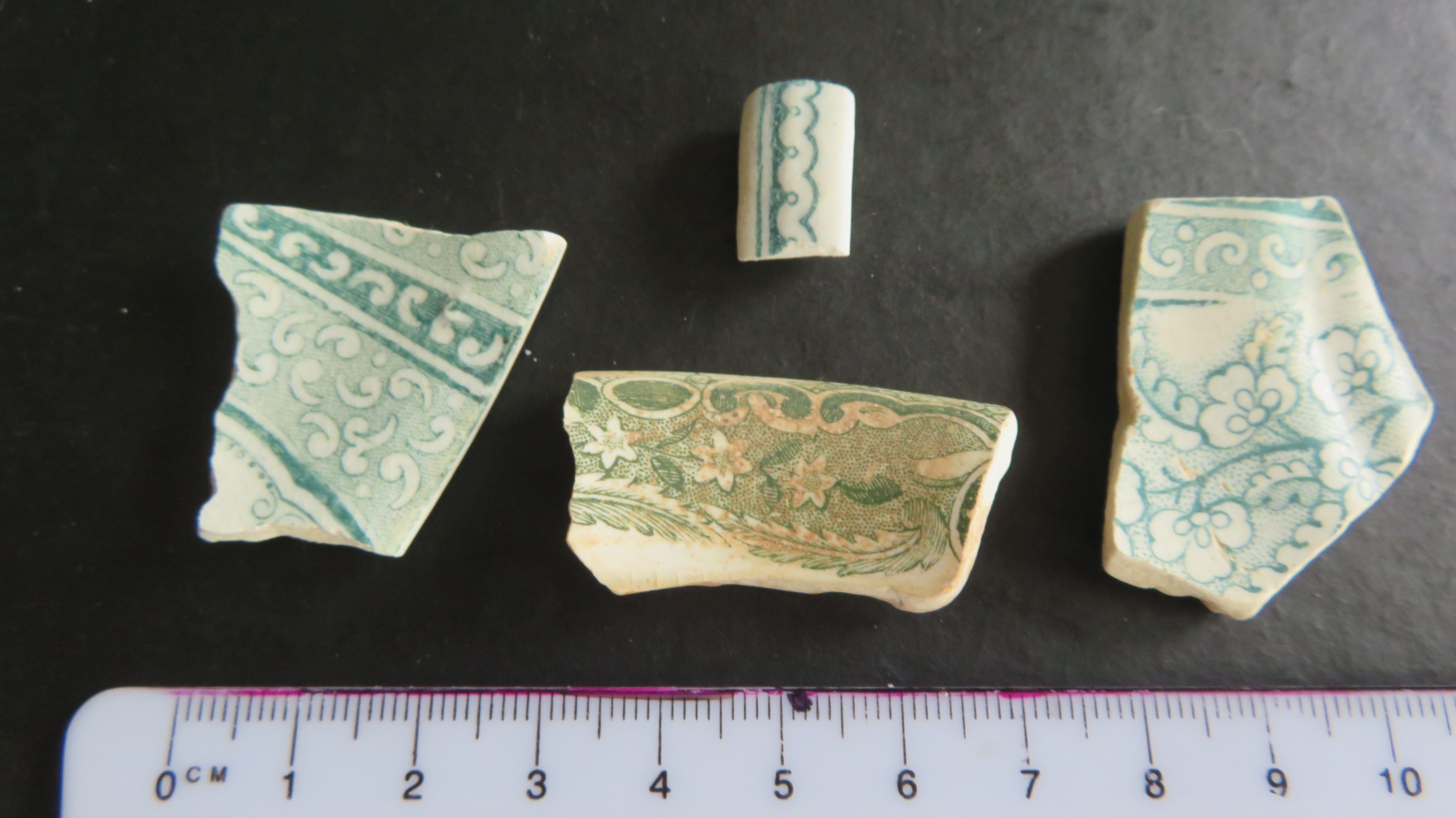
Other
This group is in essence all the other sherds that did not fit into the other three categories. There are fifty-four sherds in total of which almost half are of a type with yellow/green glaze, several with a white annular slip.
Of the remaining sherds; three are red earthenware with a yellow tin glaze, probably one vessel and most likely to be from a large mixing bowl; two, possibly three have mulberry coloured transfer print; six are green transfer print; three are brown transfer print; three have a black flow transfer print and the remainder have a single colour glaze suggest a mid-20th century date. The different coloured transfer prints were popular in the mid to late nineteenth century.
Conclusions
The study of nineteenth and twentieth century ceramic types is hampered by the huge variety present. Dating of the ceramics depends largely on fabric type and glaze. Generally speaking creamwares are earliest (1762-1800), followed by pearlwares (1775-1840) and then whitewares (1820 – ). For more information on the differences of these fabric/glaze types the following article is useful starting point – https://cartarchaeology.wordpress.com/2017/02/17/creamware_to_whiteware/
In a previous blog post I suggested that the earliest occupation of the bay was by a James Fitzpatrick and his family who settled and lived here from around 1840/50 – James tried his hand at anything and was at various times a farmer, a gumdigger and had a small brickworks on the edge of the beach. The earliest parts of the assemblage would corroborate an early occupation, such as the pearlware, the early transfer print and the shell-edge moulded ware. When the Fitzpatricks’ left the area is not known.
Following this time, the bay was rarely occupied until the late 1800s and early 1900s when the grassy area was utilised as a campsite during the summer months for Aucklanders wishing to get away from it all. There was at this time a caretaker’s house on the hill above the beach. Once again, the assemblage follows in these footsteps, with many of the sherds being of a type to be expected for the time and usage.
The small handful of mid twentieth century sherds goes some way to corroborate the local story of American soldiers being temporarily stationed in the area during WWII.
The vast quantity of sherds (note I have also perused the beach at nearby Kendall’s Bay, which was also used as a campsite in the late 1800s and early 1900s and have found only a fraction of the Fitzpatrick’s assemblage) and as only a small number are quite worn from being tumbled about in the sea it is fair to say the majority come from an unknown dump site, situated not far from the beach. There are two possible contenders for the dump site; the first is situated at the northern end of the beach and is heavily eroded away, a number of the sherds were found on the beach below this point. The second is at the southern end of the bay where there is a modern drainage ditch which may have cut through the dump serving to wash many of the sherds down onto the beach.
The likelihood is that both were in use at various times, the first one was perhaps in use by the campers of the late nineteenth and early twentieth centuries whilst the second which would be situated at the bottom of short sharp drop (typical of very early dump sites) dates to when there was a farmhouse on the hill above the beach as well as the later caretaker’s house.
I have had the privilege of being involved in archaeology in both the UK and to a lesser extent here in New Zealand. If you have read my bio you would know that I taught archaeology to University students and adult education students in Cornwall and here in NZ I am a volunteer with the archaeology department at the Auckland Museum.
Recently as part of the latter I was involved in a Bioblitz event on the Coromandel Peninsula. Over this three-day event first the local schools and then on the Saturday the community were invited to participate in a range of activities, mostly to do with the natural environment. Members of the Auckland Museum, DoC Rangers and prominent locals encouraged the children and adults alike to look deeply at the world around them.
For the first time the archaeologists were also involved and for our part we conducted a mock excavation on the beach for the school children as a way of engaging them in what it is that archaeologists do – it was an interesting experiment and it certainly brought to light an issue that is prevalent within the average New Zealanders mindset.
The mock excavation underway
At the beginning of each session the curator, Louise Furey, would ask each group what they thought archaeology was, ‘what do archaeologists do?’ And yes, you guessed it each and every group came back with, ‘digging for dinosaurs/fossils/treasure’. They can of course be forgiven after all they were just children and the forty-five minutes we had them with us was probably not enough time to get across the complexity that is archaeology.
However, what it did do was get me thinking – why is archaeology in New Zealand so invisible?
Even as a university student here in Auckland when people asked me what I was studying and told them archaeology/anthropology they either did not what they were or once again I would get the old, ‘so you dig up dinosaurs?’ It was frustrating in the least…
Moving to the UK, studying and teaching archaeology there was a completely different game. Archaeology in the UK does not need to explained, only the occasional person who thought they were being funny would mention dinosaurs and thanks to numerous tv shows (Time Team, Meet the Ancestors and others) it was much more main stream. As a teacher of adult education there was no end to those who were keen to learn about archaeology and when I came back to NZ I attempted to start adult education classes in archaeology locally but the uptake was so small (3 or 4 at the most) that it was not viable. So why might this be?
I believe ultimately it comes down to people’s perception of the past and perhaps comparing NZ to the UK is not fair, the two countries have vastly different histories but I do think we can learn something from the UK on how to promote the past as being a place everyone can visit and learn from.
I have on several occasions had people ask me if there was any archaeology in New Zealand – they are surprised to learn that not only is the answer is ’YES!’ but that is somewhere around 70,000 archaeological sites in the country, not bad for some 800 years of human occupation. Here is the problem, in comparing ourselves with other countries which have a much longer history we do ourselves a disservice, convinced that our past is not as exciting or as interesting as others we disregard it; archaeology, heritage, history take a back seat and in the case of archaeology become virtually invisible.
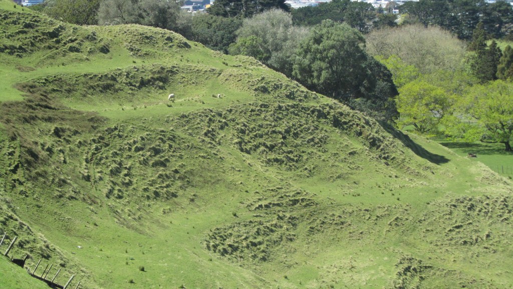
The humps and bumps of terracing on Maungakiekie (One Tree Hill, Auckland), a place of importance for the Maori of Tamaki Makerau and one of many archaeological sites in New Zealand.
Archaeology in NZ has for many years been the domain of professionals and academics which has in effect built a wall between themselves and the general public that was almost impossible to climb over. Changing perceptions takes time and this process has already begun with events such as Bioblitz and New Zealand Archaeology Week which actively involve and educate the public, the enthusiastic amateur. But there is still work to be done, education is vitally important and whilst we do not want people digging up sites (please do not do this, not only is it highly illegal and get you into a whole lot of trouble – about $50,000 worth of trouble – it is ethically wrong), we do want to encourage awareness, understanding and respect.
In a recent Heritage New Zealand newsletter, the Chief Executive Andrew Coleman stated
“Archaeology is one of the most questioned aspects of heritage. The questions are often negative and many highlight a significant misunderstanding on the important role archaeology plays in Aotearoa New Zealand.”
Why is archaeology important in New Zealand? In essence, because our oldest heritage can only be found beneath the ground and reading the evidence in a careful and controlled way is the domain of the archaeologist. Andrew Coleman titled his column ‘Archaeology – the unsung hero of history and heritage’ and he is right it is the unsung hero. Without it our picture of the past would be incomplete, there is only so much standing buildings, documents, oral histories and the humps and bumps of the landscape can tell us. Each are important individually but together with the archaeological knowledge a much more complete picture can be had.
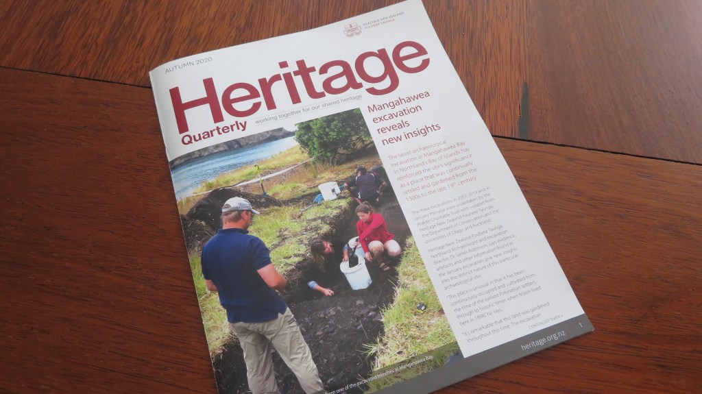
The March issue of Heritage New Zealand newsletter featuring the excavations at Mangawhea in the far north – one of several excavations which are helping us understand the lives of the first people to New Zealand.
It is the kiwi way not to blow our own trumpet but instead we wait for someone else to notice what we are doing and then tell the world – are we as archaeologists too shy to say ‘hey look at us, we’re important too!’ Perhaps we are just tired of the dinosaur jokes and the Indiana Jones references…Maybe it is here we could look to the UK and the way in which archaeology has connected to the media (Daily Mail headlines not included). Television in particular has played a significant role in awakening the public archaeological interest but it does require the archaeologists to join in. There have been several interesting albeit short lived tv shows here in NZ that have attempted to follow in these footsteps and had the potential to show the masses our unique and fascinating past.
In my own rather humble opinion awareness of archaeology in this country begins with education, not just at university level but at primary and high school. Archaeology is after all one of those subjects which encompasses all aspects of the school curriculum regardless of level. Maths, English, geography, biology, chemistry, physics, geology, environmental science, economics, statistics, computer studies, art, history, technical drawing, photography and more are all subject’s archaeology includes in its parameters. So why isn’t it being taught as a part of the school curriculum, to our children who are the future custodians of our heritage? More specifically why isn’t New Zealand archaeology being taught to our youngsters?
We often encourage our children to be themselves, to not compare themselves with others, to accept their unique points, to celebrate that which makes them different. Perhaps it is time we started doing the same to our past, to celebrate not just the parts that are visible but that which is unseen and underground, to say cheers to the archaeology!
Addendum – I am sure there are some who might read this article and say why would I care, after all I did leave New Zealand to study and work in the UK and that would be fair to ask. At the time of finishing my BA at Auckland University in the mid-90s, I could see that opportunities for me would be limited, this combined with a desire to travel (it’s a kiwi thing) and a long-standing interest in British archaeology it was only natural for me to head overseas. But I have been back now for almost fifteen years watching from the side lines and my enthusiasm and love of the subject has not waned. It does not matter where I am, for myself it is the understanding of the past that matters and archaeology is central to this.
Originally written for the now defunct Mythology Magazine I am unsure if it was ever published…anywho…let this be the first in an A-Z of Maori legends, stories and myths.
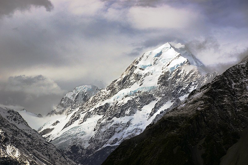
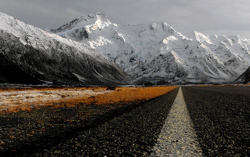
At 3,724 metres* Aoraki is New Zealand’s highest mountain. It sits amongst the Southern Alps which in turn form the backbone of the South Island of New Zealand. Regardless of where you travel in the world there will not be a landscape feature without a story and Aoraki is no different, even if there are a couple of different versions of the story.
The myth of Aoraki is connected to a vast array of creation myths the Maori have to explain the land they found themselves in. In most cases the myths and stories of creation have the same essentials but it is often the details which differ depending on whom you talk to and where in New Zealand they are from. This can make the study of Maori mythology a little complicated.
In the beginning Aoraki was not a mountain, he was a man, the son of Raki* the sky. In creating the world Raki married Papa, the earth, and they had many children, which is a tale for another time. Now as it happened Raki had children from another earlier union and as we all know children from previous relationships can make life difficult for the new partner. Some of these children came down from the sky in a giant waka (canoe) known as Te Waka-a-Aoraki. Their names were Aoraki, Rakiroa, Rakirua and Rarakiroa and they wished to inspect their father’s new bride.
When they arrived they found Papa lying in the ocean, a huge landmass, they sailed around her, poking and prodding until they got bored and then off they went exploring into the vast ocean hoping to find more land but all they found was more ocean. Feeling somewhat disappointed they decided to return to the sky. However, the ritual chant which was needed to send them home was performed wrong* and their waka began to sink, turning to stone and earth. As it sank it heeled over leaving the western side much higher than the eastern side. The four sons of Raki climbed onto the highest side and turned into mountains with Aoraki the eldest becoming the tallest mountain with his brothers by his side. The European names for these mountains are Mt Cook (Aoraki), Mt Dampier (Rakiora), Mt Teichelmann (Rakirua) and the Silberhorn (Rarakiroa). For the local iwi (tribe) of Nga Tahu Aoraki is the most sacred of the ancestors, its physical form provides a link between the supernatural and nature.
A long time passed with the mountains watching and waiting, eventually a man came to the land, his name was Tu-te-raki-whanoa and his task was to prepare the land for human habitation. In the north-east where the prow of the canoe had fallen and broken into many pieces forming the inlets and islands we now know as the Marlborough Sounds, he left alone. But on the east coast he built up the land at Banks Peninsula and his assistant formed the Kaikora Peninsula. He also planted the land with vegetation.
In much later times it was believed he would visit the east coast on occasion usually in the company of Takaroa. They would appear as whales in the estuaries and river mouths and their presence was considered to be an important omen.
There is an alternative to this story, in which it is Maui – he who fished up Te Ika a Maui (the North Island) – who was not only a descendent of Aoraki but it was his task to sail around the waka that Aoraki had left and make it safe for people to live on. Some even say that the whole of the South Island is Maui’s waka and not Aoraki’s. Some even go so far as to dispute the whole myth of Aoraki by saying he was a part of the crew of the Araiteuru which was wrecked and he was turned to stone along with his companions. These alternative storylines do not originate with the Nga Tahu and it could be suggested are a case of Chinese whispers where the story has become distorted as it travels further away from the source.
*Aoraki was previously measured as being 3,754m but a landslide triggered by the movement of the Pacific and Indo-Australian plates knocked off a few metres from the top.
One eye slowly opened and gazed out onto a
world barely recognisable.
Soon, whispered the wind.
The
word rolled around in his awakening mind.
Soon, whispered the wind.
The
morning bell jangled across the playground, children scattered to their
classrooms, some with an enthusiasm that can only come with being new to
school. Others saunter slowly; after
all, what’s the rush, school sucks…
Eventually, Tapuhi Primary settles into its morning routine. In room six Mrs Foster calls the role, ten
eager faces, arms and legs crossed, fighting the urge to fidget on the rough carpet
tiles.
“Well,
today we have some special visitors. As
you know all week we have been learning about the stories and traditions of Aotearoa.
Today we are going to learn about taniwha. Who can tell
me what a taniwha is?”
Ten
eager hands shot into the air.
“Yes
Samantha?” Mrs Foster smiles.
“ A taniwha
is…a taniwha is a kinda’ monster, like a really big lizard that lives in
rivers and lakes and is really scary and likes to eat people!” The words came out in a rush, nine heads nod
knowingly in agreement.
“Yes,
you could say that, Samantha. But there
is much more to taniwha then just eating people and being scary. After morning tea we will be having a visit
from The Aunties,” ten little hearts leapt into ten little mouths – The
Aunties!
Everyone
had heard of The Aunties, most were related to them in some way; everyone
listened when they spoke and did as they were told. Except old Dave who ran the only garage for
miles around, but then he was scarier than The Aunties. The arguments between old Dave and The
Aunties were the stuff legends in themselves.
Never mind the taniwha!
The
morning flew by quickly. Morning tea
came and went in a flurry of biscuit crumbs and half eaten fruit. As the children rushed back into class The
Aunties were already there greeting each child by name. The result was instantaneous, the children
silently taking their places on the story mat and Mrs Foster briefly wondered
if there was any way of bottling that effect…
“Everyone
please welcome The Aunties to room six.”
“Kia
Ora Aunties,” said room six in a sing song unison.
“Kia
Ora children, thank you for having us here today. Mrs Foster has asked to come and tell you
about taniwha and we are happy to do this but first you need to tell us what
you know about taniwha,” said the Auntie in the middle.
An
uncomfortable silence ensued as the children looked everywhere except at the
Aunties. Speak to the Aunties? Who were they kidding? The slow tick-tock of the clock could be
heard as the Aunties sat watching the children, waiting patiently, still as
stone, their eyes missing nothing and just as Mrs Foster was just about to fill
the silence a tentative hand reached up.
“Thank
you Wiremu, what can you tell The Aunties about taniwha,” said a very relieved
Mrs Foster. There had been some raised
eyebrows in the staffroom when she had talked about asking The Aunties to
visit.
“Umm,
taniwha were creatures that lived near water and ate people?” said Wiremu
hesitantly remembering what Samantha had said earlier in the day, “and my dad
said they’re not real, just stories to scare people,” Wiremu finished quickly.
The
Aunties exchanged a quiet look, once more the middle Auntie spoke, “yes, sometimes
that is correct, the stories do sometimes tell of taniwha that eat people but
they also tell of taniwha who protected people too. Like the taniwha Tuhirangi who was Kupe’s
guardian and protected the canoes that crossed the Cook Strait or the taniwha
Pane-iraira who took the form of a whale and swam with the Tainui canoe from
Hawaiki.”
“So
they don’t eat people?” piped up Wiremu, his curiosity getting the better of
him.
“Ahh,
yes some do. The taniwha Tutaeporoporo he
would travel up and down the river eating people, in revenge for being badly
treated by the chief of that time.”
“Is he
still eating people?”
“No,
the great warrior and taniwha slayer Ao-kehu killed him.”
“How?”
“He
hid inside a hollow log…” Wiremu who was now thoroughly entranced began to
speak again, stopping abruptly when the Auntie held up her hand…“He hid
inside a hollow log, the taniwha smelt him and ate the log whole. But, Ao-kehu was clever and had taken with
him an axe which he used to chop first through the log and then through the
taniwha eventually killing him. Inside
the stomach of the taniwha they found two hundred of his victims”.
“Eww!”
went a collective noise from room six as they settled in for more.
The
hour and half between morning tea and lunch sped by as the children were held
enthralled by stories of taniwha, the good and the bad. There were taniwha who could shape shift,
there were taniwha who were sharks, whales, dolphins and giant reptiles and
even some who were enchanted logs or rakau tipua. There was some disbelief at the last but the
Aunties told the story of Humuhumu the guardian of the Ngati Whatua in the
Kaipara, he was a totara log drifting in a lagoon near the harbour.
“But
how do you know it’s a taniwha and not just some rotten old log?” Nine pairs of
eyes widened in alarm – questioning the Aunties knowledge? Unheard of!
The
three ageless women exchanged glances, “because Wiremu Collins, the log moved
against the current and if it was not a taniwha how could it do that?” Faced
with three pairs of eyebrows raised in a silent challenge, a red faced Wiremu
had no answer.
Later,
sitting on the hard asphalt of the playground eating warm sandwiches Wiremu’s
mind began to wander, thoughts of taniwha filling his young head.
“Let’s
go hunting for taniwha for real!” Wiremu’s words came out of the blue, as soon
as he said it he knew it to be a good idea.
His mates looked at him, shook their heads and carried on eating their
lunch.
“After school, we head down to the bush and
follow the track along the river. I bet
there is a taniwha down there somewhere.
We can pretend we are like the brave warriors from the olden days, it’ll
be cool!”
“But
Wiremu, what if we actually find one?” piped up one of the group.
Wiremu
smiled, “It’ll be ok, remember what the Aunties said, not all taniwha are bad eh?
And anyway Dad said they’re not real, just stories, come on…it’ll be awesome!” Wiremu’s enthusiasm was infectious and soon
there was mass showing of hands.
The
decision made there was no going back and Wiremu felt his insides clench, part
of him wanted to know what he was going to do if he actually found a taniwha
and another part of him told him not to be stupid they were never going to find
a taniwha because they were just stories – not real just like his dad said.
That
afternoon as the going home bell jangled across the school, messages were sent
home via brothers, sisters and cousins. Walking
out the school gates several curious adult eyes followed them, some smiled to
see the kids off on an adventure, better then wasting time playing video games
or watching the box.
Afternoon
sun filtered through the canopy, a bossy fantail followed them along the path
flitting from tree to tree, grumpy at being disturbed. The gurgle of the river calling them down the
track to their destination.
“Well Wiremu?
You’re the boss which way do we go? Up or down?” Asked one of the would-be taniwha hunters once
they arrived at the river.
Wiremu
looked up the river and then down, he had no idea. He closed his eyes. At first all he could hear was the rush of
the river, the wind in the tree tops and the calls of a tui, but then slowly he
heard it, thump, thump. A quiet heartbeat, he turned his head one way
and then another – thump, thump. Wiremu’s eyes flew open and walked off up
river, the others scrambling to keep up.
“Hey
wait!” yelled one of the others, but Wiremu had heard something and without
stopping to think his feet followed the sound that resonated up through his
soles.
Eventually,
little legs began to ache and puku’s rumbled as Wiremu’s relentless pace
continued. When the path became little
more than a goat track, the merry band of would be warriors mutinied. Wiremu however, was deaf to their pleas, his
head filled with the stories of brave and clever warriors, the thump, thump, beneath his feet calling
him forward.
“Wiremu! Stop!” they shouted, to no avail. This adventure was no longer fun.
“Come
on lets go back, Wiremu will be fine, it’s not like he’ll actually find a
taniwha,” one of the others spoke up.
The
bush fringing the creek was dense and yet Wiremu carried on, unable to stop no
matter how hard the bush tried to stop him.
Somewhere along the way he lost a shoe, kicking the other off when he
realised. The sharp stones on his bare
feet not slowing him. He knew he was
close.
Thump, thump, thump…
Eventually
the bush stopped getting in his way and a smooth path opened up before
him. Wiremu’s feet stopped moving forward,
his mind cleared and looking around for the first time he was suddenly very
aware. He was alone in the middle of the
bush, probably miles from anywhere. Where did everyone go? His brothers had always said he was a dick. Wiremu’s heart leapt in panic.
Looking
behind him he saw the dense bush and wondered how he had gotten through in the
first place. In front of him lay an easy
path, smooth, wide and gentle on young feet.
Come.
It
wasn’t long before the path came to an end at the edge of a deep dark pool, the
perfect place to find a taniwha. Wiremu
shivered. The bush eerily silent,
waiting, expecting. Wiremu stood at the
edge of the pool, his toes touching the cool water. Looking at his reflection, he saw himself, a
small scared boy, his chest heaving.
It is time.
Do taniwha eat people? Some do, some don’t
the
words of the Aunties echoed around Wiremu’s head. How
wrong was my dad, he thought as he watched mesmerised as the still pool began
to churn. The ground beneath his feet
shook slightly, belatedly he realised that his brothers were right, he was a
dick. I am a dick for thinking I could hunt taniwha, I am a dick for not
taking the stories of my whanau seriously and now I am a dick because I am
about to be eaten by one of those stories.
The warm
rancid breath of the taniwha tickled the back of Wiremu’s neck, inviting him to
turn around. Wiremu stood still as a
stone gazing in terror at his reflection churning at his feet.
Turn, would be warrior, turn and gaze upon
me, it is time.
Wiremu’s
heart almost stopped. Time for what?
The
iridescent blue of a kingfisher fluttered past settling on a branch hanging over
the pool. The kingfisher and Wiremu looked at each other, wisdom and knowledge
in its small beady eyes, hope. Words
filled Wiremu’s mind.
Ina te rua taniwha!
Pute ona karu
Murara te ohi!
Tau mai te po
Takina te whakaihi
Ki Rarohenga rawa iho
Moe ate Po
Te Po-nui
TePo-roa
Te Po riro atu ai e!
Wiremu stumbled over the words, nothing happened, the
pool still churned, he could almost feel the lick of a tongue. The kingfisher
looked at him head cocked to one side, try
again Wiremu, you can do better.
Deep breath, his eyes fixed on the bright blue bird, he repeated the
words again, stronger, louder. As he
finished, the churning pool subsided, the warmth at his back eased. Wiremu began to breathe once more.
“Thank
you.”
The kingfisher flew to another branch, Wiremu’s eyes
followed. There, below the kingfisher a
stepping stone path to the other side of the pool. He didn’t need to be told twice, crossing
quickly with wings on his feet he scrambled up the bank on the far side of the
pool. As he reached the top, he glanced
over his shoulder amazed that all was still and quiet again. It could have been a dream, but it
wasn’t. With a shudder he turned his
back on the dark pool – time to go home.
Three ageless ladies stood watching, silent witnesses. The words of the karakia still echoed around
the pool. Today had been a close
call. They had seen it in his face at
the school. He was the one. But not on this day.
Regardless of where you go in the world and what culture you
study, stories of dragons are a recurring theme within the stories of any given
people. Dragons abound everywhere and every time, even in our modern and
increasingly sceptical world the desire to believe is still strong. Take the stories of the Loch Ness monster or
the giant serpents of the Hudson River and other similar creatures that
periodically pop up all over the world. The Maori are no different, they too
have their myths and traditions involving dragons, of a sort, called taniwha,
who are intimately connected with the natural world.
Early drawing of waka – the double hulled waka were most likely to have been used for long sea journeys. (From Rotorua Museum, Wikicommons)
Taniwha are in essence supernatural creatures which can
appear in different forms, one of which is dragon-like giant lizard, but they
can also resemble sharks, dolphins, whales or even in some instances enchanted
logs. They can be the agents of good or
evil and sometimes neither. Every region
of New Zealand has a host of stories about their local taniwha, many of whom
came with the first explorers acting as guardians and protectors. Some are special people who have been turned
into taniwha upon their death and others are of unknown origin.
The Maori are descended from the first Polynesian explorers
who arrived in the land we now know of as New Zealand approximately eight
hundred years ago (give or take a few hundred years…) and there are often
similarities in the myths from certain parts of the Pacific, such as the Cook
Islands and Society Islands. However, the taniwha of Maori tradition have
evolved as a result of the unique environment these early explorers found
themselves in. New Zealand’s environment is very different from the island
worlds they would have come from. It is after all a much larger world of
mountains, deep forests with giant trees, fast flowing rivers and wild
coasts. Even today a person walking in
the bush can come across areas, secret places where you feel it would not pay
to tarry.
In Maori tradition the first people to arrive came on large
seagoing waka and many of the early stories relate to these ancestors and how
they adjusted to their new land. In the traditions the waka would be
accompanied by a taniwha who would be its protector, such as, Kupe’s taniwha,
Tuhirangi or the female taniwha Araiteuru who came with the waka Mamari. Though there are some traditions which say
she travelled with the waka Takitimu and another taniwha called Ruamono.
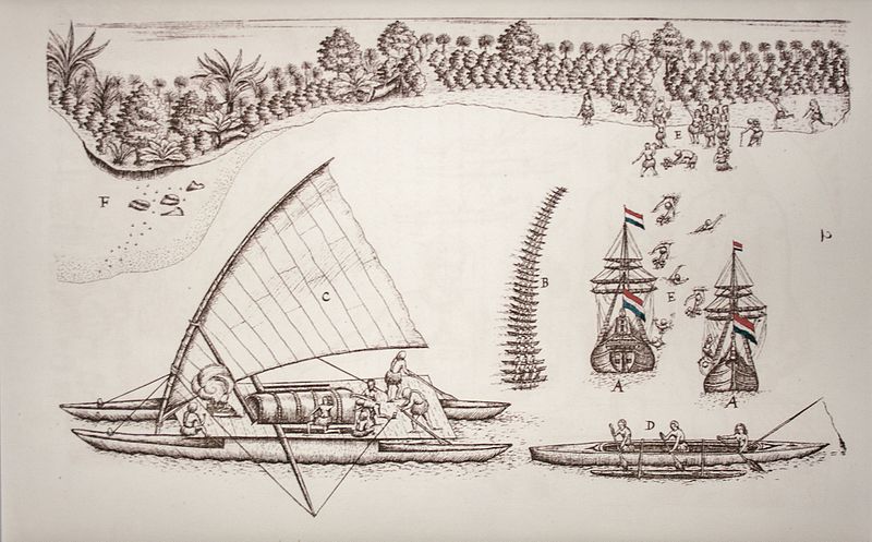
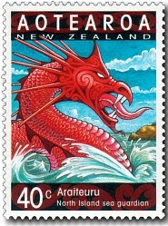
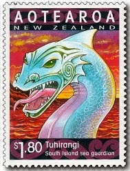
In the year 2000 New Zealand Post put out a series of stamps to celebrate the year of the Dragon; Araiteuru and Tuhirangi were part of this.
Araiteuru gave birth to eleven sons on arrival in New
Zealand, who all went digging trenches along the way, thus creating the
numerous branches of the Hokianga Harbour.
It is said that Lake Omapere was created when one of her sons burrowed
inland and thrashed his tail around. As
guardian of the Hokianga Harbour Araiteuru dwells in a cave at the south head
of the harbour, whilst her companion, Niua, lives in the north head of the
harbour.
The taniwha Tuhirangi is said to dwell in the Cook Strait
where Kupe left him to guide and protect waka as they crossed between the two
islands. Between 1888 and 1912 a Rissos
dolphin named Pelorus Jack accompanied ships travelling between the North and
South Islands. At the time, local Maori
believed this was the taniwha Tuhirangi in the form of a dolphin, guiding and
protecting ships in this dangerous stretch of water. A number of years later in the summer of 1955/56
another friendly dolphin appeared, but this time at Opononi in the far north of
the North Island. Nicknamed Opo, the
dolphin would play and interact with visitors and many Maori believed Opo to be
a guardian taniwha.
A grainy photo taken in 1911 of Pelorus Jack/Tuhirangi.
Tuhirangi and Araiteuru were part of a trio of important
taniwha, the third member of this group was a female called Huriawa. Her home is Te Waikoropupr Springs, Golden
Bay. She is regarded as brave and wise, travelling through the earth to clear blocked
waterways. The springs which are her
home are regarded as the purest form of water which both the spiritual and
physical source of life. The water is
often used for healing and in blessing ceremonies.
Another taniwha which accompanied the ancestral waka of the
Tainui from Hawaikii was the whale Paneiraira.
His name means ‘spotted head’ referring to his appearance. He was last seen in 1863 just before the war
broke out between the Maori and the newly arrived Europeans. It is said he came to warn his people of
impending disaster.
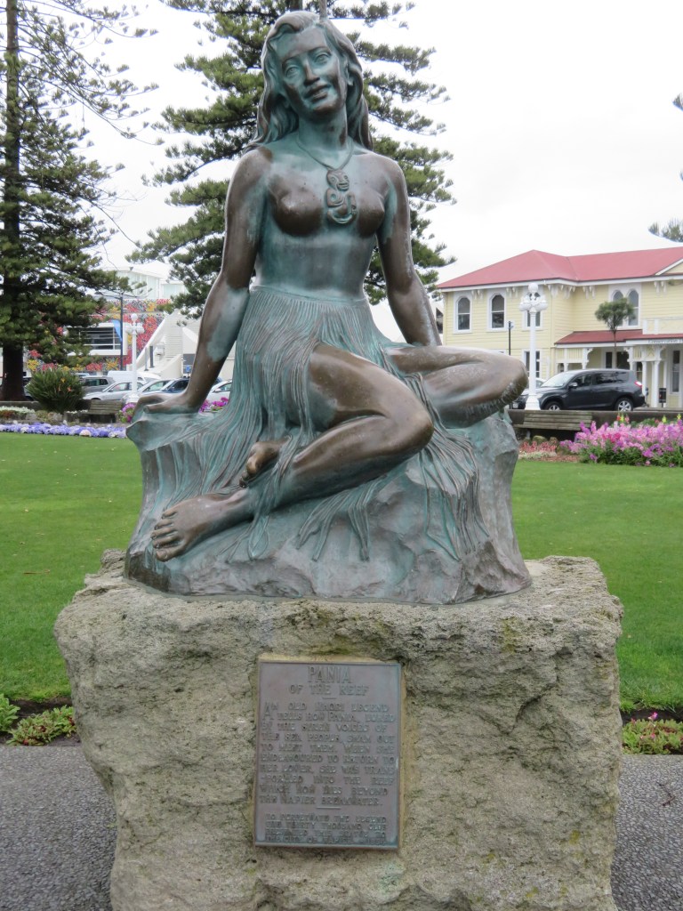
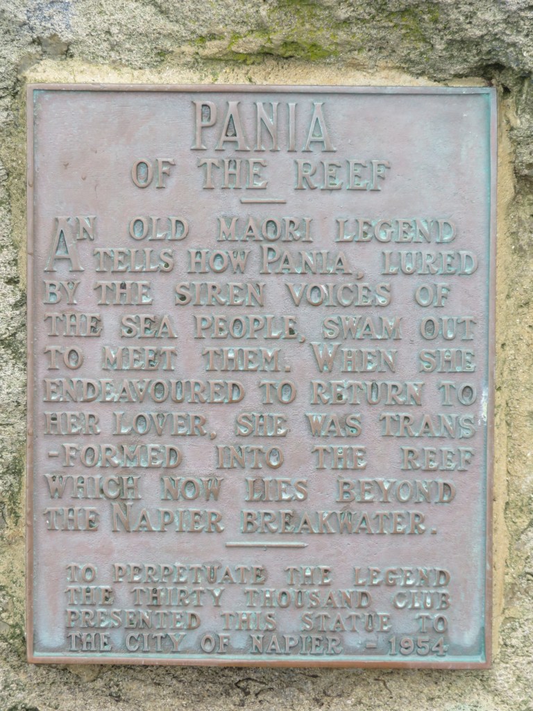
In the story of Pania and Karitoki, their son (Moremore)
became a taniwha when his father attempted a ritual to keep his mother form
returning to the sea people and failed.
Moremore is a guardian, or Kaitiaki, of the harbour at Te Whanga-nui-a-Orutu. He appears in different forms, as a shark, an
octopus and sometimes a log. Patrolling
the harbour, he would protect the people from danger while they gathered
seafood and fished.
A statue of Pania on the Napier seafront.
An important aspect of the people’s relationship with
taniwha was acknowledgement by making the necessary offerings or appropriate
chants. The local tohunga might off the
first kumara to be harvested or the first birds to be caught in the
season. Travellers when passing by a
known lair might make an offering of a green twig whilst reciting a chant. In 2002, the Ngati Nohu (a hapu of the
Waikato area) objected to the construction of part of a highway on the basis it
would destroy the lair of their taniwha, Karutahi. After much discussion and to the satisfaction
of the elders, the transport agency agreed to reroute the highway to avoid the
lair.
One of the more unusual forms a taniwha can take it that of
a log. In order to identify the taniwha
you would be looking for a log that did behave in the manner of regular log,
known as Rakau tipua. On Lake Rotoiti
the taniwha Mataura would appear on the water as a huge tree trunk with
numerous branches and covered in water weed, particularly on the death of a
high-ranking person. When visiting the Kaipara Harbour watch out for a log
moving against the current. It is
believed to be the taniwha Humuhumu, the guardian of the Ngati Whatua.
Other taniwha can take a myriad of forms, some can be a
strange conglomeration of creatures – native lizards such as the gecko or
tuatara feature strongly as do bat wings, shark teeth and octopus tentacles.
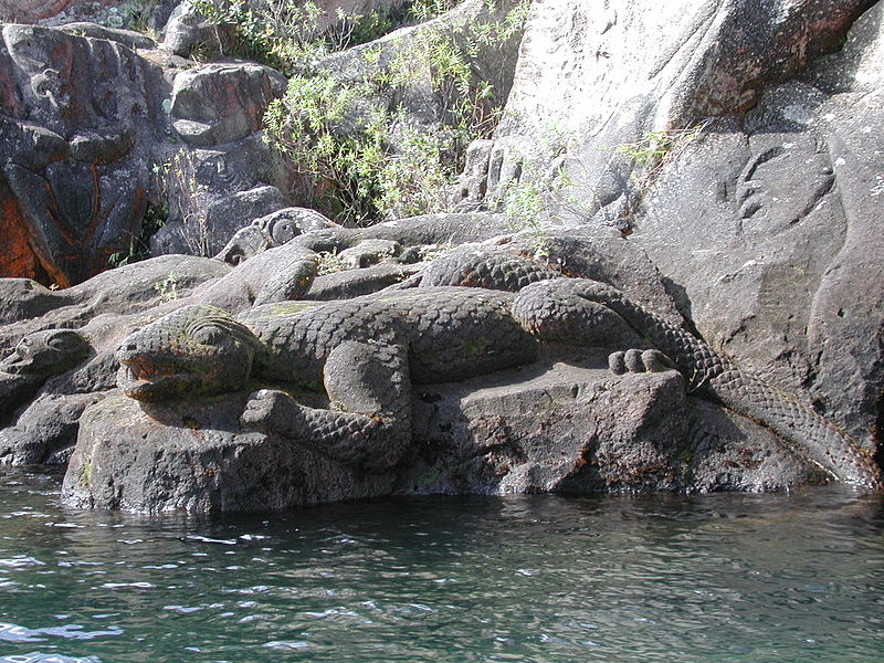
A modern rock carving of a taniwha on the shore of Lake Taupo – here their lizard like appearance is emphasised.
So far, we have only looked at those taniwha who are
kaitiaki, but not all have good intentions.
Some may have begun this way, as guardians of the people, but it only
takes one mistake and the taniwha can turn on the people.
“Because of their role
as guardians they watched vigilantly to ensure that the people respected the
tapu restrictions imposed upon them, and any violation of tapu was sure to be
punished. They were usually held responsible for deaths by drowning; the person
must have insulted the taniwha by breaking tapu in some way” (Orbell M. 1995)
In December 1876, a
news article in a Maori language paper told of four young girls who went
swimming in a waterhole at Waipapa.
Local tradition knew this place to be the lair of the taniwha
Taminamina. One of the girls swam to the
far side of the waterhole where she climbed up onto a rock and started to drink
the nectar of the red flowers of the sacred Rata tree. Without warning, the
girl slipped into the water, one of the other girls tried to save her but
failed. The water began to froth and
swirl and the girls believed it was the taniwha. The elders were of the firm belief that the
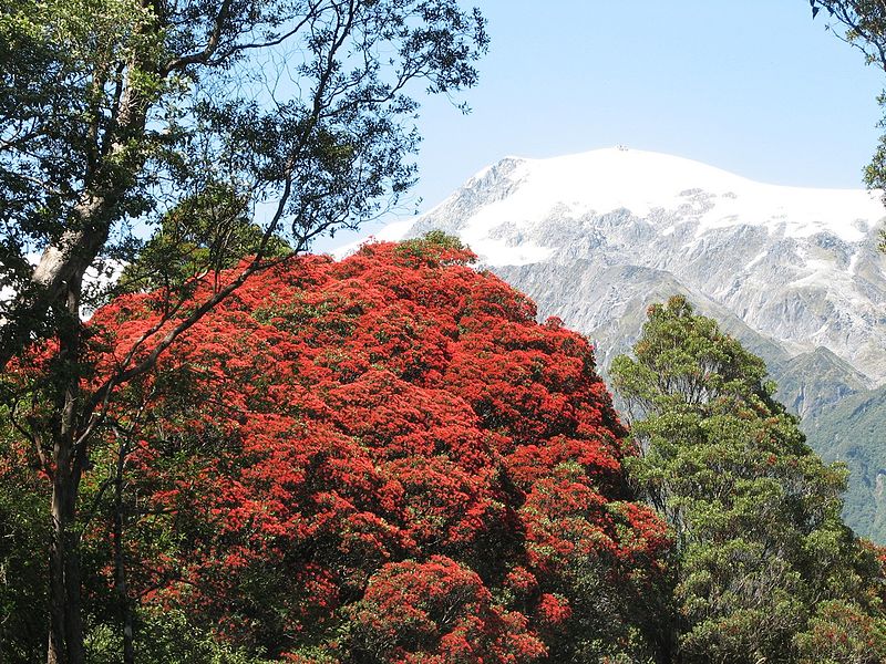
girl was punished for breaking tapu and drinking the nectar of the sacred Rata.
Southern Rata near Franz Joseph Glacier (Photo by Graham Rabbitts wikicommons)
In 1955, a photograph was taken on the Whanganui River. It depicts a swirling mass in the middle of
the river and the inscription on the back of the photo reads:
“On many occasions a large flow of water gushes up from the
head of the Wanganui river below the bluff of Buckthaughts Redoubt, just past
the village of Upokongaro. This phenomenon is accompanied by a loud bubbling
noise and small pieces of waterlogged wood and debris are brought to the
surface. Few people have ever seen this occurrence and this photograph was
taken in 1955 by one of a party of Wellington visitors camping at Mosquito
point.”
In another story the guardian (Takere-piripiri) of
Otautahonga Pa, a hillfort of the Ngati Raukawa would have offerings of food
left below his cave. One day a gift of
eels was mostly eaten by the people who had brought it. This angered the taniwha and he ate the
people instead, unfortunately this gave him a taste for human flesh and he left
the pa and went to the mountains where he would prey upon travellers.
There were though taniwha who were just plain nasty, such as
Ngarara Huarau from the Hawkes Bay who just liked to eat people and then there
were the taniwha who liked to kidnap beautiful young women to keep as wives.
However, not all is lost because where there is a threat to
the people there will always be heroes.
In this case warriors who used their strength and cunning to defeat the
taniwha and protect the people. Pitaka, Tamure, Potoru and Ao-Kehu were all
famous warriors known for their prowess in defeating taniwha. Tamure had a
special mere (greenstone club) which had the power to defeat taniwha. He is well known for defeating the taniwha at
Piha who had a taste for people.
Interestingly, he did not kill this taniwha but wounded it enough that
it could not eat people. The warrior
Ao-Kehu hid himself in a hollow log with a shark tooth club and when the
taniwha smelt him he swallowed the log whole. Ao-Kehu then hacked his way out
of the log and out of the taniwha killing it in the process.
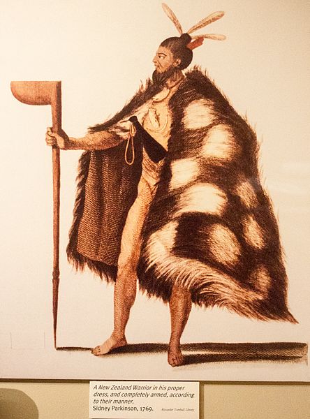
Photo of a drawing of an unknown Maori warrior by Sydney Parkinson (photo by Szilas at the Canterbury Museum Christchurch)
The earliest stories are those connected with the arrival of
the first waka. These stories or
traditions are in the style of creation myths adapted to the local
landscape. Hence, many taniwha are responsible
for the sinuous rivers, the many inlets in a harbour or in the case of the Porirua
taniwha, Awaru, the flat appearance of Mana Island which she crashed into as
she was learning to fly.
Others are stories which serve to identify valuable resources
and offer a means of protection of those resources. Then there are those which all societies have;
sagas that glorify desirable human qualities.
For the Maori, the great warriors used both their minds and their
strength to defeat the undesirable taniwha.
The traditions of taniwha are often complex narratives which serve to enforce what was considered acceptable behaviour within an iwi/hapu (tribe/subtribe), whilst at the same time providing reassurance to the people – reasons for why certain events happened. If a group of travellers went missing in the mountains, the most likely reason was that they did not make the right offerings and were eaten by the taniwha. Even today the New Zealand bush is not a place for an inexperienced hiker, accidents can and do happen. Rivers and lakes are deep and full of hazards, drownings are a far too common event, landslides and earthquakes are a regular occurrence. We are all familiar with the sense of helplessness, the feelings of not being in control. Attributing such events to the taniwha, a creature you can placate with offerings, or in some cases can hunt and kill, helps to explain such events and at the same time offers a way to take control once more of their world.
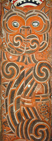
Ureia, a kaitiaki taniwha – carved on a poupou (house post) inside Hotuni, a carved meeting house of the Ngati Maru. The building can now be found inside the Auckland War Memorial Museum.
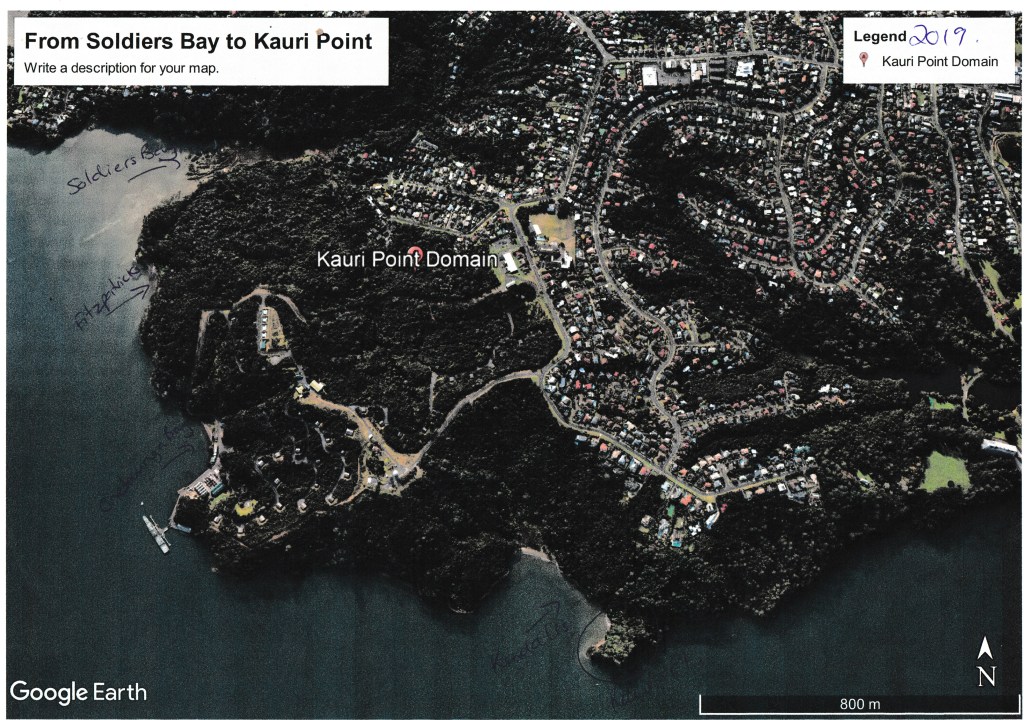
In this the
second part of my small study of land use and settlement in the Upper Waitemata
we are staying within the area defined in part one – from Island Bay to
Kendall’s Bay, keeping within the coastal strip. This part will take a look at the early colonial/settler
history of the area, with the emphasis being on the early or pre-WWII. After this point in time there is plenty of
written records and several good books written on the history of Birkenhead and
I have no desire to rehash already well-known information.
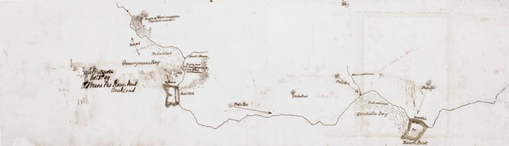
In 1769
Captain James Cook sailed through the Hauraki Gulf past Waiheke Island and made
a note that there might be sheltered harbours to the west. The only other Europeans around at the end of
the eighteenth century were whalers and as of yet no records have been found of
any exploration into the upper Waitemata.
It appears that it is not until 1820 that Europeans began to show an
interest in this sheltered inland harbour.
Reverend
Samuel Marsden is often credited with being the first to explore the area, in
his diaries he states that he left the HMS Coromandel at Waiheke and was guided
by Te Morenga to Riverhead where he then travelled overland to the Kaipara
River – a route travelled by Maori for centuries.
During the
next twenty years there were undoubtedly forays by other Europeans into the
Waitemata, perhaps looking for timber and other such opportunities however
their stories are as yet unknown. In
1840 the HMS Herald was the next major ship to visit the Waitemata, onboard was
the Lieutenant Governor of NZ Hobson and the Surveyor General Felton
Matthew. They spent the next two weeks
exploring the harbour – Herald Island is named after the ship and of course
Hobsonville after the Governor who had initially favoured the place as the capital
of New Zealand.
Slightly
further afield from our area of study there are records from around this time
which make a note of sailors rowing up Hellyers Creek to a place called The
Lagoon to restock their freshwater supplies, however, “it has also been recorded that in 1841 a Mr Hellyer, lived on the bank
of the creek which now bears his name.
He brewed beer which no doubt was a great incentive to those earlier
seamen who rowed up the harbour…”
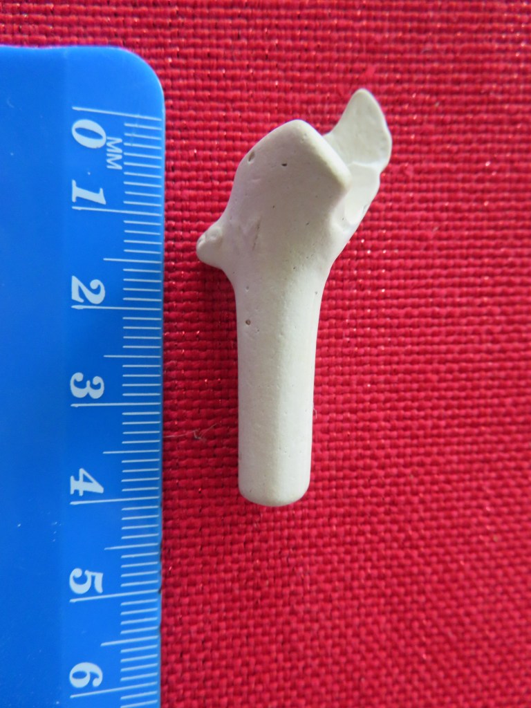
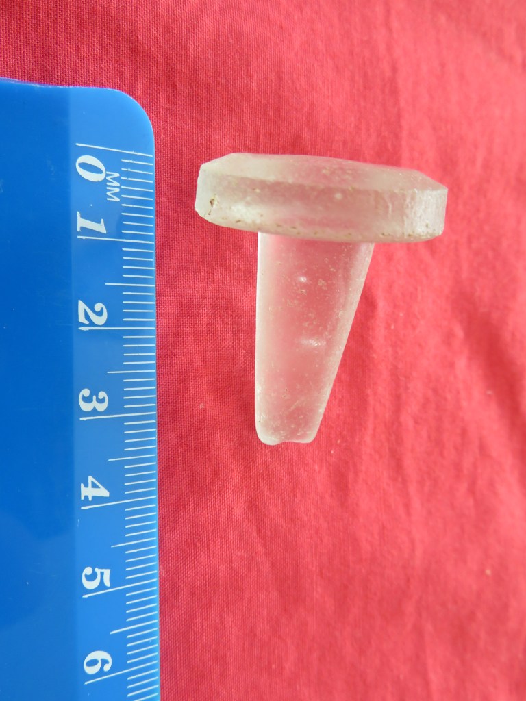
An early but seriously water worn pipe end found on the beach at Kendall’s Bay – it is easy to imagine the early sailor who dropped their pipe overboard as they sailed up the Waitemata.
In 1841 our
area of study was part of a large land purchase called the Mahurangi Block, it
extended from Takapuna/Devonport to Te Arai and encompassed the majority of the
present-day North Shore. The first parcels of land to be auctioned in 1844 were
between Northcote and Lake Pupuke. Much of the early purchases in the
Birkenhead area were part of a land speculation trend without the land being
settled or farmed. Significant chunks of
land sold were the area from Rangitira Rd/Beach Rd to Soldiers Bay which was
sold to William Brown in 1845 and the area from Balmain and Domain Rds to the
shore encompassing one hundred and ten acres being sold to a James Woolly also
in 1845. However, it does not seem that
either of them actually lived here. It
was common practice for land to bought speculatively and sold on in smaller
parcels to settlers fresh off the boat so to speak, such as the ‘Tramway
Company’ a land development company who bought large tracts of land in what is
now Birkenhead.
The earliest
settlers of the Birkenhead area who are known were Henry Hawkins, Hugh McCrum,
John Creamer, Joseph Hill, James Fitzpatrick and William Bradney. All of whom appeared to have had a go at
farming but little else is known about them.
Unfortunately,
those early settlers who chose the Birkenhead area were in for a hard time, as
mentioned in part one the soil was not conducive to farming in the traditional
sense. Settlement was a rather slow
process particularly when compared to other parts of the North Shore and
Auckland. Not surprising when faced with
the prospect of clearing the bush before they could even build themselves a
dwelling. Many of the early dwellings
were simple one room nikau whares, constructed of sod walls with a raupo or
nikau thatched roof. As they cleared the
bush often deposits of kauri gum would be found and sold ensuring a source of
income.
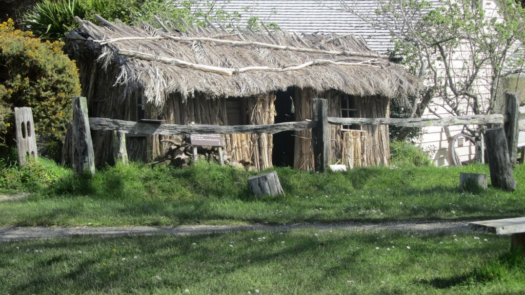
A reconstructed nikau/ raupo whare at Howick Historical Village – a living history museum in east Auckland.Lumps of kauri gum found at Kendall’s Bay.
Even though
most of these early farmers only managed a subsistence living, there were the
occasional success story. Birkenhead
became quite well known for its fruit orchards, the first of which was
established by Henry Hawkins. There are
two differing accounts as to where Hawkins had his orchard, some maintain it
was near Soldiers Bay and others say it was on the ridge where Birkenhead Ave
now runs. It is of course possible that
both are correct, one of the earliest estates to be subdivided and sold was the
Balmain Estate (also known as the Balmain Township) which extended over a much
wider area than just the Balmain Rd of today.
The steep sided valley of Soldiers Bay would appear to not be conducive
to a fruit orchard, the thick kauri groves would have been quite a hindrance to
say the least. However, an advertisement
in the local paper for 1855 has H J Hawkins selling 700 fruit trees from his
farm at The Glen, Soldiers Bay. Later in 1870-71 Hawkins is recorded as owning
allotment two and three in Birkenhead – this is situated on the ridge which is
now Birkenhead Ave.
Another
early settler is mentioned in relation to a dwelling on a map dated to 1849,
the house was owned by a John Crisp and was situated close to what is now
Fitzpatrick Bay. Unfortunately, I have been unable to corroborate this.
According to
a local history study of Island Bay and surroundings (Island Bay. A Brief History) there is an 1844 map which shows a
dwelling occupied by a Mr George Skey. The bottom part of the block was
developed into a small farm and sold as a going concern around 1849. It had its own jetty and a farm boundary
ditch, unfortunately I have been unable to track down this map to verify this
information and the area where the farm is said to be (and relatively well
preserved) is part of the Muriel Fisher Reserve which is currently closed due
to kauri dieback. Having said that, it
is definitely something to consider and requires further investigation.
Soldiers Bay at low tide – the tree covered area to the left is part of the Muriel Fisher Reserve and the probable site of allotment 148.
Whilst the
1880-81 electoral roll lists a small block (allotment 148 – a trapezoidal block
which ran from what is now Rangitira Rd to the western edge of Soldiers Bay) of
twenty-three acres owned by a Mr Clement Partridge who is described as a
settler. The area of Island Bay was one
of those places where early land sales were of the speculative kind. It wasn’t until the “Tramway Company”, a land
development company, bought large tracts of land in the Birkenhead area
including Island Bay, that small dwellings began to appear. Like many of the
bays in the area, Island Bay was a summer place with the majority of dwellings
being bach’s and only a handful were occupied all year round. The road began as a dirt track mostly used by
gumdiggers and was previously known as Victoria Rd West prior to 1913.
What’s in a Name?
Placenames
often hold clues as to the early settlement of an area and its changing
history. In part one we already looked
at some of the Maori names for places and how they relate to not only how the
landscape was used but also how the people saw themselves within their
world. For Europeans the naming of
places can be a lot more prosaic and, in some cases, the reason for the name is
obvious such as Island Bay, so named for the small island at the end of the
road which was once separated from the mainland and only accessed at low tide
via stepping stones.
The island after which Island Bay is so named…
Others,
however, are much more difficult to ascertain – Kendall Bay is obviously a
European name but at this point in time there are no records of anyone with the
name of Kendall after whom the bay was so named. One possibility is that Kendall may be the
name of gumdigger or gum buyer situated at the bay – gumdigger camps were often
situated at the head of sheltered gullies near fresh water and near to the
coast. Kendall Bay satisfies all of
these requirements. Interestingly, the
bay is also known locally as Shark Bay, undoubtedly because of the shark
fishing grounds exploited by Maori and later Europeans.
Kendall’s Bay or Shark Bay on a foggy morning.
Interestingly,
Kauri Point is the one placename not to change and to be consistently included
in the majority of maps dating back to 1842 and up to the present day. It would be a fair guess to say the name came
about as a result of the large kauri stands which would have been easily
visible to the first people to sail up the harbour.
Names have
also changed through time or have been forgotten. The Upper Waitemata was once called Sandy Bay
on a nautical chart from 1841; another early map refers to Pt Shortland (1842),
the headland where the Naval Base currently is; on other maps the bay we know
today as Onetaunga Bay was once called Quarryman’s Bay.
Quarryman’s Bay, like Brick Bay further up the harbour, refer to the early industrial endeavours of the area’s inhabitants. Both quarrying and brickmaking were popular industries in a land where traditional farming was problematic. One of the occupations of a potential early settler in the area was brickmaker (see below).
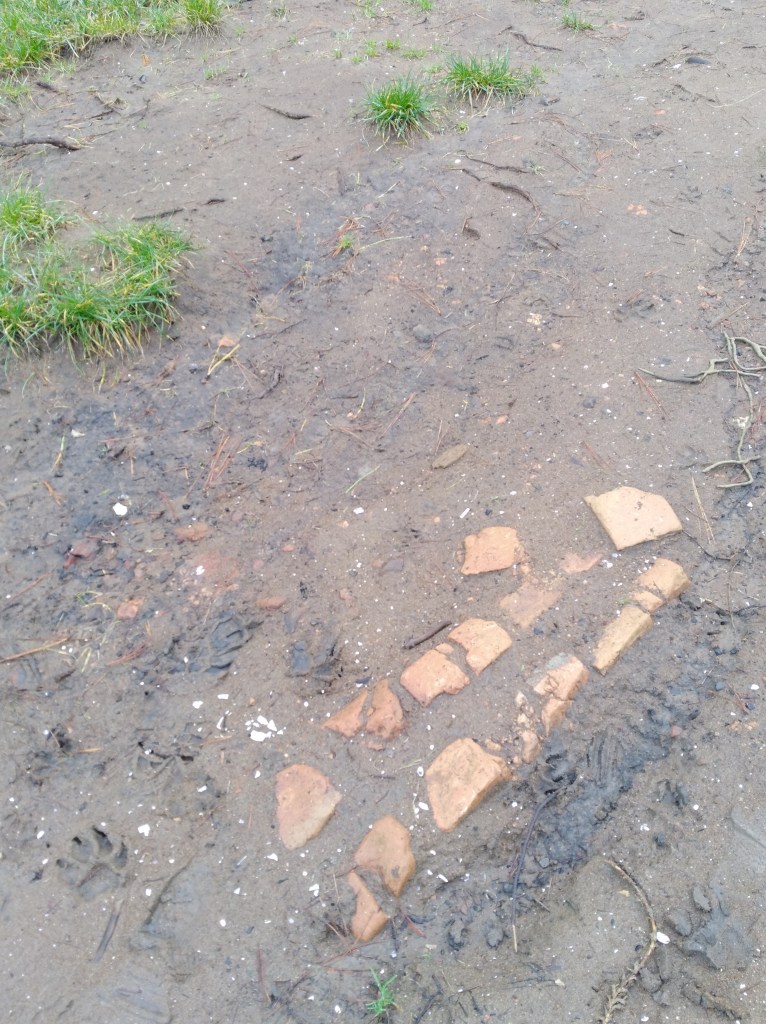
Just a few of the many bricks found on the beach at Fitzpatrick’s Bay – possibly either as a result of a small brick making industry or as a result of the demolition of the house on the hill which may have had a brick chimney.
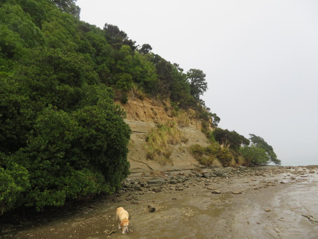
Soldiers Bay
is an interesting case of a name that has been around for a long time but its
origins are hazy. The earliest mention that
I have been able to track down is dated to a map of 1863. Today the stream that runs down from the high
ground and empties into Soldiers Bay would have been a lot less silted up and
most likely navigable by waka or rowboat as far as the present-day
carpark. Today there is a causeway which
joins the bottom of Balmain Rd to the reserve which would not have been there
in the early days. This causeway was
most likely constructed in the early twentieth century when a caretakes lived
at the end of the reserve above Fitzpatrick’s Bay.
The modern causeway which now links Kauri Point Domain to the bottom of Balmain Rd – there are oral histories which tell of access to the beaches being further up the valley.
None of
which gives us any clue as to why Soldier’s Bay is so named…it has been
suggested that the bay gained its name as a result of an encampment of militia
during the unsettled times of the mid-1800s.
At the time, Hone Heke was ‘making life unpleasant’ for settlers in the
north, particularly the Hokianga, and many had moved south to take up land in
Birkenhead. To allay the fears of the
settlers a contingent of soldiers may have been positioned in various
places…hence Soldiers Bay. As mentioned
before the stream would have been navigable to the bottom of present-day
Balmain Rd, just before that though there is a flat spur which would have
provided a good position for an encampment, with a clear view of the harbour
and a fresh water supply.
The final
placename to consider is that of Fitzpatrick’s Bay, this small sandy bay is
today part of the Kauri Point Domain and is a popular recreational reserve for
the local area. There are two possible
people responsible for naming of the Bay – Charles Fitzpatrick or James
Fitzpatrick.
An
examination of Jury Lists and Electoral Rolls shows that a James Fitzpatrick
arrived on the Jane Gifford in 1842 with his wife and daughter. The Jury List of 1842-57 lists James as
living on the North Shore as a brickmaker; in the 1850s and 1860s he was still
living on the North Shore but was now a farmer and a freeholder. Whether or not he was actually living in the
Birkenhead area is difficult to say; Birkenhead itself was not so named until
1863 and up until that point there was very little distinction between
areas. In the 1870-71 electoral roll
James was listed as residing in Takapuna, allotment 15 – a survey of the
cadastral maps of 1868 shows that allotment 15 is in fact in Northcote
(Takapuna refers to Takapuna Parish of which included todays Takapuna,
Birkenhead, Northcote, Hillcrest, Birkdale, Beachhaven and so on). In 1890, James was still in the Takapuna
Parish but was now listed as a gumdigger.
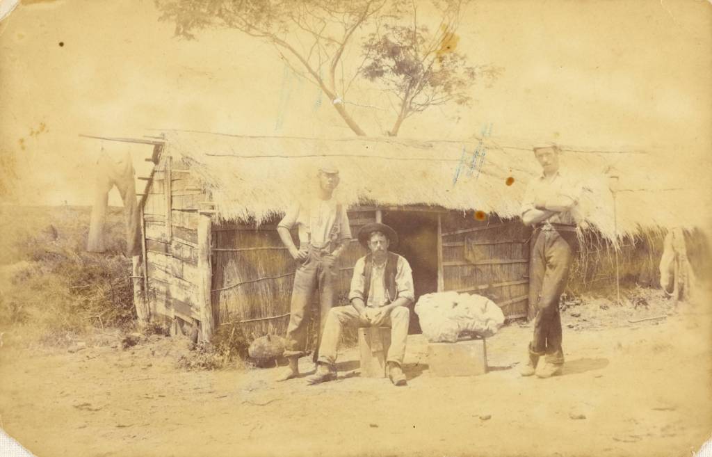
Photo of gumdiggers outside a raupo whare on the Manukau Pennisula ca 1891 (from Auckland Libaries heritage Collections 07064)
Charles Fitzpatrick only appears twice in the lists; first in 1867 and as having a freehold land and house at Kauri Point however by 1890 he had moved to Morrinsville. Whilst only Charles is listed specifically as living in our area of study and he would appear to be the best option for the naming of Fitzpatrick Bay it is still not possible to rule out James.
Addendum
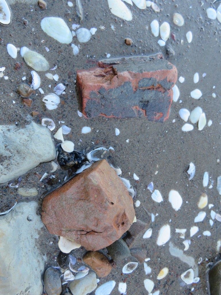
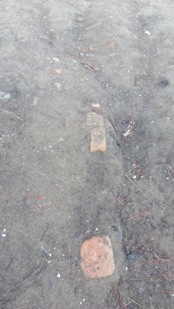
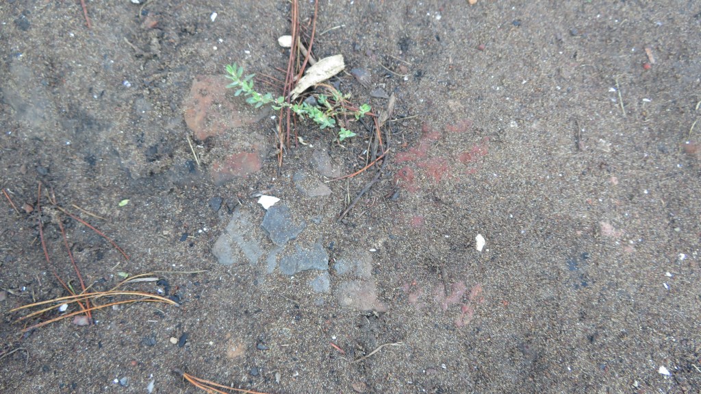
Not long after this post was written, I was contacted by a gentleman who currently lives south of Auckland near Hamilton. He was happy to confirm that James Fitzpatrick was indeed the correct person after whom the bay was named – James was his great great grandfather. He was also able to confirm that James did have a small brick kiln in the bay.
The first photo shows the slope near the beach where the brick kiln was situated; the second and third photos show one wall of the kiln in situ, but taken two years apart. Erosion, foot traffic and such has meant much of what was exposed has now disappeared. The last photo shows a close up of the soil with evidence for burning.
Fun in the Sun
The study
area today is made up of three different zones – residential (Island Bay),
defence (Onetaunga Bay) and recreational (Fitzpatrick Bay, Soldiers Bay and
Kendall Bay). In 1888 Governor William
Jervois permanently reserved for the purpose of recreation 133 acres of land
(allotment 162 and 163) in the Parish of Takapuna. It had been his hope that the area was turned
into a national park, a place of tranquillity for Aucklanders. This was the
area from Kendall Bay to the eastern end of Fitzpatrick Bay. In 1913 the Harbour Board acquired a further
forty-two acres which included Kauri Point (allotment 164) which had previously
been owned by Sir John Logan Campbell until his death in 1912. Further to this the area around Fitzpatrick
and Soldiers Bay were then added to the park in 1916. An article in the New Zeland Herald in 1916
stated that the reserve had a fine waterfront and had in the past had been much
used as a camping and picnic ground. It
also mentions a ‘good five roomed house’, our first mention of what was to be
known as the caretakers’ house.
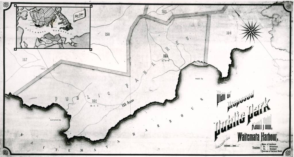
Photo of the proposed plan for a park at Kauri Point dated to 1913.
An article from 1900 also in the New Zealand
Herald also mentions how the Kauri Point Domain board had agreed to allow
campers for a small fee. Interestingly
they also denied a request for funds for a wharf. Reading through multiple articles the request
for a wharf in the area is one which is constantly brought up, eventually a
wharf was constructed but not at Fitzpatrick’s or Soldiers Bay but at Onetaunga
Bay and it was paid for and built without the help of the board or their funds.
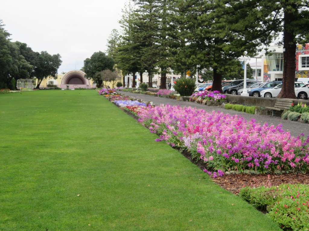
The grassy area at Fitzpatrick’s used by campers since the 1900s if not earlier.
This marked
a new era for this inner harbour landscape; each of the small bays were
transformed in the summer months as families from the city side would spend the
warmer days living under canvas. In the 1920s and 1930s there were seven or
eight families holidaying at Kendall Bay, their camp was at the western end of
the bay where there is a level space and a freshwater stream. At Fitzpatrick’s the camp site was at the
northern end of the bay on the grassy area above the beach. Unlike elsewhere this part of the reserve was
owned by the Birkenhead Borough Council from 1929 who improved it and put in
place a caretaker.
The site of the caretakers house – the bushes behind the pine trees conceal the remains of the house and the third photo shows a large rambling fig which was part of the garden.
The only
recorded caretaker was a William Henry Rickwood who lived in small house with
his family on the hill above Fitzpatricks.
Oral histories record how Williams’ wife would keep a small store
selling sweets, soft drinks and other useful supplies. There was also a ‘ponga-house’ where Mrs
Rickwood would provide hot water and often sold tea and scones to the visitors. There is very little that remains of this
house today, just a level area with an overgrown collection of European garden
plants such as figs and a rambling rose.
However, there is evidence of both the campers and the caretakers in
form of the rubbish they were throwing away.
Often along the bay sherds of old ceramics dating from the late 1800s to
the mid-1930s can be found, undoubtedly there is a European midden that has
eroded onto the beach.
A small selection of the beach finds found on the beach below the campground and caretakers house at Fitzpatrick’s.
As well as the tent sites at Kendall
Bay, there were other camping places, near the wharf at Onetaunga Bay and at
Fitzpatricks bay which is the beach at the present Kauri Point Domain. Pre-World War Two and back through the
Depression years, tents appeared each summer for a back-to-nature holiday by
bush and sea. Much of the housework was
left behind at home and there was no problem keeping the children amused. There
were good sandy beaches and the harbour water was clear and clean in those days
before the march of suburbia. (From a pamphlet of remembrances celebrating twenty years of
Kauri Point Centennial Park, available in the Birkenhead Library).
Island Bay
whilst listed as residential today was up until the construction of the Harbour
Bridge mainly a summer town, full of bachs occupied only in the summer by
families from across the water in the city. Unlike the other bays the land
around Island Bay was owned by a land development company, being subsequently
subdivided and sold off. However,
because of issues of transport and roads only a few of the blocks were
permanently occupied. Newspapers from
the early 1900s often have articles describing summer outings by the Ponsonby
Yacht Club to Soldiers Bay and area.
Defence
A final
chapter in the history of land use in our area is that of defence. Just prior to the Second World War in 1935
ninety acres of the Kauri Point Domain was taken for defence purposes. The area of Onetaunga Bay (once Quarryman’s
Bay) was developed for a storage facility for naval armaments. This unfortunately put paid to those carefree
summer campers who no longer came in the large numbers, the caretaker at Fitzpatrick’s
was still Mr Rickwood in 1938, as listed in the Wises Directory, but with the
outbreak of WWII everything changed.
In 1942 the
Americans had arrived in response to the Japanese threat in the South Pacific.
Kauri Point Domain, Fitzpatrick’s bay included, were given over to the Americans
and a large number of powder magazines were built. There are several unusual features on the
beach at Fitzpatrick’s Bay, which may relate to these days.
After the war the Domain reverted to being parkland but never again were campers allowed back to any of the bays. Today the Naval depot forms a large wedge between Kauri Point Domain and Kauri Point Centennial Park.
The wedge of buildings and land is the naval depot – Kauri Point Domain is to the top and Kauri Point Centennial Park the dark area to bottom and along.
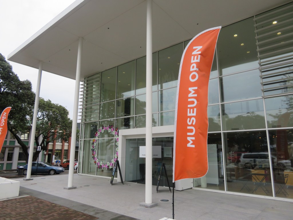
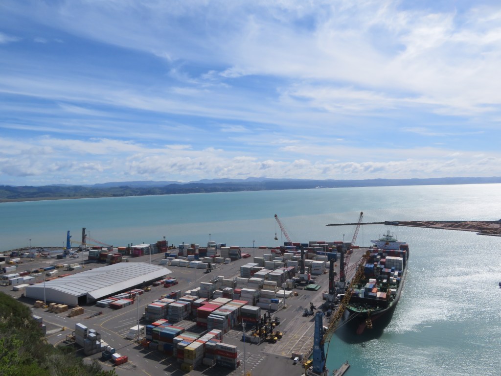
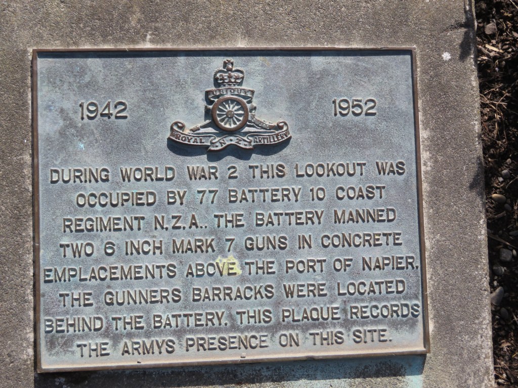
Just recently the husband and I had a child free weekend away, during this time we spend two days exploring the town of Napier in the Hawkes Bay. Naturally I was drawn to the town’s heritage and as per usual my first stop was to the local museum – MTG Hawkes Bay.
The exterior of the museum.
Situated in the main part
of town near the seafront, it is attached to the library and spread over three
floors. The ground floor gallery is
taken up by two exhibitions – Tenei Tonu and Turuturu, Fingers, Feathers and Fibre.
Tenei Tonu showcased the taonga, both historic and contemporary, alongside the
stories of the local Iwi Ngati Kahunguru. Turuturu took up a space which joined
the museum to the library and is a fascinating albeit brief look at the
importance of weaving in Maori culture.
Turuturu are weaving pegs used to keep a
garment off the ground when it is being made. The main peg is the right one and
can be elaborately decorated. It represents the mana of Te Whare Pora – the
knowledge-bank of the art-form. The peg itself upholds the mana of the growing
garment and it spiritually connects the maker to the world of thought and
concentration. The peg also grounds the maker so they do not get lost in their
intellectual world. (quoted
from the MTG Hawkes Bay website)
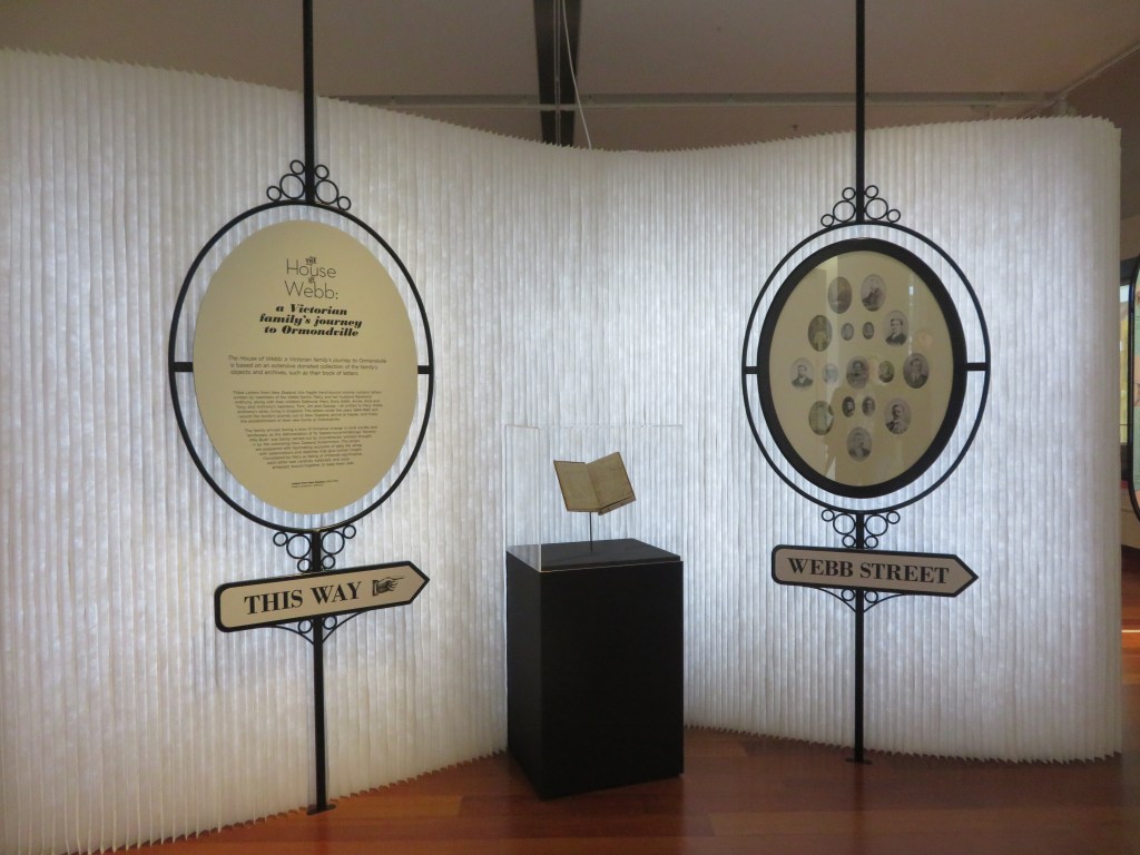
On the second floor was three collections – one of an amazing display of heirloom silverware whilst the second was called Five Pakeha Painters – Perspectives on the Hawkes Bay. This small exhibition of artwork acknowledged the importance of art as a form of dialogue between the artist, the land and the social norms of the time. The third exhibition was titled The House of Webb – A Victorian Family’s Journey to Ormondsville. This is a temporary exhibition (it finishes on the 3rd November) showcasing life in Victorian Napier through the belongings, diaries and letters of the Webb Family. In 1884 the Webb family left their comfortable life in England and travelled to Napier and then further south to Ormondsville, this exhibition showed what life was like for these early settlers, some of their trials and how they survived those early days.
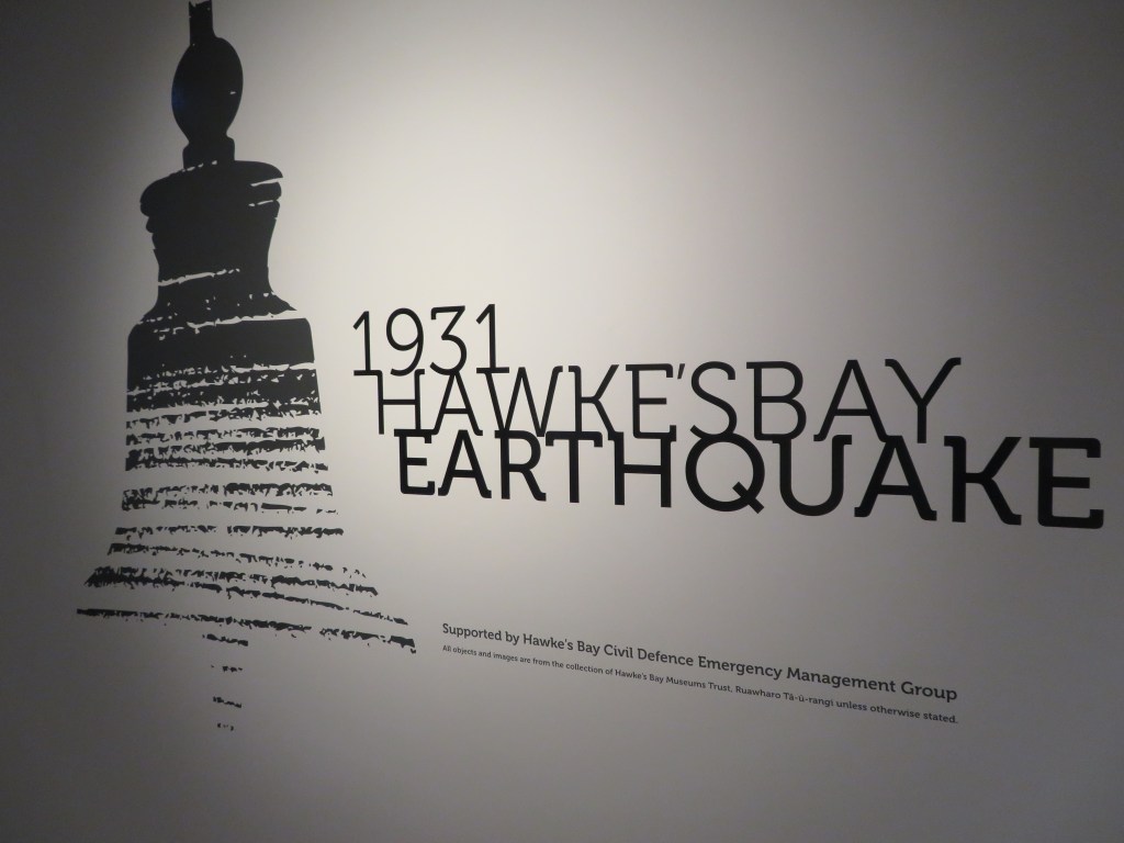
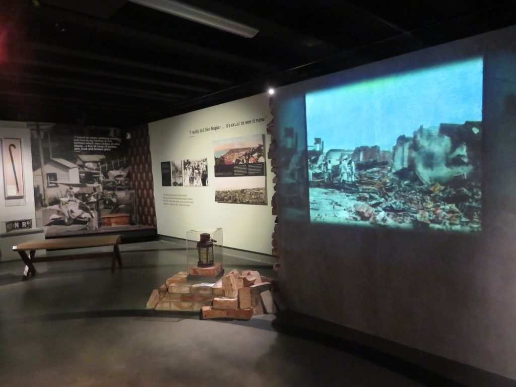
The final gallery to be
explored was in the basement of the museum – here the visitor is taken through
that fateful day in 1931 when the Hawkes Bay was hit by a massive earthquake
which destroyed almost all of Napier and killed over three hundred people.
At 10:47am on 3 February 1931, a devastating
earthquake struck Hawke’s Bay. In that moment it seemed the end of the world
had come. People were thrown off their
feet; buildings shuddered and collapsed as the ground pitched violently. In
central Napier, fires broke out within minutes and rushed through the city.
Amidst the burning, falling buildings, the bright blue sky of a summer’s day
was obscured by smoke and dust. People
could only watch as their home was destroyed around them. In desperation the
injured screamed for help, others ran for the safety of the beach, or home to
find their families. (Quoted from the MTG Hawkes Bay website)
As well as the thoughtful display of objects and stories, there is also a short film of ‘Survivor Stories’ which brings home how devasting the earthquake was to the people of the Hawkes Bay. Time here will forever be divided between ‘before and after the earthquake’.
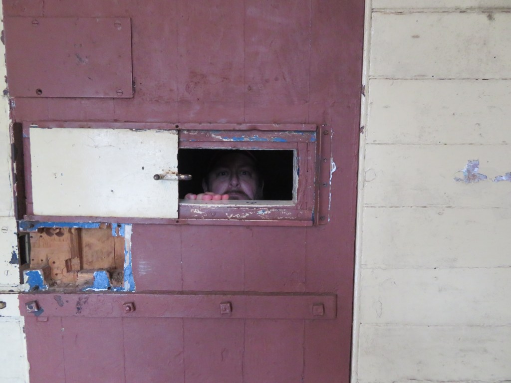
The second place to be visited was the Napier Prison…yes on purpose…and no not in shackles…
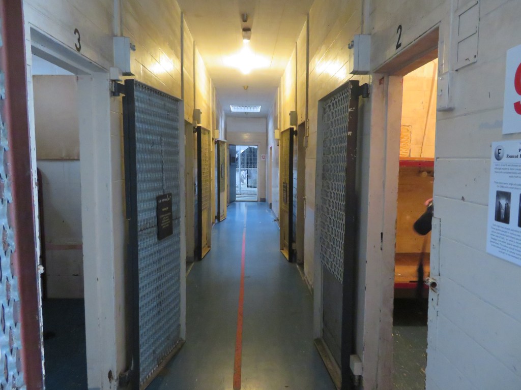
Napier Prison is New Zealand’s oldest prison, it was first opened in 1852 and was closed to inmates in 1993. Situated on Bluff Hill and next to the quarry where early inmates were expected to do hard labour extracting the stone that would build walls which now surround the prison. In 2002 the prison was restored to the state it is in by a local family who turned it into a back-packers (not my first choice of accommodation) but nowadays it is a tourist attraction and even on the cold wet day we visited there were a quite a few visitors.
The forbidding entrance of Napier Prison – visitors must knock…
As a visitor you can either go on a guided tour or do the self-guided audio tour which we did. The facilities also host scare tours in the evenings and has an Escape Room Experience for those wanting something a bit different. On two separate occasions and for quite different reasons, the prison has been the focus of a TV show – one looking to enhance the visitor experience from a heritage perspective and the other capitalising on the prison’s spookier stories. The prison has also through its time been used as a psychiatric unit, a lighthouse and a meeting place for Alcoholic Anonymous groups.
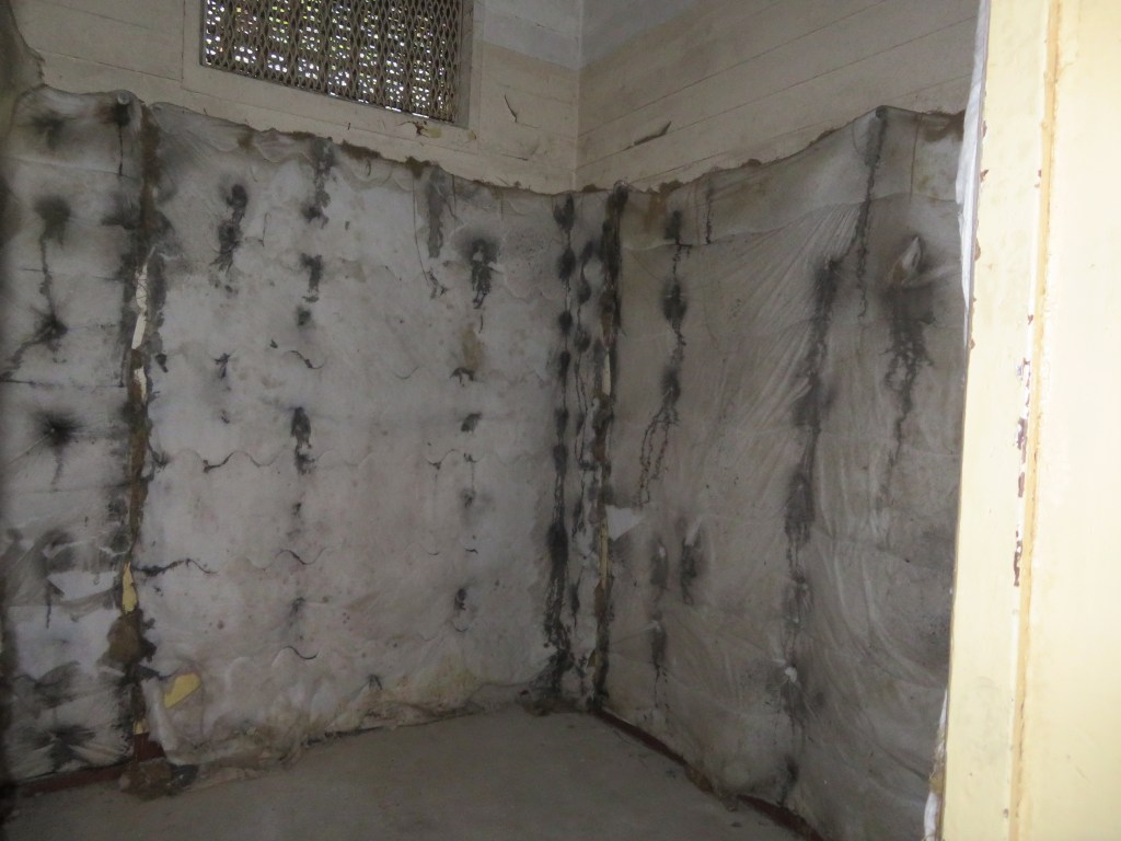
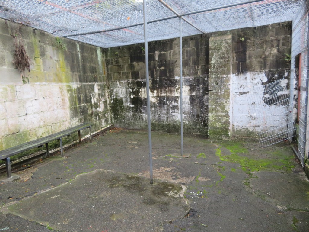
Above is a block called ‘The Pound’ – the padded cells and caged exercise area chilling reminders that once upon a time mental illness was treated with a lot less compassion.
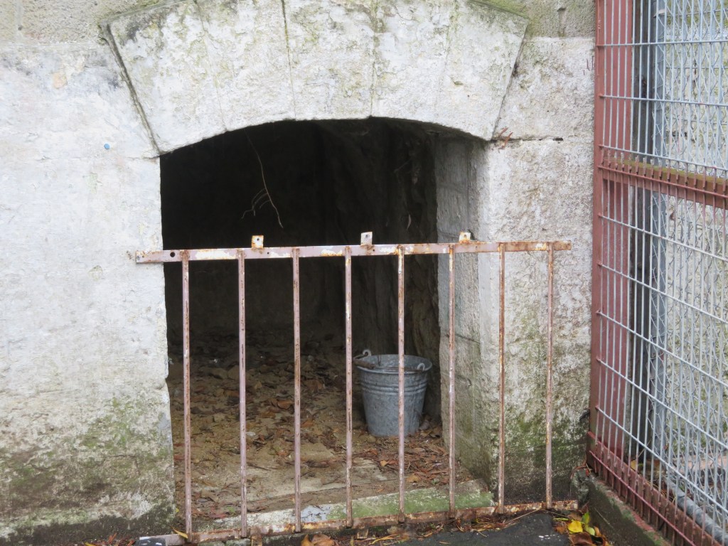
Beside The Pound is ‘The Hole’ – use your imagination…
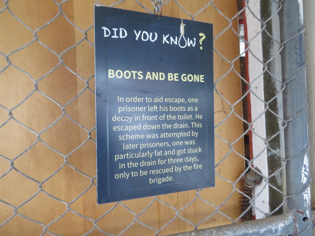
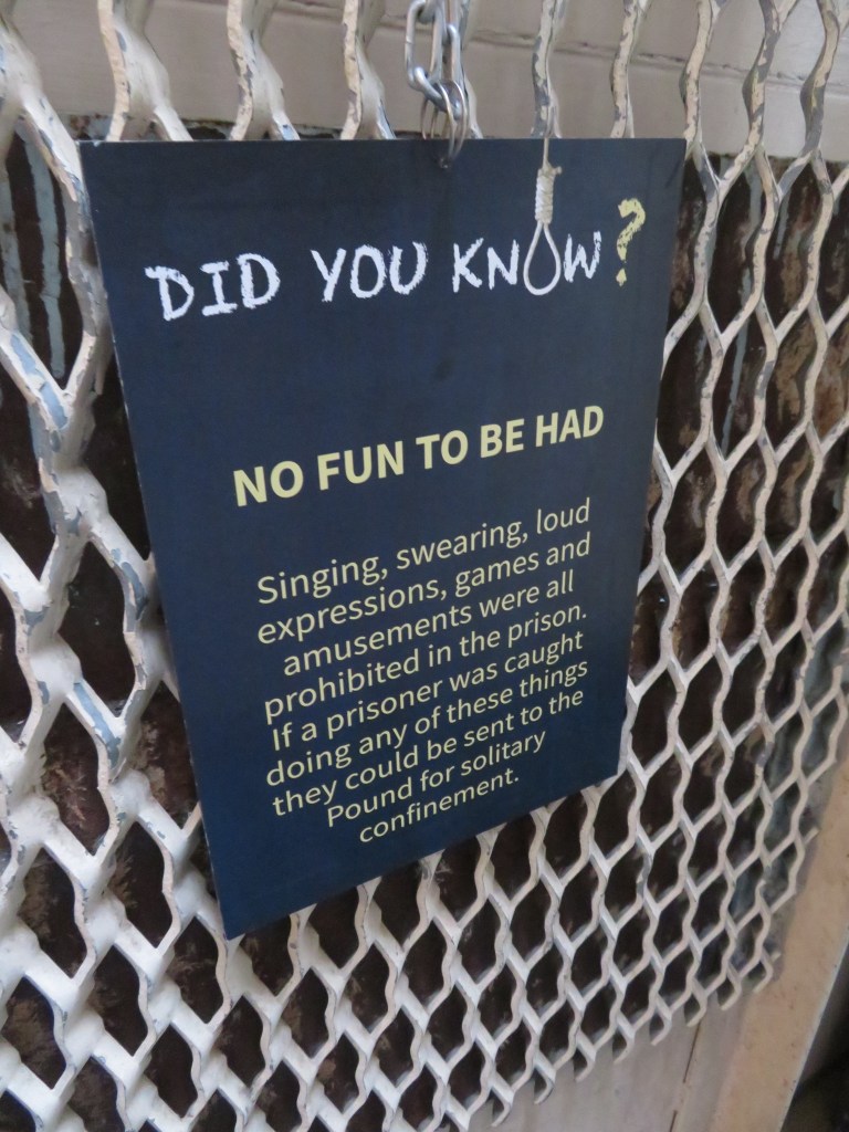
The above photos show a small selection of numerous information boards that provide a light moment amongst the many somber ones.
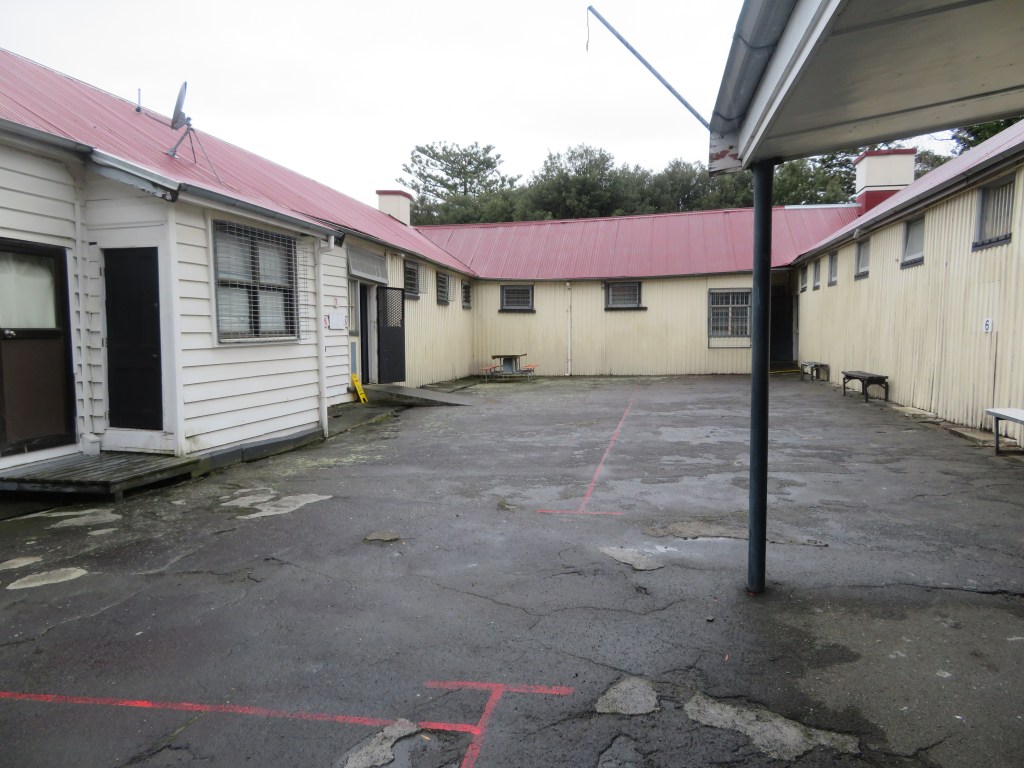
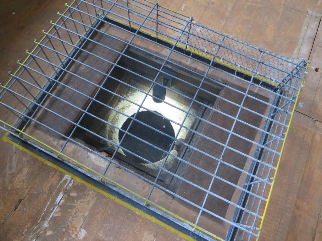
The above photos are of the main block and exercise yard, the bottom picture is of a well discovered a short while ago. The well room is in what was once the infirmary before being divided into other rooms during the prisons back packing days.
Above is a plaque about one of the prison’s most well known executioners. – the role of executioner would often fall to one of the inmates and Tom Long was no exception.
On a personal note, it was a fascinating place, however the sense of relief when I walked back out the front gates was immense. The heavy sense of foreboding made for an uncomfortable visit, there were places I simply could not enter. I took no photos of the ‘hanging yard’ or the graveyard (where only three burials are had), the feelings of deep sadness were enough to stop me pressing the shutter. The ‘hanging yard’ in particular had an effect on me…but having said that I am glad I went, it was educational and an eye-opener to life behind bars in New Zealand’s oldest prison.
The remaining photos are just a few from around a city well known for its art deco architecture and seafront gardens.
The view of Napier Port from the lookout on Bluff Hill.
Please note that all photos are my own – the MTG Hawkes Bay do not allow photography in many of their galleries, hence the paucity of photos from this lovely museum.
For the last
five years or so I have been walking the ever-faithful Brad the Dog to a small
but perfectly formed bay known locally as Fitzpatrick’s. During this time, I
have found a variety of interesting objects on the beach, some have obviously
been washed in and others have eroded out of the beach head and sand. I also
noticed a few interesting humps and bumps and well that was it, my curiosity
was well and truly piqued.
Multiple questions
kept my mind occupied, such as, who was Fitzpatrick? Who lived in the house on
the hill of which only humps, bumps and a rambling rose remained? Why do I keep
finding ceramics on the beach? And what about the pre-colonial settlement of
the area? As I began to research it became necessary to expand the overall area
of interest to include the bays east of Fitzpatrick’s – Onetaunga Bay and
Kendall’s Bay – and the bays west – Soldiers Bay and Island Bay – in order to
get a fuller picture.
For the purpose of this article there are two distinct early phases of settlement and use of the area – the Maori pre-colonial and the early colonial up to 1900 – which will be the focus of this article and the next (part two). Later occupation of the area can be divided by the World Wars particularly the second World War and the construction of the Harbour Bridge which indelibly changed the face of the North Shore. But first let’s consider the bare essence of the area, without the human factor muddying the waters.
Note how much the landscape has changed between 1963 and 2019 below.
The Naval Base is in the middle of the dense bush that lines the coast.
The Geology and all that Natural Stuff…
The area with
Fitzpatrick’s Bay at its centre is situated on the north side of the Waitemata
Harbour in the suburb of Birkenhead. Geologically speaking the Waitemata
Harbour is a drowned late Pleistocene valley whose natural rock type is
sandstone and mudstone. It is highly susceptible to coastal erosion, often
resulting in steep sided promontories that continue to crumble particularly
after heavy rain.
The current environment is one of invasive pine trees and impenetrable scrub bush although originally the hills behind the beaches were once thick with kauri, pohutakawa and other natives (small stands still survive in places). The presence of kauri caused the soil to be nutrient poor and therefore not the best for horticulture, unlike the landscapes on the opposite side of the harbour with its rich volcanic soils ideal for horticulture and therefore human settlement. However, the rich waters of the Waitemata made up for this deficiency particularly for the early inhabitants. On the southern edges of the Waitemata Harbour and opposite Kendall’s Bay is Meola Reef, also known as Te Tokaroa Reef – the area is well known to marine biologists as a shark spawning ground, here female sharks leave their young to fend for themselves in the relative safety of the inland harbour.
In addition to
shark there are many other species of fish which frequent the harbour, such
snapper, flounder and yellow-eyed mullet. The foreshore also provides an
abundance of shell fish, predominately in the form of pipis, cockles and rock
oysters.
The Maori
The Maori story of this part of Auckland differs considerably from other parts. The central area of Tamaki Makarau with its fertile volcanic cones was ideally suited to horticulture and thus heavily settled. The northern side of the inner Waitemata Harbour was not so suited to horticulture, the vast kauri forests having depleted the already thin soils of nutrients. So how was this part of Tamaki Makarau utilised by the Maori?
Our understanding of the settlement and subsistence patterns of this pre-Treaty of Waitangi time is restricted to the several defended promontories (pa) and the many shell middens which can be found around the shoreline.
Colonel Boscawen’s hand drawn map of 1899 to accompany his photos taken at the same time. He was very interested in Maori settlement and was a prolific photographer.
The Pa
The term pa is taken to mean any settlement that consists of defensive earthworks such as banks and ditches. The pa in our area are mainly confined to the steep sided promontories that are usually adjacent to a protected beach where waka were able to land safely. The most well-known is Kauri Point or Te Matarae A Mana, named for Manaoterangi a chief of the Ngati Kawerau who flourished in this area from around 1720-1790. It is also the only pa to have any archaeological excavations undertaken (in response to the possible threat of the construction of a second harbour crossing, the first having completely destroyed Onewa Pa on Stokes Point in Northcote).
Te Matarae A Mana (Kauri Point) from the beach below.
These excavations were undertaken by Janet Davidson in 1971 and consisted of a total of seven test pits in four areas. In the 1990 report of the excavation Davidson emphasises the strategic importance of the headland describing the approach from the landward side as being along a narrow and winding ridge which widens to become a flat-topped headland. The site has natural defences in the form of a steep scarp to the southern side which is enhanced by two incomplete ditches. The excavations and subsequent finds revealed that even given its impressive position the site was only used for a limited time. The middens found in three of the four areas produced well-preserved fish bone – but not much in terms of quantity; a single dog bone; pipi and cockle shell – the principal species, which was to be expected; as well as mussel and oyster shells. Interestingly, there were a large number of slipper shells whose flesh may have used as bait for fishing. The middens themselves were quite small and corresponded with the lack of structures found on the headland.
This unassuming dent in the ground is the remains of one of Davidson’s excavation pits.
“In view of the apparently strategic
location, this lack of evidence of prolonged or repeated occupation was
surprising” (Davidson J 1990 ‘Test Excavations on the Headland Pa at Kauri
Point, Birkenhead, Auckland in 1971’)
This was very different from other pa sites in Auckland and Davidson concluded that the headland had been constructed by people who visited the adjacent bay for seasonal fishing and that most of the activities happened in the bay below. The pa therefore may have had a more esoteric function such as the proclamation of the Kawerau Chiefs’ mana, an assertion of the group’s rights to the area and ultimately as a ‘just in case’ need for defence.
The photos below are a selection from Te Matarae – the first shows the overgrown nature of the eastern ditch; the second is of the interior which is flat to sloping; the third whilst not very clear is the remains of midden; the fourth is the view from the top out towards Auckland City and finally the last looks down onto Kendall’s Bay below.
According to the “Cultural Heritage Inventory” published by North Shore City Council in June 1994 there are two further pa in the vicinity of Kauri Point. One was presumed to be located within the grounds of the Naval Base which sits in the middle of our research area and is inaccessible for security reasons. In 1899 a Colonel Boscawen did a rough drawing of the area to accompanying six photos he took. On the map he noted this particular pa which appears to be a major headland pa, was far greater in size than Te Matarae A Mana (Kauri Point). However, on closer inspection of Col Boscawen’s photos and map, it may be possible that this larger pa with its large ditches may not be in the Navy compound but further to the west and near to Soldiers Bay. Over a two-day period I attempted to prove or disprove this idea but the dense bush in the area was a significant issue. In addition, aerial photos have shown that even if the site was in the Naval base much of it would have been destroyed during the development of the land for the base. So as of now the issue is still unresolved…
Below are Col Boscawen photos of the various sites – 1. Te Matarae form landward – the ditches are faintly visible across the neck of the promontory. 2. Te Matarae from up on the hill which is now part of the Naval Base and assumed to be the pa site of Maunganui. 3. On Boscawen’s map this is labelled photo 5 and could be either Fitzpatrick Bay or Onetaunga Bay. 4. A view of the headland labelled photo 4 on the Boscawen’s map which is labelled as a Maori pa site and has two ditches drawn in. Once again this may be either at the eastern end of Fitzpatrick Bay or the headland on the Naval Base. 5. This headland at the western end of the beach as seen in number 3.
The second pa
recorded is named as Maunganui and according to the “Inventory” Janet Davidson
is thought to have identified ‘part of the Pa ditch in scrub just south and
east of the trig at the corner of Onetaunga Road and the road to the Naval
Base’. The general assumption is that it is situated on the ridge on which the
Onetaunga trig is located, but there is still some doubt as later developments
may have caused the landscape to take on forms which deceive the eye. It is interesting to note that Col Boscawen
did not include this pa on his map of 1899, a site he would have been aware of,
unless of course the large pa mentioned above was in fact Maunganui and this has
become a case of mistaken identity.
Beyond Kauri Point and past Fitzpatrick’s are two further pa, one south of Island Bay and the second at Island Bay. The first is situated on top of a cliff about half way between Soldiers Bay and Island Bay. It has been recorded as consisting of a ten-metre square flat area with a small terrace forming the internal area of the Pa. There is ditch on the landward side whilst the other sides are formed by steep cliff faces or slopes.
A grassy reserve above Island Bay – may be the remnants of terracing associated with the above mentioned pa.
The photos below are of Island Bay – here a small promontory pa is joined today by a modern carpark which is reclaimed land. The pa itself has been extremely modified with the addition of concrete paths, a wharf and toilet block. The last photo shows the promontory in profile looking west.
The pa at Island Bay is situated on top of the island itself and it is approximately 15 metres by 20 metres in size; middens can be discerned on the northern and western sides. The middens appear to dominated by cockle shell, pipi and oyster. When last surveyed, charcoal, hangi stones and obsidian were also noted. It has been noted that the top of the island consists of some terracing which are not obvious until seen in profile.
The midden at Island Bay on the eastern edge of the promontory – now very badly eroded – the white flecks are shell.
The Middens
Already
mentioned above is the Island Bay Pa midden, and in addition there are recorded
middens at Kauri Point Domain and Soldiers Bay. The Kauri Point midden is
regarded as the largest in the area and situated at the southern end of the
Domain and is noticeable as a result of a stormwater drain cutting through it. Today
grass has almost obliterated the view of the midden and it does appear to have
eroded away quite a bit. However, previous surveys have found it to be three
metres long and one metre high; three layers of shell have been discerned each
separated by layers of sand and clay mix. Apart from cockle, pipi and scallop
shells, hangi stones and charcoal are also present. Waterworn hangi stones are
often to be seen on the beach, giving further emphasis to the issues of coastal
erosion.
A midden eroding out onto the path just above the beach at Kendall’s Bay at the foot of Te Matarae/Kauri Point.
The midden at
Soldiers Bay is situated on the small beach beyond the current mangroves. It
has suffered much from erosion and when last surveyed was two metres long and
spread over a height of three and half metres. Opposite and nearby are a
further two smaller middens. In 1899 Colonel Boscawen drew a map to accompany
half a dozen photos he took of the area. On this map he mentions the presence
of ‘pipi shell mounds’ at the edge of a bay he called Quarryman’s Bay, which
appears to be the combined bays of Soldiers Bay and Fitzpatrick’s Bay, and
correspond with what can be seen today.
“The majority of the middens revisited are
located in bays sheltered from the southerly winds…As for the pa, they are
located on low cliff tips and are close to the deeper waters of the Upper
Waitemata Harbour. They also have strategic views along prime fishing waters
and are located along a major access route to the Kaipara Harbour located on
the west coast.” (‘Archaeological Sites of Birkenhead’ by Richard Jennings in
“Cultural Heritage Inventory” North Shore City Council June 1994)
Other Evidence
Other archaeological features which may be indicative of the Maori use of the area include a range of pits and terraces recorded at various places. Unfortunately, the later expansive development of the area means that much of the evidence has been destroyed, or what is being recorded may instead be the result of such development. The previously mentioned Colonel Boscawen also mentioned on his hand drawn map the presence of ‘fairly good soil, has appearance of old Maori cultivation’ in the area near to Quarryman’s Bay. A closer inspection of the beach area below Te Matarae revealed two possible house platforms above the high tide line and close to the cliff edge, these are hidden today by extensive regrowth and are not obvious from the beach. Each platform is roughly 5m x 12m.
Although hard to see in a photo this flat area is one of two which are visible in the undergrowth at the beach edge below Te Matarae/Kauri Point. They measure approximately seven metres in width and twelve metres in length.
In addition to
the actual archaeological sites there are two other sources of information
which may serve to fill in a few of the gaps – beach finds (random artefacts
found on the beaches of the area concerned) and oral tradition.
Below are selection of beach finds dating from this period – these were found mostly on Fitzpatrick’s Bay, Onetaunga Bay and Soldiers Bay. Please note that at no time did I or anyone else from whom I received information on these artefacts dig them up; they were found simply by eye on the foreshore below the tide line. What they can tell us though is that Maori were active in the area and had wide ranging contacts (the obsidian); the sinkers are indicative of a community taking advantage of the marine resources; the adze (and the pieces of adze) are suggestive of woodworking; and already mentioned are the hangi stones found in the tidal area as a result of erosion.
The last five photos are of artefacts found by a fellow dog walker who has kindly allowed me to photograph his finds. It should also be noted that he has found a broken adze head (used in wood working) and several other stone flakes. These items have been donated to the Auckland Museum and are undergoing processing as new acquisitions.
Our knowledge of
Maori history prior to the arrival of the Europeans is based upon the rich oral
histories passed down through the generations and here on the Waitemata this is
no different. The name Waitemata can be translated as ‘the waters of the Te
Mata’ – the reason for the name can be found in the oral history of the region.
Some traditions tell of the canoe Te Arawa which arrived in Tamaki under Tamate
Kapua. It was he who gave Tamaki its mauri or soul by placing a sacred rock
from Hawaiki on the island called Te Mata (known today as Boat Rock which is just
above the harbour bridge). It was the mauri was called Te Mata – hence the
name, Waitemata. Often before a fishing expedition was undertaken, a carved
sinker would be taken to Te Mata and a karakia said then the sinker was hung on
the front of the waka. In Nagti Whatua tradition the first fish caught in the
season would be used as an offering and placed on the rock called Te Mata.
The first hapu
to live on the North Shore were the Kawerau with their main centres being in
the Takapuna/Devonport area where land was easier to cultivate. The coastal
area of the Waitemata appear to be less well populated but that is not to say
no less important. Perhaps the site most well known in our area of concern is
Te Matarae a Mana or Kauri Point. In the late 1700s the Waiohua and the Ngati
Whatua were at war for the occupation of Tamaki. A great number of battles were
fought with many chiefs being killed including Tamaki Kiwi. According to Maori
history, the site was spared by the Nagti Whatua during their conquest of
Tamaki because the chief Te Mana asked for protection from Tuperiri, one of the
leaders of the conquest. Te Mana eventually died an old man in 1790, passing on
the custodianship of Te Matarae and his people to Tuperiri.
However, this
was not the end of the story – the son of Te Mana, Takarau, joined a large war party
heading north against the Nga Puhi. The raid was successful and many Nga Puhi
chiefs were killed. But in 1821 when Hongi Hika (Nga Puhi) returned from
England he brought with him muskets and invaded Tamaki with devastating effect.
Takarau was away at the time and so was spared; his people fared less well and
those that could escaped into the hinterland, hiding in the bush until the
1830s, when a small contingent reoccupied Te Matarae. On the 13th of
April 1841 all of the land in our area and beyond was sold as part of huge
parcel of land, referred to as the Mahurangi Block.
Beyond the stories of battles and conquest, our understanding of how sites such as Te Matarae were utilised can also be gleaned from the oral traditions. George Graham recorded how the beach and village below Te Matarae became busier with many waka using the beach during the shark fishing season. Some fleets were said to come from as far away as Hauraki. This may account for the terraces above the beach which could be interpreted as house platforms.
Placenames are
also an interesting source of information – all of the places we are looking at
as part of this article have European names but of course once upon a time they
had Maori names – so for example the bay west of Kauri Point was called
Ngutuwera (translated as ‘burnt lips’). The bay below Kauri Point was called
Rongohau or ‘nook sheltered from the wind’; here waka would take shelter during
bad weather. The deep wooded gully which leads to Soldiers Bay was once called
Tawhiwhi Kareao and its translation is interesting as it refers to the plant
called supplejack which was used in lashing for the wakas. Island Bay was once
called Te Waitioroa (‘the area of Toroa’) and was apparently named so because
Toroa rested there on his way to Paremoremo. But it is not only landscape
features which had names; actual parts of the harbour were given names such as
Wairoria or ‘the swirling waters’ – a place west of Kauri Point where a strong
tidal rip is always found.
From the
archaeological, historical and oral traditions we can say that the use of the
area by Maori was extensive. Settlement in many parts may not have been permanent
in the European sense, but it was no less important.
“Ahi ka did not mean that occupation at each place had to be maintained all year round. However, reqular visiting and use of the camps or temporary settlement affirmed authority in the region.” (M. Kawharu 2004).
Bibliography
Davidson J (1990) ‘Test excavations on the headland Pa at Kauri Point, Birkenhead, Auckland in 1971’ Records of the Auckland Institute and Museum 27:1-18
Jennings R (1994) ‘Archaeological Sites of Birkenhead’ in “Cultural Heritage Inventory” North Shore City Council.
Kawharu M. (2004) ‘Tamaki Foreshore and Harbour Report’ Auckland City Council.
McClure M (1987) ‘The Story of Birkenhead’ Birkenhead City Council.
Simmons D (2013) ‘Greater Maori Auckland. Including Maori Placenames of Auckland’ Bush Press of New Zealand.