As an Amazon Associate, I earn from qualifying purchases and as such some of the links in this blog are affiliate links. This means if you clink on the link and purchase, I get a small commission, at no extra cost to you. The items I have linked are always ones that I myself have enjoyed/read – all opinions remain my own.
July 2022, it’s hot, humid and even though only 10am the sweat is beginning to accumulate between my shoulder blades and in other unmentionable places. Not for the first time I am surprised at how hot it is in the city. Crossing the road in search of shade, I find myself greeted by the vista of St Pauls Cathedral, but this is not my destination, turning left I head for the Thames and the Millenium Bridge. Today, or at least for a couple of hours, I am joining a group of like-minded people to…mudlark.
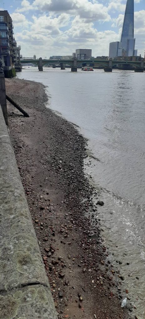
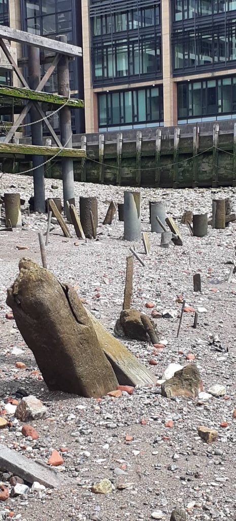
I am early, really early, but it gives me time to watch – the river and the people – from a shady spot, which, thankfully, is tickled by an occasional breeze. Observing the tide as it slowly retreats, numerous wooden structures begin to appear, the remains of old jetties and the like can be seen jutting out of the mud. The Thames has been the lifeblood of London for more than two thousand years and although officially it was the Romans who first established a settlement here there were other inhabitants of the area throughout prehistory.
The tide begins to fall…
The excitement builds as more of the foreshore is revealed…
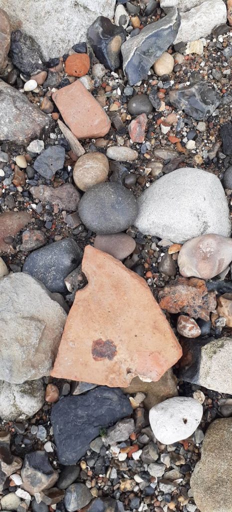
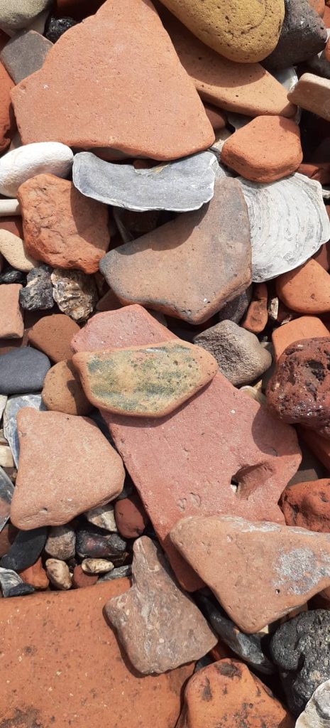
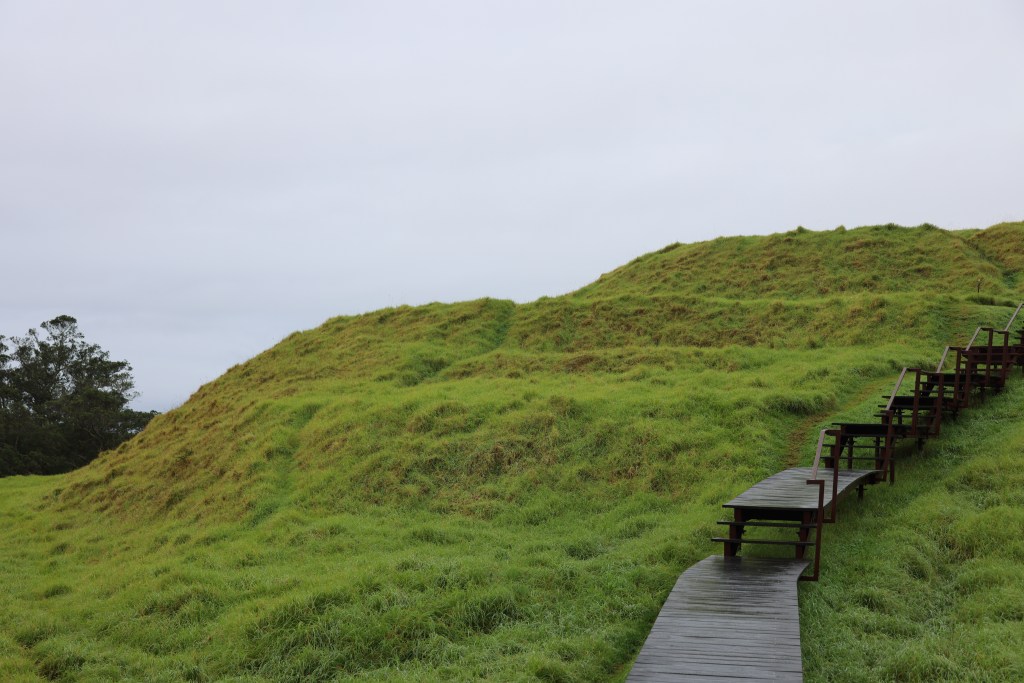
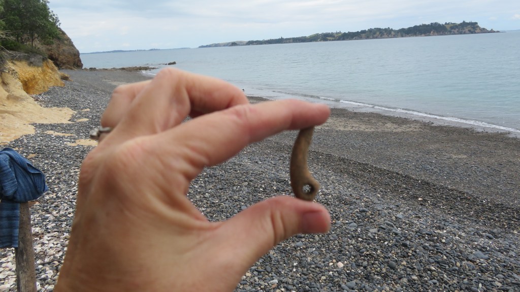
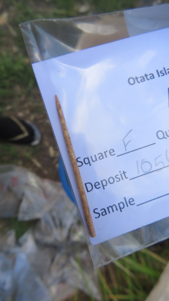
Finally…I am on the foreshore…where do I look first? (note the ubiquitous clay pipe stem).
All of those people, have over thousands of years left traces of their lives on the foreshore of the Thames.
In the past mudlarks were group of souls who spent endless hours sorting and collecting useful debris from the mud to sell – it was an occupation for only the most desperate.
“The searched for pieces of coal they could wash and sell on the streets; rags, bones, glass and copper nails they could take to various merchants to recycle…sometimes the children would turn cartwheels in the mud for the amusement of onlookers, who would toss in a penny for them to find. It was a pathetic existence and just a step away from the workhouse.” (L Maiklem ‘A Field Guide to Larking’ 2021).
Nowadays, mudlarks have a much-improved reputation – the twenty first century mudlarks of the Thames foreshore scour the mud and debris for stories of the past. Bits of broken pottery, clay pipes pieces, coins, buckles, pins, tiles, bones and much more all tell the story of London’s history. Not the story of kings and queens but one of ordinary people whose voices are often lost to us but who can speak to us down through time via the bits and bobs they lost and discarded along the river.
As some may already realise, larking is one of my favourite activities – in NZ it is dressed up as beach combing and often consists of finding odds and ends of glass bottles and 19th/20th century ceramics if I’m lucky. So when the opportunity arises for me to become a mudlark for a few hours…well…what can I say…(actually I yelled, ‘here take my money!’)
At this point it is important to note that not just anyone can mudlark on the Thames foreshore and there are a number of rules and regulations to follow. Everyone who is involved in the searching and removal of objects from the foreshore has to hold a permit to do so. There are also exceptions as to where you can and cannot search, for example, the foreshore in front of Westminster is completely out of bounds (for obvious reasons). There are places where only certain permit holders can go and there are rules surrounding the digging/scraping of the foreshore. For more information on the rules and regulations look here.
For the casual visitor to London there are two ways to get involved mudlarking – get a day permit from the Ports of London Authority or join a mudlarking tour. The Thames Explorer Trust do daily tours and give you plenty of time on the foreshore to fossick. Needless to say, my foray into mudlarking was with the Thames Explorer Trust, as I found it to be the cheapest and easiest way to get involved.
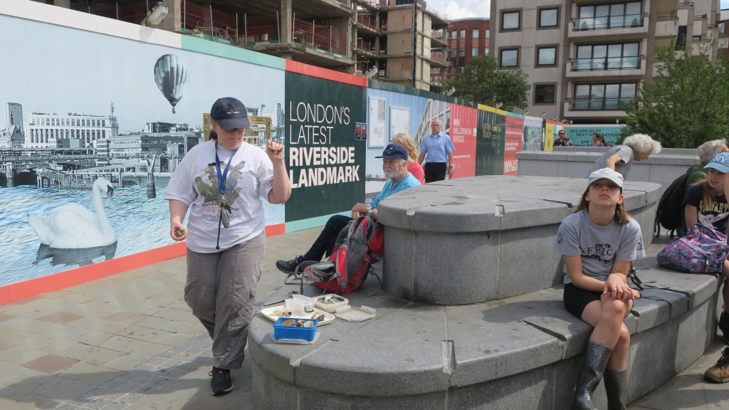
Our guide (standing in the hat) giving us a whistle-stop tour of London’s history through its artefacts.
Our guide for the morning was both knowledgeable and enthusiastic (and a fellow NZer!) She began the tour with a whirlwind introduction to the history of London and the types of artefacts we might find on the foreshore. Eventually, we were ushered to the steps that led down to the riverside. A few final words of warning from our guide (watch out for the wash of passing boats, no digging or scraping and don’t go past that point over there…) and we were left to our own devices.
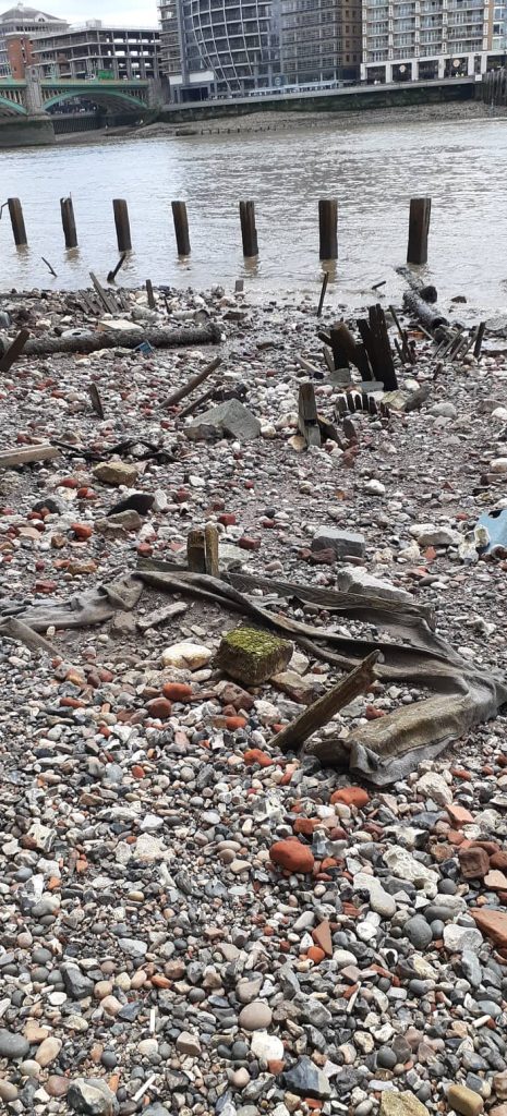
The area where we were not allowed to venture – the round posts in the center of the photo are actually surrounding the remains of the Anglo Saxon wharf at Queenhithe. Only certain people are allowed to search in this area.
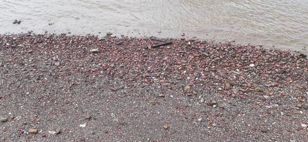
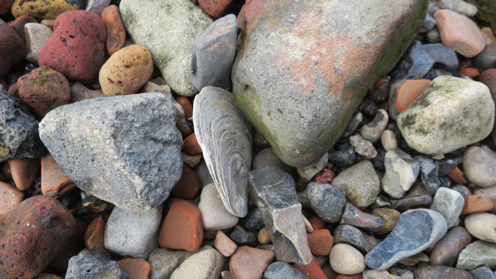
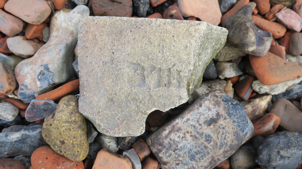
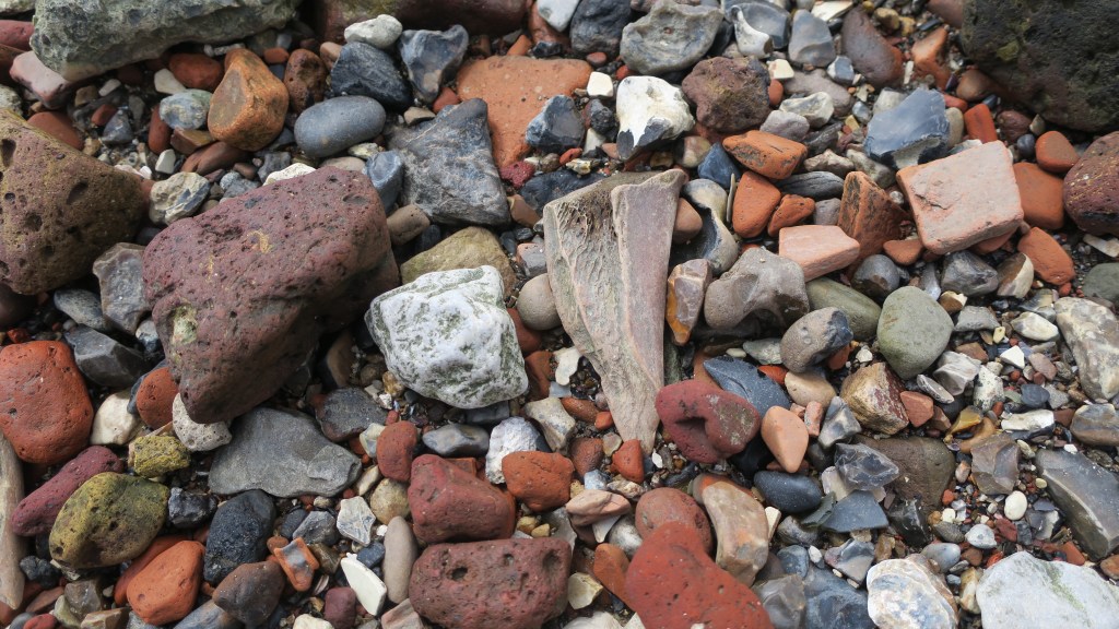
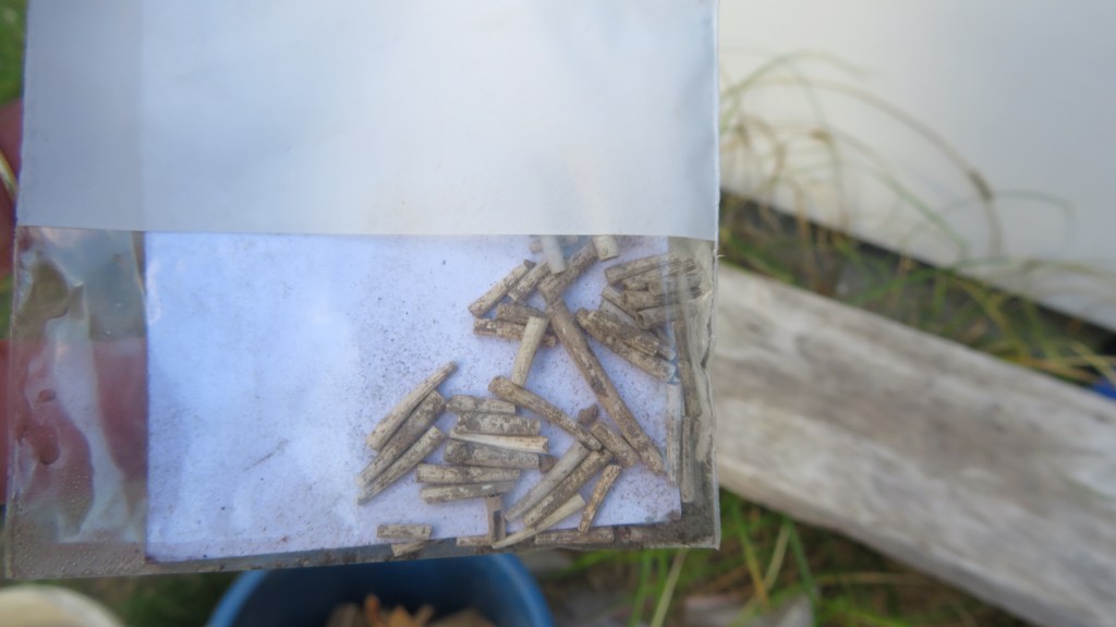
Bent over, eyes on the ground, the rest of the world receded to a low hum in the background as bit-by-bit London’s past revealed itself. The broken stems of clay pipes were by far the most numerous artefacts, along with red bricks and roof tiles, pottery fragments began to leap out. At first the ubiquitous willow pattern and plain white sherds but then as I looked harder, the green glaze of medieval pottery could be seen. Animal bones were plentiful, some the remains of someone’s fried chicken dinner, whilst others spoke of the butcher and the resources needed to feed the people of London. Oyster shells told a tale of cheap and easy eats (in the past oysters were not a delicacy but a cheap foodstuff for poor people).
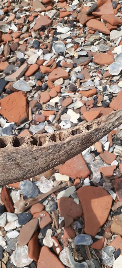
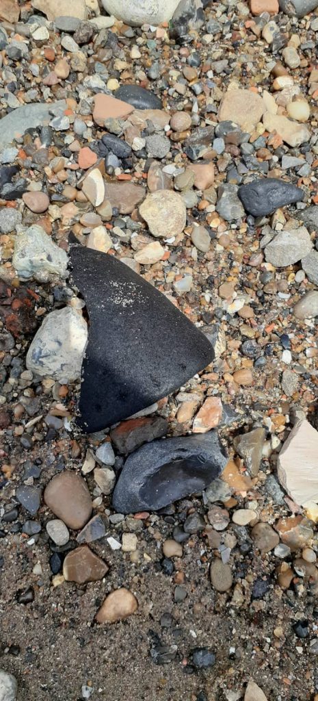
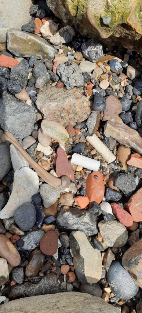
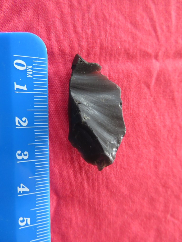
The above photos show just some of the things I spotted – in truth I kept forgetting to take photos, I was so engrossed. The first photo is of a roof tile, the nail holes can be seen on either side (I would like to think this was Roman but I cannot say for sure), second photo is the jaw bone of a pig and represents just some of the vast amount of bones found on the foreshore. The third photo is the sole of a leather shoe, age is undetermined but most likely Victorian – the Thames mud is of type which preserves organic remains very well. The fourth picture shows first a chicken leg bone, clay pipe stems and a small sherd of green glazed medieval pottery. The final photo is a close up of the medieval pottery sherd, note the quantity of terracotta brick and tile.
It was, simply, two hours of joy that flew by in seconds.
Please note, as a participant of the tour artefacts could not be removed from the foreshore; if you have one day permit you can remove artefacts but if you are travelling overseas, it is important to know that it is illegal to remove any artefacts over 300 years old from the UK. I would also like to stress that there are many laws around the removal of artefacts from any archaeological site (The Thames can be considered an archaeological site in its entirety) and it is up to the individual to know and understand these laws.
The following books are a good source of information regarding mudlarking on the Thames.
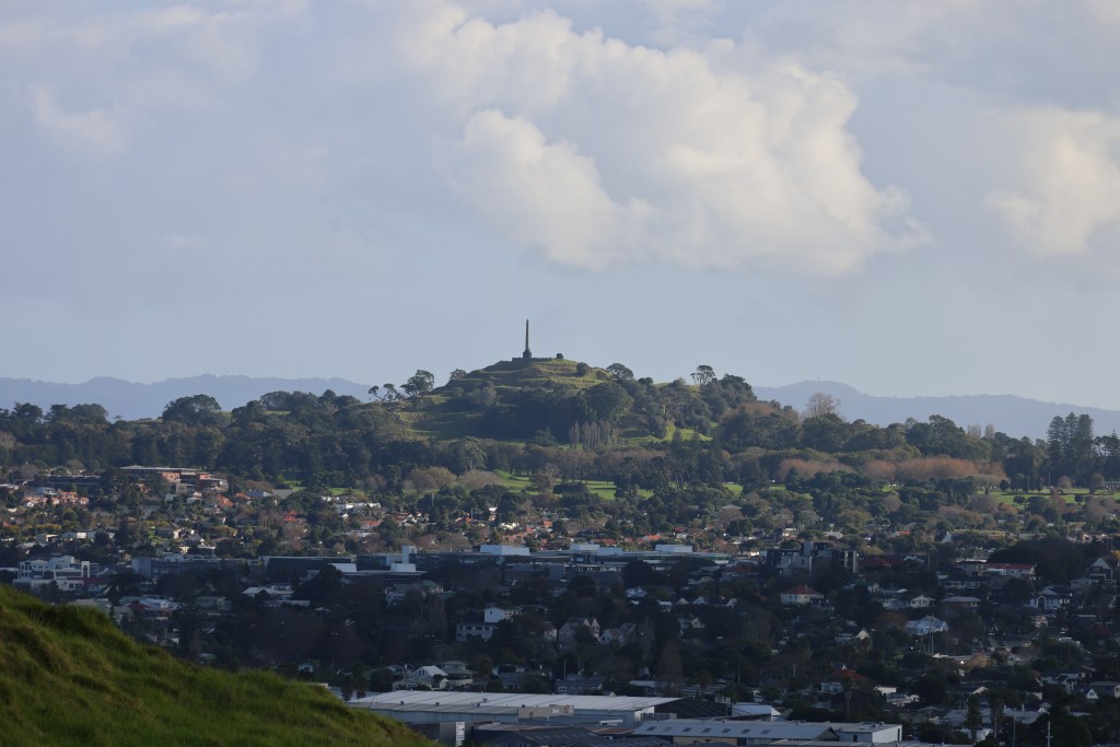
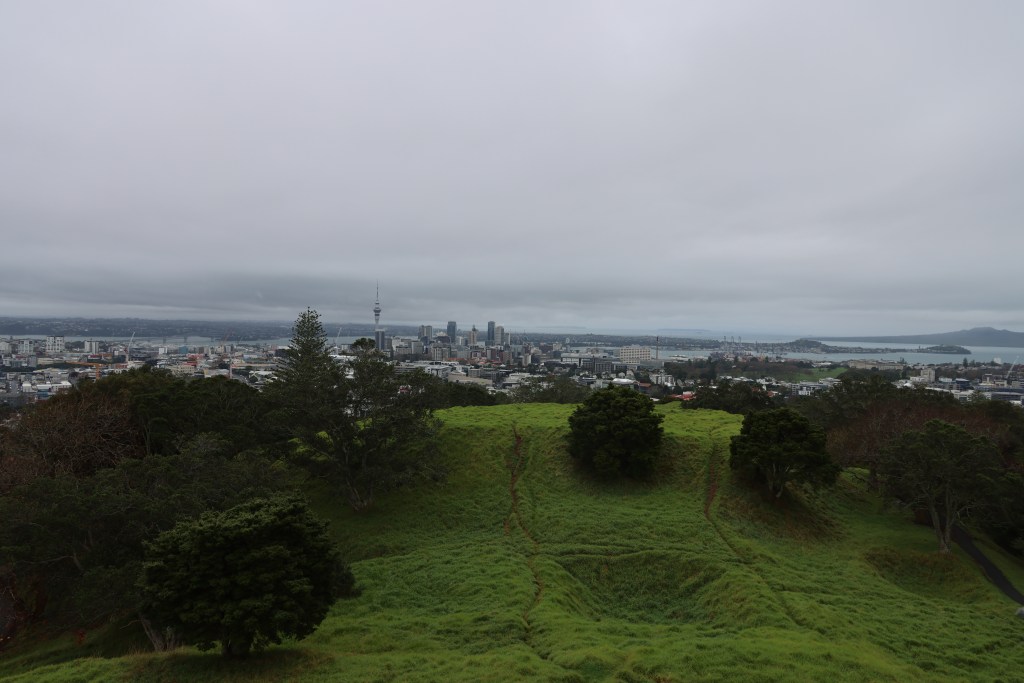
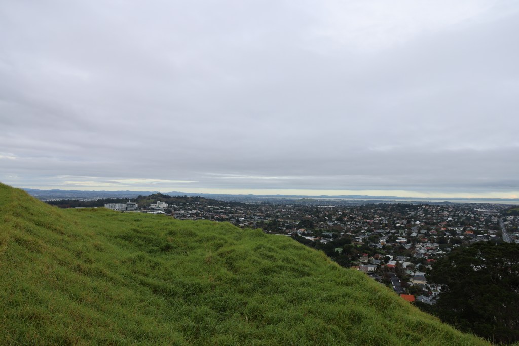
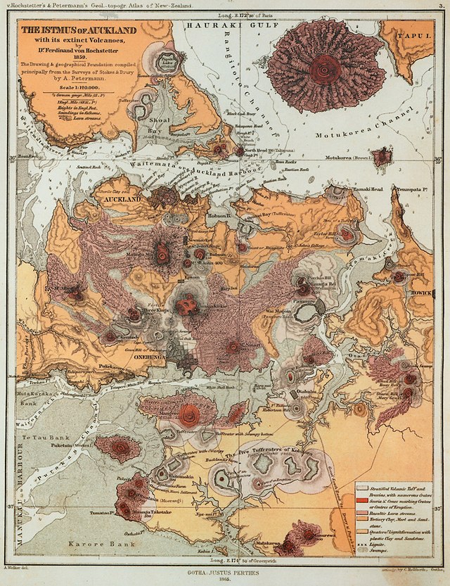
Perhaps one of the most dominant and much-loved landscape features of Tamaki Makaurau Auckland are the remains of long dead volcanoes. Fifty-three volcanoes have erupted in the Auckland area over many millennia (the most recent being Rangitoto), some exist in today’s landscape as basins or form lakes and many have been quarried away for stone used in the construction of roads and building, or to simply make room for the ever-developing city.
“For hundred of years, these volcanoes have played a key part in the lives of Māori and Pākehā – as sites for Māori pā and 20th century military fortifications, as kūmara gardens and parks, as sources of water and stone.” (B.Hayward ‘Volcanoes of Auckland’ 2019).
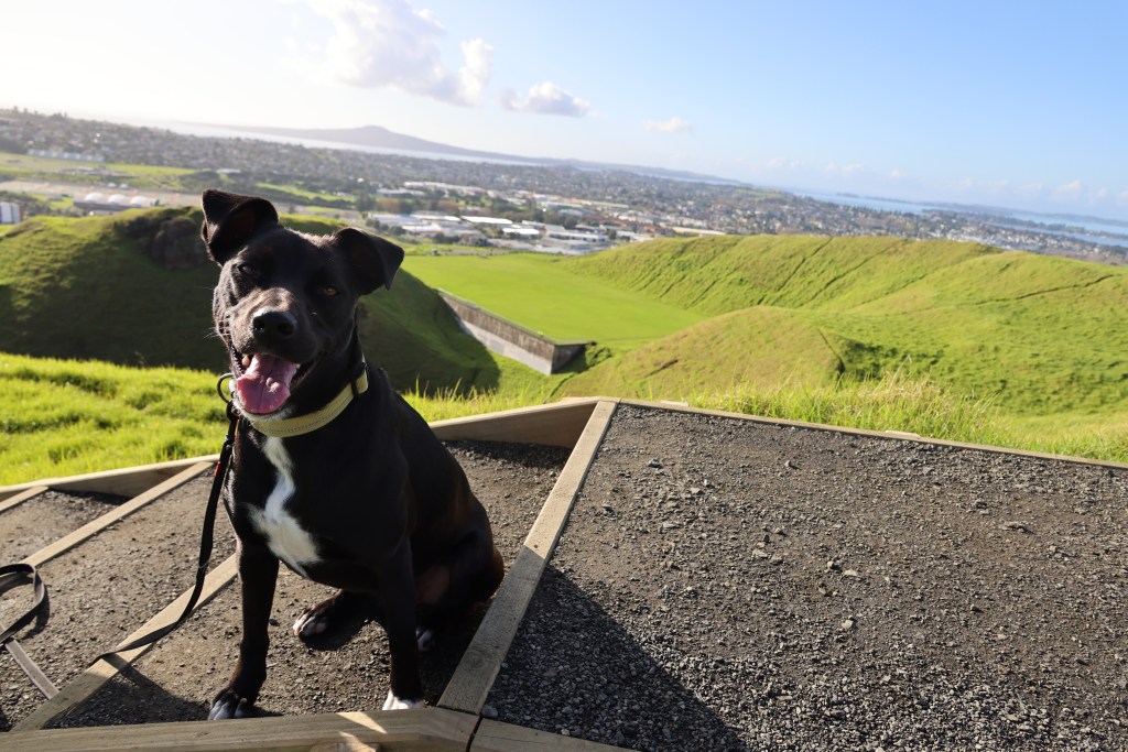
As an archaeologist my interest in the upstanding cones of Auckland’s past volcanoes relate to the features found on and near their slopes, to this extent with the company of the dog, the other half and one of the teens, it was decided to explore those we had seen from a distance as we zipped up and down the motorway.
The trusty hound on the summit of Maungarei/Mt Wellington.
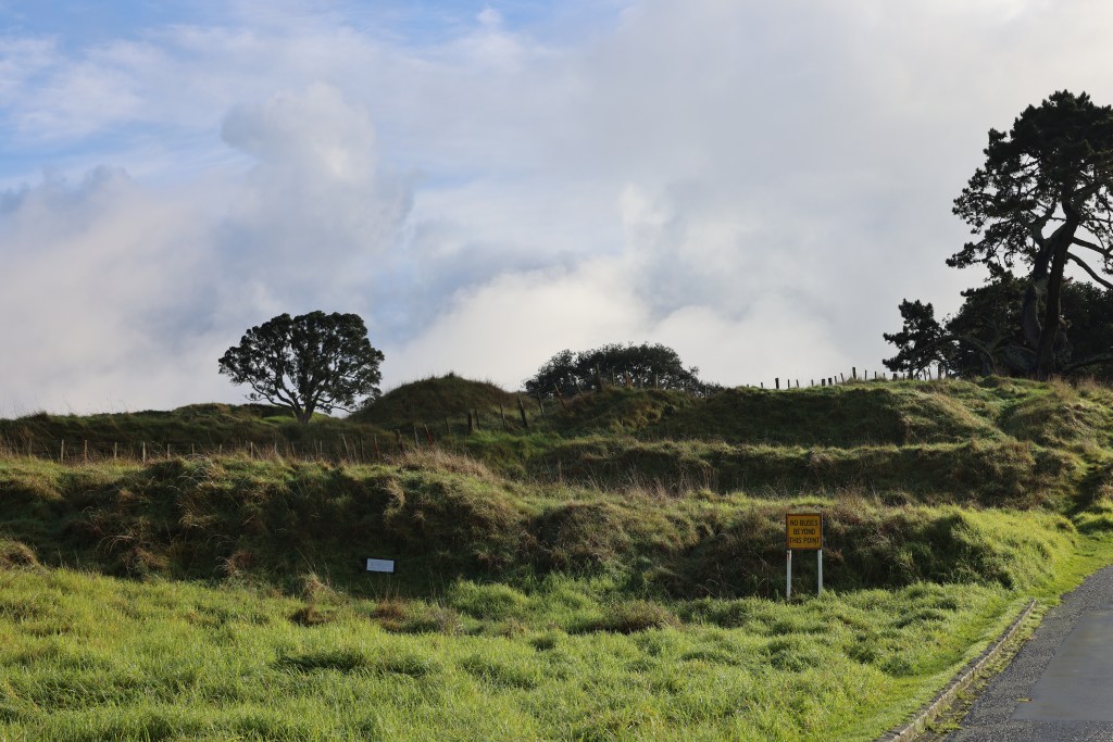
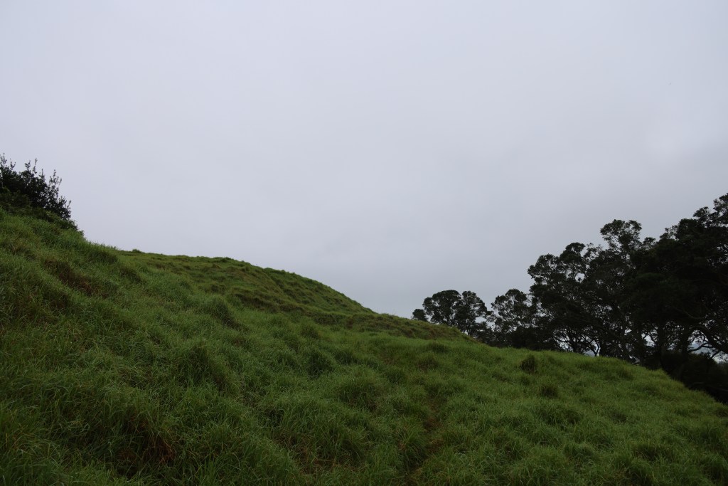
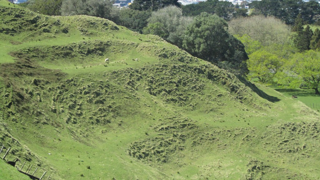
The four largest maunga (mountains/volcanic cones) in Auckland are Maungarei (Mt Wellington), Maungakiekie (One Tree Hill), Maungawhau (Mt Eden) and Mangere. Today’s visitor to these places may have a skewed view of the maunga, seeing them standing alone within a landscape of roads, housing developments and shopping centers. This was of course not always the case, using archaeology it is possible to strip back the layers of modern city life to see into the past. It is equally important to understand that the maunga were not static occupation sites. There were many changes over time, what we see today is simply the last phase of occupation. One of the most common assumption about all of Aucklands upstanding volcanic cones are that they were solely used for defence in times of upheaval. The common name for this type of site with its banks and ditches is pā – a Māori fortification which in turn has resulted in other misconceptions that will be touched upon below.
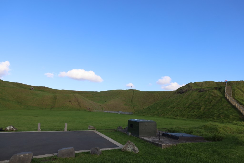
It is also important to know that remarkably little archaeological excavation work has been done on the maunga of Auckland. The most well known was the series of excavations done on Maungarei between 1960 and 1972 ahead of several developments (installation of water tank and road access).
The interior of the volcanic cone – the flat area is the top of a water tank with an asphalt carpark immediately in front (please note vehicle access is no longer possible on any of the maunga).
As mentioned above, a pā is seen as any type of settlement which has been fortified, their defining features are the banks and ditches surrounding an area of landscape. Situated mainly on hills, spurs and headlands (but not always, such as the ‘swamp pā’ found in the Waikato), there are some five thousand known pā in New Zealand, of which, the majority are found in areas good for horticulture. Other features can include, pits, terraces and house platforms.
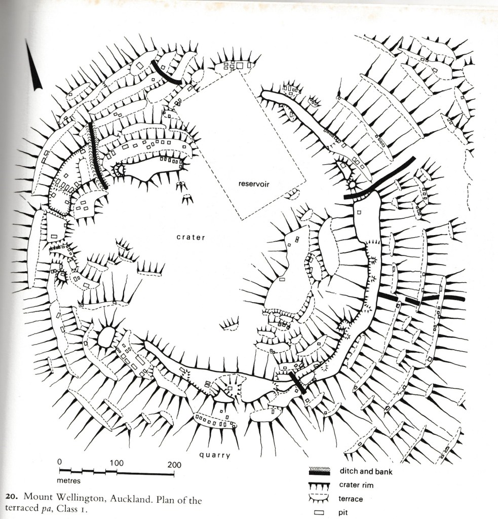
From Fox A (1976) ‘Prehistoric Maori Fortifications in the North Island of New Zealand’
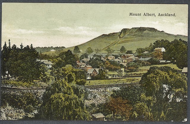
An old postcard of Mt Albert – the banks and ditches surrounding the summit can be clearly seen.
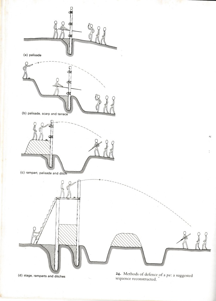
The above diagram is from A Fox (1976) ‘Prehistoric Maori Fortifications in the North Island of New Zealand’ depicting the variety of methods used in defence of a pā.
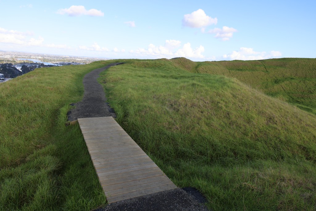
A sequence of ditches and banks along the north east rim of Maungarei/Mt Wellington.
It is perhaps a mistake to assign a singular function to pā – they were used as places of refuge but they were also places were people lived (although not always and in some cases never), where they stored important food and water supplies; they could also be focal points for religious activity. The palisades and ditches were just as likely to be a symbolic boundary separating a sacred area from the everyday, then a fortification built during times of war.
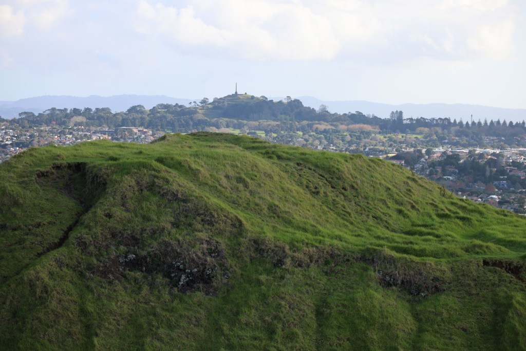
Maungakiekie (One Tree Hill) has four heavily defended summits but at its the very highest point there is an area which is regarded as important and sacred. Called Te Totara-i-ahua after the sacred lone tōtara that grew there in pre-European times (see earlier post) and it has the greatest amount of defenses surrounding it.
The highest point of One Tree Hill – note the many humps and bumps surrounding it – these are the remains of the terraces (lower slopes) and the banks and ditches (upper slopes).
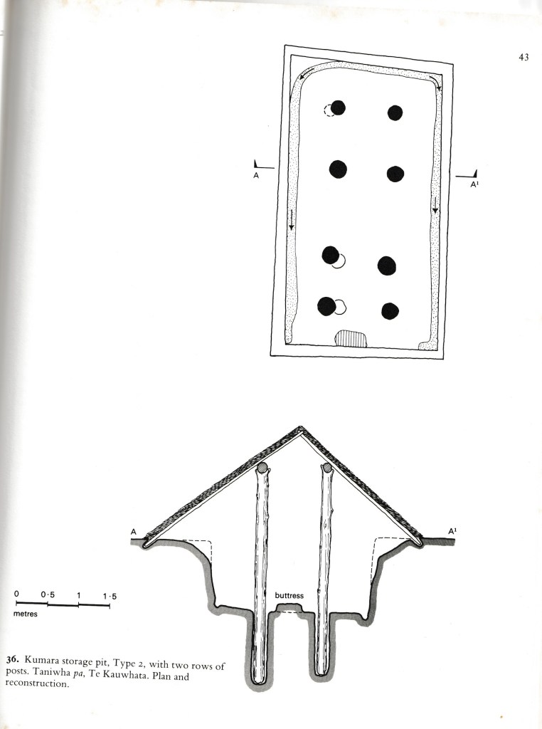
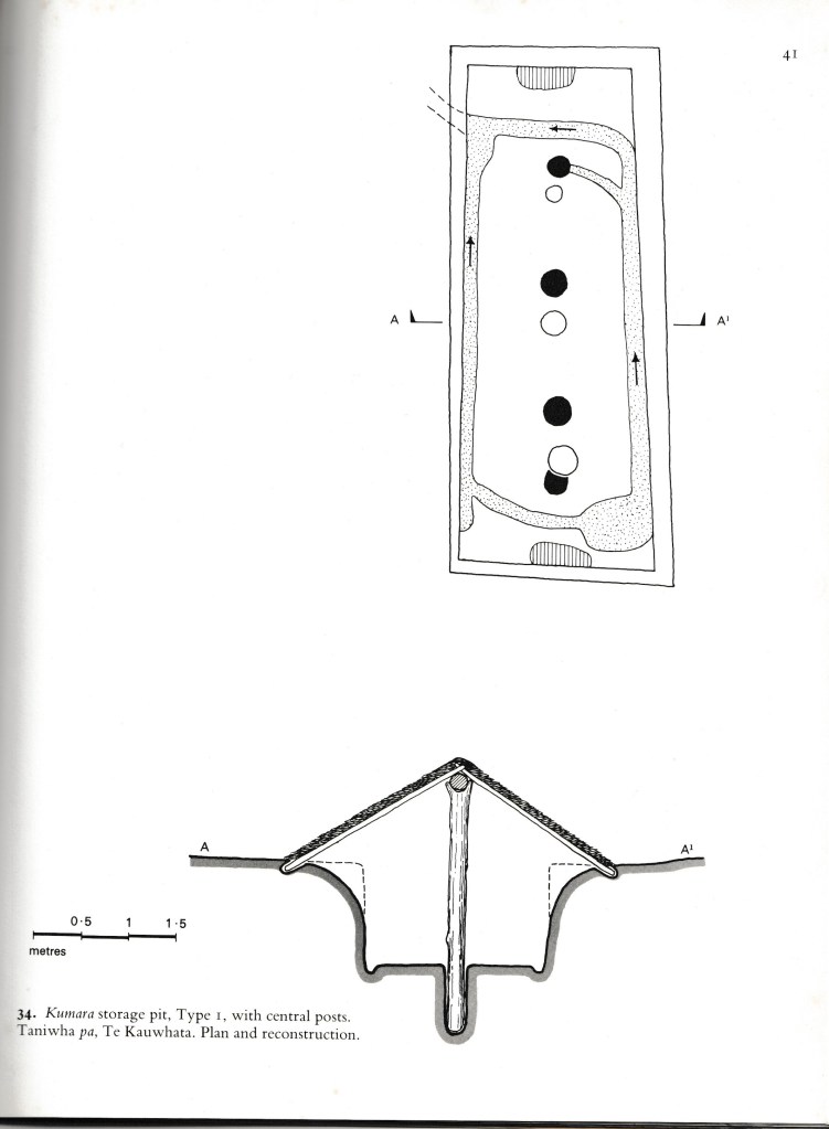
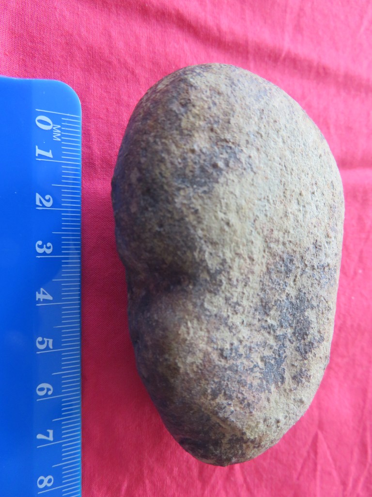
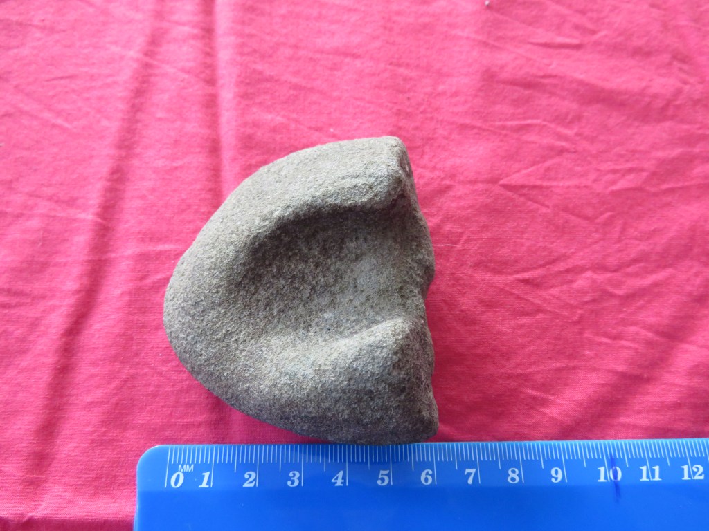
One of the most common features found at many pā including the maunga of Auckland are the storage pits. Unlike the ancestral tropical home of the Māori where important food staples could be grown all year round, Aotearoa’s more temperate climate required some lateral thinking by New Zealand’s first people.
Storage pits enable kumara tubers to be stored in conditions that protected them from extremes of temperature both for future planting and consumption. There are several types of storage pits – rua are small cave like structures that are dug into the ground and sealed with a wooden door. The type which is most obvious on Auckland’s maunga are the large rectangular storage pits dug into an area and topped with a pitched roof. Depending on the size the roof was supported by either a single line of central posts or a double line of posts. Other features within the storage pit itself include drainage channels that led to one corner of the structure and a sump – an important feature in Aotearoa’s rainy climate.
The above are from Fox A (1976) ‘Prehistoric Maori Fortifications in the North Island of New Zealand’ and show the two types of storage pits commonly seen on the maunga of Auckland.
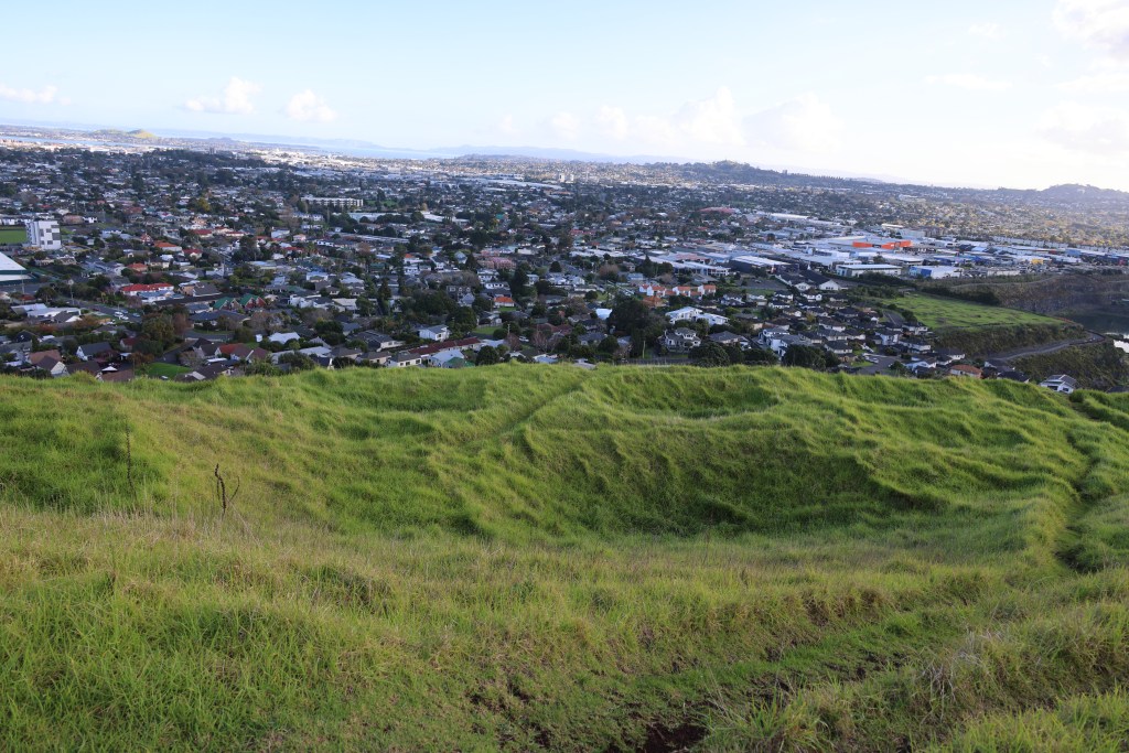
The depressions seen in a row (mid photo) are the remains of the rectangular storage pits – Manugarei/Mt Wellington.
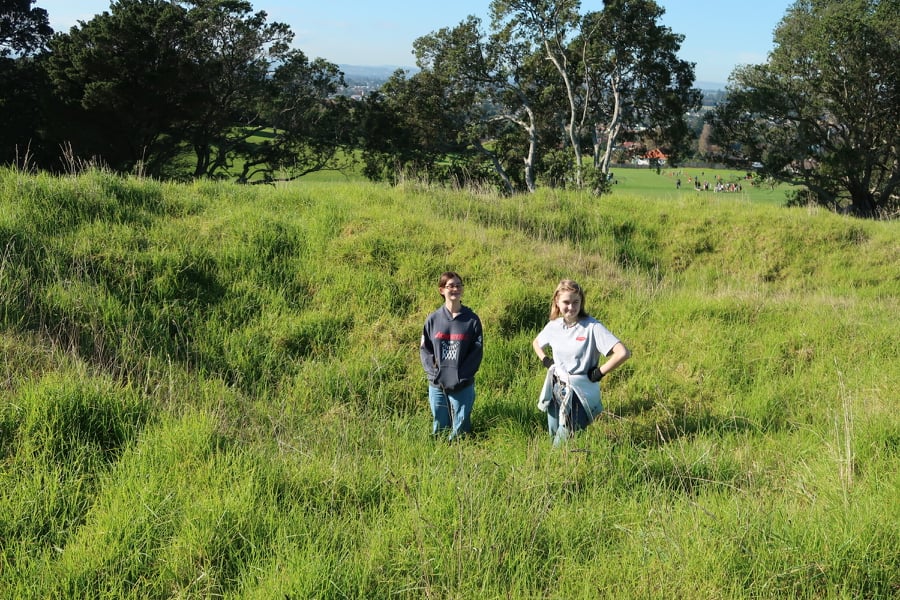
More of the rectangular storage pits but this time from Mangere Mountain – the two reluctant teens being used to show context regarding size of the pits.
As mentioned before the maunga of Auckland existed within a landscape dotted with settlements and gardens. The fertile volcanic soils surrounding the maunga providing a perfect growing medium for kumara and later the potatoe. This combined with the easy access to other natural resources such as fish and shellfish from the nearby harbours east and west of the central maunga made the isthmus a desirable to place to live where resources were plentiful.
The view from Mangere Mountain towards the Manakau Harbour – the stonefield gardens of Otuatua and Puketutu Island are to the top and left of the photo.
“The prospect from the summit is grand and nobly pleasing, I observed twenty villages in the valley below, and, with a single glance, beheld the largest portionn of cultivated land I had ever met in one place in New Zealand.” From Reverend John Butler – travelling with Samuel Marsden in 1820 as he climbed the summit of Maungarei.
The excavations of Maungarei produced radiocarbon dates for the earliest occupation on the lower slopes to the early 1500s. The period from the mid 1500s to the late 1600s was a time of intensive use. But after 1700 Maungarei does not feature in oral accounts of Māori history and was perhaps no longer an important place. The archaeology suggests that it was the two high points which were the most densely protected (tihi) by palisades and ditches. The lower terraces providing evidence of structures (postholes), hearths, fire scoops, midden deposits and storage pits.
“Maungarei was thus the location of repeated settlements, which were sometimes fortified, particularly late in the sequence, but often not.” From J Davidson (2011) ‘Archaeological investigations at Maungarei: A large Māori settlement on a volcanic cone in Auckland, New Zealand’ Tuhinga 22 Te Papa.
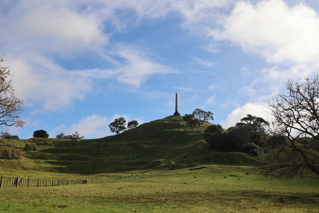
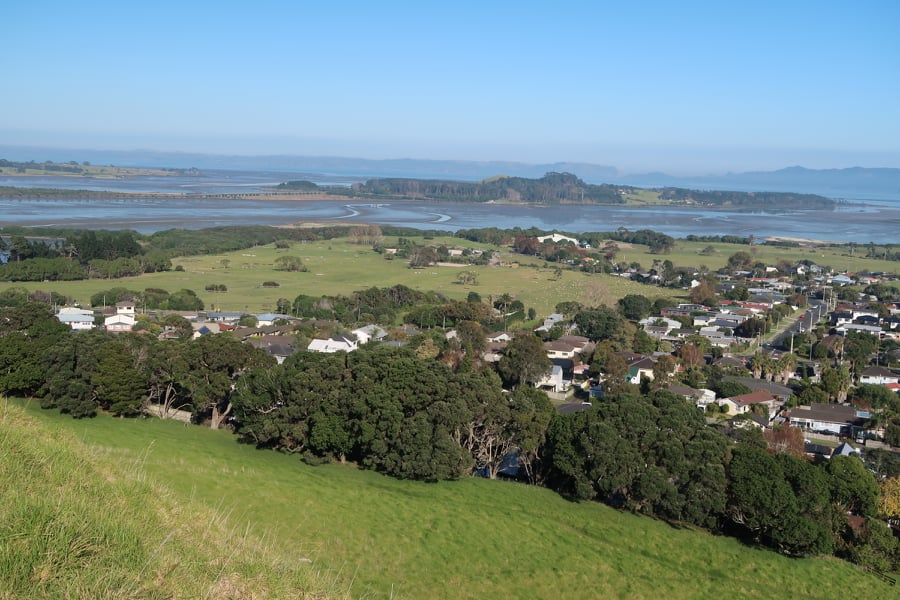
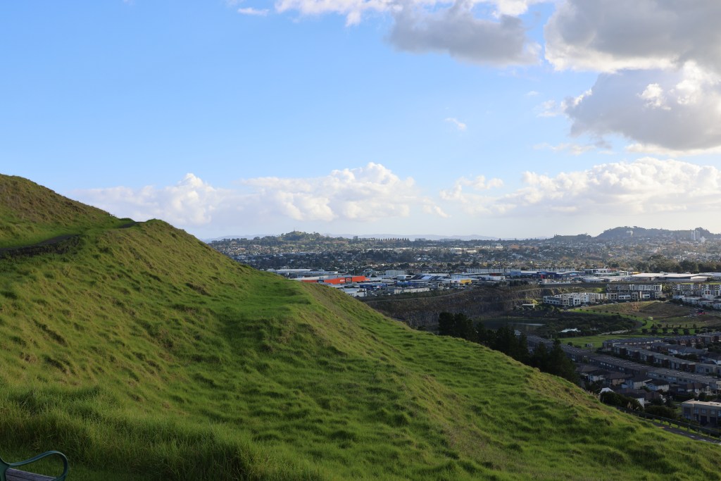
A view of the man humps and bumps to be found over Maungarei – looking north towards Rangitoto.
Maungarei – the seeming farmland setting belies the busy road behind me and the surrounding suburban sprawl which are just out of shot.
Increasingly, archaeological studies are showing that the pā as a site was a late feature of the landscape, dating from the 1500s onwards, not all were in use at the same time and not all functioned in the same way. This would appear to be the case for Tamaki Makaurau Auckland as well. For a long time it has been assumed that the widespread presence of pā in Auckland has meant that the area was in a constant state of flux.
“…Tamaki, in the years of Waiohua ascendency, was one of the most settled and extensively cultivated regions in Aotearoa…in spite of the received wisdom of historians to the contrary, was the the fact that tribes enjoyed long periods of relative peace.” From R C J Stone (2001) ‘From Tamaki-makau-rau to Auckland’ Auckland University Press.
Another of the common features of the maunga are the areas of flat ground surrounding cones. These terraces were used as places for living (some have house platforms), as places for storage pits and as places for gardens.
The above slideshow shows a fraction of the terraces that can be found on any given maunga in Auckland. These examples are from Maungakiekie, Mangere, Maungarei and Maungawhau.
But this is not to say that pā were never used for defence, the banks, ditches and palisades would suggest otherwise. Instead it is suggested that a more balanced view be taken when interpreting such places. Understanding that what we see in the landscape is but the final stage of a long and often complicated history – the evidence from the excavations at Maungarei are a good example of this.
Auckland was recently subjected to what the meteorologists refer to as a ‘weather event’. High winds and a months worth of rainfall caused damage and chaos throughout the city. None more so than on the islands of the Hauraki Gulf including Otata.
Reports came in of erosion and the lost of the shingle beach exposing the clay beds. It was decided that a visit to the island would be necessary, to assess and record the damage to the midden site. In addition, Louise Furey, the archaeology curator at the Auckland Museum, invited Bruce Hayward and Robert Brassey for a second opinion on the stratigraphy of the site (the former a geologist and the latter an archaeologist who had worked on the nearby islands of Motatapu and Tiritiri Matangi).
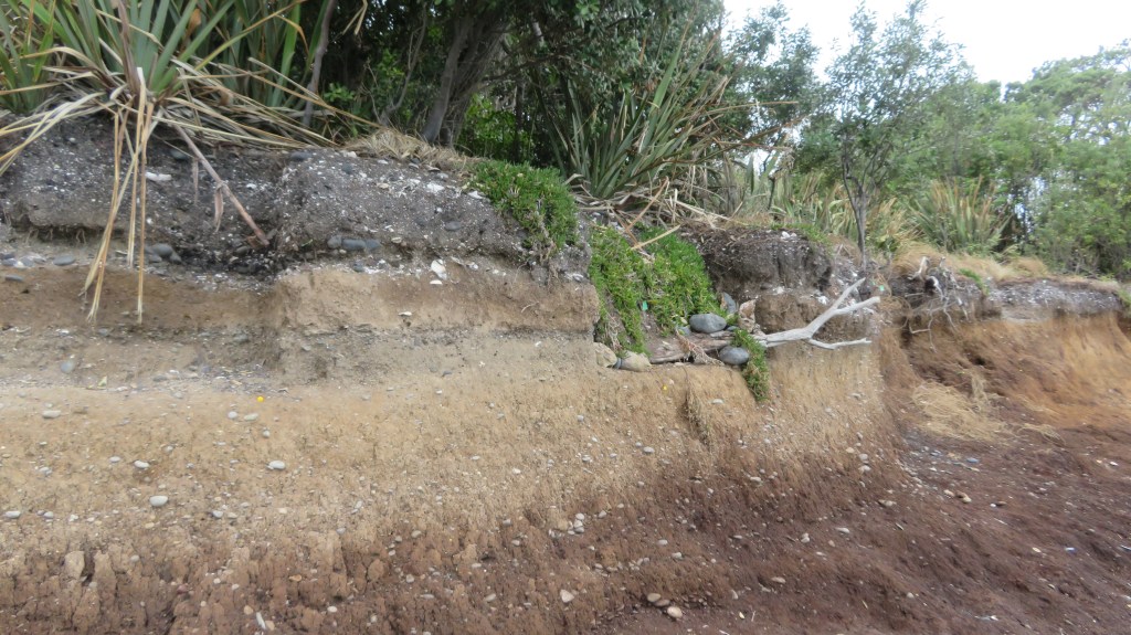
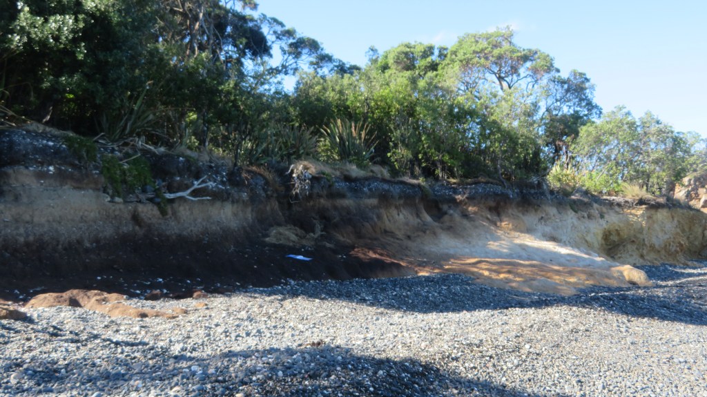
The first attempt to visit the island was thwarted, yet again by bad weather. However, on the second attempt we were graced with a stunning day with tides and winds in our favour and so we set off early morning. It was with some luck that only a few days earlier, the wind and tide redeposited much of the shingle back onto the beach, making landing on the island a little safer. On our arrival we could see that the sea had not been kind to the midden and much of the beach had indeed been washed away, leaving the midden sitting up high.
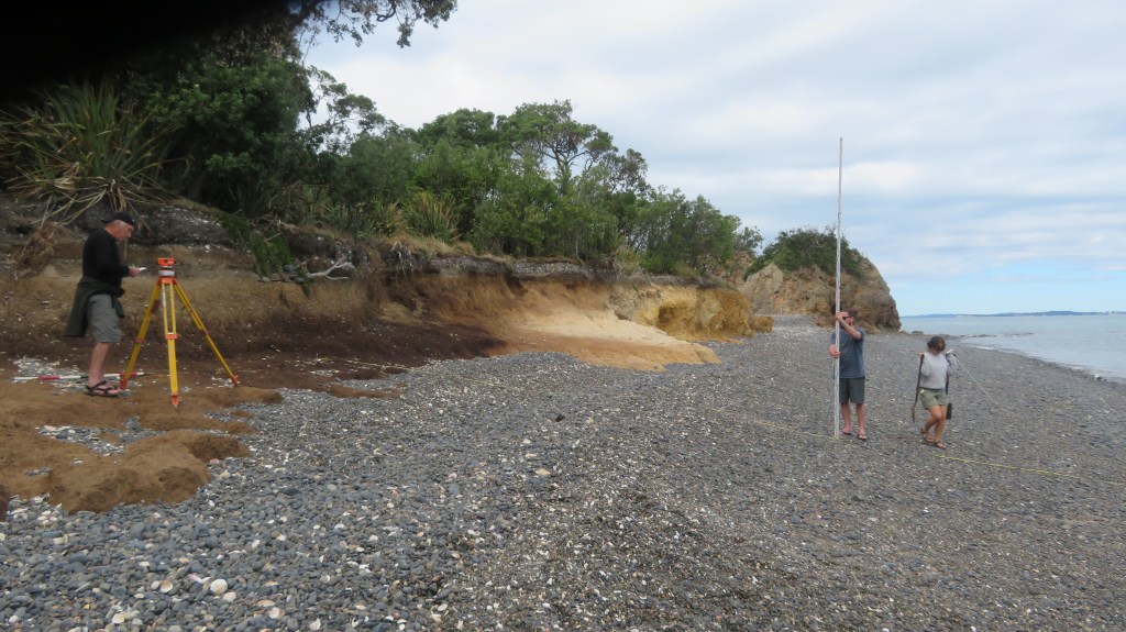
We spent the day measuring levels, recording and describing what could be seen. An Auckland Museum photography was on site to provide a photographic record of the midden in detail (look out for the video during Archaeology Week 2022). There was also a great deal of discussion regarding the stratigraphy – the outcomes of which can wait until the published report.
The following photos are of the site as it was seen on March 28th 2022 – these photos are my own.
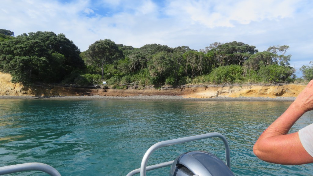
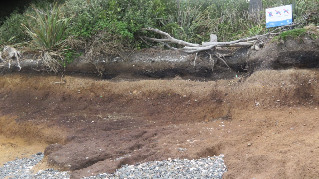
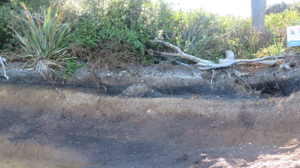
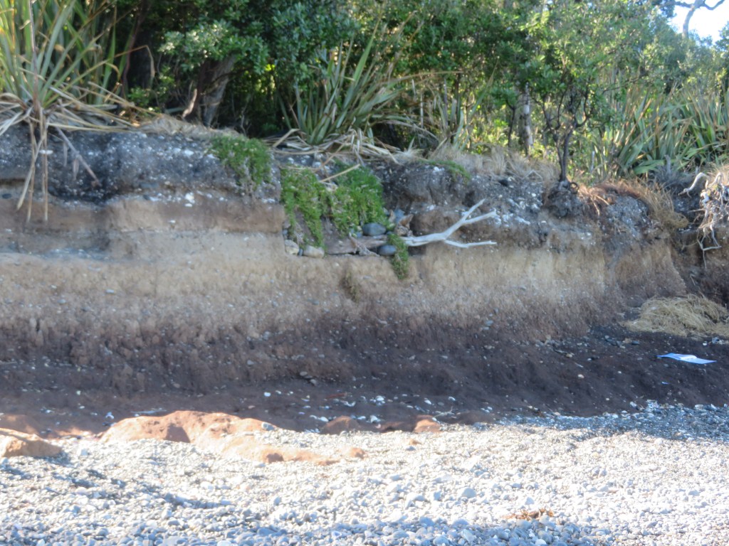
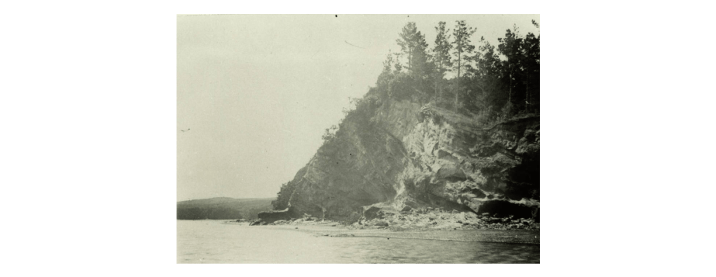
Main Beach from the boat – the grey band is the remaining shingle, the dark brown band is the clay and above that are the midden layers.
The area of last years excavation – where the cobbles and branch is sticking out of the edge is where I excavated last year. The base of this square was at ankle height but is now almost chest height.
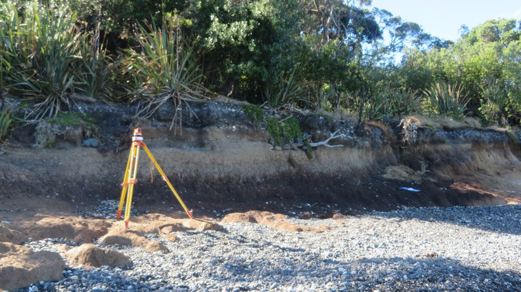
Taking levels.
For more information see a previous article on Otata here or visit the Noises website here and here for articles by Emma Ash (Assistant Archaeology Curator, Auckland Museum).
Coastal sites are always at the mercy of the environment and it can be heartbreaking to watch them year after year become less and less. The greatest shame is in the loss of the information that would have been gained if time and funds had allowed. Yes, it is true that excavation is destruction but when a site is under threat from elsewhere then surely it is time to step in and save that information for future generations. This is often done in urban areas before large developments are undertaken. Rescue archaeology shouldn’t just be about pre-development but also about the natural damage being done to archaeological sites.
Te Wiki o Te Reo Māori – Placenames in the Landscape.
Last week it was Te Wiki o Te Reo Māori – Māori Language Week and even if this post is a little late, it seemed a good idea to take a look at the names Māori gave to their places as a way of celebrating the language of New Zealand’s first people.
As you may already know as a landscape archaeologist I have a fondness for place names (see an earlier post on Cornish Place names) so felt it was about time I had a look at place names here in Aotearoa (New Zealand).
Place names in today’s Aotearoa are either of European origin or Māori, however it should be remembered that many of the places which today have a European name did indeed have a Māori name prior. As mentioned above the purposes of this blog it is the Māori names which are of interest. The European names will be considered in a separate article at a later date.
The need to give a place a name is universal to people across the world, it is our way of defining who we are and our relationship with the world surrounding us. The names of places can commemorate an event, define a landscape feature, be used to help travellers find their way, as a warning or as a way to signify a place of importance. In regard to Māori place names difficulties arise when trying to give a literal translation into English, for some words there are more than one meaning (as it is with English). Often the meanings behind a word are not easily definable. Words such a Mana and Tapu can be given an English interpretation but in actuality have a much more complex meaning to Māori. Add to this the fact that when Māori words were first written down by Europeans often the words were misheard and misspelt – a wrongly placed vowel can change the meaning of a word quite drastically.
What follows is just a few of the many place names and their interpretations.
One of the most important common words that make up Māori place names relate to features in the environment. Thus a word that begins with ‘Awa’ could refer to a river, gulley or valley; ‘Manga’ though is a stream or tributary and is not to be confused with ‘Maunga’ or mountain. The prefixes can be followed by other descriptive terms such as, iti/small, nui/big, roa/long. They can also have the names of people attached to them, the names of gods and the names of birds, fish and fruit. The latter often indicating the good places to forage for the said kai (food). From the perspective of the landscape archaeologist (or anyone interested in the past) the interpretation of place names can give us clues to the past, fleshing out the otherwise dry facts with the human story.
One of the most important part of any society is the ability to feed the people. As a result there are many place names which indicate the places that are good for food gathering and growing.
Awatuna – eel (tuna) creek (awa).
Kaipataki – to eat (kai) flounder (pataki).
Kaipara – to eat (kai) fernroot (para).
Motukanae – mullet (kanae) island (motu).
Whenuapai – good (pai) land (whenua).
Motukina – island (motu) of kina (a type of sea urchin).
Otamahua – the place where (o) children (tama – short for tamariki) at seagull eggs (hua).
Kaikoura – to eat (kai) crayfish (koura) – its full name is Te Ahi-Kai-koura-a-Tama-ki-te-rangi or where Tama the great traveller stayed and lit a fire to cook crayfish. A place where even today crayfish are sought after.
Arowhenua – there are several possible interpretations of this name – good or desirable land; turning land for cultivation or to desire land.
Hakapupu – estuary of shellfish.
Ororoa – the place of roroa (a type of shellfish).
Tahekeaua – a place to catch herrings by the waterfall – taheke (waterfall) aua (herring).
Mararua – two (rua) plantations/places of cultivation (mara)
Kaikoura 1983 from Archives New Zealand.
Other resources also appear in place names:
Motukauatiti/Motukauatirahi – two bays (Corsair and Cass Bay) noted for the Kaikomako trees, the timber of which was good for firemaking.
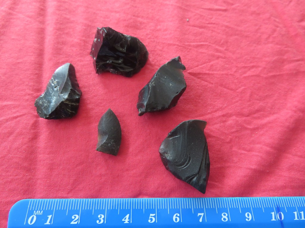
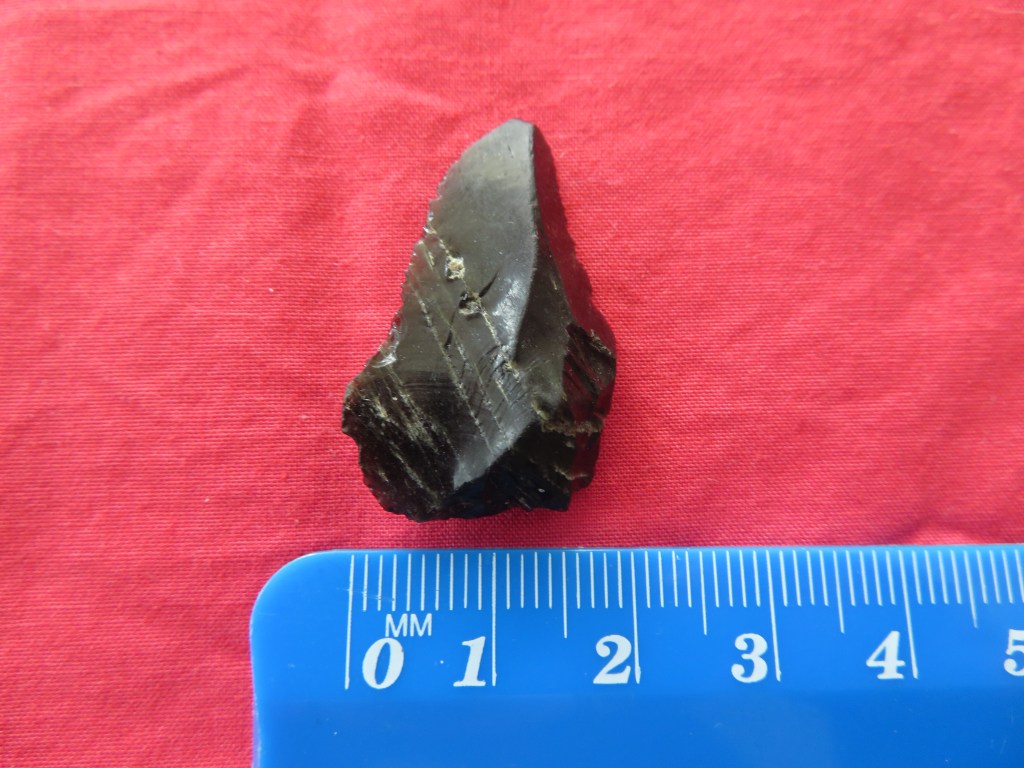
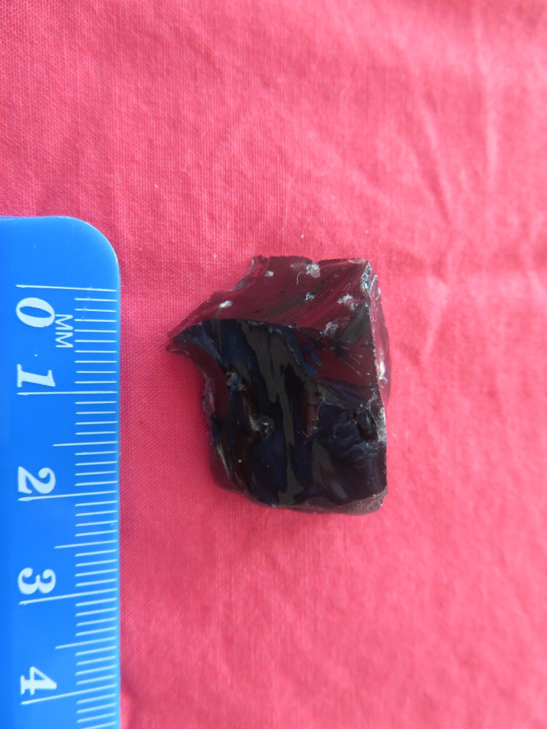
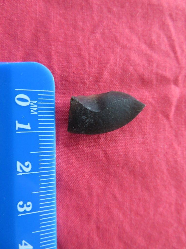
Omata – the place of flint/quartz – O meaning ‘the place of’ and mata can mean either flint, quartz, sometimes obsidian but also headland (interpretations can depend on what comes before or after the word).
Otemata – the place of good flint or quartz.
Ratanui – plenty (nui) of rata trees.
Kaitieke – to eat the tieke (saddle-back, a native bird).
Whangamata – obsidian/flint/quartz (mata) harbour (whanga) – obsidian is the most likely candidate as it washes upon the beach here from nearby Mayor Island.
Anatoki – cave of the adze.
From Buller’s ‘A History of the Birds of New Zealand, 2nd edition’ 1888.
Then there are the names that serve to aid those navigating the landscape:
Putarepo – the place at the end of the swamp where it could be crossed.
Puhoi – refers to the slow tidal flow thus it was necessary to wait for high tide for the river to be navigable.
Otira – the place of travellers – indicating an old campsite on the Otira River where food was prepared for the trip through the Hurunui Pass.
Motuara – island (motu) path (ara) – most likely to mean an island in the path of canoes.
Tauranga – resting place/safe anchorage for canoes.
Kaiwaka – literally to eat (kai) canoes (waka) – may refer to the places where the swift flowing river has the ability to destroy a canoe.
Mangawhata – the stream by the storehouse.
Arapuni – two possible interpretations – a path to a camp or a path that has been blocked – Ara meaning path.
Whangaruru – a sheltered (ruru) harbour (whanga).
There are also names that serve to warn people away from place:
Kaitoke – to eat (kai) toke (worms) – indicating a place of poor soil.
Mangakino – bad/useless (kino) stream (manga).
Waikino – bad (kino) water (wai).
Mangamate – stream (manga) of death (mate) – one wonders what happened here to warrant such a name.
Otepopo – literally the place of the decay – or the place of Te Popo.
Motutapu – sacred/forbidden (tapu) island (motu) – possible a name given after the eruptions of Rangitoto and the island was covered in volcanic ash.
Matatapu – sacred headland.
The two islands of Rangitoto (on the left) and Motatapu (right).
Other places are simply descriptive:
Maunganui – big (nui) mountain (maunga)
Tauranga-Kohu – kohu means mist/fog and thus this name could indicate a place where the mists linger.
Waihapa – crooked (hapa) water/stream (wai).
Waihaha – noisy (haha) water/stream (wai).
Pukekahu – hill (puke) of hawks (kahu).
Pakowhai – village/settlement (pa) by the kowhai (native flowering tree).
Mahoenui – the place of many mahoe trees.
Ngaroto – the lakes.
Rotoma – the lake of clear waters.
Ngapuna – the springs
Onehunga – the place of burial
A simple perusal of any map will show that certain prefixes are more common than others and for obvious reasons. Hills (puke), mountains (maunga) rivers (awa), streams (manga), lakes (roto), caves (rua), water (wai) and harbours (whanga) are prolific features of the landscape.
Other names are used to commemorate an event thus Ahuahu (Great Mercury Island) is literally translated as ‘to heap up’ but refers to when Paikea came to the island on the back of a whale, when he landed he was cold and so heaped the warm sand over himself hence the name.
Iwikatea (Balclutha) is a reference to a great battle that occurred here and where the bones of the slain remained for many years.
The Hokianga proper name is Hokianga-nui- a-Kupe or the ‘Great returning place of Kupe’ – it is from here that Kupe returned to Hawaikii.
A panoramic view of the entrance to the Hokianga Harbour- photo by Andyking50 on wikicommons.
Patumahoe literally translates as a weapon made of mahoe, a native tree. But further digging finds a tale of how ‘in a battle at this place a chief was killed with a mahoe stake’.
Tamaki-Makau-Rau (Auckland) is called thus because of its excellent soils and bountiful harbour there were often many fights to establish who would hold this prize – literally it is translated as ‘Tamaki of a hundred lovers’ – tamaki can be translated as battle.
Motu-toa can be translated as the island where warriors fought.
Rotoiti – the full name of this lake is Te Roto-iti-kite-a-Ihenga and is interpreted as the little lake that was discovered by Ihenga.
Te Tawa – here Ihenga pushed his canoe with a piece of tawa wood, it stuck in the ground and he left it there thus naming the place after it. Ihenga features in many of the interpretations of Aoteoroa’s places.
Kirikau – a place where a battle was fought in which the contestants were naked – kiri (skin) kau (bare).
Another grouping of place names relate to the cosmological – the deities, the supernatural and the movement of the sun, moon and stars.
Tapuaenuku – the footsteps of the rainbow god.
Te Puka-A-Maui – the anchor stone of Maui (Stewart Island).
Ruataniwha – literally, the two taniwha (see earlier article on taniwha for more information) – in this case that there were two great taniwha who lived in a lake and fought over a boy who fell in. Their struggles formed the Tukituki and Waipawa Rivers.
Oamaru – the place of the god Maru.
Anakiwa – Cave of Kiwa – Kiwa was a man’s name but was also one of the gods of the sea.
Omaui – the place of Maui.
Oue – the moon on the fourth night.
Otane – the moon on the twenty-seventh night – the place of the moon.
Momorangi – offspring of Rangi (the sky god).
Te Waka-A-Maui – an old name for the South Island – referring to the canoe (waka) from which Maui fished up the North Island.
Otamarau – the place of Tamarau – a spirit who comes in the whirlwinds.
Map of Te Waka-A-Maui (The South Island)
These are all just a few examples of the wide variety of names used by Māori, there are many more that have not been touched on in this article – to do so would be the work of whole of book. Place names not mentioned are those commemorating a particular person. Ihenga and Kupe have already been mentioned but there are many others such as Mangaotaki (the stream of Taki) or Hekura, the name of a woman from the Arai-te-uru canoe. Or Ohinemutu, the place of the young woman who was killed – she was the daughter of Ihenga who placed a memorial stone at the place of her death calling it Ohinemutu. There are also the places that were named after the arrival of the Europeans such as Hiona, the name given to a pa on the Whanganui River, by the missionaries – it is the Māori name for Zion. Or Maheno, an island – the name was given by the Europeans.
Then there are the names which are very old and come from the homeland of the first people to set foot in Aotearoa. Names such as, Maketu or Nuhaka, both names are after a place in Hawaikii. Then there is Atiu, one of the oldest names in Marlborough and is a possibly a name transferred from the Cook Islands.
As mentioned before this is but a small insight of the fascinating world of Te Reo and the place names of Aotearoa. From a landscape archaeologist point of view all of these names give an insight to how Māori viewed their world and the events that shaped their memories of places. Giving us key glimpses into the past. Putting flesh on the bones of the evidence.
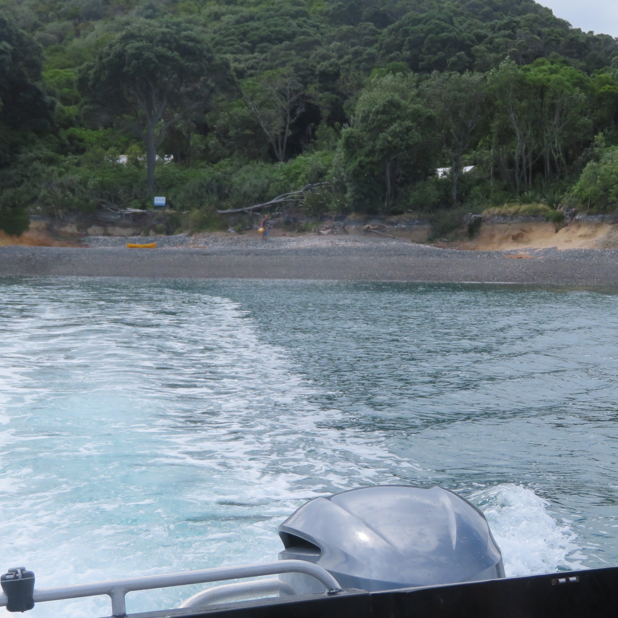
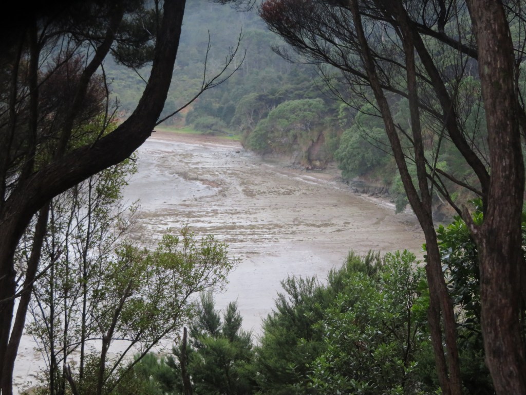
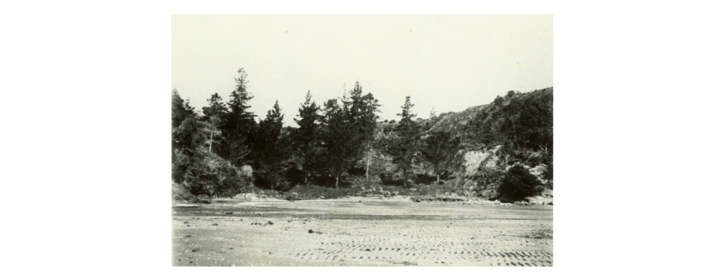
Otata Island is the largest of several island that make up the Noises island group. Situated on the edge of the Hauraki Gulf, its nearest neighbour is the island of Rakino.
View of Rakino Island from the beach at Otata.
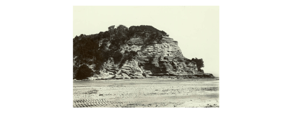
In 2018 a storm swept away some five meters of the shoreline and in doing so exposed a large midden, approximately 50m in length. Concerned that even more of the shoreline and thus the midden could be lost during subsequent storms the landowners (the Neureuter Family) contacted the Auckland Museum for assistance.
The beach at Otata, the excavation site is just pass the tripod legs of the sieves. For those who know this island well, the beach has been dramatically transformed in the last 2-3 years – in places the erosion issue is plain to see.
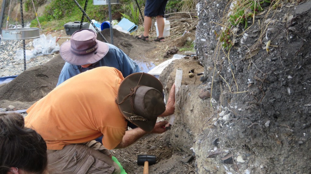
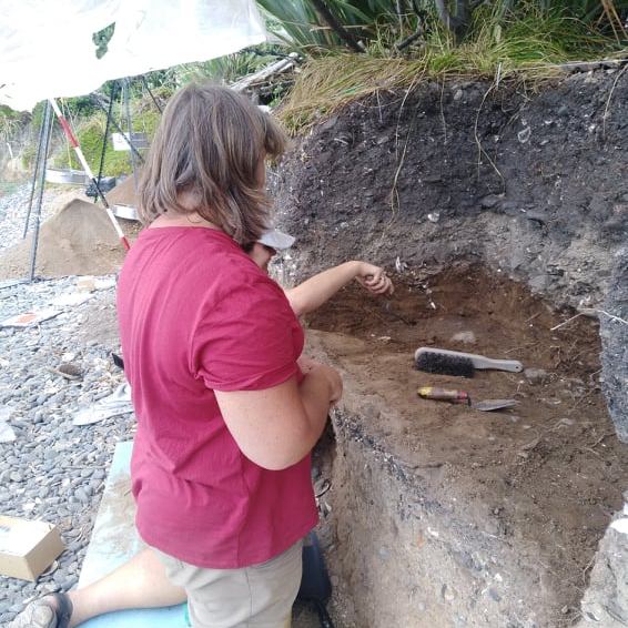
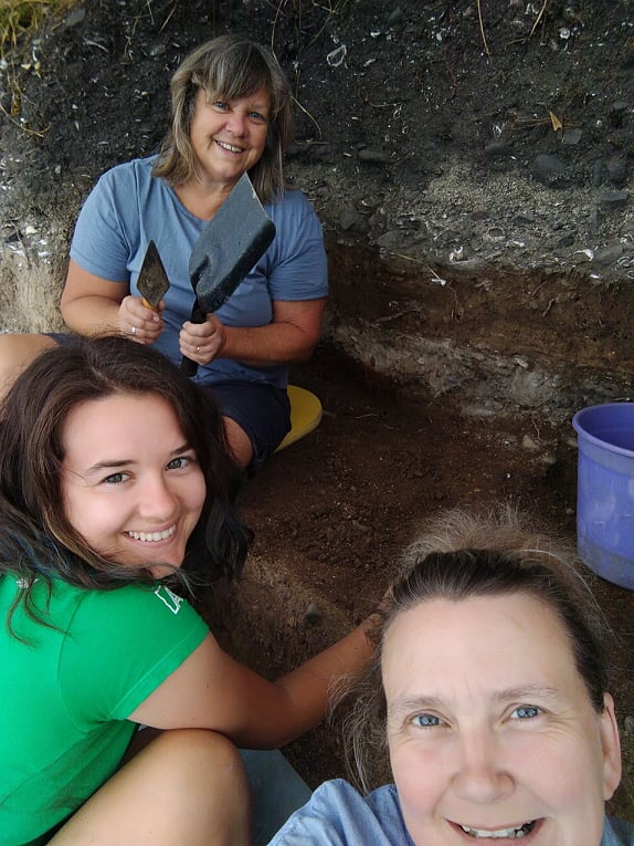
In March 2020 (just prior to New Zealand’s month long lockdown) archaeologists from the Auckland Museum, led by curator Louise Furey, along with representatives from Ngai Tai ki Tamaki and the family began a week long excavation. The following year they were back again for another week of digging (- it was at this time I was given the opportunity to participate).
One of the aims on both occasions was to record vital information before the midden was lost to erosion – a common issue for archeology in New Zealand where so many sites are situated in coastal areas and are vulnerable to climatic conditions. The fragility of the shoreline was evident during the 2021 excavation, when large chunks of the edge would crumble away with the slightest touch – the square I was excavating was reduced by a third by the end of the dig. It is not hard to imagine what a storm surge could do.
Of equal importance is another of the aims of the project was provide an environmental baseline for the understanding the marine environment around Otata and how it has changed over time.
“For archaeologists the most exciting feature of the Otata midden is the rich diversity of species contained within it. Middens with an abundant range of species are rare in the Hauraki Gulf and only a few have undergone full analysis”
E. Ash ‘Excavating Otata Island: A Midden Revealed’ Auckland Museum Blog.
The partnership with the Ngai Tai ki Tamaki provided another dimension to understanding the archaeology. Mataurangi Maori – the knowledge and oral histories of local iwi – can serve as a valuable aid for the understanding of archaeological sites. In the case of Otata, the archaeology appears to support the ancestral stories, aiding our understanding of how early Maori used the Hauraki Gulf.
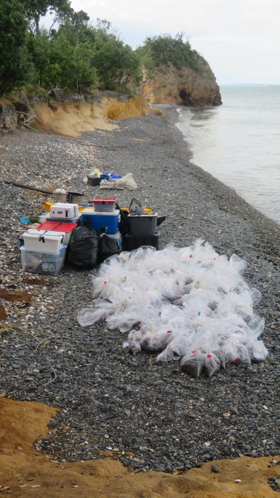
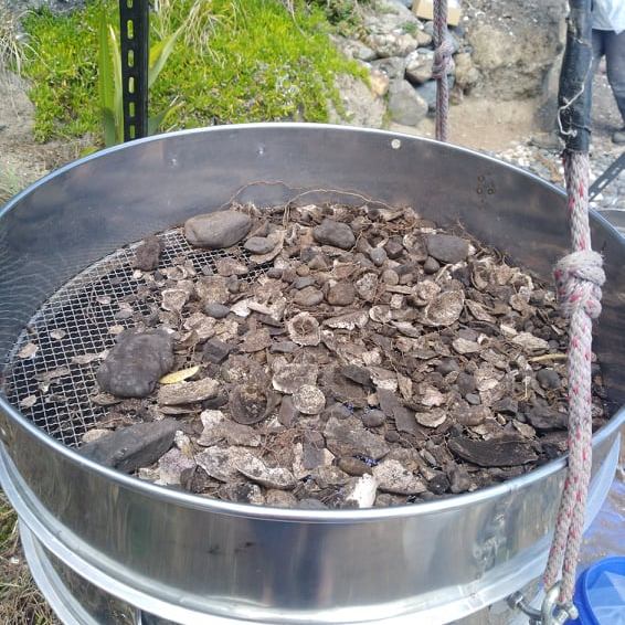
Because of the size of the midden, it would have been impractical to excavate large areas, instead a sampling strategy was employed. In total over the two weeks, seven one meter squares were hand trowelled, using a system of 5cm spits (unless features were identified) with the material from each spit being sieved (6mm and 3mm). The sieved material was then bagged up to be taken back to the museum for further analysis. In both years the samples taken from the island weighed in at approximately 500kgs.
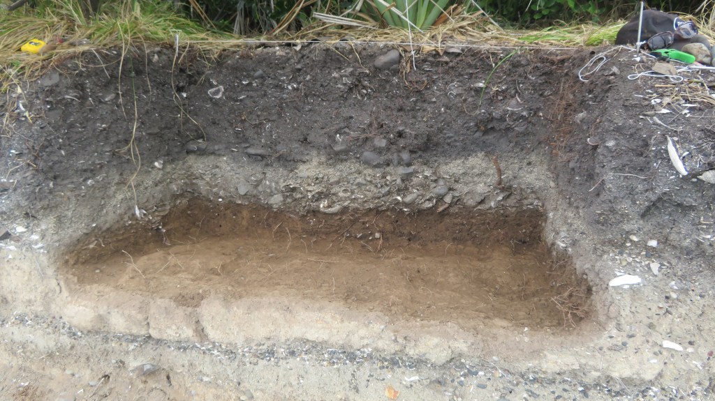
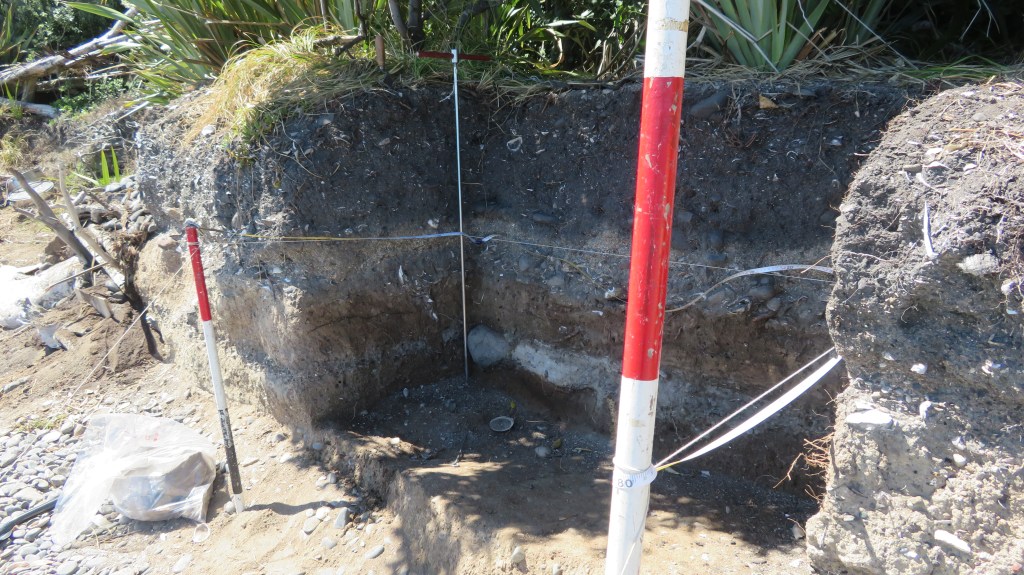
The sieving area with the excavation behind (2021) – the exposed face of the midden allowed us to dig directly into the midden.
From these samples it is the intention to identify and quantify the types of shellfish, fish and birds that were found on and around the island. This gives us an idea of foraging behaviour, food preferences and seasonality.
During the 2020 dig one of the squares dug down into a large hangi which consisted of quantities of burnt shell, a dense charcoal layer and large stones (see Emma Ash’s blog below for more details). Also discovered during that week was a cultural layer sealed below a layer of volcanic ash (tephra) from the eruption of Rangitoto. Only one other site in the Gulf has a similar stratigraphy – the Sunde site on Motatapu Island. It was this lower layer which was the focus of attention during the 2021 dig.
The plan for the 2021 dig was to excavate four one meter squares, each of which was further divided into four quadrants and all but two of the quadrants were excavated.
On a personal level this was fascinating week, not only did I have the opportunity to be digging what, I am sure, will turn out to be a very important site but I was in the enviable position of camping on beautiful island in the Hauraki Gulf. It had been some years since I had last been on a dig so I was a tad nervous about stuffing up…anyway lets just say it was a bit like riding a bike, once learnt never forgotten – at least that’s what they say, I haven’t ridden a bike since I was a child so goodness knows how that would go.
The following are a few photos from the 2021 excavation and my experience (please note these are my own photos).
The upper cultural layers found above the tephra, note the blackened stones , the white flecks are degraded shell.
One of several obsidian flakes found at the interface between the tephra and the upper layers.
Removing an intact sample of the tephra stratigraphy for later analysis.
You would be forgiven for thinking we were castaways…
A favourite find – a bone lure point.
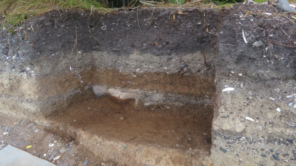
Areas E and F – partway through the tephra layer. The light gray layer was full of shell and bone.
Areas E and F – now below the tephra and into an earlier cultural layer in which a hollow had been dug for a fire and large stones were placed around the edge.
These are ‘Dentalium nanum’ beads – a form of tusk shell commonly found in New Zealand waters and used for personal ornamentation by Maori and is more typically found at sites in the Coromandel. These were very carefully excavated from the ashy layer associated with the fire feature in the above picture.
A very fine bone needle, found below aforementioned feature and to the edge of square F.
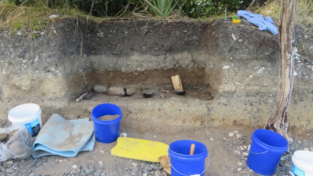
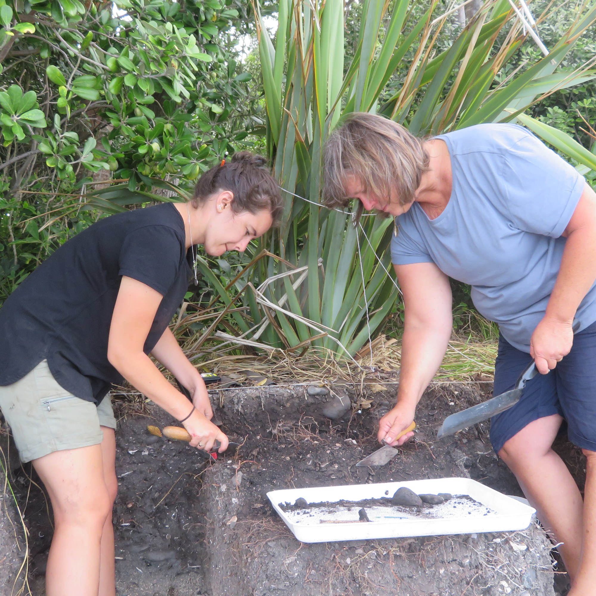
Recording the sections…
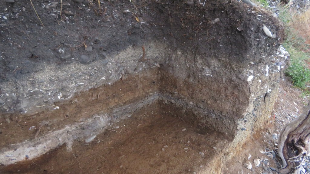
And we’re finished – square E and half of square F.
Another look at the final stratigraphy looking south east.
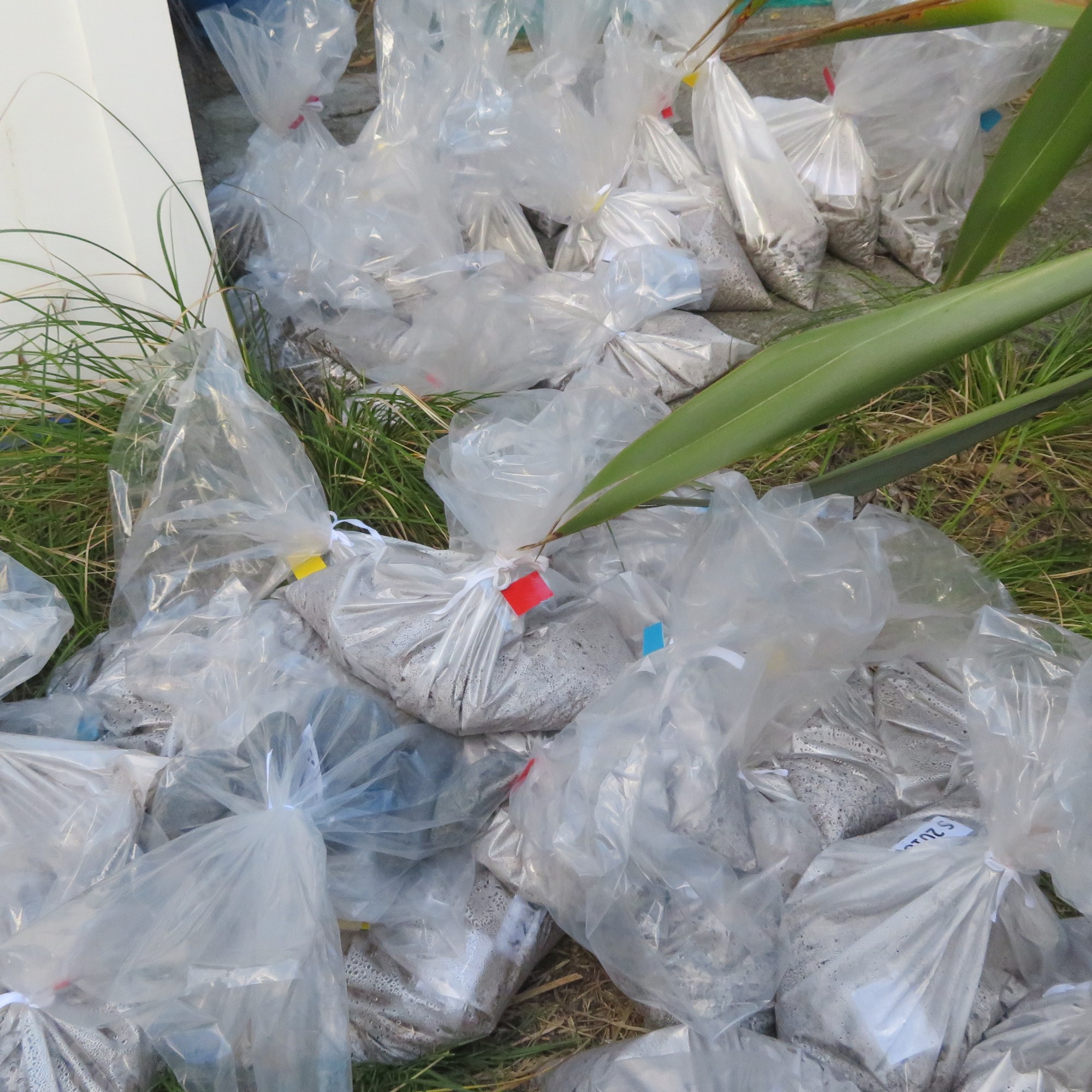
Our gear and many, many bags of samples waiting for pick up…
As a final note I would like to thank Louise Furey (and company – you know who you are) from the the Auckland Museum for inviting me along on the dig this year. I came home tired, smelly, covered in mozzie bites and just a little crispy but even so it was a thoroughly enjoyable experience and one I shall not forget in a hurry…much like riding a bike…
As an Amazon Associate, I earn from qualifying purchases and as such some of the links in this blog are affiliate links. This means if you clink on the link and purchase, I get a small commission, at no extra cost to you. The items I have linked are always ones that I myself have enjoyed/read – all opinions remain my own.
I wanted to title this blog ‘How to Bluff Your Way in Archaeology’ but that would almost be plagiarism, but I am happy to admit to being inspired by the small and very funny book by Paul Bahn ‘Bluff Your Way in Archaeology’. As you read you may well think I have lost the plot in my little lockdown world, this is not the case (well, not entirely). The following is a tongue-in-cheek consideration (I am basically taking the mick) of the archaeological profession and it is not intended to offend. After all, if you can’t laugh at yourself then who can you laugh at. If you do get offended easily and do take your profession seriously then I would suggest stop here and read no more…
Lets begin at the outset in saying that to be an archaeologist is to be an accomplished bluffer. I can already hear the sharp intakes of breath as archaeologists around the world start formulating their arguments, some will even be nicely presented with bullet points and the occasional funny quote (only ever occasional because it is a serious subject, after all…) and which won’t necessarily be funny to the average person but instead will demonstrate how clever the speaker is.
Now let me qualify that first statement with my own presentation duly littered with funny quotes and memes, (I do this because I can, this is my blog…).
In the majority of cases every archaeologist begins their career as a student and it is here where our life long pattern of bluffing is established. A student must effectively bluff his or her way through numerous years of study, convincing lecturers, Professors and supervisors that they have read the book list, they thoroughly understand what theoretical archaeology is and they can be trusted with a trowel at the next training dig. The universities are themselves places where the student can learn from the best bluffers in the profession.
Lecturers and other academic staff are so good at bluffing that it is almost impossible to tell they are doing it, in fact I am sure they’re not even aware of doing it. On a daily basis they manage to convince students and those not of their pay grade that they actually know stuff when in fact they had only just read up on the subject the night before (I speak from personal experience here…). The senior members of staff are the best bluffers as having already laid the foundations of a good bluff they merely need rest on their laurels watching with glee as others attempt to climb that mountain.
Beyond the university walls there are generally speaking three types of archaeologists. The professional archaeologist (white collar, slightly better paid, tied to the spreadsheet type) who can also lay claim to be a professional bluffer. The need in this day and age to tender for jobs, apply for grants and funds means that in order to make some form of career out of that university degree one’s projects are always ‘crucial to our understanding’ or ‘vital in furthering our knowledge’. Classic bluffer language meant to impress those with the cheque books.
The second type heavily rely on the first for their job, they are the field archaeologists. Their unique take on the bluff begins the moment they start working, whether it is bluffing their way around a piece of equipment they’ve never actually used before or bluffing the boss that it’s not a fresh break/they haven’t been slacking its just a very complicated site or simply bluffing friends and family about how interesting their job is…
Field archaeologists do precisely what it says on the tin, they work in the field digging or surveying archaeological sites. When seen in public they may be mistaken for the local homeless, excavation is not conducive to cleanliness and they wear their dirt with pride. A good bluffer on excavation will always comment on how straight (or not) other diggers trench walls (known as sections) are, or quite literally lose their tempers when someone walks on their newly cleaned surface. The latter is a big no-no and an experienced bluffer will know to ask first if it is okay to enter a trench – earning them much needed brownie points.
The third group are the theoretical archaeologists (they are also sometimes attached to universities mainly so the university can bluff everyone into thinking how academic and clever THEY are). This type has taken the role of devil’s advocate and run with it so far that even the devil has lost sight of the objective. In essence they do not or will not obtain their own material/data so in order to cover up their own inadequacies they question the validity of everyone else’s work. So they ask questions such as how well was the site excavated? Is the sample representative? They publish large quantities of material usually collating and condensing everyone else’s hard won data. This type can be recognised by the excessive use of jargon and large words that mean very little; a heavy reliance on mathematical equations and complicated diagrams. All of which are smoke and mirrors designed to hide their own inadequacies.
All of this is fine and dandy but what are the practical aspects of bluffing your way in archaeology? Well in truth this can be boiled down into two points – the way you look and your attitude…get these right and no one will know you don’t have that degree.
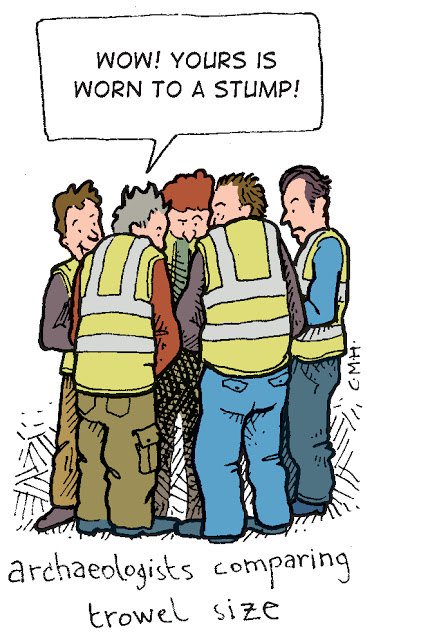
What does an archaeologist look like? This will depend slightly on gender and age – beards are common as are spectacles; a field archaeologist will generally have a very basic wardrobe with sturdy footwear; a ruddy complexion with a touch of sun/wind burn adds to the authenticity. When on a dig be sure to wear the same t-shirt for at least three days in row. Newbies are easily spotted (and derided) based on their cleanliness and the size of their trowel – a good bluffer would have ensured that their trowel was suitably worn down prior to arriving at the dig. The more academic archaeologists are usually the bespectacled type in clothing that wasn’t even trendy in their grandparents day. They often looked confused when approached by the enthusiastic student and will be carrying a collection of papers with hastily scribbled notes that mean nothing to anyone who glances that way. This type of bluffer will always be in an immense hurry and when asked to do something will always forget citing how busy they are and they’re so sorry they’ll get onto it straight away – they don’t…
If at anytime you are asked to contribute to a conversation here are a few things to remember –
*When talking to anyone who knows nothing about archaeology and excavation it is important to emphasise that it is the processing and analysing of the data collected which takes the longest amount of time – the digging is but a small part of a larger picture.
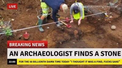
*Desirory comments about the latest Daily Mail or BBC archaeology headline is acceptable in all circumstances. As is wondering out loud who their source of information was and why do they not employ a journo with some archaeological knowledge.
obviously not a real headline…but not too far off…
*In any conversation that focuses on individual treasures (particularly when questions of monetary value arise) it is important to let everyone know that you do not approve – a loud sigh usually works well – before launching into a lecture on how archaeologists dig not to find things but to find things out. At which point it is also acceptable to walk away muttering about context…
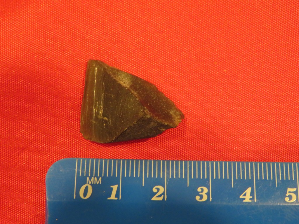
*When asked why you do archaeology be sure to smile and then tell a story about how as young child you found an interesting flint arrowhead (or whatever is appropriate to you) and so begun your life long passion for the subject. A really good bluffer will be able to produce said arrowhead from their pocket with a whimsical smile. Apart form this good bluffers can talk endlessly about their passion for the subject (don’t forget to get really animated) and how they long to contribute to our understanding of the past. Because lets not forget no one does archaeology to get rich.
*You must at all times pour unadulterated scorn on any who ask about the monetary value of an object and show absolute contempt for ‘treasure hunters’ and the History Channel – I may have repeated myself here…
*Finally, a really good bluffer will be found at the pub – if you’re in the UK – otherwise anywhere there is a plentiful supply of alcohol, preferably cheap…
A good bluffer will already know this and will be happy to point it out to newbies on site…
There is so much more I could wax lyrical about regarding bluffing your way in archaeology (thank you Mr Bahn) but I won’t (phew!) Please do remember that this is my own feeble attempt to get a laugh and if I have failed and you do find yourself a little bit offended perhaps a pint at the pub might help – after lockdown that is…stay safe.
The following are a just a few books you might find interesting and useful in your archaeological journey particularly if you want to really impress! I did 🙂
I have had the privilege of being involved in archaeology in both the UK and to a lesser extent here in New Zealand. If you have read my bio you would know that I taught archaeology to University students and adult education students in Cornwall and here in NZ I am a volunteer with the archaeology department at the Auckland Museum.
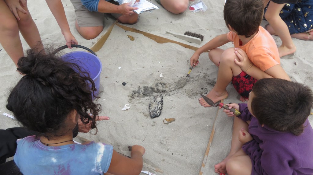
Recently as part of the latter I was involved in a Bioblitz event on the Coromandel Peninsula. Over this three-day event first the local schools and then on the Saturday the community were invited to participate in a range of activities, mostly to do with the natural environment. Members of the Auckland Museum, DoC Rangers and prominent locals encouraged the children and adults alike to look deeply at the world around them.
For the first time the archaeologists were also involved and for our part we conducted a mock excavation on the beach for the school children as a way of engaging them in what it is that archaeologists do – it was an interesting experiment and it certainly brought to light an issue that is prevalent within the average New Zealanders mindset.
The mock excavation underway
At the beginning of each session the curator, Louise Furey, would ask each group what they thought archaeology was, ‘what do archaeologists do?’ And yes, you guessed it each and every group came back with, ‘digging for dinosaurs/fossils/treasure’. They can of course be forgiven after all they were just children and the forty-five minutes we had them with us was probably not enough time to get across the complexity that is archaeology.
However, what it did do was get me thinking – why is archaeology in New Zealand so invisible?
Even as a university student here in Auckland when people asked me what I was studying and told them archaeology/anthropology they either did not what they were or once again I would get the old, ‘so you dig up dinosaurs?’ It was frustrating in the least…
Moving to the UK, studying and teaching archaeology there was a completely different game. Archaeology in the UK does not need to explained, only the occasional person who thought they were being funny would mention dinosaurs and thanks to numerous tv shows (Time Team, Meet the Ancestors and others) it was much more main stream. As a teacher of adult education there was no end to those who were keen to learn about archaeology and when I came back to NZ I attempted to start adult education classes in archaeology locally but the uptake was so small (3 or 4 at the most) that it was not viable. So why might this be?
I believe ultimately it comes down to people’s perception of the past and perhaps comparing NZ to the UK is not fair, the two countries have vastly different histories but I do think we can learn something from the UK on how to promote the past as being a place everyone can visit and learn from.
I have on several occasions had people ask me if there was any archaeology in New Zealand – they are surprised to learn that not only is the answer is ’YES!’ but that is somewhere around 70,000 archaeological sites in the country, not bad for some 800 years of human occupation. Here is the problem, in comparing ourselves with other countries which have a much longer history we do ourselves a disservice, convinced that our past is not as exciting or as interesting as others we disregard it; archaeology, heritage, history take a back seat and in the case of archaeology become virtually invisible.
The humps and bumps of terracing on Maungakiekie (One Tree Hill, Auckland), a place of importance for the Maori of Tamaki Makerau and one of many archaeological sites in New Zealand.
Archaeology in NZ has for many years been the domain of professionals and academics which has in effect built a wall between themselves and the general public that was almost impossible to climb over. Changing perceptions takes time and this process has already begun with events such as Bioblitz and New Zealand Archaeology Week which actively involve and educate the public, the enthusiastic amateur. But there is still work to be done, education is vitally important and whilst we do not want people digging up sites (please do not do this, not only is it highly illegal and get you into a whole lot of trouble – about $50,000 worth of trouble – it is ethically wrong), we do want to encourage awareness, understanding and respect.
In a recent Heritage New Zealand newsletter, the Chief Executive Andrew Coleman stated
“Archaeology is one of the most questioned aspects of heritage. The questions are often negative and many highlight a significant misunderstanding on the important role archaeology plays in Aotearoa New Zealand.”
Why is archaeology important in New Zealand? In essence, because our oldest heritage can only be found beneath the ground and reading the evidence in a careful and controlled way is the domain of the archaeologist. Andrew Coleman titled his column ‘Archaeology – the unsung hero of history and heritage’ and he is right it is the unsung hero. Without it our picture of the past would be incomplete, there is only so much standing buildings, documents, oral histories and the humps and bumps of the landscape can tell us. Each are important individually but together with the archaeological knowledge a much more complete picture can be had.
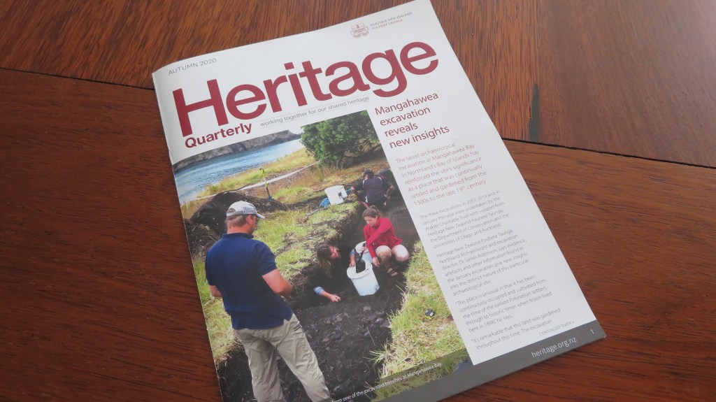
The March issue of Heritage New Zealand newsletter featuring the excavations at Mangawhea in the far north – one of several excavations which are helping us understand the lives of the first people to New Zealand.
It is the kiwi way not to blow our own trumpet but instead we wait for someone else to notice what we are doing and then tell the world – are we as archaeologists too shy to say ‘hey look at us, we’re important too!’ Perhaps we are just tired of the dinosaur jokes and the Indiana Jones references…Maybe it is here we could look to the UK and the way in which archaeology has connected to the media (Daily Mail headlines not included). Television in particular has played a significant role in awakening the public archaeological interest but it does require the archaeologists to join in. There have been several interesting albeit short lived tv shows here in NZ that have attempted to follow in these footsteps and had the potential to show the masses our unique and fascinating past.
In my own rather humble opinion awareness of archaeology in this country begins with education, not just at university level but at primary and high school. Archaeology is after all one of those subjects which encompasses all aspects of the school curriculum regardless of level. Maths, English, geography, biology, chemistry, physics, geology, environmental science, economics, statistics, computer studies, art, history, technical drawing, photography and more are all subject’s archaeology includes in its parameters. So why isn’t it being taught as a part of the school curriculum, to our children who are the future custodians of our heritage? More specifically why isn’t New Zealand archaeology being taught to our youngsters?
We often encourage our children to be themselves, to not compare themselves with others, to accept their unique points, to celebrate that which makes them different. Perhaps it is time we started doing the same to our past, to celebrate not just the parts that are visible but that which is unseen and underground, to say cheers to the archaeology!
Addendum – I am sure there are some who might read this article and say why would I care, after all I did leave New Zealand to study and work in the UK and that would be fair to ask. At the time of finishing my BA at Auckland University in the mid-90s, I could see that opportunities for me would be limited, this combined with a desire to travel (it’s a kiwi thing) and a long-standing interest in British archaeology it was only natural for me to head overseas. But I have been back now for almost fifteen years watching from the side lines and my enthusiasm and love of the subject has not waned. It does not matter where I am, for myself it is the understanding of the past that matters and archaeology is central to this.
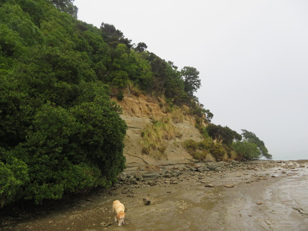
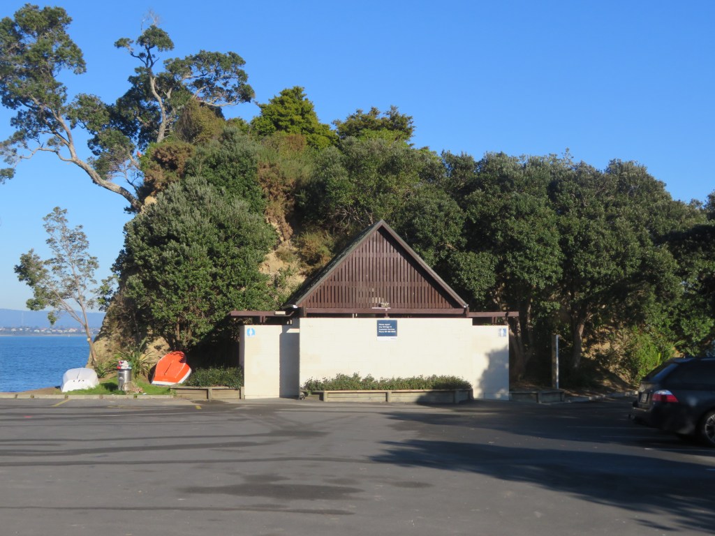
For the last
five years or so I have been walking the ever-faithful Brad the Dog to a small
but perfectly formed bay known locally as Fitzpatrick’s. During this time, I
have found a variety of interesting objects on the beach, some have obviously
been washed in and others have eroded out of the beach head and sand. I also
noticed a few interesting humps and bumps and well that was it, my curiosity
was well and truly piqued.
Multiple questions
kept my mind occupied, such as, who was Fitzpatrick? Who lived in the house on
the hill of which only humps, bumps and a rambling rose remained? Why do I keep
finding ceramics on the beach? And what about the pre-colonial settlement of
the area? As I began to research it became necessary to expand the overall area
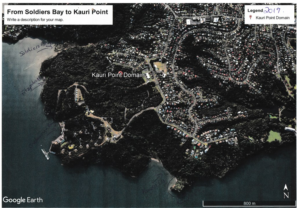
of interest to include the bays east of Fitzpatrick’s – Onetaunga Bay and
Kendall’s Bay – and the bays west – Soldiers Bay and Island Bay – in order to
get a fuller picture.
For the purpose of this article there are two distinct early phases of settlement and use of the area – the Maori pre-colonial and the early colonial up to 1900 – which will be the focus of this article and the next (part two). Later occupation of the area can be divided by the World Wars particularly the second World War and the construction of the Harbour Bridge which indelibly changed the face of the North Shore. But first let’s consider the bare essence of the area, without the human factor muddying the waters.
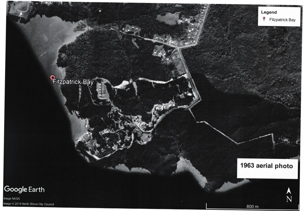
Note how much the landscape has changed between 1963 and 2019 below.
The Naval Base is in the middle of the dense bush that lines the coast.
The Geology and all that Natural Stuff…
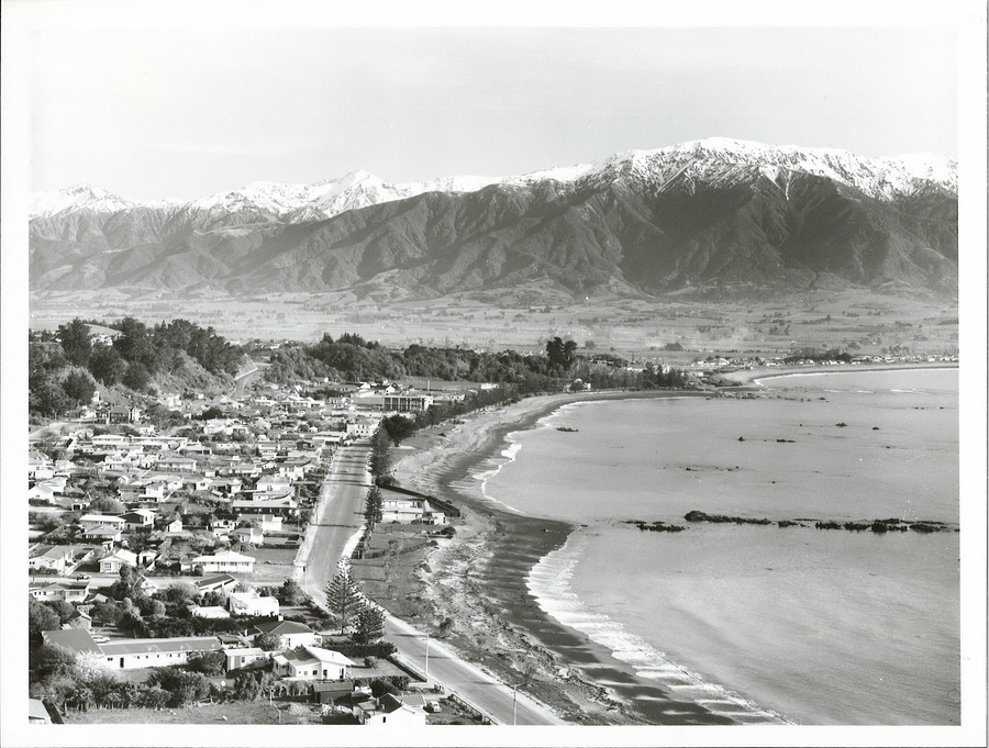
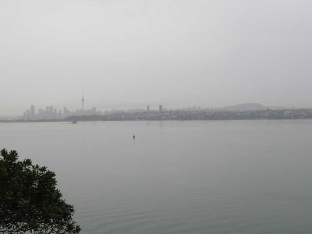
The area with
Fitzpatrick’s Bay at its centre is situated on the north side of the Waitemata
Harbour in the suburb of Birkenhead. Geologically speaking the Waitemata
Harbour is a drowned late Pleistocene valley whose natural rock type is
sandstone and mudstone. It is highly susceptible to coastal erosion, often
resulting in steep sided promontories that continue to crumble particularly
after heavy rain.
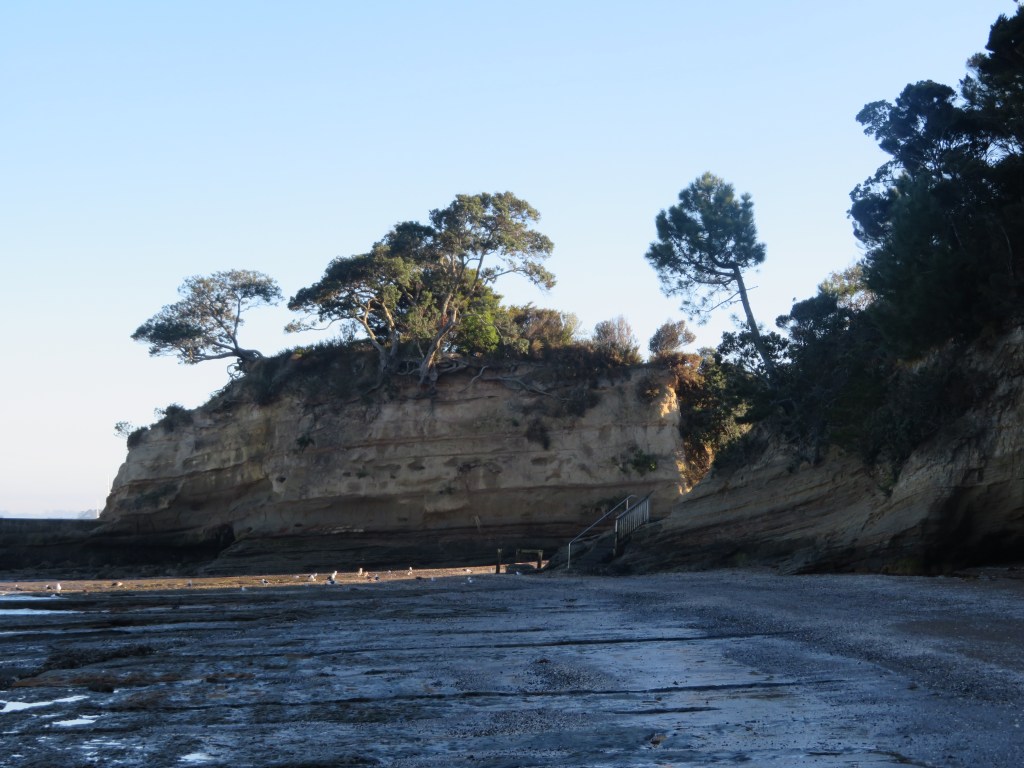
The current environment is one of invasive pine trees and impenetrable scrub bush although originally the hills behind the beaches were once thick with kauri, pohutakawa and other natives (small stands still survive in places). The presence of kauri caused the soil to be nutrient poor and therefore not the best for horticulture, unlike the landscapes on the opposite side of the harbour with its rich volcanic soils ideal for horticulture and therefore human settlement. However, the rich waters of the Waitemata made up for this deficiency particularly for the early inhabitants. On the southern edges of the Waitemata Harbour and opposite Kendall’s Bay is Meola Reef, also known as Te Tokaroa Reef – the area is well known to marine biologists as a shark spawning ground, here female sharks leave their young to fend for themselves in the relative safety of the inland harbour.
In addition to
shark there are many other species of fish which frequent the harbour, such
snapper, flounder and yellow-eyed mullet. The foreshore also provides an
abundance of shell fish, predominately in the form of pipis, cockles and rock
oysters.
The Maori
The Maori story of this part of Auckland differs considerably from other parts. The central area of Tamaki Makarau with its fertile volcanic cones was ideally suited to horticulture and thus heavily settled. The northern side of the inner Waitemata Harbour was not so suited to horticulture, the vast kauri forests having depleted the already thin soils of nutrients. So how was this part of Tamaki Makarau utilised by the Maori?
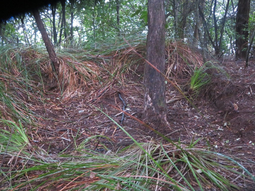
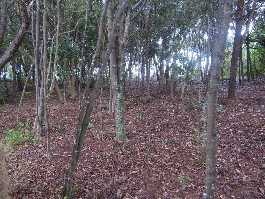
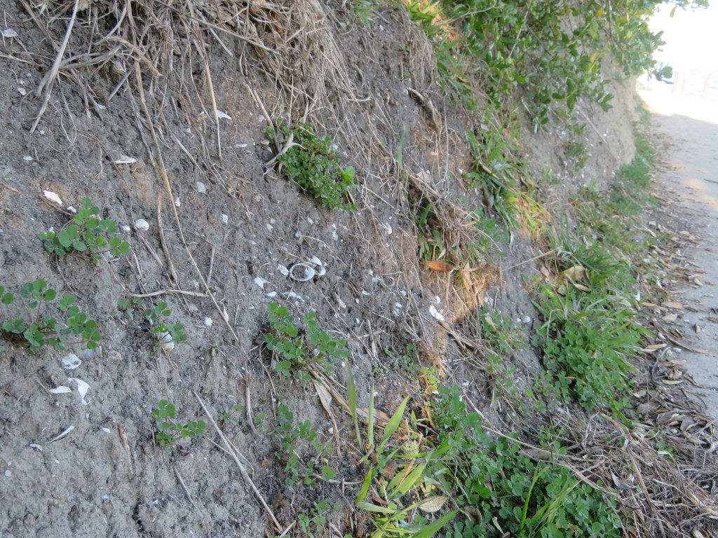
Our understanding of the settlement and subsistence patterns of this pre-Treaty of Waitangi time is restricted to the several defended promontories (pa) and the many shell middens which can be found around the shoreline.
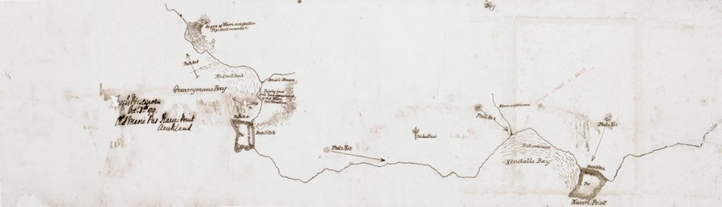
Colonel Boscawen’s hand drawn map of 1899 to accompany his photos taken at the same time. He was very interested in Maori settlement and was a prolific photographer.
The Pa
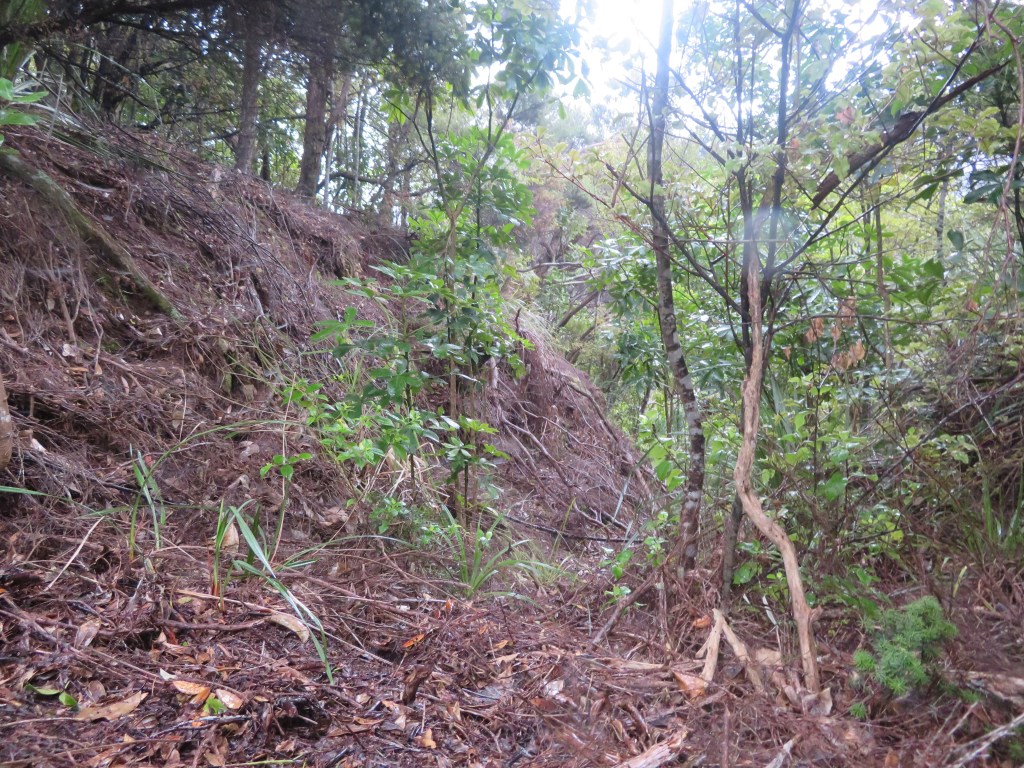
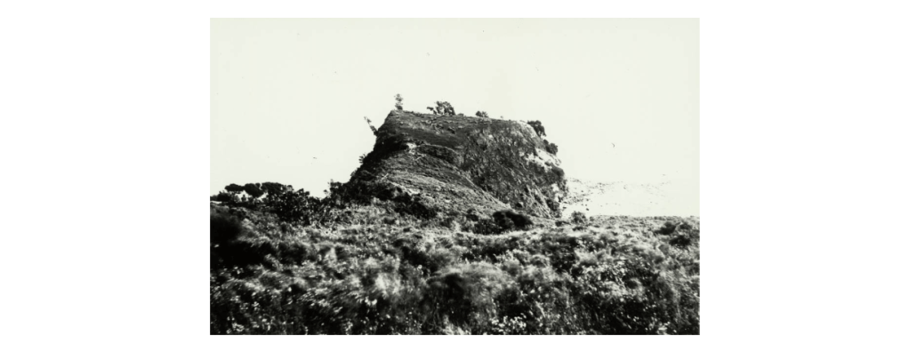
The term pa is taken to mean any settlement that consists of defensive earthworks such as banks and ditches. The pa in our area are mainly confined to the steep sided promontories that are usually adjacent to a protected beach where waka were able to land safely. The most well-known is Kauri Point or Te Matarae A Mana, named for Manaoterangi a chief of the Ngati Kawerau who flourished in this area from around 1720-1790. It is also the only pa to have any archaeological excavations undertaken (in response to the possible threat of the construction of a second harbour crossing, the first having completely destroyed Onewa Pa on Stokes Point in Northcote).
Te Matarae A Mana (Kauri Point) from the beach below.
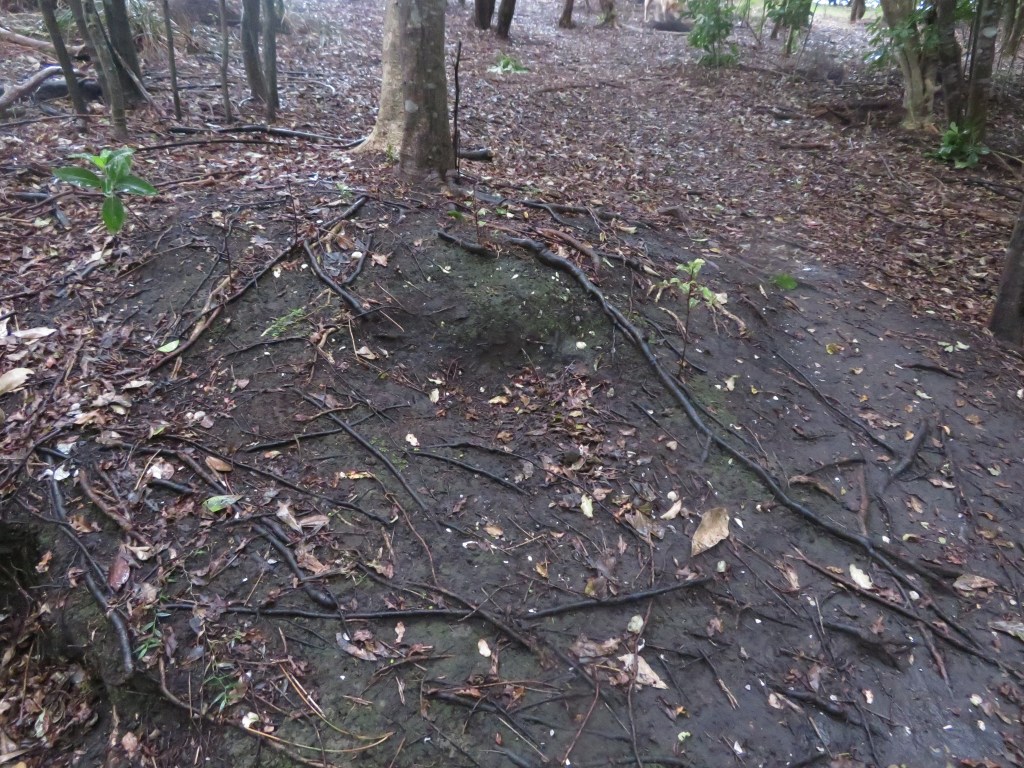
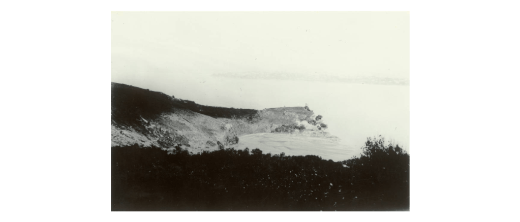
These excavations were undertaken by Janet Davidson in 1971 and consisted of a total of seven test pits in four areas. In the 1990 report of the excavation Davidson emphasises the strategic importance of the headland describing the approach from the landward side as being along a narrow and winding ridge which widens to become a flat-topped headland. The site has natural defences in the form of a steep scarp to the southern side which is enhanced by two incomplete ditches. The excavations and subsequent finds revealed that even given its impressive position the site was only used for a limited time. The middens found in three of the four areas produced well-preserved fish bone – but not much in terms of quantity; a single dog bone; pipi and cockle shell – the principal species, which was to be expected; as well as mussel and oyster shells. Interestingly, there were a large number of slipper shells whose flesh may have used as bait for fishing. The middens themselves were quite small and corresponded with the lack of structures found on the headland.
This unassuming dent in the ground is the remains of one of Davidson’s excavation pits.
“In view of the apparently strategic
location, this lack of evidence of prolonged or repeated occupation was
surprising” (Davidson J 1990 ‘Test Excavations on the Headland Pa at Kauri
Point, Birkenhead, Auckland in 1971’)
This was very different from other pa sites in Auckland and Davidson concluded that the headland had been constructed by people who visited the adjacent bay for seasonal fishing and that most of the activities happened in the bay below. The pa therefore may have had a more esoteric function such as the proclamation of the Kawerau Chiefs’ mana, an assertion of the group’s rights to the area and ultimately as a ‘just in case’ need for defence.
The photos below are a selection from Te Matarae – the first shows the overgrown nature of the eastern ditch; the second is of the interior which is flat to sloping; the third whilst not very clear is the remains of midden; the fourth is the view from the top out towards Auckland City and finally the last looks down onto Kendall’s Bay below.
According to the “Cultural Heritage Inventory” published by North Shore City Council in June 1994 there are two further pa in the vicinity of Kauri Point. One was presumed to be located within the grounds of the Naval Base which sits in the middle of our research area and is inaccessible for security reasons. In 1899 a Colonel Boscawen did a rough drawing of the area to accompanying six photos he took. On the map he noted this particular pa which appears to be a major headland pa, was far greater in size than Te Matarae A Mana (Kauri Point). However, on closer inspection of Col Boscawen’s photos and map, it may be possible that this larger pa with its large ditches may not be in the Navy compound but further to the west and near to Soldiers Bay. Over a two-day period I attempted to prove or disprove this idea but the dense bush in the area was a significant issue. In addition, aerial photos have shown that even if the site was in the Naval base much of it would have been destroyed during the development of the land for the base. So as of now the issue is still unresolved…
Below are Col Boscawen photos of the various sites – 1. Te Matarae form landward – the ditches are faintly visible across the neck of the promontory. 2. Te Matarae from up on the hill which is now part of the Naval Base and assumed to be the pa site of Maunganui. 3. On Boscawen’s map this is labelled photo 5 and could be either Fitzpatrick Bay or Onetaunga Bay. 4. A view of the headland labelled photo 4 on the Boscawen’s map which is labelled as a Maori pa site and has two ditches drawn in. Once again this may be either at the eastern end of Fitzpatrick Bay or the headland on the Naval Base. 5. This headland at the western end of the beach as seen in number 3.
The second pa
recorded is named as Maunganui and according to the “Inventory” Janet Davidson
is thought to have identified ‘part of the Pa ditch in scrub just south and
east of the trig at the corner of Onetaunga Road and the road to the Naval
Base’. The general assumption is that it is situated on the ridge on which the
Onetaunga trig is located, but there is still some doubt as later developments
may have caused the landscape to take on forms which deceive the eye. It is interesting to note that Col Boscawen
did not include this pa on his map of 1899, a site he would have been aware of,
unless of course the large pa mentioned above was in fact Maunganui and this has
become a case of mistaken identity.
Beyond Kauri Point and past Fitzpatrick’s are two further pa, one south of Island Bay and the second at Island Bay. The first is situated on top of a cliff about half way between Soldiers Bay and Island Bay. It has been recorded as consisting of a ten-metre square flat area with a small terrace forming the internal area of the Pa. There is ditch on the landward side whilst the other sides are formed by steep cliff faces or slopes.
A grassy reserve above Island Bay – may be the remnants of terracing associated with the above mentioned pa.
The photos below are of Island Bay – here a small promontory pa is joined today by a modern carpark which is reclaimed land. The pa itself has been extremely modified with the addition of concrete paths, a wharf and toilet block. The last photo shows the promontory in profile looking west.
The pa at Island Bay is situated on top of the island itself and it is approximately 15 metres by 20 metres in size; middens can be discerned on the northern and western sides. The middens appear to dominated by cockle shell, pipi and oyster. When last surveyed, charcoal, hangi stones and obsidian were also noted. It has been noted that the top of the island consists of some terracing which are not obvious until seen in profile.
The midden at Island Bay on the eastern edge of the promontory – now very badly eroded – the white flecks are shell.
The Middens
Already
mentioned above is the Island Bay Pa midden, and in addition there are recorded
middens at Kauri Point Domain and Soldiers Bay. The Kauri Point midden is
regarded as the largest in the area and situated at the southern end of the
Domain and is noticeable as a result of a stormwater drain cutting through it. Today
grass has almost obliterated the view of the midden and it does appear to have
eroded away quite a bit. However, previous surveys have found it to be three
metres long and one metre high; three layers of shell have been discerned each
separated by layers of sand and clay mix. Apart from cockle, pipi and scallop
shells, hangi stones and charcoal are also present. Waterworn hangi stones are
often to be seen on the beach, giving further emphasis to the issues of coastal
erosion.
A midden eroding out onto the path just above the beach at Kendall’s Bay at the foot of Te Matarae/Kauri Point.
The midden at
Soldiers Bay is situated on the small beach beyond the current mangroves. It
has suffered much from erosion and when last surveyed was two metres long and
spread over a height of three and half metres. Opposite and nearby are a
further two smaller middens. In 1899 Colonel Boscawen drew a map to accompany
half a dozen photos he took of the area. On this map he mentions the presence
of ‘pipi shell mounds’ at the edge of a bay he called Quarryman’s Bay, which
appears to be the combined bays of Soldiers Bay and Fitzpatrick’s Bay, and
correspond with what can be seen today.
“The majority of the middens revisited are
located in bays sheltered from the southerly winds…As for the pa, they are
located on low cliff tips and are close to the deeper waters of the Upper
Waitemata Harbour. They also have strategic views along prime fishing waters
and are located along a major access route to the Kaipara Harbour located on
the west coast.” (‘Archaeological Sites of Birkenhead’ by Richard Jennings in
“Cultural Heritage Inventory” North Shore City Council June 1994)
Other Evidence
Other archaeological features which may be indicative of the Maori use of the area include a range of pits and terraces recorded at various places. Unfortunately, the later expansive development of the area means that much of the evidence has been destroyed, or what is being recorded may instead be the result of such development. The previously mentioned Colonel Boscawen also mentioned on his hand drawn map the presence of ‘fairly good soil, has appearance of old Maori cultivation’ in the area near to Quarryman’s Bay. A closer inspection of the beach area below Te Matarae revealed two possible house platforms above the high tide line and close to the cliff edge, these are hidden today by extensive regrowth and are not obvious from the beach. Each platform is roughly 5m x 12m.
Although hard to see in a photo this flat area is one of two which are visible in the undergrowth at the beach edge below Te Matarae/Kauri Point. They measure approximately seven metres in width and twelve metres in length.
In addition to
the actual archaeological sites there are two other sources of information
which may serve to fill in a few of the gaps – beach finds (random artefacts
found on the beaches of the area concerned) and oral tradition.
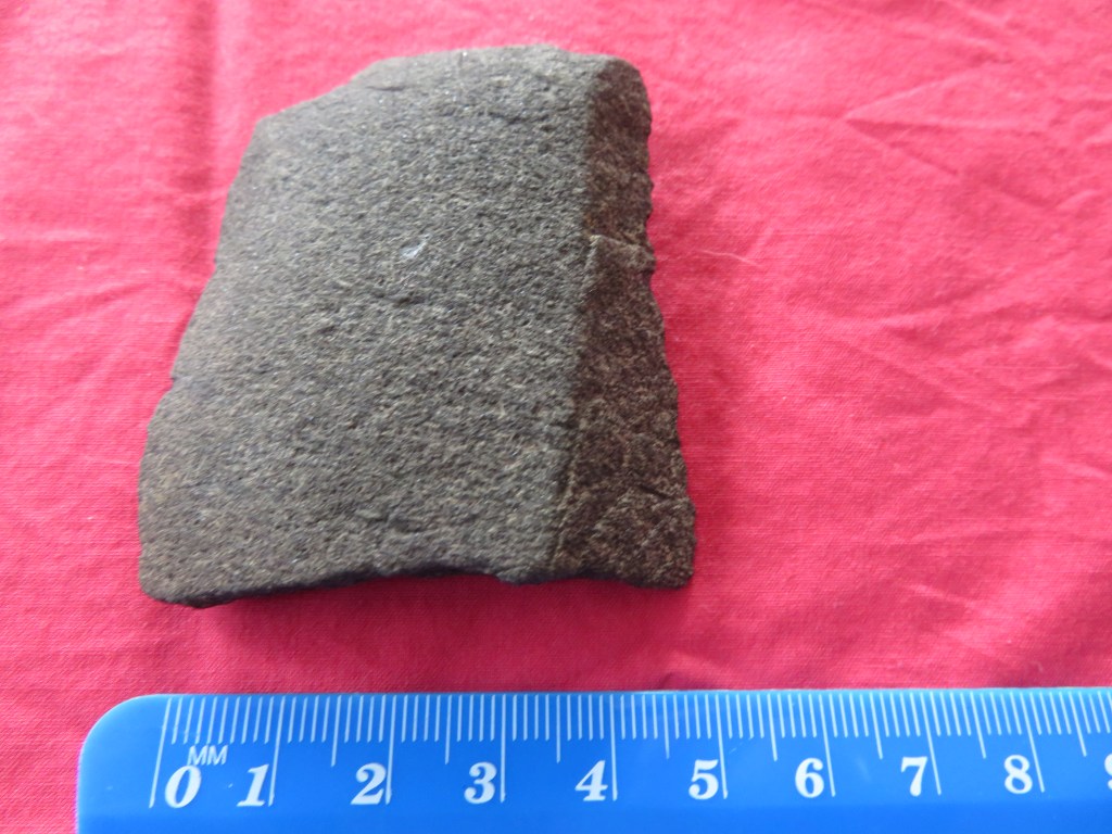
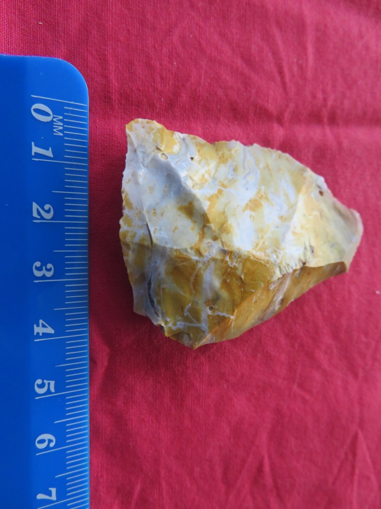
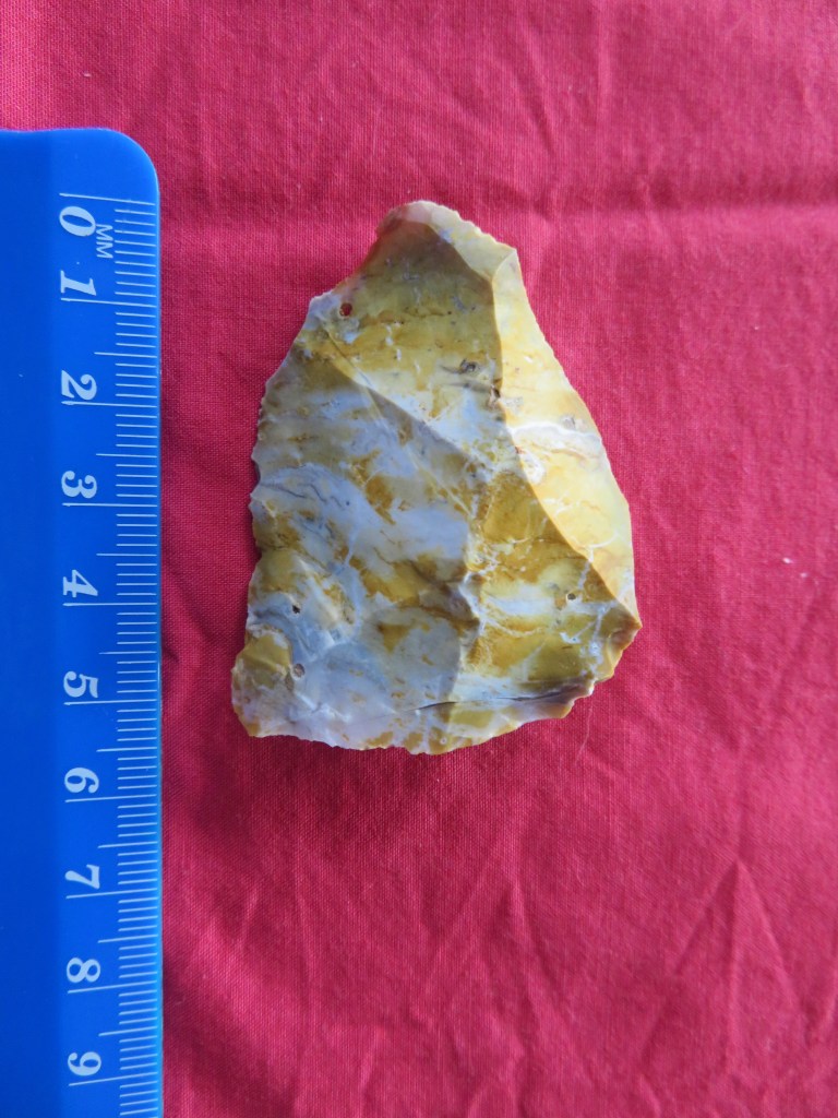
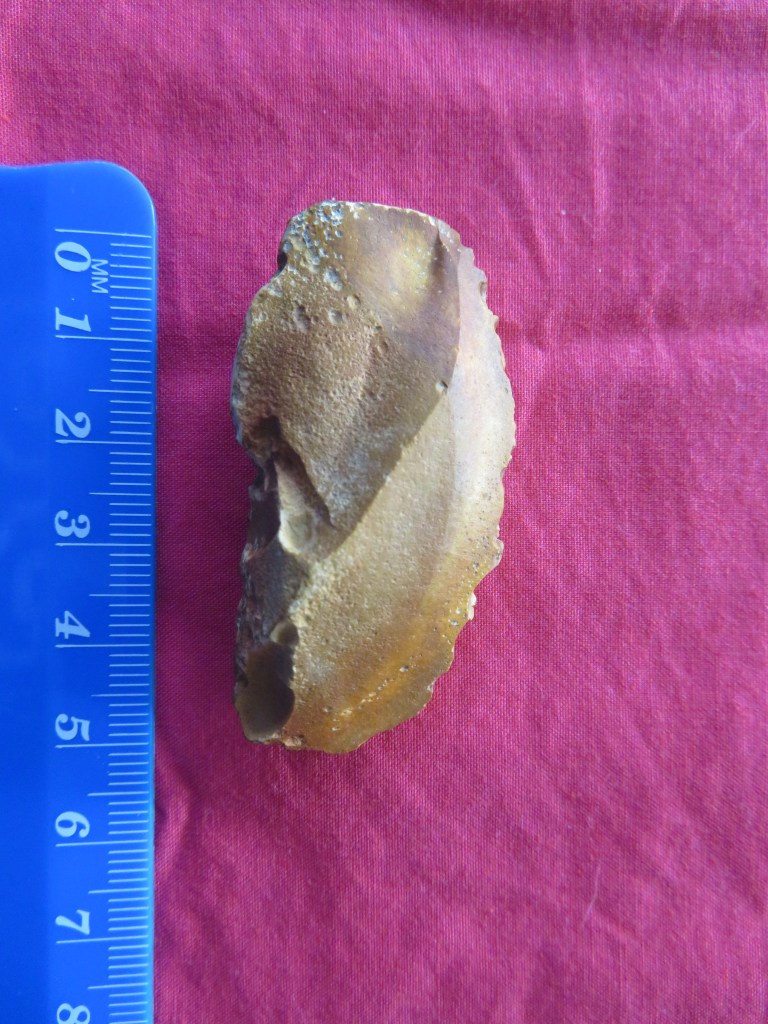
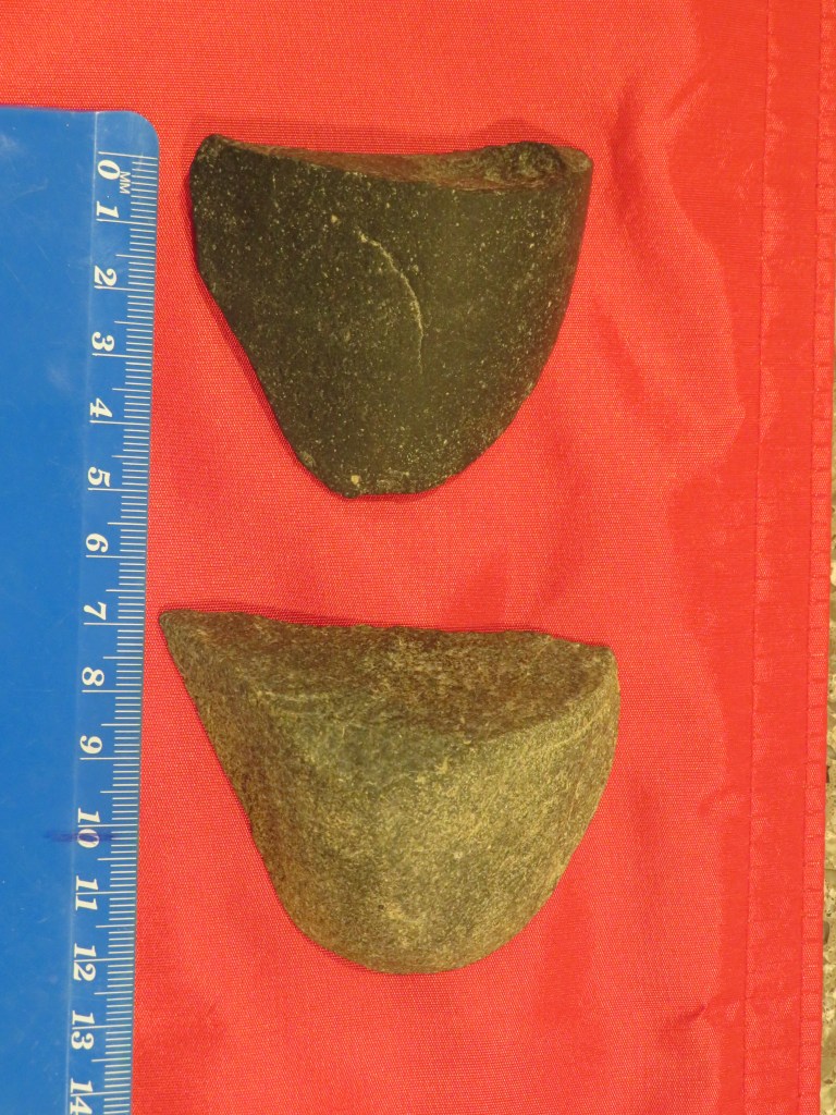
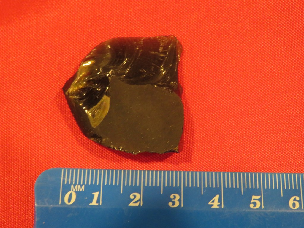
Below are selection of beach finds dating from this period – these were found mostly on Fitzpatrick’s Bay, Onetaunga Bay and Soldiers Bay. Please note that at no time did I or anyone else from whom I received information on these artefacts dig them up; they were found simply by eye on the foreshore below the tide line. What they can tell us though is that Maori were active in the area and had wide ranging contacts (the obsidian); the sinkers are indicative of a community taking advantage of the marine resources; the adze (and the pieces of adze) are suggestive of woodworking; and already mentioned are the hangi stones found in the tidal area as a result of erosion.
The last five photos are of artefacts found by a fellow dog walker who has kindly allowed me to photograph his finds. It should also be noted that he has found a broken adze head (used in wood working) and several other stone flakes. These items have been donated to the Auckland Museum and are undergoing processing as new acquisitions.
Our knowledge of
Maori history prior to the arrival of the Europeans is based upon the rich oral
histories passed down through the generations and here on the Waitemata this is
no different. The name Waitemata can be translated as ‘the waters of the Te
Mata’ – the reason for the name can be found in the oral history of the region.
Some traditions tell of the canoe Te Arawa which arrived in Tamaki under Tamate
Kapua. It was he who gave Tamaki its mauri or soul by placing a sacred rock
from Hawaiki on the island called Te Mata (known today as Boat Rock which is just
above the harbour bridge). It was the mauri was called Te Mata – hence the
name, Waitemata. Often before a fishing expedition was undertaken, a carved
sinker would be taken to Te Mata and a karakia said then the sinker was hung on
the front of the waka. In Nagti Whatua tradition the first fish caught in the
season would be used as an offering and placed on the rock called Te Mata.
The first hapu
to live on the North Shore were the Kawerau with their main centres being in
the Takapuna/Devonport area where land was easier to cultivate. The coastal
area of the Waitemata appear to be less well populated but that is not to say
no less important. Perhaps the site most well known in our area of concern is
Te Matarae a Mana or Kauri Point. In the late 1700s the Waiohua and the Ngati
Whatua were at war for the occupation of Tamaki. A great number of battles were
fought with many chiefs being killed including Tamaki Kiwi. According to Maori
history, the site was spared by the Nagti Whatua during their conquest of
Tamaki because the chief Te Mana asked for protection from Tuperiri, one of the
leaders of the conquest. Te Mana eventually died an old man in 1790, passing on
the custodianship of Te Matarae and his people to Tuperiri.
However, this
was not the end of the story – the son of Te Mana, Takarau, joined a large war party
heading north against the Nga Puhi. The raid was successful and many Nga Puhi
chiefs were killed. But in 1821 when Hongi Hika (Nga Puhi) returned from
England he brought with him muskets and invaded Tamaki with devastating effect.
Takarau was away at the time and so was spared; his people fared less well and
those that could escaped into the hinterland, hiding in the bush until the
1830s, when a small contingent reoccupied Te Matarae. On the 13th of
April 1841 all of the land in our area and beyond was sold as part of huge
parcel of land, referred to as the Mahurangi Block.
Beyond the stories of battles and conquest, our understanding of how sites such as Te Matarae were utilised can also be gleaned from the oral traditions. George Graham recorded how the beach and village below Te Matarae became busier with many waka using the beach during the shark fishing season. Some fleets were said to come from as far away as Hauraki. This may account for the terraces above the beach which could be interpreted as house platforms.
Placenames are
also an interesting source of information – all of the places we are looking at
as part of this article have European names but of course once upon a time they
had Maori names – so for example the bay west of Kauri Point was called
Ngutuwera (translated as ‘burnt lips’). The bay below Kauri Point was called
Rongohau or ‘nook sheltered from the wind’; here waka would take shelter during
bad weather. The deep wooded gully which leads to Soldiers Bay was once called
Tawhiwhi Kareao and its translation is interesting as it refers to the plant
called supplejack which was used in lashing for the wakas. Island Bay was once
called Te Waitioroa (‘the area of Toroa’) and was apparently named so because
Toroa rested there on his way to Paremoremo. But it is not only landscape
features which had names; actual parts of the harbour were given names such as
Wairoria or ‘the swirling waters’ – a place west of Kauri Point where a strong
tidal rip is always found.
From the
archaeological, historical and oral traditions we can say that the use of the
area by Maori was extensive. Settlement in many parts may not have been permanent
in the European sense, but it was no less important.
“Ahi ka did not mean that occupation at each place had to be maintained all year round. However, reqular visiting and use of the camps or temporary settlement affirmed authority in the region.” (M. Kawharu 2004).
Bibliography
Davidson J (1990) ‘Test excavations on the headland Pa at Kauri Point, Birkenhead, Auckland in 1971’ Records of the Auckland Institute and Museum 27:1-18
Jennings R (1994) ‘Archaeological Sites of Birkenhead’ in “Cultural Heritage Inventory” North Shore City Council.
Kawharu M. (2004) ‘Tamaki Foreshore and Harbour Report’ Auckland City Council.
McClure M (1987) ‘The Story of Birkenhead’ Birkenhead City Council.
Simmons D (2013) ‘Greater Maori Auckland. Including Maori Placenames of Auckland’ Bush Press of New Zealand.
During a recent holiday in Vietnam I visited the temple precinct of My Son, the principal religious center of the Champa. The following are a few photos (read many) of this day trip with a bit of background for good measure.
Who were the Champa?
Essentially the Champa were a collection of independent polities who ruled central and southern Vietnam from around the second century AD. The independent states became united in the fourth century under the rule of King Bhadravarman of Indrapura during the 4th century. Between the 7th and 10th centuries the Cham controlled the trade in spices and silk out of the South China Sea. Hoi An was the main port of the principality of Indrapura and whilst the capital of the Champa was in the area of the modern village of Dong Duang – both are situated near to My Son.
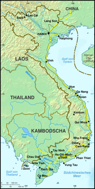
Map of Vietnam – Hoi An and Da Nang are roughly central on the coast.
From around the fourth century the Cham adopted Hinduism as their principle religion although many were eventually converted to Islam from the 10th century onwards. Today whilst the majority are Muslim there are still some that retain the Hindu faith and traditions.
The name Champa comes from the Sanskrit word ‘campaka’ which refers to species of flowering tree similar to a magnolia.
By 1832 the northern Vietnamese Emperor Minh Mang had annexed and absorbed the Cham polities
My Son
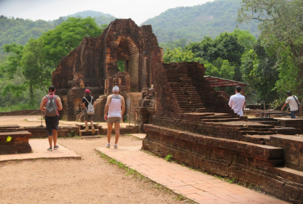
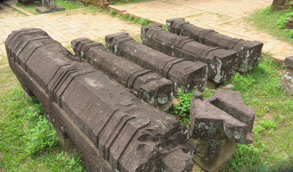
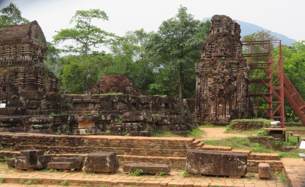
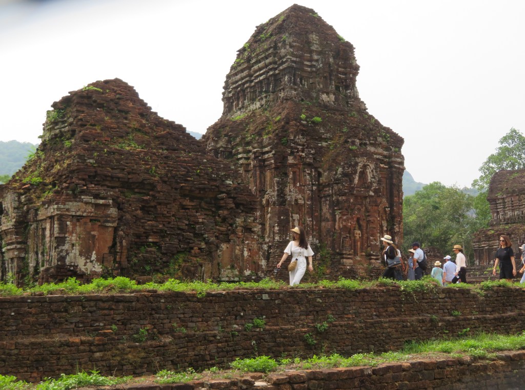
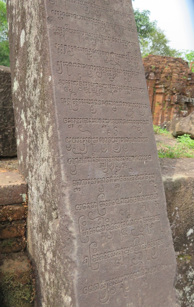
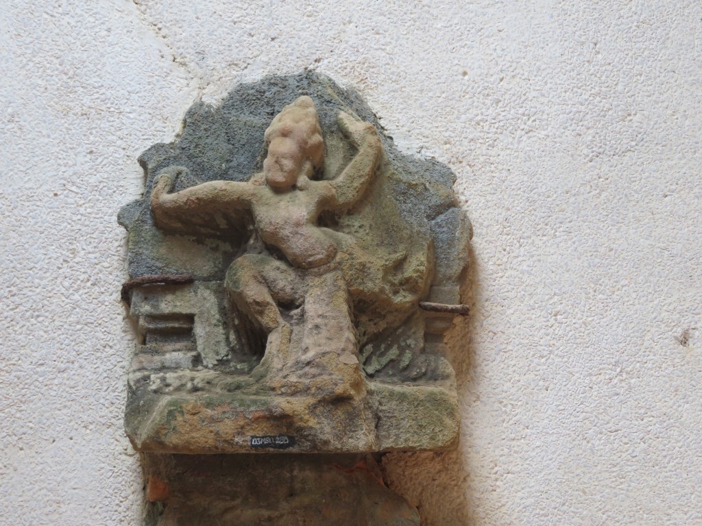
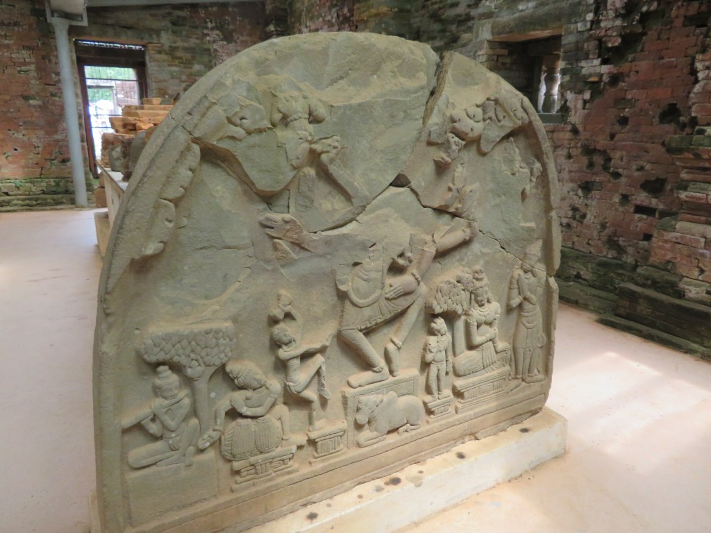
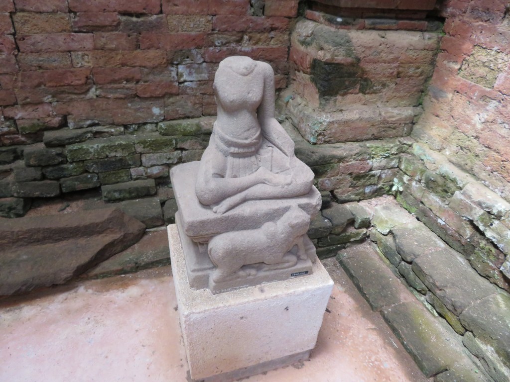
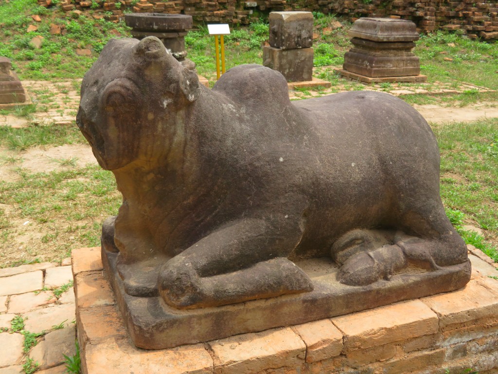
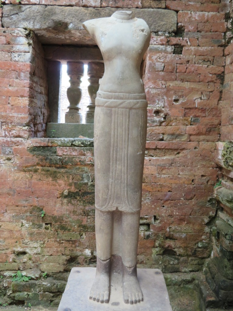
My Son is situated in a valley near the village of Duy Phu approximately 69km from DaNang and was the site of religious ceremonies for the HIndu Cham rulers between the 4th and 14th centuries. It also served as a royal burial place. There are in excess of seventy temples in addition to many stele containing important inscriptions in both Sanskrit and Cham.
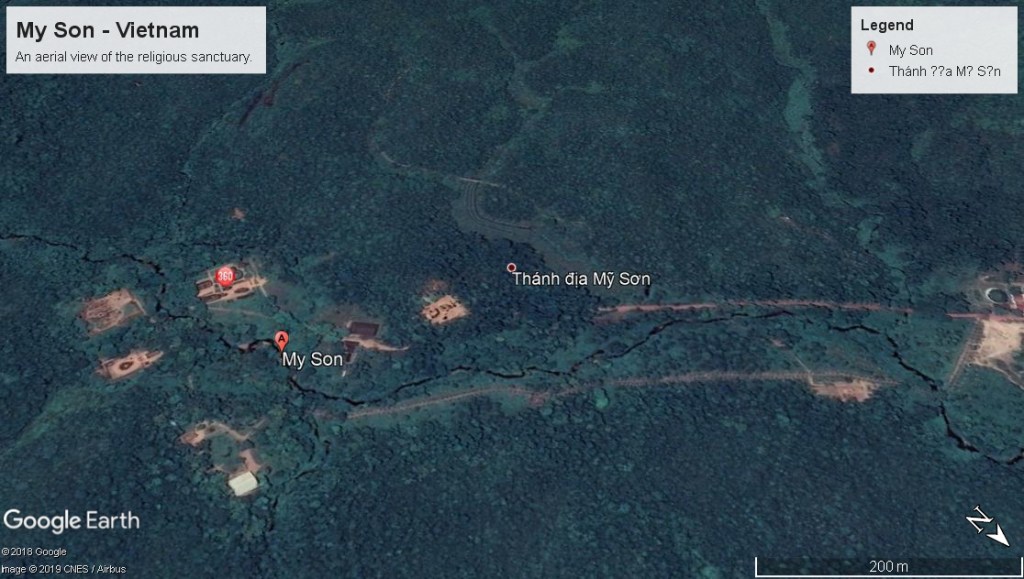
An aerial view of the now jungle covered valley, the bare patches are some of the temples accessible to the visitor.
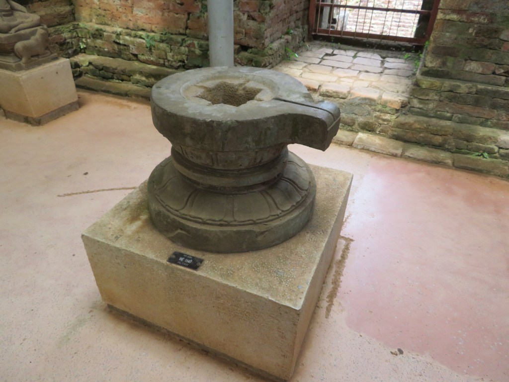
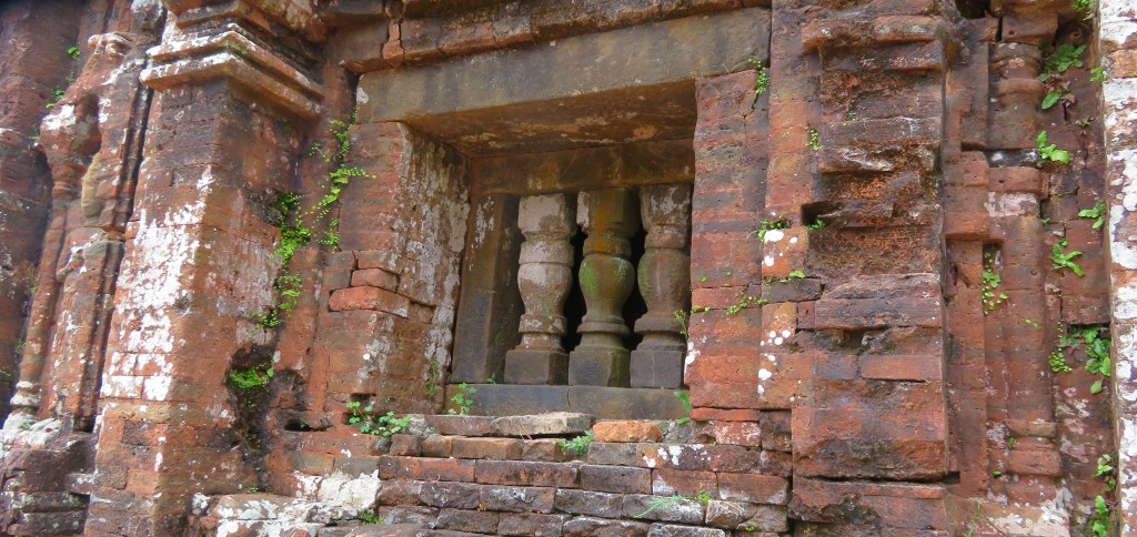
The Hinduism of the Champa was Shaiva with elements of local religious cults such as that of the earth goddess Lady Po Nagar. A number of the features at My Son are the linga – a black stone pillar representing Shiva and the yoni representing the mother.
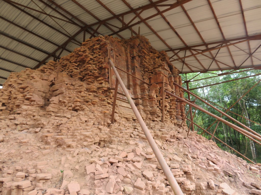
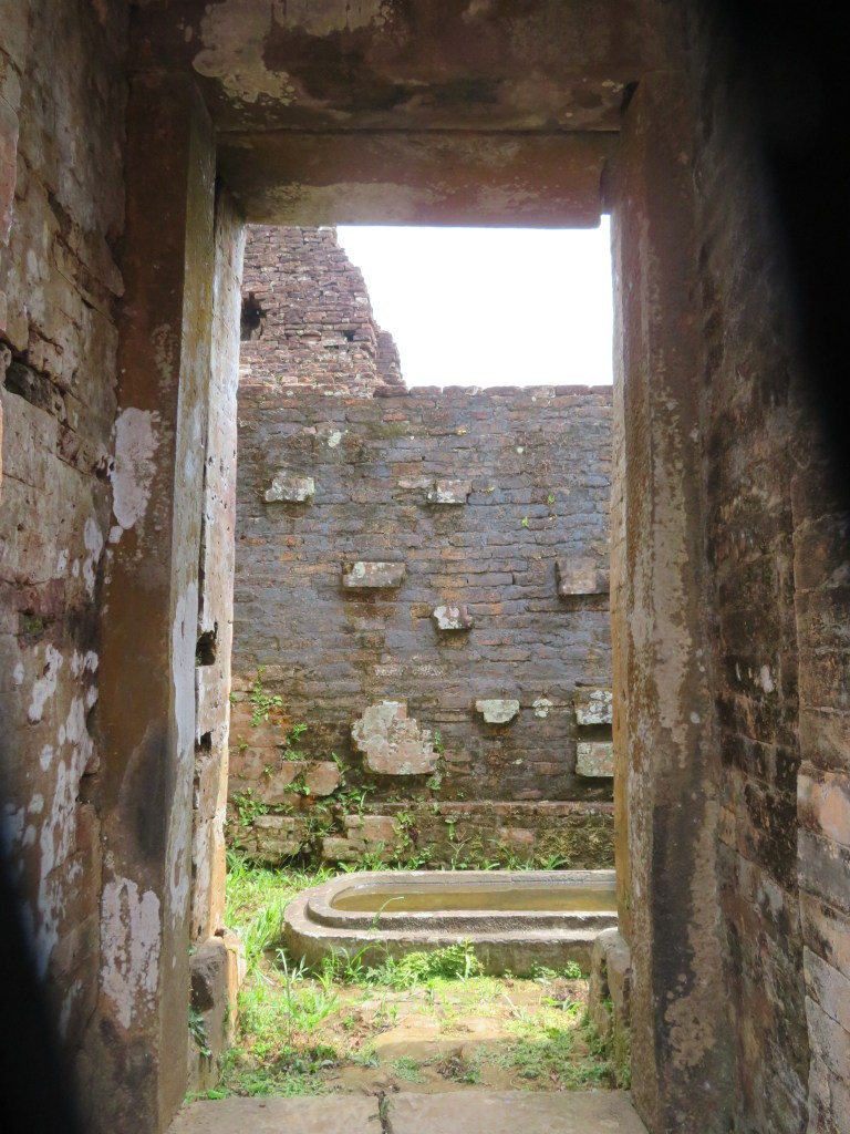
Unfortunately the valley was carpet bombed by the Americans during the Vietnam war and many of the temples were severely damaged and in some cases totally destroyed. In recent years efforts have been made to rebuild the temples (the work is ongoing).
A bomb crater
The hollows are indeed bomb craters – this part of the site has been left untouched – as awful as the bombing of such an important site is, the act is part of the history of My Son and as such needs to be remembered and preserved if we are to learn anything from it.
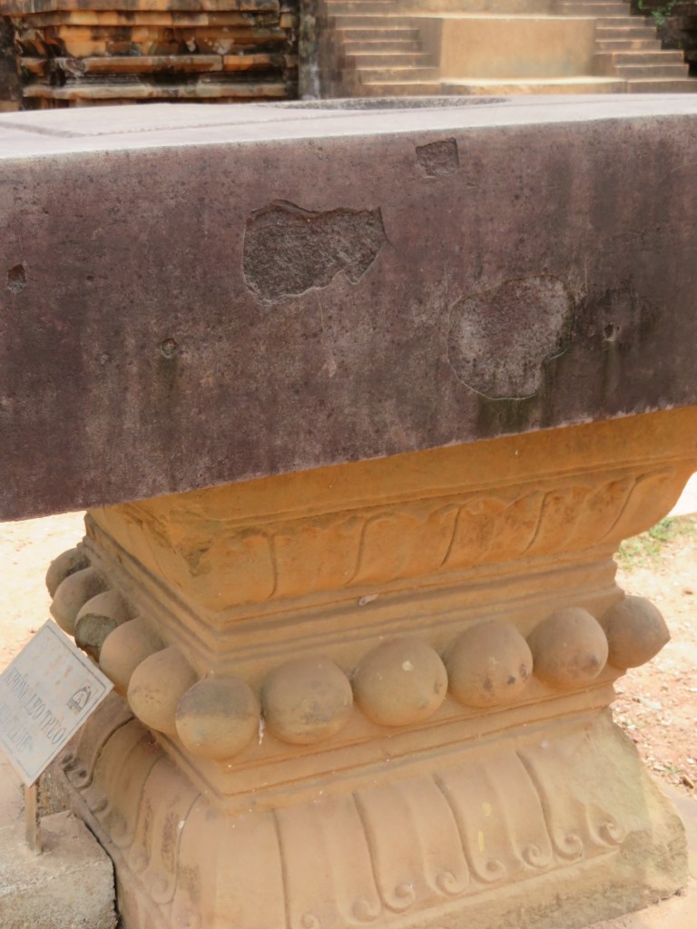
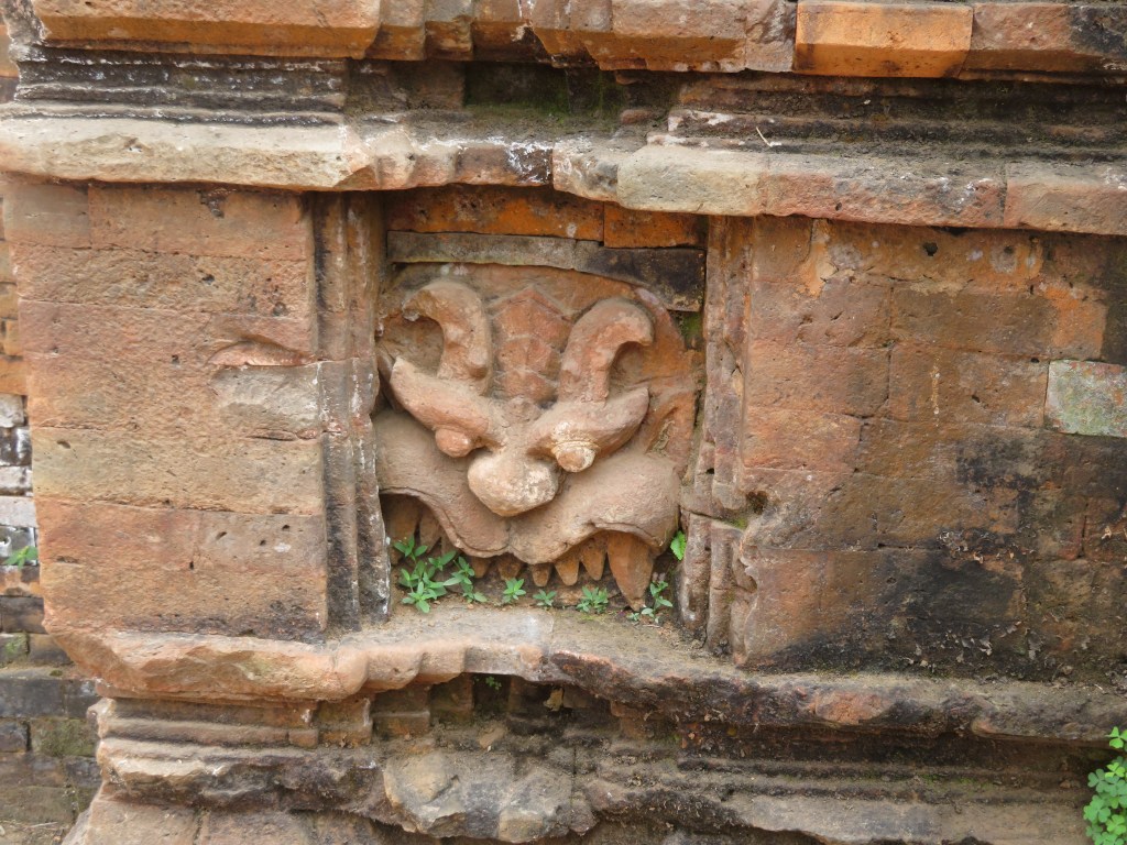
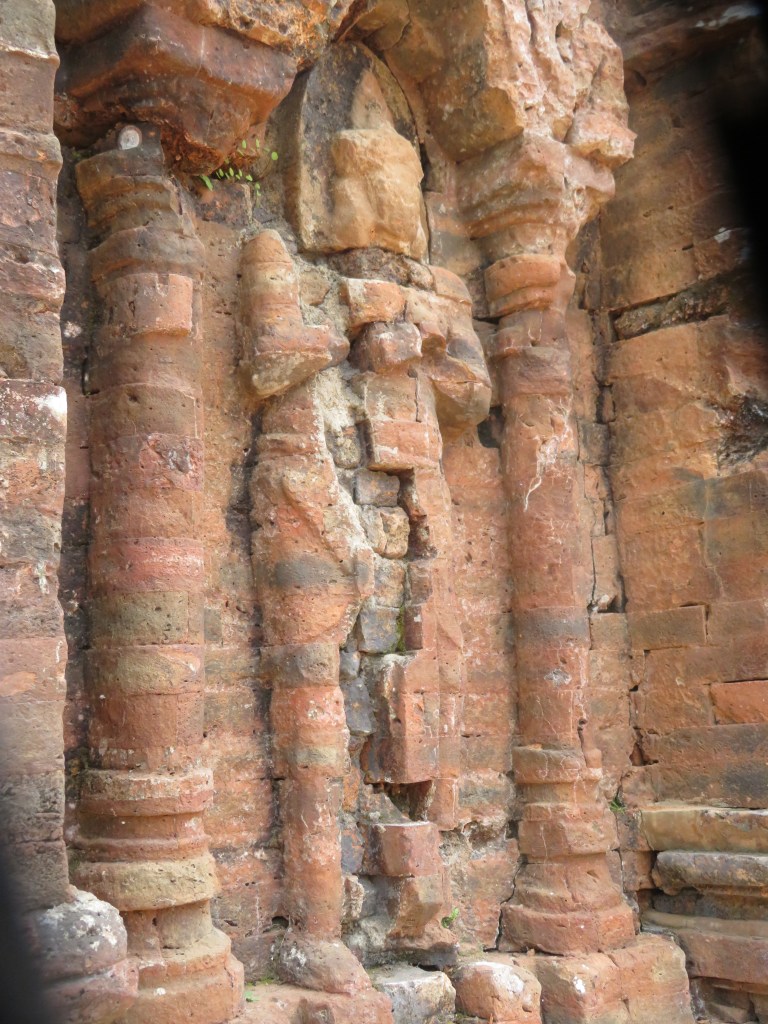
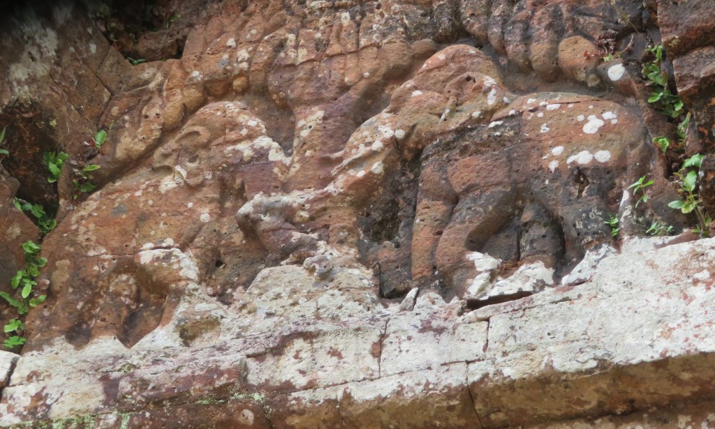
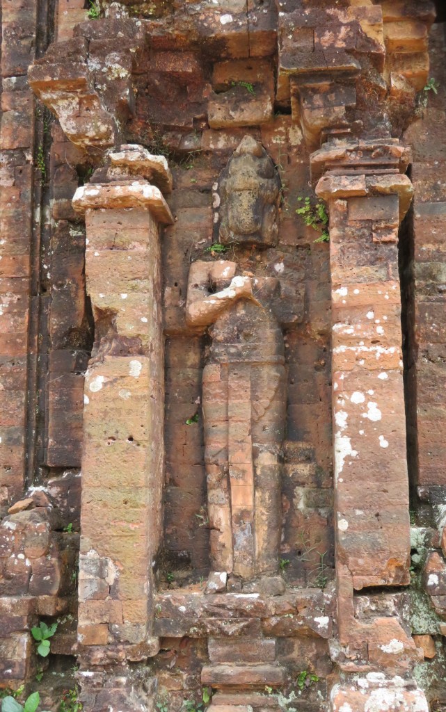
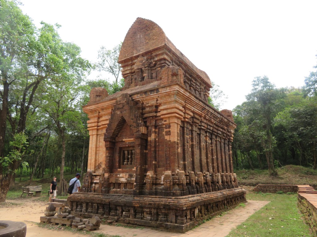
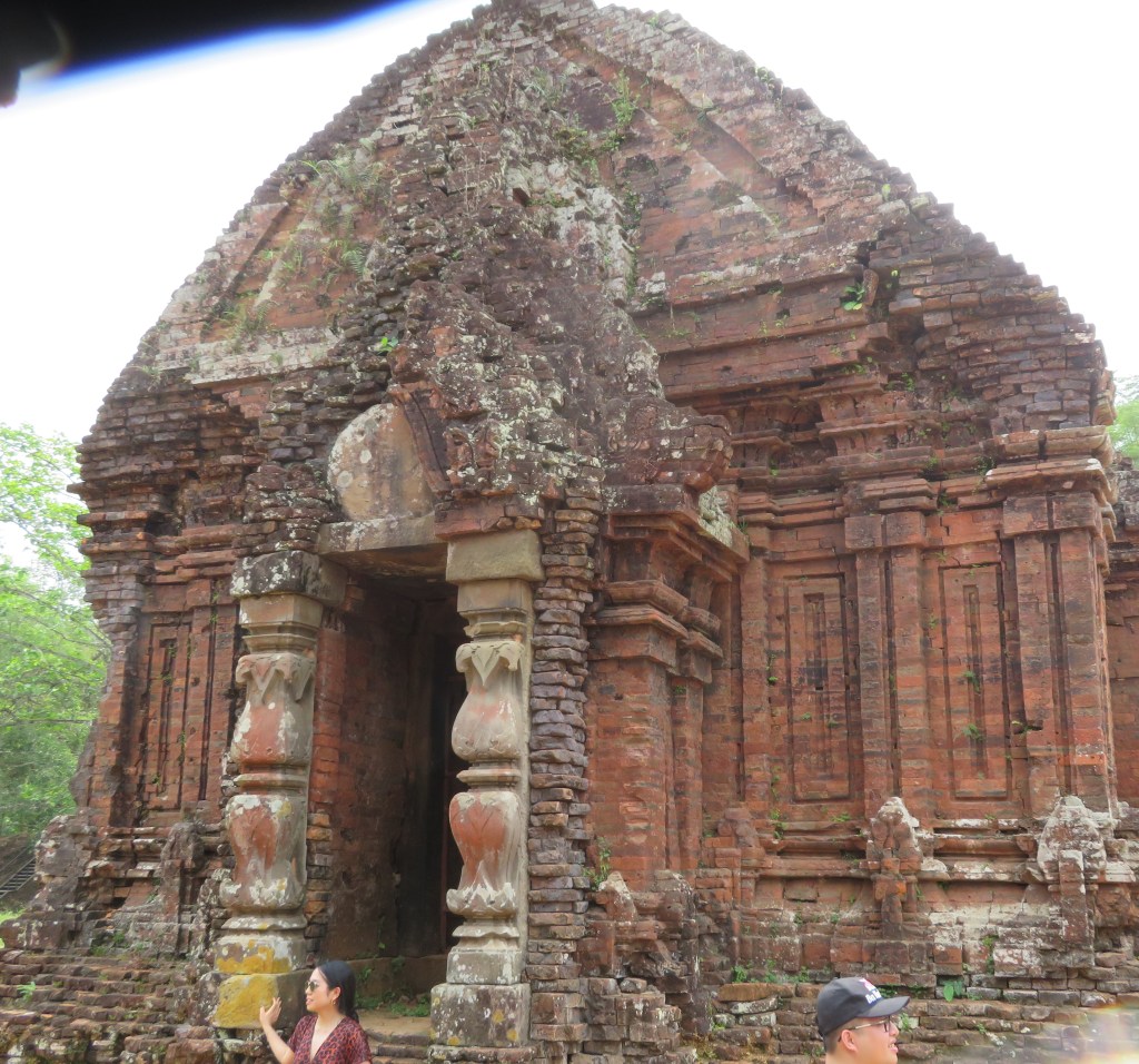
All but one of the temples are constructed from red brick (the only stone built temple is in the area known as B1). The decorative carvings which adorn the temple exteriors were cut directly into the bricks themselves. Although there has been some discussion about the type of mortar used in construction of the temples, it is now generally accepted that the mortar consisted of a sticky clay solution similar to the brick clay.
There are four types of buildings –
Kalan – the brick sanctuary used to house the diety.
Mandapa – the entry hallway associated with a sanctuary.
Kasagrha – ‘fire-house’ usually with a saddle shaped roof and used to house valuables or to cook for the diety.
Gopura – the gate tower leading into a walled temple complex.
In addition to the many sculptures and statues there are numerous stele (32 known in total) dating between the 5th and 12th century. The stelae can refer to a foundation of a temple, altar or pedestal. As historical documents they are very useful as they list names of kings, cities and occasionally describe important historical events such as the wars between Champa and Cambodia in the 12th century. The statues and carvings are usually representations of Shiva, also there are guardian statues found outside the temples.
The sacred cow/bull.
One of several guardian statues
The monuments of the My Son sanctuary are the most important constructions of the My Son civilization. The tower temples have a variety of architectural designs symbolizing the greatness and purity of Mount Meru, the mythical sacred mountain home of Hindu gods at the center of the universe, now symbolically reproduced on Earth in the mountainous homeland of the Cham people. They are constructed in fired brick with stone pillars and decorated with sandstone bas-reliefs depicting scenes from Hindu mythology. Their technological sophistication is evidence of Cham engineering skills while the elaborate iconography and symbolism of the tower-temples give insight into the content and evolution of Cham religious and political thought.