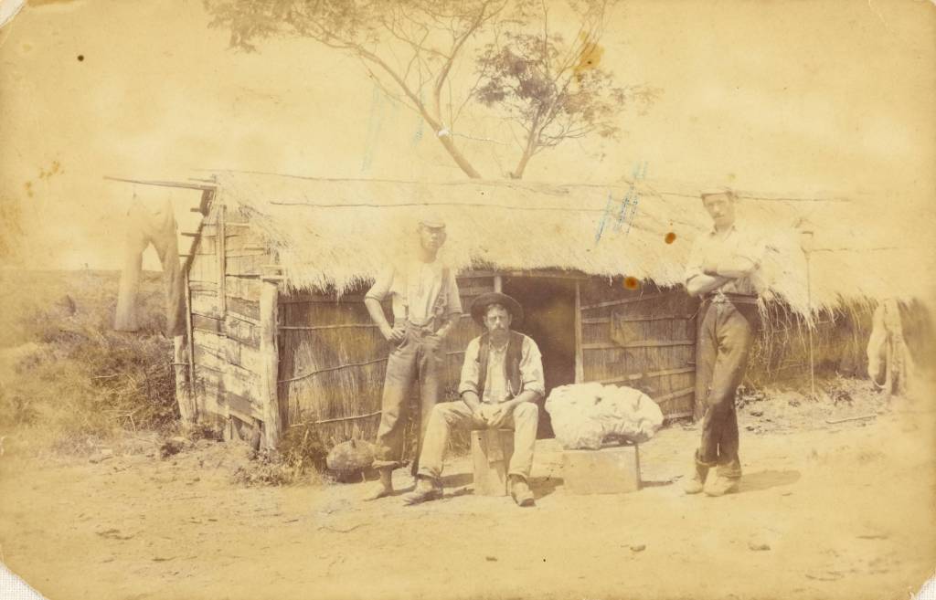
Te Wiki o Te Reo Māori – Placenames in the Landscape.
Last week it was Te Wiki o Te Reo Māori – Māori Language Week and even if this post is a little late, it seemed a good idea to take a look at the names Māori gave to their places as a way of celebrating the language of New Zealand’s first people.
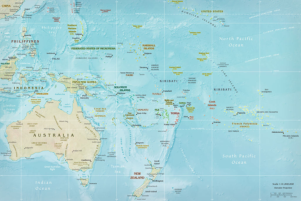
As you may already know as a landscape archaeologist I have a fondness for place names (see an earlier post on Cornish Place names) so felt it was about time I had a look at place names here in Aotearoa (New Zealand).
Place names in today’s Aotearoa are either of European origin or Māori, however it should be remembered that many of the places which today have a European name did indeed have a Māori name prior. As mentioned above the purposes of this blog it is the Māori names which are of interest. The European names will be considered in a separate article at a later date.
The need to give a place a name is universal to people across the world, it is our way of defining who we are and our relationship with the world surrounding us. The names of places can commemorate an event, define a landscape feature, be used to help travellers find their way, as a warning or as a way to signify a place of importance. In regard to Māori place names difficulties arise when trying to give a literal translation into English, for some words there are more than one meaning (as it is with English). Often the meanings behind a word are not easily definable. Words such a Mana and Tapu can be given an English interpretation but in actuality have a much more complex meaning to Māori. Add to this the fact that when Māori words were first written down by Europeans often the words were misheard and misspelt – a wrongly placed vowel can change the meaning of a word quite drastically.
What follows is just a few of the many place names and their interpretations.
One of the most important common words that make up Māori place names relate to features in the environment. Thus a word that begins with ‘Awa’ could refer to a river, gulley or valley; ‘Manga’ though is a stream or tributary and is not to be confused with ‘Maunga’ or mountain. The prefixes can be followed by other descriptive terms such as, iti/small, nui/big, roa/long. They can also have the names of people attached to them, the names of gods and the names of birds, fish and fruit. The latter often indicating the good places to forage for the said kai (food). From the perspective of the landscape archaeologist (or anyone interested in the past) the interpretation of place names can give us clues to the past, fleshing out the otherwise dry facts with the human story.
One of the most important part of any society is the ability to feed the people. As a result there are many place names which indicate the places that are good for food gathering and growing.
- Awatuna – eel (tuna) creek (awa).
- Kaipataki – to eat (kai) flounder (pataki).
- Kaipara – to eat (kai) fernroot (para).
- Motukanae – mullet (kanae) island (motu).
- Whenuapai – good (pai) land (whenua).
- Motukina – island (motu) of kina (a type of sea urchin).
- Otamahua – the place where (o) children (tama – short for tamariki) at seagull eggs (hua).
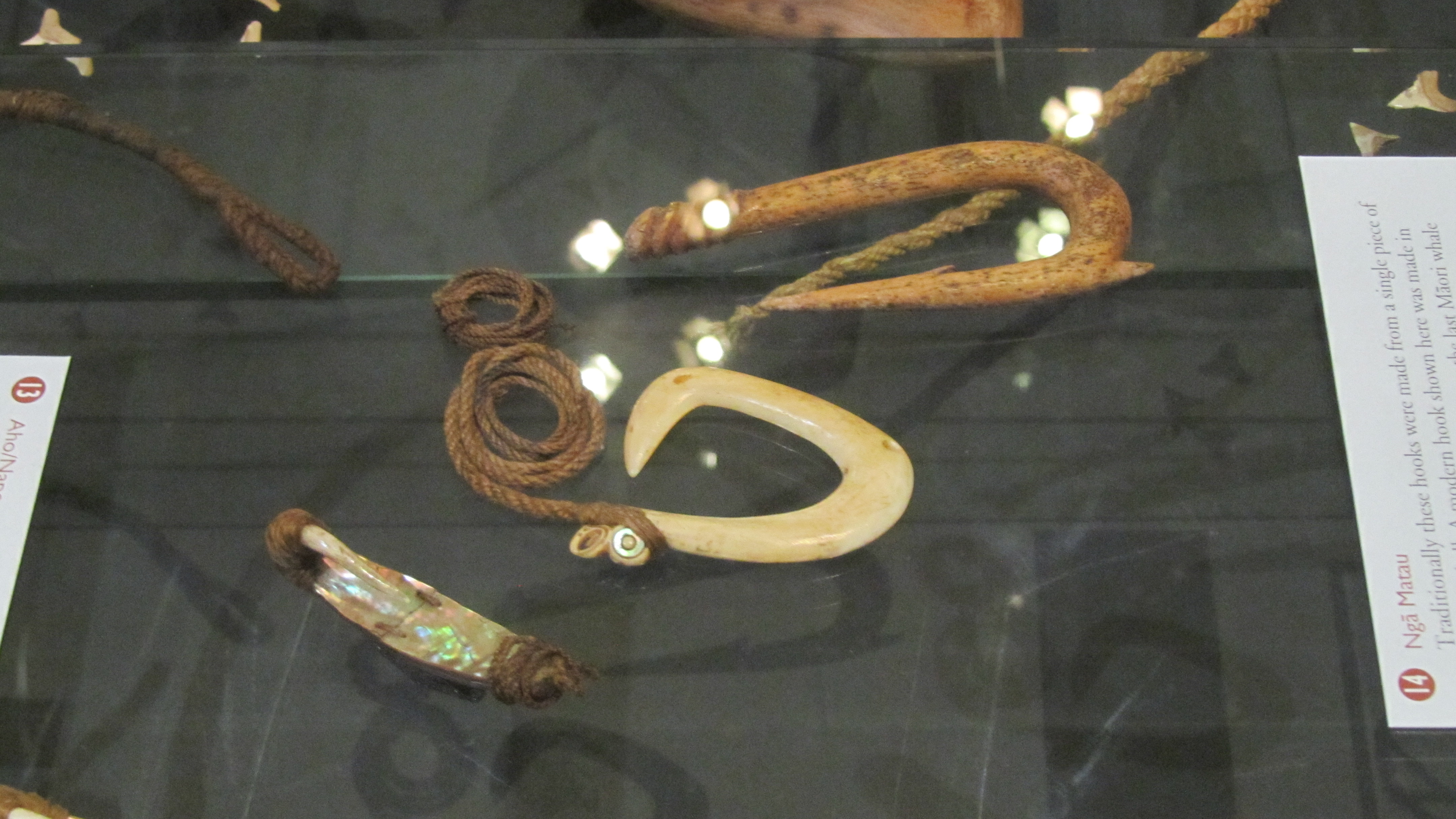
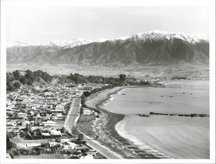
- Kaikoura – to eat (kai) crayfish (koura) – its full name is Te Ahi-Kai-koura-a-Tama-ki-te-rangi or where Tama the great traveller stayed and lit a fire to cook crayfish. A place where even today crayfish are sought after.
- Arowhenua – there are several possible interpretations of this name – good or desirable land; turning land for cultivation or to desire land.
- Hakapupu – estuary of shellfish.
- Ororoa – the place of roroa (a type of shellfish).
- Tahekeaua – a place to catch herrings by the waterfall – taheke (waterfall) aua (herring).
- Mararua – two (rua) plantations/places of cultivation (mara)
Other resources also appear in place names:
- Motukauatiti/Motukauatirahi – two bays (Corsair and Cass Bay) noted for the Kaikomako trees, the timber of which was good for firemaking.
- Omata – the place of flint/quartz – O meaning ‘the place of’ and mata can mean either flint, quartz, sometimes obsidian but also headland (interpretations can depend on what comes before or after the word).
- Otemata – the place of good flint or quartz.
- Ratanui – plenty (nui) of rata trees.
- Kaitieke – to eat the tieke (saddle-back, a native bird).
- Whangamata – obsidian/flint/quartz (mata) harbour (whanga) – obsidian is the most likely candidate as it washes upon the beach here from nearby Mayor Island.
- Anatoki – cave of the adze.

Then there are the names that serve to aid those navigating the landscape:
- Putarepo – the place at the end of the swamp where it could be crossed.
- Puhoi – refers to the slow tidal flow thus it was necessary to wait for high tide for the river to be navigable.
- Otira – the place of travellers – indicating an old campsite on the Otira River where food was prepared for the trip through the Hurunui Pass.
- Motuara – island (motu) path (ara) – most likely to mean an island in the path of canoes.
- Tauranga – resting place/safe anchorage for canoes.
- Kaiwaka – literally to eat (kai) canoes (waka) – may refer to the places where the swift flowing river has the ability to destroy a canoe.
- Mangawhata – the stream by the storehouse.
- Arapuni – two possible interpretations – a path to a camp or a path that has been blocked – Ara meaning path.
- Whangaruru – a sheltered (ruru) harbour (whanga).
There are also names that serve to warn people away from place:
- Kaitoke – to eat (kai) toke (worms) – indicating a place of poor soil.
- Mangakino – bad/useless (kino) stream (manga).
- Waikino – bad (kino) water (wai).
- Mangamate – stream (manga) of death (mate) – one wonders what happened here to warrant such a name.
- Otepopo – literally the place of the decay – or the place of Te Popo.
- Motutapu – sacred/forbidden (tapu) island (motu) – possible a name given after the eruptions of Rangitoto and the island was covered in volcanic ash.
- Matatapu – sacred headland.
Other places are simply descriptive:
- Maunganui – big (nui) mountain (maunga)
- Tauranga-Kohu – kohu means mist/fog and thus this name could indicate a place where the mists linger.
- Waihapa – crooked (hapa) water/stream (wai).
- Waihaha – noisy (haha) water/stream (wai).
- Pukekahu – hill (puke) of hawks (kahu).
- Pakowhai – village/settlement (pa) by the kowhai (native flowering tree).
- Mahoenui – the place of many mahoe trees.
- Ngaroto – the lakes.
- Rotoma – the lake of clear waters.
- Ngapuna – the springs
- Onehunga – the place of burial
A simple perusal of any map will show that certain prefixes are more common than others and for obvious reasons. Hills (puke), mountains (maunga) rivers (awa), streams (manga), lakes (roto), caves (rua), water (wai) and harbours (whanga) are prolific features of the landscape.
Other names are used to commemorate an event thus Ahuahu (Great Mercury Island) is literally translated as ‘to heap up’ but refers to when Paikea came to the island on the back of a whale, when he landed he was cold and so heaped the warm sand over himself hence the name.
Iwikatea (Balclutha) is a reference to a great battle that occurred here and where the bones of the slain remained for many years.
The Hokianga proper name is Hokianga-nui- a-Kupe or the ‘Great returning place of Kupe’ – it is from here that Kupe returned to Hawaikii.

Patumahoe literally translates as a weapon made of mahoe, a native tree. But further digging finds a tale of how ‘in a battle at this place a chief was killed with a mahoe stake’.
Tamaki-Makau-Rau (Auckland) is called thus because of its excellent soils and bountiful harbour there were often many fights to establish who would hold this prize – literally it is translated as ‘Tamaki of a hundred lovers’ – tamaki can be translated as battle.
Motu-toa can be translated as the island where warriors fought.
Rotoiti – the full name of this lake is Te Roto-iti-kite-a-Ihenga and is interpreted as the little lake that was discovered by Ihenga.
Te Tawa – here Ihenga pushed his canoe with a piece of tawa wood, it stuck in the ground and he left it there thus naming the place after it. Ihenga features in many of the interpretations of Aoteoroa’s places.
Kirikau – a place where a battle was fought in which the contestants were naked – kiri (skin) kau (bare).
Another grouping of place names relate to the cosmological – the deities, the supernatural and the movement of the sun, moon and stars.
- Tapuaenuku – the footsteps of the rainbow god.
- Te Puka-A-Maui – the anchor stone of Maui (Stewart Island).
- Ruataniwha – literally, the two taniwha (see earlier article on taniwha for more information) – in this case that there were two great taniwha who lived in a lake and fought over a boy who fell in. Their struggles formed the Tukituki and Waipawa Rivers.
- Oamaru – the place of the god Maru.
- Anakiwa – Cave of Kiwa – Kiwa was a man’s name but was also one of the gods of the sea.
- Omaui – the place of Maui.
- Oue – the moon on the fourth night.
- Otane – the moon on the twenty-seventh night – the place of the moon.
- Momorangi – offspring of Rangi (the sky god).
- Te Waka-A-Maui – an old name for the South Island – referring to the canoe (waka) from which Maui fished up the North Island.
- Otamarau – the place of Tamarau – a spirit who comes in the whirlwinds.
These are all just a few examples of the wide variety of names used by Māori, there are many more that have not been touched on in this article – to do so would be the work of whole of book. Place names not mentioned are those commemorating a particular person. Ihenga and Kupe have already been mentioned but there are many others such as Mangaotaki (the stream of Taki) or Hekura, the name of a woman from the Arai-te-uru canoe. Or Ohinemutu, the place of the young woman who was killed – she was the daughter of Ihenga who placed a memorial stone at the place of her death calling it Ohinemutu. There are also the places that were named after the arrival of the Europeans such as Hiona, the name given to a pa on the Whanganui River, by the missionaries – it is the Māori name for Zion. Or Maheno, an island – the name was given by the Europeans.
Then there are the names which are very old and come from the homeland of the first people to set foot in Aotearoa. Names such as, Maketu or Nuhaka, both names are after a place in Hawaikii. Then there is Atiu, one of the oldest names in Marlborough and is a possibly a name transferred from the Cook Islands.
As mentioned before this is but a small insight of the fascinating world of Te Reo and the place names of Aotearoa. From a landscape archaeologist point of view all of these names give an insight to how Māori viewed their world and the events that shaped their memories of places. Giving us key glimpses into the past. Putting flesh on the bones of the evidence.
Some further information: